|
Proper Municipality Name |
Photo Description |
Photo |
|
Pictures taken
from driver's perspective appear offset from centre-line pictures: |
North-
bound |
South-
bound |
|
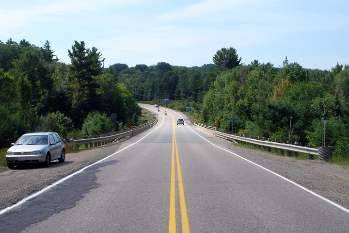
Highway 118 runs east-west
through a considerable portion of Central Ontario between Foot`s Bay and
Paudash.
Click here for Highway 118 images. |
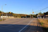
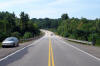
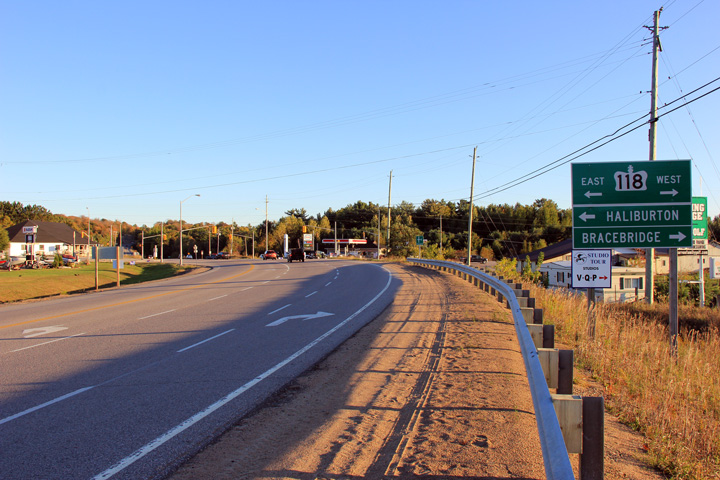
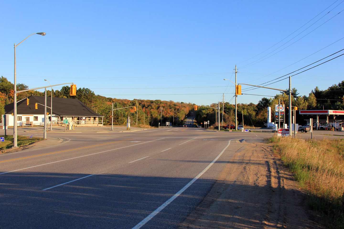
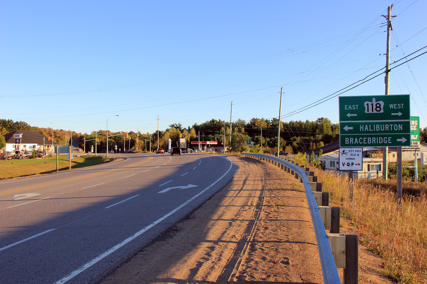
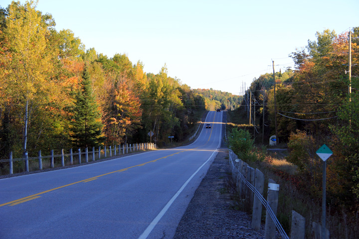
| Township of Minden Hills County
of Haliburton |
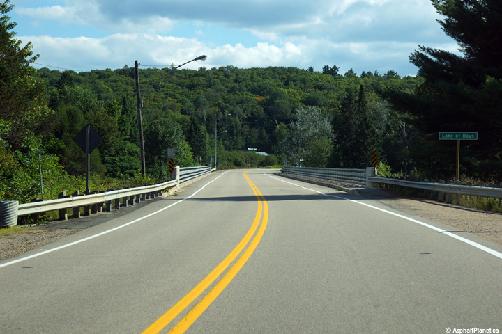
Two views looking southerly along Highway 35 approaching the signalized
intersection with Highway 118 at Carnarvon.
Photos taken: October 1st, 2011. |
(720x480)
(1440x960)
(2400x1600)
(720x480)
(1440x960)
(2400x1600) |
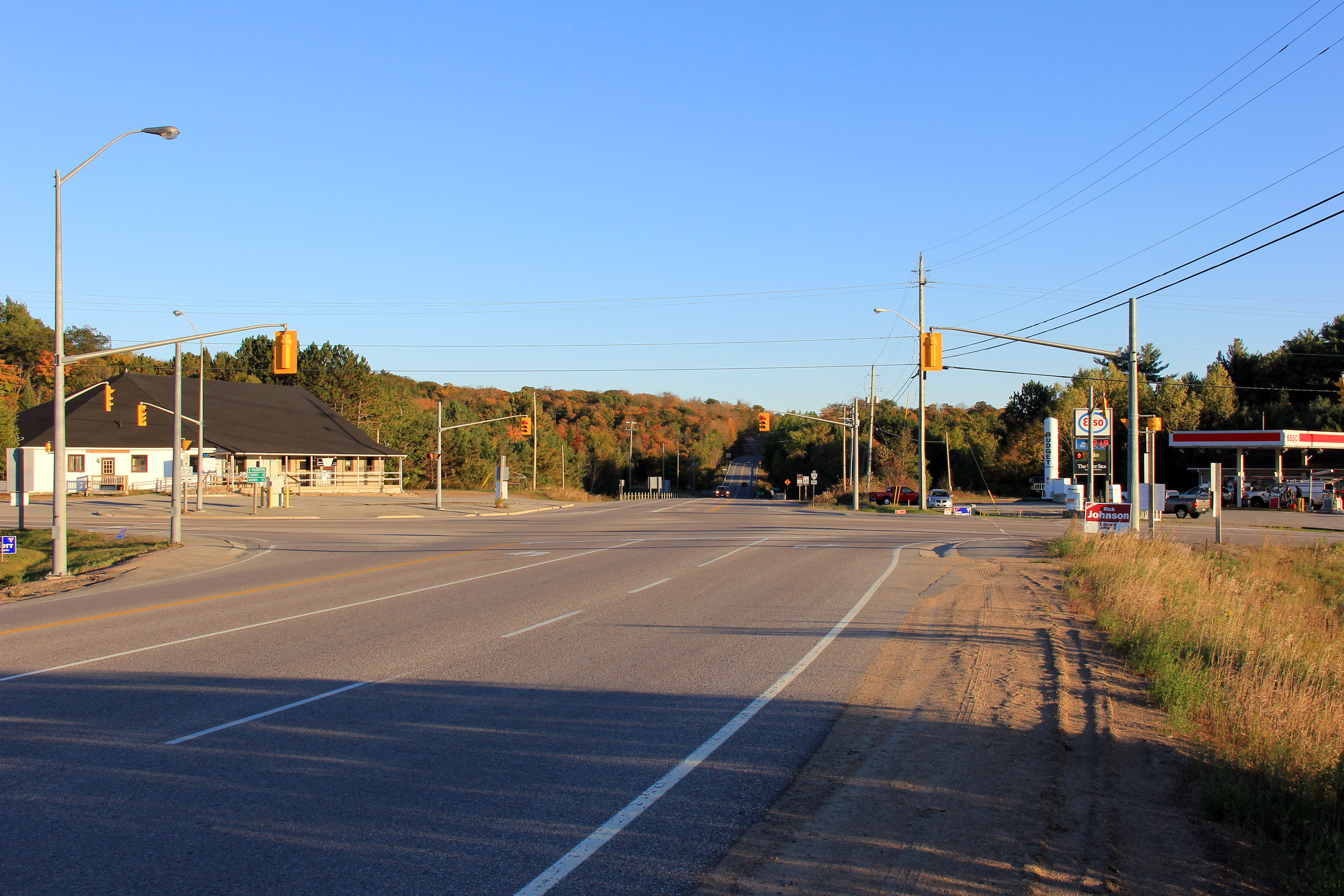
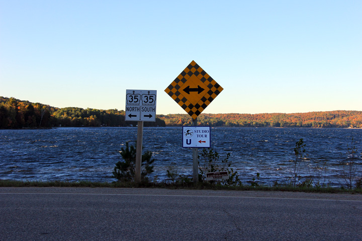
| Township of Algonquin Highlands
County of Haliburton |
This view looks southerly towards Carnarvon from the Wayman Road
intersection.
Photo taken: October 1st, 2011. |

(720x480)
(1440x960)
(2400x1600) |
| Township of Algonquin Highlands
County of Haliburton |
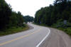
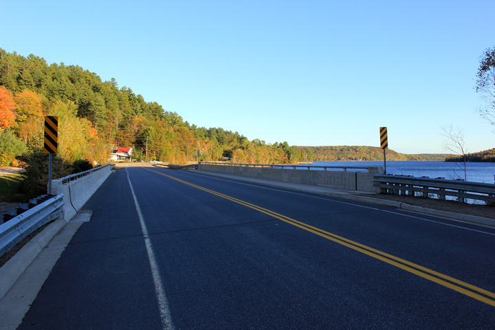
Looking southerly across the Buttermilk Falls bridge along Highway 35.
Buttermilk Falls is located about 7km north of Carnarvon. Photo taken:
October 30th, 2005. |
(720x480)
(1440x960) |
| Township of Algonquin Highlands
County of Haliburton |
Northerly view along Highway 35 as the highway rounds the western bank of
Halls Lake.
Photo taken: October 1st, 2011. |
(720x480)
(1440x960)
(2400x1600) |
| Township of Algonquin Highlands
County of Haliburton |
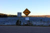
Signage assembly at the northern terminus of Buckslide Lake Road at Highway
35 on the shore of Halls Lake.
Photos taken: October 1st, 2011. |
(720x480)
(1440x960)
(2400x1600)
(720x480)
(1440x960)
(2400x1600) |
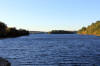
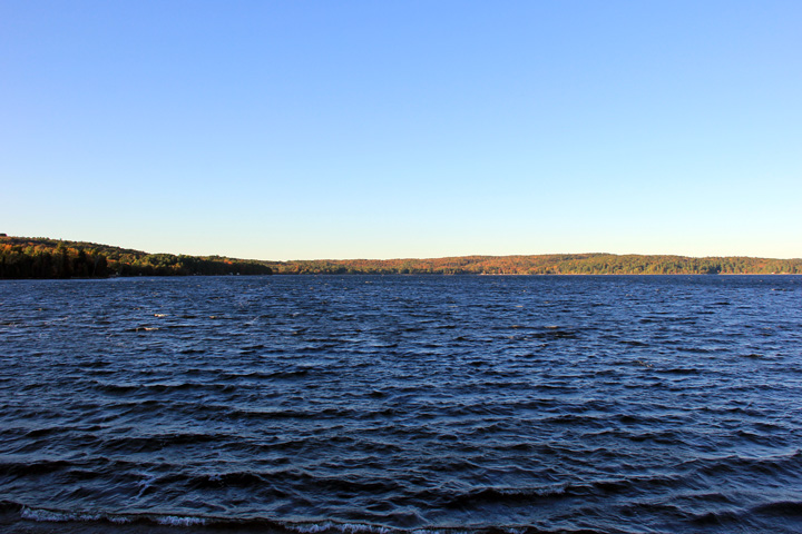
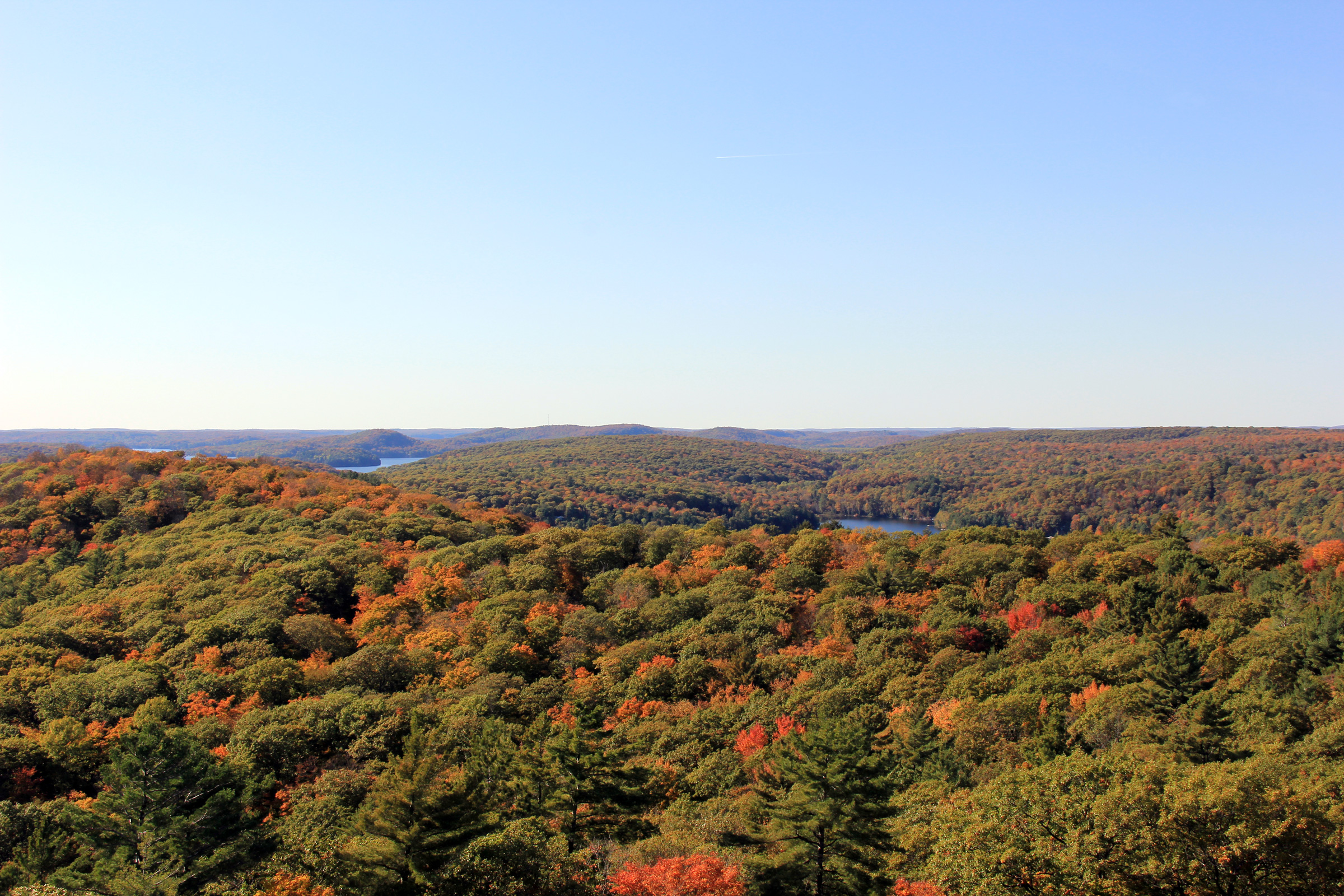
| Township of Algonquin Highlands
County of Haliburton |
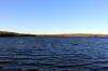
Scenic fall view looking southerly across Saskatchewan Lake. The
Haliburton and Algonquin Highland areas of Ontario are dotted with hundreds
of small picturesque lakes such as this. Photo taken: October 30th,
2005. |
(720x480)
(1440x960) |
| Township of Algonquin Highlands
County of Haliburton |
View looking northerly towards Dorset at Ox Narrows.
Photo taken: October 1st, 2011. |
(720x480)
(1440x960)
(2400x1600) |
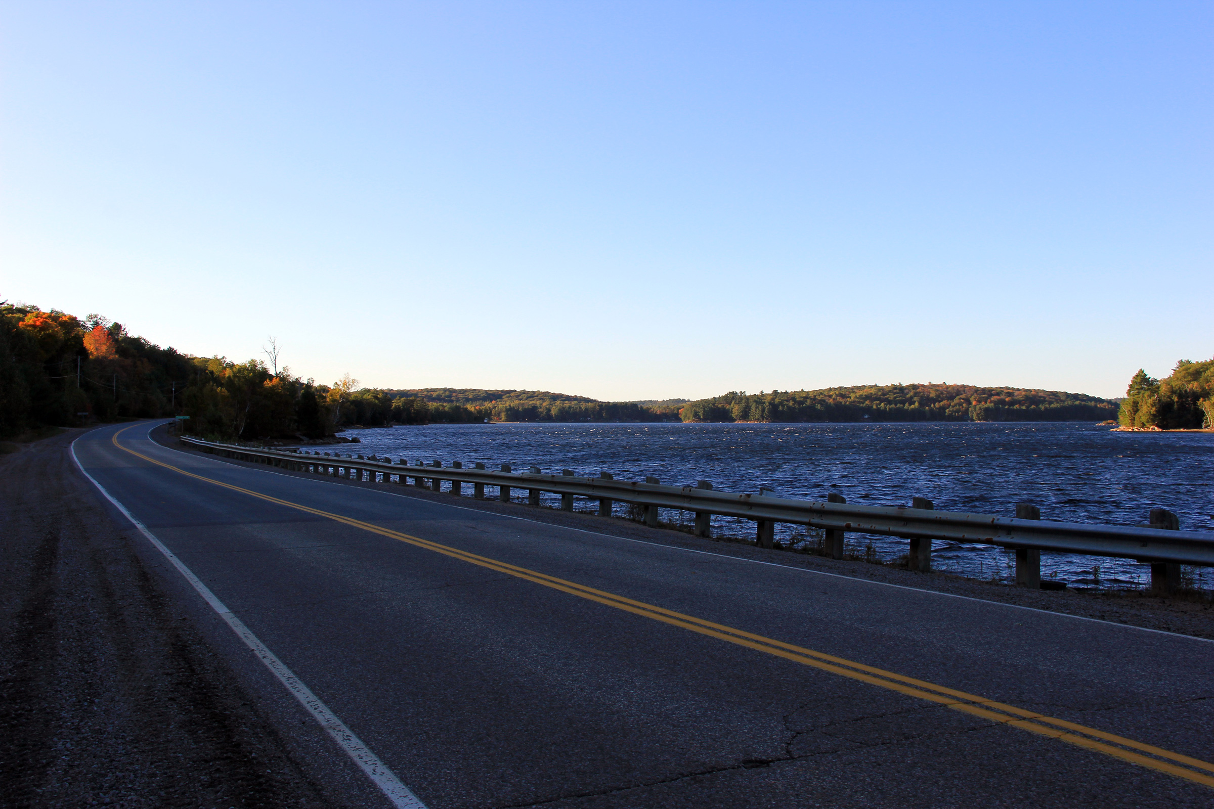
| Township of Algonquin Highlands
County of Haliburton |
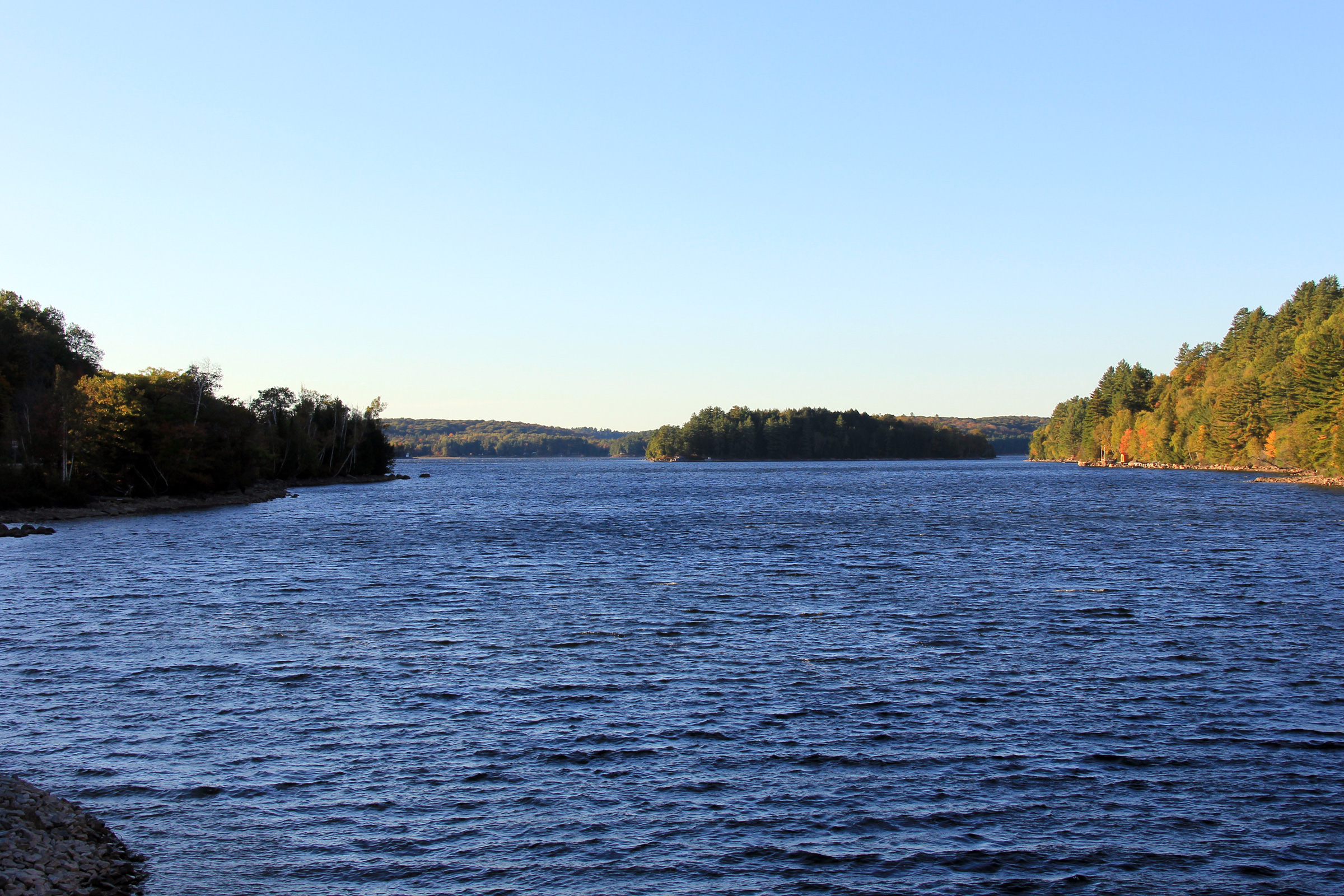
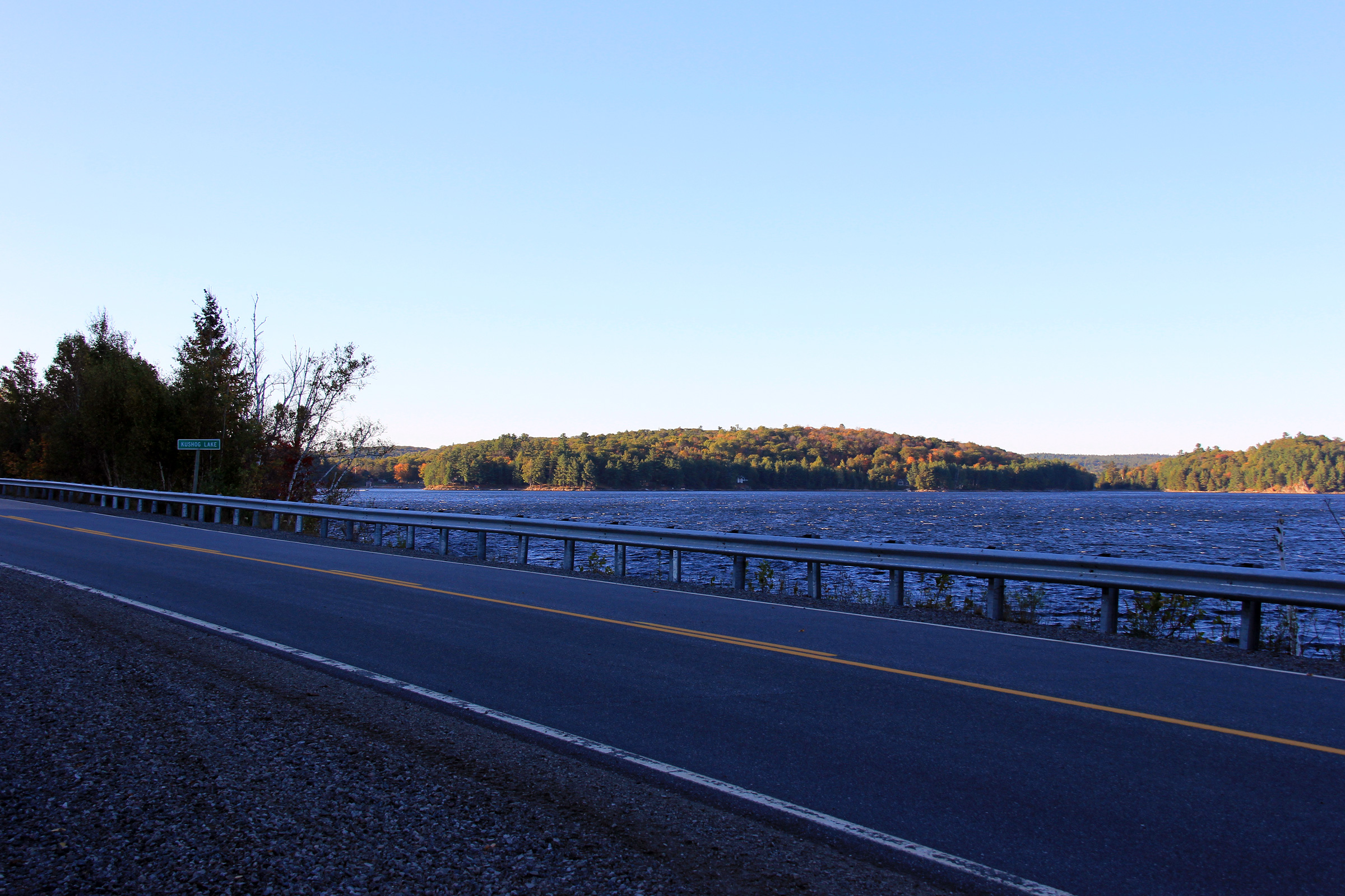
Northerly view of the picturesque Ox Narrows of Kushog Lake from the Highway 35 crossing.
Photo taken: October 1st, 2011. |
(720x480)
(1440x960)
(2400x1600) |
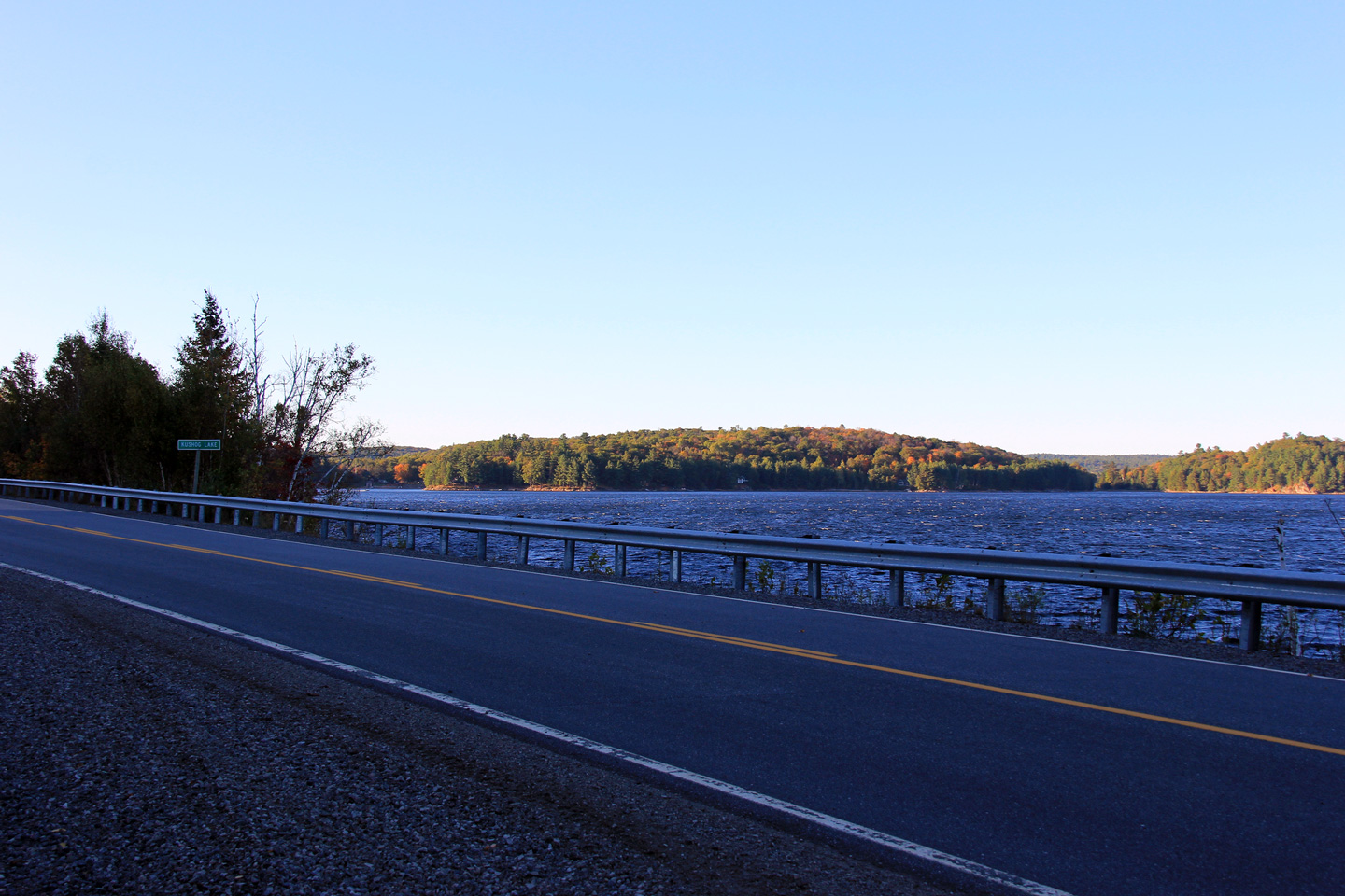
| Township of Algonquin Highlands
County of Haliburton |
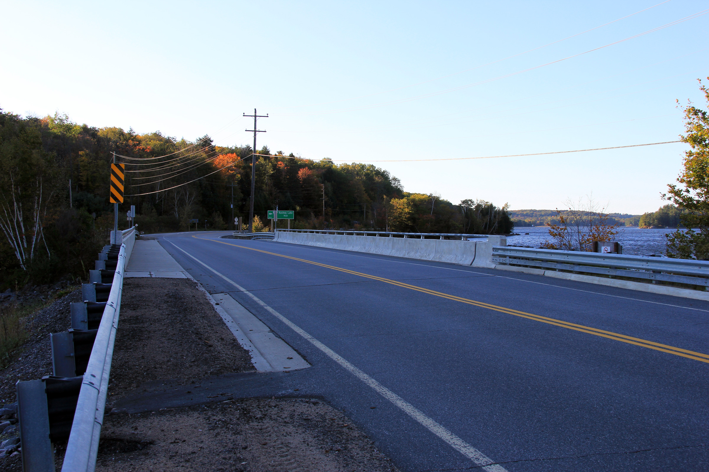
Southerly view across the Ox Narrows from the Kushog Lake Road intersection.
Kushog Lake can be seen on the right side of the photo.
Photo taken: October 1st, 2011. |
(720x480)
(1440x960)
(2400x1600) |
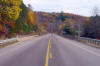
| Township of Algonquin Highlands
County of Haliburton |
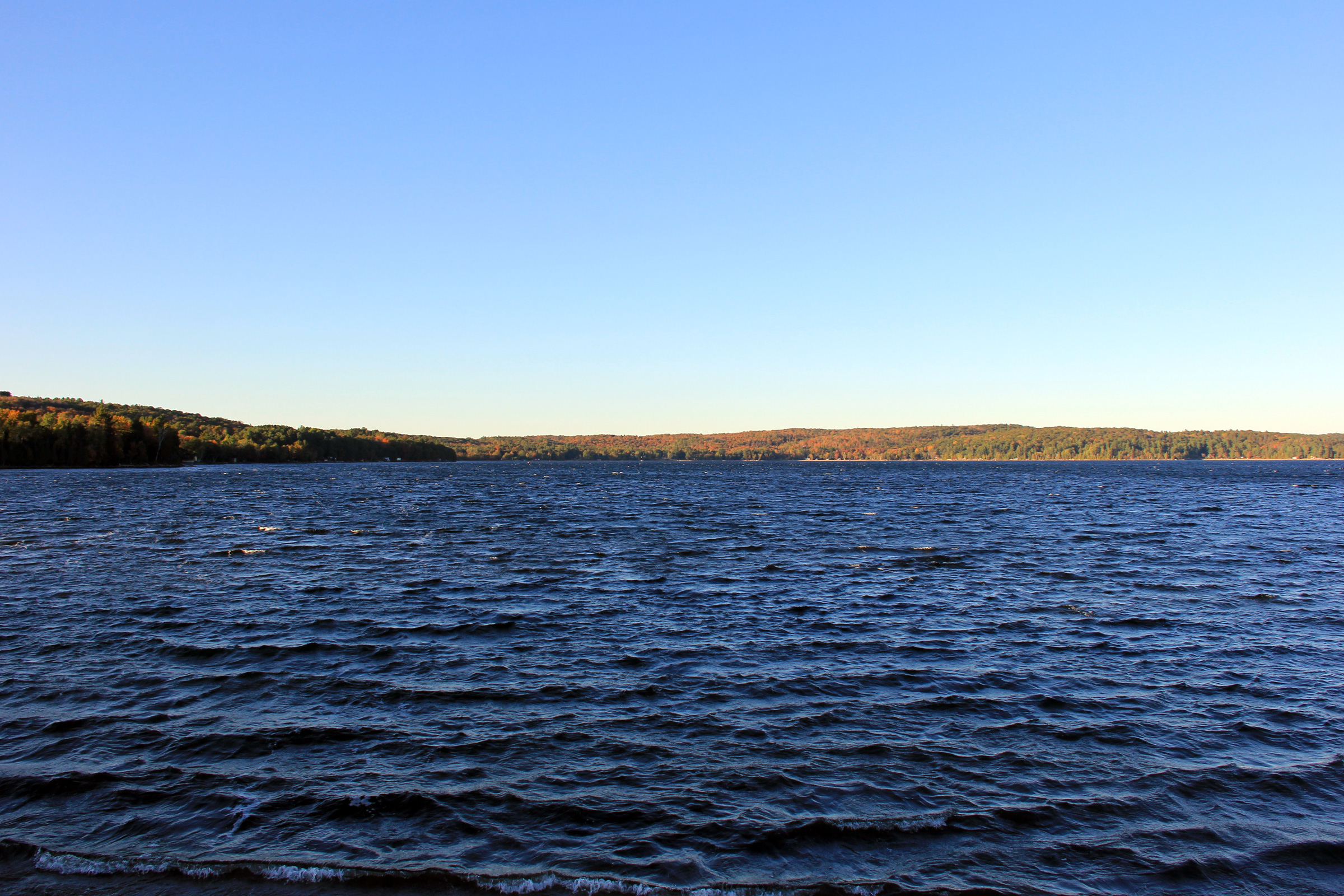
Northerly view as Highway 35 hugs the western bank of Kushog Lake.
Photo taken: October 1st, 2011. |
(720x480)
(1440x960)
(2400x1600) |
| Township of Algonquin Highlands
County of Haliburton |
Southerly view towards Ox Narrows from about 1km north of the Kushog Lake
Road.
Photo taken: October 1st, 2011. |

(720x480)
(1440x960)
(2400x1600) |
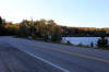
| Township of Algonquin Highlands
County of Haliburton |
One final view of Kushog Lake as Highway 35 continues to progress northerly
along its western bank. This section of Highway 35 is undoubtedly one
of Ontario`s most scenic highways.
Photo taken: October 1st, 2011. |
(720x480)
(1440x960)
(2400x1600) |
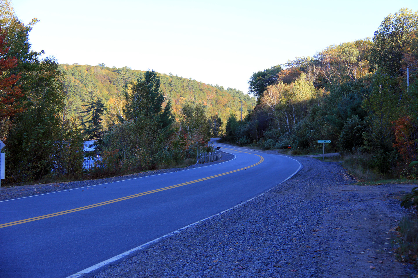
| Township of Algonquin Highlands
County of Haliburton |
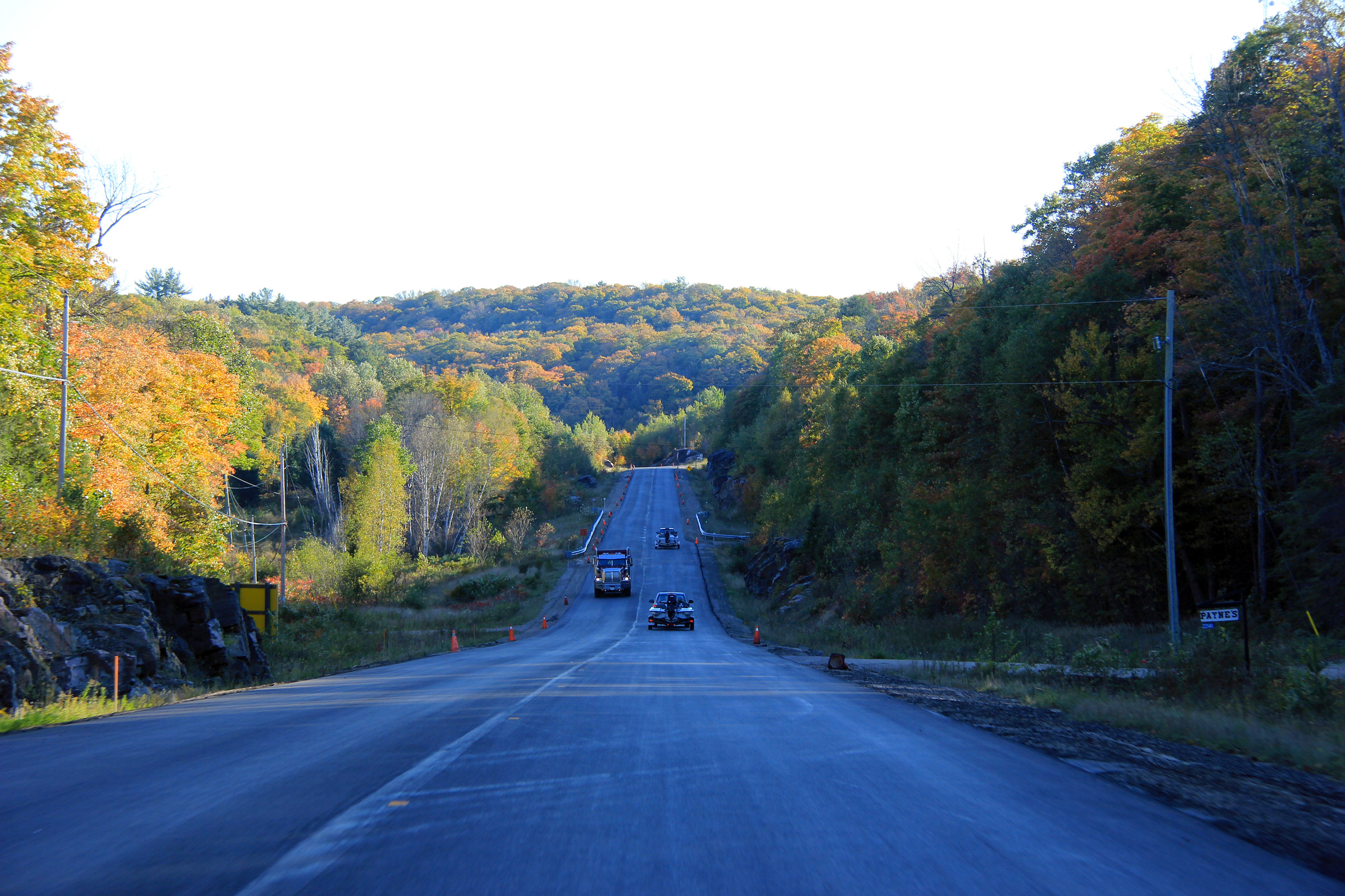
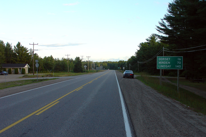
View looking southerly along Highway 35 just south of Dorset. A small
resurfacing contract was underway when this photo was taken to correct some
frost heaves that had developed along the highway.
Photo taken: October 1st, 2011. |

(720x480)
(1440x960)
(2400x1600) |
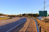
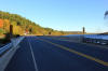
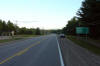
| Township of Algonquin Highlands
County of Haliburton |
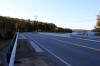
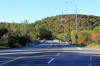
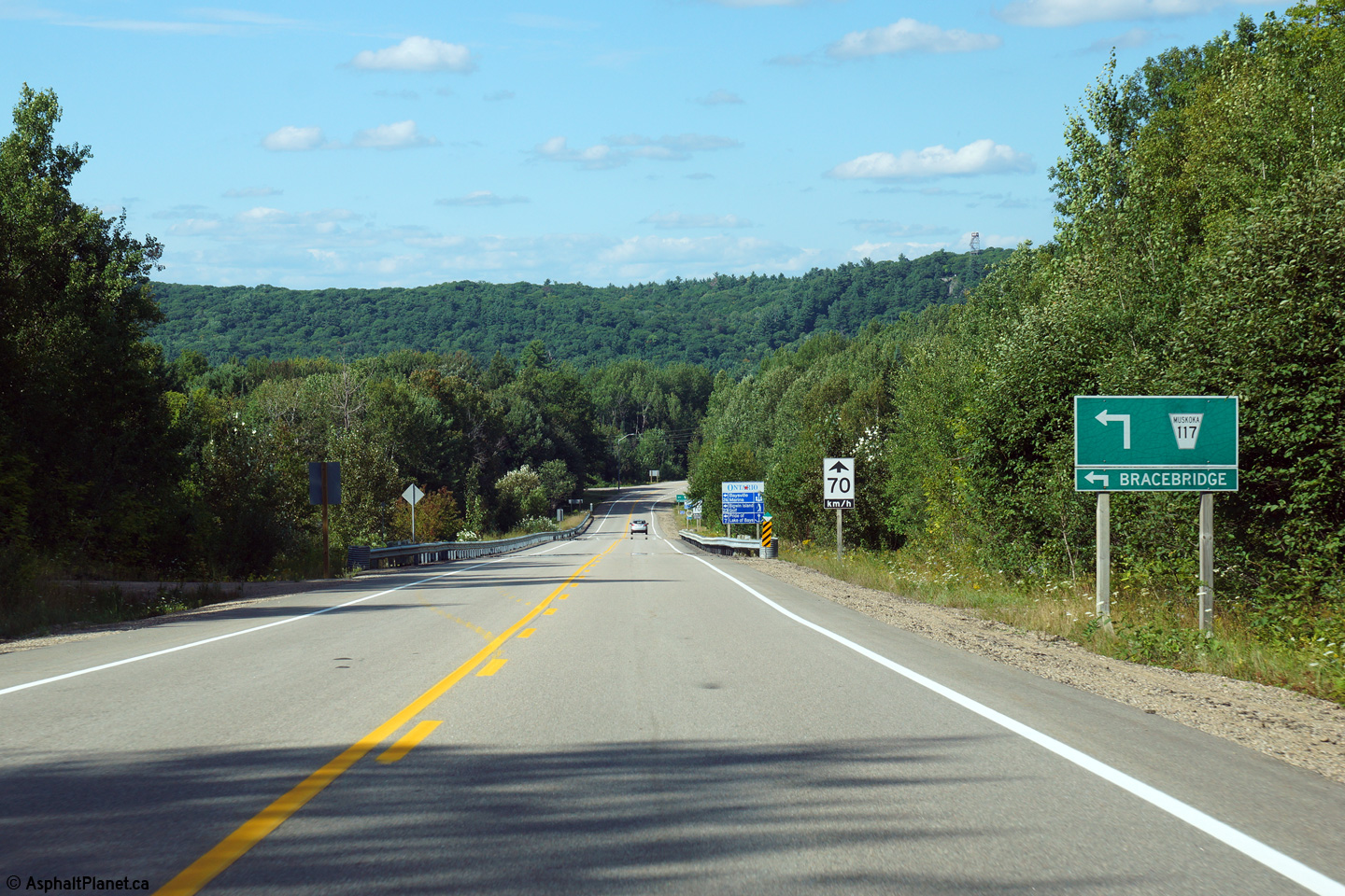
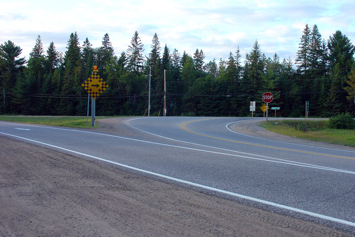
Northbound view approaching the Highway 117 intersection.
Photo taken: August 25th, 2015. |

(720x480)
(1440x960)
(2400x1600) |
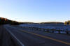
| Township of Algonquin Highlands
County of Haliburton |
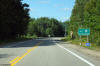
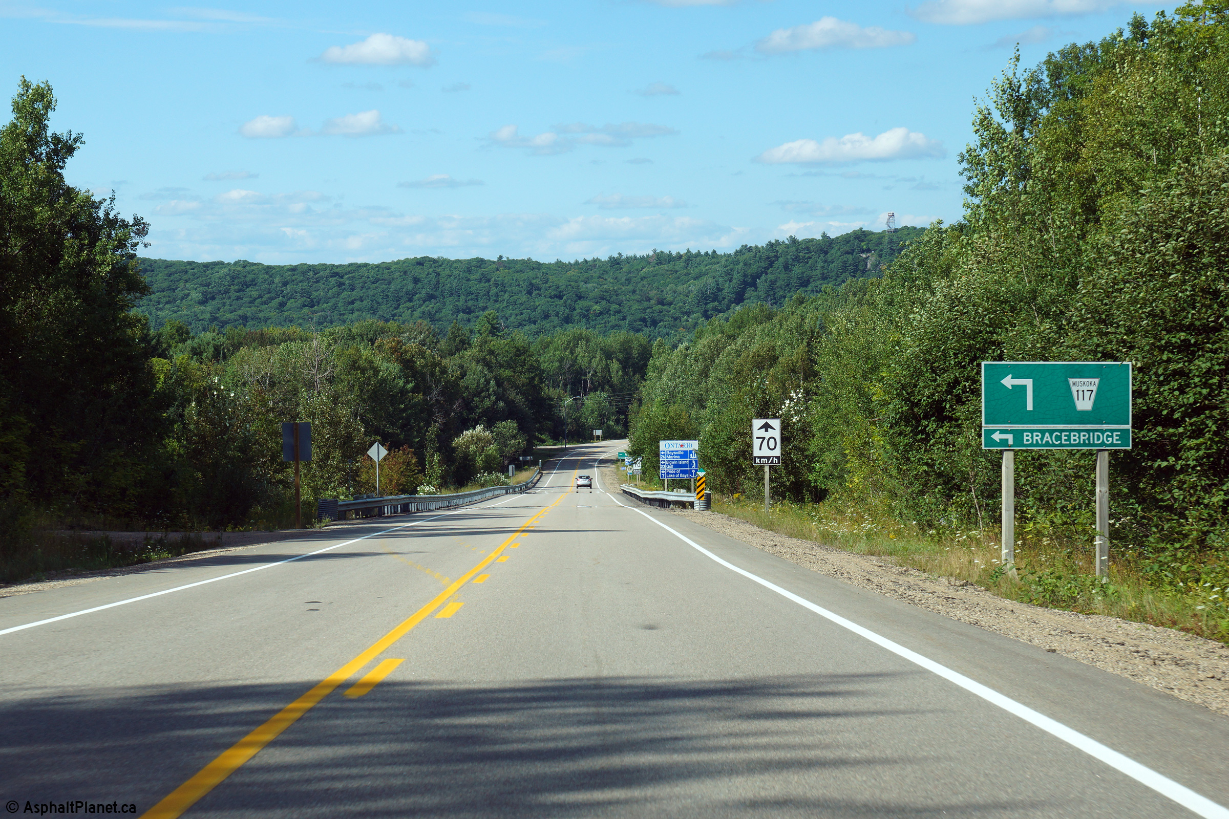
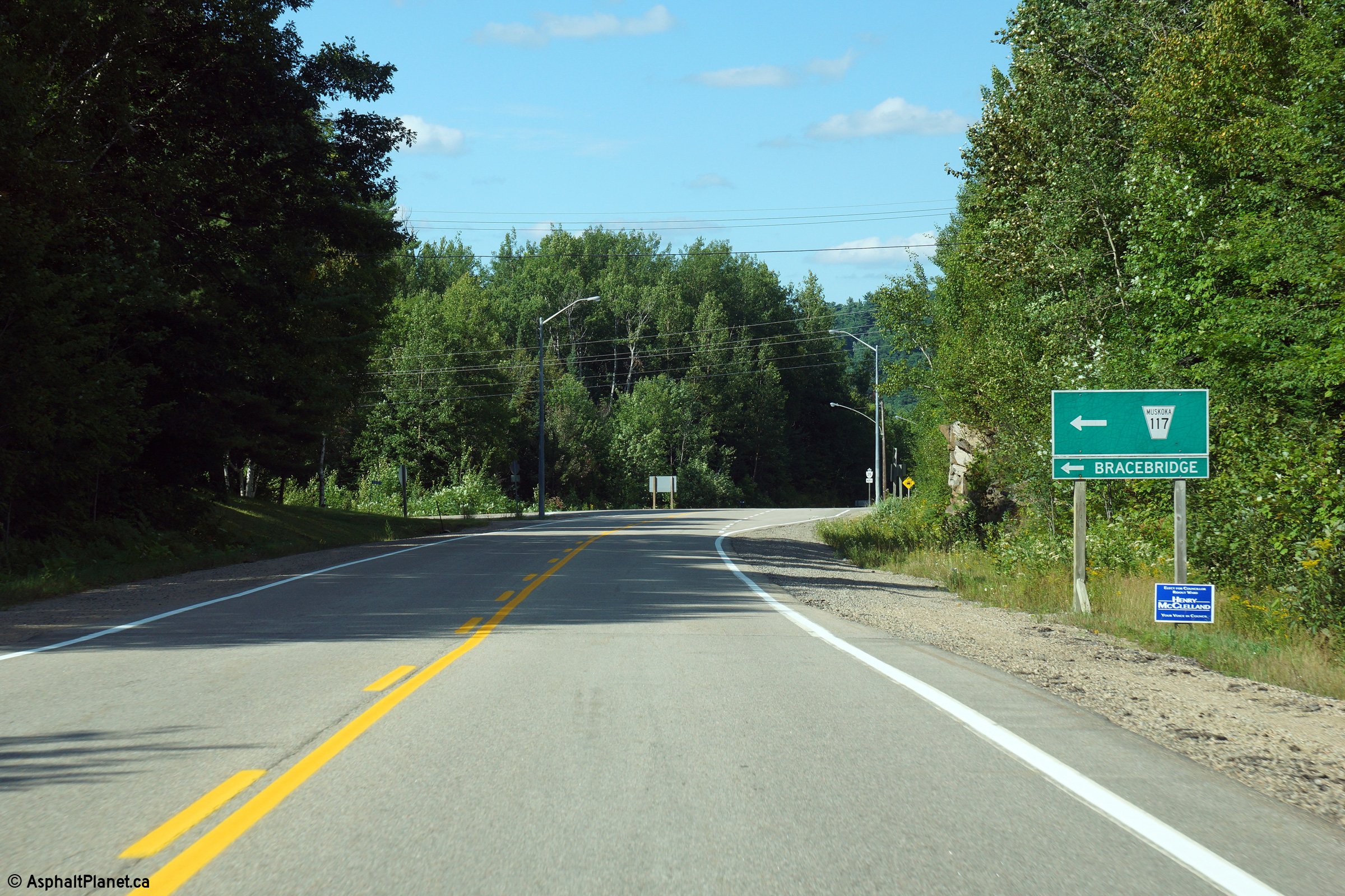
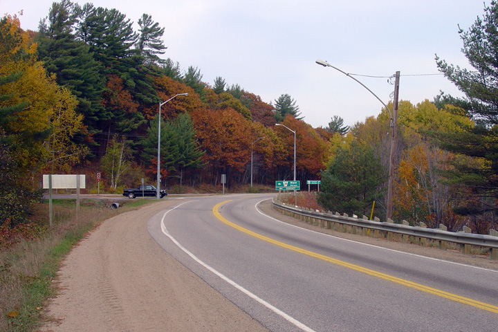
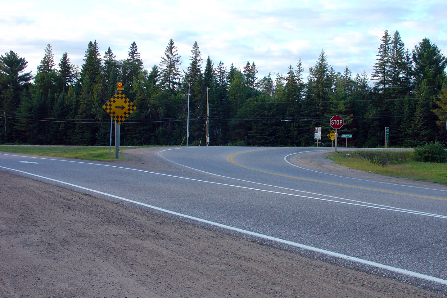
View looking northerly at the Highway 117 intersection. Highway 117
meets Highway 35 at a very non-descript rural intersection.
Photo taken: August 25th, 2015. |
(720x480)
(1440x960)
(2400x1600) |
|
Highway 117 (now Muskoka Road
117) leads westerly from Dorset to Bracebridge at Highway 11.
Click here for Highway 117 images. |
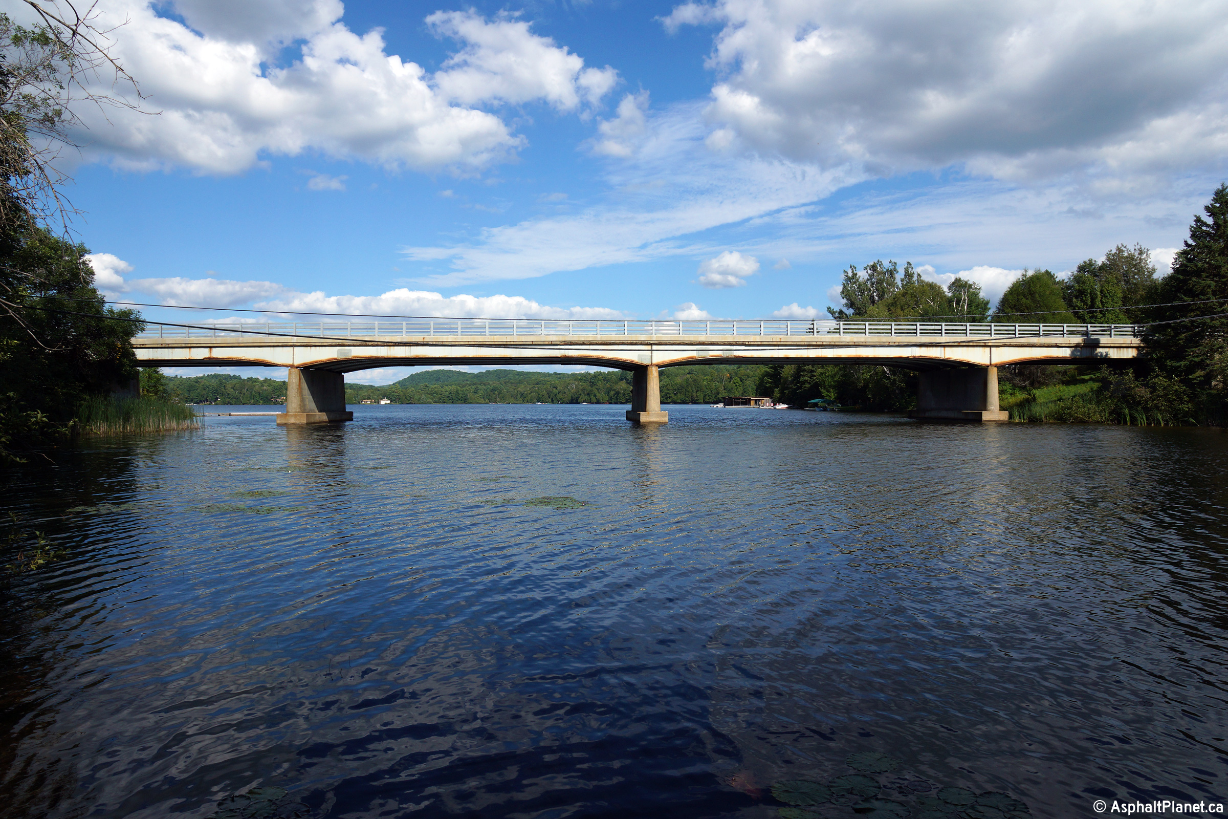
| Algonquin Highlands - Lake of
Bays Boundary Haliburton - Muskoka Boundary |
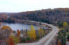
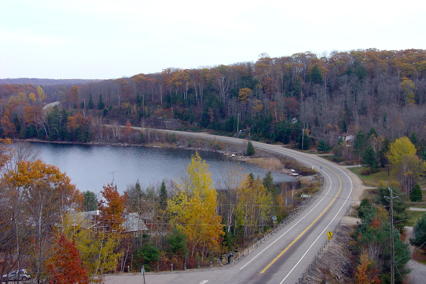
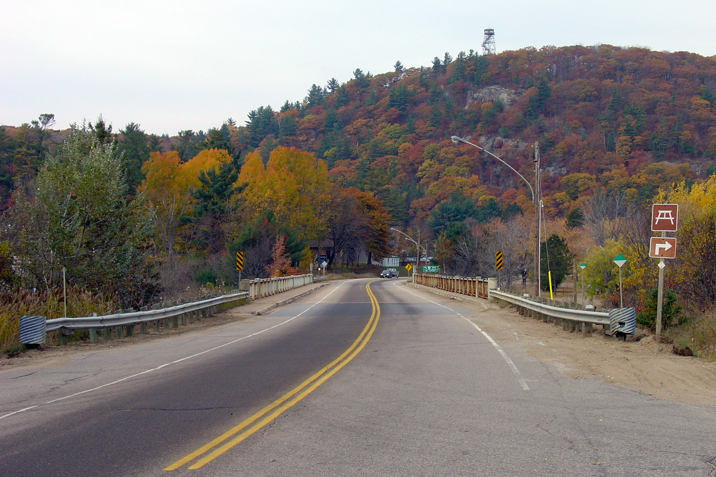
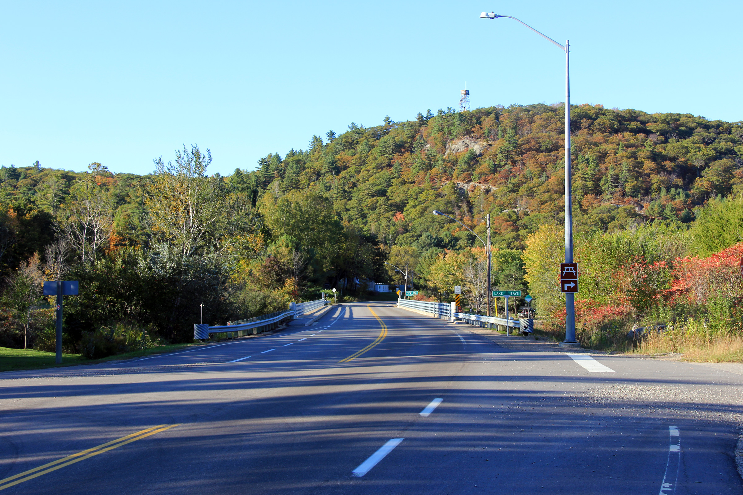
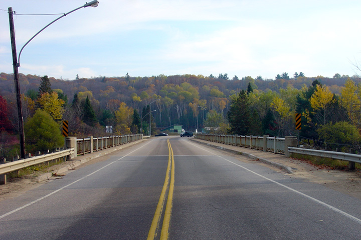
Two views looking northerly across the Dorset By-pass bridge along Highway 35.
Notice the Dorset Observation Tower located atop the hill in the background.
The Dorset Observation Tower offers tourists stunning views of the
surrounding area. Sometime between 2005 and 2011, the Lake of Bays
bridge was extensively rehabilitated.
Upper photo taken: October 30th, 2005.
Lower photo taken: October 1st, 2011. |
(720x480)
(1440x960)
(2400x1600) |
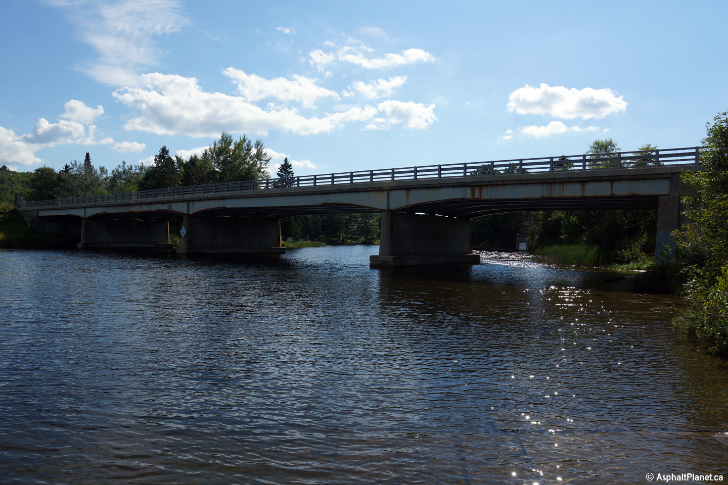
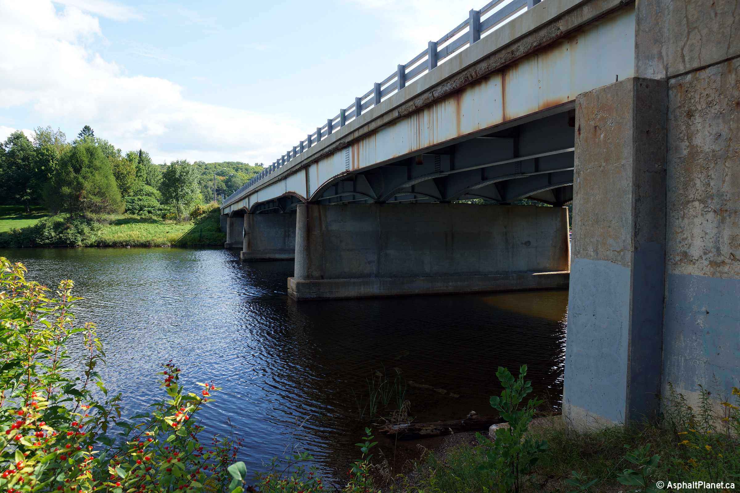
| Algonquin Highlands - Lake of
Bays Boundary Haliburton - Muskoka Boundary |
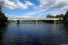
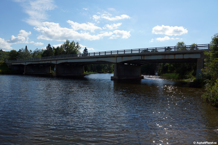
Two views looking south-westerly towards the Lake of Bays Narrows Bridge.
Highway 35 crosses Lake of Bays at four-span haunched steel girder bridge.
The structural steel was repainted during the 2016 construction season.
Photos taken: August 25th, 2014. |

(720x480)
(1440x960)
(2400x1600)

(720x480)
(1440x960)
(2400x1600)
|
| Algonquin Highlands - Lake of
Bays Boundary Haliburton - Muskoka Boundary |
Easterly view towards the Lake of Bays Narrows Bridge.
Photo taken: August 25th, 2014. |
(720x480)
(1440x960)
(2400x1600) |
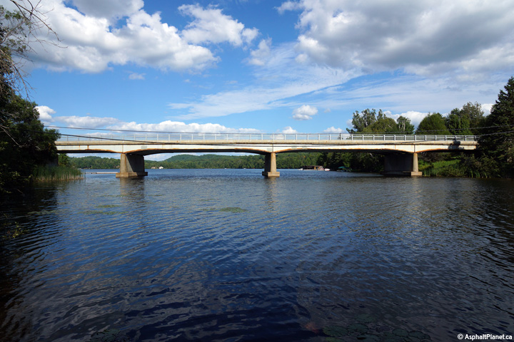
| Algonquin Highlands - Lake of
Bays Boundary Haliburton - Muskoka Boundary |
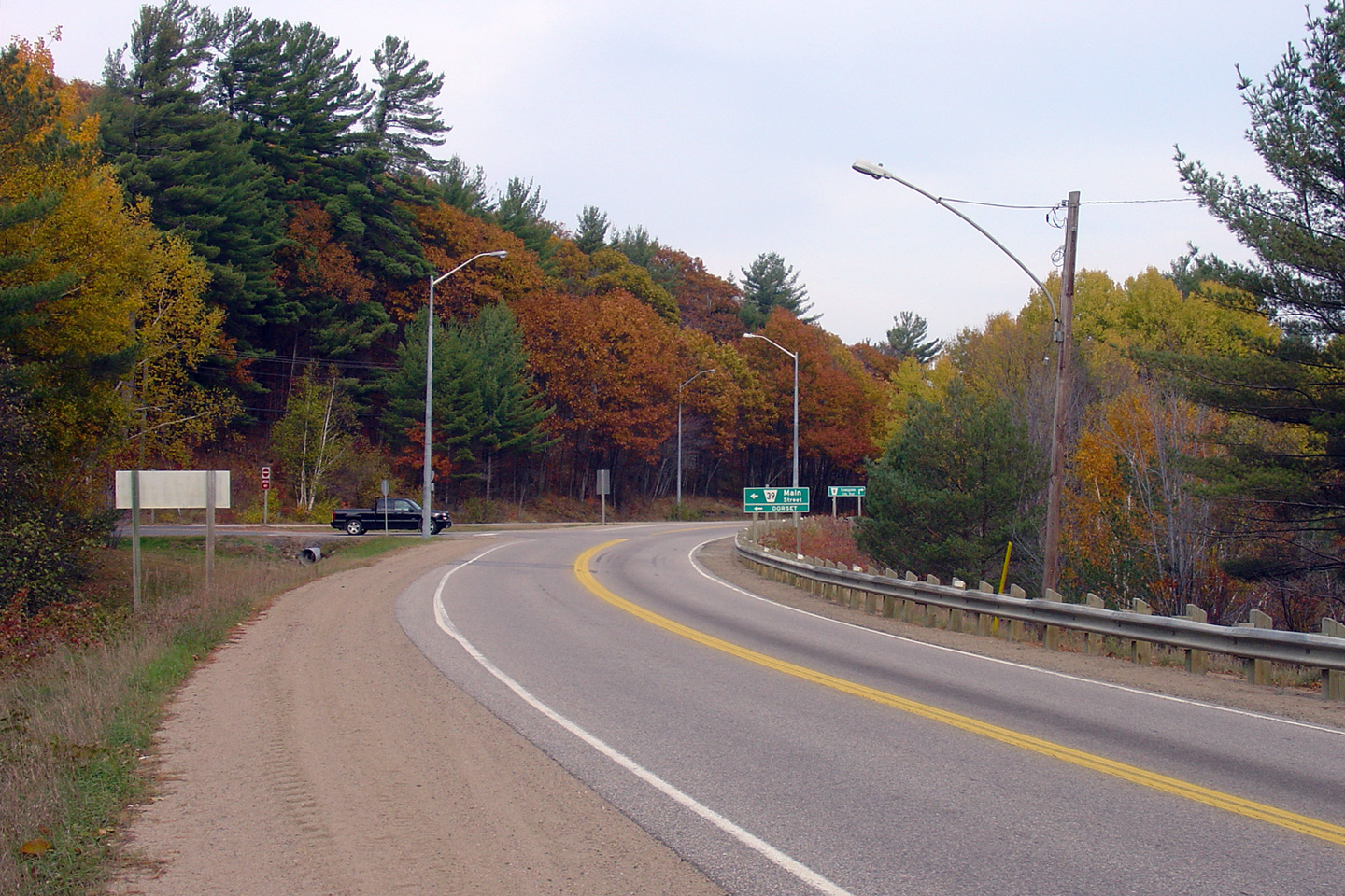
Looking southerly across the Dorset By-pass bridge along Highway 35.
This structure was built in 1958, bypassing both Downtown Dorset, and a
narrow truss bridge.
Upper photo taken: October 30th, 2005.
Lower photo taken: August 25th, 2014. |

(720x480)
(1440x960)
(2400x1600) |
| Township of Algonquin Highlands
County of Haliburton |
View looking northerly towards the northern Haliburton Road 39. Before
1958, when the Dorset by-pass was completed, Highway 35 followed what is now
Haliburton Road 39 through the heart of the small village, crossing the Lake
of Bays overtop of a steep single lane truss bridge.
Photo taken: October 30th, 2005. |

(720x480)
(1440x960) |
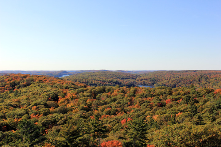
| Township of Algonquin Highlands
County of Haliburton |
View of the the Lake of Bays from high atop the Dorset Observation Tower.
Photo taken: October 4th, 2011. |

(720x480)
(1440x960)
(2400x1600) |
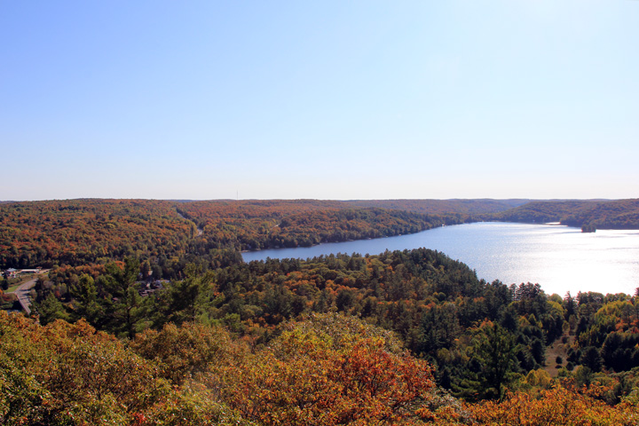
| Township of Algonquin Highlands
County of Haliburton |
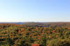
View looking north overtop of the autumn Muskoka and Haliburton Forests from
the Dorset Observation Tower.
Photo taken: October 4th, 2011. |
(720x480)
(1440x960)
(2400x1600) |
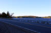
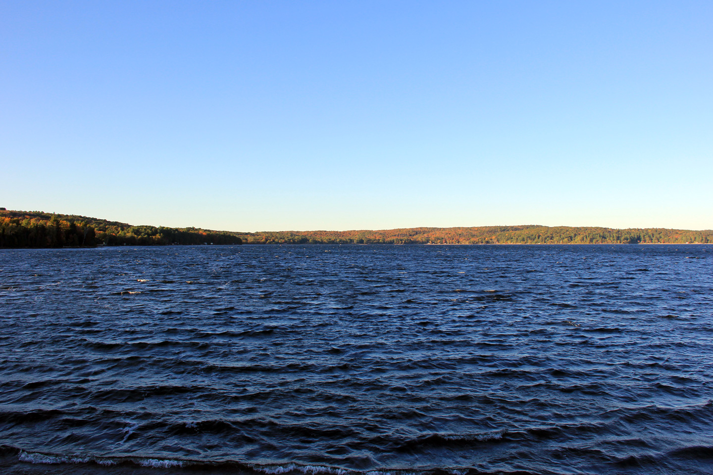
| Township of Lake of Bays
District Municipality of Muskoka |
Looking north along Highway 35 from roughly the Muskoka-Haliburton Boundary.
This boundary is located roughly 8km south of
Highway 60. Picture taken: August 7th, 2004. |

(720x480)
(1440x960) |
| Township of Lake of Bays
District Municipality of Muskoka |
Reversing curve along Highway 35, looking south from the junction of Muskoka
Road 21. Picture taken: August 6th, 2006. |
(720x480)
(1440x960) |
| Township of Lake of Bays
District Municipality of Muskoka |
Looking southerly along Highway 35 as it crosses the Oxtongue River bridge,
south of Highway 60. Picture taken: August 6th, 2006. |
(720x480)
(1440x960) |
| Township of Lake of Bays
District Municipality of Muskoka |
Looking south along Highway 35 from just south of the
Highway 60 junction. Photo taken: August 7th, 2004. |
(720x480)
(1440x960) |
| Township of Lake of Bays
District Municipality of Muskoka |
Looking north towards the northern terminus of Highway 35 at
Highway 60. This intersection favours
continuous west-south movement .
Photo taken: August 7th, 2004. |
(720x480)
(1440x960) |
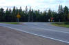
| Township of Lake of Bays
District Municipality of Muskoka |
Junction assembly denoting the northern terminus of Highway 35 at
Highway 60. Photo taken: August 7th, 2004. |
 (720x480) (720x480)
(1440x960) |
|
Highway 35 ends at Highway 60
between Huntsville and Algonquin Park.
Click here for Highway 60 images. |


 (720x480)
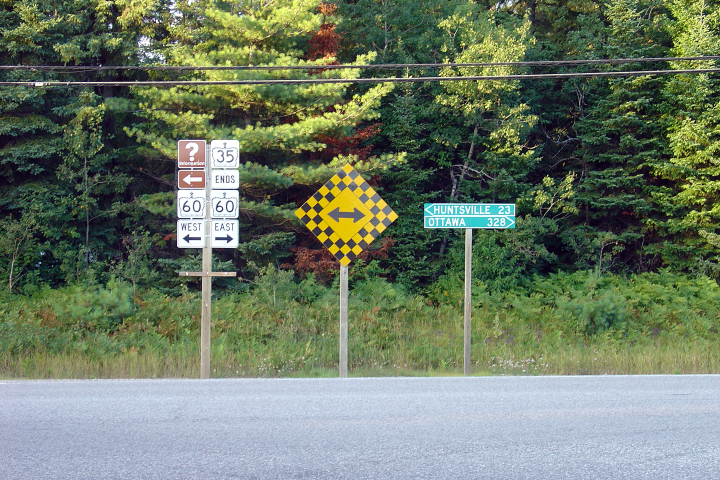