|
Proper Municipality Name |
Photo Description |
Photo |
|
Pictures taken
from driver's perspective appear offset from centre-line pictures: |
North-
Bound |
South-
Bound |
City of Mississauga
Regional Municipality of Peel |
Northerly view along Highway 10 approaching the former cloverleaf
interchange with the QEW. This interchange was reconfigured into a
half diamond/half parclo configuration shortly after these photos were
taken.
Photo taken: May 30th, 2007. |
|
City of Mississauga
Regional Municipality of Peel |
View looking southerly at the former QEW cloverleaf interchange from just
underneath of the structure.
Photo taken: May 30th, 2007. |
|
|
The QEW slices through the
southern portion of Mississauga on its routing between Toronto and Fort
Erie. Click here
for QEW images. |
City of Mississauga
Regional Municipality of Peel |
This view looks northerly from the QEW structure towards the northern part
of the former QEW cloverleaf interchange.
Photo taken: May 30th, 2007. |
|
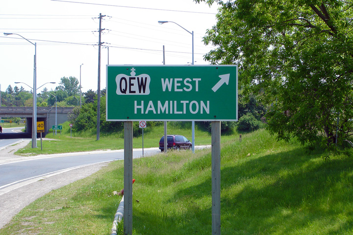
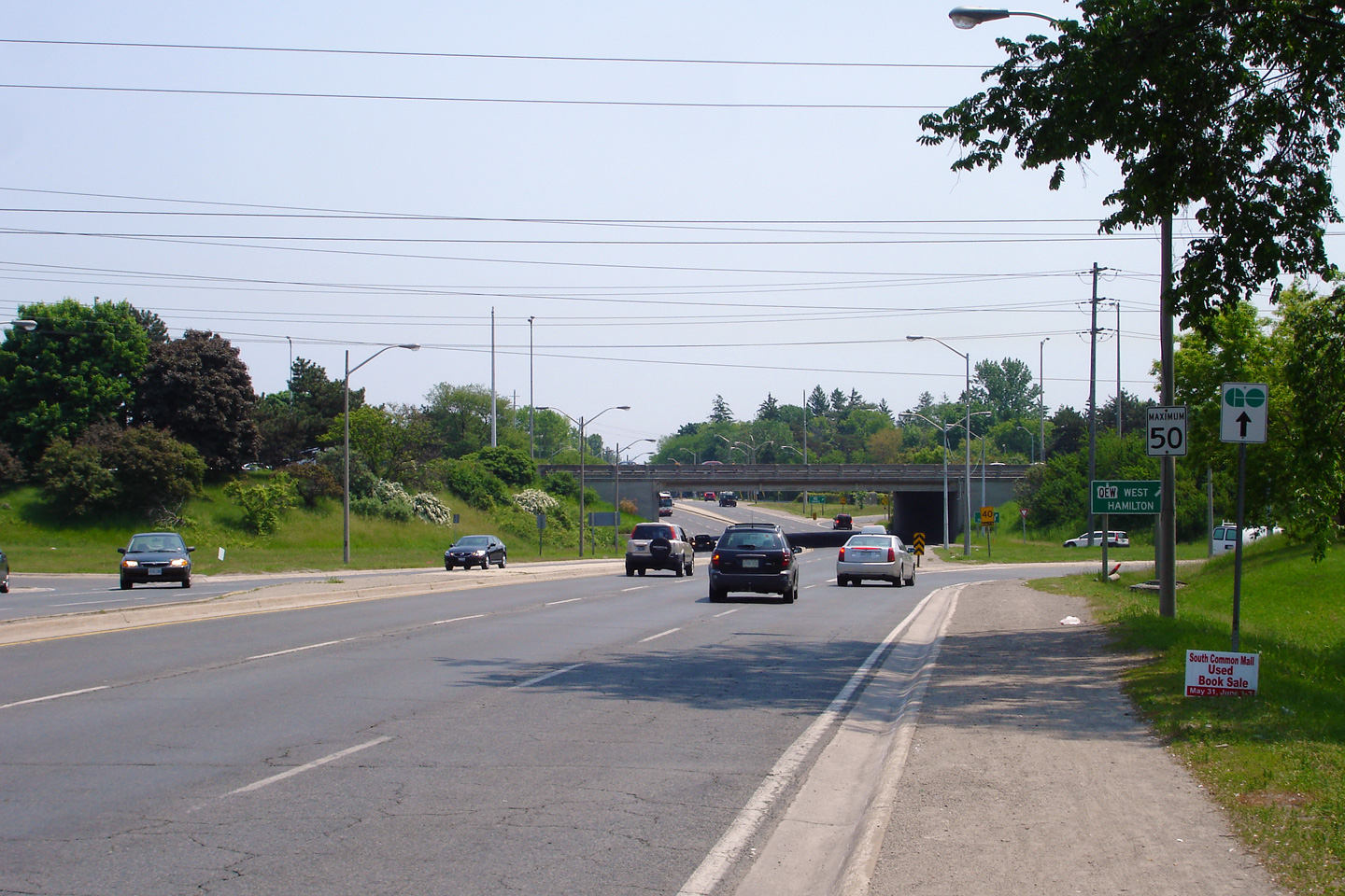
City of Mississauga
Regional Municipality of Peel |
Directional sign for the ramp to the Hamilton bound QEW.
Photo taken: May 30th, 2007. |
 (720x480) (720x480)
(1440x960) |
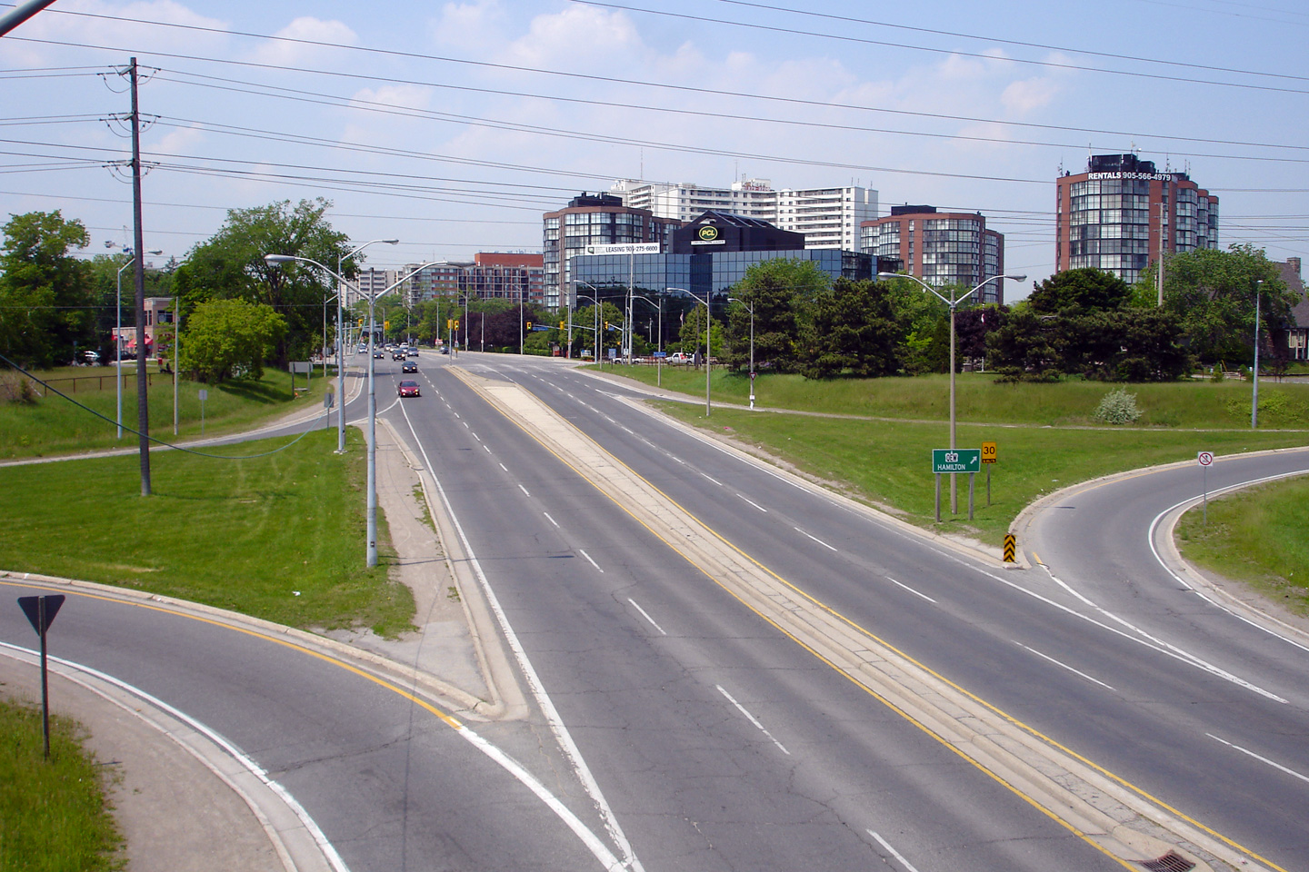
City of Mississauga
Regional Municipality of Peel |
Southerly view towards the QEW cloverleaf interchange.
Photo taken: May 30th, 2007. |
|
|
Dundas Street carried the Highway 5 designation
before 1997. Click here
for Highway 5 images. |
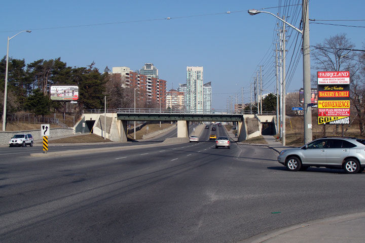
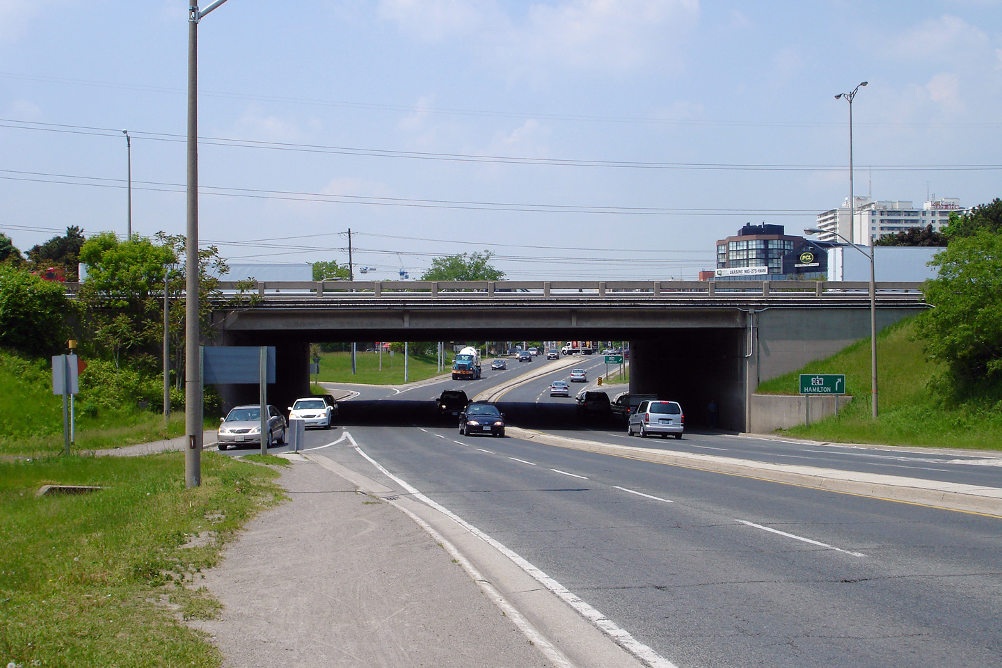
City of Mississauga
Regional Municipality of Peel |
View looking northerly along Hurontario Street
towards the CP Rail overhead. CP's Galt Subdivision was the only GO
transit line to run all-day service outside of the Lakeshore Lines in the
GTA. All day service was tried on a trial basis between 1990 and 1996
before being discontinued under the Harris government.
Photo taken: March 28th, 2009. |

(720x480)
(1440x960) |
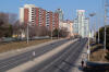
City of Mississauga
Regional Municipality of Peel |
View
looking southerly from the CP Railway overhead towards Dundas Street.
South of Dundas Street, Hurontario Street passes through a much older part
of Mississauga, at the Lakeshore dating back to the old town of Port Credit
before Toronto Township was amalgamated into the City of Mississauga.
Photo taken: March 28th, 2009. |
(720x480)
(1440x960) |
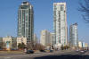
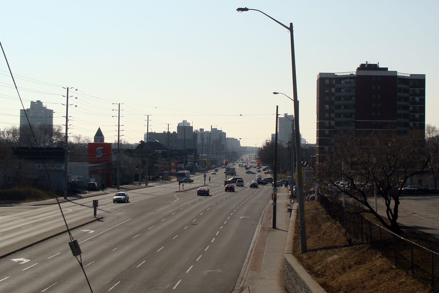
City of Mississauga
Regional Municipality of Peel |
Northerly
view along Hurontario from the CP Railway overhead. Contrast the
different styles of residential towers pictured. The older red brick
tower would likely date back to the 1970s, while the green glass structures
were likely constructed in the 2000s. In my opinion, both
architectural styles are a little stale.
Photo taken: March 28th, 2009. |
(720x480)
(1440x960) |
City of Mississauga
Regional Municipality of Peel |
View of condo towers that have popped up to the
south of Square One. This concrete and green glass style of condo
tower is very popular in Mississauga and Toronto. There has been quite
a boom in condominium construction in the Greater Toronto Area during the
past decade (2000s).
Photo taken: March 28th, 2009. |
(720x480)
(1440x960) |
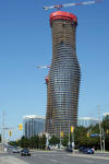
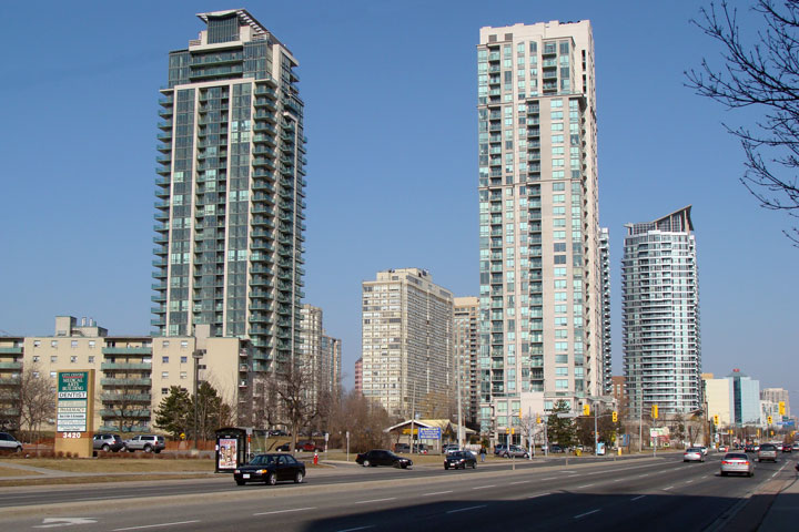
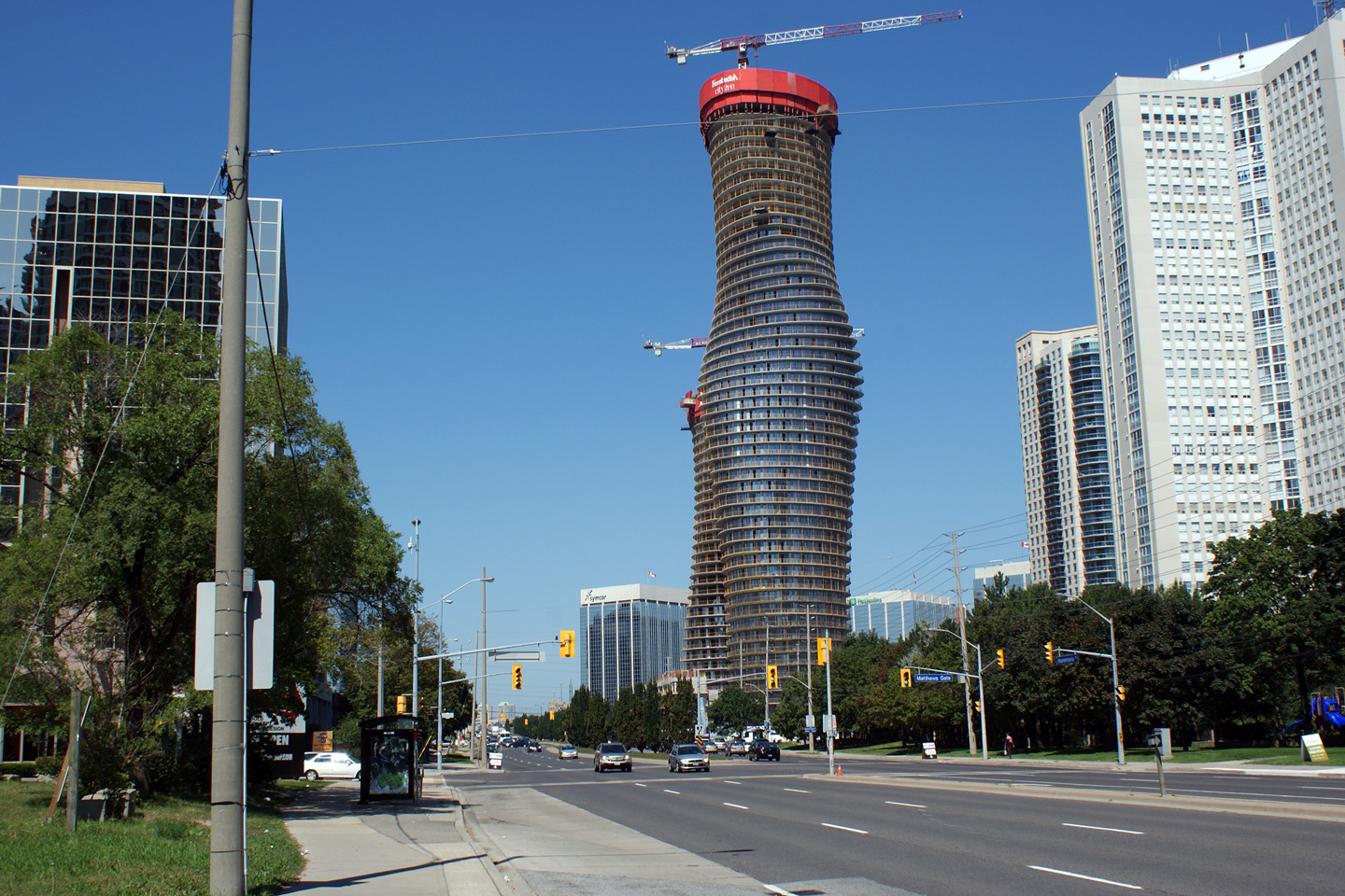
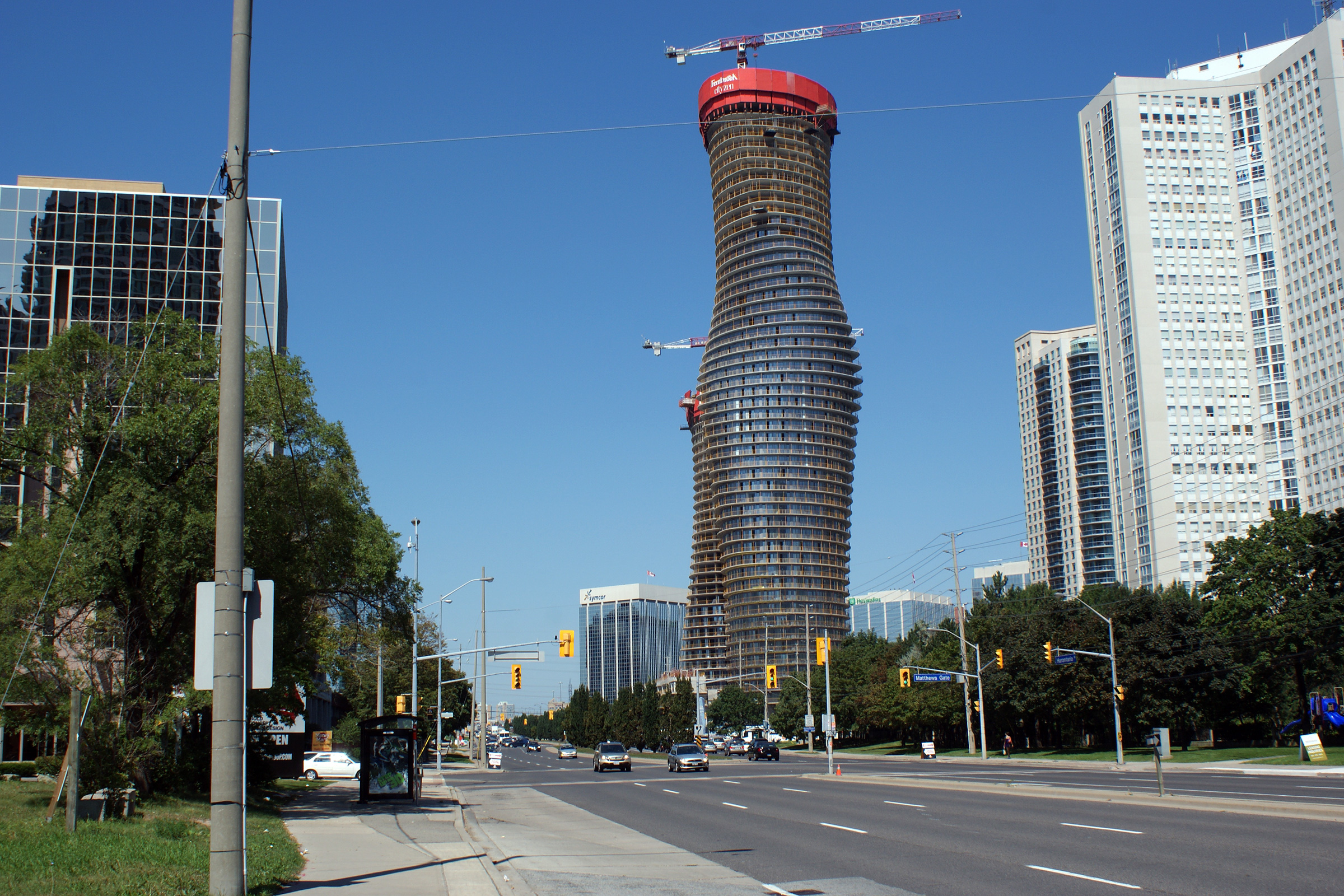
City of Mississauga
Regional Municipality of Peel |
Two views as Highway 10 passes by Mississauga's iconic Absolute World
Towers. Absolute World won the prestigious Emporis Skyscraper Award
for best skyscraper in 2012 for its unique and iconic design. The
towers have been completed since these photos was taken.
Photos taken: August 28th, 2010
|

(720x480)
(1440x960)
(2400x1600)
(480x720)
(960x1440) |
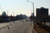
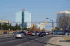
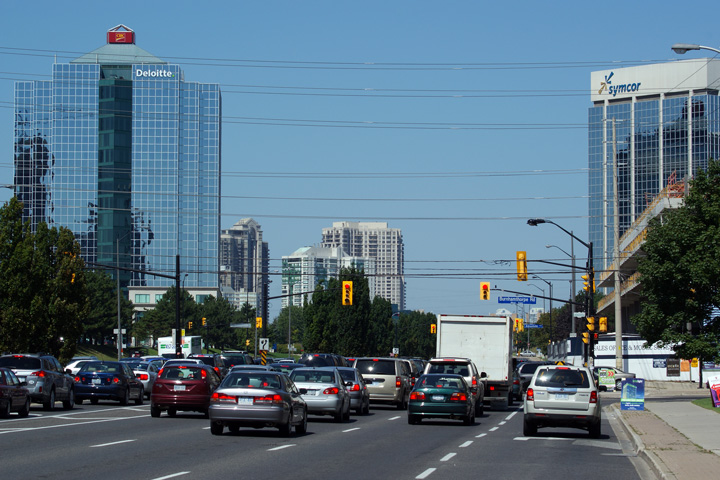
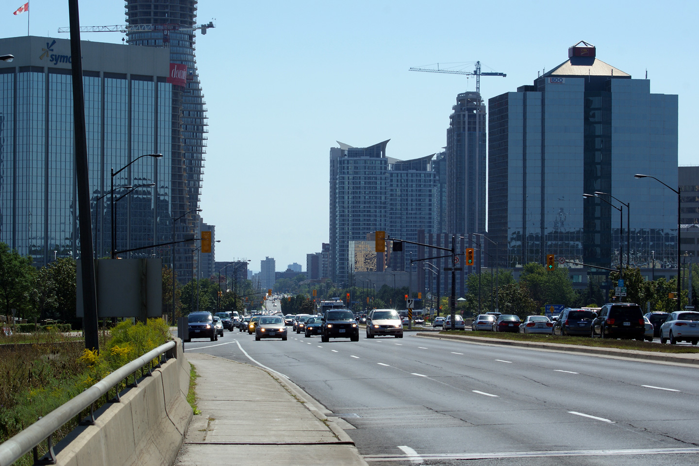
City of Mississauga
Regional Municipality of Peel |
View looking northerly from the Burnhamthorpe
Road. Mississauga can attribute a lot of its success from the city's
ability to attract high paying employers to set up shop within its
boundaries. Pictured here are towers from Deloitte, CIBC and the
energy company Symcor.
Photo taken: March 28th, 2009. |
(720x480) (1440x960) |
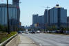
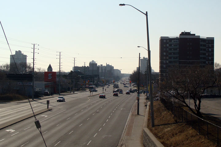
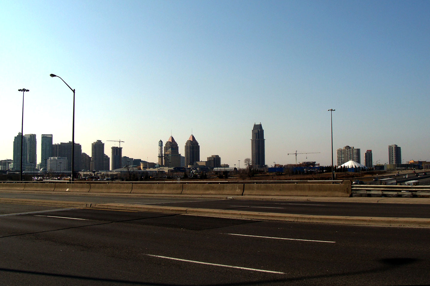
City of Mississauga
Regional Municipality of Peel |
This view looks southerly from the Highway 403
interchange along Hurontario Street. Mississauga has a surprisingly
impressive Downtown Skyline -- particularly since it is very much a
satellite city to Toronto.
Photo taken: March 28th, 2009. |
(720x480)
(1440x960)
(2400x1600) |
|
Immediately to the North of Mississauga's Square
One Shopping Mall, is Highway 403, the City's principal east-west artery.
Click here
for Highway 403 images. |
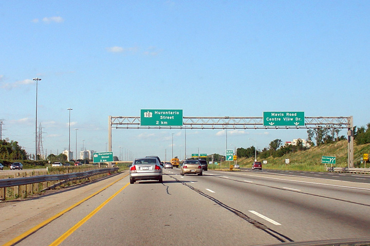
City of Mississauga
Regional Municipality of Peel |
Overhead advanced signage for Highway 10 along Highway 403 in Mississauga.
This photograph was taken in 2004 before the HOV lanes were added to Highway
403.
Photo taken: August 1st, 2004. |

(720x480)
(1440x960) |
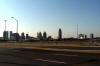
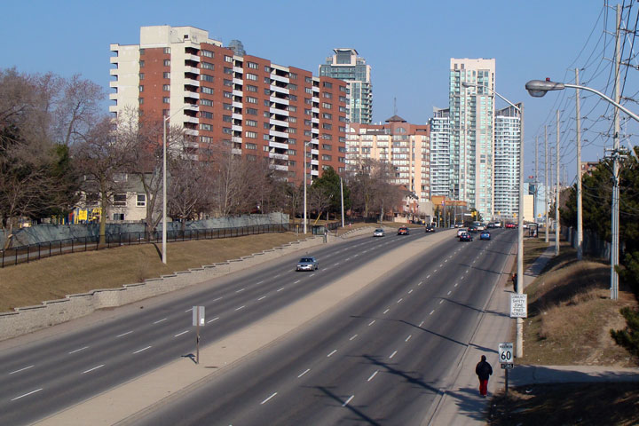
City of Mississauga
Regional Municipality of Peel |
View
looking southwesterly from the Highway 10 overpass over The 403.
Mississauga's 'skyline' is found predominantly to the south of Highway 403
contained between Hurontario Street and Mavis Road. Notice the
Mississauga City Hall in the centre of the photo. Mississauga City
hall was designed to look like a modern super farm, apparently a tribute to
the acres of prime farmland the city has swallowed up.
Photo taken: March 28th, 2009. |
(720x480)
(1440x960) |
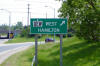
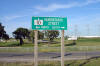
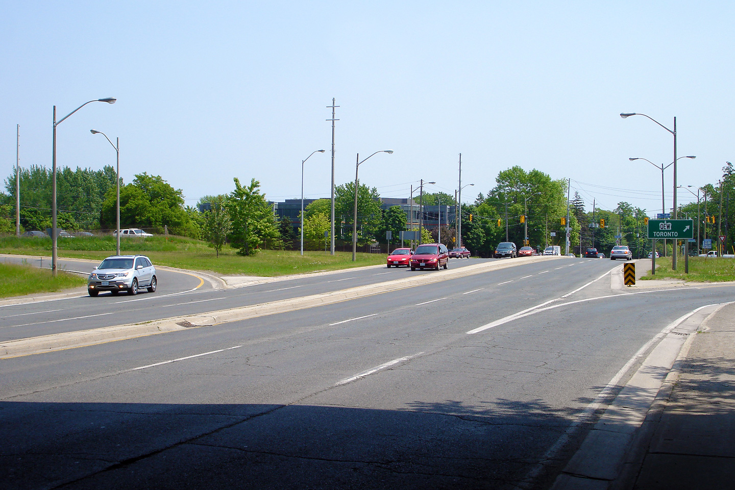
City of Brampton
Regional Municipality of Peel |
Green signage greeting motorists at the end of the eastbound off-ramp from
Highway 407 to Hurontario Street.
Photo taken: August 13th, 2006. |
 |
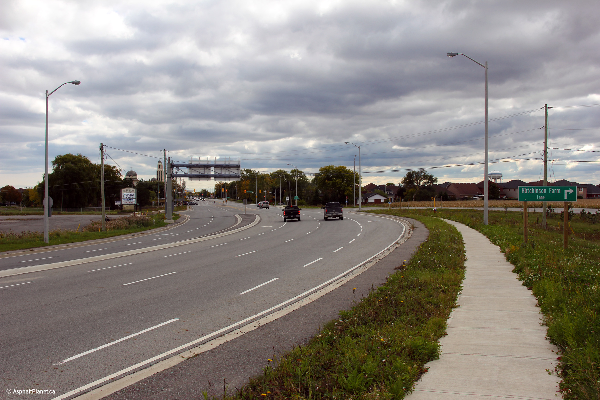
City of Brampton
Regional Municipality of Peel |
This view looks northerly at the Hutchinson Farm Lane intersection just
south of the Highway 410 interchange along Highway 10.
Photo taken: October 1st, 2012. |
(720x480)
(1440x960)
(2400x1600) |
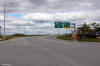
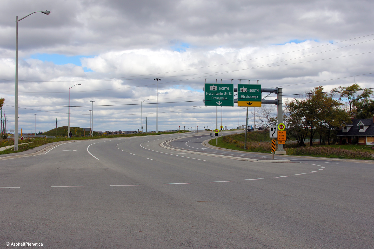
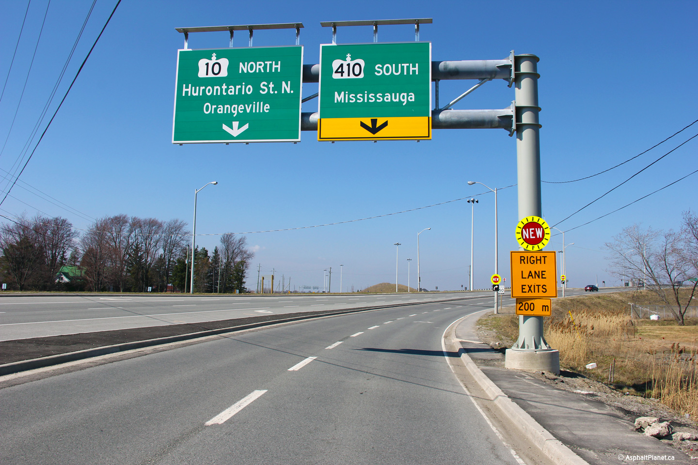
Town of Caledon
Regional Municipality of Peel |
Two incarnations of signage advising motorists of the upcoming Highway 410
interchange. Since the highway was opened to traffic in 2009, the
interchange has undergone three major signage overhauls.
Upper photo taken: June 6th, 2010.
Lower photo taken: March 19th, 2012. |
|
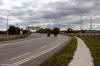
Town of Caledon
Regional Municipality of Peel |
Southerly view along Hurontario Street, looking south from the Highway 410
interchange.
Upper photo taken: June 6th, 2010.
Lower photo taken: October 1st, 2012. |
(720x480)
(1440x960)
(2400x1600) |
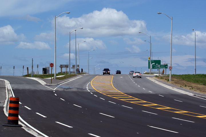
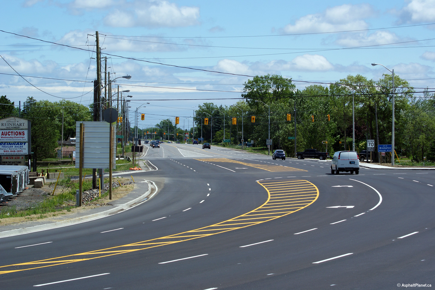
Town of Caledon
Regional Municipality of Peel |
Two views looking northerly towards the Highway 410 interchange. The
lower photo shows the short section of Highway 10 that was by-passed by the
new interchange project.
Upper photo taken: June 6th, 2010.
Lower photo taken: March 19th, 2012. |
(720x480)
(1440x960)
(2400x1600) |
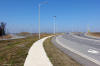
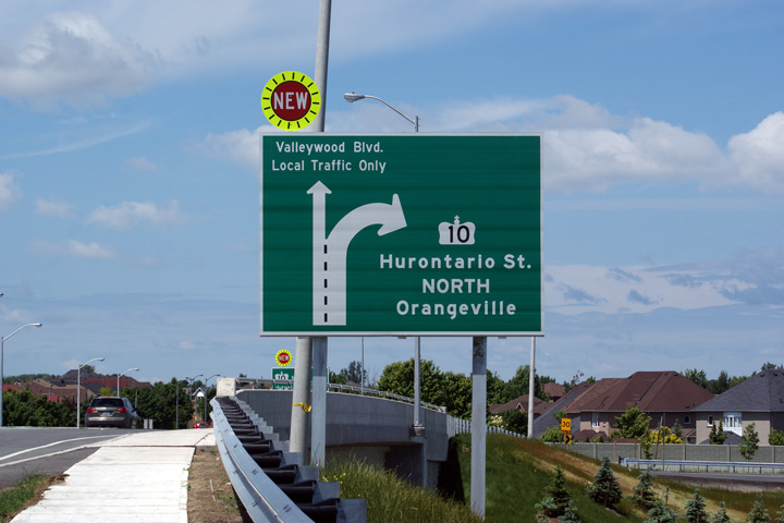
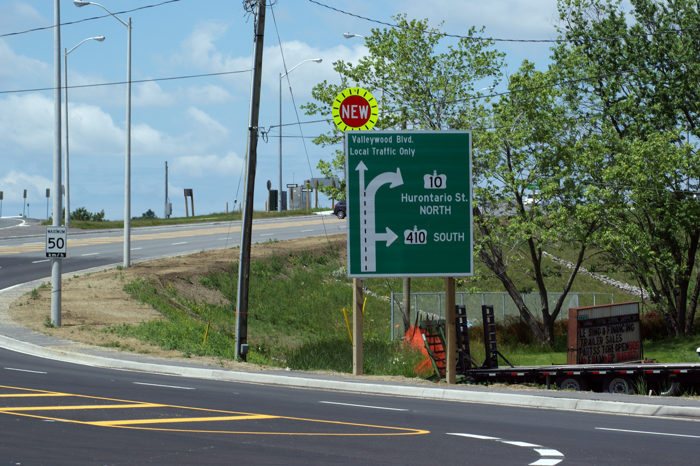
Town of Caledon
Regional Municipality of Peel |
Former northbound advanced signage for the ramp to Highway 10 North along
Hurontario Street. This diagram sign was removed when the overhead
signage was erected during the fall of 2010.
Photo taken: June 6th, 2010. |
|
Town of Caledon
Regional Municipality of Peel |
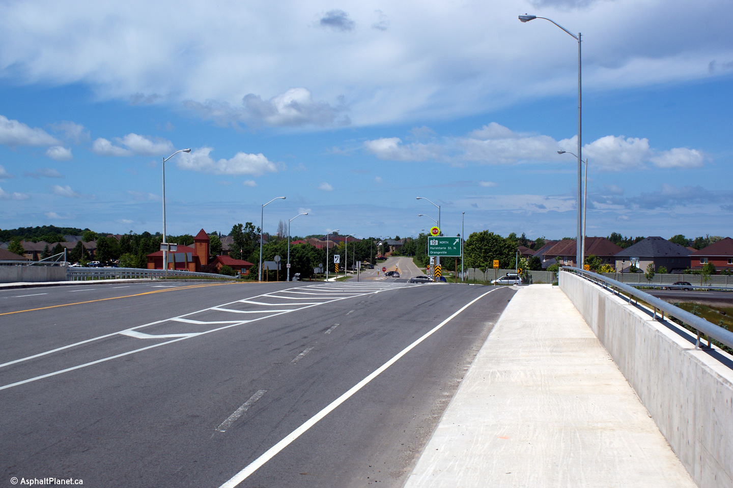
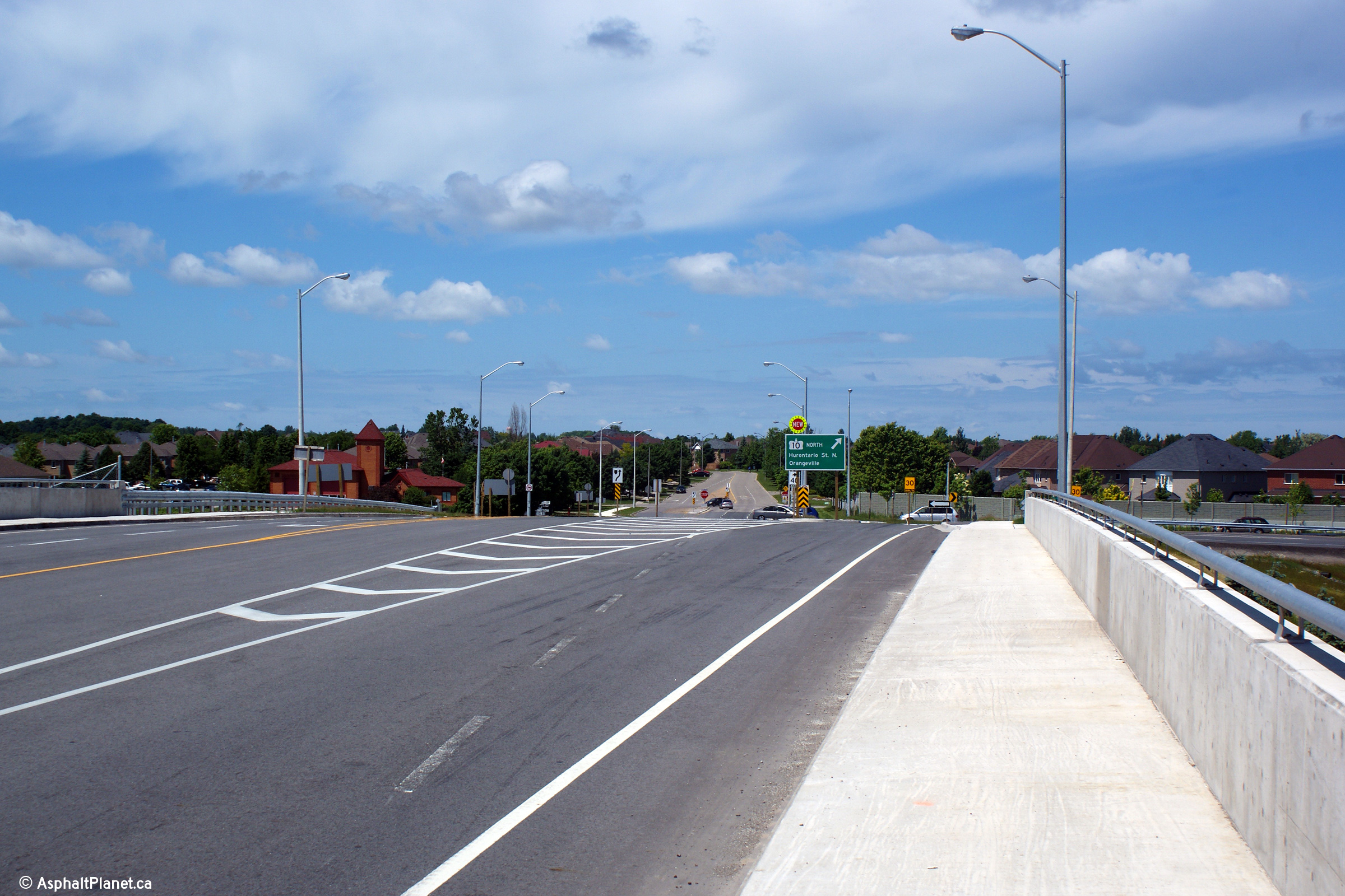
Two views looking northerly across the Highway 410 overpass. This
collection of photos shows the varying lane configurations of this overpass.
When it opened during the fall of 2009, this overpass was striped with four
through lanes in each direction. It has since been narrowed twice and
now has a single northbound lane for through movements for traffic
continuing north along Highway 10 with a lane that develops for local
traffic to access the Valleywood Subdivision.
Upper photo taken: June 6th, 2010.
Lower photo taken: October 1st, 2012. |
|
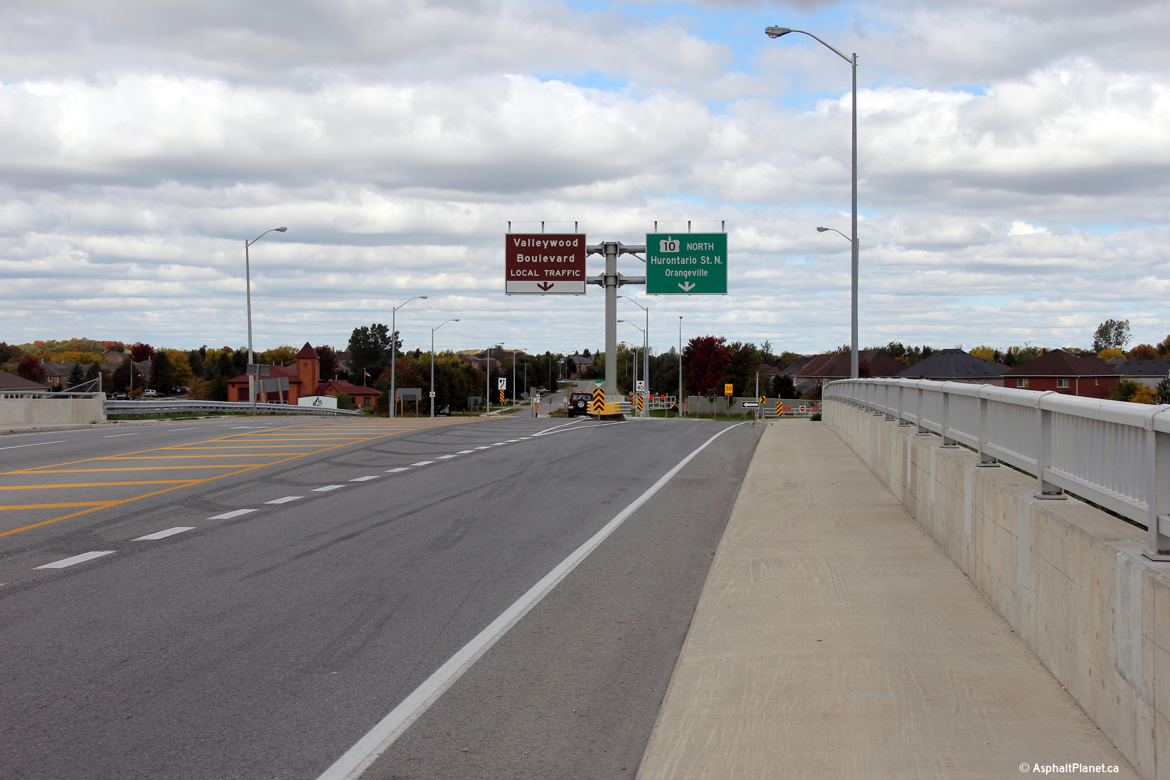
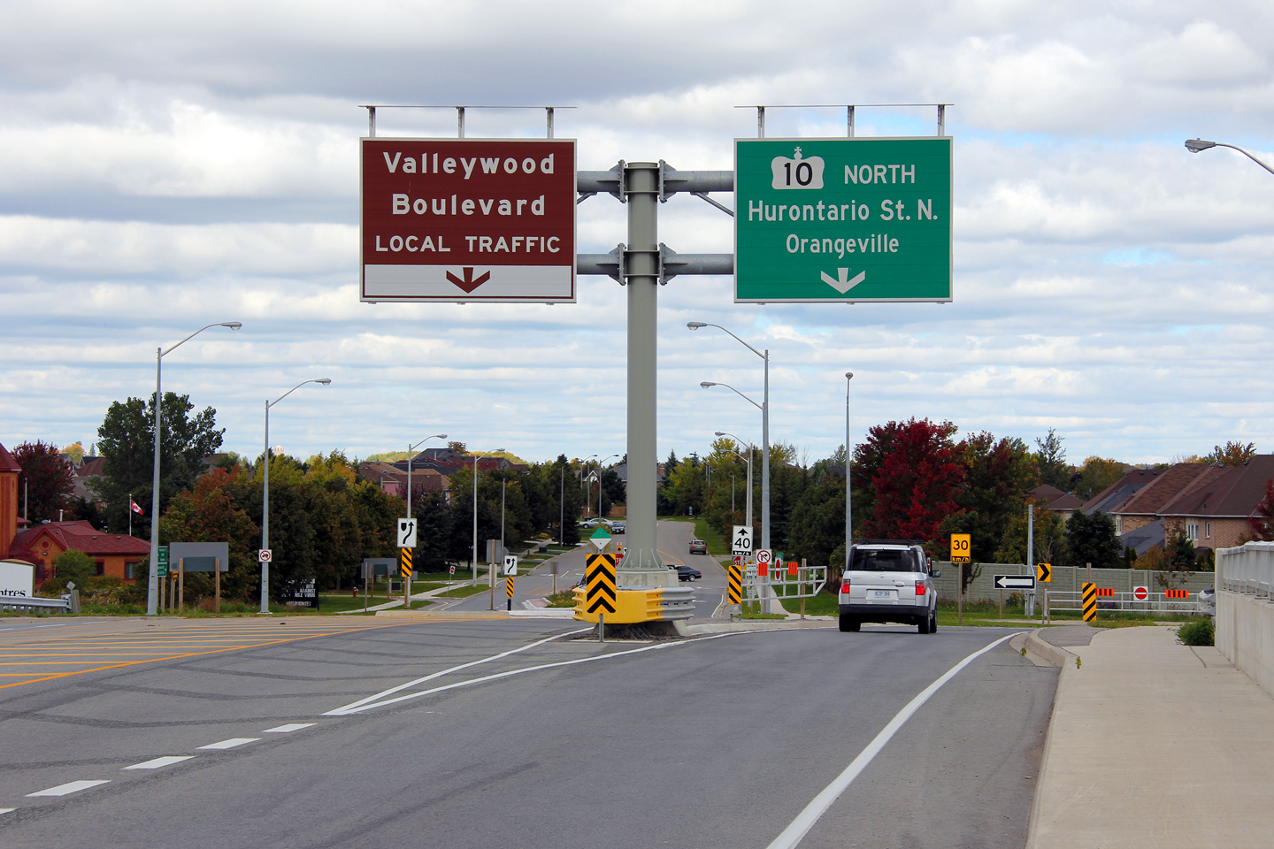
Town of Caledon
Regional Municipality of Peel |
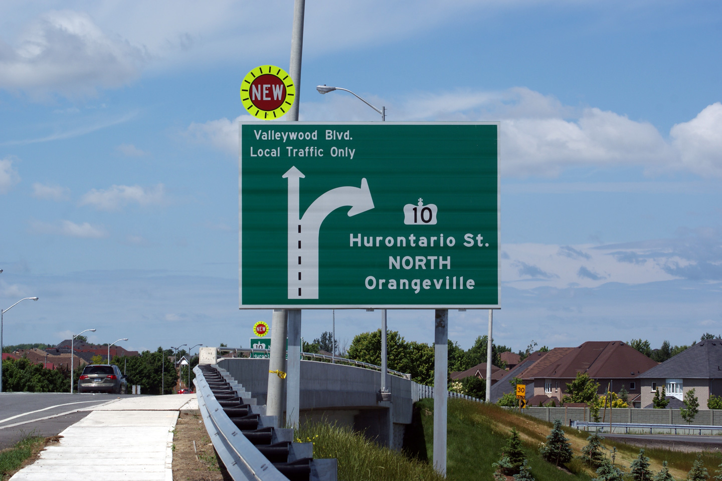
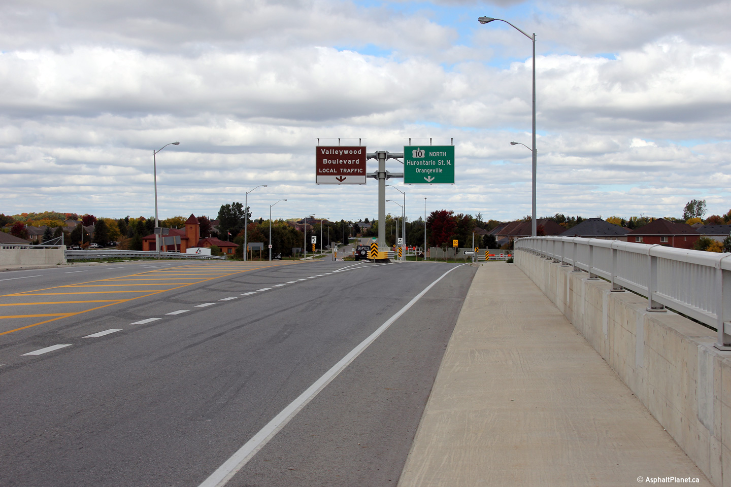
Northbound signage directing through traffic to continue northerly along
Highway 10. In the lower photo, note the use of a brown sign,
seemingly to attempt to detract through traffic from entering the Valleywood
subdivision.
Upper photo taken: June 6th, 2010.
Lower photo taken: October 1st, 2012. |
|
|
South of Highway 10, the former
Highway 24 heads to Guelph, Cambridge and Brantford.
Click
here for Highway 410 images. |
|
Continue north on Highway 10 via
Page 2 Images |


 (720x480)


 (720x480)


 (720x480)

 (720x480)