AsphaltPlanet.ca > OntHighways > QEW > Images > Page 1
Queen Elizabeth Way - Images
Page 1 - Fort Erie to Niagara-on-the-Lake Page 2 ->
Photos shown in this table are arranged from South (Fort Erie) to North (Toronto):
| Proper Municipality Name | Photo Description | Photo | ||
|
Pictures taken from driver's perspective appear offset from centre-line pictures: |
Toronto- Bound |
Fort Erie- Bound |
||
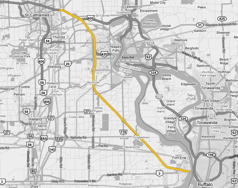
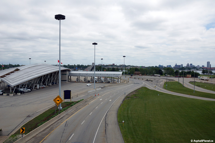
| The QEW ends at the Peace Bridge - which links to Interstate 190. Click here for I-190 images. | ||||
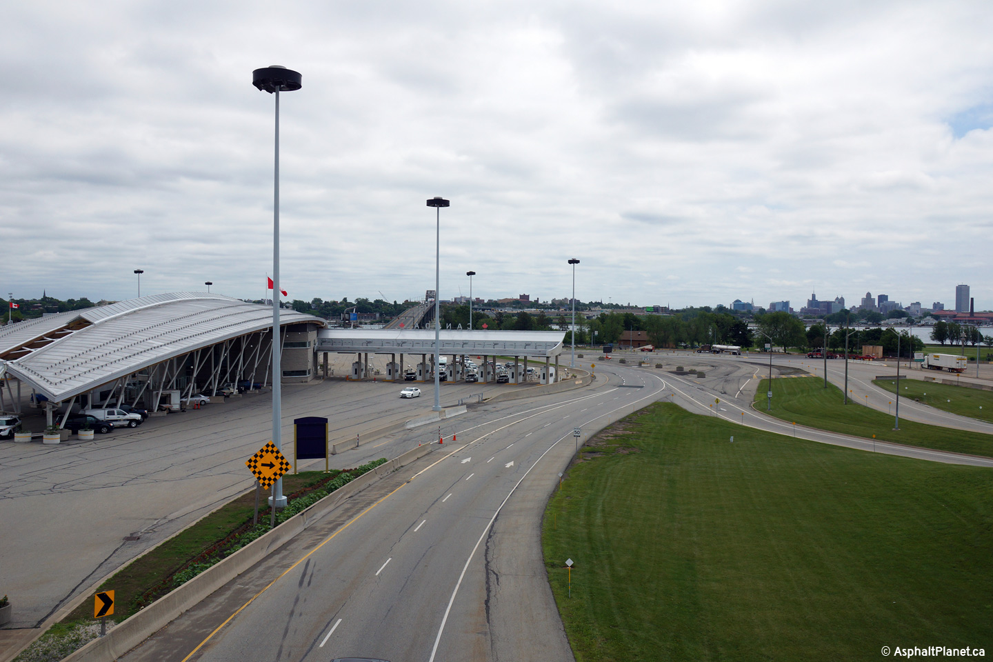
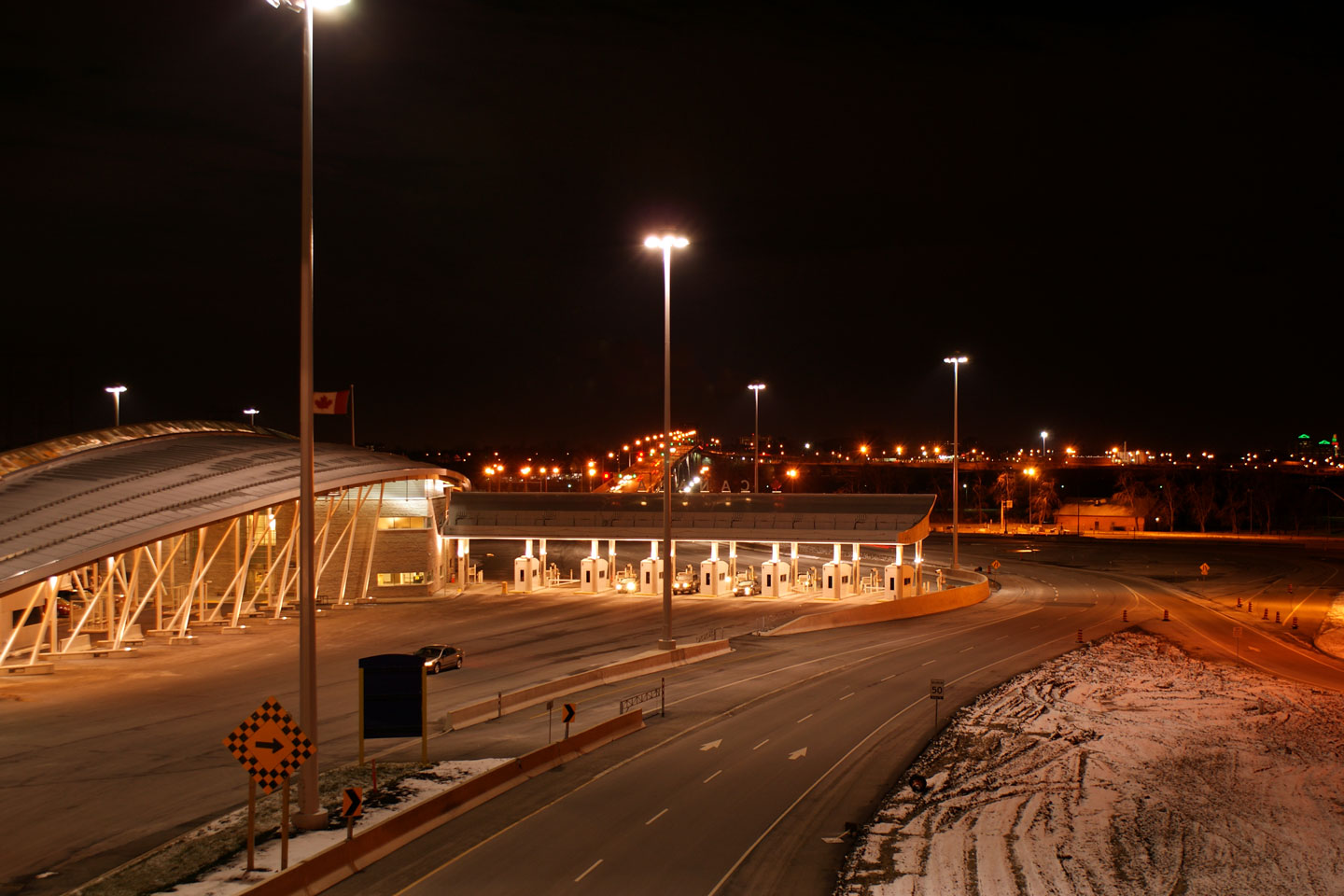
| Town of Fort Erie Regional Municipality of Niagara |
Easterly
view across the Peace Bridge towards Buffalo, New York. Upper photo taken: June 19th, 2015. Lower photo taken: December 13th, 2008. |
 (720x480) (1440x960) (2400x1600) 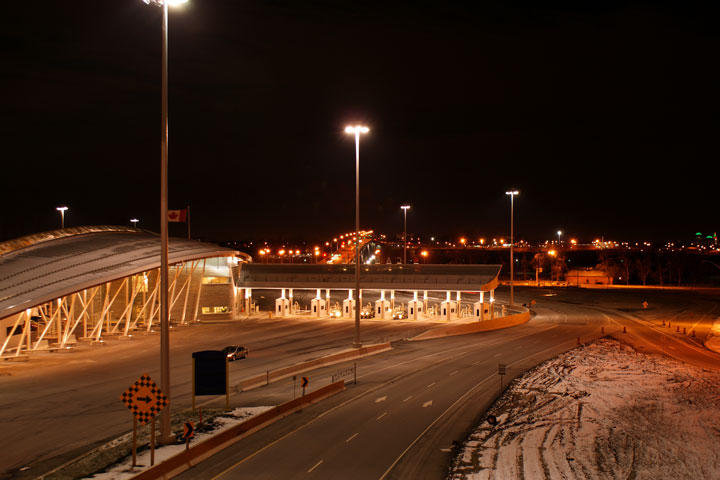 (720x480) (1440x960) |
||
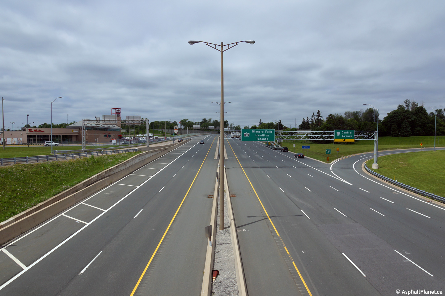
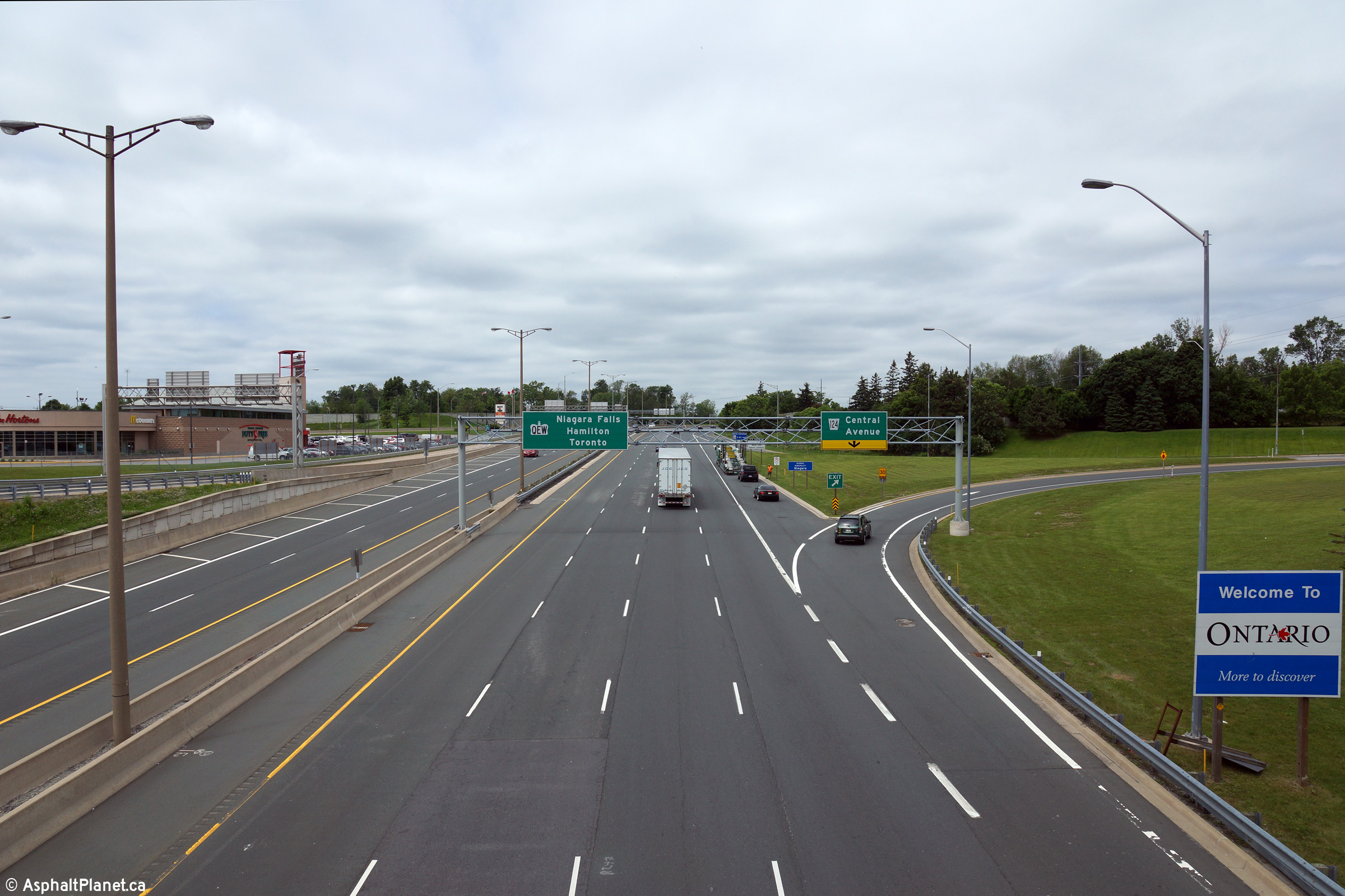
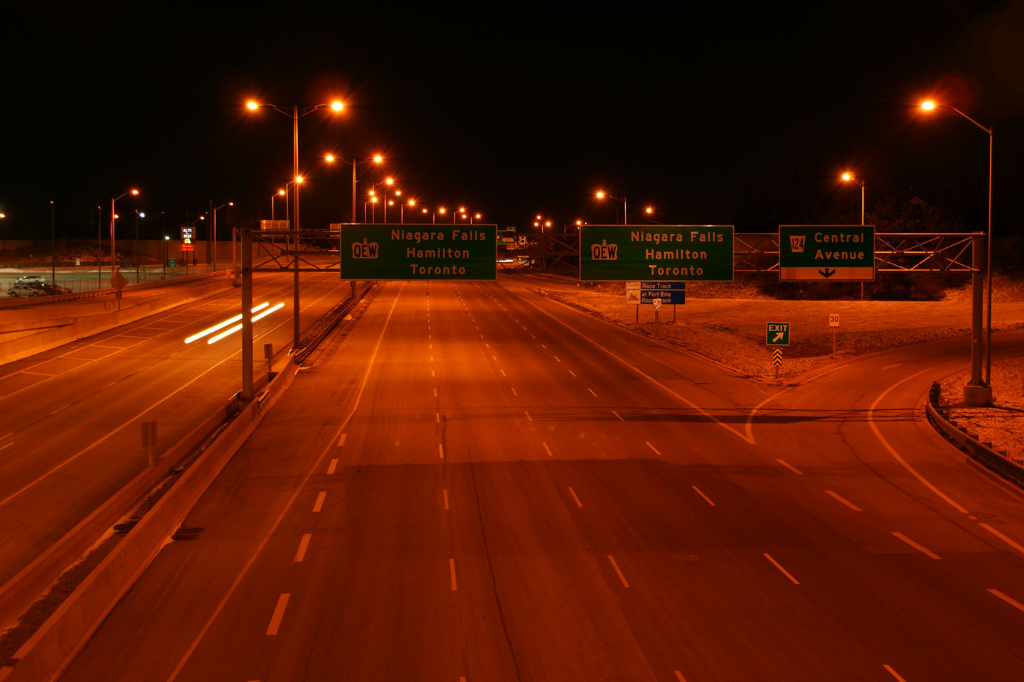
| Town of Fort Erie Regional Municipality of Niagara |
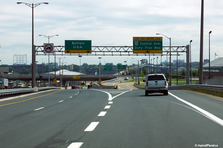
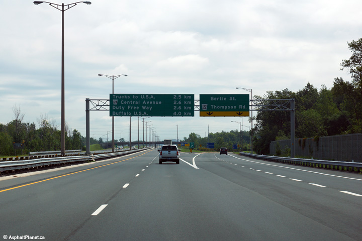
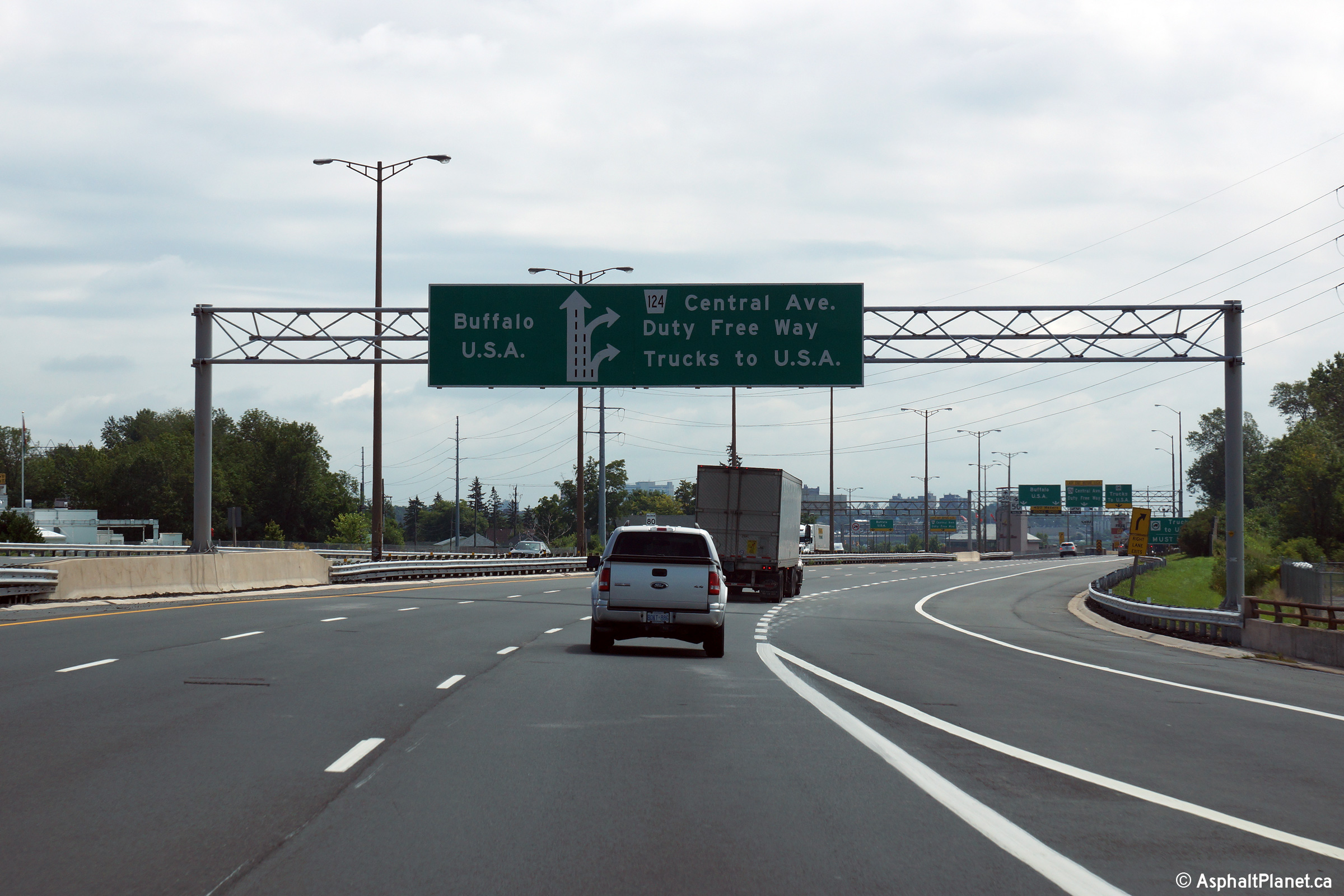
View
from the Central Avenue overpass towards the Toronto-bound QEW. There
was a short collector lane here at one point, explaining the dual overhead
pull-through signage. Upper photoa taken: June 19th, 2015. Lower photo taken: December 13th, 2008. |
 (720x480) (1440x960) (2400x1600)  (720x480) (1440x960) (2400x1600)  (720x480) (1440x960) |
||
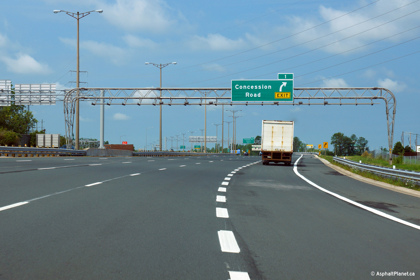
| Town of Fort Erie Regional Municipality of Niagara |
Advanced signage for the Toronto-bound off-ramp to Concession Road.
Concession Road is the second exit from the Toronto-bound QEW. Photo taken: August 9th, 2013. |
 (720x480) (720x480)(1440x960) (2400x1600) |
||
| Town of Fort Erie Regional Municipality of Niagara |
Toronto-bound signage at the off-ramp to Concession Road. Photo taken: August 9th, 2013. |
 (720x480) (720x480)(1440x960) (2400x1600) |
||
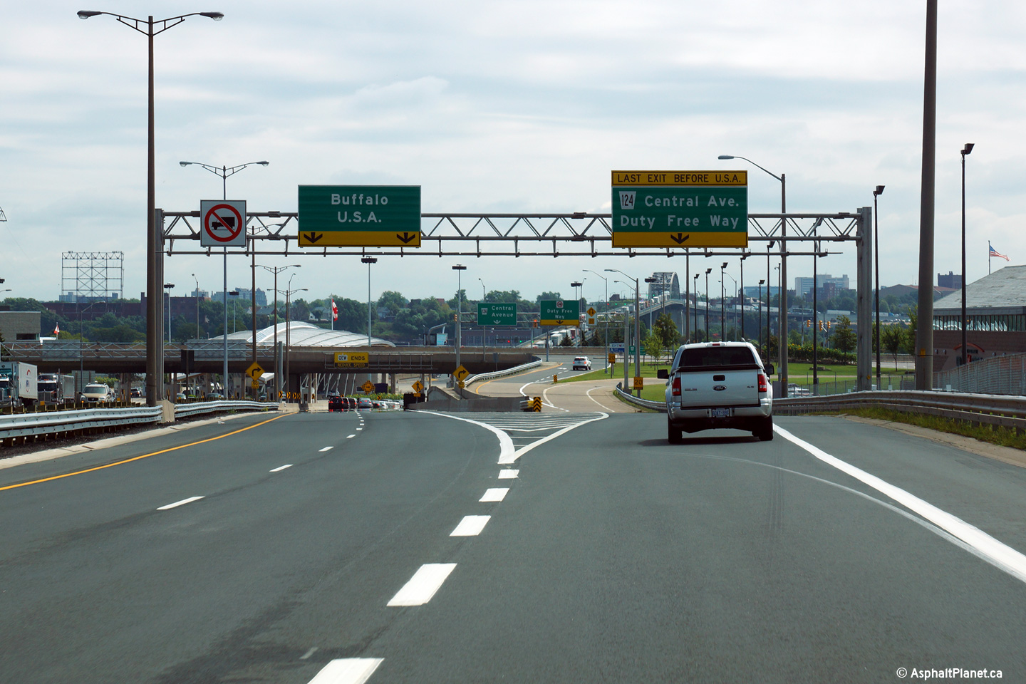
| Town of Fort Erie Regional Municipality of Niagara |
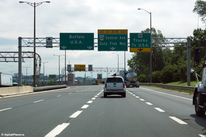
This picture shows the last interchange before the Peace Bridge on the QEW.
Beyond this interchange, the Bridge-bound QEW narrows to one lane, before
crossing the 3 lane (one lane each direction, plus one centre-reversible
lane) Peace Bridge into Buffalo, New York, USA. Photo taken: August 9th, 2013. |
 (720x480) (720x480)(1440x960) (2400x1600) |
||
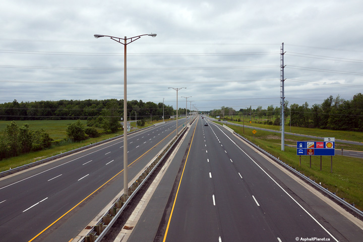
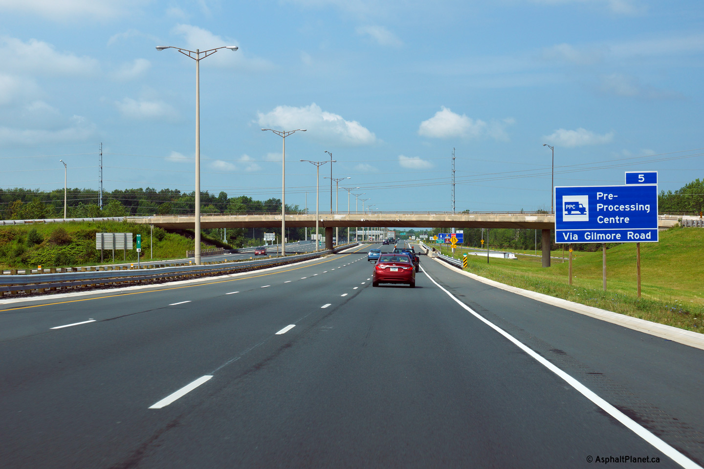
| Town of Fort Erie Regional Municipality of Niagara |
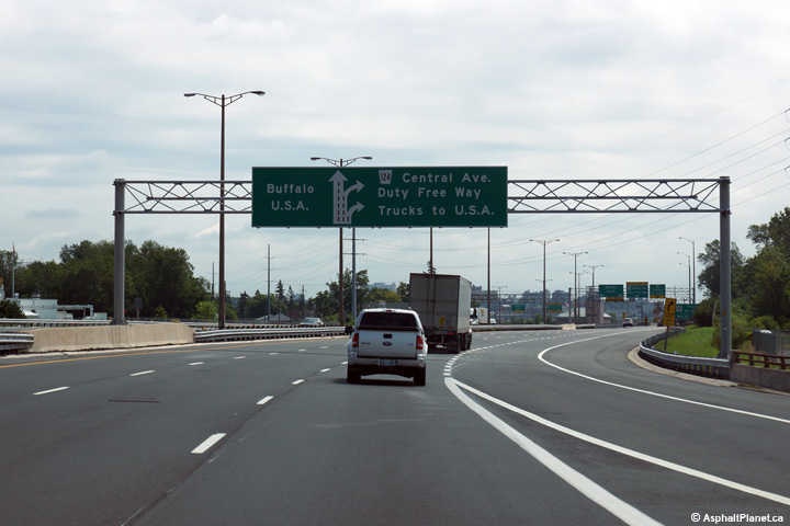
This picture is located about 500m west of the previous picture. This
picture shows in greater detail the few exits from the QEW in Fort Erie.
All trucks must exit the highway at this point for a pre-processing centre
that is located south of the QEW and the Duty Free before crossing the
Peace Bridge Photo taken: August 9th, 2013. |
 (720x480) (720x480)(1440x960) (2400x1600) |
||
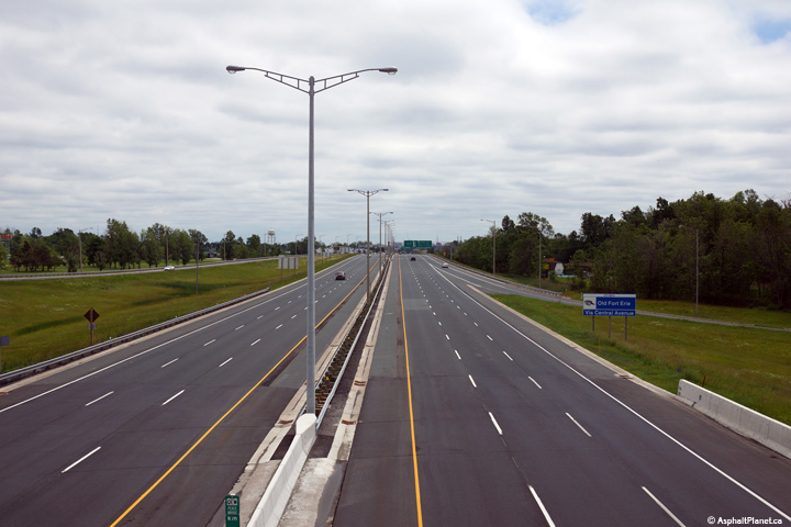
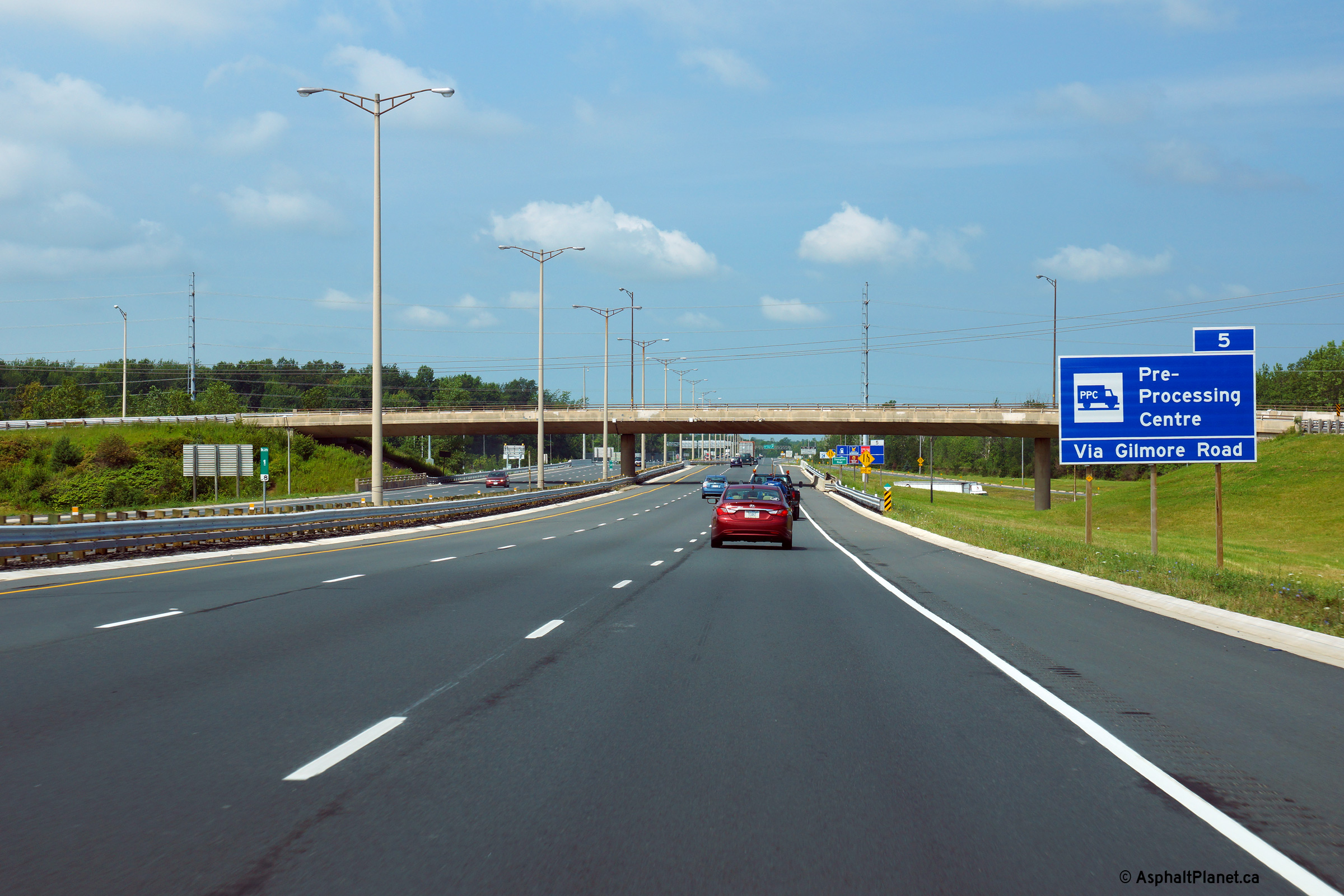
| Town of Fort Erie Regional Municipality of Niagara |
This picture is located roughly at kilometre 1.8 of the QEW and shows the
third (and last) diagramical sign illustrating the last few exits of the
QEW. Through Fort Erie the QEW is a 6-lane freeway. Photo taken: August 9th, 2013. |
 (720x480) (720x480)(1440x960) (2400x1600) |
||
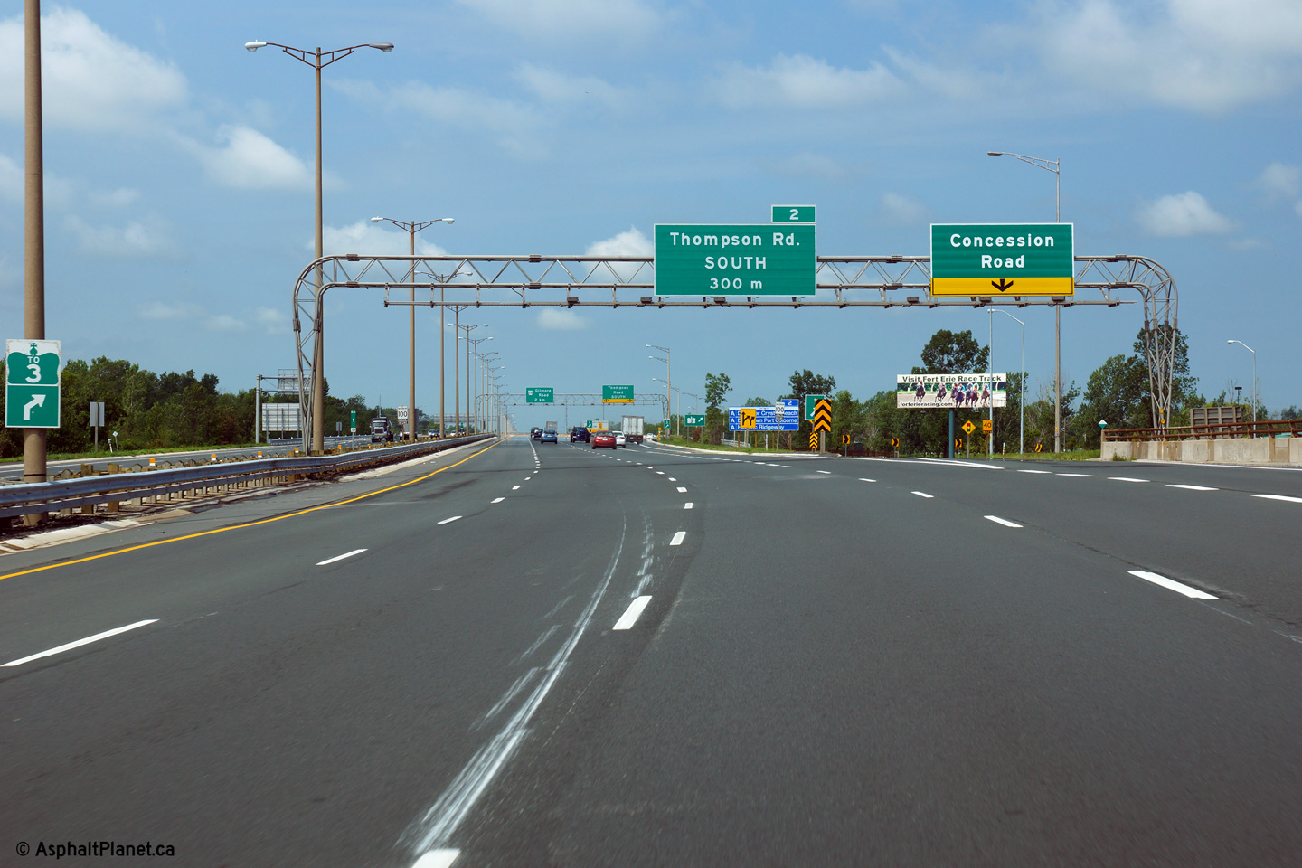
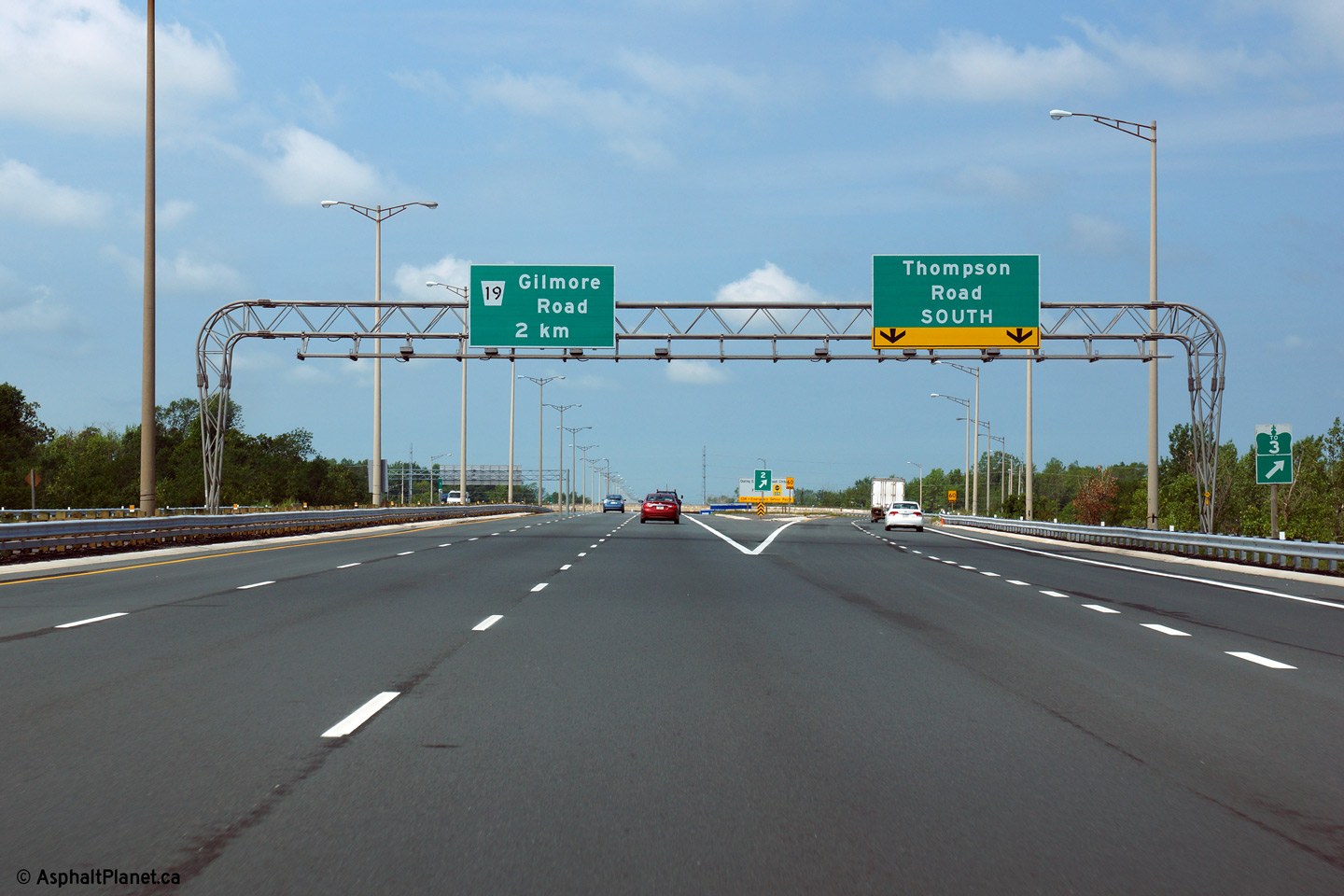
| Town of Fort Erie Regional Municipality of Niagara |
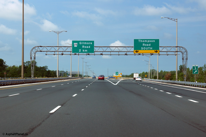
Signage for the flyover ramp to Thompson Road South. There is no
direct connection to Thompson Road North from the Toronto-bound QEW.
Traffic bound for Highway 3 is directed to exit the QEW at this interchange. Photo taken: August 9th, 2013. |
 (720x480) (720x480)(1440x960) (2400x1600) |
||
| Town of Fort Erie Regional Municipality of Niagara |
View looking towards Toronto as the QEW passes beneath the flyover ramp to
Thompson Road South. Photo taken: August 9th, 2013. |
 (720x480) (720x480)(1440x960) (2400x1600) |
||
| Town of Fort Erie Regional Municipality of Niagara |
Two views looking towards the Peace Bridge from the high-speed flyover ramp
that links the Toronto-bound QEW to Thompson Road South. The Thompson
Road fly-over seems considerably oversized given the small amount of traffic
that utilizes the ramp. Photos taken: June 19th, 2015. |
 (720x480) (1440x960) (2400x1600) 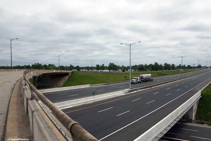 (720x480) (1440x960) (2400x1600) |
||
| Town of Fort Erie Regional Municipality of Niagara |
View looking towards Toronto from the Thompson Road flyover. Photo taken: June 19th, 2015. |
 (720x480) (1440x960) (2400x1600) |
||
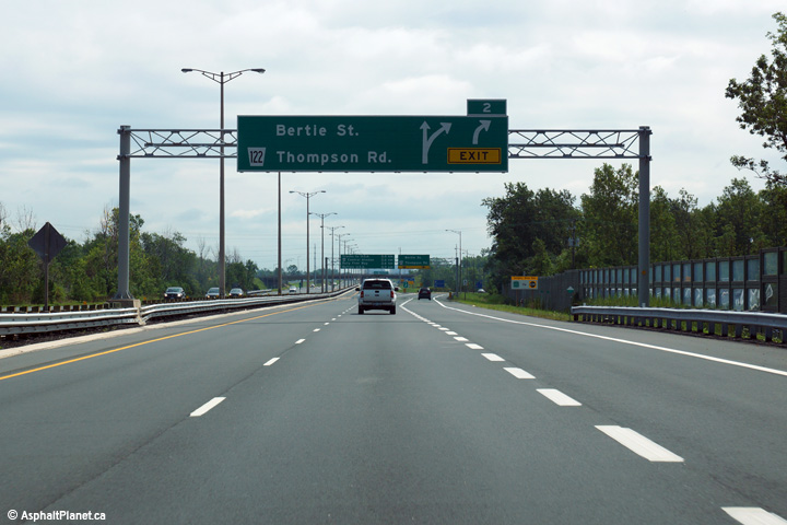
| Town of Fort Erie Regional Municipality of Niagara |
Fort Erie-bound signage for the off-ramp to Bertie Street and Thompson Road. Photo taken: August 9th, 2013. |
 (720x480) (720x480)(1440x960) (2400x1600) |
||
| Town of Fort Erie Regional Municipality of Niagara |
Advanced signage for the off-ramp to Bertie Street and Thompson Road. Photo taken: August 9th, 2013. |
 (720x480) (720x480)(1440x960) (2400x1600) |
||
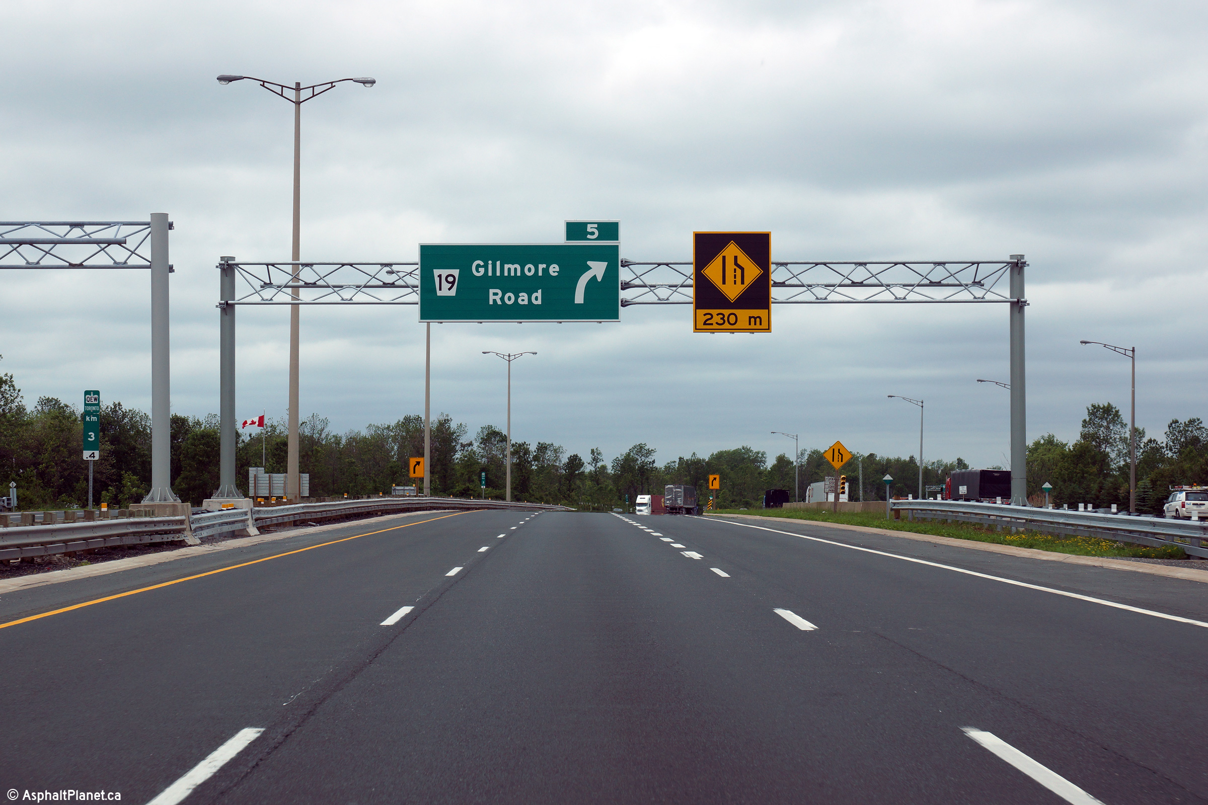
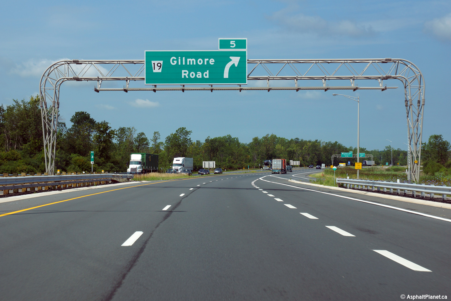
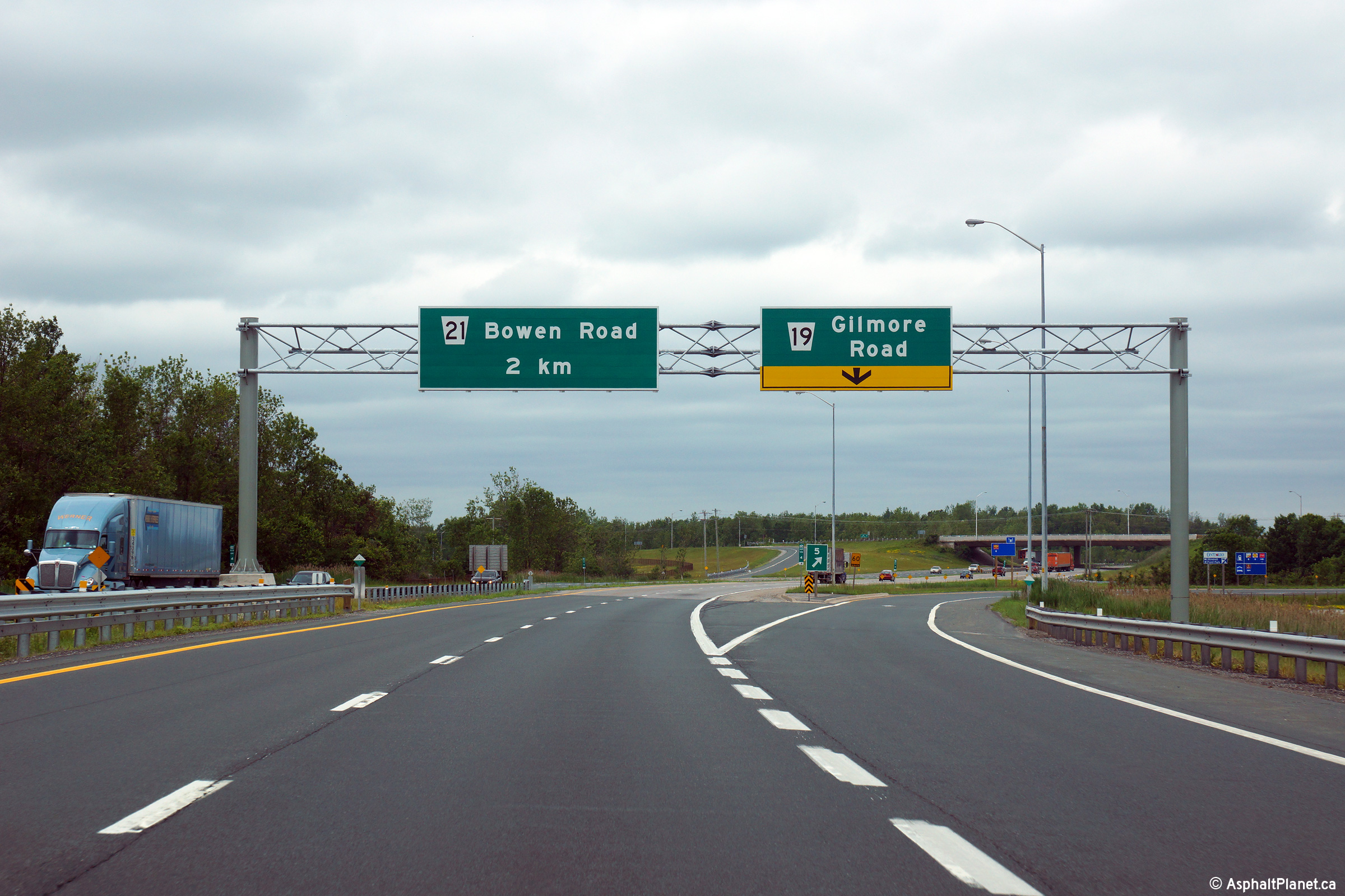
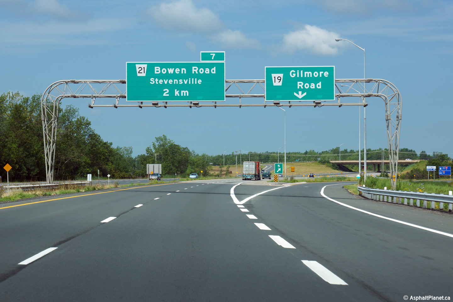
| Town of Fort Erie Regional Municipality of Niagara |
Advanced signage for the Gilmore Road interchange. The urbanized
cross-section through Fort Erie ends just beyond this overhead sign.
This overhead signage was replaced late in 2014,
click here for a photo, taken
June 2015, of the current assembly. Photo taken: August 9th, 2013. |
 (720x480) (720x480)(1440x960) (2400x1600) |
||
| Town of Fort Erie Regional Municipality of Niagara |
Overhead signage at the ramp to Gilmore Road. This overhead signage
was replaced late in 2014, click here
for a photo, taken June 2015, of the current assembly. Photo taken: August 9th, 2013. |
 (720x480) (720x480)(1440x960) (2400x1600) |
||
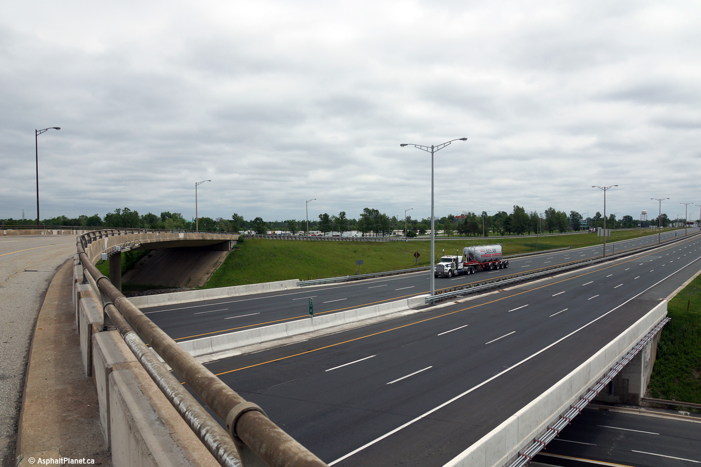
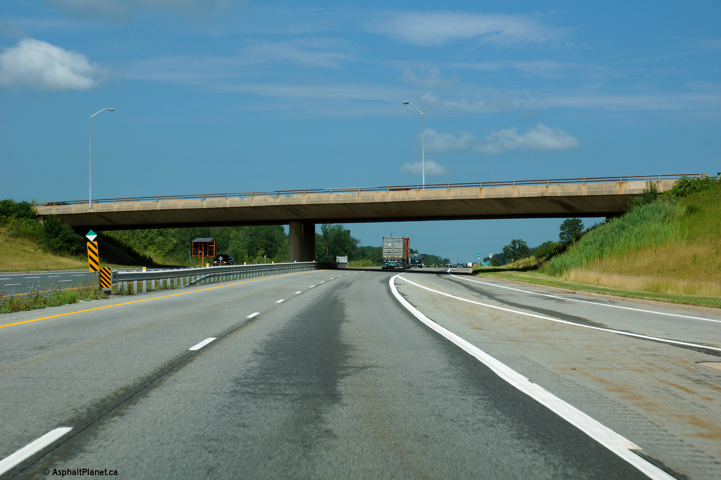
| Town of Fort Erie Regional Municipality of Niagara |
View looking beneath the Gilmore Road overpass towards Toronto on the QEW. Photo taken: August 9th, 2013. |
 (720x480) (720x480)(1440x960) (2400x1600) |
||
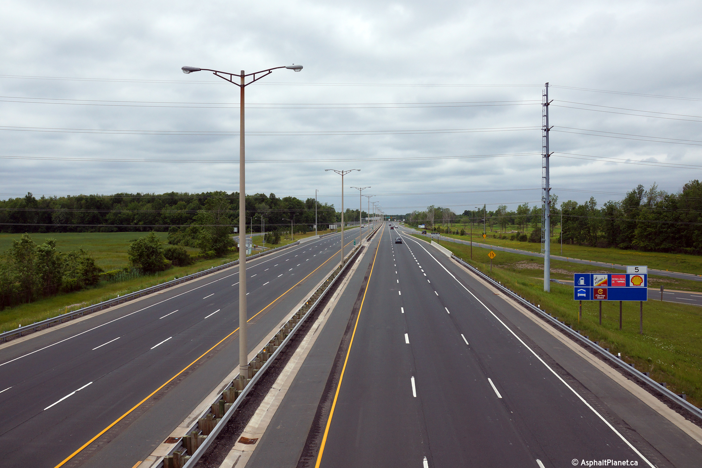
| Town of Fort Erie Regional Municipality of Niagara |
View looking towards Fort Erie from the Gilmore Road overpass along the QEW. Photo taken: October 30th, 2006. |
 (720x480) (1440x960) |
||
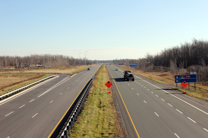
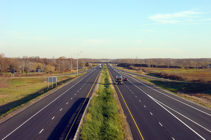
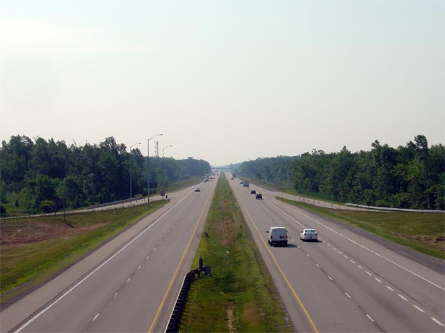
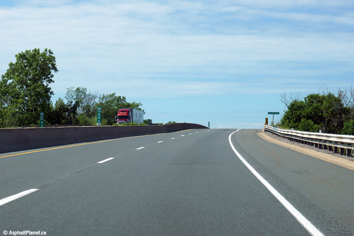
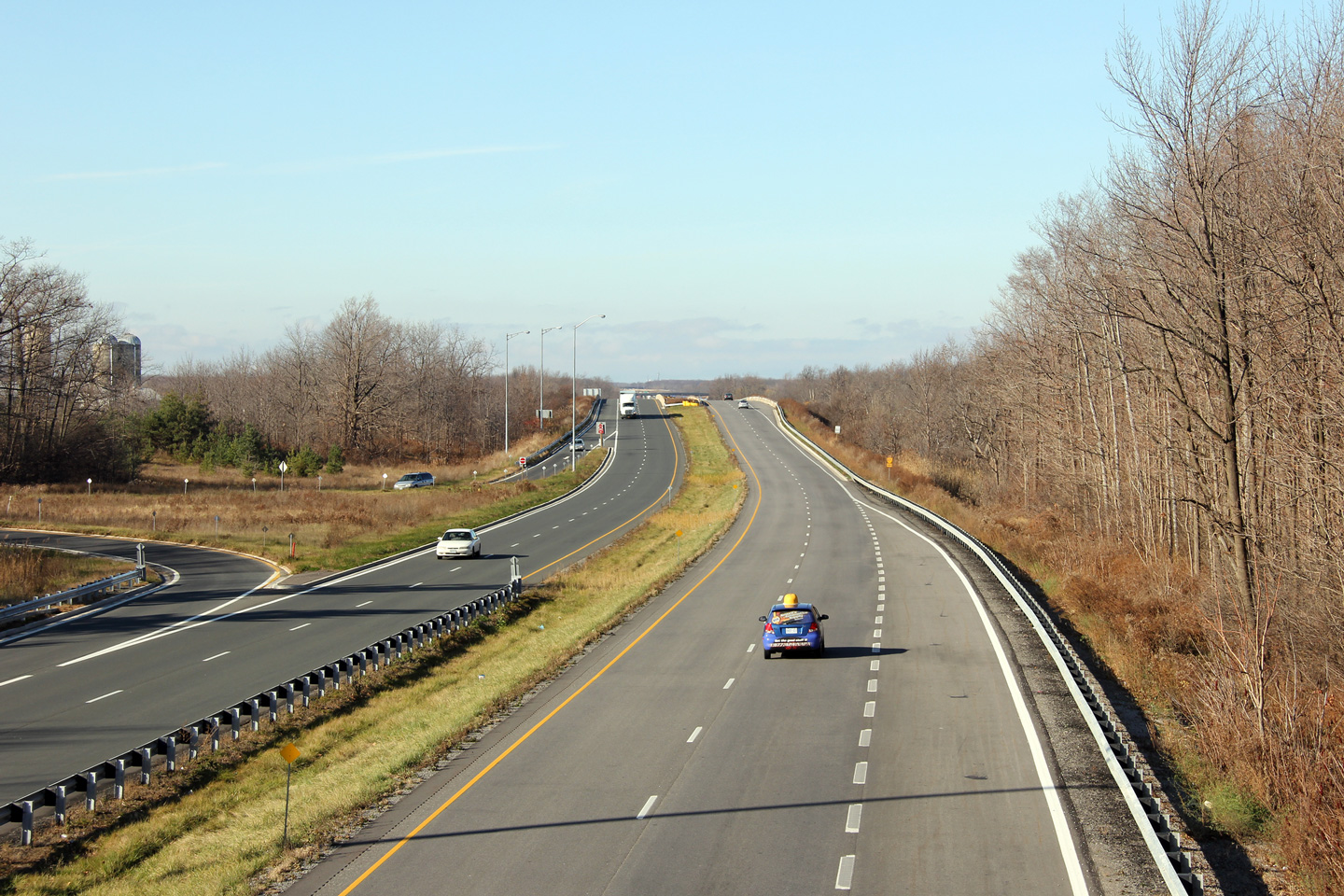
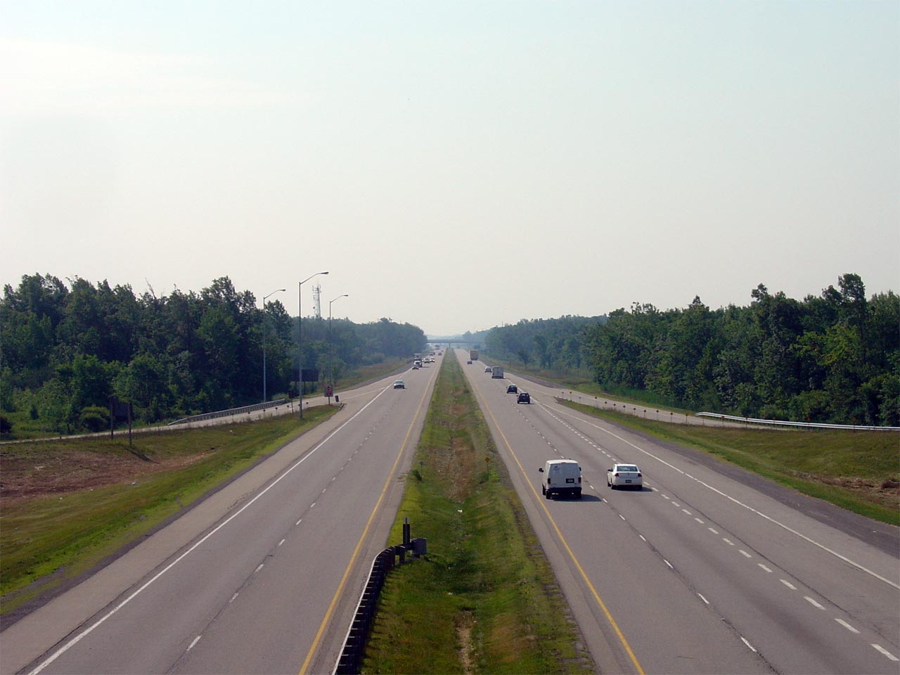
| Town of Fort Erie Regional Municipality of Niagara |
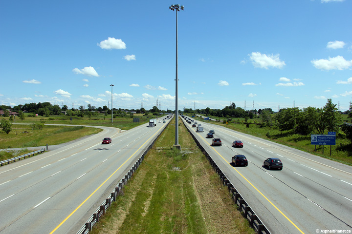
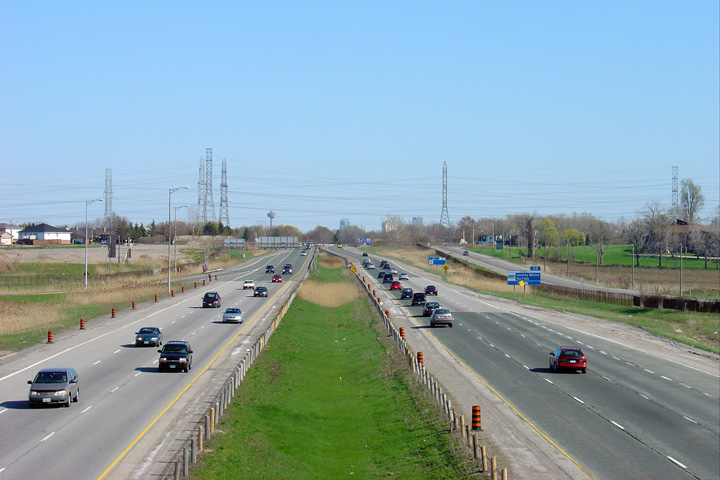
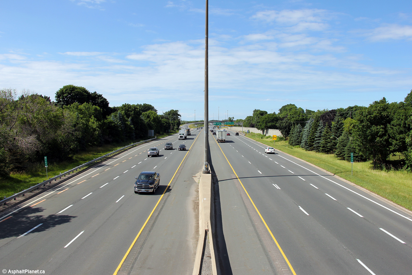
This view looks Toronto-bound towards the Bowen Road overpass. Between
Fort Erie and Niagara Falls, the opposing carriageways of the QEW are
separated by only a very narrow depressed grassed median. Medians such
as this were common to divided highways built in Ontario from the 1930s all
of the way until the end of the 1950s. As highways have been
reconstructed over the years, improvements to the medians of rural highways
have taken place. This is the only segment of freeway in Ontario to
have such a narrow median without any type of continuous barrier system. Photo taken: October 30th, 2006. |
 (720x480) (1440x960) |
||
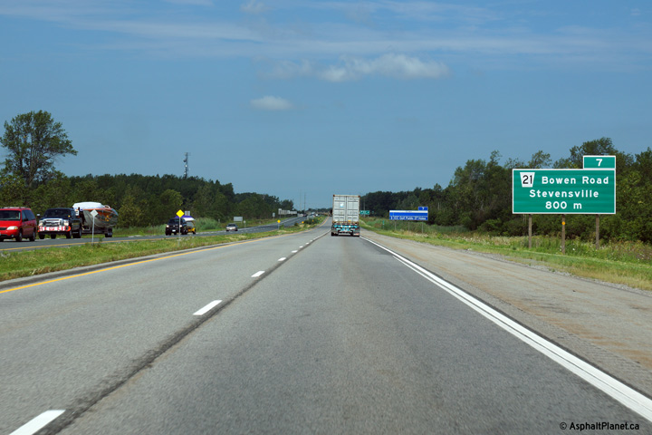
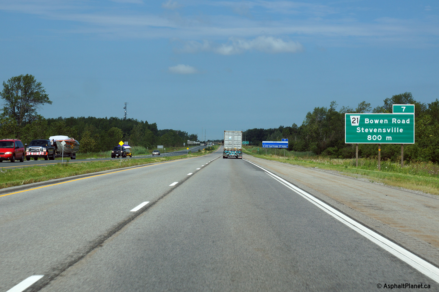
| Town of Fort Erie Regional Municipality of Niagara |
Advanced signage for the ramp to the Bowen Road interchange. Photo taken: September 25th, 2011. |
 (720x480) (720x480)(1440x960) (2400x1600) |
||
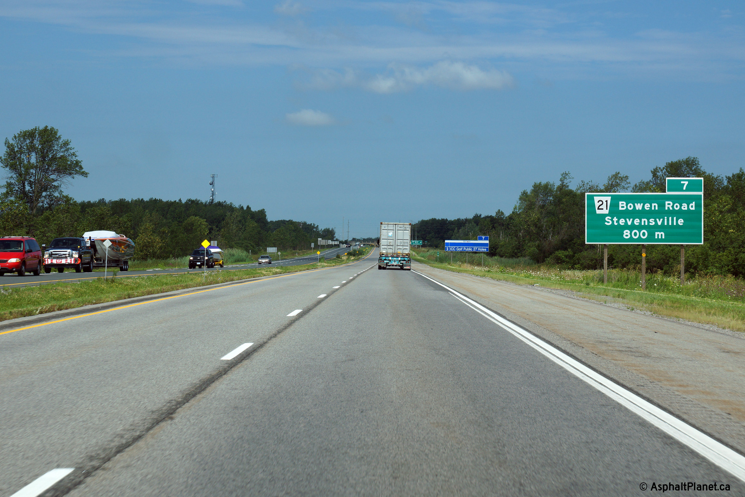
| Town of Fort Erie Regional Municipality of Niagara |
Signage for the Toronto-bound off-ramp to the Bowen Road interchange. Photo taken: September 25th, 2011. |
 (720x480) (720x480)(1440x960) (2400x1600) |
||
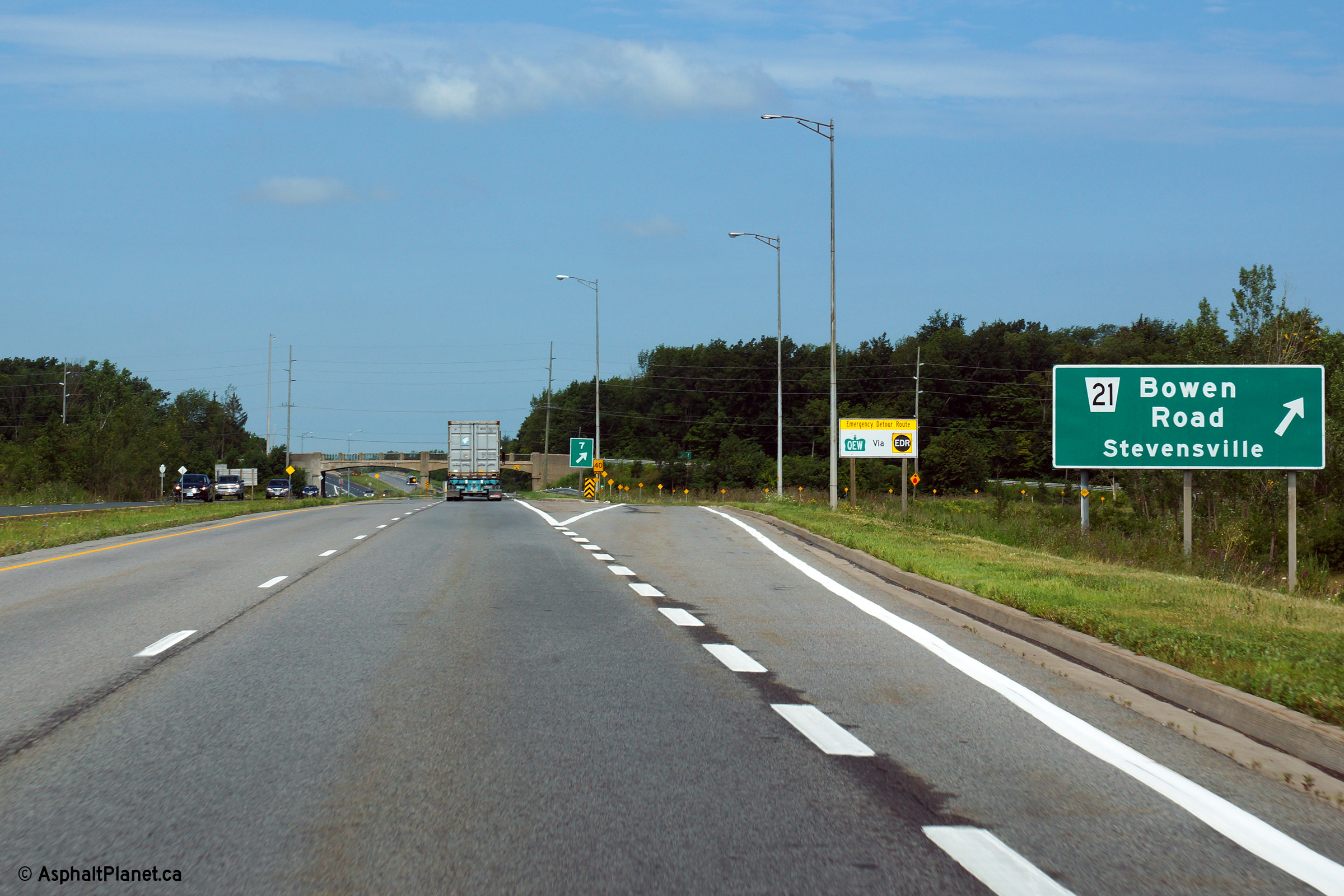
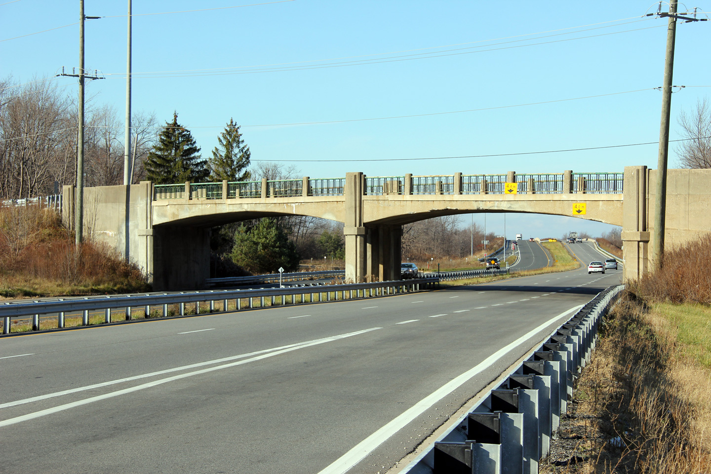
| Town of Fort Erie Regional Municipality of Niagara |
This view looks Toronto-bound towards the Bowen Road overpass.
Structures such as this were at one time ubiquitous along the QEW.
This proud structure is the finest example of an arched rigid frame
structure along the length of the freeway. This structure is set to be
replaced in the coming years, however a firm construction timetable has yet
to be established for this work. Photo taken: November 21st, 2011. |
 |
||
| Town of Fort Erie Regional Municipality of Niagara |
View towards Fort Erie from the Bowen Road overpass. While the design
of the QEW between Fort Erie and Niagara Falls is quite dated by modern
standards -- this freeway represented the pinnacle of highway engineering
when it was built. For example, it was not until median cross-over
collisions began to be observed that highway engineers saw the need to build
median barriers or winder highway medians. Photo taken: November 21st, 2011. |
 |
||
| Town of Fort Erie Regional Municipality of Niagara |
Looking northwest towards Toronto from the Bowen Road overpass. Due to
the highways early vintage, the freeway lacks outer shoulders between the
Bowen Road interchange and the CN Railway underpass just to the north. Photo taken: November 21st, 2011. |
 |
||
| Town of Fort Erie Regional Municipality of Niagara |
Looking towards the Bowen Road bridge from the CN and SL&H Railway
underpass. The railways that pass under the QEW at this location are
en-route to the International Bridge that spans the Niagara River north of
the Peace Bridge between Fort Erie and Buffalo. As a result of the
decline of Buffalo as a manufacturing and transportation hub coupled with
the overall decline in railway traffic in general, these railways are no
long well utilized. Photo taken: November 21st, 2011. |
 |
||
| Town of Fort Erie Regional Municipality of Niagara |
Fort Erie-bound view from the Ridgemount Road overpass. Photo taken: October 30th, 2006. |
 (720x480) (1440x960) |
||
| Town of Fort Erie Regional Municipality of Niagara |
Reverse view looking into Niagara Falls. Photo taken: October 30th, 2006. |
 (720x480) (1440x960) |
||
| Town of Fort Erie Regional Municipality of Niagara |
This view looks southeasterly towards the Peace Bridge from the Townline
Road overpass. Photo taken: October 30th, 2006. |
 (720x480) (1440x960) |
||
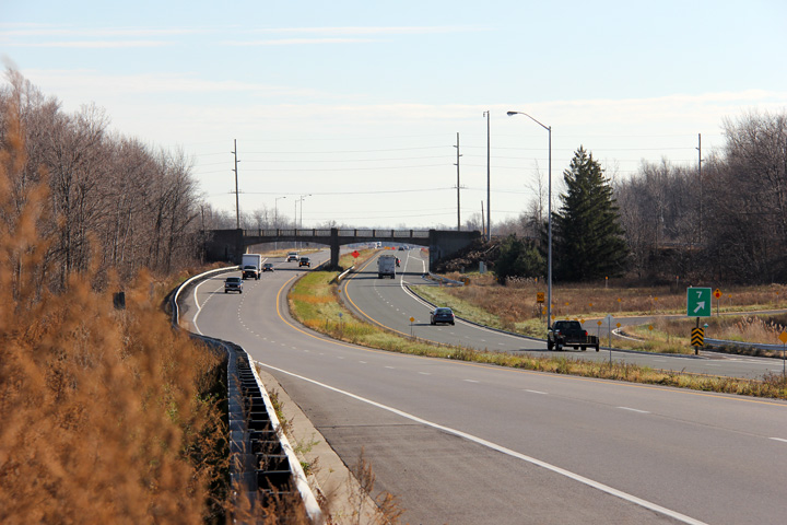
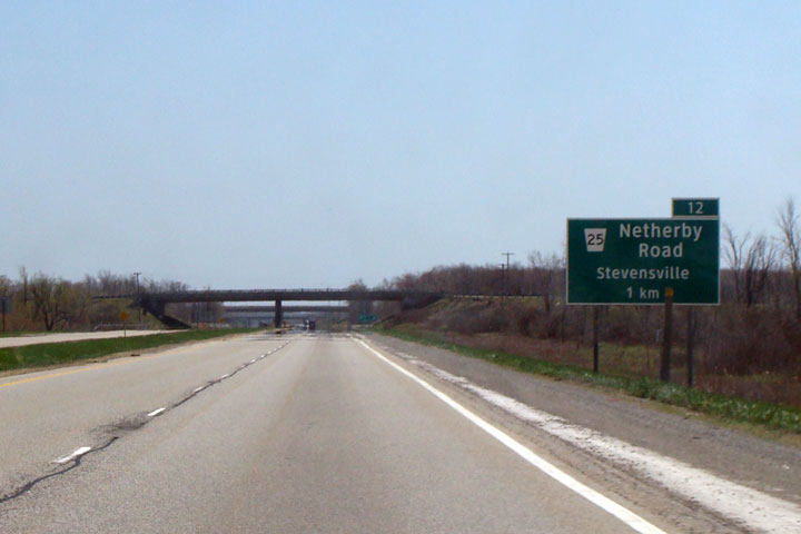
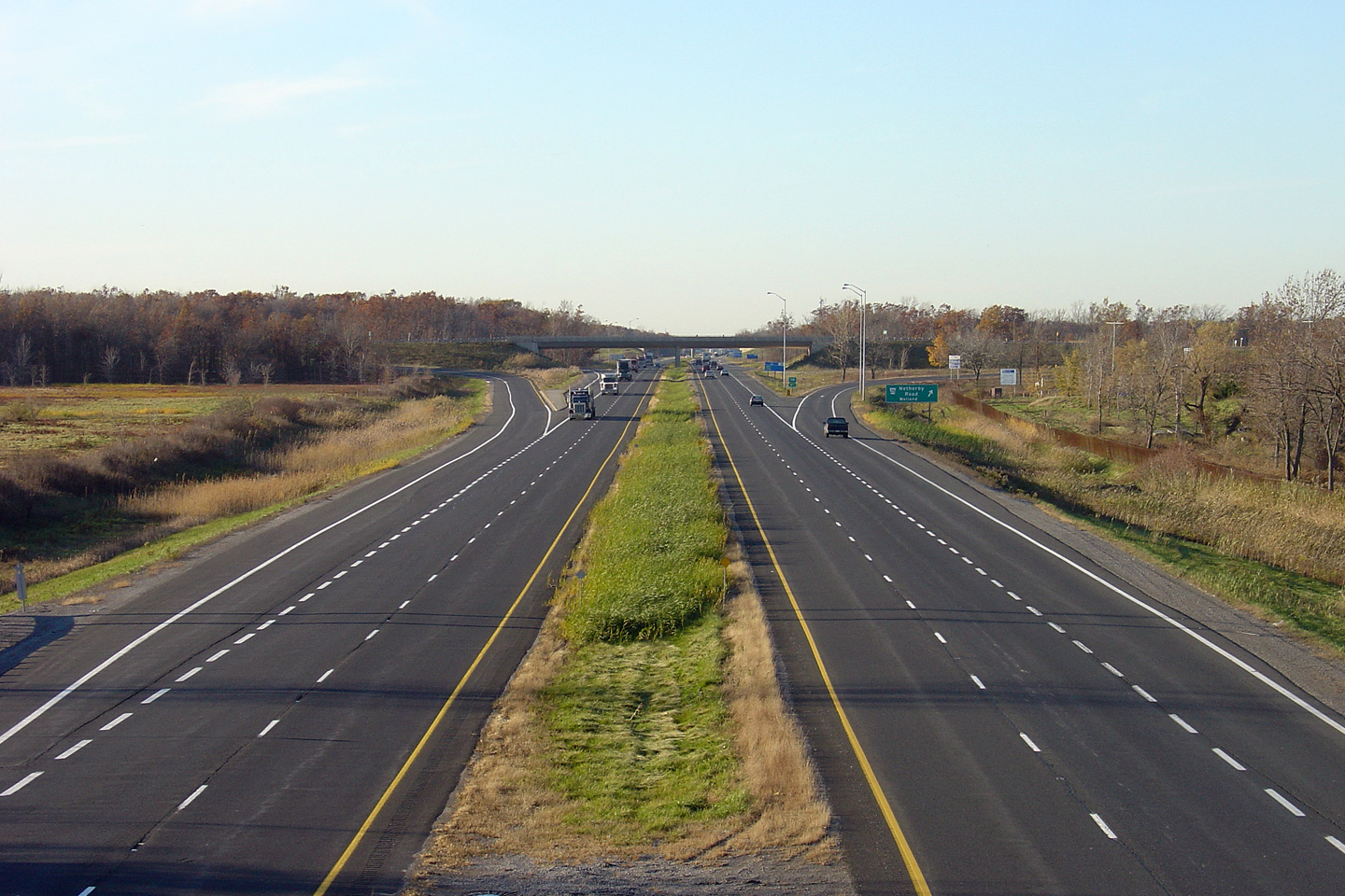
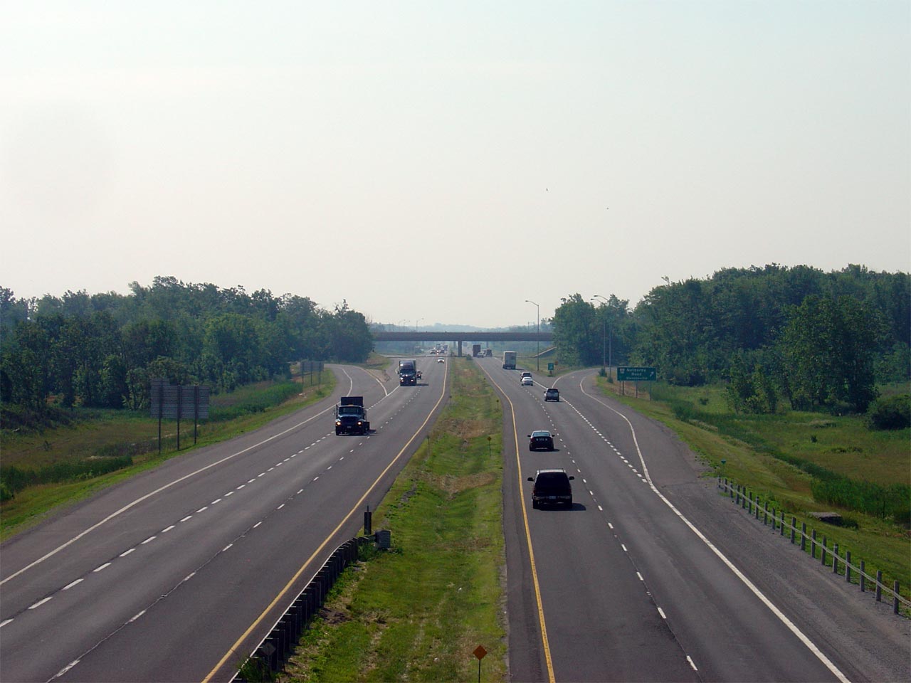
| City of Niagara Falls Regional Municipality of Niagara |
View looking Toronto-bound towards the Netherby Road interchange. Photo taken: October 30th, 2006. |
 (720x480) (1440x960) |
||
| City of Niagara Falls Regional Municipality of Niagara |
Fort Erie-bound from the Netherby Road interchange. The Netherby Road
interchange was constructed in 1977. With the exception of Bowen Road
interchange, the QEW was an at-grade four lane highway between Fort Erie and
Niagara Falls until the 1970s. Photo taken: October 30th, 2006. |
 (720x480) (1440x960) |
||
| City of Niagara Falls Regional Municipality of Niagara |
Toronto-bound view from the Netherby Road overpass. Photo taken: October 30th, 2006. |
 (720x480) (1440x960) |
||
| City of Niagara Falls Regional Municipality of Niagara |
Clearview
exit signage for Netherby Road. Photo taken: Spring 2008. |
 |
||
| City of Niagara Falls Regional Municipality of Niagara |
View looking towards the Netherby Road interchange and Fort Erie from Baker
Road. Photo taken: July 9th, 2007. |
 (720x480) (1440x960) |
||
| City of Niagara Falls Regional Municipality of Niagara |
Clearview
advanced signage for Netherby Road. Photo taken: Spring 2008. |
 |
||
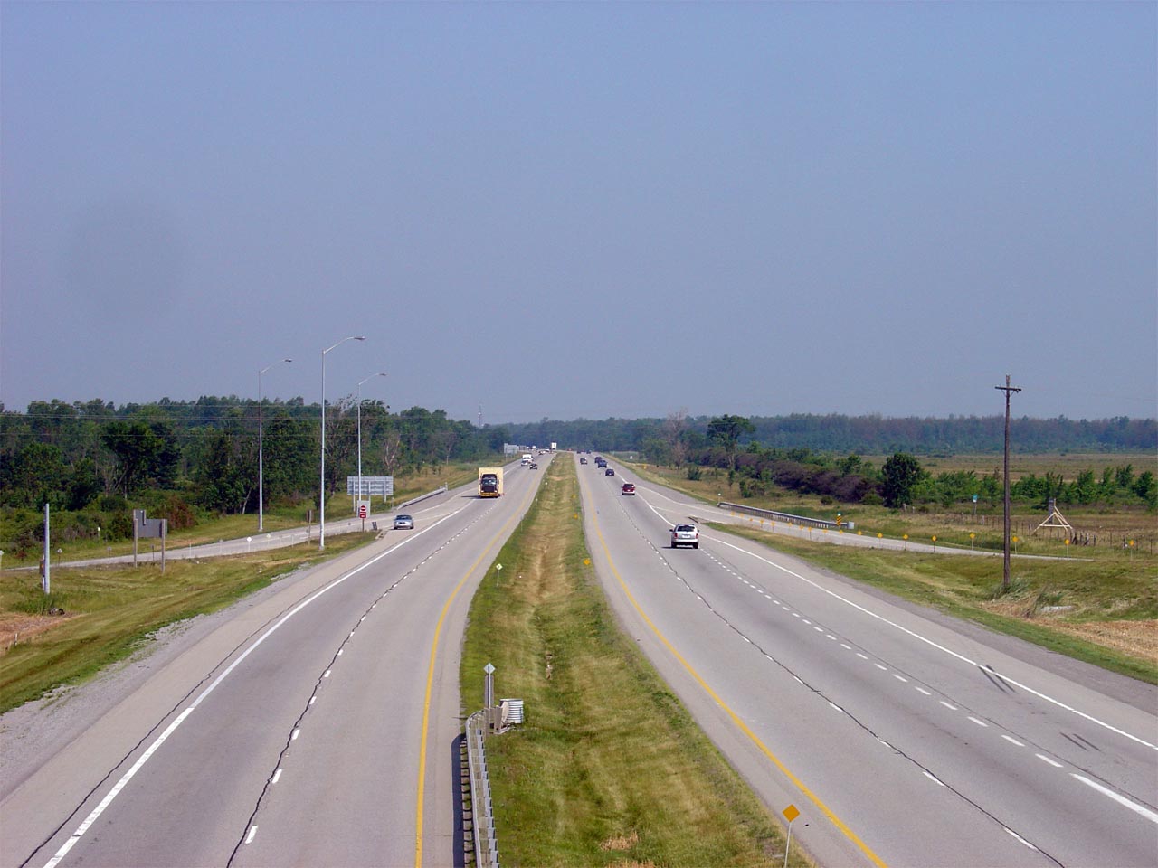
| City of Niagara Falls Regional Municipality of Niagara |
Looking northwesterly towards Niagara Falls from the Baker Road overpass. Photo taken: July 9th, 2007. |
 (720x480) (1440x960) |
||
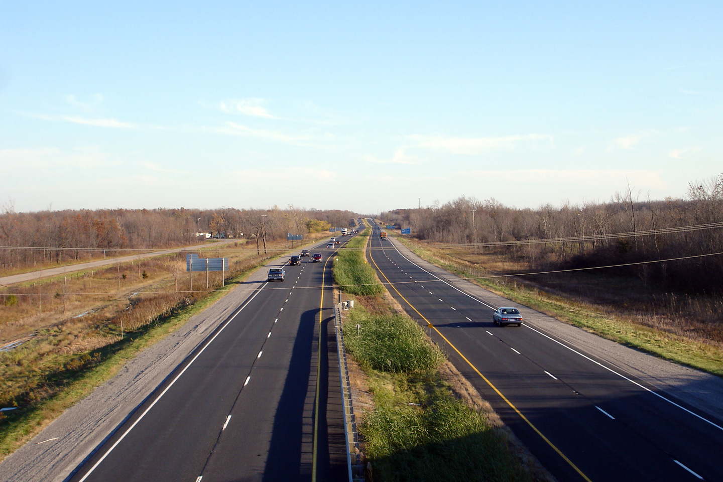
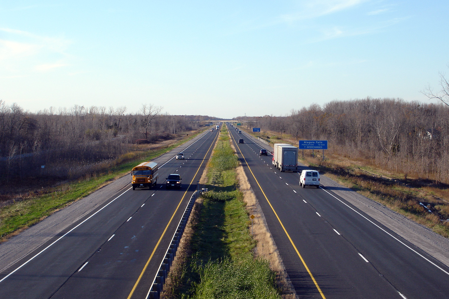
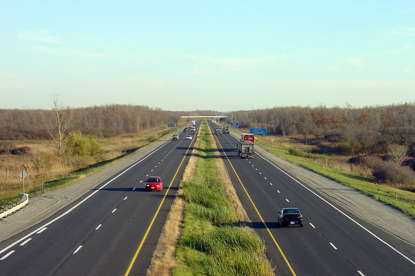
| City of Niagara Falls Regional Municipality of Niagara |
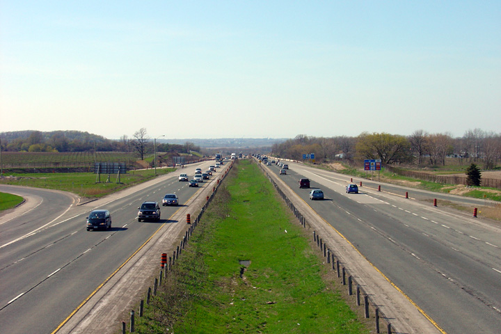
View looking southeasterly towards Fort Erie from Sodom Road. Niagara
Region is very flat between Niagara Falls and Fort Erie. Photo taken: July 9th, 2007. |
 (720x480) (1440x960) |
||
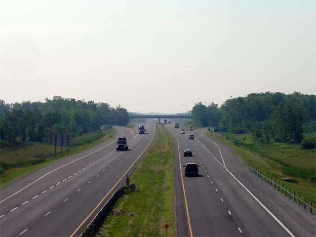
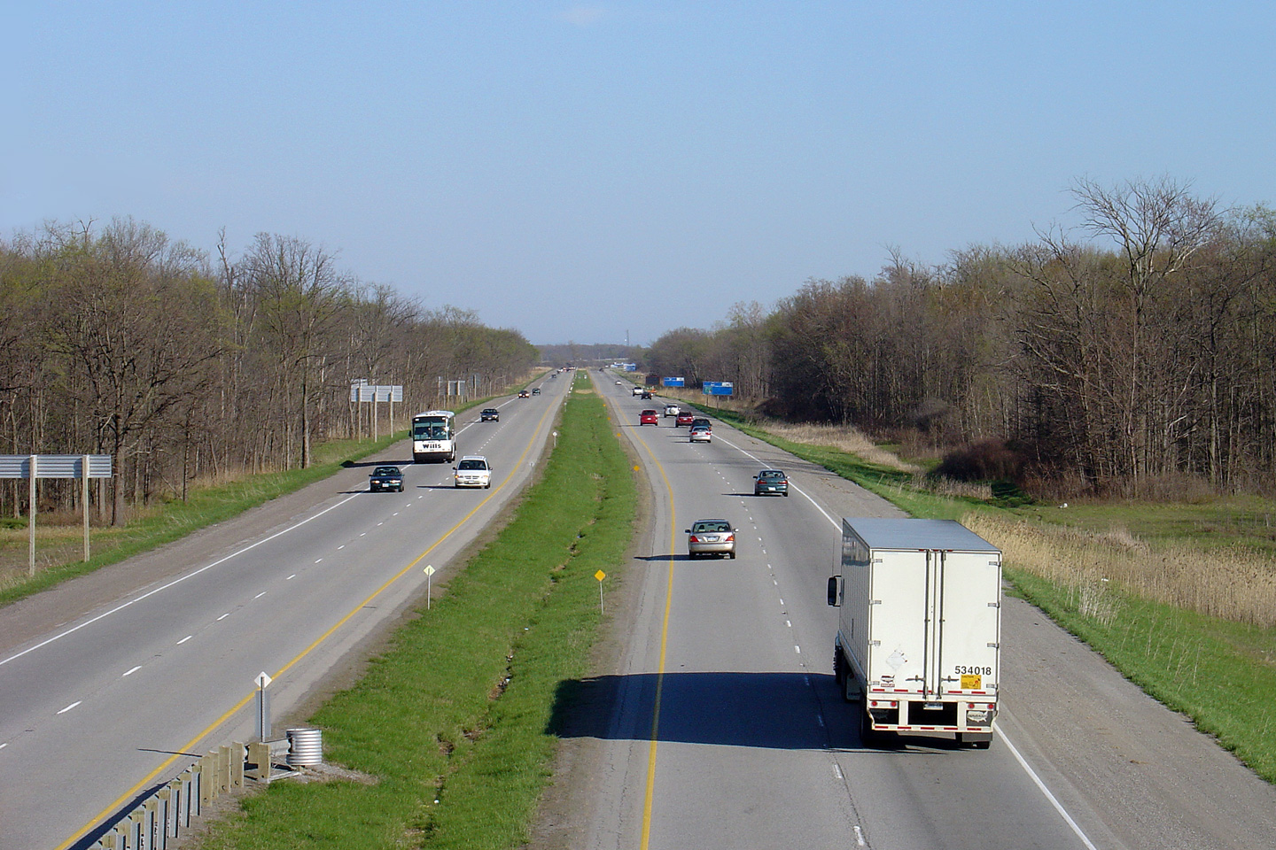
| City of Niagara Falls Regional Municipality of Niagara |
Two views of the QEW looking towards Niagara Falls from Sodom Road.
The QEW wasn't upgraded to a full freeway between Niagara Falls and Fort
Erie until the 1970s, explaining the large and modern parclo interchanges
that adorn this early divided highway. Photos taken: July 9th, 2007. |
|
||
| City of Niagara Falls Regional Municipality of Niagara |
Looking towards Fort Erie from the Beck Road overpass. Click
here for an additional view from this
overpass, taken in May of 2005. Photo taken: July 10th, 2014. |
 (720x480) (1440x960) (2400x1600) |
||
| City of Niagara Falls Regional Municipality of Niagara |
The QEW looking Toronto-bound from the Beck Road overpass. Click
here for an additional view from this
overpass, taken in May of 2005. Photo taken: July 10th, 2014. |
 (720x480) (1440x960) (2400x1600) |
||
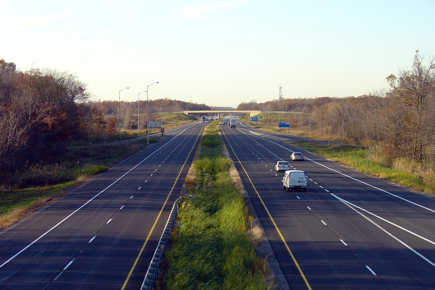
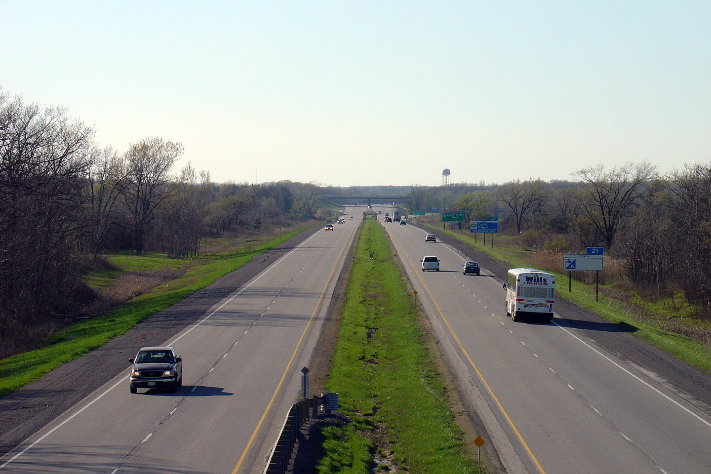
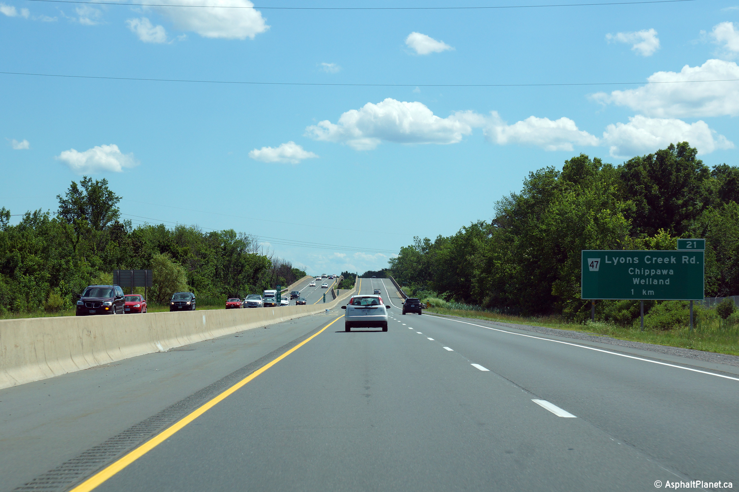
| City of Niagara Falls Regional Municipality of Niagara |
This view looks towards Fort Erie from the Lyons Creek Road overpass.
The QEW crosses Lyons Creek immediately southeast of this interchange. Photo taken: November 21st, 2011 |
 (720x480) (1440x960) (2400x1600) |
||
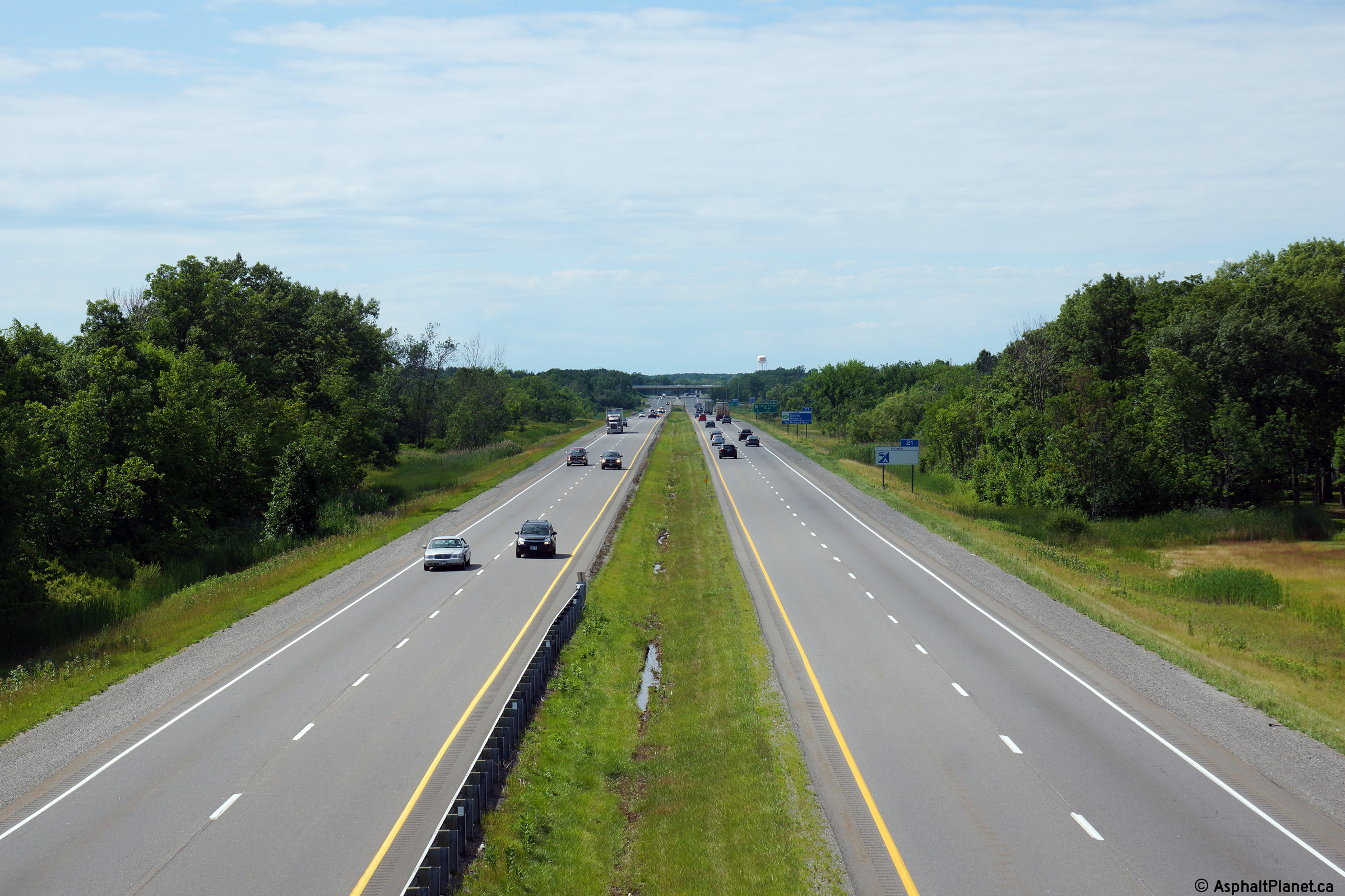
| City of Niagara Falls Regional Municipality of Niagara |
This view looks towards Toronto from the Lyons Creek Road overpass. Photo taken: November 21st, 2011. |
 (720x480) (1440x960) (2400x1600) |
||
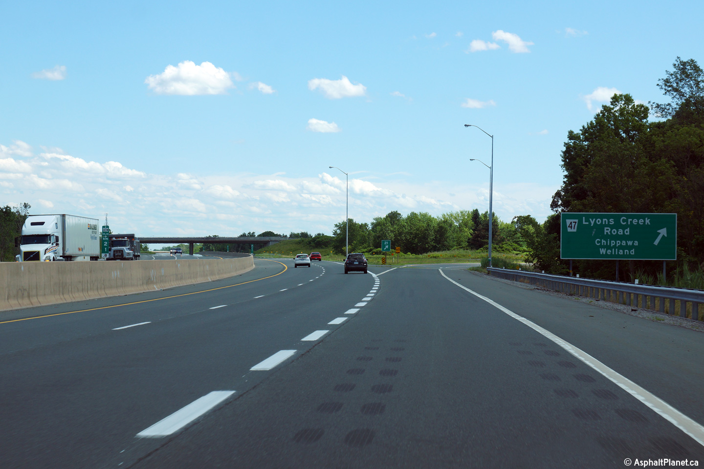
| City of Niagara Falls Regional Municipality of Niagara |
View looking towards Fort Erie as the off-ramp to Lyons Creek departs the
freeway mainline. Photo taken: July 10th, 2014. |
 (720x480) (720x480)(1440x960) (2400x1600) |
||
| City of Niagara Falls Regional Municipality of Niagara |
Distance signage situated on the Toronto-bound side of the Lyons Creek Road
interchange. Photo taken: July 10th, 2014. |
 |
||
| City of Niagara Falls Regional Municipality of Niagara |
View looking northerly towards Toronto approaching the Welland River bridge.
The Welland River bridge has a fairly abrupt vertical crest curve where the
structure crosses overtop of the Canada Southern Railway. Photo taken: July 10th, 2014. |
 (720x480) (720x480)(1440x960) (2400x1600) |
||
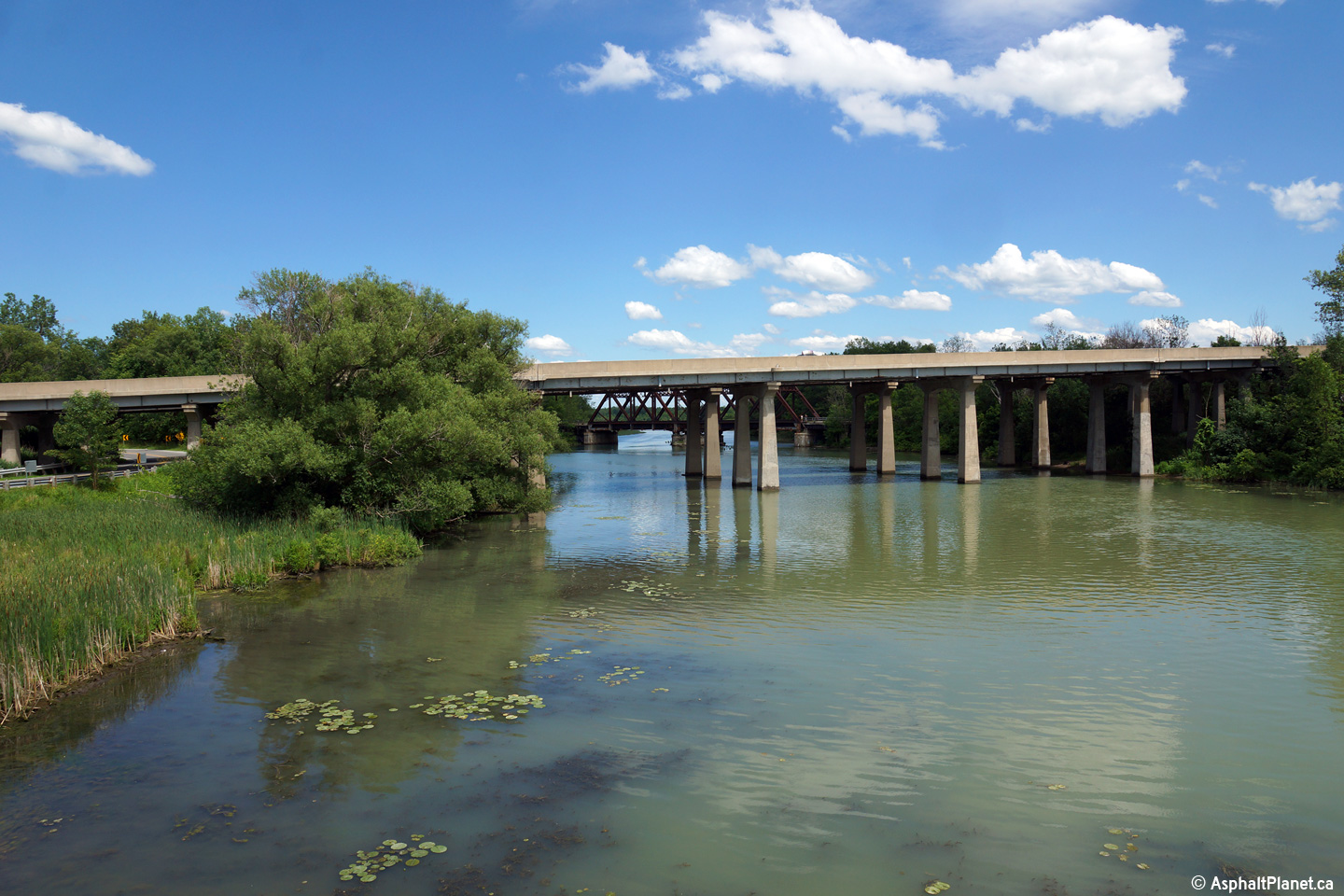
| City of Niagara Falls Regional Municipality of Niagara |
View looking northerly (towards Toronto) in the median of the QEW at the
Welland River bridge. The lengthy Welland River bridge carries the QEW
overtop of the Canada Southern Railway and Oakwood
Drive in addition to the Welland
River. Photo taken: July 10th, 2014. |
 (720x480) (1440x960) (2400x1600) |
||
| City of Niagara Falls Regional Municipality of Niagara |
View looking easterly towards the Niagara River at the Welland River
Bridge from Montrose Road. Photo taken: July 10th, 2014. |
 (720x480) (1440x960) (2400x1600) |
||
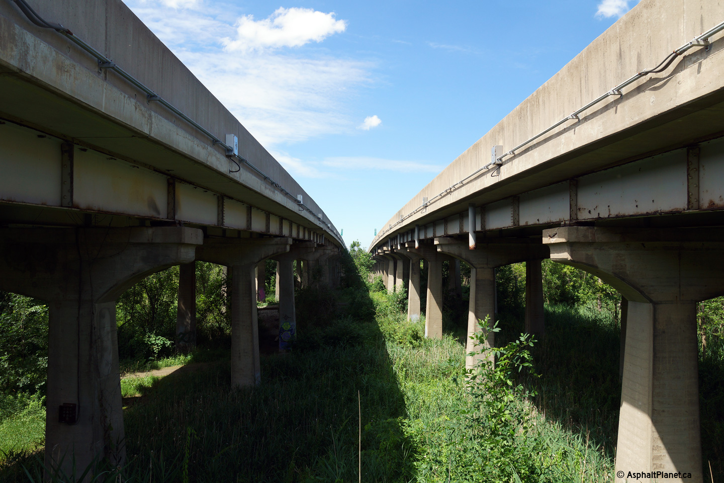
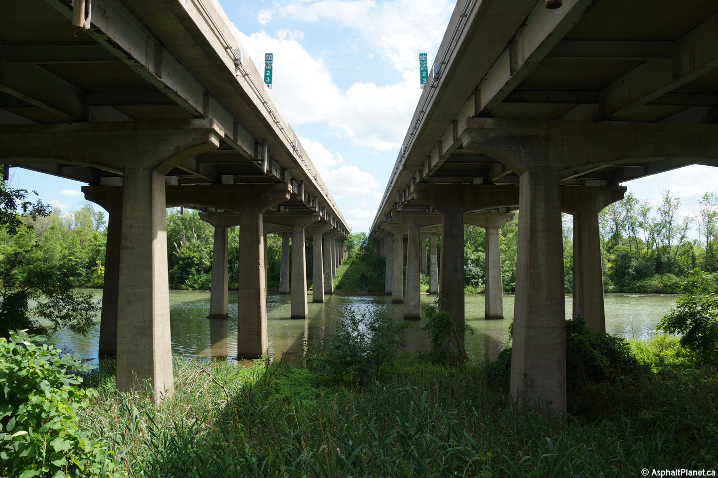
| City of Niagara Falls Regional Municipality of Niagara |
View looking towards the south between the twin Welland River bridges.
The Welland River bridges are nearly 500m in length. Photo taken: July 10th, 2014. |
 (720x480) (1440x960) (2400x1600) |
||
| City of Niagara Falls Regional Municipality of Niagara |
Fort Erie-bound advanced signage for the off-ramp to Lyons Creek Road.
The Welland River bridge is visible in the distance. Photo taken: July 10th, 2014. |
 (720x480) (720x480)(1440x960) (2400x1600) |
||
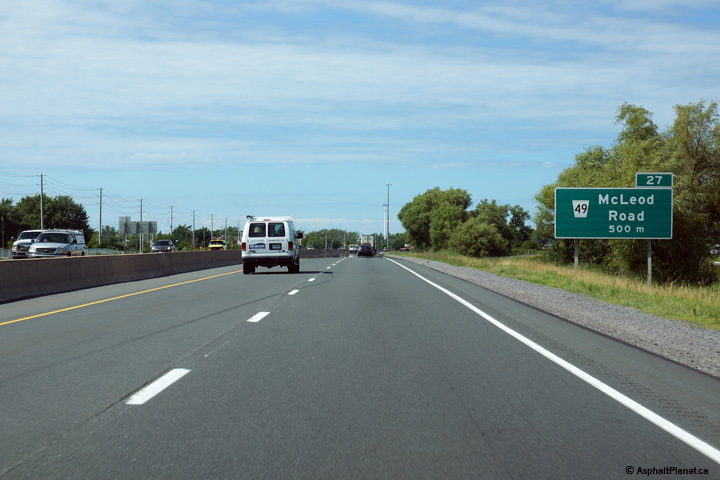
| City of Niagara Falls Regional Municipality of Niagara |
The Toronto-bound advanced signage for the McLeod Road interchange is
located only 500m upstream of the interchange. Photo taken: July 10th, 2014. |
 (720x480) (720x480)(1440x960) (2400x1600) |
||
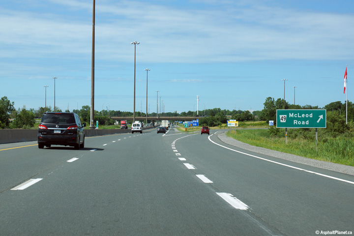
| City of Niagara Falls Regional Municipality of Niagara |
This view looks northerly as the off-ramp to McLeod Road departs the freeway
mainline. Photo taken: July 10th, 2014. |
 (720x480) (720x480)(1440x960) (2400x1600) |
||
| City of Niagara Falls Regional Municipality of Niagara |
Looking towards Fort Erie from the McLeod Road overpass in Niagara Falls.
McLeod Road marks the southern urban boundary of the city of Niagara Falls. Photo taken: May 8th, 2005. |
 (720x480) (1440x960) |
||
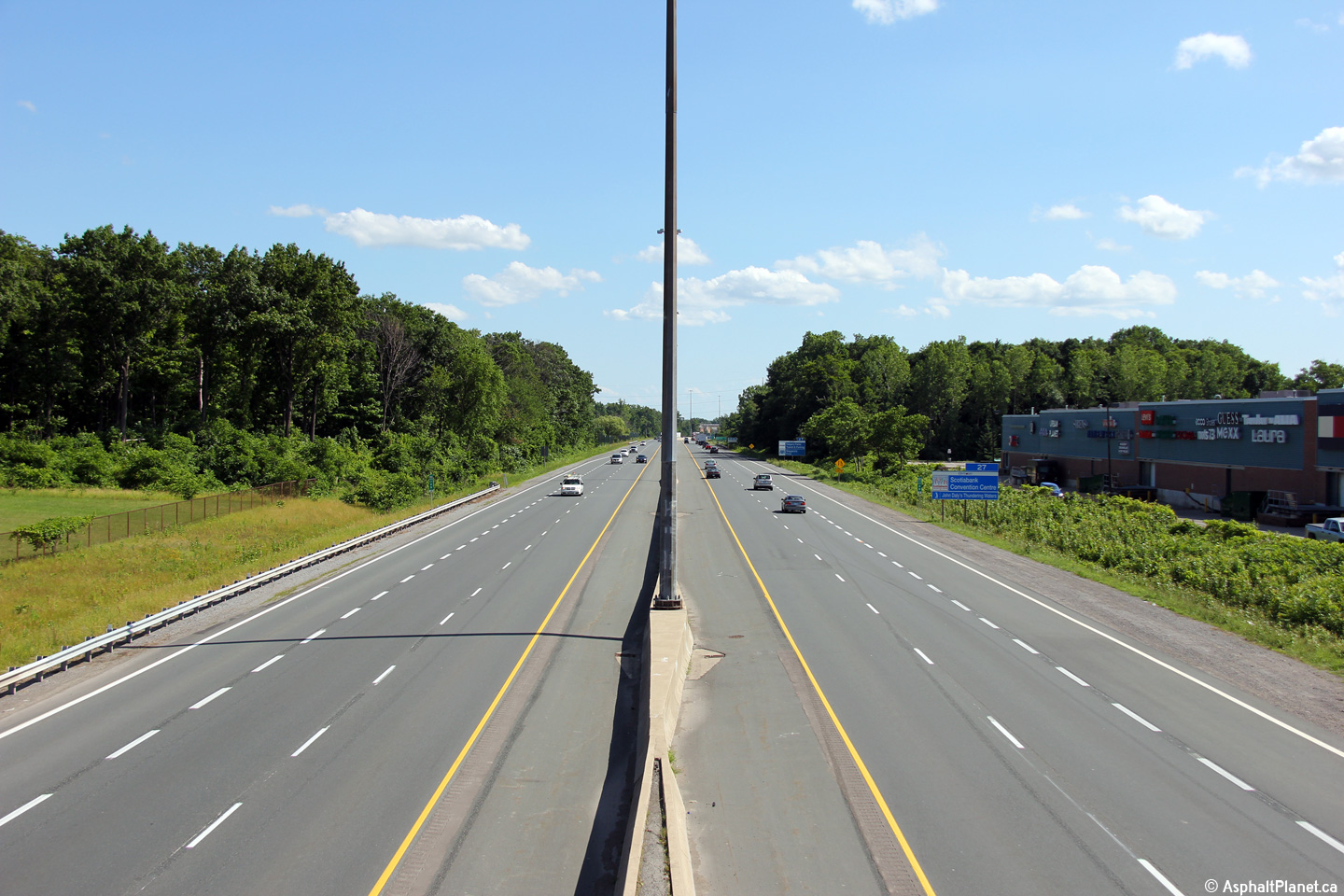
| City of Niagara Falls Regional Municipality of Niagara |
Looking northerly towards Toronto from the McLeod Road overpass.
McLeod Road is located roughly at kilometre marker 27. Photo taken: May 8th, 2005. |
 (720x480) (1440x960) |
||
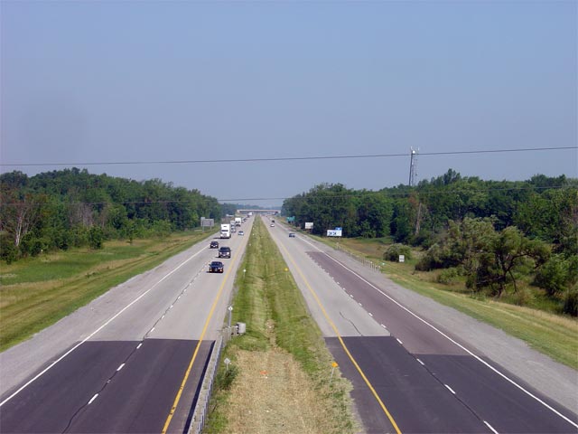
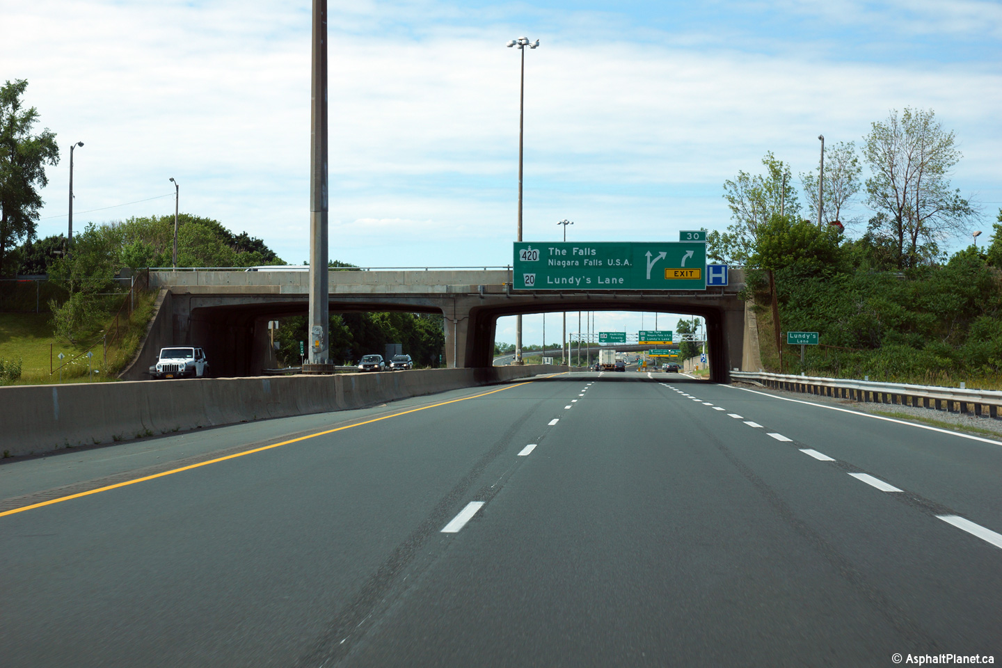
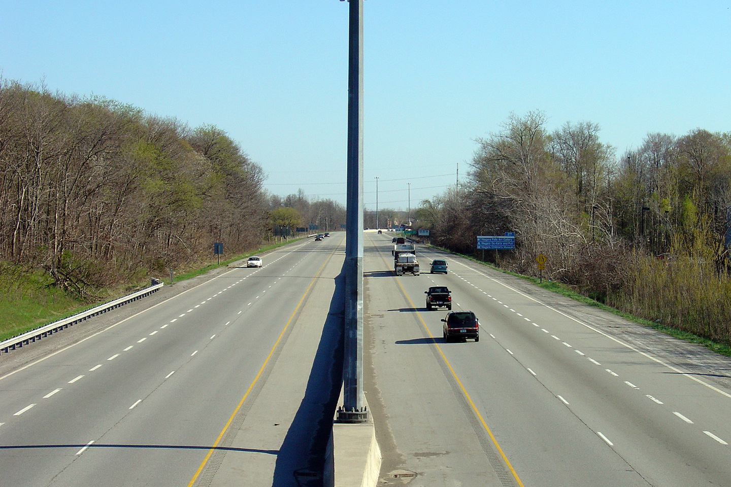
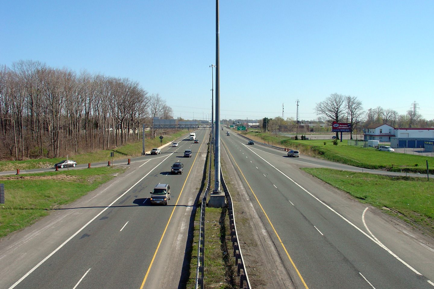
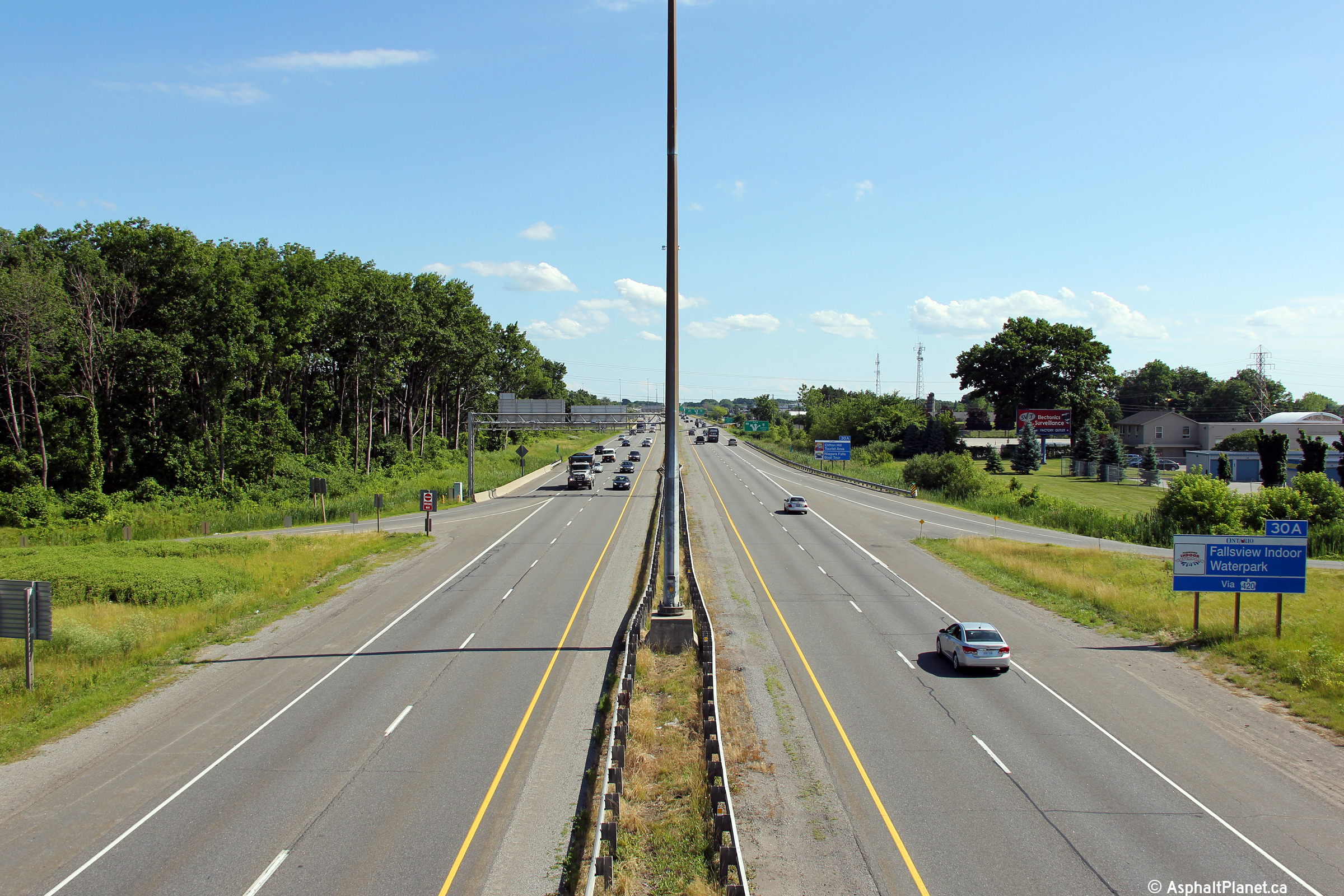
| City of Niagara Falls Regional Municipality of Niagara |
The advanced sign for the Toronto-bound off-ramp to Highway 420 is affixed
to the Lundy's Lane overpass. Photo taken: July 10th, 2014. |
 (720x480) (720x480)(1440x960) (2400x1600) |
||
| City of Niagara Falls Regional Municipality of Niagara |
Looking towards Fort Erie from the Lundy's Lane overpass.
Historically, Lundy's Lane carried the Highway
20 designation overtop of the QEW. Before the adjacent high-speed
Highway 420 interchange was completed in the early 1970s, direct access
between Highway 20 and the QEW was provided by a cloverleaf interchange.
Click here for an additional view from this
overpass, taken in May of 2005. Photo taken: July 10th, 2014. |
 (720x480) (1440x960) (2400x1600) |
||
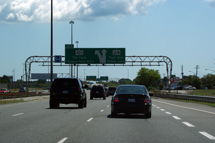
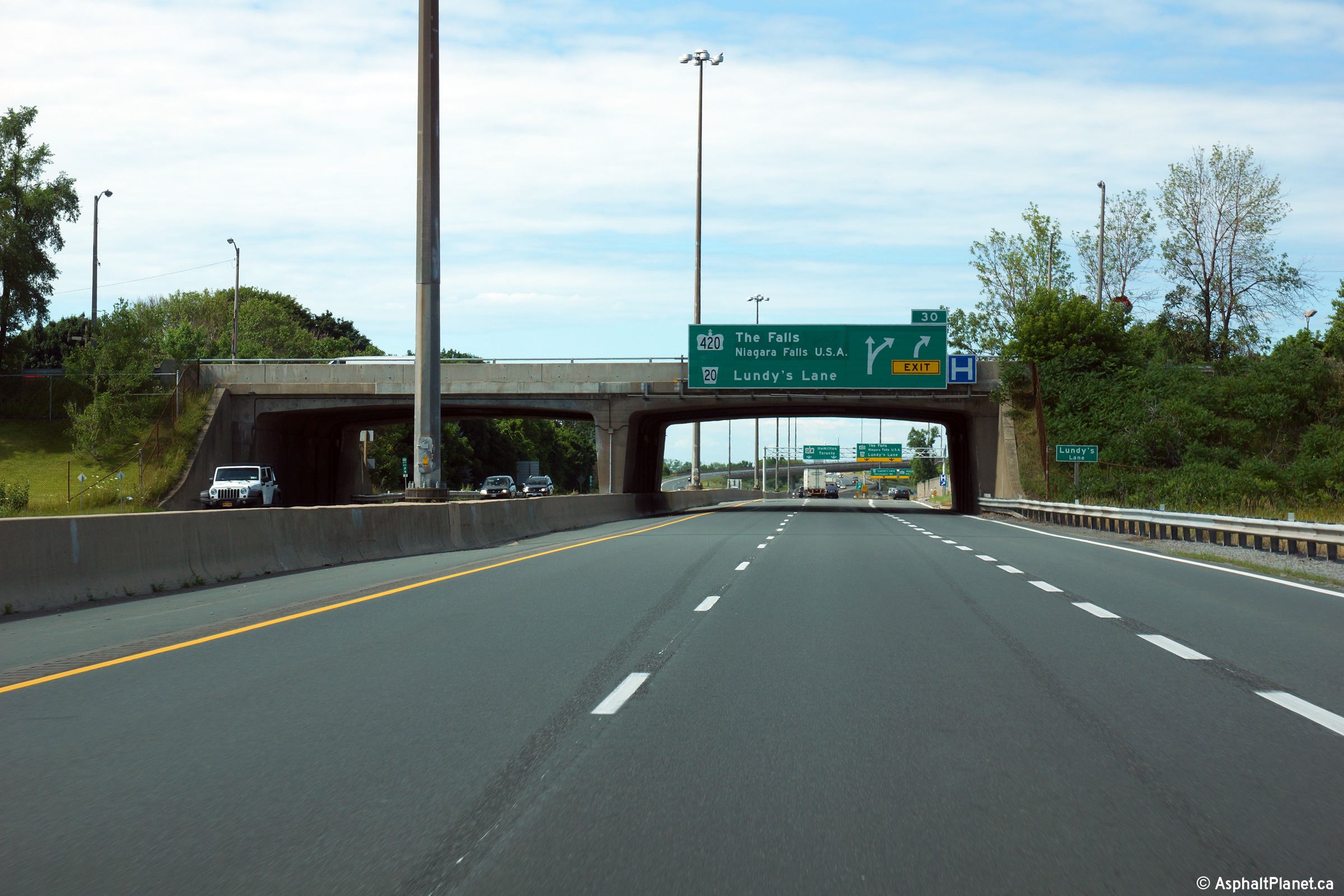
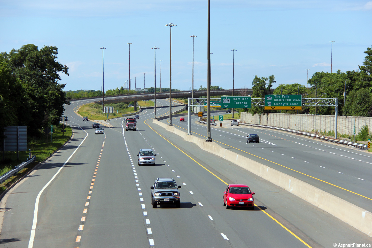
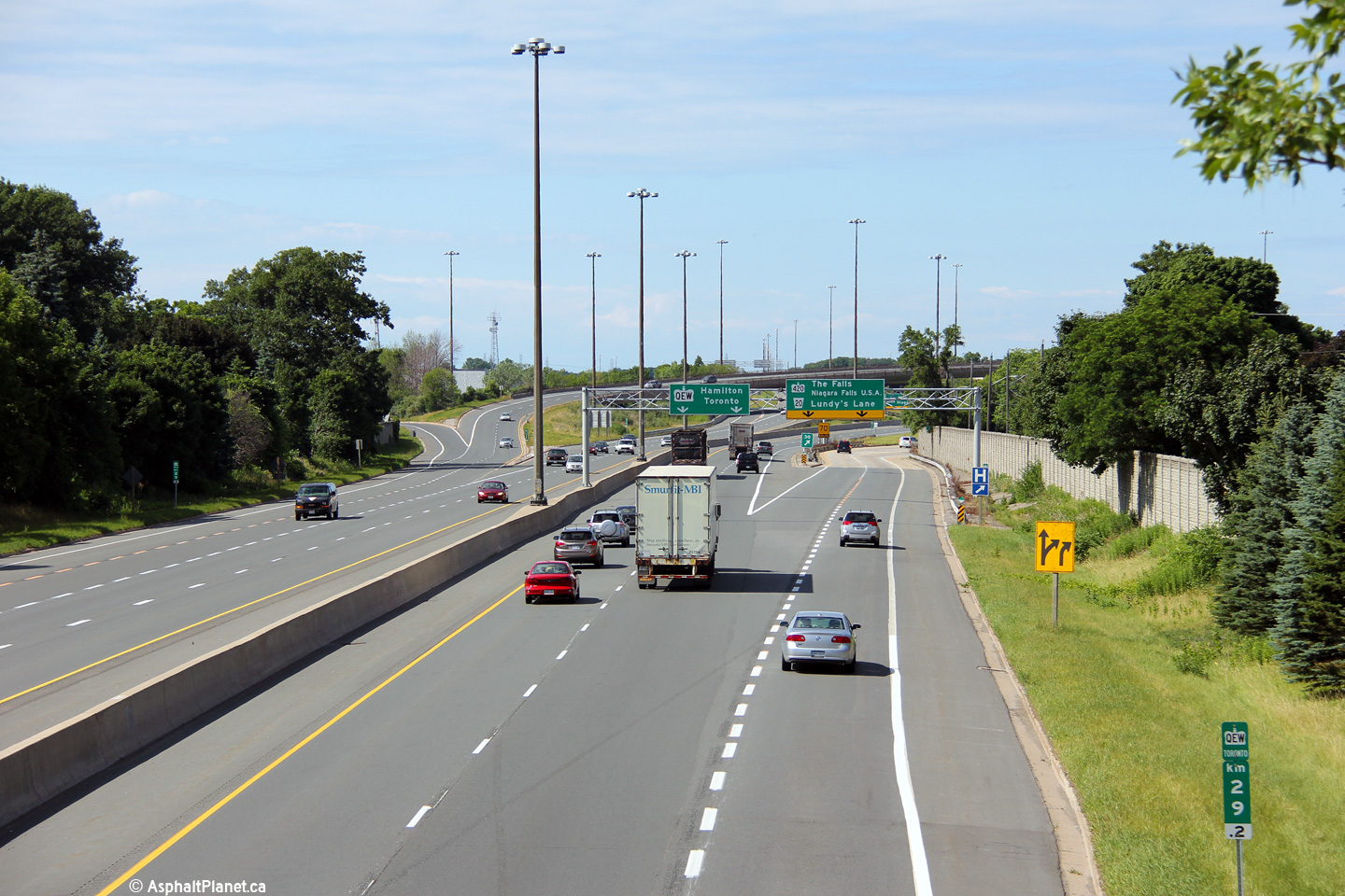
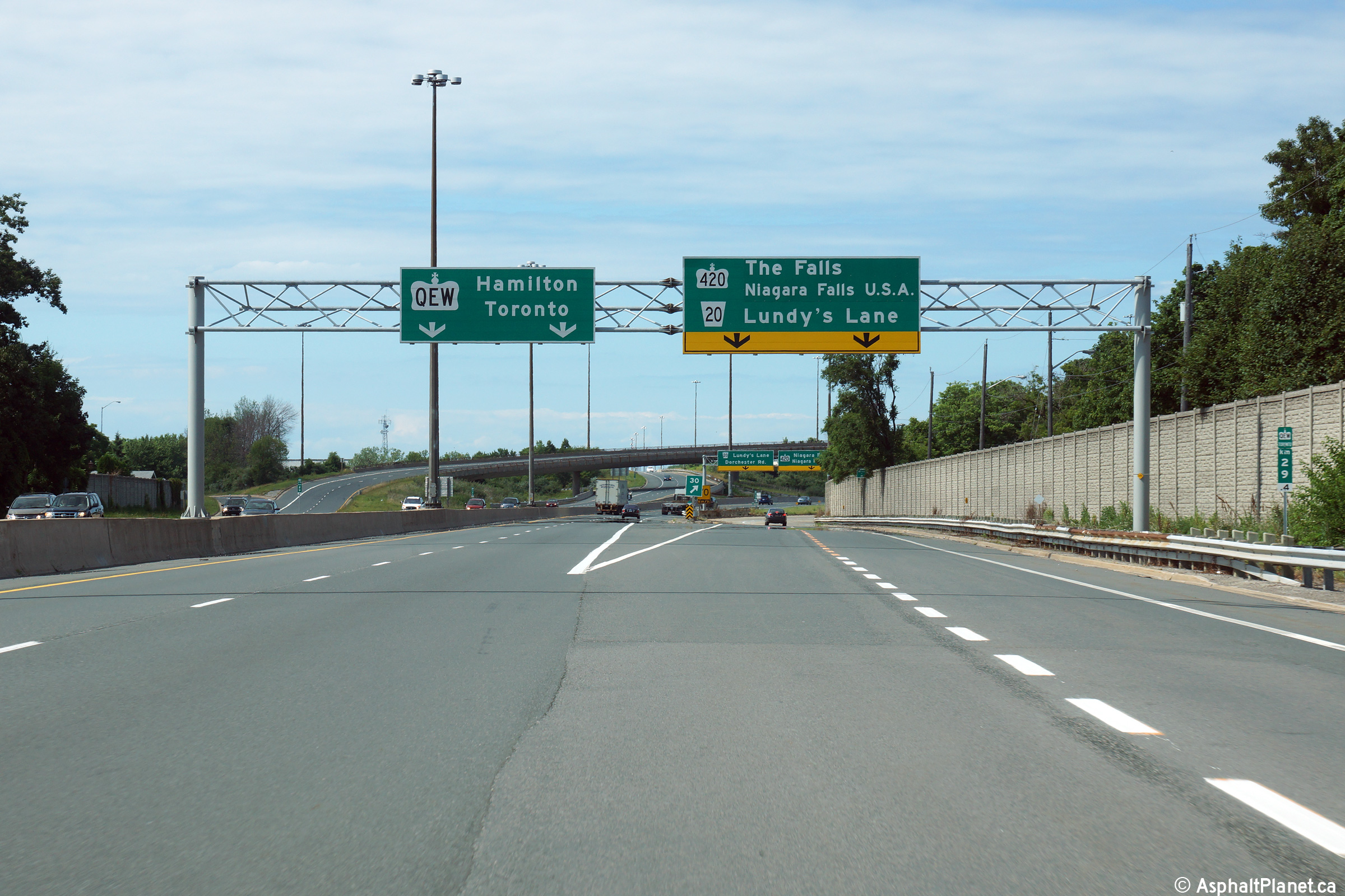
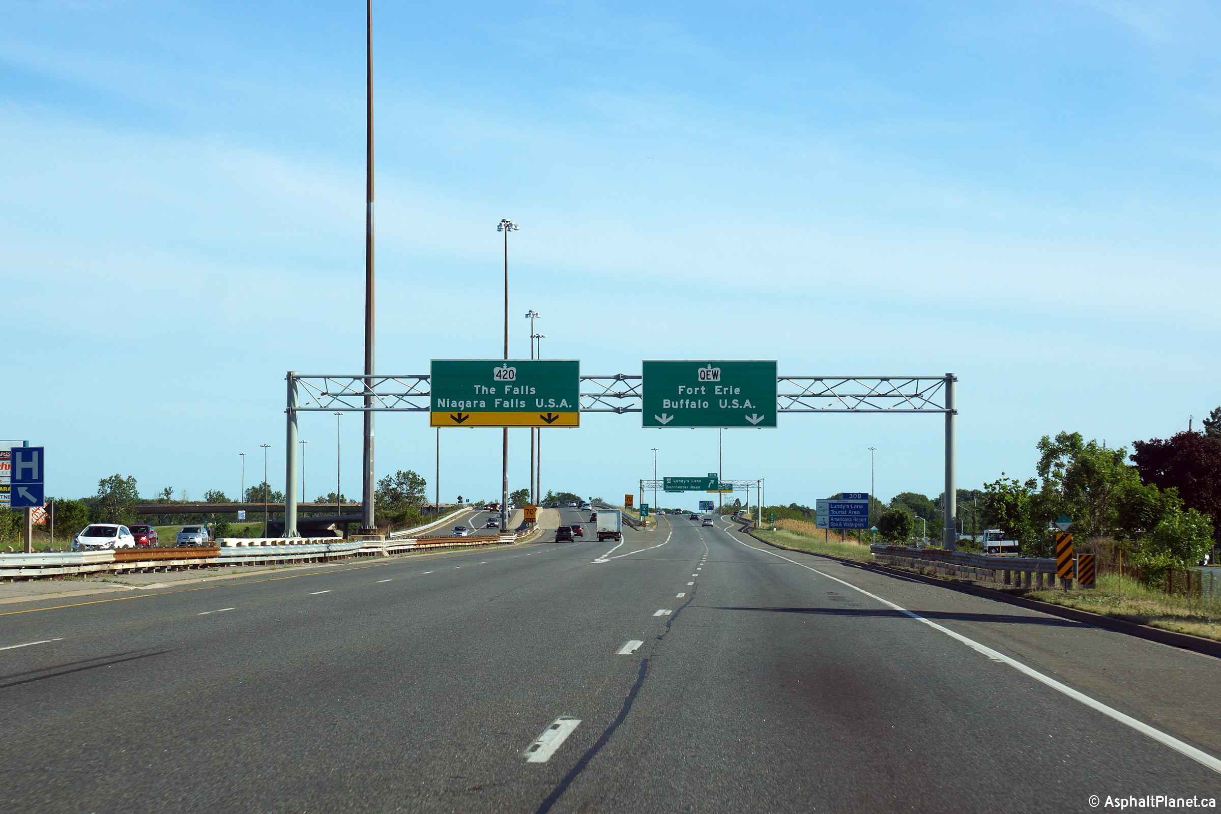
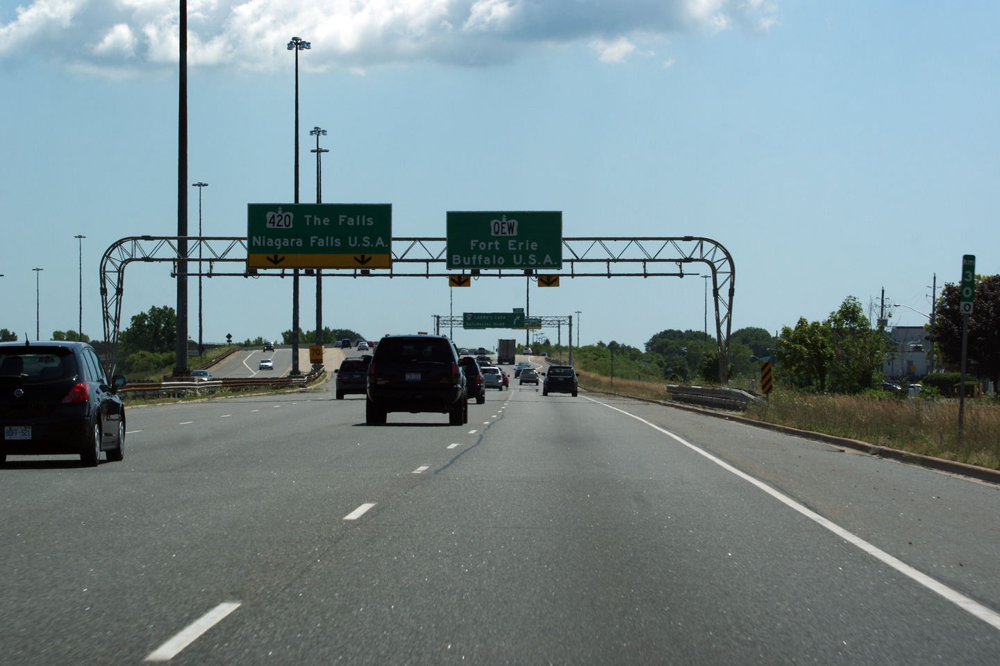
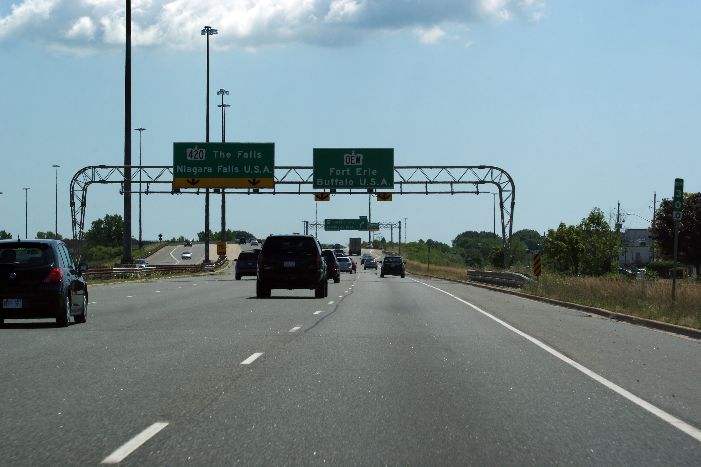
| City of Niagara Falls Regional Municipality of Niagara |
This picture shows the QEW looking Toronto-bound (north) from the Lundy's
Lane overpass in Niagara Falls. Lundy's Lane is located roughly at
kilometre marker 29. In the distance of this photo shows the QEW/420
interchange. The QEW/420 interchange is a very large and complex
interchange, especially for a city the size of Niagara Falls. Click
here for an additional view from this
overpass, taken in May of 2005. Photos taken: July 10th, 2014. |
 (720x480) (1440x960) (2400x1600)  (720x480) (1440x960) (2400x1600) 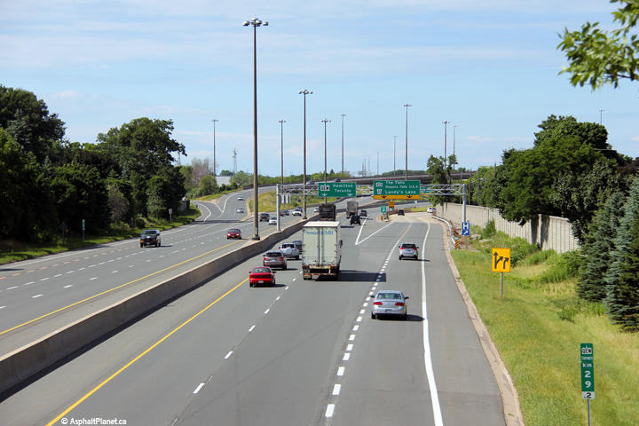 (720x480) (1440x960) (2400x1600) |
||
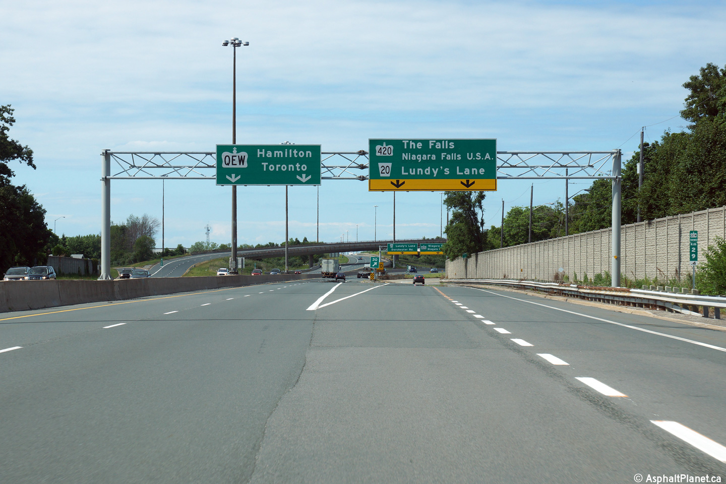
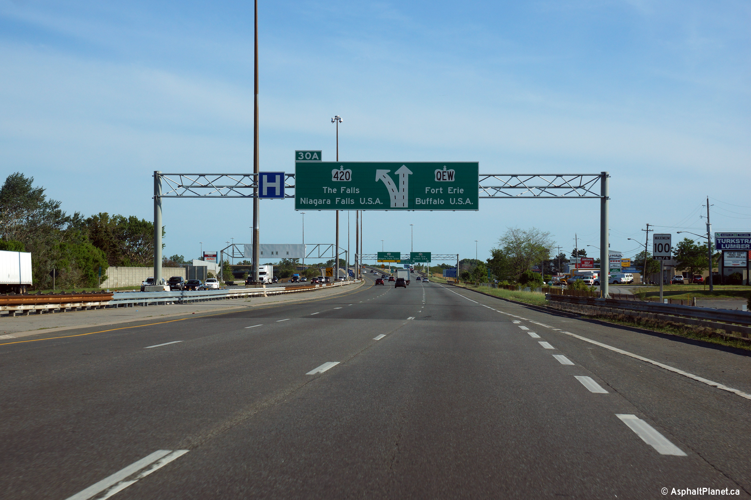
| City of Niagara Falls Regional Municipality of Niagara |
View looking towards Toronto at the off-ramp to Highway 420. Photo taken: July 10th, 2014. |
 (720x480) (720x480)(1440x960) (2400x1600) |
||
| Highway 420 extends east of the QEW into Downtown Niagara Falls and the Rainbow Bridge. Click here for Highway 420 images. | ||||
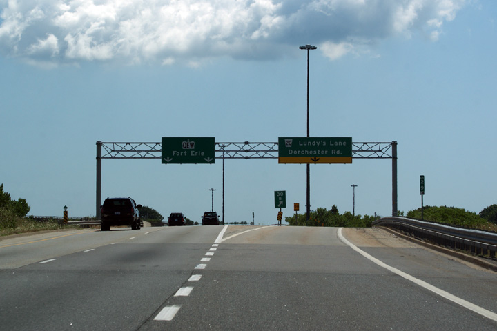
| City of Niagara Falls Regional Municipality of Niagara |
Overhead signage for the Fort-Erie bound ramp to Lundy's Lane. Despite
being intertwined with the four-level Highway 420 interchange, the QEW meets
Lundy's Lane at a conventional six ramp parclo A4. Photo taken: July 30th, 2011. |
 (720x480) (720x480)(1440x960) (2400x1600) |
||
| City of Niagara Falls Regional Municipality of Niagara |
Overhead advanced signage for the ramp to Lundy's Lane. Photo taken: July 30th, 2011. |
 (720x480) (720x480)(1440x960) (2400x1600) |
||
| City of Niagara Falls Regional Municipality of Niagara |
Exit signage for the Highway 420 exit from the Fort Erie-bound QEW.
The 420 is accessed from the Fort
Erie-bound QEW via a high-speed directional ramp. This overhead signage was
replaced late in 2014,
click here for a photo, taken
June 2015, of the current assembly. Photo taken: July 30th, 2011. |
 (720x480) (720x480)(1440x960) (2400x1600) |
||
| City of Niagara Falls Regional Municipality of Niagara |
Diagaramical sign denoting the upcoming Highway QEW/420
interchange. As
noted by the sign, traffic heading for Highway 420 departs the Fort
Erie-bound QEW from the left. This overhead signage was replaced late
in 2014, click here for a photo, taken
June 2015, of the current assembly. Photo taken: July 30th, 2011. |
 (720x480) (720x480)(1440x960) (2400x1600) |
||
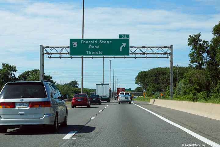
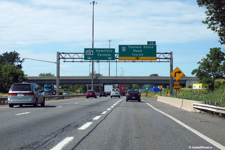
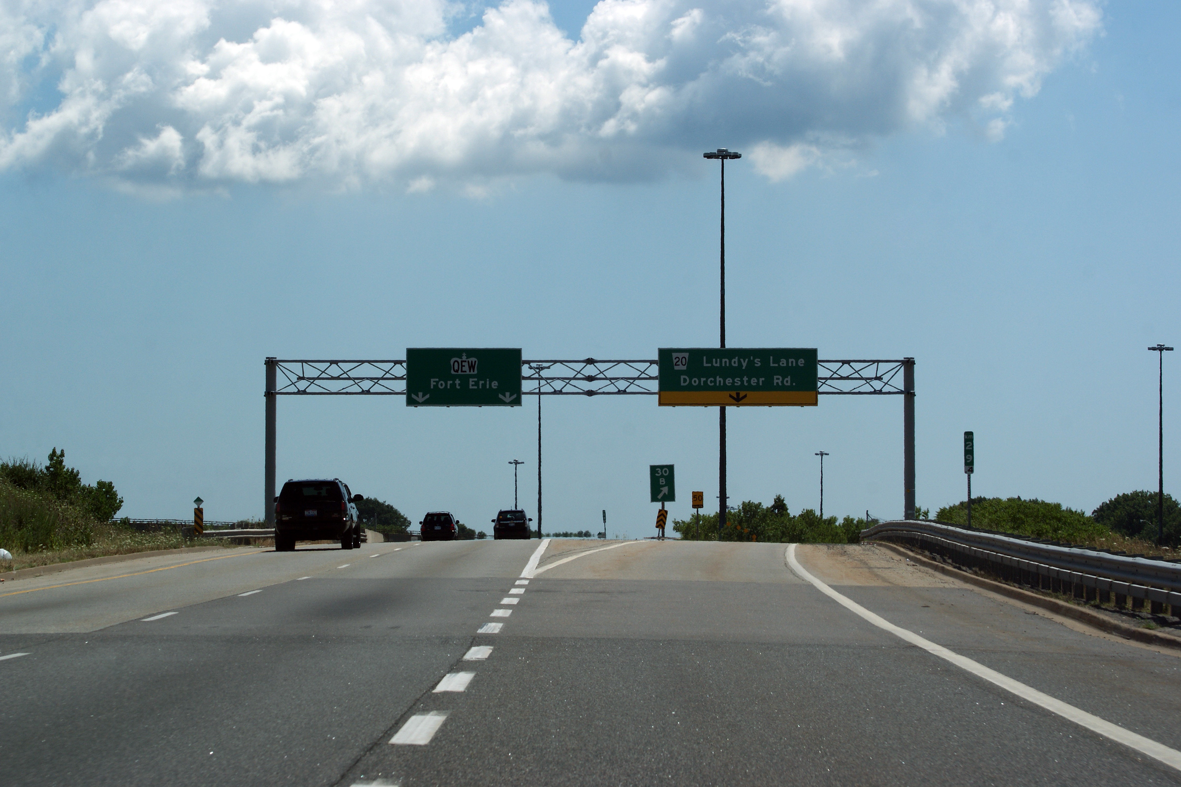
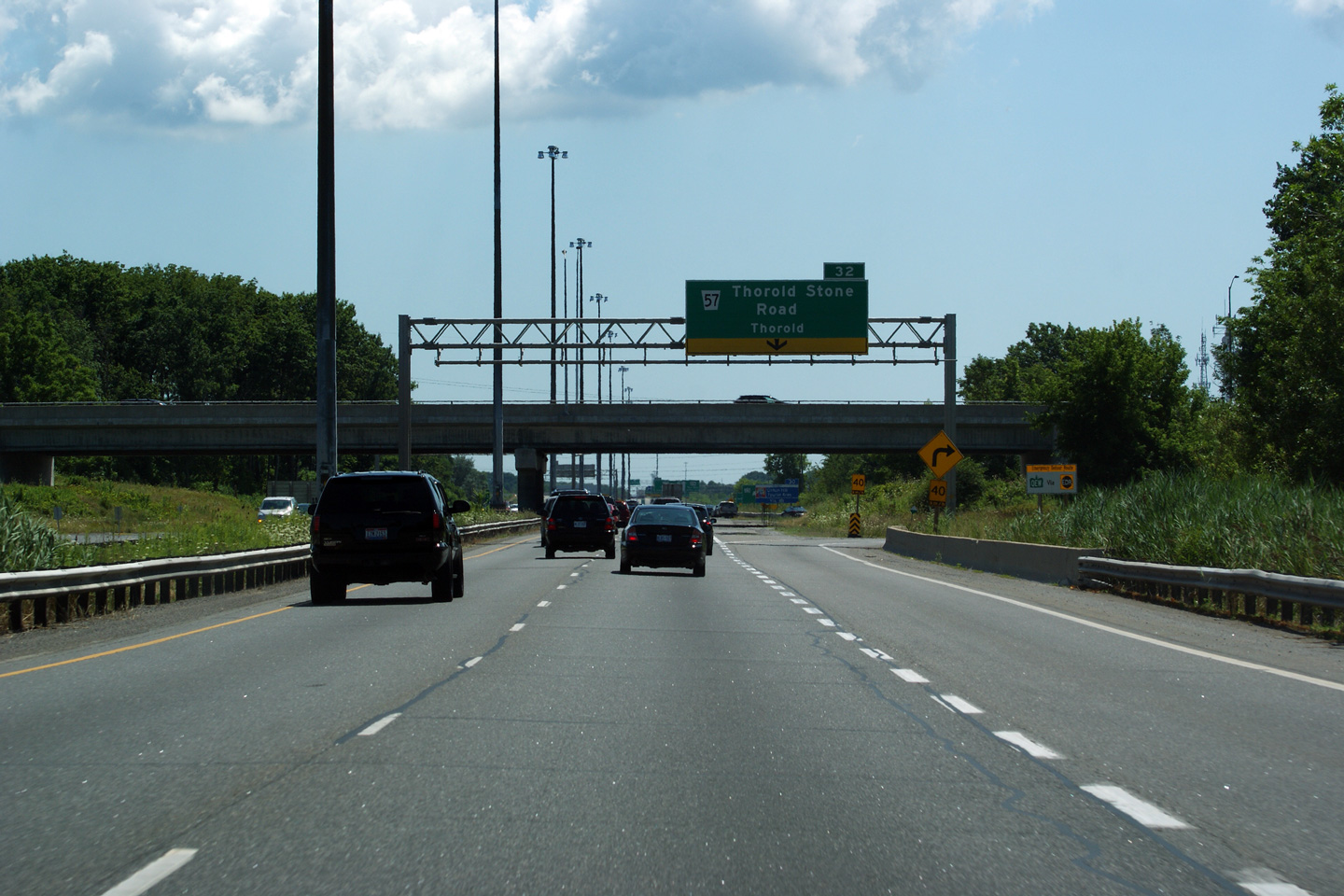
| City of Niagara Falls Regional Municipality of Niagara |
Toronto-bound advanced signage for the Thorold Stone Road interchange. Photo taken: July 10th, 2014. |
 (720x480) (720x480)(1440x960) (2400x1600) |
||
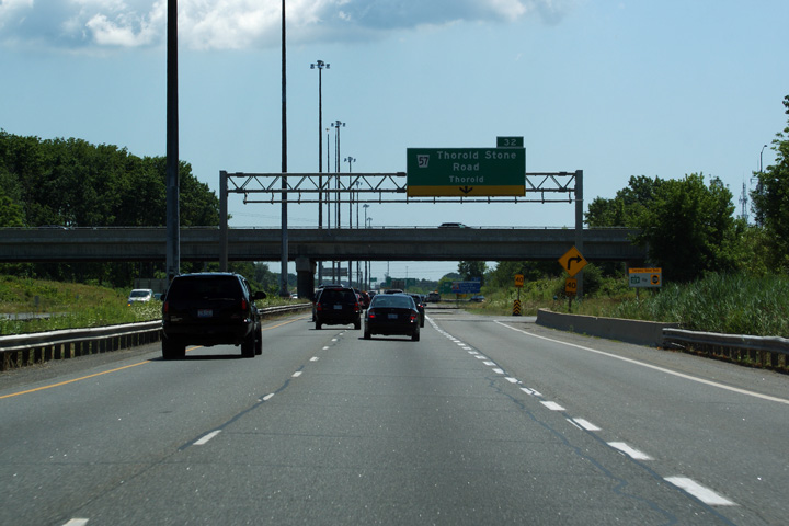
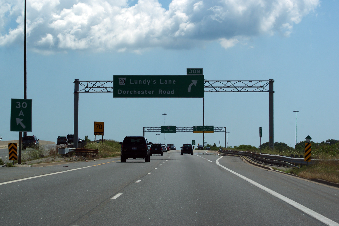
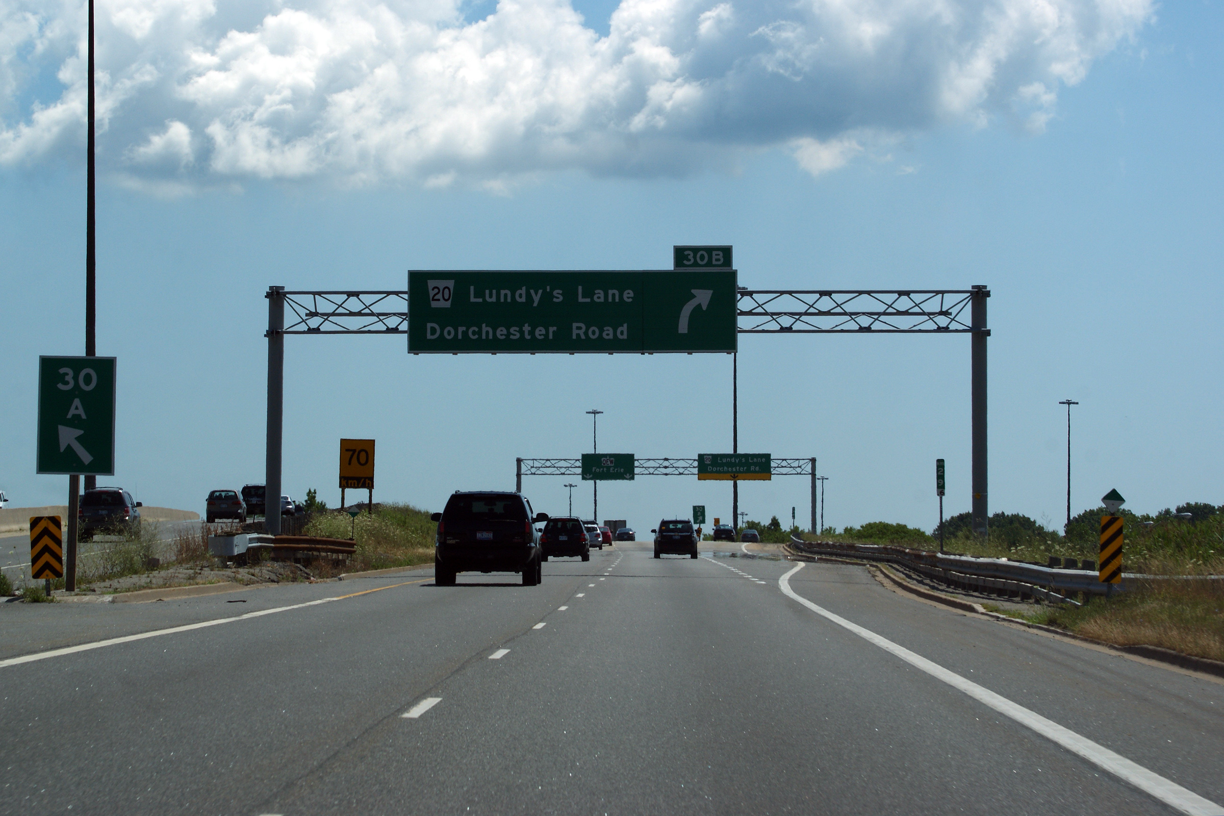
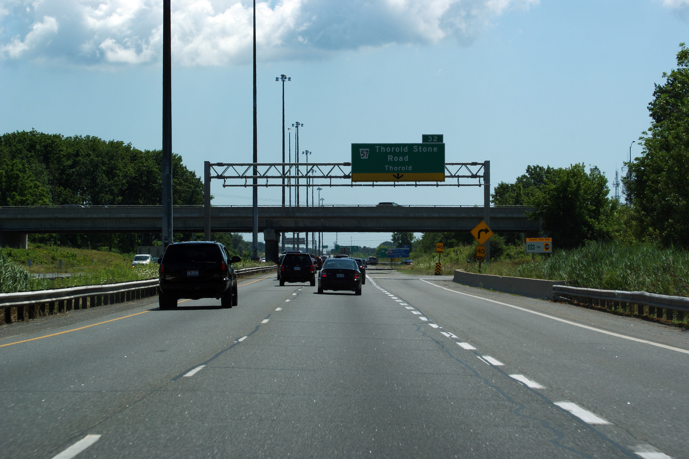
| City of Niagara Falls Regional Municipality of Niagara |
Signage at the Toronto-bound off-ramp to Thorold Stone Road. Thorold
Stone Road is a useful cut-off between the QEW and Highway 58 at the Thorold
Tunnel. Photo taken: July 10th, 2014. |
 (720x480) (720x480)(1440x960) (2400x1600) |
||
| City of Niagara Falls Regional Municipality of Niagara |
This picture shows the QEW looking towards Fort Erie and the Highway 420
interchange from the Thorold Stone Road overpass in Niagara Falls.
Click here for an additional view from
this overpass, taken in May of 2005. Photo taken: July 10th, 2014. |
 (720x480) (1440x960) (2400x1600) |
||
| City of Niagara Falls Regional Municipality of Niagara |
Looking towards Toronto and St. Catharines from the Thorold Stone Road
overpass. Though it may be hard to believe given the current ramp
configuration of the Thorold Stone Road interchange, Thorold Stone Road
formerly met the QEW at a parclo "B" style interchange. Click
here for an additional view from this
overpass, taken in May of 2005. Photo taken: July 10th, 2014. |
 (720x480) (1440x960) (2400x1600) |
||
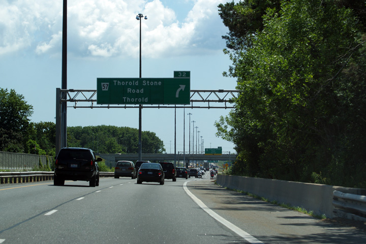
| City of Niagara Falls Regional Municipality of Niagara |
Signage at the Niagara-bound off-ramp to Thorold Stone Road.
Strangely, a pre-advanced sign for the next sequential interchange (Highway
420) has not been erected on this overhead truss. Photo taken: July 30th, 2011. |
 (720x480) (720x480)(1440x960) (2400x1600) |
||
| City of Niagara Falls Regional Municipality of Niagara |
Advanced signage for the ramp to Thorold Stone Road. Photo taken: July 30th, 2011. |
 (720x480) (720x480)(1440x960) (2400x1600) |
||
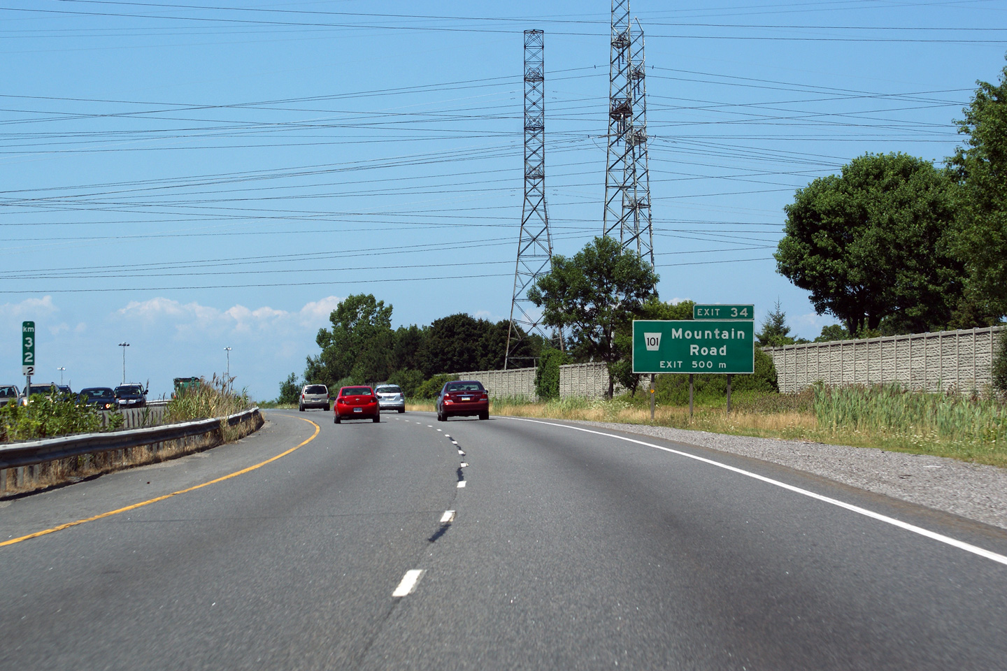
| City of Niagara Falls Regional Municipality of Niagara |
Ground mounted advanced signage for the ramp to Mountain Road. Photo taken: July 30th, 2011. |
 (720x480) (720x480)(1440x960) (2400x1600) |
||
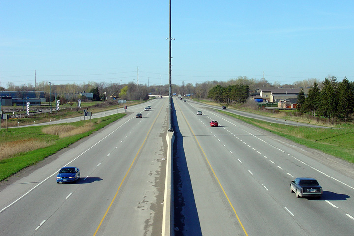
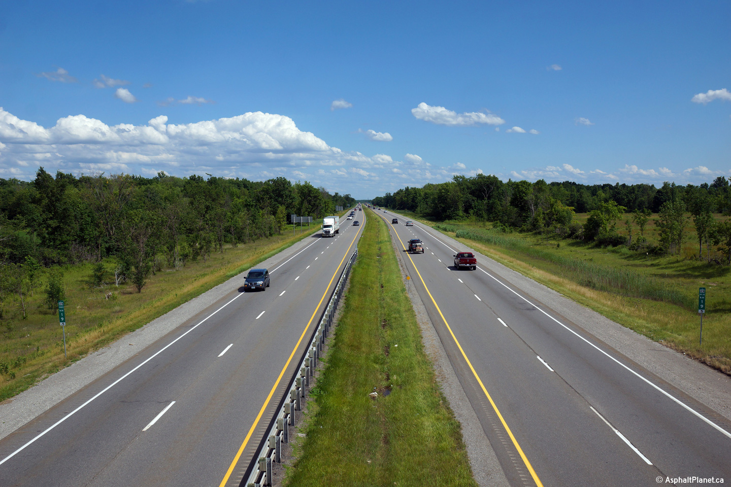
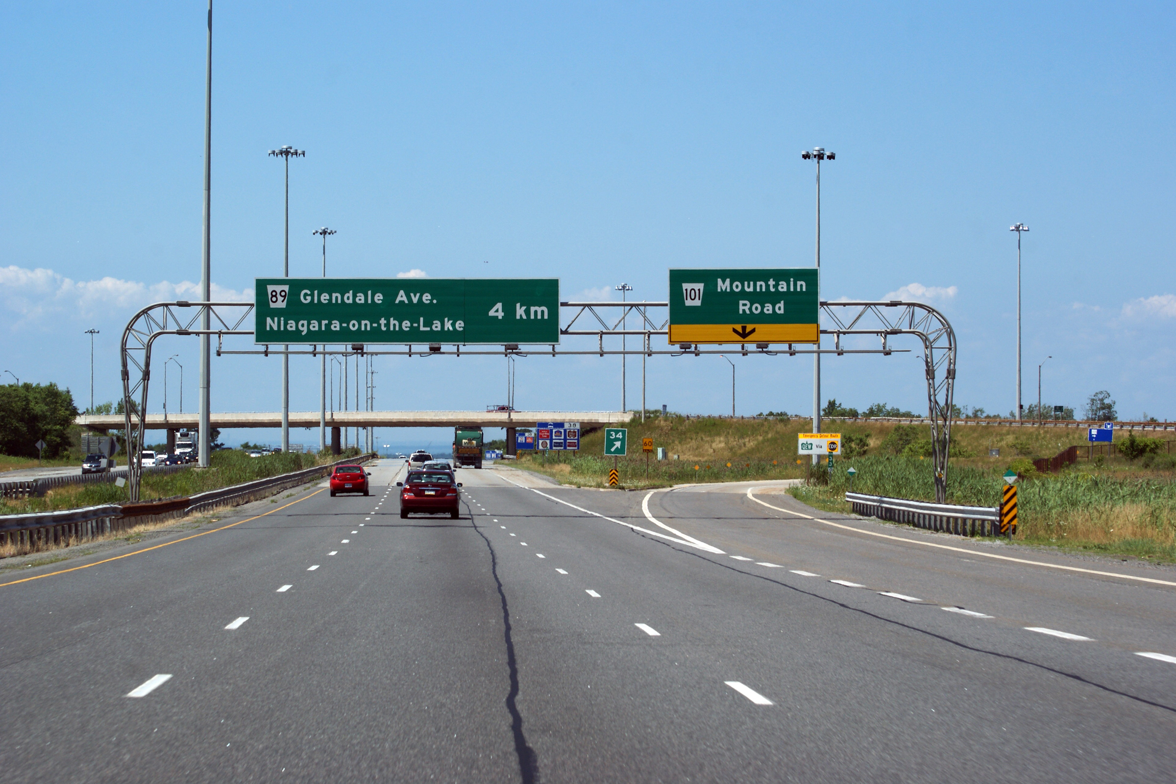
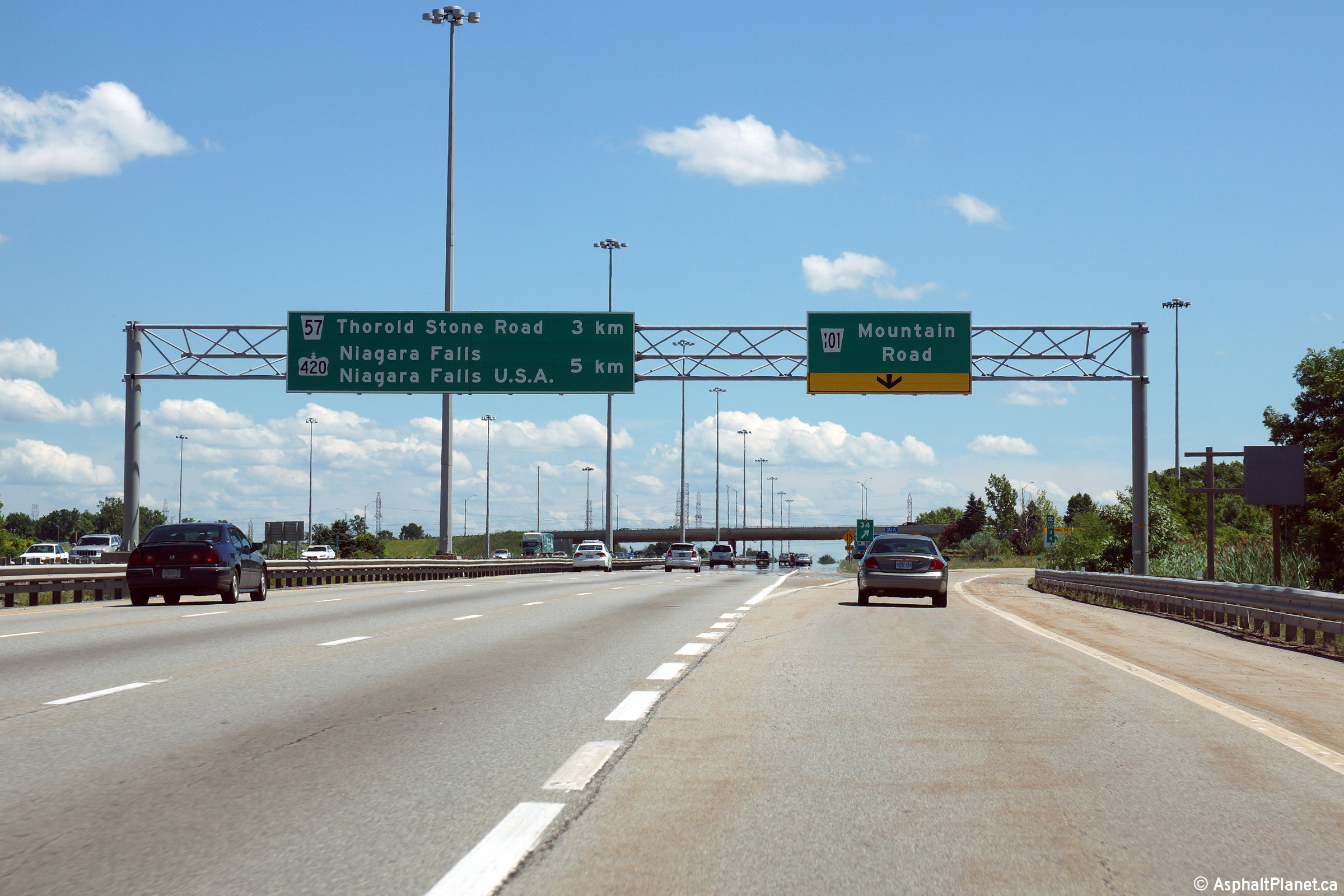
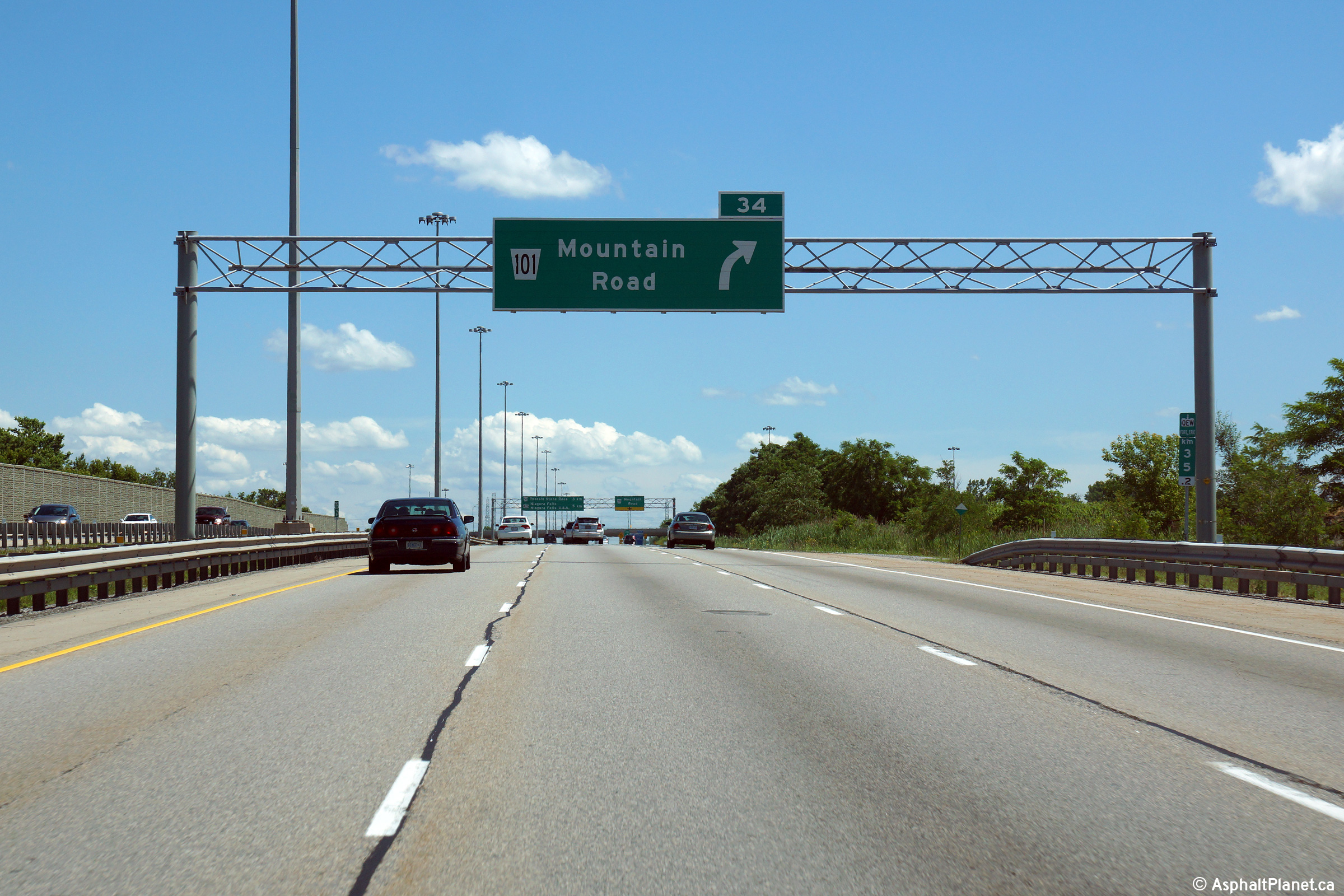
| City of Niagara Falls Regional Municipality of Niagara |
Toronto-bound view at the exit to Mountain Road. The Queen Elizabeth
Way widens to six lanes (three per direction) north of the Mountain Road
interchange. The highway maintains this cross-section from this
interchange until the Freeman interchange with Highways 403 and 407 ETR in
Burlington. Photo taken: July 30th, 2011. |
 (720x480) (720x480)(1440x960) (2400x1600) |
||
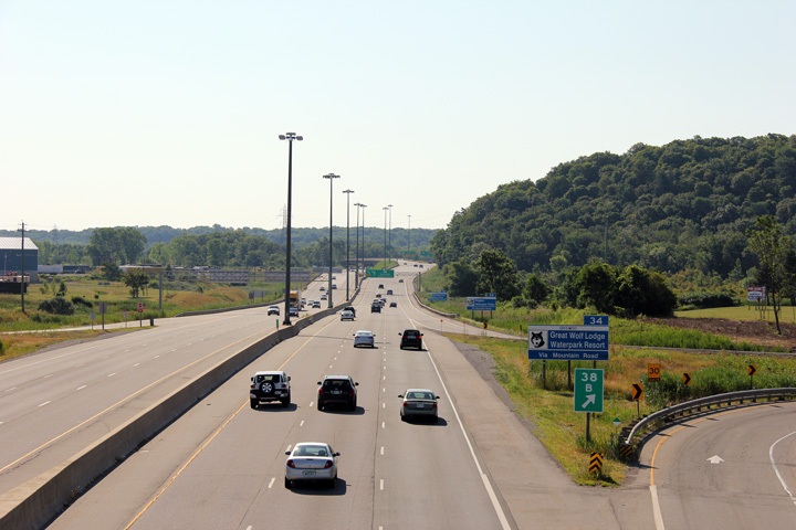
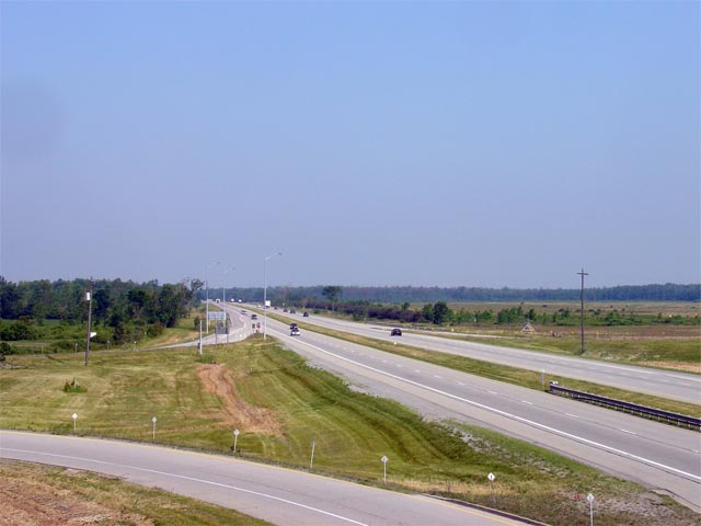
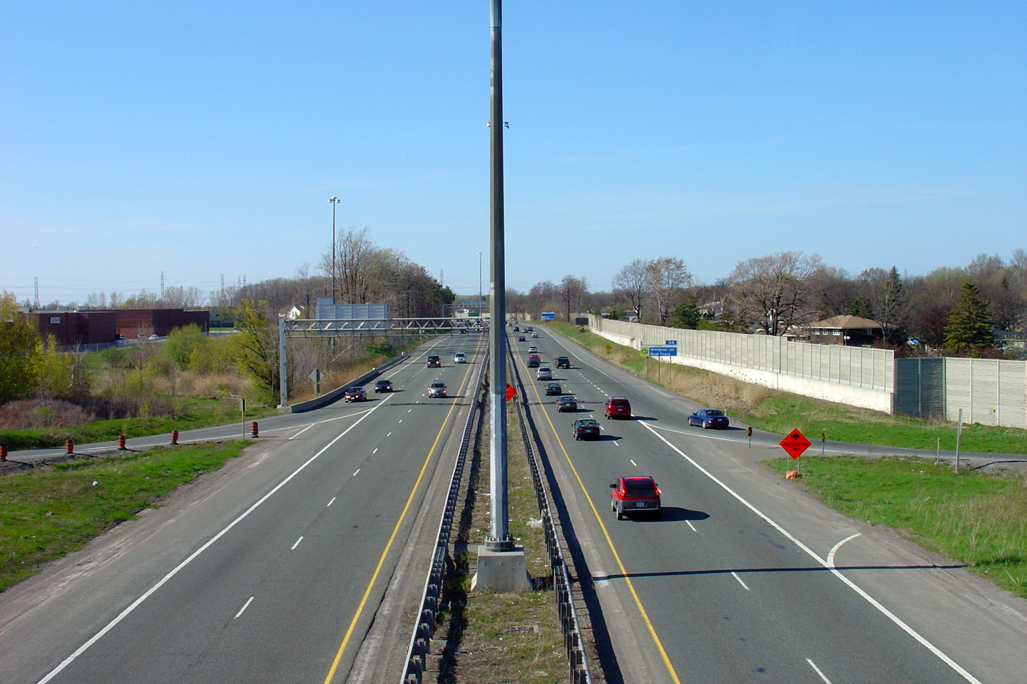
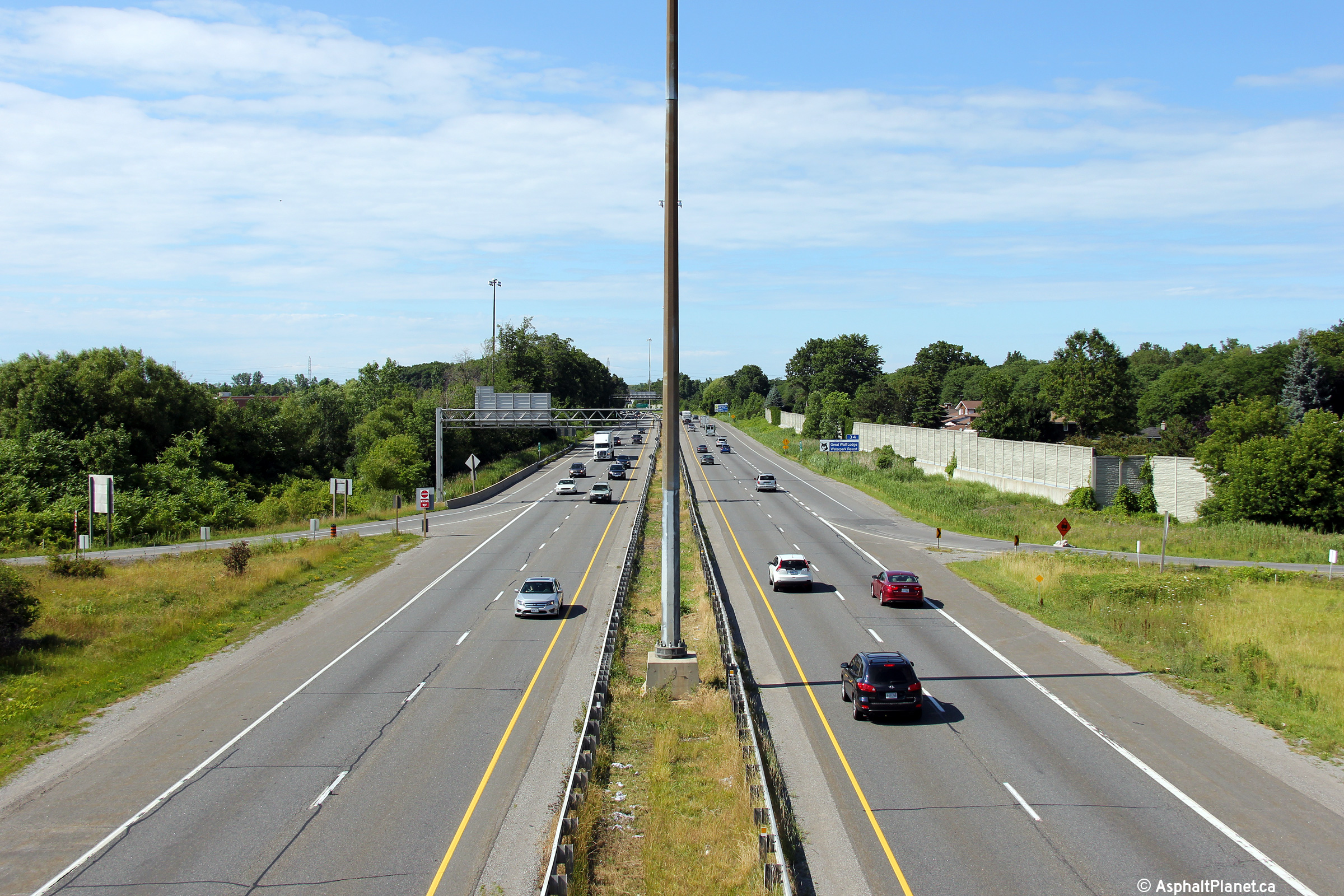
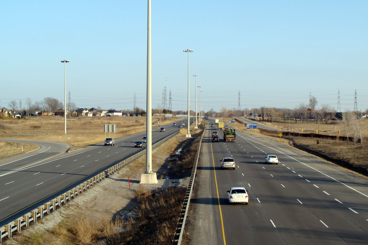
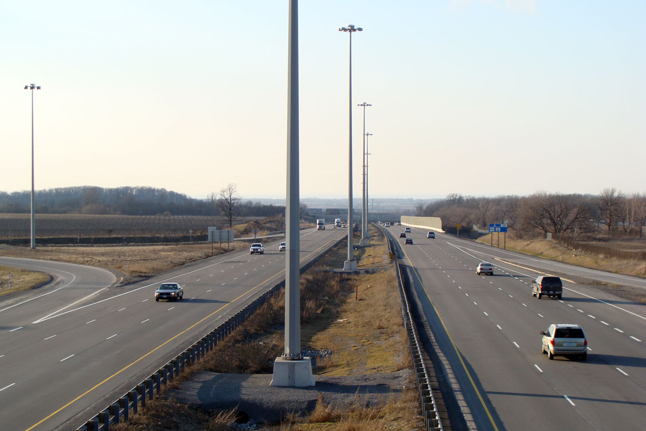
| City of Niagara Falls Regional Municipality of Niagara |
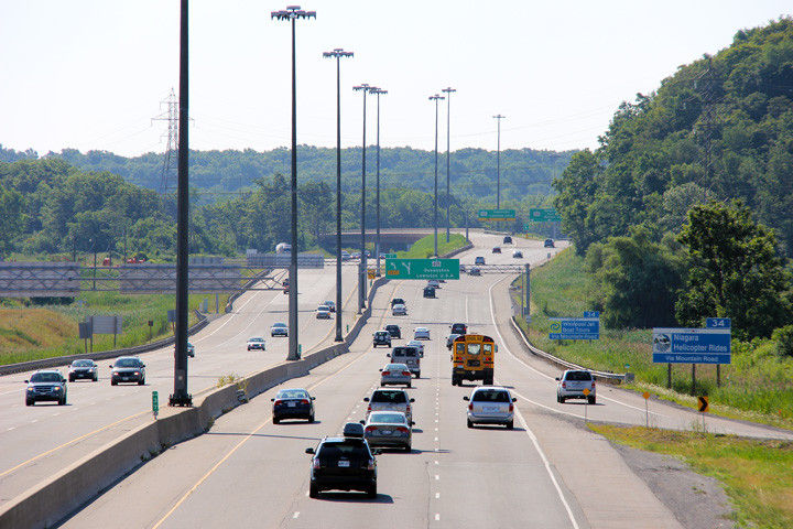
The QEW looking Fort Erie-bound from the Mountain Road overpass.
Mountain Road is located at kilometre marker 34. The QEW was 6-laned
through the Mountain Road interchange many years ago. Click
here for an additional view taken
from this vantage point taken in April, 2008. Upper photo taken: May 8th, 2005. Lower photo taken: July 10th, 2014. |
 (720x480) (1440x960) (2400x1600) |
||
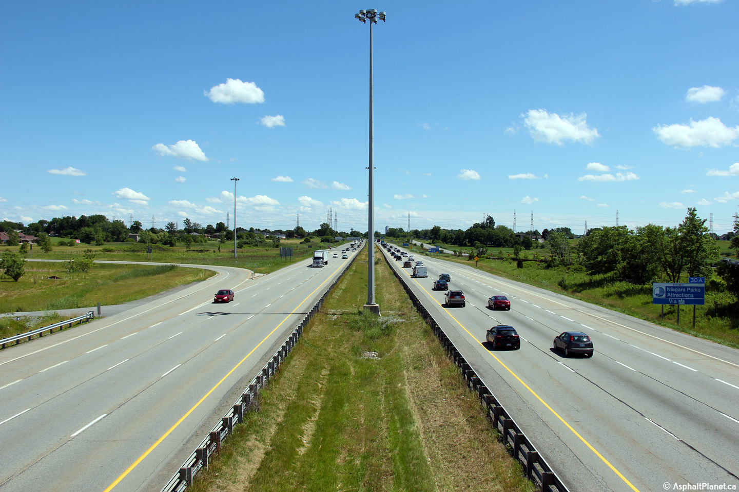
| City of Niagara Falls Regional Municipality of Niagara |
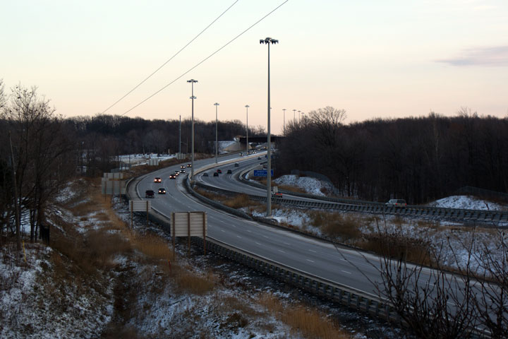
The QEW looking Toronto Bound from the Mountain Road overpass. Beyond
the view of this photo, the QEW begins its descent down Sandplant Hill
towards Niagara-on-the-Lake and St. Catharines. Click
here for an additional view taken
from this vantage point taken in April, 2008. Upper photo taken: May 8th, 2005. Lower photo taken: July 10th, 2014. |
 (720x480) (1440x960) (2400x1600) |
||
| City of Niagara Falls Regional Municipality of Niagara |
View looking towards the Mountain Road interchange from the Niagara bound
lanes of the QEW. Photo taken: April 2nd, 2008. |
 (720x480) (720x480)(1440x960) (2400x1600) |
||
| City of Niagara Falls Regional Municipality of Niagara |
The rather attractive advanced signage for Mountain Road sits at the top of
the escarpment. Photo taken: April 2nd, 2008. |
 (720x480) (720x480)(1440x960) (2400x1600) |
||
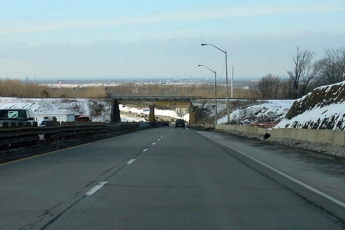
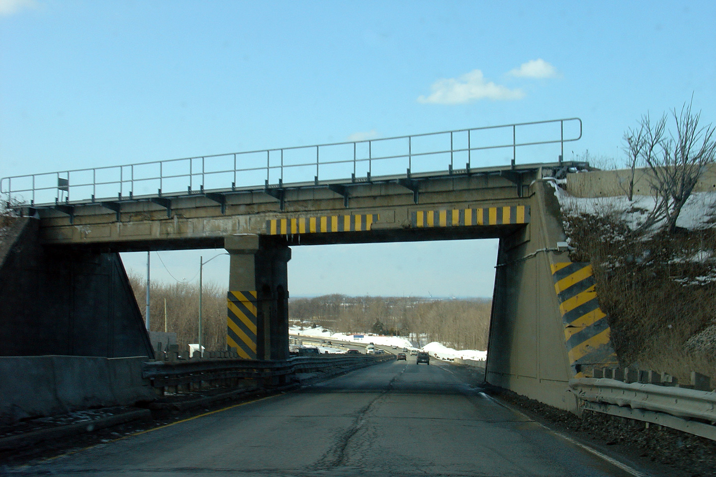
| City of Niagara Falls Regional Municipality of Niagara |
Two views looking Toronto-bound through the former CNR overhead. This
narrow structure was replaced with a modern one in 2007. Photos taken: February 23rd, 2005. |
|
||
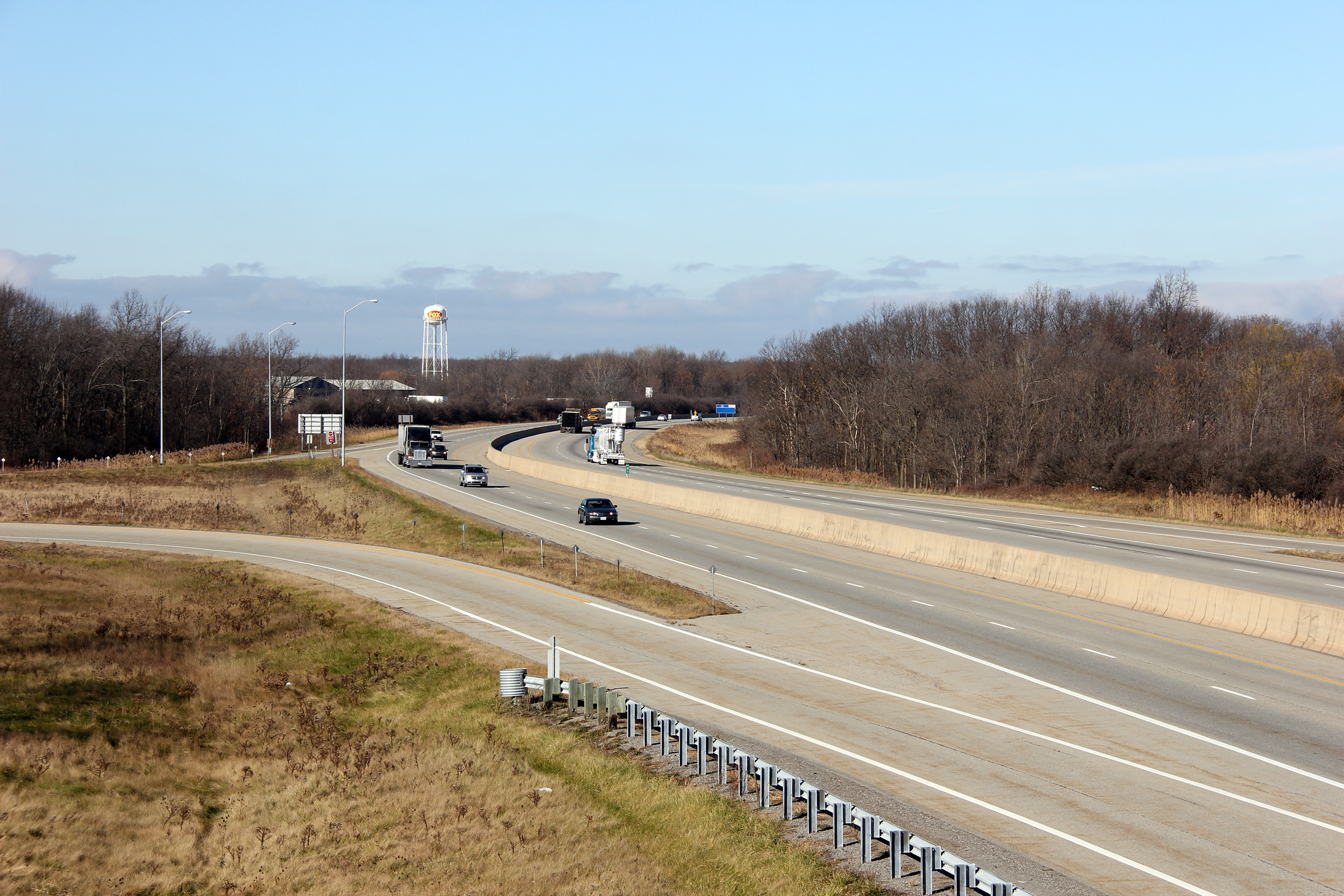
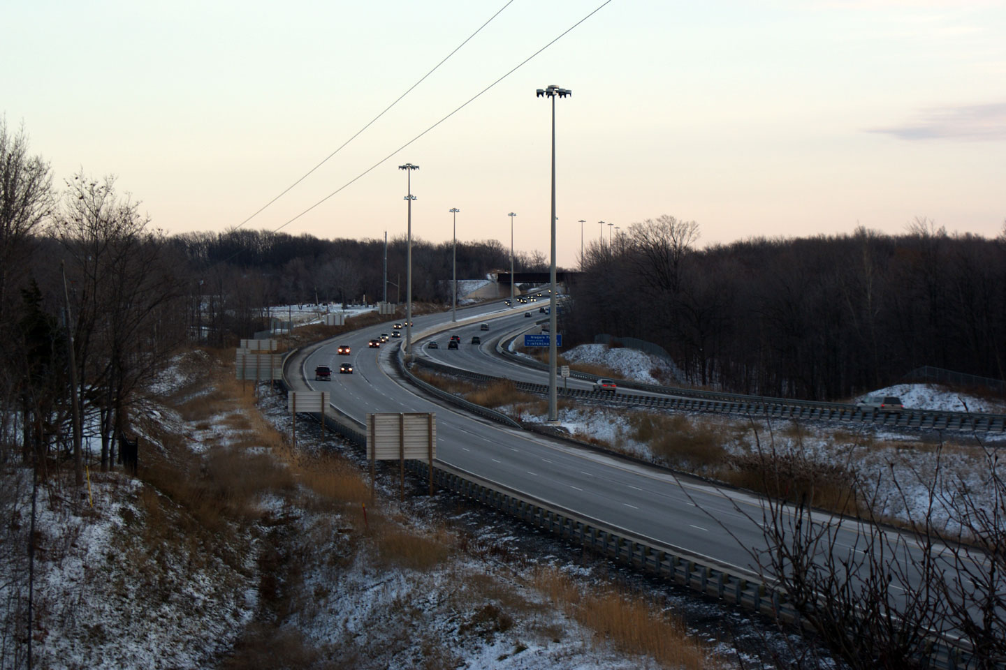
| City of
Niagara Falls Regional Municipality of Niagara |
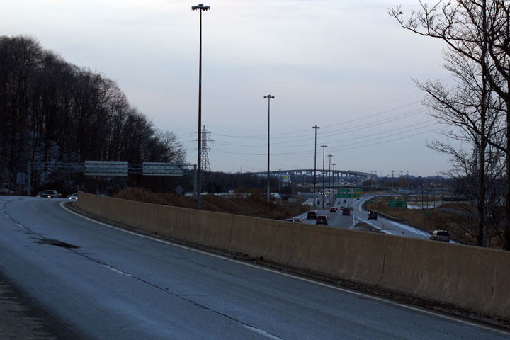
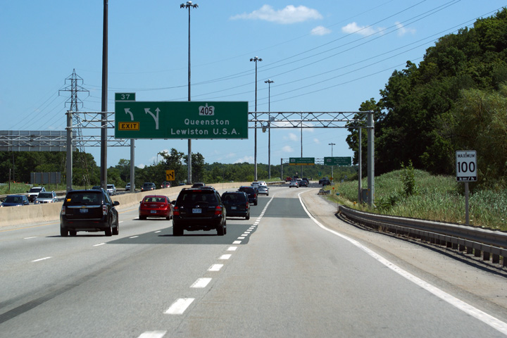
View
towards the Sandplant Hill from the Highway 405 overpass. Photo taken: December 2008. |
 (720x480) (1440x960) |
||
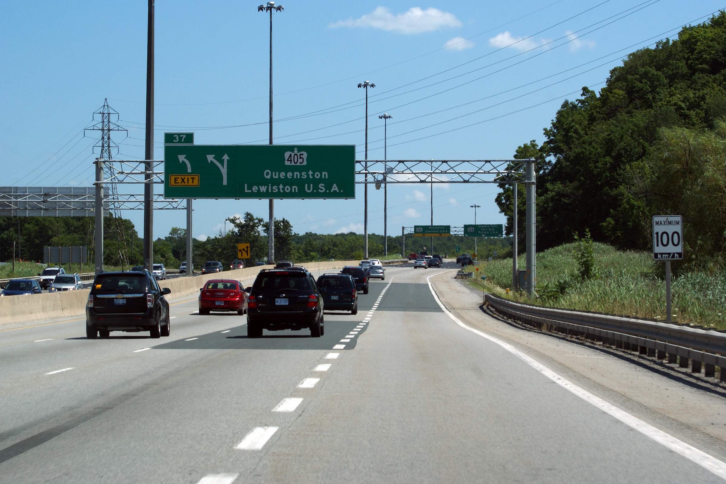
| Highway 405 extends east of the QEW to I-190 at the Queenston Lewiston Bridge. Click here for Highway 405 images. | ||||
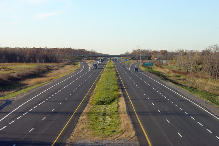
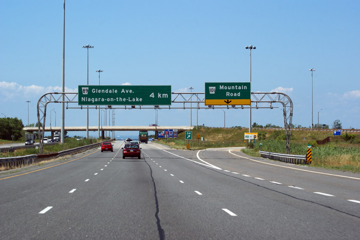
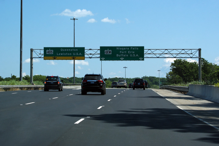
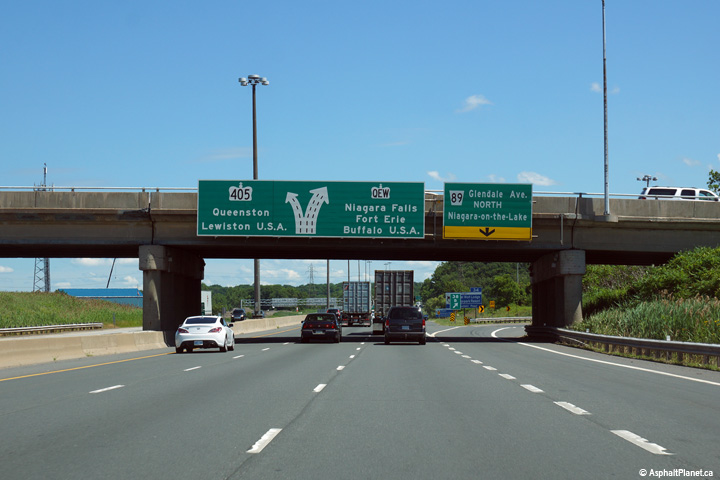
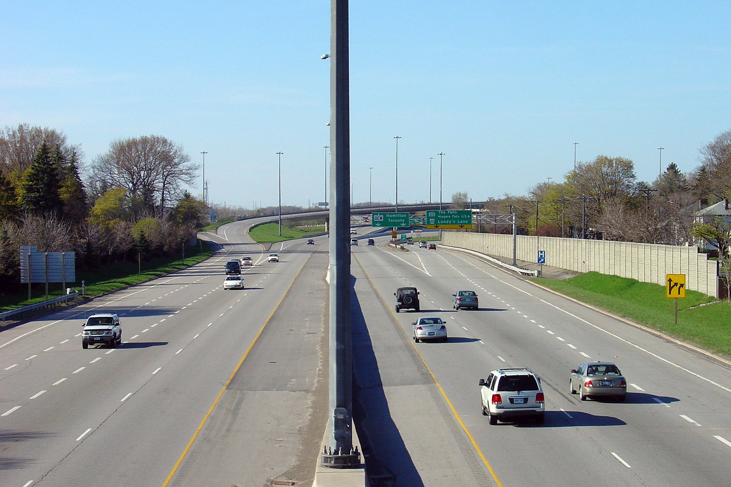
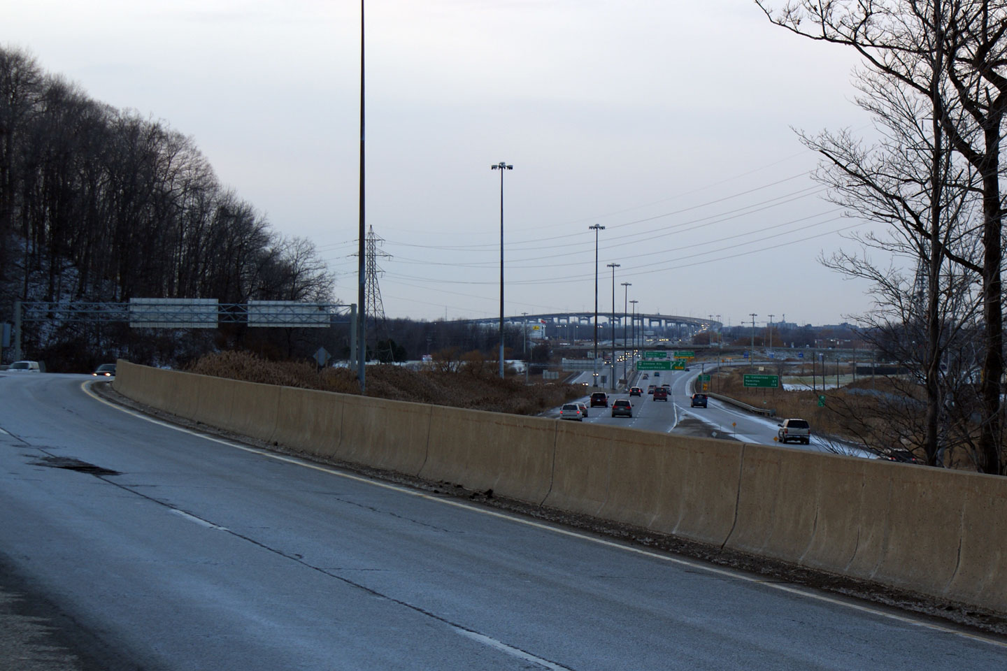
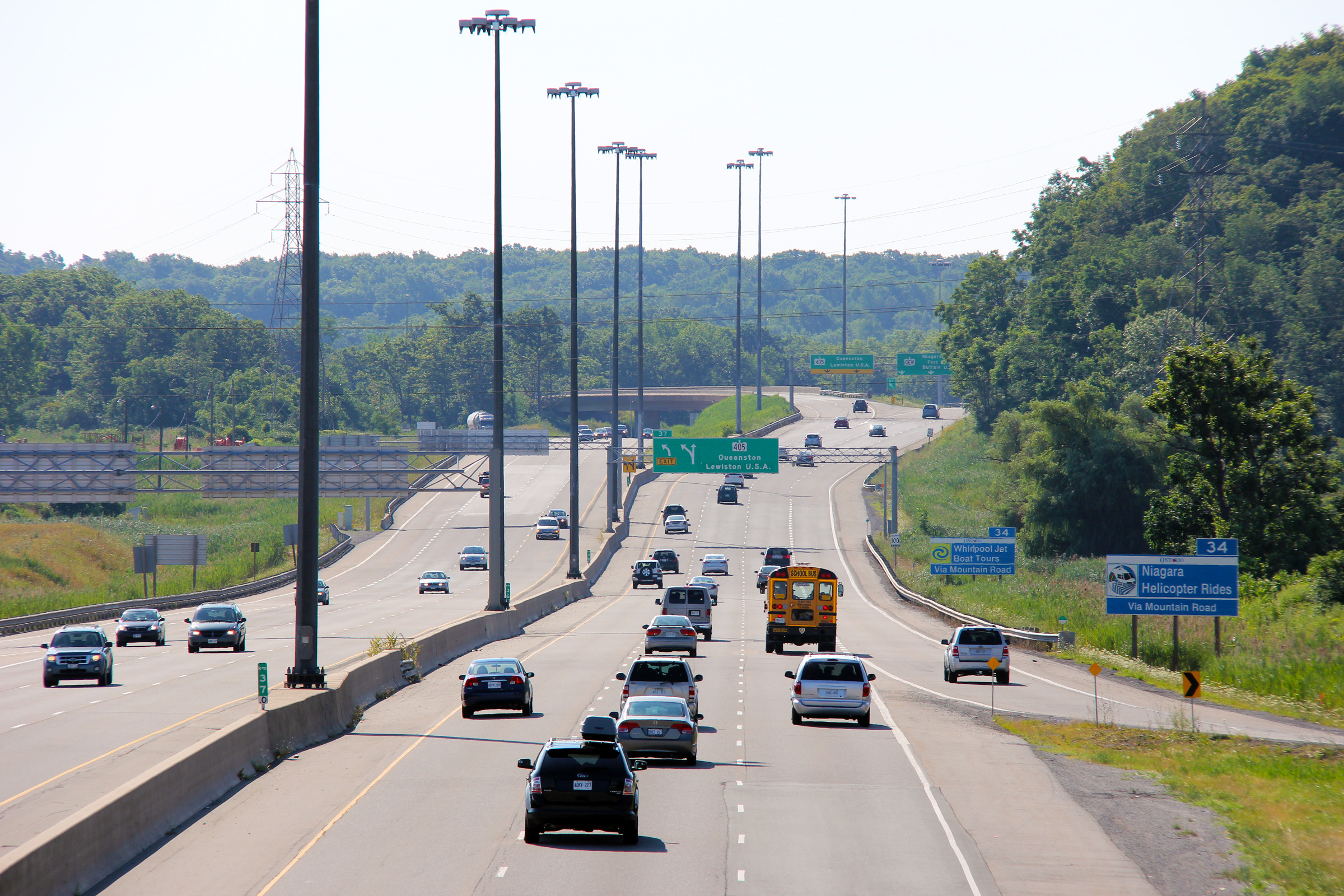
| Town of Niagara-on-the-Lake Regional Municipality of Niagara |
Westerly
view from Highway 405 towards the Glendale
Avenue interchange and Garden City Skyway. Photo taken: December 2008. |
 (720x480) (1440x960) |
||
| Town of Niagara-on-the-Lake Regional Municipality of Niagara |
Overhead guide signage for the 405 exit, showing three operational lanes
heading up Sandplant Hill on the QEW. Photo taken: July 30th, 2011. |
 (720x480) (720x480)(1440x960) (2400x1600) |
||
| Town of Niagara-on-the-Lake Regional Municipality of Niagara |
Overhead advanced signage for Highway 405. Photo taken: July 30th, 2011 |
|||
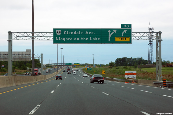
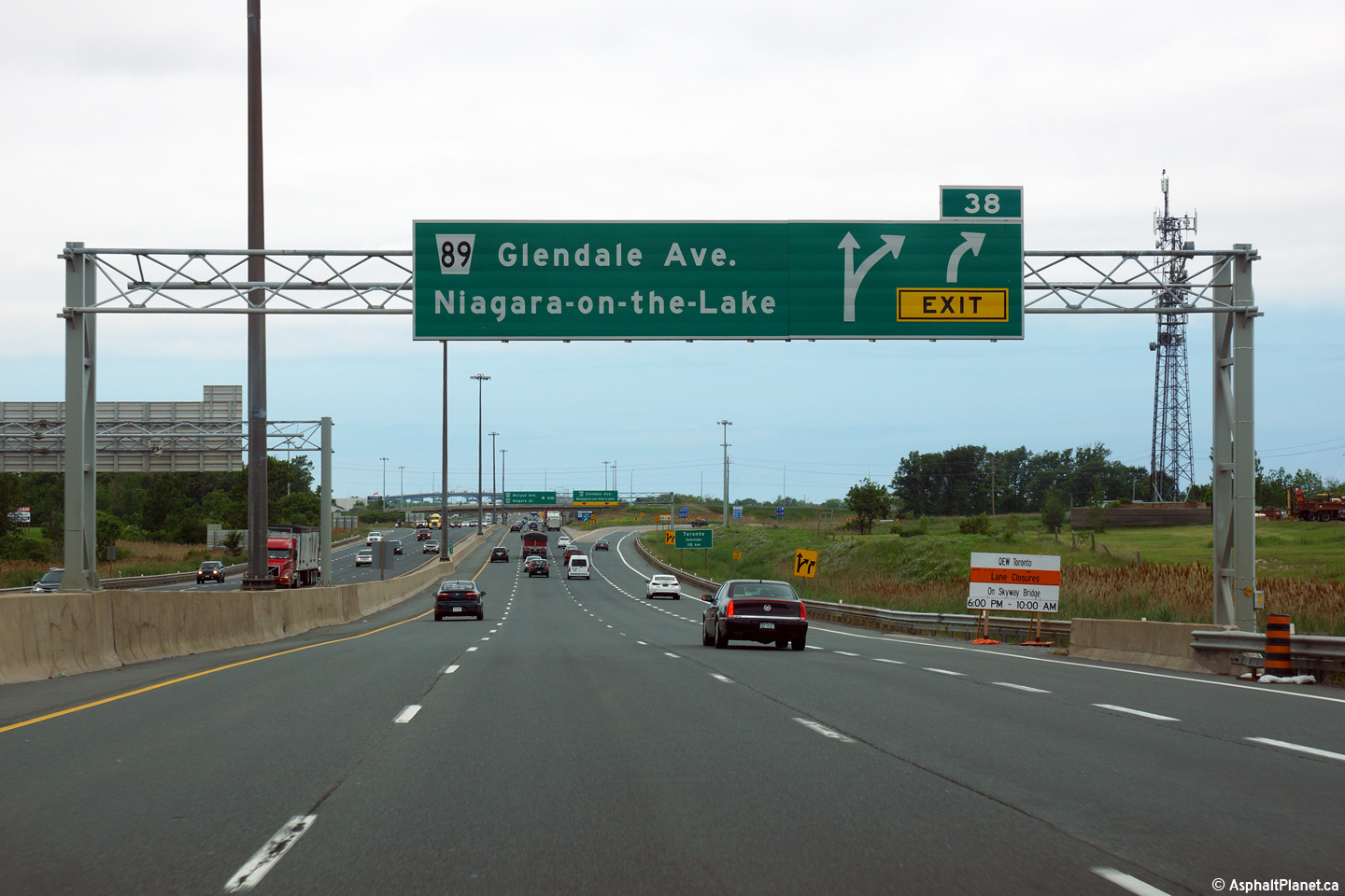
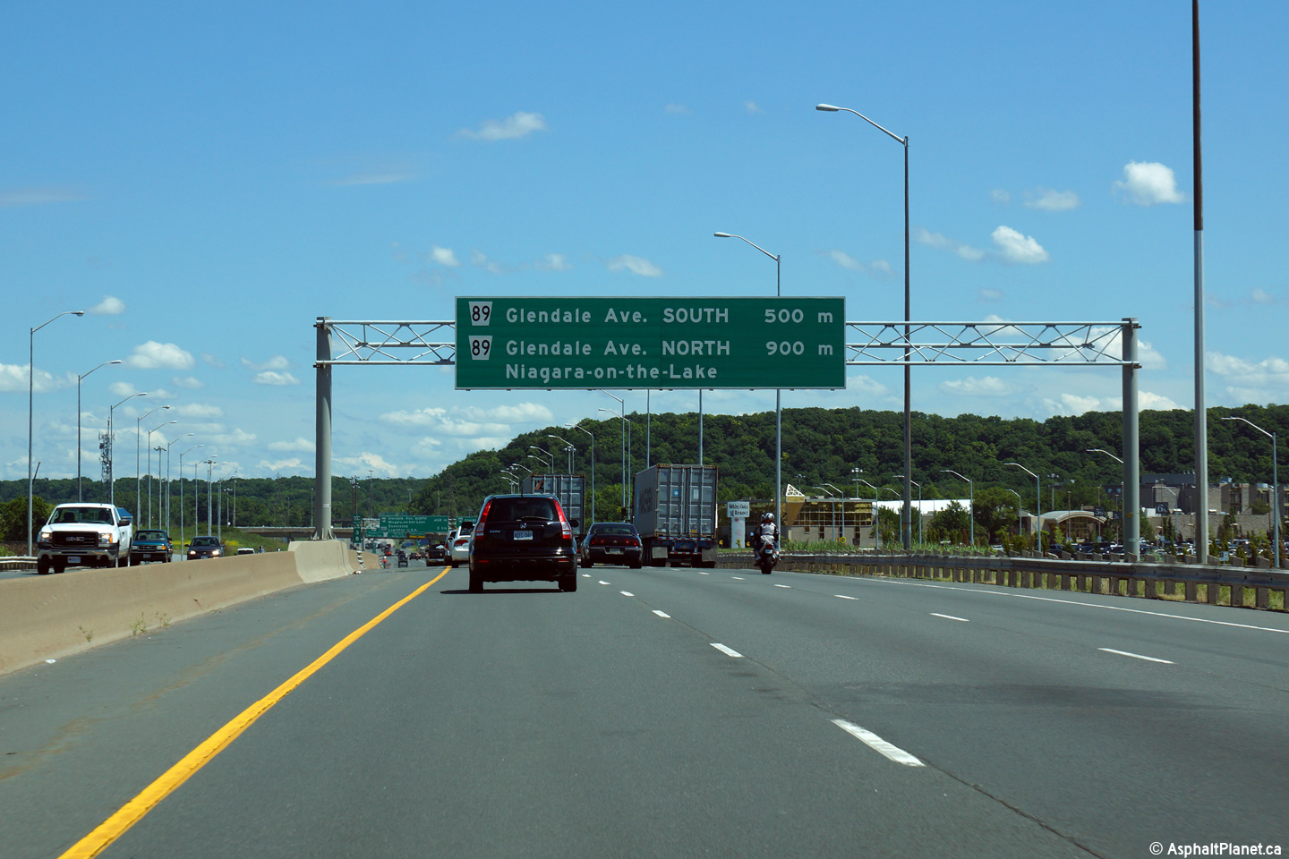
| Town of Niagara-on-the-Lake Regional Municipality of Niagara |
Toronto-bound advanced signage for the Glendale Avenue interchange.
The fourth Toronto-bound lane of the QEW that entered the highway from
Highway 405 quickly departs at Glendale Road. Photo taken: June 19th, 2015. |
 (720x480) (720x480)(1440x960) (2400x1600) |
||
| Town of Niagara-on-the-Lake Regional Municipality of Niagara |
Signage at the Toronto-bound off-ramp to Glendale Avenue. Photo taken: June 19th, 2015. |
 (720x480) (720x480)(1440x960) (2400x1600) |
||
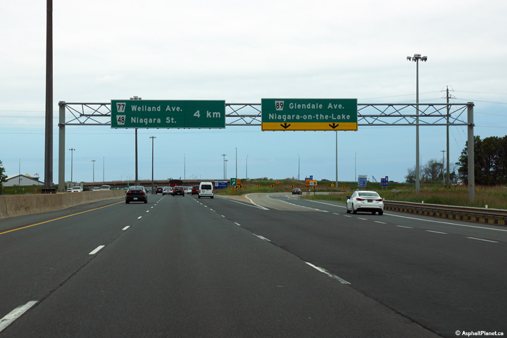
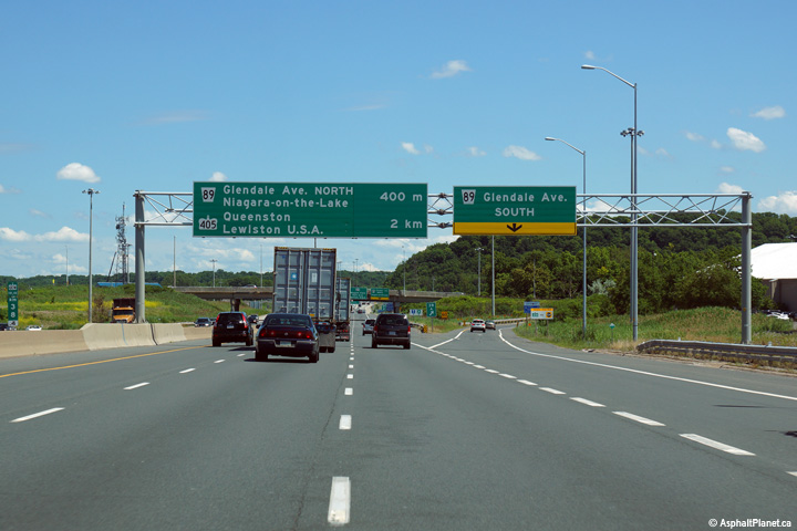
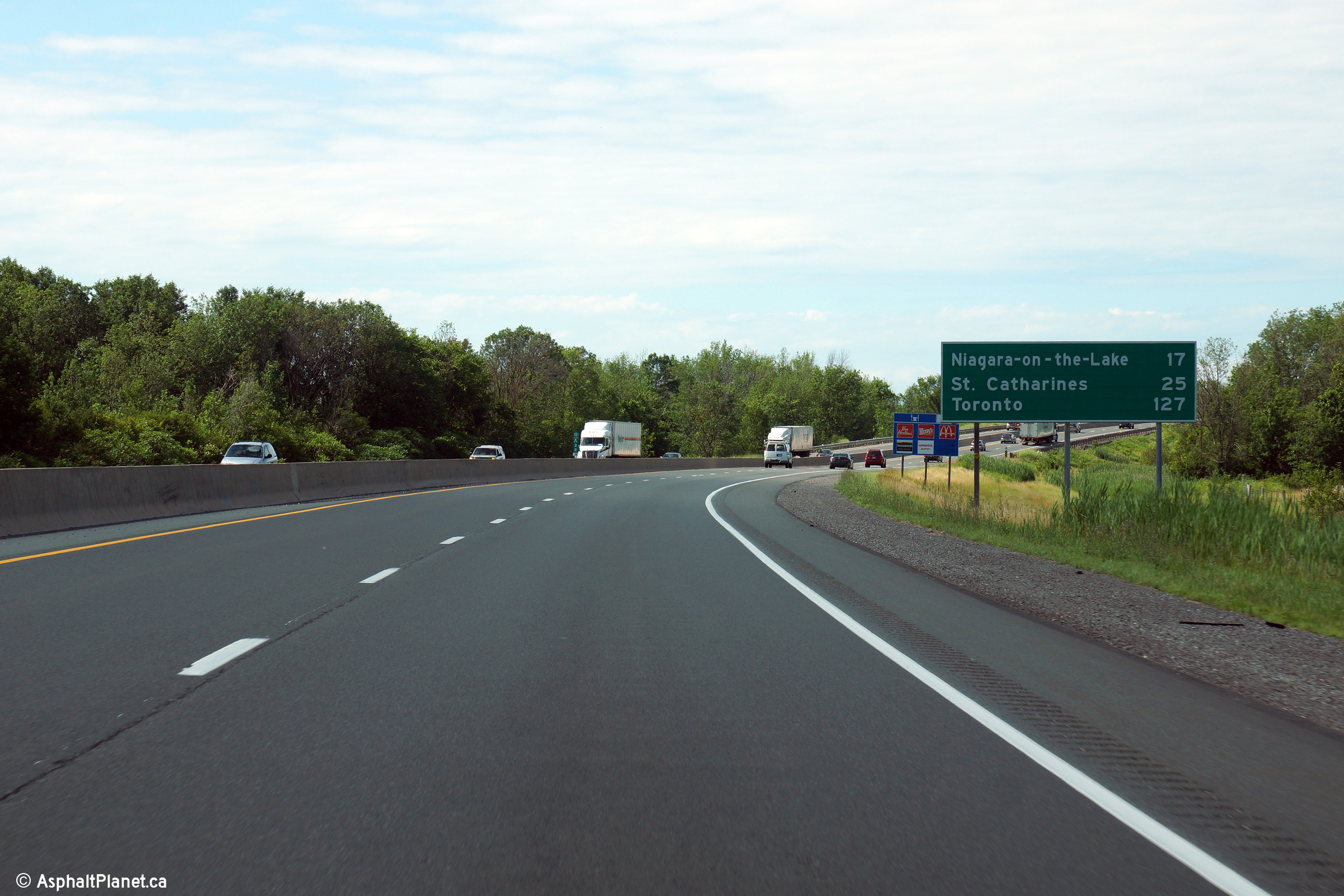
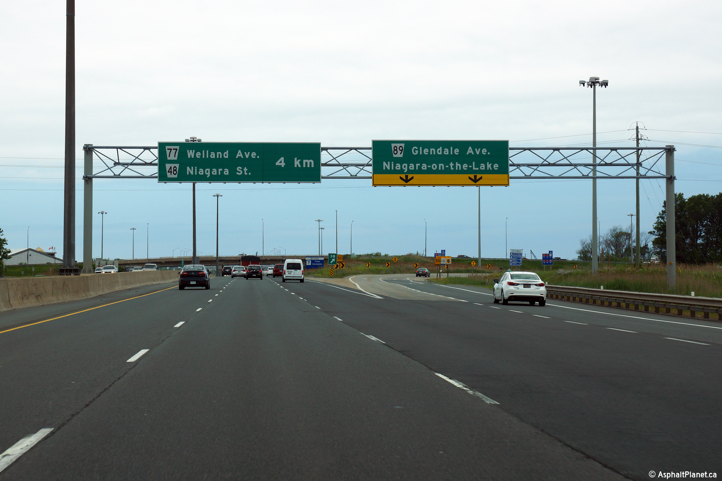
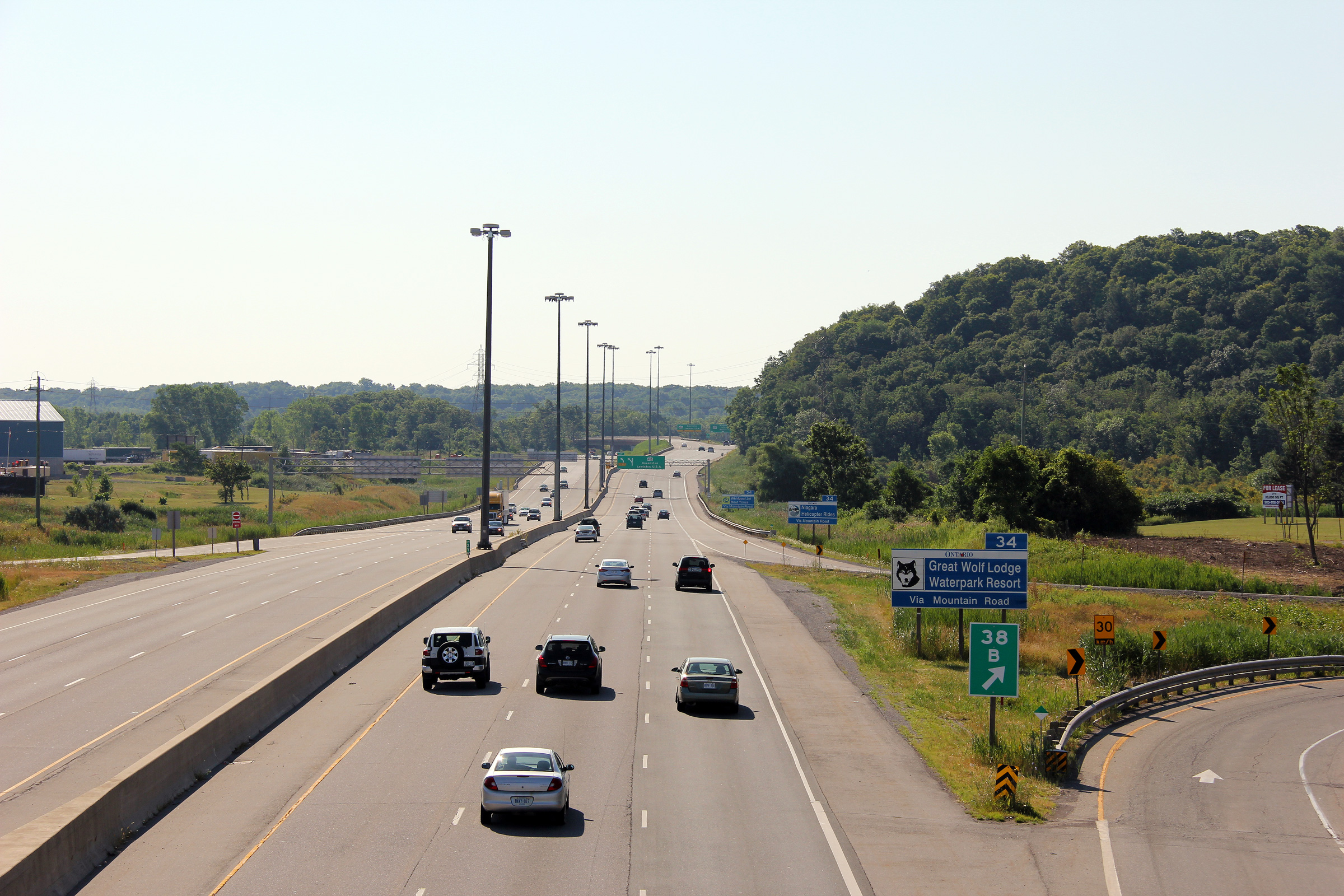
| Town of Niagara-on-the-Lake Regional Municipality of Niagara |
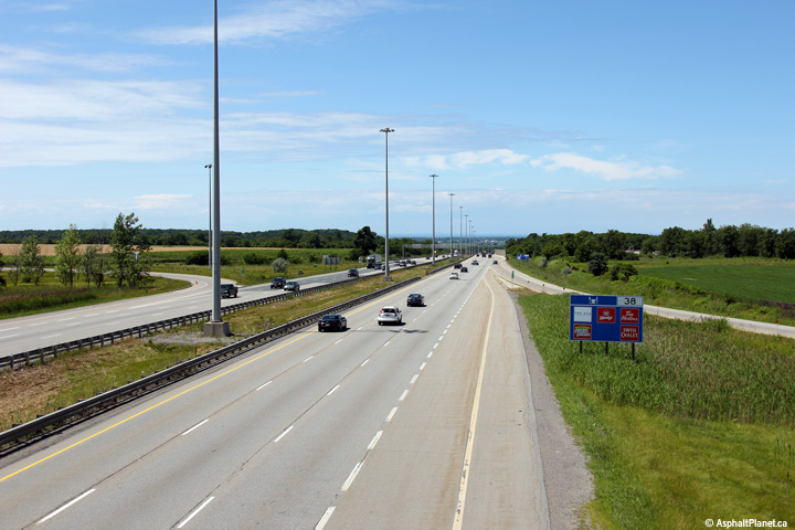
The QEW looking Niagara-bound from the Glendale Avenue overpass. Glendale
Avenue is located roughly at kilometre marker 38. In the
distance of this photo, the Highway 405 interchange is visible.
Highway 405 heads from the QEW easterly to the Queenston-Lewiston
International Bridge. Photos taken: July 30th, 2011. |
(720x480)
(1440x960)
(2400x1600) |
||
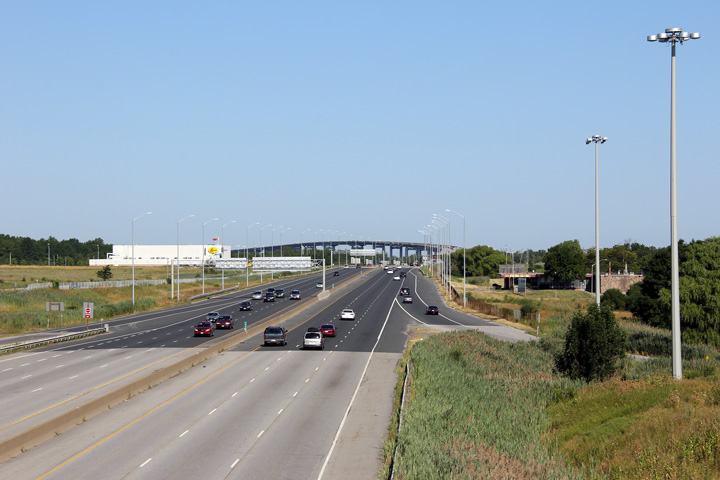
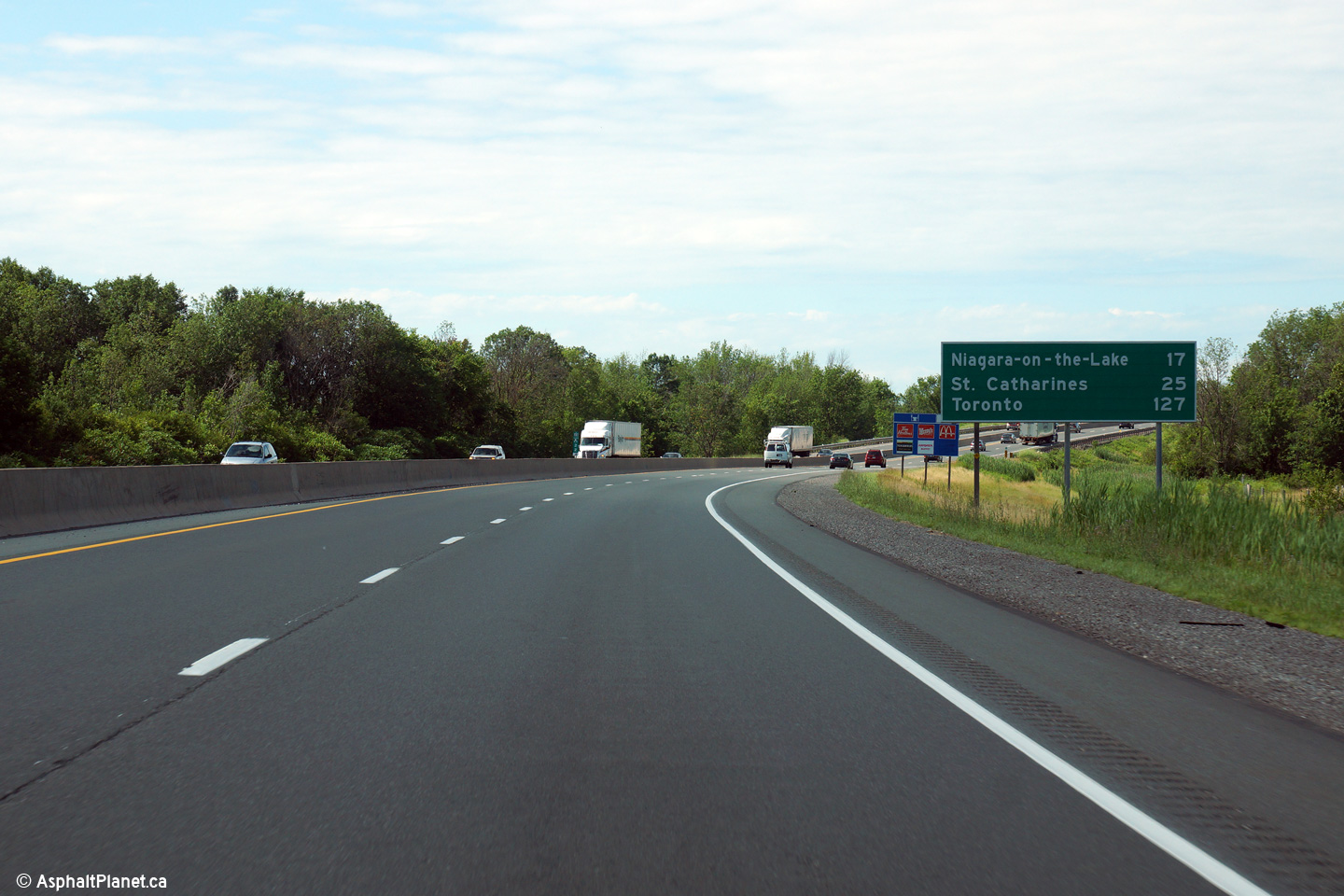
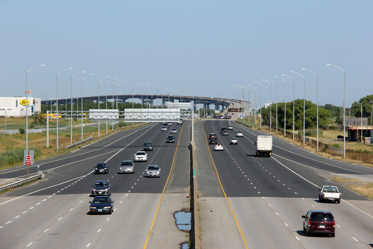
| Town of Niagara-on-the-Lake Regional Municipality of Niagara |
The QEW looking Toronto-bound from the Glendale Avenue overpass. In the
distance of this photo, the rather impressive Garden City (Homer) Skyway can
be seen. The Garden City Skyway was the second Skyway to be
constructed on the QEW, bypassing the old congested alignment that crossed
the Welland Canal via the Homer Lift Bridge. Photos taken: July 30th, 2011 |
(720x480)
(1440x960)
(2400x1600) |
||
| Town of Niagara-on-the-Lake Regional Municipality of Niagara |
Signage at the off-ramp to Glendale Avenue North. Motorists are given
their first notice that the upcoming Highway 405 interchange departs from
the left at this point. Photo taken: July 10th, 2014. |
 (720x480) (720x480)(1440x960) (2400x1600) |
||
| Town of Niagara-on-the-Lake Regional Municipality of Niagara |
Signage at the off-ramp to Glendale Avenue South from the Fort Erie-bound
QEW. Photo taken: July 10th, 2014. |
 (720x480) (720x480)(1440x960) (2400x1600) |
||
| Town of Niagara-on-the-Lake Regional Municipality of Niagara |
Advanced signage for the Glendale Avenue interchange along the Fort
Erie-bound QEW. Photo taken: July 10th, 2014. |
 (720x480) (720x480)(1440x960) (2400x1600) |
||
| Town of Niagara-on-the-Lake Regional Municipality of Niagara |
Overhead changeable message sign on approach to the Garden City Skyway. Photo taken: July 30th, 2011. |
 (720x480) (720x480)(1440x960) (2400x1600) |
||
| Click here for Burlington to Toronto Images | ||||
Queen Elizabeth Way Images Index Page 2 Images ->
<- Highway 811 Images Back to Queen Elizabeth Way Highway 2 Images ->
Copyright (c) 2004-2015, Scott Steeves (Webmaster) scott@asphaltplanet.ca


