AsphaltPlanet.ca > OntHighways > QEW > Images > Page 2
Queen Elizabeth Way - Images
<- Page 1 Page 2 - Niagara-on-the-Lake to Stoney Creek Page 3 ->
Photos shown in this table are arranged from South (Fort Erie) to North (Toronto):
| Proper Municipality Name | Photo Description | Photo | ||
|
Pictures taken from driver's perspective appear offset from centre-line pictures: |
Toronto- Bound |
Fort Erie- Bound |
||
| Continued from Fort Erie to Niagara-on-the-Lake Images | ||||
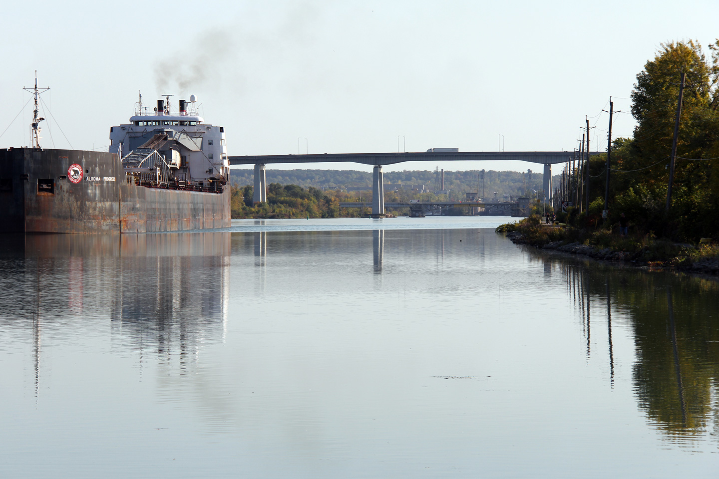
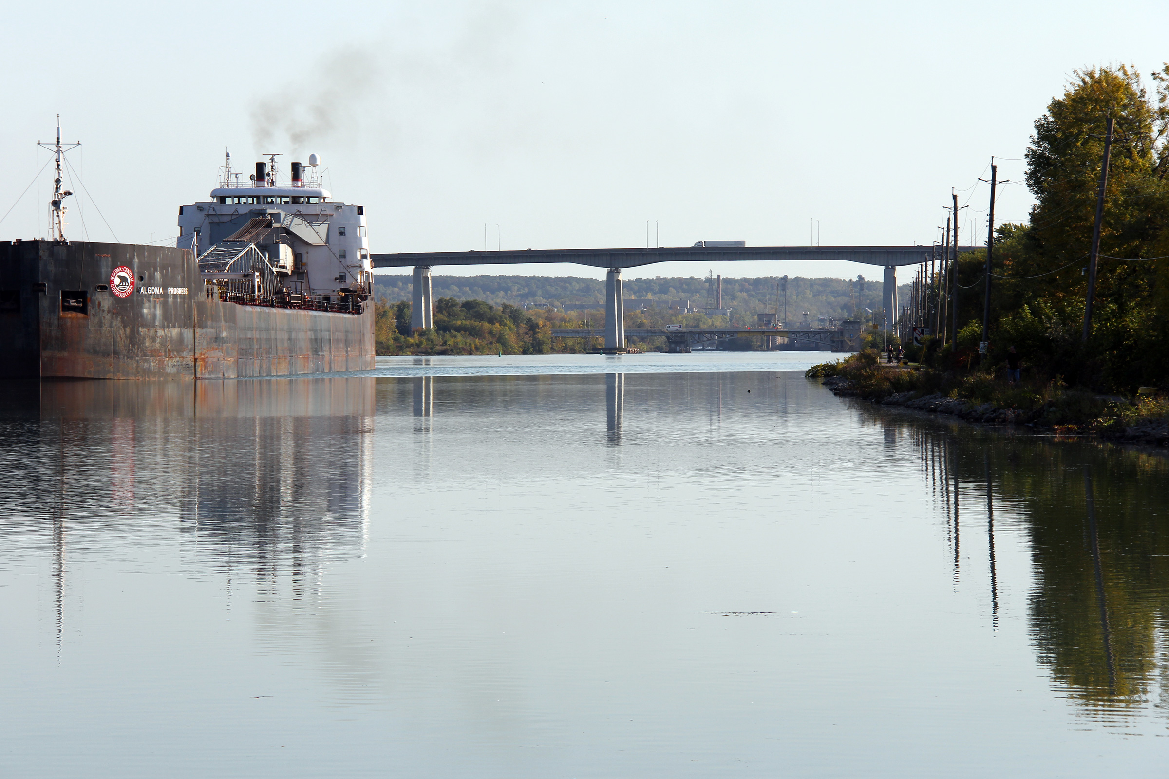
| City of St. Catharines Regional Municipality of Niagara |
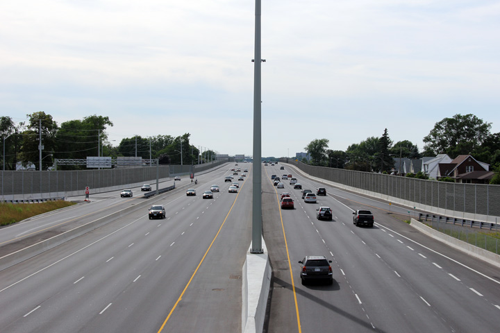
View looking southerly as the Algoma Princess overshadows the immense Garden
City Skyway that carries Queen Elizabeth Way (QEW) traffic high above the Welland
Canal. Photo taken: October 7th, 2011. |
 |
||
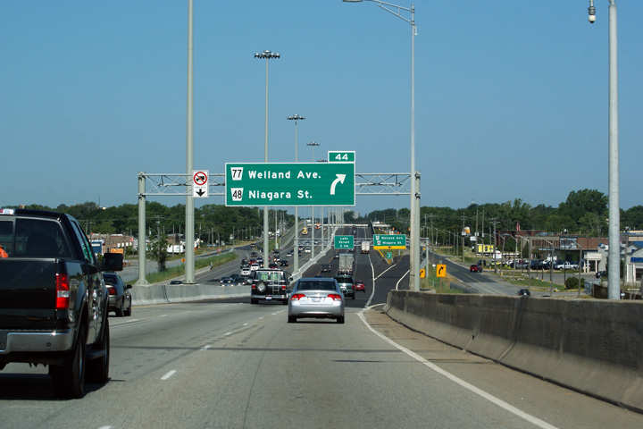
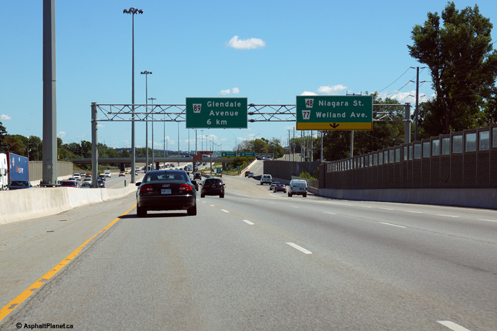
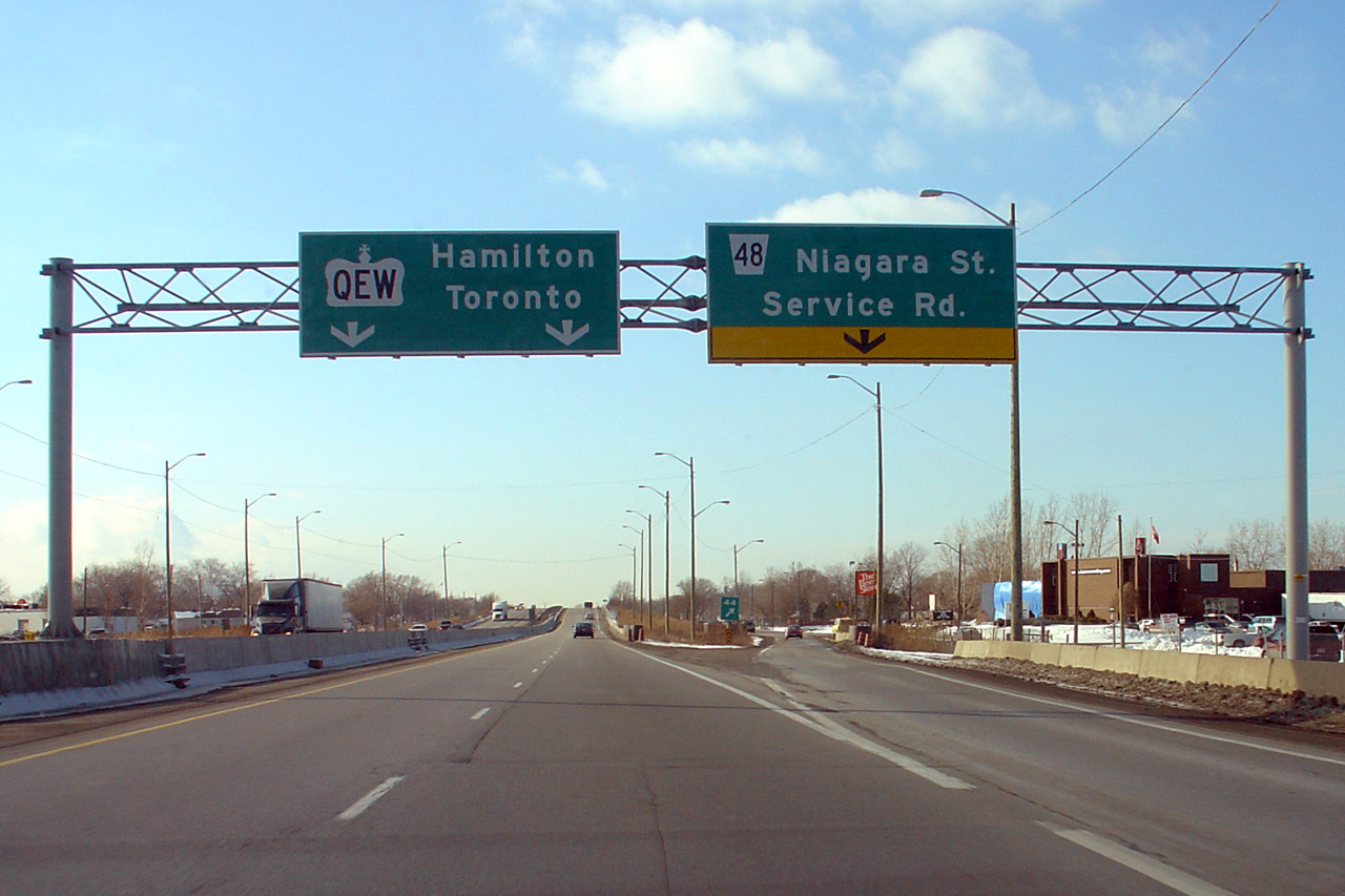
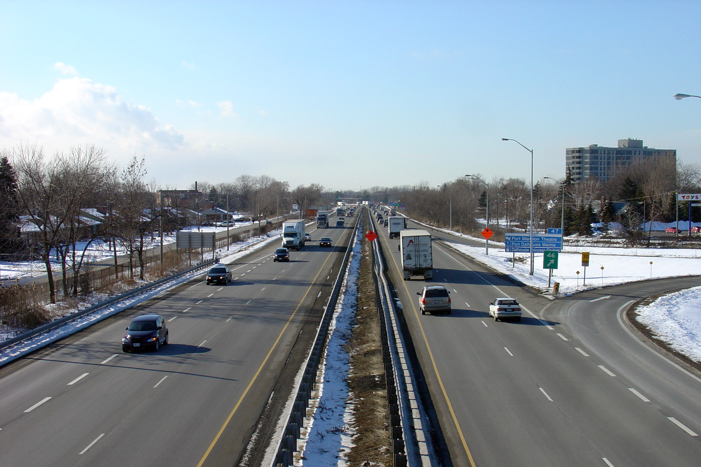
| City of St. Catharines Regional Municipality of Niagara |
This picture shows the advance signage for the Niagara Street off-ramp as the QEW descends from high atop the Garden City Skyway.
Picture taken: July 30th, 2011. |
 (720x480) (720x480)(1440x960) (2400x1600) |
||
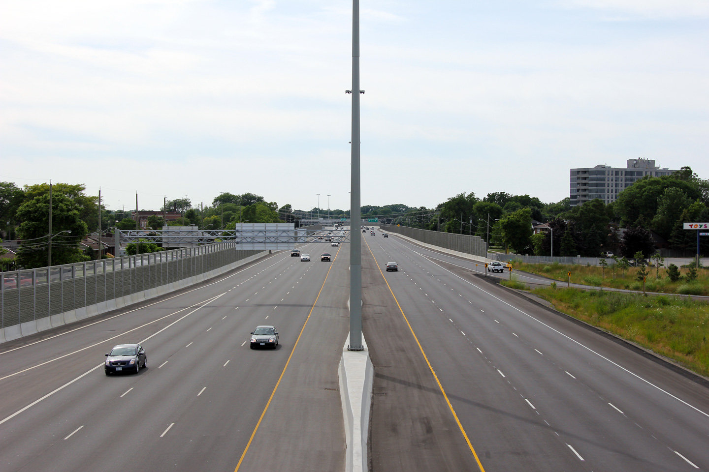
| City of St. Catharines Regional Municipality of Niagara |
Two views of different incarnations of the overhead signage and accompanying highway off-ramp for Niagara Street. The upper photo is obviously from the days when the QEW had only four-lanes through St. Catharines, while the lower photo shows the current (as of 2011) six lane highway through the Garden City.
Upper photo taken: February 23rd, 2005.
Lower photo taken: July 30th, 2011. |
|
||
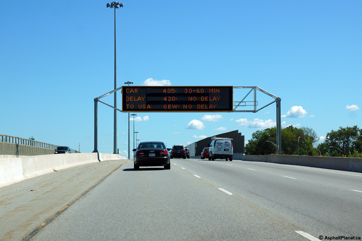
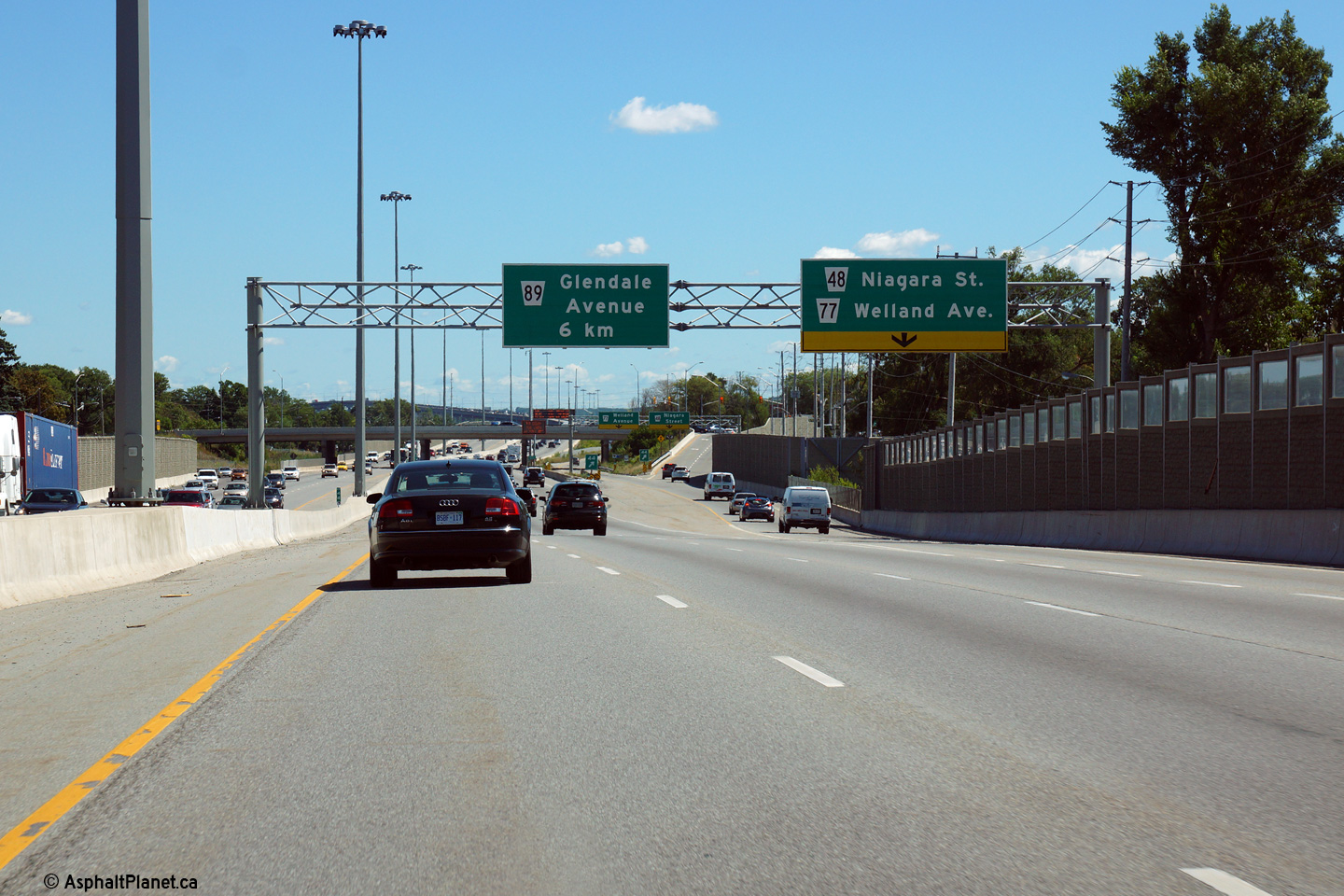
| City of St. Catharines Regional Municipality of Niagara |
This overhead changeable message sign stands over the Niagara-bound lanes of
the QEW at the Welland Avenue underpass. Photo taken: August 28th, 2014. |
 (720x480) (720x480)(1440x960) (2400x1600) |
||
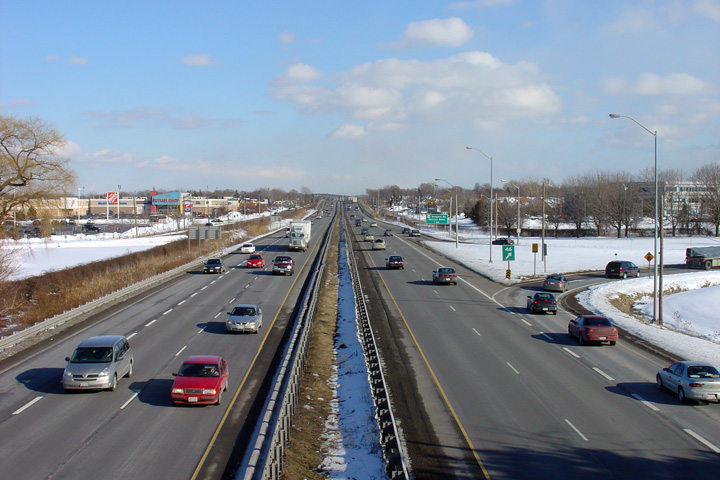
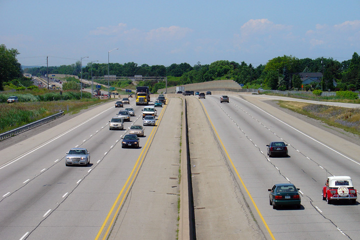
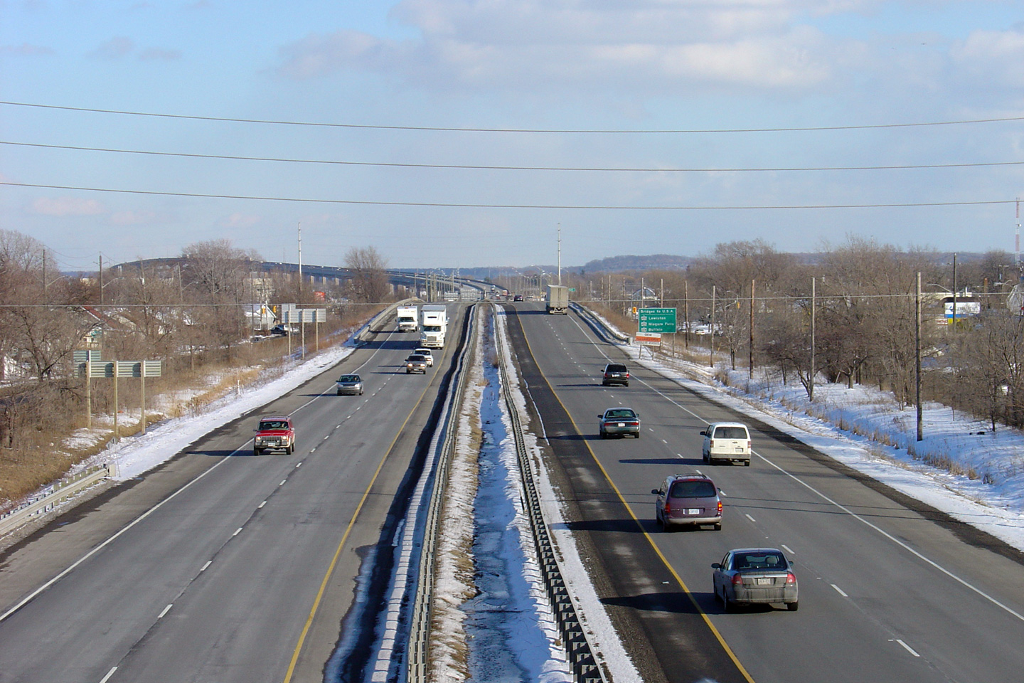
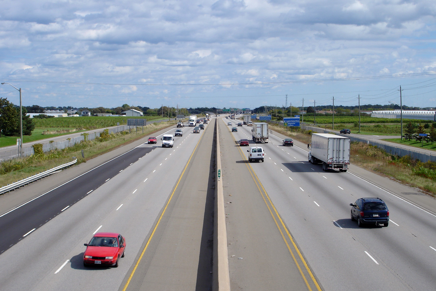
| City of St. Catharines Regional Municipality of Niagara |
The QEW looking Fort Erie-bound (east) from the Niagara Street overpass in St. Catharines. This overpass is located roughly at kilometre marker 44. In the distance of this photo, you can see the high level Garden City Skyway that carries the QEW over the Welland Canal.
Upper photo taken: February 23rd, 2005.
Lower photo taken: July 1st, 2011. |
 |
||
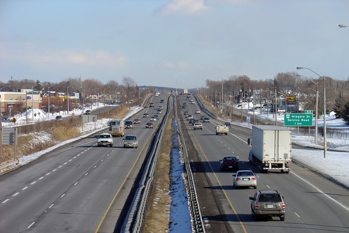
| City of St. Catharines Regional Municipality of Niagara |
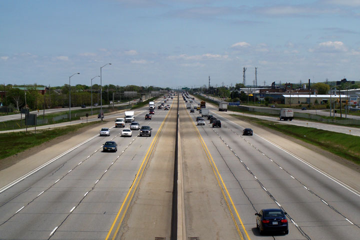
Highway QEW looking Toronto-bound (west) from the Niagara Street overpass. In the distance of the upper photo, the very low standard western side of the Niagara Street interchange can be seen. Notice that the on-ramp to the Toronto bound lanes (on the right side of the photo) has no acceleration ramp. A fatal accident in 2006 prompted the entrance ramp to be extended later that year. The ramp configuration was modified entirely as part of the six-laning contract.
Upper photo taken: February 23rd, 2005.
Lower photo taken: July 1st, 2011. |
 |
||
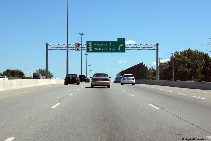
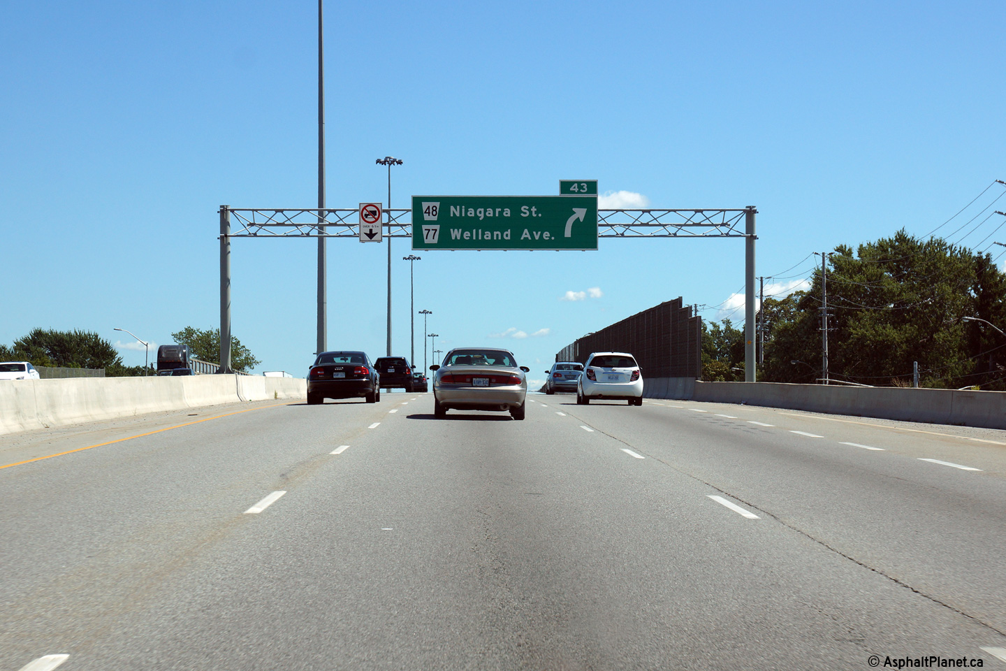
| City of St. Catharines Regional Municipality of Niagara |
Niagara-bound signage at the Niagara Street interchange. Photo taken: August 28th, 2014. |
 (720x480) (720x480)(1440x960) (2400x1600) |
||
| City of St. Catharines Regional Municipality of Niagara |
Advanced signage for the Niagara Street interchange. Photo taken: August 28th, 2014. |
 (720x480) (720x480)(1440x960) (2400x1600) |
||
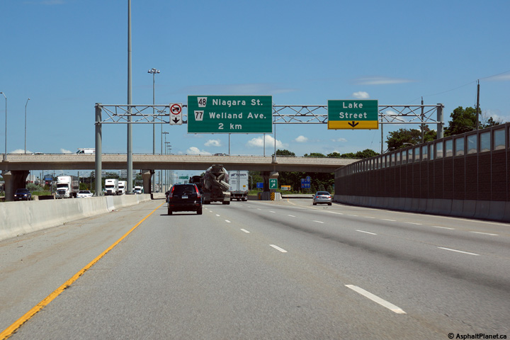
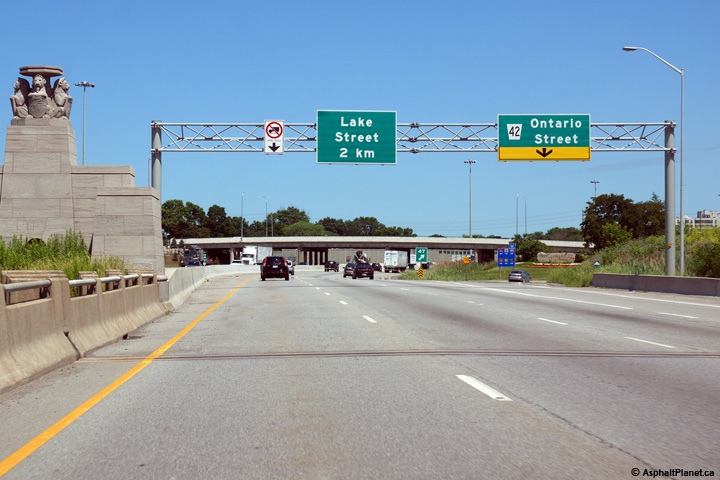
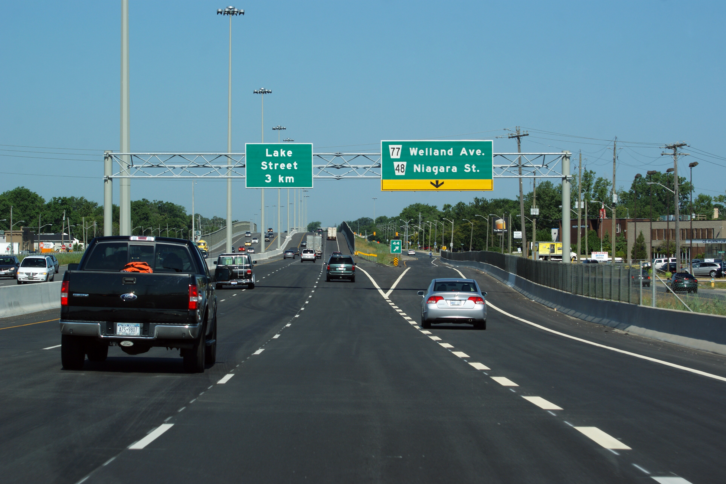
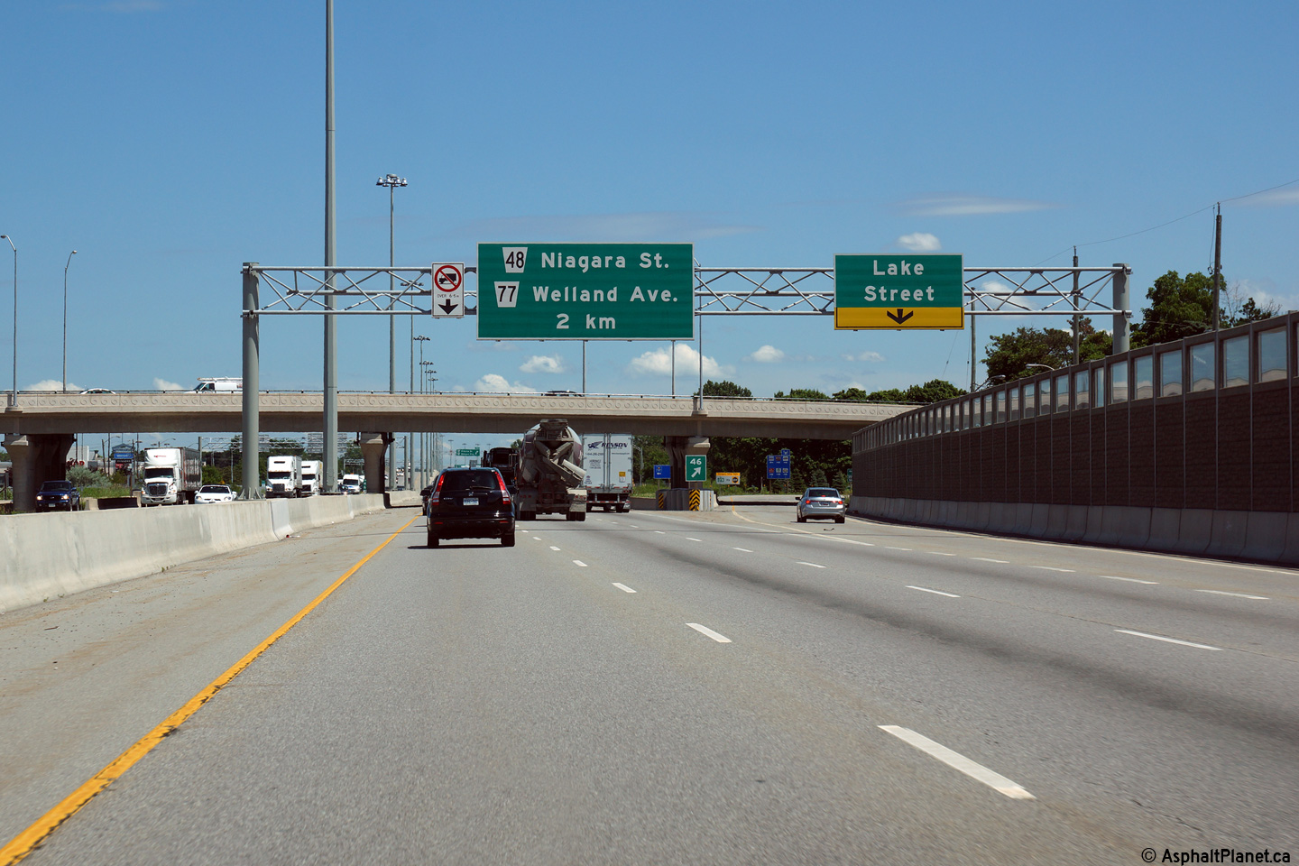
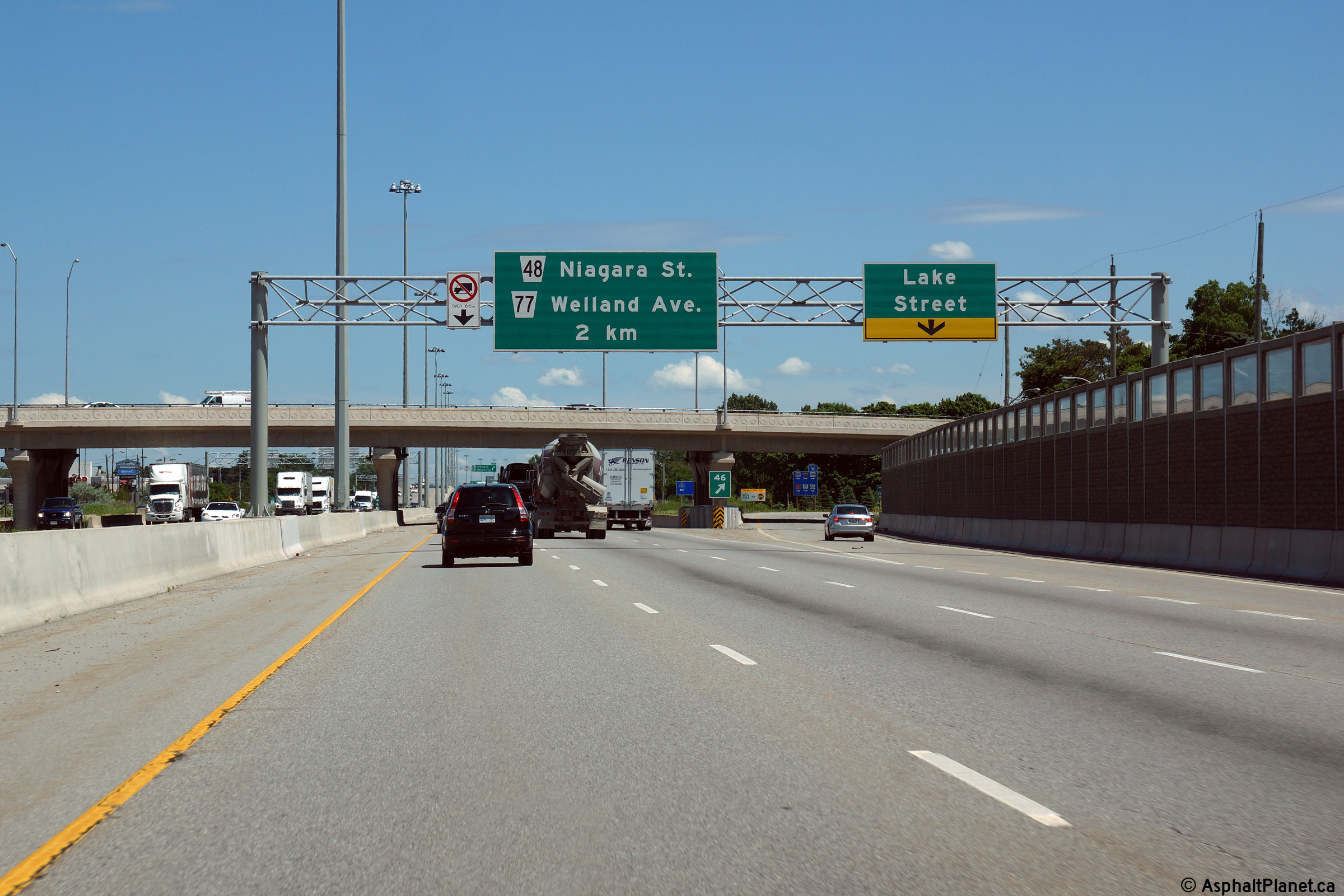
| City of St. Catharines Regional Municipality of Niagara |
Toronto-bound advanced signage for the ramp to Lake Street. Photo taken: July 30th, 2011. |
 (720x480) (720x480)(1440x960) (2400x1600) |
||
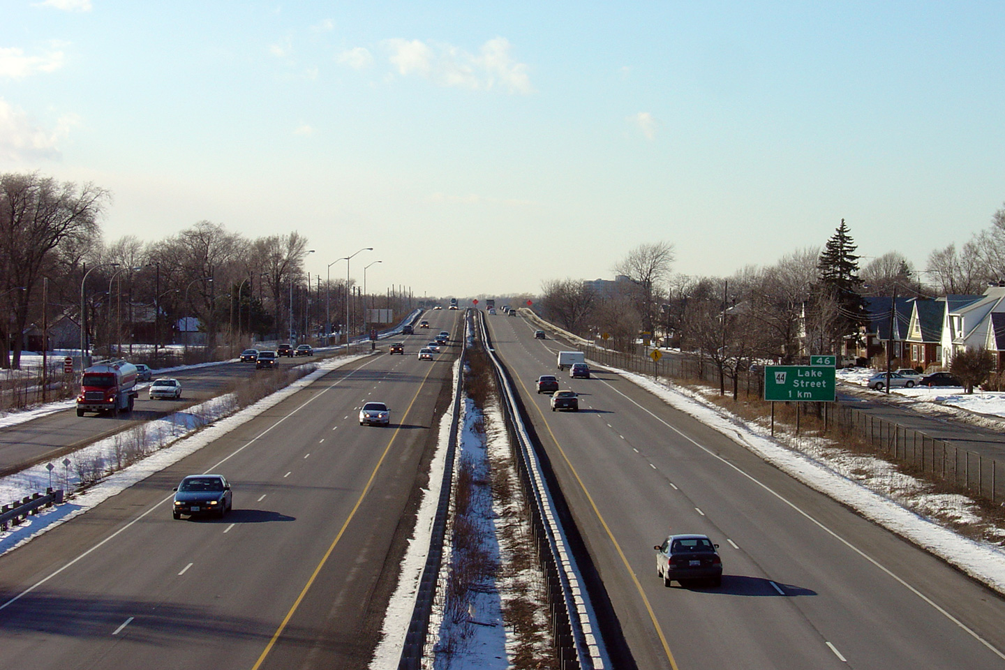
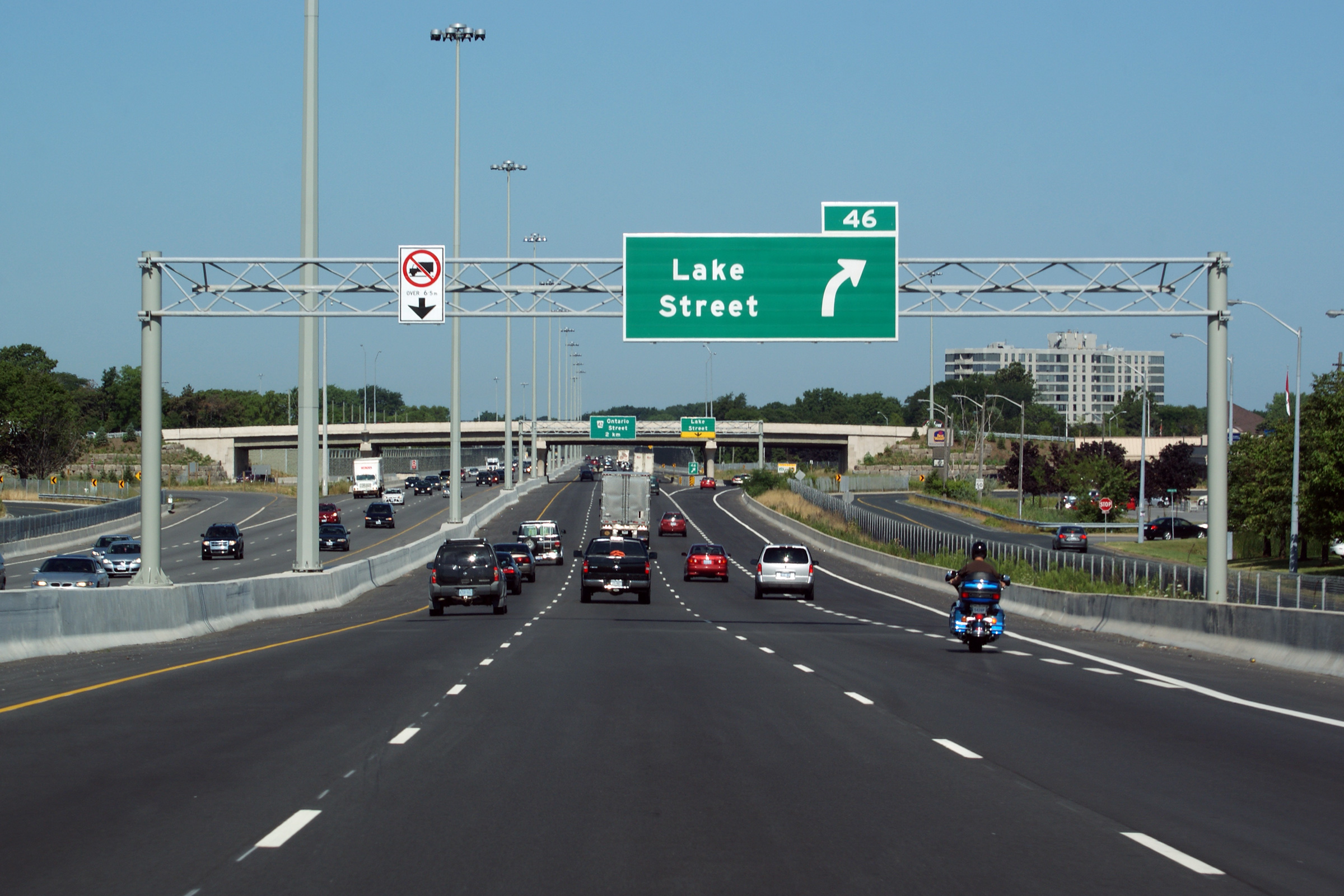
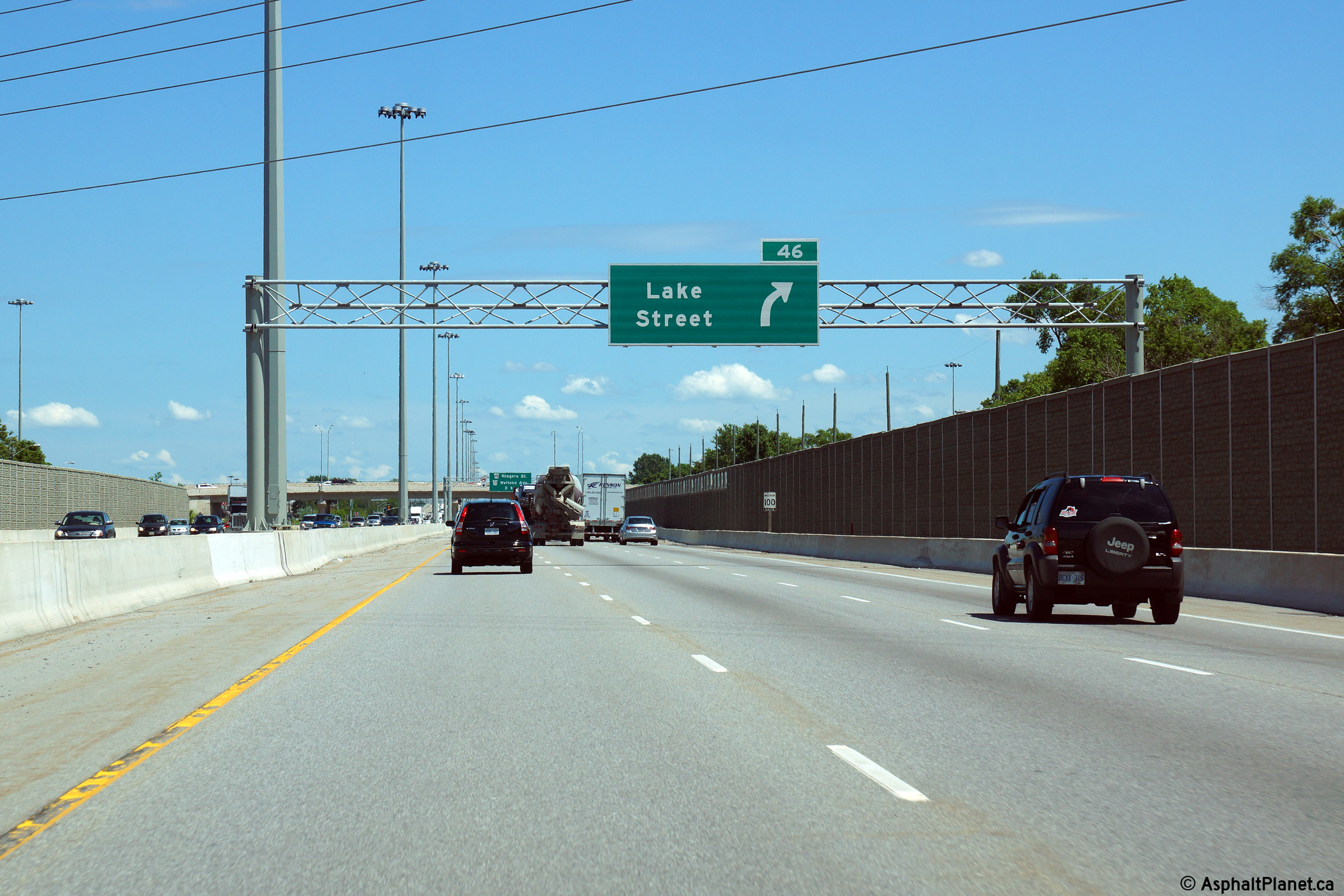
| City of St. Catharines Regional Municipality of Niagara |
Toronto-bound signage for the off-ramp to Lake Street. Photo taken: July 30th, 2011. |
 (720x480) (720x480)(1440x960) (2400x1600) |
||
| City of St. Catharines Regional Municipality of Niagara |
A series of views looking Fort-Erie-bound from the Lake Street overpass. Upper two photos taken: February 23rd, 2005. Lower photo taken: July 1st, 2011. |
 |
||
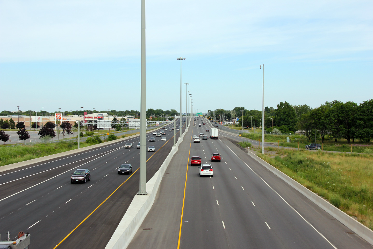
| City of St. Catharines Regional Municipality of Niagara |
Two views looking Toronto-bound from the Lake Street overpass. One of
the most pronounced design improvements at this interchange was moving the
bullnose of both the Toronto- and Niagara-bound off-ramps to Lake Street so
that they
depart the freeway in advance of the overpass. The dark shadows cast
by an overpass tend to hide a departing off-ramp located directly
after the structure. This situation is likely to result in an increased accident rate. Upper photo taken: February 23rd, 2005. Lower photo taken: July 1st, 2011. |
 |
||
| City of St. Catharines Regional Municipality of Niagara |
Niagara-bound off-ramp to Lake Street in St. Catharines. Photo taken: July 10th, 2014. |
 (720x480) (720x480)(1440x960) (2400x1600) |
||
| City of St. Catharines Regional Municipality of Niagara |
Niagara-bound advanced signage for the ramp to Lake Street. Photo taken: July 10th, 2014. |
 (720x480) (720x480)(1440x960) (2400x1600) |
||
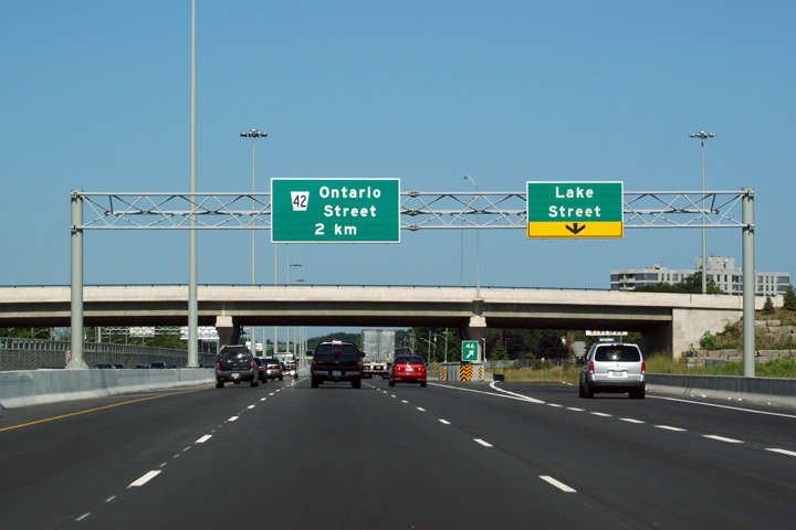
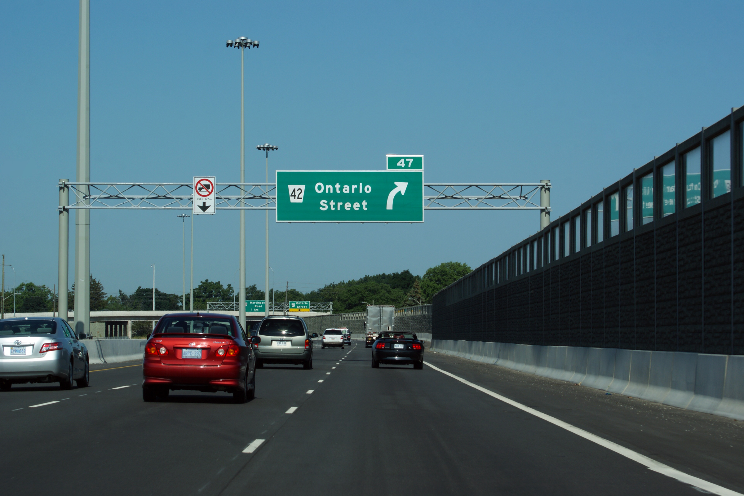
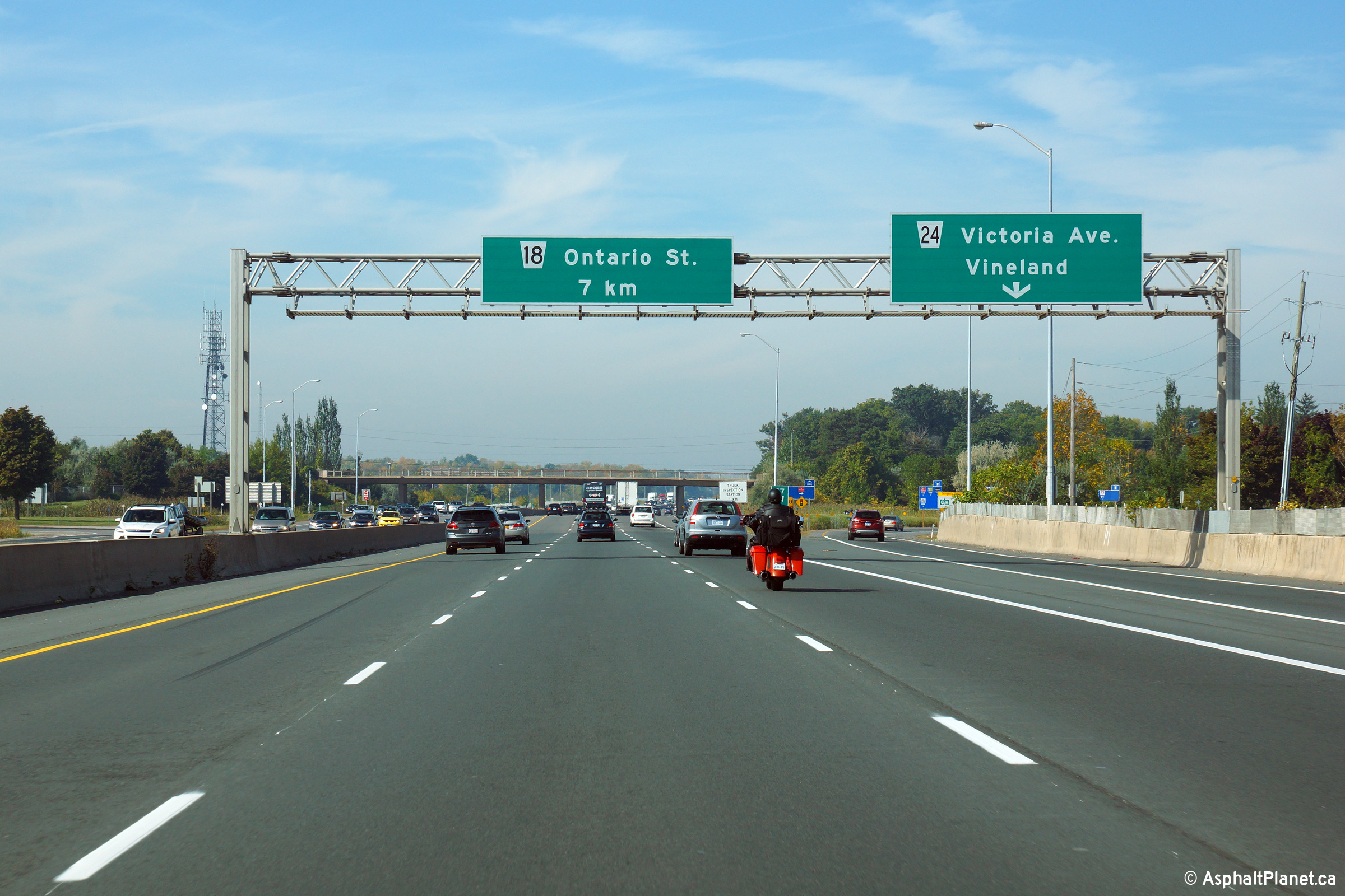
| City of St. Catharines Regional Municipality of Niagara |
Toronto-bound advanced signage for the ramp to Ontario Street. The
windows that have been incorporated into the top of the noise walls through
much of St. Catharines reduce the canyon effect of driving through the
city. Photo taken: July 1st, 2011. |
 (720x480) (720x480)(1440x960) (2400x1600) |
||
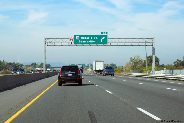
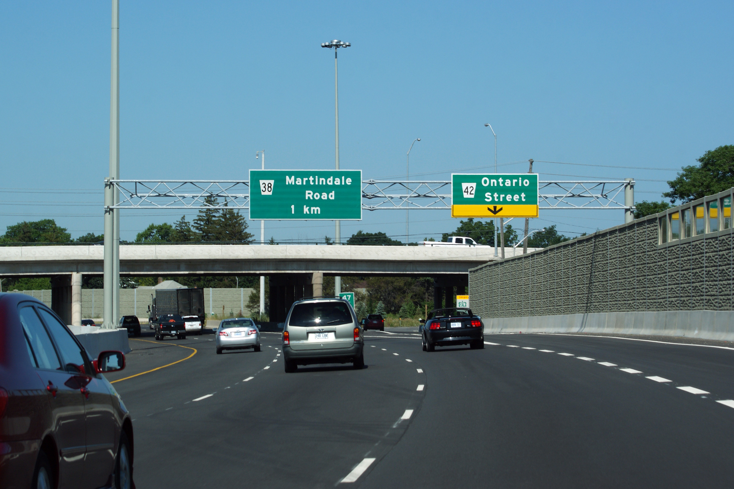
| City of St. Catharines Regional Municipality of Niagara |
Toronto-bound signage at the off-ramp to Ontario Street. Photo taken: July 1st, 2011. |
 (720x480) (720x480)(1440x960) (2400x1600) |
||
| City of St. Catharines Regional Municipality of Niagara |
Niagara-bound views from the Ontario Street overpass in St. Catharines. The
2005 photo shows that prior to the most recent upgrading project the QEW
passed through residential areas of the city without any acoustic
protection. Sound barriers were not legislated to be installed to
mitigate highway noise until the 1970s; highways such as the QEW that were constructed
before the environmental legislation that mandated sound mitigation was
enacted were grandfathered into the system, despite the fact that the QEW
likely exceeded MOE's residential noise guidelines. It wasn't until the QEW
was substantially altered that noise mitigation techniques were required. Upper photo taken: February 23rd, 2011. Lower photo taken: July 1st, 2011. |
 |
||
| City of St. Catharines Regional Municipality of Niagara |
Two views looking towards Toronto from the Ontario Street overpass towards
the historic Henley Bridges. One of the most striking differences
between the old and new highway photos is the improvement to the QEW's
geometry as the freeway crosses the Henley Bridges. Observe in the
2005 photo how the freeway lanes snake in and out on both the approaches to the Henley Bridges. During the reconstruction project that was
completed in 2011, the freeway alignment was straightened considerably. Upper photo taken: February 23rd, 2005. Lower photo taken: July 1st, 2011. |
 |
||
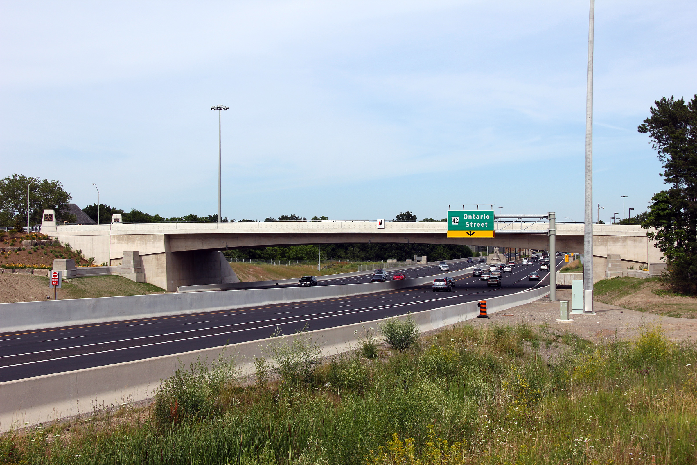
| City of St. Catharines Regional Municipality of Niagara |
The signage for the Ontario Street off-ramp is situated immediately on the
St. Catharines end of the Henley Bridge. Photo taken: July 10th, 2014. |
 (720x480) (720x480)(1440x960) (2400x1600) |
||
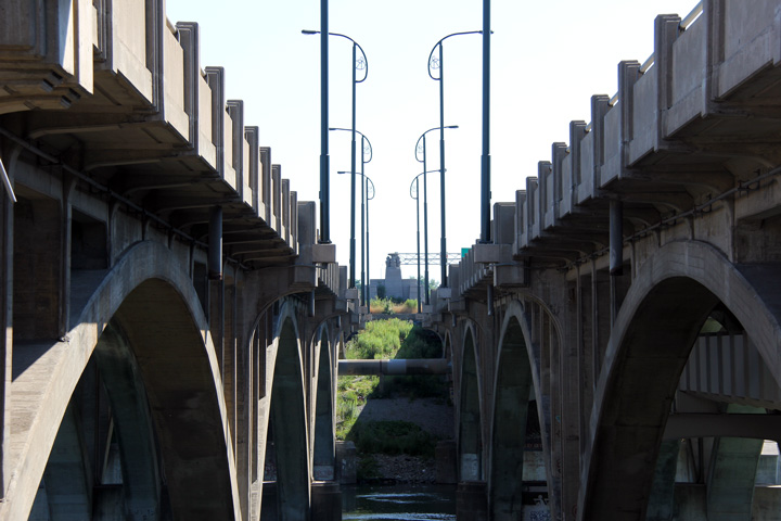
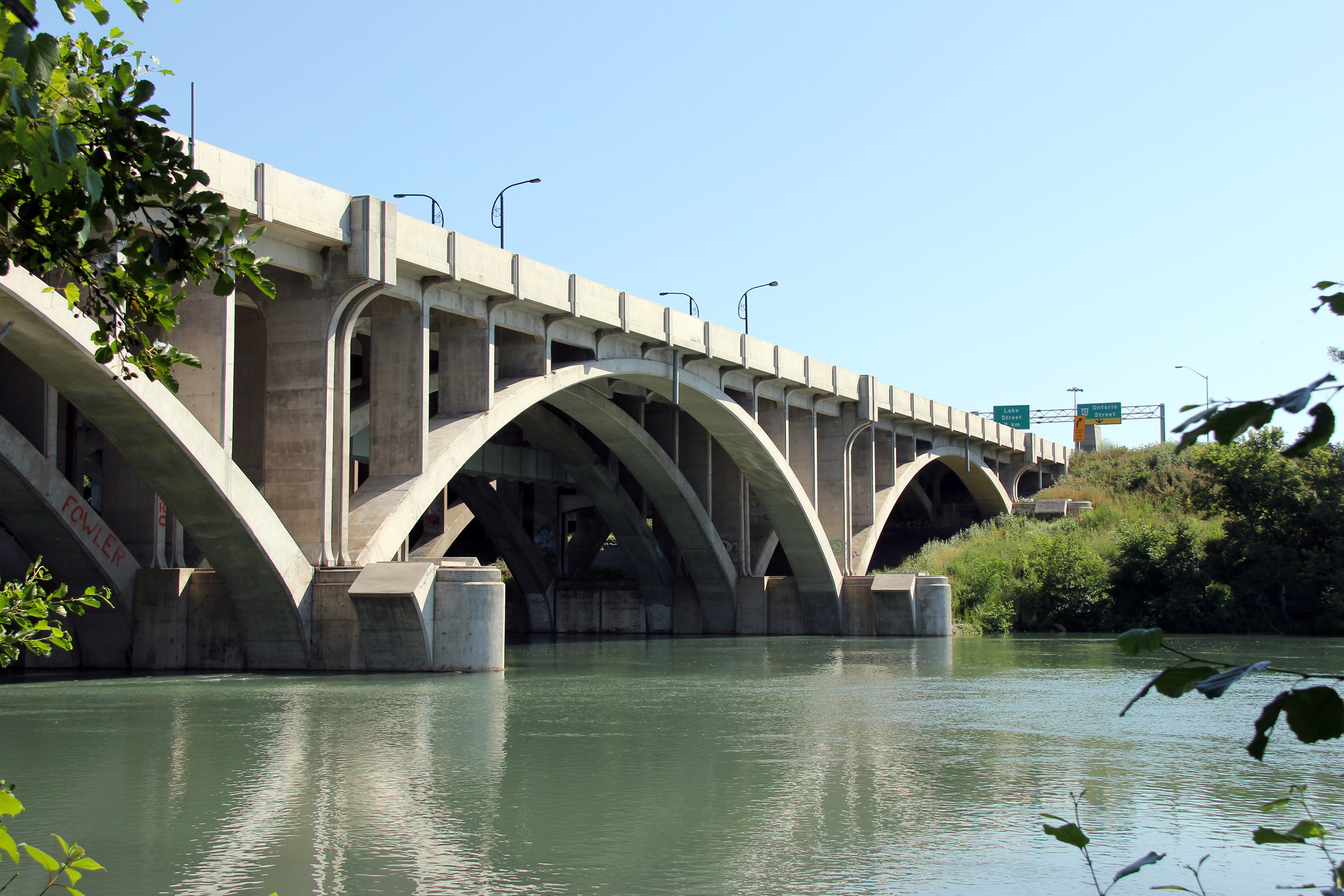
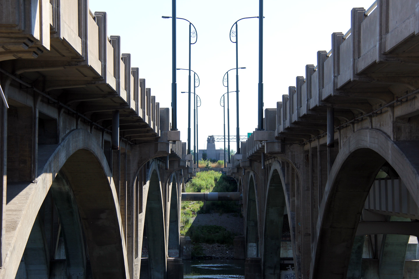
| City of St. Catharines Regional Municipality of Niagara |
The recently widened Henley bridges as seen from the shore of Twelve Mile
Creek. For both the Toronto bound and Fort Erie bound structure, the
pier bases have been poured wide enough for an additional arch to be
constructed to widen the structure yet again. In water construction
triggers approvals from the Federal Department of Fisheries, the local
Conservation Authority, and potentially Transport and Environment Canada
depending upon the scope of the work. It was prudent to complete
future in-water work for an ultimate eight-lane cross-section during the
2005-06 construction project to streamline the approvals process for any
potential widening. Photo taken: July 30th, 2011. |
 |
||
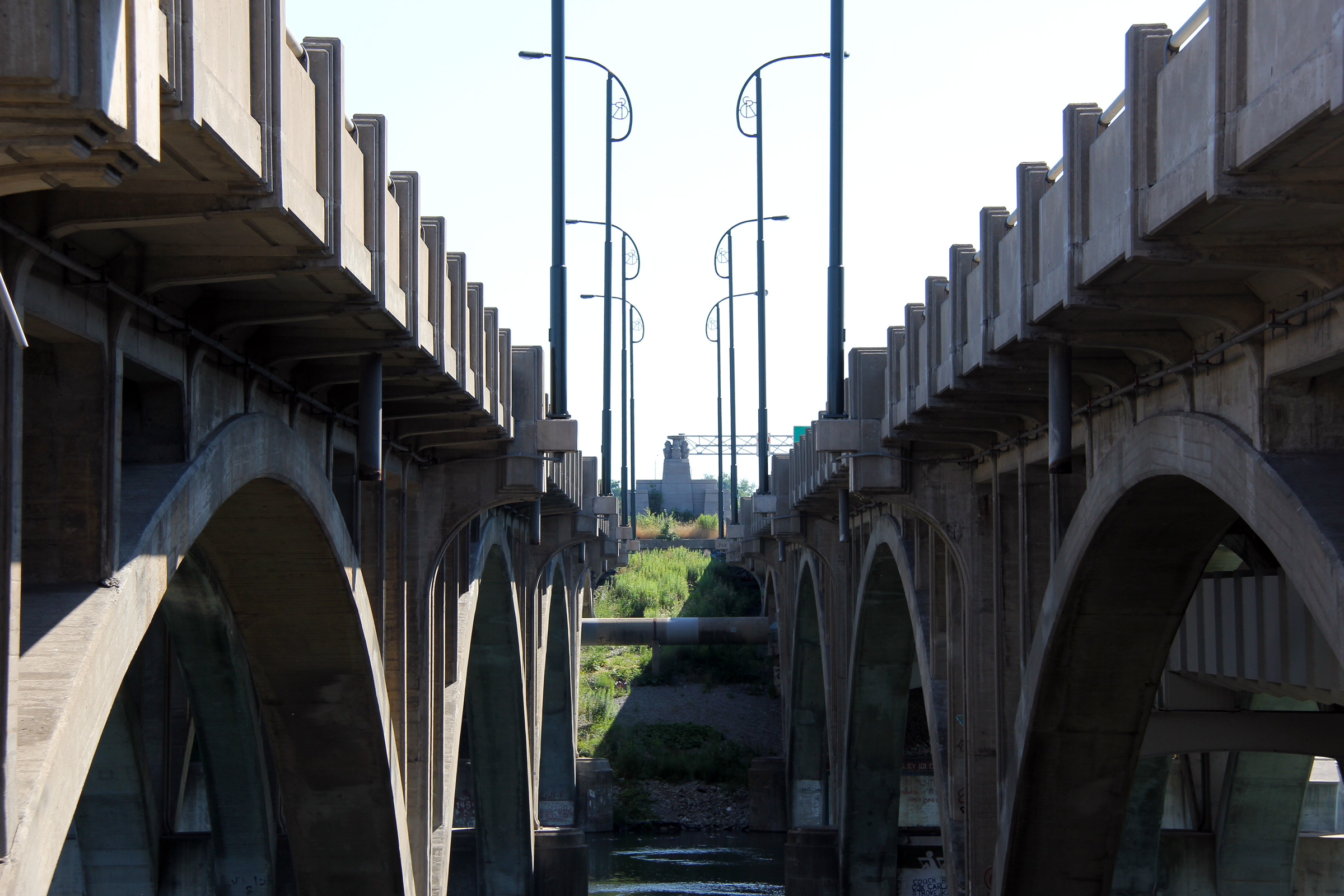
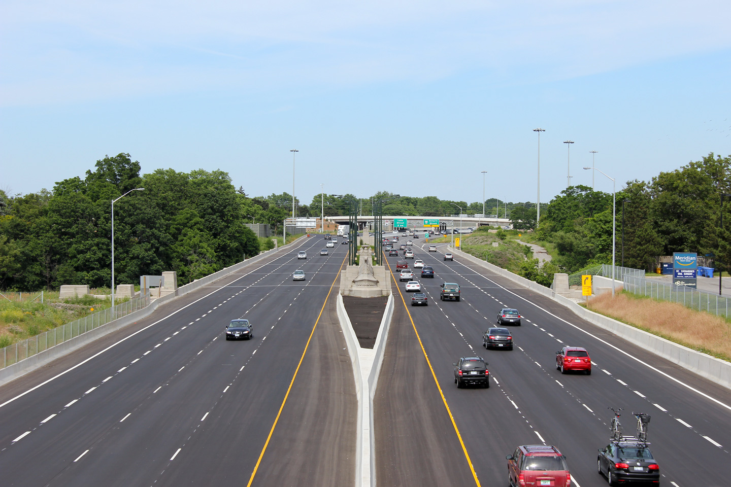
| City of St. Catharines Regional Municipality of Niagara |
View looking through the median of the Queen Elizabeth Way through St.
Catharines. Few highway bridges in Ontario have been constructed with
as many decorative elements as the Henley Bridge.
TheKingsHighway.ca has an excellent series of photos detailing both bridges
prior to widening that is worth a look. Photo taken: July 30th, 2011. |
 |
||
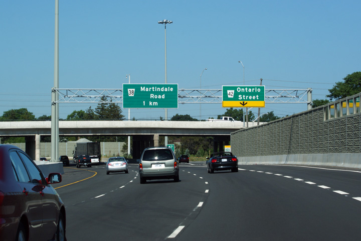
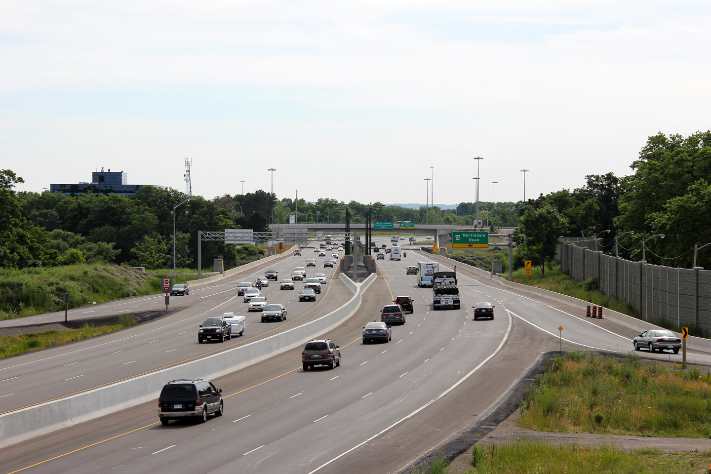
| City of St. Catharines Regional Municipality of Niagara |
This view looks Toronto-bound alongside the Queen Elizabeth Way facing the
Martindale Road overpass. Photo taken: July 30th, 2011. |
 (720x480) (720x480)(1440x960) (2400x1600) |
||
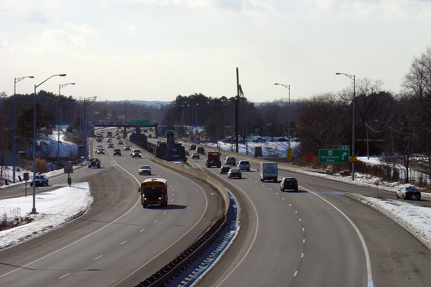
| City of St. Catharines Regional Municipality of Niagara |
Two views facing towards Fort Erie along the QEW from the Martindale Road
overpass in western St. Catharines. The 2005 photo shows a four lane
Queen Elizabeth Way crossing the historic Henley Bridges, while the 2011
photo shows the Henley Bridges after the QEW through St.
Catharines had been widened to six lanes. Upper photo taken: July 7th, 2005. Lower photo taken: July 1st, 2011. |
 |
||
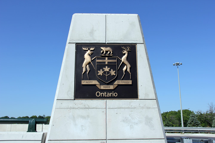
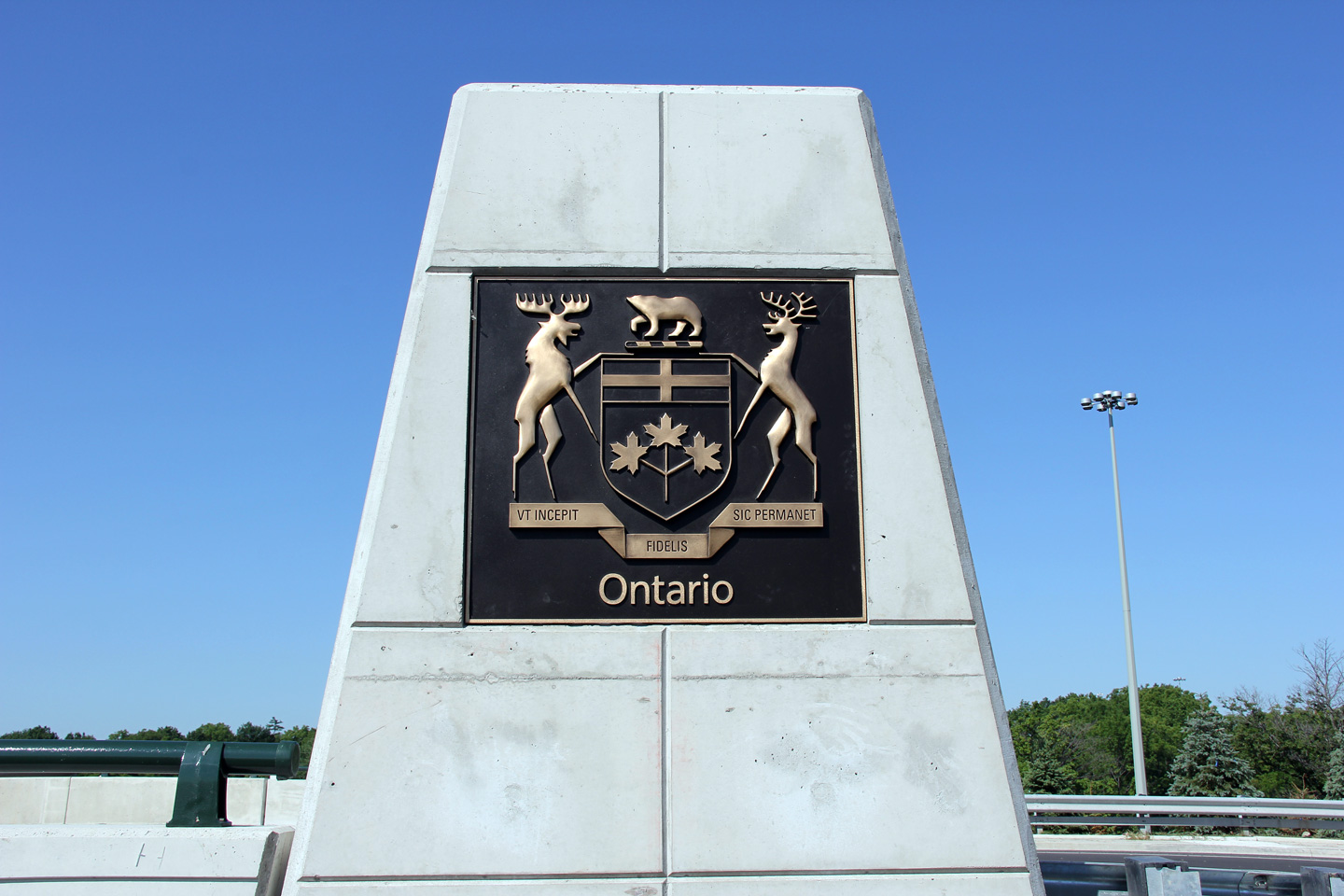
| City of St. Catharines Regional Municipality of Niagara |
The Ontario provincial Coat of Arms stands proudly on each of the four
ceremonial columns that mark the four corners of the Martindale Road bridge.
Each Coat of Arms carries an inscription of Latin
text that reads: "VT Incepit Fidelis Sic
Permanet", translated to English meaning "as she began loyal, so she
persists". Photo taken: July 30th, 2011. |
 (720x480) (1440x960) |
||
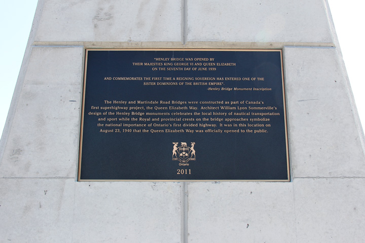
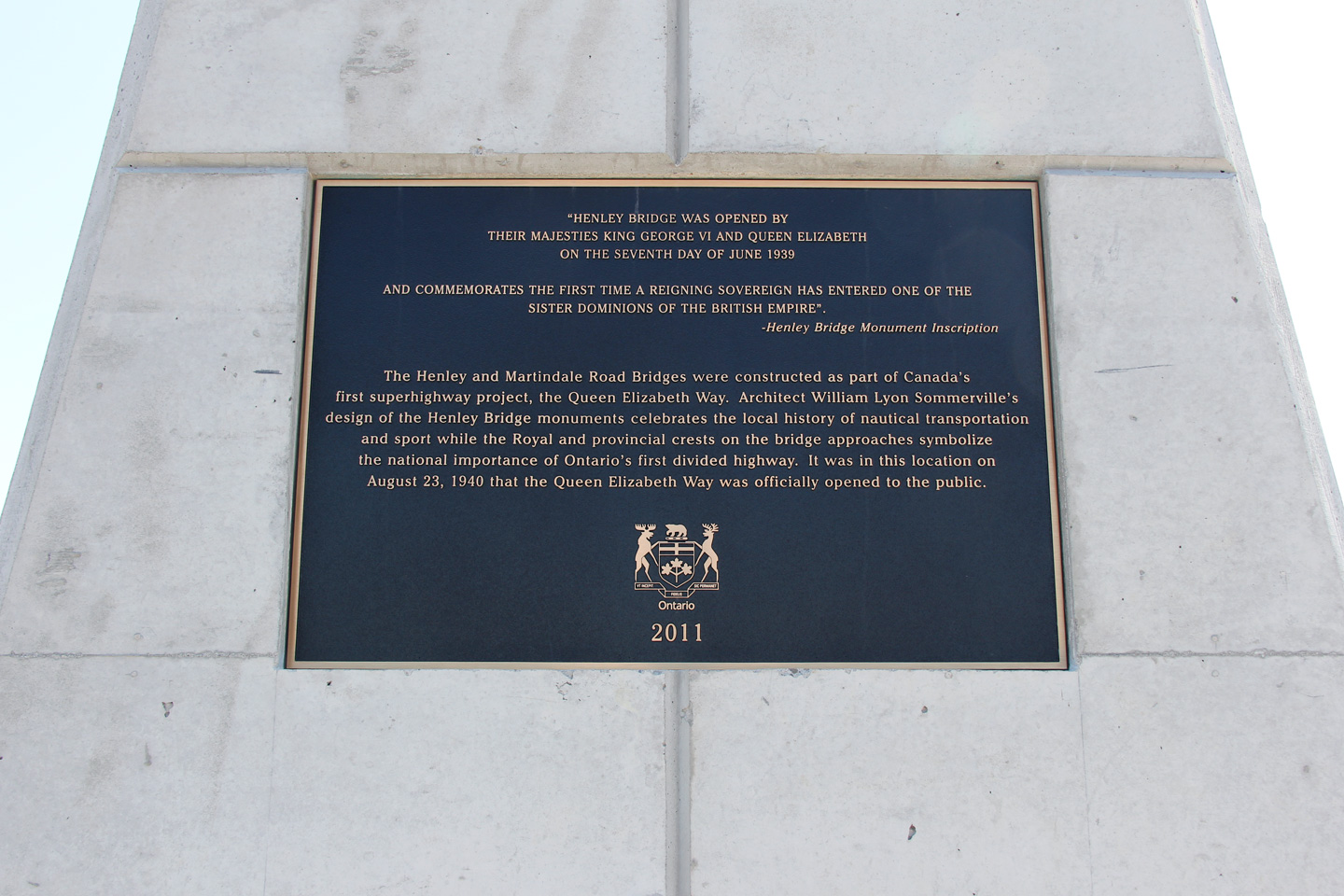
| City of St. Catharines Regional Municipality of Niagara |
Facing Martindale Road traffic sits a plaque that commemorates the opening
of the adjacent Henley Bridge. Enough cannot be written about just how
instrumental the construction of the Queen Elizabeth Way was to the
development of South-central Ontario. Photo taken: July 30th, 2011. |
 (720x480) (1440x960) |
||
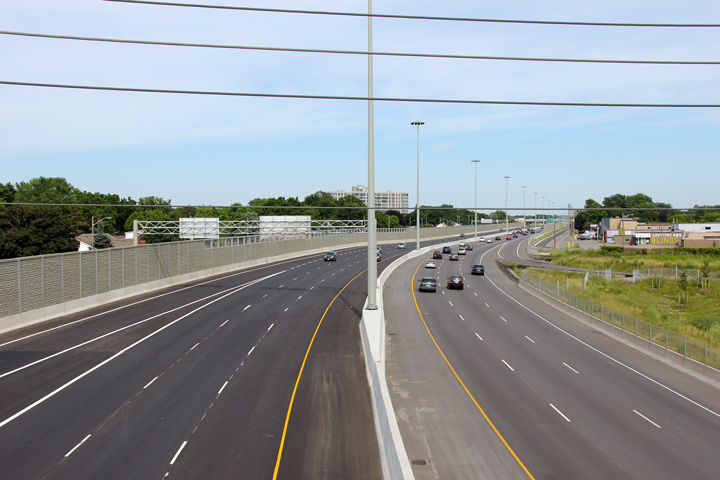
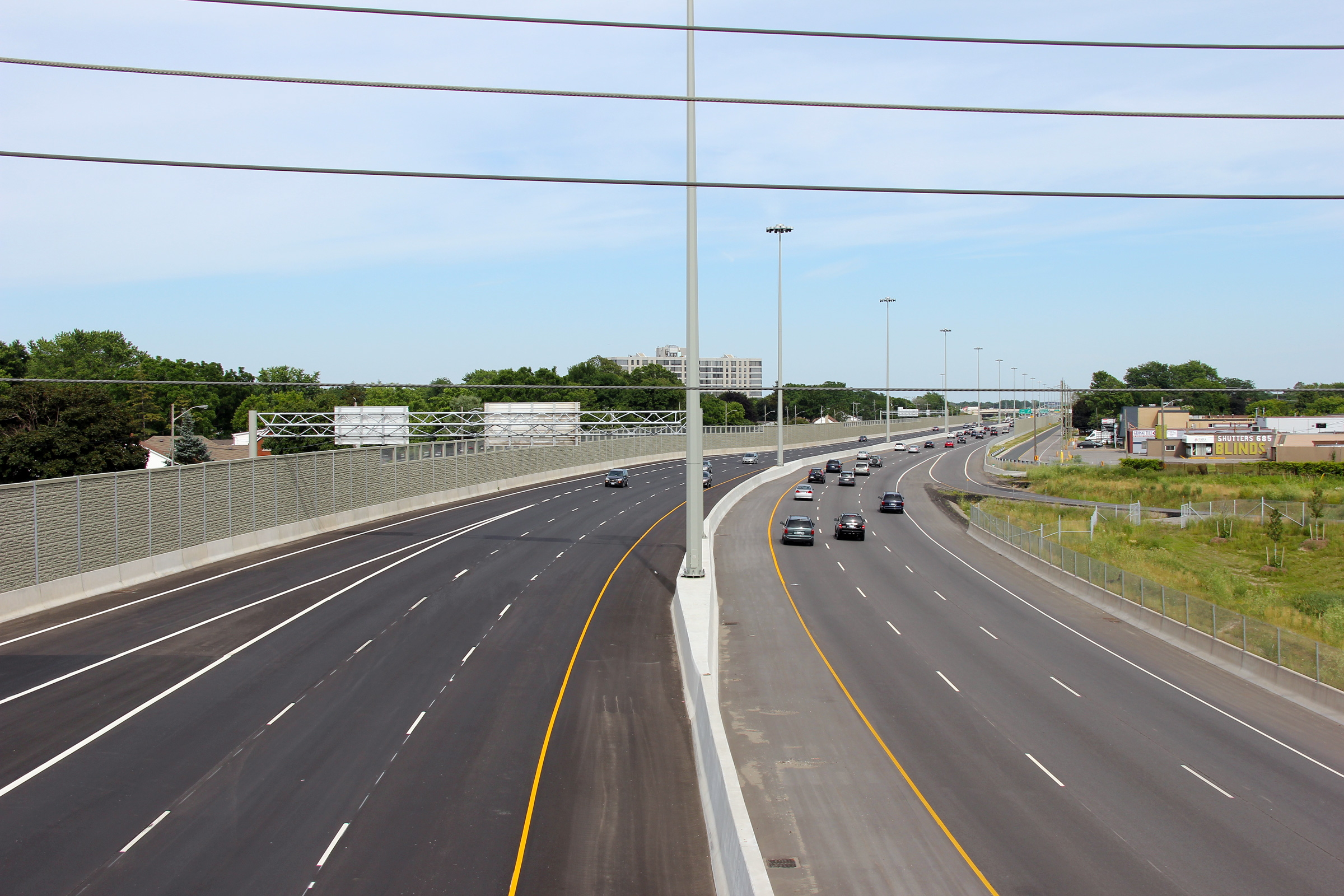
| City of St. Catharines Regional Municipality of Niagara |
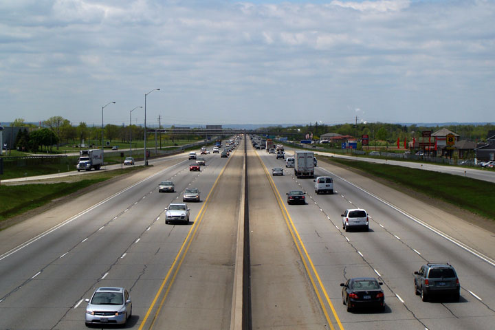
Two views looking towards Toronto from the Martindale Road overpass along
the QEW. The QEW through St. Catharines was improved dramatically
during the multiyear reconstruction and widening project that was completed in
2011. Upper photo taken: July 7th, 2005. Lower photo taken: July 30th, 2011. |
 |
||
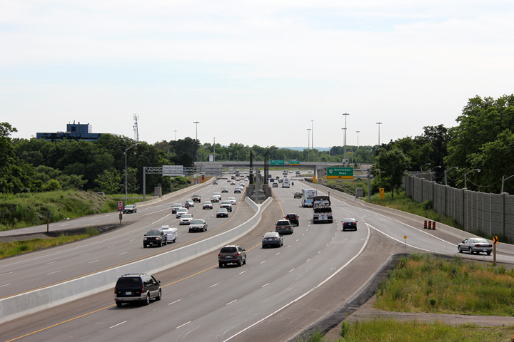
| City of St. Catharines Regional Municipality of Niagara |
View looking towards Fort Erie through the Martindale Road bridge towards
the Henley Bridges. A simple wave pattern was cast into the concrete
parapet walls along the Martindale Road overpass to improve highway
aesthetics. The wave pattern was chosen as it is consistent with the
nautical themed Henley Monument. Photo taken: July 30th, 2011. |
 (720x480) (720x480)(1440x960) (2400x1600) |
||
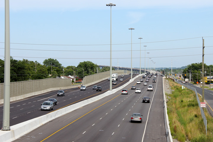
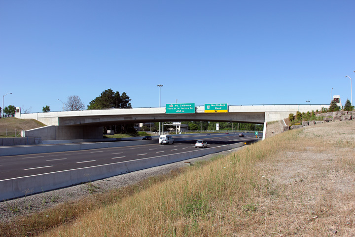
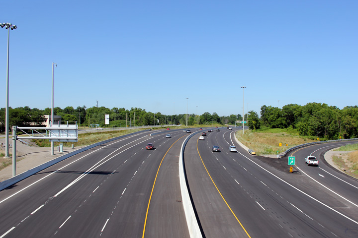
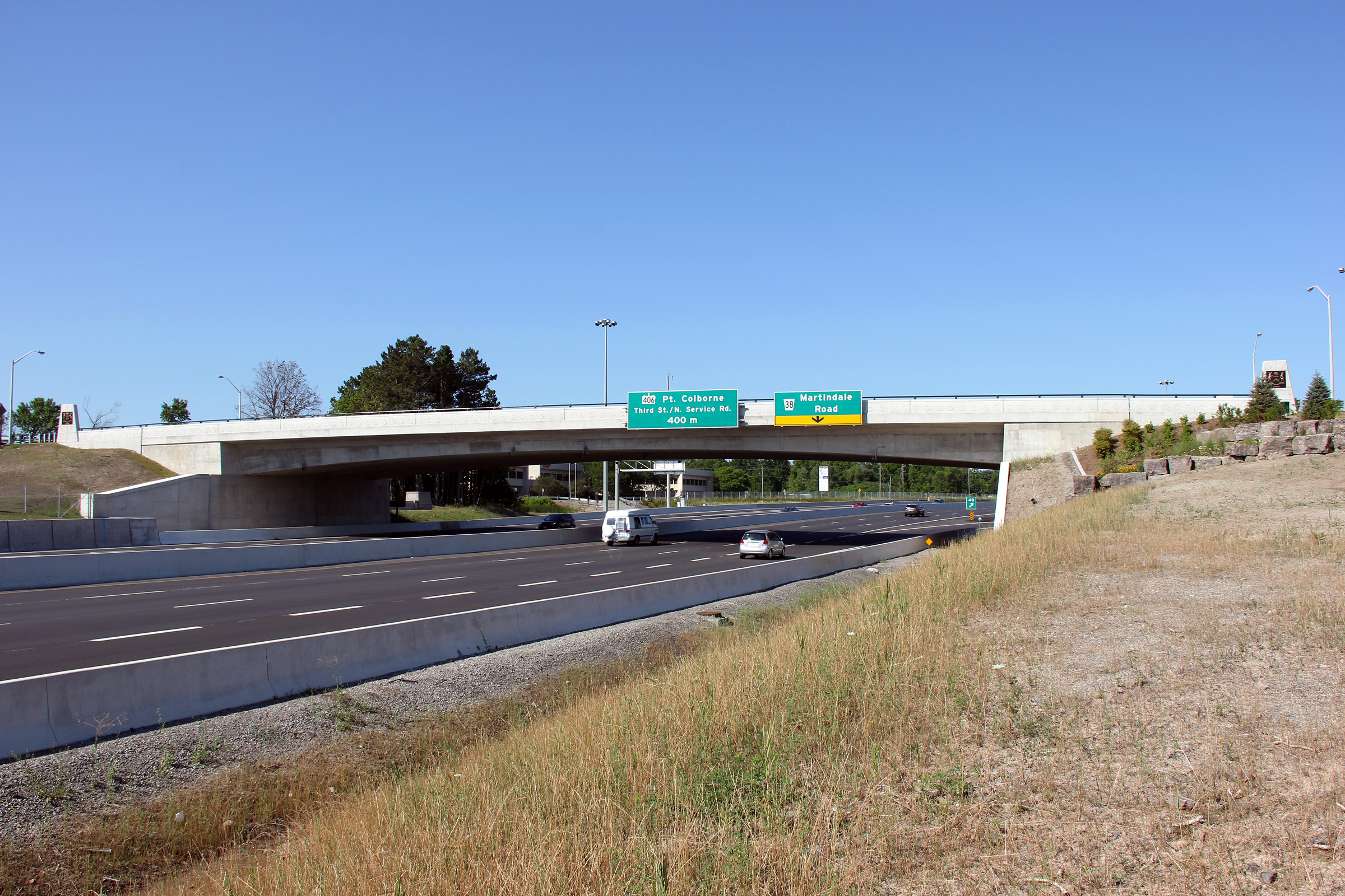
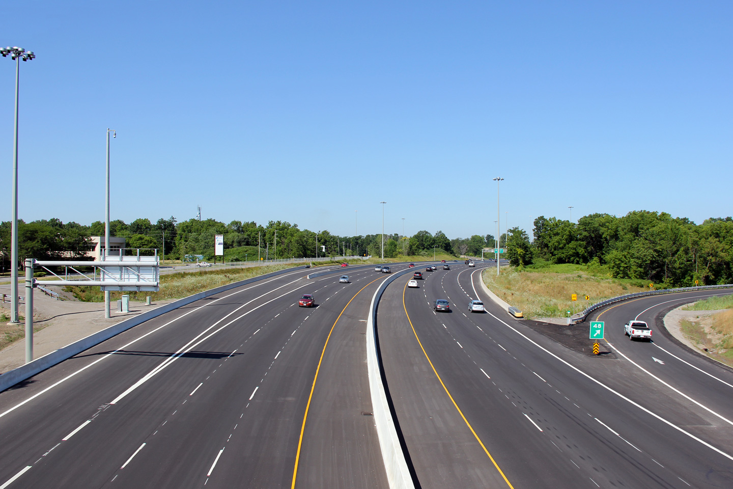
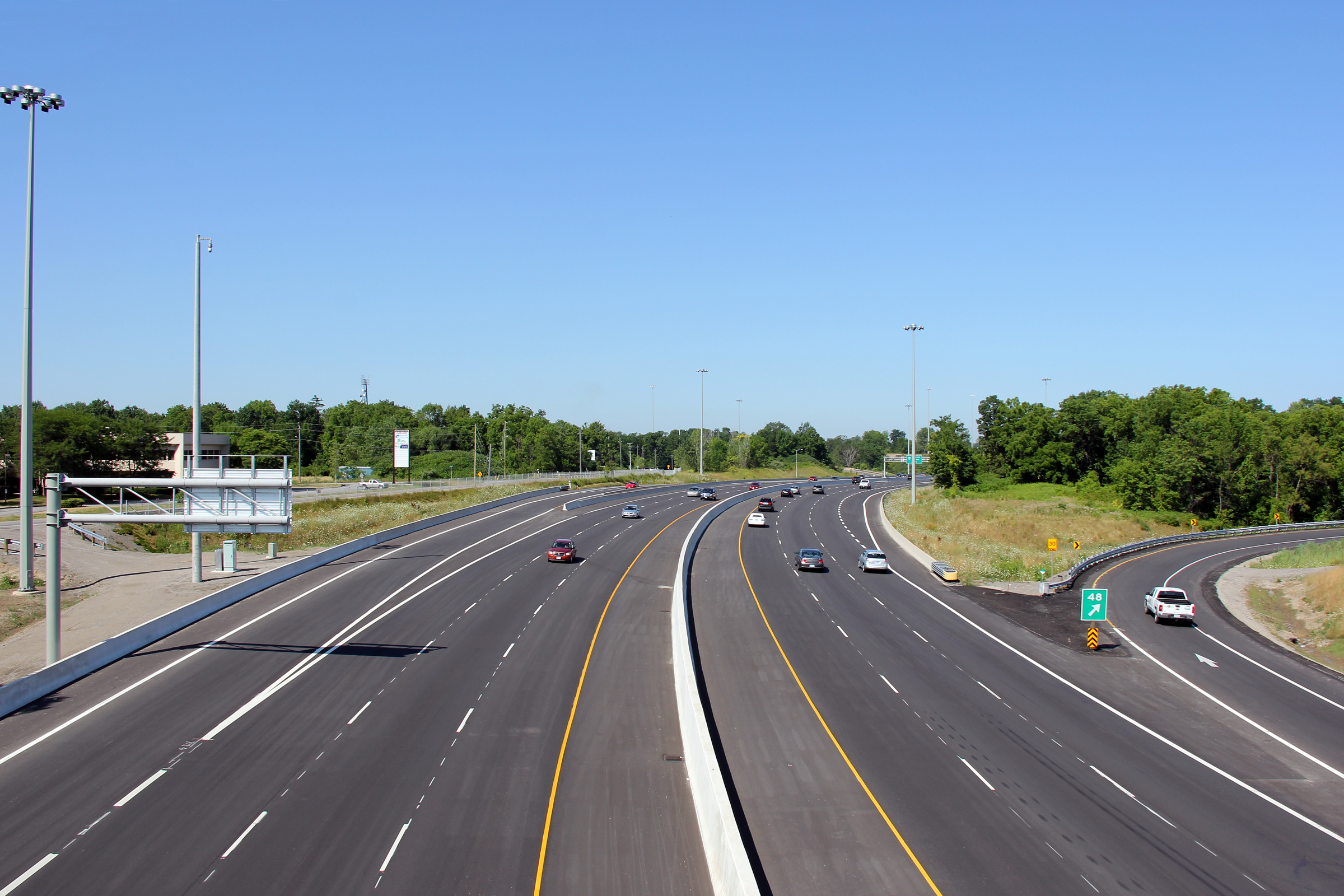
| City of St. Catharines Regional Municipality of Niagara |
Driving towards Toronto as the ramp to Highway 406 departs the Queen
Elizabeth Way. Photo taken: October 8th, 2014. |
 (720x480) (720x480)(1440x960) (2400x1600) |
||
| Highway 406 leads south of the QEW through Downtown St. Catharines terminating in Welland. Click here for Highway 406 images. | ||||
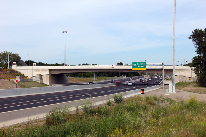
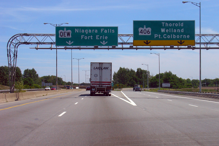
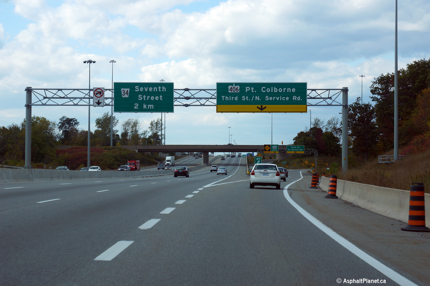
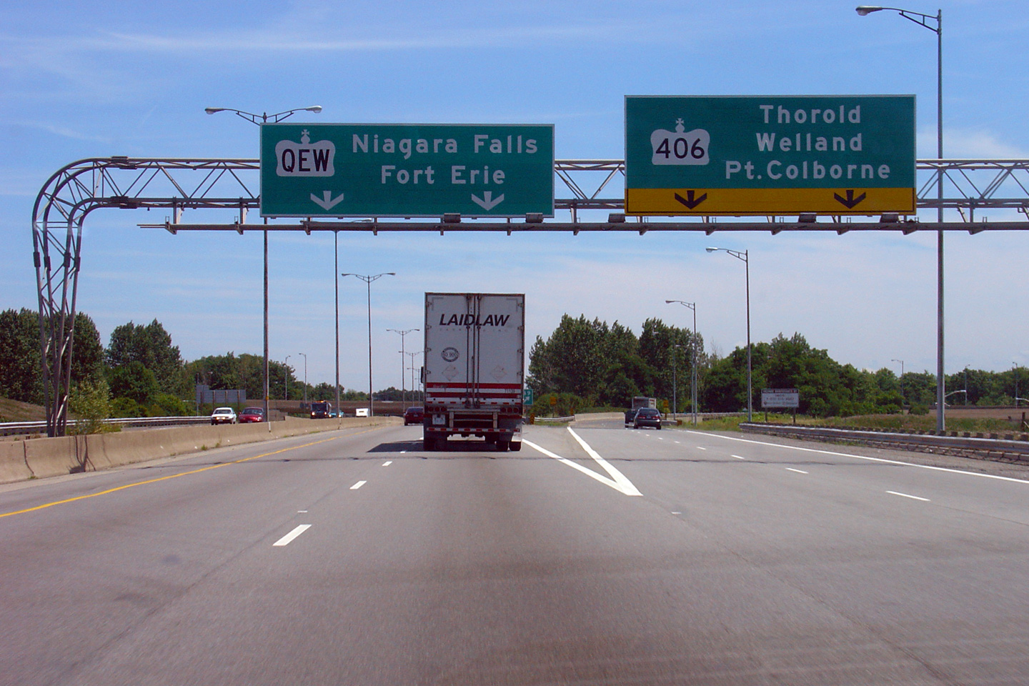
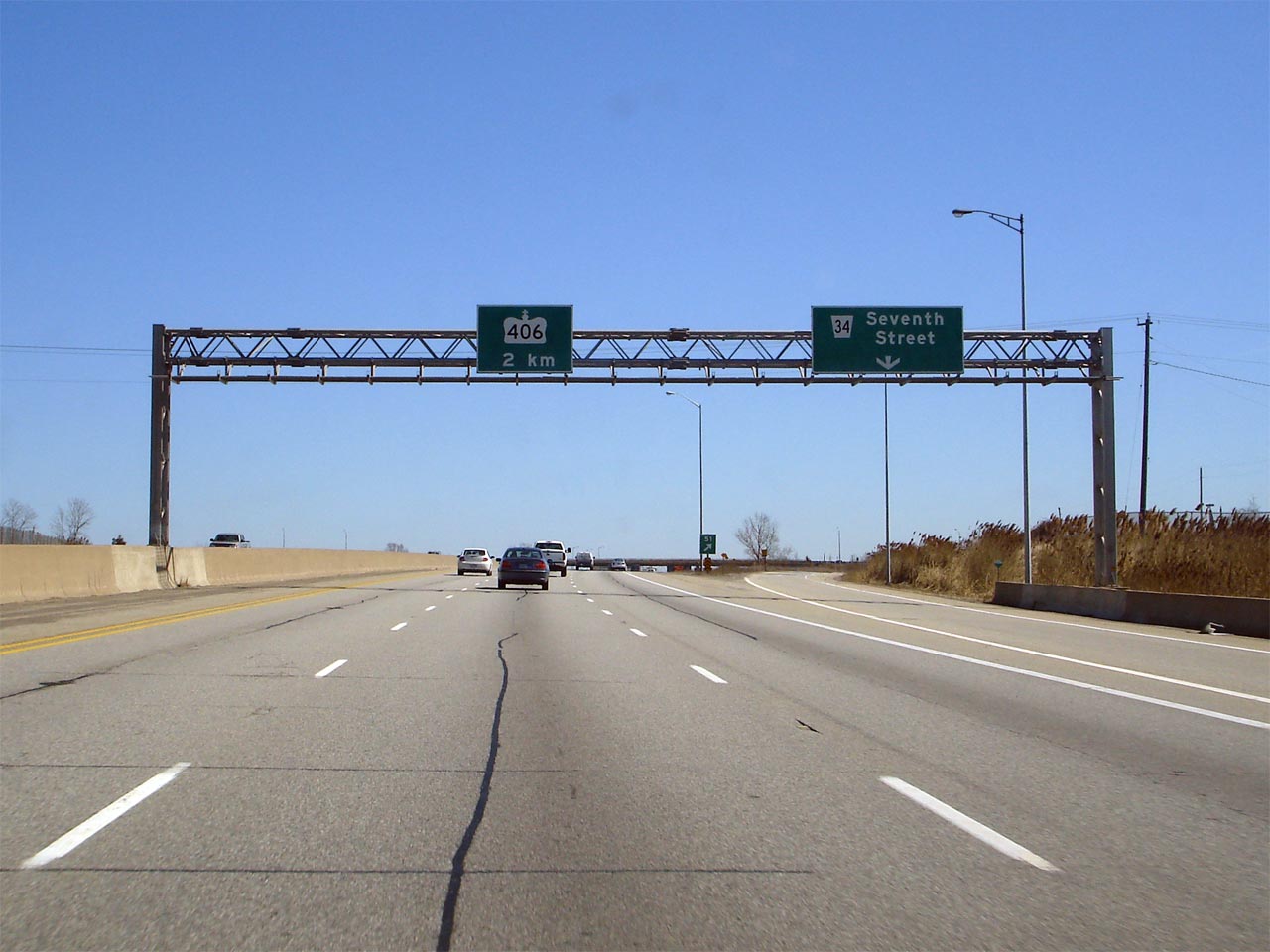
| City of St. Catharines Regional Municipality of Niagara |
Signage for the Highway 406 exit from the
Niagara Bound QEW. Prior to 2011, the right hand lane of the Niagara-bound lanes departed the QEW for Highway 406 at this interchange. As
is indicated by the 2014 photo, this is no longer the case. Upper photo taken: July 7th, 2005. Lower photo taken: July 10th, 2014. |
|
||
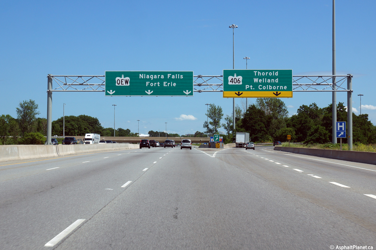
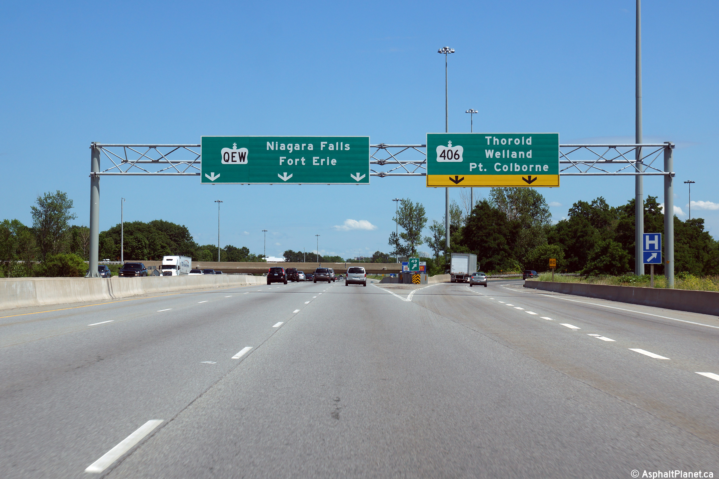
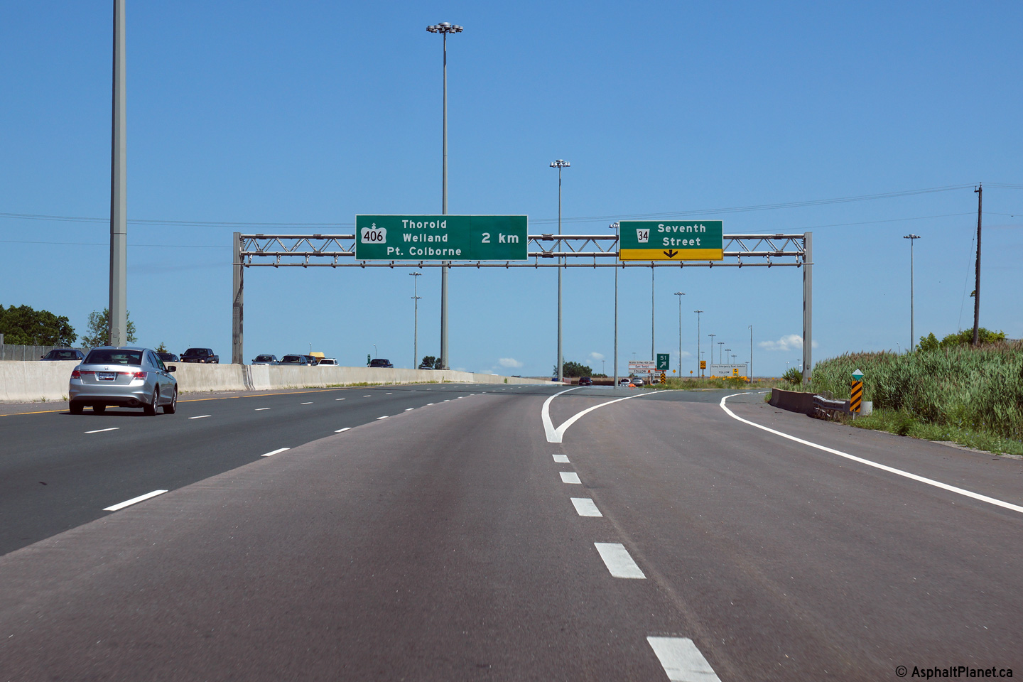
| City of St. Catharines Regional Municipality of Niagara |
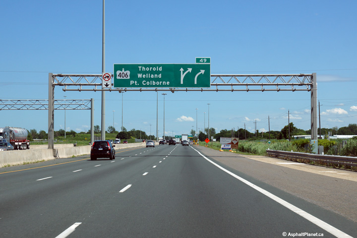
Advanced overhead signage for Highway 406 from the Niagara-bound QEW.
Highway 406 leads travelers south of the QEW, heading along the south and
west sides of St. Catharines before heading into the cities of Thorold and Welland. Photo taken: July 10th, 2014. |
 (720x480) (720x480)(1440x960) (2400x1600) |
||
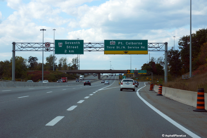
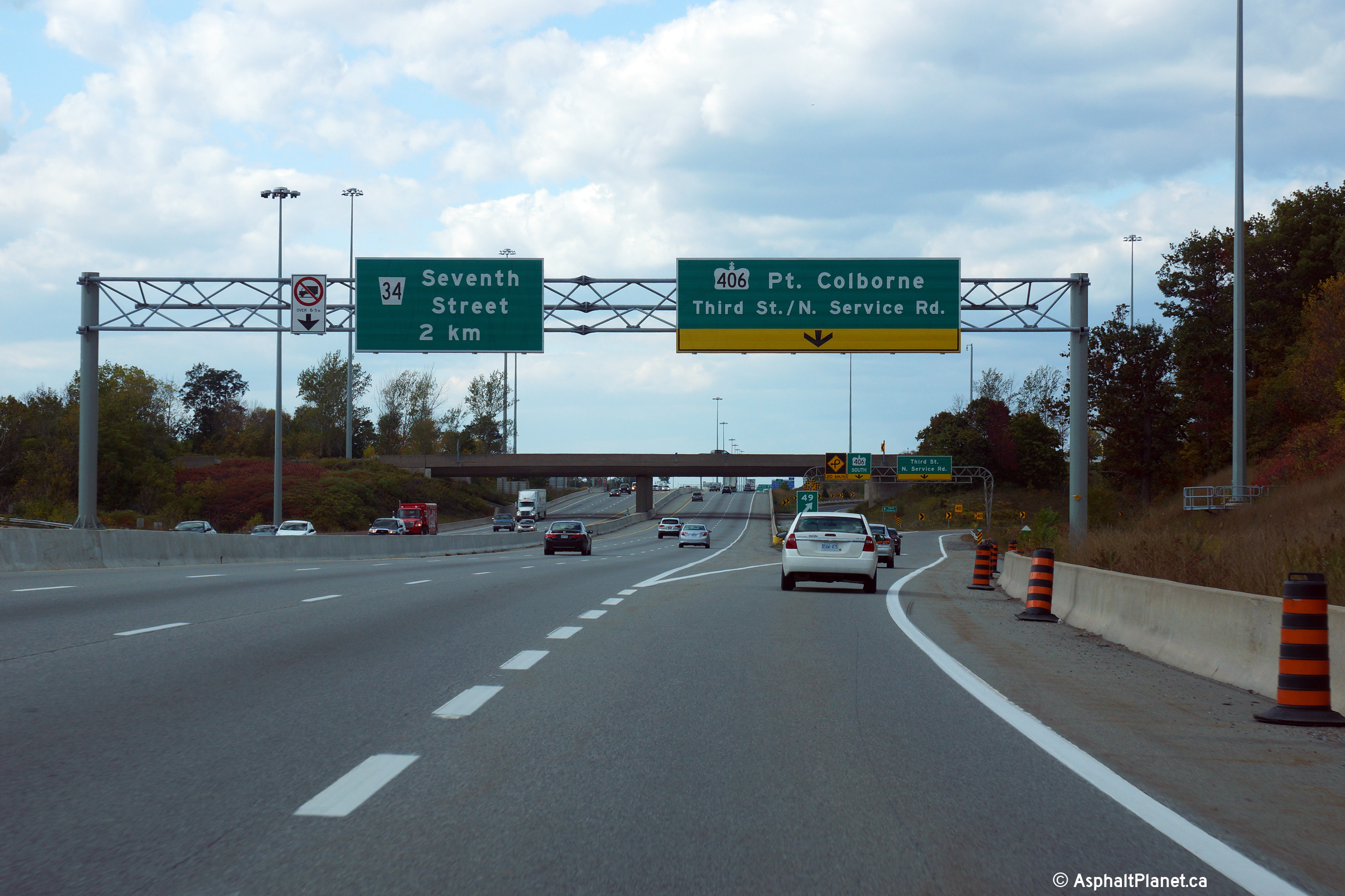
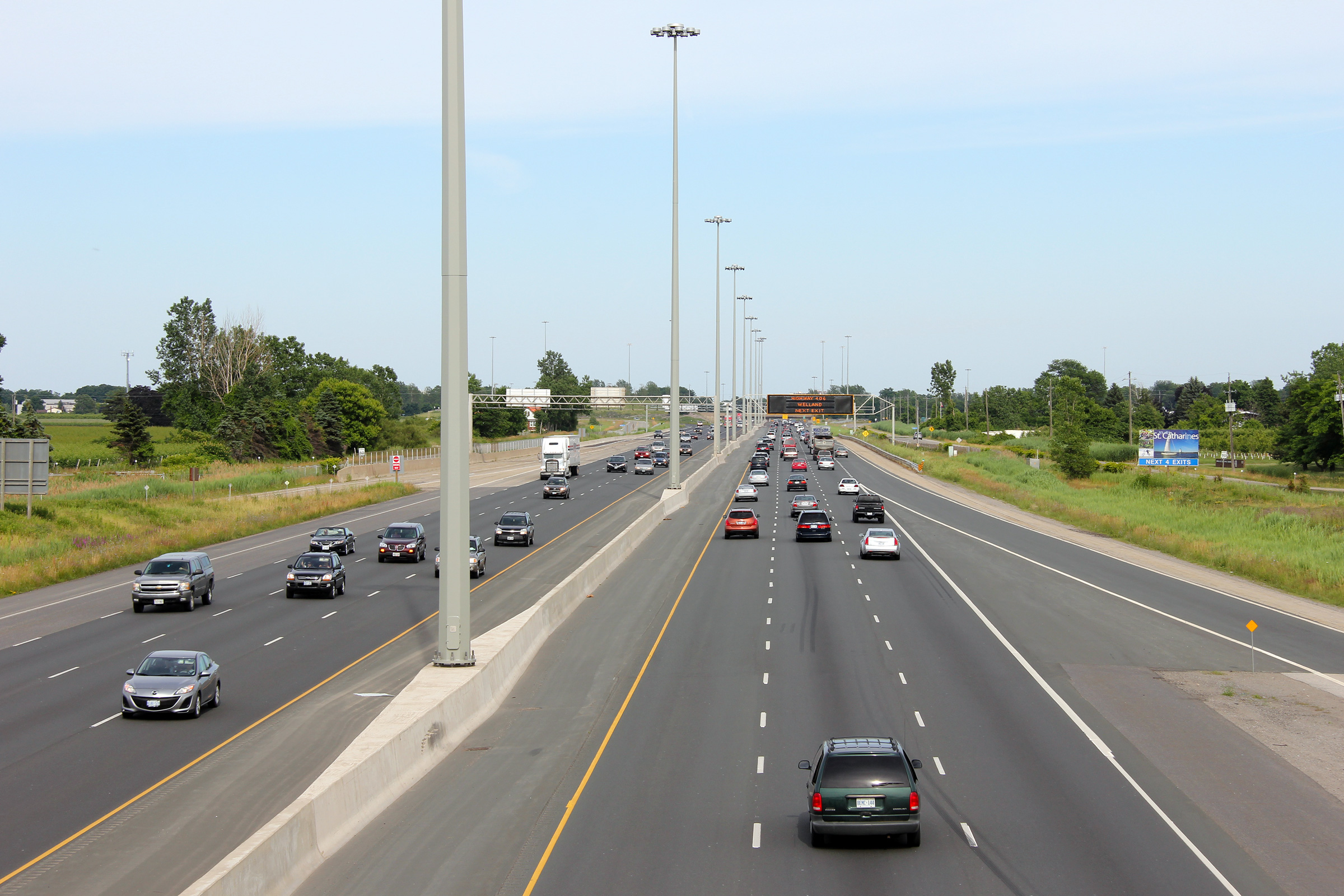
| City of St. Catharines Regional Municipality of Niagara |
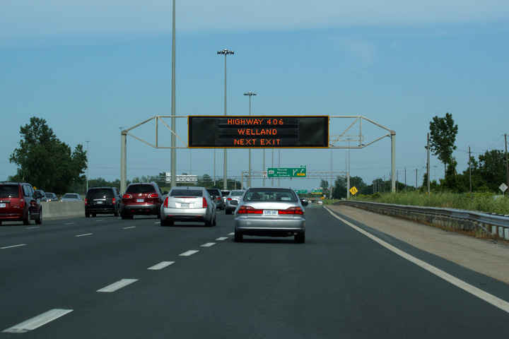
Changeable message signage located Niagara-bound between the Seventh Street
and Highway 406 interchanges. Photo taken: July 1st, 2011. |
 (720x480) (720x480)(1440x960) (2400x1600) |
||
| City of St. Catharines Regional Municipality of Niagara |
Advanced signage for the Toronto-bound ramp to Seventh Street. There
are five Toronto-bound lanes between the on-ramp from Highway 406 and the
off-ramp to Seventh Street. Photo taken; September 28th, 2014. |
 (720x480) (720x480)(1440x960) (2400x1600) |
||
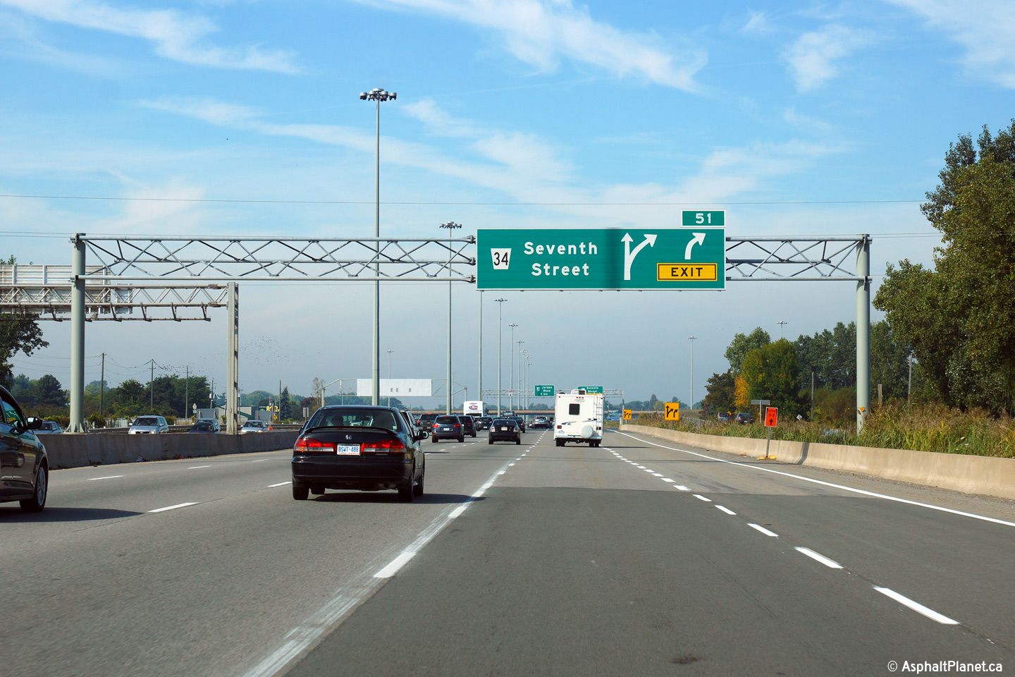
| City of St. Catharines Regional Municipality of Niagara |
Exit signage for the Seventh Street off-ramp. The fifth Toronto-bound
lane of the QEW exits at the Seventh Street interchange, and the forth
Toronto-bound lane ends just beyond the Seventh Street overpass. Photo taken: September 28th, 2014.1 |
 (720x480) (720x480)(1440x960) (2400x1600) |
||
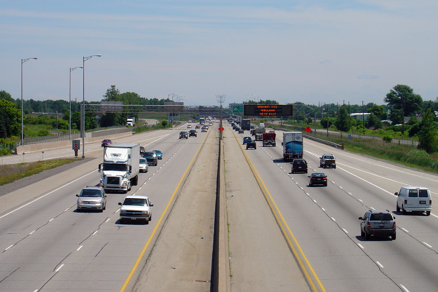
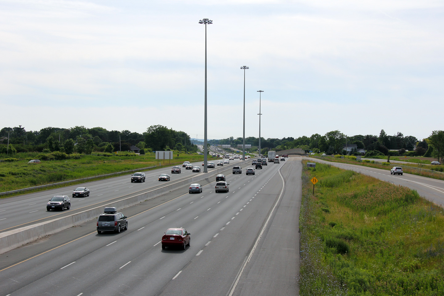
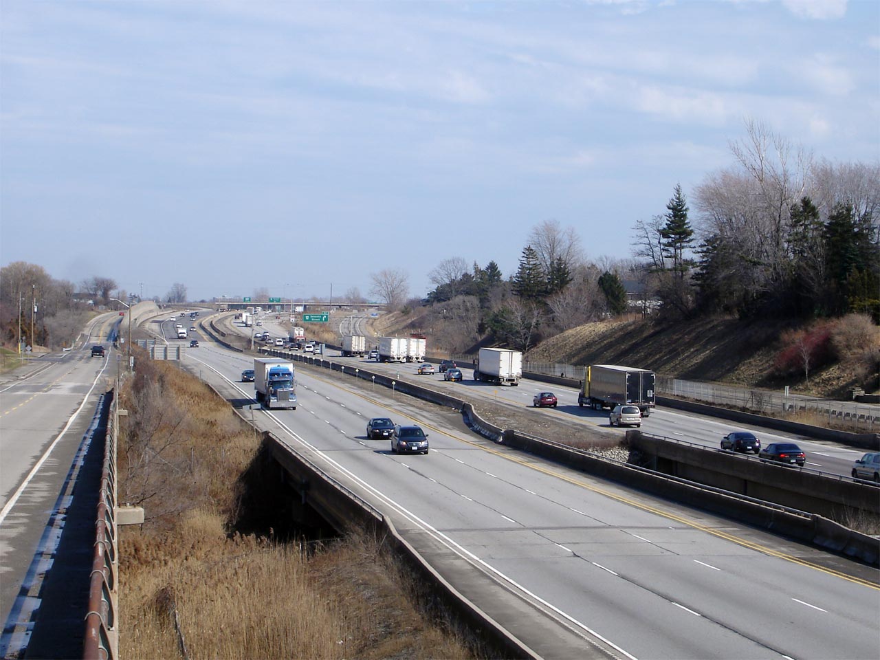
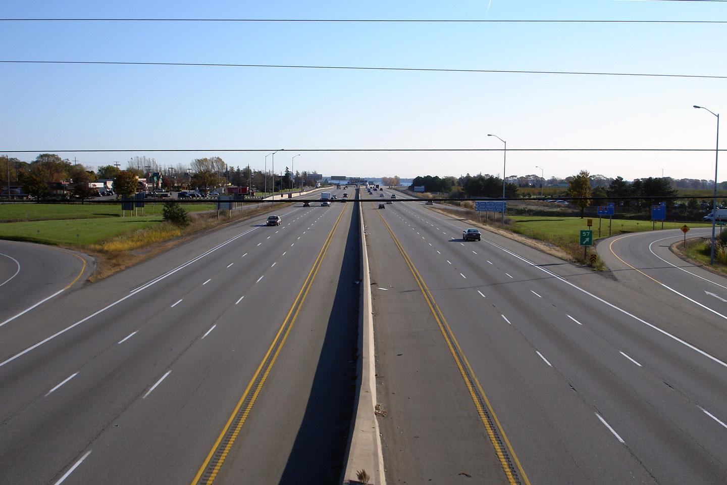
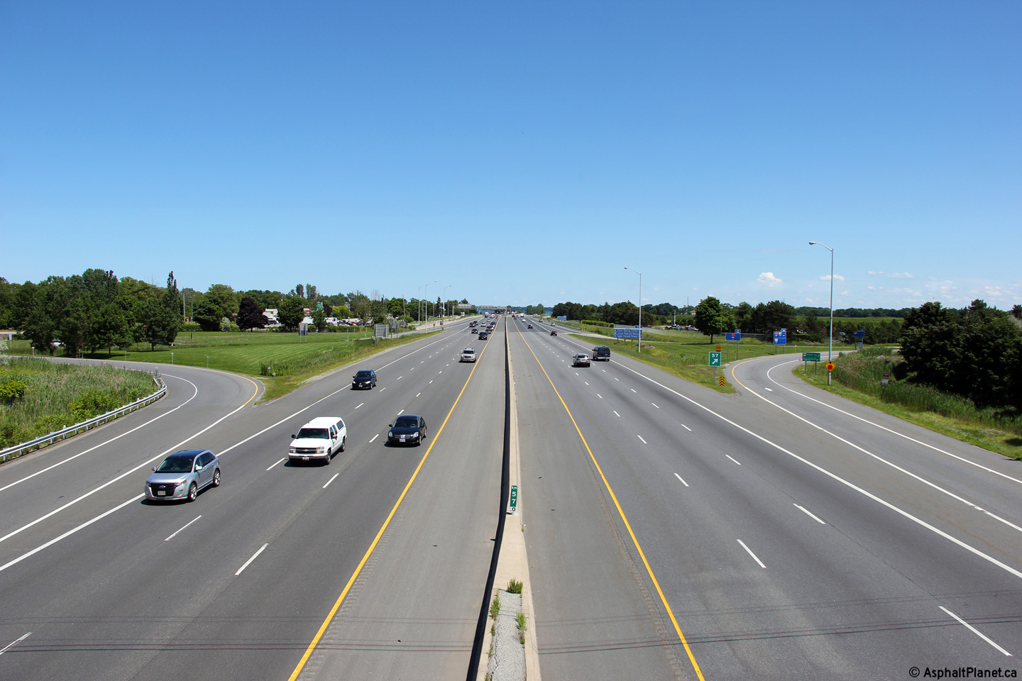
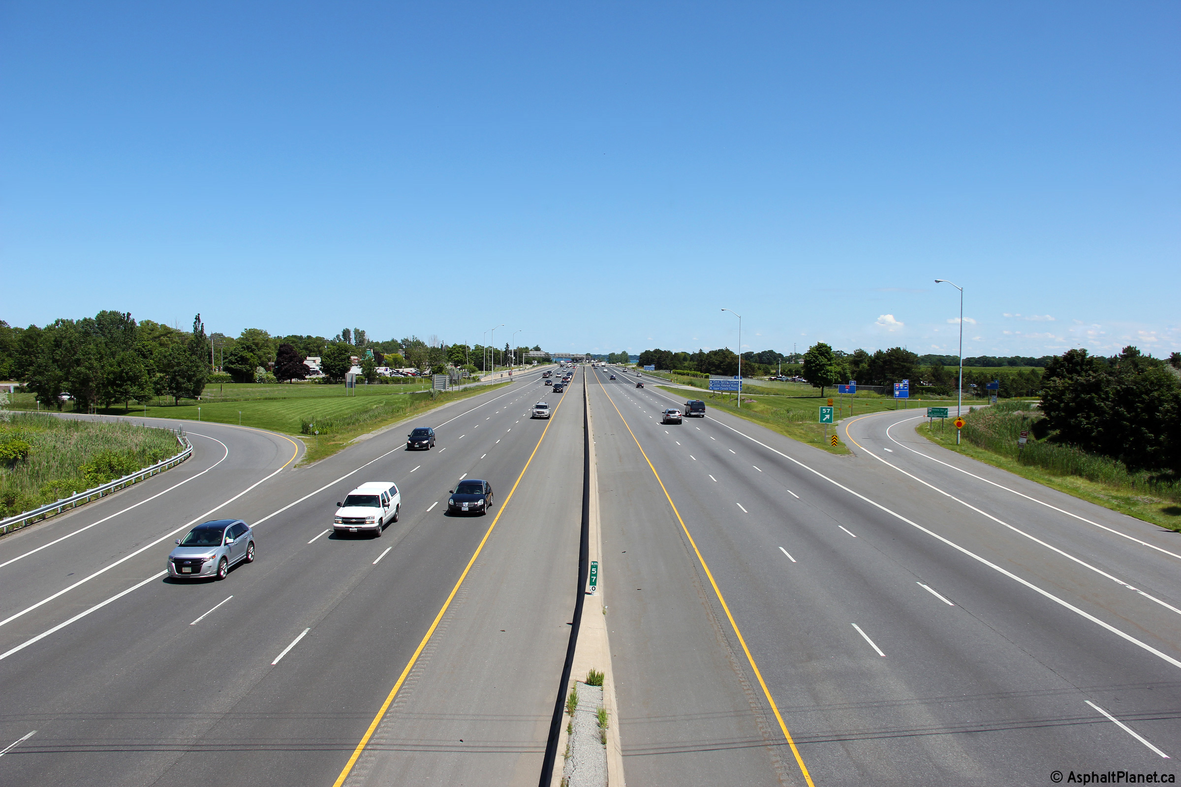
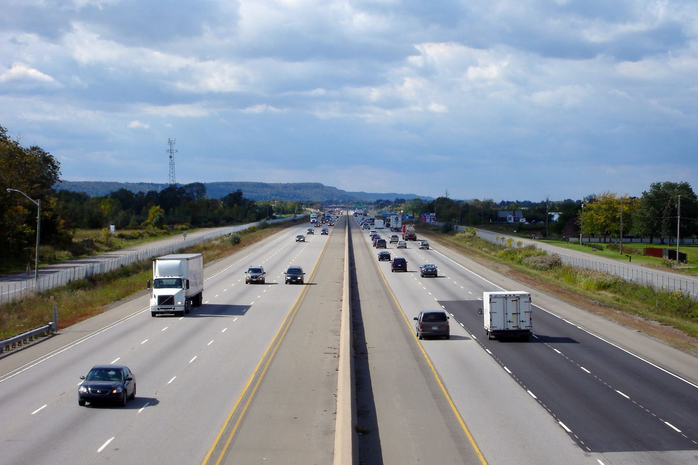
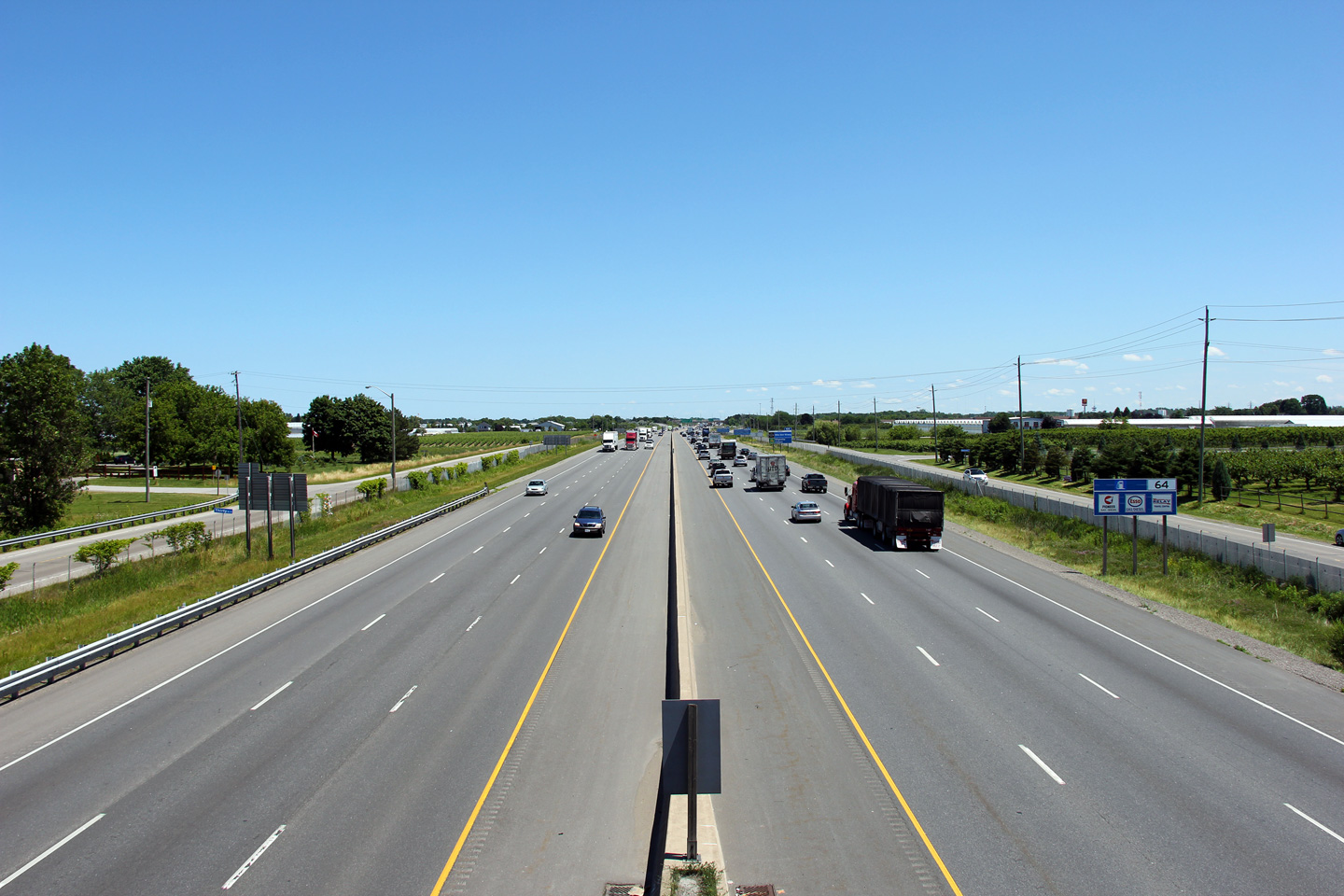
| City of St. Catharines Regional Municipality of Niagara |
Two views looking towards Niagara Falls and Fort Erie along the QEW from Seventh Street.
Seventh Street is located at roughly kilometre marker 51. Upper photo taken: July 7th, 2005. Lower photo taken: July 1st, 2011. |
 |
||
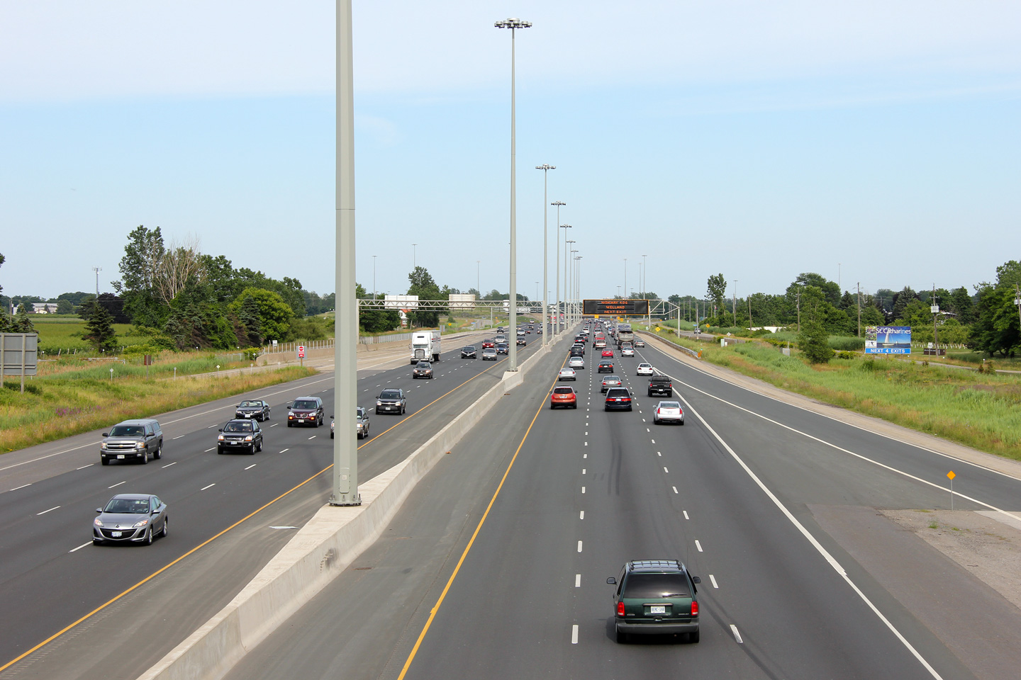
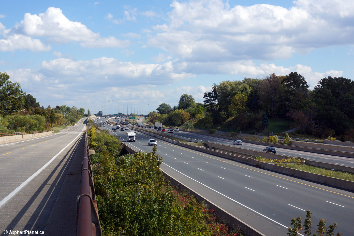
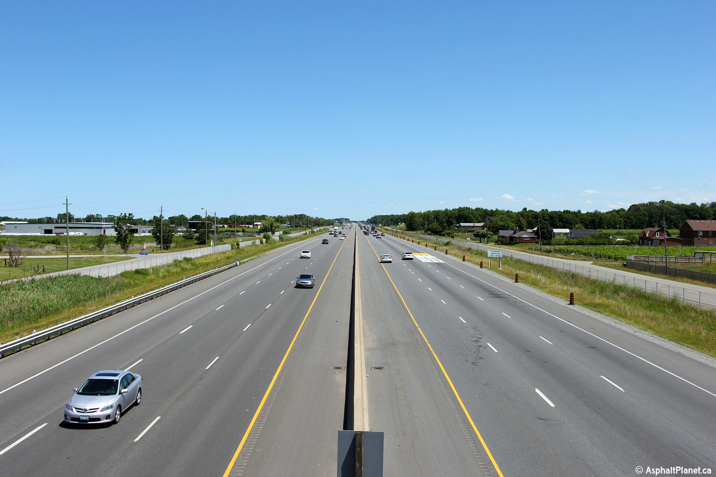
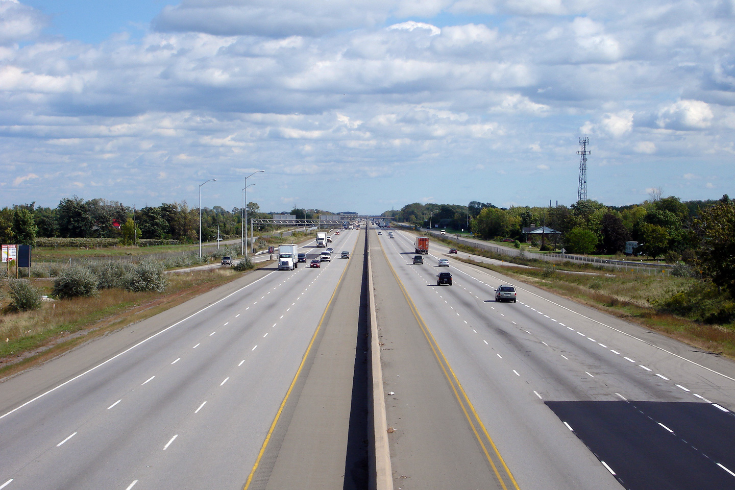
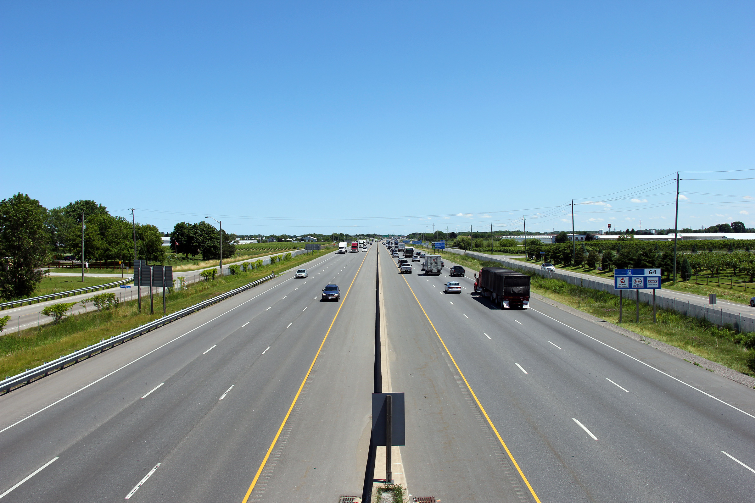
| City of St. Catharines Regional Municipality of Niagara |
Two views looking towards Toronto on the QEW from the Seventh Street overpass in western
St. Catharines. For the next several kilometres the QEW follows the
Lake Ontario Shoreline very closely. There are several scenic views of
Lake Ontario through this area. Upper photo taken: July 7th, 2005. Lower photo taken: July 1st, 2011. |
 (720x480) (1440x960) (2400x1600) |
||
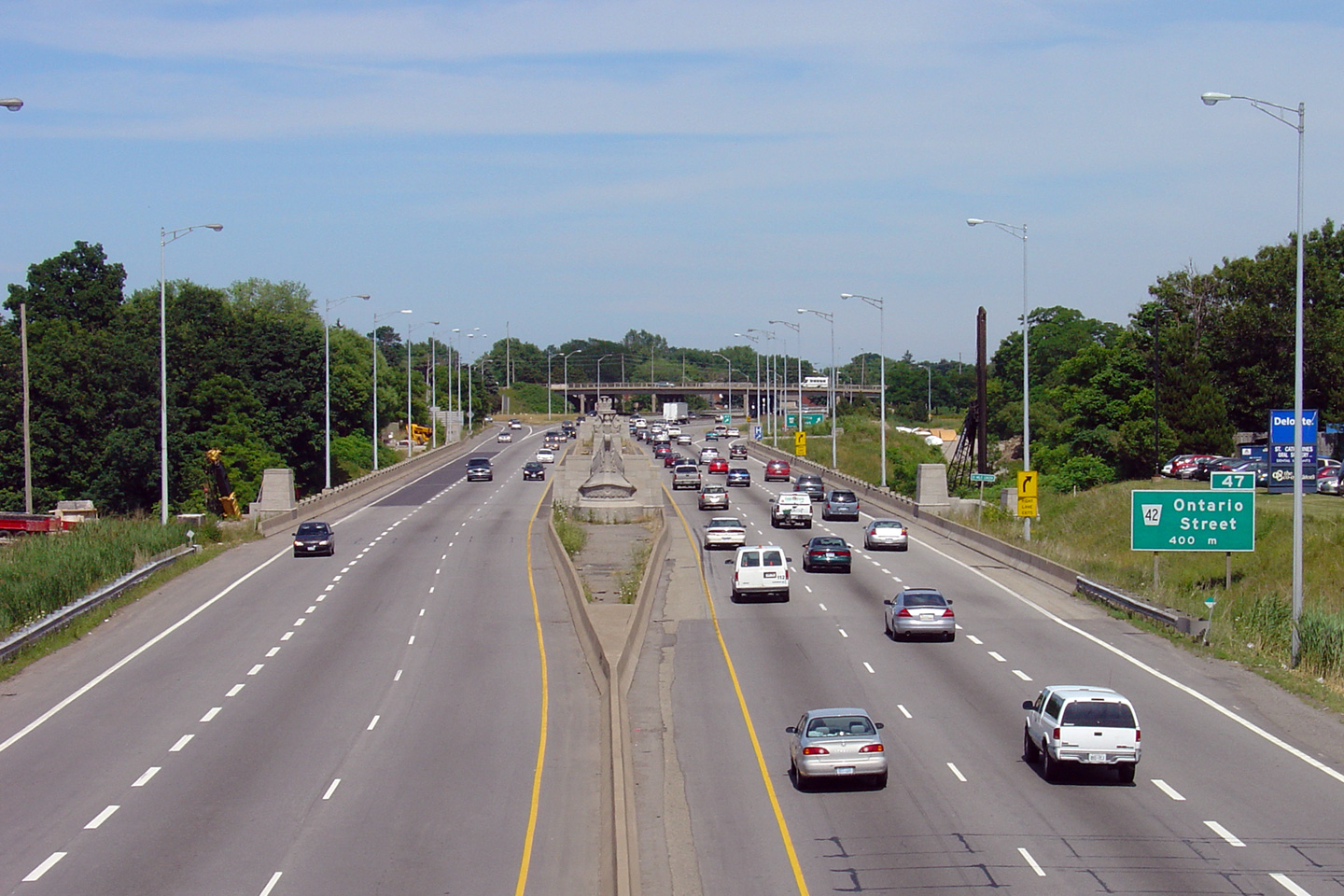
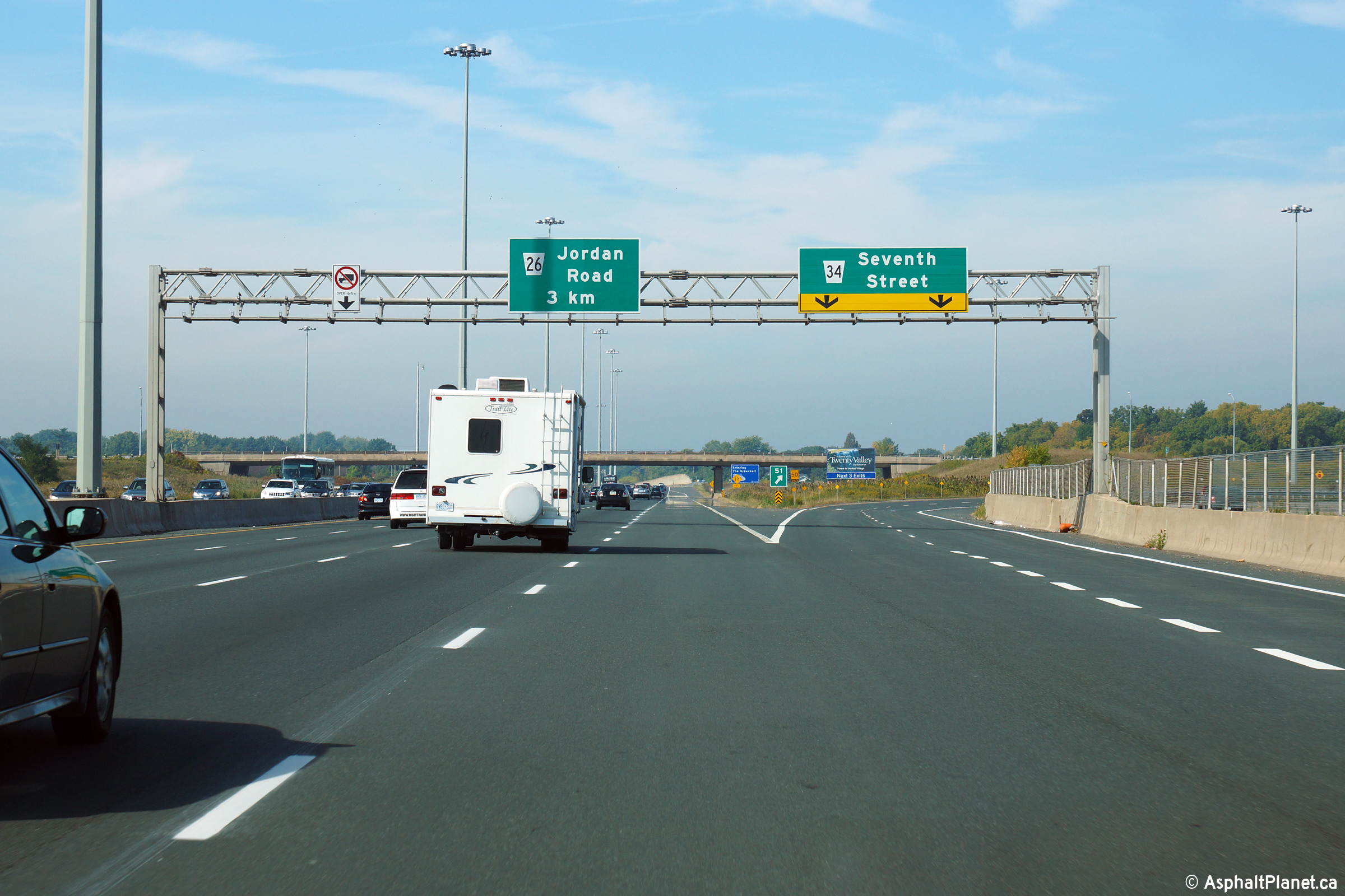
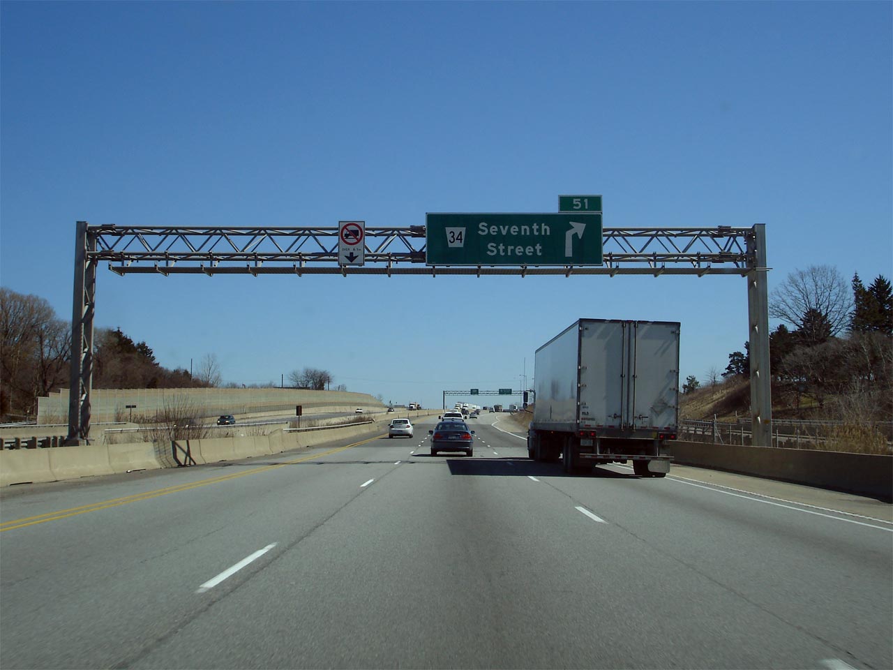
| City of St. Catharines Regional Municipality of Niagara |
Signage for the Niagara-bound ramp to Seventh Street in St. Catharines
accompanied by an undersized advanced sign for Highway 406. For an
earlier incarnation of this signage, taken in March, 2007,
click here. Photo taken July 10th, 2014. |
|||
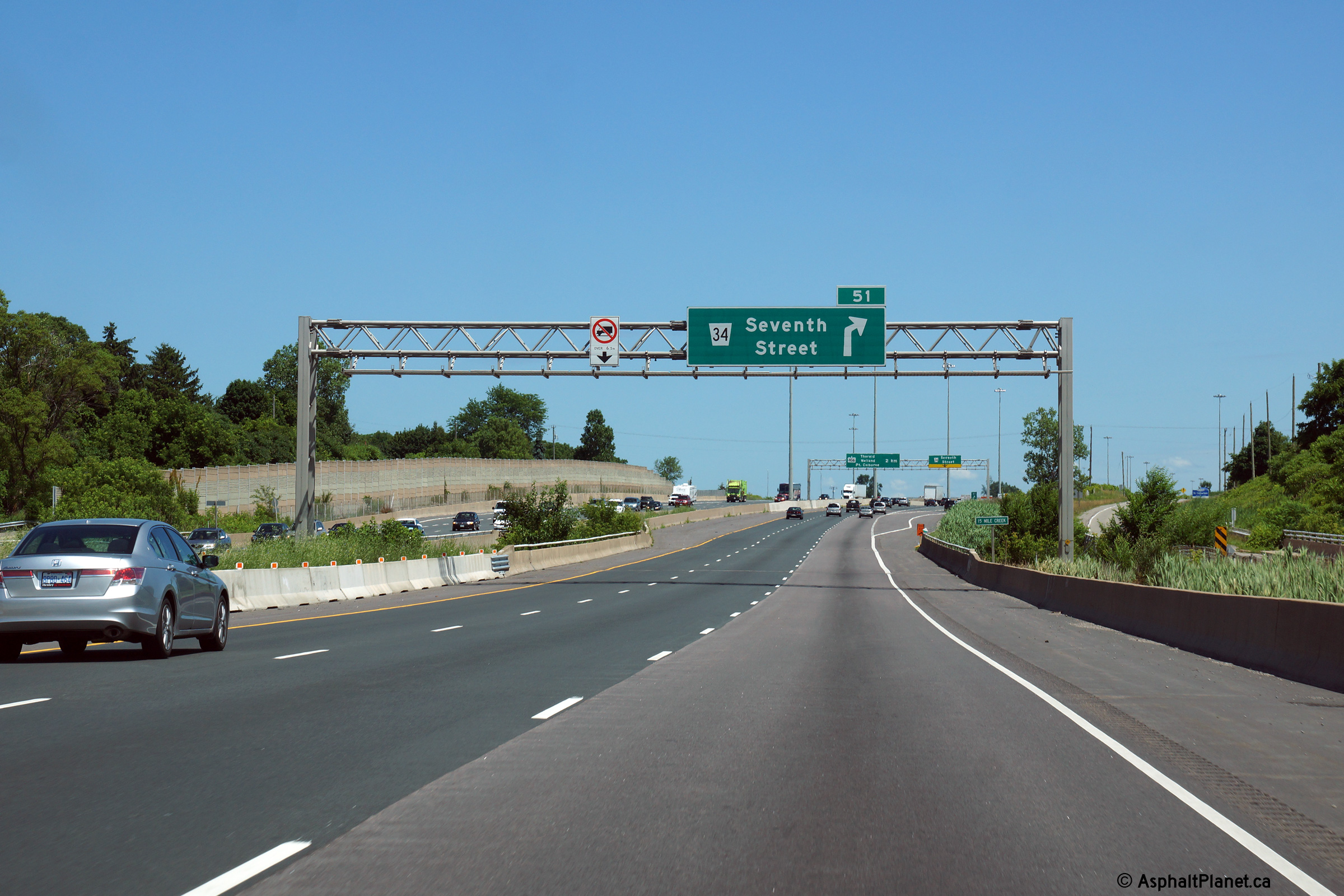
| City of St. Catharines Regional Municipality of Niagara |
Advanced overhead signage for the Seventh Street interchange along the
Niagara-bound QEW. Signage along the QEW through this part of Niagara
Region was erected in the early 1990s, at about the same time Ontario last redesigned its freeway signage. Because of this, there are several older style advanced
arrows adorning the signage along this part of the QEW. For an earlier
incarnation of this signage, taken in March, 2007,
click here. Photo taken July 10th, 2014. |
|||
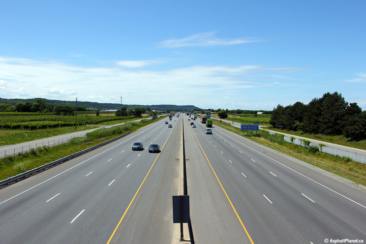
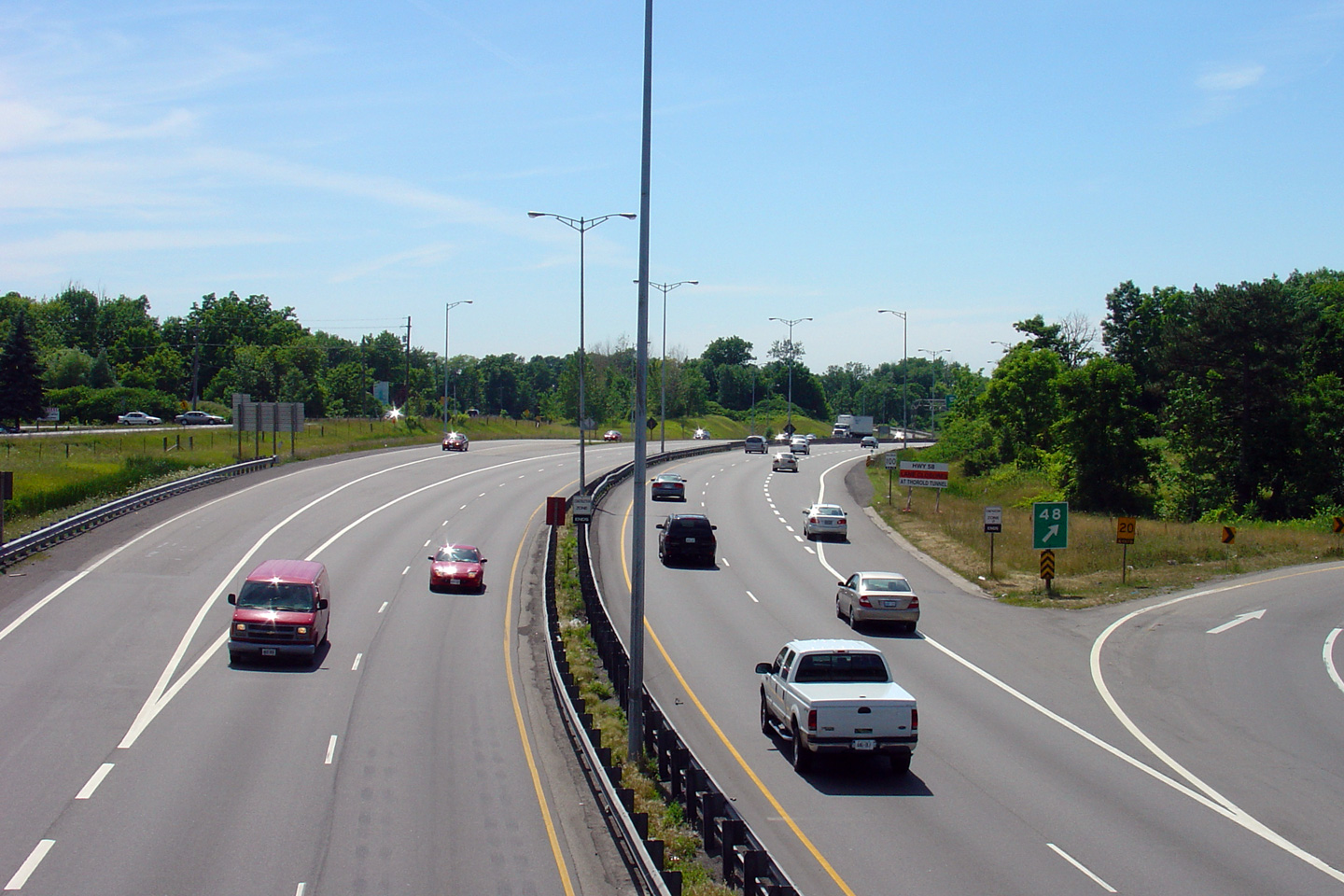
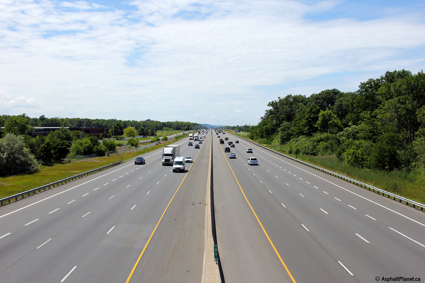
| Town of Lincoln Regional Municipality of Niagara |
View looking easterly towards Niagara and Fort Erie as the QEW crosses
Fifteen Mile Creek. Notice the tall wall barrier is located in the
middle of a narrow grassed median in between the two watercourse crossings.
This was constructed this way in advance of the eventual 8-laning between
St. Catharines and Hamilton. Click here
for an additional photo taken from this location in March, 2007. Photo taken: October 8th, 2014. |
 (720x480) (1440x960) (2400x1600) |
||
| Town of Lincoln Regional Municipality of Niagara |
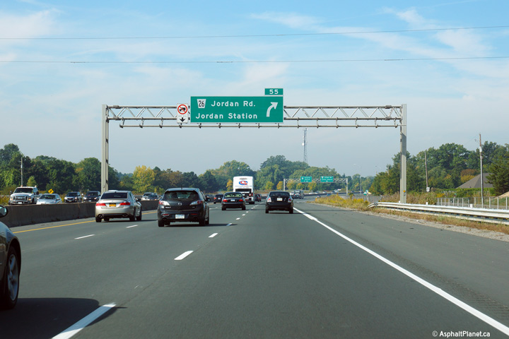
Advanced signage situated overtop of the Toronto-bound lanes of the QEW
approaching the Jordan Road interchange. Photo taken: September 28th, 2014. |
 (720x480) (720x480)(1440x960) (2400x1600) |
||
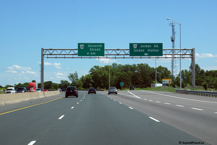
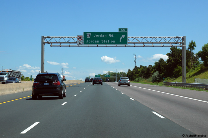
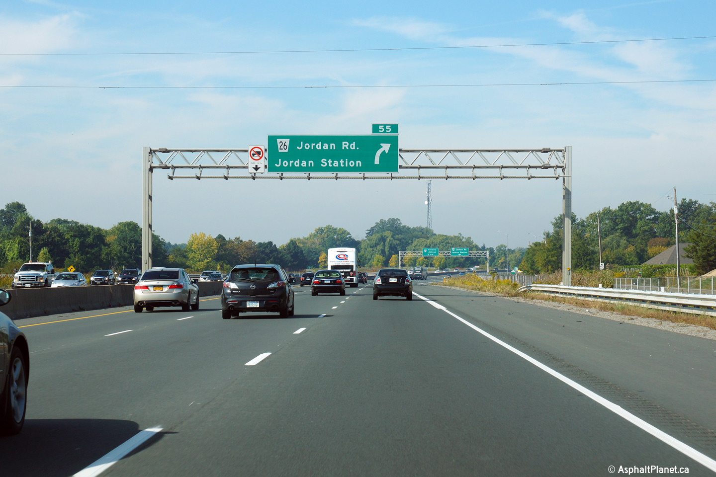
| Town of Lincoln Regional Municipality of Niagara |
Toronto-bound signage for the Jordan Road interchange. Because of the
age of this signage, the exiting lane is not signed with a yellow down arrow
at several signs along the QEW between St. Catharines and Hamilton. Photo taken: September 28th, 2014. |
 (720x480) (720x480)(1440x960) (2400x1600) |
||
| Town of Lincoln Regional Municipality of Niagara |
The Fort Erie bound turn-off signage along the QEW uses clearview font.
Clearview font was used on several signs along the QEW on a trial basis.
To this date, the MTO has elected not to use clearview font on highway signs
on a permanent basis. Photo taken: July 10th, 2014. |
 (720x480) (720x480)(1440x960) (2400x1600) |
||
| Town of Lincoln Regional Municipality of Niagara |
Fort-Erie bound advanced signage for the off-ramp to Jordan Road. Photo taken: July 10th, 2014. |
 (720x480) (720x480)(1440x960) (2400x1600) |
||
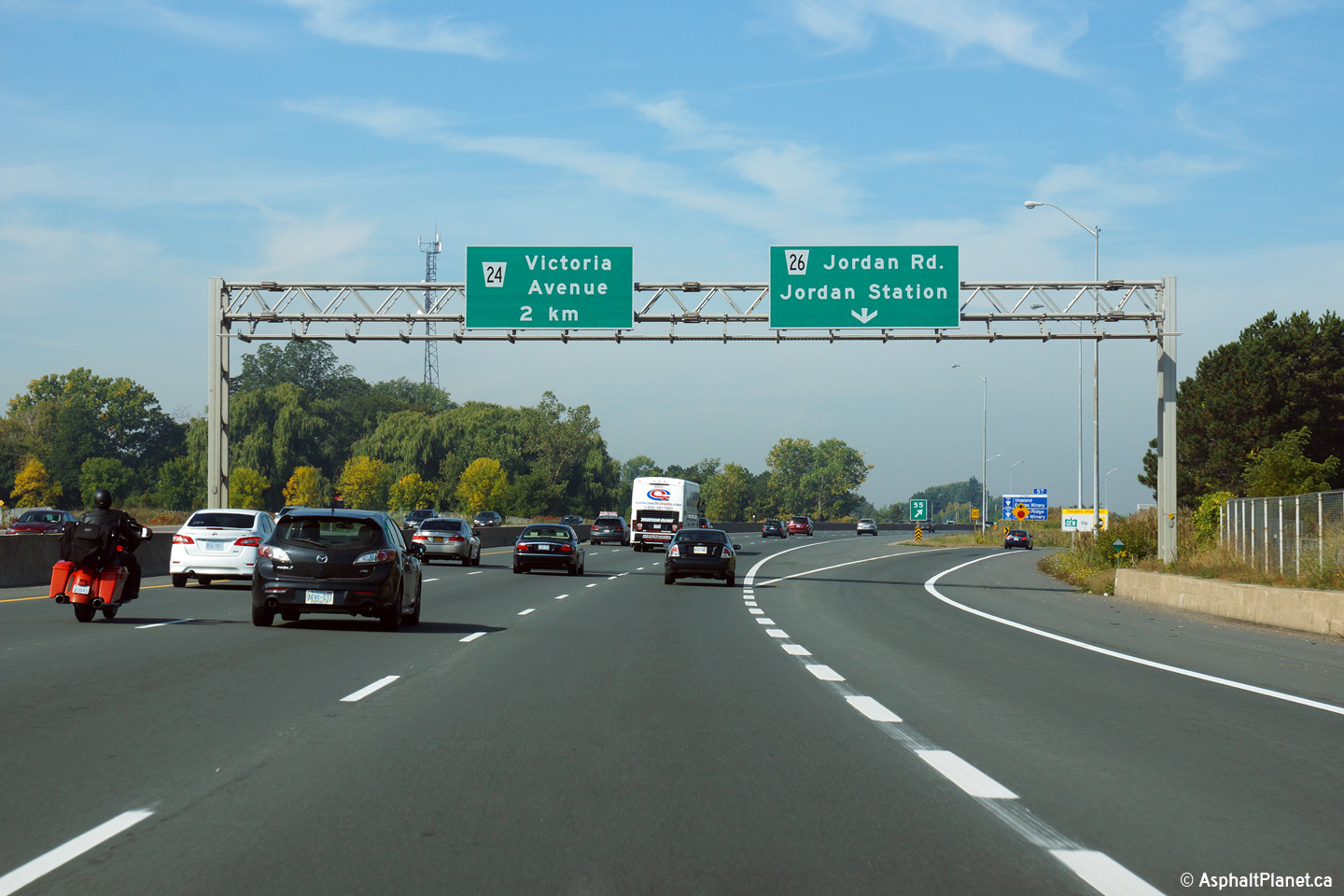
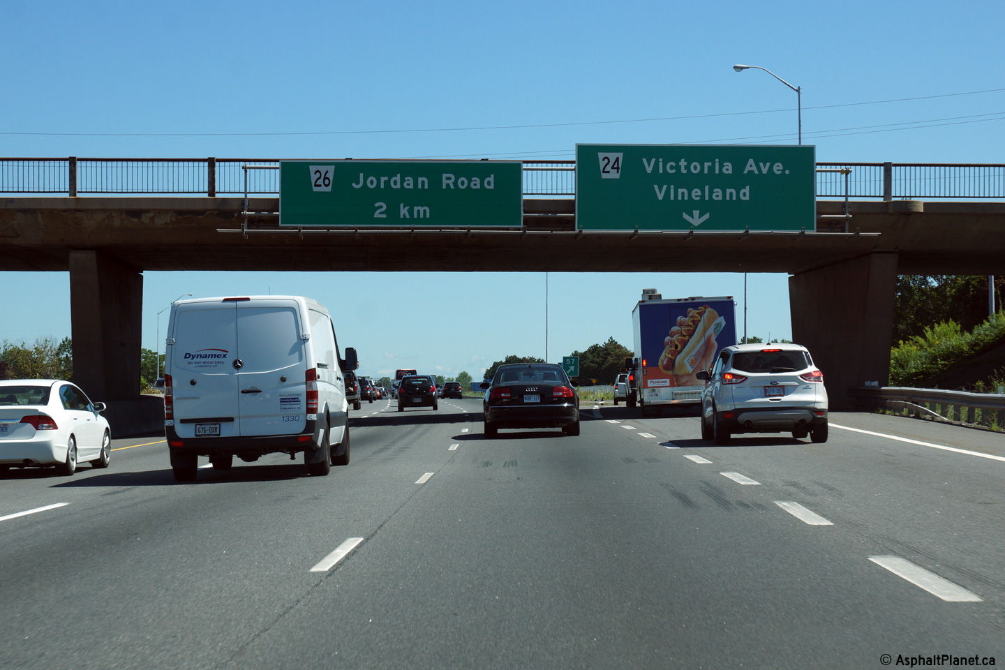
| Town of Lincoln Regional Municipality of Niagara |
Advanced signage for the off-ramp to Victoria Road. Photo taken: September 28th, 2014. |
 (720x480) (720x480)(1440x960) (2400x1600) |
||
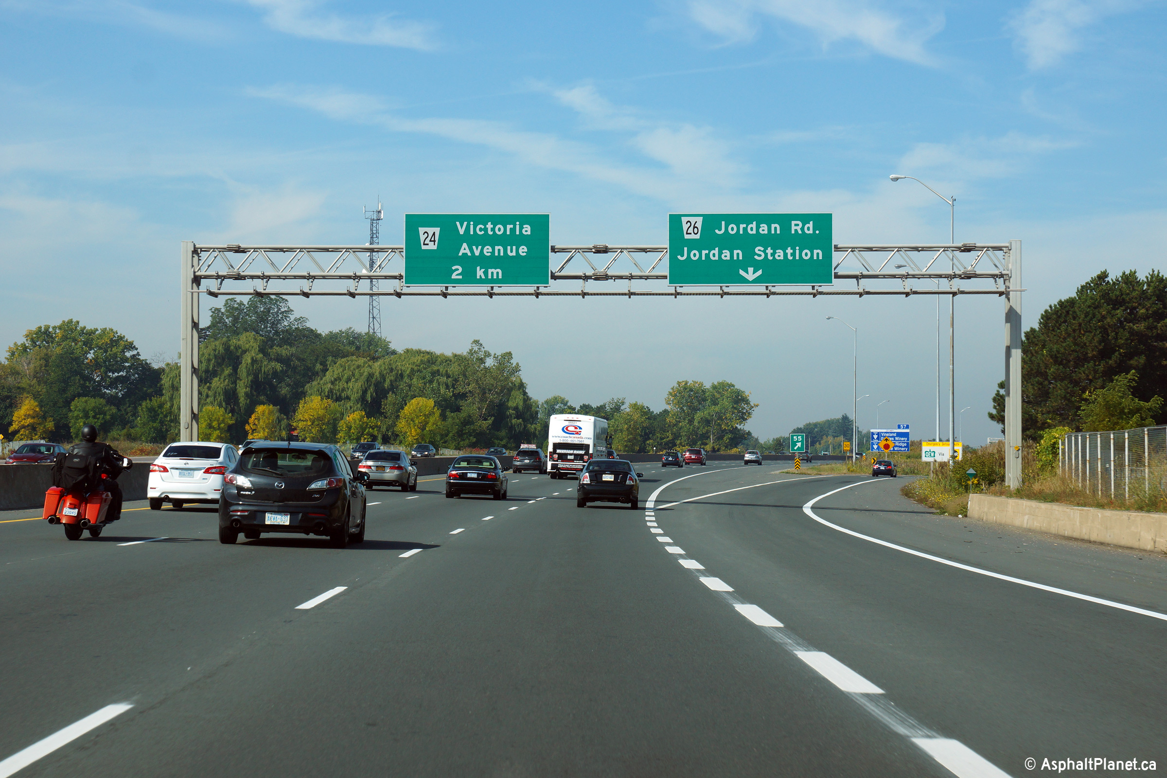
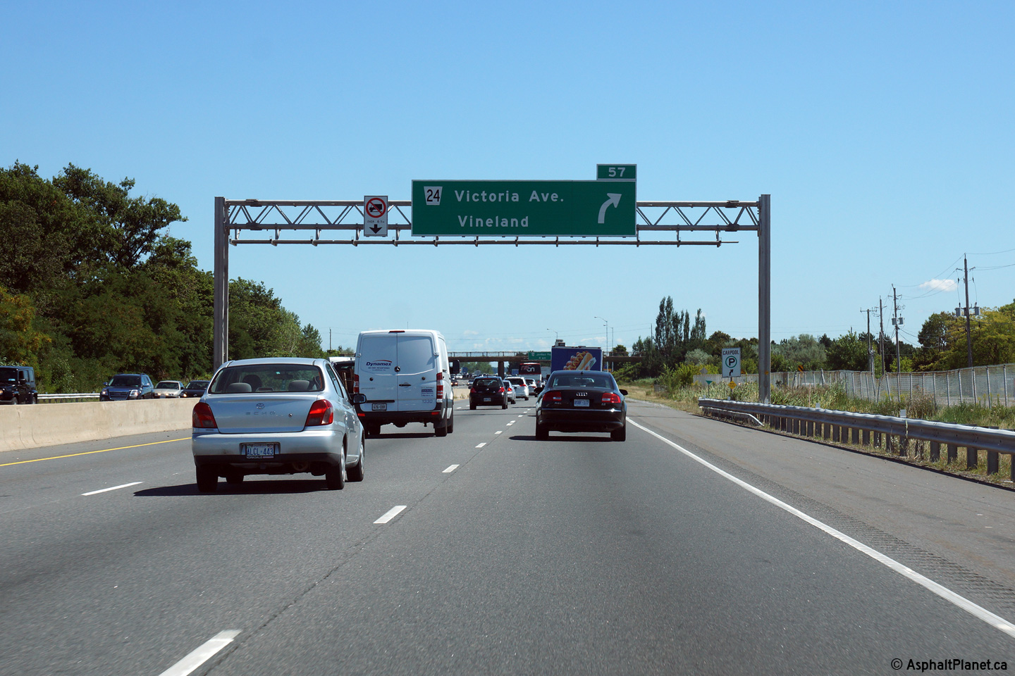
| Town of Lincoln Regional Municipality of Niagara |
Toronto-bound view at the off-ramp to Victoria Road. Victoria Road was
one of the first rural interchanges constructed along the QEW between
Hamilton and St. Catharines. Photo taken: September 28th, 2014. |
 (720x480) (720x480)(1440x960) (2400x1600) |
||
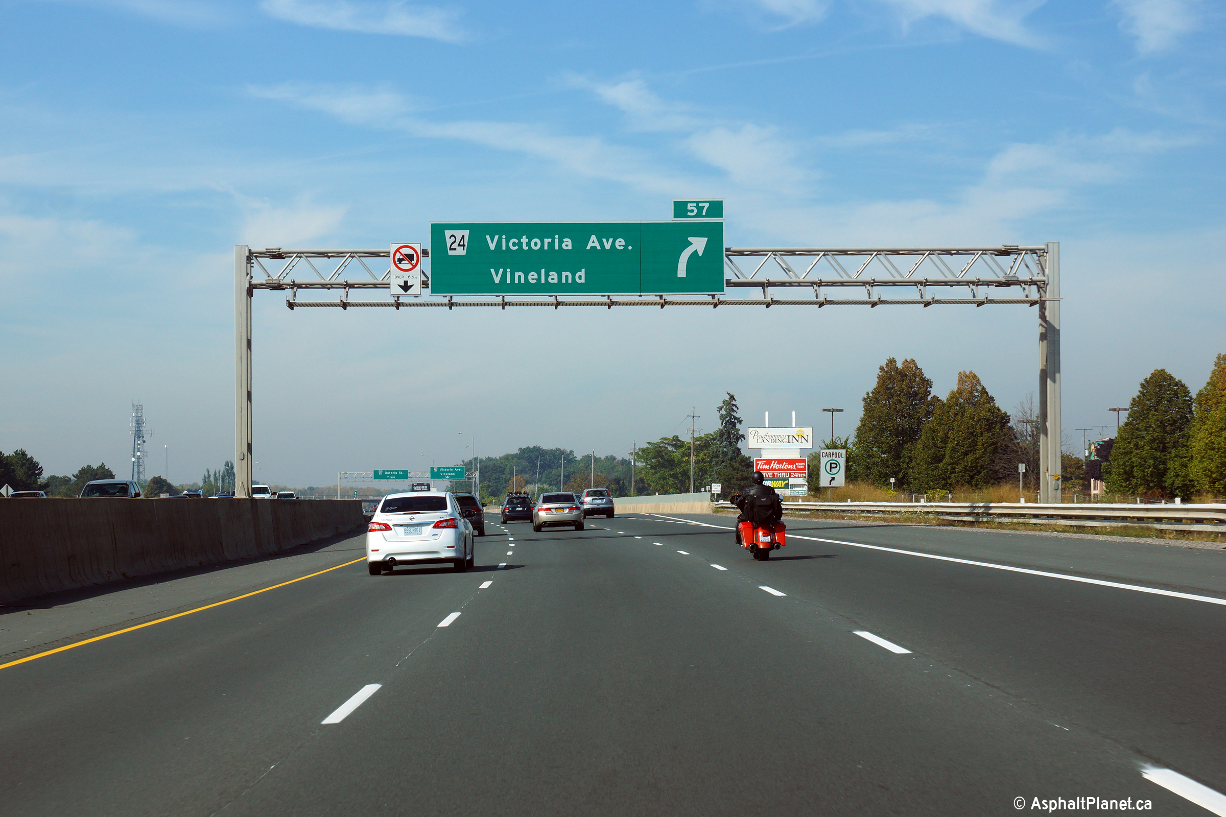
| Town of Lincoln Regional Municipality of Niagara |
View looking easterly from the Victoria Road overpass. Victoria Road
meets the QEW at a parclo AB interchange just west of Jordan Harbour.
Click here for an additional view from
this overpass, taken in October, 2006. Photo taken: July 10th, 2014. |
 (720x480) (1440x960) (2400x1600) |
||
| Town of Lincoln Regional Municipality of Niagara |
Toronto-bound view towards the Victoria Road overpass. Click
here for an additional view from this
overpass, taken in October, 2006. Photo taken: October 30th, 2006. |
 (720x480) (1440x960) (2400x1600) |
||
| Town of Lincoln Regional Municipality of Niagara |
The Fort Erie Bound exit signs for the Victoria Road overpass is affixed to
the Victoria Road structure itself. Photo taken: August 28th, 2014. |
 (720x480) (720x480)(1440x960) (2400x1600) |
||
| Town of Lincoln Regional Municipality of Niagara |
Fort Erie bound advanced signage for the off-ramp to Victoria Road. Photo taken: August 28th, 2014. |
 (720x480) (720x480)(1440x960) (2400x1600) |
||
| Town of Lincoln Regional Municipality of Niagara |
Niagara-bound view from the Tufford Road overpass. Click
here for an additional view from this
overpass, taken in September, 2006. Photo taken: July 10th, 2014. |
 (720x480) (1440x960) (2400x1600) |
||
| Town of Lincoln Regional Municipality of Niagara |
Toronto-bound view from the Tufford Road overpass. Click
here for an additional view from this
overpass, taken in September, 2006. Photo taken: July 10th, 2014. |
 (720x480) (1440x960) (2400x1600) |
||
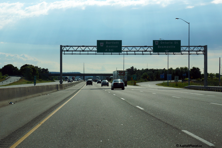
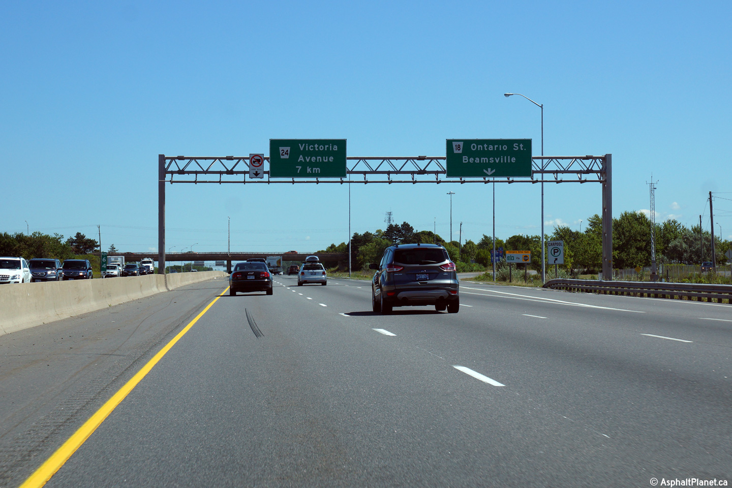
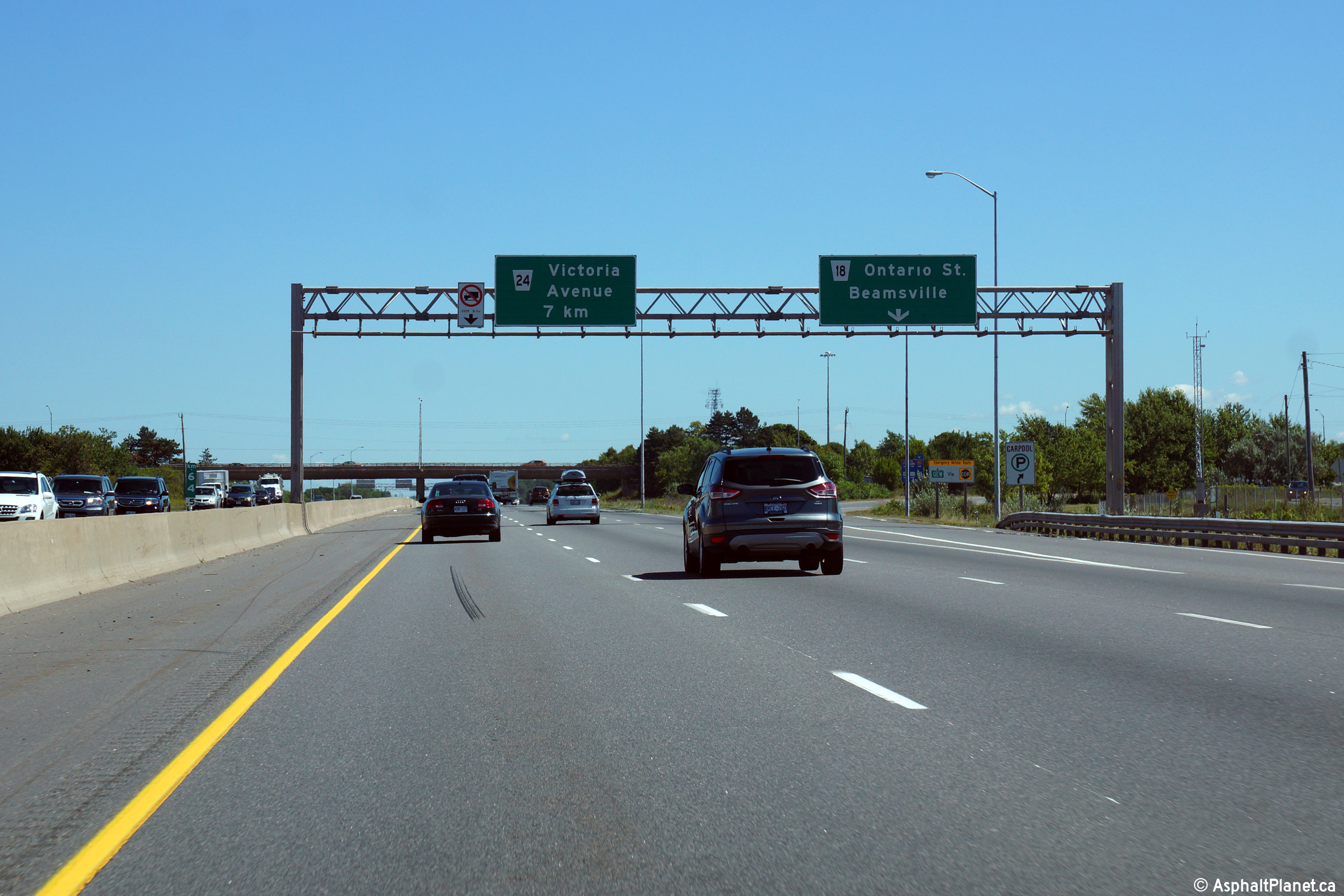
| Town of Lincoln Regional Municipality of Niagara |
Toronto-bound advanced signage for the ramp to Ontario Street in Beamsville. Photo taken: September 28th, 2014. |
 (720x480) (720x480)(1440x960) (2400x1600) |
||
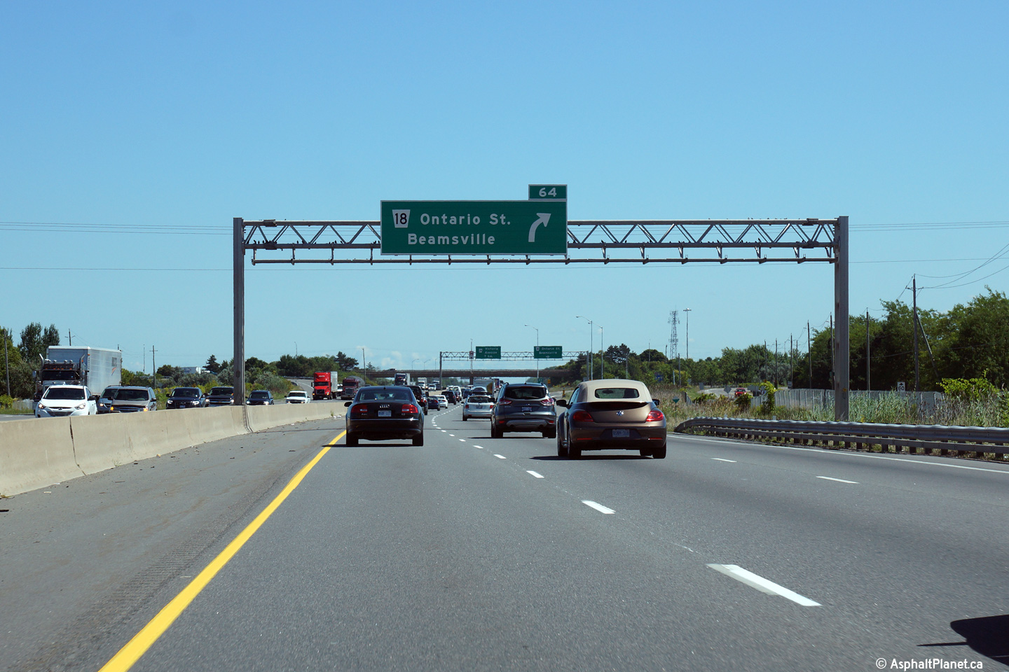
| Town of Lincoln Regional Municipality of Niagara |
Signage at the turn-off to Ontario Street in Beamsville. Photo taken: July 10th, 2014. |
 (720x480) (720x480)(1440x960) (2400x1600) |
||
| Town of Lincoln Regional Municipality of Niagara |
Niagara-bound view from the Ontario Street overpass in Beamsville.
Click here for an additional view from
this overpass, taken in September, 2006. Photo taken: September 25th, 2006. |
 (720x480) (1440x960) (2400x1600) |
||
| Town of Lincoln Regional Municipality of Niagara |
View towards Toronto from the Ontario Street overpass. Click
here for an additional view from this
overpass, taken in September, 2006. Photo taken: September 25th, 2006. |
 (720x480) (1440x960) (2400x1600) |
||
| Town of Lincoln Regional Municipality of Niagara |
Turn-off signage to the Fort Erie bound ramp to Ontario Street in
Beamsville. Photo taken: July 10th, 2014. |
 (720x480) (720x480)(1440x960) (2400x1600) |
||
| Town of Lincoln Regional Municipality of Niagara |
Fort Erie bound advanced signage for the Ontario Street off-ramp. Photo taken: July 10th, 2014. |
 (720x480) (720x480)(1440x960) (2400x1600) |
||
| Town of Lincoln Regional Municipality of Niagara |
Niagara-bound view from the Mountainview Road overpass. Click
here for an additional view from this
overpass, taken in September, 2006. Photo taken: July 10th, 2014. |
 (720x480) (1440x960) (2400x1600) |
||
| Town of Lincoln Regional Municipality of Niagara |
Toronto-bound view from the Mountainview Road overpass looking towards the
Jordan Road interchange in Beamsville. Click
here for an additional view from this
overpass, taken in September, 2006. Photo taken: July 10th, 2014. |
 (720x480) (1440x960) (2400x1600) |
||
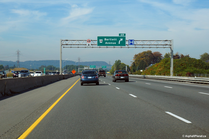
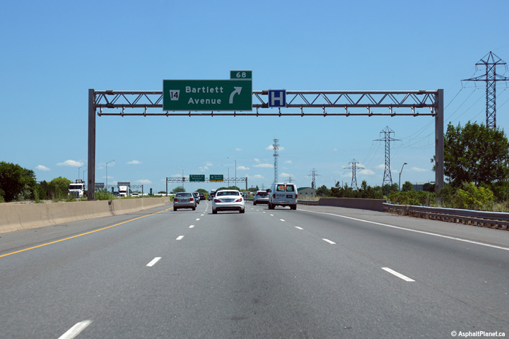
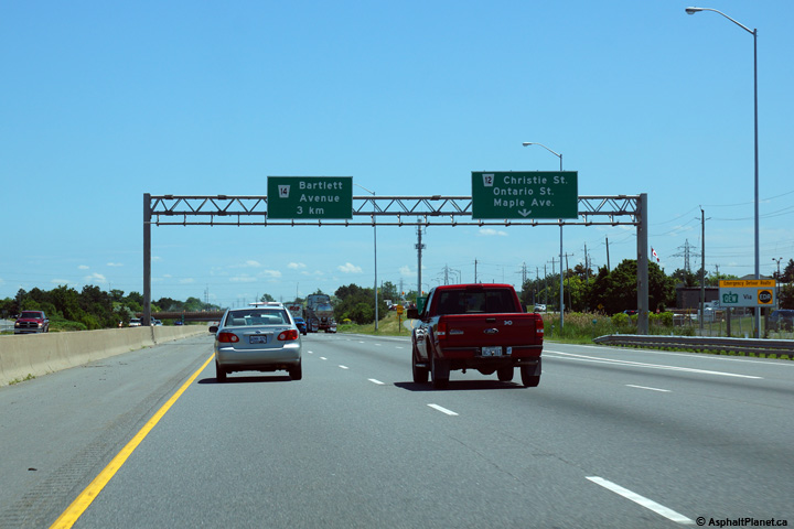
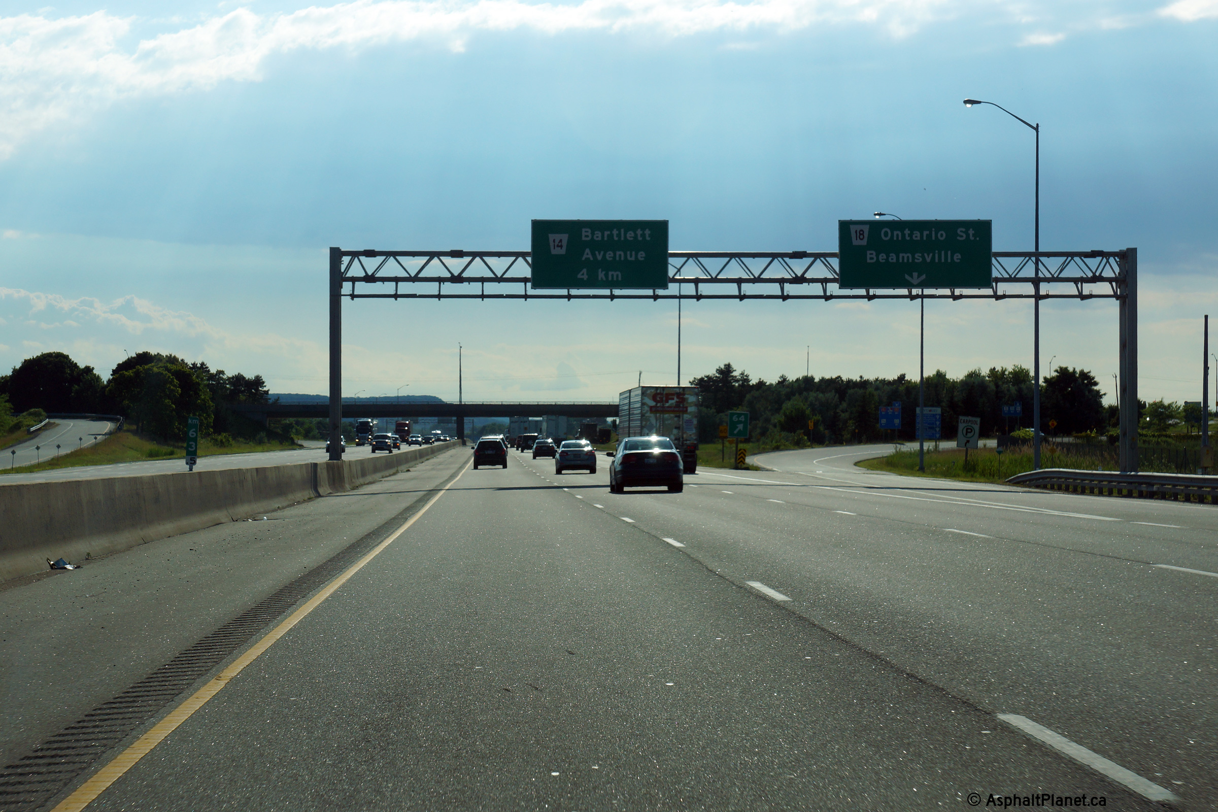
| Town of Lincoln Regional Municipality of Niagara |
Toronto-bound advanced signage for the off-ramp to Bartlett Avenue in
Grimsby. Photo taken: September 28th, 2014. |
 (720x480) (720x480)(1440x960) (2400x1600) |
||
| Town of Lincoln Regional Municipality of Niagara |
Signage at the Toronto-bound off-ramp to Bartlett Avenue. Photo taken: September 28th, 2014. |
 (720x480) (720x480)(1440x960) (2400x1600) |
||
| Town of Lincoln Regional Municipality of Niagara |
Fort Erie bound signage at the turn-off to the ramp to Bartlett Avenue. Photo taken: July 10th, 2014. |
 (720x480) (720x480)(1440x960) (2400x1600) |
||
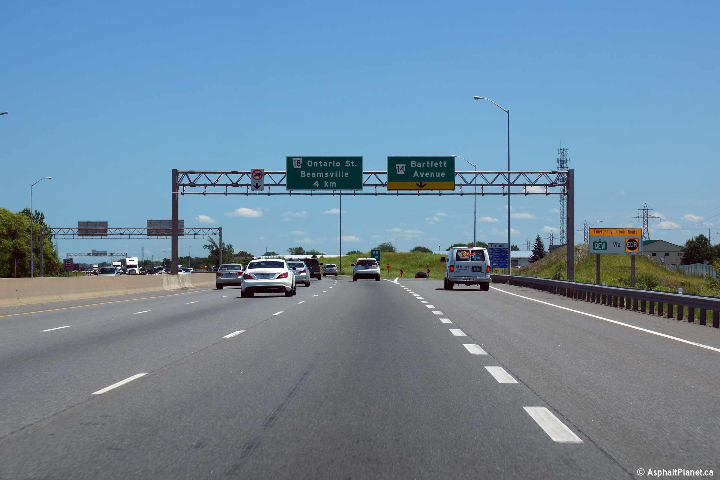
| Town of Lincoln Regional Municipality of Niagara |
Advanced signage for the Bartlett Avenue interchange. Photo taken: July 10th, 2014. |
 (720x480) (720x480)(1440x960) (2400x1600) |
||
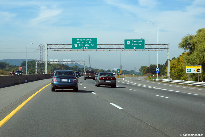
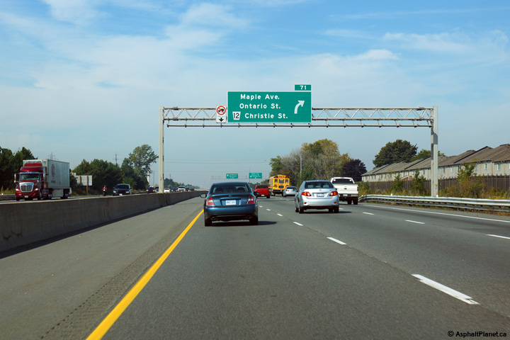
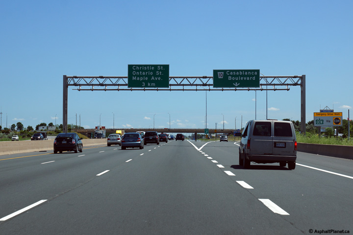
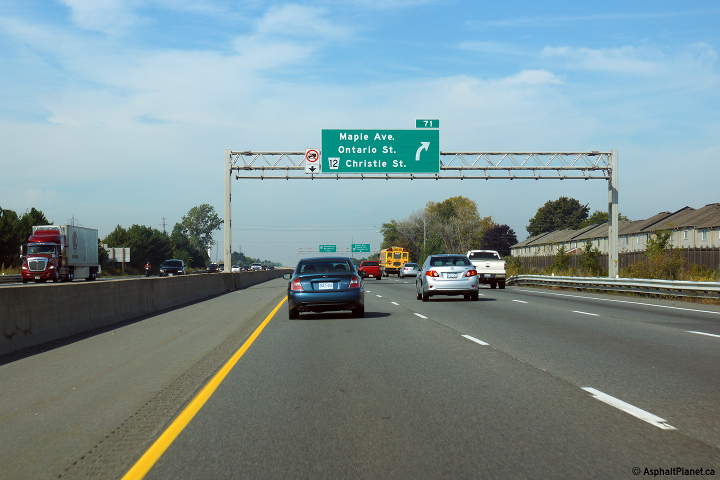
| Town of Grimsby Regional Municipality of Niagara |
Advanced signage for the Toronto-bound off-ramp to Maple Avenue, Ontario
Street and Christie Street in Grimsby. The QEW meets these three
cross-roads at an elongated diamond interchange, where the off-ramp
intersects each cross-road at grade. Photo taken: September 28th, 2014. |
 (720x480) (720x480)(1440x960) (2400x1600) |
||
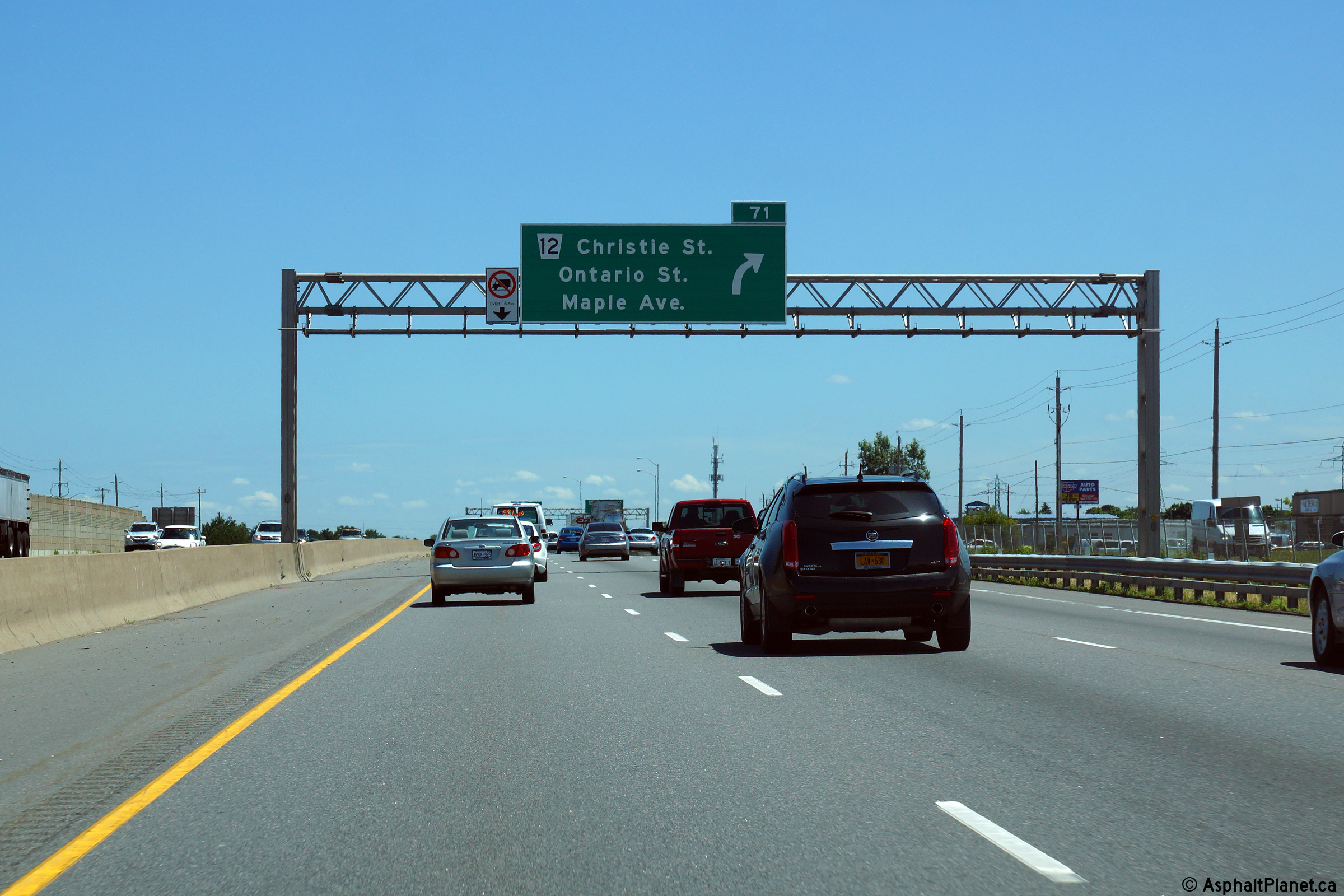
| Town of Grimsby Regional Municipality of Niagara |
Signage at the Toronto-bound off-ramp to the Maple Avenue, Ontario Street
and Christie Street interchange. Photo taken: September 28th, 2014. |
 (720x480) (720x480)(1440x960) (2400x1600) |
||
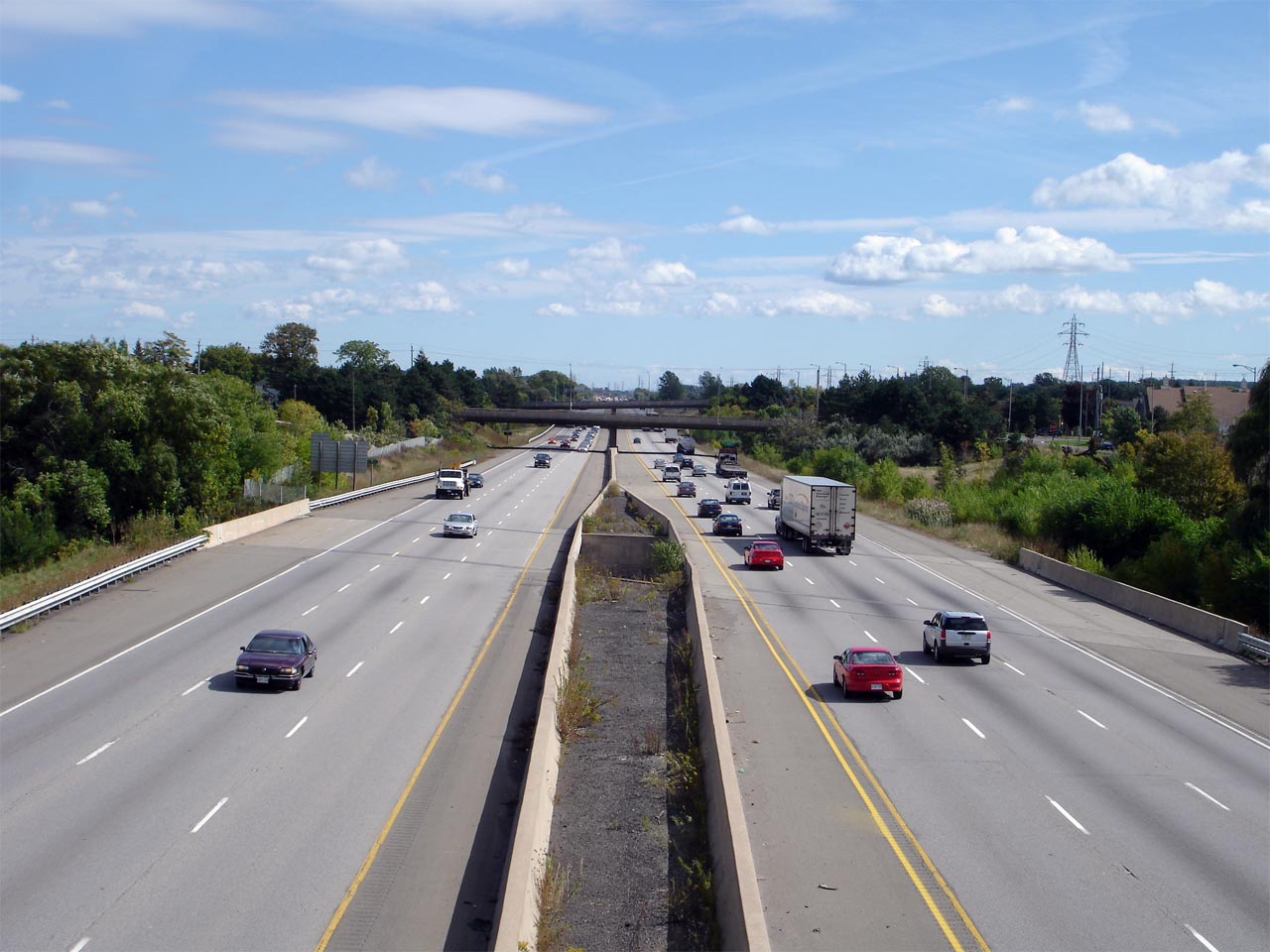
| Town of Grimsby Regional Municipality of Niagara |
View looking easterly from the Christie Street overpass in Grimsby towards
the Ontario Street and Maple Avenue overpasses. Notice that the
structure carrying the QEW over Forty Mile Creek has been widened to support
an 8-lane freeway. Picture taken: September 25th, 2006. |
 (720x480) (1440x960) |
||
| Town of Grimsby Regional Municipality of Niagara |
Looking west towards Hamilton along the QEW from the Christie Street
overpass. Picture taken: September 25th, 2006. |
 (720x480) (1440x960) |
||
| Town of Grimsby Regional Municipality of Niagara |
Niagara-bound off-ramp to the Grimsby interchange. Photo taken: July 10th, 2014. |
 (720x480) (720x480)(1440x960) (2400x1600) |
||
| Town of Grimsby Regional Municipality of Niagara |
Advanced signage for the principal Grimsby interchange. Photo taken: July 10th, 2014. |
 (720x480) (720x480)(1440x960) (2400x1600) |
||
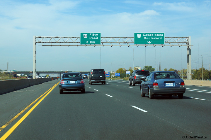
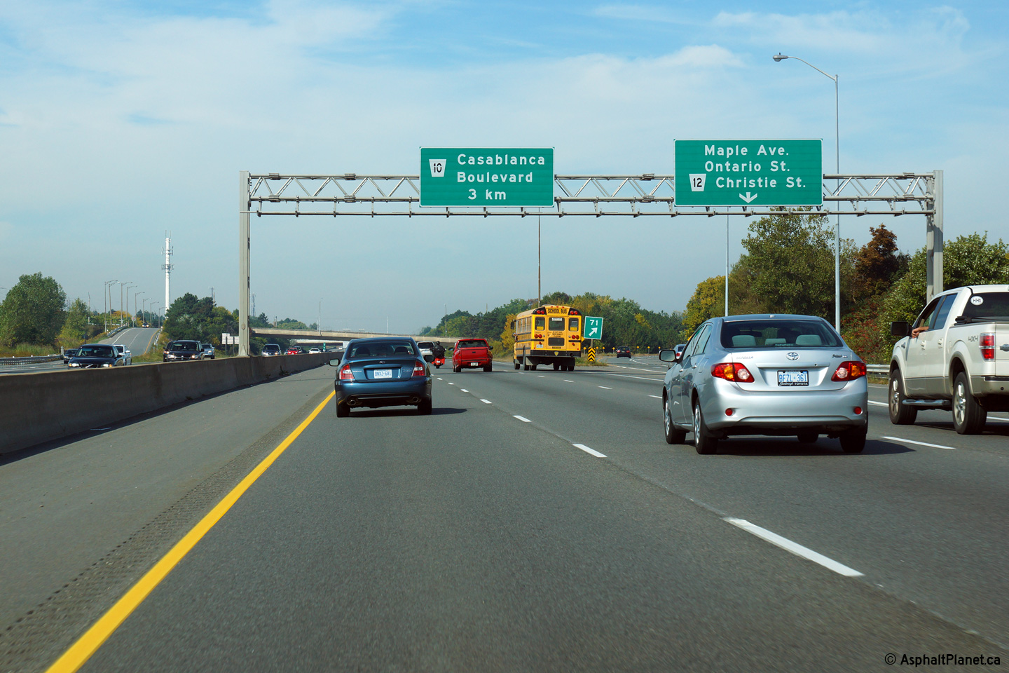
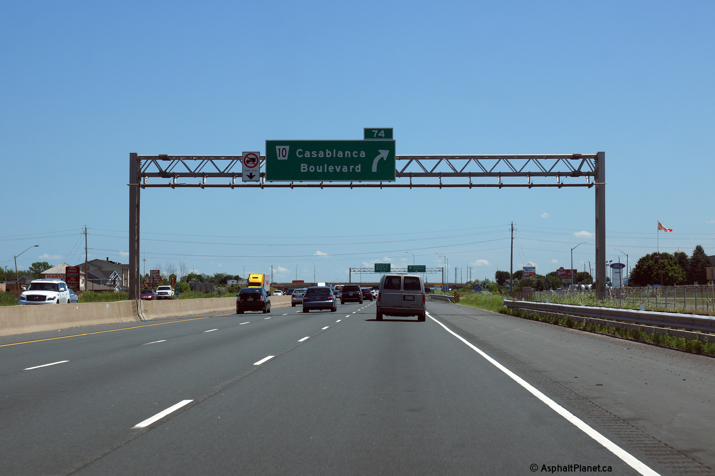
| Town of Grimsby Regional Municipality of Niagara |
Toronto-bound advanced signage for the the off-ramp to Casablanca Boulevard. Photo taken: September 28th, 2014. |
 (720x480) (720x480)(1440x960) (2400x1600) |
||
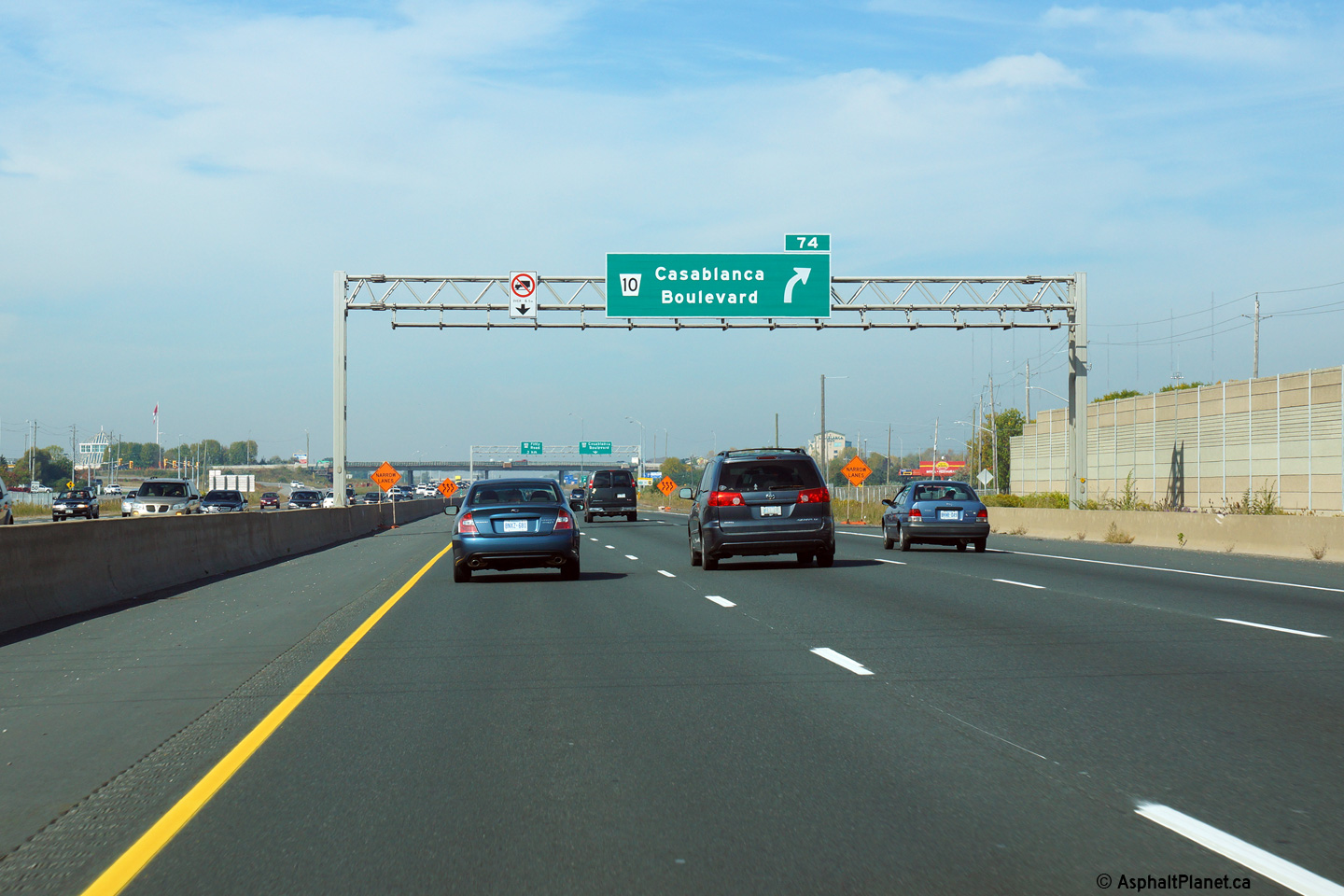
| Town of Grimsby Regional Municipality of Niagara |
Signage at the off-ramp to Casablanca Boulevard. Photo taken: September 28th, 2014. |
 (720x480)
(1440x960) (2400x1600) |
||
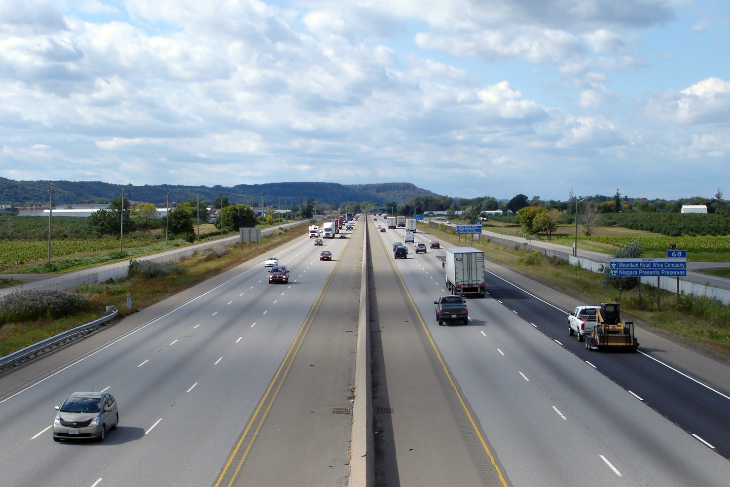
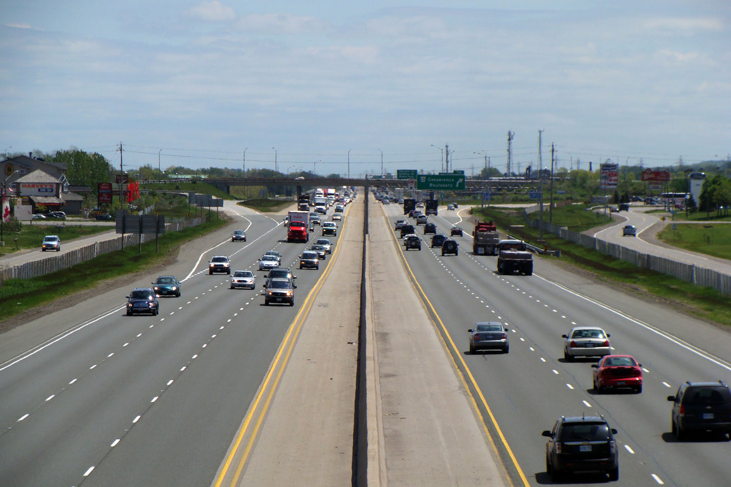
| Town of Grimsby Regional Municipality of Niagara |
View looking towards Niagara and Fort Erie from the Casablanca Boulevard
interchange. Picture taken: May 23rd, 2008. |
 (720x480) (1440x960) |
||
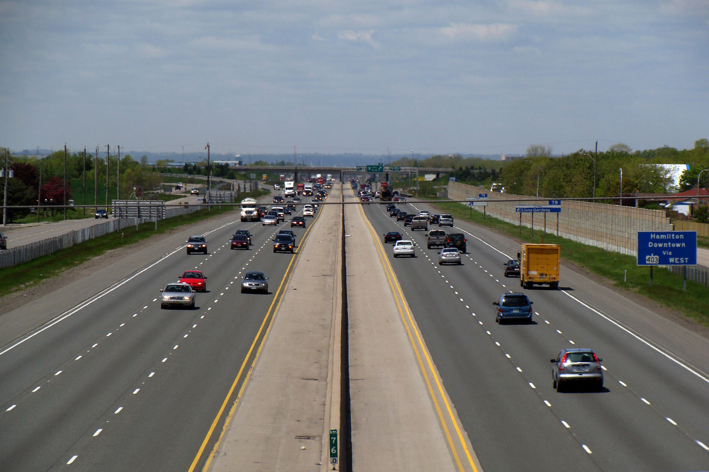
| Town of Grimsby Regional Municipality of Niagara |
View looking westerly towards Hamilton from the Casablanca Boulevard
interchange. This is the first (from the west) interchange in Niagara
Region along the QEW, and serves as the main access to the Gateway Niagara
Service Centre. Picture taken: May 23rd, 2008. |
 (720x480) (1440x960)  (720x480) (1440x960) |
||
| Town of Grimsby Regional Municipality of Niagara |
Overhead signage at the off-ramp to Casablanca Boulevard looking easterly
towards Fort Erie. Photo taken: July 10th, 2014. |
 (720x480) (720x480)(1440x960) (2400x1600) |
||
| Town of Grimsby Regional Municipality of Niagara |
Advanced signage for the Casablanca Boulevard interchange. Photo taken: July 10th, 2014. |
 (720x480) (720x480)(1440x960) (2400x1600) |
||
| Town of Grimsby Regional Municipality of Niagara |
Looking east from Oaks Road. This overpass is located roughly at
kilometre marker 76. Picture taken: May 23rd, 2008. |
 (720x480) (1440x960) |
||
| Town of Grimsby Regional Municipality of Niagara |
View looking towards Hamilton from the Oaks Road overpass. This is the
western-most QEW overpass in Niagara Region. Picture taken: May 23rd, 2008. |
 (720x480) (1440x960) |
||
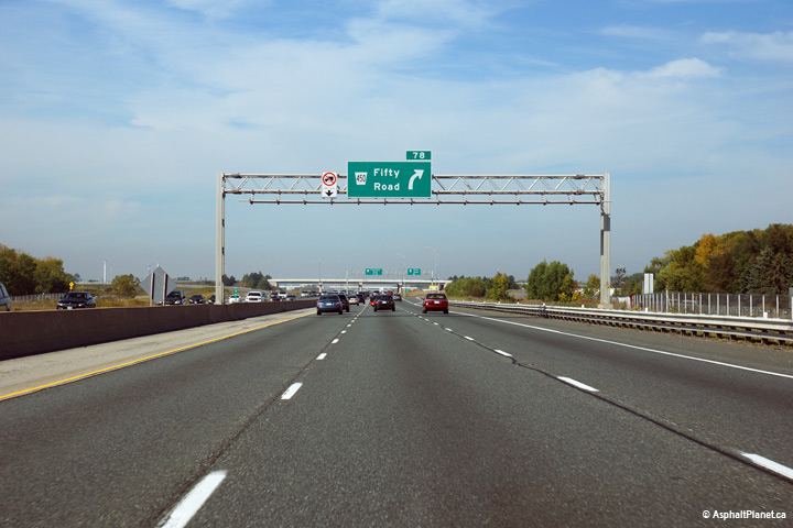
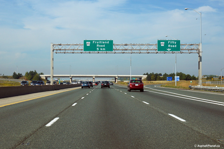
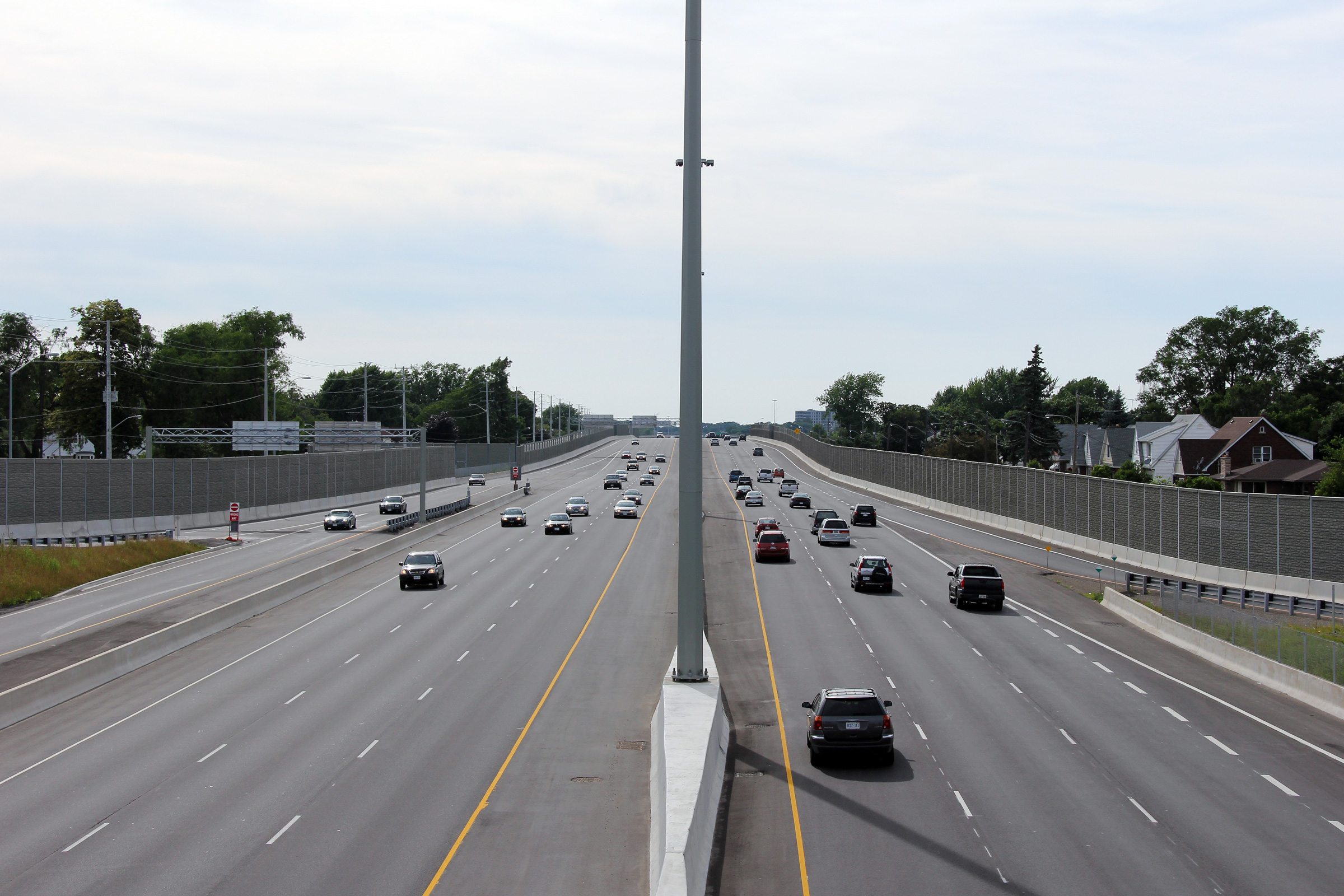
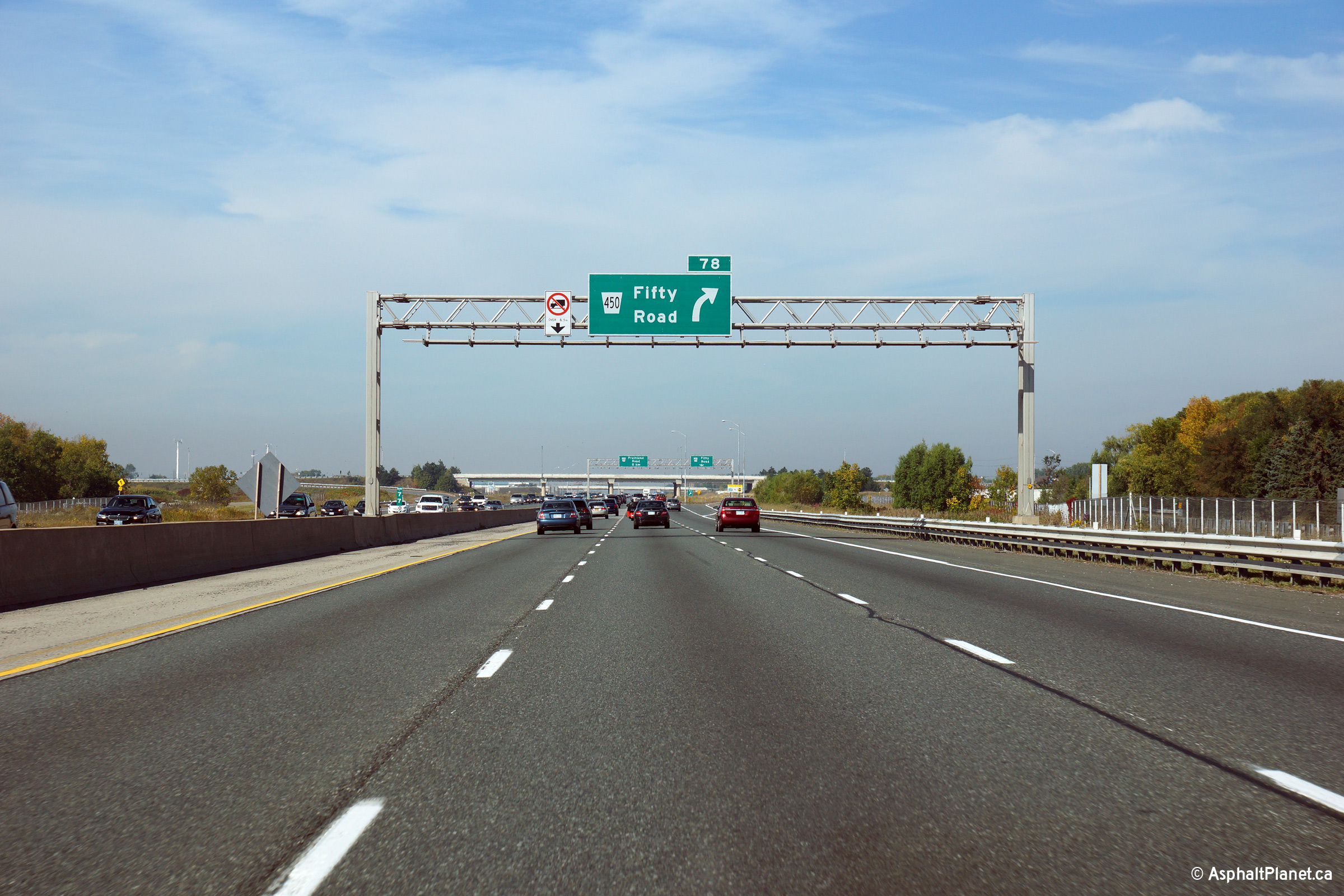
| City of Hamilton |
Toronto-bound signage in advance of the off-ramp to Fifty Road. Photo taken: September 28th, 2014. |
 (720x480) (720x480)(1440x960) (2400x1600) |
||
| City of Hamilton |
Signage at the Toronto-bound off-ramp to Fifty Road. Photo taken: September 28th, 2014. |
 (720x480) (720x480)(1440x960) (2400x1600) |
||
| City of Hamilton |
Looking towards Fort Erie from the Fifty Road overpass in the east end of
Hamilton. Click here to jump to the
opposing view from the Fifty Road overpass. Picture taken: May 23rd, 2008. |
 (720x480) (1440x960) |
||
| Continues on Stoney Creek to Burlington Images Page | ||||
<- Page 1 Images Queen Elizabeth Way Images Index Page 3 Images ->
<- Highway 811 Images Back to Queen Elizabeth Way Highway 2 Images ->
Copyright (c) 2004-2015, Scott Steeves (Webmaster) scott@asphaltplanet.ca


