King's Highway 17 - Images
<- Page 5A Page 5B - Rockland to Hawksbury Page 5B->
Photos shown in this table are arranged from West to East:
|
Proper Municipality Name |
Photo Description |
Photo |
|
|
Pictures taken from driver's perspective appear offset from centre-line pictures: |
East- |
West- |
|
|
Pictures continue westward on Highway 17 - Ottawa to Rockland Images Section |
|||
|
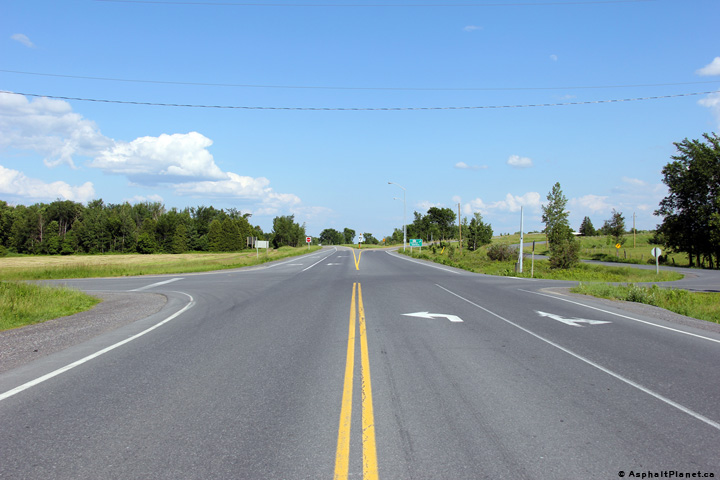
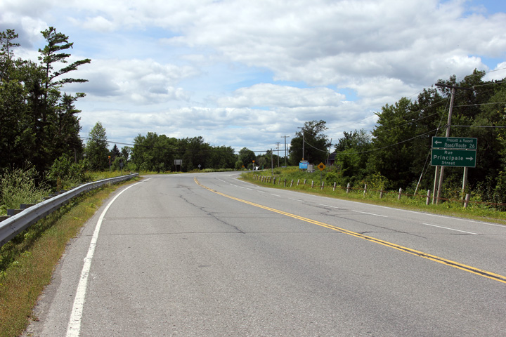
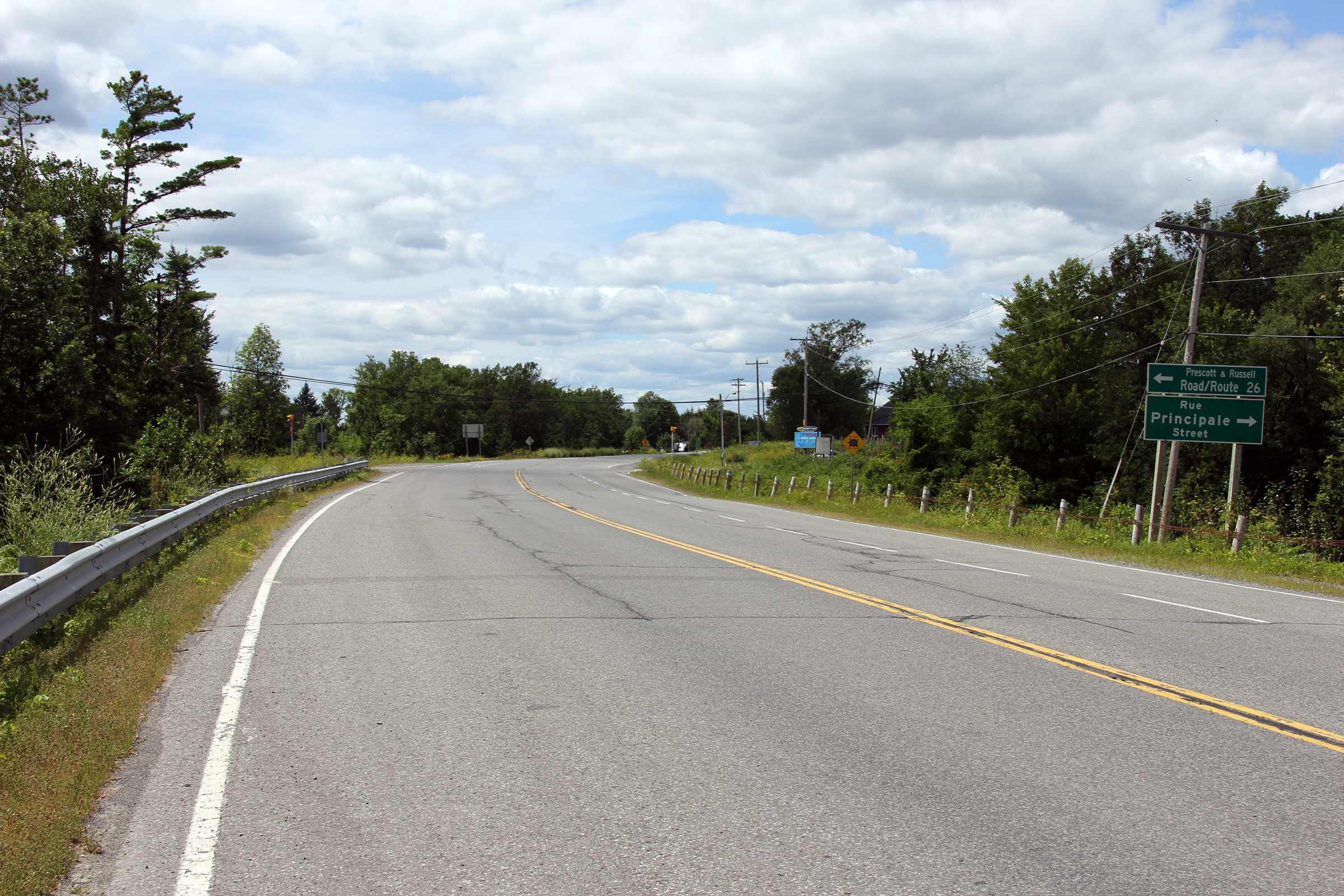
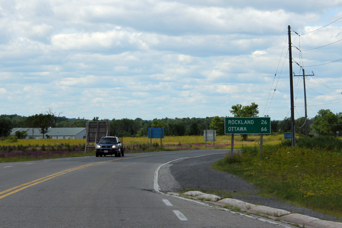
Township of Alfred and Plantagenet United Counties of Prescott and Russell |
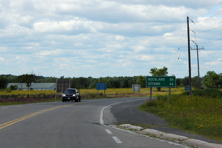
Westerly view along Highway 17 at the Prescott & Russell Road 26
intersection. The pre-1954 alignment of Highway 17 crossed the current
highway at this junction. During the 1950s, almost the entire routing
of Highway 17 between Ottawa and the Québec Border was
realigned. Depending upon the exact section the realigned Highway 17
served as the principal route between Ottawa and Montreal for about 20 years
before it was again by-passed by Highway 417. Photo taken: July 24th, 2011. |
||
|
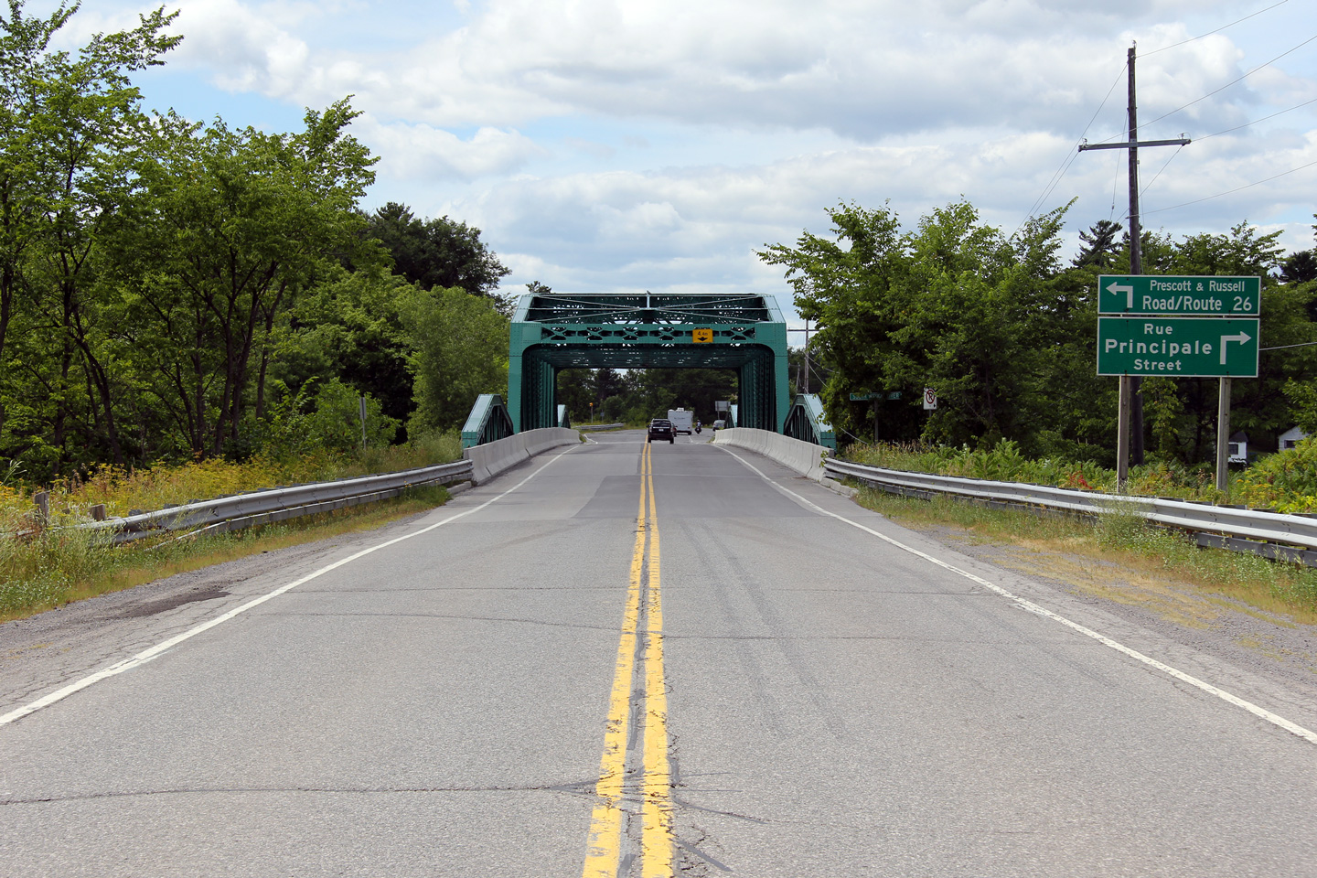
Township of Alfred and Plantagenet United Counties of Prescott and Russell |
Two views looking easterly across the South Nation River truss bridge.
The South Nation River Bridge had recently been sandblasted and repainted
when this photo was taken.. Photo taken: July 24th, 2011. |
 (720x480) (1440x960) (2400x1600)  (720x480) (1440x960) (2400x1600) |
|
|
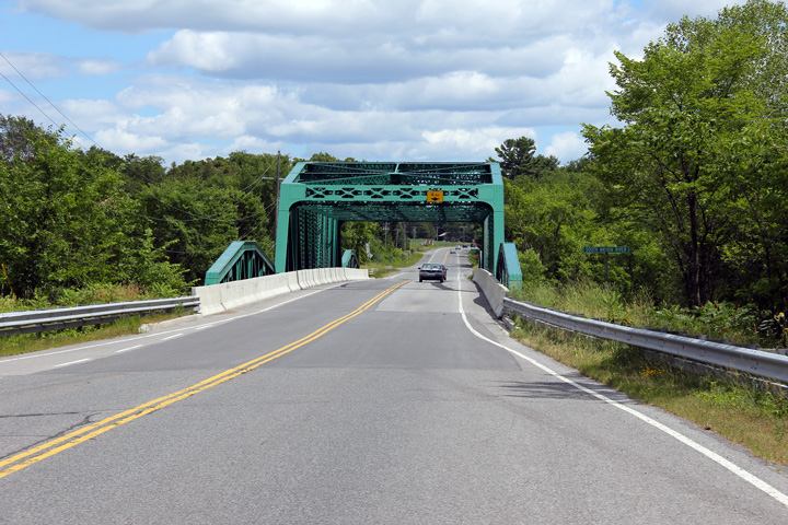
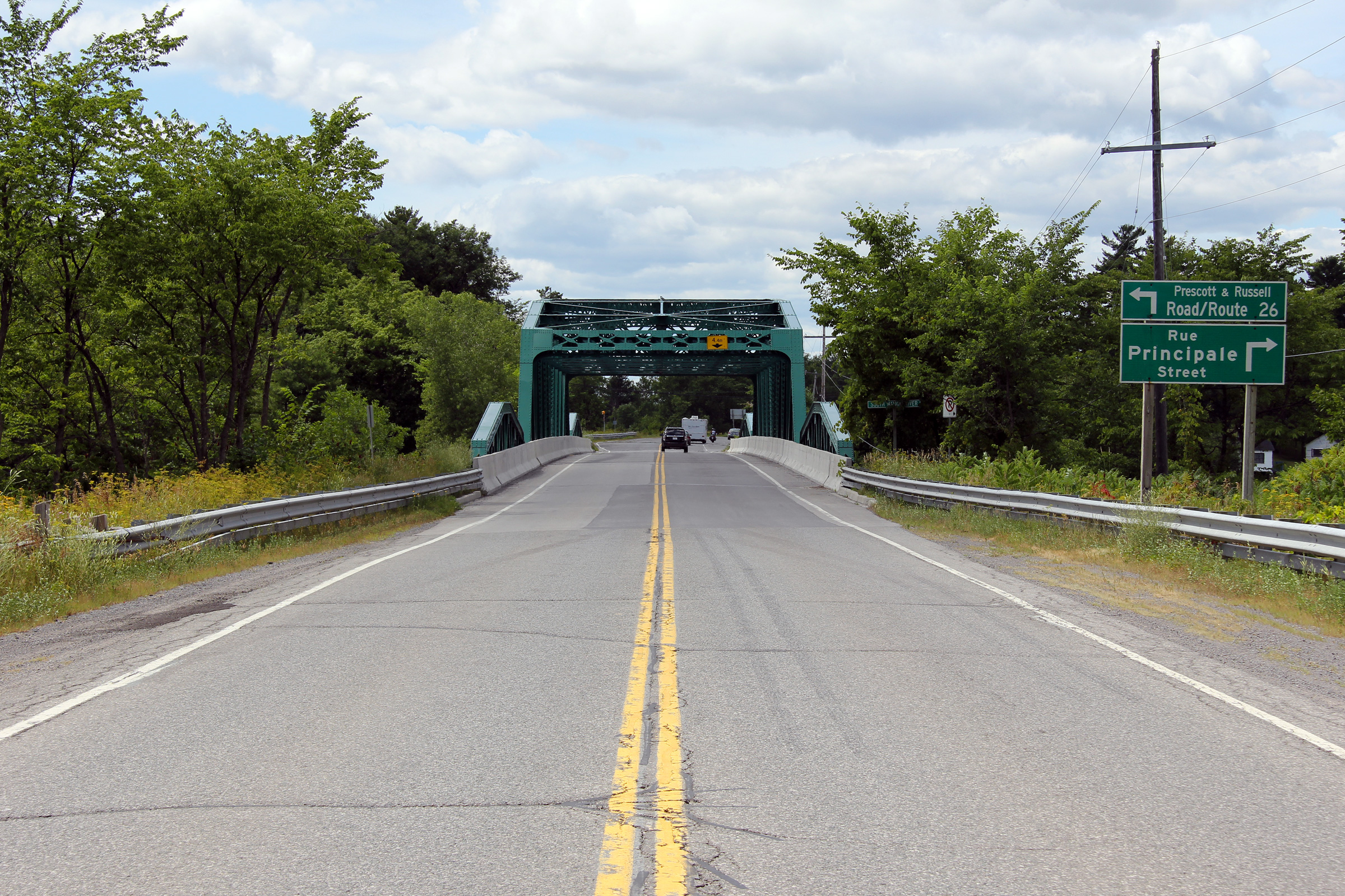
Township of Alfred and Plantagenet United Counties of Prescott and Russell |
Westerly view as Highway 17 crosses the South Nation River truss bridge.
While the truss bridge is an extremely elegant design, given the high-speed
nature of Highway 17, the span is just a touch too narrow, particularly
given the bridge's long length. Pedestrians and cyclists would be well
advised to cross the South Nation River through Plantagenet and not along
Highway 17. Photo taken: July 24th, 2011. |
||
|
Township of Alfred and Plantagenet United Counties of Prescott and Russell |
Eastbound view from just east of the South Nation River. Eastern
Ontario's bilingual population creates an interesting problem for road sign
designers. Photo taken: July 24th, 2011. |
||
|
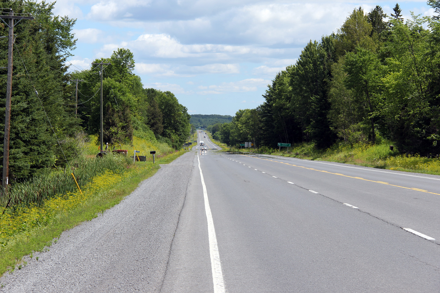
Township of Alfred and Plantagenet United Counties of Prescott and Russell |
Easterly view looking into the South Nation River valley. Highway 17
runs parallel to the South Nation River for several kilometres north of
Plantagenet. Photo taken: July 24th, 2011. |
||
|
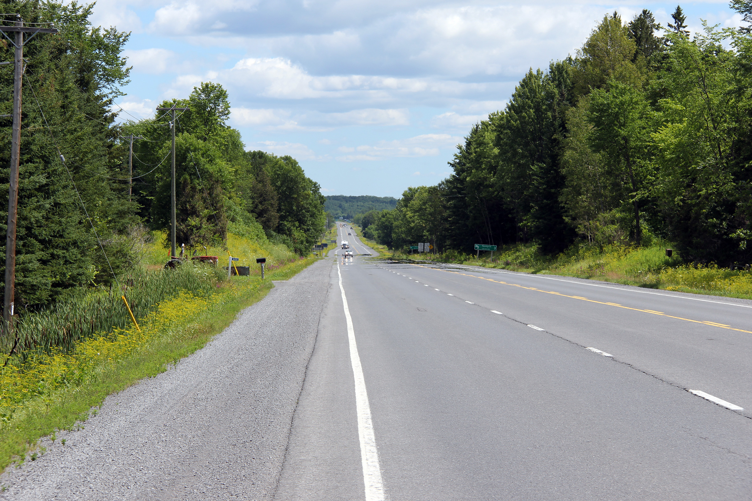
Township of Alfred and Plantagenet United Counties of Prescott and Russell |
Easterly view along Highway 17 approaching the long climbing lane that takes
traffic briefly out of the South Nation River valley. Photo taken: July 24th, 2011. |
||
|
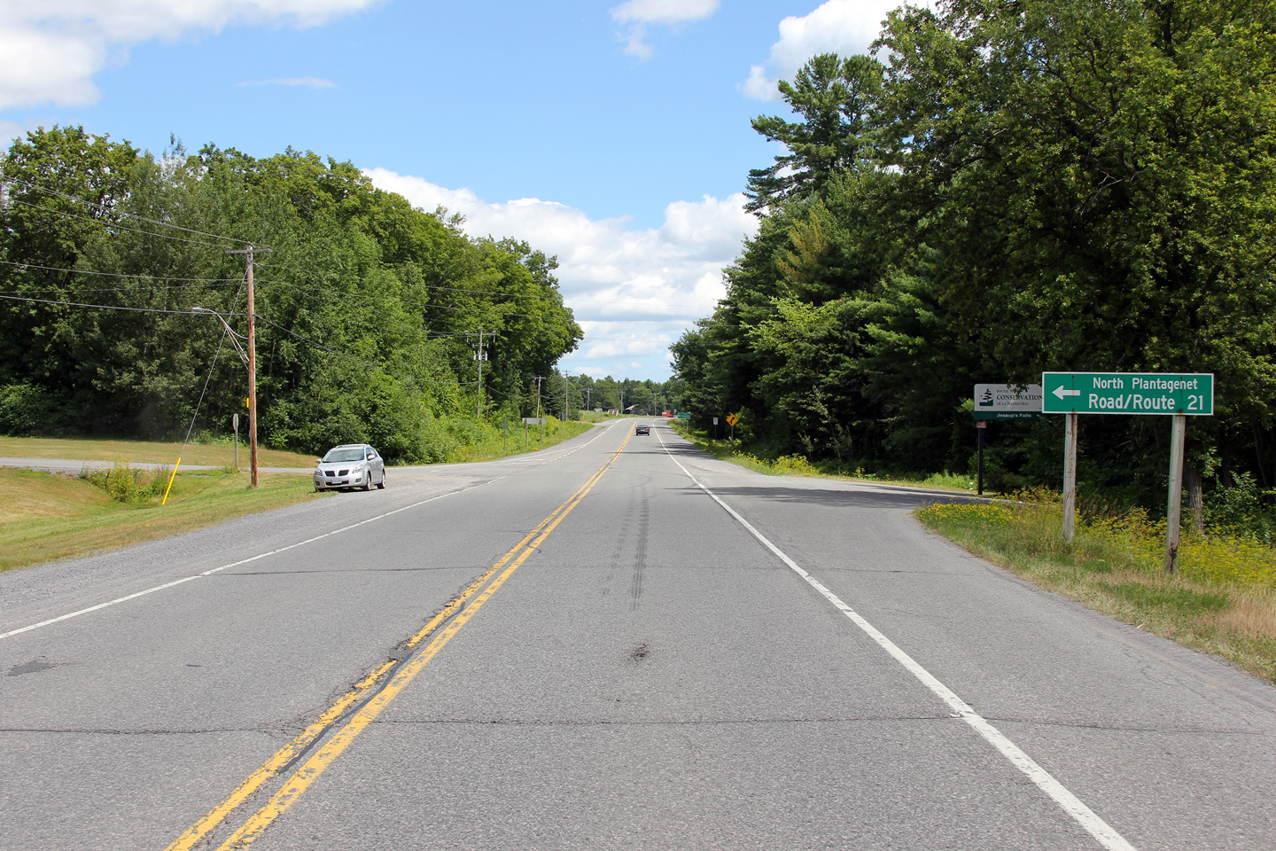
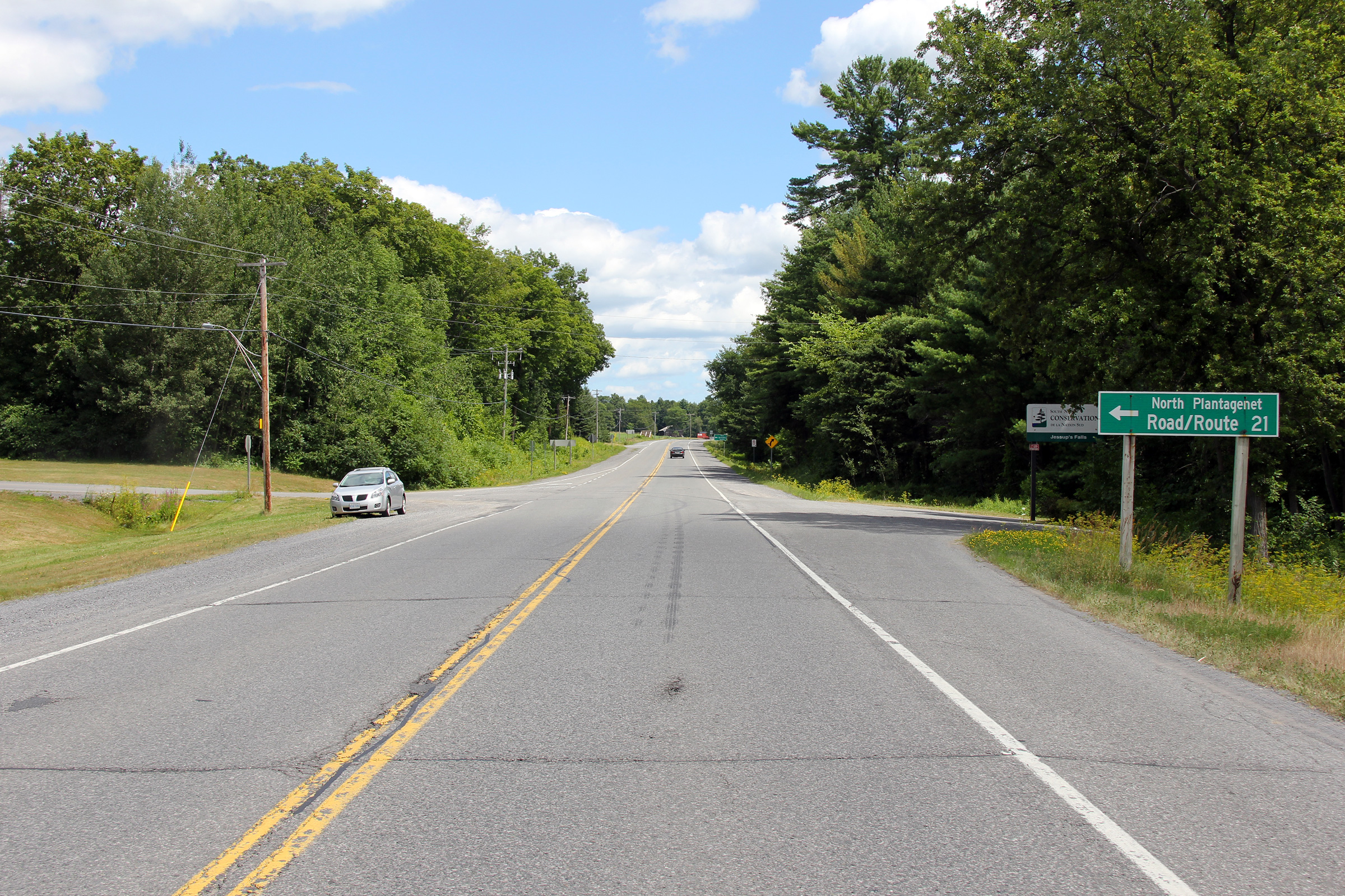
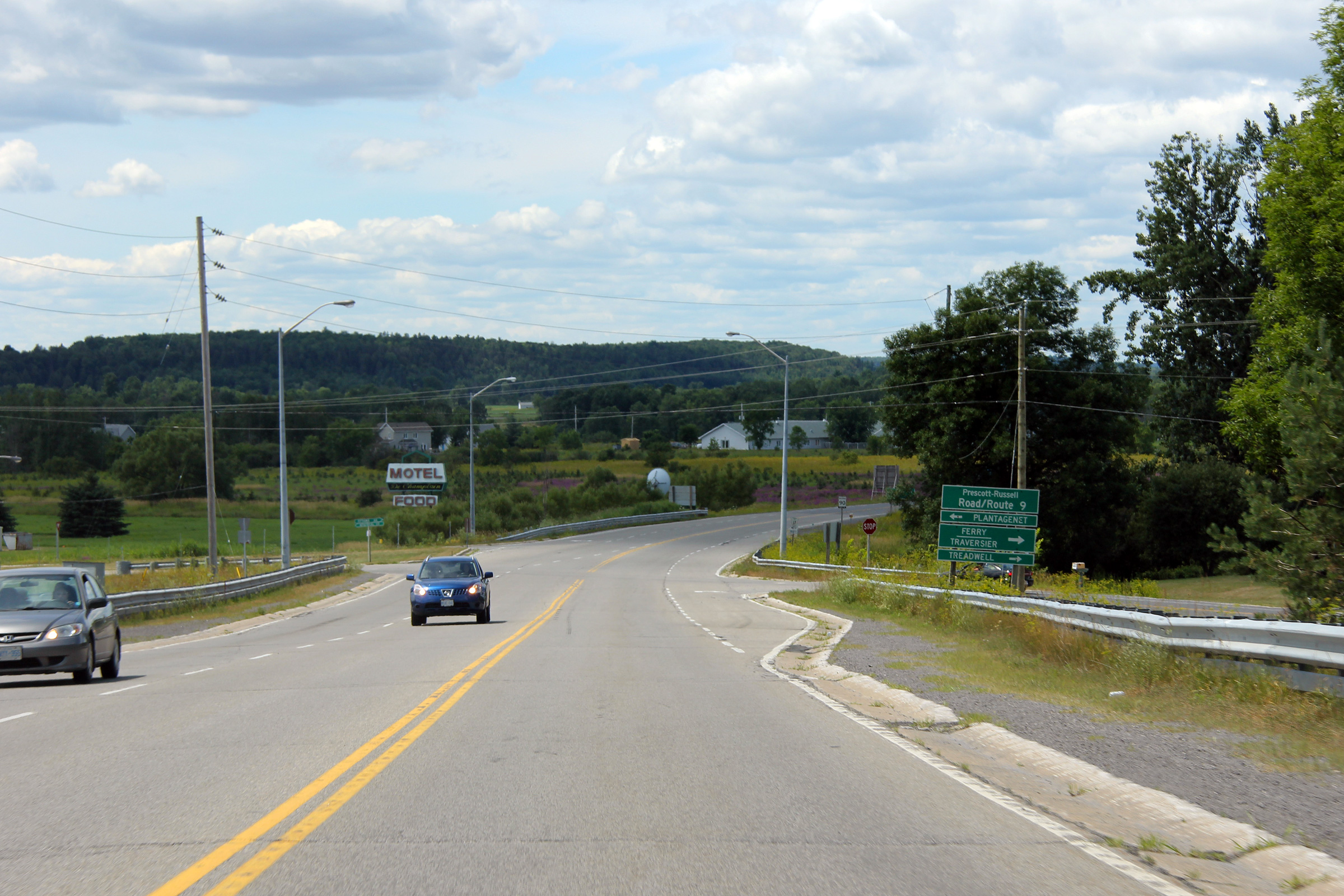
Township of Alfred and Plantagenet United Counties of Prescott and Russell |
Westbound distance signage just west of the Prescott & Russell Road 9
intersection. The placement of this sign is indicative of the fact
that Prescott & Russell Road 9 through the town of Plantagenet is the former
alignment of Highway 17. The current highway was completed circa 1954,
however there was a time during the 1950s where both the new and old
alignments of Highway 17 were designated as king's highways. It is
typical for a distance sign to be placed after an intersection with another
(former) highway. Photo taken: July 24th, 2011. |
 (720x480) (720x480)(1440x960) |
|
|
Township of Alfred and Plantagenet United Counties of Prescott and Russell |
Westerly view approaching the Prescott & Russell Road 9 intersection.
Prescott & Russell has chosen to stripe this intersection in a very atypical
manner since receiving this road from the province. Photo taken: July 24th, 2011. |
||
|
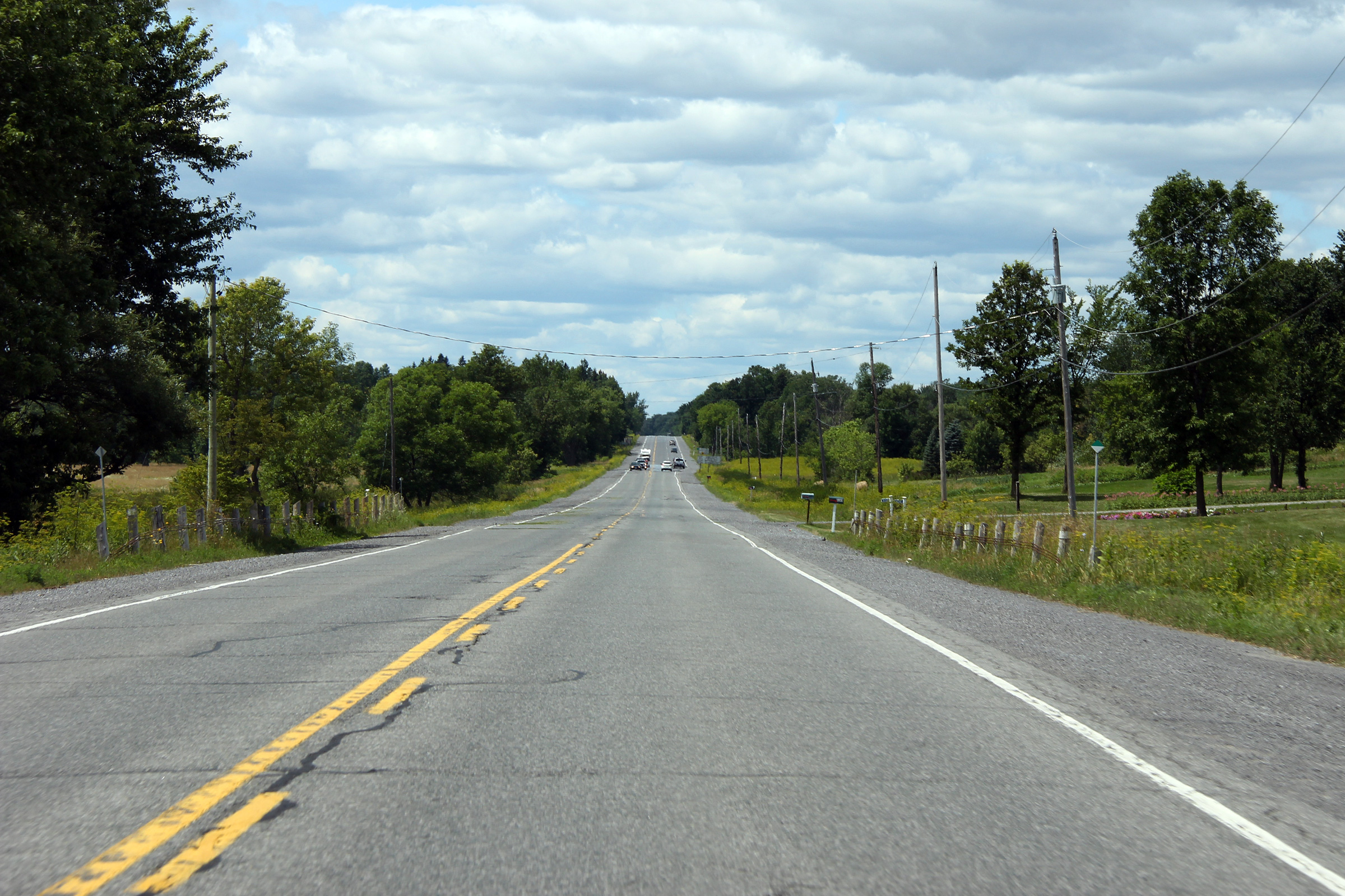
Township of Alfred and Plantagenet United Counties of Prescott and Russell |
Fairly non-descript view of Highway 17 approaching Boundary Road.. Photo taken: July 24th, 2011. |
||
|
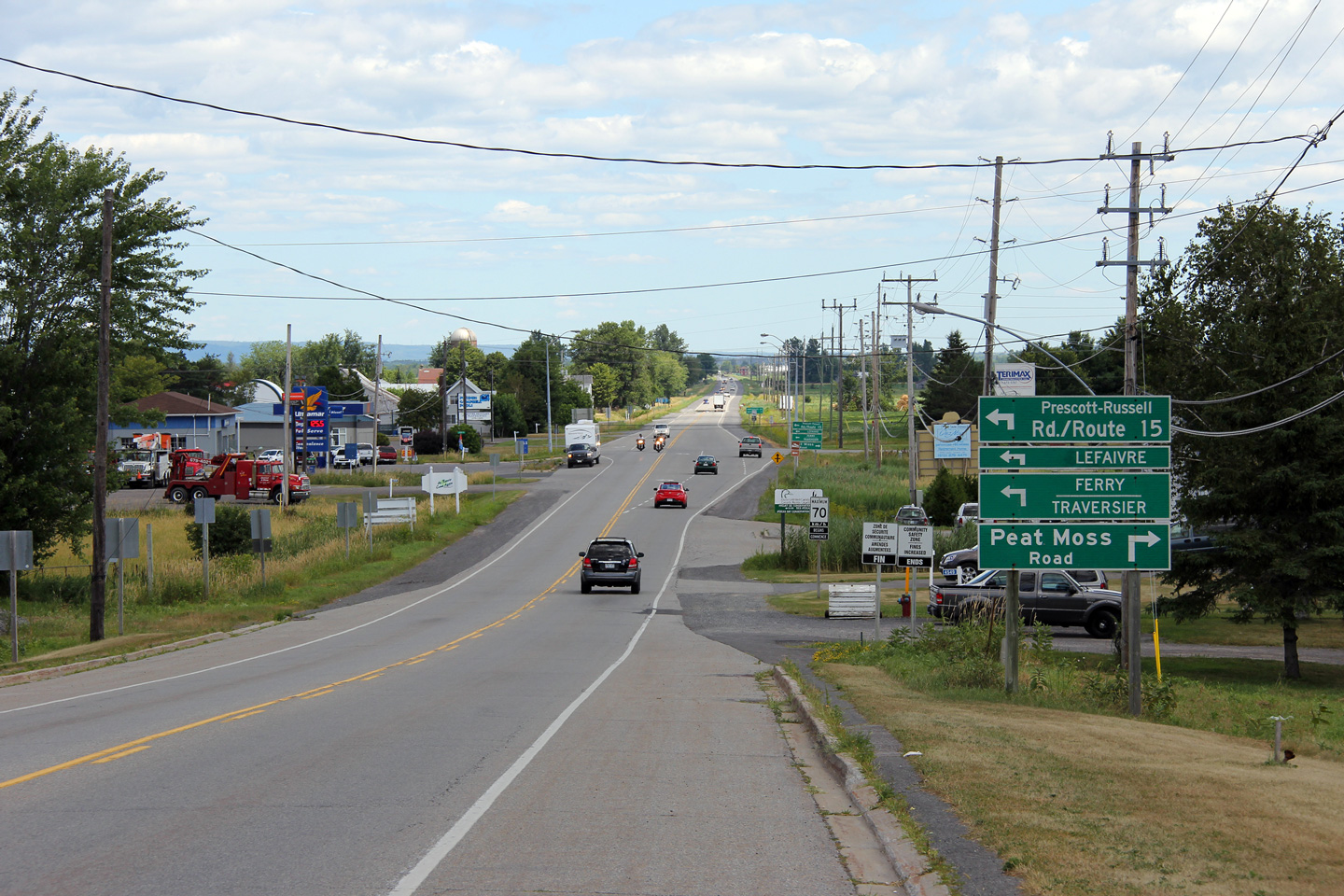
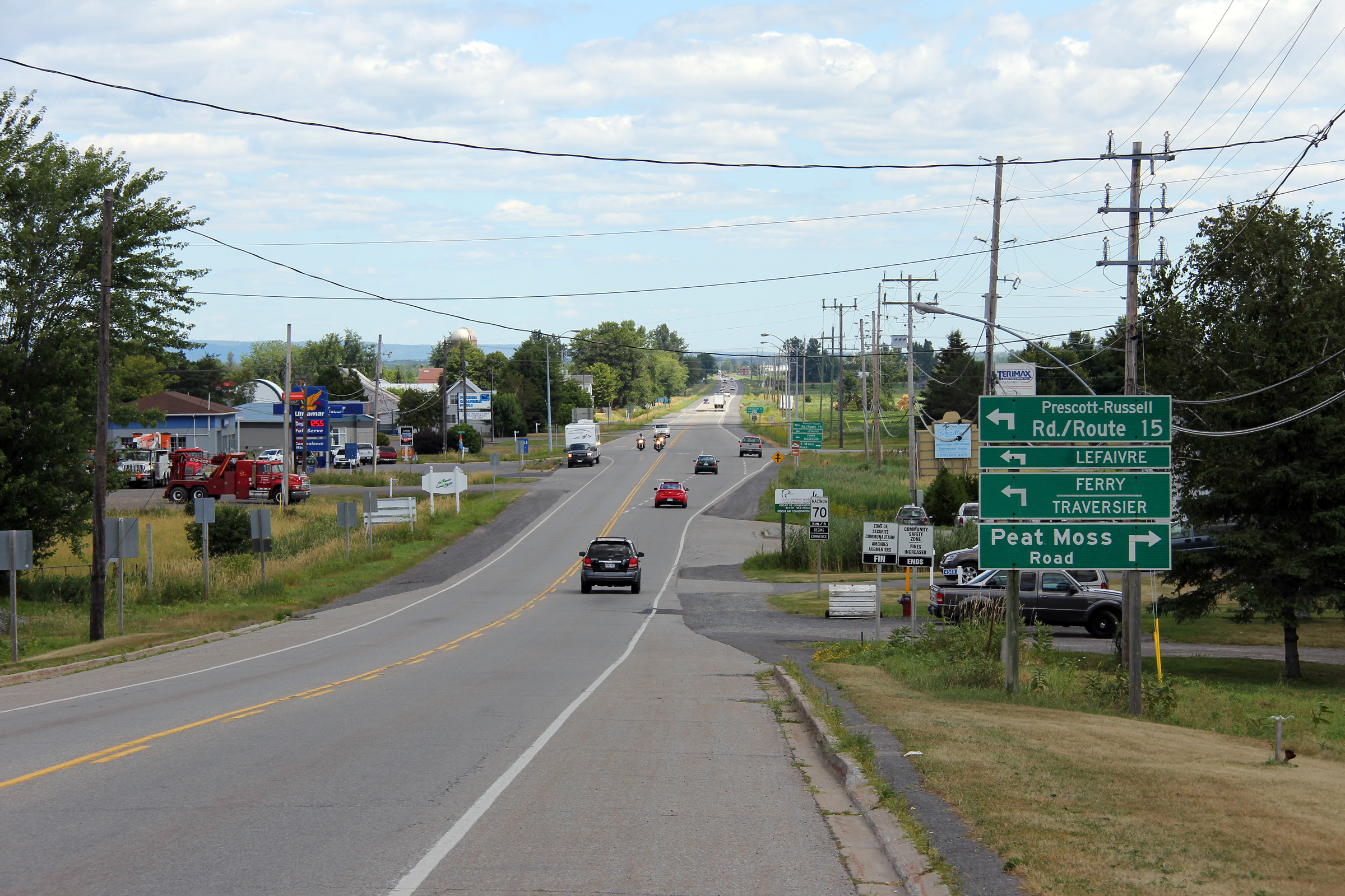
Township of Alfred and Plantagenet United Counties of Prescott and Russell |
Easterly view along Highway 17 from the eastern limits of the community of
Alfred. Notice the guide signage directing traffic towards Lafaivre
and to the ferry. There are no bridges over the Ottawa River between
Ottawa and Hawkesbury, though there are several ferries to link the two
provinces. Photo taken: July 24th, 2011. |
||
|
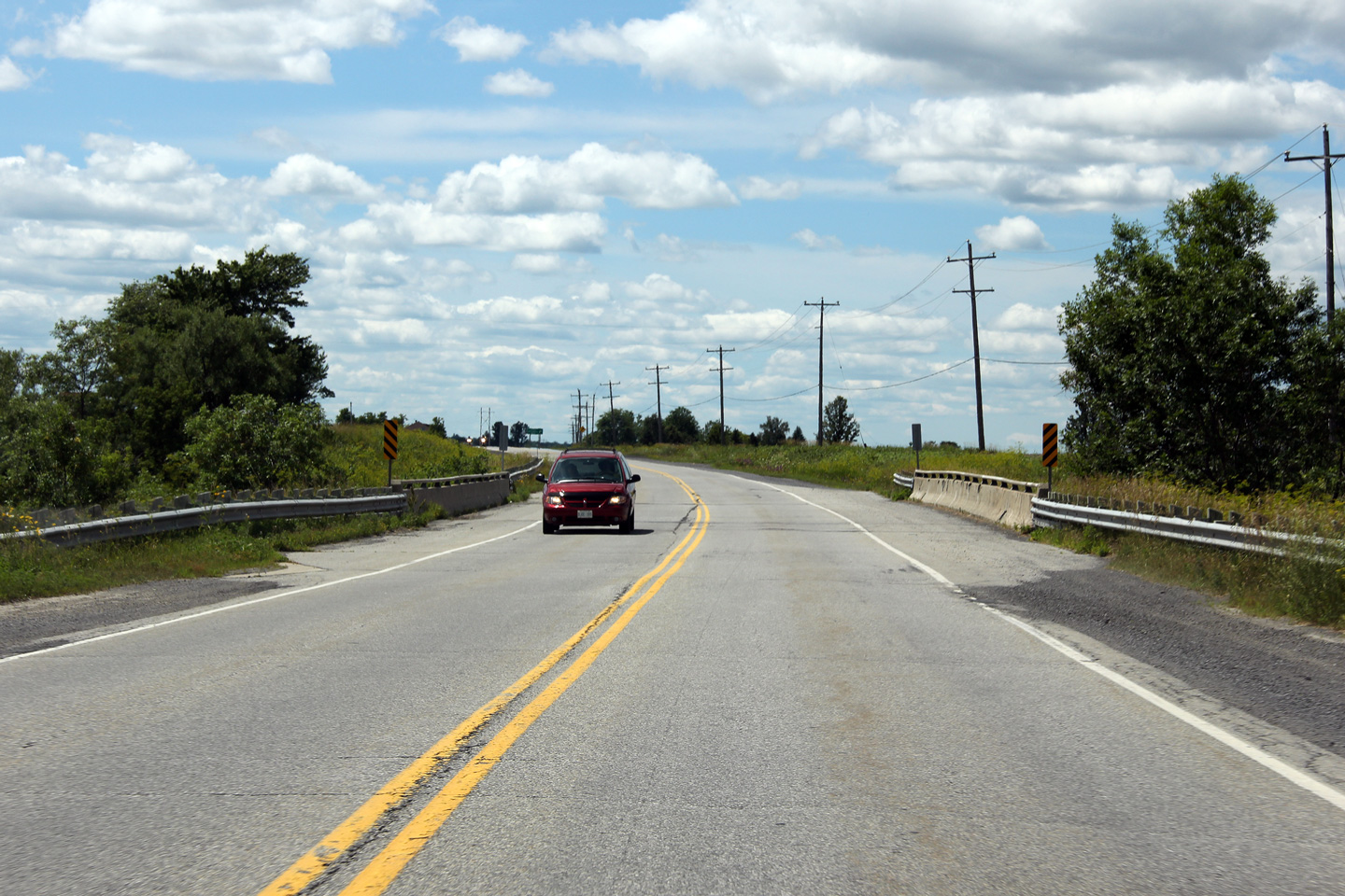
Township of Alfred and Plantagenet United Counties of Prescott and Russell |
Westerly view across the Ruisseau des Actoas bridge. Highway 17 was
the Trans-Canada Highway until 1997/98, hence the wide shoulders on this
bridge. Photo taken: July 24th, 2011. |
||
|
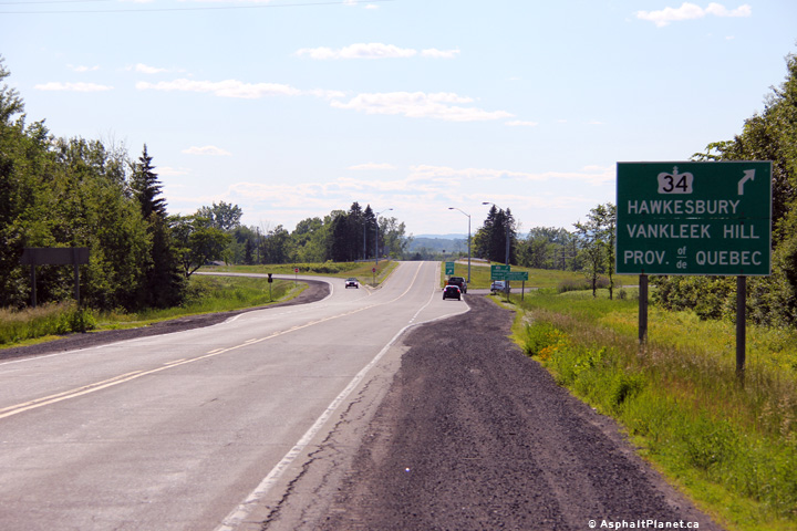
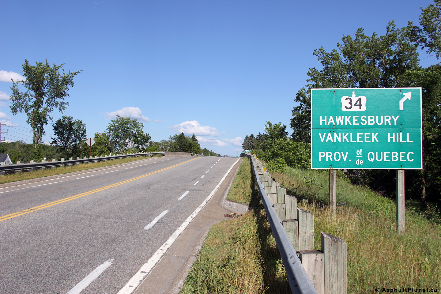
Township of Champlain United Counties of Prescott and Russell |
Eastbound advanced signage for the ramp to Highway 34. Photo taken: June 18th, 2013. |
 (720x480) (720x480)(1440x960) (2400x1600 |
|
|
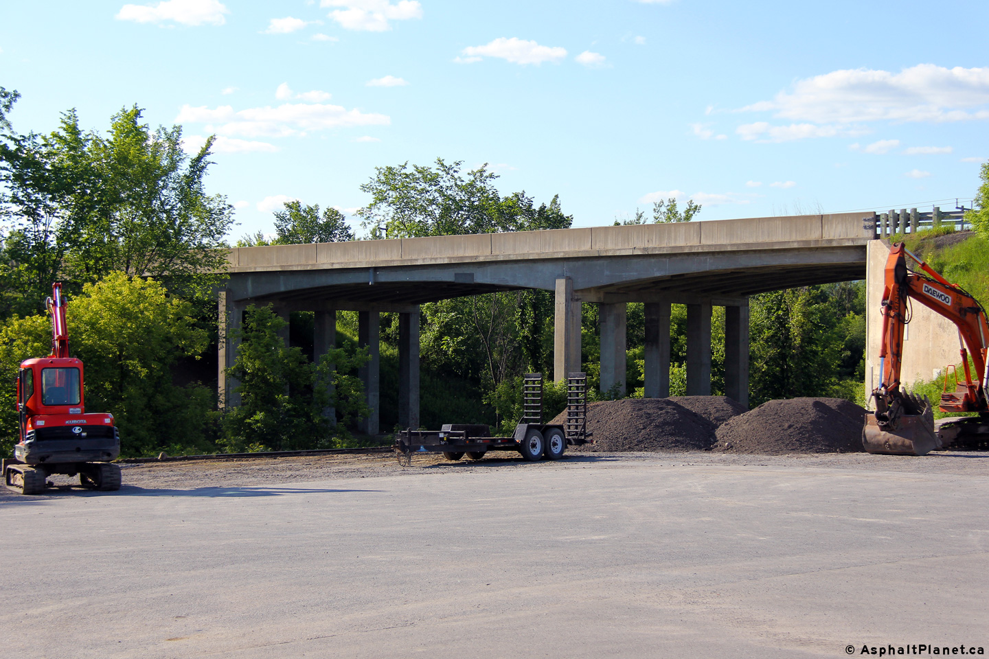
Township of Champlain United Counties of Prescott and Russell |
Immediately west of the Highway 34 interchange, Highway 17 passes overtop of
a spur line of the CN Railway. This view looks northerly towards the Ottawa
River. Photo taken: June 18th, 2013. |
 (720x480) (1440x960) (2400x1600) |
|
|
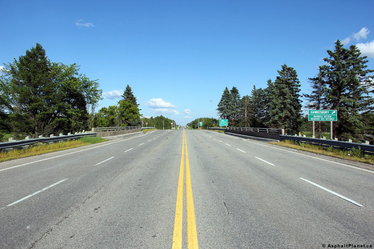
Township of Champlain United Counties of Prescott and Russell |
Two views looking easterly across the Highway 34 underpass. Photo taken: June 18th, 2013. |
 (720x480) (1440x960) (2400x1600)  (720x480) (1440x960) (2400x1600) |
|
| Highway 34 runs south from Hawkesbury bound for Highway 417 and beyond. Click here for Highway 34 images. | |||
|
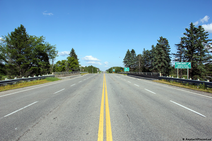
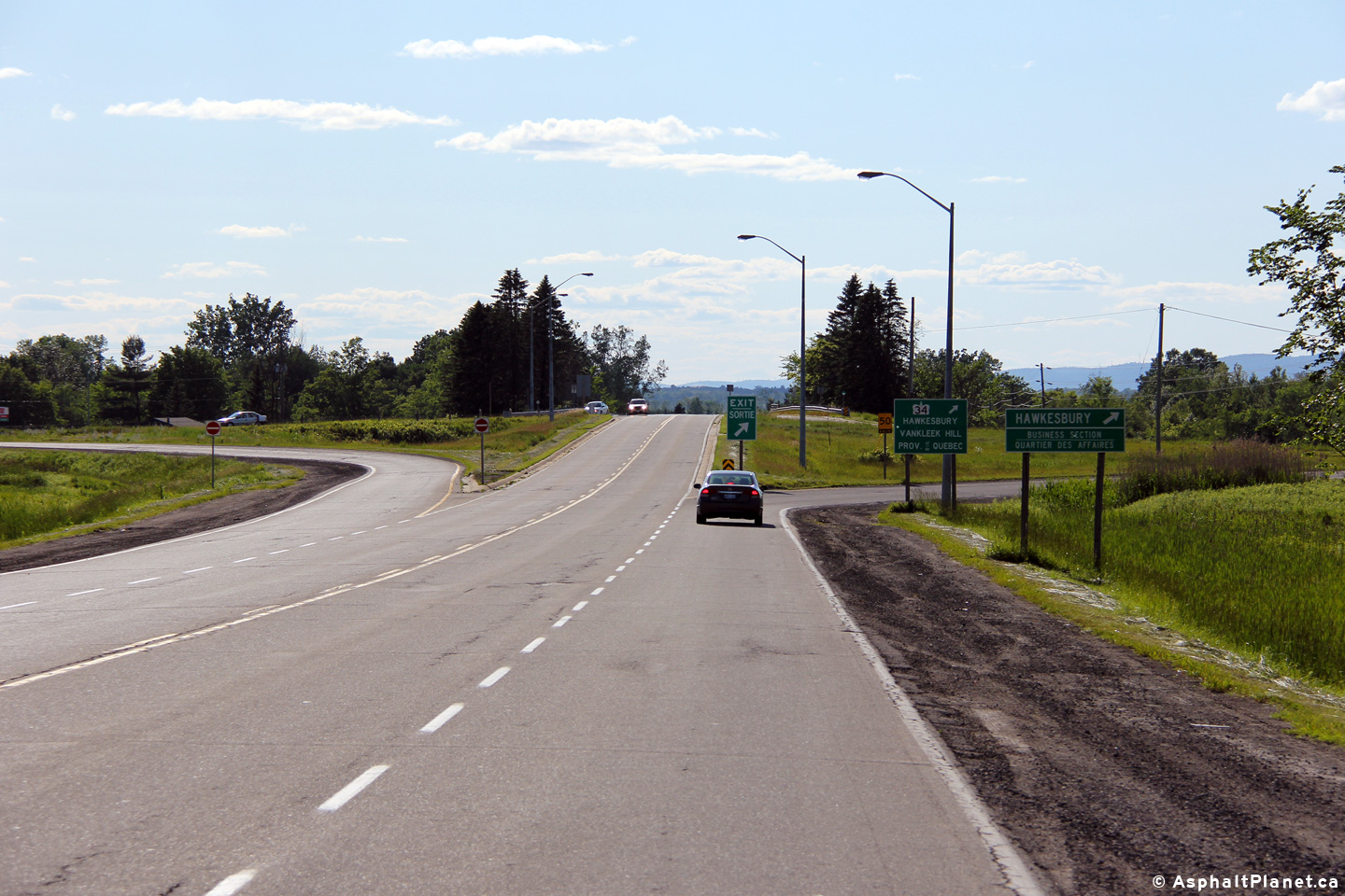
Township of Champlain United Counties of Prescott and Russell |
Westerly view approaching the Highway 34 interchange. Highway 17 meets
Highway 34 at a four-ramp parclo AB interchange. This is the only
instance in the province of Ontario where an interchange between a county
road and a provincial highway favours the county road. Photo taken: June 18th, 2013. |
 (720x480) (720x480)(1440x960) (2400x1600) |
|
|
Township of Champlain United Counties of Prescott and Russell |
Advanced signage for the Highway 34 interchange. Photo taken: June 18th, 2013. |
 (720x480) (720x480)(1440x960) (2400x1600) |
|
|
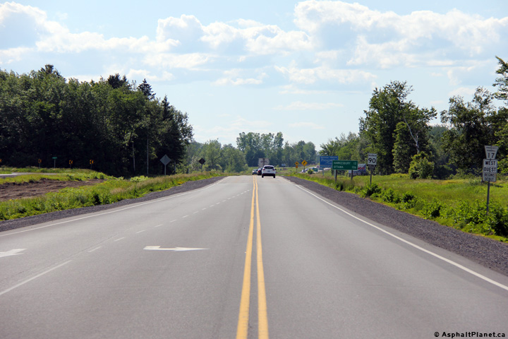
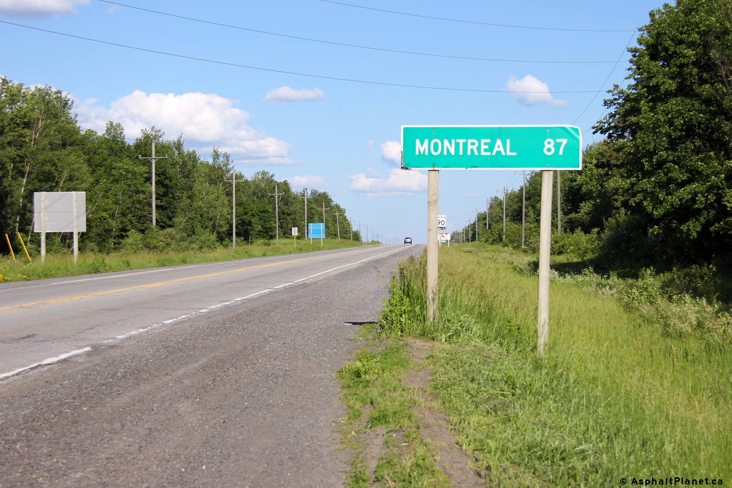
Township of Champlain United Counties of Prescott and Russell |
Eastbound distance signage east of the Highway 34 interchange near
Hawkesbury. Photo taken: June 18th, 2013. |
 (720x480) (720x480)(1440x960) |
|
|
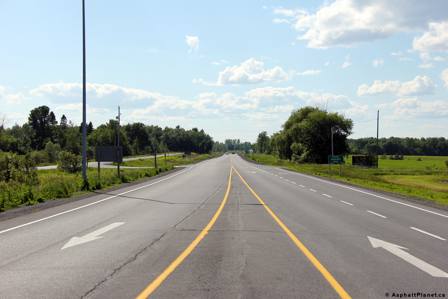
Township of East Hawkesbury United Counties of Prescott and Russell |
This view looks westerly along Highway 17 from just west of the Gourley Road
intersection. Photo taken: June 18th, 2013. |
 (720x480) (1440x960) (2400x1600) |
|
|
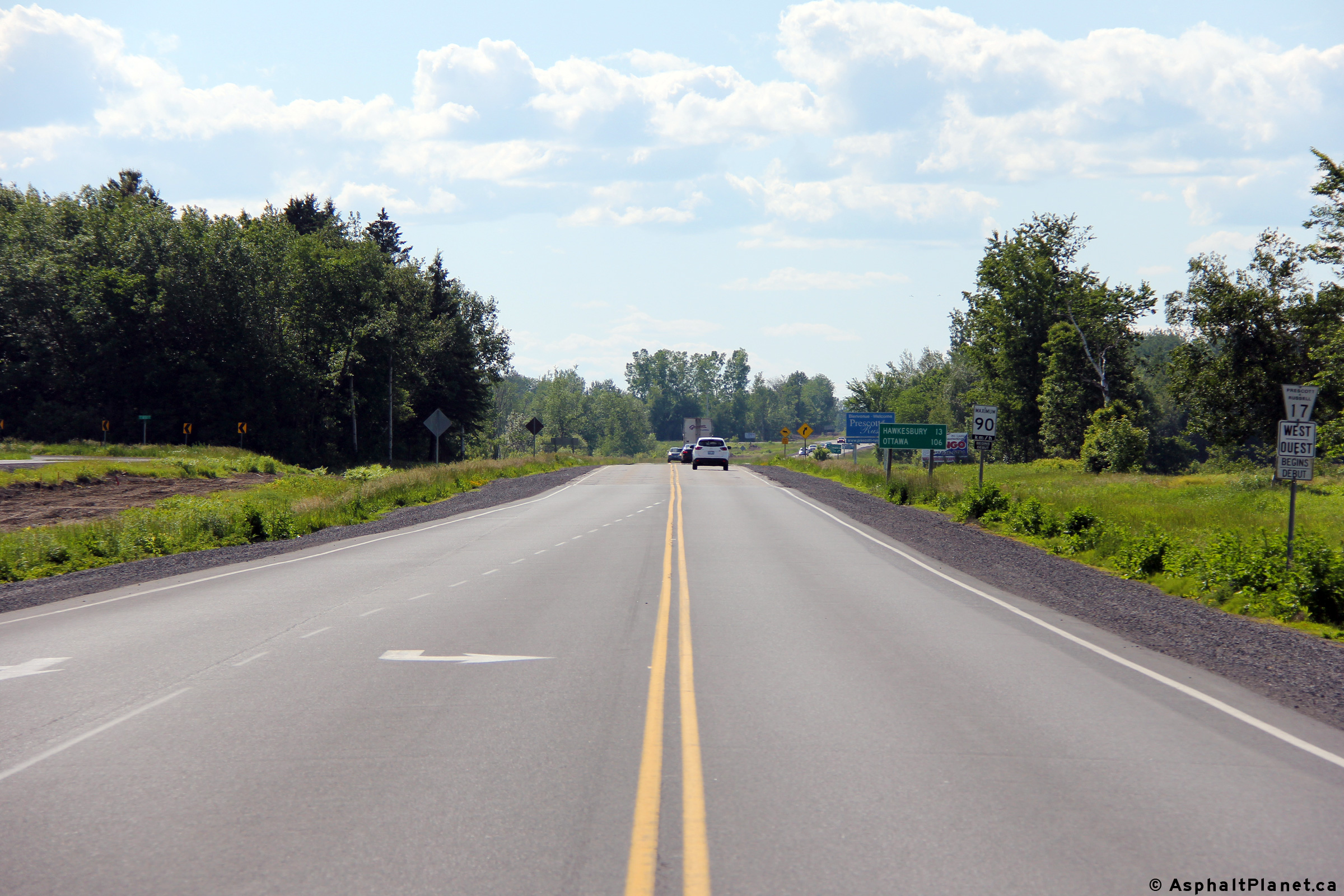
Township of East Hawkesbury United Counties of Prescott and Russell |
Easterly view looking through the Gourley Road intersection towards the
eastern terminus of Highway 17 at the Highway
417 interchange. Photo taken: June 18th, 2013. |
 (720x480) (1440x960) (2400x1600) |
|
|
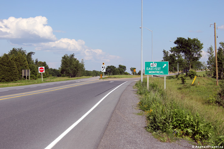
Township of East Hawkesbury United Counties of Prescott and Russell |
Signage at the eastern terminus of Highway 17 at the Highway 417
interchange. Photo taken: June 18th, 2013. |
 (720x480) (720x480)(1440x960) (2400x1600 |
|
|
Township of East Hawkesbury United Counties of Prescott and Russell |
View looking westerly along Highway 17 from the Highway 417 interchange. Photo taken: June 18th, 2013. |
 (720x480) (1440x960) (2400x1600) |
|
| Click here to continue easterly via Highway 417 Images | |||
<- Page 5A Images Highway 17 Images Index Hwy 417 Images ->
<- Highway 16 Images Back to Highway 17 Highway 17A Images ->
Copyright (c) 2004-2015, Scott Steeves (Webmaster) scott@asphaltplanet.ca


