|
Proper Municipality Name |
Photo Description |
Photo |
|
Pictures taken
from driver's perspective appear offset from centre-line pictures: |
East-
bound |
West-
bound |
|
Highway 17A ends at Highway
17 west of Kenora. Highway 17 continues east through Kenora and west
to Manitoba from this junction.
Click here for
Highway 17 images. |
| District of Kenora |
This photo is actually showing a lot more of
Highway 17 then it is of Highway 17A. I am including this photo in the
Highway 17A gallery to show how seamless the transition from Highway 17A is
to Highway 17. I am standing in the
left turn lane from Highway 17A westbound to Highway 17 eastbound, straight
through the intersection is
Highway 17 west.
Photo taken: July 13th, 2004. Low-res: 40kb. |
_west_small.jpg) |
| District of Kenora |
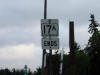
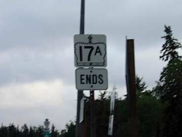
This photo shows the ends sign for Highway
17A at its western terminus. This is a very bland assembly as it only
shows that Highway 17A ends, not what it ends at (in this case it ends at
Highway 17).
Photo taken: July 13th, 2004. Low-res: 10kb. |
 |
| District of Kenora |
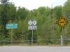
This is picture shows the signage that one
encounters when traveling along Highway 17 from Kenora west into Manitoba.
Traffic can either turn left to continue along Highway 17 towards Manitoba
or turn right to take 17A east along the Kenora bypass. (Sorry about
the poor photo quality, the lighting was terrible when I came through
Kenora).
Photo taken: July 13th, 2004. Low-res: 160kb. |
|
| District of Kenora |
Looking east from the Highway 17 junction along
Highway 17A at the start of the Kenora By-pass. It takes nearly
20minutes to drive from end to end along the Kenora By-pass. Photo taken July 13th, 2004. Low-res: 50kb |
_east_small.jpg)
|
| District of Kenora |
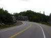
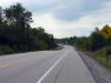
View looking west as Highway 17A rounds a long
curve about 4.5km east of the western Highway 17 junction. Photo taken:
September 2nd, 2006. Low-res: 45kb. High-res: 175kb. |
Low-res
High-res |
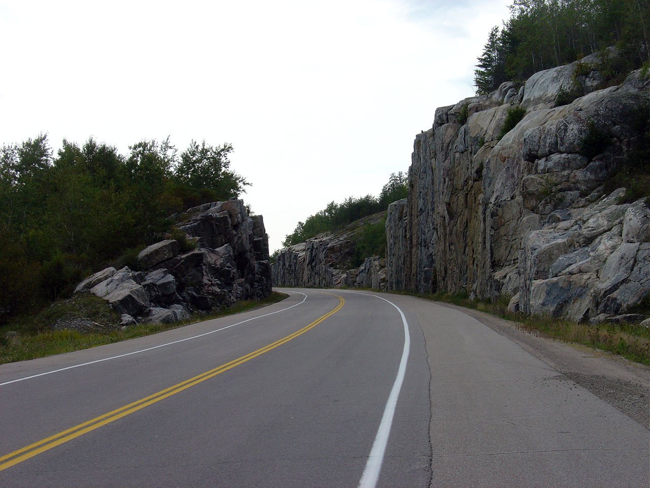
| District of Kenora |
Opposing view from the same location as the
previous photo. Photo taken: September 2nd, 2006. Low-res: 70kb.
High-res: 280kb. |
Low-res
High-res |
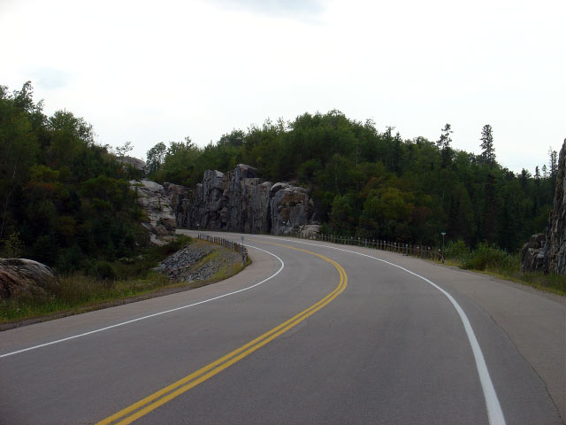
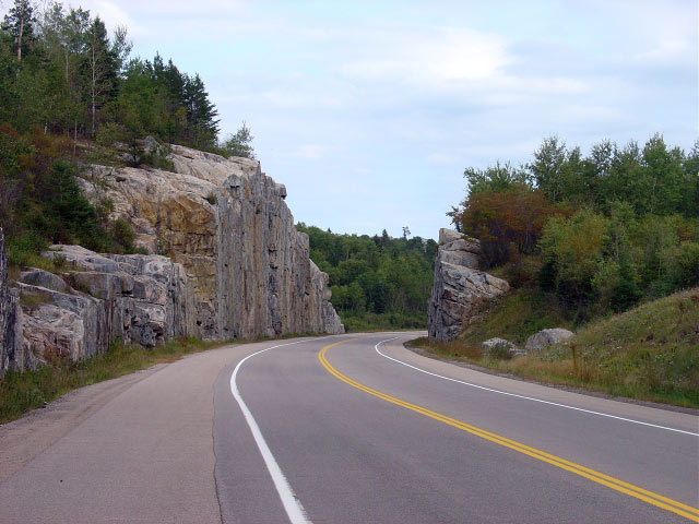
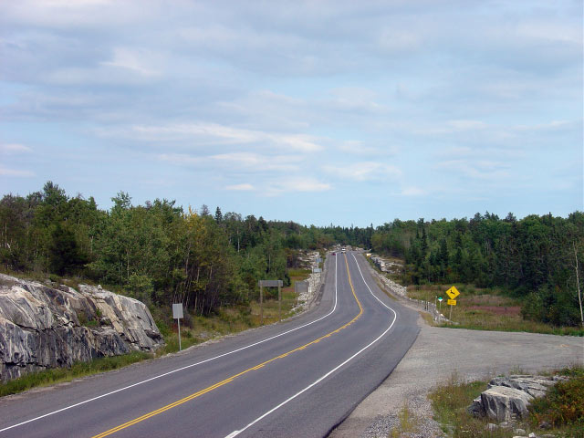
| District of Kenora |
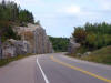
Looking west through the same large rock cut as
the previous photo. There are several sizable rock cuts located along
Highway 17A Photo taken: September 2nd, 2006. Low-res: 55kb.
High-res: 230kb. |

Low-res
High-res |
| District of Kenora |
View looking west along Highway 17A from about
1km west of the Highway 658 junction. Photo taken: September 2nd, 2006.
Low-res: 65kb. High-res: 265kb. |
Low-res
High-res |
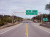
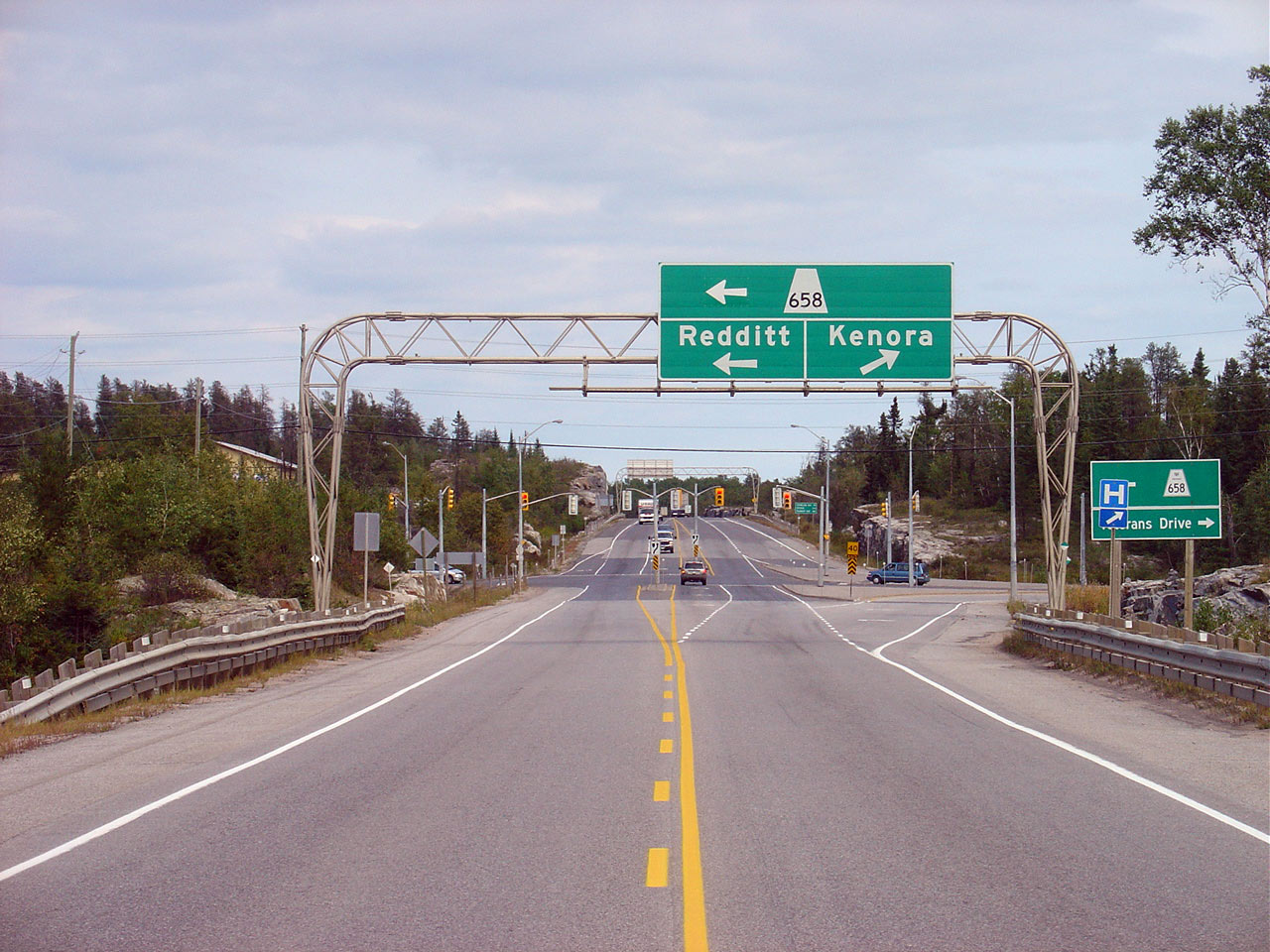
| District of Kenora |
View looking easterly along Highway 17A towards
the Highway 658 junction. Notice the new ground mounted sign
accompanying the overhead signage indicating Highway 658 south of Highway
17A as Veterans Drive. Highway 658 was downloaded south of between
Highway 17 and Highway 17A in 1998.
Photo taken: September 2nd, 2006. Low-res: 65kb. High-res:
270kb. |
Low-res
High-res |
|
Highway 658 runs northerly from
Kenora to the small community of Redditt. Click here for Highway 658
images. |
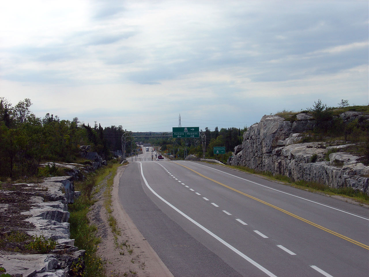
| District of Kenora |
Looking westerly at the same intersection as the
previous photo. Photo taken: September 2nd, 2006. Low-res: 50kb.
High-res: 200kb. |
Low-res
High-res |
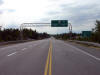
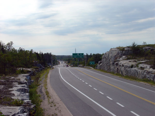
| District of Kenora |
Another westerly view of the Highway 658
intersection -- this time from the top of a nearby rock cut. This is
the only traffic signal along Highway 17A, and the only signal along the
Trans-Canada Highway between Dryden and Winnipeg.
Photo taken: September 2nd, 2006. Low-res: 55kb.
High-res: 205kb. |

Low-res
High-res |
| District of Kenora |
View looking east from a large rock outcrop just
east of the Highway 658 junction. Photo taken: September 2nd, 2006. Low-res:
60kb.
High-res: 240kb. |
Low-res
High-res |
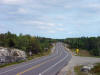
| District of Kenora |
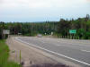
This photo shows Highway 17A looking east from
Highway 671. This photo also showcases one of the two westbound passing lanes
that exist along the Kenora By-pass. Photo taken: July 3rd, 2004.
Low-res: 35kb. |
|
| District of Kenora |
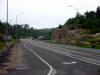
This shot shows the junction assembly at the
east end of Highway 17A where it intersects Highway 17. To the left is
the Kenora Bypass towards Winnipeg, to the right is the rest of Ontario.
Photo taken: July 13th, 2004. Low-res: 90kb. |
_small.jpg)
|
| District of Kenora |
This is Highway 17A looking west from Highway 17
at the very east end of the Kenora Bypass. In the right of the picture
(in the middle) there is a transport truck sitting in a 'Pulp Load Check
Area' these are very common in northern Ontario, and Highway 17A is no
exception.
Photo taken: July 13th, 2004. Low-res: 40kb. |
|
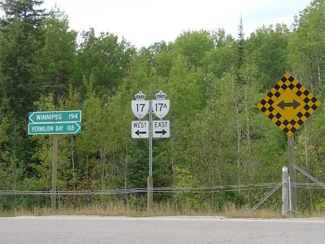
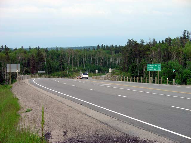
| District of Kenora |
This photo showcases the junction assembly for
the eastern terminus of Highway 17A. To the right is Highway 17 West
which leads back into Kenora, and ahead is Highway 17 eastbound which leads
to all other points in Ontario.
Photo taken: July 13th, 2004. Low-res: 30kb. |
|
|
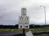
Highway 17A meets Highway 17 once again at the east
end of the Kenora By-pass.
Click here for Highway 17 images. |
_west.jpg)
_east.jpg)


.jpg)

