|
Proper Municipality Name |
Photo Description |
Photo |
|
Pictures taken
from driver's perspective appear offset from centre-line pictures: |
East-
bound |
West-
bound |
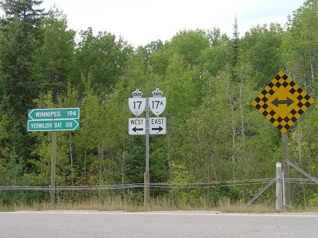
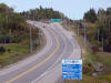
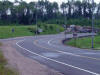
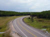
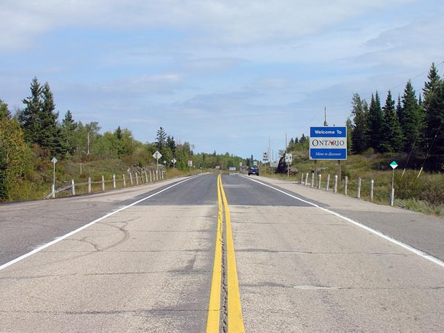
| Manitoba - Ontario Border |
This is the western terminus of
Highway 17, which is located at the Ontario-Manitoba Border. The road
in the foreground (the highway with the darker pavement) is Highway 17.
The continuation (the road with the grayer asphalt) is
Manitoba Highway 1.
Most of Manitoba Highway 1 is twinned between Ontario and Winnipeg, with a
small exception near Falcon Lake.
Picture taken: September 2nd,
2006. Size: 50kb. |
 |
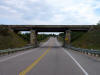
| Manitoba - Ontario Border |
Looking easterly at the east end of Manitoba's Highway 1 towards Ontario's
Highway 17.
Despite the fact that the
majority of Trans-Canada Highway routes in Ontario are two-lanes, Ontario's
highway 17 is much better maintained then
Manitoba's Highway 1. Most
of Highway 17 has been very recently reconstructed, while Manitoba's Highway
1 is often cracked and broken.
Picture taken: September
2nd, 2006. Size: 55kb. |
 |
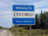
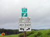
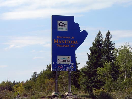
| Manitoba - Ontario Border |
Welcome to Manitoba sign at the
Manitoba-Ontario boundary. Manitoba's Welcome Centre is located a
short distance westerly along
Highway 1. Click here for Manitoba
Highway 1 images (Coming Soon!).
Picture size: 30kb |
 |
|
Manitoba - Ontario Border |
First of two Welcome to Ontario signs located along Highway 17. This
is the standard sign that greets motorists at all provincial boundaries.
The second sign is an older more stylish sign, and is located about 1km east
of the border.
Picture size: 40kb. |
 |
|
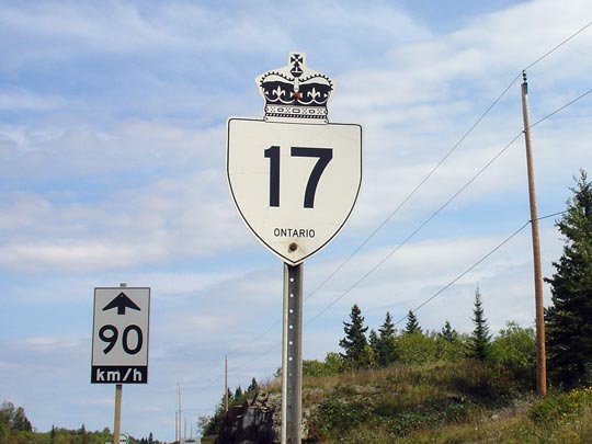
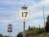
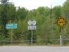
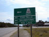
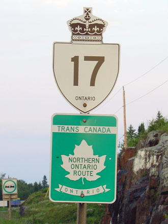
District of Kenora |
First eastbound Highway 17 shield
east of the Ontario-Manitoba Boundary. This shield is located just
east of the Ontario-Manitoba Boundary. This sign was recently replaced
at which time the Trans-Canada Highway marker was removed. (Click
here for an earlier version of this sign with a Trans-Canada Highway marker).
Picture size: 35kb |
 |
|
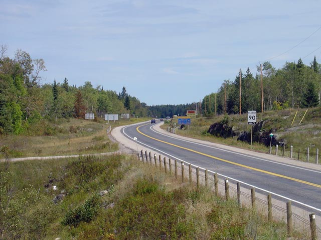
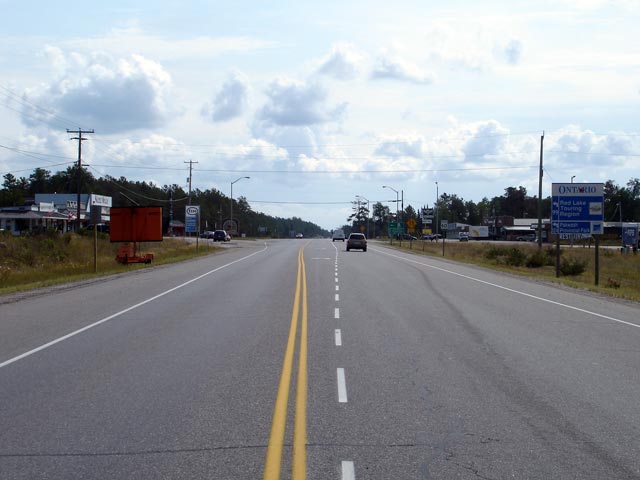
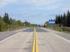
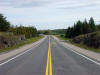
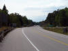
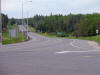
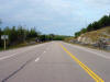
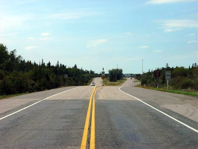
District of Kenora |
Highway 17 looking east from the
Ontario-Manitoba Border. Unlike in many cases along the Trans-Canada
Highway through the Western Provinces, two-lane rural portions of Highway 17
have a maximum posted speed limit of 90km/h.
Picture taken: September 2nd,
2006. Size: 65kb. |
 |
|
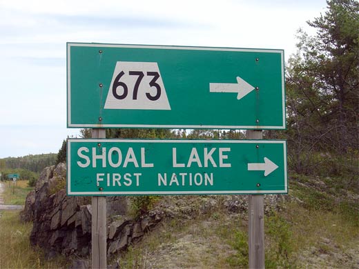
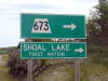
District of Kenora |
The medium green sign at Highway
673 west of Kenora in Ontario. Highway 673 is the highest numbered
Secondary Highway in the Province, and is coincidentally the most westerly
secondary. Highway 673 stretches 8km south from Highway 17 about half
of the distance to Shoal Lake
Picture taken: July 13th, 2004.
Size: 15kb |
|
|
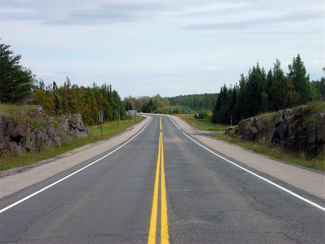
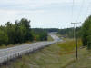
District of Kenora |
Highway 17 looking east from
Secondary Highway 673. Highway 17 has full paved shoulders in
Extreme-Northwestern Ontario. Few 2-lane Ontario highways have
continuously paved shoulders, though it is common practice on the
Trans-Canada highway through Western Canada.
Picture taken: September 2nd,
2006.
Size: 50kb |
 |
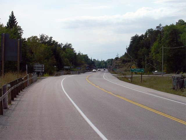
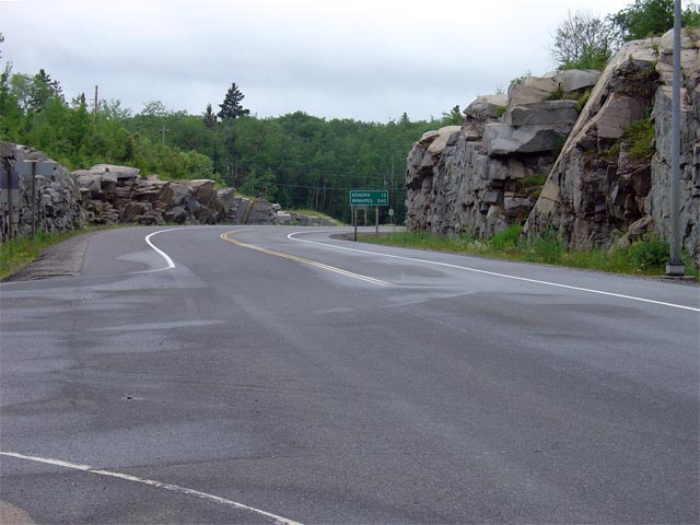
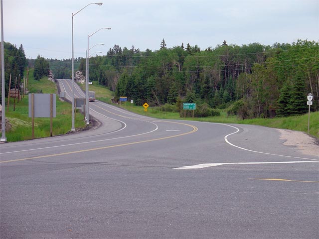
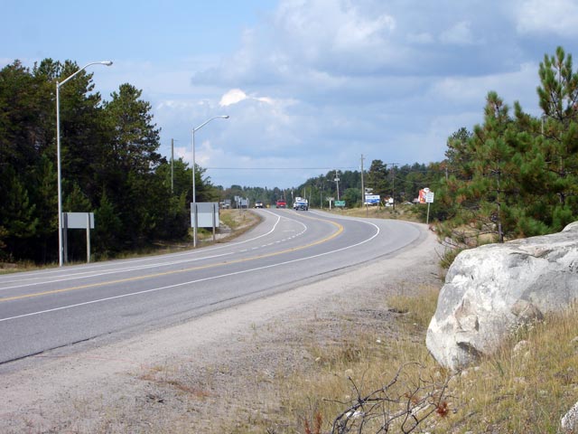
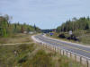
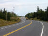
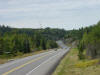
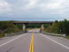
| District of Kenora |
View looking westerly along Highway 17 from roughly 18km east of the
Manitoba Provincial boundary. Picture taken: September 2nd, 2006.
Size: 50kb. |
 |
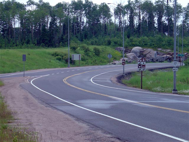
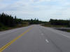
| District of Kenora |
View looking easterly along Highway 17 from roughly 18km east of the
Manitoba boundary. The first eastbound passing lane in Ontario starts
in this photo. In the coming years, the MTO will reconstruct the most
westerly portion of Highway 17, a project which will include the addition of
two passing lanes.
Picture taken: September 2nd, 2006. Size: 40kb. |
 |
| District of Kenora |
Looking westerly towards Winnipeg from roughly 26km east of the Manitoba
boundary from Clearwater Bay. Picture taken: September 2nd, 2006.
Size: 45kb. |
 |
| District of Kenora |
Looking west along Highway 17 towards the War Eagle Road intersection from
roughly 2km west of the Highway 17A
junction. Picture taken: September 2nd, 2006. Size: 40kb. |
 |
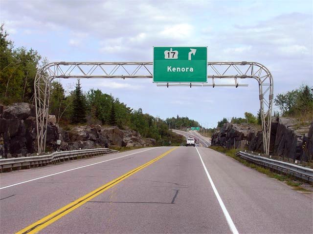
| District of Kenora |
Green advanced signage denoting the upcoming Highway 17/17A split. The
Kenora By-pass is designated as Highway 17A and is the through route around
Kenora. Picture size: 70kb. |
 |
| District of Kenora |
Overhead advanced signage denoting the upcoming Highway 17A intersection.
Picture size: 55kb. |
 |
| District of Kenora |
This picture shows the western
split of Highway 17 and Highway 17A. The
1.1km long eastbound ramp
into Kenora follows the original Highway 17 alignment from before the Kenora
By-pass was constructed, and is quite likely the longest chanalization in
the province.
Picture taken: September 2nd,
2006.
Size: 70kb |
 |
|
Highway 17A meets Highway 17
for the first time west of Kenora. Highway 17A by-passes Kenora to the
north..
Click here for Highway 17A images. |
| District of Kenora |
Signage at the western end of Highway 17A denoting the junction for
westbound traffic. At this junction, traffic following Highway 17 west
must turn left to continue towards Manitoba. A right turn leads
travelers east along Highway 17A.
Picture taken: 85kb. |
 |
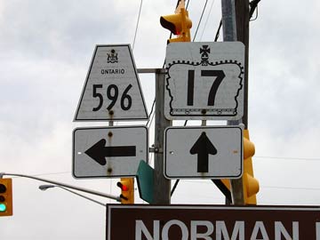
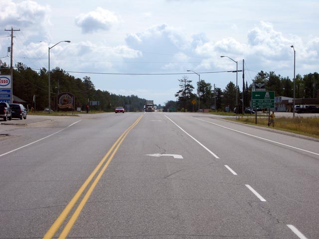
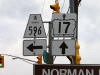
| City of Kenora |
The junction assembly for Highway 17 and Highway
596 in Kenora (Norman). Highway 596 extends about 50km north of Kenora
and leads to Minaki. Continuing straight ahead on Highway 17 leads
traffic into downtown Kenora. Click here for Highway 596 Images.
(Coming Soon!)
Picture size: 15kb |
 |
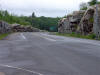
| District of Kenora |
View looking west towards Kenora from the
Longbow Lake Road intersection. Picture taken: July 13th, 2004.
Size: 50kb. |
 |
| District of Kenora |
The junction assembly for the eastern Highway
17/17A split just east of the City of
Kenora. To continue eastbound along Highway 17, traffic would take the
ramp to the right. A left turn at this junction takes travelers in the
opposite direction back towards Manitoba on the Kenora By-pass.
Picture size: 25kb. |
 |
| District of Kenora |
View looking westbound along Highway 17 from the
Highway 17A junction. From this
junction westerly Highway 17 curves to the right and heads towards Downtown
Kenora. Picture taken: July 13th, 2004. Size: 70kb. |
 |
|
Highway 17A heads west from
this junction by-passing Kenora to the north.
Click here for
Highway 17A images. |
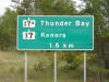
| District of Kenora |
View looking west from the Highway 71 junction towards Kenora. Notice
the large rock cut visible on the right side of this photo. Rock cuts
like this are very common along Highway 17 in Northwestern Ontario, as the
highway passes through some very rugged terrain.
Picture taken: July 3rd, 2004. Size: 45kb. |
 |
|
Highway 71 heads south to Highway
11 and Fort Frances from Highway 17.
Click here for Highway 71 images. |
| District of Kenora |
View looking east towards Dryden from the Highway 71 junction.
Picture taken: July 3rd, 2004. Size: 50kb. |
 |
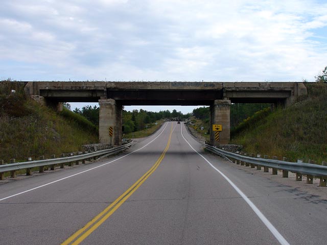
| District of Kenora |
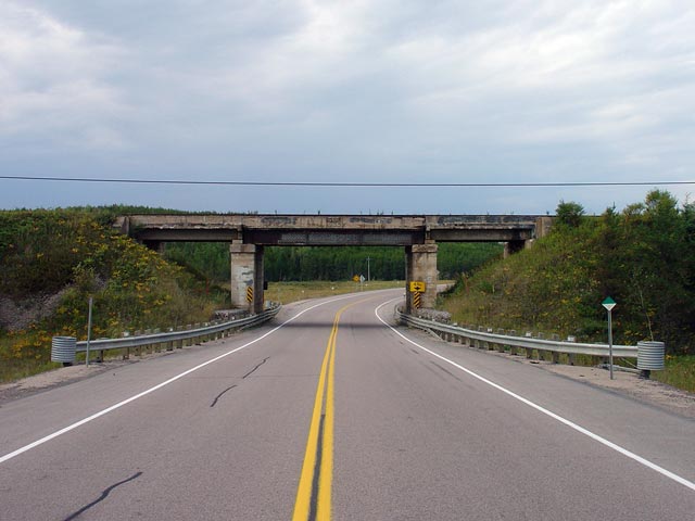
View looking easterly through the Willard Lake Subway along Highway 17.
The Willard Lake Subway was completed in 1935 and will be reconstructed
during the next few years. Picture taken: September 2nd, 2006. Size:
40kb. |
 |
| District of Kenora |
Looking westerly from the Willard Lake Subway
along Highway 17. The Willard Lake subway is located roughly 90km east
of the Manitoba boundary. Picture taken: September 2nd, 2006. Size: 50kb. |
 |
| District of Kenora |
Looking easterly along Highway 17 from the
Willard Lake Subway. An eastbound passing lane extends easterly from
the Willard Lake Subway. Picture taken: September 2nd, 2006. Size:
50kb. |
 |
| District of Kenora |
Looking westerly through the Willard Lake Subway. It is a pity that
the Willard Lake Subway is located where it is, as its narrow design is
certainly not ideal for a road such as Highway 17, though the structure is
an excellent exhibit showcasing Ontario's early highway history.
Picture taken: September 2nd, 2006. Size: 45kb. |
 |
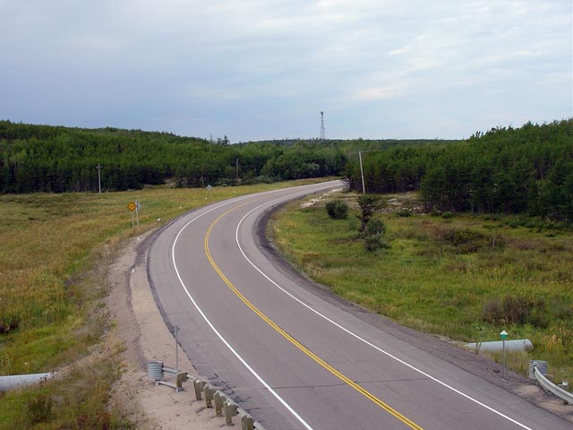
| District of Kenora |
Looking westerly along Highway 17 from Little Joe Lake. The Little Joe
Lake pull-off is located roughly 100km from the Manitoba-Ontario boundary.
Picture taken: September 2nd, 2006. Size: 45kb. |
 |
| District of Kenora |
Looking easterly from the picnic area at Little Joe Lake along Highway 17.
There is an eastbound passing lane in the vicinity of Little Joe Lake.
Passing lanes are already fairly frequent along Highway 17 between Kenora
and Vermilion Bay, but the MTO will be adding more as they reconstruct more
sections of highway through the area.
Picture taken: September 2nd, 2006. Size: 35kb. |
 |
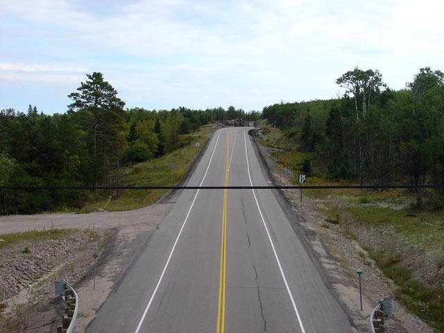
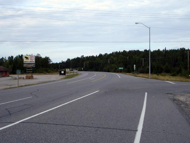
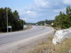
| Township of Machin District of
Kenora |
Looking westerly along Highway 17 from the
Highway 647 intersection just west of Vermillion Bay. Picture taken:
September 2nd, 2006. Size: 40kb. |
 |
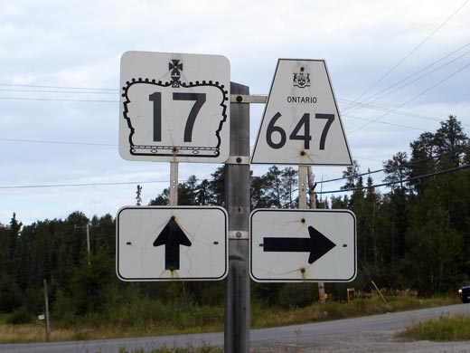
| Township of Machin District of
Kenora |
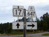
Westbound junction assembly for Highway 647 along Highway 17. Highway
647 is a short highway that leads northerly from Highway 17 to Blue Lake
Provincial Park. Click here for Highway 647 images. (Coming
Soon!)
Picture size: 30kb. |
 |
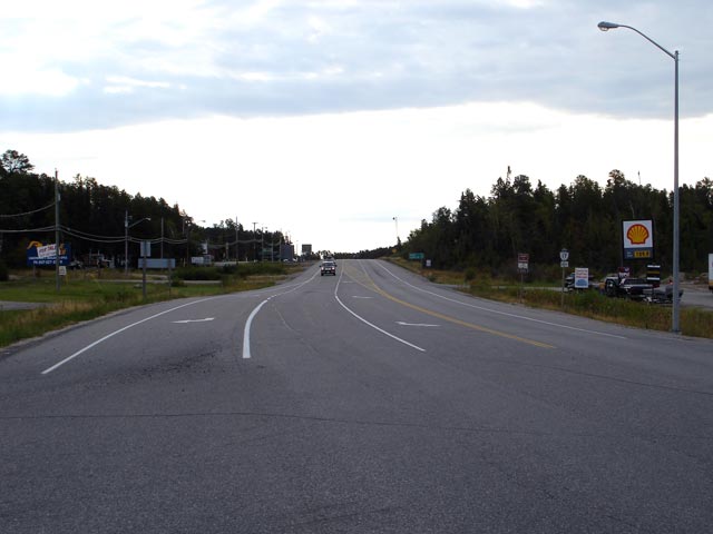
| Township of Machin District of
Kenora |
Looking westerly towards Vermilion Bay and the Highway 105 junction from
Highway 647. Highway 105 is located about 2km east of this
intersection. Picture taken: September 2nd, 2006. Size: 35kb. |
 |
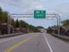
| Township of Machin District of
Kenora |
View looking westerly along Highway 17 from just west of the Highway 105
junction. The pictured ramp departing from Highway 17 eastbound leads
to a truck inspection station that is located opposite the Highway 105
junction.
Picture taken: September 1st, 2006. Size: 60kb. |
 |
| Township of Machin District of
Kenora |
Looking easterly towards the Highway 105 junction along Highway 17.
The area surrounding the Highway 105 junction is fairly built up. Picture
taken: September 1st, 2006. Size: 40kb. |
 |
| Township of Machin District of
Kenora |
A closer perspective of the Highway 105 junction along Highway 17. Picture
taken: September 1st, 2006. Size: 45kb. |
 |
| Township of Machin District of
Kenora |
Odd signage for eastbound traffic approaching the Highway 105 junction.
Both eastbound signs for Highway 105 indicate it as a secondary highway by
mistake. Click here for Highway 105 images (Coming Soon!).
Click here for photos east of Highway 105
along Highway 17.
Picture size: 45kb. |
 |
|
Click here for
Vermilion Bay to Thunder Bay Images |
