AsphaltPlanet.ca > OntHighways >
Highway 69 > Images
King's Highway 69 - Images
Contract # 2004-5001 - Twinning the Whata Gap - Images Page 1 ->
Photos shown in this table are arranged from South to North:
| Proper Municipality Name | Photo Description | Photo | ||
|
Pictures taken from driver's perspective appear offset from centre-line pictures: |
North- Bound |
South- Bound |
||
|
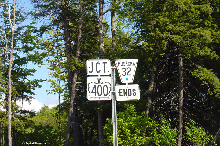
Township of Georgian Bay
District Municipality of Muskoka |
Junction assembly at the western end of Muskoka Road 32 at the Highway 400 interchange. For several years Muskoka Road 32 met Highway 400 at an at-grade intersection.
Photo taken: June 1st, 2005. |
|
||
|
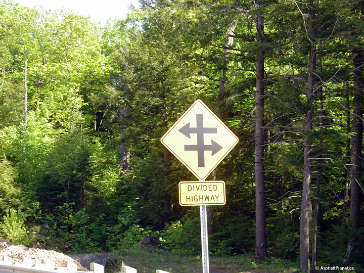
Township of Georgian Bay
District Municipality of Muskoka |
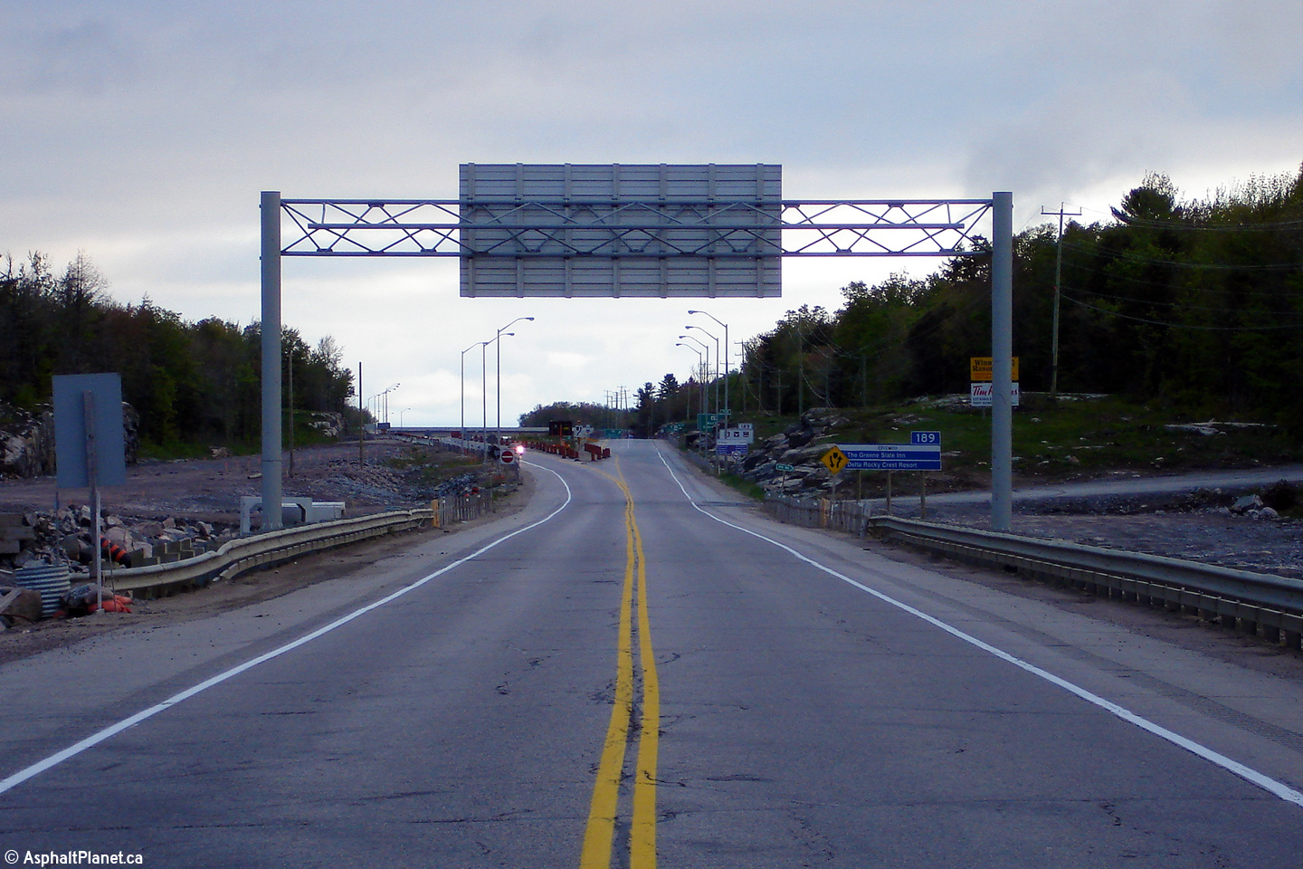
Unique (in Ontario) signage illustrating that Highway 400 is a divided highway.
Photo taken: June 1st, 2005. |
|
||
|
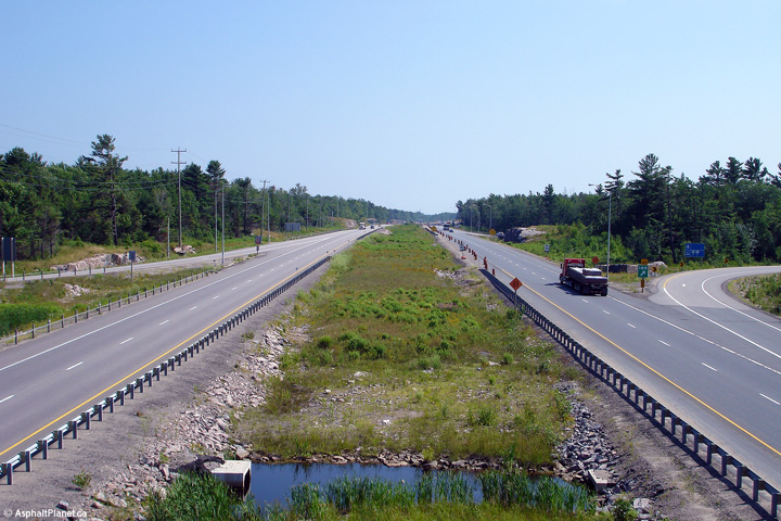
Township of Georgian Bay
District Municipality of Muskoka |
Northerly view at the end of the divided highway at the
Musquash River bridge. The divided highway ended here until
construction to complete the divided highway between the Musquash River and
MacTier was completed in 2008. |
|
||
|
Township of Georgian Bay
District Municipality of Muskoka |
Signage assembly denoting the former southern terminus of Highway 69 just south of the Musquash River bridge. Highway 69 has been truncated north of this location as further extensions of Highway 400 have been completed. Photo taken: June 1st, 2005. |
 (720x480) (720x480)(1440x960) |
||
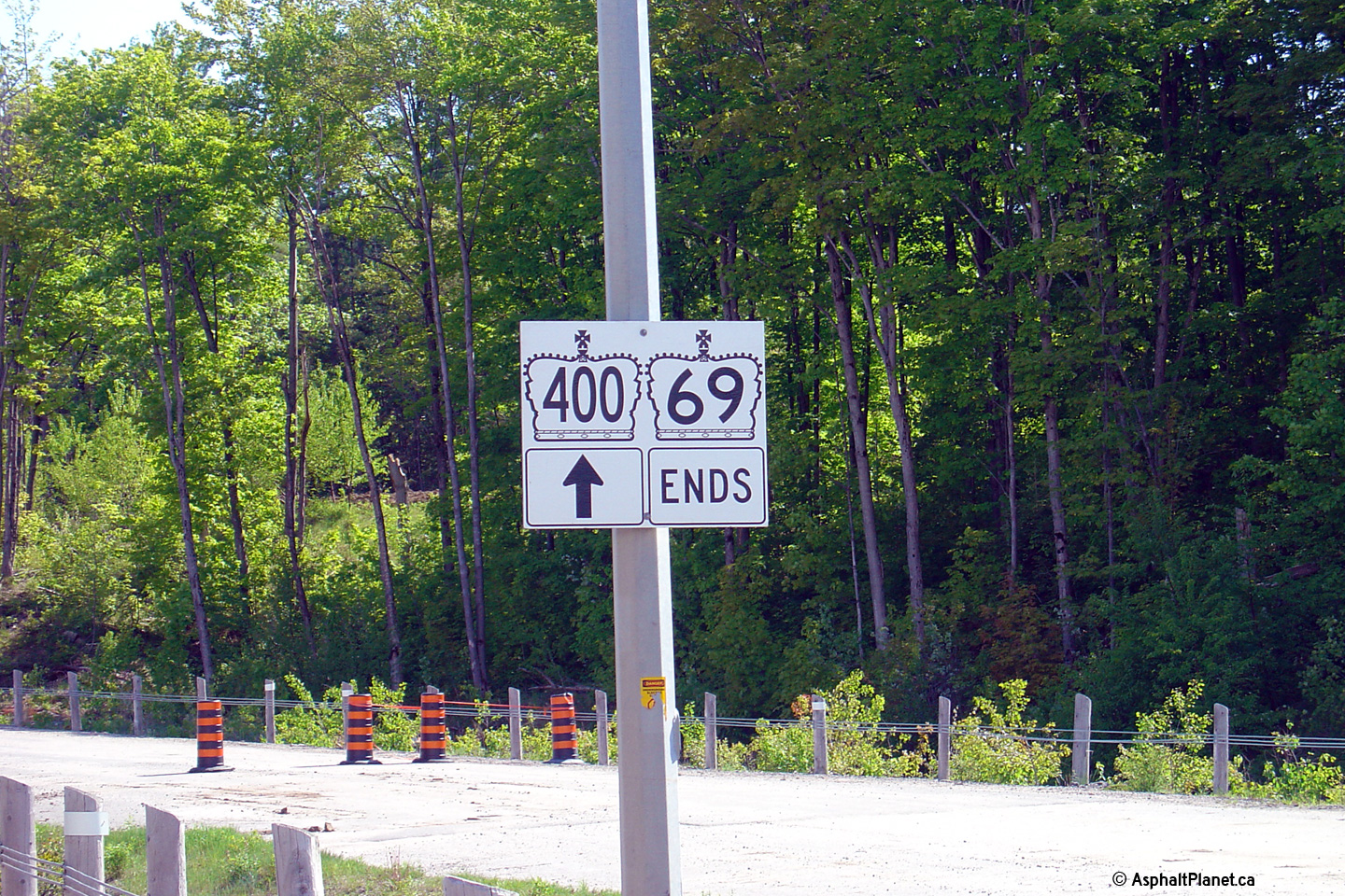
|
Township of Georgian Bay
District Municipality of Muskoka |
This picture shows Highway the southern terminus of
Highway 69. When this photo was taken, from this point southerly, Highway
400 continued as a divided highway southerly to Toronto. |
|
||
|
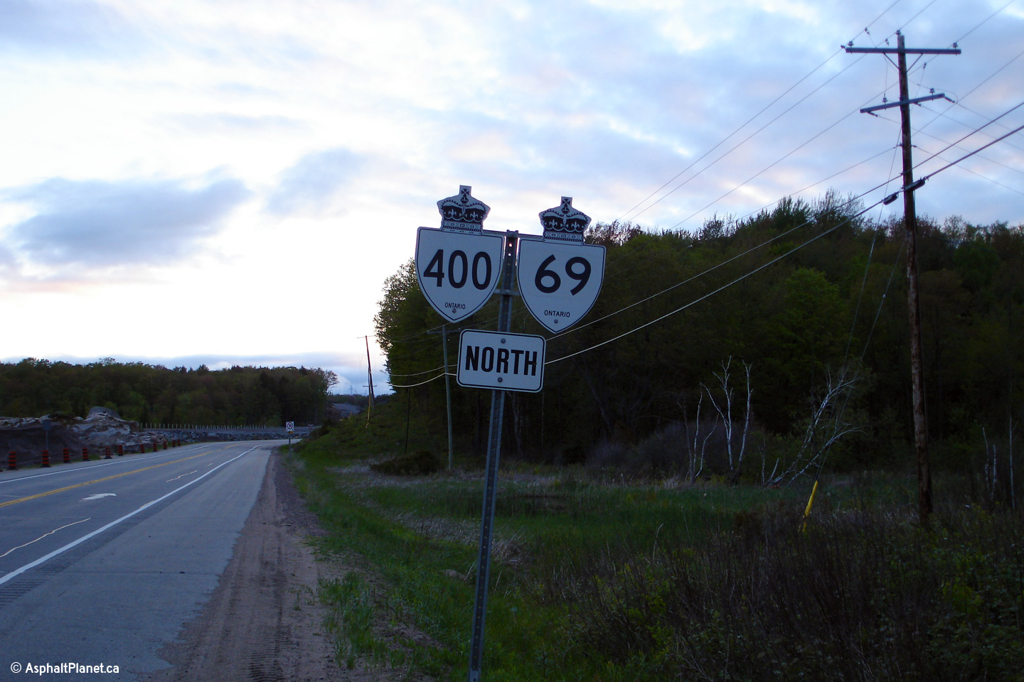
Township of Georgian Bay
District Municipality of Muskoka |
First dual highway shields north of the Musquash River. The Highway
400 designation was extended to Parry Sound in 2003, when the four lane
Joseph Lake Diversion opened to traffic. Photo taken: May 22nd, 2006. |
 (720x480) (720x480)(1440x960) |
||
|
Township of Georgian Bay
District Municipality of Muskoka |
Looking north across the Musquash River bridge. The
portion of expressway between the Musquash River and MacTier lying within
Whata Mohawk Territory was the final section of four-lane highway to open
between Parry Sound and Toronto. |
|
||
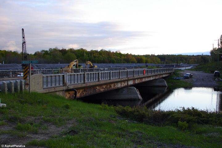
|
Township of Georgian Bay
District Municipality of Muskoka |
This is the eastern side of the Musquash River bridge along Highway 69. The surface of the steel girders had an advanced amount of rust on them before the structure was demolished.
Photo taken: May 22nd, 2006. |
|
||
|
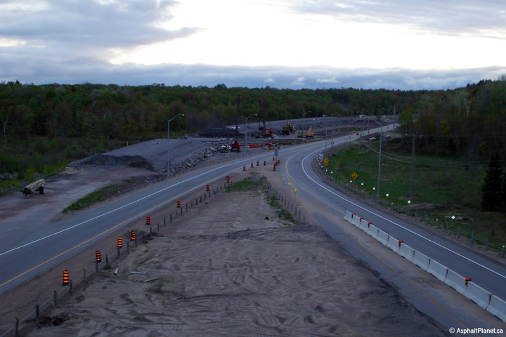
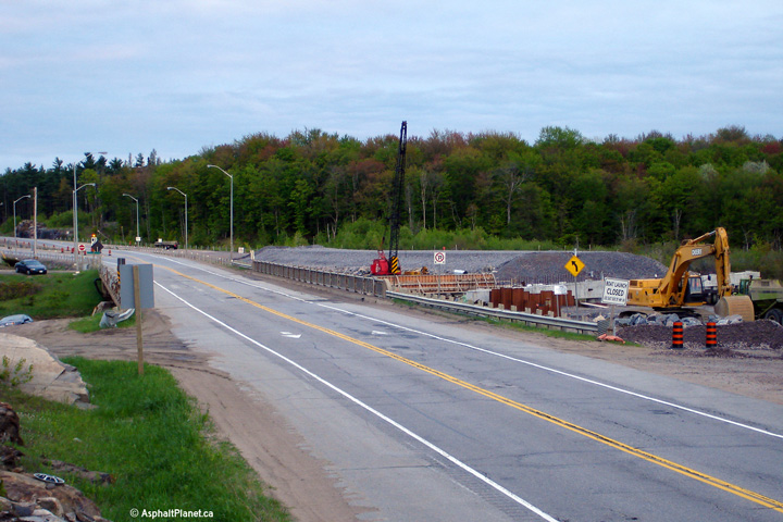
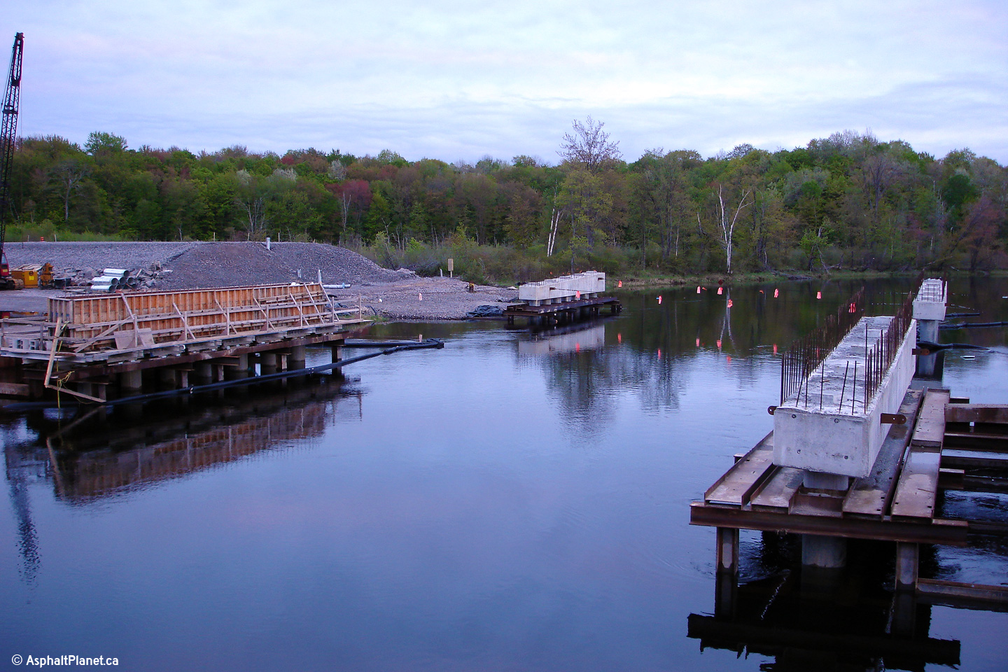
Township of Georgian Bay
District Municipality of Muskoka |
In water piers for new dual Musquash River bridges for the divided highway. The former 1950s era structure was demolished once traffic had been diverted onto the completed structures.
Photo taken: May 22nd, 2006. |
|
||
|
Gibson River IR # 31 |
Southerly view across the Musquash River Bridge. Access to the Musquash River at Highway 69 was permanently closed with the completion of the divided highway.
Photo taken: May 22nd, 2006. |
|
||
|
Gibson River IR # 31 |
Southerly view towards the Musquash River, from south of the then future Iroquois Cranberry Marsh Road interchange. Highway 400 crosses the Musquash River on a new more gentle alignment immediately west of the old Musquash River bridge.
Photo taken: May 22nd, 2006. |
|
||
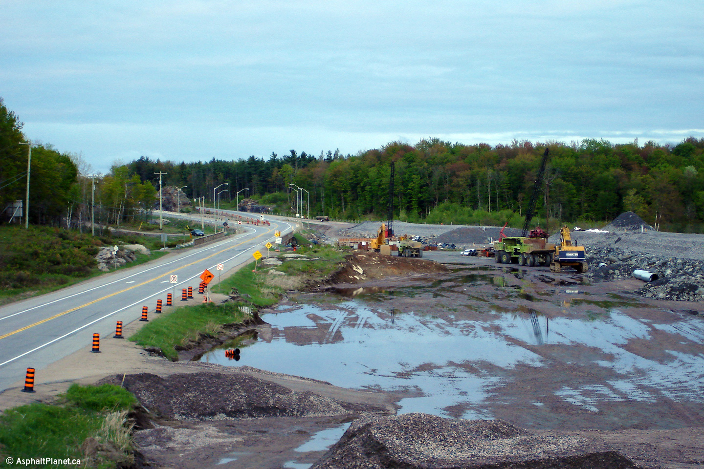
|
Gibson River IR # 31 |
Northerly view towards the future site of the Iroquois Cranberry Marsh Road interchange.
Photo taken: May 22nd, 2006. |
|
||
|
Gibson River IR # 31 |
Southerly view of the completed highway from the Iroquois Cranberry Marsh Road overpass.
|
|
||
|
Gibson River IR # 31 |
Northerly view from the Iroquois Cranberry Marsh Road. The divided highway had only been open for a few days when this photo was taken..
|
|
||
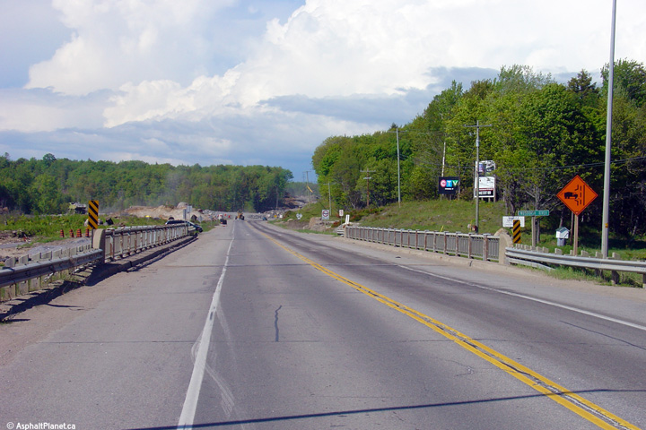
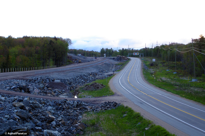
|
Gibson River IR # 31 |
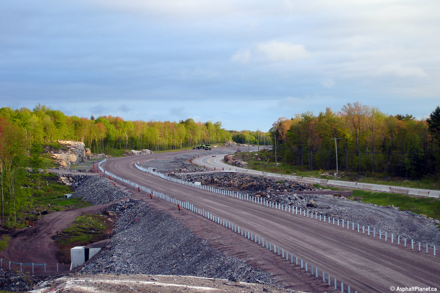
View of the divided highway construction north of the then future Iroquois
Cranberry Marsh Road interchange. The horizontal geometry of the
divided highway is much improved over the two lane alignment. The
rather sharp curve in the former highway's alignment was caused by a rock
outcropping that was blasted away entirely during the construction of the
southbound carriageway. Photo taken: May 22nd, 2006. |
|
||
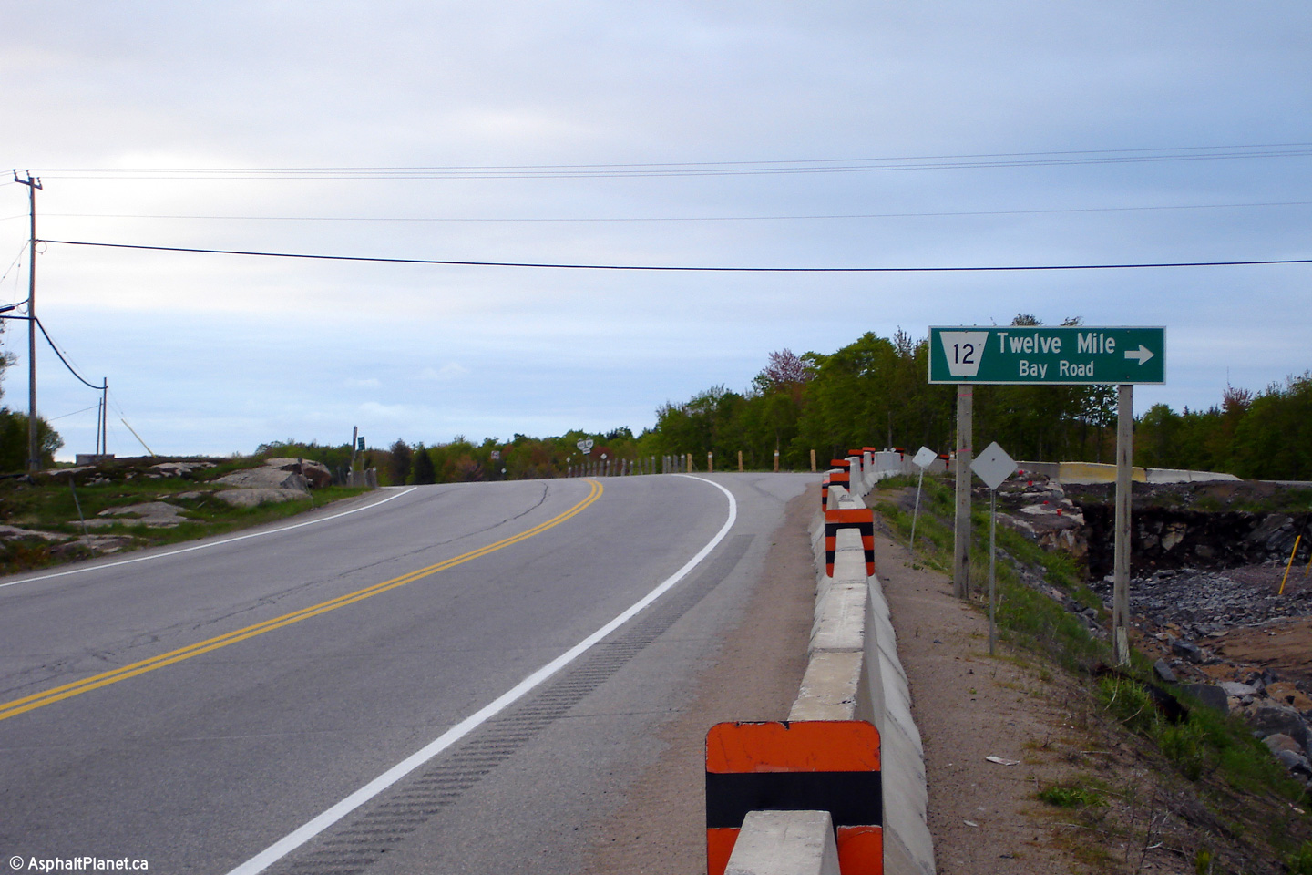
|
Gibson River IR # 31 |
Northerly view along Highway 69 from north of the Iroquois Cranberry Marsh Road interchange towards the Twelve Mile Bay Road intersection.
Photo taken: May 22nd, 2006. |
|
||
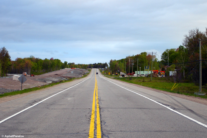
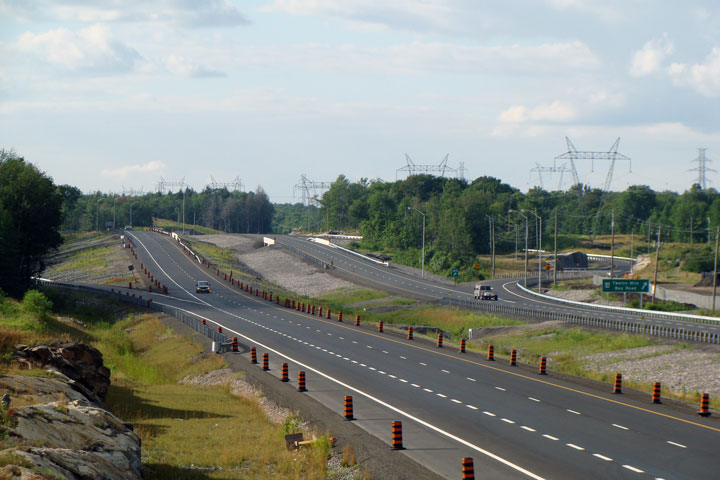
|
Township of Georgian Bay
District Municipality of Muskoka |
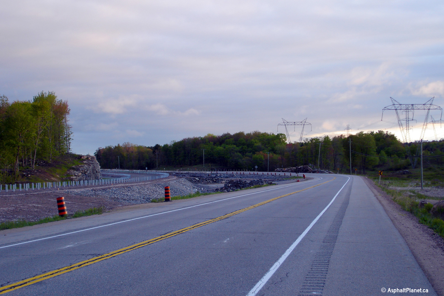
Two views of different vintages of a straightaway segment along Highway 69 south of the Twelve Mile Bay Road intersection.
Lower photo taken: August 2nd, 2008. |
|
||
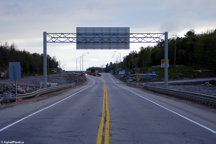
|
Township of Georgian Bay
District Municipality of Muskoka |
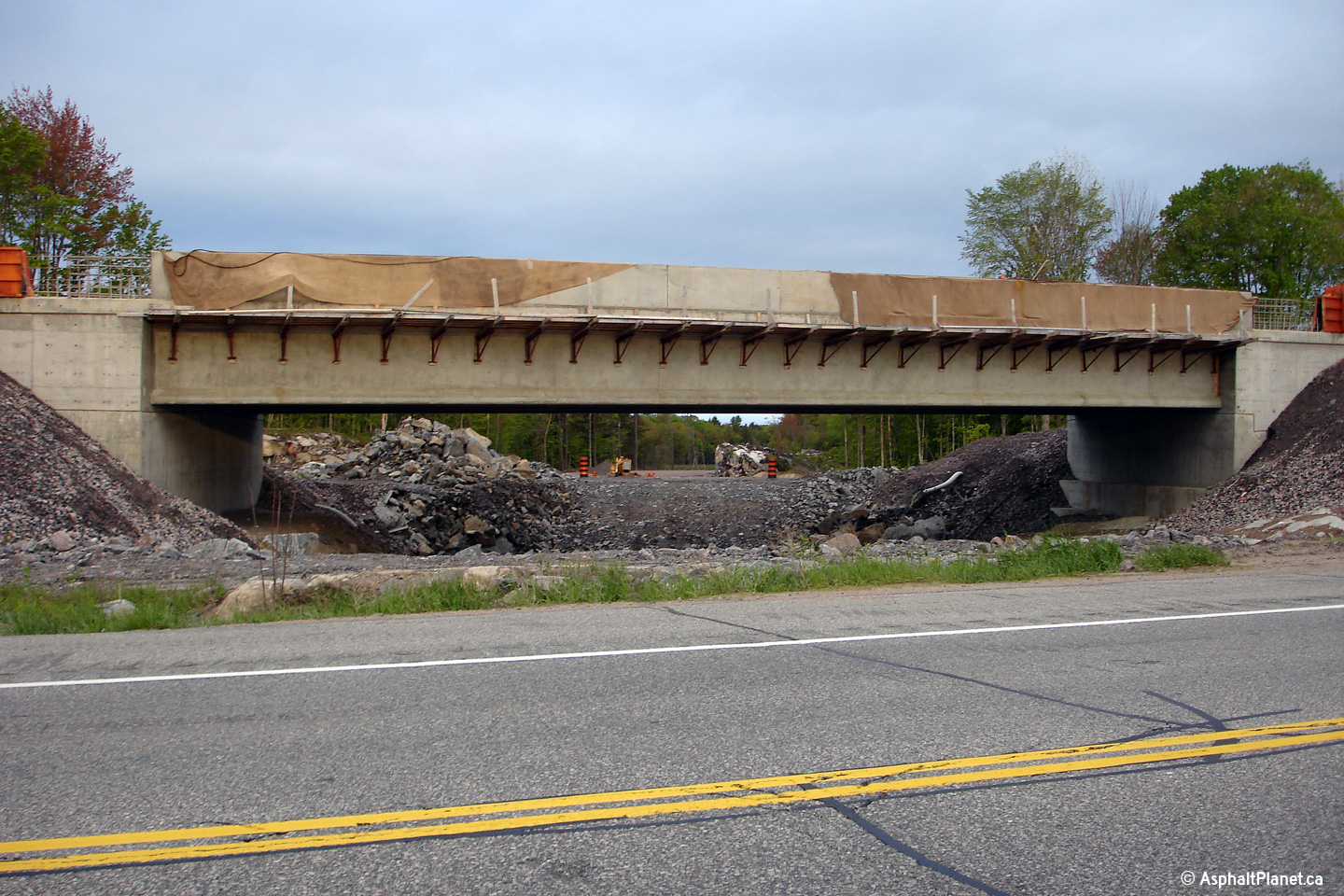
The eastern facade of the nearly completed southbound
Twelve Mile Lake Road underpass. The Twelve Mile Lake interchange is located roughly 200m
south of the former at-grade intersection. |
|
||
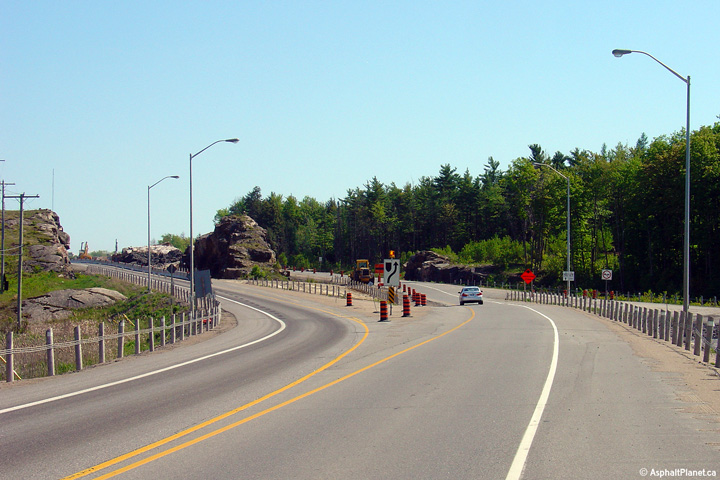
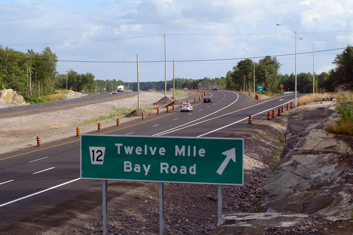
|
Township of Georgian Bay
District Municipality of Muskoka |
View of the former at grade intersection for Twelve Mile Bay Road compared with a photo taken of the four lane highway only a few days after it was completed
Upper photo taken: May 22nd, 2006.
Lower photo taken: August 2nd, 2008. |
|
||
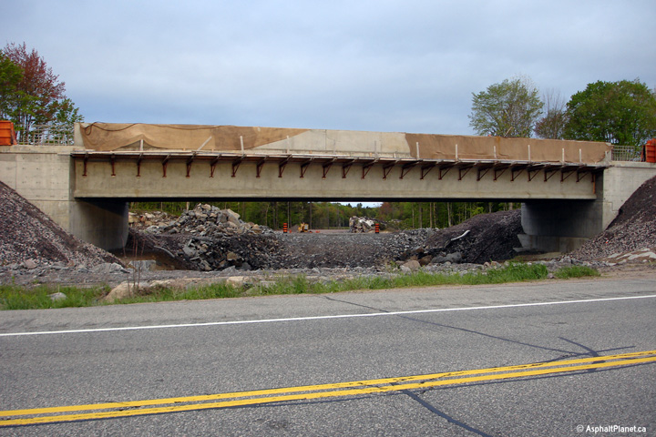
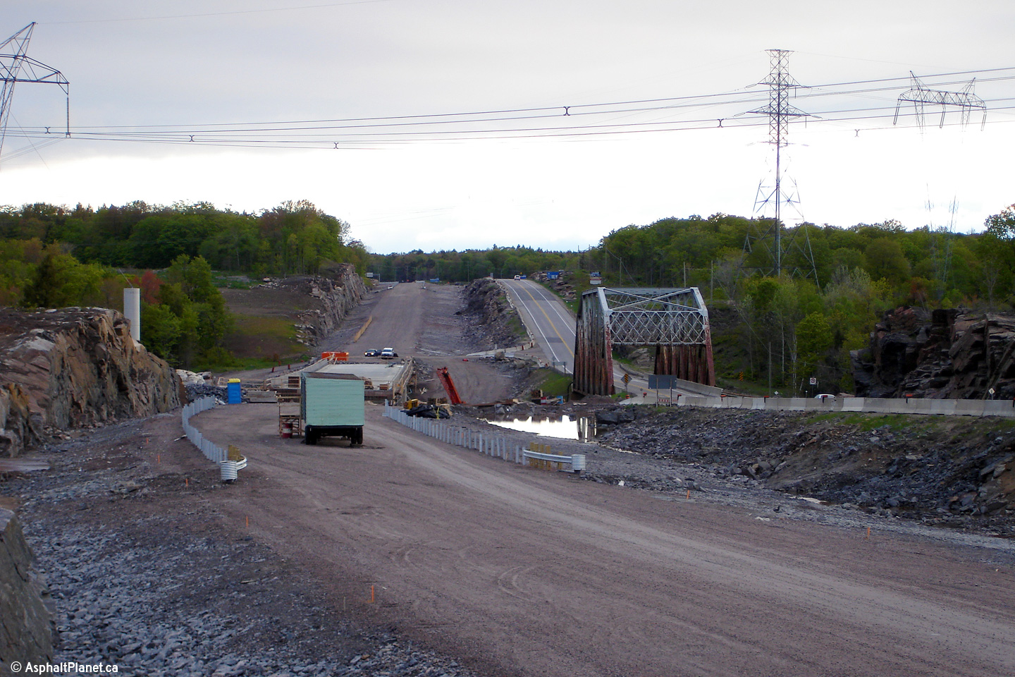
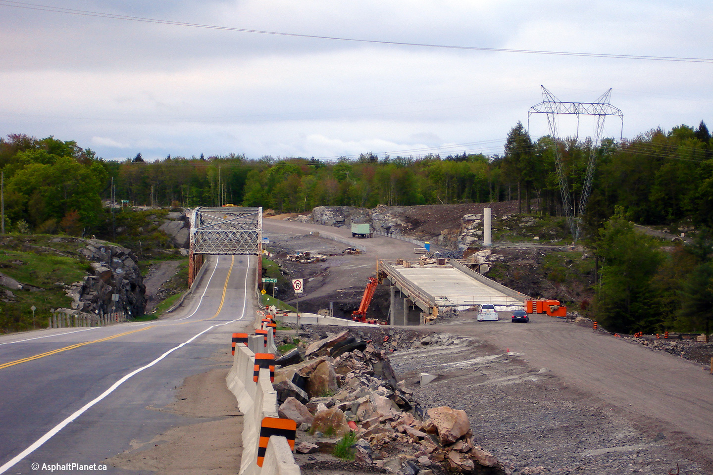
|
Township of Georgian Bay
District Municipality of Muskoka |
Looking north towards the Moon River bridge. The former truss bridge was demolished once two way traffic had been diverted onto the future southbound structure. As is pictured in the lower photo, a new northbound structure replaced the truss.
Upper photo taken: May 22nd, 2006.
Lower photo taken: August 2nd, 2008. |
 (720x480) (1440x960) |
||
|
Township of Georgian Bay
District Municipality of Muskoka |
Looking south towards the Moon River bridge. The newly constructed Moon River bridge crosses the valley on a much improved alignment compared to the existing structure. Photo taken: May 22nd, 2006. |
|
||
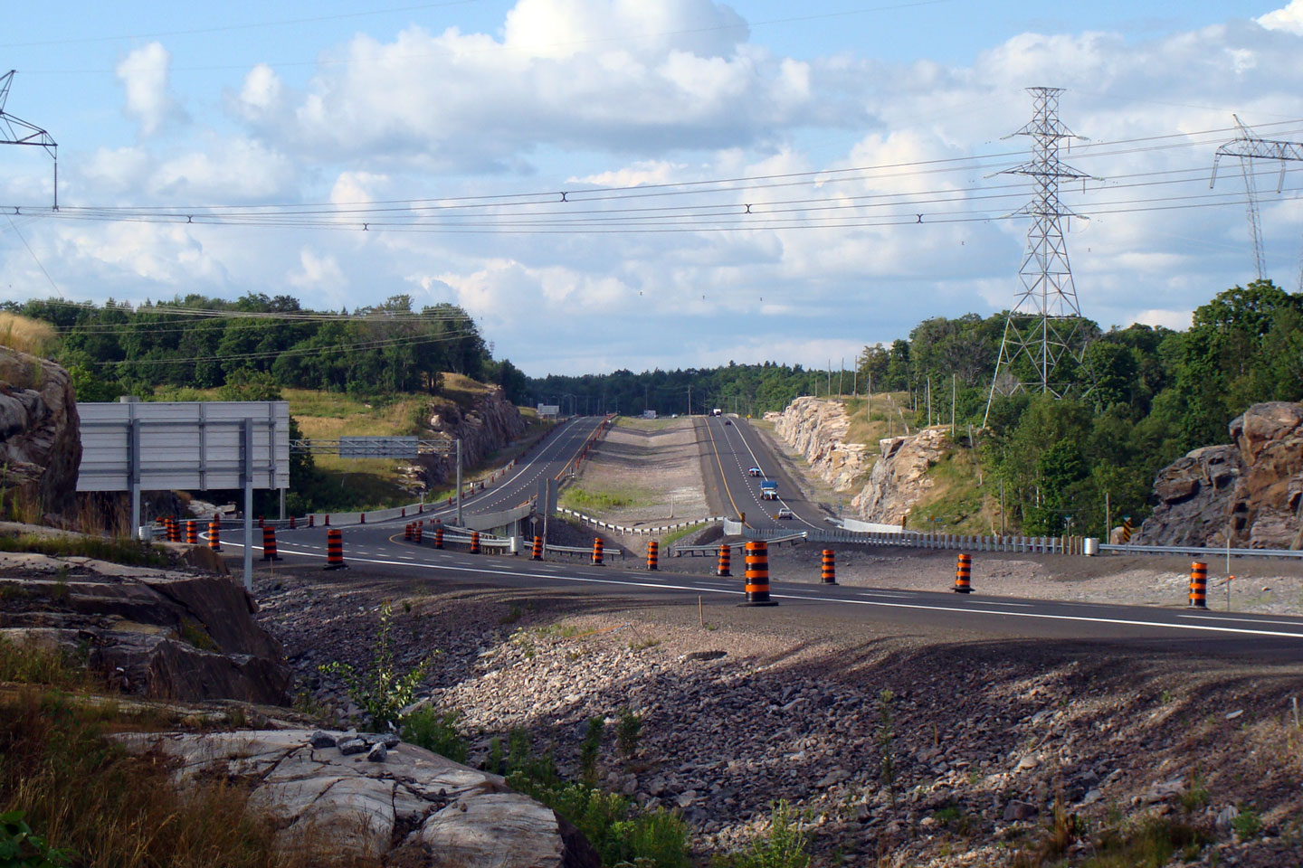
|
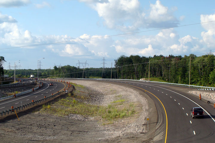
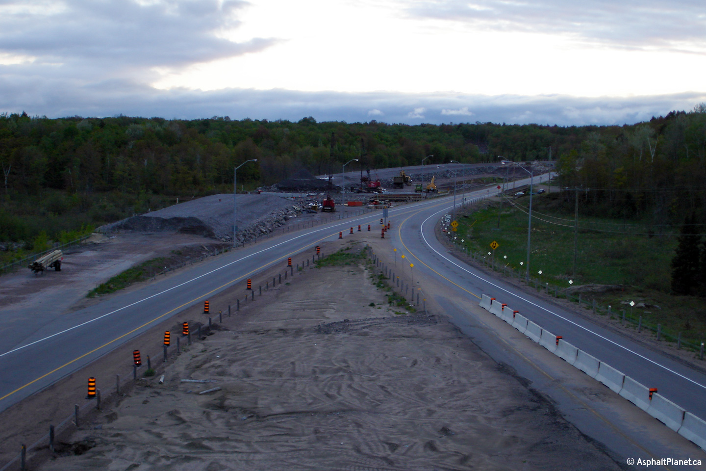
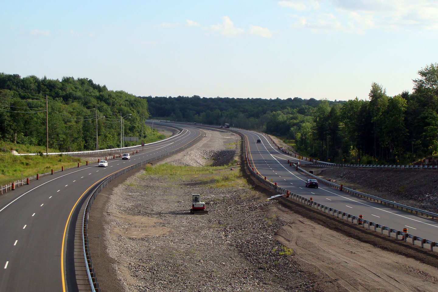
Township of Georgian Bay
District Municipality of Muskoka |
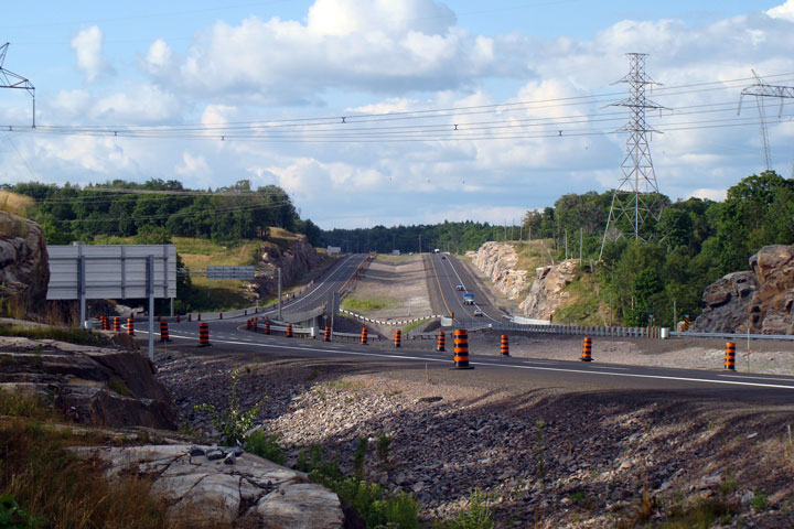
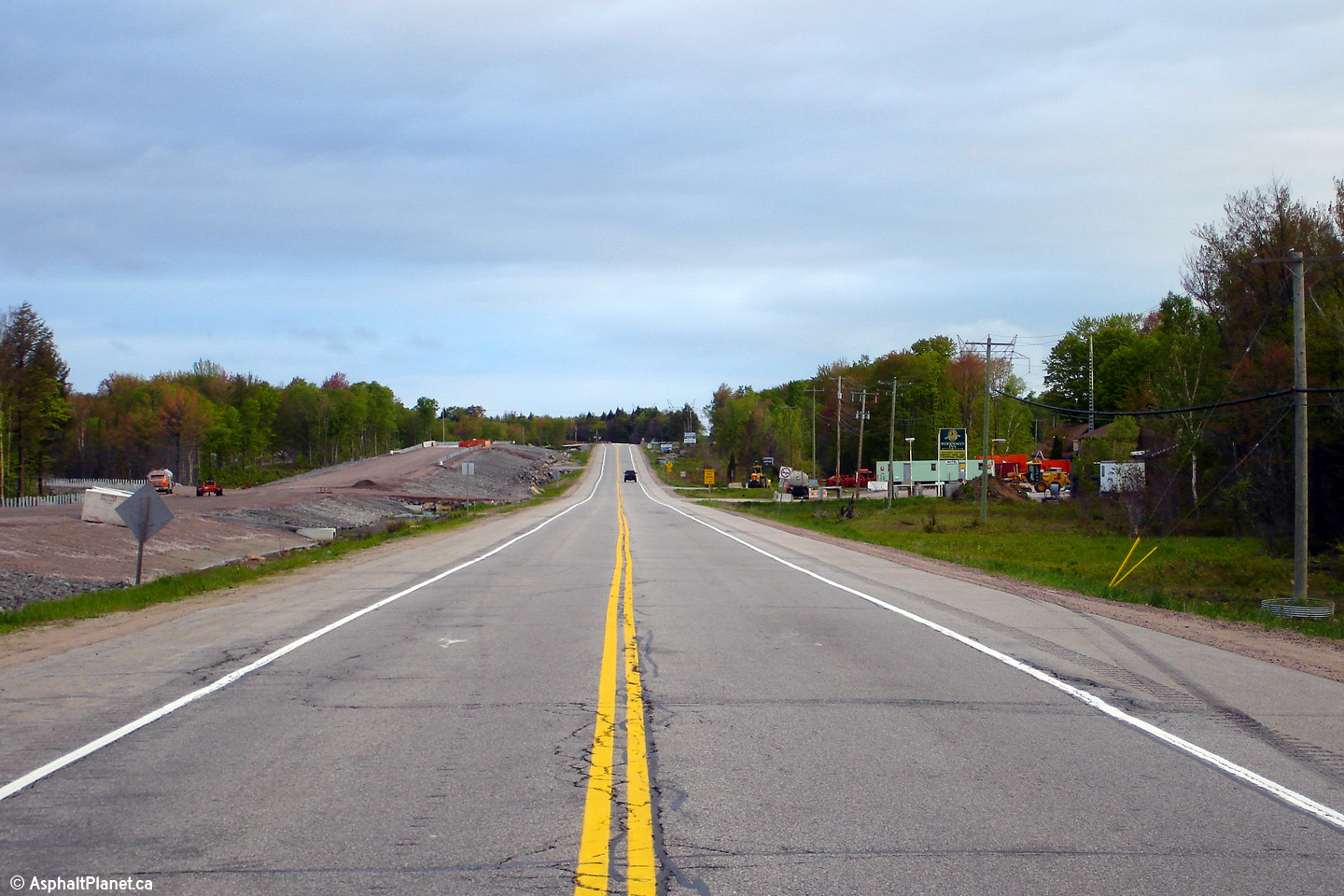
View of the beginning of the divided highway at the northern end of the
Wahta Gap. About 1km north of where the divided highway resumes
Highway 69 splits from Highway 400 heading
towards MacTier and Foot's Bay. |
|
||
|
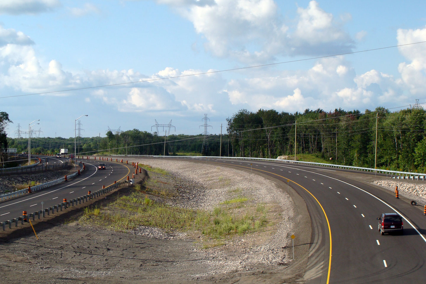
Township of Georgian Bay
District Municipality of Muskoka |
Looking south from the southern Highway 69 overpass towards Highway 69/400. The divided highway narrows for the Wahta Gap just south of this overpass.
Photo taken: July 13th, 2006. |
|
||
Highway 400 continues both north
and south of the former Whata Gap.
Click here for Highway 400 images.
|
||||
Highway 69 Images Index Lake Joseph Road Images ->
<- Highway 67 Images Back to Highway 69 Highway 70 Images ->
Copyright (c) 2004-2014, Scott Steeves (Webmaster) scott@asphaltplanet.ca
Map Image Copyright (c) 2006 - Mapart Publishing


