|
Proper Municipality Name |
Photo Description |
Photo |
|
Photos taken
from driver's perspective appear offset from centre-line Photos: |
North-
Bound |
South-
Bound |
|
Click here for Highway 400 images between
Highway 9 and Crown Hill. |
|
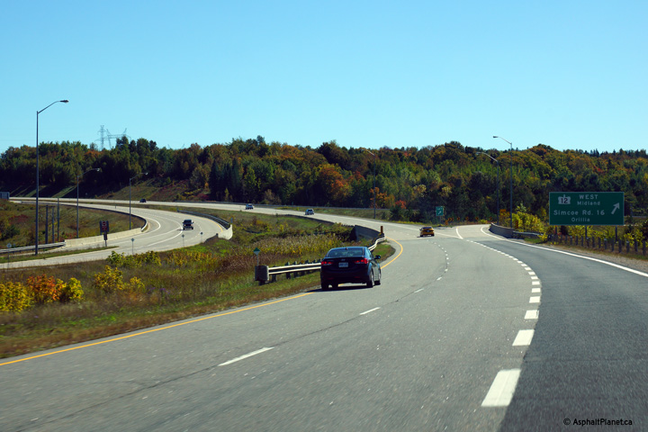
Highway 12 extends east and west
of Highway 400. Click
here for Highway 12 images. |
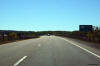
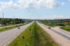
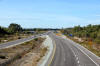
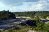
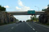
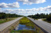
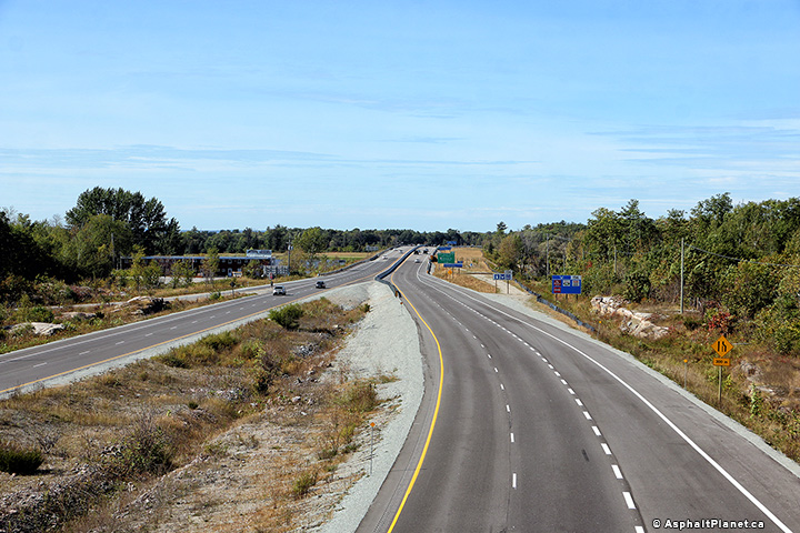
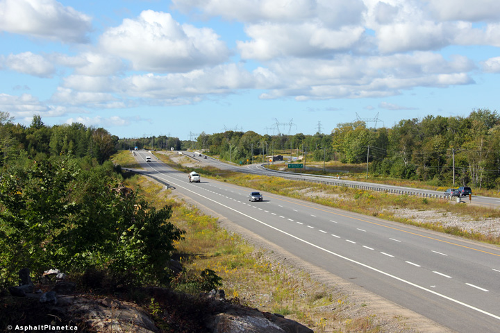
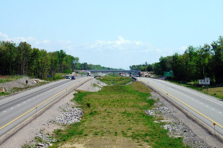
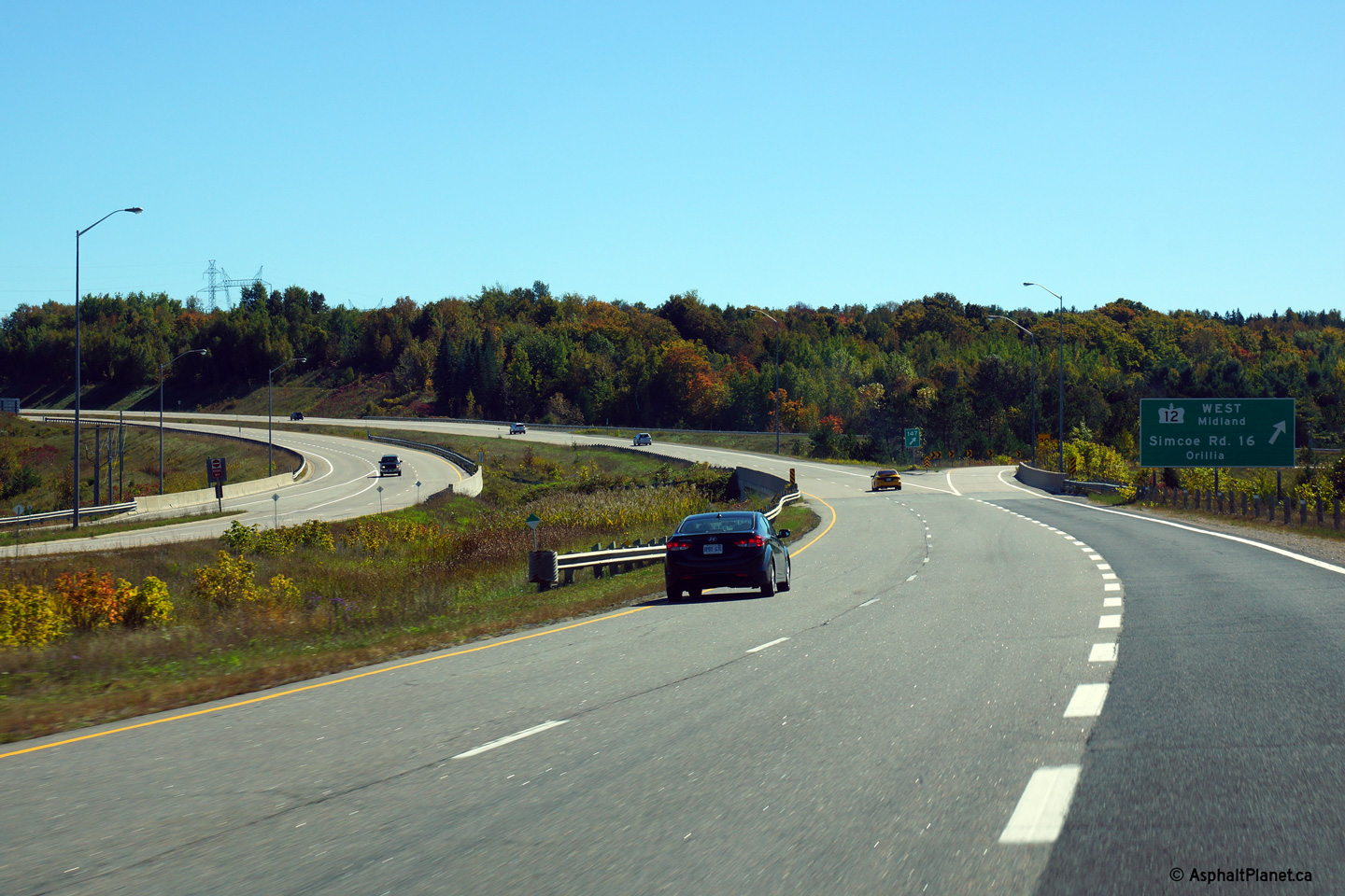
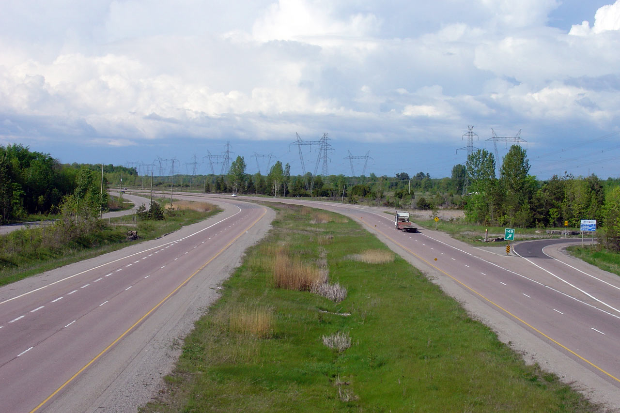
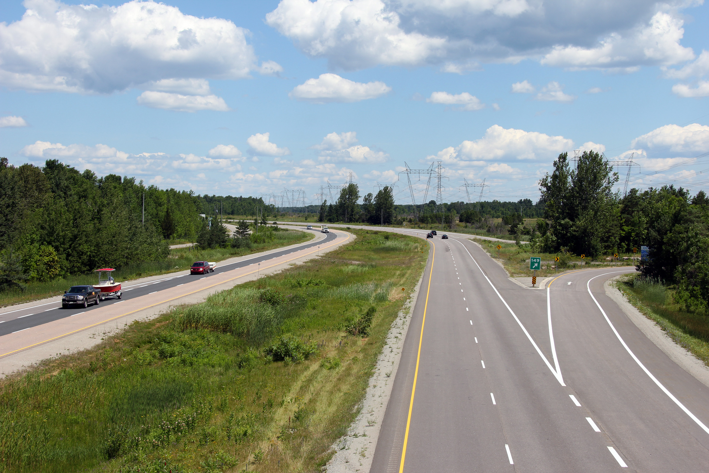
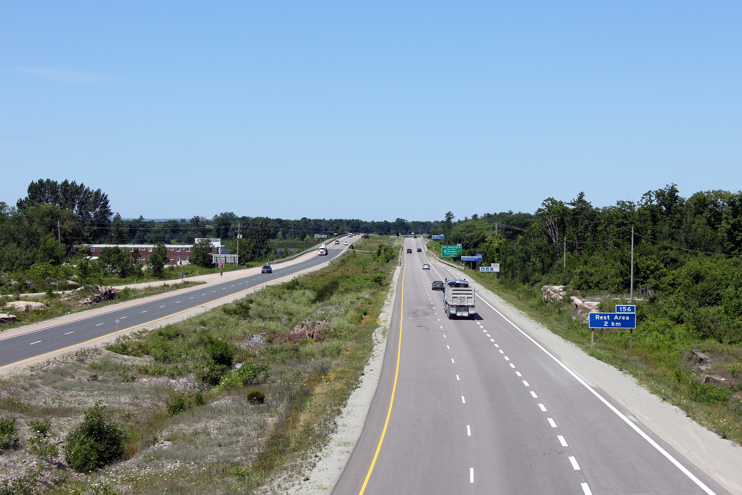
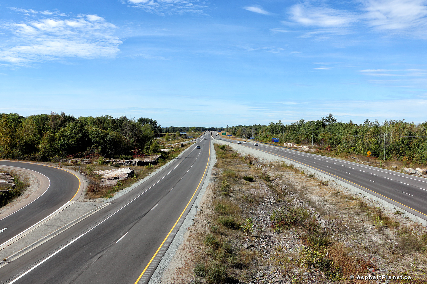
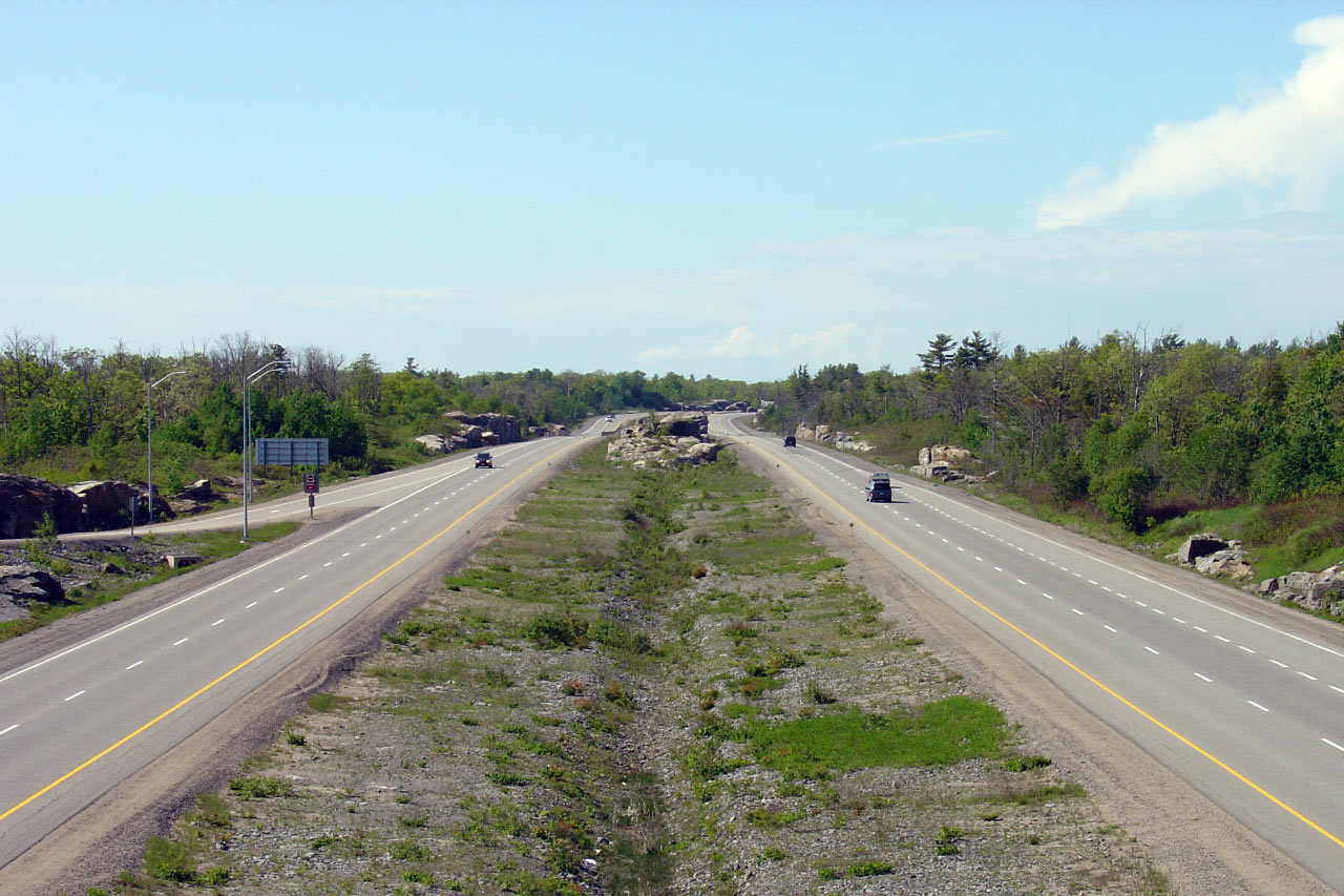
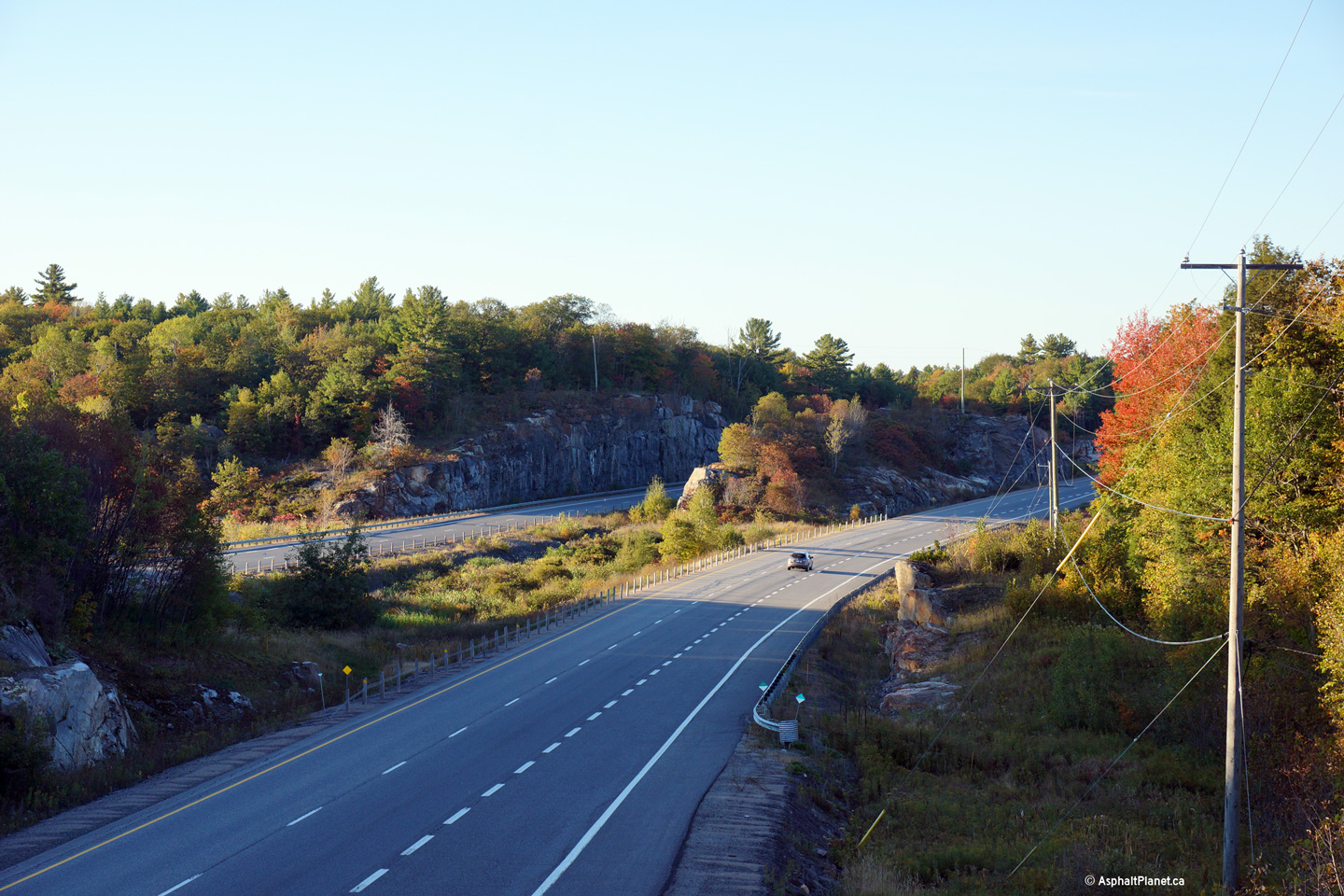
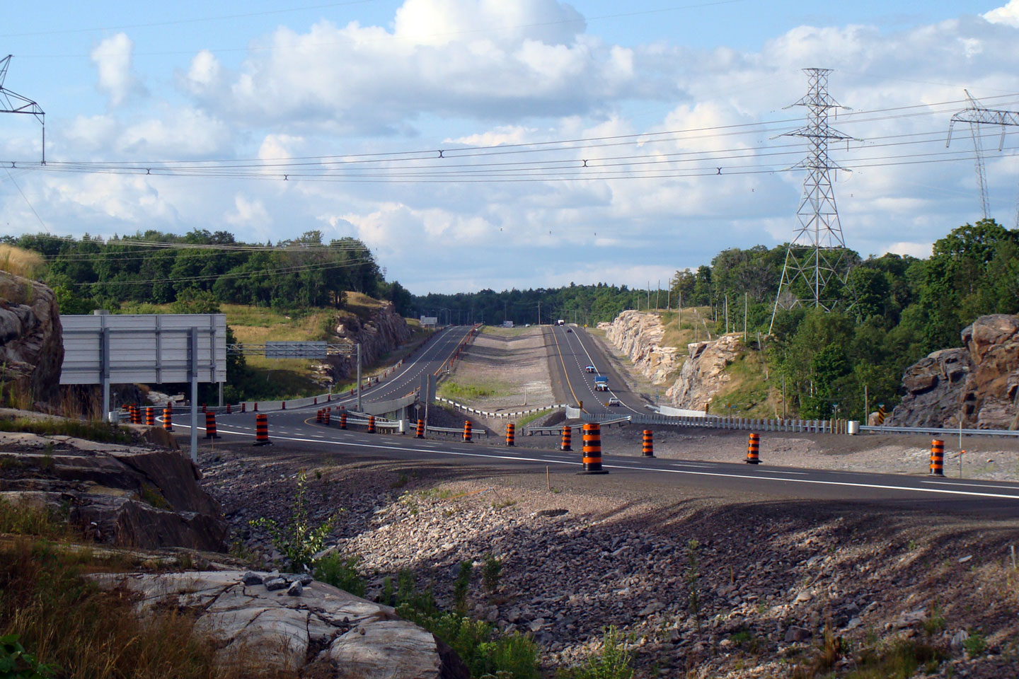
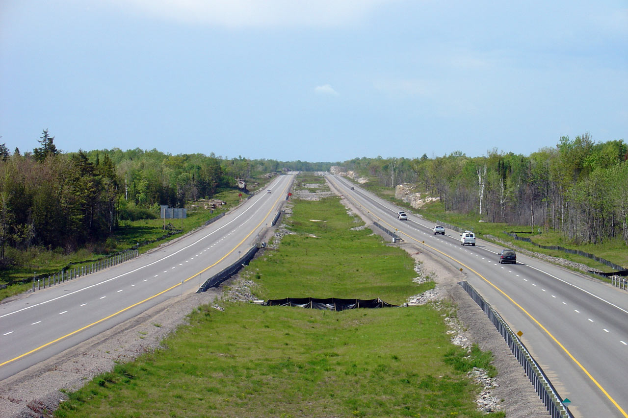
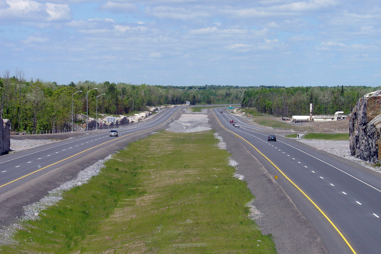
| Severn - Tay Boundary County of
Simcoe |
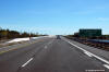
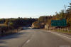
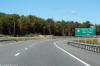
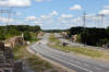
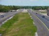
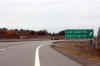
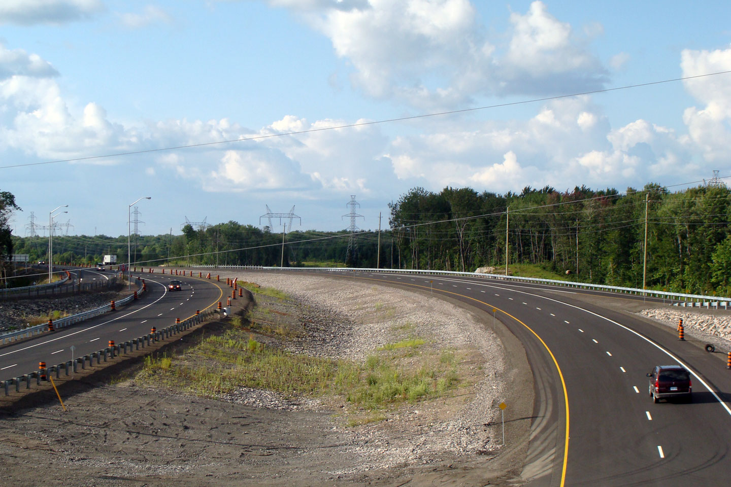
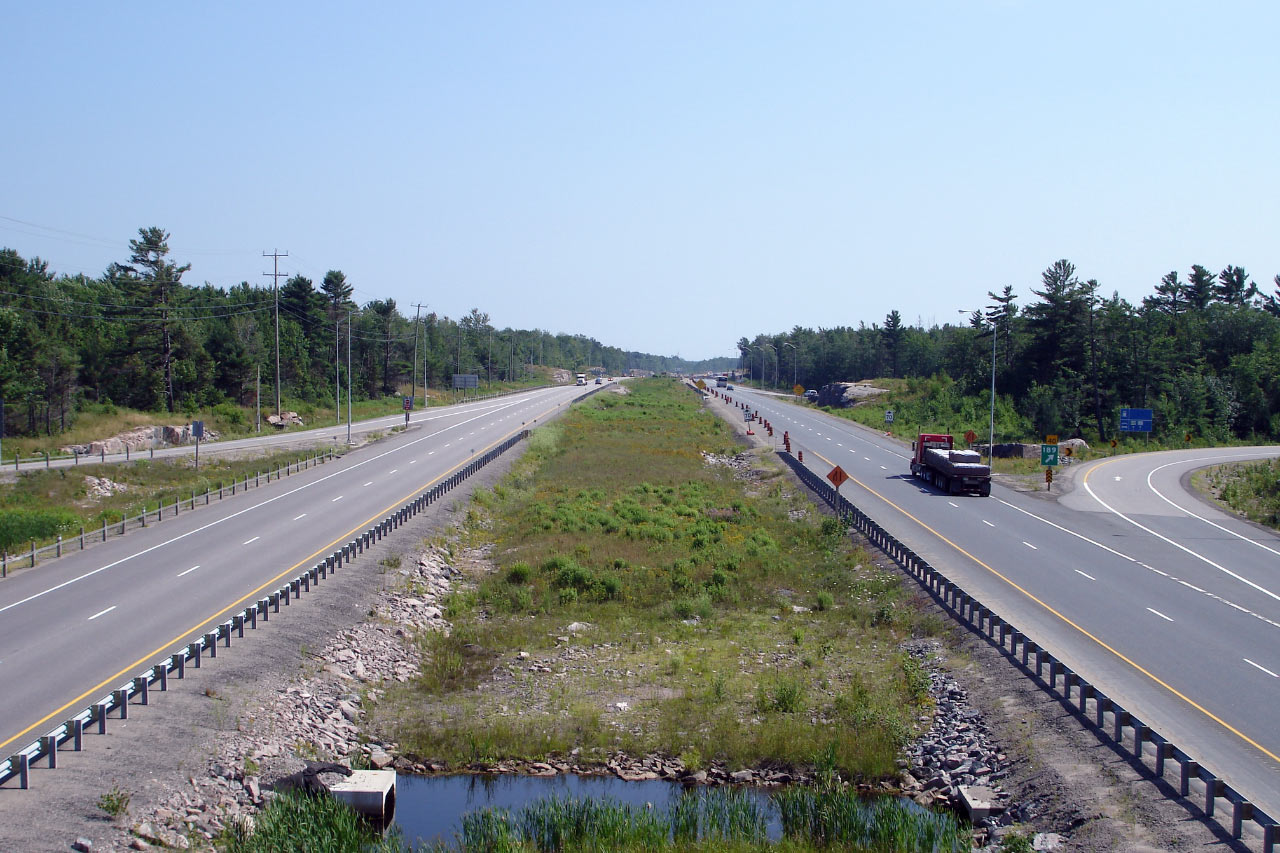
View looking southerly towards the Highway 12 interchange. Photo taken:
September 27th, 2013. |
|
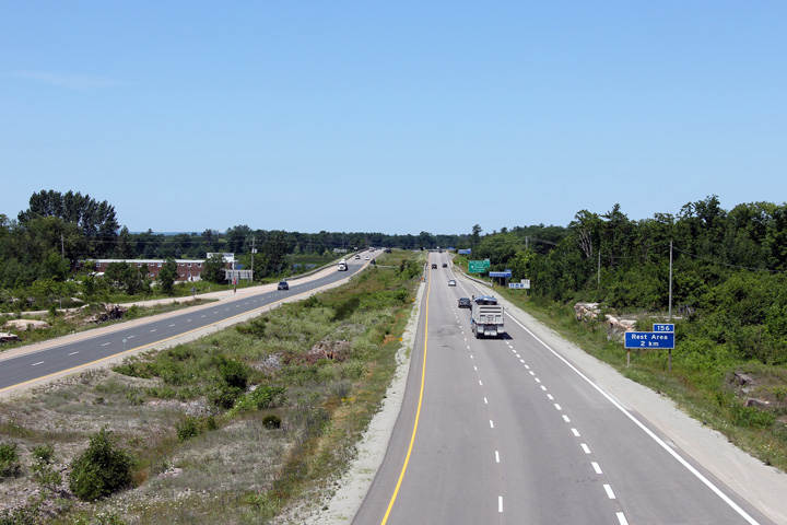
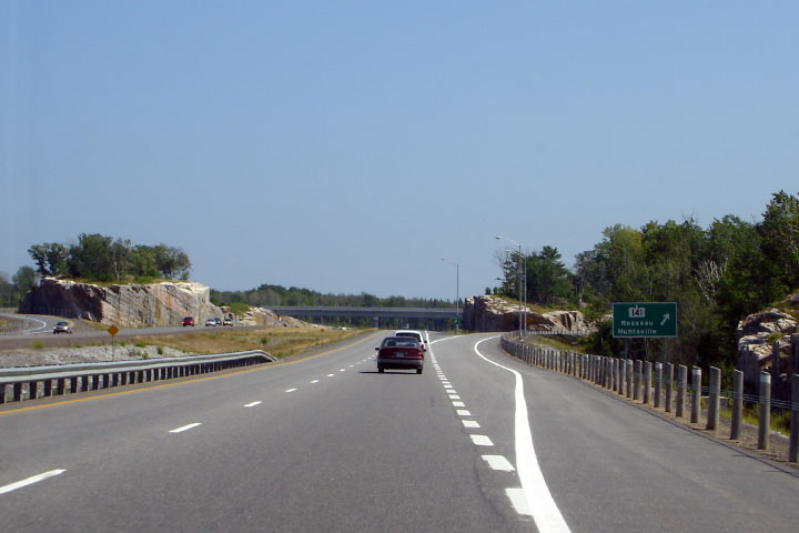
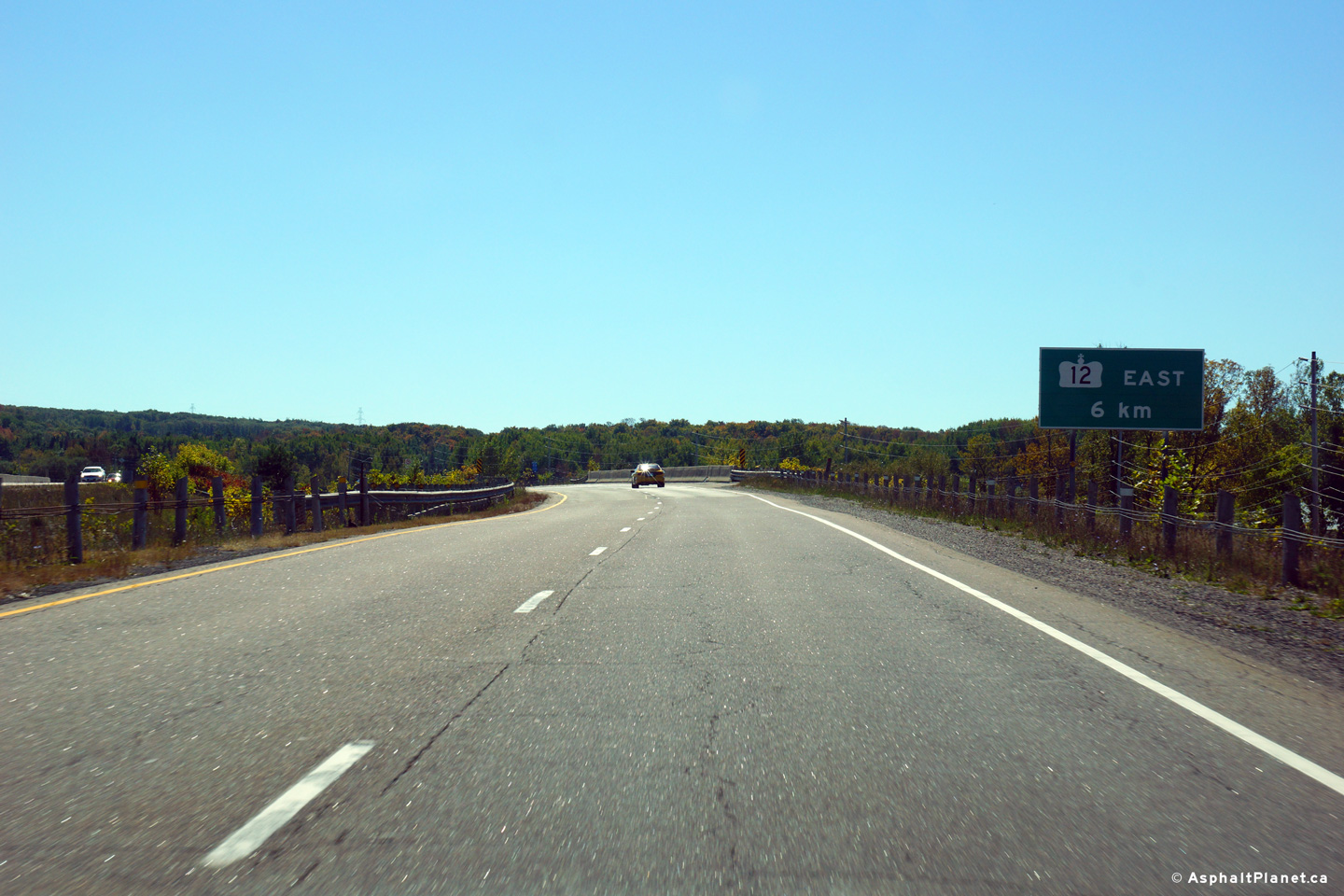
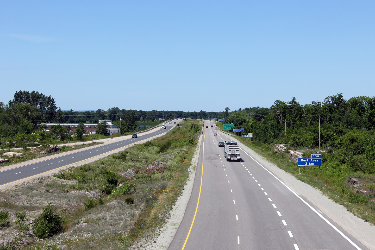
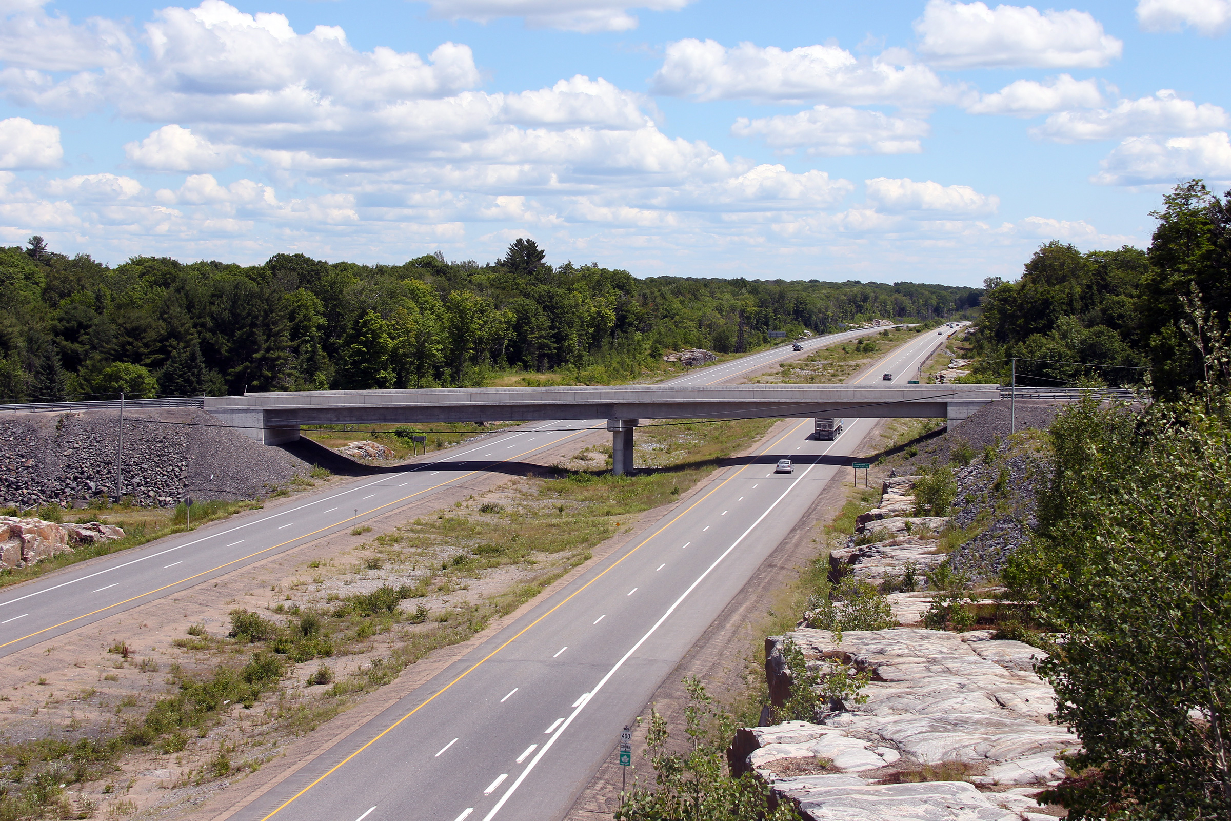
| Severn - Tay Boundary County of
Simcoe |
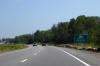
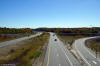
Signage advising traffic bound for Highway 12-East to remain on Highway 400
for an additional 5km.
Photo taken: September 27th, 2013. |
 (720x480) (720x480)
(1440x960)
(2400x1600) |
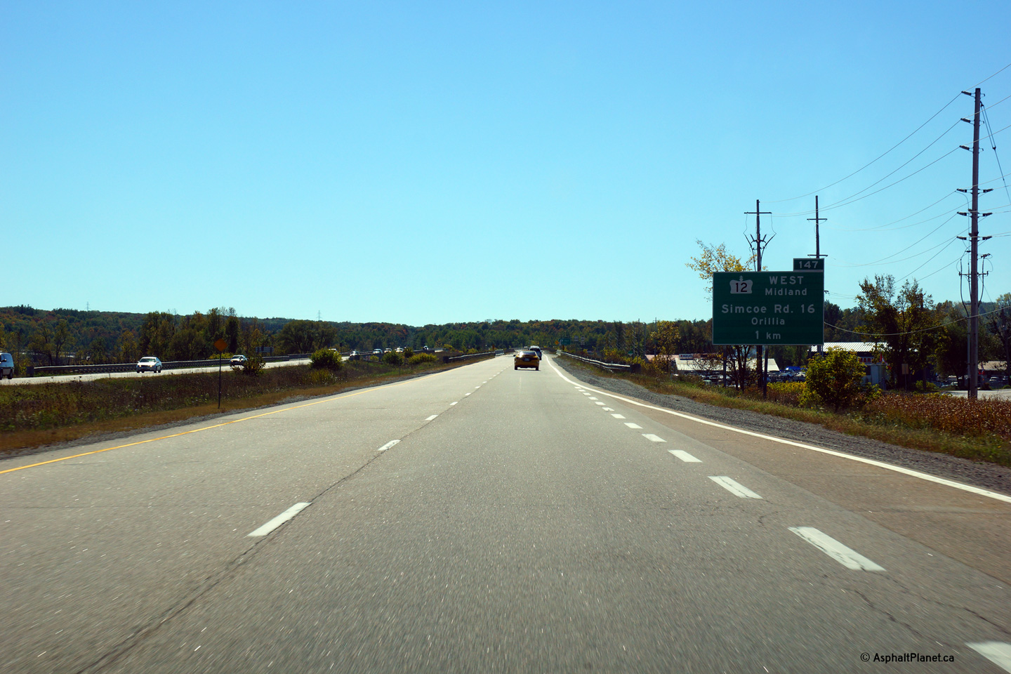
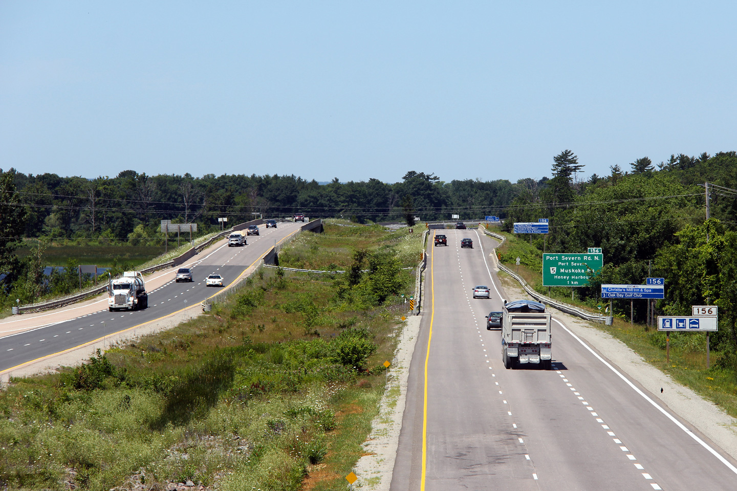
| Severn - Tay Boundary County of
Simcoe |
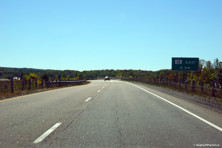
Southbound advanced signage for the Highway 12-West interchange.
Photo taken: September 27th, 2013. |
 (720x480) (720x480)
(1440x960)
(2400x1600) |
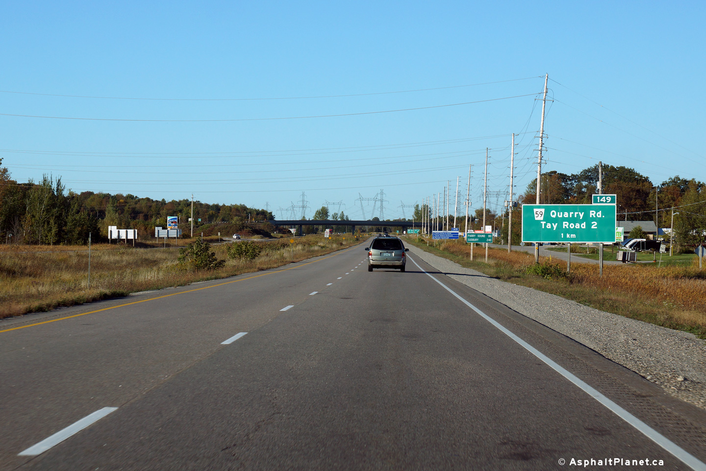
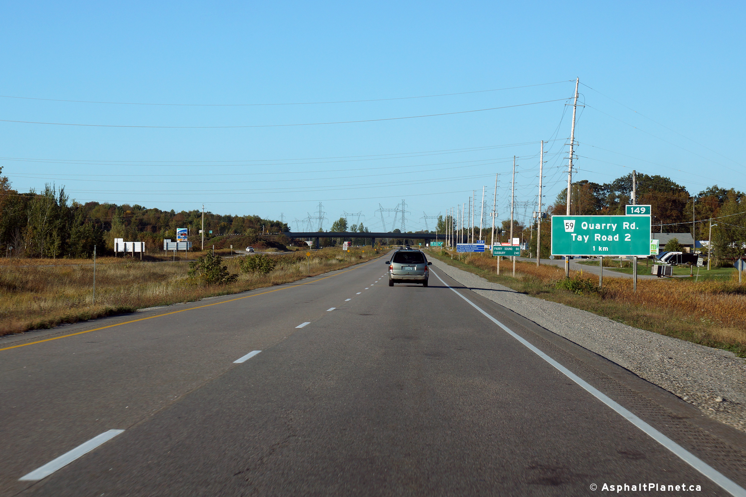
| Severn - Tay Boundary County of
Simcoe |
Northbound advanced signage for the Quarry Road interchange.
Photo taken: September 26th, 2013. |
 (720x480) (720x480)
(1440x960)
(2400x1600) |
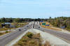
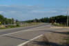
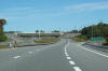
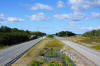
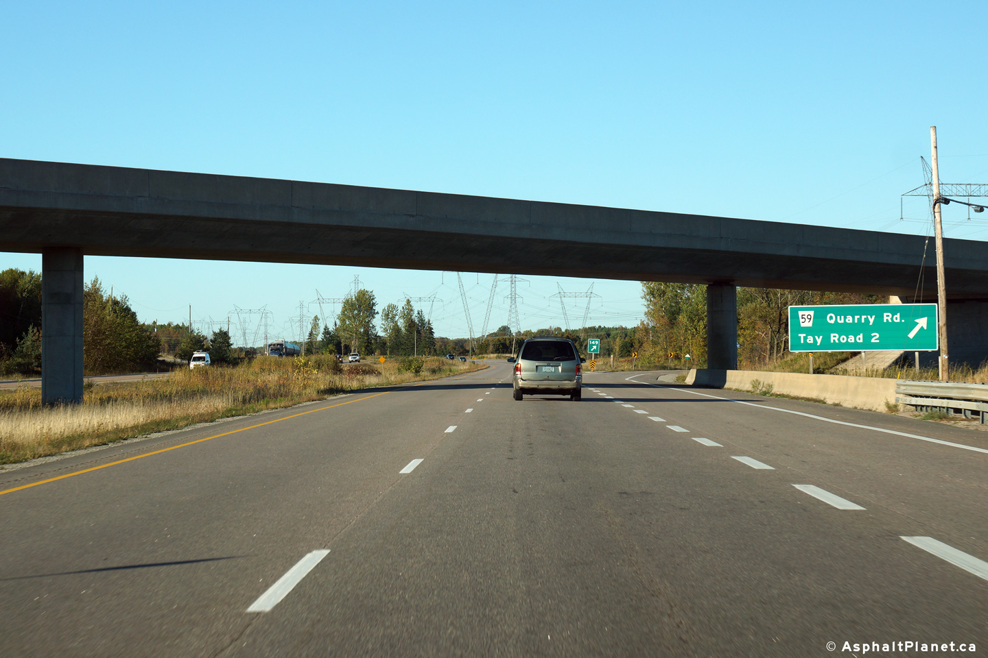
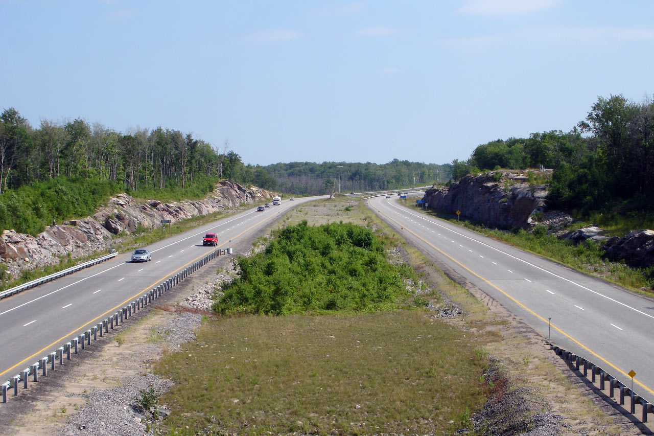
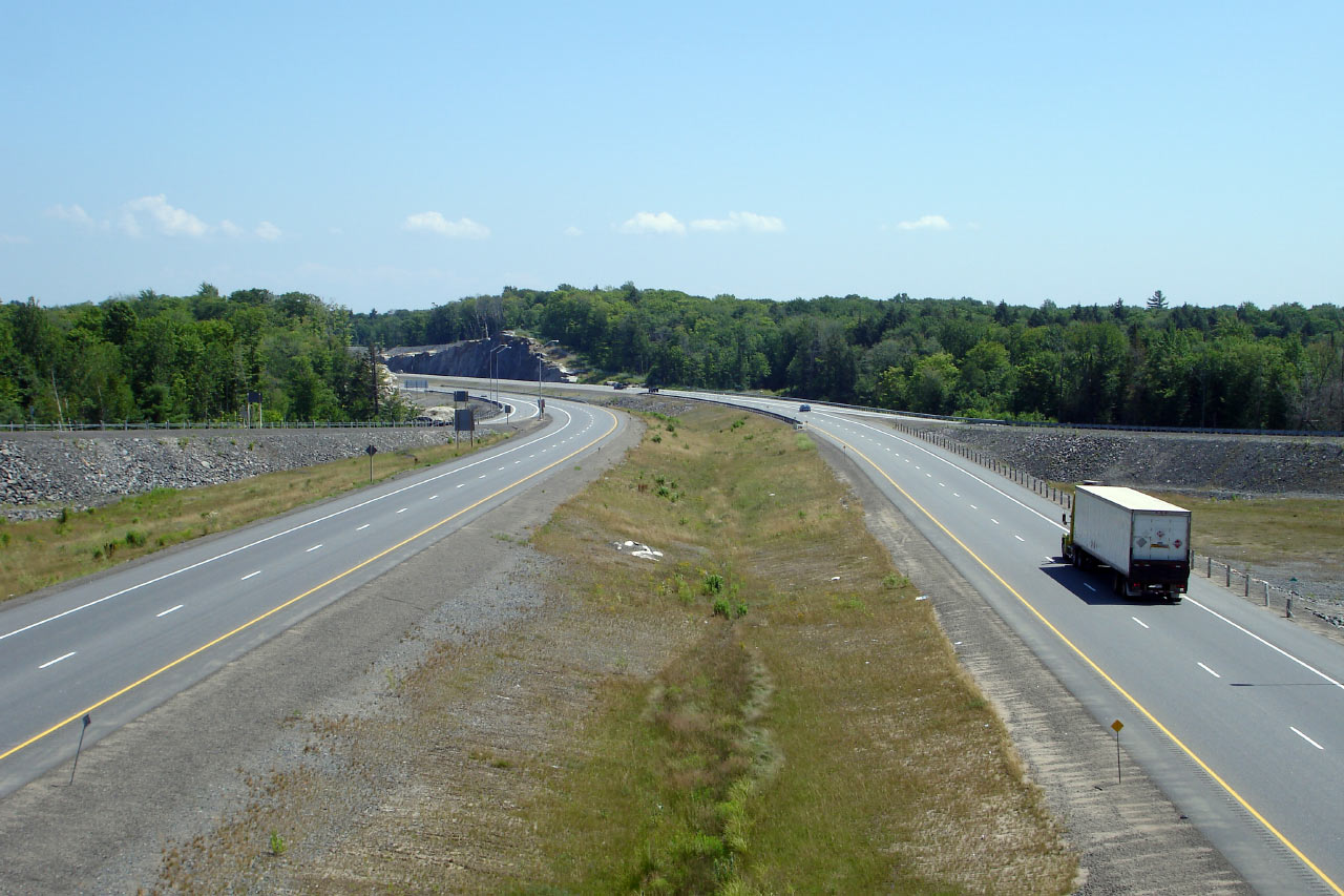
| Severn - Tay Boundary County of
Simcoe |
Northbound view at the off-ramp to Quarry Road. Highway 400 meets
Quarry Road at a fairly tight parclo A2 style interchange.
Photo taken: September 26th, 2013. |
 (720x480) (720x480)
(1440x960)
(2400x1600) |
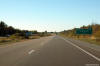
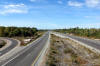
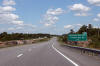
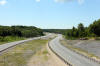
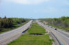
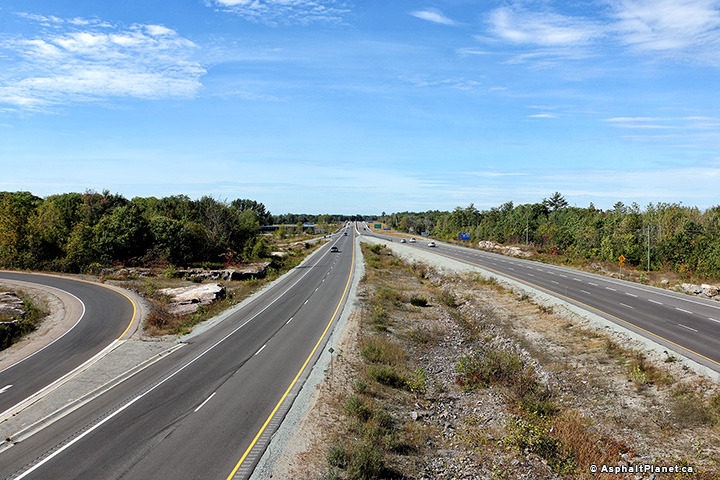
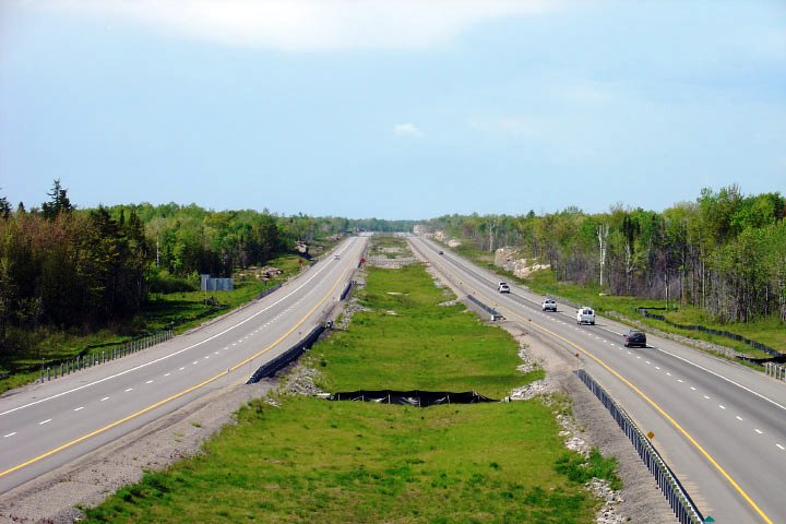
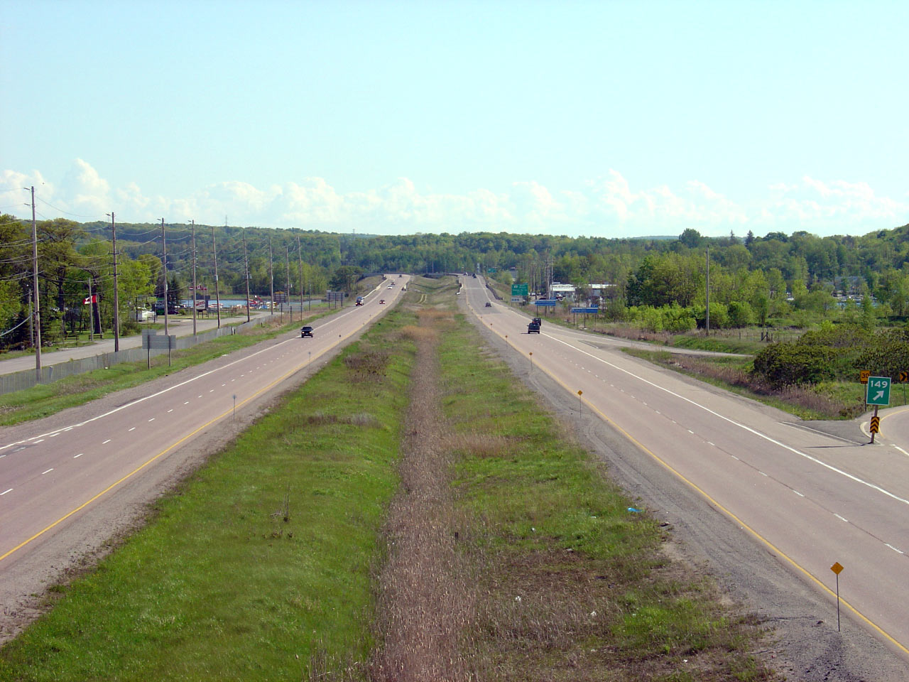
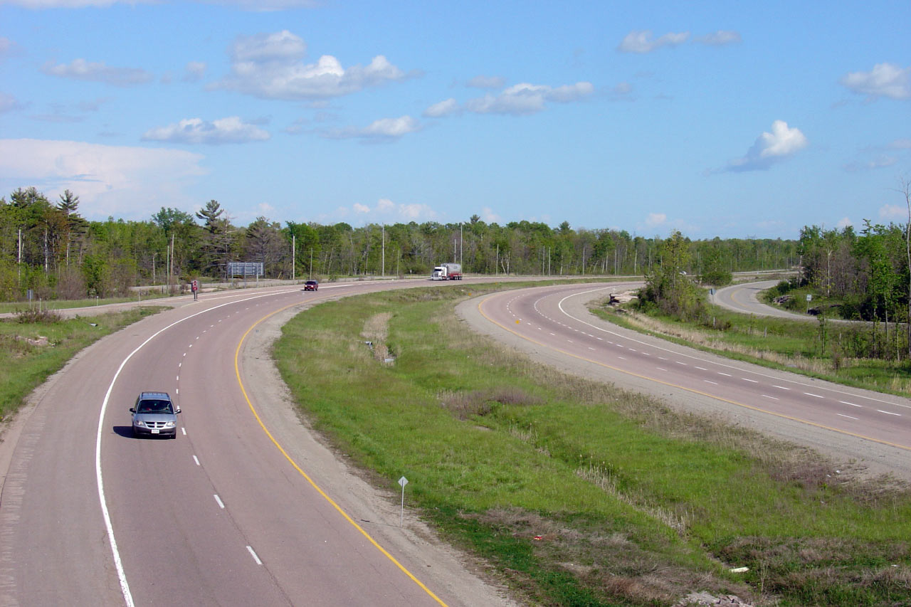
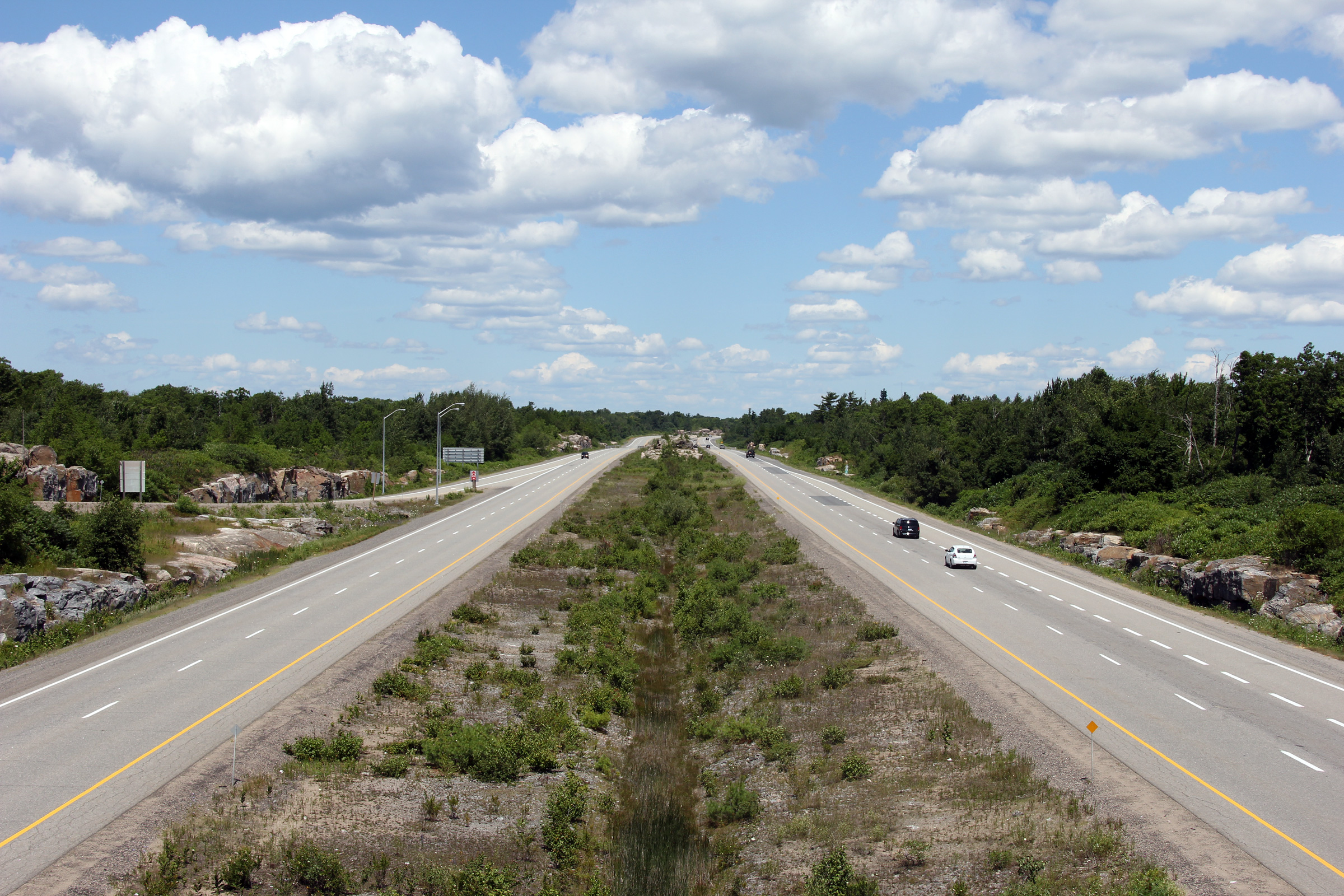
| Severn - Tay Boundary County of
Simcoe |
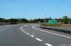
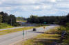
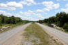
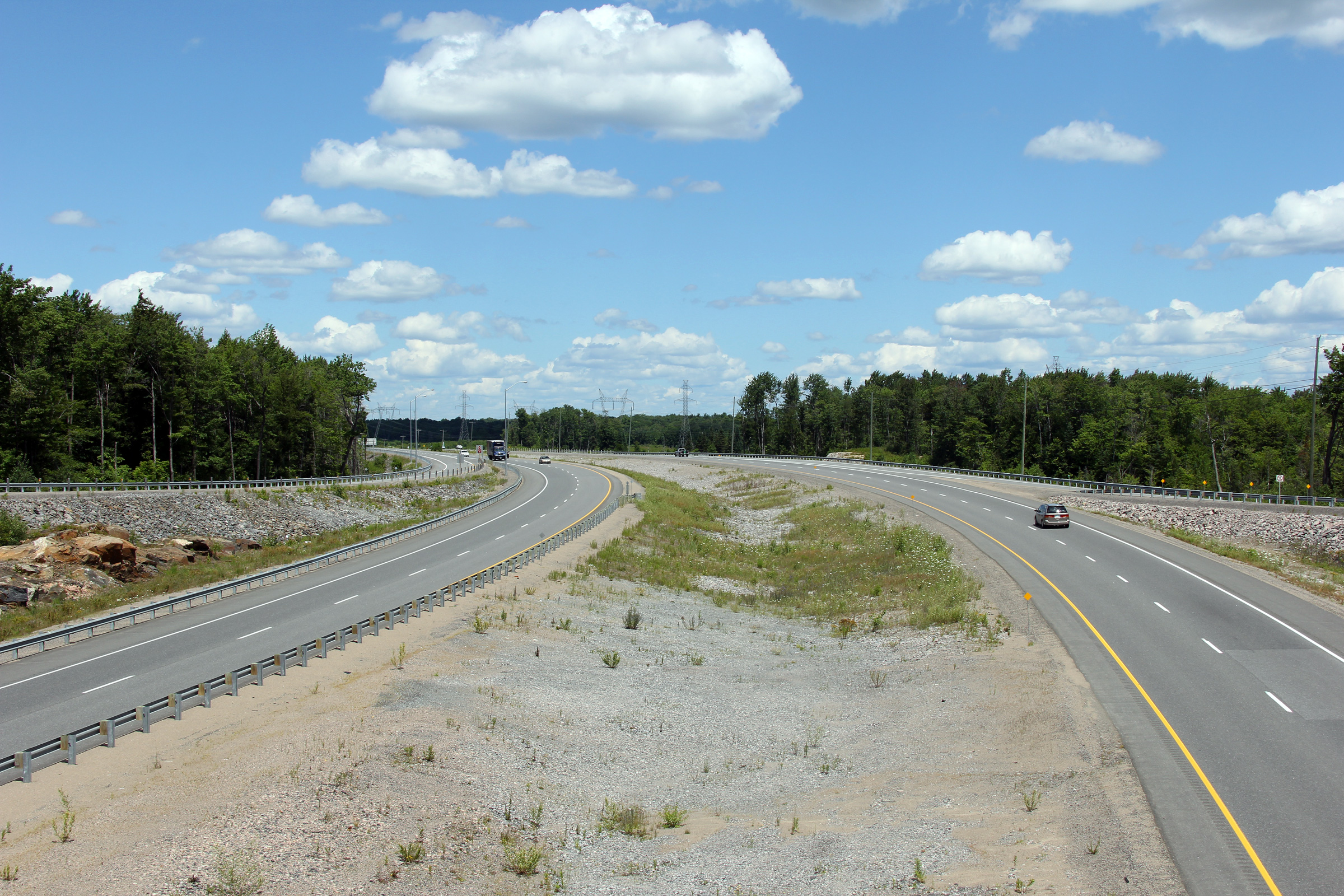
Southerly view along the 400 from the Quarry Road interchange.
Click here for this
same view taken in June, 2005. Photo taken: July 10th, 2012. |
(720x480)
(1440x960)
(2400x1600) |
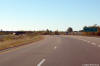
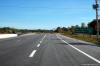
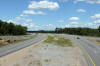
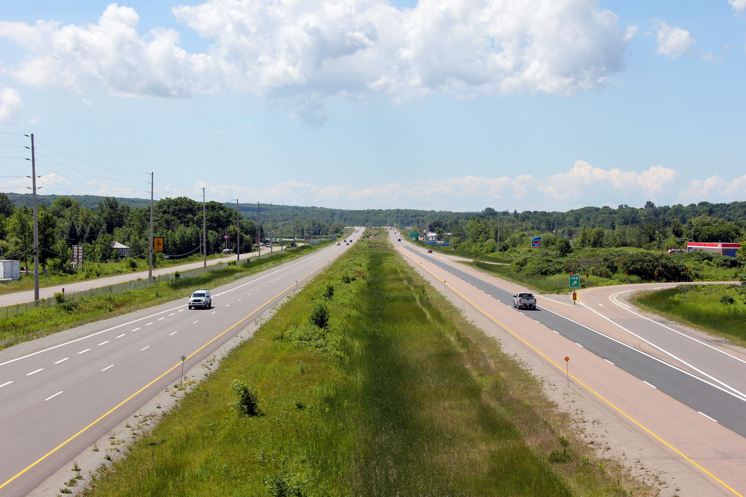
| Severn - Tay Boundary County of
Simcoe |
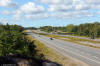
Looking north from the Quarry Road interchange.
Click here for this
same view taken in June, 2005. Photo taken: July 10th, 2012. |

(720x480)
(1440x960)
(2400x1600) |
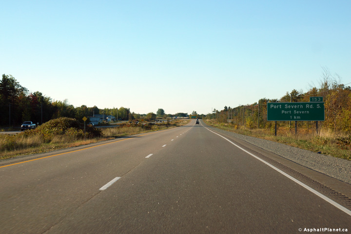
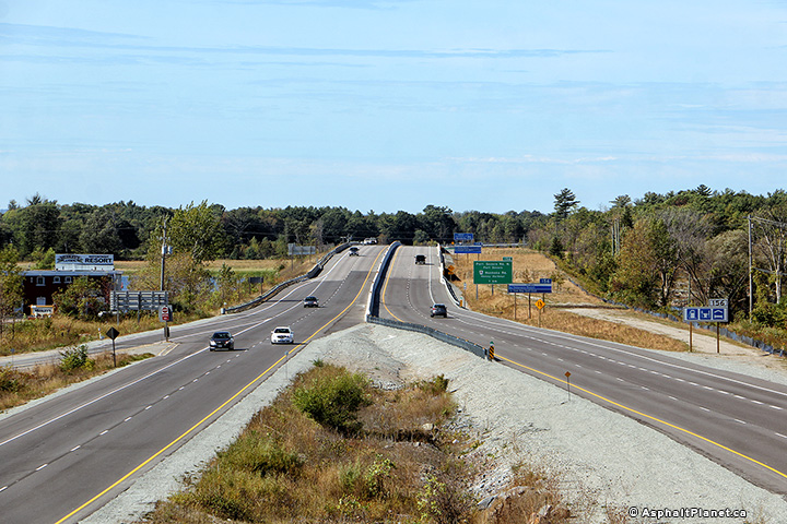
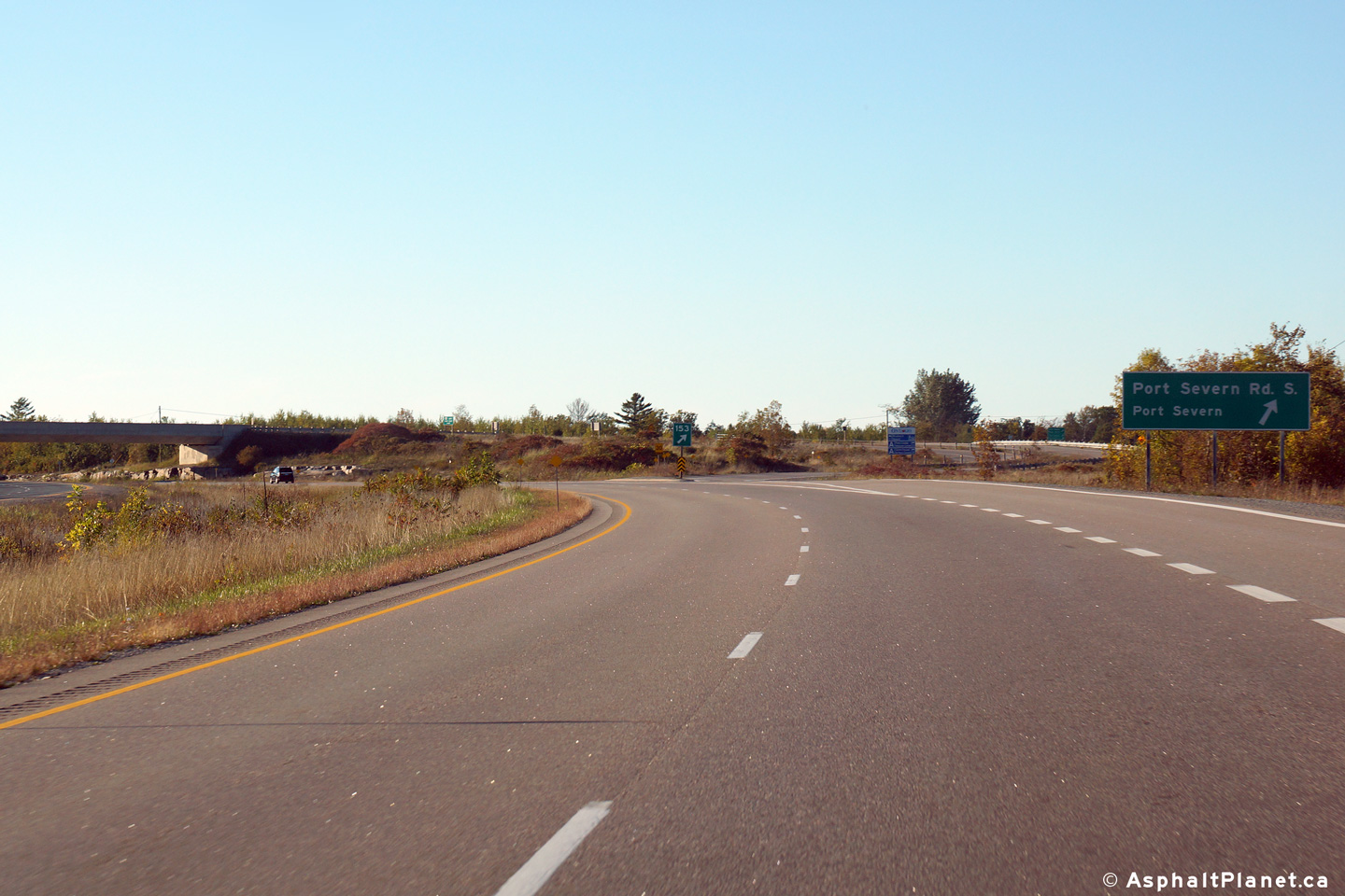
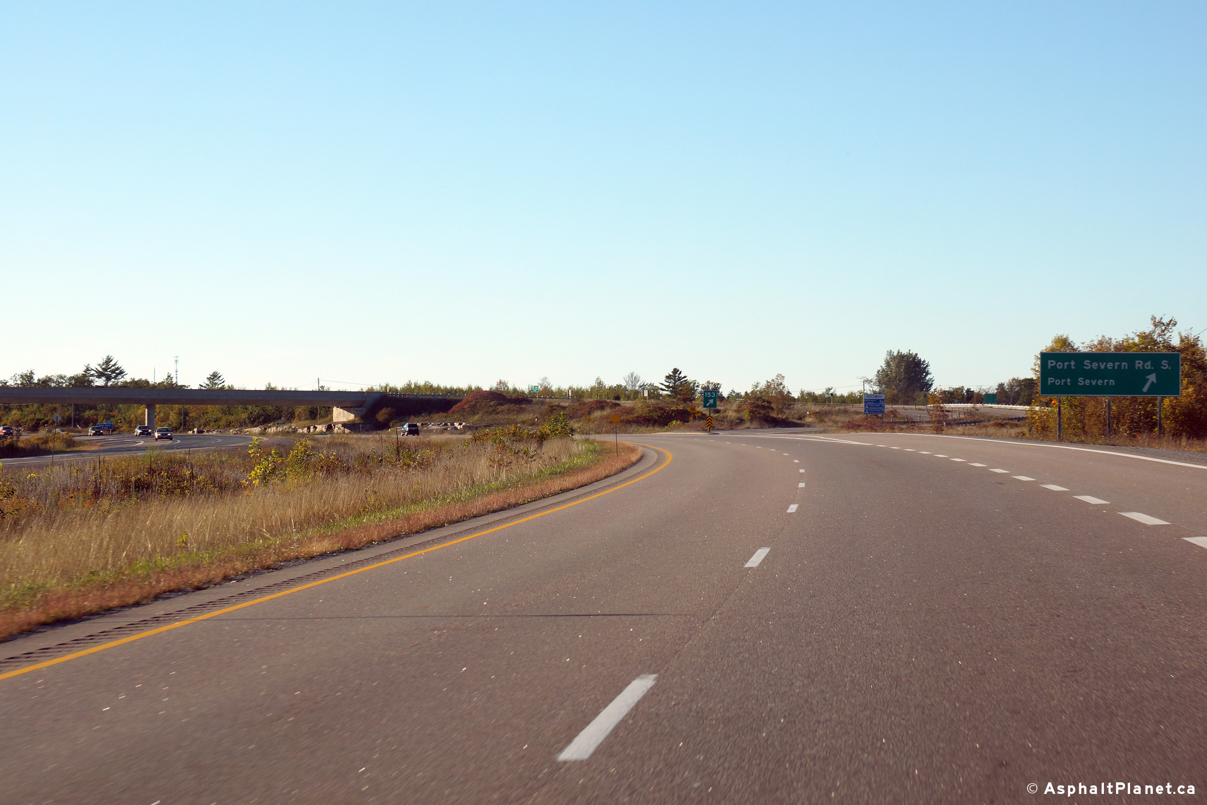
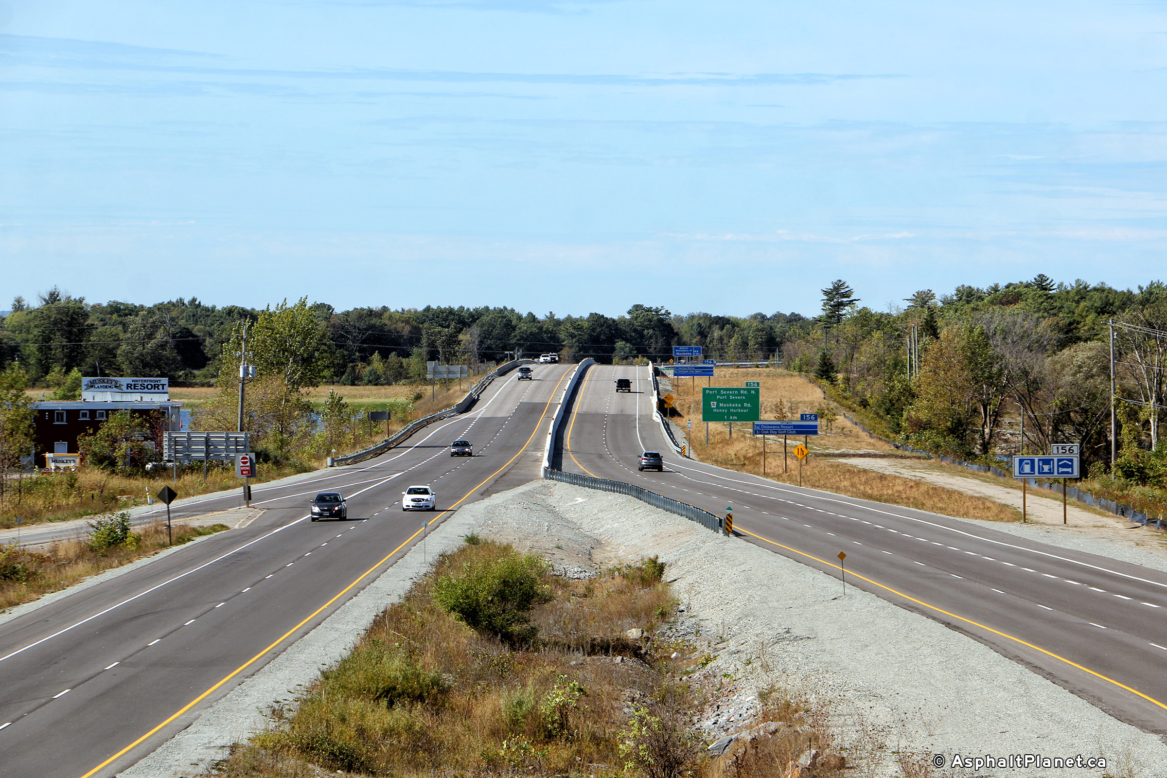
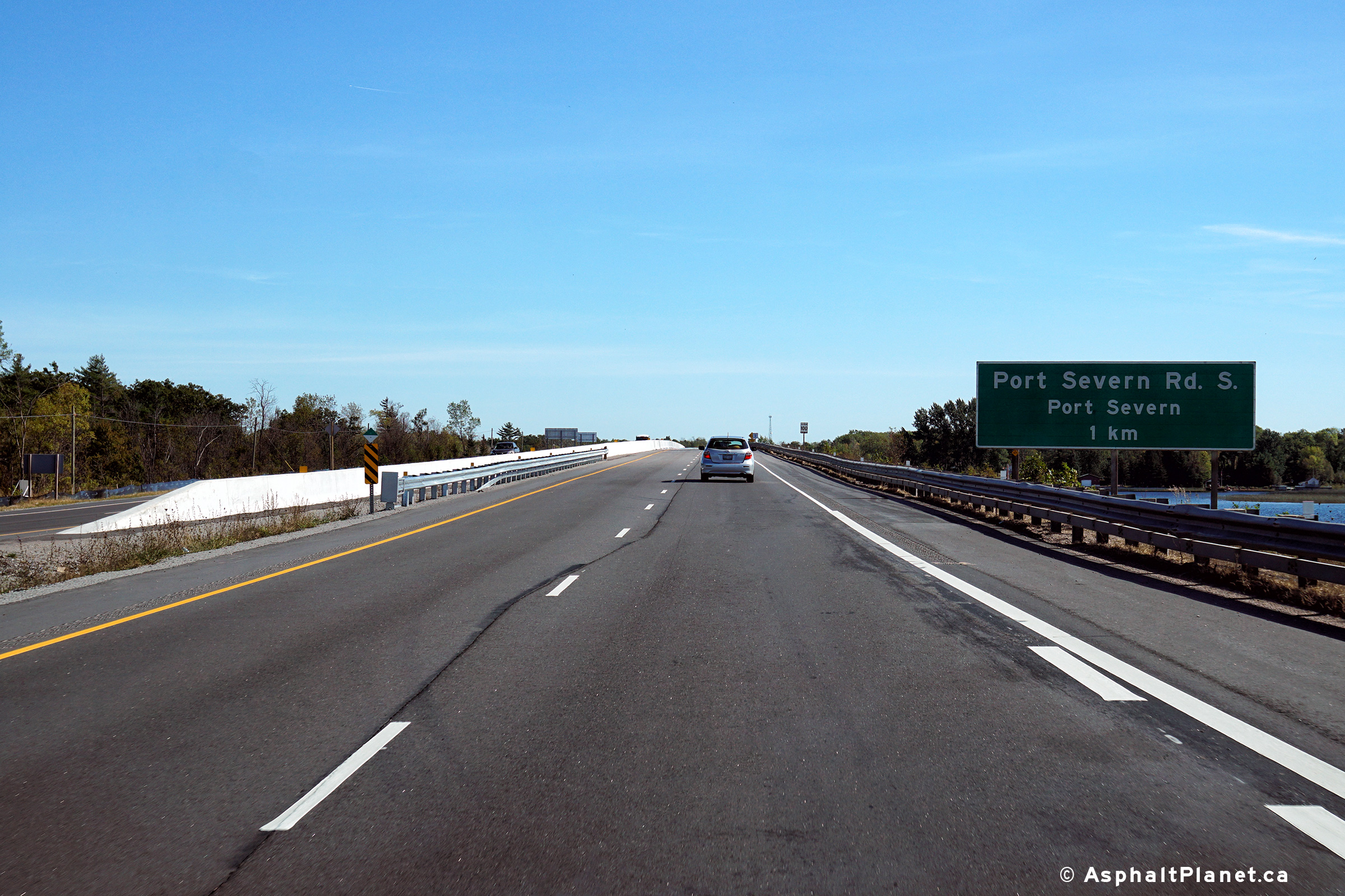
| Severn - Tay Boundary County of
Simcoe |
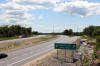
Advanced signage for the southern Port Severn Road interchange.
Photo taken: September 26th, 2013. |
 (720x480) (720x480)
(1440x960)
(2400x1600) |
| Severn - Tay Boundary County of
Simcoe |
Northerly view as Highway 400 rounds the long curve at the southern Port
Severn Road interchange
Photo taken: September 26th, 2013. |
 (720x480) (720x480)
(1440x960)
(2400x1600) |
| Severn - Tay Boundary County of
Simcoe |
This view looks south from the Port Servern Road overpass.
Click here for this
same view taken in June, 2005. Photo taken: July 10th, 2012. |
(720x480)
(1440x960)
(2400x1600) |
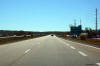
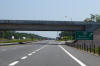
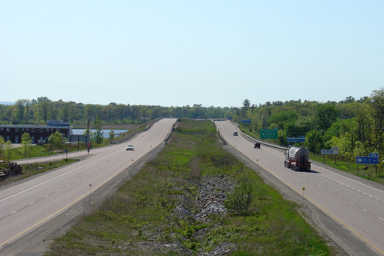
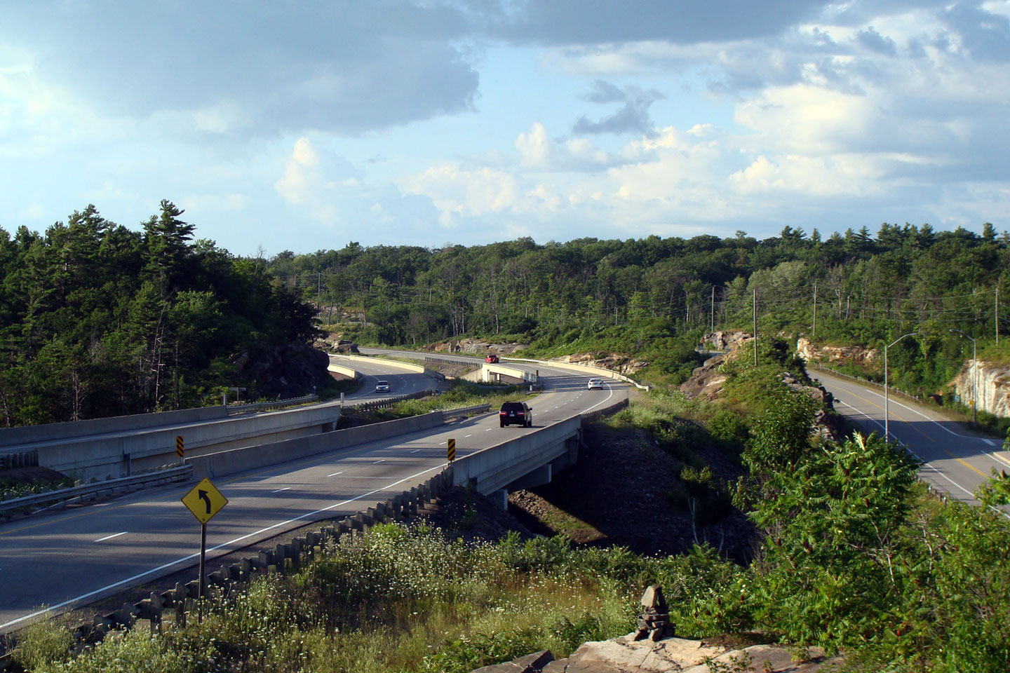
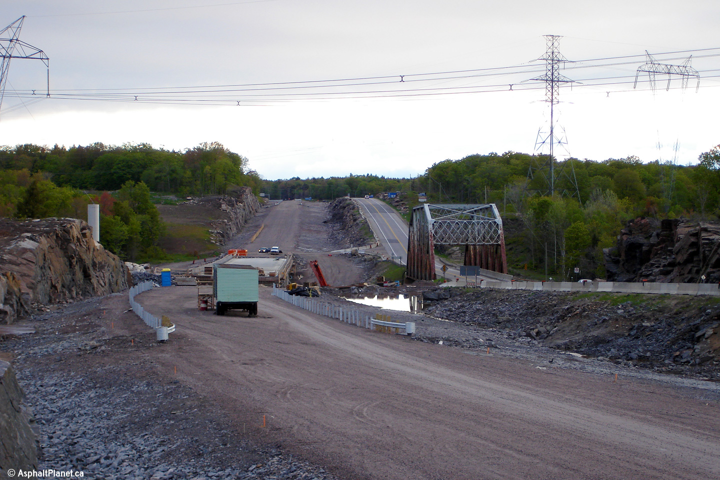
| Severn - Tay Boundary County of
Simcoe |
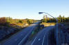
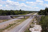
Looking northerly along the Port Severn Road overpass towards the Severn
River bridge. Starting in 2015, the northbound Port Severn structures was
replaced. Because of high volume of traffic that uses Highway 400 during
peak periods, the southbound structure will be widened and will permanently
carry traffic in both directions. The existing northbound structure and
approaching highway alignment was demolished
and abandoned.
Click here for this
same view taken in June, 2005. Upper photos taken: July 10th, 2012.
Lower photos taken: October 2nd, 2017. |
(720x480)
(1440x960)
(2400x1600)
(720x480)
(1440x960)
(2400x1600)
(720x480)
(1440x960)
(2400x1600) |
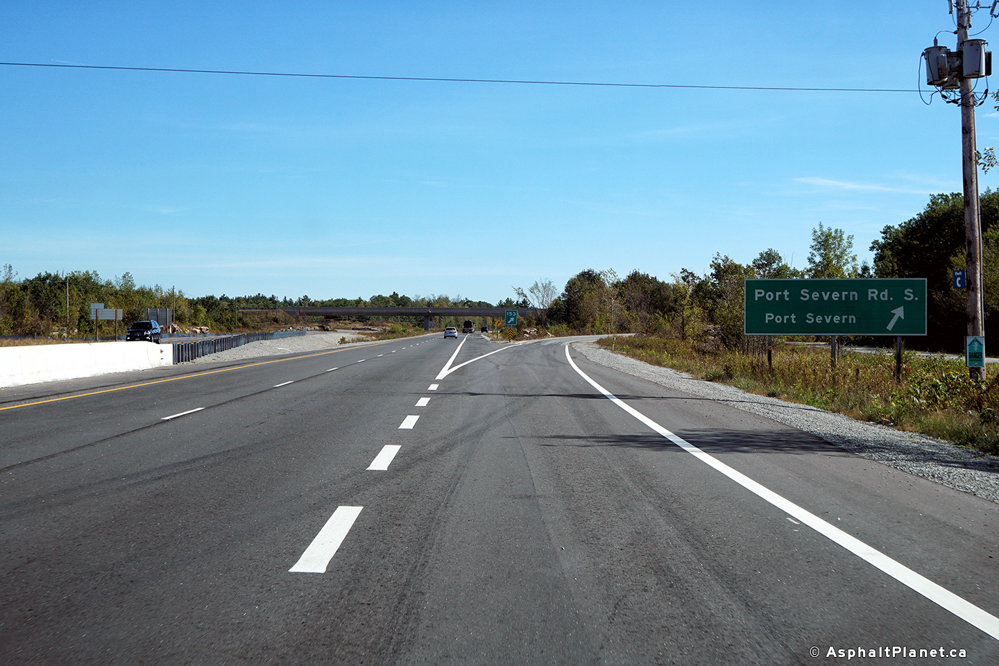
| Severn - Tay Boundary County of
Simcoe |
Southbound signage at the off-ramp to Port Severn Road South.
Photo taken: October 2nd, 2017. |
 (720x480) (720x480)
(1440x960)
(2400x1600) |
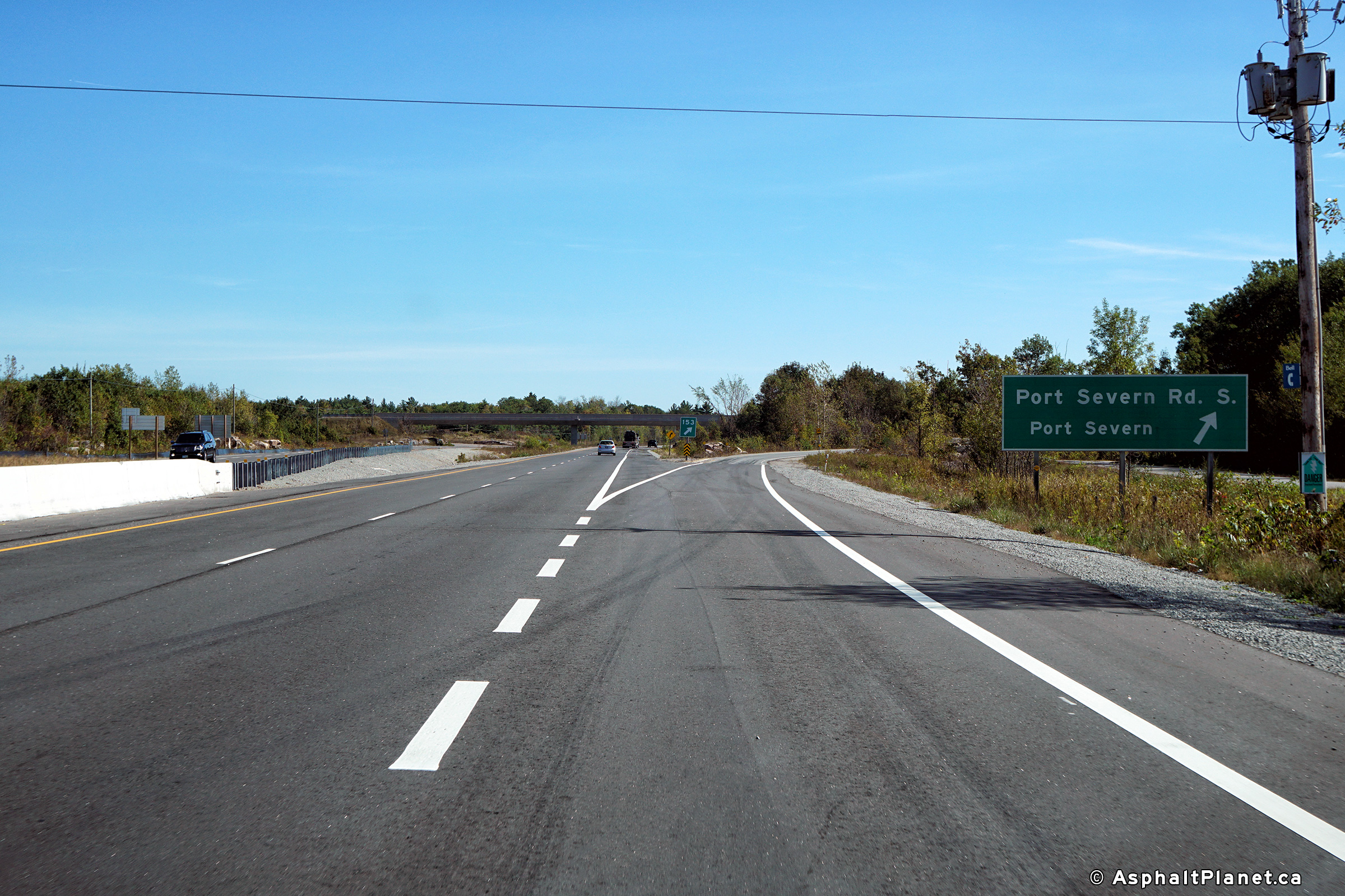
| Severn - Tay Boundary County of
Simcoe |
Southbound advanced signage for the off-ramp to Port Severn Road South.
Click here for an alternate photo of this
sign, taken June, 2005. Photo taken: October 2nd, 2017. |
 (720x480) (720x480)
(1440x960)
(2400x1600)
|
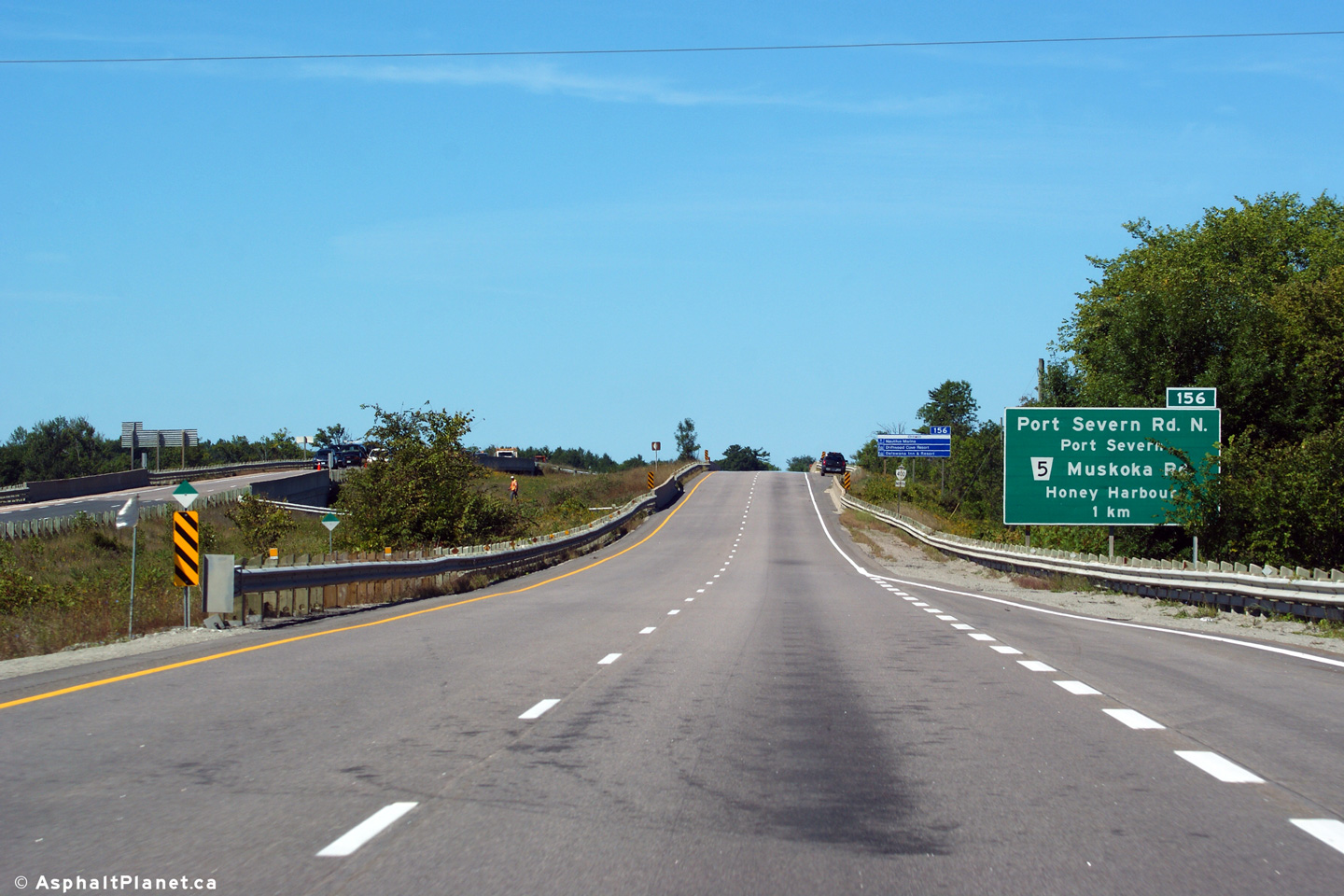
| Severn - Tay Boundary County of
Simcoe |
Advanced signage for the northern Port Severn interchange. Before the
District Municipality of Muskoka was formed in the early 1970s, today's
Muskoka Road 5 was designated as Secondary Highway 501. Unlike most of
the other secondary highway numbers used within Muskoka and Haliburton, the
Highway 501 designation has never been recycled and used on another, newer
highway elsewhere in the province.
Photo taken: September 10th, 2012. |
 (720x480) (720x480)
(1440x960)
(2400x1600) |
| Township of Georgian Bay
District Municipality of Muskoka |
View looking northerly at the off-ramp to the northern Port Severn
interchange.
Photo taken: September 10th, 2012. |
 (720x480) (720x480)
(1440x960)
(2400x1600) |
| Township of Georgian Bay
District Municipality of Muskoka |
Northbound advanced signage for the ramp to both White's Falls Road and
South Bay Road.
Photo taken: May 31st, 2014. |
 (720x480) (720x480)
(1440x960)
(2400x1600) |
| Township of Georgian Bay
District Municipality of Muskoka |
Signage at the off-ramp to both White's Falls Road and South Bay Road.
The northbound lanes of Highway 400 were resurfaced through this interchange
during the autumn of 2013.
Photo taken: May 31st, 2014. |
 (720x480) (720x480)
(1440x960)
(2400x1600) |
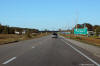
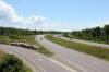
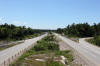
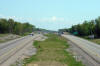
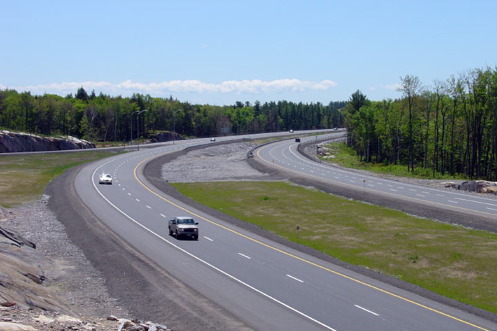
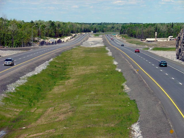
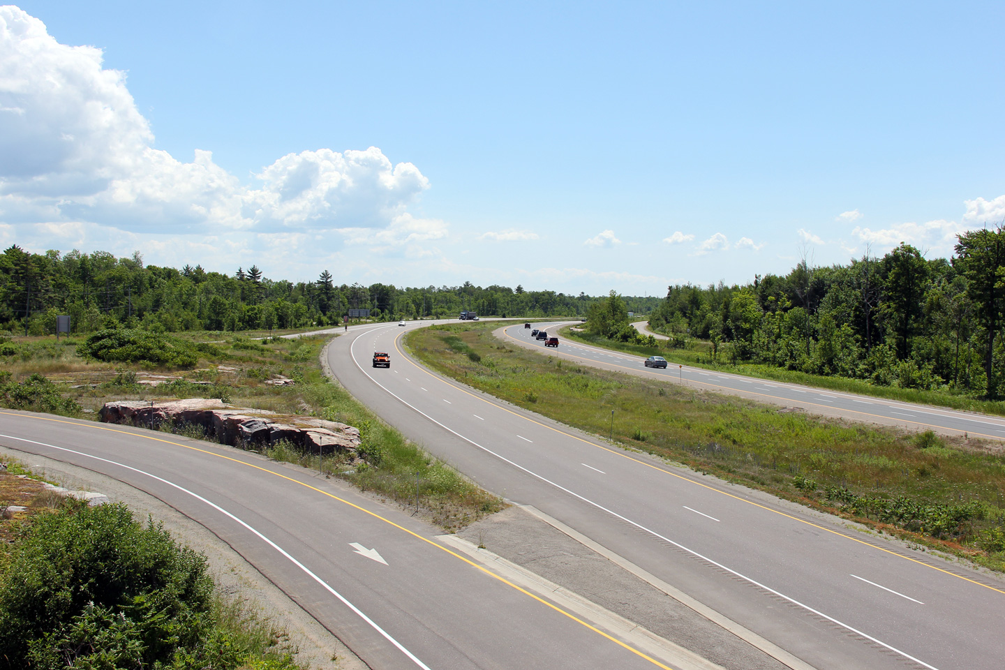
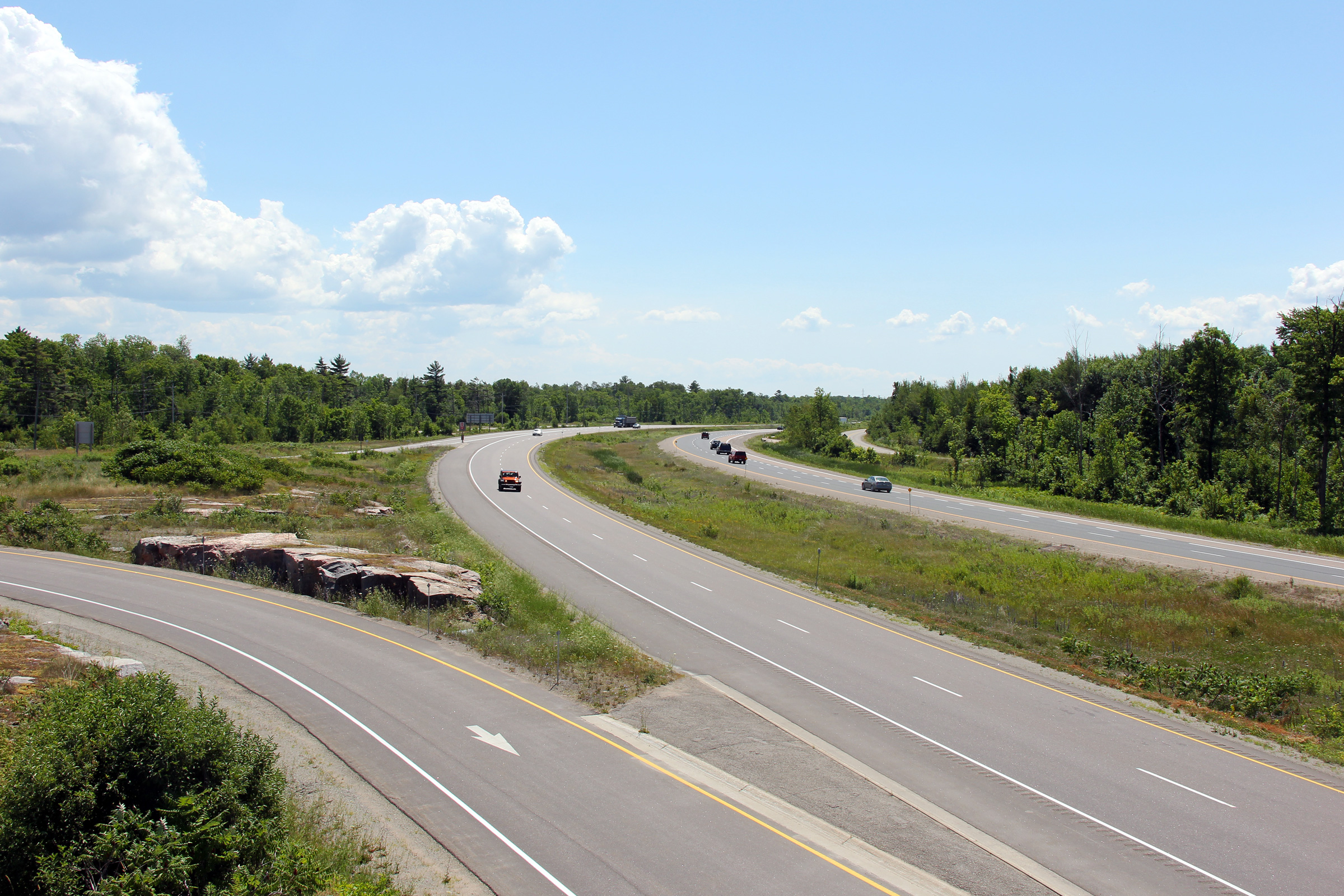
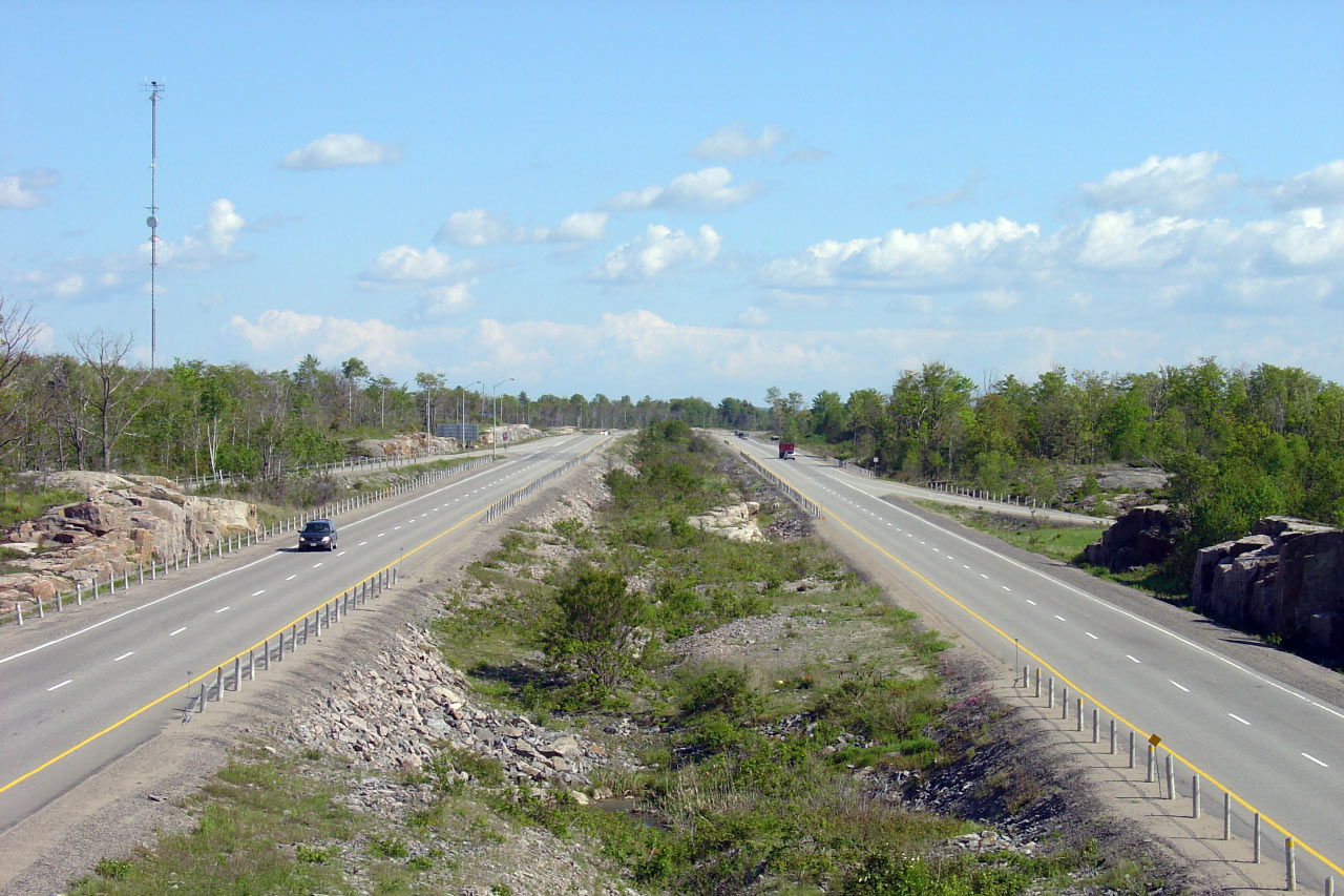
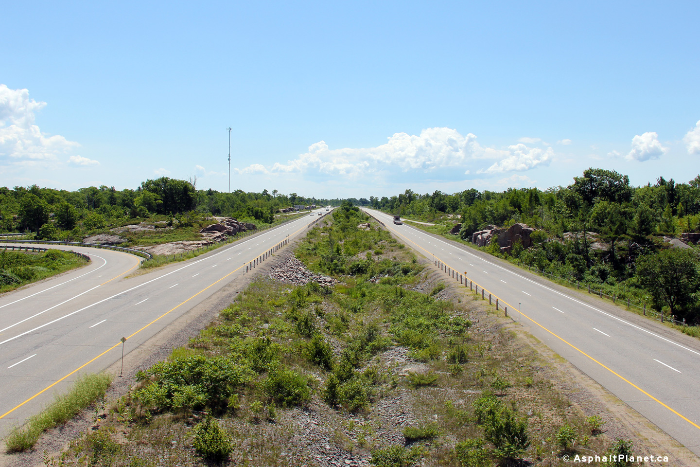
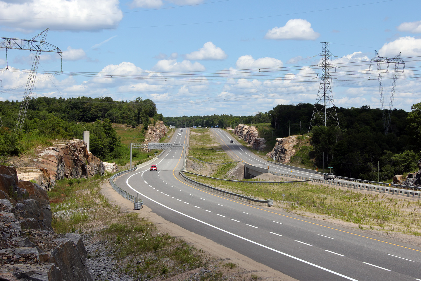
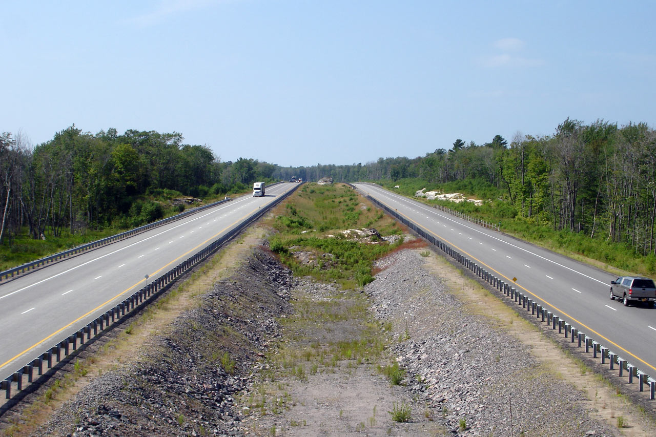
| Township of Georgian Bay
District Municipality of Muskoka |
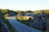
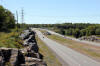
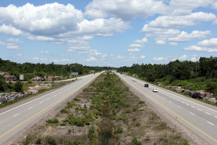
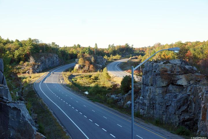
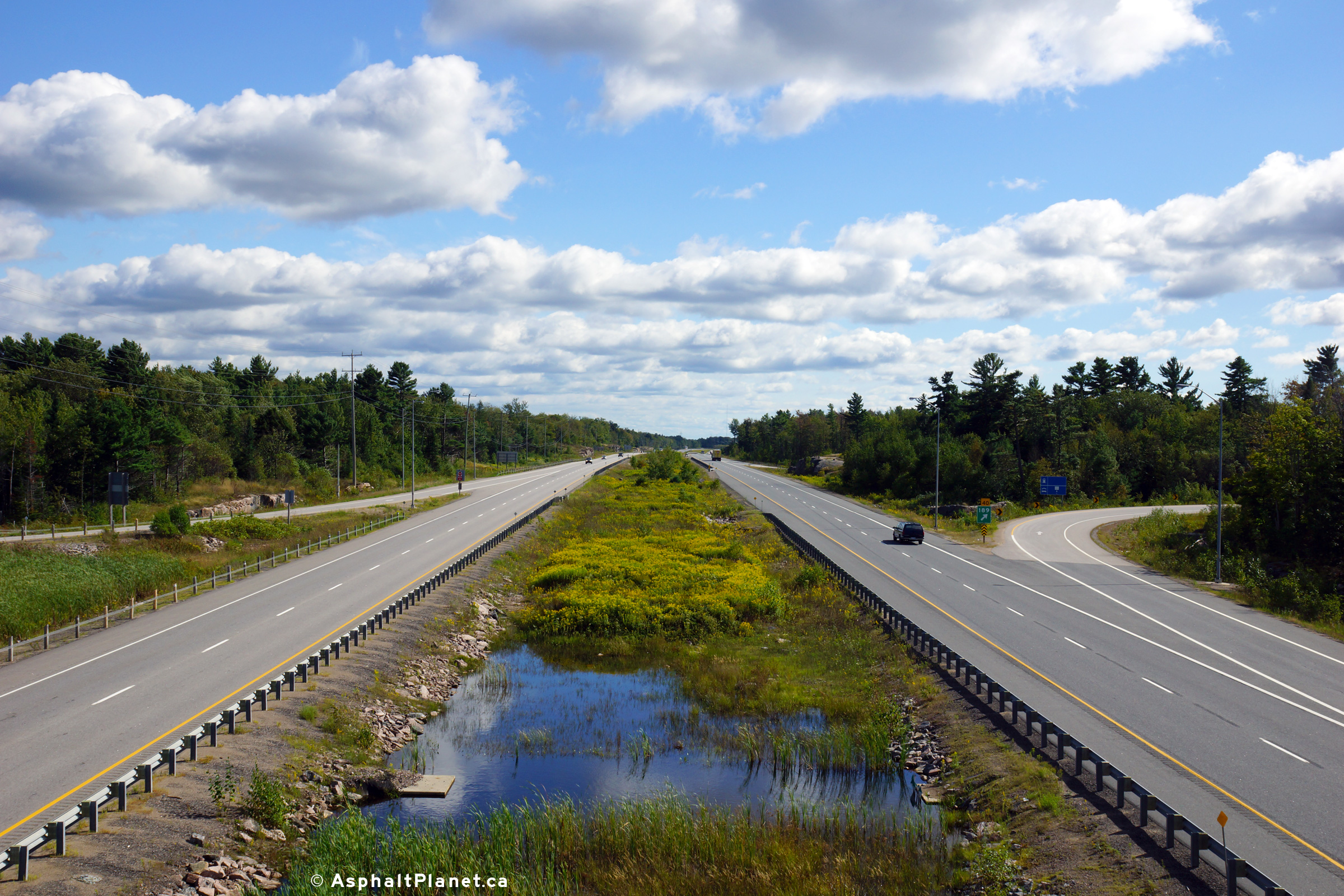
View looking southerly from the Muskoka Road 48 junction. Rock
outcroppings become quite regular north of the Severn River.
Click here for this
same view taken in June, 2005. Photo taken: July 10th, 2012. |
(720x480)
(1440x960)
(2400x1600) |
| Township of Georgian Bay
District Municipality of Muskoka |
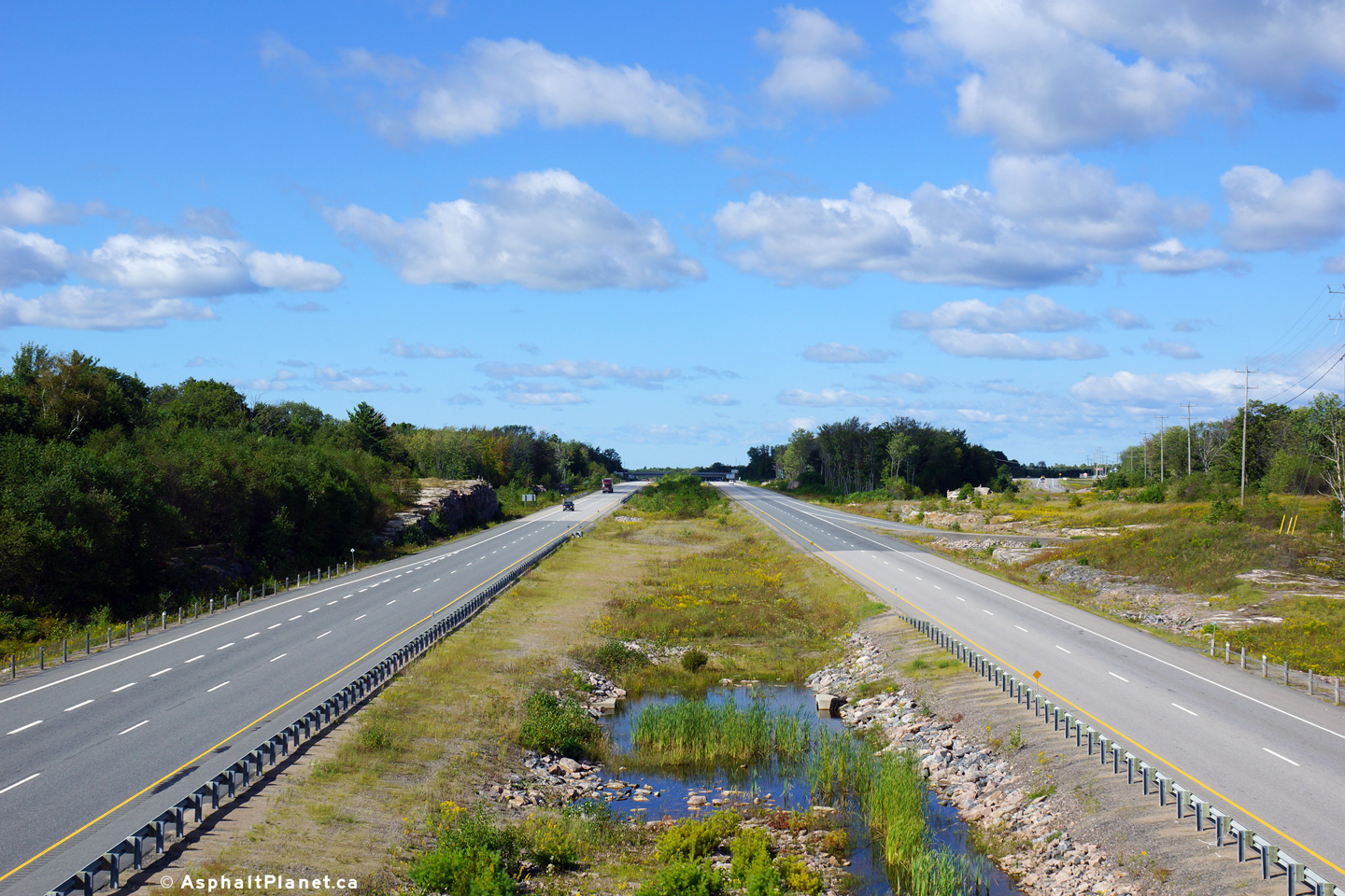
Northerly view from the Muskoka Road 48 overpass.
Click here for this
same view taken in June, 2005. Photo taken: July 10th, 2012. |
(720x480)
(1440x960)
(2400x1600) |
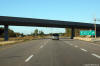
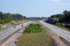
| Township of Georgian Bay
District Municipality of Muskoka |
View
looking northerly at both Highway 400 and the former Highway 69 at Baxter
Lake.
Photo taken: August 2nd, 2008 |
(720x480)
(1440x960) |
| Township of Georgian Bay
District Municipality of Muskoka |
The
at-grade intersection with Hidden Glen Road is the southernmost of three
at-grade intersections along the southbound lanes of Highway 400.
Photo taken: August 2nd, 2008 |
(720x480)
(1440x960) |
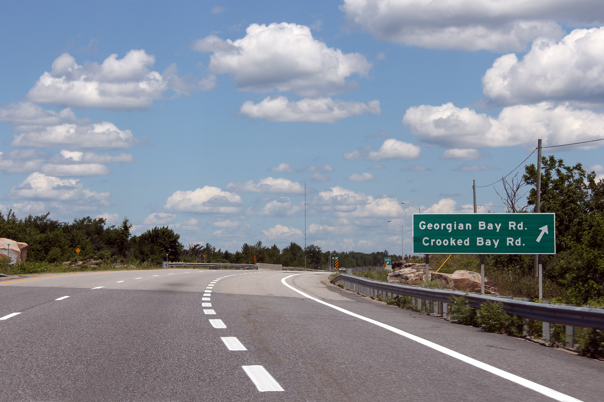
| Township of Georgian Bay
District Municipality of Muskoka |
Northbound advanced signage for the Georgian Bay and Crooked Lake Roads
interchange.
Photo taken: July 10th, 2012. |
 (720x480) (720x480)
(1440x960)
(2400x1600) |
| Township of Georgian Bay
District Municipality of Muskoka |
Northerly view at the off-ramp the Georgian Bay and Crooked Lake Road
interchange.
Photo taken: July 10th, 2012. |
 (720x480) (720x480)
(1440x960)
(2400x1600) |
| Township of Georgian Bay
District Municipality of Muskoka |
Two views looking northerly as Highway 400 crosses the McDonald River.
Unlike most of the more recent sections of highway twinning for the
construction of Highway 400, when Highway 69 was twinned in the 1990s across
the McDonald River bridge, the existing lanes of Highway 69 were not
extensively reconstructed as part of the project. Therefore, the 1950s
era box culvert that now carries the northbound lanes was not replaced with
a longer structure such as the one that was constructed during the 1990s for
the southbound lanes. This gives the highway a unique
highway geometry through the area.
Photos taken: September 26th, 2013. |
 (720x480) (720x480)
(1440x960)
(2400x1600)
 (720x480) (720x480)
(1440x960)
(2400x1600) |
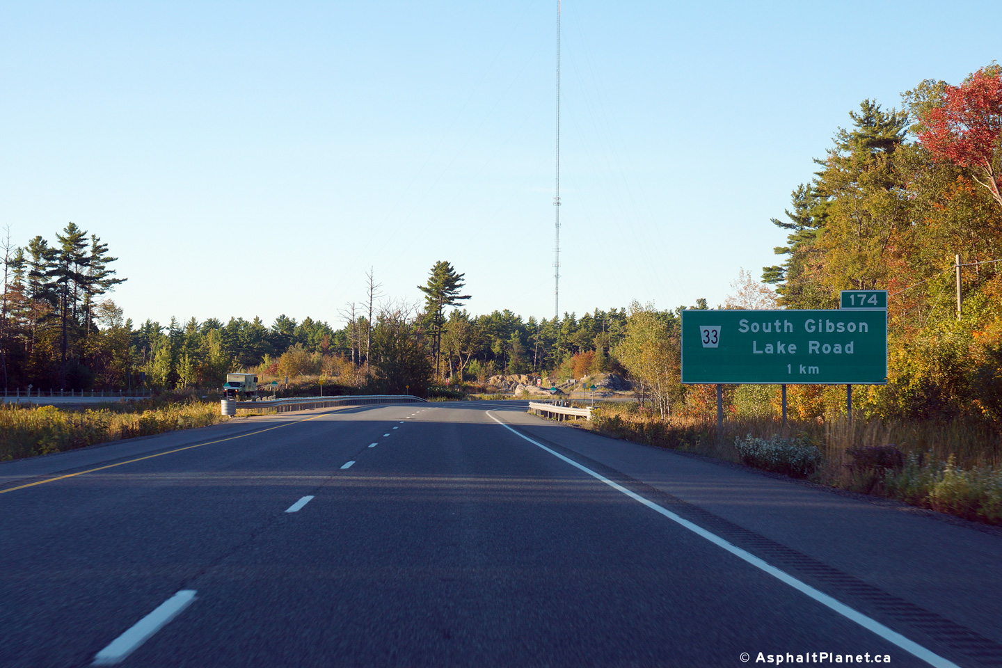
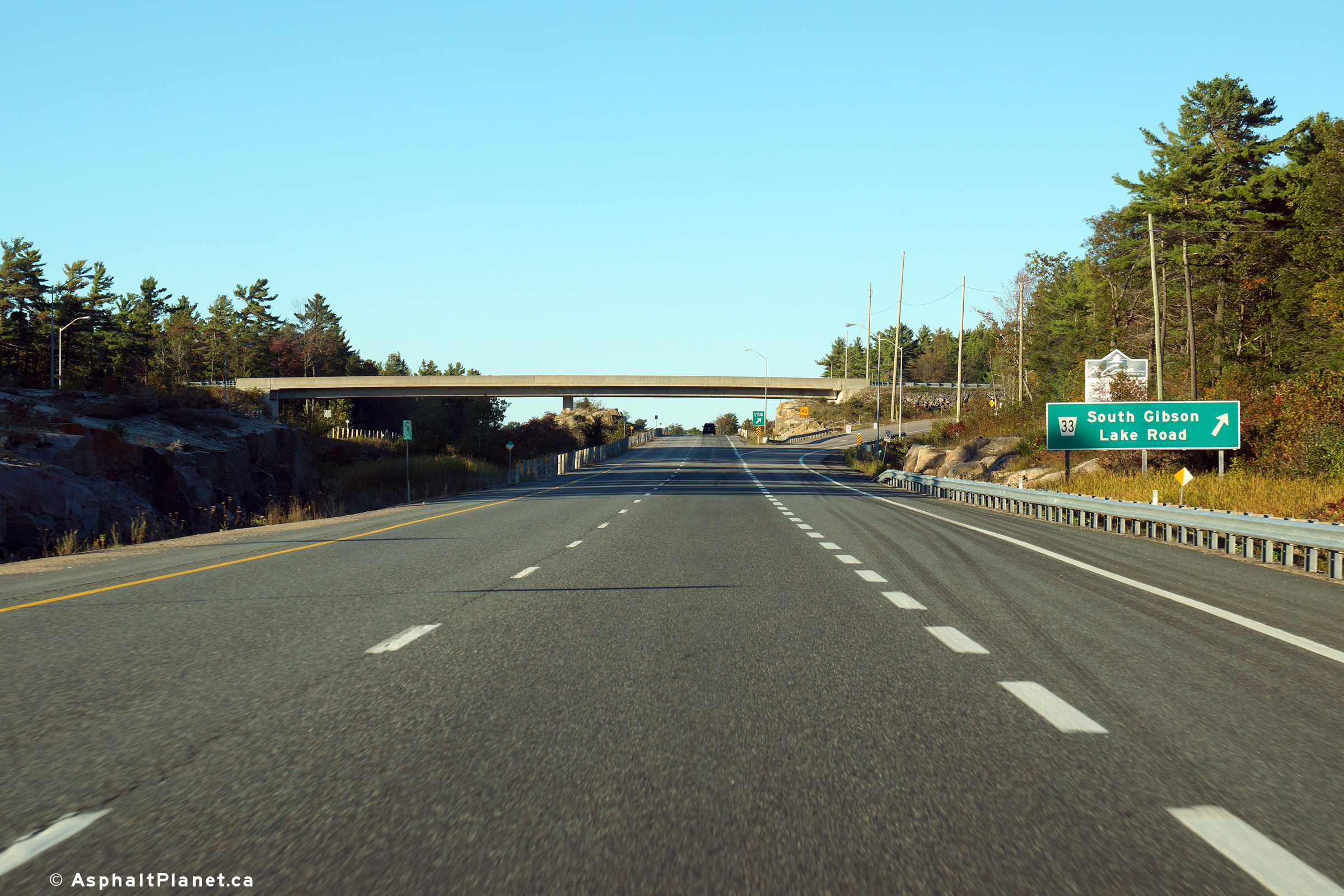
| Township of Georgian Bay
District Municipality of Muskoka |
Northbound advanced signage for the ramp to the South Gibson Lake Road
interchange. Despite being a District Road, South Gibson Lake Road is
nothing more than a glorified cul-de-sac.
Photo taken: September 26th, 2013. |
 (720x480) (720x480)
(1440x960)
(2400x1600) |
| Township of Georgian Bay
District Municipality of Muskoka |
Northerly view at the off-ramp to South Gibson Lake Road.
Photo taken: September 26th, 2013. |
 (720x480) (720x480)
(1440x960)
(2400x1600) |
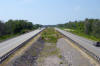
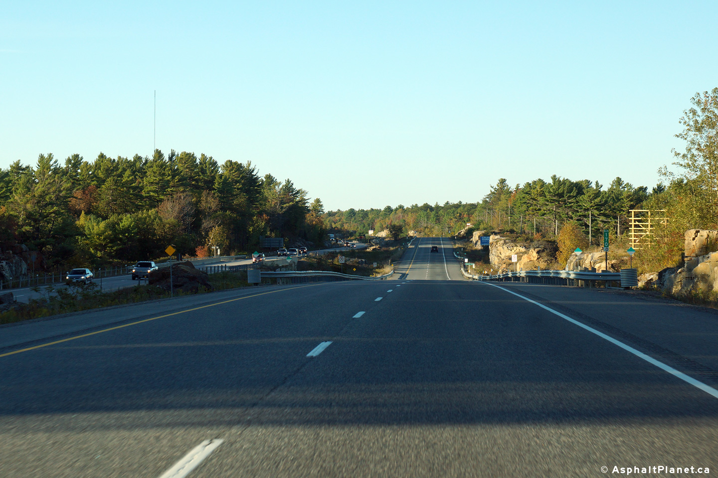
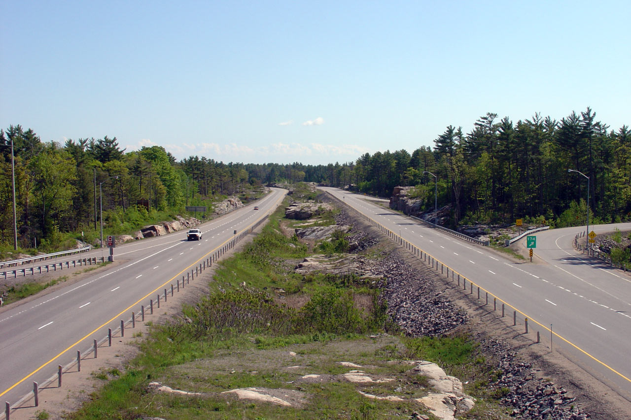
| Township of Georgian Bay
District Municipality of Muskoka |
This southerly view is from the South Gibson Lake Road overpass.
Compare the differing carriageway elevations. Through this
interchange, the northbound lanes of the freeway were once the original
Highway 69 carriageway.
Click here for this
same view taken in June, 2005. Photo taken: July 10th, 2012. |
(720x480)
(1440x960)
(2400x1600) |
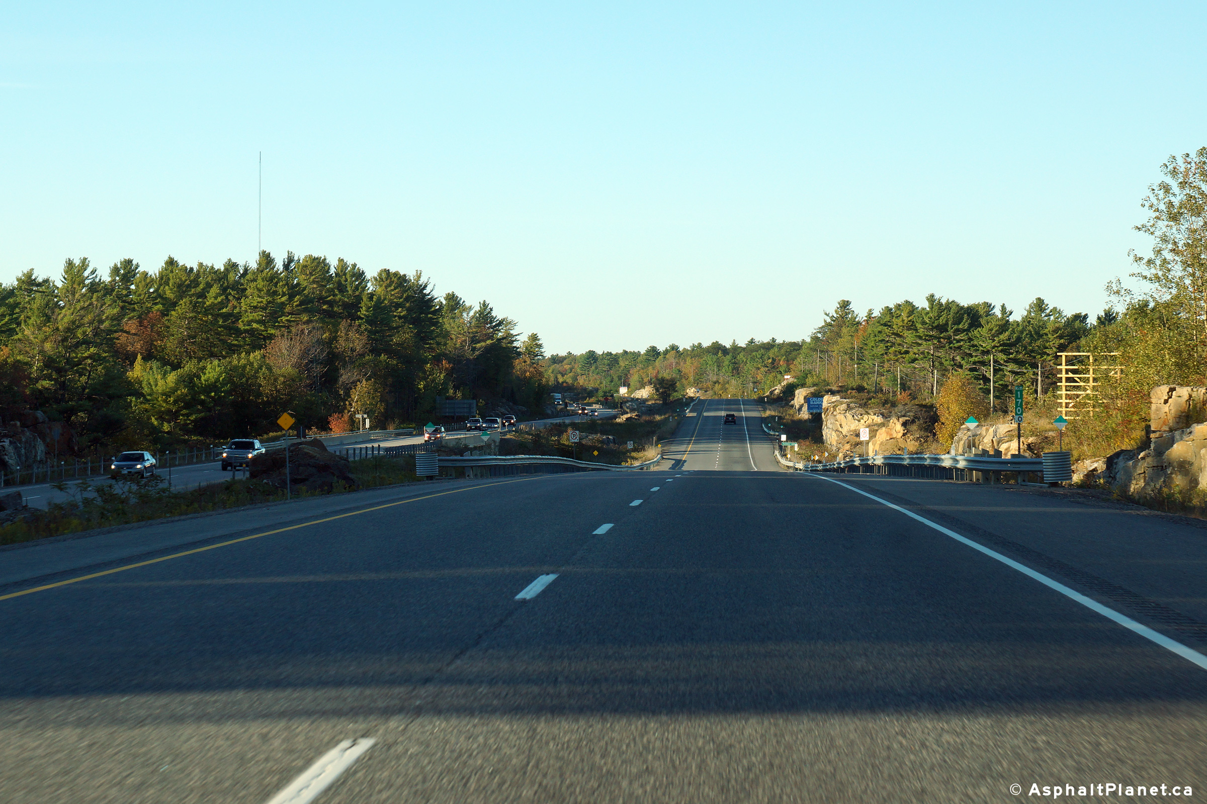
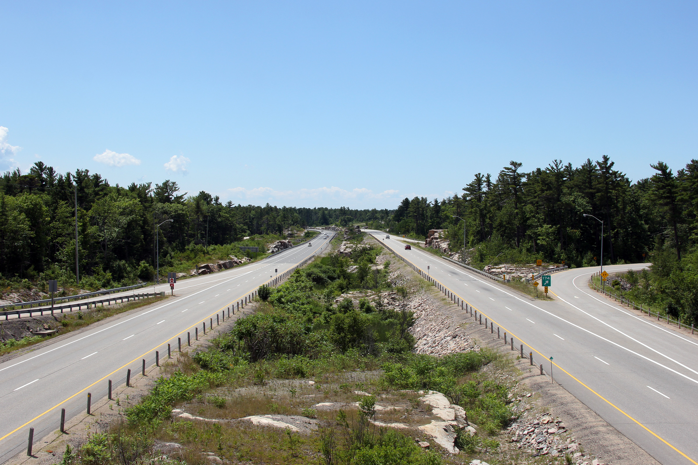
| Township of Georgian Bay
District Municipality of Muskoka |
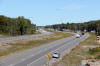
View looking north from the South Gibson Lake Road overpass.
Click here for this
same view taken in June, 2005. Photo taken: July 10th, 2012. |

(720x480)
(1440x960)
(2400x1600) |
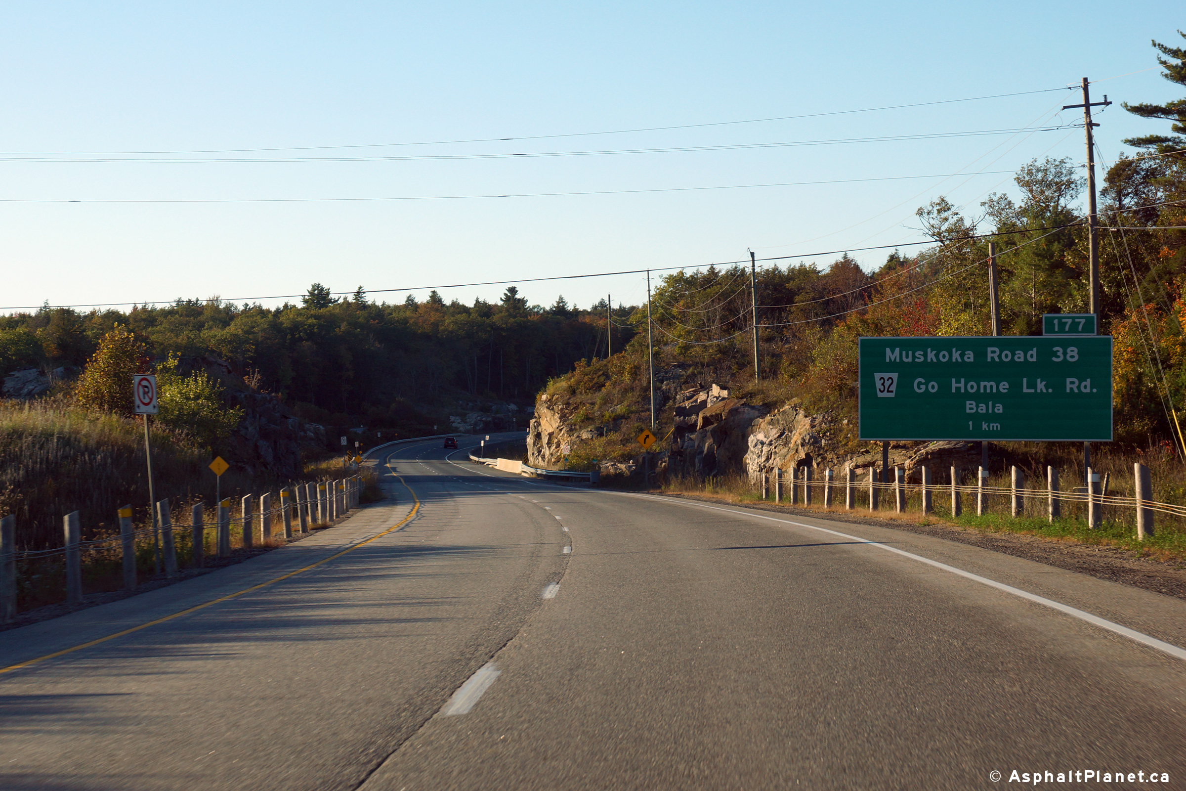
| Township of Georgian Bay
District Municipality of Muskoka |
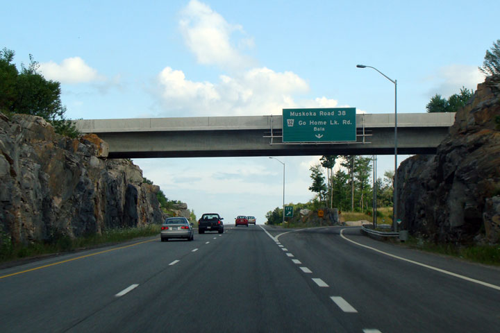
Advanced signage for the ramp to Muskoka Roads 32 and 38.
Photo taken: September 26th, 2013. |
 (720x480) (720x480)
(1440x960)
(2400x1600) |
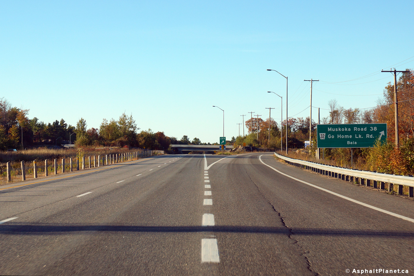
| Township of Georgian Bay
District Municipality of Muskoka |
Northbound view approaching the off-ramp to Muskoka Roads 32 and 38. For
several years after Highway 400 was extended to the Musquash River, the
divided highway met Muskoka Road 32 and 38 at an at-grad intersection.
The Muskoka Road 32/38 interchange encroaches Whata Mohawk Territory, and
the interchange could not be constructed until a legal arrangement had been
finalized between the MTO and the first nation.
Photo taken: September 26th, 2013. |
 (720x480) (720x480)
(1440x960)
(2400x1600) |
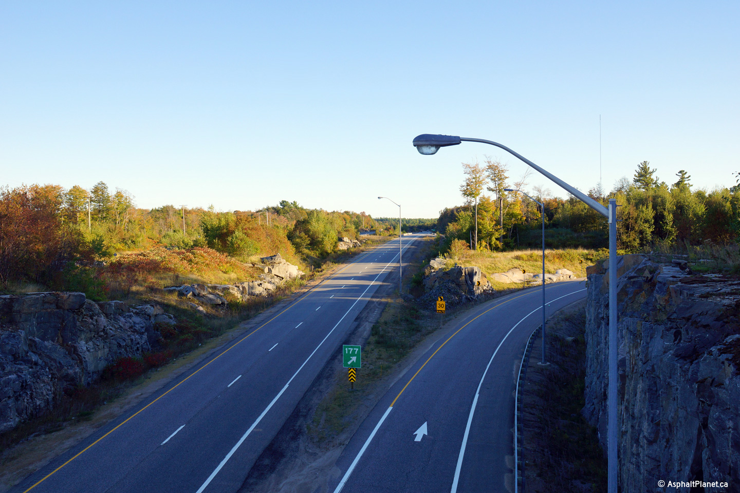
| Township of Georgian Bay
District Municipality of Muskoka |
View looking southerly from the Muskoka Road 32/38 overpass overtop of the
southbound lanes of Highway 400.
Photo taken: September 26th, 2013. |
(720x480)
(1440x960)
(2400x1600) |
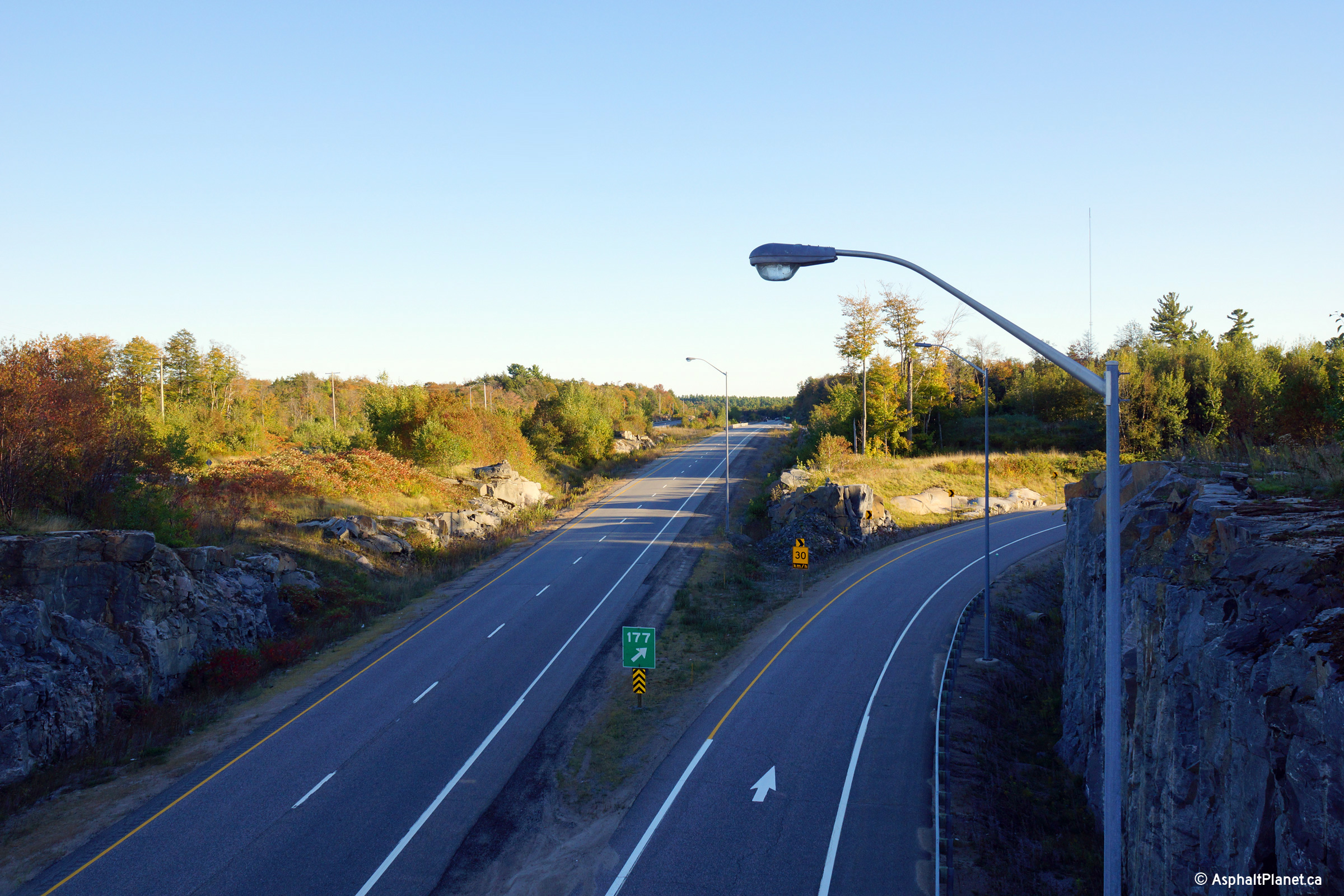
| Township of Georgian Bay
District Municipality of Muskoka |
Two views looking northerly along Highway 400 from the Muskoka Road 32/38
overpass.
Photos taken: September 26th, 2013. |

(720x480)
(1440x960)
(2400x1600)
(720x480)
(1440x960)
(2400x1600) |
| Township of Georgian Bay
District Municipality of Muskoka |
Southbound view of the 400 as it passes under Muskoka
Road 38.
Photo taken: August 2nd, 2008 |
(720x480)
(1440x960) |
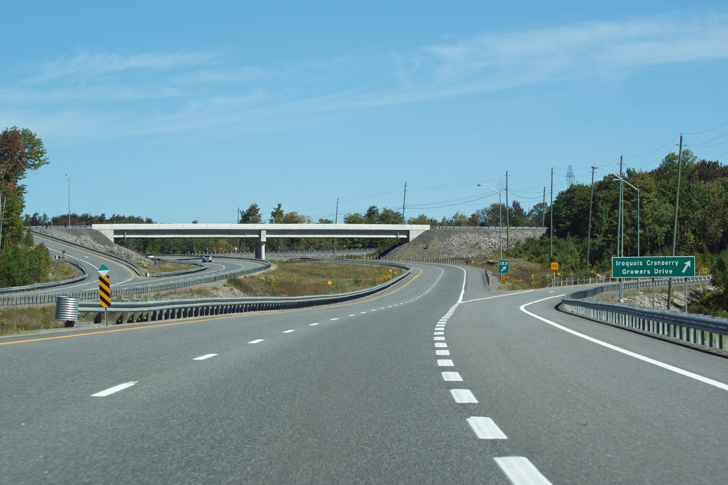
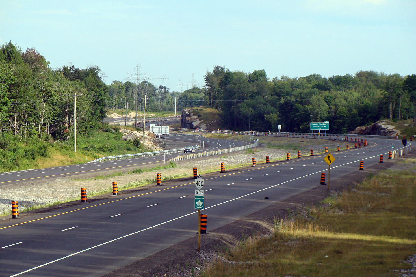
| Wahta Mohawk
First Nations |
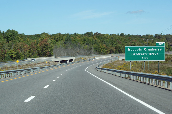
Advanced signage for the exit to Iroquois Cranberry Growers Marsh Road.
Photo taken: September 10th, 2012. |
 (720x480) (720x480)
(1440x960)
(2400x1600) |
| Wahta Mohawk
First Nations |
View looking northerly at the off-ramp to the Iroquois Cranberry Growers
Marsh Road.
Photo taken: September 10th, 2012 |
 (720x480) (720x480)
(1440x960)
(2400x1600) |
| Wahta Mohawk
First Nations |
View looking south from the Cranberry Growers Road on the
former Wahta Gap. Click here for this
same view taken in August, 2008.
Photo taken: July 10th, 2012. |
(720x480)
(1440x960)
(2400x1600) |
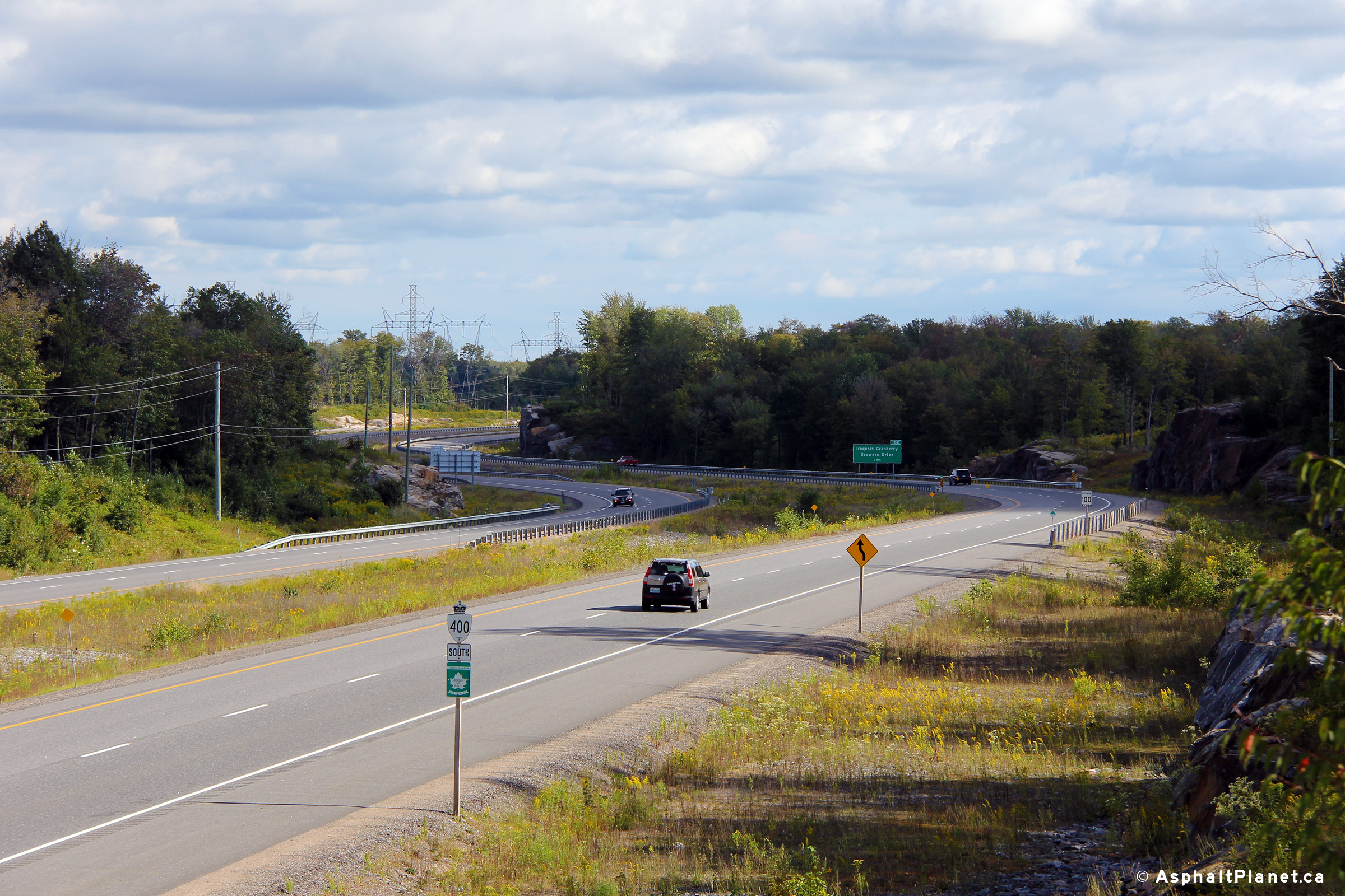
| Wahta Mohawk
First Nations |
View
looking northerly along Highway 400 from Iroquois Cranberry Growers Road.
Click here for this
same view taken in August, 2008.
Photo taken: July 10th, 2012. |
(720x480)
(1440x960)
(2400x1600) |
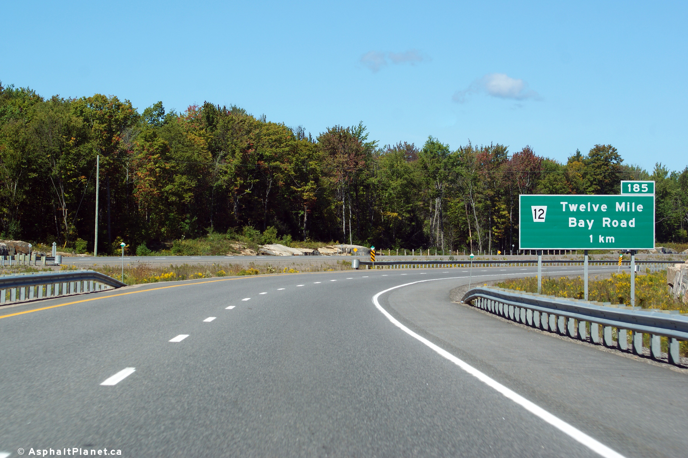
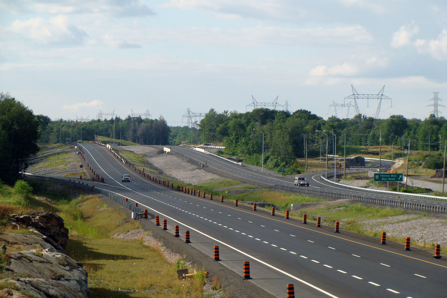
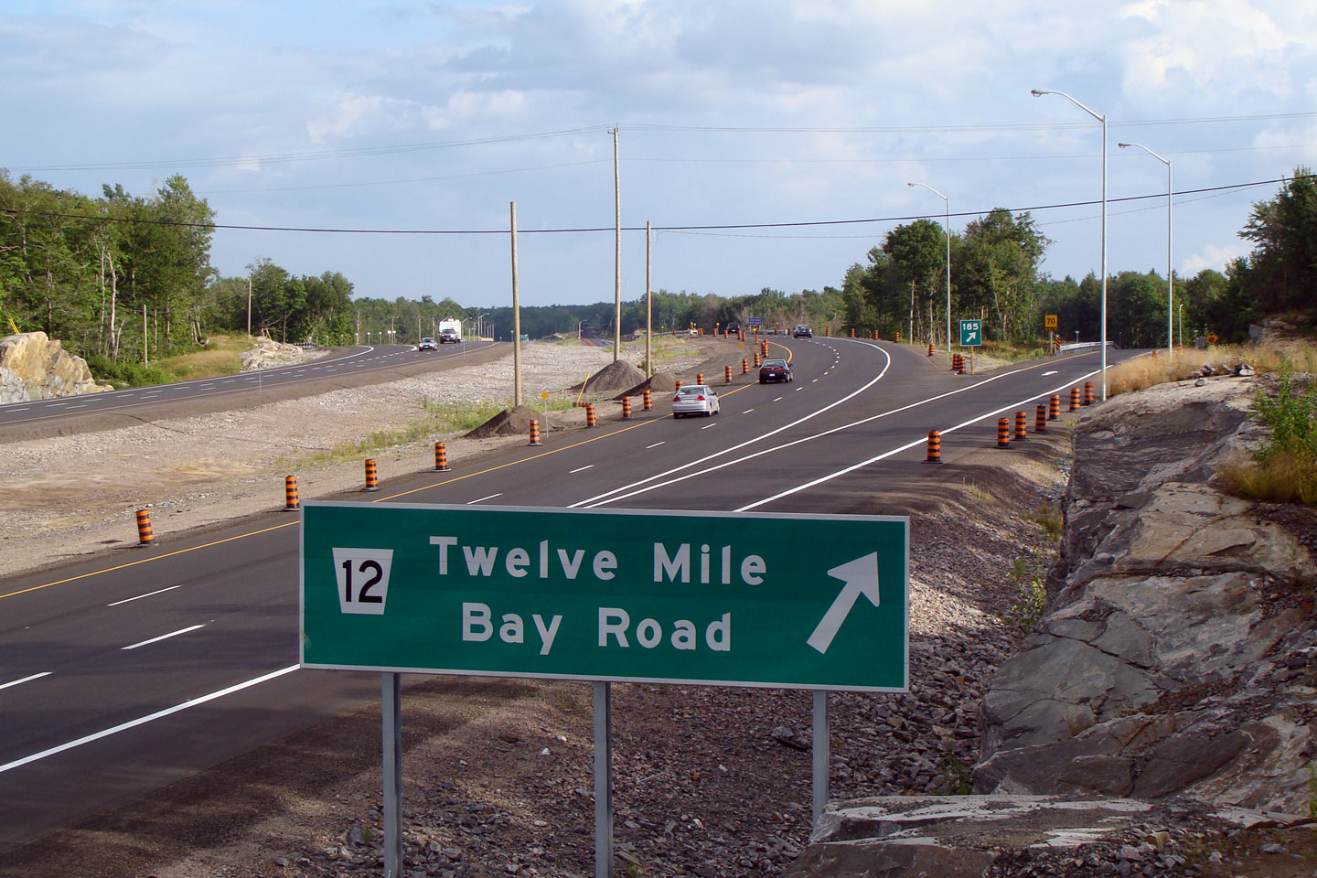
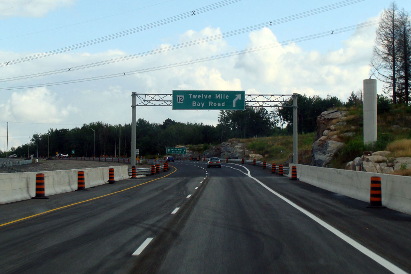
| Wahta Mohawk
First Nations |
Advanced signage for the Twelve Mile Bay Road interchange.
Photo taken: September 10th, 2012. |
 (720x480) (720x480)
(1440x960)
(2400x1600) |
| Wahta Mohawk
First Nations |
This view of Highway 400 is taken between Muskoka Road 12
and The Iroquois Cranberry Growers Road. I find this view to be
interesting, as it appears the north and southbound lanes have differing
curve radii. Click here for this
same view taken in August, 2008.
Photo taken: September 3rd, 2013. |
(720x480)
(1440x960)
(2400x1600) |
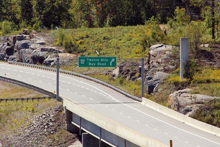
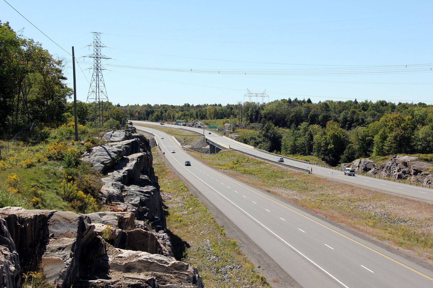
| Township of Georgian Bay
District Municipality of Muskoka |
View looking southerly at the Muskoka Road 12 diamond
interchange.
Click here for this
same view taken in August, 2008.
Photo taken: September 3rd, 2013. |
(720x480)
(1440x960)
(2400x1600) |
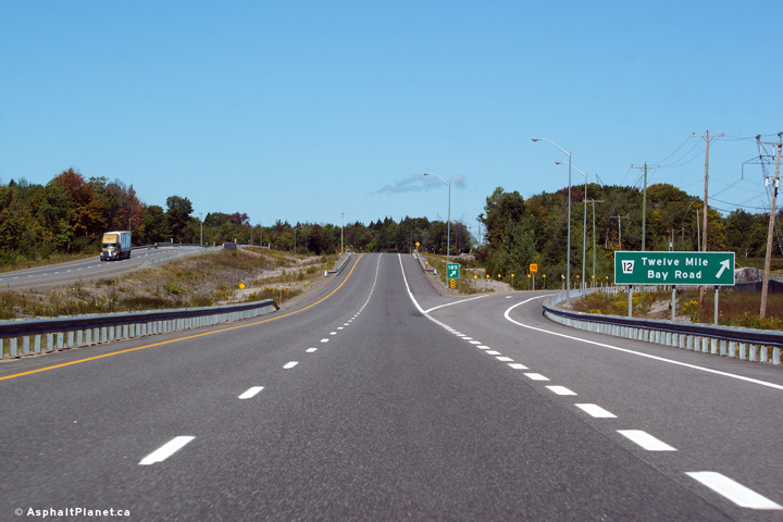
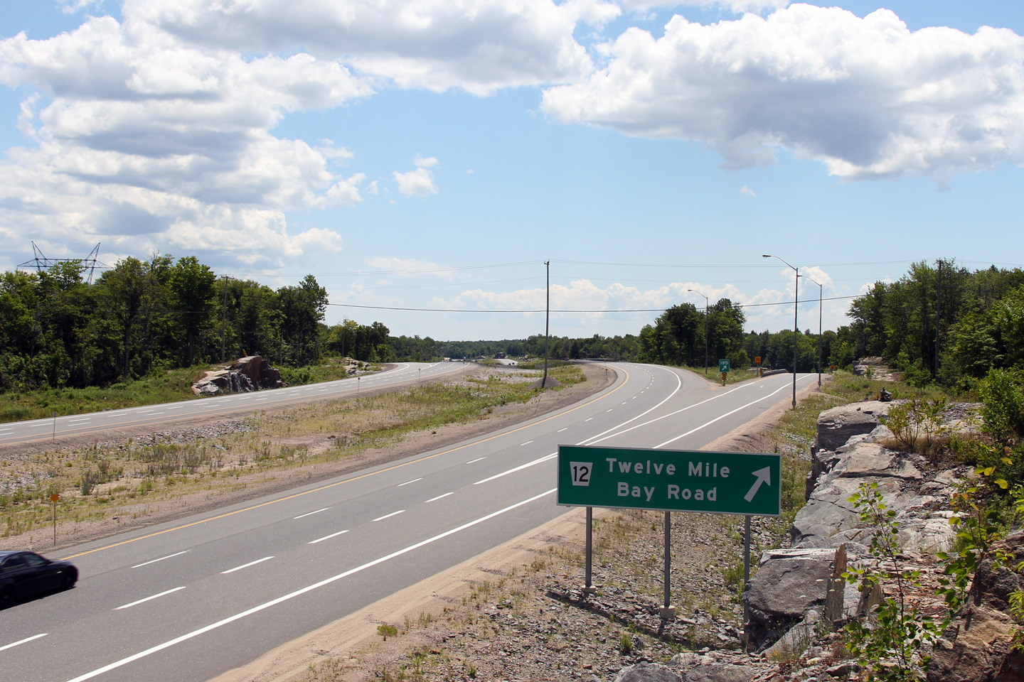
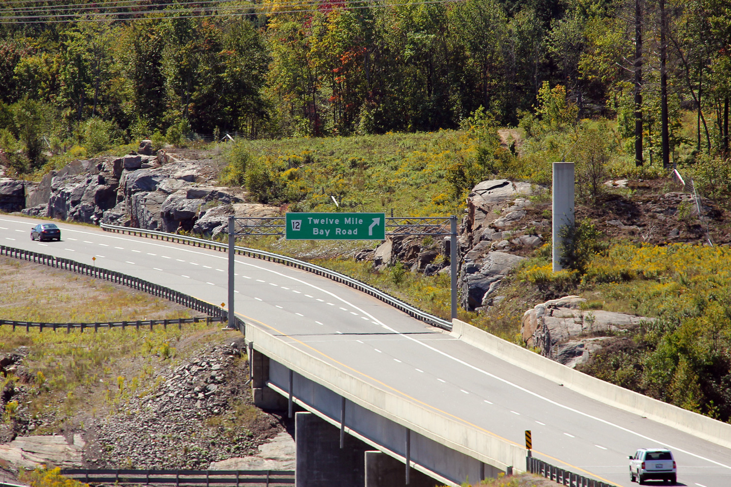
| Township of Georgian Bay
District Municipality of Muskoka |
Signage at the northbound off-ramp to Twelve Mile Bay Road.
Photo taken: September 10th, 2012. |
 (720x480) (720x480)
(1440x960)
(2400x1600) |
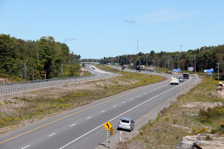
| Township of Georgian Bay
District Municipality of Muskoka |
Southerly
view of the Muskoka Road 12 interchange and signage. Click
here for this
same view taken in August, 2008.
Photo taken: August 2nd, 2008 |
(720x480)
(1440x960)
(2400x1600) |
| Township of Georgian Bay
District Municipality of Muskoka |
View
looking northerly across the Moon River bridge from just south of Muskoka
Road 12. Before the freeway was constructed, a magnificent steel
through truss bridge stood at this site. The truss bridge was
demolished during the construction project that saw the highway widened to
four lanes. Click here for an
additional post construction view taken in August, 2008.
Click for additional
photos of Highway 69 during the construction project that saw Highway 400
twinned through the Whata First Nation.
Upper photo taken: May 22nd, 2006.
Lower photo taken: July 10th, 2012. |
(720x480)
(1440x960)
(2400x1600) |
| Township of Georgian Bay
District Municipality of Muskoka |
Surprisingly,
an overhead advanced sign was placed southbound for Muskoka Road 12.
This is the only overhead signage along the freeway between Barrie and Parry
Sound. Click here for an
alternate view of the same sign, taken: August, 2008.
Photo taken: September 10th, 2012. |
 (720x480) (720x480)
(1440x960) |
| Township of Georgian Bay
District Municipality of Muskoka |
Two views looking
southerly across the Moon River bridge from south of the Lake Joseph
Road interchange. The former Moon River truss bridge was demolished in
order to improve the highway's vertical geometry when the highway was was
widened to four lanes.
Upper photo taken: May 22nd, 2006.
Lower photo taken: September 10th, 2012. |
(720x480)
(1440x960)
(2400x1600) |
| Township of Georgian Bay
District Municipality of Muskoka |
View looking northerly from north of the Moon River bridge towards the
Lake Joseph Road interchange.
Photo taken: September 10th, 2012. |
(720x480)
(1440x960)
(2400x1600) |
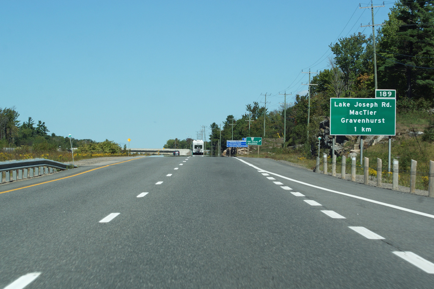
| Township of Georgian Bay
District Municipality of Muskoka |
Signage for the old alignment of Highway 69, north of the Moon River
bridge.. In the summer of 2012, Highway 69 was redesignated as Lake
Joseph Road, and the signage was updated accordingly.
Upper photo taken: July 10th, 2012.
Lower photo taken: September 10th, 2012. |
 (720x480) (720x480)
(1440x960)
(2400x1600) |
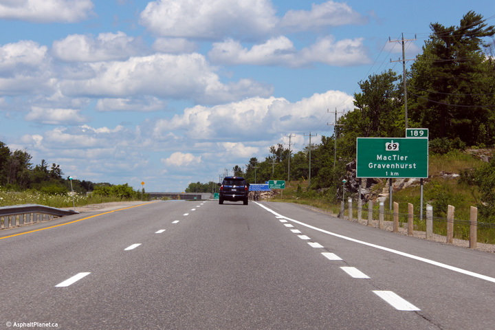
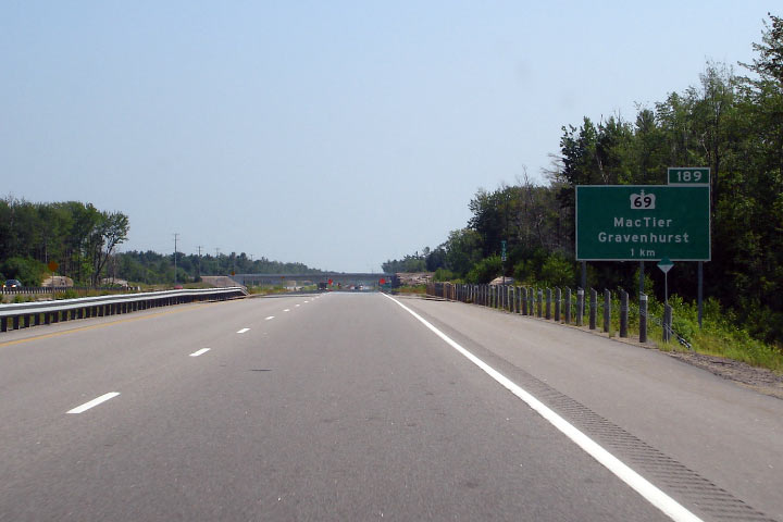
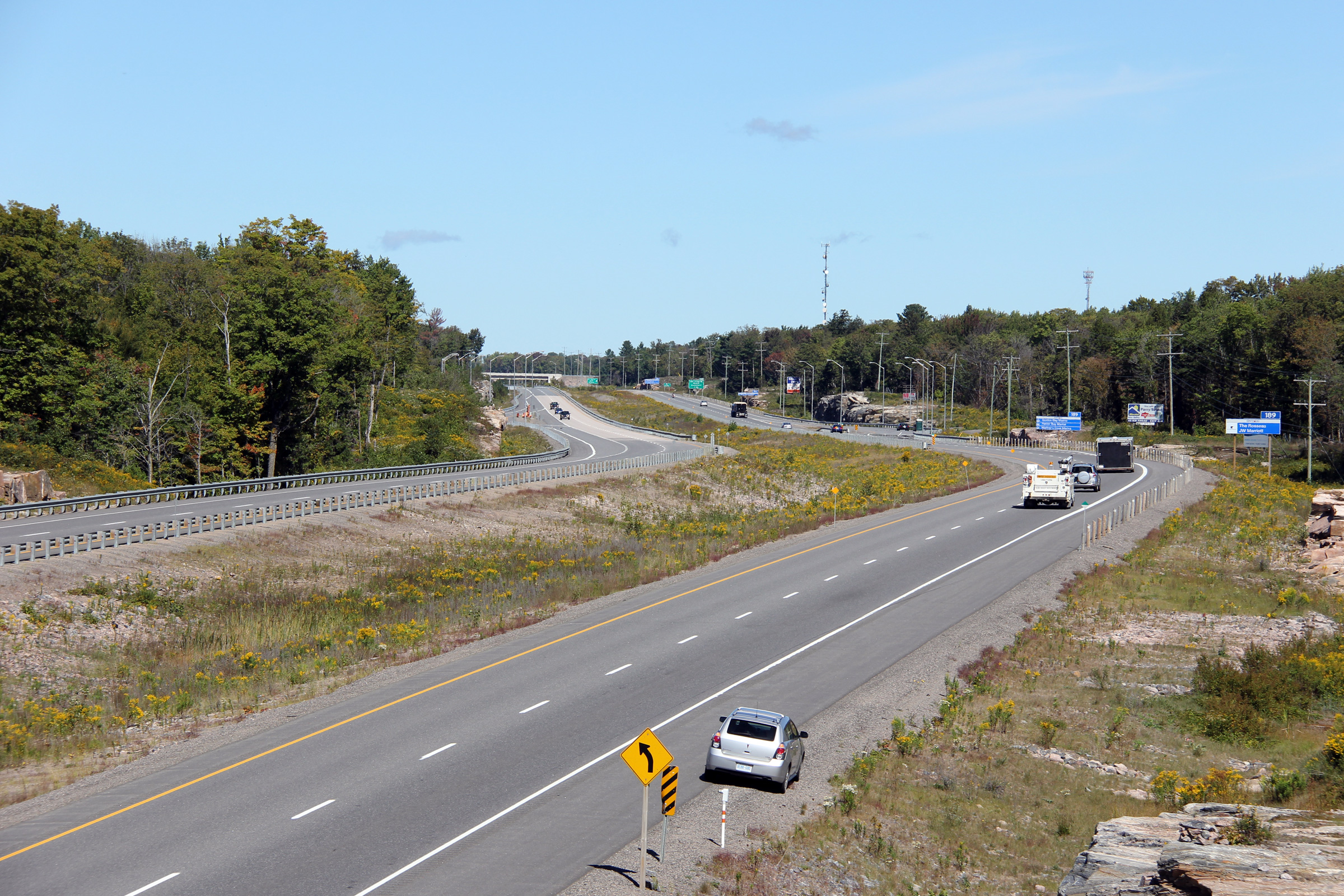
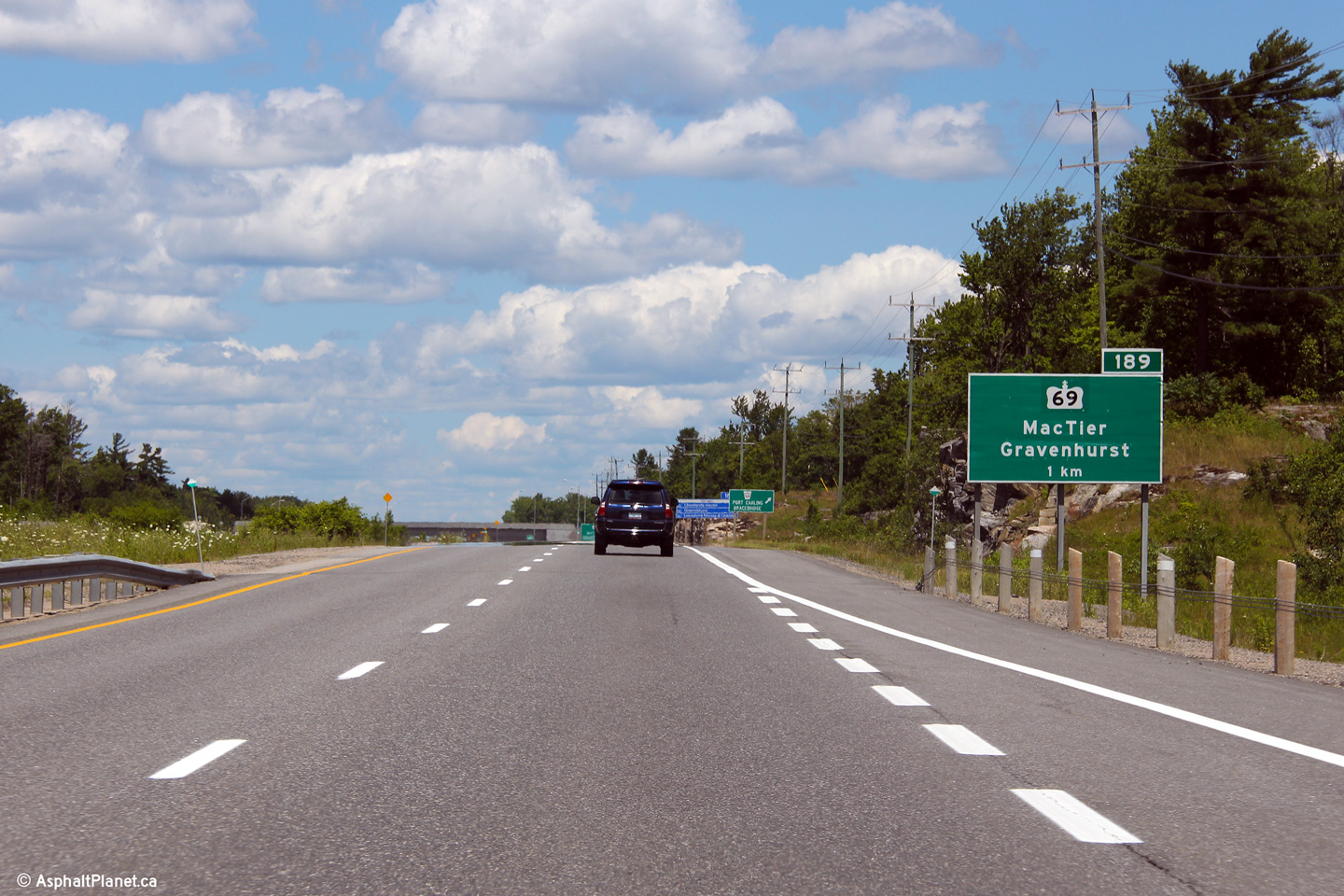
| Township of Georgian Bay
District Municipality of Muskoka |
Northbound signage for Exit # 189.
Upper photo taken: July 10th, 2012.
Lower photo taken: September 10th, 2012. |
 (720x480) (720x480)
(1440x960)
(2400x1600)
|
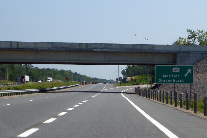
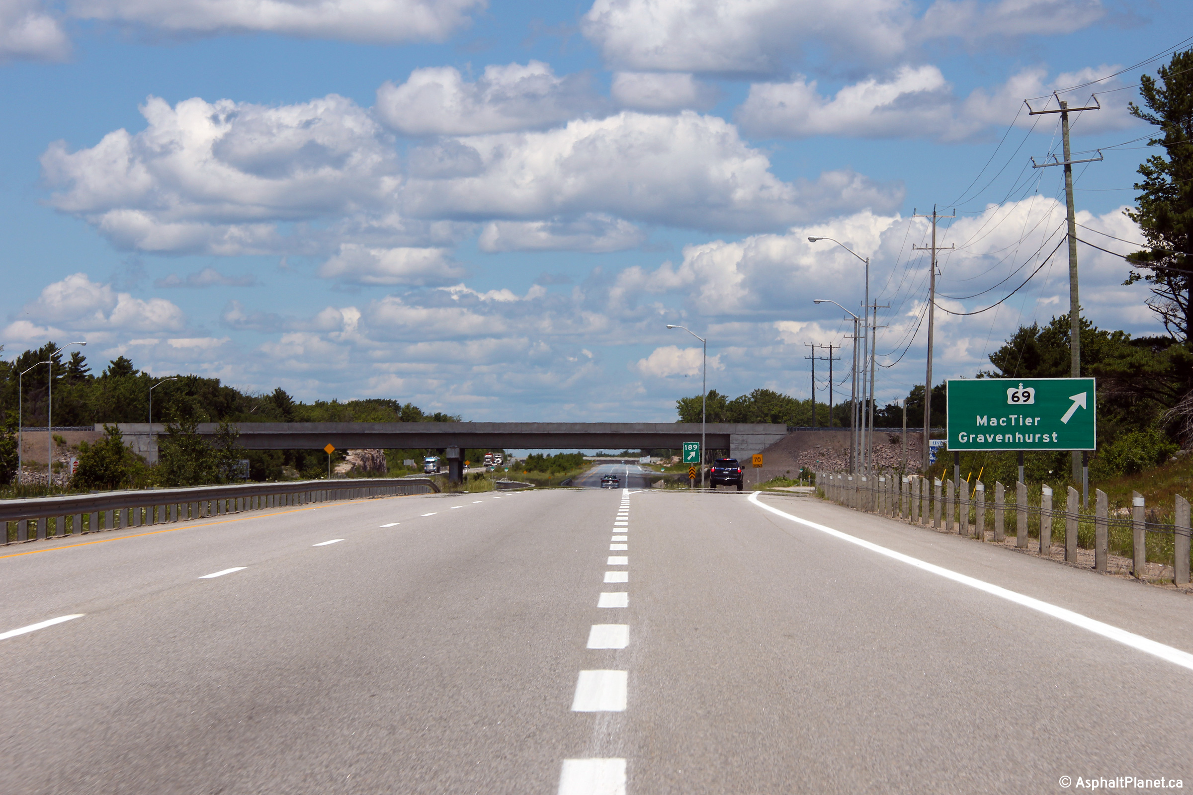
| Township of Georgian Bay
District Municipality of Muskoka |
View looking southerly along the 400 from the Highway 69-South overpass.
Before the spring of 2008, Highway 400 narrowed from four to two lanes just beyond this
interchange.
Click here for this
same view taken in June, 2005.
Photo taken: September 3rd, 2013. |
(720x480)
(1440x960)
(2400x1600) |
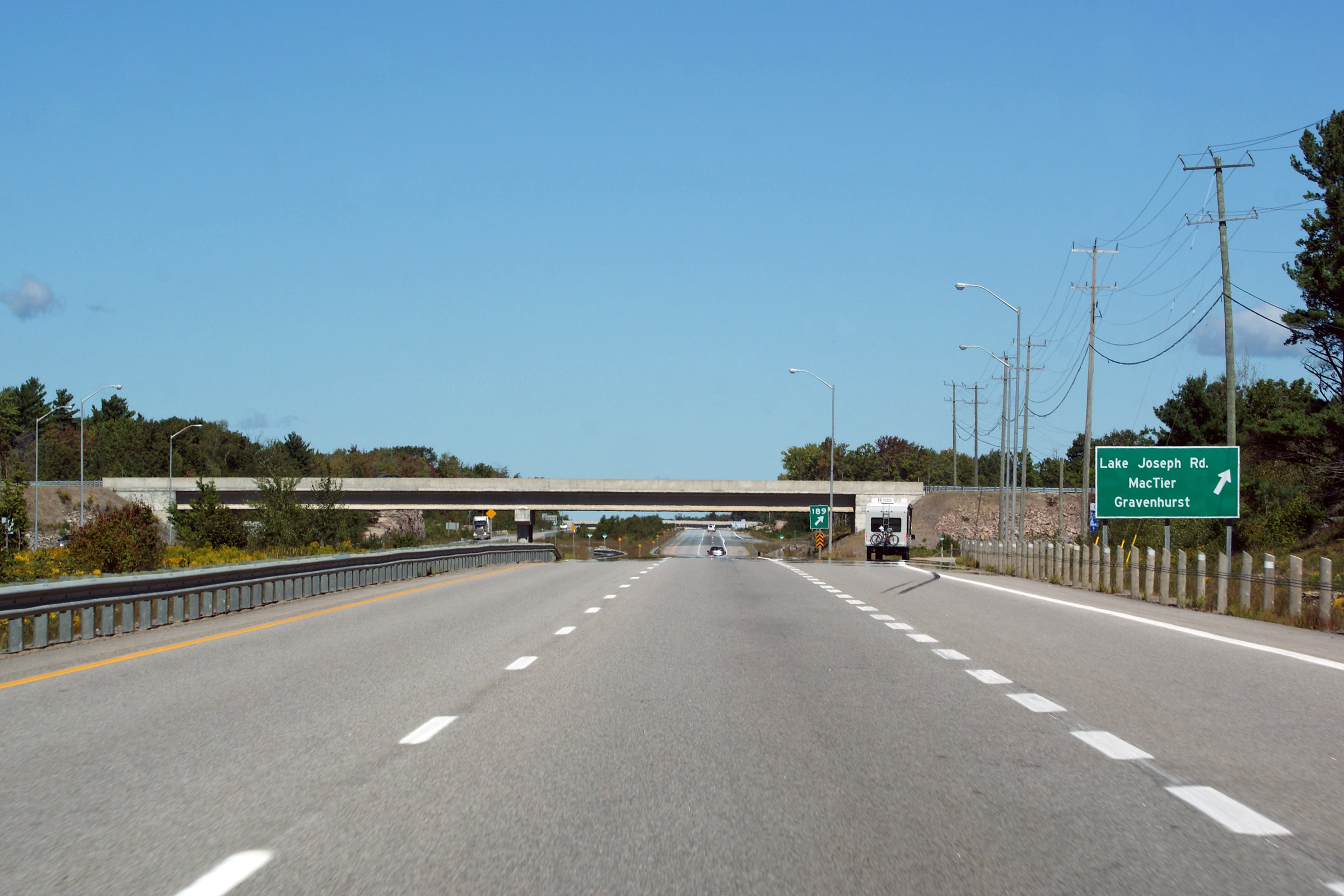
|
Lake Joseph Road (former Highway 69) branches east of Highway 400 towards MacTier at this interchange.
Click here Lake Joseph Road (former Highway 69) images. |
| Township of Georgian Bay
District Municipality of Muskoka |
Looking north from the Highway 69-South overpass. Notice the old
alignment of Highway 69 diverting to the right of the new 4-lane highway.
Click here for this
same view taken in June, 2005.
Photo taken: September 3rd, 2013. |
(720x480)
(1440x960)
(2400x1600) |
| Township of Georgian Bay
District Municipality of Muskoka |
Southbound exit signage for the ramp to Highway 69. Photo taken: July
13th, 2006. |
 |
| Township of Georgian Bay
District Municipality of Muskoka |
Southbound signage for Highway 69 south. Photo taken: July 13th, 2006. |
 |
| Township of Georgian Bay
District Municipality of Muskoka |
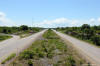
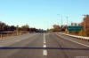
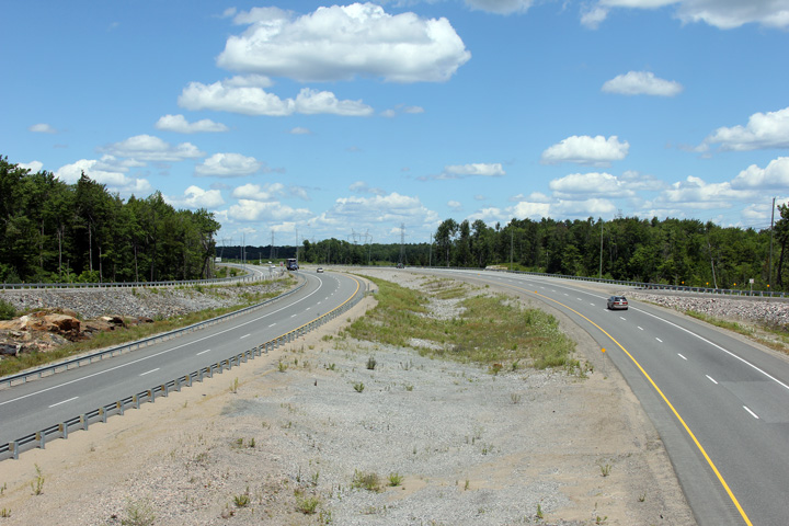
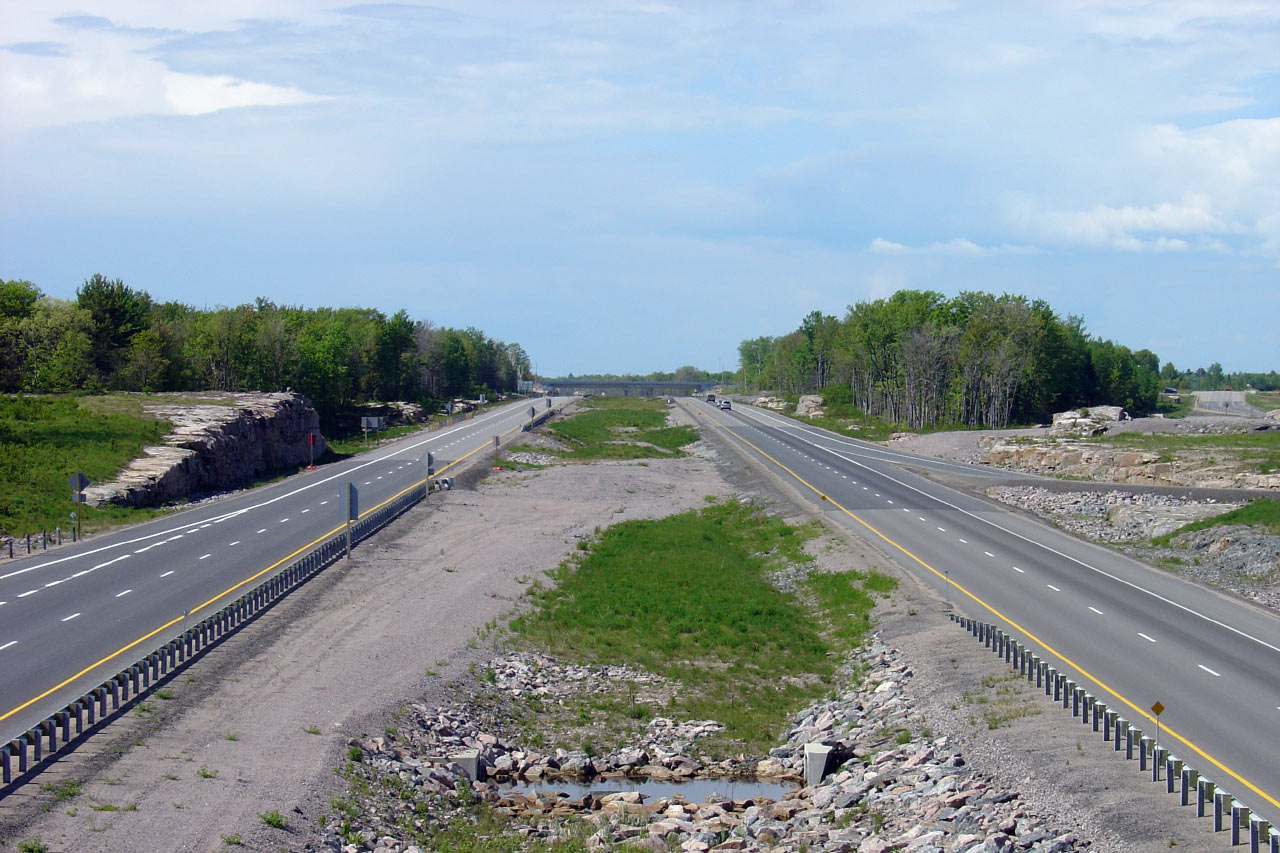
Southerly view from Tower Road. Photo taken: June 1st, 2005. |
(720x480)
(1440x960) |
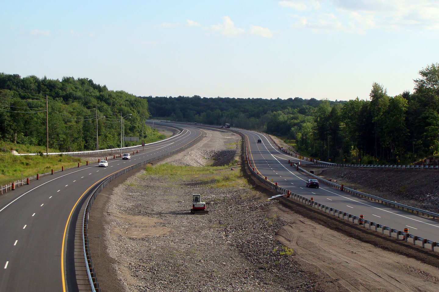
| Township of Georgian Bay
District Municipality of Muskoka |
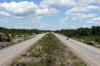
This view looks north from Tower Road. This stretch of Highway 400
opened in the Fall of 2003. Photo taken: June 1st, 2005. |
(720x480)
(1440x960) |
| Township of Georgian Bay
District Municipality of Muskoka |
Southbound view from Healy Lake Road. Photo taken: July 13th, 2006. |
(720x480)
(1440x960) |
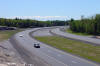
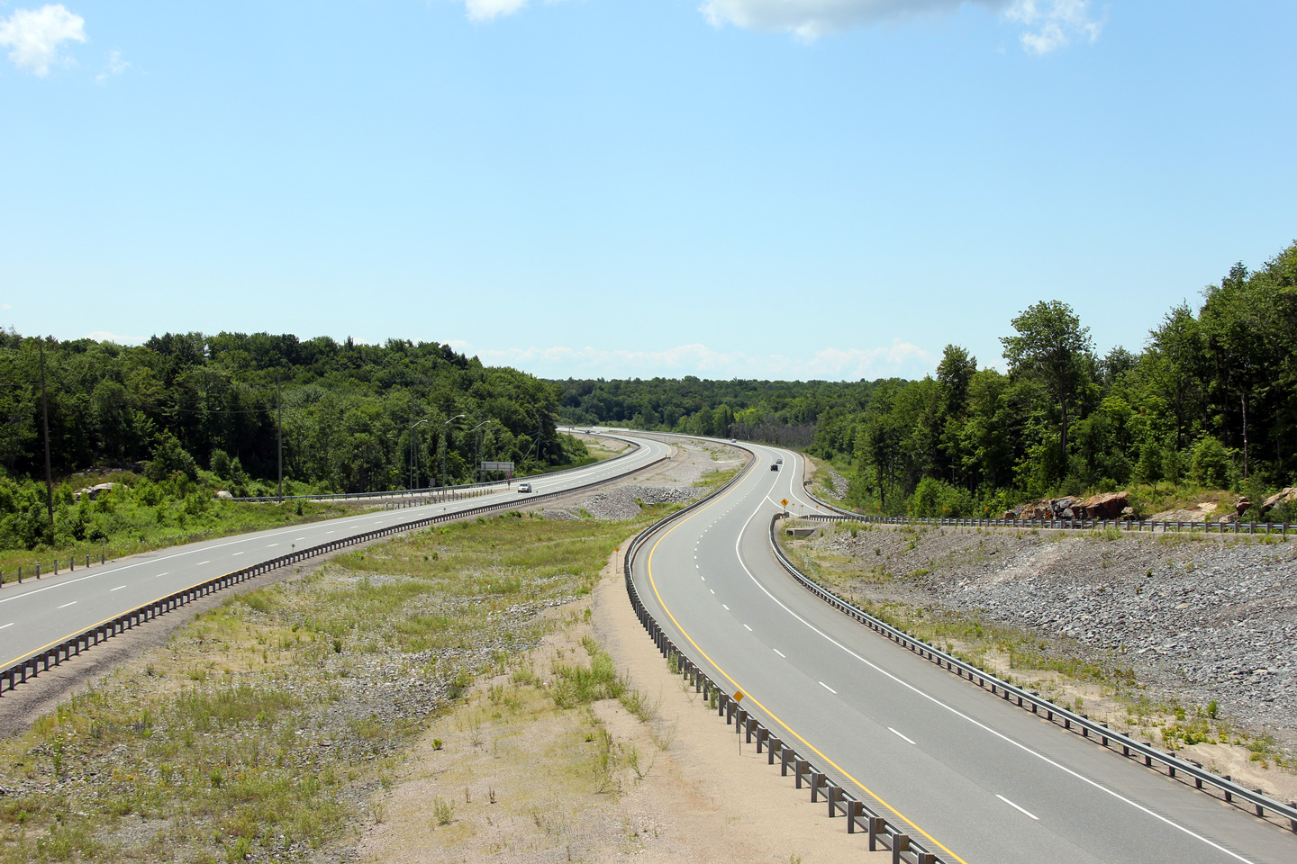
| Township of Seguin District of
Parry Sound |
Opposing view from Healy Lake Road. Photo taken: July 13th, 2006. |
(720x480)
(1440x960) |
| Township of Seguin District of
Parry Sound |
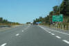
View looking south along Highway 400 from the Highway 141 interchange.
Photo taken: May 29th, 2004. |
(720x480)
(1440x960) |
|
Highway 141 leads east of this
new interchange through the heart of the Muskoka's to Highway 11 south of
Huntsville.
Click here for Highway 141 images. |
| Township of Seguin District of
Parry Sound |
Looking north from the Highway 141 overpass. There is a small regional
airstrip in the Northeast quadrant of this interchange. Photo taken: May
29th, 2004. |
(720x480)
(1440x960) |
| Township of Seguin District of
Parry Sound |
Approaching the Highway 141 interchange from the north. Photo taken: July
13th, 2006. |

(720x480)
(1440x960) |
| Township of Seguin District of
Parry Sound |
Advanced signage for the Highway 141 interchange. Photo taken: July 13th,
2006. |
 |
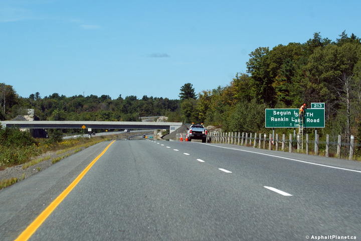
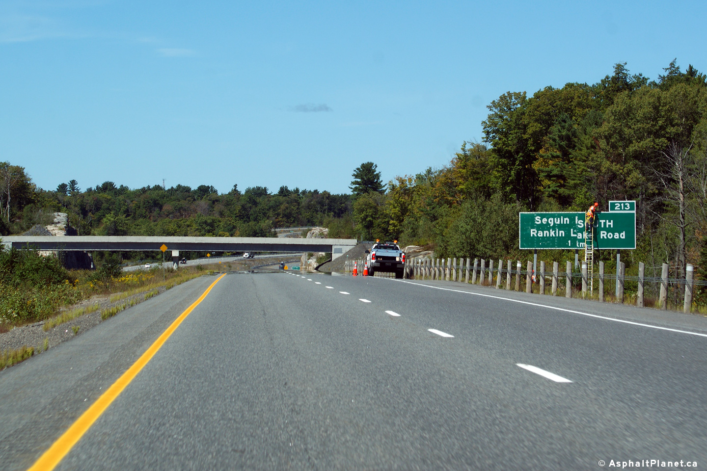
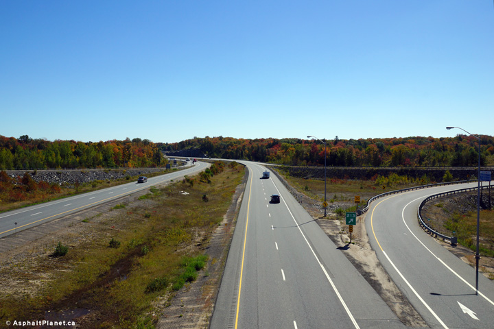
| Township of Seguin District of
Parry Sound |
Northbound signage approaching the northern Lake Joseph Road (former Highway
69) junction. In the upper photo, staff were removing the overlay that
showed this exit as being a portion of Highway 69. Before the Lake
Joseph diversion section of Highway 400 first opened to traffic, Exit #213
was originally signed as Seguin Road 69 and Rankin Lake Road. Shortly
before the highway opened to traffic, the signs were overlaid with Highway
69 crowns. Nearly a decade later, the Highway 69 crows are being
removed, and the former alignment of Highway 69 has been designated Lake
Joseph Road.
Upper photo taken: September 10th, 2012.
Lower photo taken: October 23rd, 2012. |
|
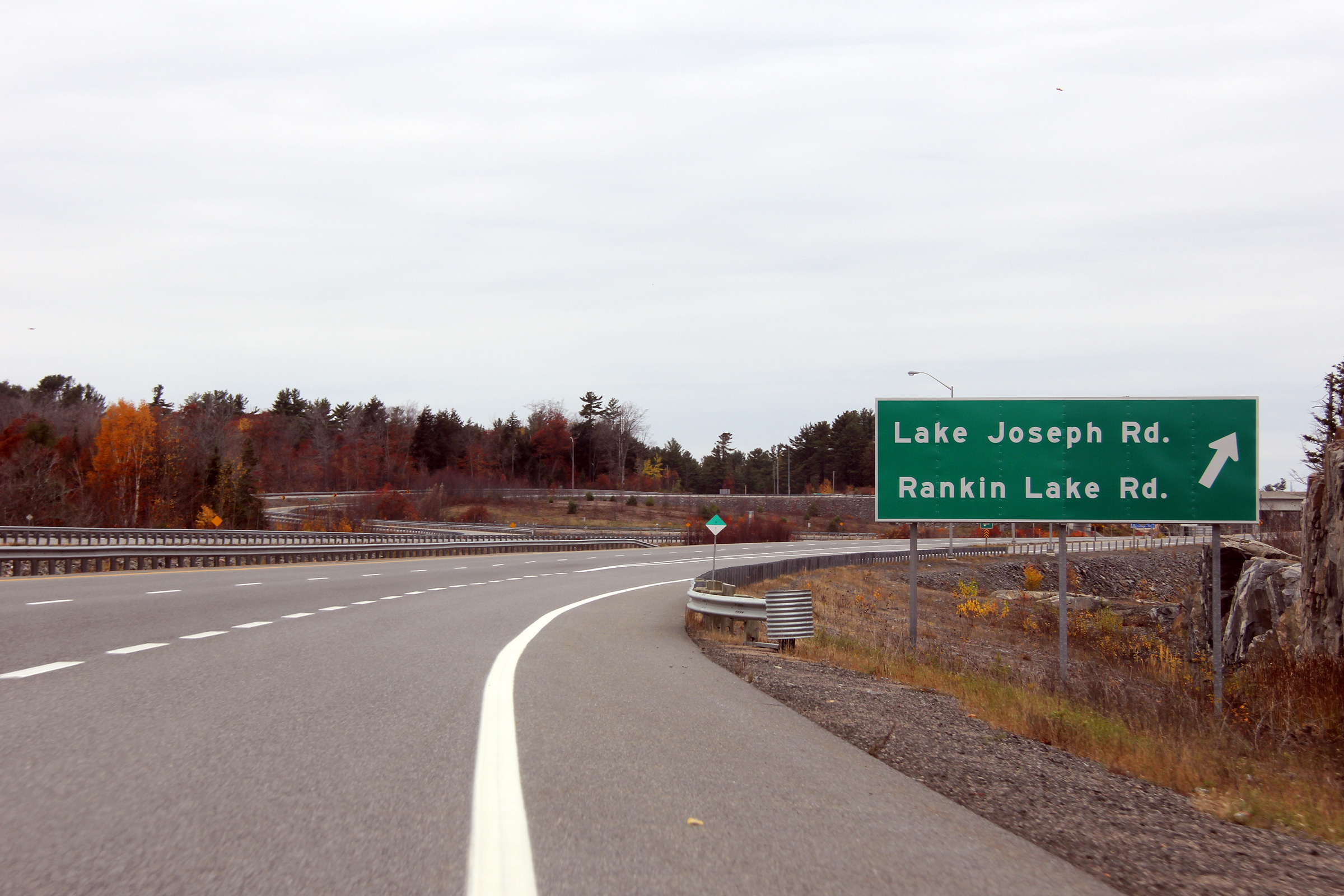
| Township of Seguin District of
Parry Sound |
Southerly view Crane Lake Road. Click
here for this
same view taken in August, 2008.
Photo taken: July 10th, 2012. |
(720x480)
(1440x960)
(2400x1600) |
| Township of Seguin District of
Parry Sound |
This view looks southerly towards the Crane Lake Road overpass.
Photo taken: July 10th, 2012. |
(720x480)
(1440x960)
(2400x1600) |
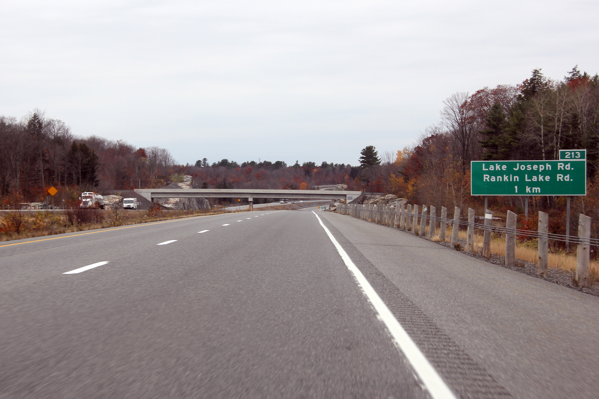
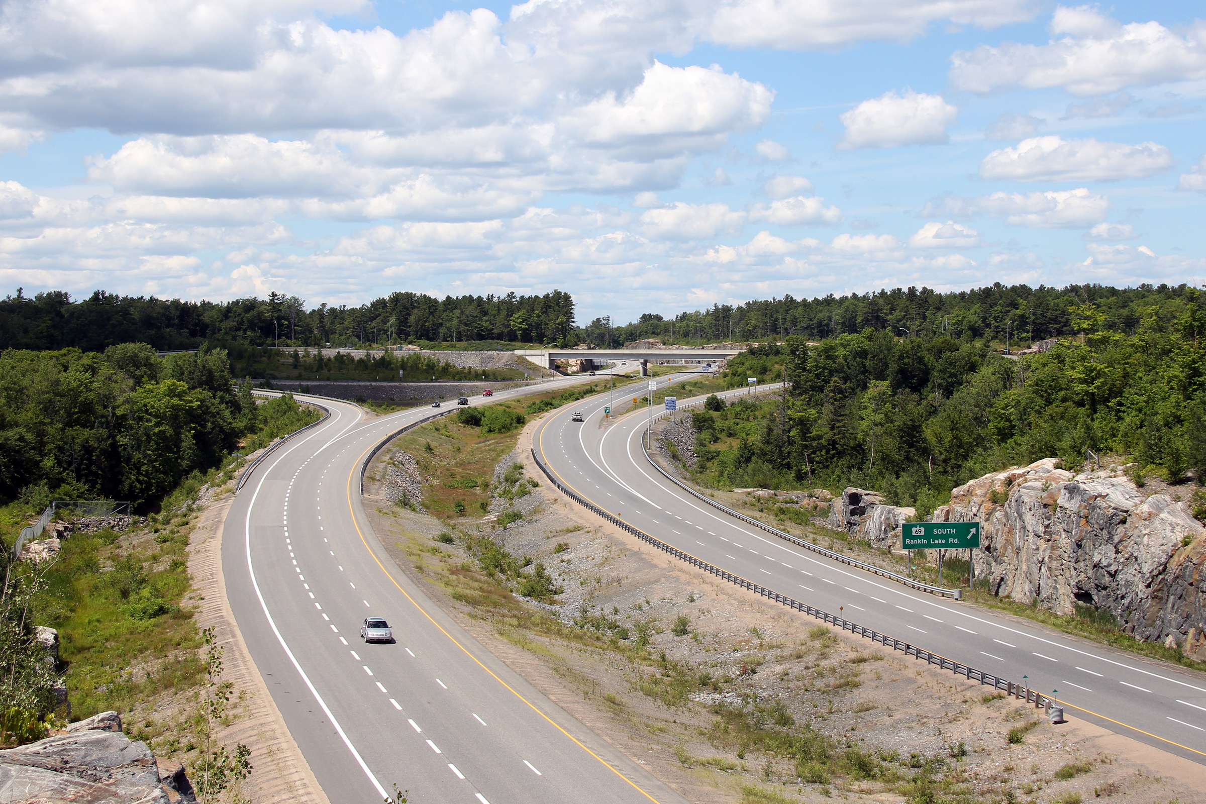
| Township of Seguin District of
Parry Sound |
This view looks northerly towards the Rankin Lake Road
interchange from just north of Crane Lake Road. This image pre-dates
Highway 69's redesignation as the Lake Joseph Road. Click
here for this
same view taken in August, 2008.
Photo taken: July 10th, 2012. |

(720x480)
(1440x960)
(2400x1600) |
| Township of Seguin District of
Parry Sound |
During the autumn of 2012 Highway 69 was resigned as Lake Joseph Road, this
was one of the last signs to be changed to reflect the highway's new status.
Photo taken: October 23rd, 2012. |
 (720x480) (720x480)
(1440x960)
(2400x1600) |
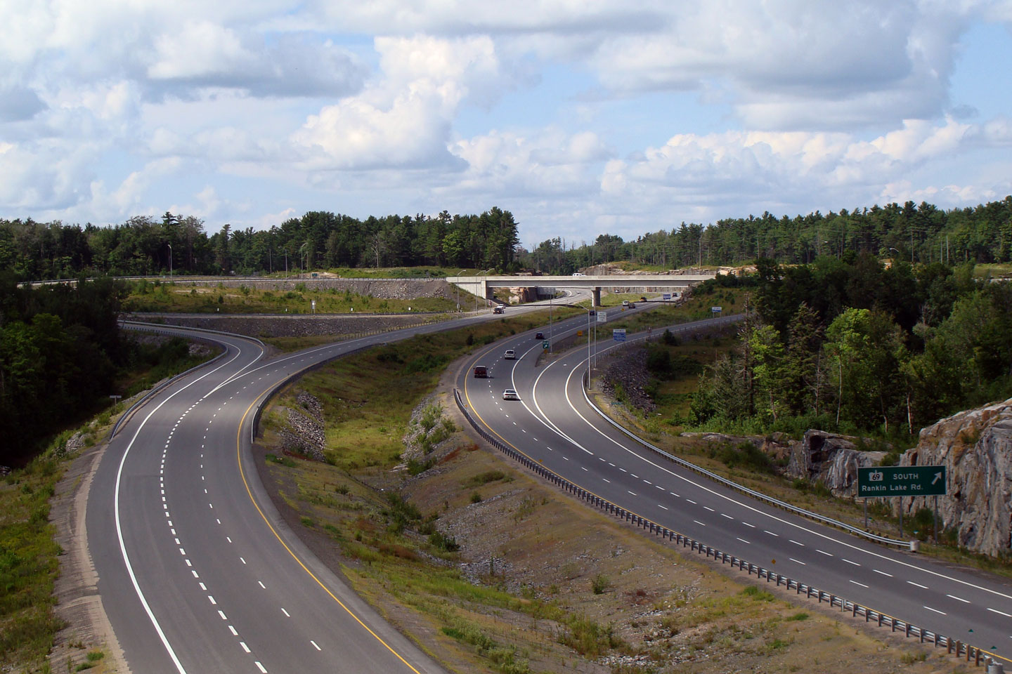
| Township of Seguin District of
Parry Sound |
This view looks south from the northern Lake Joseph Road (former Highway
69) overpass.
Click here for this
same view taken in July, 2006. Photo taken: September 27th, 2013. |
(720x480)
(1440x960)
(2400x1600) |
|
Lake Joseph Road (former Highway 69) rejoins Highway 400 at
Rankin Lake Road.
Click here for Lake Joseph Road (former Highway 69) images. |
 (720x480)
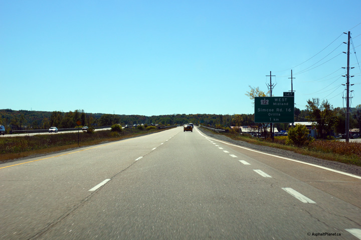 (720x480)
 (720x480)
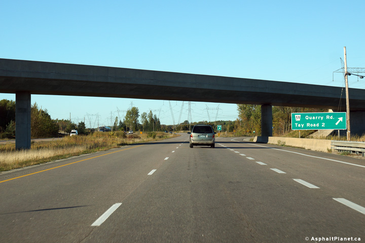 (720x480)

 (720x480)
 (720x480)
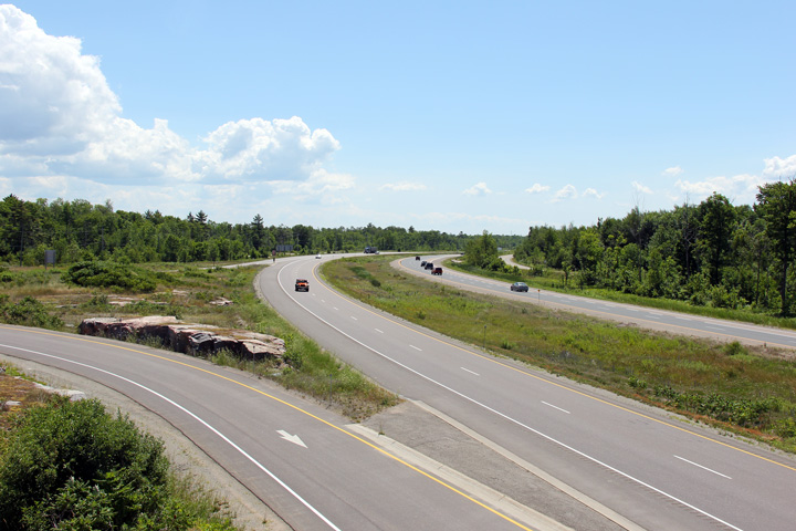

 (720x480)
 (720x480)
 (720x480)
 (720x480)
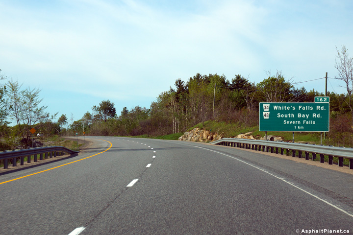 (720x480)
 (720x480)

 (720x480)
 (720x480)
 (720x480)
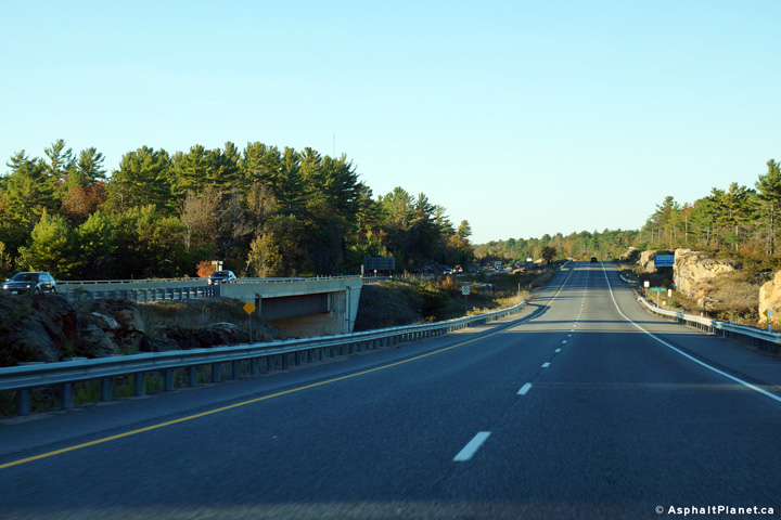 (720x480)
 (720x480)
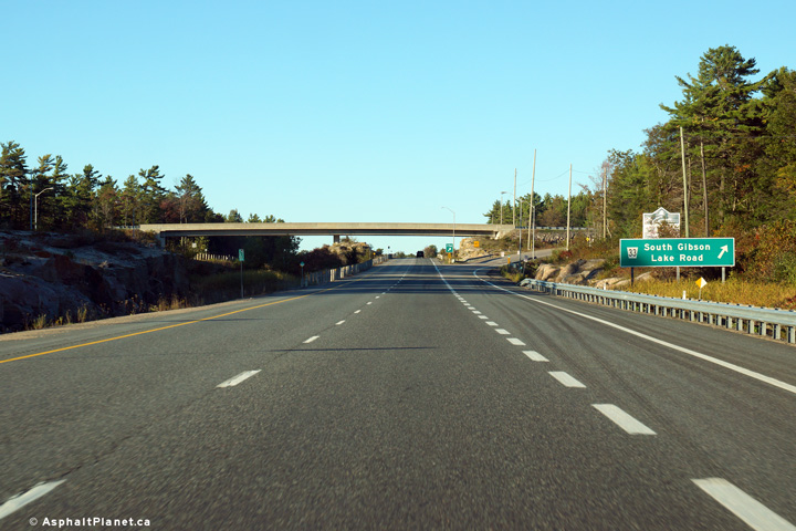 (720x480)
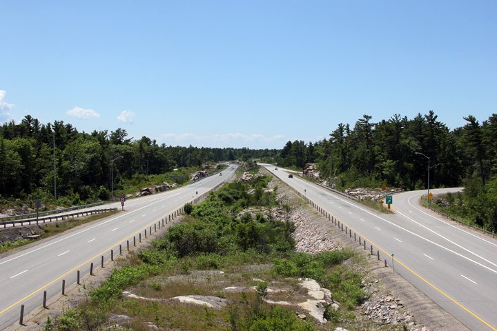

 (720x480)
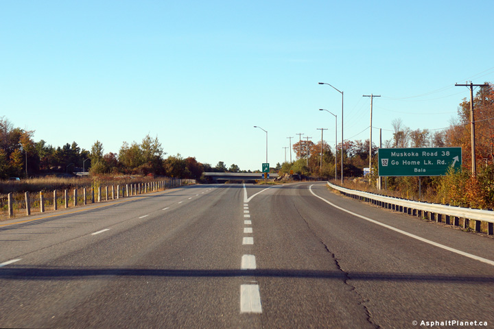 (720x480)
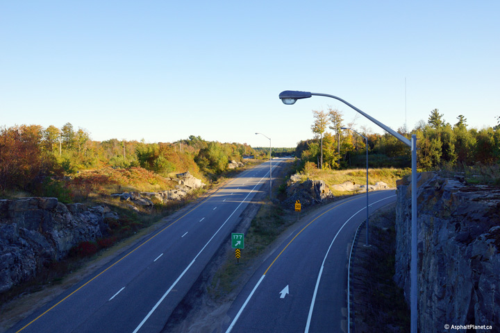

 (720x480)
 (720x480)
 (720x480)
 (720x480)


 (720x480)
 (720x480)
 (720x480)
 (720x480)


 (720x480)
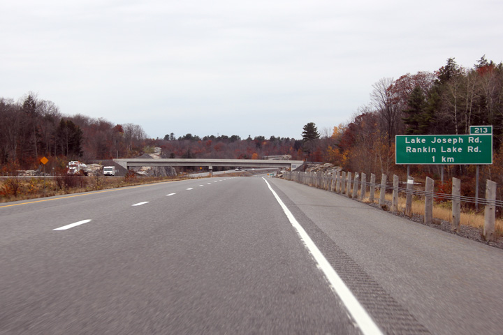


 (720x480)