|
Proper Municipality Name |
Photo Description |
Photo |
|
Pictures taken
from driver's perspective appear offset from centre-line pictures: |
East-
bound |
West-
bound |
|
Pictures continue westward from
Page 3A Images |
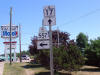
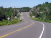
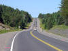
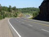
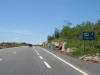
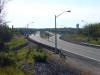
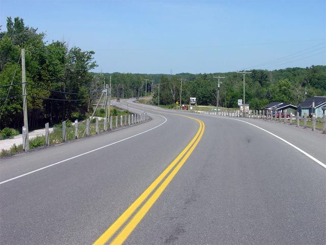
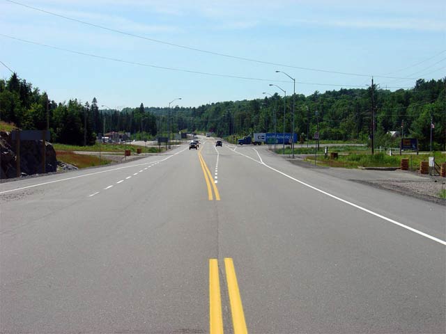
| Township of Thessalon District of Algoma |
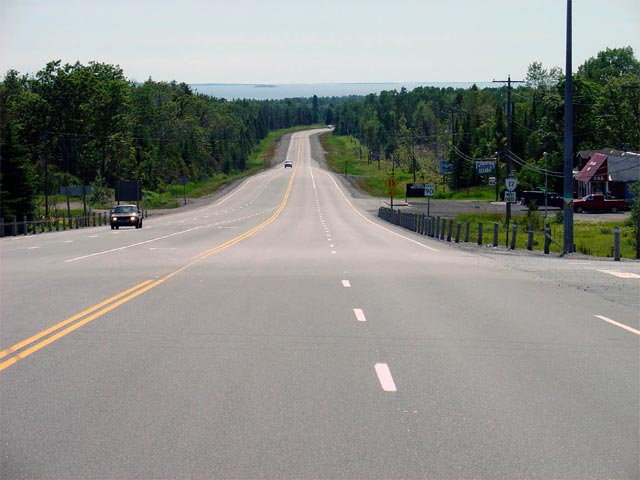
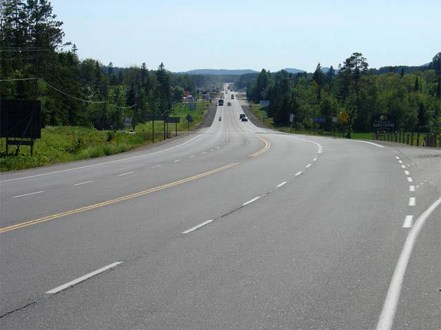
Highway 17 looking west from the
Highway 129 intersection; the intersection is located just north of the
community of Thessalon. This is a fairly typical looking view of
Highway 17 between Desbarats and Sudbury.
Picture taken: July 2nd, 2004.
Size: 75kb. |
 |
|
Highway 129 leads northerly
from Thessalon through the lonely Algoma Highlands bound for Chapleau.
Click here for Highway
129 images. |
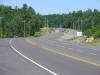
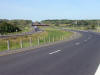
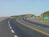
| Township of Thessalon District
of Algoma |
Highway 17 looking west from Brownlee Road. Brownlee Road is located
roughly 10 km east of Highway 129 at
Thessalon. Passing lanes are very frequent on Highway 17 between Sault
Ste. Marie and North Bay.
Picture taken: July 2nd, 2004. Size: 50kb. |
 |
| Township of Huron Shores
District of Algoma |
Highway 17 looking west across the Mississagi River bridge. The
Mississagi River cuts directly through the centre of the small community of
Iron Bridge. Iron Bridge is a full service community of about 700
residents. Highway 17 has a posted speed limit of 60km/h throughout
Iron Bridge.
Picture taken: July 3rd, 2005. Size: 50kb. |
 |
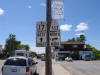
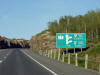
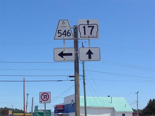
| Township of Huron Shores
District of Algoma |
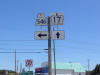
Junction assembly for Highway 546 in Iron Bridge. Highway 546 is a
long and desolate secondary highway that leads travelers northeasterly, deep
into the Algoma Highlands. Click here for Highway 546 Images (Coming
Soon!)
Picture size: 25kb. |
 |
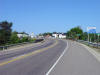
| Township of Huron Shores
District of Algoma |
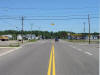
Highway 17 looking east through Iron Bridge. To the left at the
intersection shown in this photo is Highway 546. Picture taken: July 3rd, 2005. Size: 50kb. |
 |
| Town of Blind River District of
Algoma |
Looking westerly along Highway 17 from just west of Blind River.
Highway 17 follows the west arm of the Blind River (seen in the right of the
photo) for a short distance west of town. Picture taken: July 3rd, 2005.
Size: 45kb. |
 |
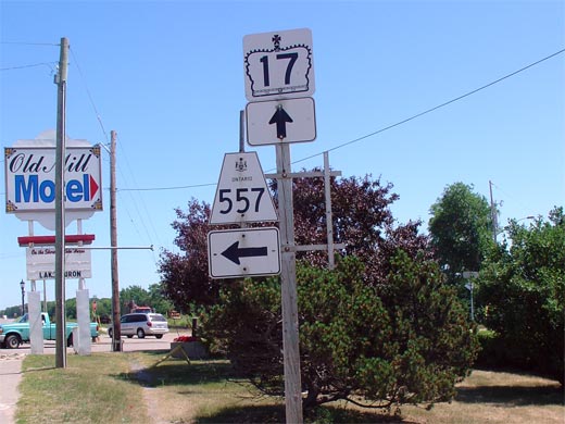
| Town of Blind River District of
Algoma |
Junction assembly for the Highway 17/557 junction. Highway 557 is a
short highway that leads north from Blind River heading to Matinenda Lake.
Picture size: 50kb. |
 |
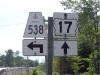
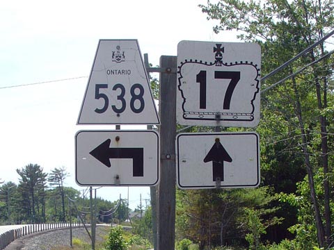
| Township of North Shore
District of Algoma |
Sign assembly for Highway the western
Highway 538 junction taken from
westbound Highway 17.
Highway 538 is actually an old abandoned
alignment of Highway 17. Since there is no lower-tiered government to
maintain this road, this abandoned alignment has remained a provincial
highway until this date.
Click here for Highway 538 Images.
Picture size: 45kb. |
 |
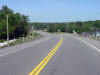
| Township of North Shore
District of Algoma |
Highway 17 looking east from the western
Highway 538 junction.
Highway 538 is located approximately 10km east of Highway 557 at Blind River.
Though not pictured in this photo, approximately 1km ahead there is a short
4-lane section where both an east- and west-bound passing lane have been
constructed.
Picture taken: July 3rd, 2005. Size: 55kb. |
 |
| Township of the North Shore
District of Algoma |
This has to be one of most complicated reassurance markers in the province.
This sign represents some of the problems that bilingualism poses in
Ontario. This sign is located just west of
Highway 108 near Serpent River. This
sign has recently been replaced with a less cluttered assembly.
Picture size: 80kb. |
 |
| Township of the North Shore
District of Algoma |
Highway 17 looking west towards the Highway 108 junction.
Highway 108
leads traffic northerly from Highway 17 to the City of Elliot Lake.
Click here for Highway 108
Images
Picture taken: July 3rd, 2005. Size: 35kb. |
 |
| Township of the North Shore
District of Algoma |
Highway 17 looking west from the small community of Cutler towards
the Highway 108 junction (which is located about 2km ahead of this photo).
Though not illustrated in this photo gallery, there is a recently
constructed brief 4-lane section located just east of Cutler.
Picture taken: July 3rd, 2005. Size: 60kb. |
 |
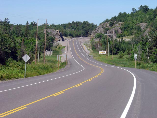
| District of Algoma |
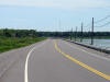
Looking west from just west of the Serpent River Bridge. Just beyond
the pictured left-hand curve in this photo, Highway 17 passes through the
First Nations community of Cutler. Through Cutler, Highway 17 has a
posted speed limit of 70km/h.
Picture taken: July 3rd, 2005. Size: 60kb. |
 |
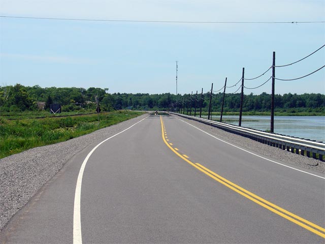
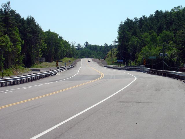
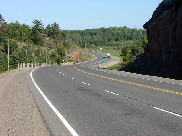
| District of Algoma |
Looking easterly across the Serpent River Bridge. The Serpent River
bridge was reconstructed in 2004. Notice the steel bridge railings on
the structure. Though these railings may seem odd to travelers from
Southern Ontario, steel railings on bridges are quite common in Northern
Ontario.
Picture taken: July 3rd, 2005. Size: 50kb. |
 |
| Township of Sables-Spanish River
District of Sudbury |
Junction assembly for the Highway 17/553 junction in Massey. Highway
553 runs roughly 33km north from Massey, where it arbitrarily ends and is
then designated as Tertiary Highway 810, which continues another 42km north
to Richie Falls. Click here for Highway 553 Images (Coming Soon!)
Picture size: 40kb. |
 |
| Township of Sables-Spanish River
District of Sudbury |
Looking west across the River Aux Sables bridge into the community of
Massey. Massey is a small community of roughly 1,000 residents.
The speed limit through Massey on Highway 17 is posted at 60km/h.
Picture taken: July 2nd, 2005. Size: 50kb. |
 |
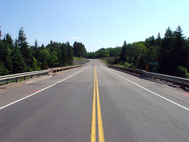
| Township of Sables-Spanish River
District of Sudbury |
Looking east along Highway 17 across the Birch Creek Bridge. Birch
Creek is located roughly 2km west of Webbwood. Picture taken: July 2nd,
2005. Size: 50kb |
 |
| Township of Sables-Spanish River
District of Sudbury |
Looking east towards Birch Creek. Shortly after this picture was
taken, heavy construction commenced to reconstruct this structure.
Before this reconstruction, this bridge had remained largely unaltered since
its original construction as part of the Trans-Canada Highway program in the
1950s.
Picture taken: July 2nd, 2005. Size: 65kb. |
 |
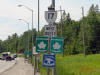
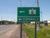
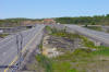
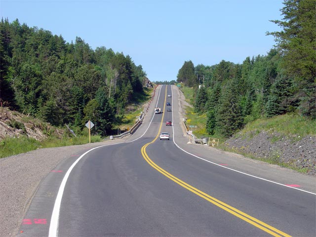
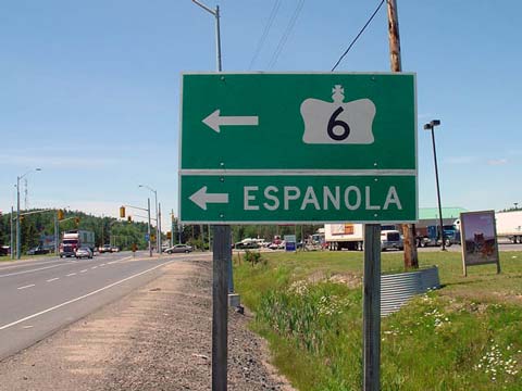
| Township of Baldwin District of
Sudbury |
Approaching the Highway 6
junction heading westbound. Highway 6
leads travelers south from Highway 17, towards Espanola and more notably
Manitoulin Island. Highway 6 is the only primary provincial highway
serving Manitoulin Island. Click here for Highway 6 Images (Coming
Soon!)
Picture Size: 30kb. |
 |
|
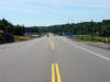
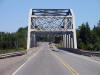
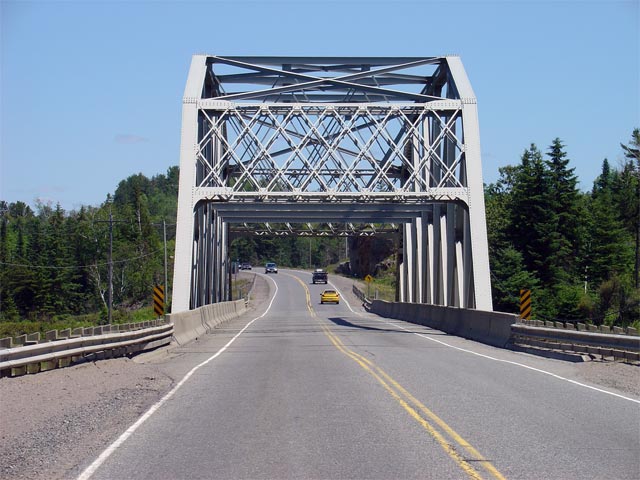
Township of Nairn and Hyman District of Sudbury |
Looking east through the magnificent Spanish River bridge along Highway 17.
This truss bridge was originally constructed in the early 1950s as part of
the construction to upgrade Highway 17 to Trans-Canada Highway standards.
The Spanish River is located roughly 8km east of the Highway 6
junction.
Picture taken: July 2nd, 2004. Size: 65kb. |
 |
|
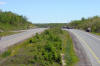
Township of Nairn and Hyman District of Sudbury |
Highway 17 looking west towards the small community of Nairn. Nairn is
the first community that Highway 17 passes through west of Sudbury.
Nairn is a full service community with a posted speed limit of 70km/h for
about 500m through town.
Picture taken: July 3rd, 2005. Size: 40kb. |
 |
|
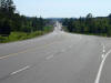
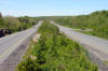
Township of Nairn and Hyman |
Highway 17 looking east from just west of Nairn. This is a fairly
typical looking view of Highway 17 through western Sudbury District.
Passing lanes are very frequent for all of Highway 17 through this area. Picture taken: July 3rd, 2005. Size: 45kb. |
 |
|
City of Greater Sudbury |
Highway 17 looking east towards the western beginning of the divided highway
at Sudbury. The divided highway begins about 1km west of the western
Sudbury Road 55 intersection. Picture taken: July 3rd, 2005. Size:
45kb. |

(720x480)
(1440x960) |
|
City of Greater Sudbury |
This picture shows the western at-grade intersection of Sudbury Road 55 and
Highway 17. Surprisingly, no interchange was constructed in this
location when the current Highway 17 freeway was constructed bypassing the
current Sudbury Road 55 in the early 1980s.
Picture taken: July 3rd, 2005. Size: 50kb. |
 |
|
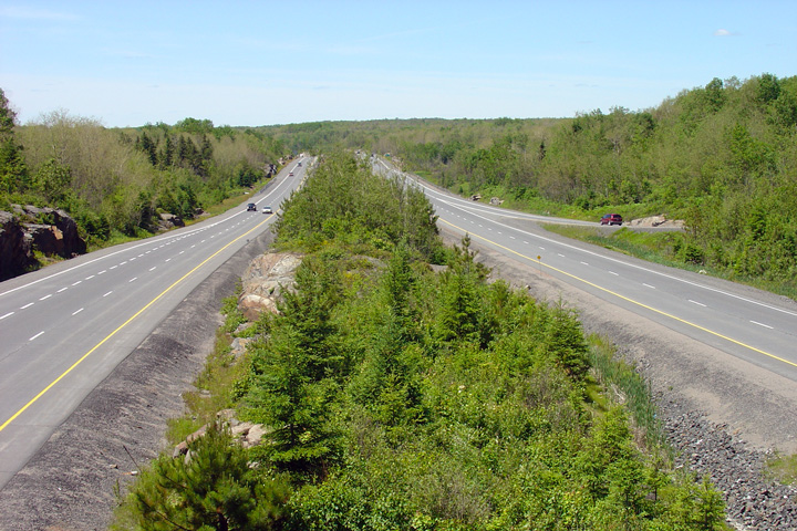
City of Greater Sudbury |
Highway 17 looking west from the
Highway 144 overpass located southwest of Sudbury. The interchange
with Highway 144 is one of two interchanges located on the freeway west of
Sudbury.
Picture taken: July 2nd, 2004.
Size: 75kb.
|
(720x480)
(1440x960) |
|
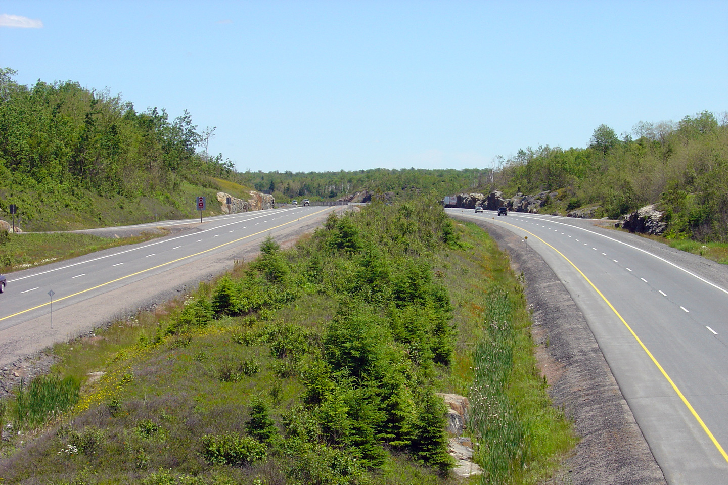
City of Greater Sudbury |
Looking east from the Highway 144 overpass towards Sudbury. Highway
144 is located roughly 5km west of the Sudbury Road 55 interchange.
Picture taken: July 2nd, 2004. Size: 70kb. |
(720x480)
(1440x960) |
|
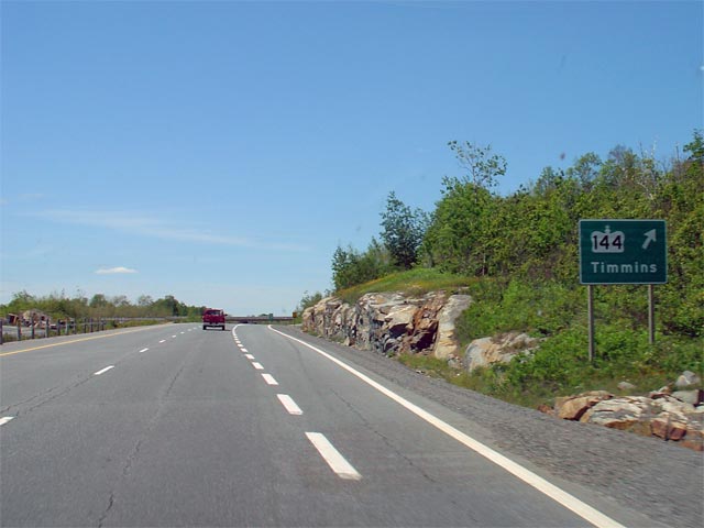
City of Greater Sudbury |
Ground signage located along Highway 17 westbound denoting the Highway 144
interchange. For some reason (unknown to me), all of the signage for
the Highway 144 interchange along Highway 17 is a fair bit smaller then
conventional freeway signage.
Picture taken: July 2nd, 2004. Size: 40kb. |
 |
|
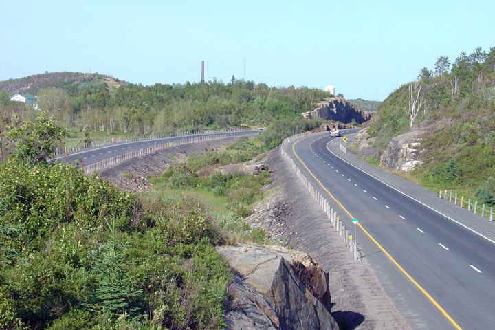
City of Greater Sudbury |
Looking easterly towards the Sudbury Road 55 interchange from the Santala
Road overpass.
Photo taken: July 3rd, 2005. |

(720x480)
(1440x960) |
|
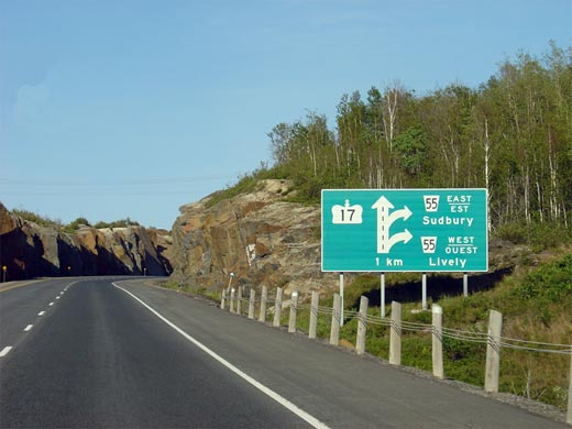
City of Greater Sudbury |
Diagaramical sign denoting the upcoming Sudbury Road 55 interchange located
about a kilometre ahead. Highway 17 meets Sudbury Road 55 at a
Parclo-B4 type interchange. Picture size: 35kb. |
 |
|
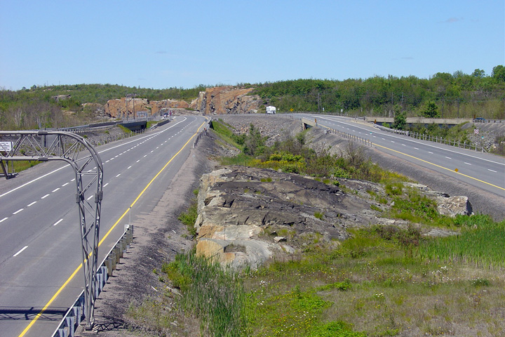
City of Greater Sudbury |
Looking west from the Sudbury Road 55 overpass. Before 1995, Highway
17 departed its current alignment at this interchange, following Sudbury
Road 55 easterly through Downtown Sudbury, instead of its current routing
that follows the Southwest and Southeast Bypasses.
Picture taken: July 2nd, 2004. Size: 75kb. |
(720x480)
(1440x960) |
|
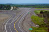
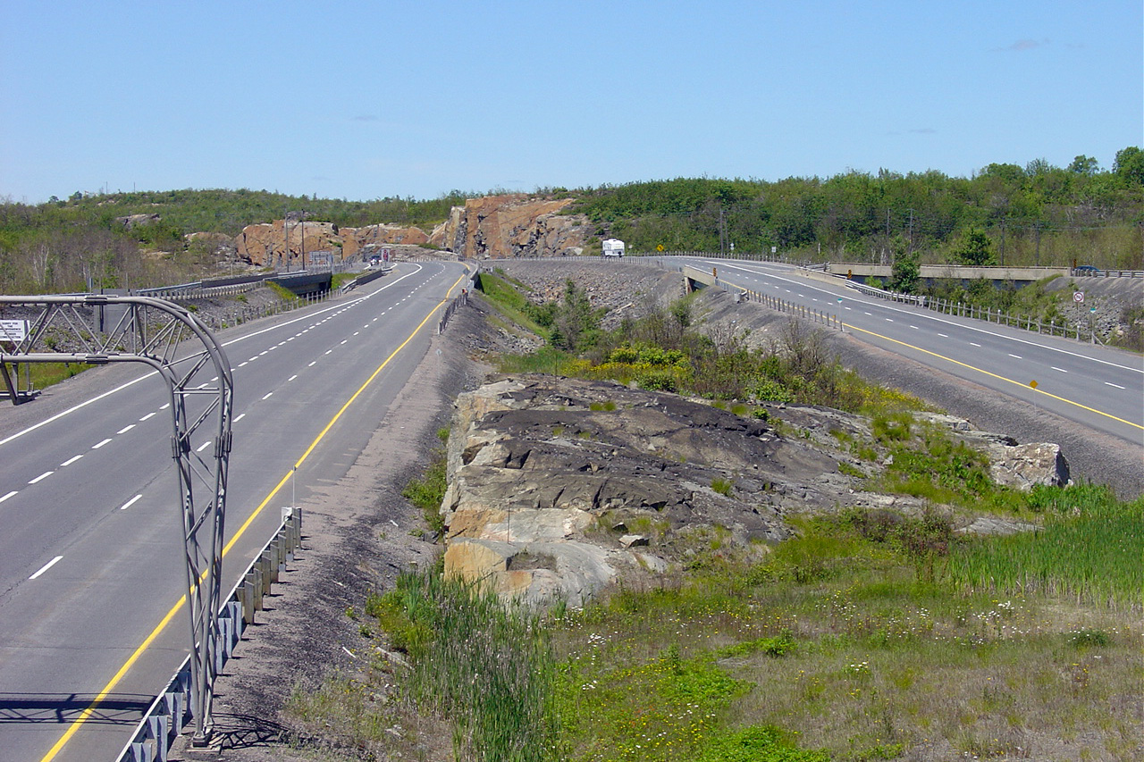
City of Greater Sudbury |
Highway 17 looking east from the
Sudbury Road 55 overpass on the Southwest By-pass in Sudbury. As
visible in the photo, Highway 17 narrows from a freeway to a conventional
2-lane highway just east of this interchange. Aside from a small divided section at the
Highway 69 interchange and regular passing
lanes, Highway 17 is a two-lane highway easterly to North Bay.
Picture taken: July 2nd, 2004.
Size: 70kb. |
(720x480)
(1440x960) |
|
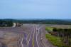
City of Greater Sudbury |
Highway 17 looking west towards the Sudbury Road 55 interchange. This
photo shows the eastern beginning of the Sudbury freeway section of Highway
17. Picture taken: July 3rd, 2005. Size: 65kb. |
 |
|
City of Greater Sudbury |
Standard shield assembly located eastbound along the Sudbury Southwest
By-pass. Before the Southeast Sudbury By-pass opened, the Southwest
Sudbury By-pass was signed exclusively with trailblazers, as it was not part
of Highway 69 or 17, but rather a 7000-series highway.
Picture size: 40kb. |
 |
|
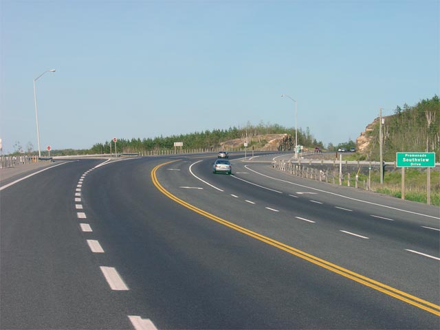
City of Greater Sudbury |
Highway 17 looking east through the Southview Drive intersection. This
is a very typical design for intersections along the Sudbury Southwest
By-pass. Picture taken: July 3rd, 2005. Size: 35kb. |
 |
|
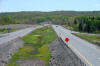
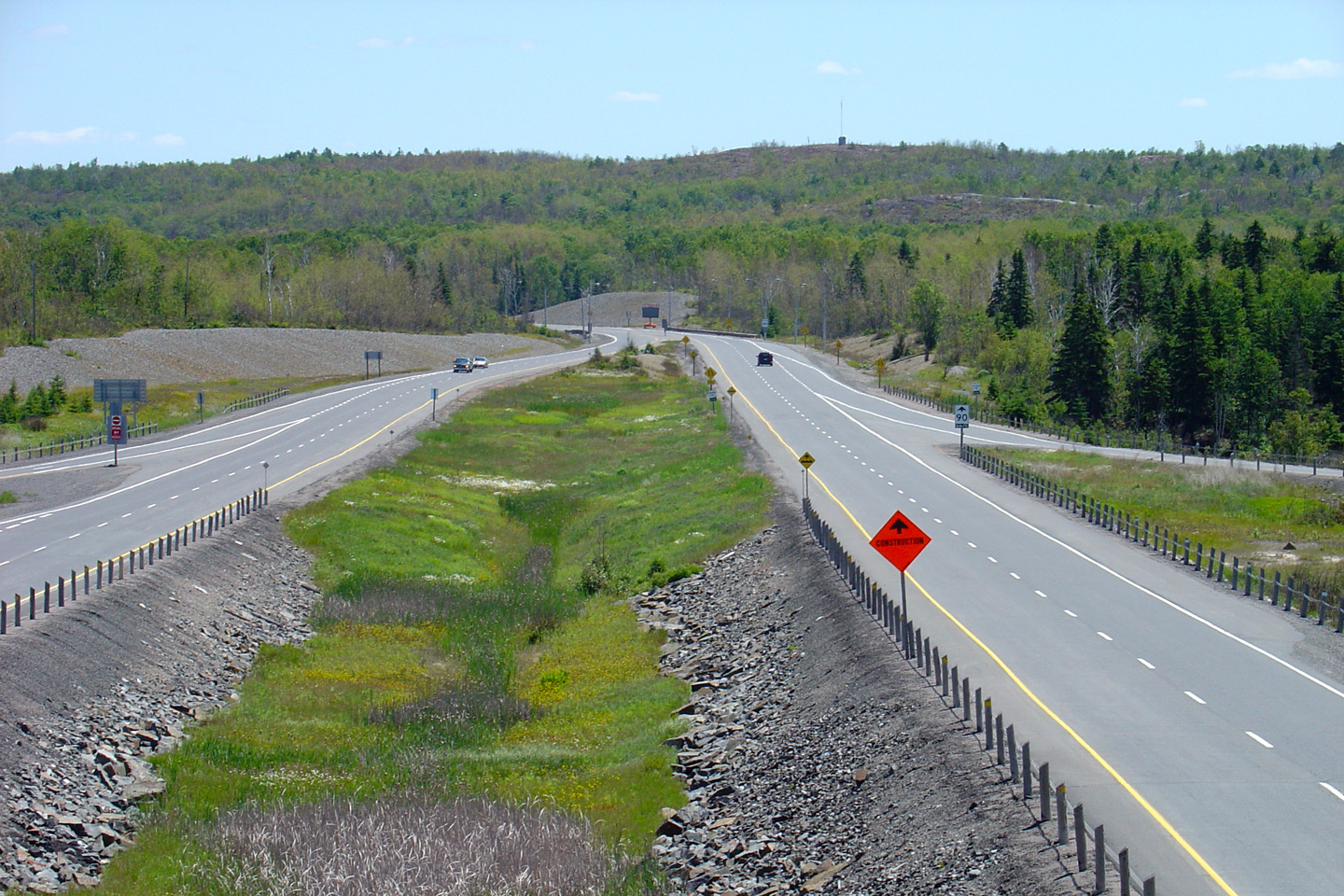
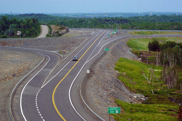
City of Greater Sudbury |
This picture shows Highway 17 looking east towards the Long Lake Road
intersection. Long Lake Road was the only set of traffic lights
along Highway 17 between Highway 6 at McKerrow, and the eastern end of the
Southeast By-pass.
Picture taken: July 3rd, 2005. Size: 40kb. |
|
|
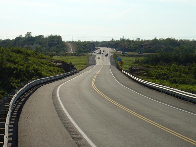
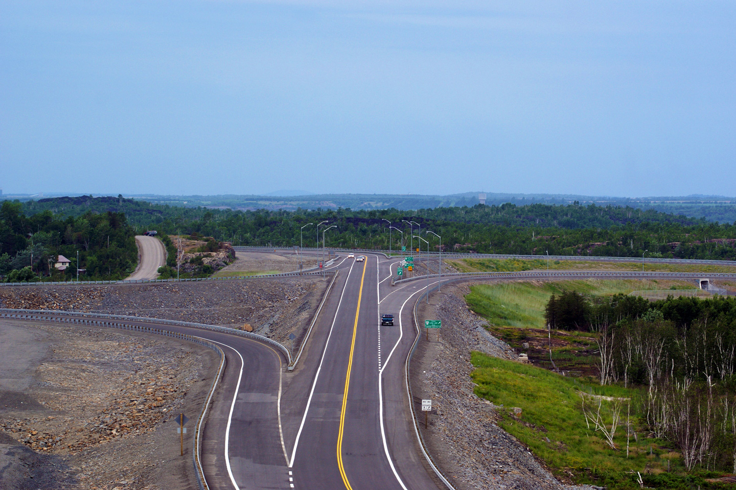
City of Greater Sudbury |
Highway 17 looking west towards the Long Lake Road intersection. The upper
photo highlights the signalized intersection with Long Lake Road, while the
lower photos show the completed two lane interchange with Long Lake Road.
Upper photo taken: July 3rd, 2005.
Lower photos taken: June 28th, 2009. |
(720x480)
(1440x960)
(2400x1600)
(720x480)
(1440x960)
(2400x1600) |
|
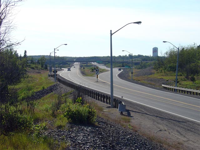
City of Greater Sudbury |
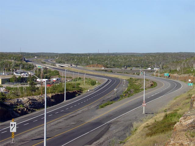
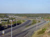
Highway 17 looking east towards the
Highway 69 interchange.
Highway 69 meets Highway 17 at a parclo-A2
interchange. As mentioned earlier, Highway 17 has a brief divided
section for about a kilometre at the
Highway 69 interchange.
Picture taken: July 3rd, 2005. Size: 55kb. |
 |
|
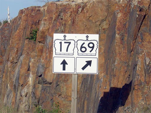
City of Greater Sudbury |
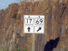
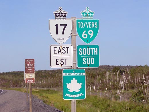
The junction assembly for the eastbound Highway 17/69
split. Picture size: 50kb. |
 |
|
Highway 69 leads southerly from
Sudbury bound for Highway 400 and Toronto.
Click here for Highway
69 images. |
|
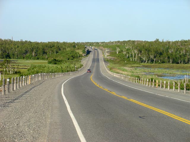
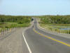
City of Greater Sudbury |
Highway 17 looking east along the Sudbury Southeast By-pass. This
picture was taken about 5km east of the
Highway 69 interchange and is a very
typical looking view of the Sudbury Southeast By-pass. Interestingly,
the Southeast By-pass meets no other roads for its entire length.
Picture taken: July 3rd, 2005. Size: 55kb. |
 |
|
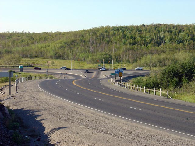
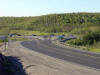
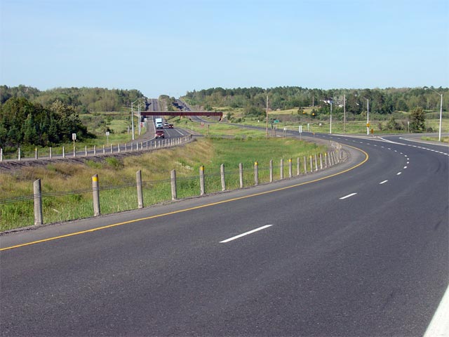
City of Greater Sudbury |
Highway 17 looking east (north) towards the end of the Sudbury Southeast
By-pass. At this junction eastbound traffic must take the ramp to the
right towards North Bay. Picture taken: July 3rd, 2005. Size: 65kb. |
 |
|
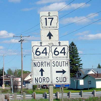
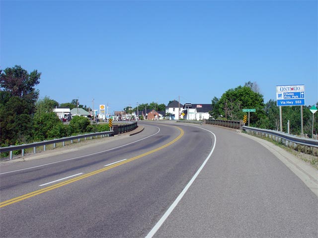
Municipality of West Nipissing District of Nipissing |
Highway 17 approaching the
western Highway 64 junction heading
eastbound. Highway 64 is co-designated
with Highway 17 for about 30 km from Verner to Sturgeon Falls. Click
here for Highway 64
Images.
Picture size: 30kb. |
 |
|
Click here for Verner to North Bay Images. |


