|
Proper Municipality Name |
Photo Description |
Photo |
|
Pictures taken
from driver's perspective appear offset from centre-line pictures: |
East-
bound |
West-
bound |
|
Pictures continue westerly on
Page 4A |
|
Highway 533 leads northwest of
Mattawa following the Ottawa River to Highway 63.
Click here
for Highway 533 images |
|
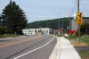
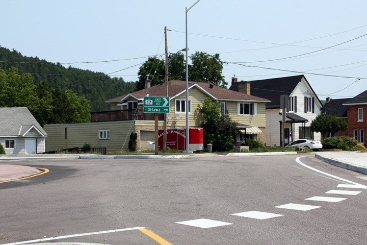
Town of Mattawa District of Nipissing |
Directional signage for Highway 17 towards Ottawa from the Mattawa
roundabout.
Photographer: Josh Anderchek. Taken: June 28th, 2012. |
 (720x480) (720x480)
(1440x960) |
|
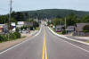
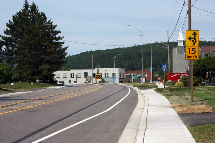
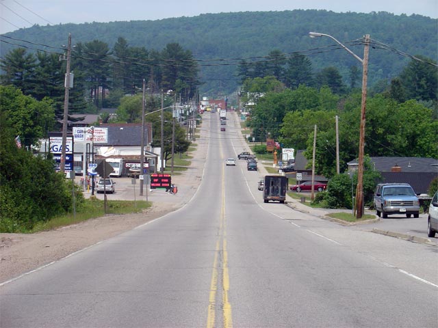
Town of Mattawa District of Nipissing |
Two westerly views approaching the Highway 533 intersection. Notice
the stylized advisory speed signage shown in the lower photo for the roundabout.
Upper photo taken: June 4th, 2006.
Lower photographer: Josh Anderchek. Taken: June 28th, 2012. |
(720x480) (1440x960)
(2400x1600) |
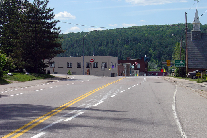
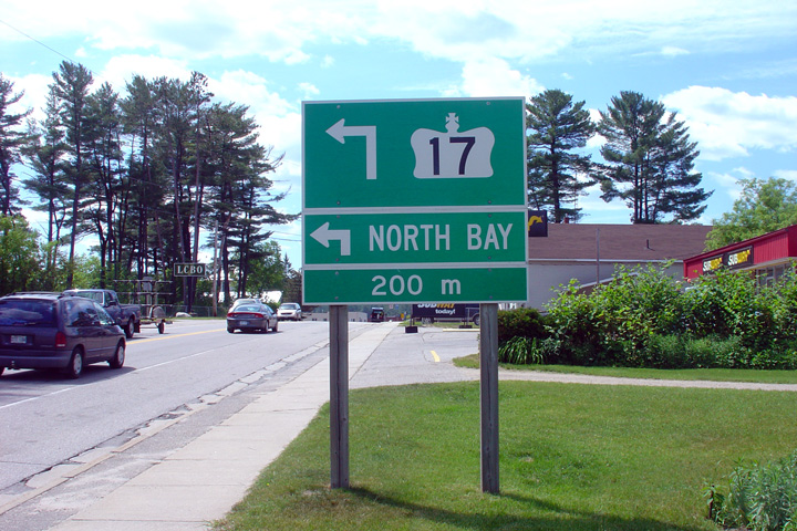
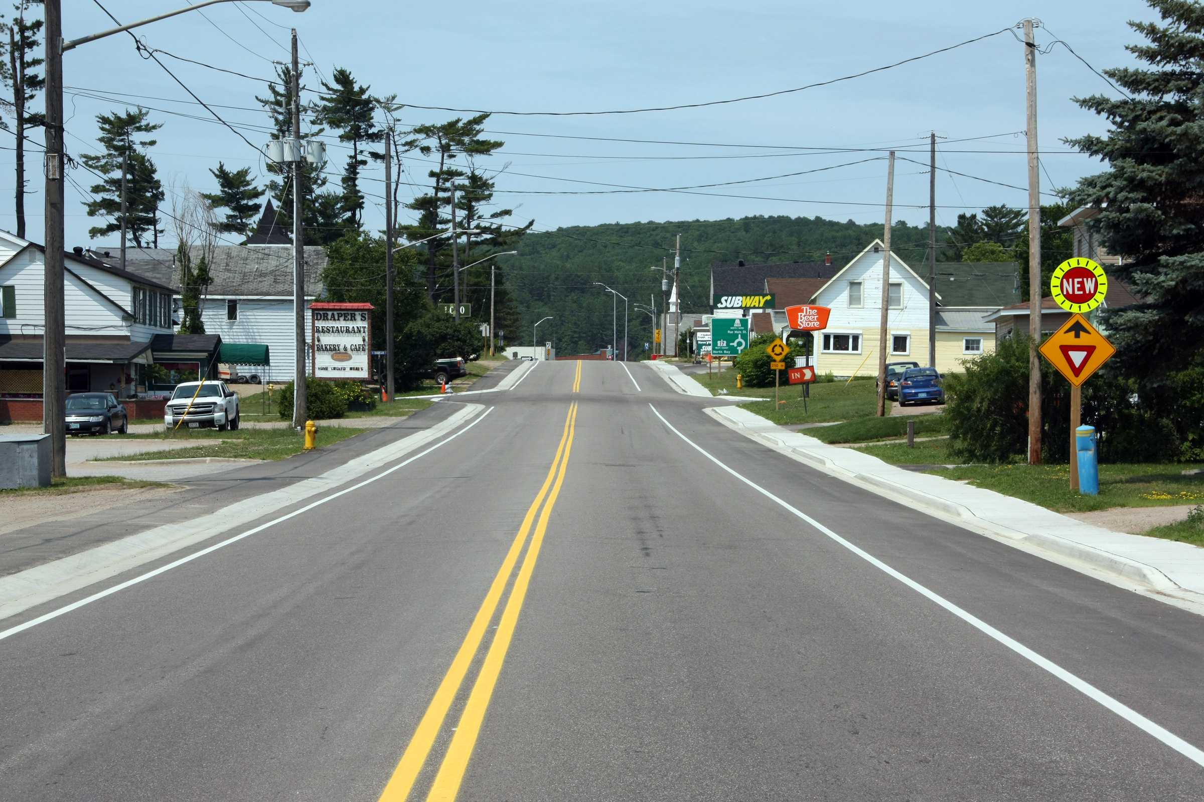
| Town of Mattawa District of
Nipissing |
Two incarnations of the green signage approaching the Highway 533
intersection in Mattawa. The upper photo shows the signage when
Highway 17 turned to the left at the Highway 533 intersection while the
lower photo shows the roundabout signage for the roundabout intersection
that was constructed at the Highway 17/533 junction during the 2011
construction season. Upper photo taken: June 4th, 2006. Lower
photographer: Josh Anderchek. Taken: June 28th, 2012. |
 (720x480) (720x480)
(1440x960) |
|
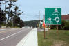
Town of Mattawa District of Nipissing |
Yield ahead signage in advance of the roundabout at Highway 533.
Photographer: Josh Anderchek. Taken: June 28th, 2012. |
(720x480)
(1440x960)
(2400x1600) |
|
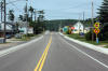
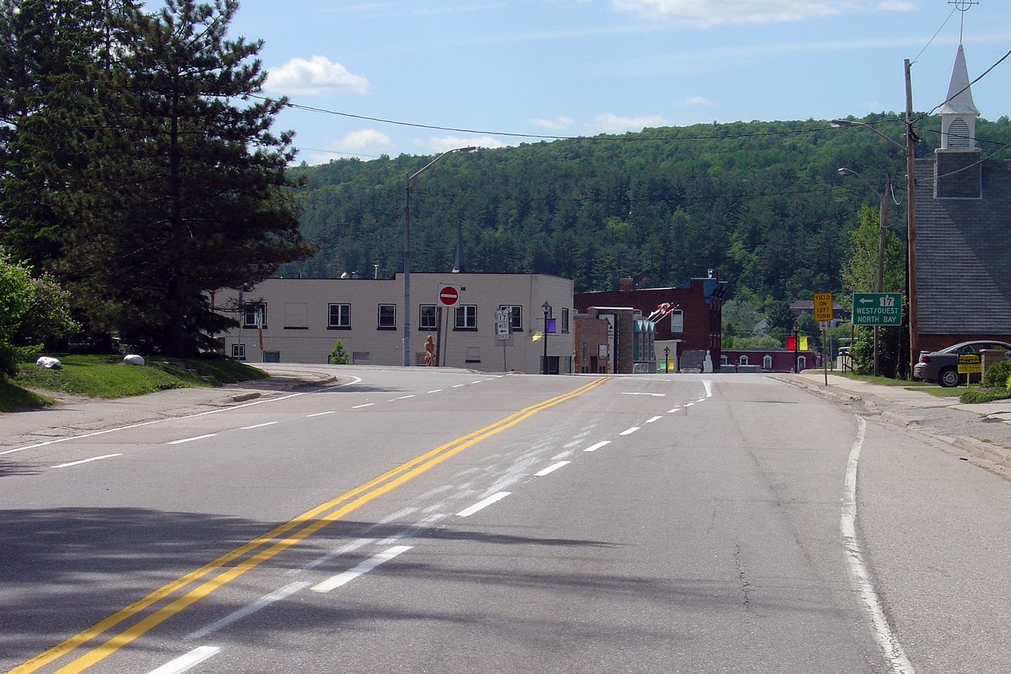
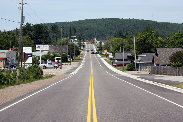
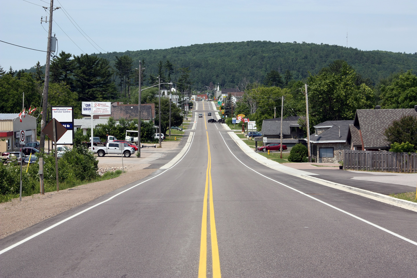
Town of Mattawa District of Nipissing |
Two westerly views through Mattawa. Highway 17 was resurfaced through
Mattawa as part of the roundabout construction at Highway 533.
Upper photo taken 4th, 2005. Size: 65kb.
Lower photographer: Josh Anderchek. Taken: June 28th, 2012. |
(720x480)
(1440x960)
(2400x1600) |
|
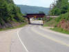
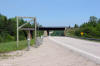
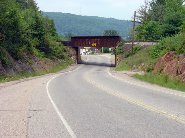
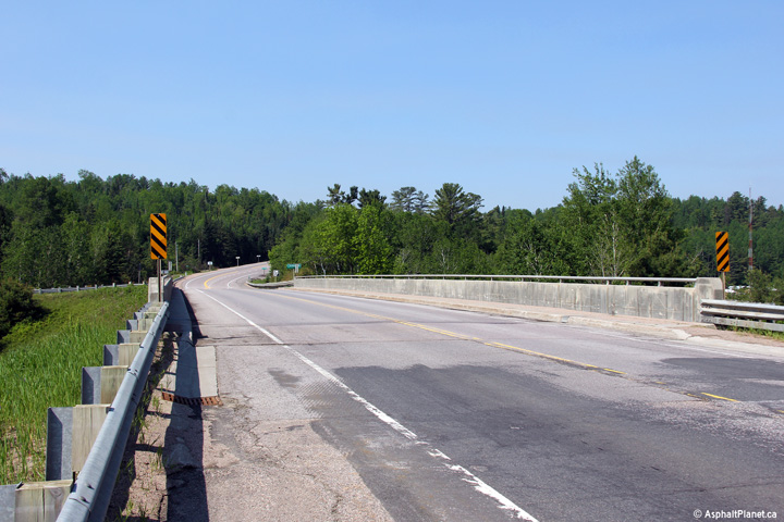
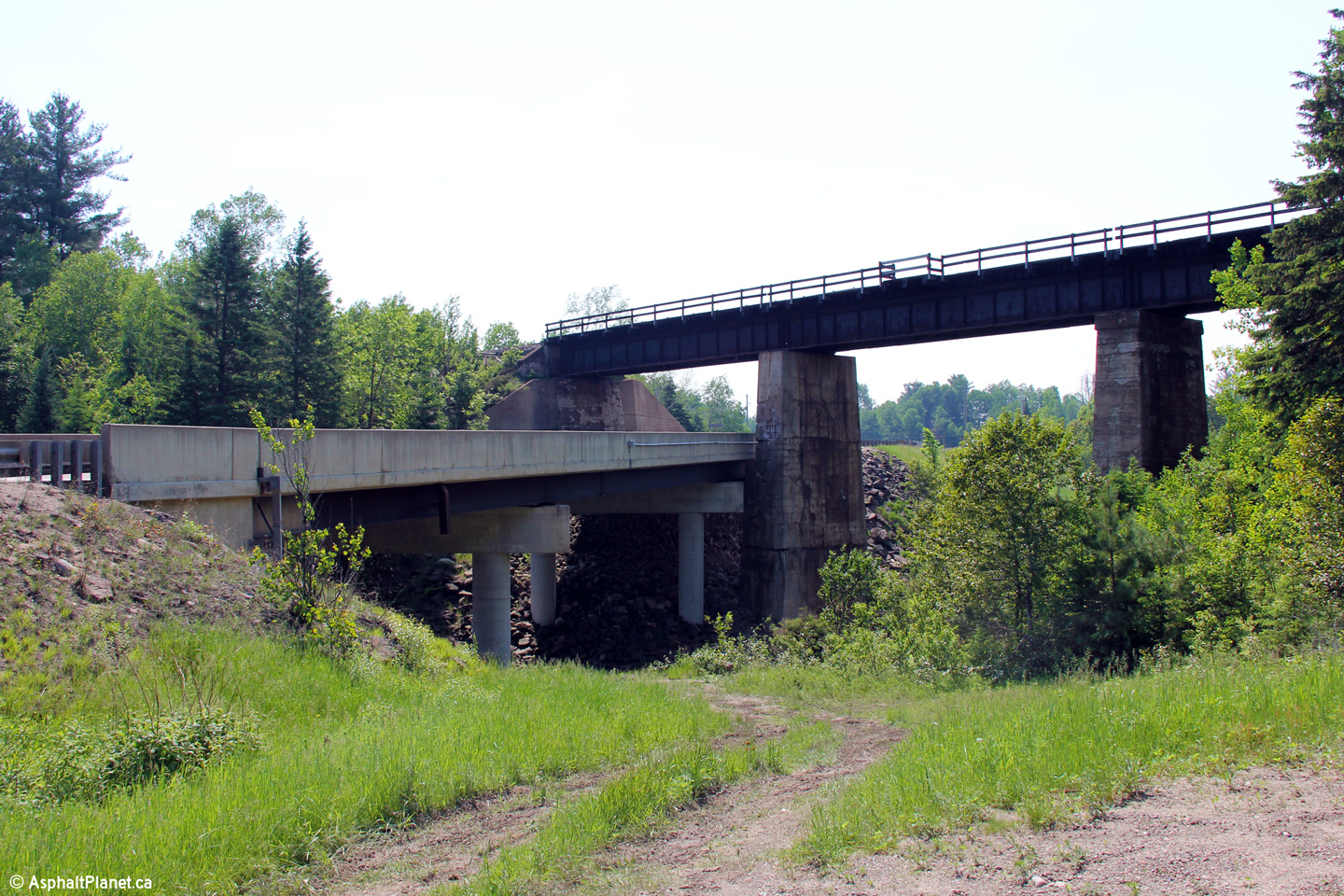
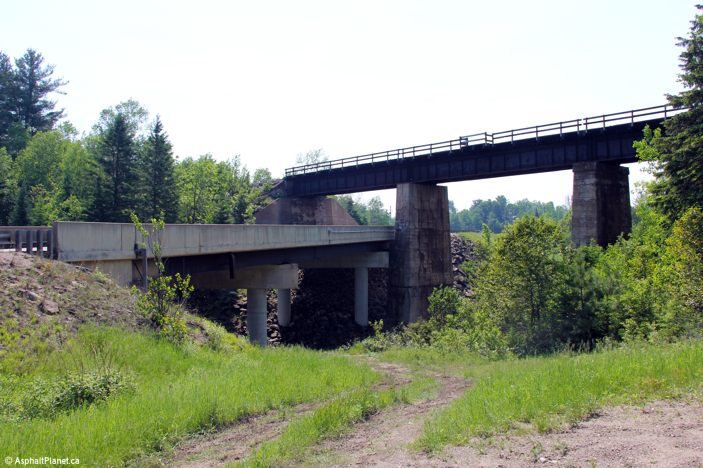
Town of Mattawa District of Nipissing |
Looking west through the narrow OVR overhead. This old and narrow
structure is located just east of Mattawa. Picture taken: July 4th, 2005.
Size: 65kb. |
 |
|
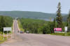
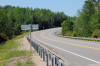
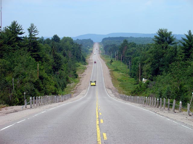
Township of Papineau-Cameron District of Nipissing |
Looking east along Highway 17 from just east of the eastern limits of the
Town of Mattawa. As evident in the photo, Highway 17 features a long
passing lane for eastbound traffic just east of Mattawa. Picture taken:
July 4th, 2005. Size: 50kb. |
 |
|
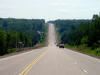
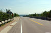
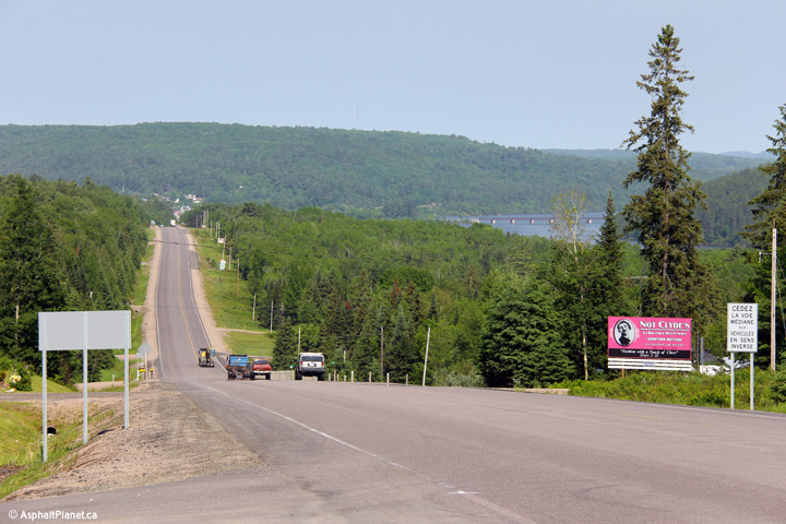
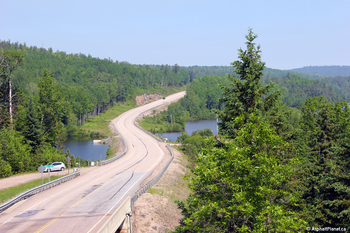
Township of Papineau-Cameron District of Nipissing |
View as Highway 17 descends a large hill into the Mattawa River Valley.
Photo taken: June 14th, 2013. |
(720x480)
(1440x960)
(2400x1600) |
|
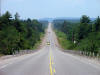
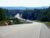
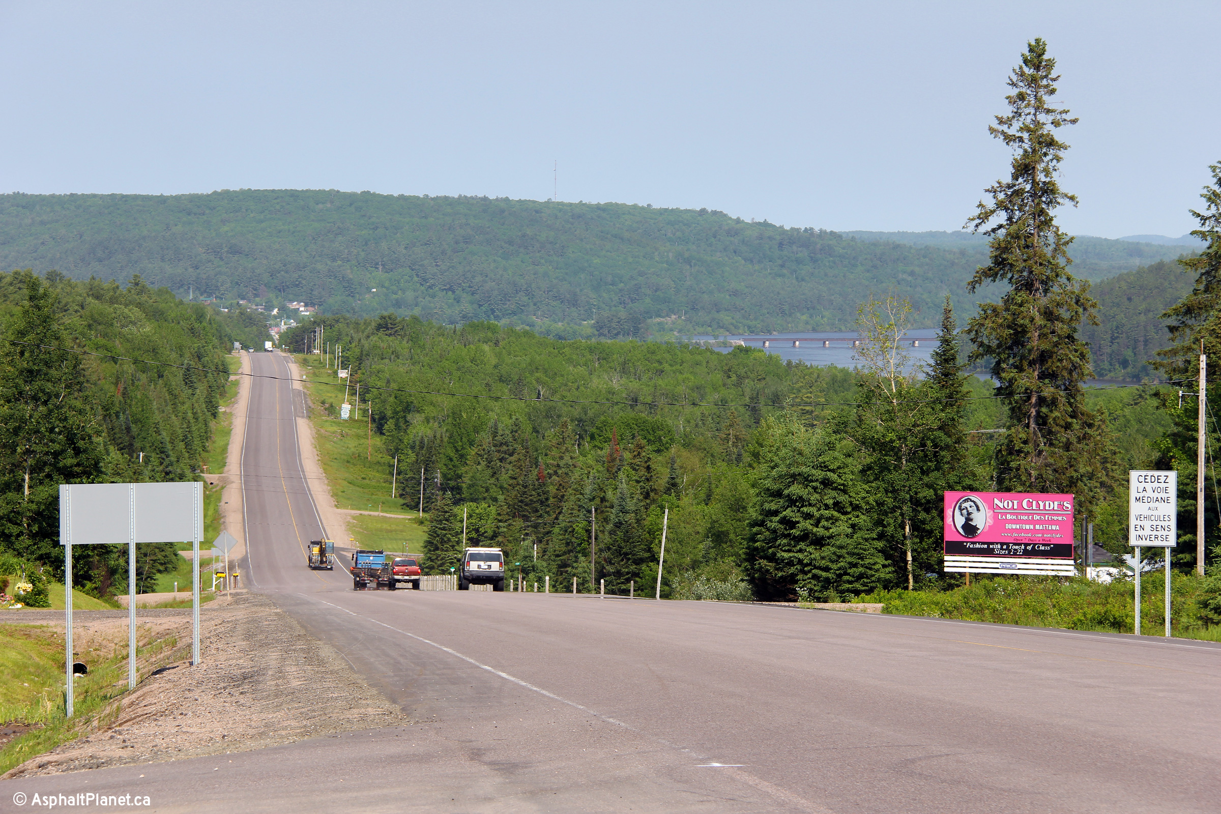
Township of Papineau-Cameron District of Nipissing |
Looking west towards Mattawa along Highway 17. This picture was taken
roughly 12km east of Mattawa. Picture taken: July 4th, 2005. Size:
60kb. |
 |
|
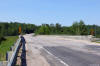
Township of Head, Clara and Maria County of Renfrew |
Looking westerly along Highway 17 from about 6km west of the Deux Rivières
CPR overhead. Though you wouldn't know it from this photo, the Ottawa River
is located just beyond the tall stand of trees to the north of the highway.
Photo taken: June 14th, 2013. |

(720x480)
(1440x960)
(2400x1600) |
|
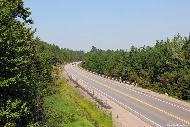
Township of Head, Clara and Maria County of Renfrew |
This view looks westerly from the western abutment of the Deux Rivières CPR
overhead. A westbound passing lane begins in this photo. Passing lanes are
frequent along this portion of Highway 17.
Photo taken: June 14th, 2013. |
(720x480)
(1440x960)
(2400x1600) |
|
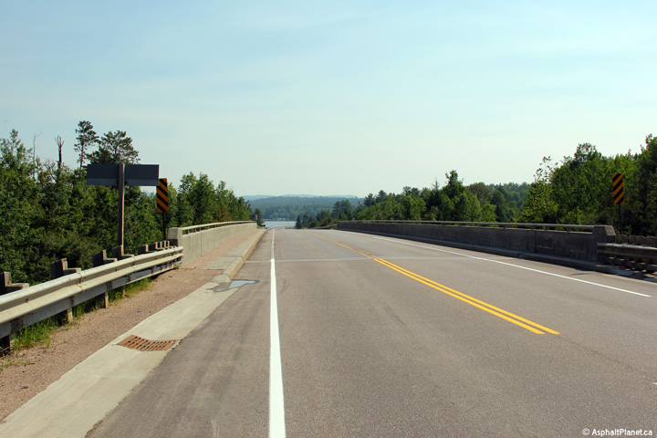
Township of Head, Clara and Maria County of Renfrew |
Easterly view across the Deux Rivières CPR overhead.
Photo taken: June 14th, 2013. |
(720x480)
(1440x960)
(2400x1600) |
|
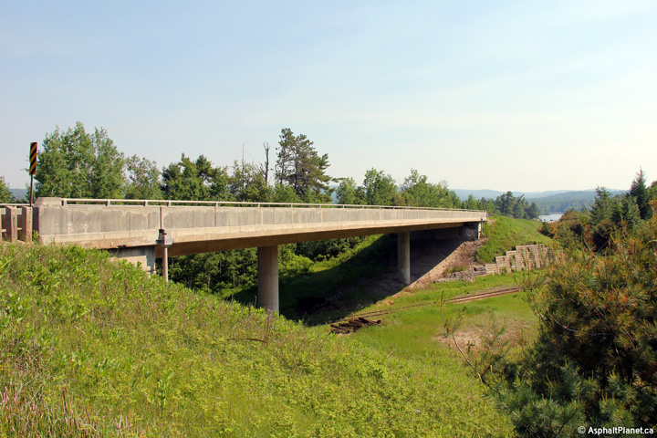
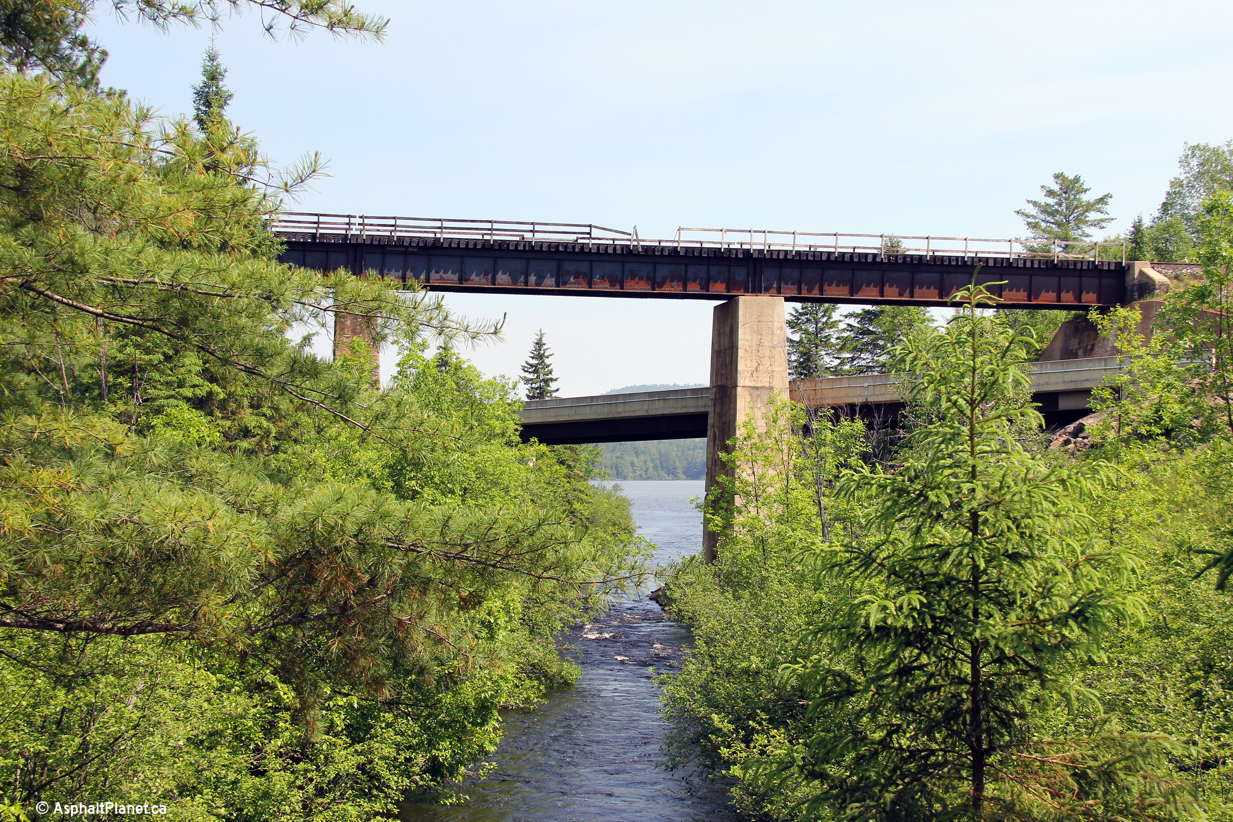
Township of Head, Clara and Maria County of Renfrew |
View looking north-east at the Deux Rivières CPR overhead. This structure
was completed in 1969, and has already been extensively rehabilitated. The
CPR beneath the structure was abandoned in 2010, though the tracks had yet
to be removed through this section when this photo was taken. With the
abandonment of the Ottawa Valley branch of the CPR, all transnational
freight traffic must be routed through Toronto.
Photo taken: June 14th, 2013. |

(720x480)
(1440x960)
(2400x1600) |
|
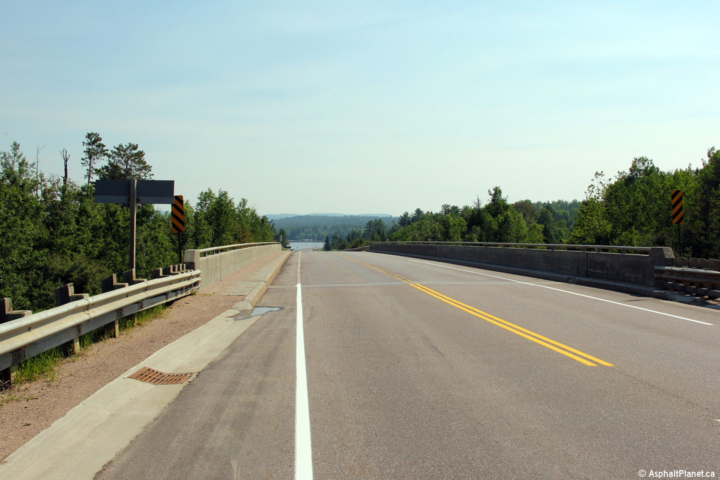
Township of Head, Clara and Maria County of Renfrew |
Westerly deck view across the Deux Rivières CPR overhead.
Photo taken: June 14th, 2013. |
(720x480)
(1440x960)
(2400x1600) |
|
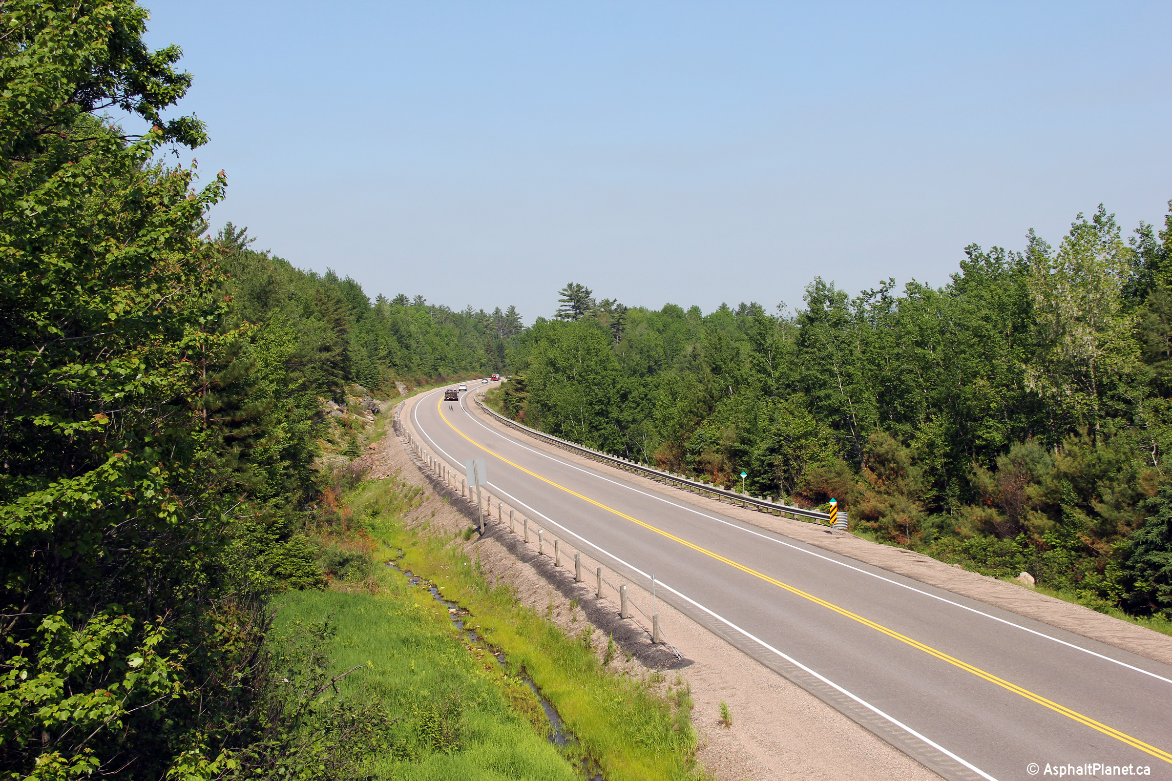
Township of Head, Clara and Maria County of Renfrew |
Easterly view from the top of the Deux Rivières CPR overhead along Highway
17. The Ottawa River is visible at the bottom of this long hill.
Photo taken: June 14th, 2013. |

(720x480)
(1440x960)
(2400x1600) |
|
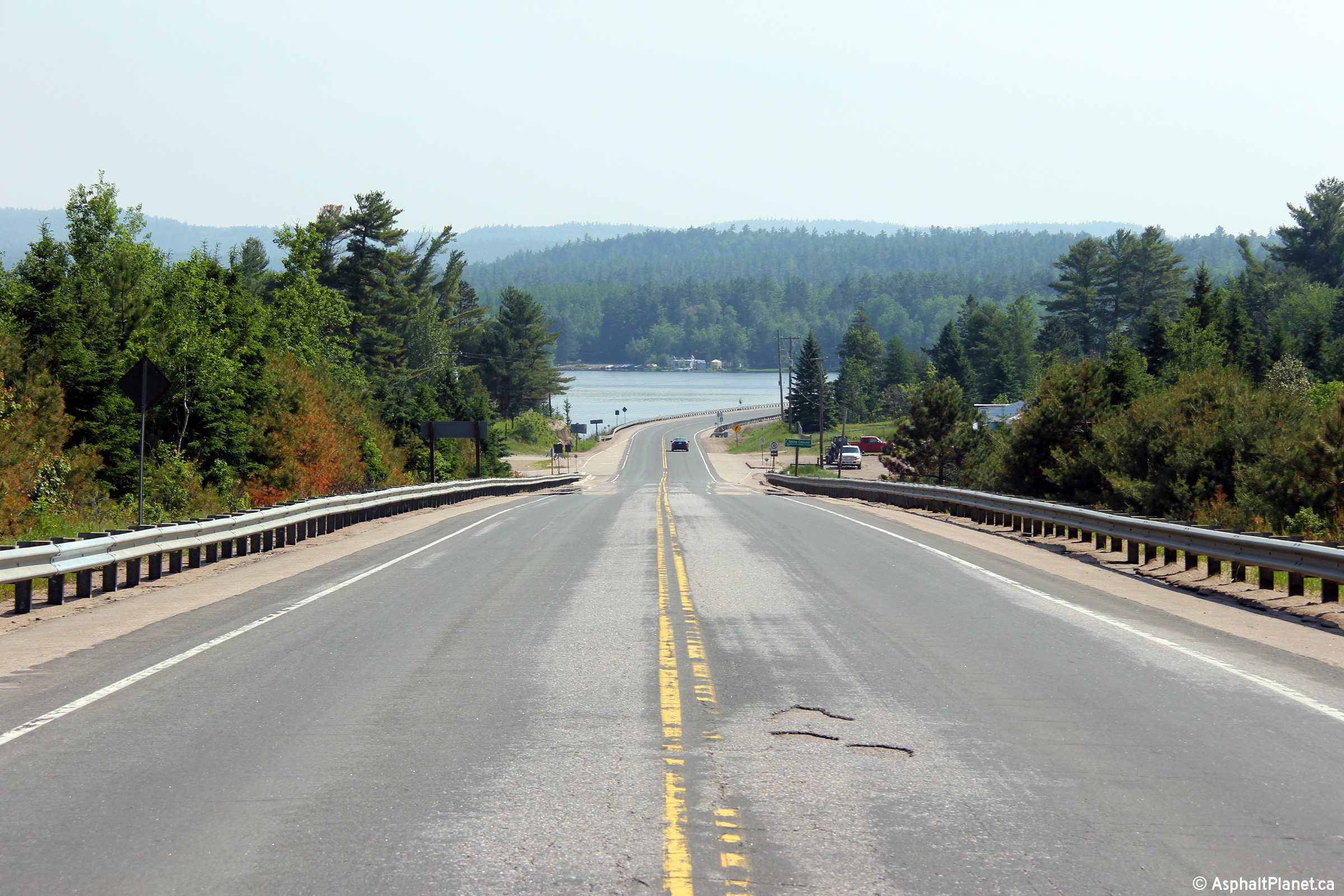
Township of Head, Clara and Maria County of Renfrew |
Looking westerly as Highway 17 passes overtop of a short causeway overtop of
the Ottawa River approaching Deux Rivières. |

(720x480)
(1440x960)
(2400x1600) |
|
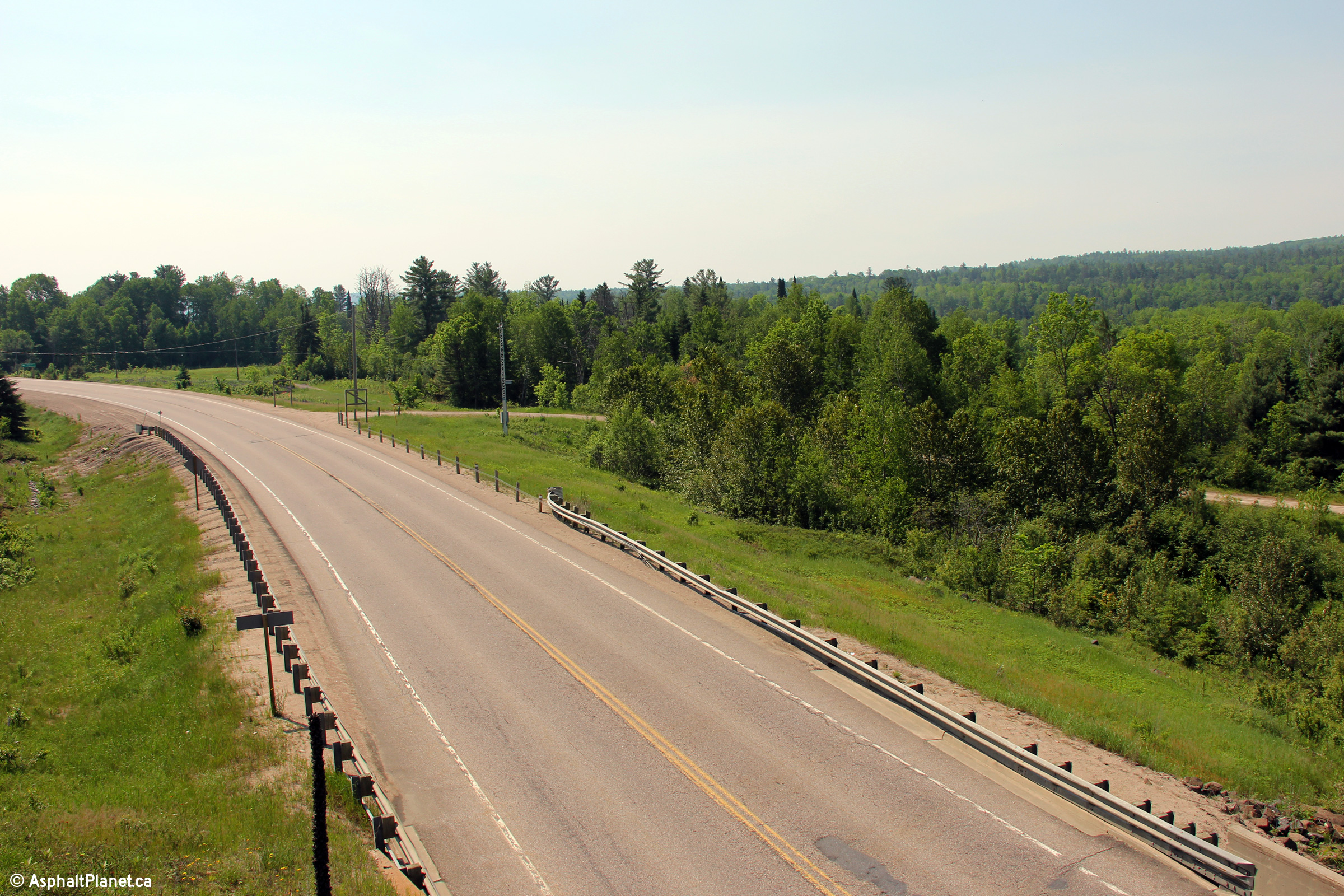
Township of Head, Clara and Maria County of Renfrew |
Looking east along Highway 17 in the vicinity of Bissett Creek.
Highway 17 was extensively rehabilitated between Deux Rivieres and Bissett
Creek in 2002. This construction included the addition of two
eastbound and westbound passing lanes to the highway.
Picture taken: July 4th, 2005. Size: 50kb. |
 |
|
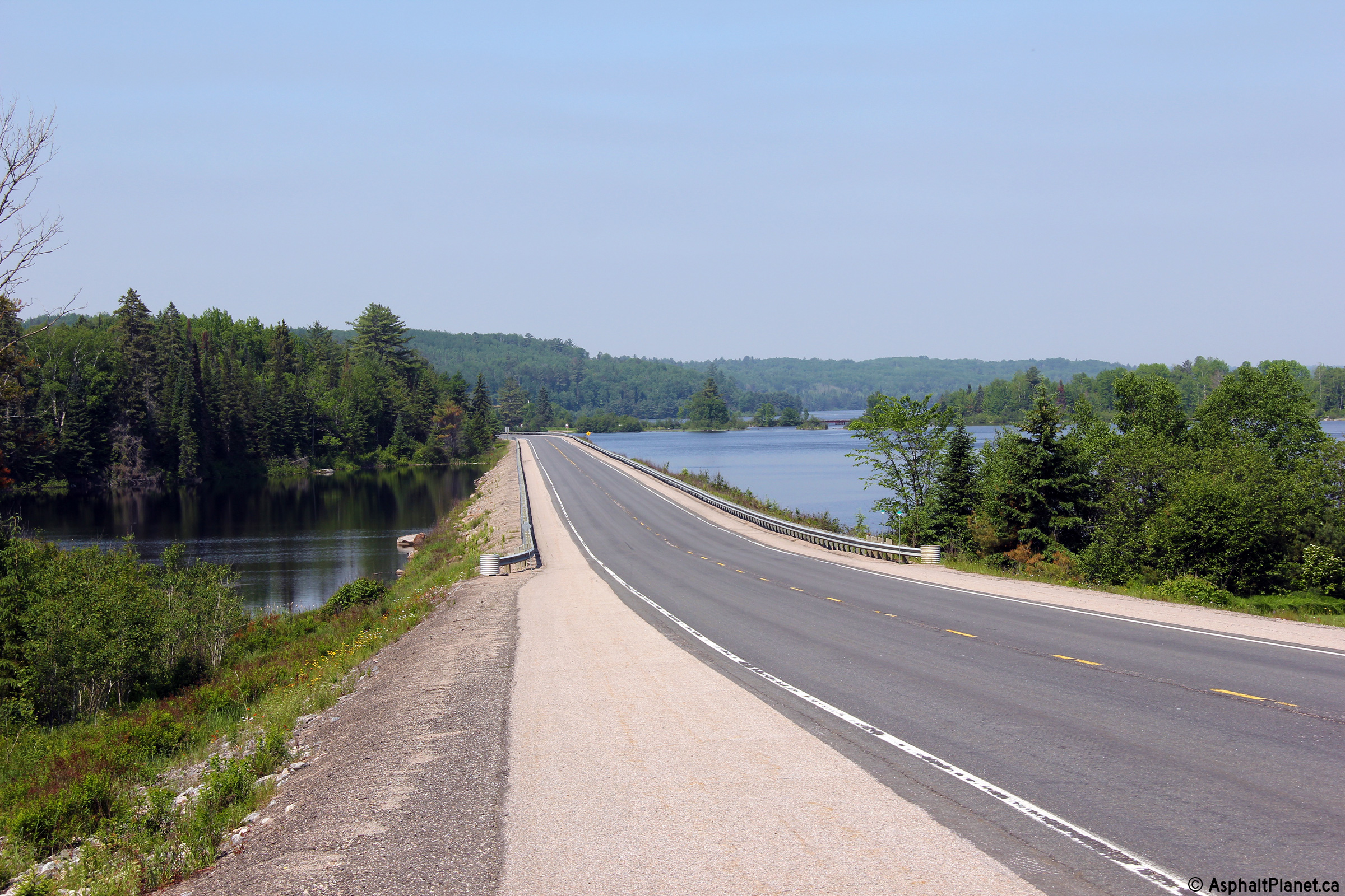
Township of Head, Clara and Maria County of Renfrew |
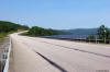
Scenic view of the Ottawa River from just west of Bissett Creek.
Photo taken: June 14th, 2013. |
(720x480)
(1440x960)
(2400x1600) |
|
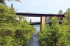
Township of Head, Clara and Maria County of Renfrew |
Westerly view along Highway 17 from overtop of the Bissett Creek CPR Subway.
A construction contract was called later in 2013 to replace the
deteriorated pavement along this stretch of Highway 17.
Photo taken: June 14th, 2013. |

(720x480)
(1440x960)
(2400x1600) |
|
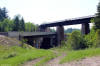
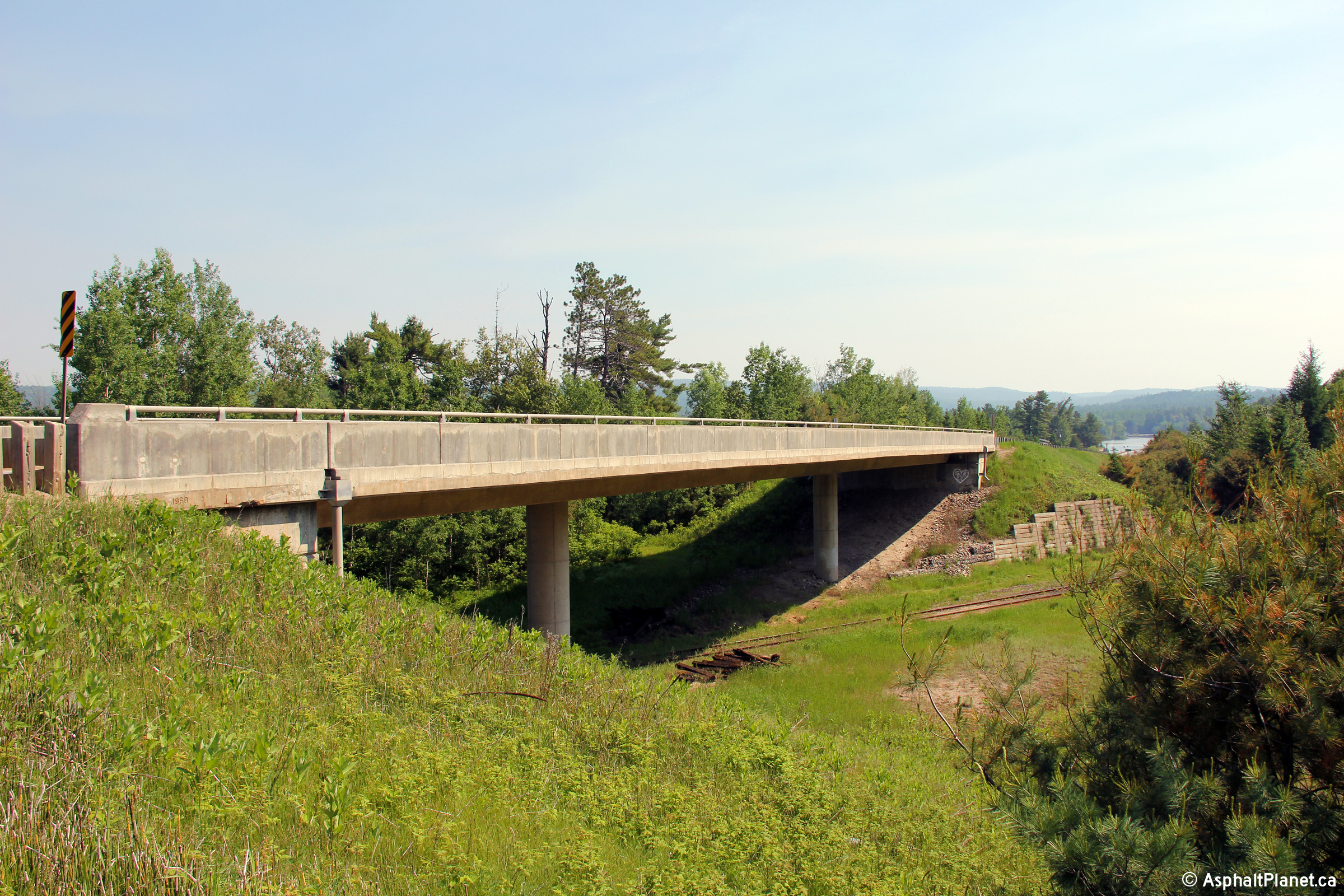
Township of Head, Clara and Maria County of Renfrew |
Highway 17 underneath the CPR using a high-level multi-span bridge that
carries the CPR overtop the Bissett Creek Valley. The CPR's Bissett
Creek bridge was constructed several decades before Highway 17 was built
through the Upper Ottawa Valley.
Photos taken: June 14th, 2013. |
(720x480)
(1440x960)
(2400x1600)
(720x480)
(1440x960)
(2400x1600) |
|
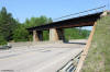
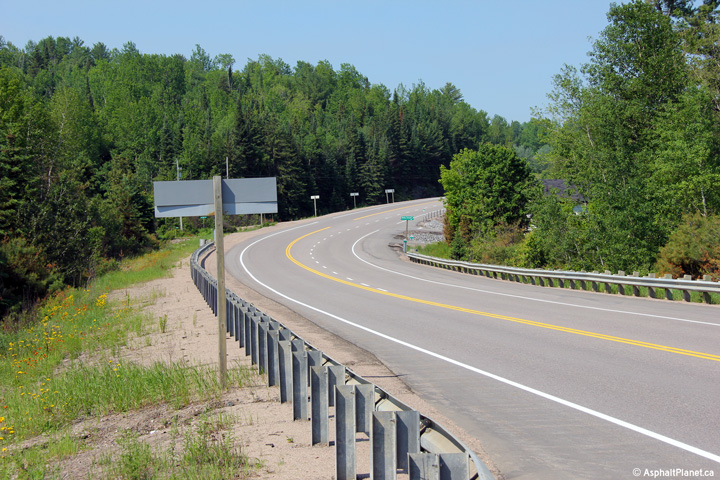
Township of Head, Clara and Maria County of Renfrew |
Easterly view along Highway 17 from the Bissett Creek CPR subway.
Photo taken: June 14th, 2013. |

(720x480)
(1440x960)
(2400x1600) |
|
Township of Head, Clara and Maria County of Renfrew |
Two views looking westerly through the Bissett Creek subway.
Photos taken: June 14th, 2013. |
(720x480)
(1440x960)
(2400x1600)
(720x480)
(1440x960)
(2400x1600) |
|
Highway 17 images continue easterly via
Page 4C |
 (720x480)
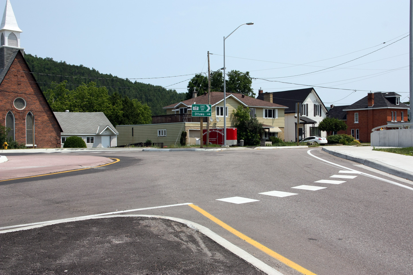
 (720x480)
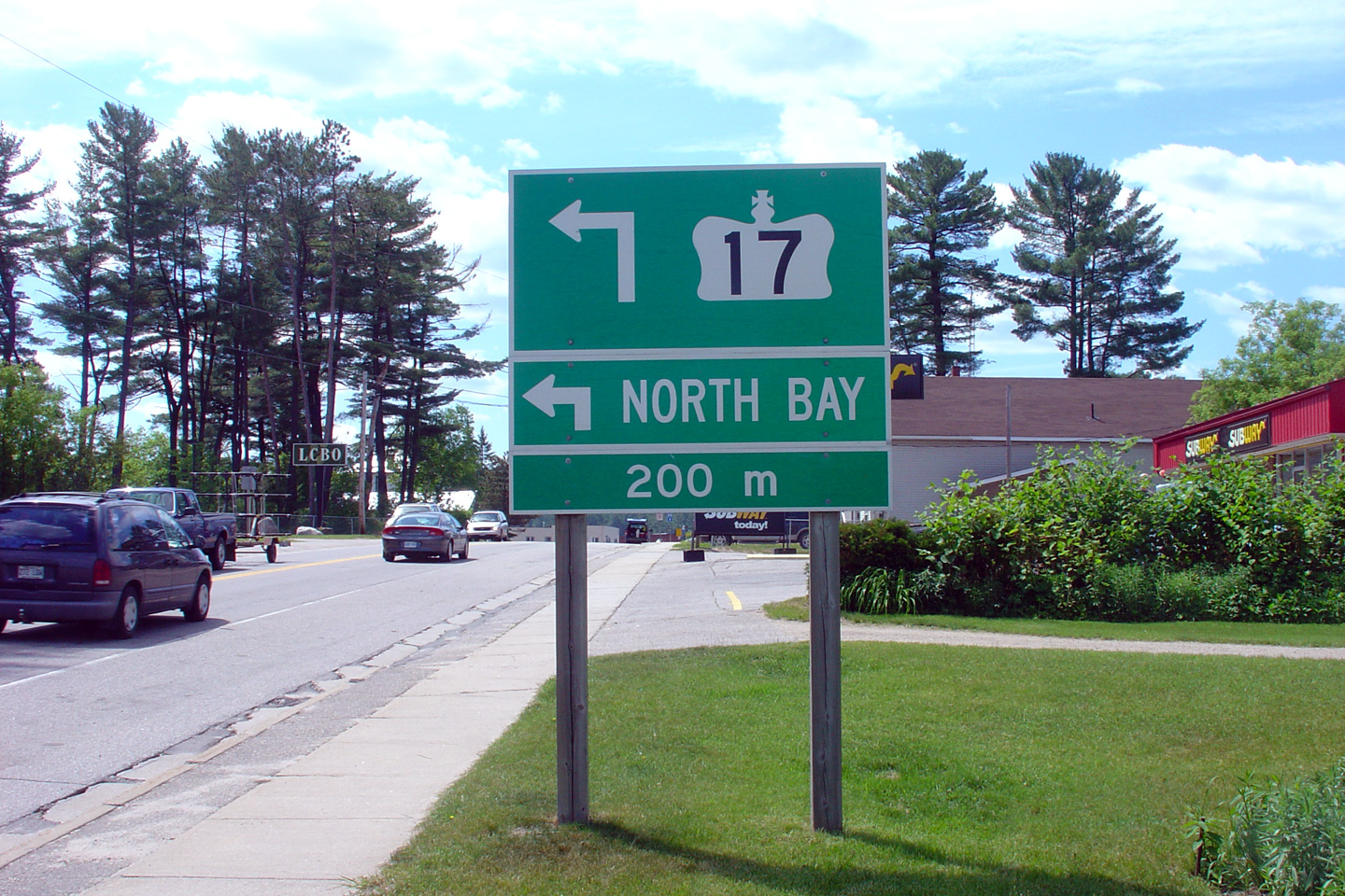
 (720x480)
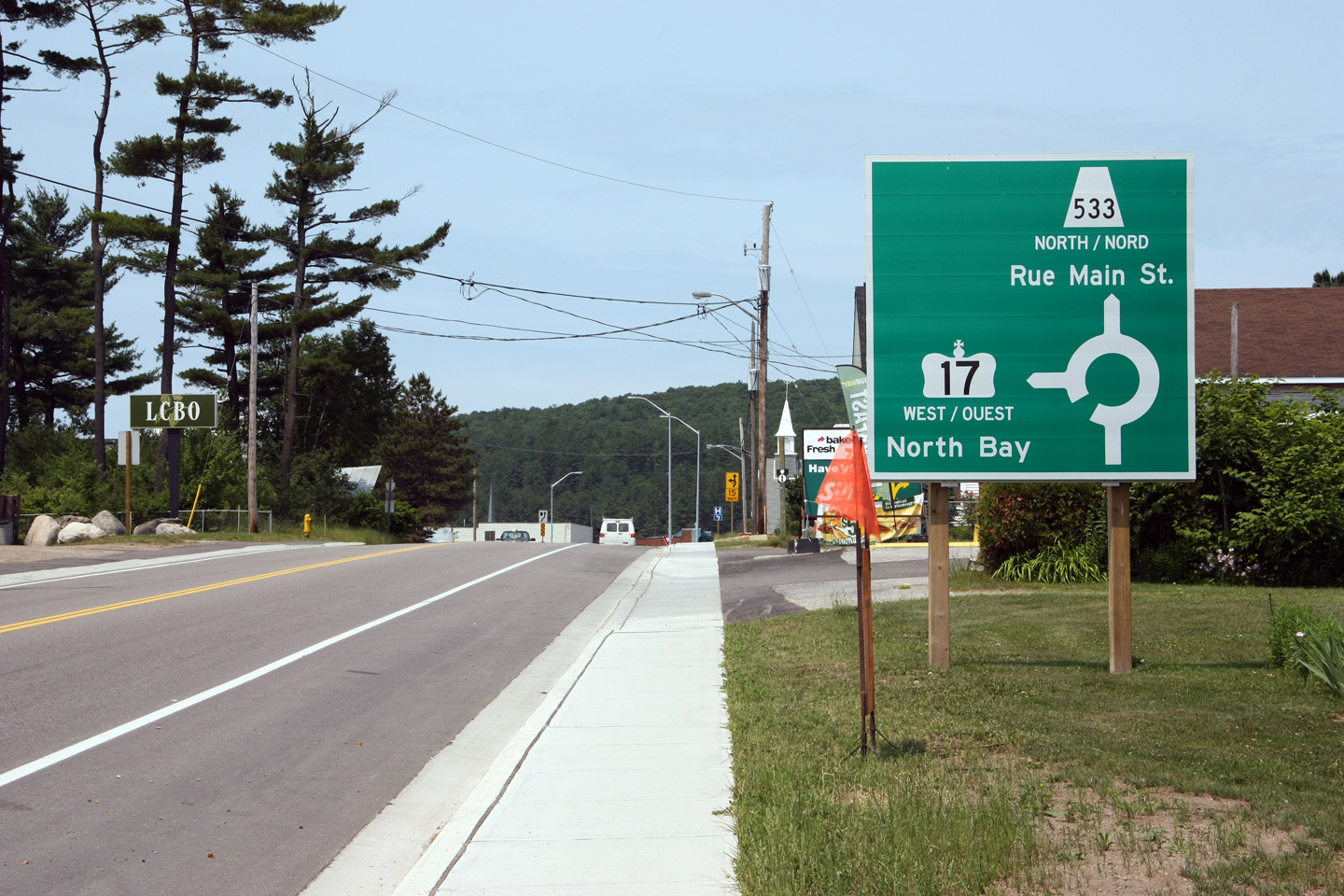


