|
Proper Municipality Name |
Community Name |
Distance |
Intersecting Road |
|
Continued from Highway 2
Page 3 |
|
In Frontenac County (Rural Kingston) Highway 2 is
known as Frontenac Road 2 |
| City of Kingston |
Barriefield |
643.7 km / 199.9 km |
Highway 15 (Frontenac Road 15) |
| City of Kingston |
King Pitt |
--- |
----- |
| City of Kingston |
Pitts Ferry |
--- |
----- |
| City of Kingston |
----- |
--- |
Joyceville Road |
| City of Kingston |
----- |
646.7 km / 187.9 km |
Howe Island Ferry Road (Frontenac Road
16) |
| City of Kingston |
----- |
649.3 km / 185.2 km |
Middle Road (Formerly Frontenac Road 15) |
|
Kingston (Frontenac County) -
Leeds and Grenville Boundary. In Kingston Highway 2 is known as County
Road 2. In Leeds and Grenville, Highway 2 is known as Leeds &
Grenville Road 2 |
| Township of Leeds and the Thousand Islands |
Willowbank |
--- |
----- |
| Township of Leeds and the Thousand Islands |
----- |
658.4 km / 176l2 km |
Howe Island Ferry Road (Leeds & Grenville Road
37) |
|
Heading EB into downtown Gananoque, turn left to
stay on King Street (away from Main Street). Heading WB turn right to
stay on King Street, right after the Bridge |
| Town of Gananoque |
Gananoque |
661.4 km / 173.2 km |
Highway 32 (Stone
Street) |
|
Highway 2's 1998 western terminus is located at the
eastern Gananoque limits. |
| Township of Leeds and the Thousand Islands |
----- |
663. 4 km / 171.2 km |
Thousand Islands Parkway (Formerly Highway 2S) |
| Township of Leeds and the Thousand Islands |
----- |
664.1 km / 170.5 km |
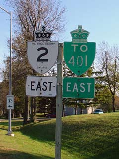
King's Highway 401 |
|
After 1998 Highway 2 ends at Highway 401. East of
Highway 401, Highway 2 is once again numbered Leeds and Grenville Road 2. |
| Township of Leeds and the Thousand Islands |
Legge |
--- |
Hiscocks Road (Leeds & Grenville Road 34) |
| Township of Leeds and the Thousand Islands |
Wilstead |
--- |
----- |
| Township of Leeds and the Thousand Islands |
Ebenezer |
--- |
----- |
| Township of Leeds and the Thousand Islands |
---- |
--- |
Reynolds Road (Leeds & Grenville Road 3) |
| Township of Leeds and the Thousand Islands |
Mitchellville |
--- |
----- |
| Township of Leeds and the Thousand Islands |
Waterton |
--- |
----- |
| Township of Leeds and the Thousand Islands |
Escott |
--- |
----- |
| Township of Front of Yonge |
Mallorytown |
--- |
Leeds & Grenville Road 4 |
| Township of Front of Yonge |
Mallorytown |
--- |
Mallorytown Road (Leeds & Grenville Road
5-South) |
| Township of Front of Yonge |
----- |
--- |
Leeds & Grenville Road 5-North |
| Township of Front of Yonge |
----- |
--- |
Yonge Mills Road (Leeds & Grenville Road 27) |
| Front of Yonge - Elizabethtown- Kitley Boundary |
Sherwood Springs |
--- |
----- |
| Township of Elizabethtown- Kitley
|
----- |
701.9 km / 132.8 km |
Kings Highway 401 |
| Township of Elizabethtown- Kitley |
----- |
708.2 km / 126.4 km |
Lyn Road (Leeds & Grenville Road 46) |
| City of Brockville |
Brockville |
711.2 km / 123.3 km |
Highway 29 (Leeds
& Grenville Road 29, Court House Avenue) |
| City of Brockville |
Brockville |
--- |
North Augusta Road |
| Township of Augusta |
Maitland |
719.3 km / 115.6 km |
Maitland Road (Leeds & Grenville Road 15) |
| Township of Augusta |
----- |
721.3 km / 113.3 km |
Brockchem Road (Leeds & Grenville Road 45) |
| Township of Augusta |
Blue Church |
725.4 km / 109.1 km |
Blue Church Road (Leeds & Grenville Road 31) |
| Township of Augusta |
Riverview Heights |
--- |
----- |
| Town of Prescott |
Prescott |
--- |
Edward Street |
| Township of Edwardsburgh/Cardinal |
Johnstown |
736.0 km / 98.6 km |
King's Highway 16 |
| Township of Edwardsburgh/Cardinal |
Cardinal |
744.7 km / 89.9 km |
Shanly Road (Leeds & Grenville Road 22-South) |
| Township of Edwardsburgh/Cardinal |
Cardinal |
745.0 km / 89.6 km |
Bridge Street (Leeds & Grenville Road 22-North) |
|
Leeds & Grenville - Stormont, Glengarry & Dundas
Boundary (S G & D). In Leeds & Grenville Highway 2 is known as Leeds &
Grenville Road 2. In S G & D, Highway 2 has been re-designated S G & D
Road 2 |
| Township of South Dundas |
Iroquois |
753.3 km / 81.2 km |
Carman Road (S G & D Road 1) |
| Township of South Dundas |
----- |
755.5 km / 79.1 km |
S G & D Road 16 |
| Township of South Dundas |
----- |
757.6 km / 76.9 km |
Lakeshore Drive (S G & D Road 4) |
| Township of South Dundas |
Morrisburg |
765.9 km / 68.7 km |
Highway 31 (S G & D Road 31)
& Ottawa Street (S G & D Road 4) |
| Township of South Dundas |
----- |
770.6 km / 63. 8 km |
Church Road (S G & D Road 8) |
| Township of South Dundas |
Riverside Heights |
--- |
----- |
| Township of South Stormont |
Ingleside |
785.4 km / 49.2 km |
S G & D Road14 |
| Township of South Stormont |
----- |
--- |
Long Sault Parkway |
| Township of South Stormont |
----- |
790.0 km / 43.7 km |
Whales Road (S G & D Road 12) |
| Township of South Stormont |
Long Sault |
793.4 km / 41.2 km |
Moulinette Road Road (S D & G Road 35) & Long
Sault Parkway |
| Township of South Stormont |
Long Sault |
793.8 km / 40.8 km |
Milles Roches Road (S G & D Road 36) |
| Township of South Stormont |
Lakeview Heights |
796.5 km / 38.1 km |
Avonmore Road (S G & D Road 15) |
|
City of Cornwall West Limits. Cornwall is not
incorporated into S G & D County Road system, Highway 2 enters Cornwall from
the west as Vincent Massey Road |
| City of Cornwall |
----- |
--- |
Link Road |
| City of Cornwall |
----- |
--- |
Power Damn Drive |
| City of Cornwall |
Cornwall |
--- |
Tollgate Road |
|
At Highway 138
North: EB: Ramp to the Right onto Brookdale Avenue SB. WB: Turn
left onto Vincent Massey Drive |
| City of Cornwall |
Cornwall |
804.7 km / 29.9 km |
King's Highway 138-North (Brookdale Avenue) |
| City of Cornwall |
Cornwall |
--- |
9th Street |
|
Brookdale Traffic Circle |
|
EB: Exit Highway 138 to the right directly after the
traffic circle towards downtown. WB: Highway 138 joins Highway 2 (Brookdale
Avenue) from the left. |
| City of Cornwall |
Cornwall |
--- |
King's Highway 138-South |
|
At 2nd Street/Brookdale Avenue Intersection: EB:
Turn Left at 2nd Street. WB: Turn Right onto Brookdale Avenue North. |
| City of Cornwall |
Cornwall |
--- |
2nd Street (West) & Brookdale Avenue (South) |
| City of Cornwall |
Cornwall |
--- |
McConnell Avenue |
|
EB: Turn Right onto Boundary Road.
WB: Turn left onto 2nd Street. |
| City of Cornwall |
Cornwall |
813.5 km / 12.0 km |
Boundary Road |
|
EB: Turn Left onto Montreal Road
and back onto S G & D Road 2. WB: Turn right onto Boundary Road.
City of Cornwall is not included in County Road network. |
| Township of South Glengarry |
Glen Walter |
--- |
Rae Road |
| Township of South Glengarry |
----- |
822.7 km / 11.8 km |
Summerstown Road (S G & D Road 27) |
| Township of South Glengarry |
Summerstown |
--- |
----- |
| Township of South Glengarry |
South Lancaster |
--- |
----- |
| Township of South Glengarry |
Lancaster |
834.6 km / 0 km |
King's
Highway 401 (Autoroute Macdonald-Cartier Freeway) & Highway 34 (S G & D Road 34) |
|
King's Highway 2 ENDS |