AsphaltPlanet.ca > California > Interstate 405
Pictures on this
page are arranged in order from west to east. I-405 East photos are
left-aligned in the last column, while I-405 West photos are right-aligned.
Center-line pictures are centered within the last column.
|
Location |
Description |
Photo |
||
|
North- |
South- |
|||
|
Orange County |
View looking northerly as the carpool lane flyover from CA-55 South passes over the northbound lanes of Interstate 405. |
 |
||
|
Date: 12/17/2014 |
High-res: (1440x960) (2400x1600) | |||
|
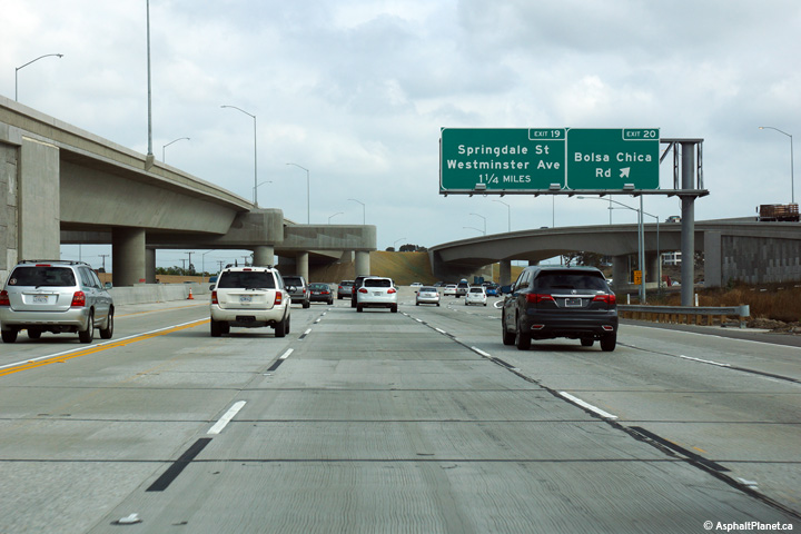
Orange County |
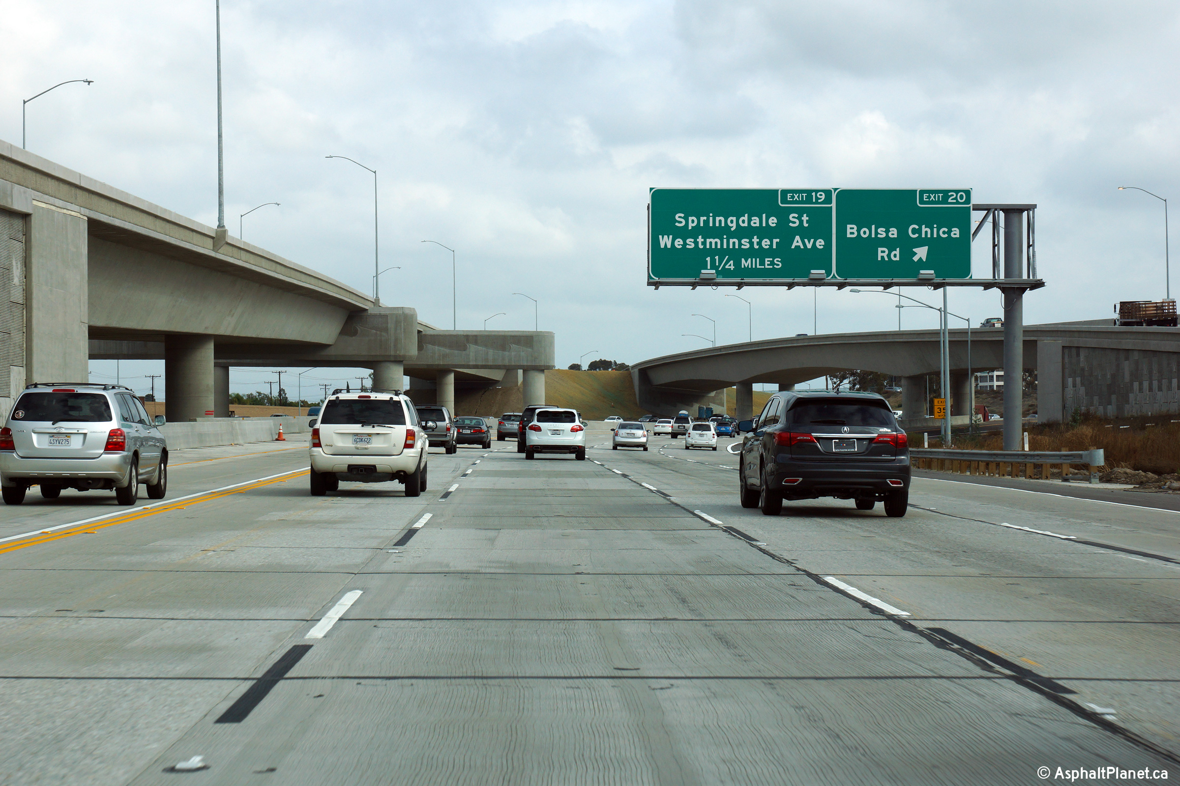
Northbound interchange sequence signage located just beyond the northbound off-ramp to Westminster Boulevard. |
 |
||
|
Date: 12/17/2014 |
High-res: (1440x960) (2400x1600) | |||
|
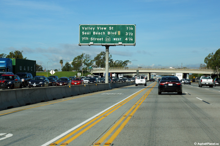
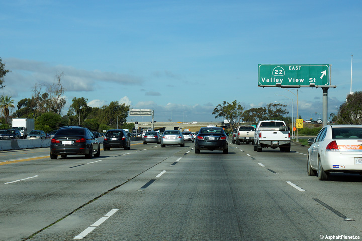
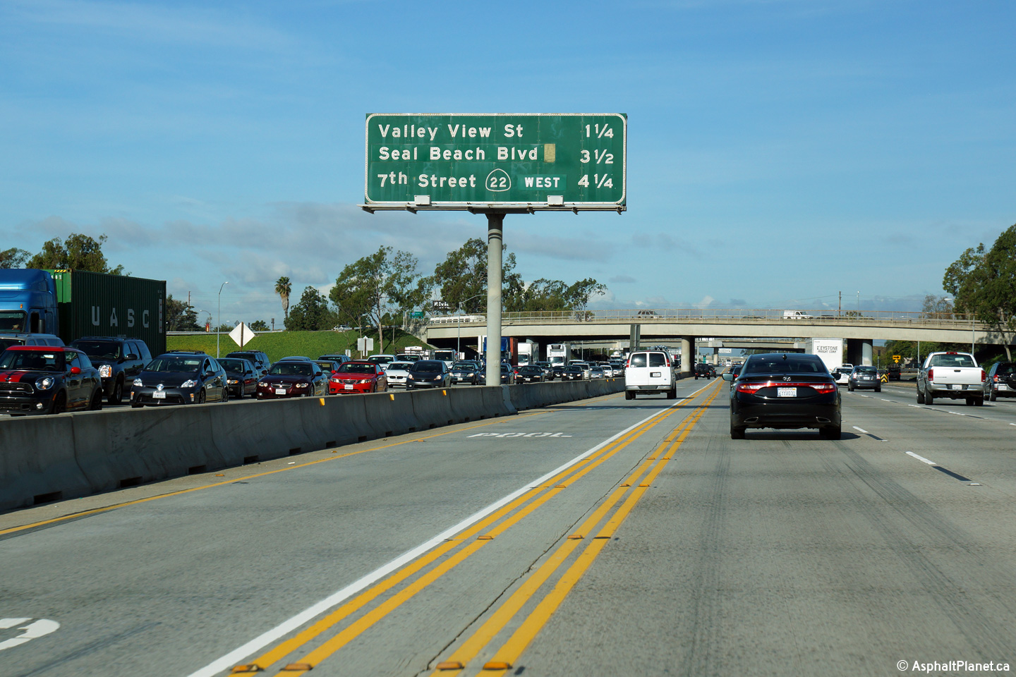
Orange County |
Northerly view at the off-ramp to Valley View Street. Motorists bound for the eastbound lanes of SR-22 must pass through a traffic signal at the end of the ramp terminal in order to do so. |
 |
||
|
Date: 12/17/2014 |
High-res: (1440x960) (2400x1600) | |||
|
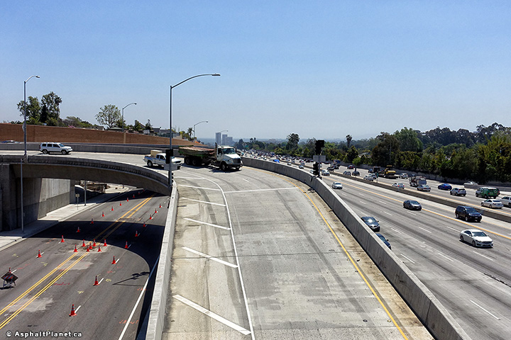
Orange County |
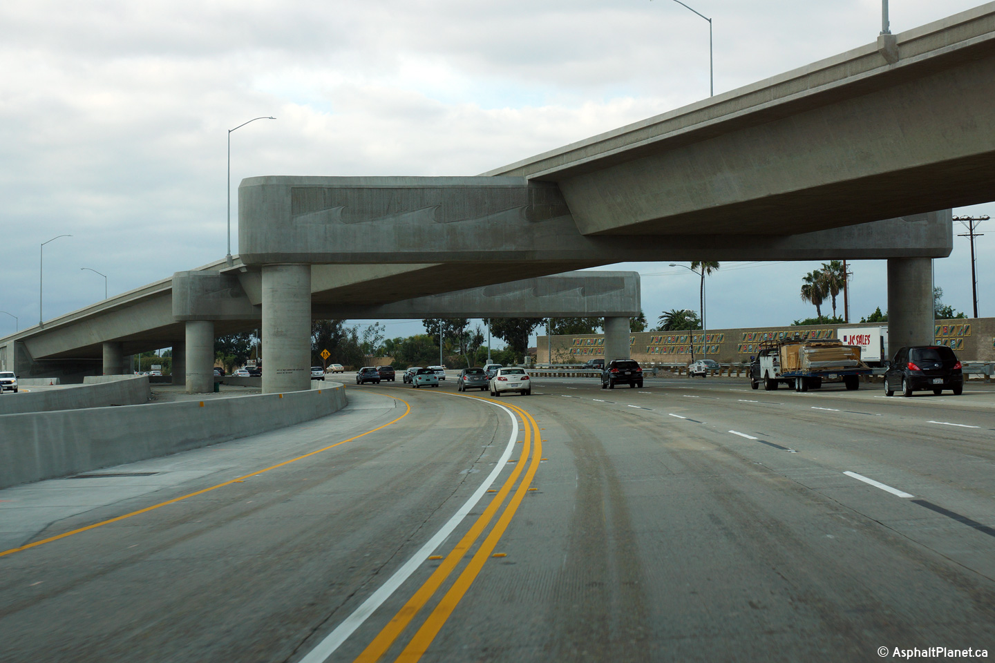
Northerly view as the 405 passes beneath the flyover ramp that carries carpool lanes between the respective medians of SR-22 and I-405. This large structure was completed and placed into service during a large multiyear construction project that was finished in 2014. |
 |
||
|
Date: 12/11/2014 |
High-res: (1440x960) (2400x1600) | |||
|
Orange County |
Southbound signage at the off-ramp to Bolsa Chica Road. The off-ramp to Bolsa Chica Road is located within the footprint of the eastern SR-22 interchange. |
 |
||
|
Date: 12/11/2014 |
High-res: (1440x960) (2400x1600) | |||
|
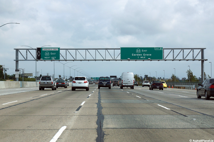
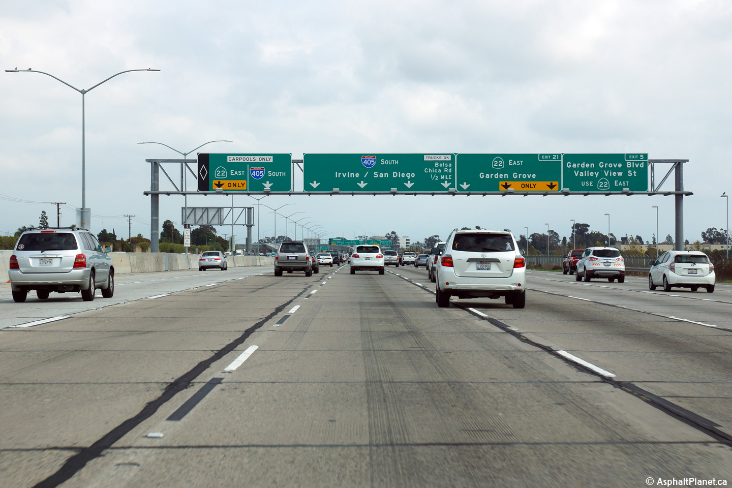
Orange County |
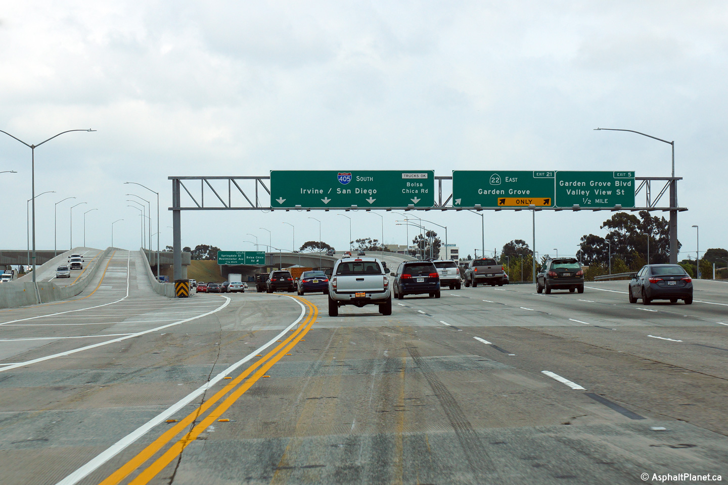
Southbound guide signage at the off-ramp to the Garden Grove Freeway. Three general purpose highway lanes exit from the right of the freeway, while a single carpool lane exits to the left of the freeway. |
 |
||
|
Date: 12/11/2014 |
High-res: (1440x960) (2400x1600) | |||
|
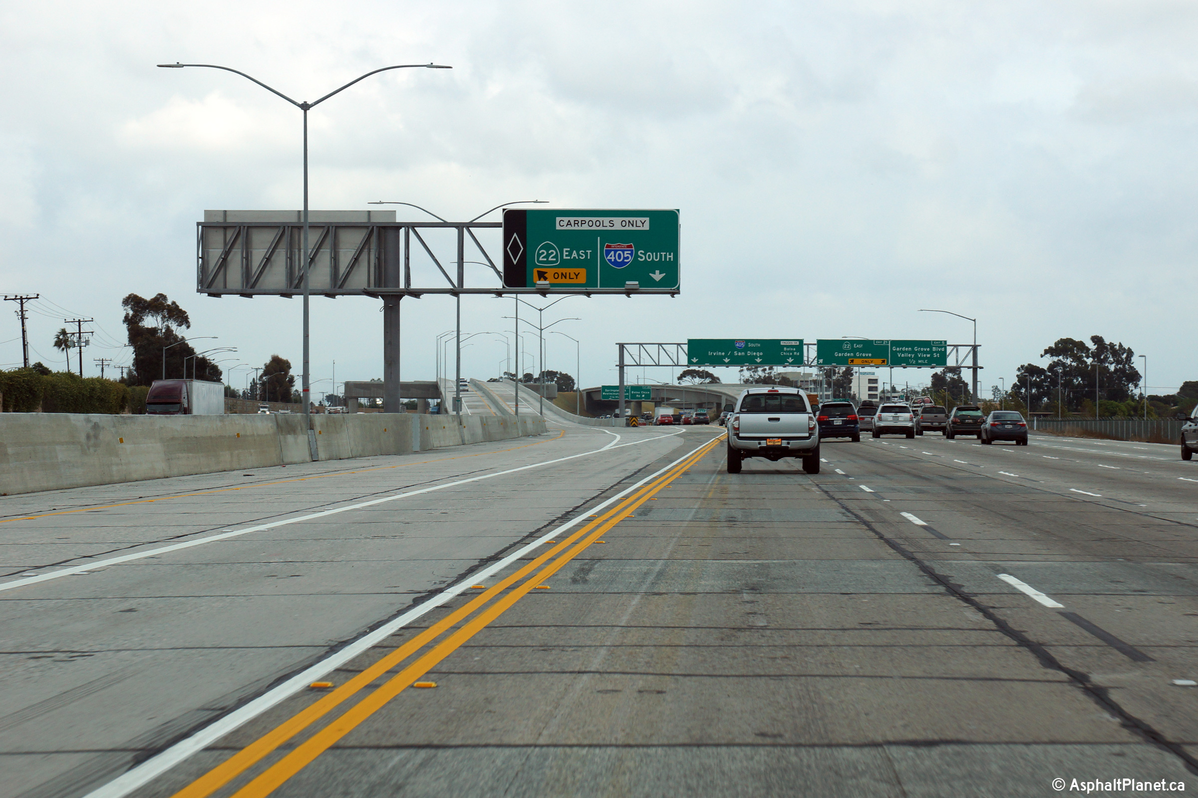
Orange County |
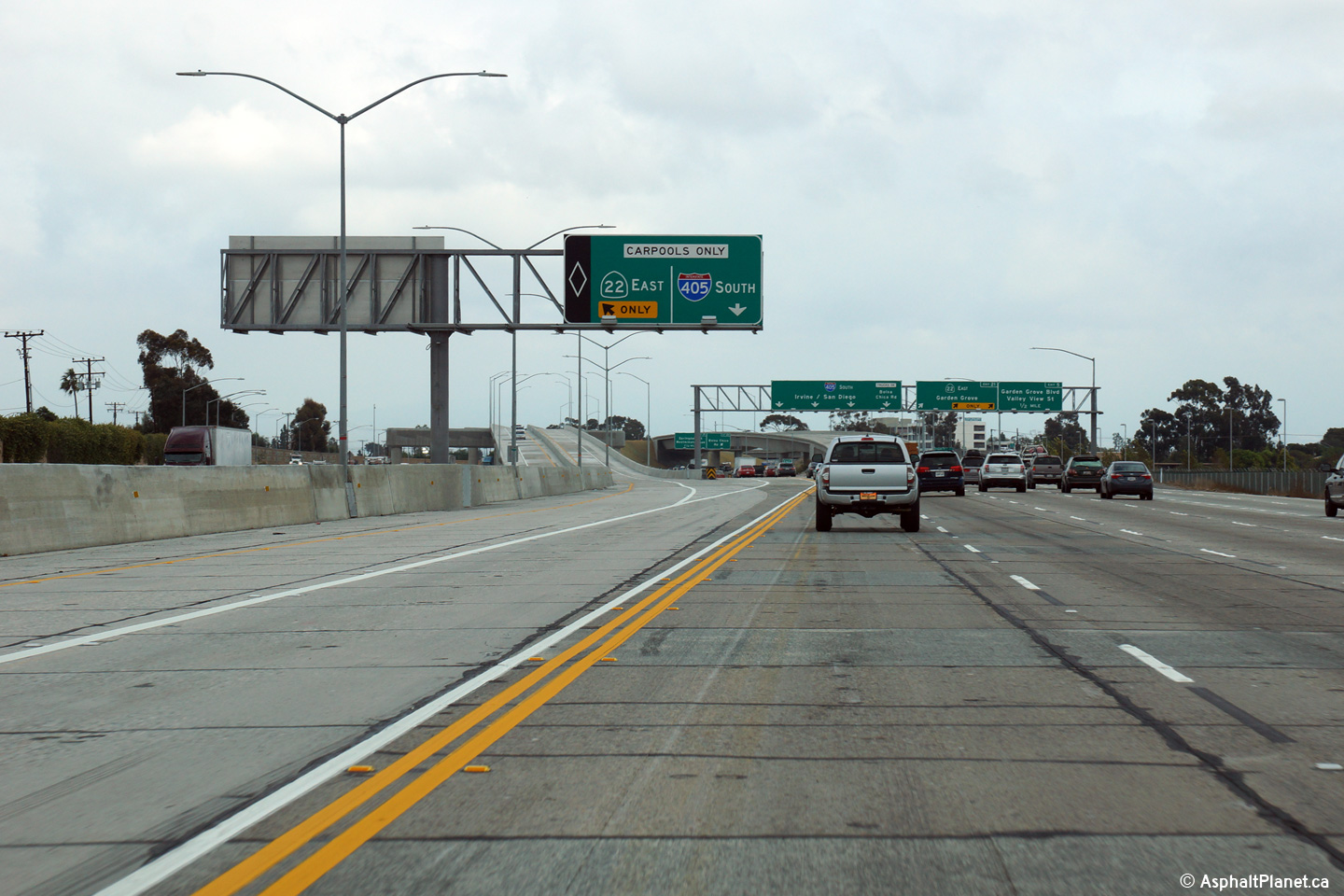
Overhead signage for the carpool lane ramp the eastbound lanes of the Garden Grove Freeway. |
 |
||
|
Date: 12/11/2014 |
High-res: (1440x960) (2400x1600) | |||
|
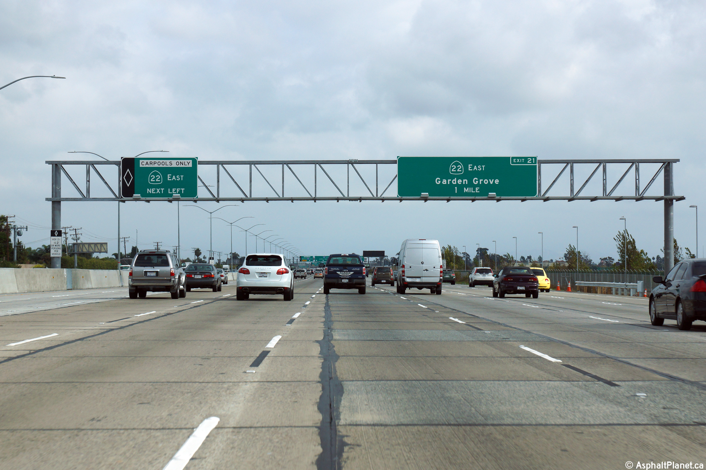
Orange County |
Southbound advanced signage approaching the Garden Grove Freeway (SR-22). |
 |
||
|
Date: 12/11/2014 |
High-res: (1440x960) (2400x1600) | |||
|
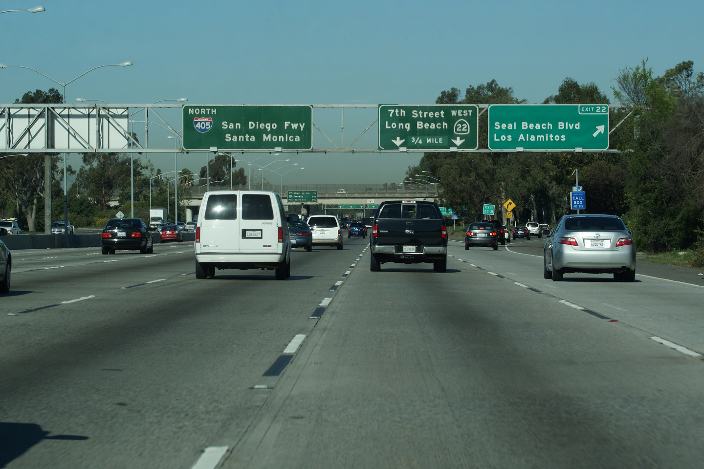
Orange County |
This southbound advanced signage is situated immediately to the east of the Seal Beach Boulevard interchange. |
 |
||
|
Date: 12/11/2014 |
High-res: (1440x960) (2400x1600) | |||
|
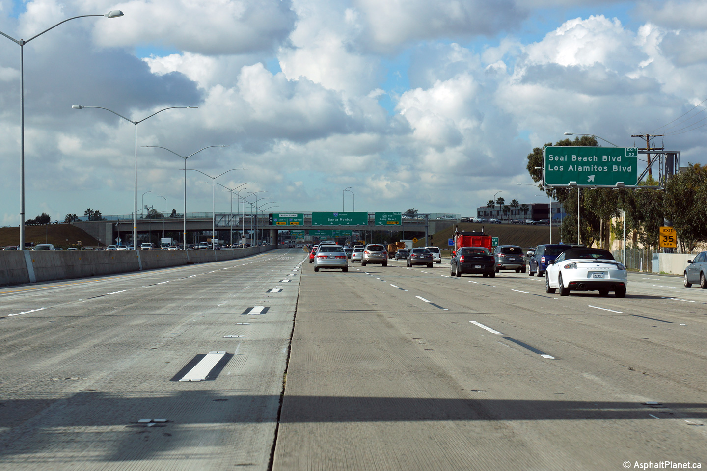
Orange County |
Overhead guide signage at the off-ramp to Seal Beach Boulevard. Before the 405 was widened, the off-ramp to Seal Beach Boulevard was signed with a pull-through signage for the upcoming western SR-22 interchange. Click here for a photo of the former signage, taken in April, 2010. |
 |
||
|
Date: 12/17/2014 |
High-res: (1440x960) (2400x1600) |
|||
|
Orange County |
The overhead signage in advance of the western SR-22 interchange is located immediately adjacent to the Seal Beach Boulevard overpass. This overhead signage replaces an older interchange sequence signage that was previously situated at this location. |
 |
||
|
Date: 12/17/2014 |
High-res: (1440x960) (2400x1600) | |||
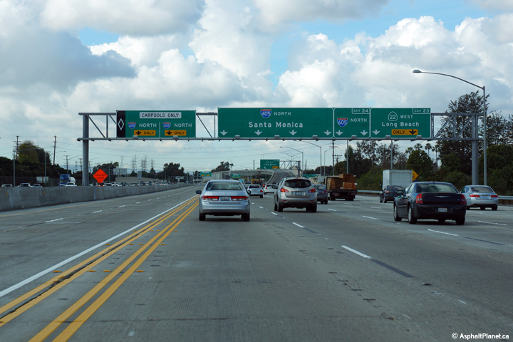
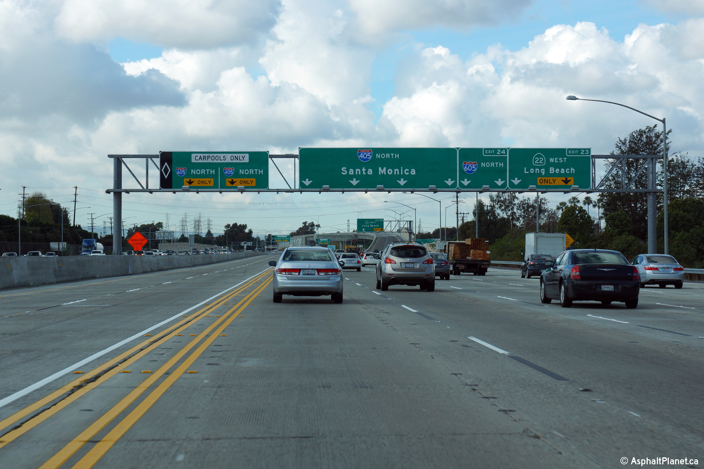
|
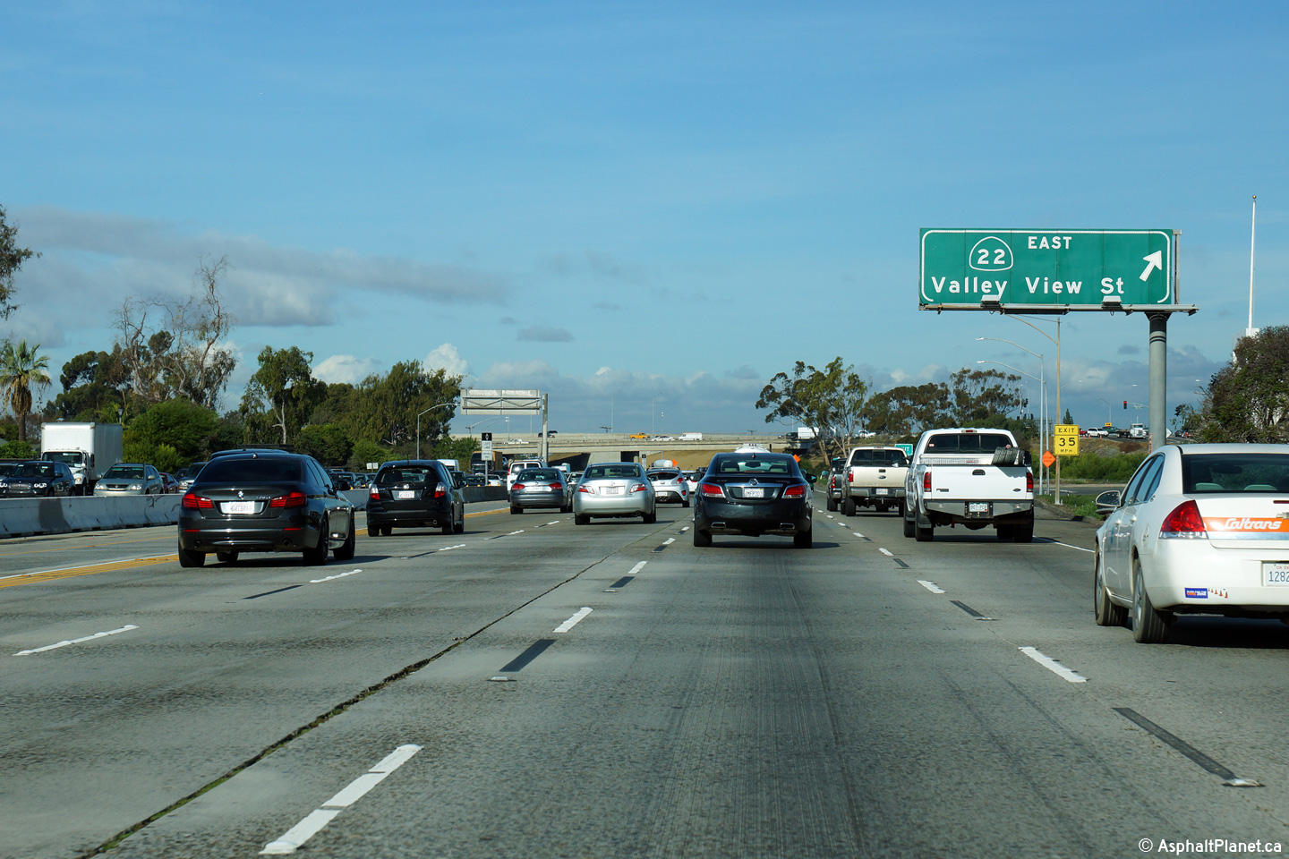
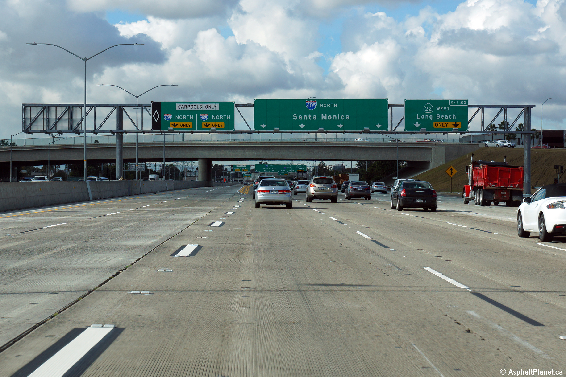
Orange County |
Advanced signage for both the western extension of Highway 22 and the 605 Freeway. The 405 meets both the 22 and 605 Freeways in short succession. Click here for a photo of the signage that previously stood at this location before the 405 was widened through the interchange, taken in April, 2010. |
 |
||
|
Date: 12/17/2014 |
High-res: (1440x960) (2400x1600) |
|||
|
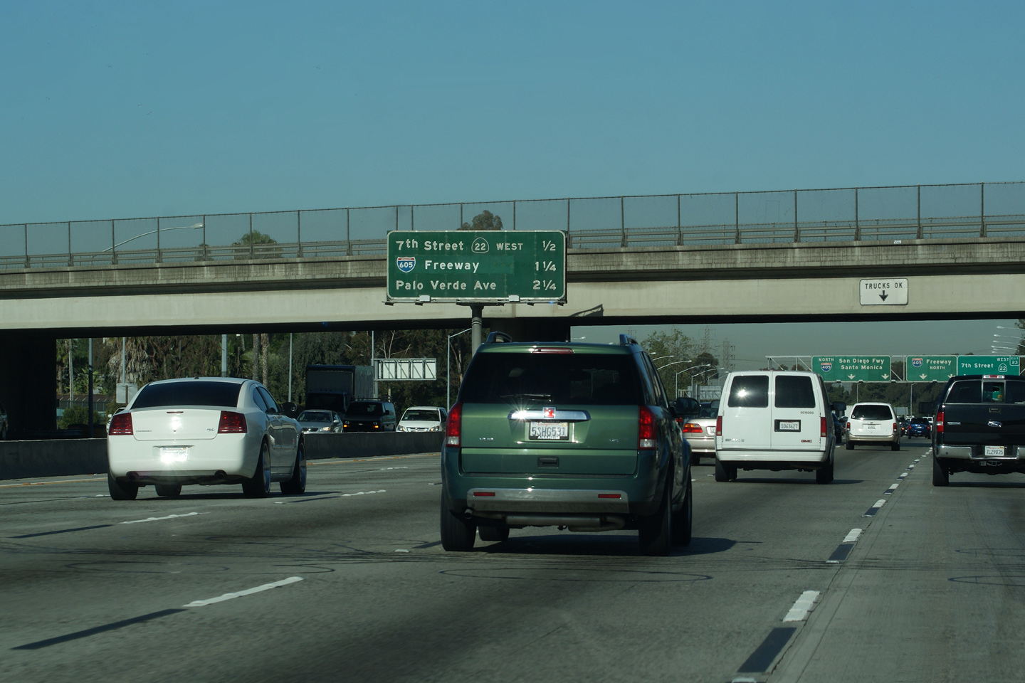
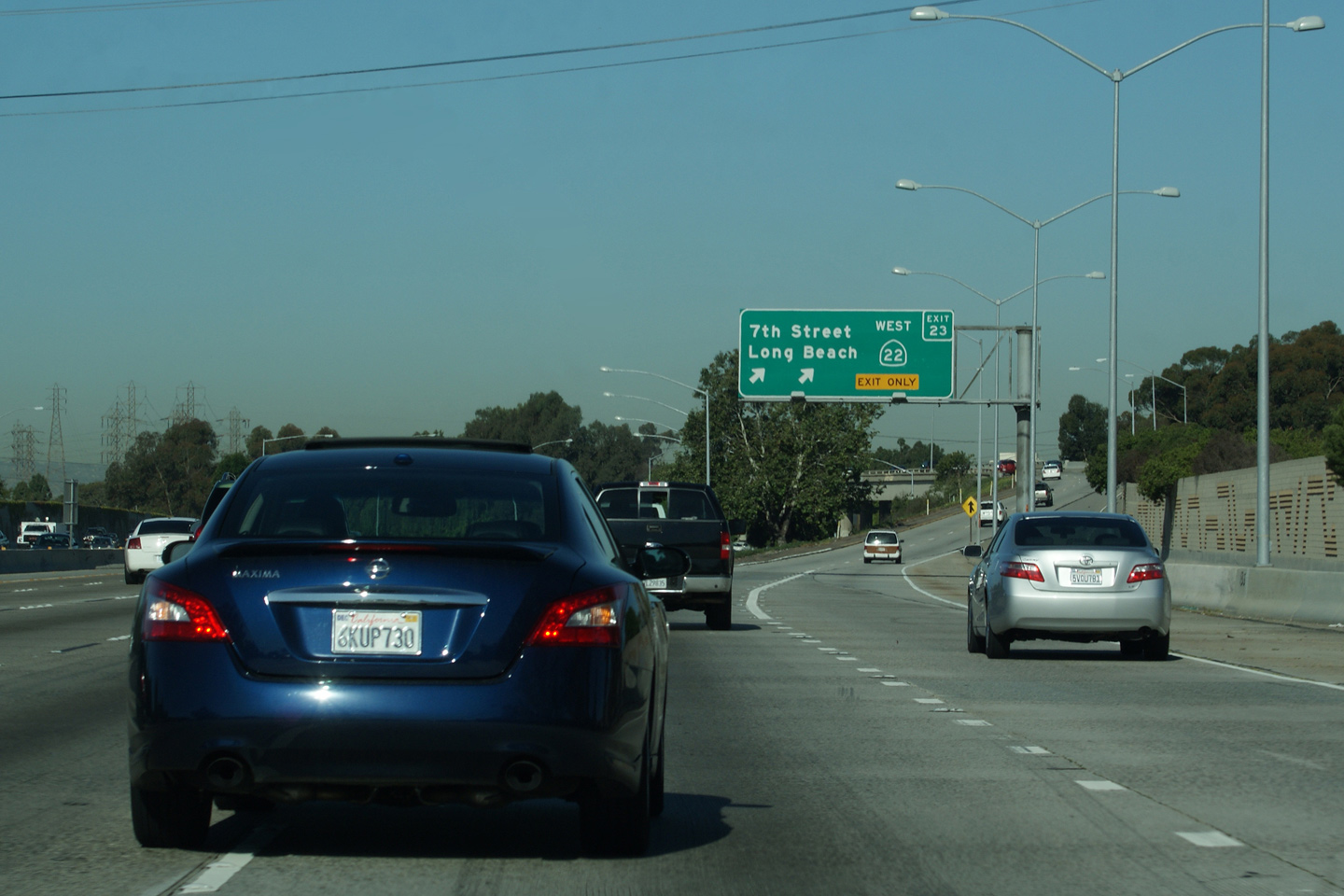
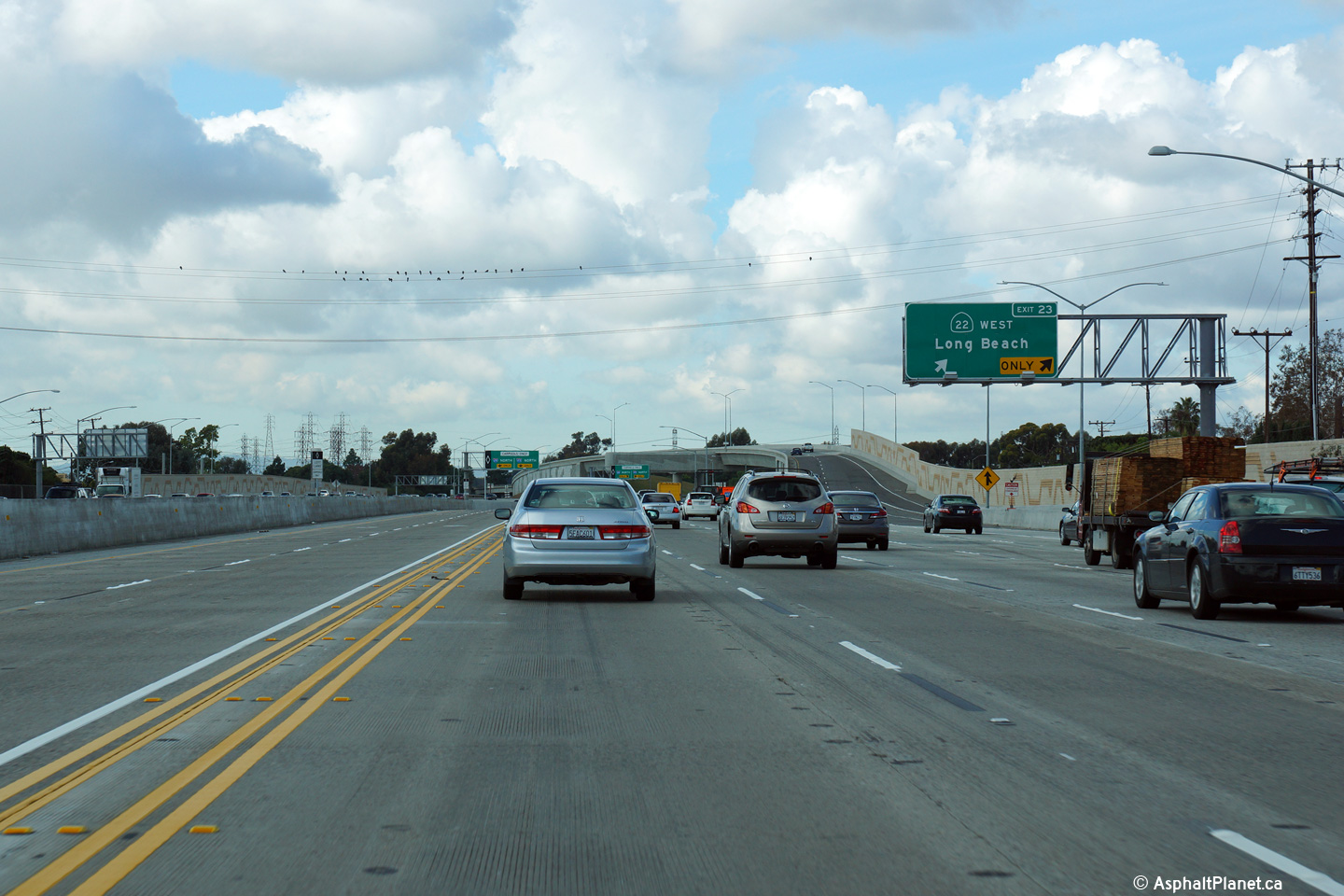
Orange County |
Guide signage at the departure of Highway 22. State Route 22 remains a freeway for about a mile west of the 405 interchange before narrowing down to a conventional city street. Click here for a photo of the signage that previously stood at this location before the 405 was widened through the interchange, taken in April, 2010. |
 |
||
|
Date: 12/17/2014 |
High-res: (1440x960) (2400x1600) |
|||
| Highway 22 continues west of The 405 into Long Beach terminating at the Pacific Coast Highway. Click here for Highway 22-West Images. | ||||
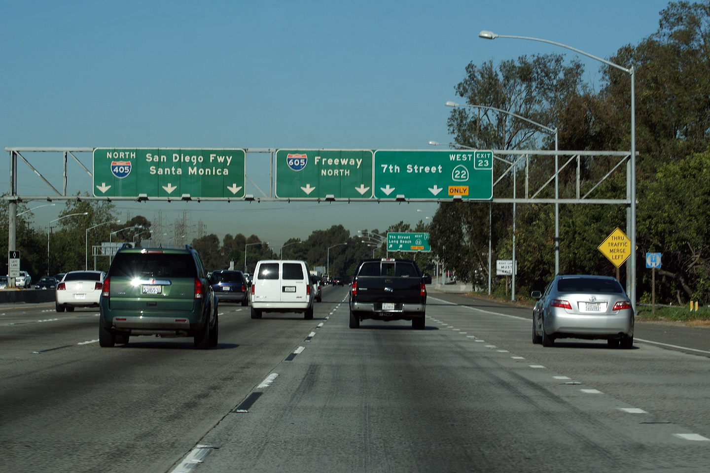
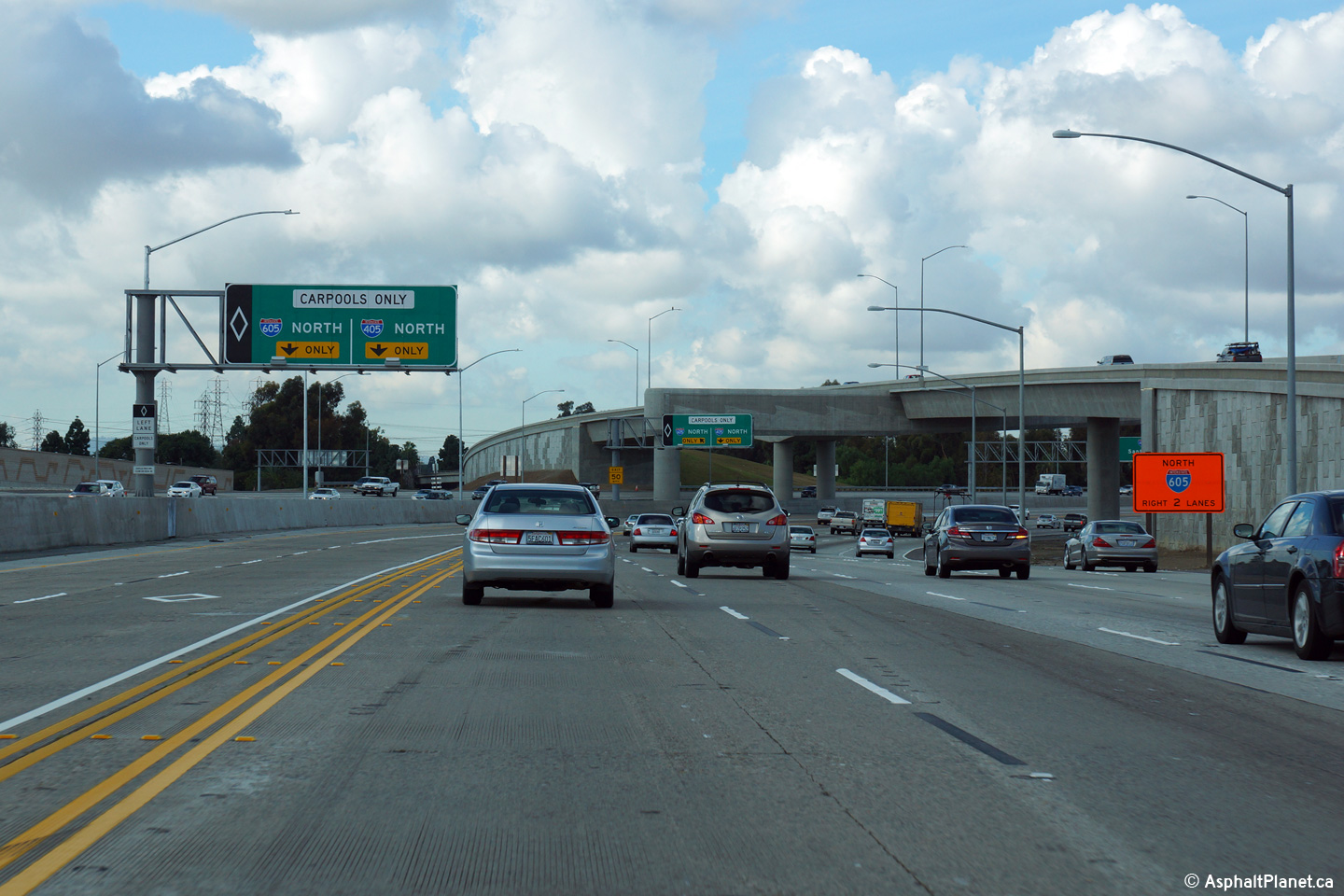
|
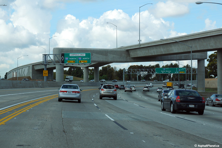
Orange County |
The advanced signage for the carpool lane ramp to the 605 Freeway is situated just beyond the northbound off-ramp to the SR-22 West. |
 |
||
|
Date: 12/17/2014 |
High-res: (1440x960) (2400x1600) |
|||
|
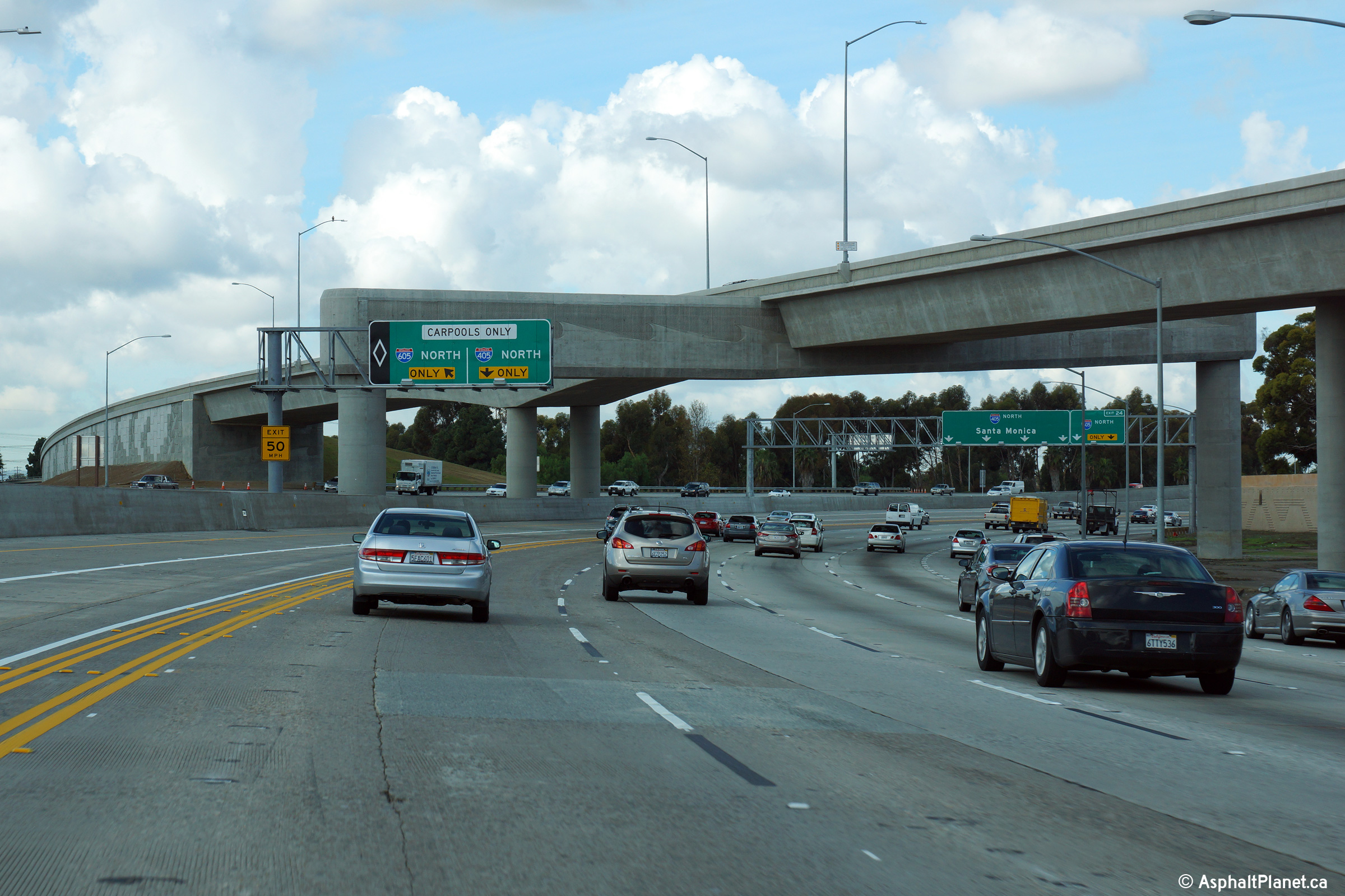
Orange County |
Signage for as the carpool lane ramp to I-605 North splits from the 405 carpool lane. |
 |
||
|
Date: 12/17/2014 |
High-res: (1440x960) (2400x1600) |
|||
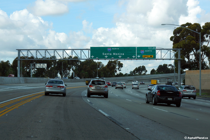
|
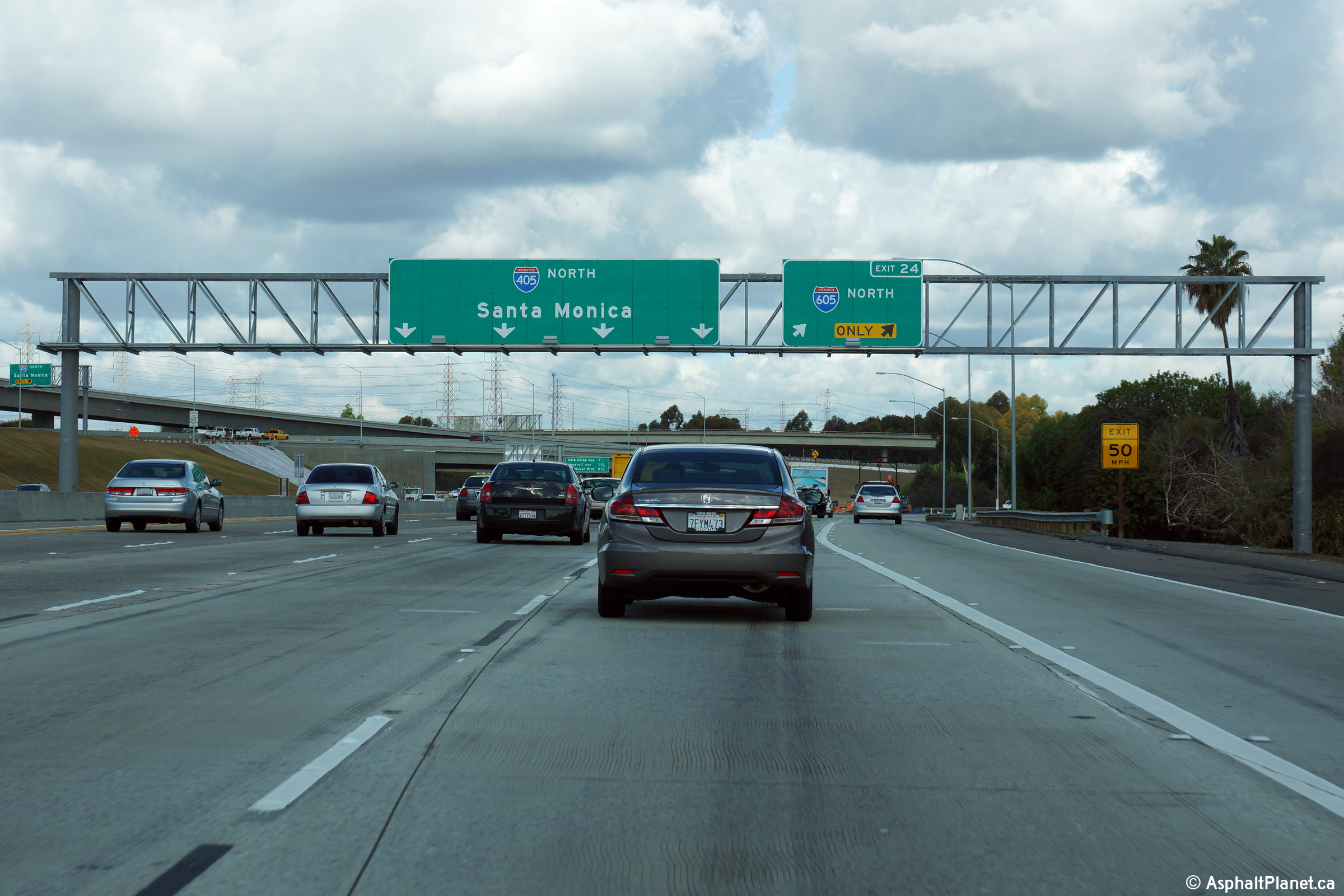
Orange County |
Second full size advanced signage for the quickly approaching I-605 interchange. Click here for the former button copy signage that stood at this location, taken in April, 2010. |
 |
||
|
Date: 12/17/2014 |
High-res: (1440x960) (2400x1600) |
|||
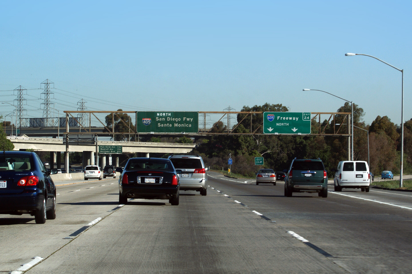
|
Orange County |
Pull through signage at the 605 Freeway exit. Click here for a photo of the signage that previously stood at this location before the 405 was widened through the interchange, taken in April, 2010. |
 |
||
|
Date: 12/17/2014 |
High-res: (1440x960) (2400x1600) |
|||
| Interstate 605 begins its trek northerly through the eastern portion of Los Angeles County at this interchange. Click here for Interstate 605 Images. | ||||
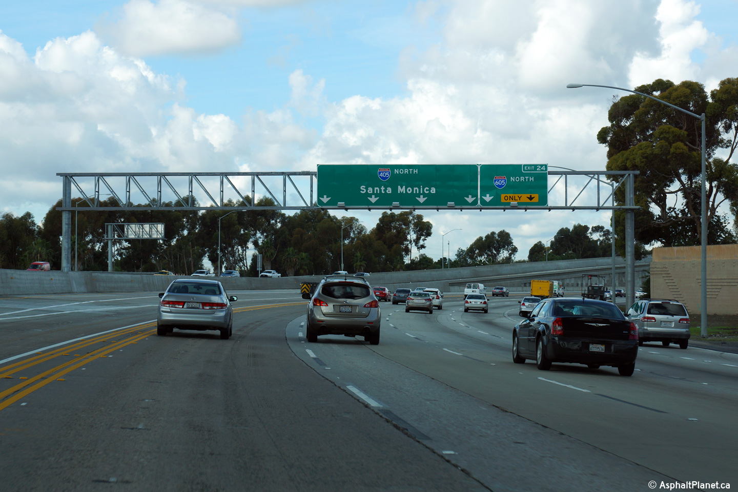
|
Orange County |
Next exit signage at the 605 interchange. The 605 interchange is fairly complex, especially given that the 605 Freeway ends at the 405. |
 |
||
|
Date: 3/26/2010 |
High-res | |||
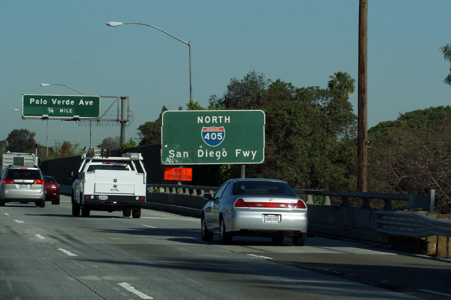
|
Los Angeles County |
Reassurance signage for the 405 Freeway. Interstate 405 is known as the San Diego Freeway for its entire length. Beyond the 405, the San Diego Freeway continues southerly as Interstate 5. |
 |
||
|
Date: 3/26/2010 |
||||
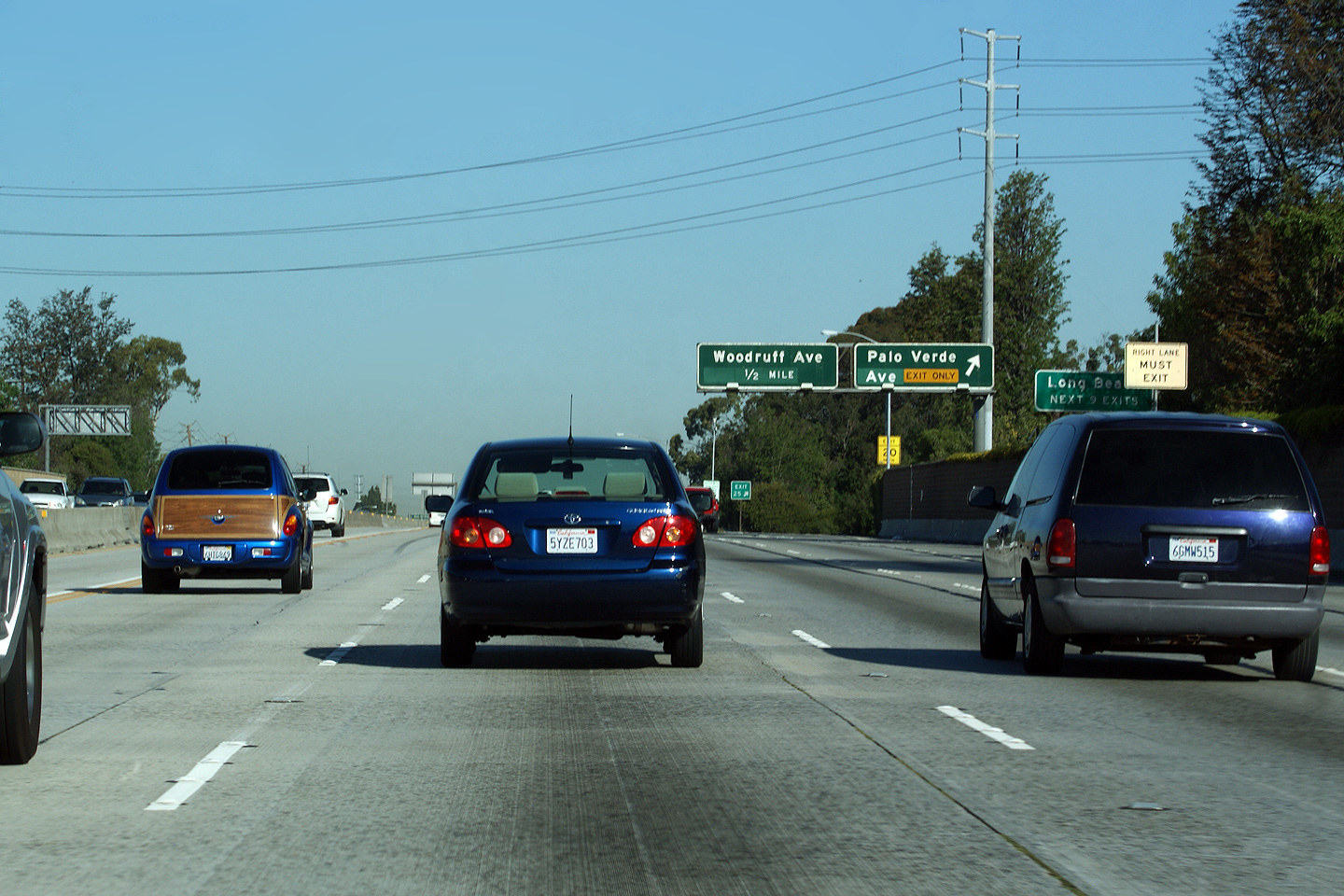
|
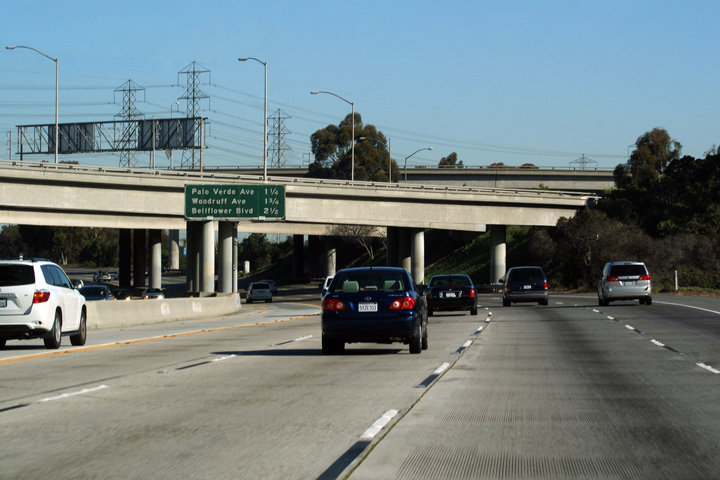
Los Angeles County |
Overhead signage for Palo Verde Avenue. |
 |
||
|
Date: 3/26/2010 |
||||
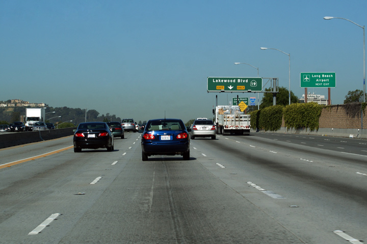
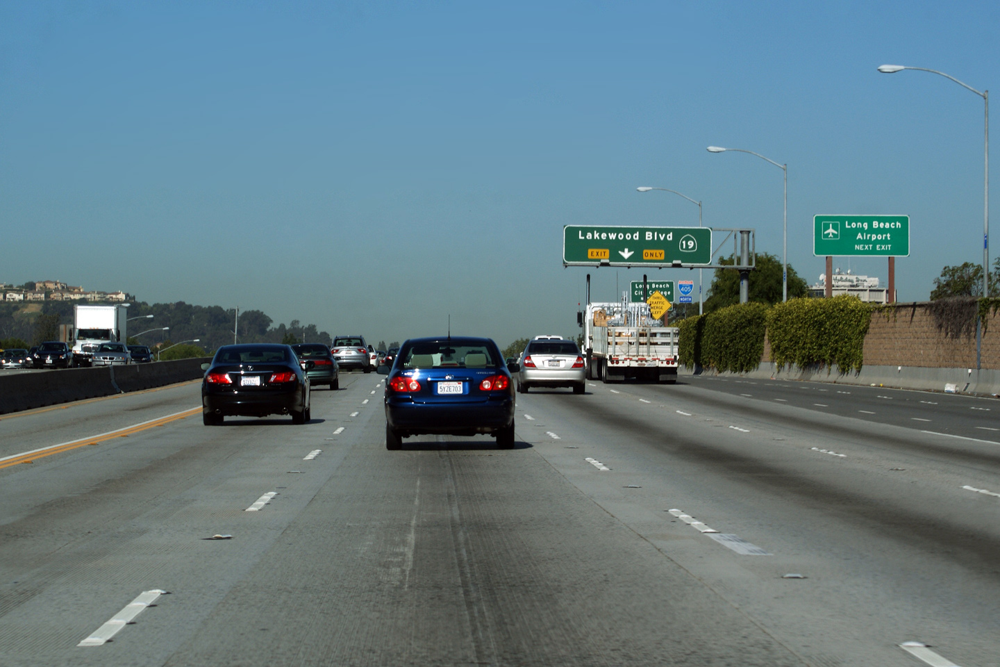
|
Los Angeles County |
Exit signage for Lakewood Boulevard. Unlike at the Century Freeway crossign, Lakewood Boulevard is still part of CA-19 where it crosses the 405. |
|
||
|
Date: 3/26/2010 |
||||
|
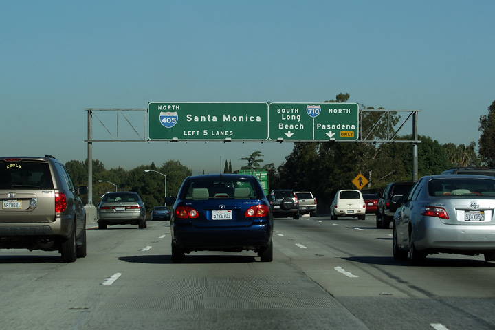
Los Angeles County |
Second round of advanced signage for the Long Beach Freeway interchange. Note 'I-405 Left 5 Lanes' -- Aside from within Los Angeles where else would you see that on an overhead sign? |
 |
||
|
Date: 3/26/2010 |
High-res | |||
|
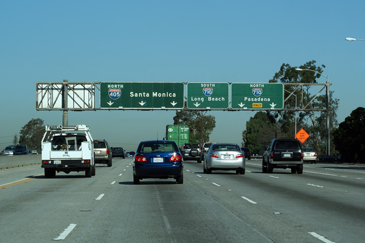
Los Angeles County |
Signage at the off-ramp for the Long Beach Freeway (I-710) interchange. The 405 meets the Long Beach Freeway at an antiquated three-quarter cloverleaf interchange. The 710 Freeway is one of Los Angeles County's older superhighways and as such features numerous antiquated interchanges. |
 |
||
|
Date: 3/26/2010 |
High-res: (1440x960) (2400x1600) |
|||
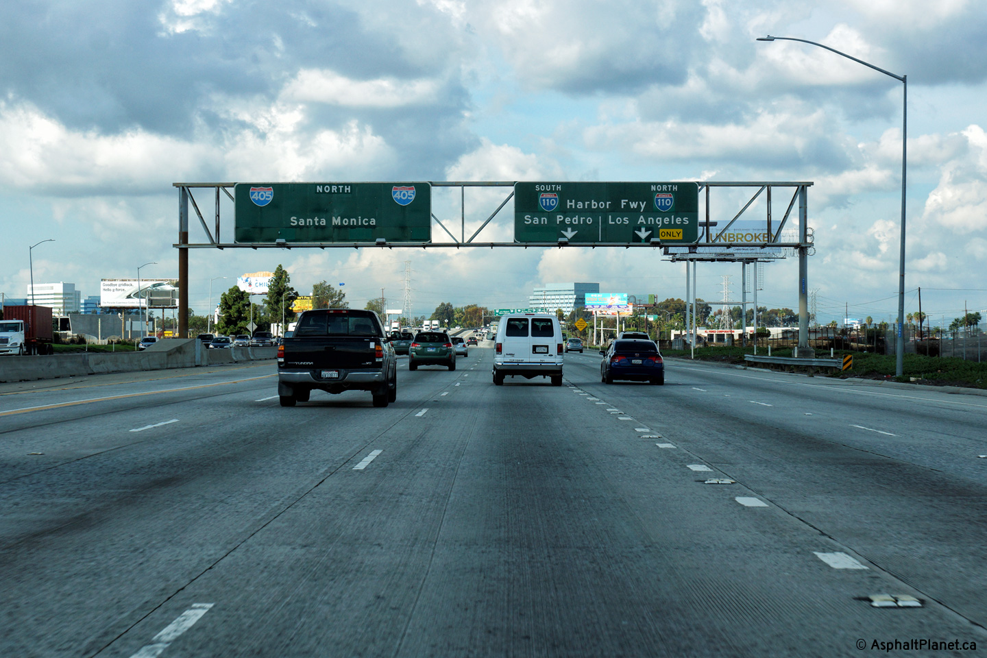
|
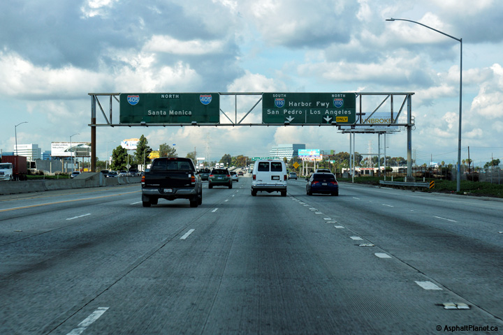
Los Angeles County |
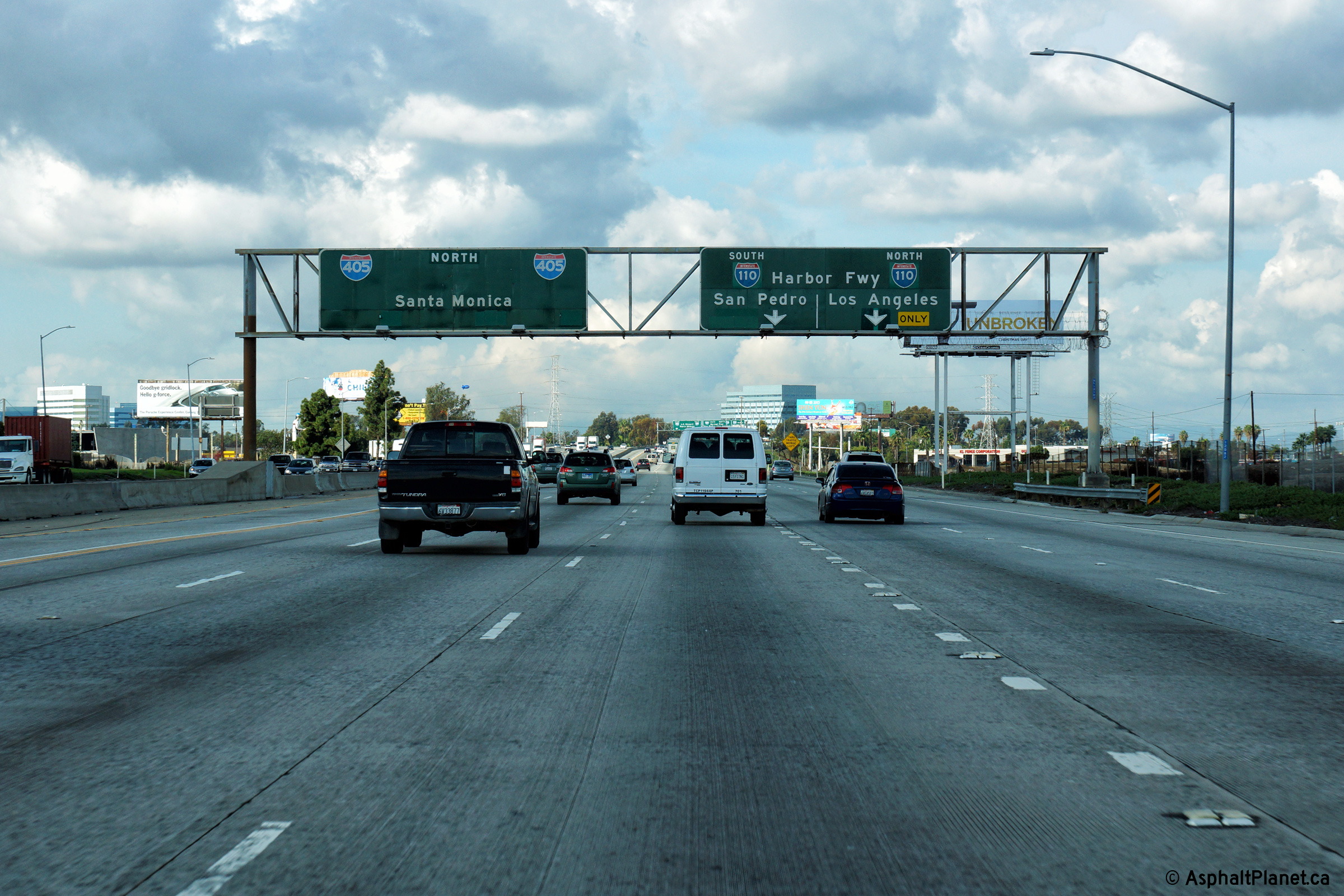
Northbound advanced signage for the I-110 Interchange. The right two northbound lanes of I-405 depart to the 110 Freeway. |
 |
||
|
Date: 12/17/2014 |
High-res: (1440x960) (2400x1600) |
|||
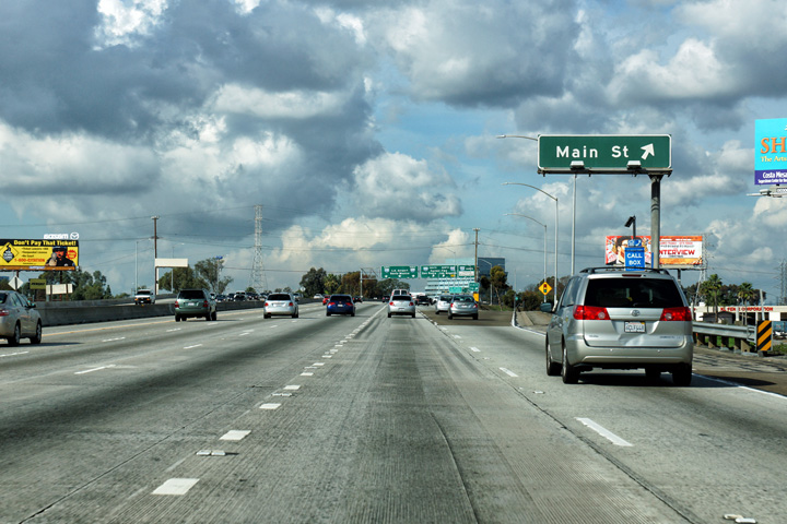
|
Los Angeles County |
Northbound signage at the off-ramp to Main Street in Carson. |
 |
||
|
Date: 12/17/2014 |
High-res: (1440x960) (2400x1600) |
|||
|
Los Angeles County |
Northbound signage at the off-ramp to the 110 Freeway. |
 |
||
|
Date: 12/17/2014 |
High-res: (1440x960) (2400x1600) |
|||
| The Harbor Freeway (Interstate 110) extends southerly from Downtown LA into San Pedro. Click here for Interstate 110 Images. | ||||
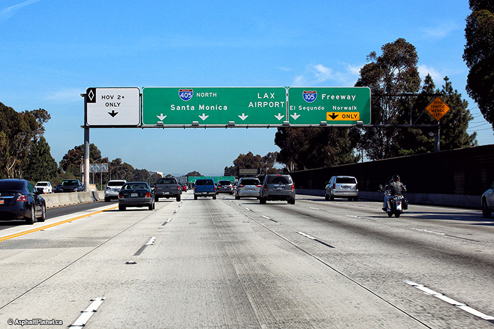
|
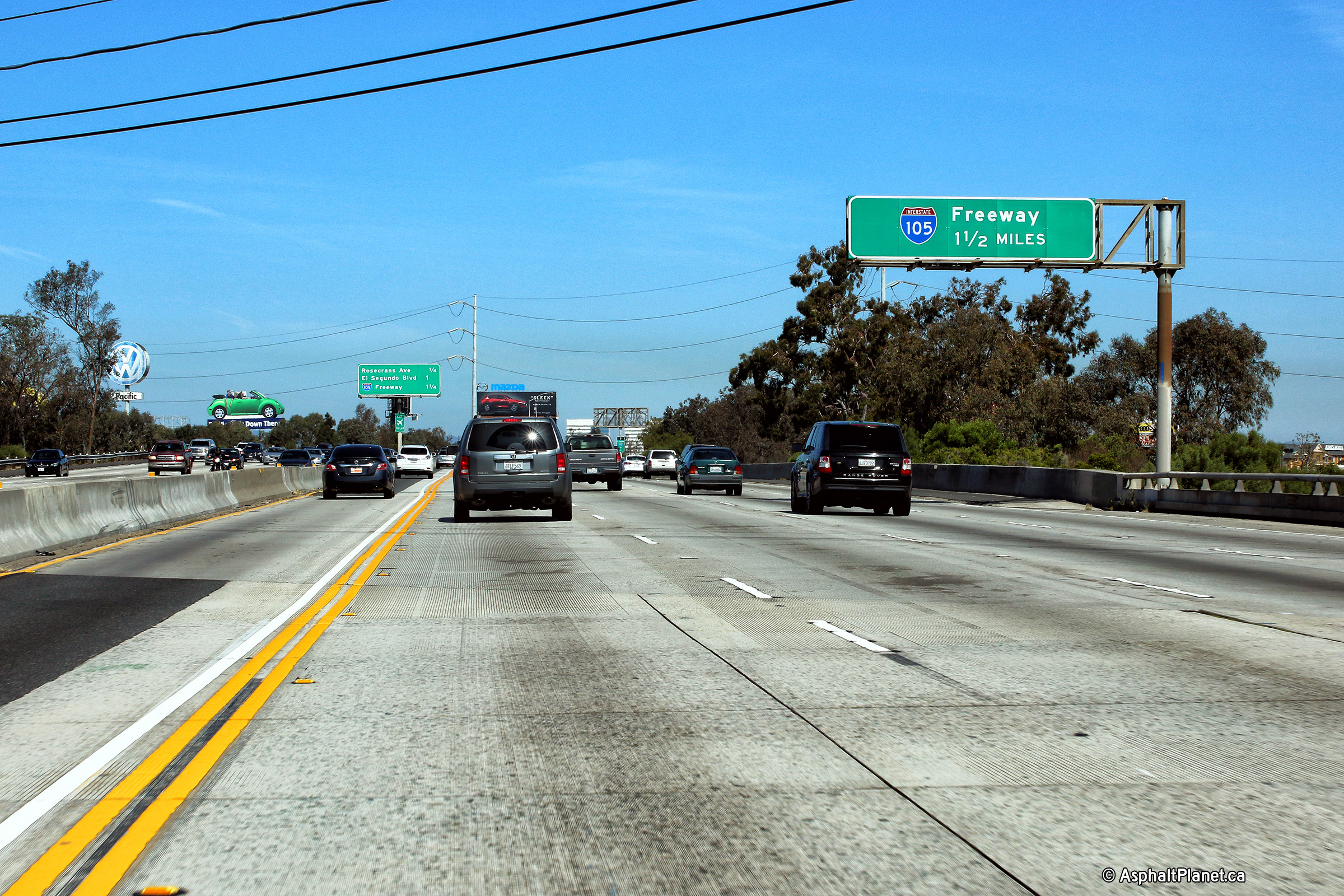
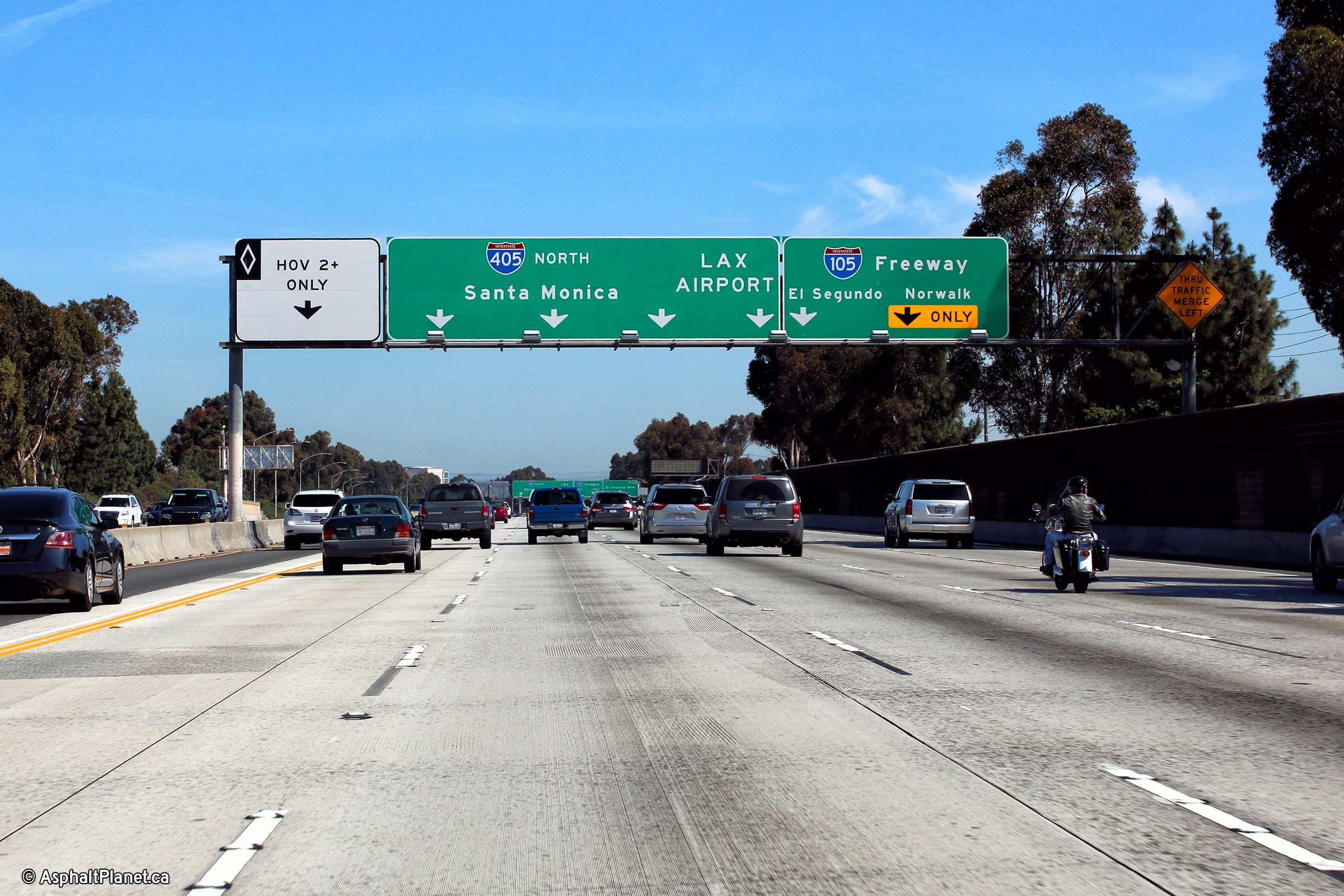
Los Angeles County |
Northbound advanced signage for the off-ramp to Interstate 105. |
 |
||
|
Date: 4/16/2017 |
High-res: (1440x960) (2400x1600) |
|||
|
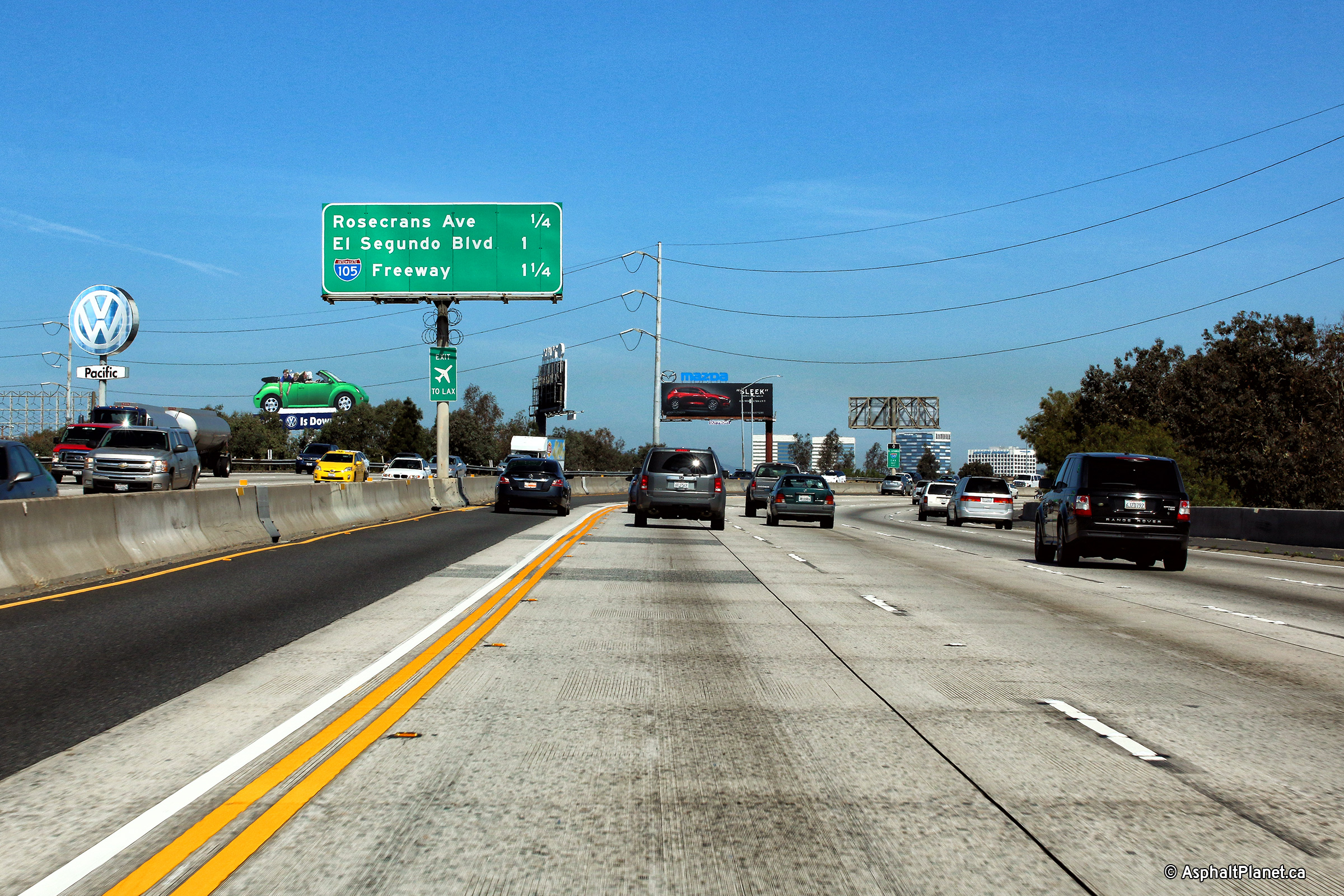
Los Angeles County |
Interchange sequence signage in advance of the interchange to Rosecrans Avenue. |
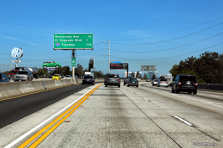 |
||
|
Date: 4/16/2017 |
High-res: (1440x960) (2400x1600) |
|||
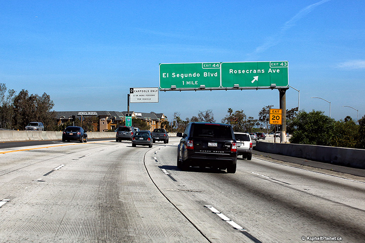
|
Los Angeles County |
Northbound signage at the off-ramp to Rosecrans Avenue. |
 |
||
|
Date: 4/16/2017 |
High-res: (1440x960) (2400x1600) |
|||
|
Los Angeles County |
Signage at the northbound off-ramp to El Segundo Boulevard. |
 |
||
|
Date: 4/16/2017 |
High-res: (1440x960) (2400x1600) |
|||
|
Los Angeles County |
Northbound interchange sequence signage approaching the Imperial Boulevard interchange. |
 |
||
|
Date: 4/16/2017 |
High-res: (1440x960) (2400x1600) |
|||
|
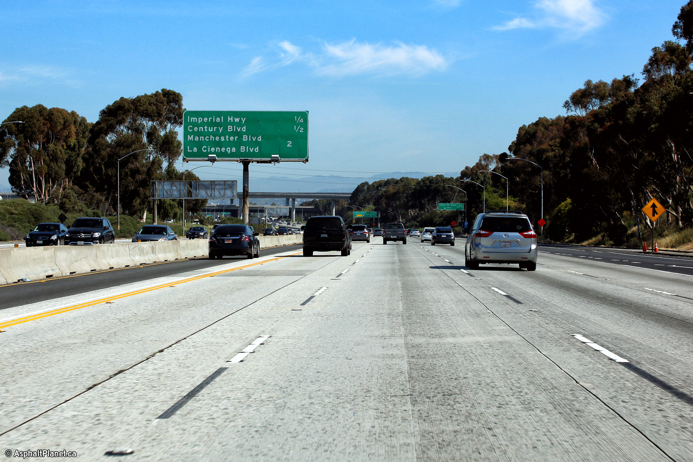
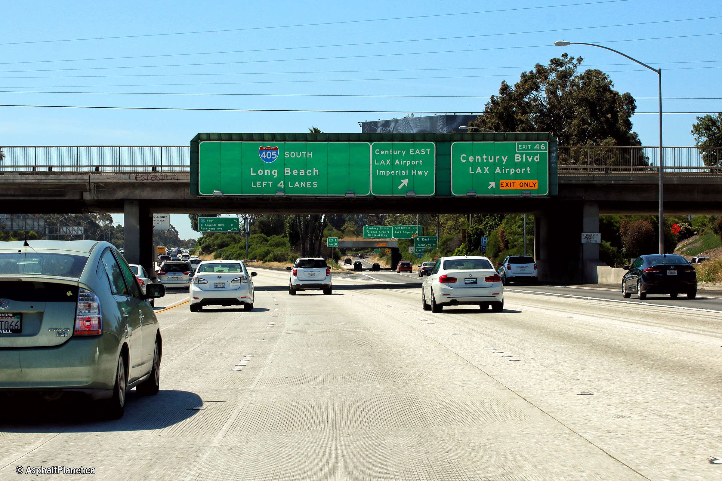
Los Angeles County |
Southbound signage at the off-ramp to Century Boulevard. |
 |
||
|
Date: 4/16/2017 |
High-res: (1440x960) (2400x1600) | |||
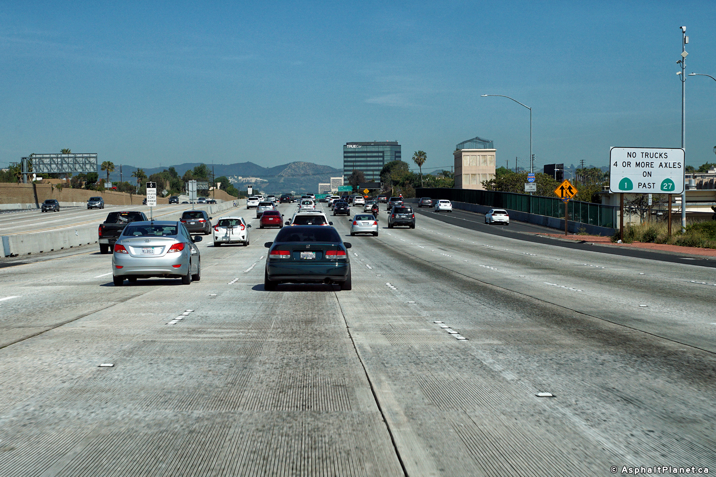
|
Los Angeles County |
Signage warning trucks that Hwy 1 isn't an alternate to I-405 and US-101. |
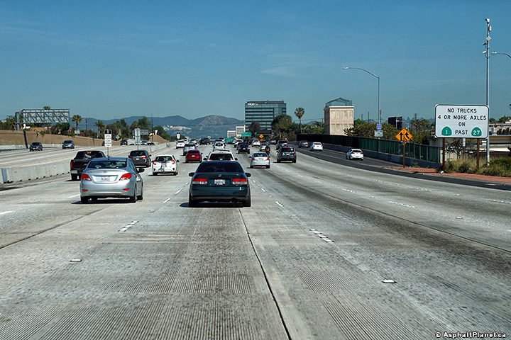 |
||
|
Date: 4/16/2017 |
High-res: (1440x960) (2400x1600) |
|||
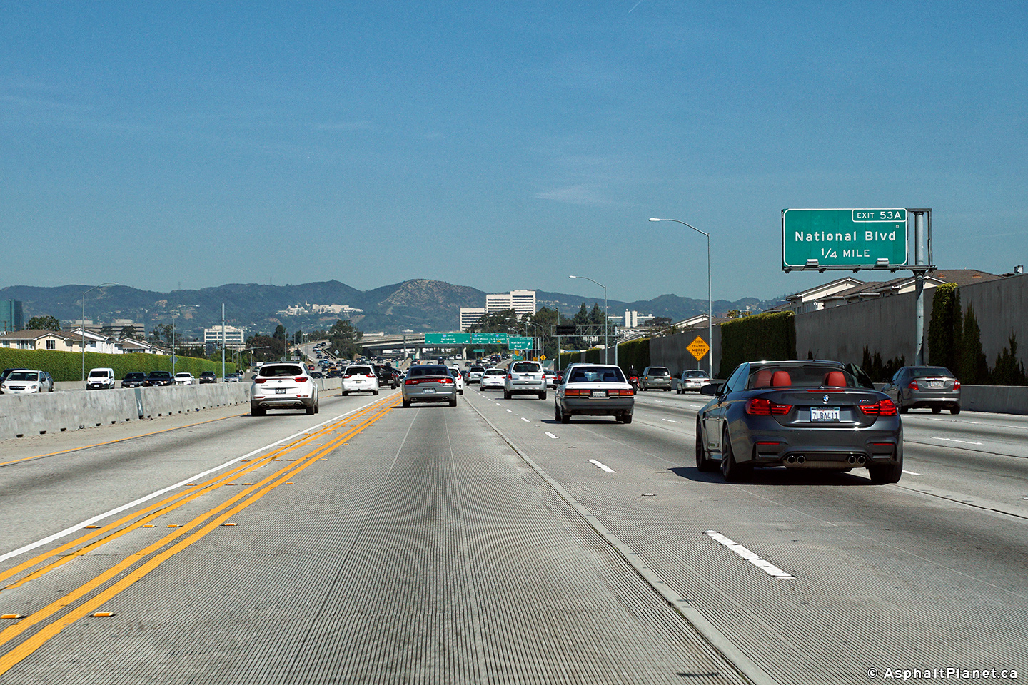
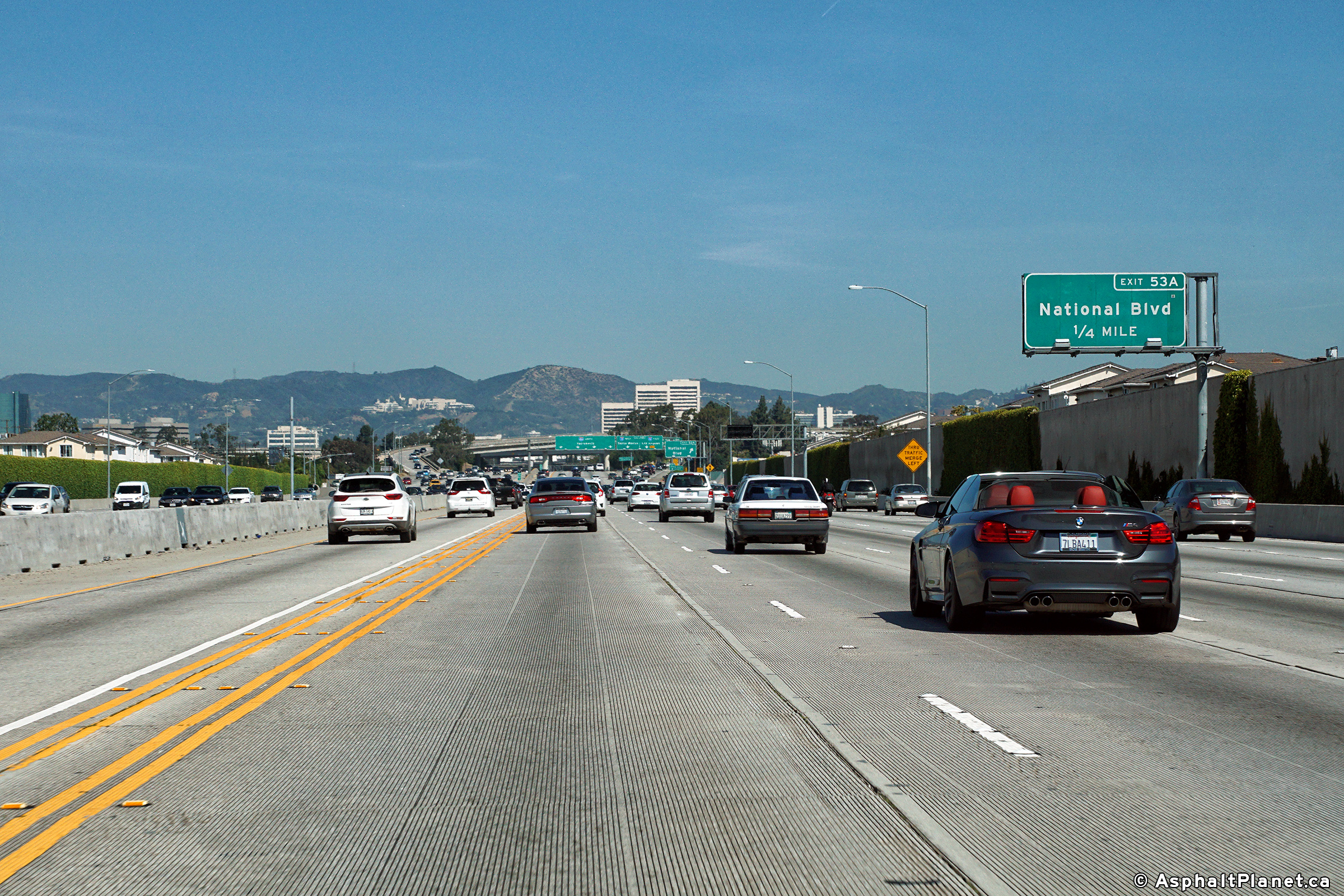
|
Los Angeles County |
Northbound interchange sequence signage approaching the National Boulevard interchange. |
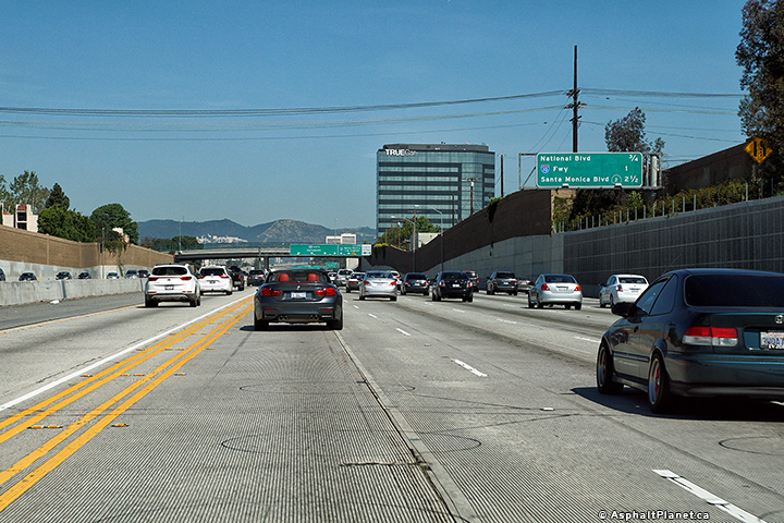 |
||
|
Date: 4/16/2017 |
High-res: (1440x960) (2400x1600) |
|||
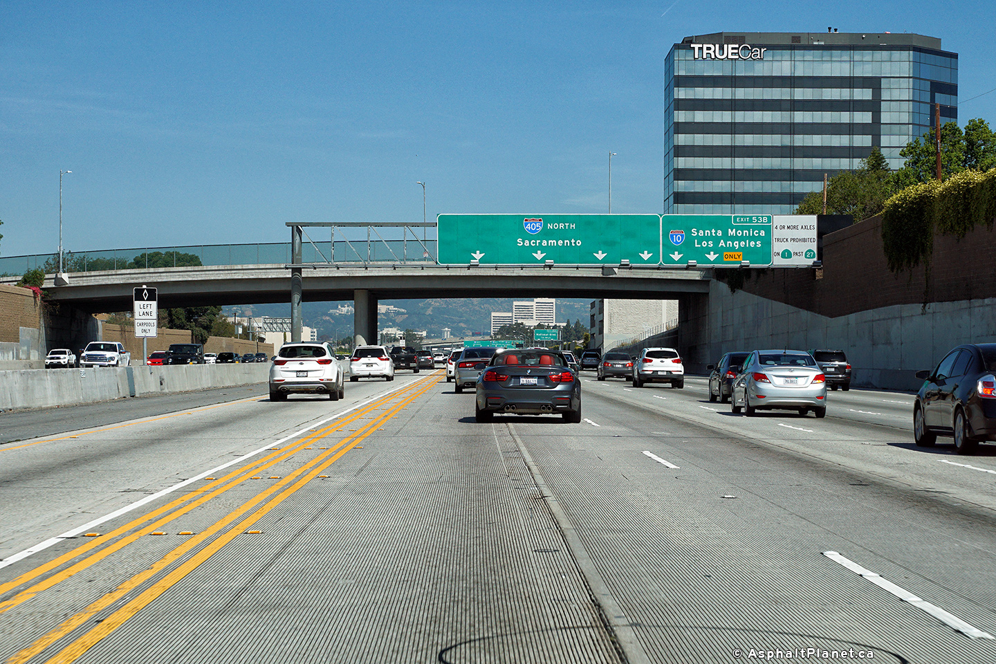
|
Los Angeles County |
Advanced lane assignment signage approaching the Interstate 10 interchange. |
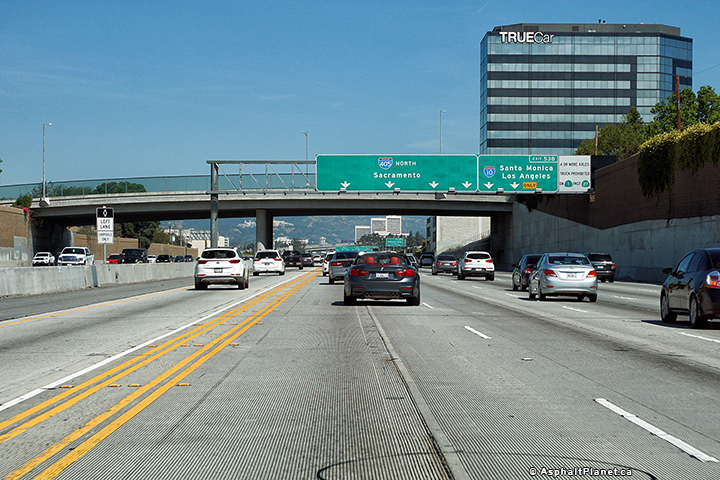 |
||
|
Date: 4/16/2017 |
High-res: (1440x960) (2400x1600) |
|||
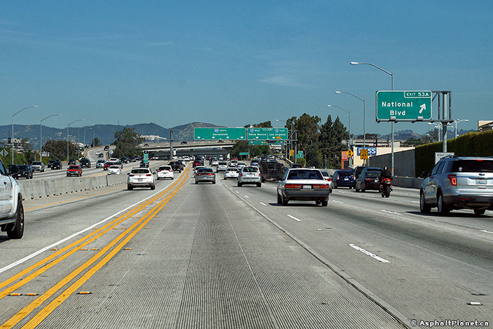
|
Los Angeles County |
Advanced signage for the National Boulevard interchange. |
 |
||
|
Date: 4/16/2017 |
High-res: (1440x960) (2400x1600) |
|||
|
Los Angeles County |
The off-ramp to National Boulevard exits immediately before the off-ramp to Interstate 10. |
 |
||
|
Date: 4/16/2017 |
High-res: (1440x960) (2400x1600) |
|||
|
Los Angeles County |
Signage at the northbound off-ramp to Interstate 10. |
 |
||
|
Date: 4/16/2017 |
High-res: (1440x960) (2400x1600) |
|||
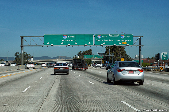
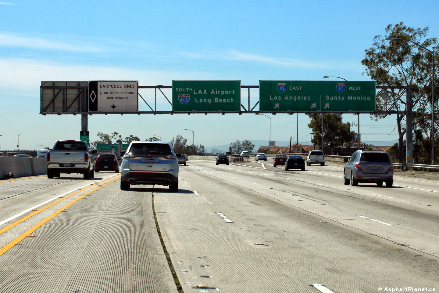
|
Los Angeles County |
View looking northerly as the 405 Freeway passes through the I-10 interchange. |
 |
||
|
Date: 4/16/2017 |
High-res: (1440x960) (2400x1600) |
|||
|
Los Angeles County |
Southerly view as the 405 Freeway passes through the I-10 interchange. |
 |
||
|
Date: 4/16/2017 |
High-res: (1440x960) (2400x1600) | |||
|
Los Angeles County |
Signage at the southbound off-ramp to Interstate 10. |
 |
||
|
Date: 4/16/2017 |
High-res: (1440x960) (2400x1600) | |||
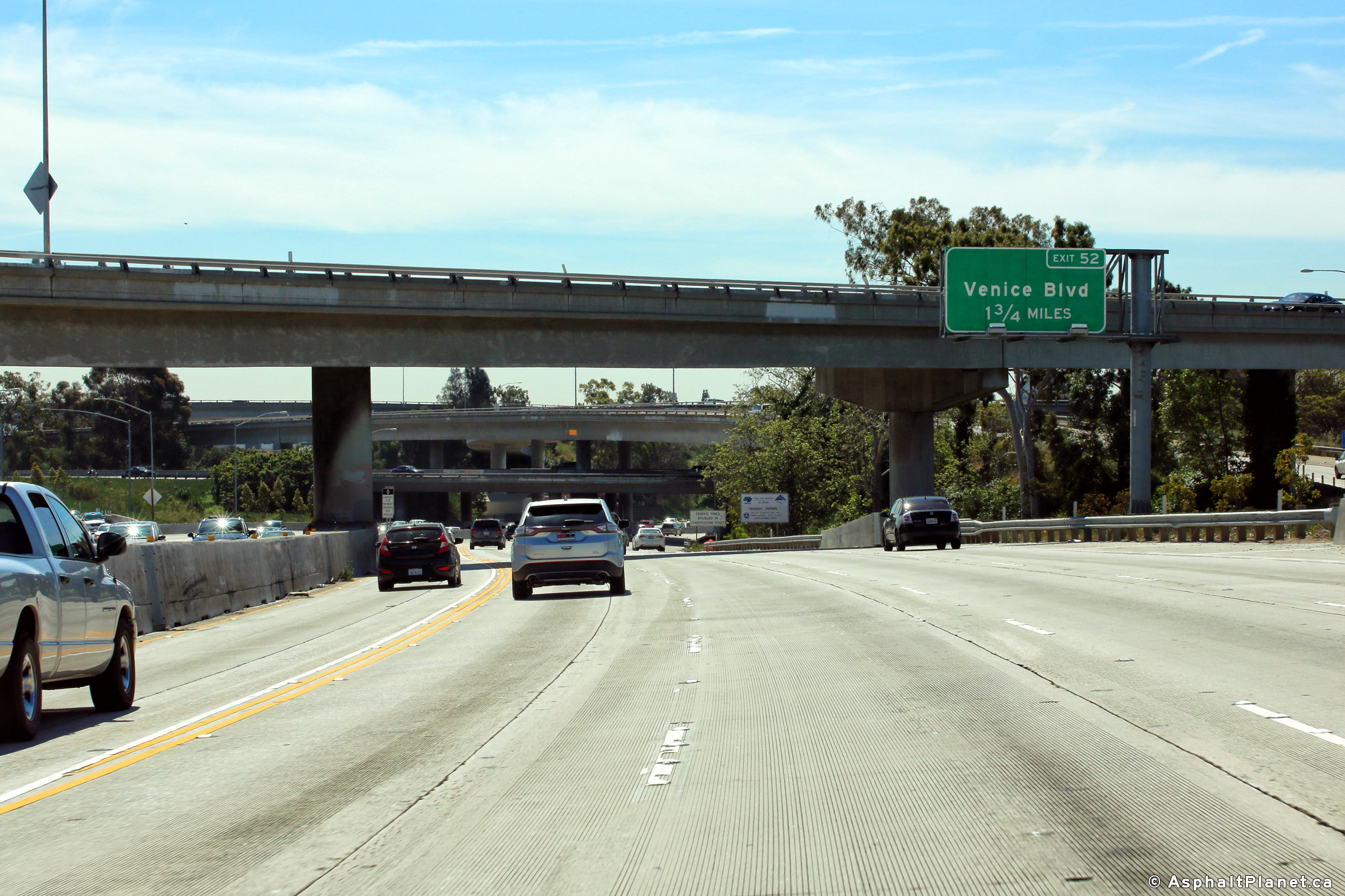
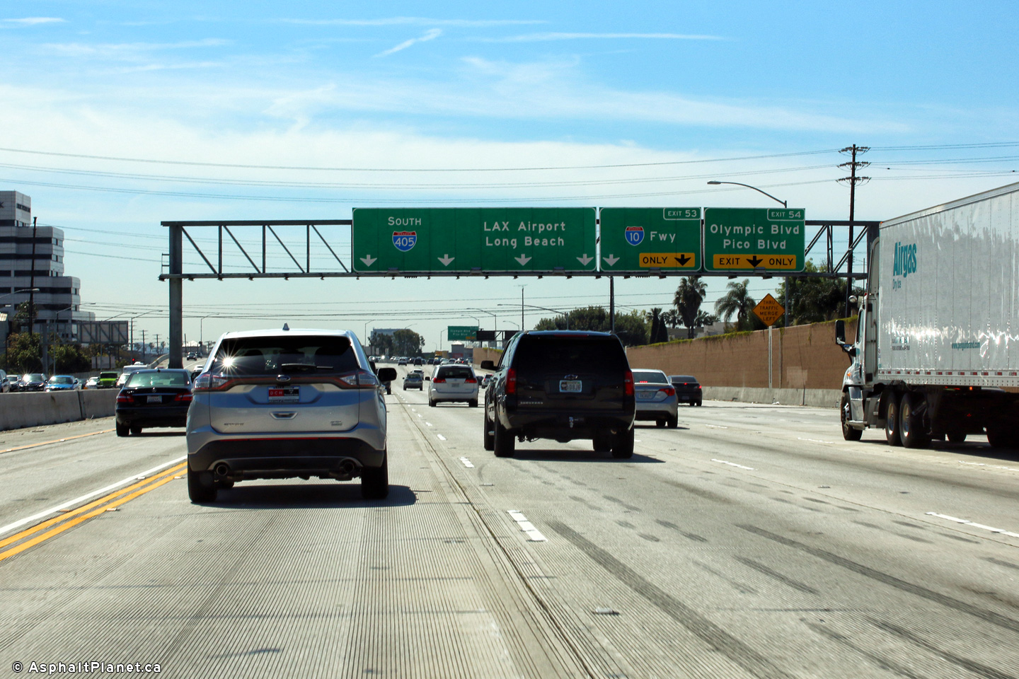
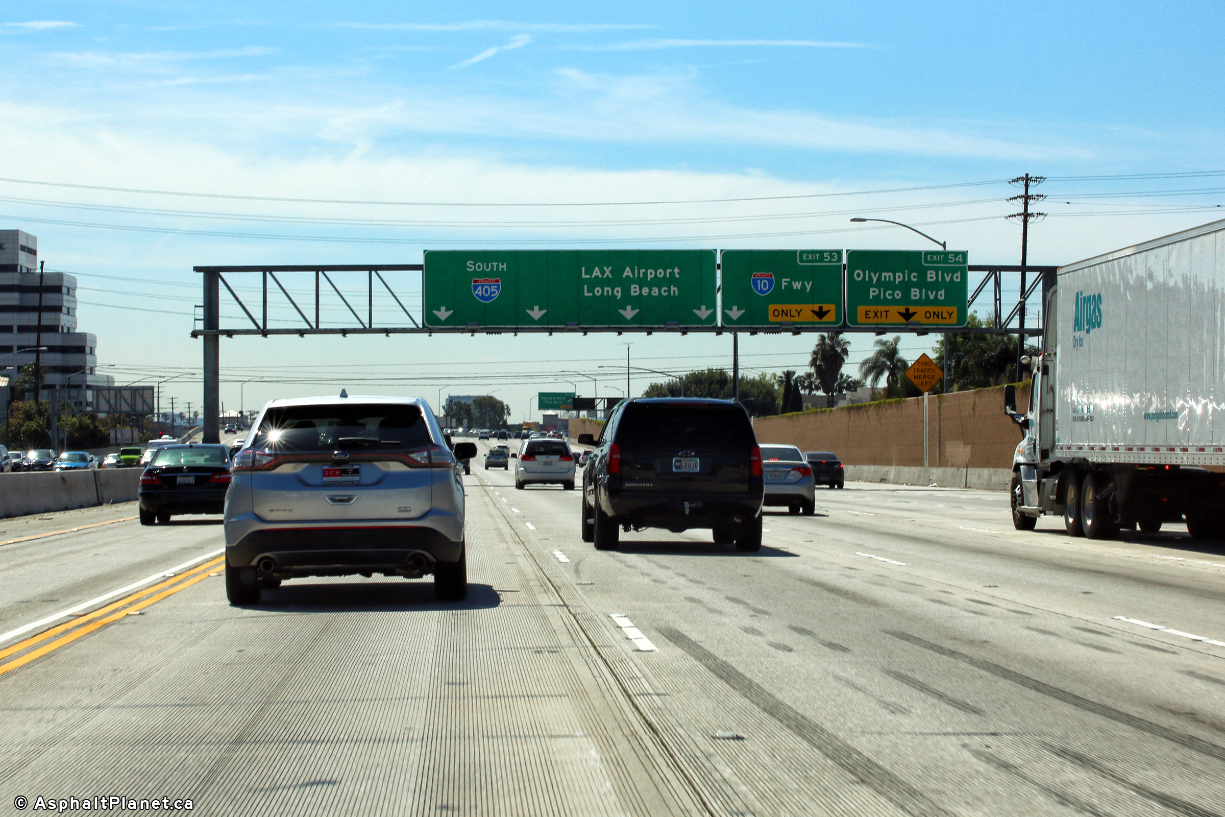
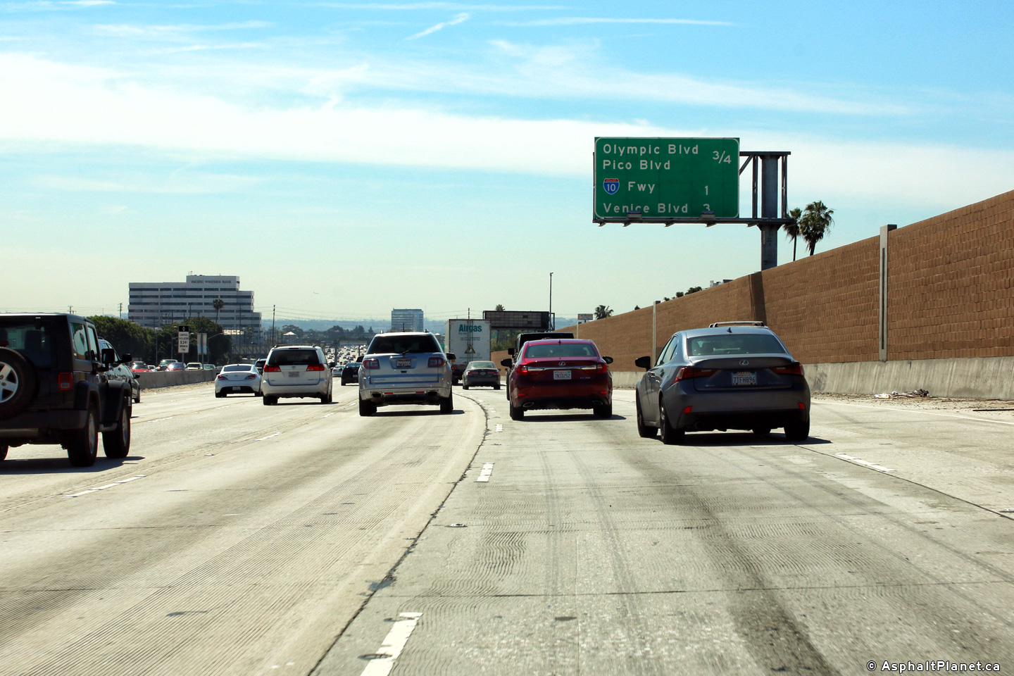
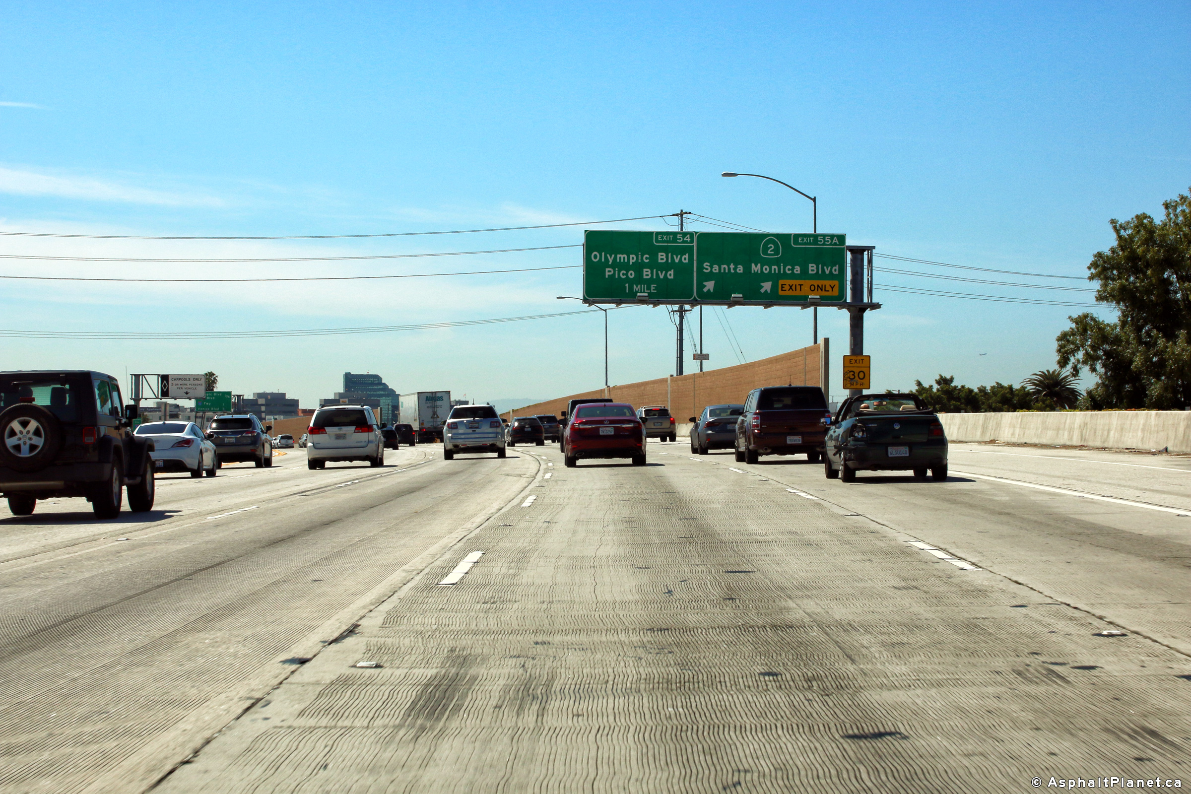
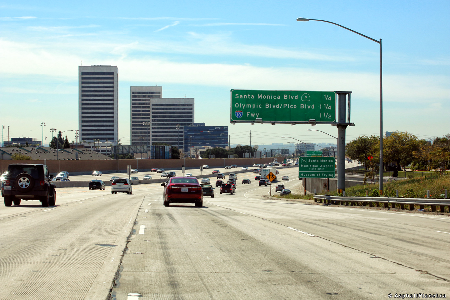
|
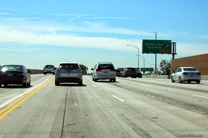
Los Angeles County |
Overhead guide signage for the off-ramp to Olympic Boulevard and Pico Boulevard. |
 |
||
|
Date: 4/16/2017 |
High-res: (1440x960) (2400x1600) | |||
|
Los Angeles County |
Southbound lane assignment signage in advance of the I-10 interchange. |
 |
||
|
Date: 4/16/2017 |
High-res: (1440x960) (2400x1600) | |||
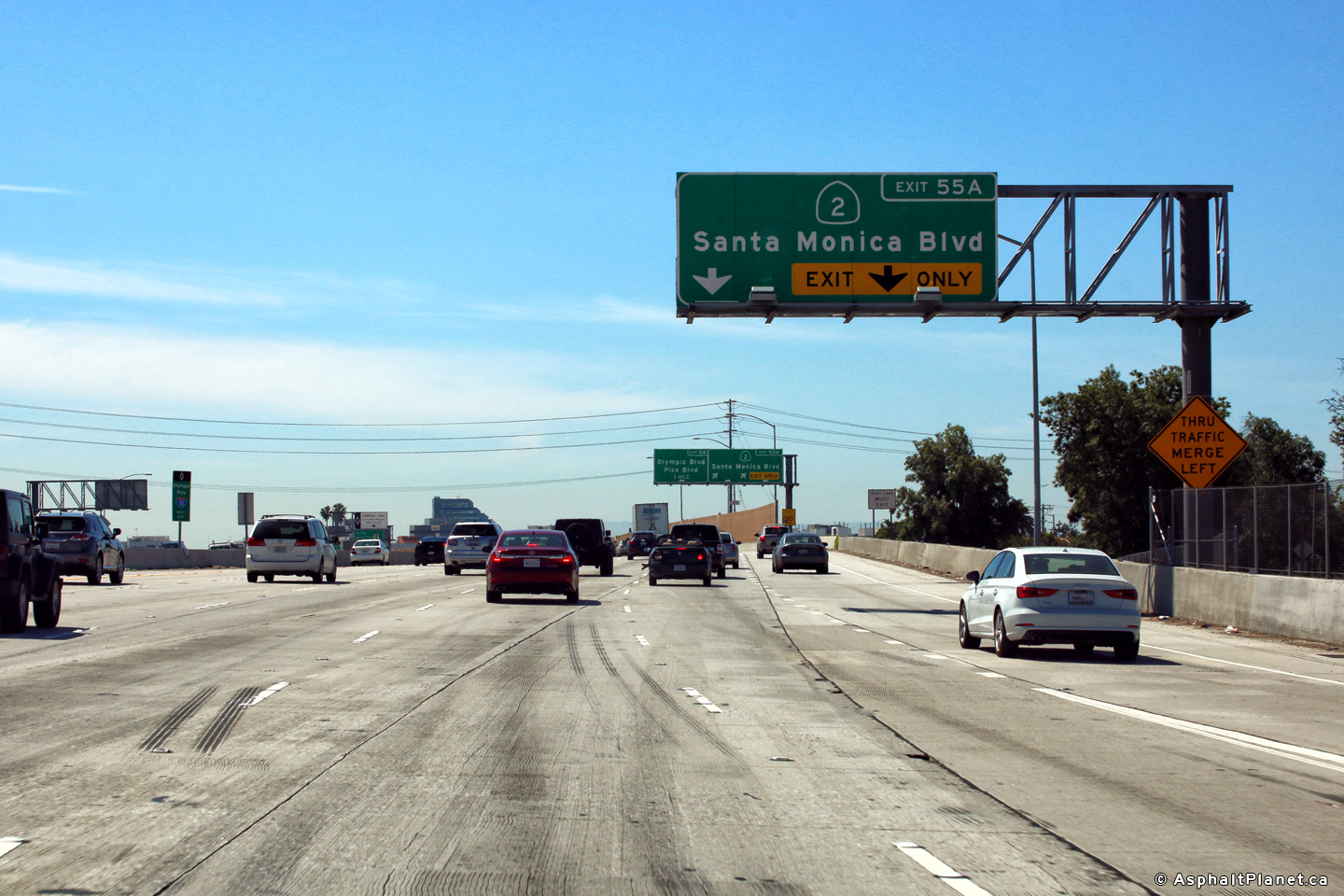
|
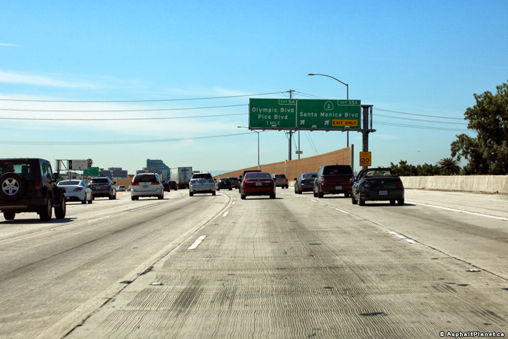
Los Angeles County |
Southbound interchange sequence signage located south of the Santa Monica Boulevard interchange. |
 |
||
|
Date: 4/16/2017 |
High-res: (1440x960) (2400x1600) | |||
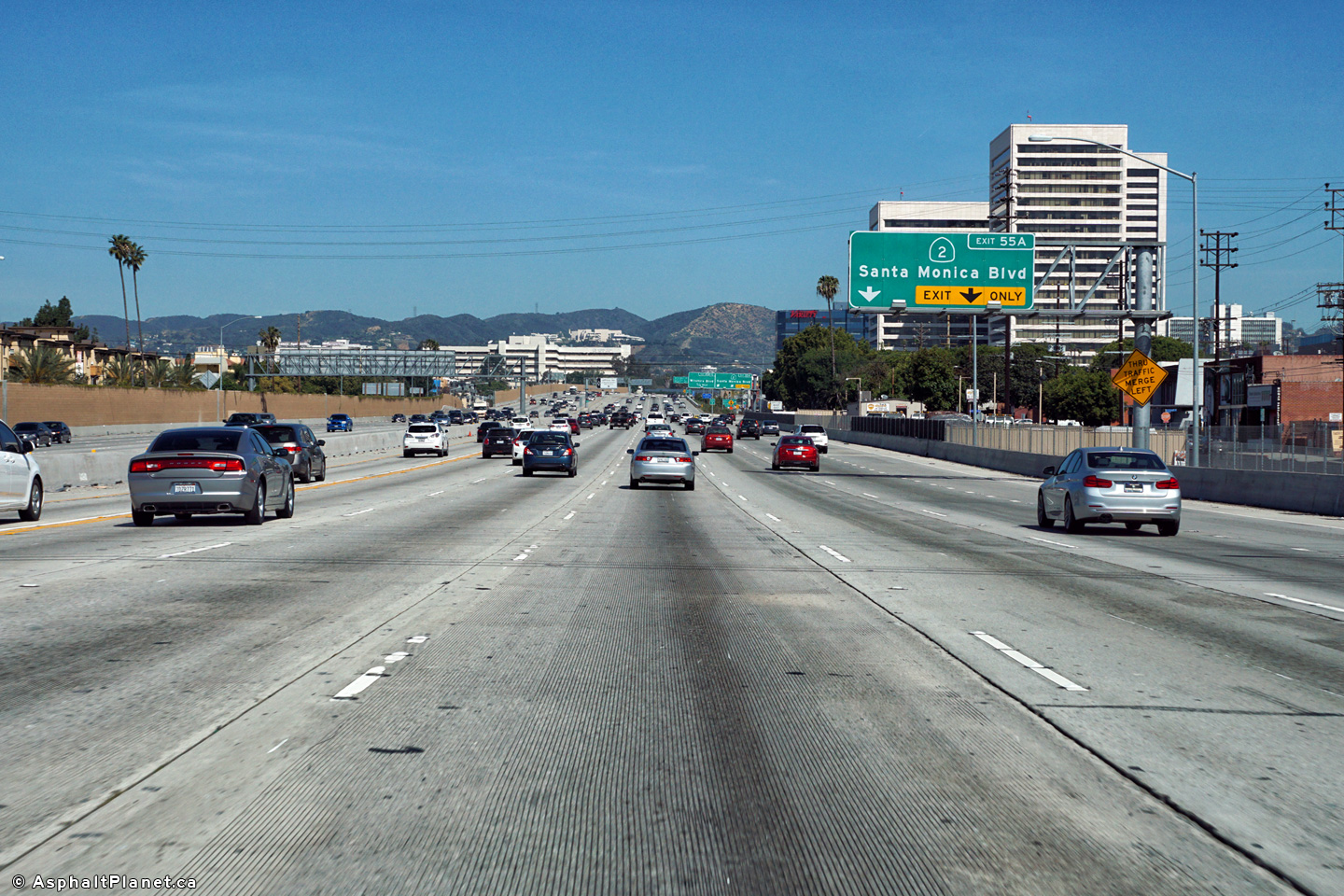
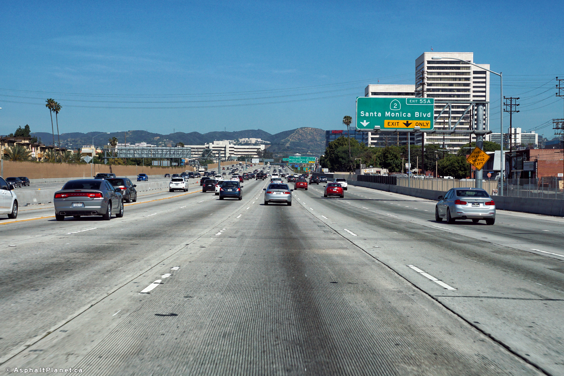
|
Los Angeles County |
Northbound advanced signage for the off-ramp to Santa Monica Boulevard. |
 |
||
|
Date: 4/16/2017 |
High-res: (1440x960) (2400x1600) |
|||
|
Los Angeles County |
View looking northerly at the off-ramp to Santa Monica Boulevard. |
 |
||
|
Date: 4/16/2017 |
High-res: (1440x960) (2400x1600) |
|||
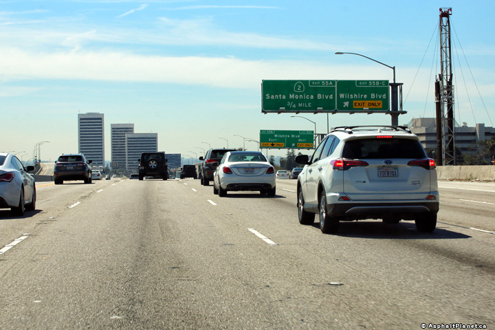
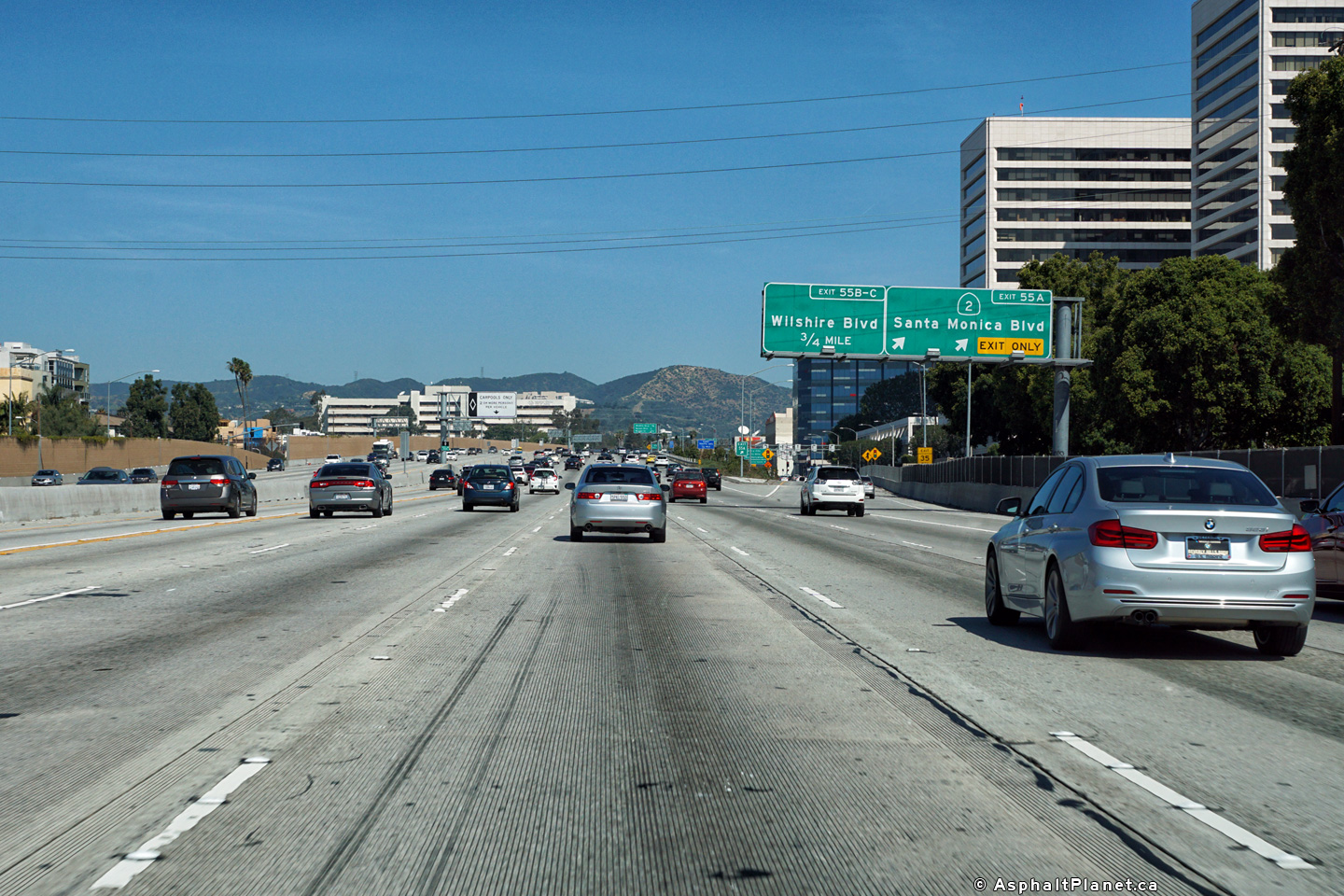
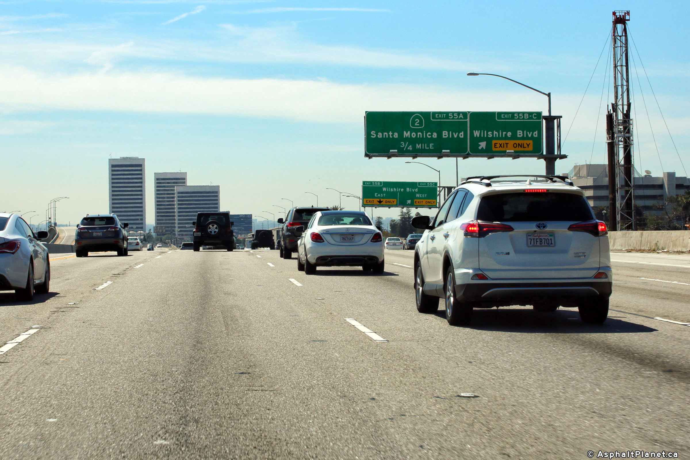
|
Los Angeles County |
Interchange sequence signage located within the Santa Monica Boulevard interchange in advance of the Wilshire Boulevard interchange. The Wilshire Boulevard interchange is located immediately downstream of the Santa Monica Boulevard interchange. |
 |
||
|
Date: 4/16/2017 |
High-res: (1440x960) (2400x1600) |
|||
|
Los Angeles County |
Southbound signage at the off-ramp to Santa Monica Boulevard. |
 |
||
|
Date: 4/16/2017 |
High-res: (1440x960) (2400x1600) | |||
|
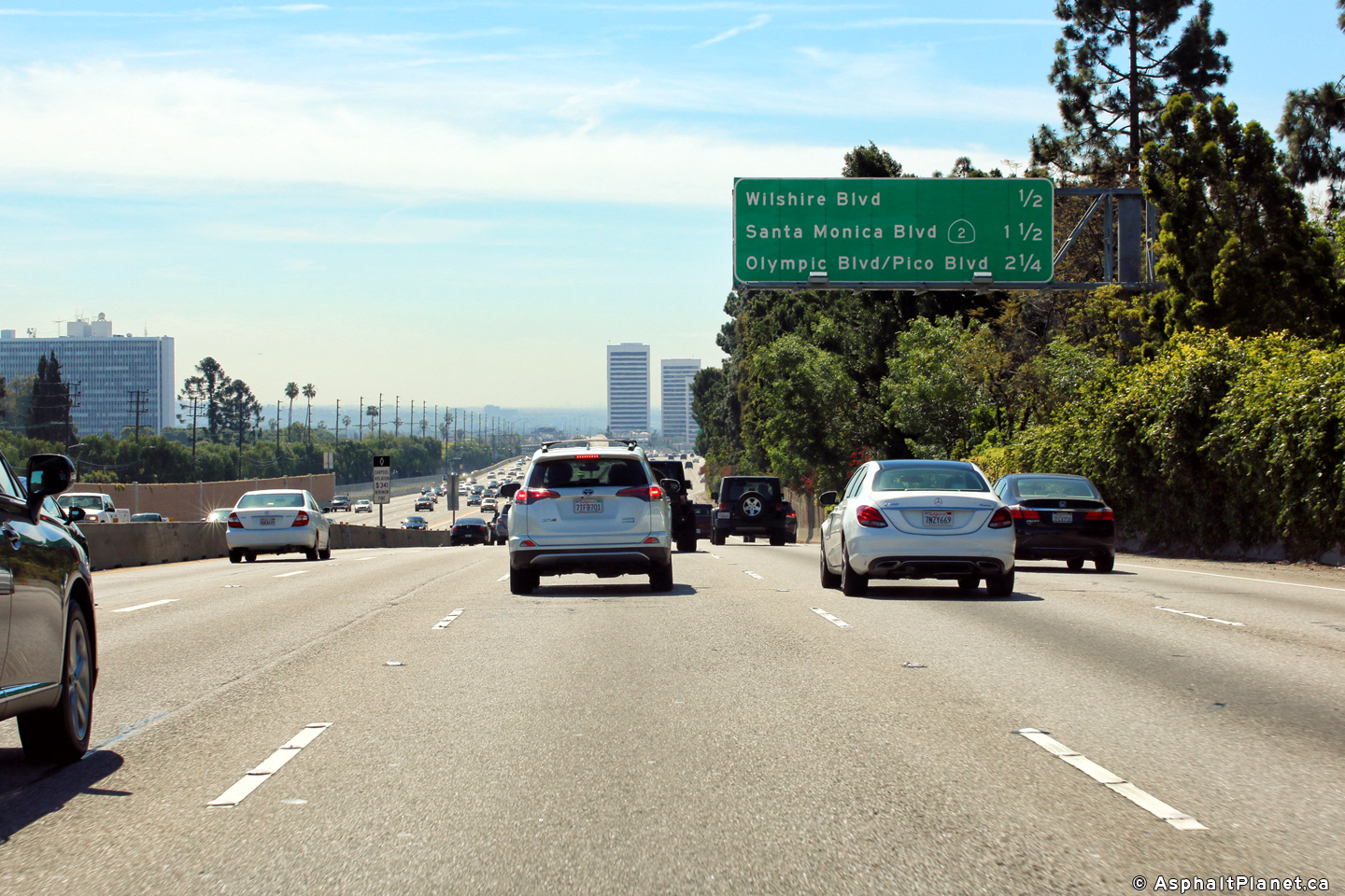
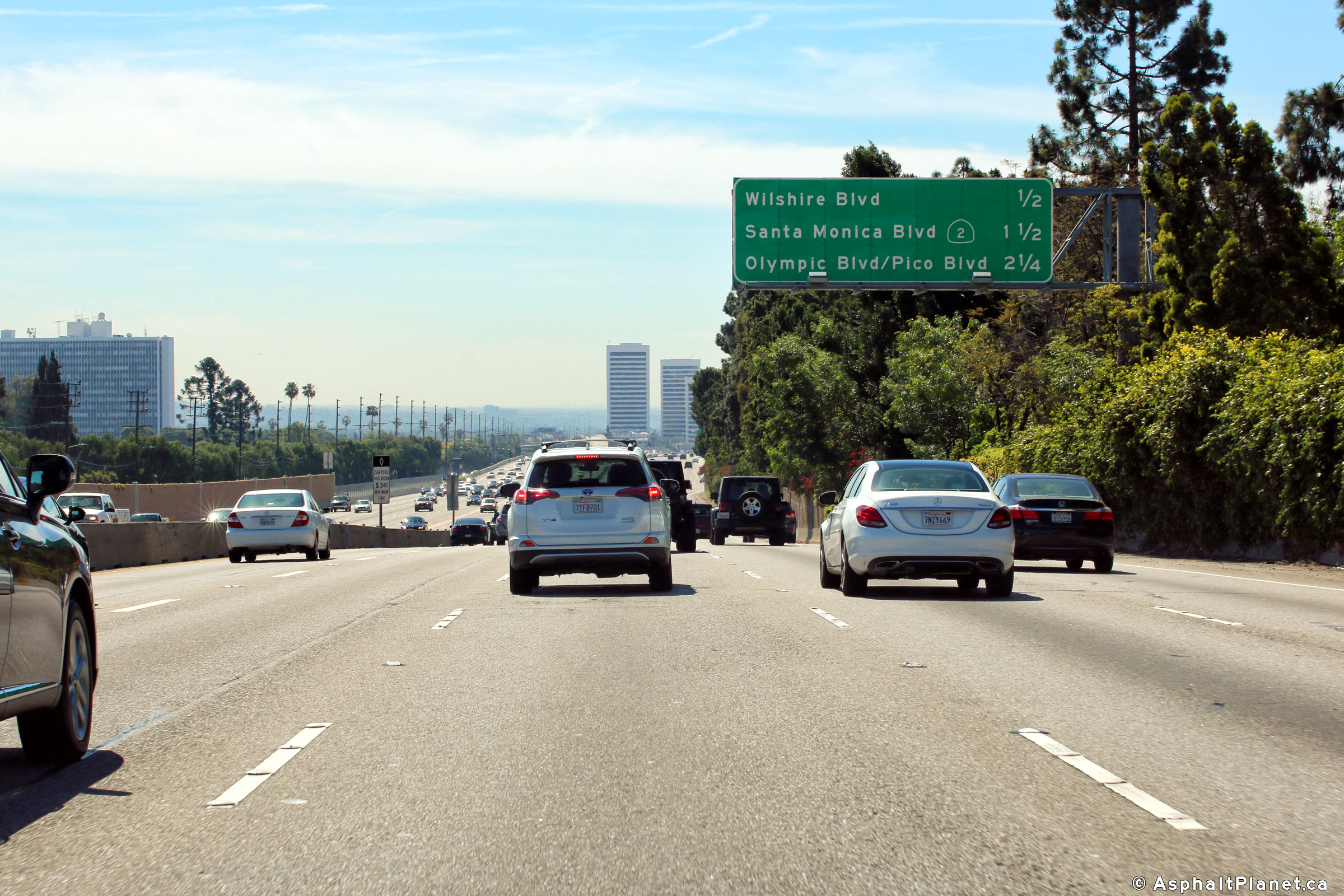
Los Angeles County |
Southbound advanced signage for the off-ramp to Santa Monica Boulevard. The on-ramp from the Wilshire Boulevard interchange quickly departs for Santa Monica Boulevard. |
 |
||
|
Date: 4/16/2017 |
High-res: (1440x960) (2400x1600) | |||
|
Los Angeles County |
Northbound advanced signage for the Wilshire Boulevard interchange. The on-ramp from Santa Monica Boulevard interchange quickly departs for Wilshire Boulevard. |
 |
||
|
Date: 4/16/2017 |
High-res: (1440x960) (2400x1600) |
|||
|
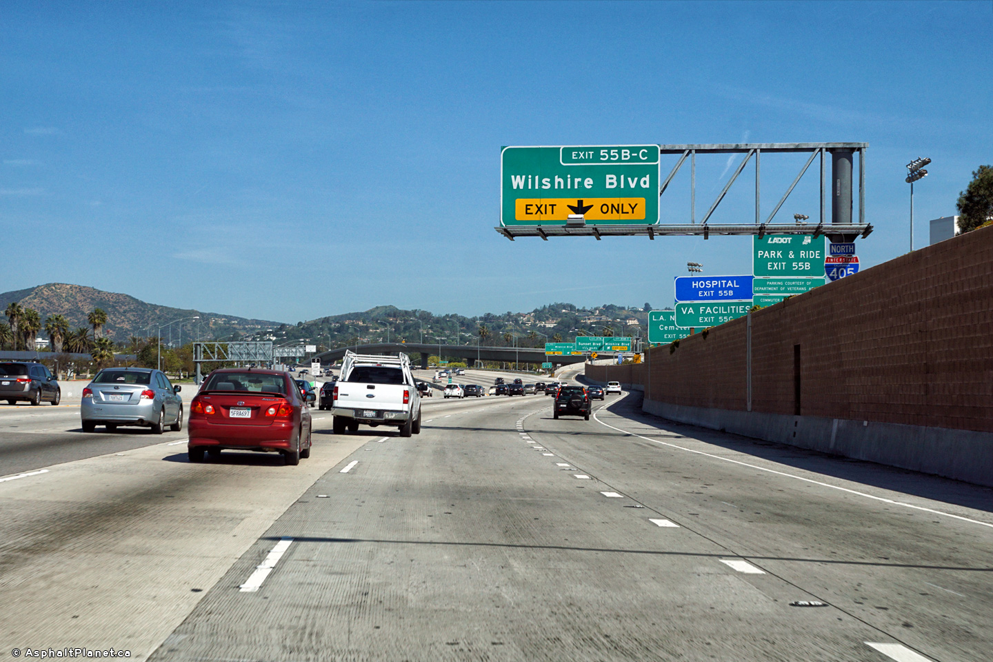
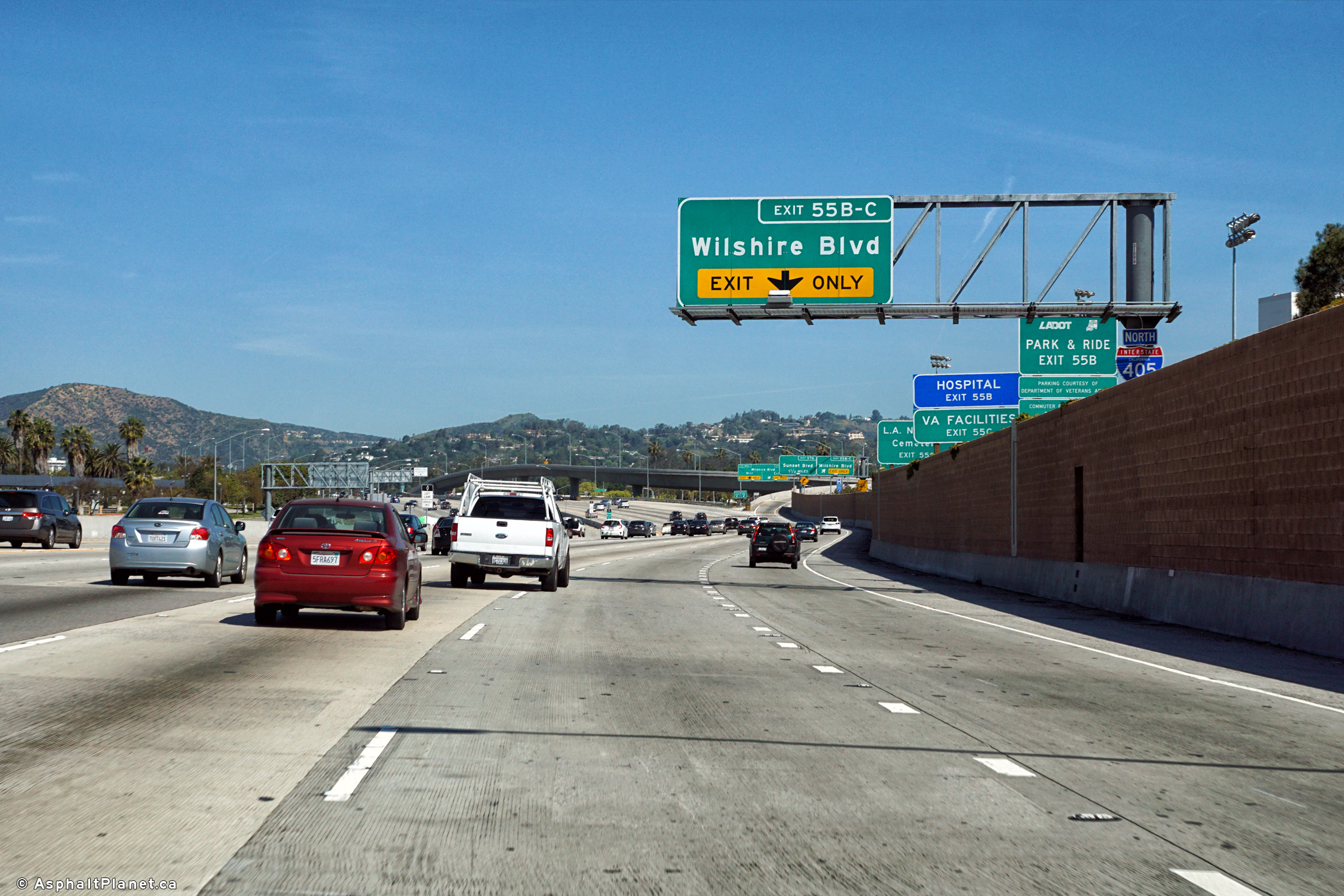
Los Angeles County |
Signage at the northbound off-ramp to Wilshire Boulevard. |
 |
||
|
Date: 4/16/2017 |
High-res: (1440x960) (2400x1600) |
|||
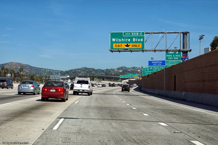
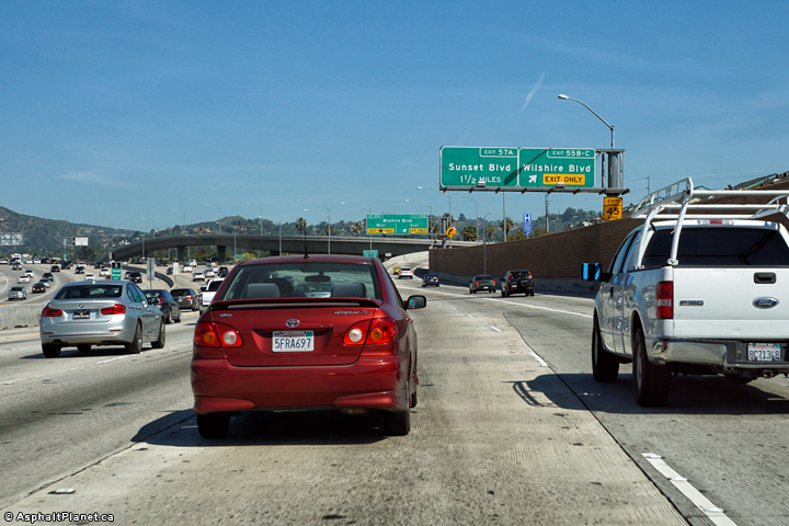
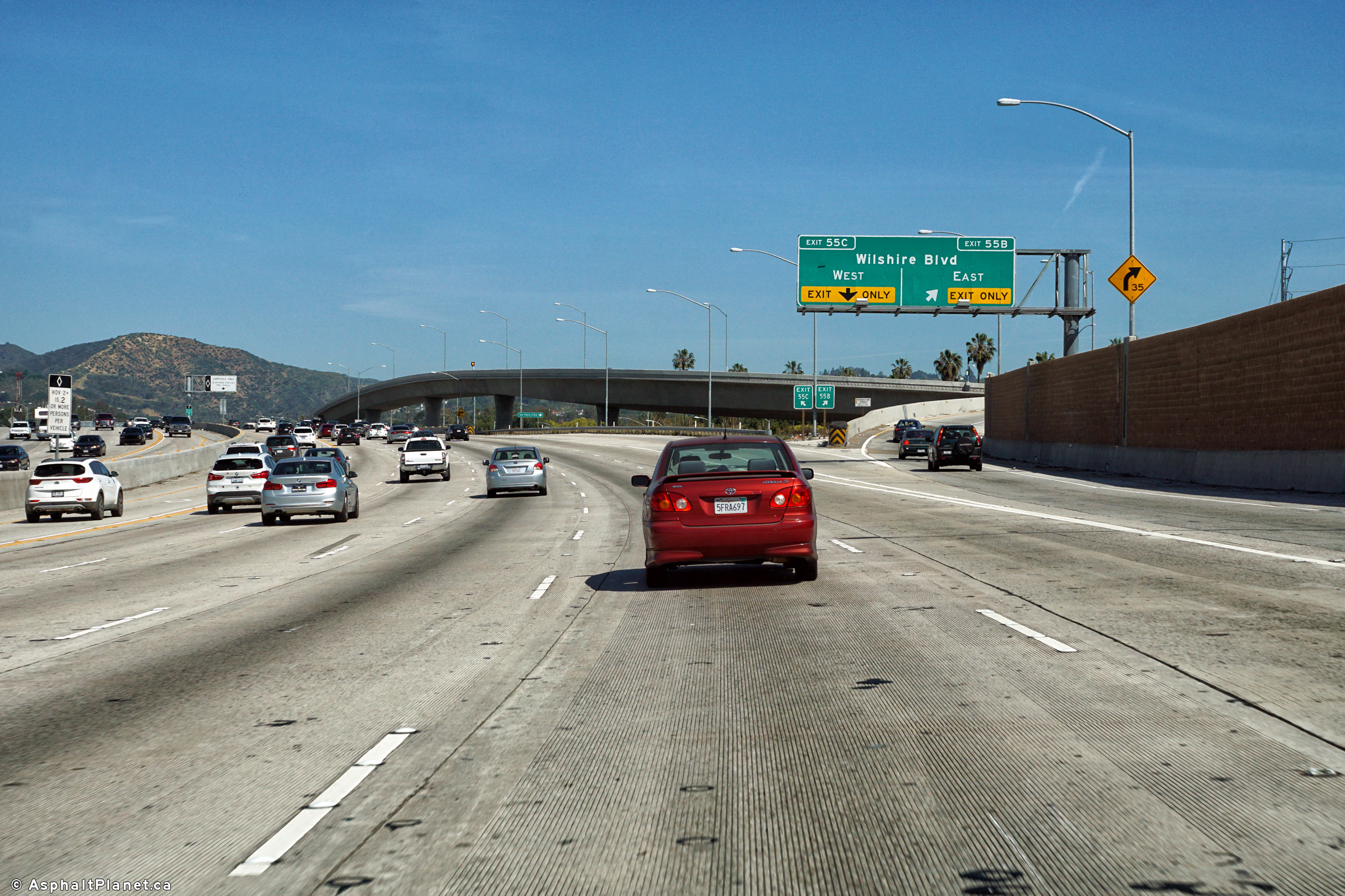
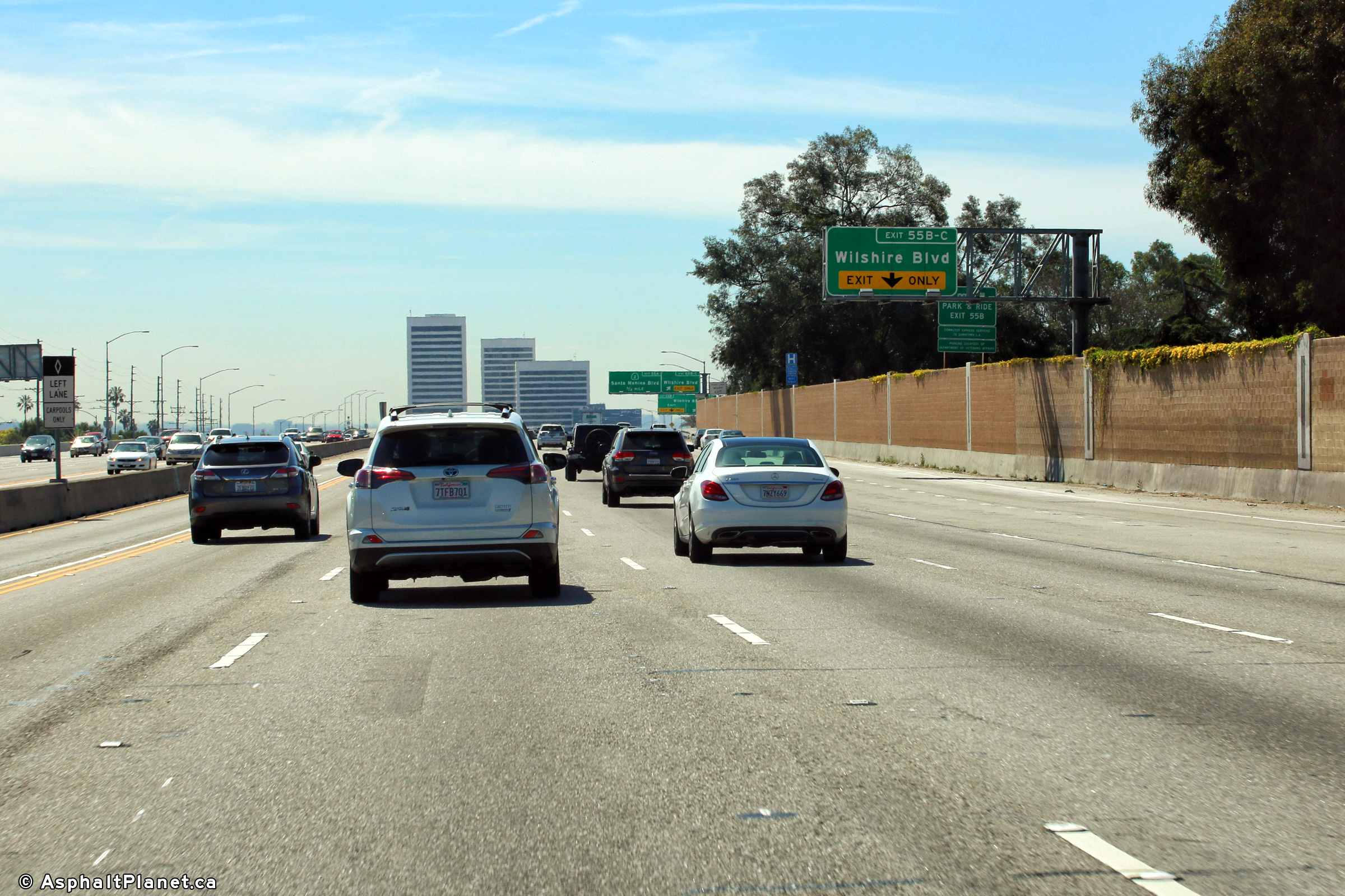
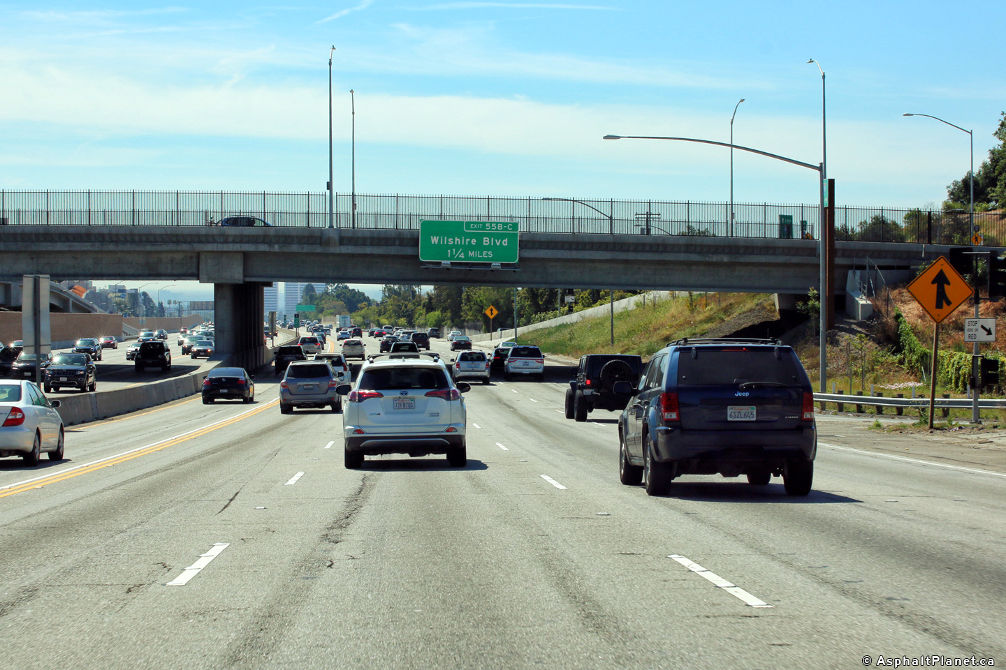
|
Los Angeles County |
The off-ramp to Wilshire Boulevard quickly splits into ramps to both the westbound and eastbound lanes of Wilshire Boulevard as I-405 meets Wilshire Boulevard at an elongated cloverleaf interchange. |
 |
||
|
Date: 4/16/2017 |
High-res: (1440x960) (2400x1600) |
|||
|
Los Angeles County |
Southbound interchange sequence signage situated in the footprint of the Wilshire Boulevard interchange. |
 |
||
|
Date: 4/16/2017 |
High-res: (1440x960) (2400x1600) | |||
|
Los Angeles County |
Southerly view of Interstate 405 as it passes through the Wilshire Boulevard interchange. Interstate 405 meets Wilshire Boulevard at a cloverleaf interchange |
 |
||
|
Date: 4/16/2017 |
High-res: (1440x960) (2400x1600) | |||
|
Los Angeles County |
Southbound signage at the off-ramp to Wilshire Boulevard. |
 |
||
|
Date: 4/16/2017 |
High-res: (1440x960) (2400x1600) | |||
|
Los Angeles County |
Southbound advanced signage for the off-ramp to Wilshire Boulevard. |
 |
||
|
Date: 4/16/2017 |
High-res: (1440x960) (2400x1600) | |||
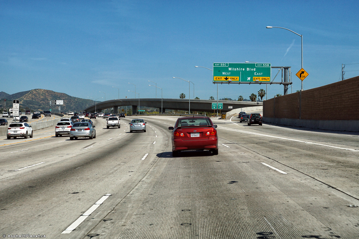
|
Los Angeles County |
Southbound interchange sequence signage approaching the Wilshire Boulevard interchange. |
 |
||
|
Date: 4/16/2017 |
High-res: (1440x960) (2400x1600) | |||
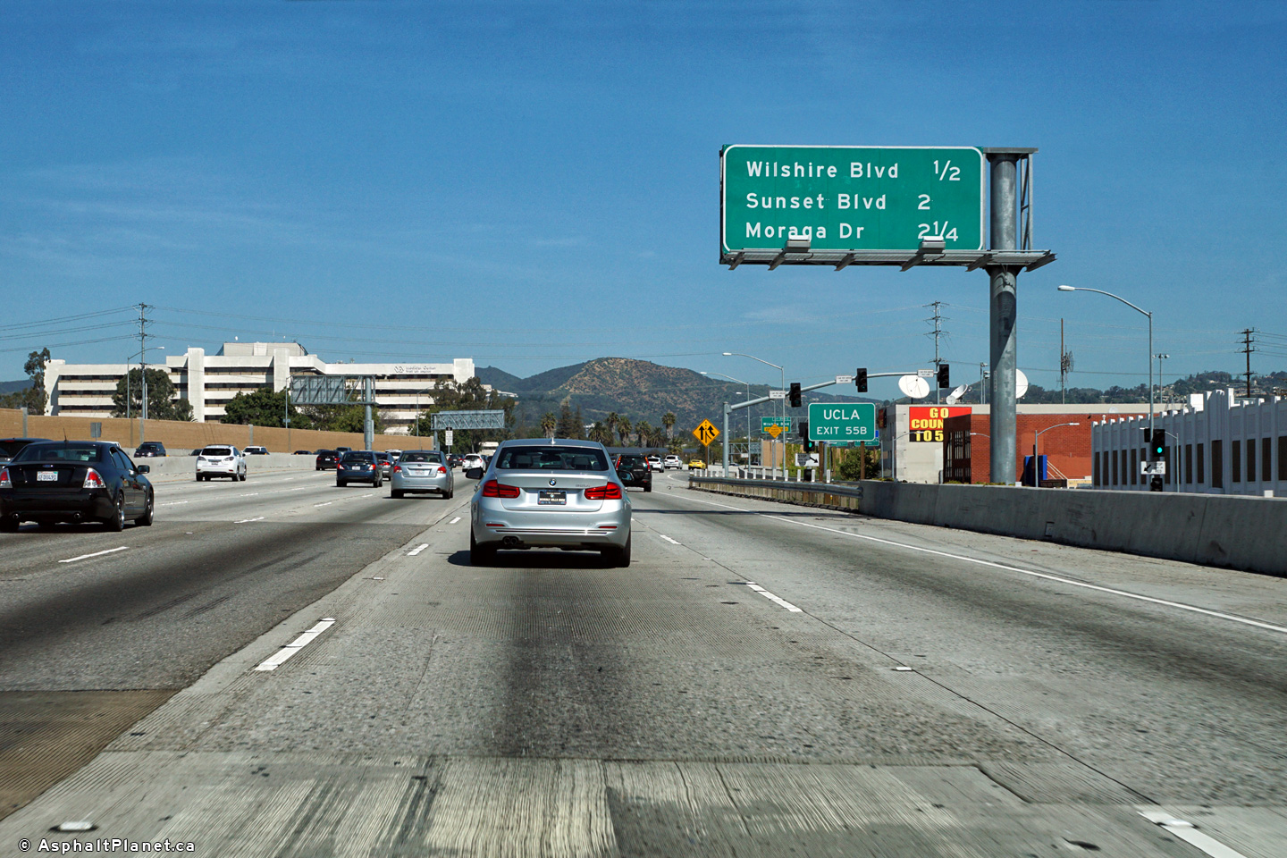
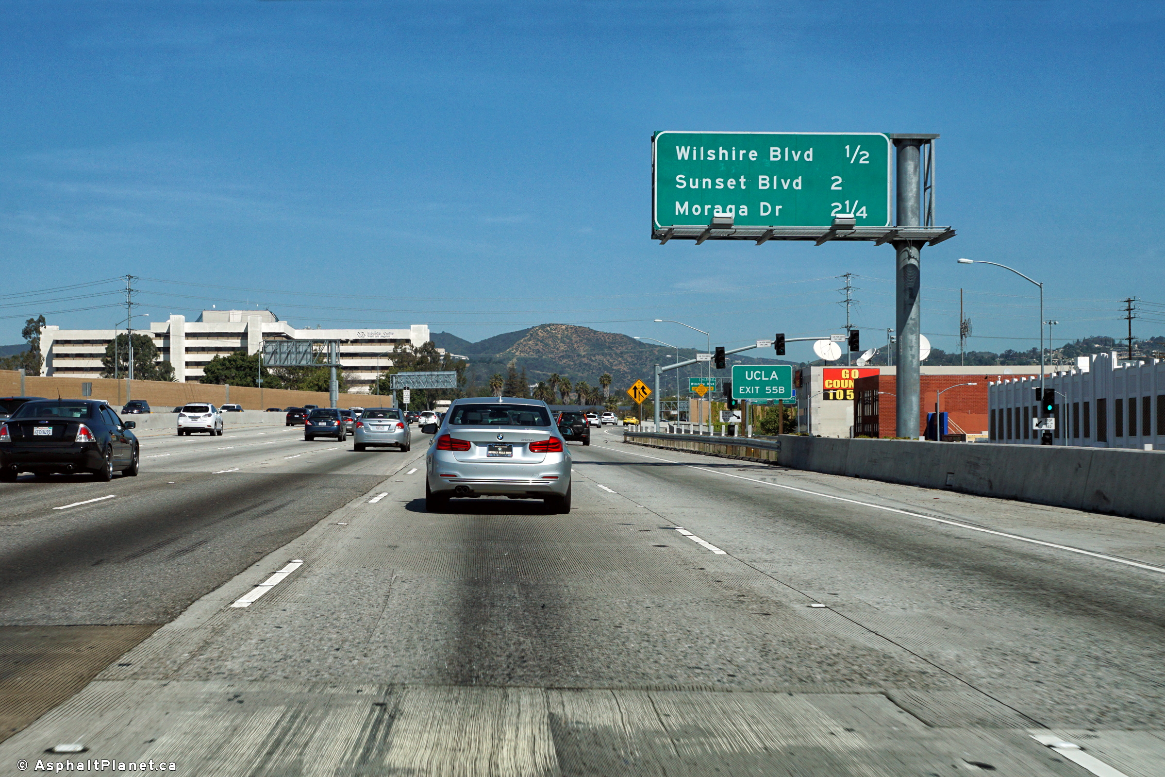
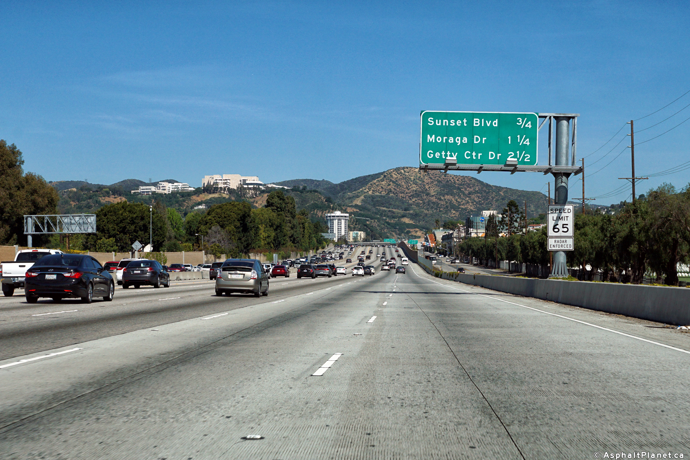
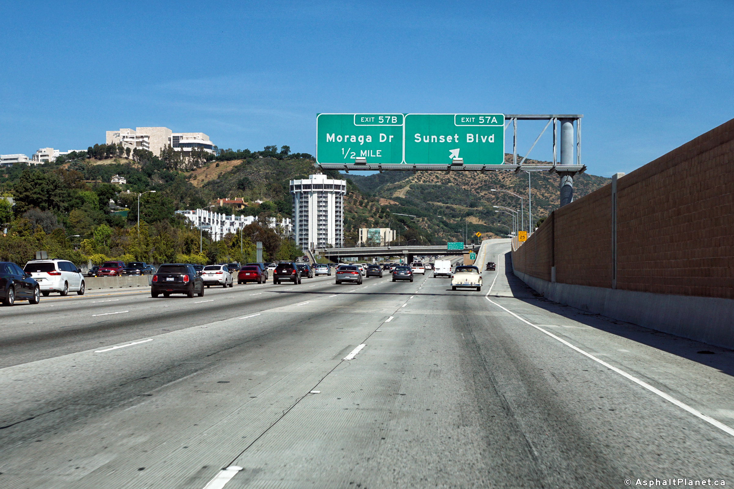
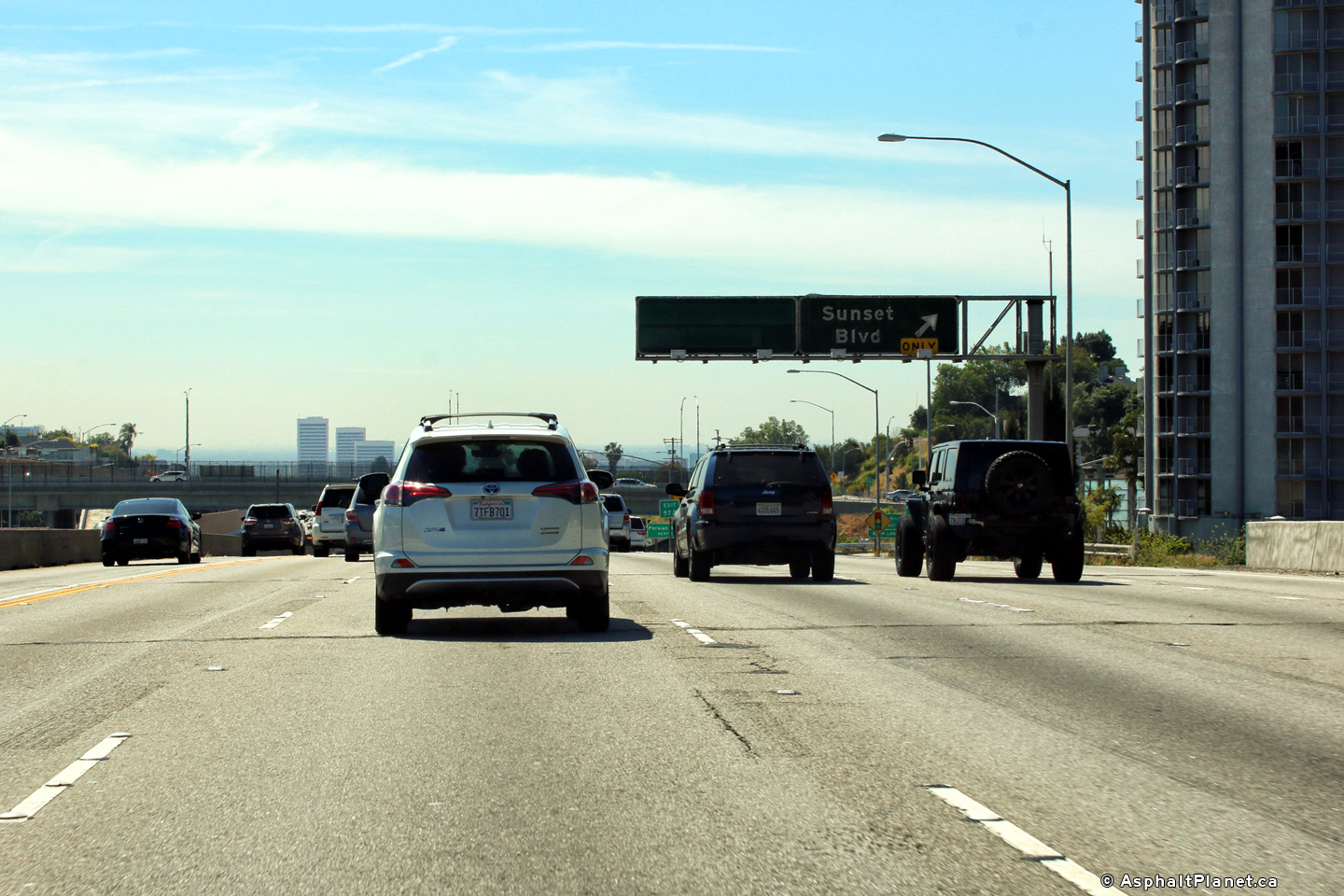
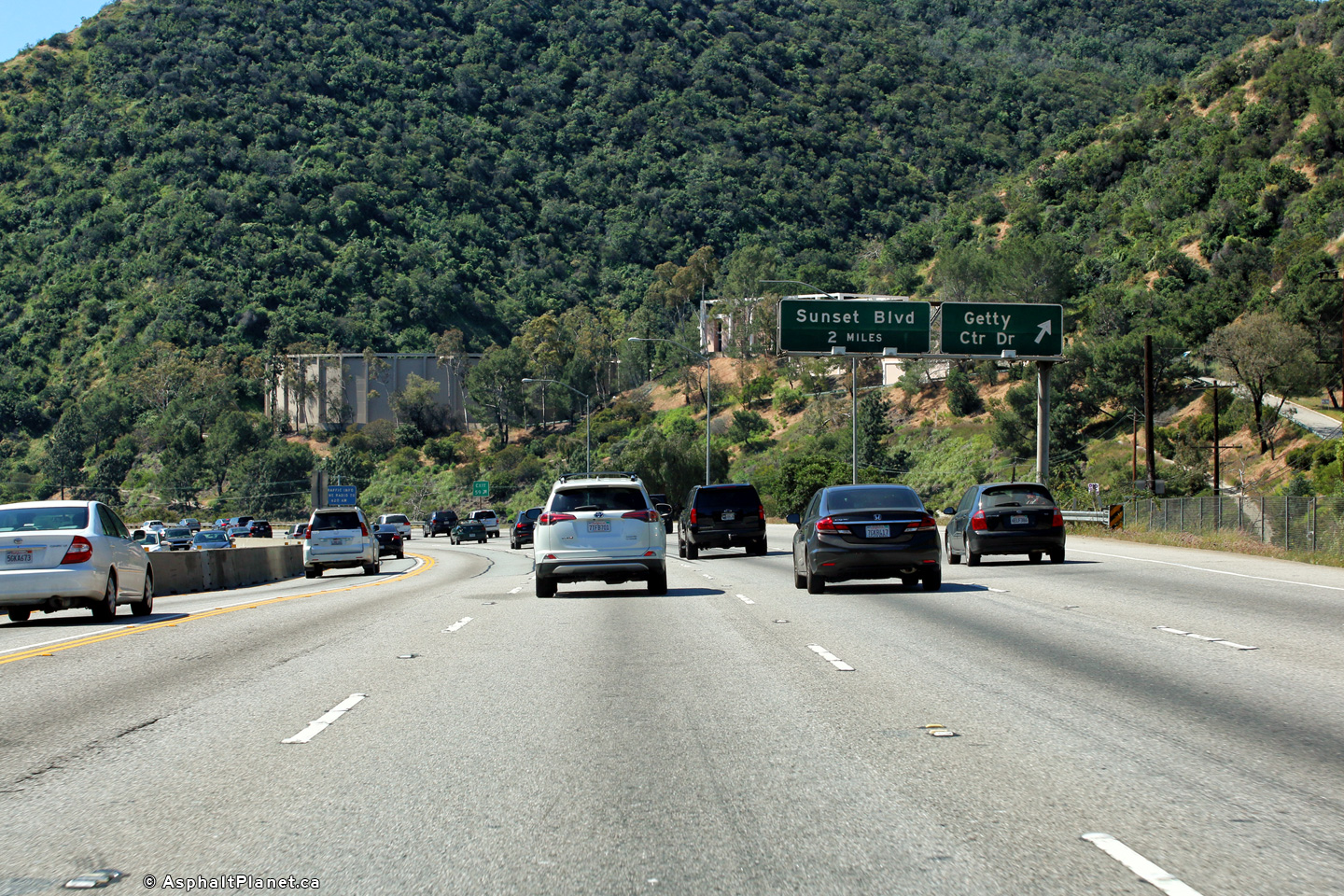
|
Los Angeles County |
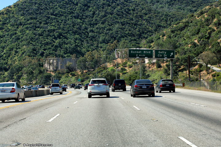
Northbound interchange sequence signage approaching the Sunset Boulevard interchange. |
 |
||
|
Date: 4/16/2017 |
High-res: (1440x960) (2400x1600) |
|||
|
Los Angeles County |
Northbound signage at the off-ramp to Sunset Boulevard. |
 |
||
|
Date: 4/16/2017 |
High-res: (1440x960) (2400x1600) |
|||
|
Los Angeles County |
View looking northerly as I-405 passes beneath the Sunset Boulevard interchange. |
 |
||
|
Date: 4/16/2017 |
High-res: (1440x960) (2400x1600) |
|||
|
Los Angeles County |
Southerly view along I-405 from the Sunset Boulevard overpass. The on-ramps to and from I-405 North pass overtop of Sepulveda Boulevard as is pictured in the top photo of the series. |
 |
||
|
High-res: (1440x960) (2400x1600) |
||||
 |
||||
|
High-res: (1440x960) (2400x1600) |
||||
 |
||||
|
Date: 4/16/2017 |
High-res: (1440x960) (2400x1600) |
|||
|
Los Angeles County |
A series of three views looking northerly along the 405 Freeway from the Sunset Boulevard overpass. Just north of the Sunset Boulevard interchange the 405 begins its climb north over Sepulveda Pass from the LA Basin into the San Fernando Valley. |
 |
||
|
High-res: (1440x960) (2400x1600) |
||||
 |
||||
|
High-res: (1440x960) (2400x1600) |
||||
 |
||||
|
Date: 4/16/2017 |
High-res: (1440x960) (2400x1600) |
|||
|
Los Angeles County |
Southerly view as the 405 passes through the Sunset Boulevard interchange. |
 |
||
|
Date: 4/16/2017 |
High-res: (1440x960) (2400x1600) | |||
|
Los Angeles County |
Southbound signage at the of-ramp to Sunset Boulevard. Until the late 1990s there was an off-ramp servicing local accesses at South Church Lane between Sunset and Wilshire Boulevards hence why the pre-advanced sign for the next interchange has been "greened-out". |
 |
||
|
Date: 4/16/2017 |
High-res: (1440x960) (2400x1600) | |||
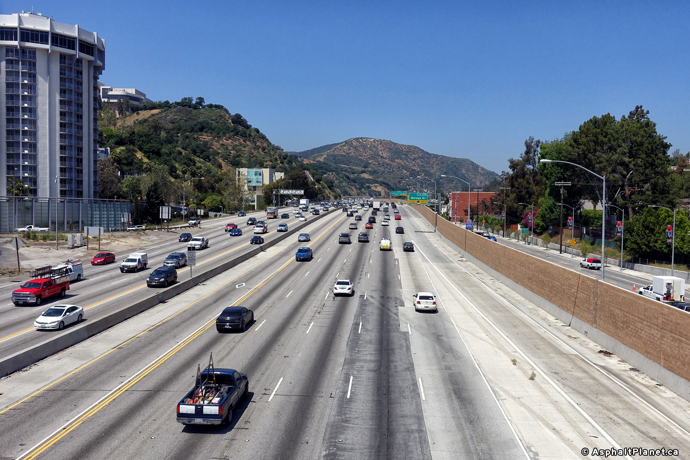
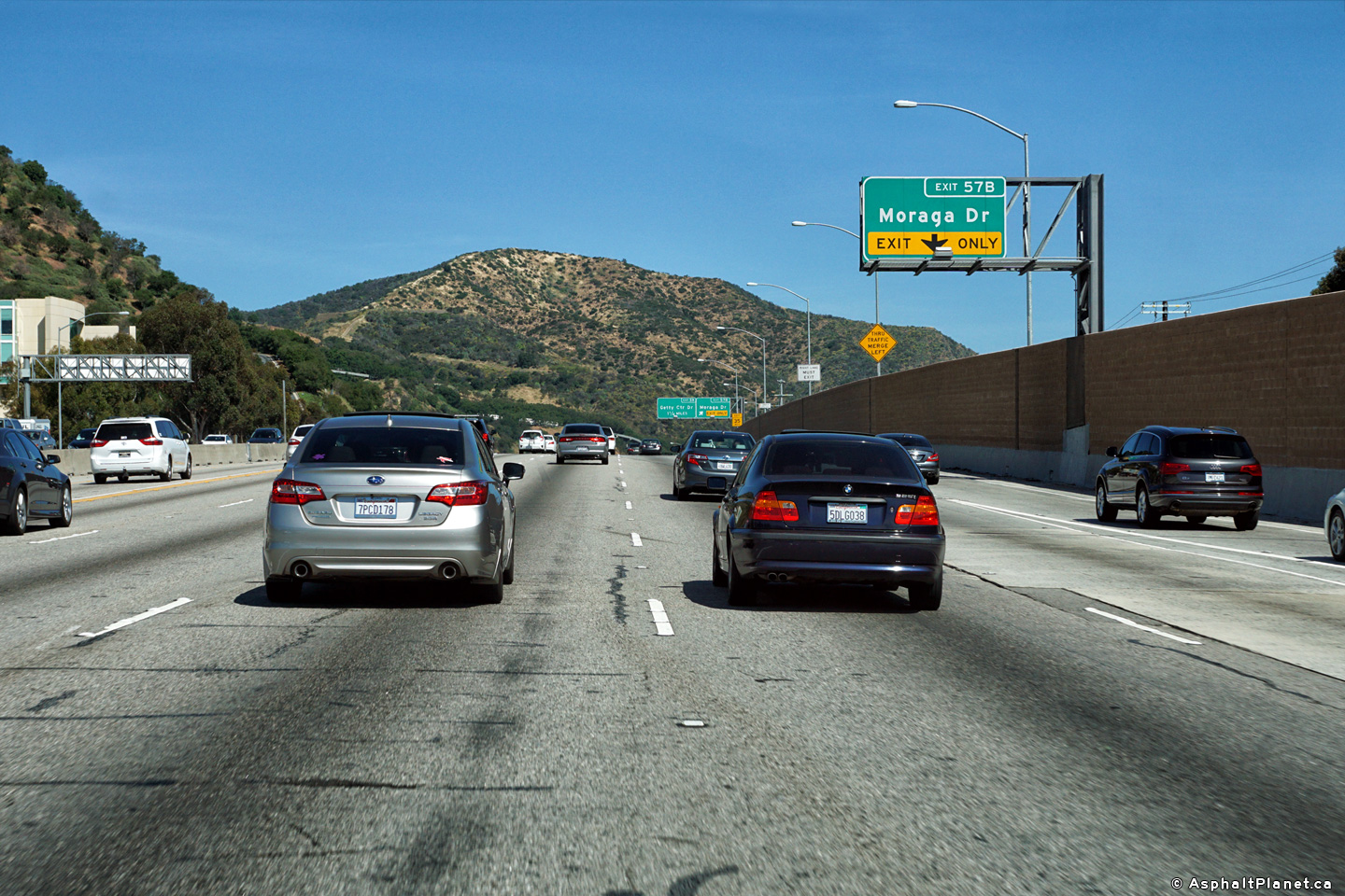
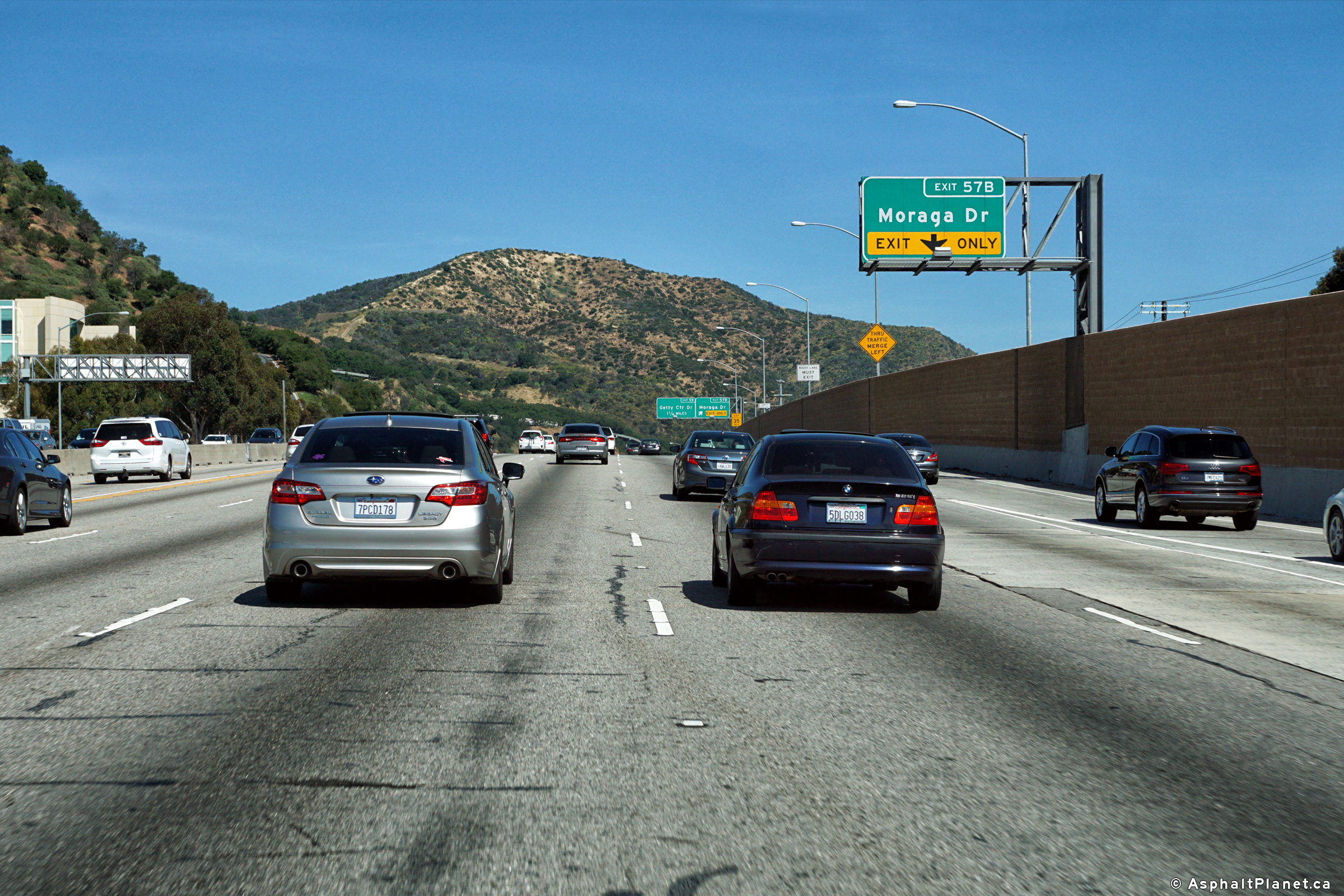
|
Los Angeles County |
Northbound advanced signage for the Moraga Drive interchange. |
 |
||
|
Date: 4/16/2017 |
High-res: (1440x960) (2400x1600) |
|||
|
Los Angeles County |
Signage at the northbound off-ramp to Moraga Drive. |
 |
||
|
Date: 4/16/2017 |
High-res: (1440x960) (2400x1600) |
|||
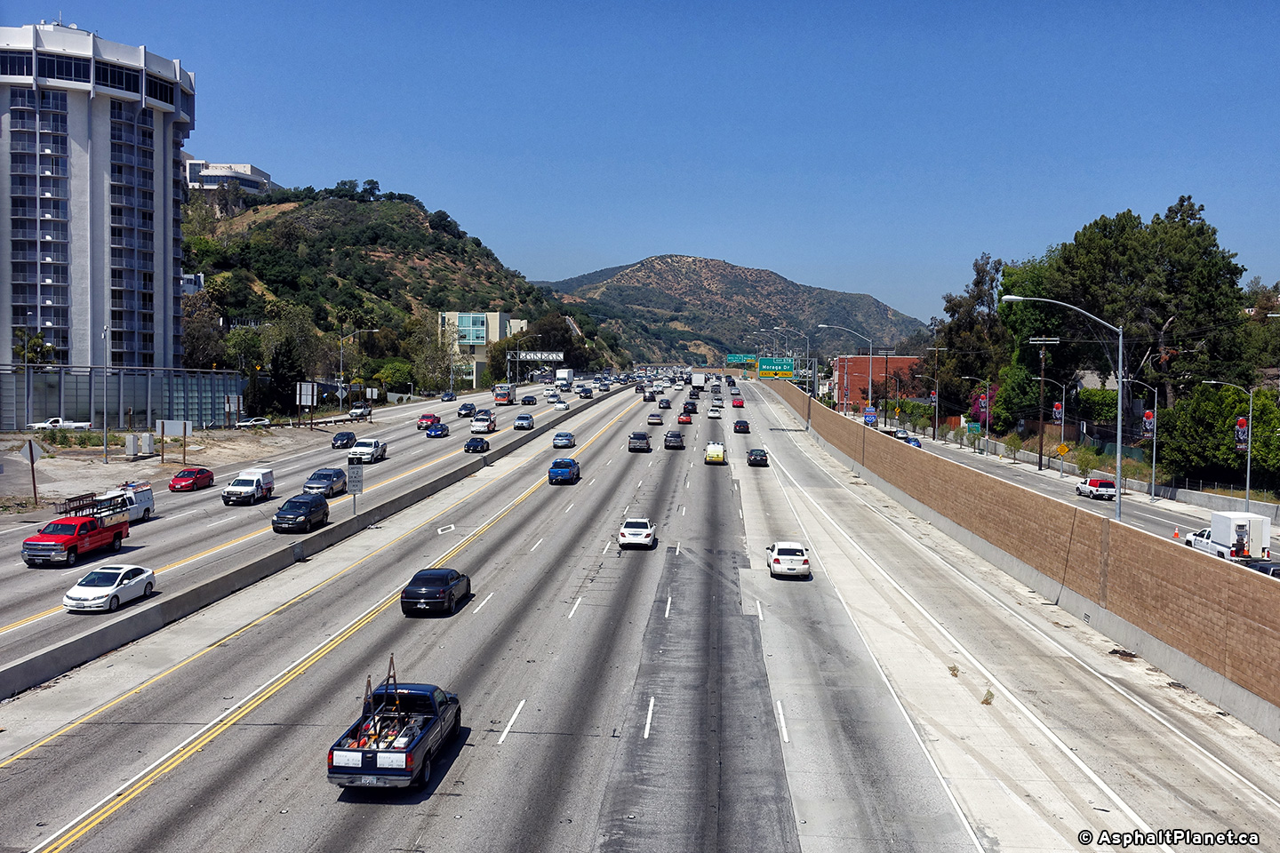
|
Los Angeles County |
Southbound interchange sequence signage approaching the Sunset Boulevard interchange. |
 |
||
|
Date: 4/16/2017 |
High-res: (1440x960) (2400x1600) | |||
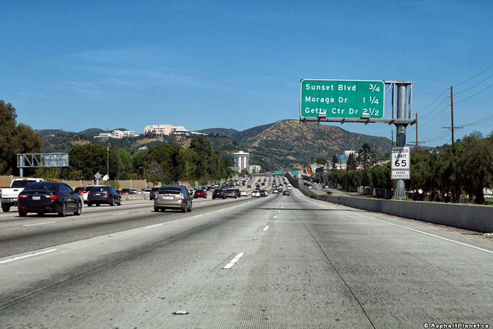
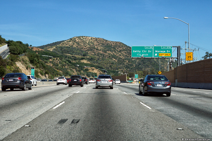
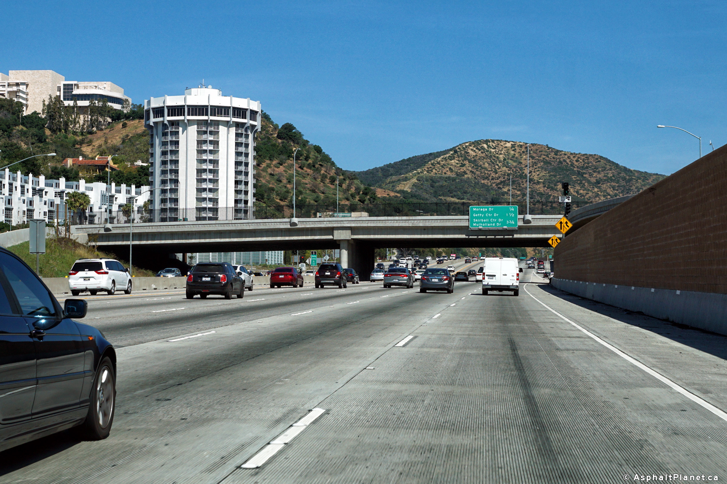
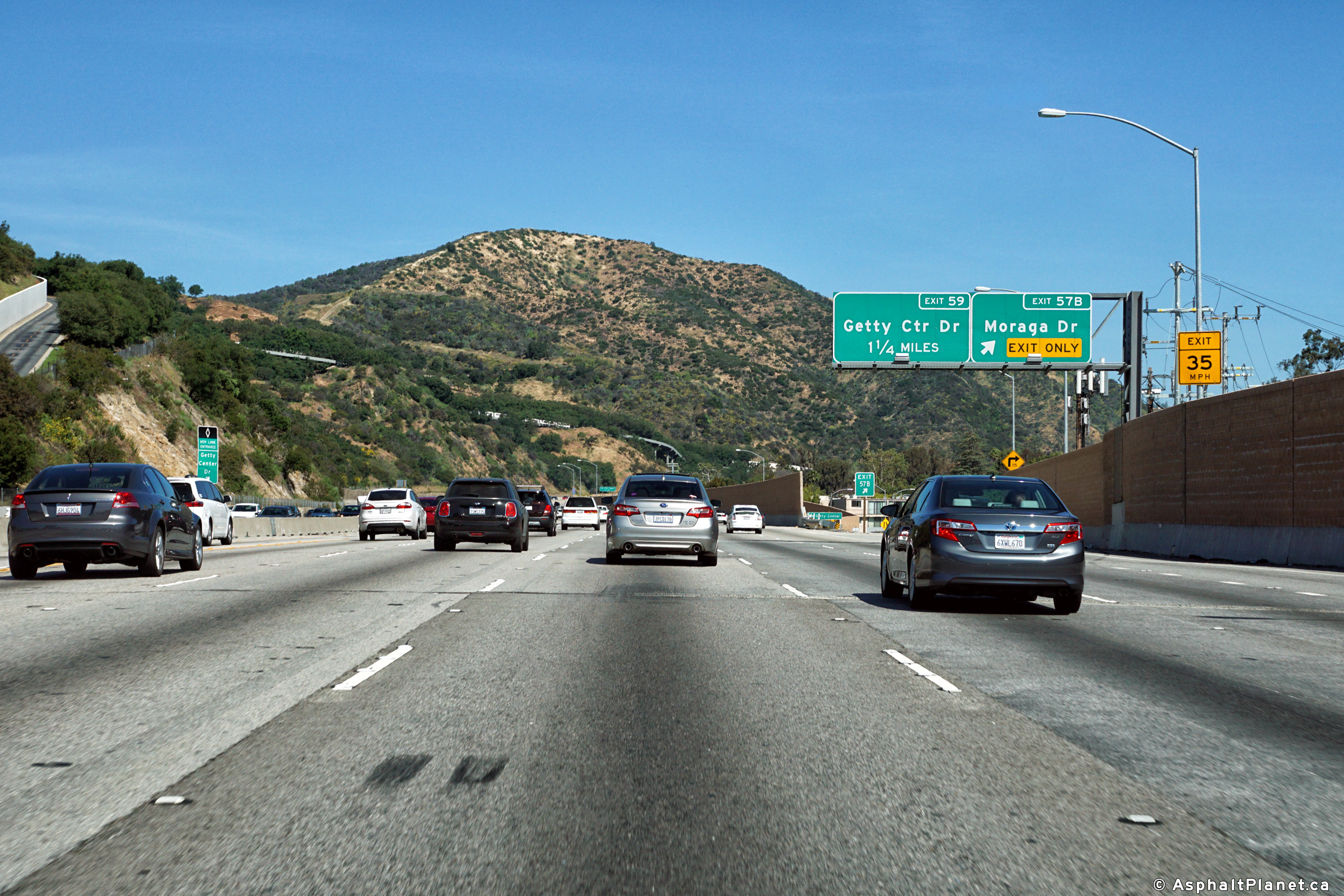
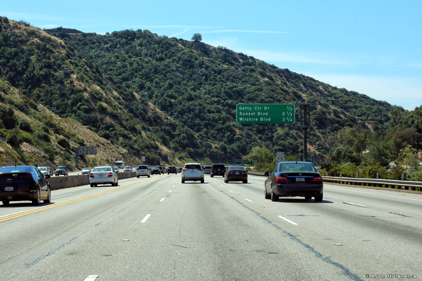
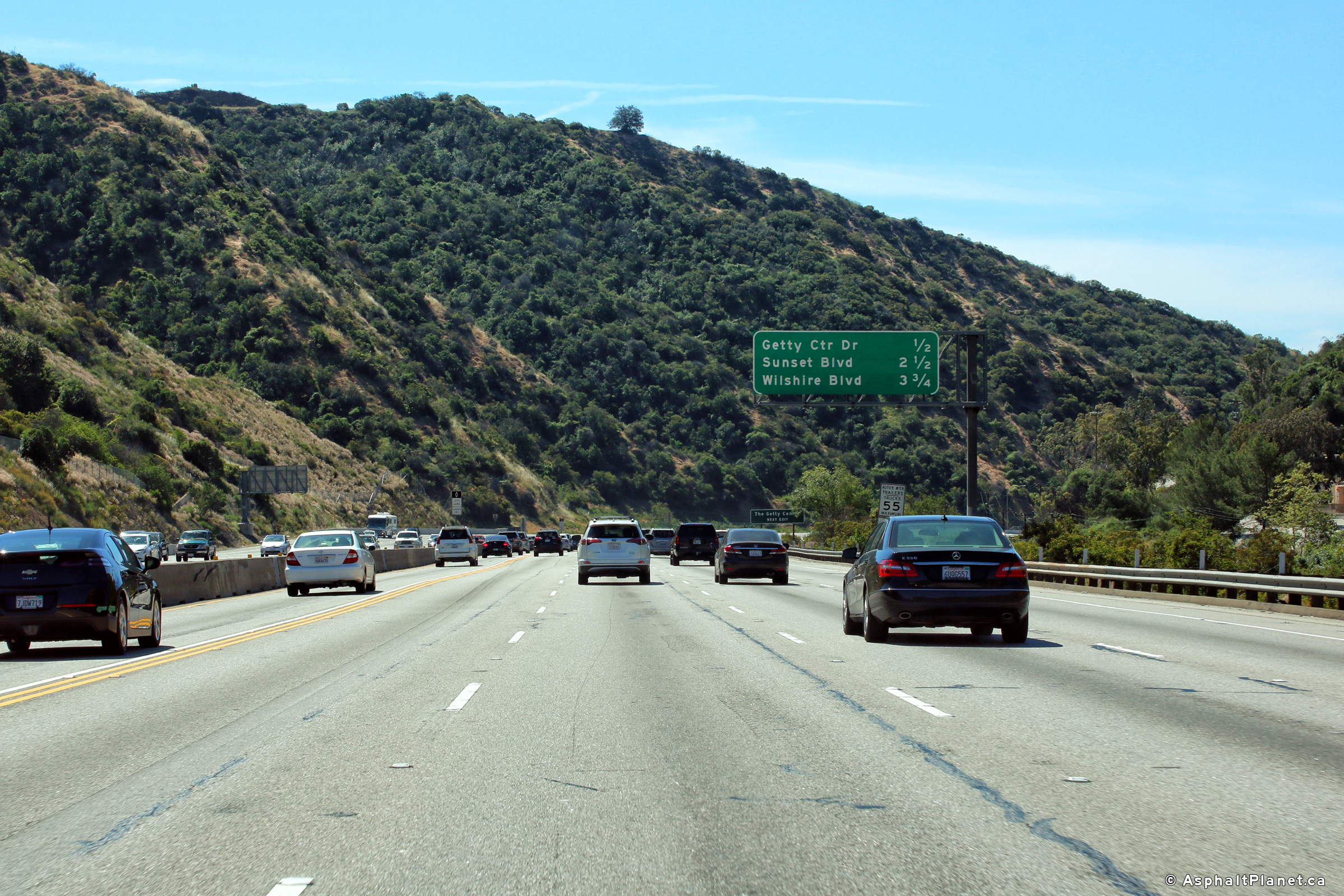
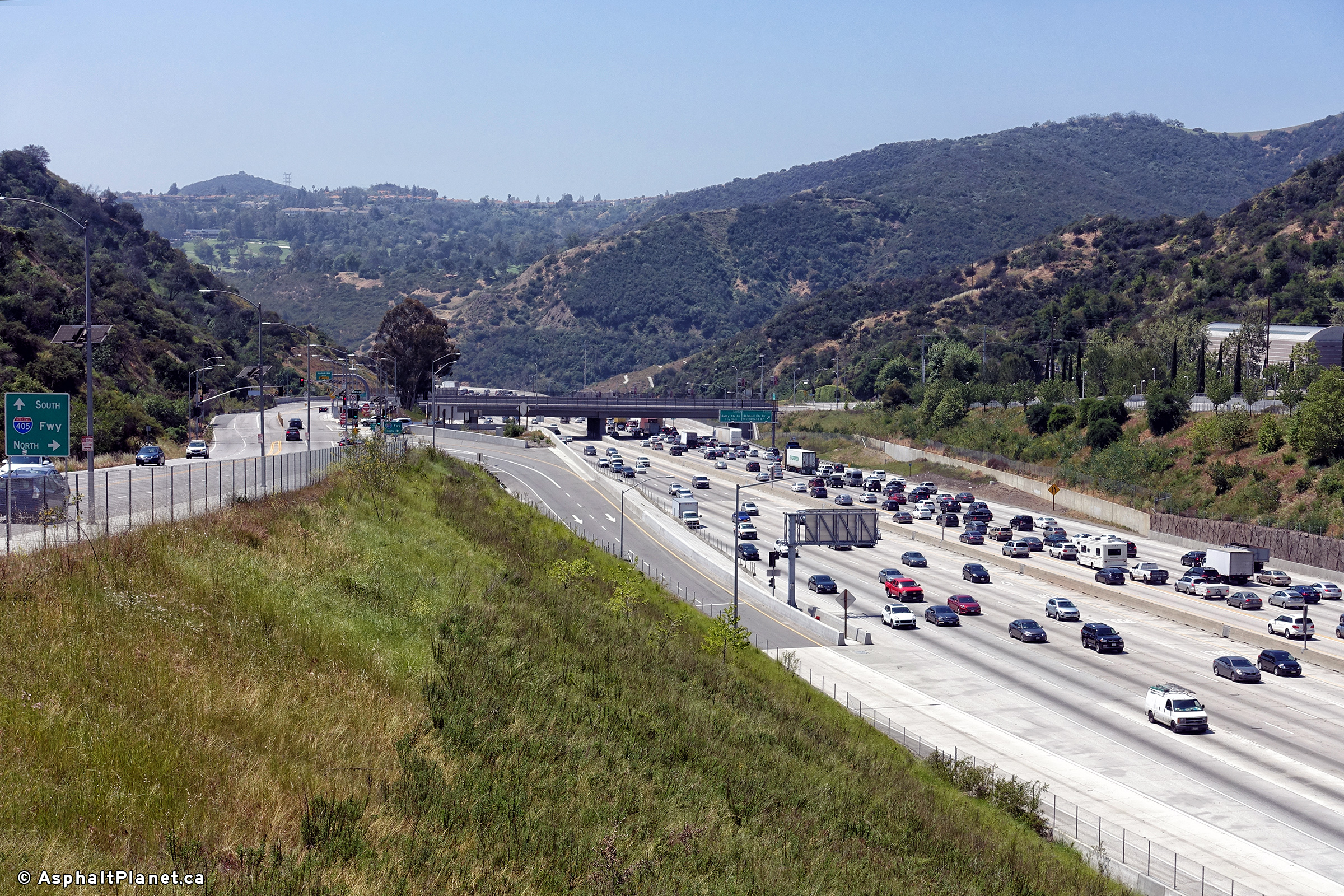
|
Los Angeles County |
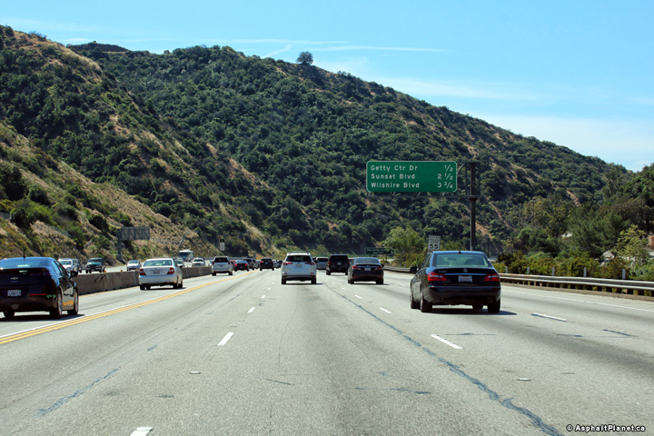
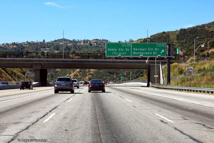
Northbound interchange sequence signage approaching the Getty Center Drive interchange. |
 |
||
|
Date: 4/16/2017 |
High-res: (1440x960) (2400x1600) |
|||
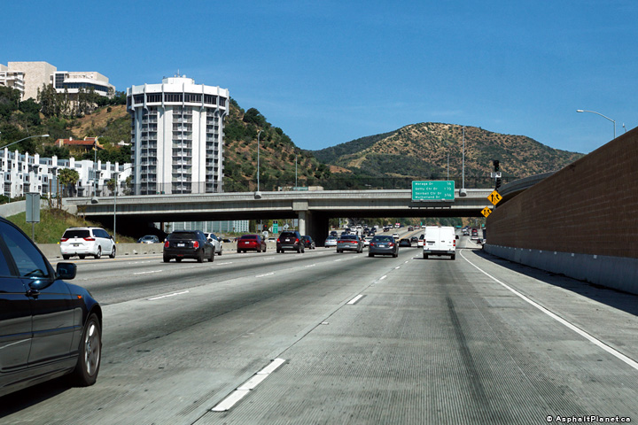
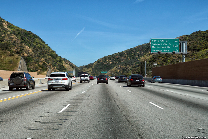
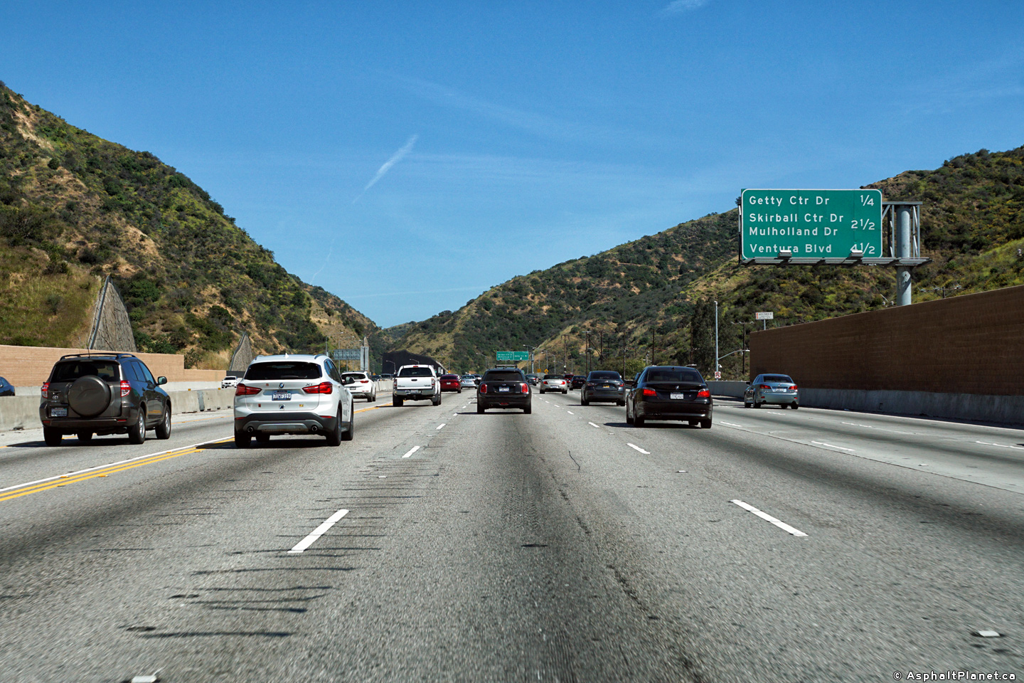
|
Los Angeles County |
Northbound signage at the off-ramp to Getty Center Drive. Note the significant retaining walls that have been constructed to retain the mountains that line the Sepulveda Pass freeway corridor. These retaining walls were constructed during a mid-2010's reconstruction and widening of I-405 through Sepulveda Pass. |
 |
||
|
Date: 4/16/2017 |
High-res: (1440x960) (2400x1600) |
|||
|
Los Angeles County |
Southbound signage at the off-ramp to Getty Center Drive. |
 |
||
|
Date: 4/16/2017 |
High-res: (1440x960) (2400x1600) | |||
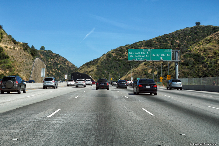
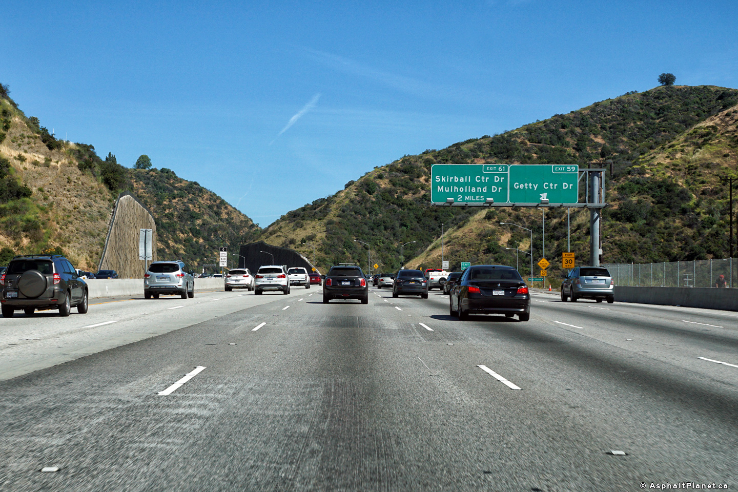
|
Los Angeles County |
Southbound interchange sequence signage in advance of the Getty Centre Drive interchange. |
 |
||
|
Date: 4/16/2017 |
High-res: (1440x960) (2400x1600) | |||
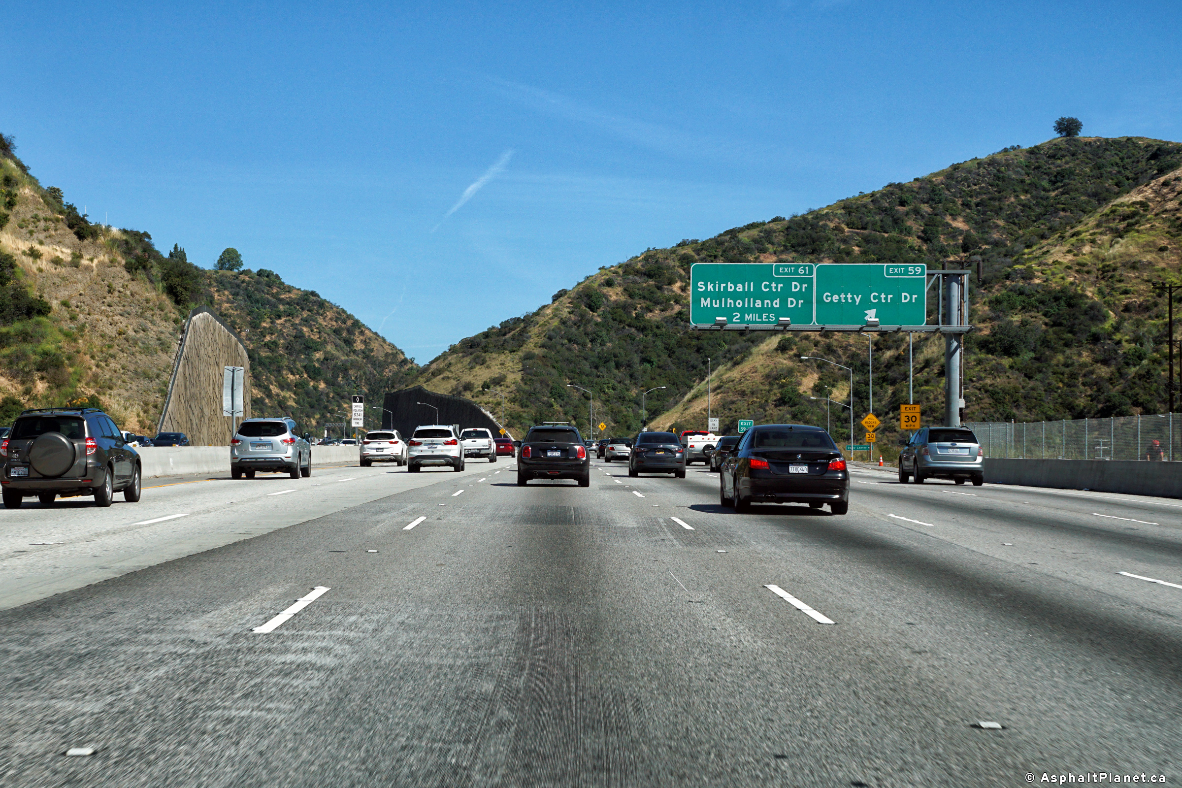
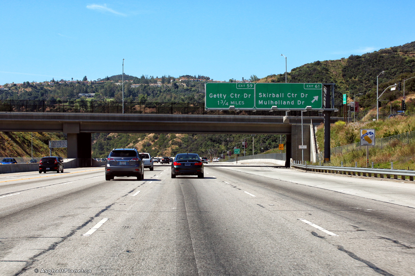
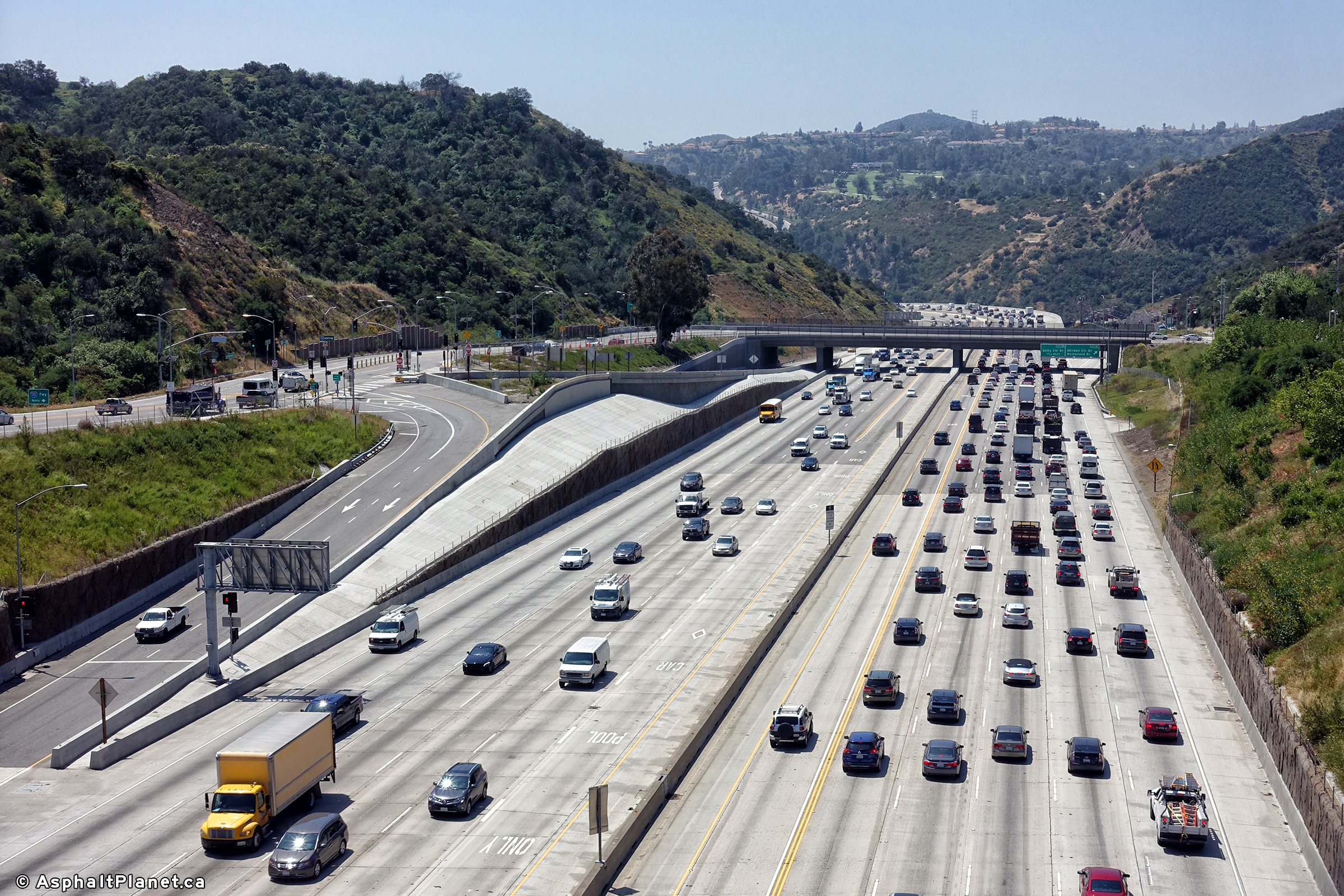
|
Los Angeles County |
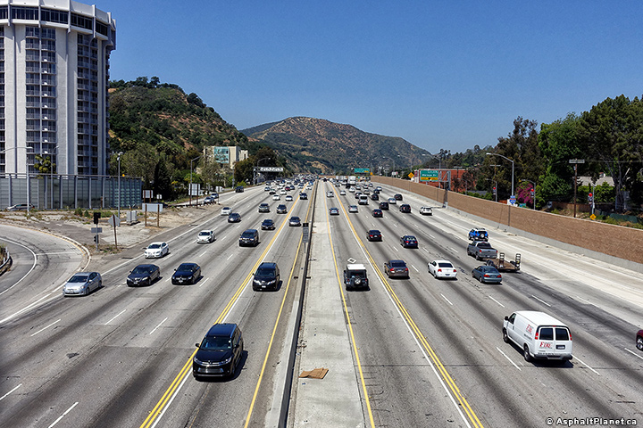
Signage at the southbound off-ramp to Skirball Center and Mulholland Drives. The sixth southbound lane ends just beyond this signage -- a source of major congestion along this section of the San Diego Freeway during most daylight hours. |
 |
||
|
Date: 4/16/2017 |
High-res: (1440x960) (2400x1600) | |||
|
Los Angeles County |
Northbound view along Interstate 405 as the highway passes beneath the towering Mulholland Driver overpass. |
 |
||
|
Date: 4/16/2017 |
High-res: (1440x960) (2400x1600) |
|||
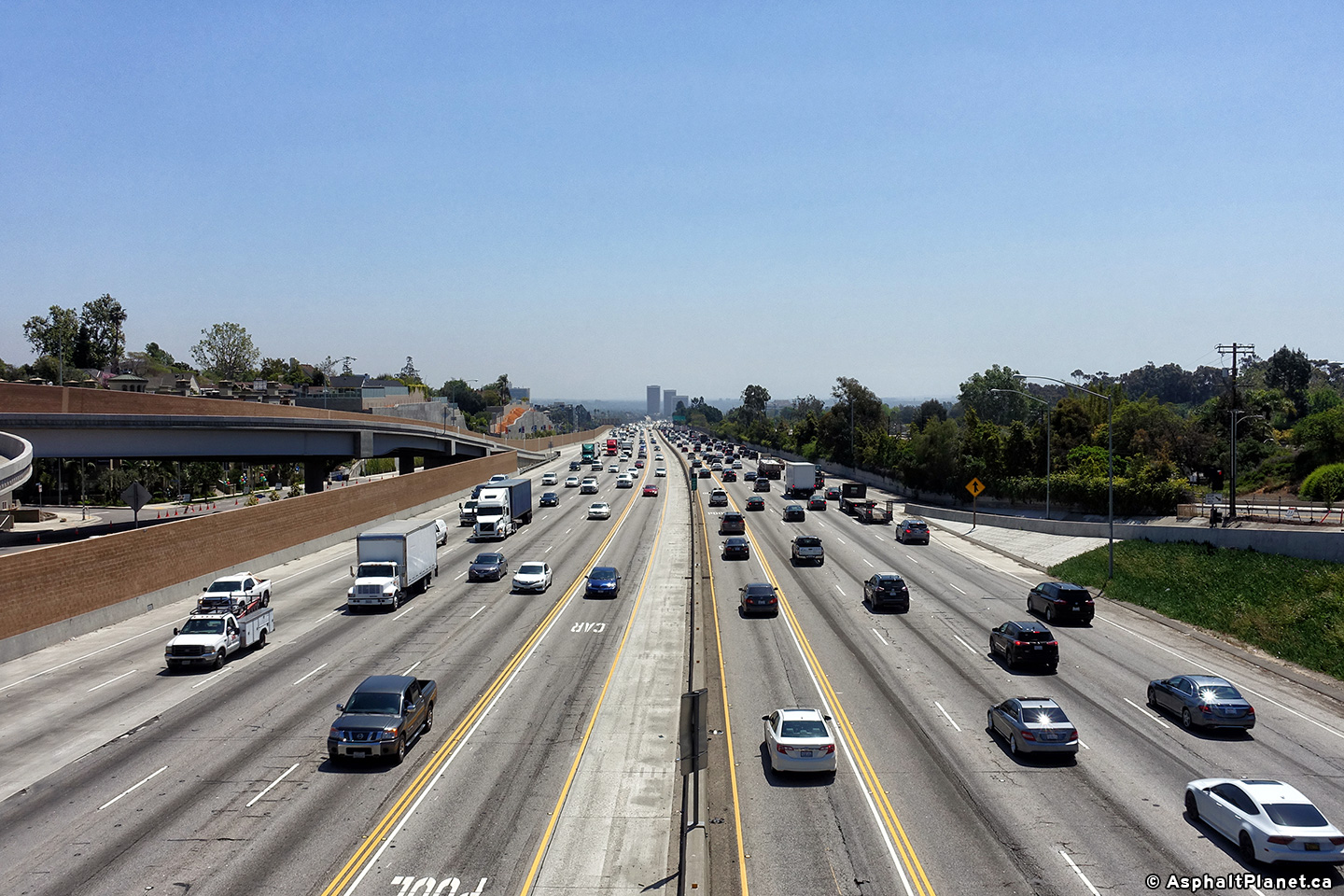
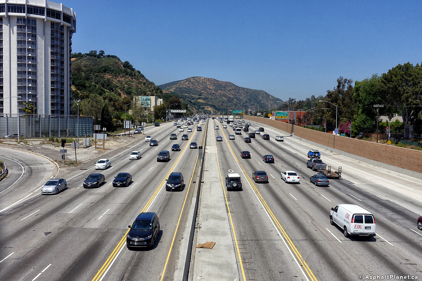
|
Los Angeles County |
Two views looking southerly from Mulholland Drive as the 405 Freeway descends through Sepulveda Pass. |
 |
||
| High-res: (1440x960) (2400x1600) | ||||
 |
||||
|
Date: 4/16/2017 |
High-res: (1440x960) (2400x1600) | |||
|
Los Angeles County |
Two views looking northerly from the Mulholland Drive overpass as the 405 Freeway begins its descent into the San Fernando Valley. |
 |
||
| High-res: (1440x960) (2400x1600) | ||||
 |
||||
|
Date: 4/16/2017 |
High-res: (1440x960) (2400x1600) | |||
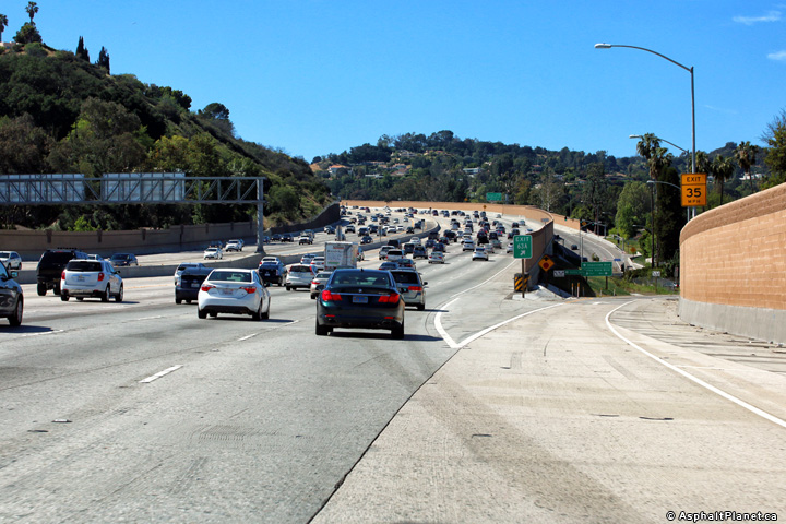
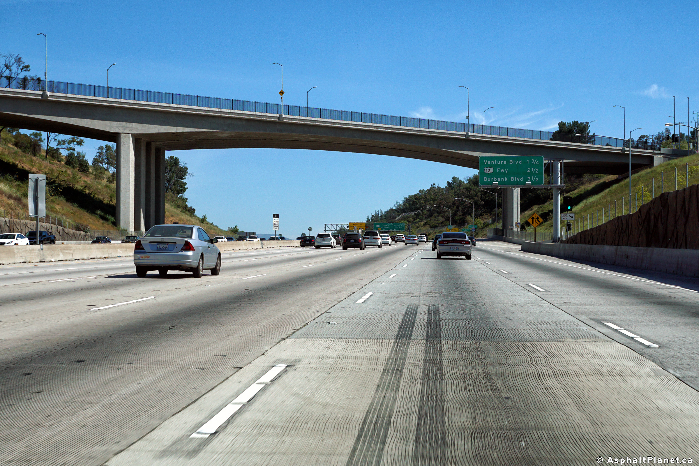
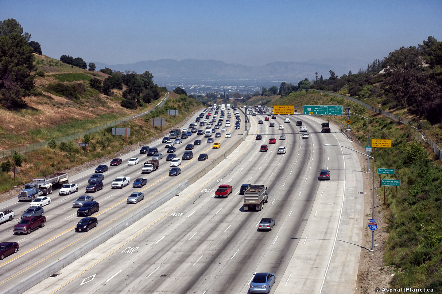
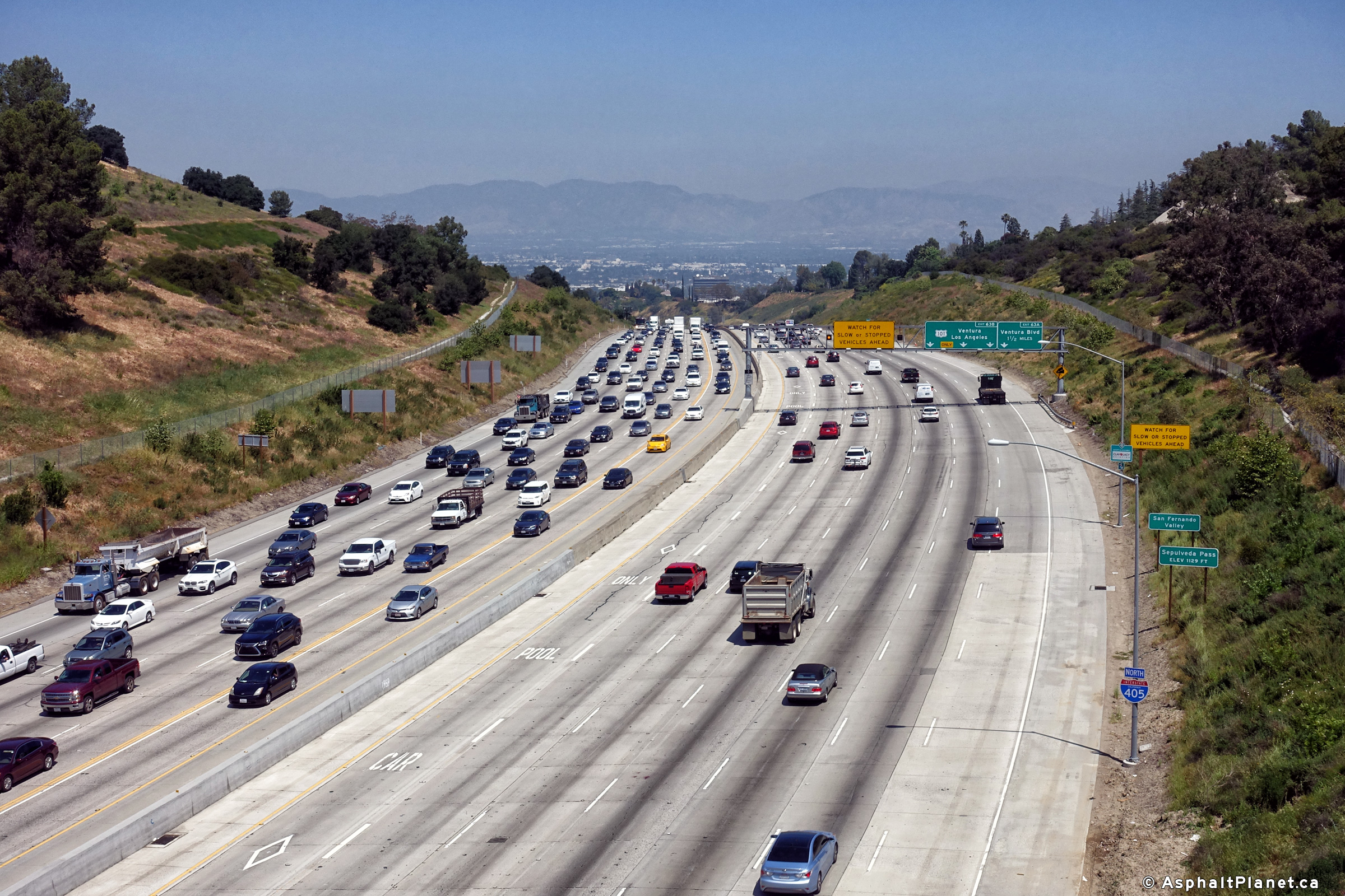
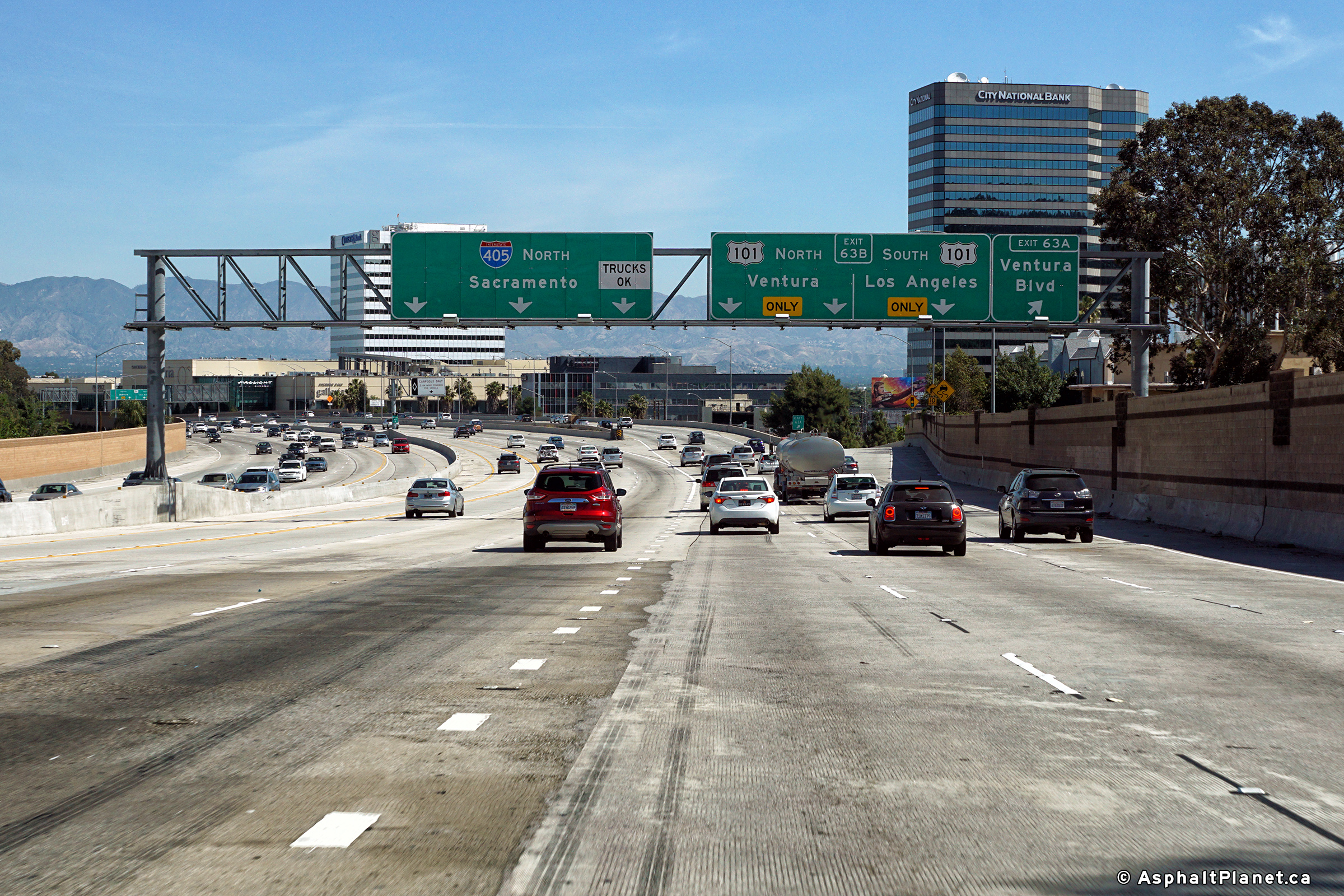
|
Los Angeles County |
Overhead lane assignment signage approaching the interchange with US-101 in the San Fernando Valley. As denoted by the overhead signage, this interchange is fairly chronically congested. |
 |
||
|
Date: 4/16/2017 |
High-res: (1440x960) (2400x1600) |
|||
|
Los Angeles County |
View looking northerly at the off-ramp to Valley View Drive. |
 |
||
|
Date: 4/16/2017 |
High-res: (1440x960) (2400x1600) | |||
|
Los Angeles County |
Modern signage at the northbound off-ramp to Valley View Drive. |
 |
||
|
Date: 4/16/2017 |
High-res: (1440x960) (2400x1600) | |||
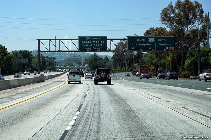
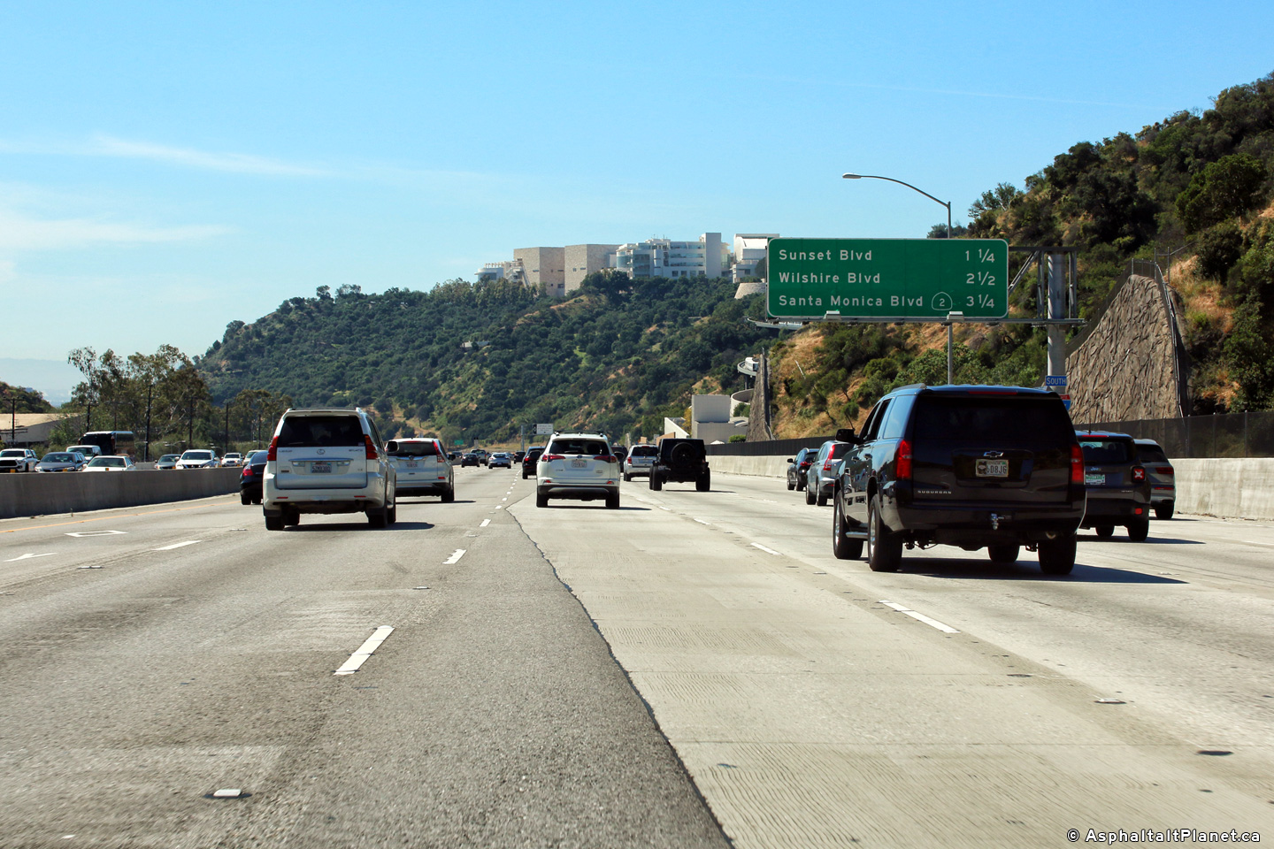
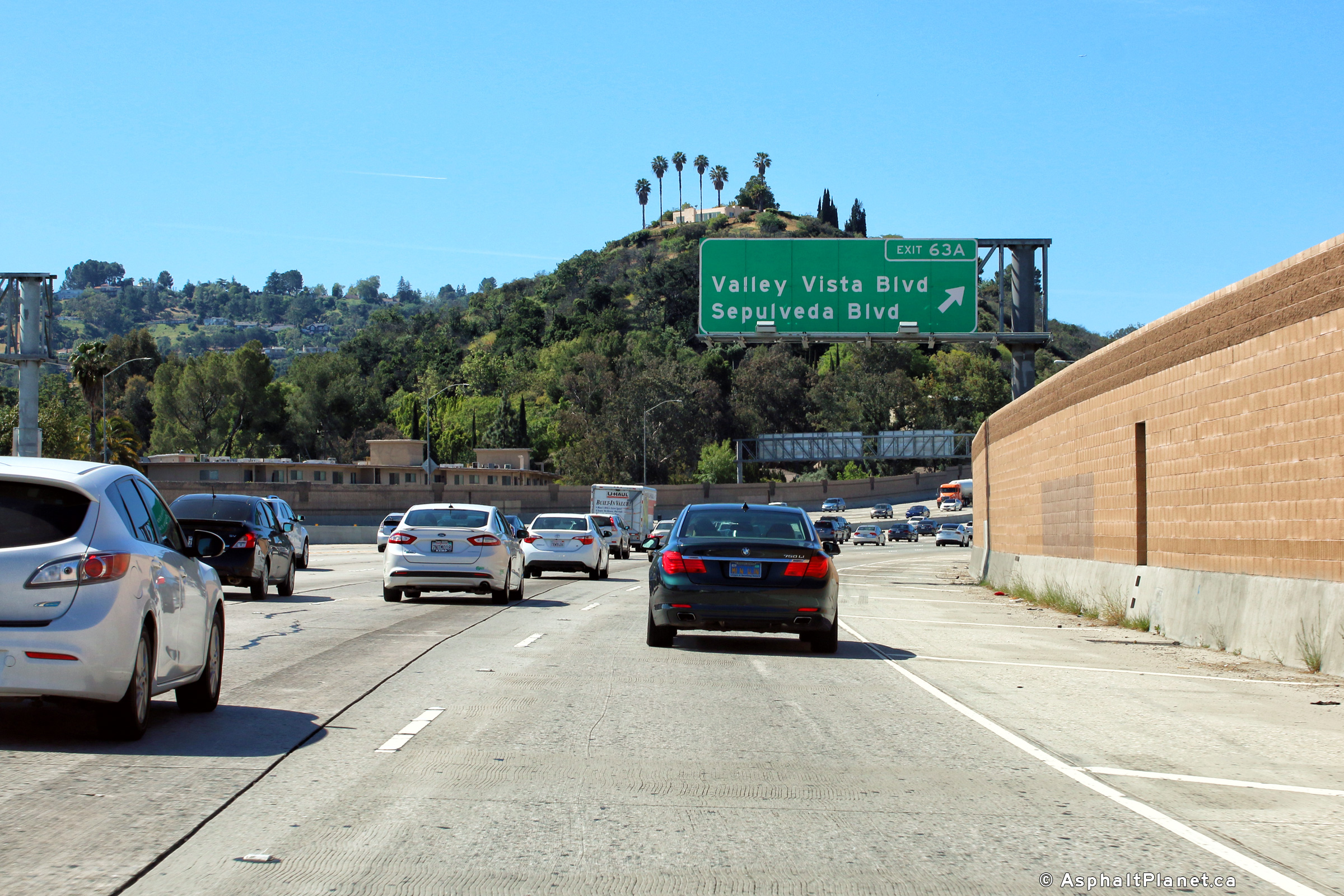
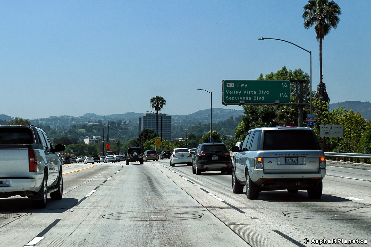
|
Los Angeles County |
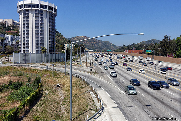
Guide signage for the Sepulveda Boulevard interchange. The 405 meets Sepulveda Boulevard just south of the Ventura Freeway interchange. Between the Ventura and Santa Monica Freeways, Interstate 405 passes overtop of the Santa Monica Mountains. |
 |
||
|
Date: 4/07/2010 |
High-res: (1440x960) (2400x1600) | |||
|
Los Angeles County |
Northbound signage approaching the US-101 interchange. |
 |
||
|
Date: 4/16/2017 |
High-res: (1440x960) (2400x1600) |
|||
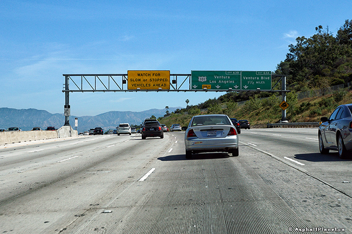
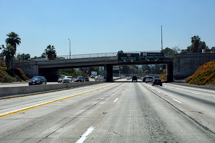
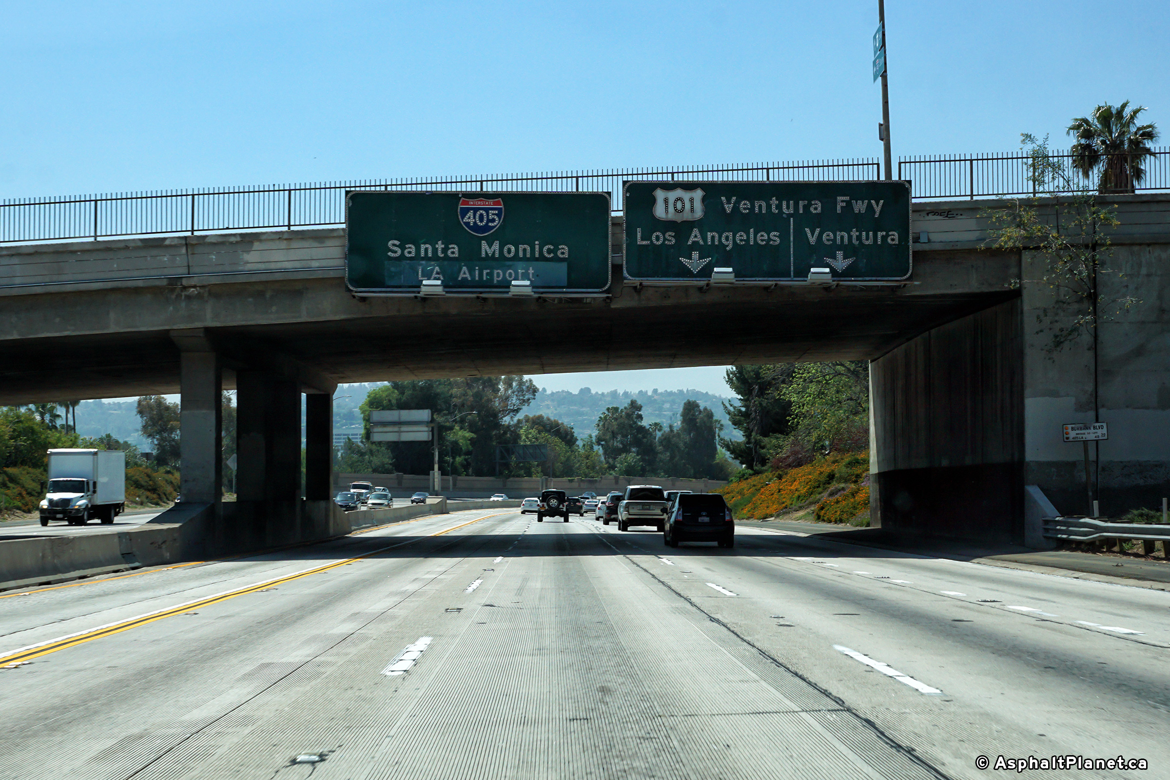
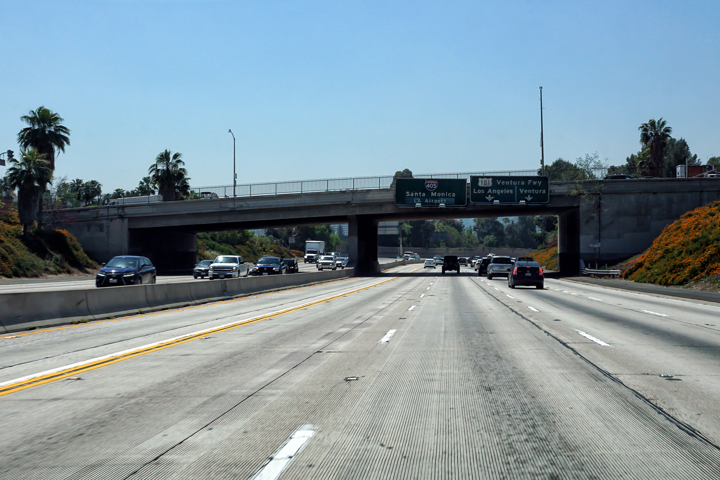
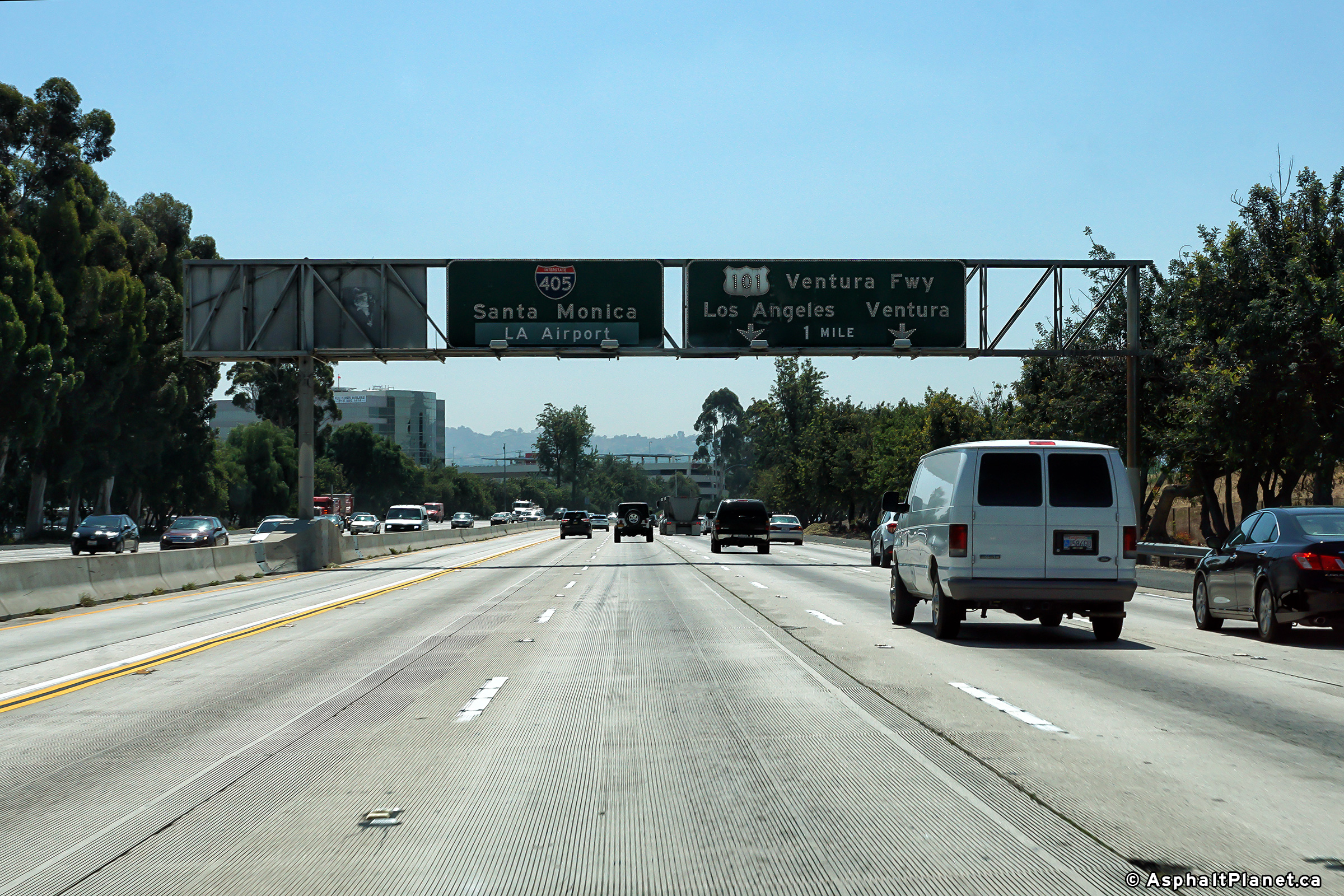
|
Los Angeles County |
Northbound view at the off-ramp to both US-101 and Ventura Boulevard. Ventura Boulevard is the former alignment of US-101 before the current freeway was constructed. |
 |
||
|
Date: 4/16/2017 |
High-res: (1440x960) (2400x1600) |
|||
| The Ventura Freeway (US-101) runs along the southern edge of the San Fernando Valley. Click here for US-101 Images. | ||||
|
Los Angeles County |
Southbound signage at the off-ramp to US-101 at the northern end of Sepulveda Pass |
 |
||
|
Date: 4/12/2017 |
High-res: (1440x960) (2400x1600) | |||
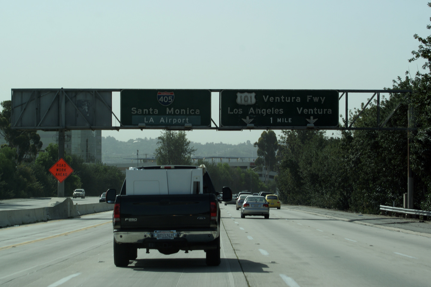
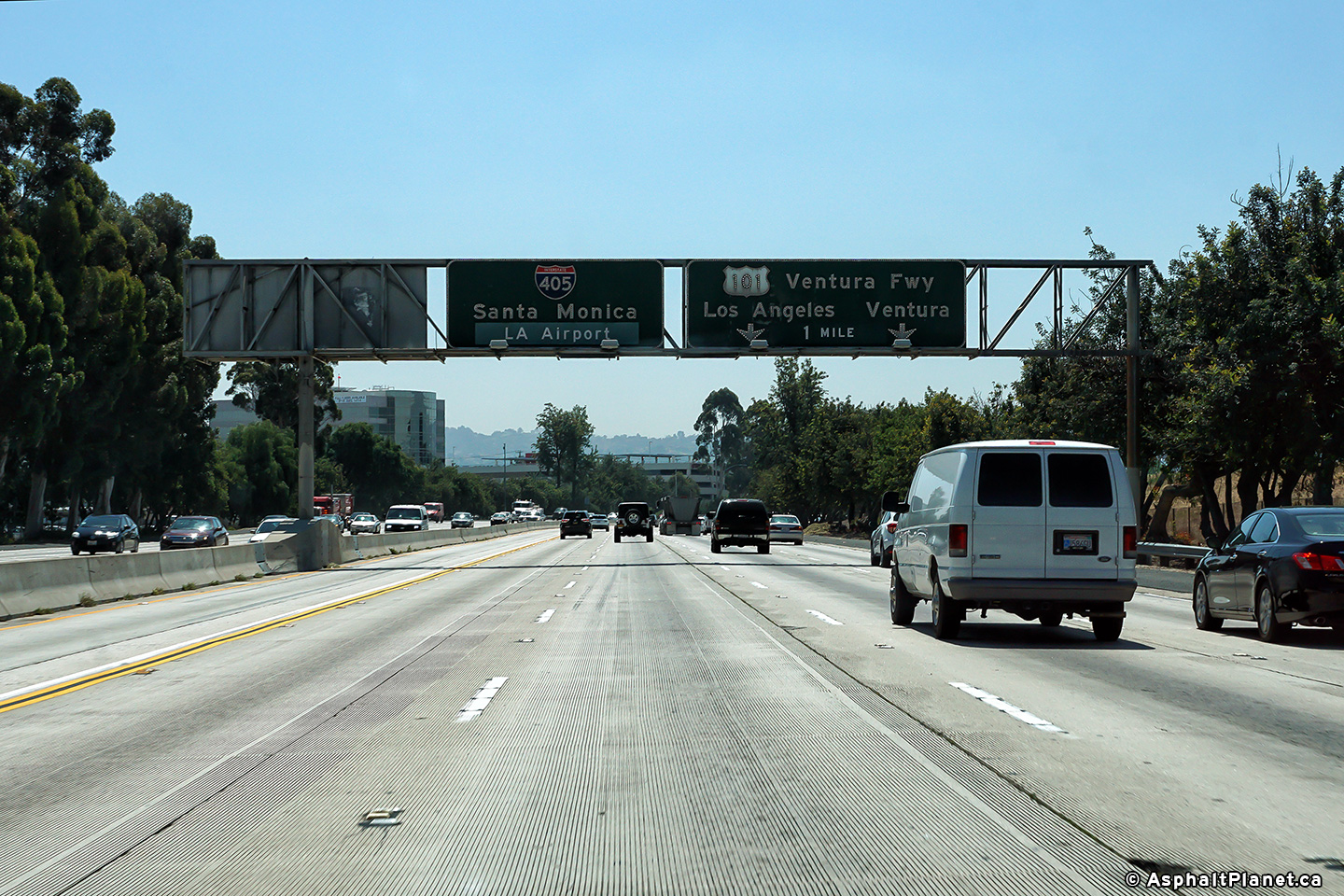
|
Los Angeles County |
Southbound interchange sequence signage approaching the US-101 inerchange. |
 |
||
|
Date: 4/12/2017 |
High-res: (1440x960) (2400x1600) | |||
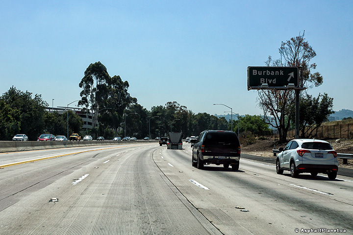
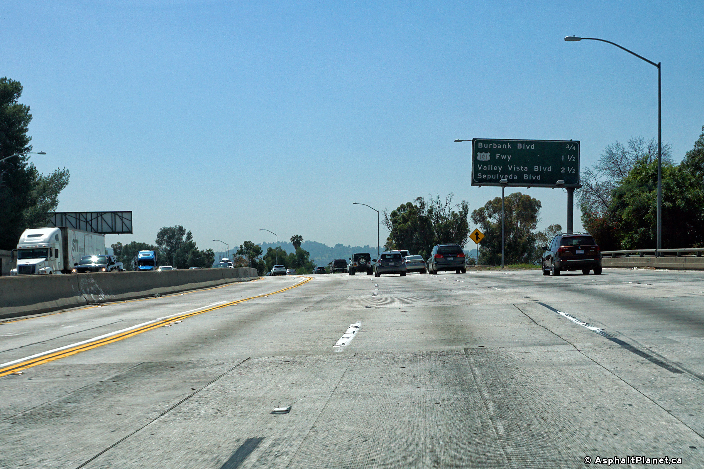
|
Los Angeles County |
Southbound signage in advance of the US-101 interchange has been affixed to the Burbank Boulevard interchange. |
 |
||
| High-res: (1440x960) (2400x1600) | ||||
 |
||||
|
Date: 4/12/2017 |
High-res: (1440x960) (2400x1600) | |||
|
Los Angeles County |
Southbound signage at the off-ramp to Burbank Boulevard. |
 |
||
|
Date: 4/12/2017 |
High-res: (1440x960) (2400x1600) | |||
|
Los Angeles County |
Overhead lane assignment signage advising southbound motorists of the upcoming interchange with US-101. An additional view of this sign, taken in April 2010 can be seen here |
 |
||
|
Date: 4/12/2017 |
High-res: (1440x960) (2400x1600) | |||
|
Los Angeles County |
Southbound interchange sequence signage in advance of the Burbank Boulevard interchange. |
 |
||
|
Date: 4/12/2017 |
High-res: (1440x960) (2400x1600) | |||
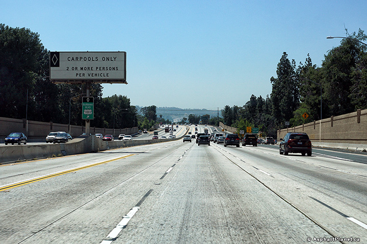
|
Los Angeles County |
Traffic in the carpool lane bound for the US-101 interchange must exit the carpool lane just beyond this median mounted overhead sign. |
 |
||
|
Date: 4/12/2017 |
High-res: (1440x960) (2400x1600) | |||
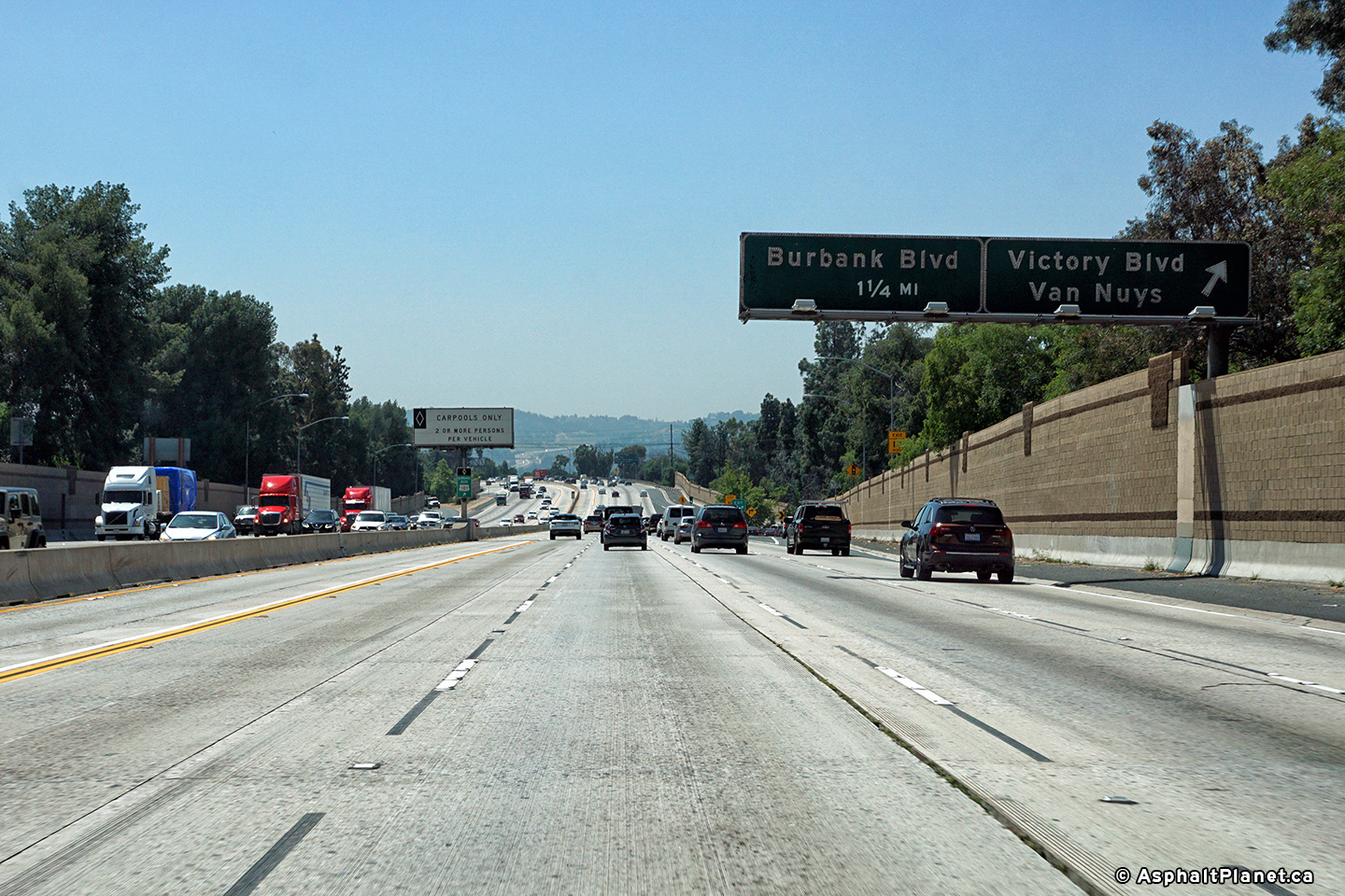
|
Los Angeles County |
Southbound view at the off-ramp to Victory Boulevard. |
 |
||
|
Date: 4/12/2017 |
High-res: (1440x960) (2400x1600) | |||
|
Los Angeles County |
Median mounted interchange sequence signage approaching the southbound off-ramp to Victory Boulevard. |
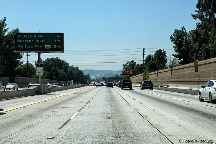 |
||
|
Date: 4/12/2017 |
High-res: (1440x960) (2400x1600) | |||
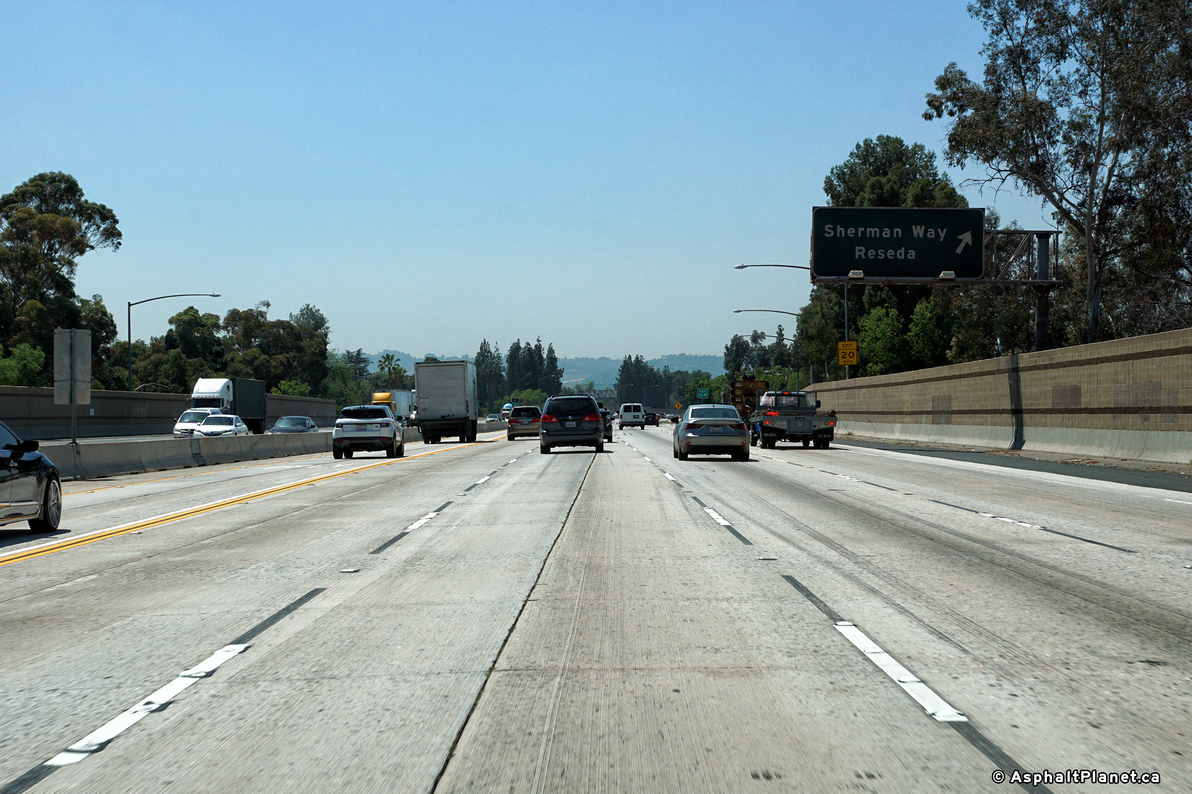
|
Los Angeles County |
Signage at the southbound off-ramp to Sherman Way. |
 |
||
|
Date: 4/12/2017 |
High-res: (1440x960) (2400x1600) | |||
|
Los Angeles County |
Median mounted interchange sequence signage approaching the Sherman Way interchange. |
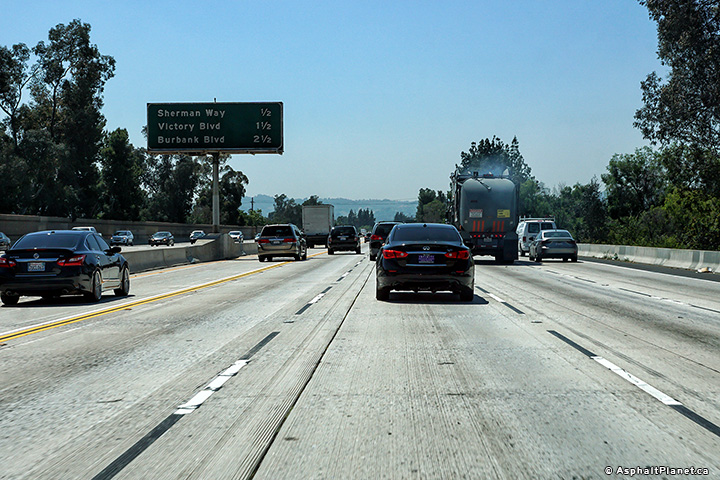 |
||
|
Date: 4/12/2017 |
High-res: (1440x960) (2400x1600) | |||
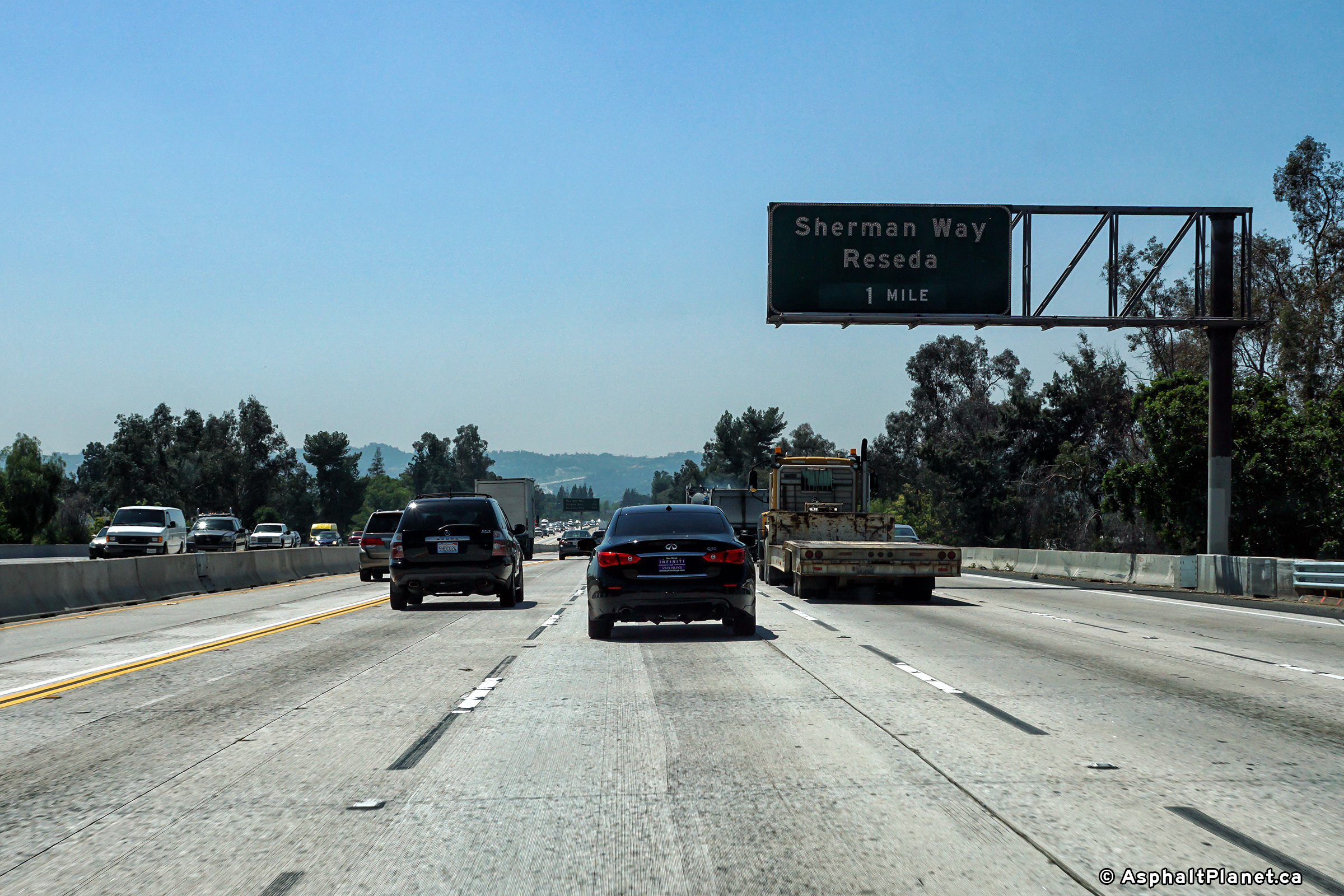
|
Los Angeles County |
Signage at the southbound off-ramp to Sherman Way. |
 |
||
|
Date: 4/12/2017 |
High-res: (1440x960) (2400x1600) | |||
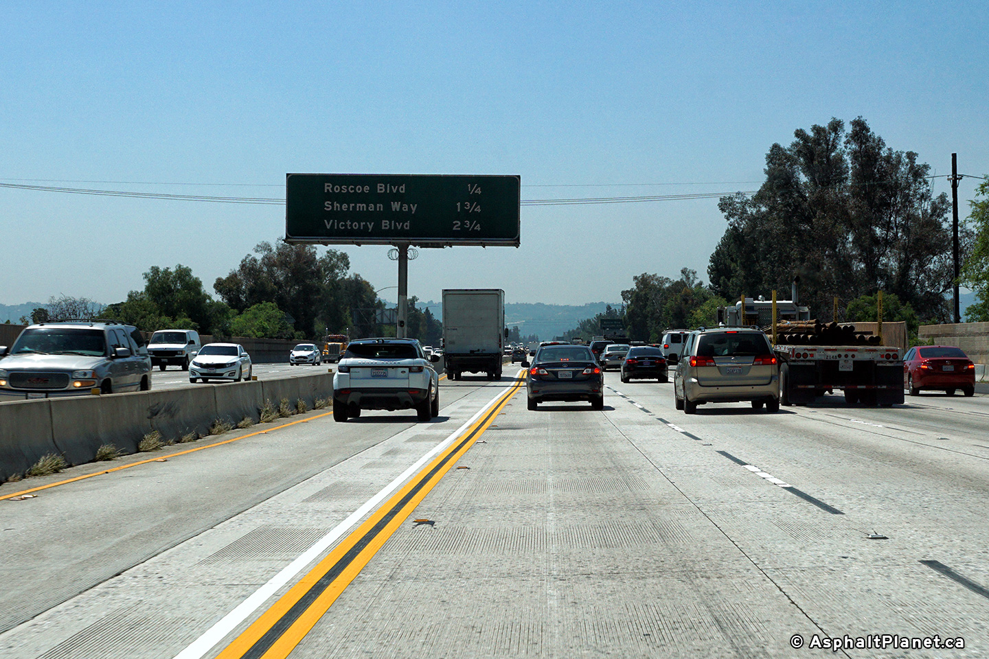
|
Los Angeles County |
Median mounted southbound advanced signage approaching the Roscoe Road interchange. |
 |
||
|
Date: 4/12/2017 |
High-res: (1440x960) (2400x1600) | |||
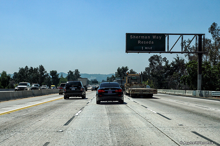
|
Los Angeles County |
Signage for the southbound off-ramp to Nordhoff Road. |
 |
||
|
Date: 4/12/2017 |
High-res: (1440x960) (2400x1600) | |||
|
Los Angeles County |
Southbound advanced signage for the off-ramp to Nordhoff Road. |
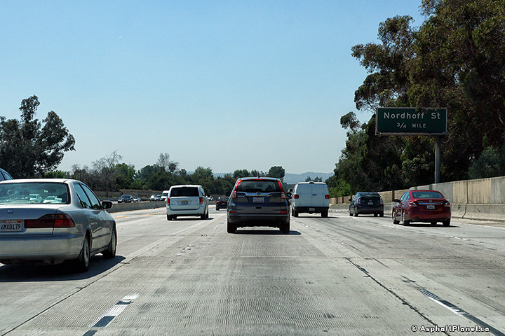 |
||
|
Date: 4/12/2017 |
High-res: (1440x960) (2400x1600) | |||
| Highway 118 runs westerly through the San Fernando and Simi Valleys. Click here for Highway 118 Images. | ||||
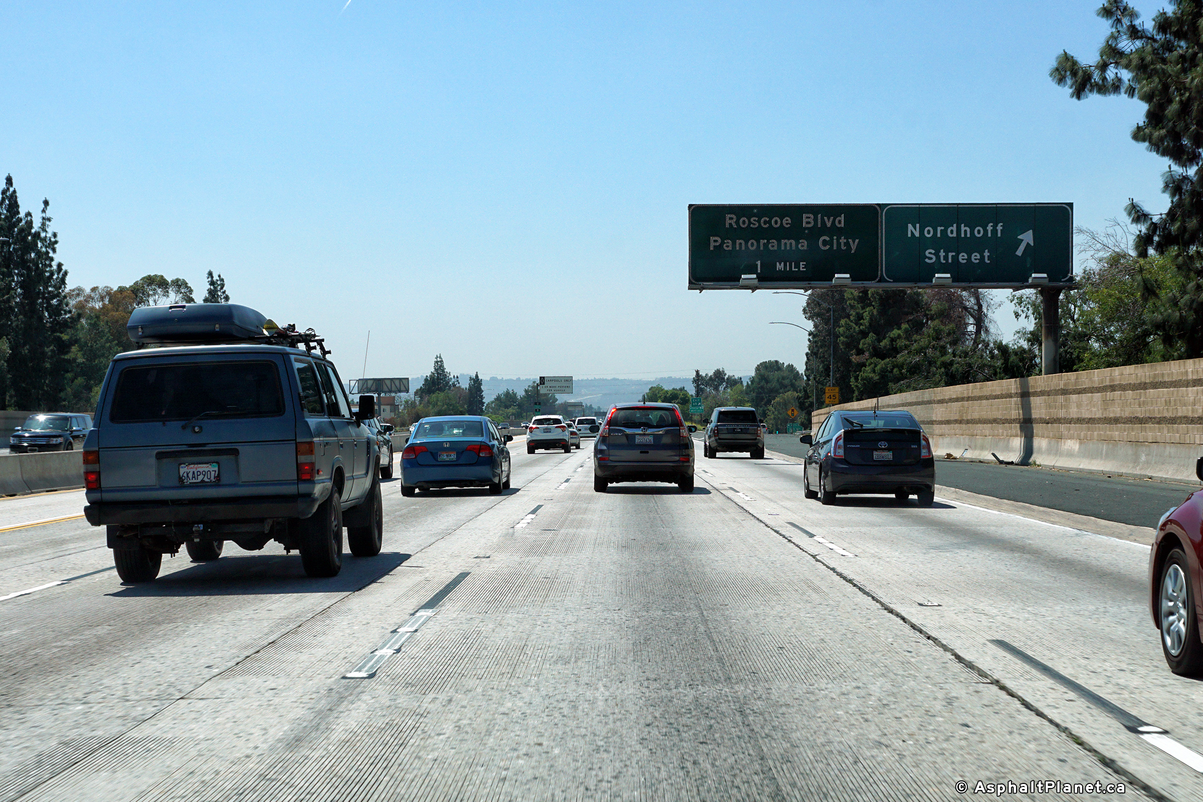
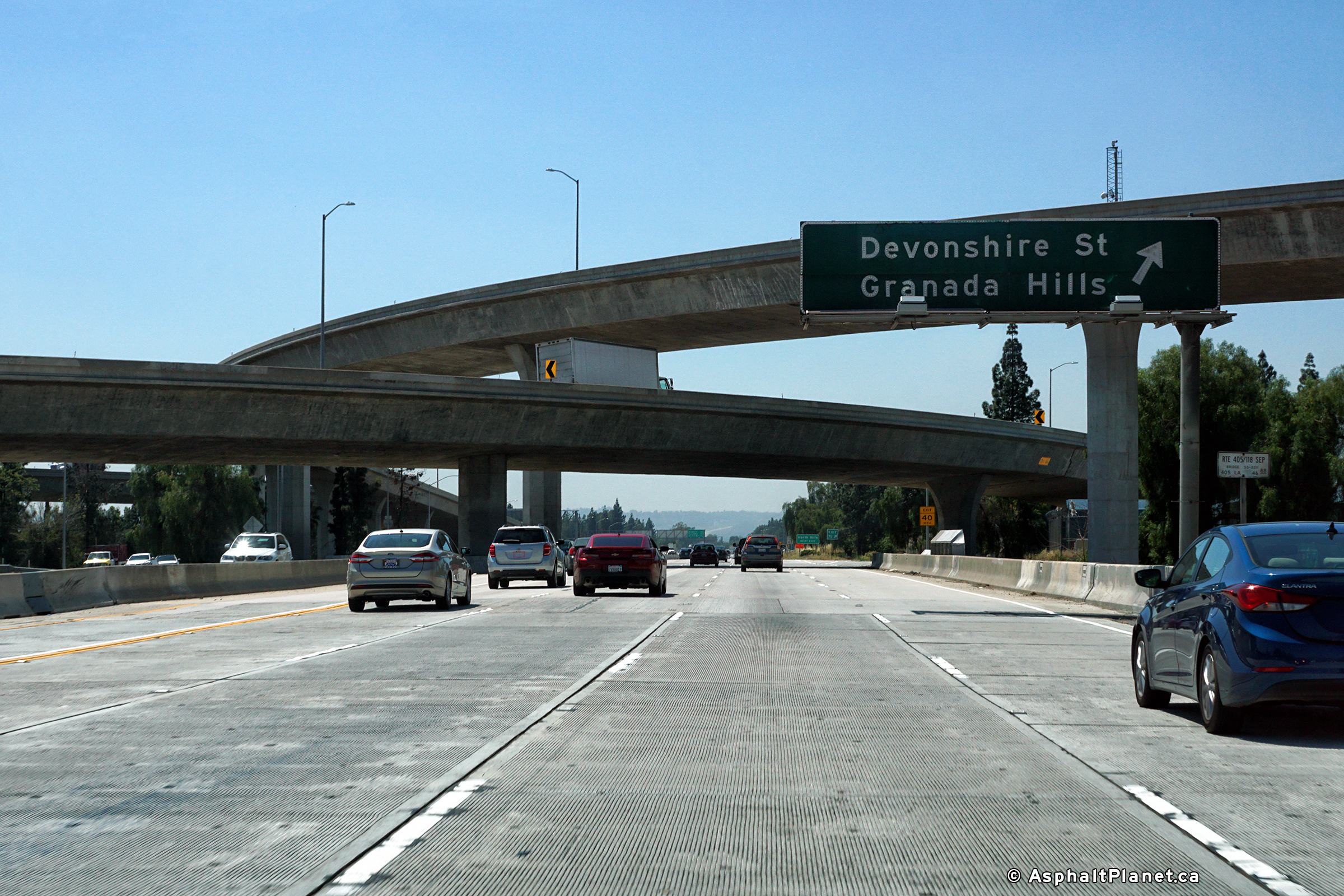
|
Los Angeles County |
Southbound signage a the off-ramp to Devonshire Road. |
 |
||
|
Date: 4/12/2017 |
High-res: (1440x960) (2400x1600) | |||
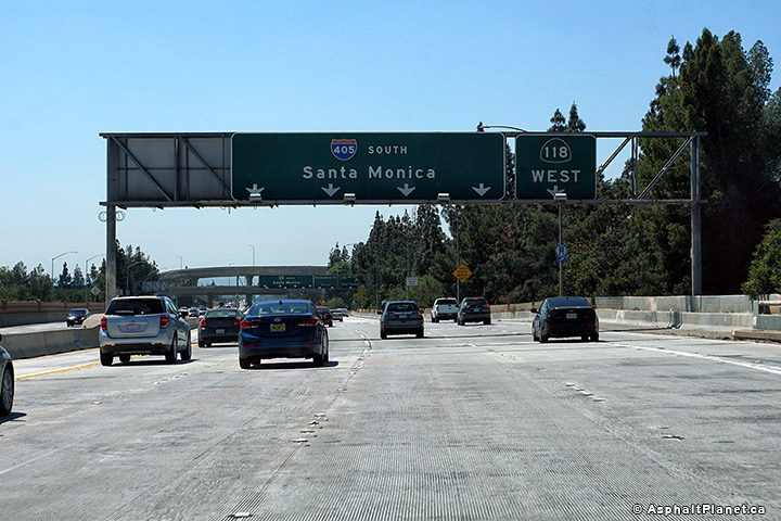
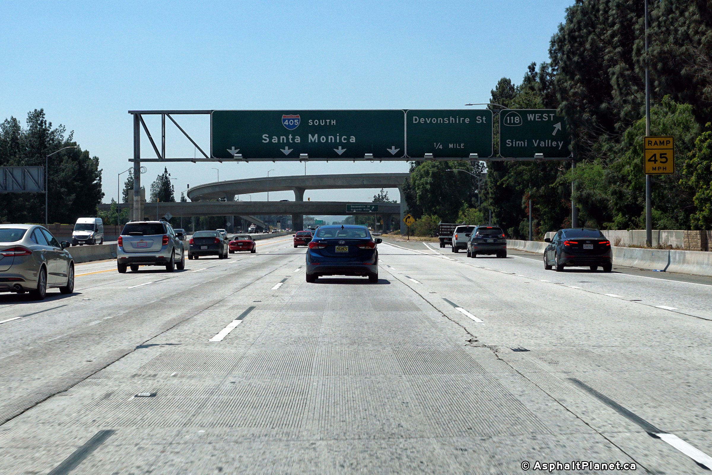
|
Los Angeles County |
Southbound signage at the off-ramp to SR-118 West. There is no direct ramp to SR-118 East from the 405 Freeway. Traffic bound for SR-118 East likely would have followed I-5 South to meet the 118 Freeway. |
 |
||
|
Date: 4/12/2017 |
High-res: (1440x960) (2400x1600) | |||
|
Los Angeles County |
Southbound lane assignment signage approaching the SR-118 interchange. |
 |
||
|
Date: 4/12/2017 |
High-res: (1440x960) (2400x1600) | |||
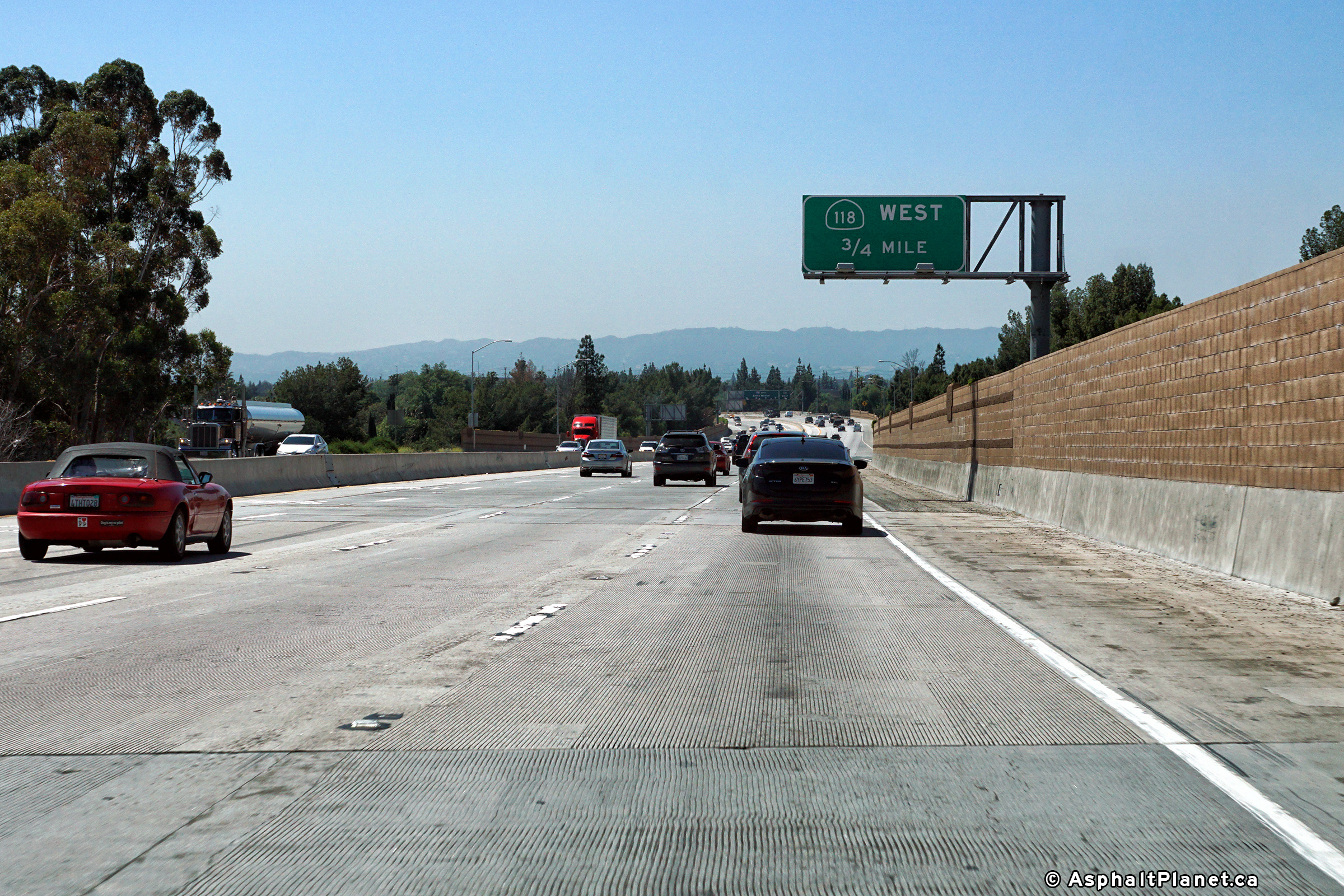
|
Los Angeles County |
Southbound advanced signage approaching the SR-118 interchange. |
 |
||
|
Date: 4/12/2017 |
High-res: (1440x960) (2400x1600) | |||
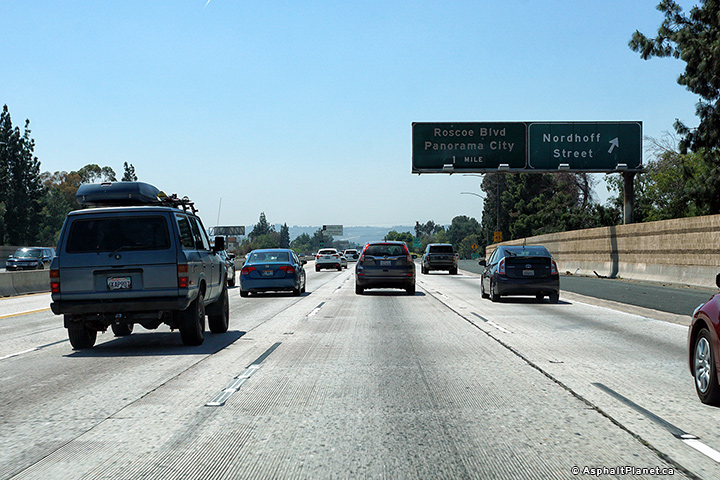
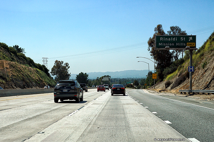
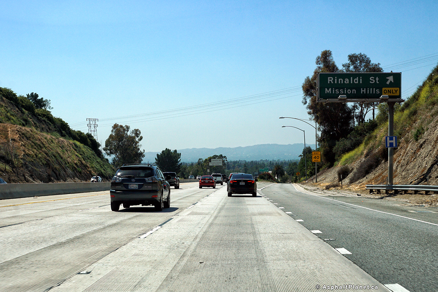
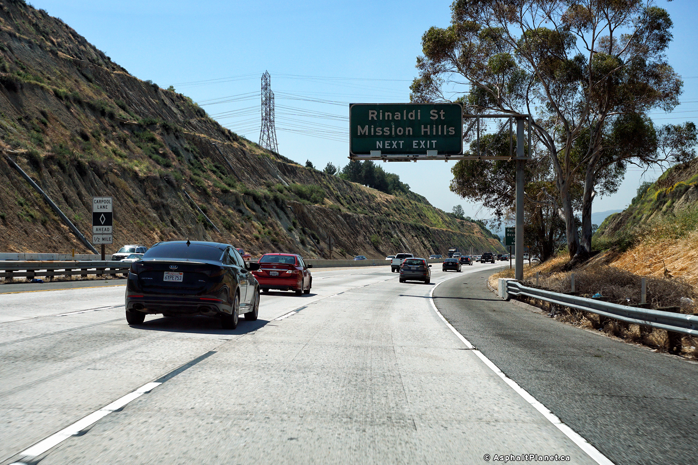
|
Los Angeles County |
Northbound advanced signage approaching the Rinaldi Street interchange. |
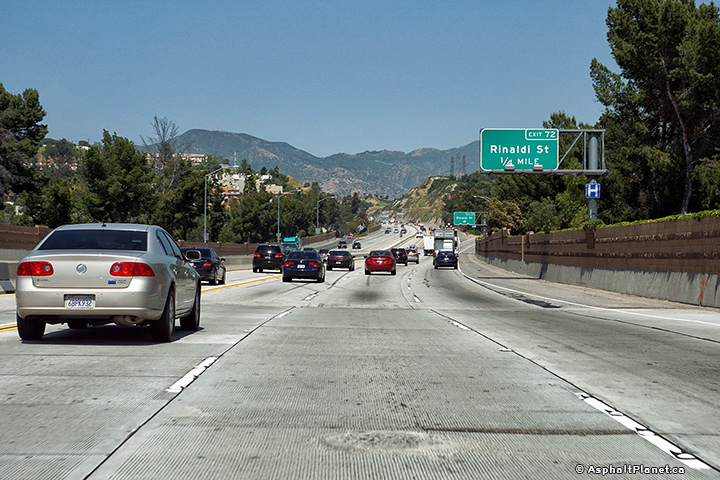 |
||
|
Date: 4/12/2017 |
High-res: (1440x960) (2400x1600) |
|||
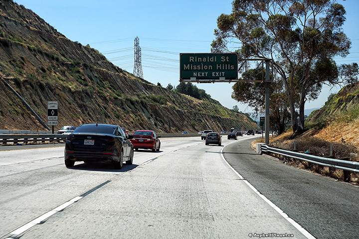
|
Los Angeles County |
View looking northerly at the northbound off-ramp to Rinaldi Street. |
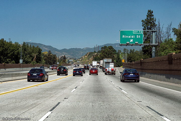 |
||
|
Date: 4/12/2017 |
High-res: (1440x960) (2400x1600) |
|||
|
Los Angeles County |
Southbound signage at the off-ramp to Rinaldi Street. |
 |
||
|
Date: 4/12/2017 |
High-res: (1440x960) (2400x1600) | |||
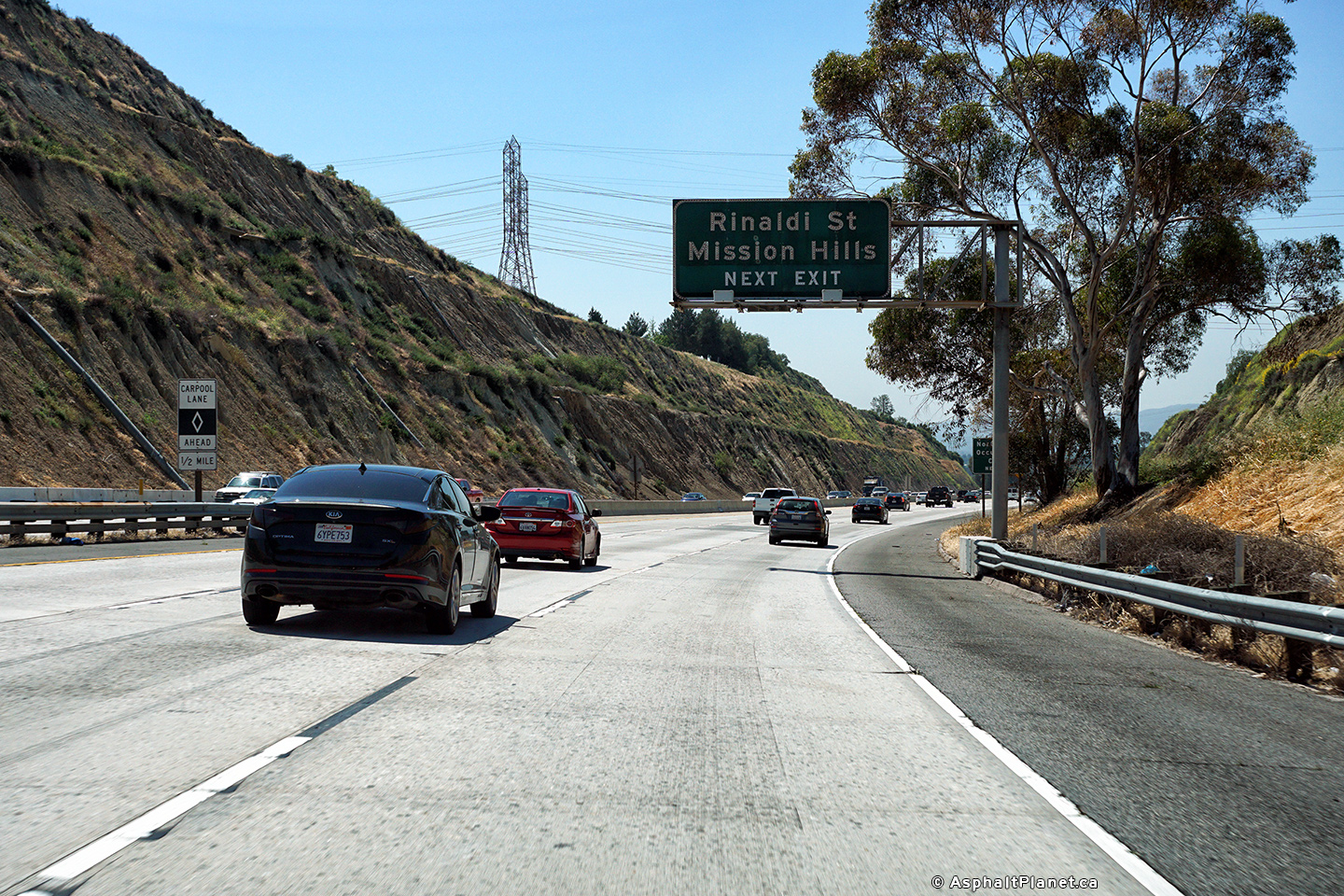
|
Los Angeles County |
Southbound advanced signage for the Rinaldi Street interchange. |
 |
||
|
Date: 4/12/2017 |
High-res: (1440x960) (2400x1600) | |||
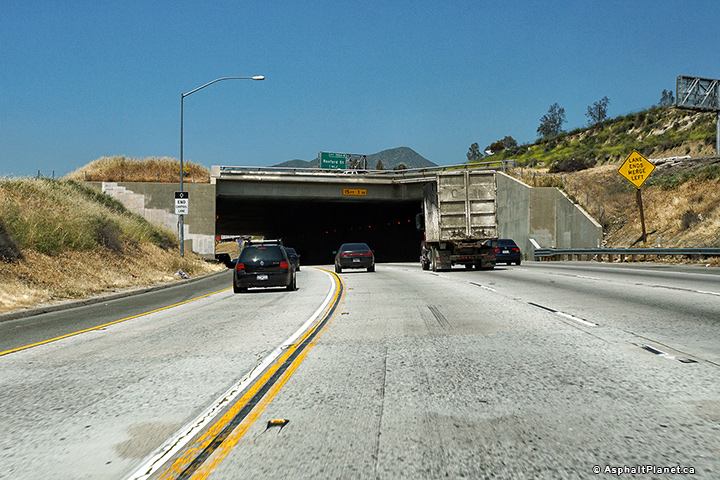
|
Los Angeles County |
View looking northerly as the northbound lanes of the 405 freeway pass beneath I-5. This is the northern terminus of I-405. |
 |
||
|
Date: 4/12/2017 |
High-res: (1440x960) (2400x1600) |
|||
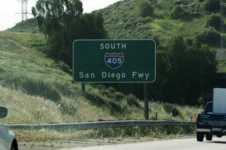
|
Los Angeles County |
First southbound reassurance marker for the San Diego Freeway. |
 |
||
|
Date: 4/07/2010 |
High-res: (1440x960) |
|||
| Interstate 5 continues northerly from the 405 Freeway as the Golden State Freeway. Click here for Interstate 5 Images. | ||||
<- I-380
CA Highways
I-480 ->
AsphaltPlanet.ca
© 2010-18 AsphaltPlanet.ca.
AsphaltPlanet@asphaltplanet.ca
Page Created: April 22, 2010.
Last Updated: February 3, 2015.