AsphaltPlanet.ca > California > Highway 22
Pictures on this page are arranged in order from west to east. CA-22 East
photos are left-aligned in the last column, while CA-22 West photos are right-aligned.
Center-line pictures are centered within the last column.
|
Location |
Description |
Photo |
||
|
East- |
West- |
|||
|
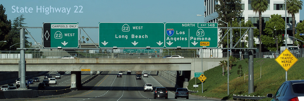
Orange County City of Seal Beach |
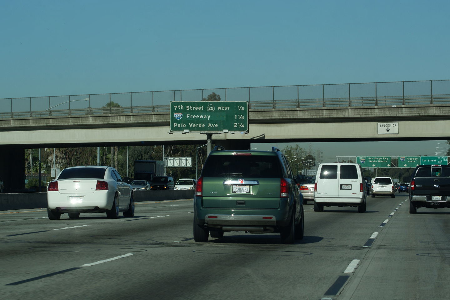
Signage at the ramp to Interstate 605 North from the 22 Freeway East. Highway 22 begins its trek across Orange County at the Pacific Coast Highway in Long Beach. For the first mile of highway, located in Los Angeles County, Highway 22 is a divided arterial known as 7th Street. Beyond Los Cerritos Channel, the highway widens out to a freeway with an interchanging at Studebaker Road before meeting the 405 and 605 freeways at a substantial interchange. |
 |
||
|
Date: 4/07/2010 |
||||
|
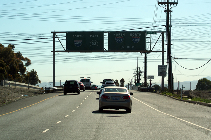
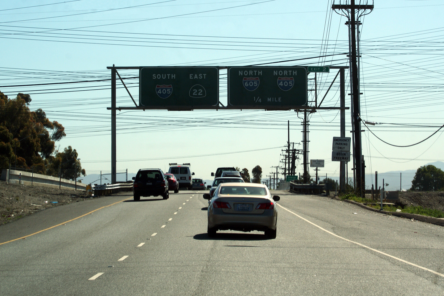
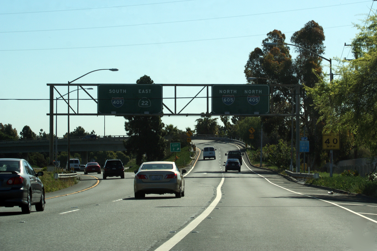
Orange County City of Seal Beach |
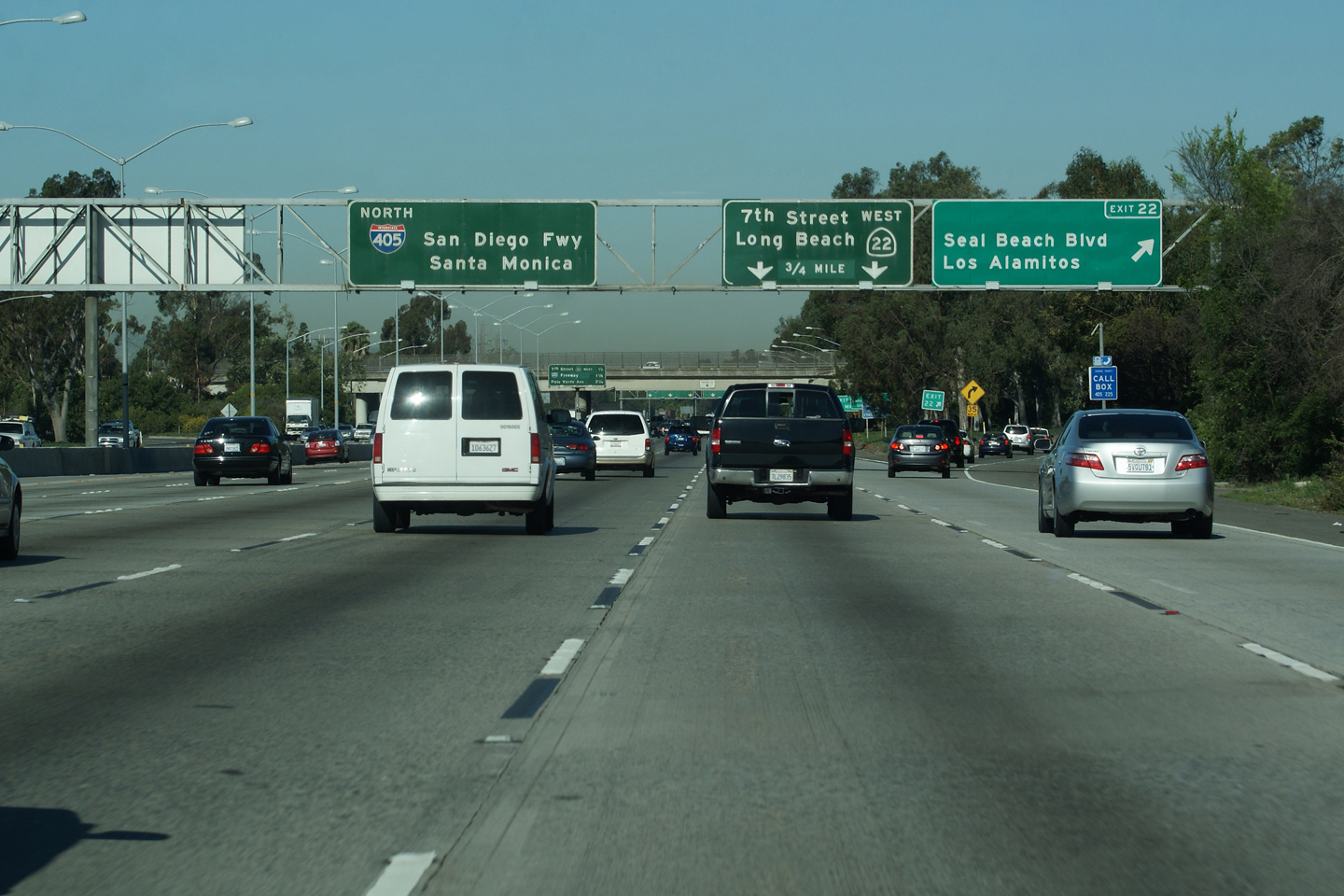
This is the split that divides traffic between Highway 22 East, and the 405 South, and the 405 and 605 Freeways North. Highway 22 runs concurrent with the 405 east of this interchange for just over two miles. |
 |
||
|
Date: 4/07/2010 |
||||
| Interstate 405 continues northerly past The 22 Freeway as the San Diego Freeway, bound for Santa Monica and eventually Interstate 5 at Santa Clarita. Click here for Interstate 405 Images. | ||||
|
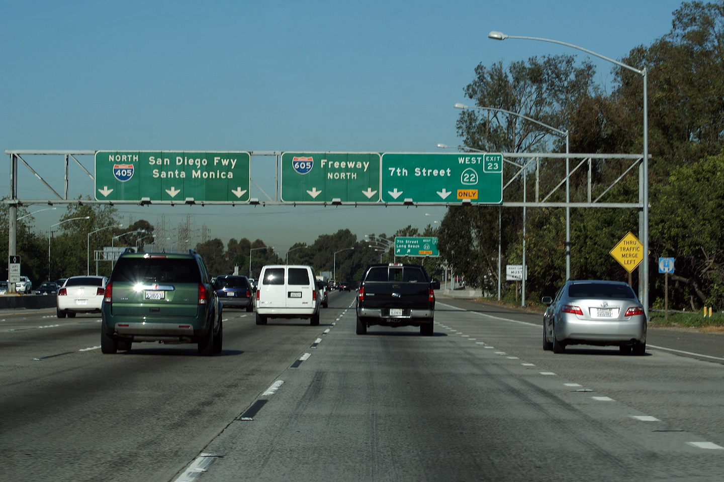
Orange County |
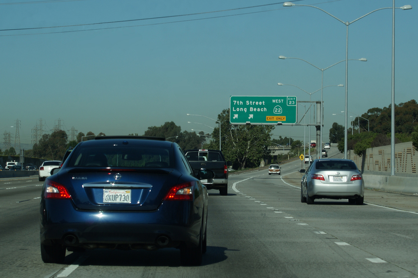
Guide signage at the departure of Highway 22 from The 405. The ramp to the 605 Freeway is found a short distance west of this ramp along the 405 Freeway. |
 |
||
|
Date: 4/07/2010 |
||||
|
Orange County |
Advanced signage for both the western extension of Highway 22 and the 605 Freeway. Both Highway 22 and The 605 Freeway meet Interstate 405 at the upcoming interchange. |
 |
||
|
Date: 4/07/2010 |
||||
|
Orange County |
Next exit signage in front of the Seal Beach Boulevard overpass. |
 |
||
|
Date: 3/26/2010 |
High-res | |||
|
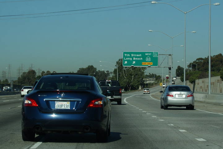
Orange County |
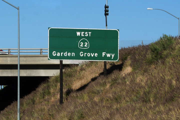
Exit signage for Seal Beach Boulevard. Seal Beach Boulevard meets Highway 22 where it runs concurrent with Interstate 405. This section of Highway 22 is known as the San Diego Freeway. Highway 22's Garden Grove Freeway designation begins east of Interstate 405. |
 |
||
|
Date: 3/26/2010 |
||||
|
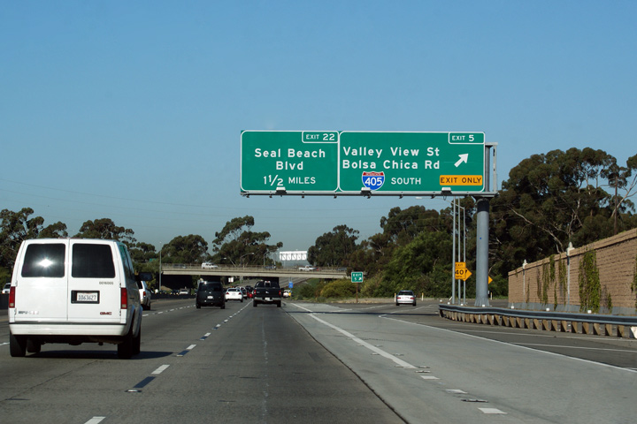
Orange County |
Guide signage for the ramp to Valley View Street and Bolsa Chica Road. Note how far back the sound barrier is from the departing lane for Valley View Street/Bolas Chica Road. Also, the concrete extension past the off-ramp. Starting in 2010, Caltrans plans to extend Highway 22's HOV lanes through the 405 interchange providing a direct connection to the HOV lanes along The 605 Freeway. |
 |
||
|
Date: 4/07/2010 |
||||
|
Orange County |
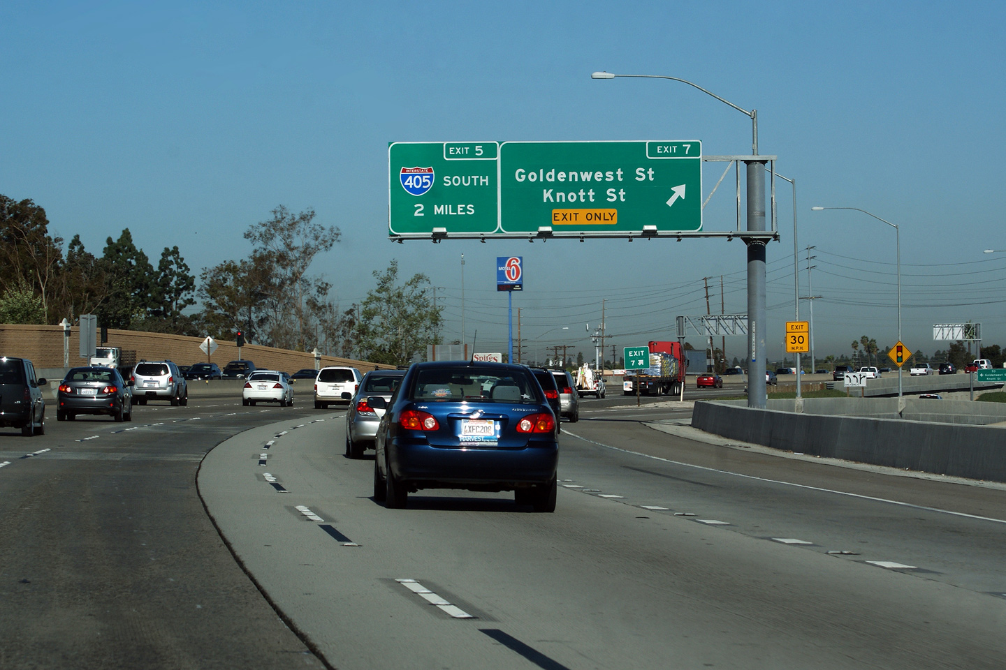
Signage at the exit for Goldenwest Street and Knott Street. The advanced signage for Interstate 405 South is a bit of a misnomer as there is no free-flow connection to I-405 South. Rather travelers must the surface street, use Bolsa Chica Road to make the movement. |
 |
||
|
Date: 4/07/2010 |
||||
|
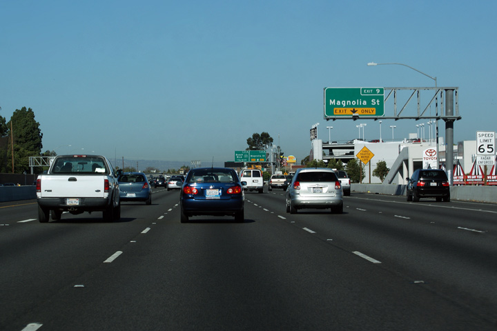
Orange County |
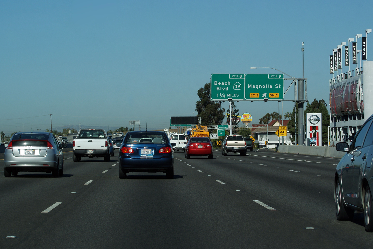
Advanced exit signage for Highway 39 to Beach Boulevard. The 22 Freeway was widened from six lanes to its current configuration with carpool and auxiliary lanes from 2005 to 2006. Unfortunately, all the former button copy signage along the freeway was removed during the reconstruction. That said, California seems to do a very nice job with its newer reflectorized signage. |
 |
||
|
Date: 4/07/2010 |
||||
|
Orange County |
Westerly view as The Garden Grove Freeway approaches the Magnolia Street interchange. |
 |
||
|
Date: 4/07/2010 |
||||
|
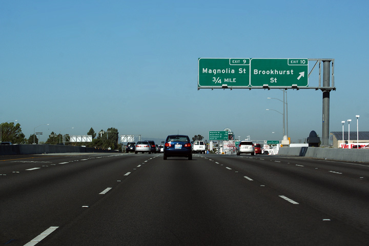
Orange County |
Advanced exit signage for Magnolia Street. The incoming lane from the Brookhurst Street interchange departs almost immediately for Magnolia Street. During my visit to California, I was often surprised at just how closely spaced some of the interchanges are along some LA Area freeways. |
 |
||
|
Date: 4/07/2010 |
||||
|
Orange County |
Next exit signage immediately west of the Brookhurst Street interchange. Sporadic sections of the Garden Grove Freeway were surfaced with a rubberized asphalt. Likely asphalt was laid as it proved to be a more cost effective solution compared to rehabilitating the former concrete driving surface. California garners far more longevity out of its concrete highways compared to many North American transportation agencies. |
 |
||
|
Date: 4/07/2010 |
||||
|
Orange County |
Westbound exit to Brookhurst Street. |
 |
||
|
Date: 4/07/2010 |
||||
|
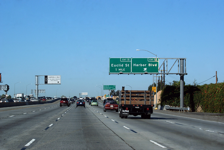
Orange County |
Signage for the Harbor Boulevard interchange. In Canada, Harbor is spelled as 'Harbour'. Their are numerous similar words where the American dictionary omits the 'u', other examples include 'colour', and 'neighbour'. Canada's English dictionary is heavily influenced by the country's French population. |
 |
||
|
Date: 4/07/2010 |
||||
|
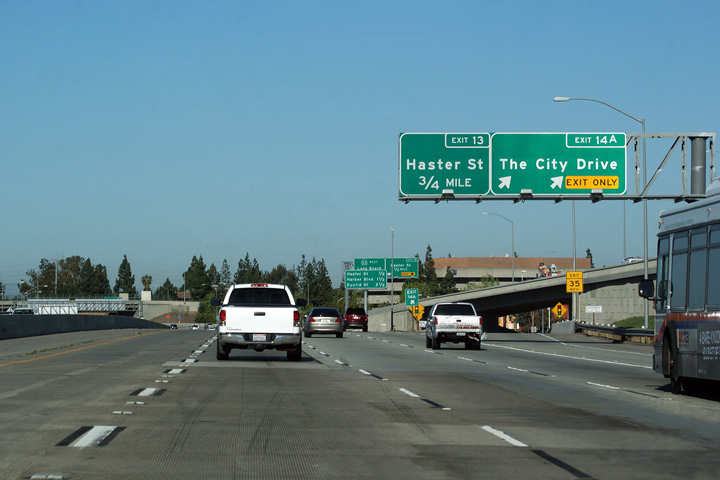
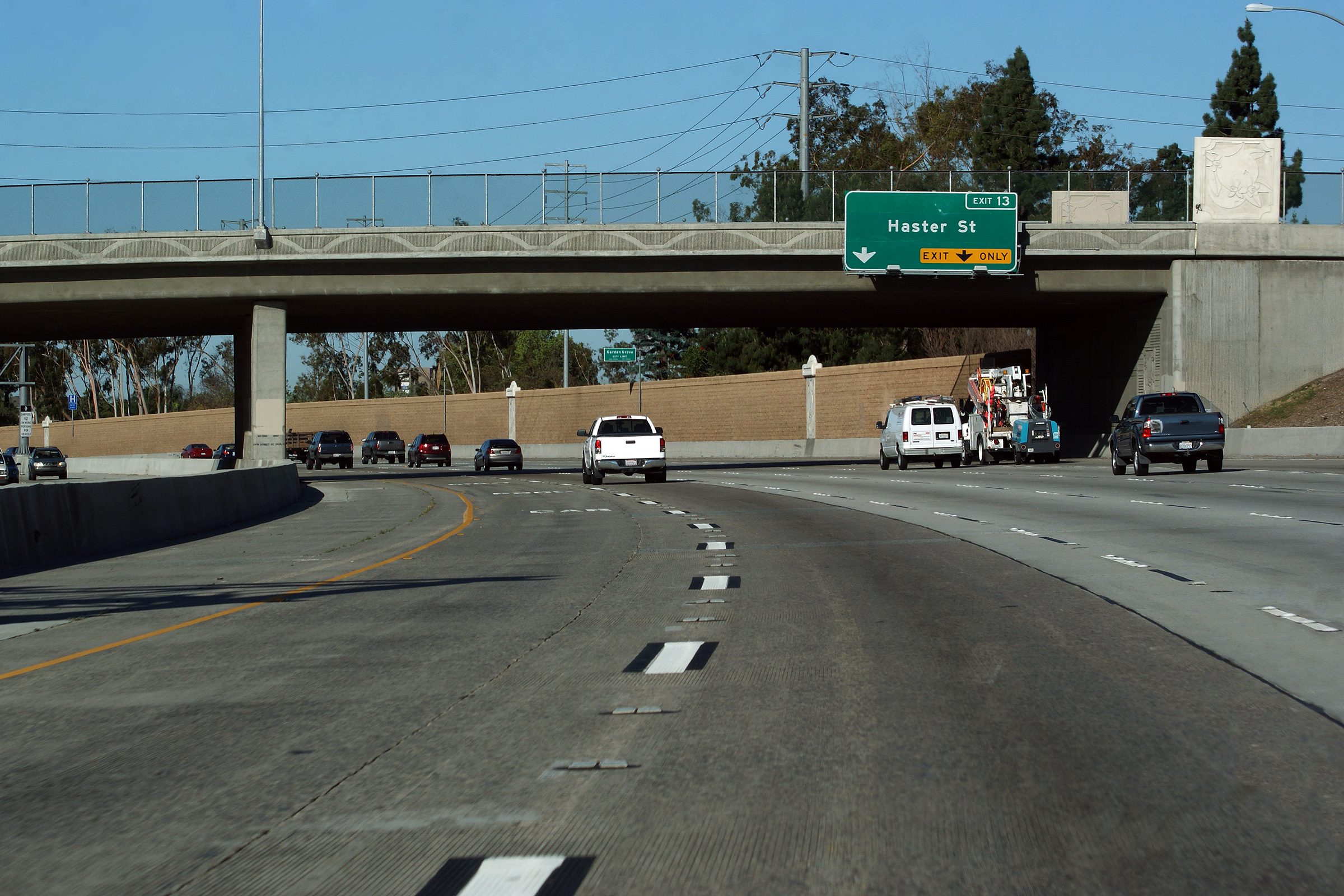
Orange County |
Advanced signage for the Haster Street off-ramp from Highway 22 West. Note the decorative parapet that has has been constructed adorning the Lewis Street overpass. |
 |
||
|
Date: 4/07/2010 |
High-res: (1440x960) (2400x1600) | |||
|
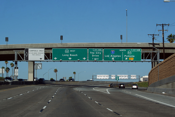
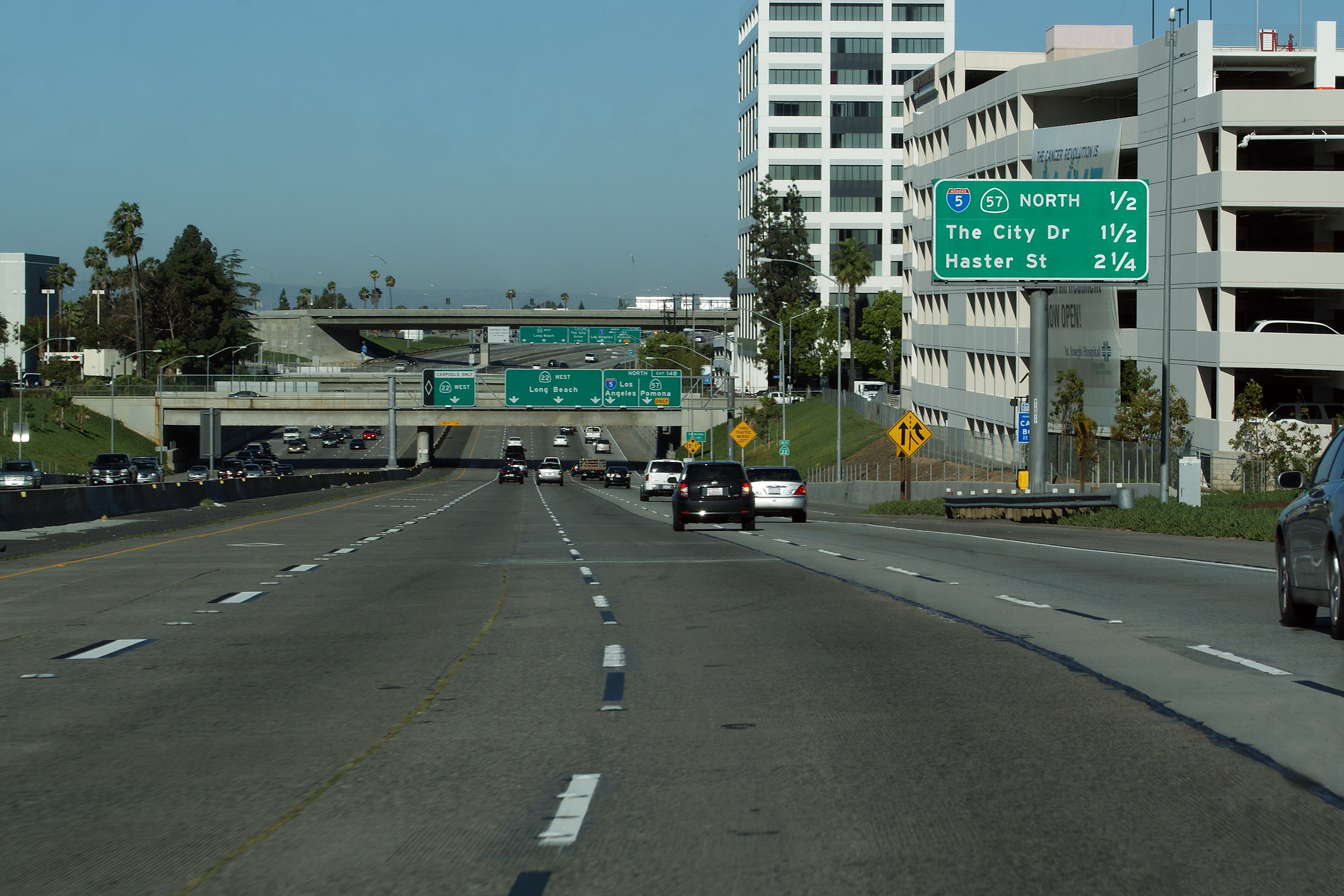
Orange County |
Signage at the exit to The City Drive. The ramp from to The City Drive from The Garden Grove West passes underneath of the on-ramp entering the 22 Freeway from the 57 and 5 Freeways South. The City Drive, Bristol Road, the 5, and the 57 Freeway all interchange with the Garden Grove freeway within just over a mile. |
 |
||
|
Date: 4/07/2010 |
||||
|
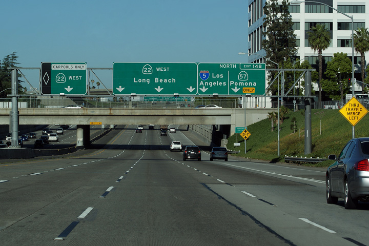
Orange County |
Signage underneath the fly-over ramp from I-5 North to CA-57 North for the I-5 and CA-57 Freeways. The interchange between The Garden Grove (CA-22), The Santa Ana (I-5), and the Orange (CA-57) Freeways is known colloquially as the Orange Crush. |
 |
||
|
Date: 4/07/2010 |
||||
|
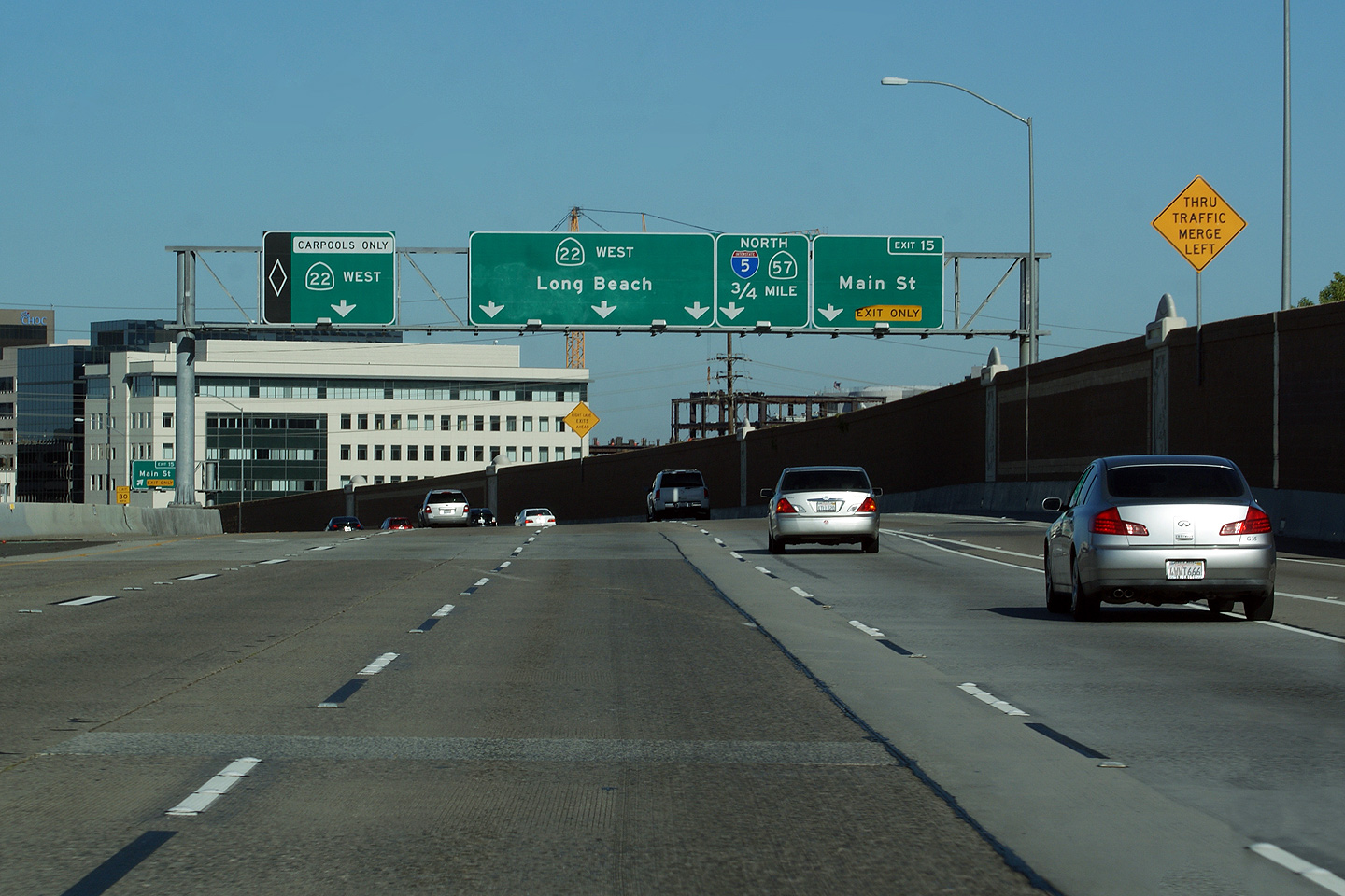
Orange County |
Overhead sign truss visible as the Garden Grove Freeway passes underneath of the Main Street overpass. Note that a reassurance sign has been placed overtop of the carpool lane -- this is atypical of a lot of California Freeways, which typically do not place pull-through signage overtop of the HOV lane. |
 |
||
|
Date: 4/07/2010 |
High-res: (1440x960) (2400x1600) | |||
|
Orange County |
Next exit signage about half a mile in advance of the Orange Crush interchange. Take notice of the multi-story building visible to the north of the freeway. Both Los Angeles and Orange Counties have extremely low density residential and commercial uses. in fact, it is rare to see multi-story buildings outside of the Downtown core of LA. Perhaps unsurprisingly the building that is closest to the freeway in this case is actually a large multi-story carpark. |
 |
||
|
Date: 4/07/2010 |
High-res: (1440x960) (2400x1600) | |||
|
Orange County |
Advanced signage for Main Street and the Orange Crush interchange. |
 |
||
|
Date: 4/07/2010 |
||||
|
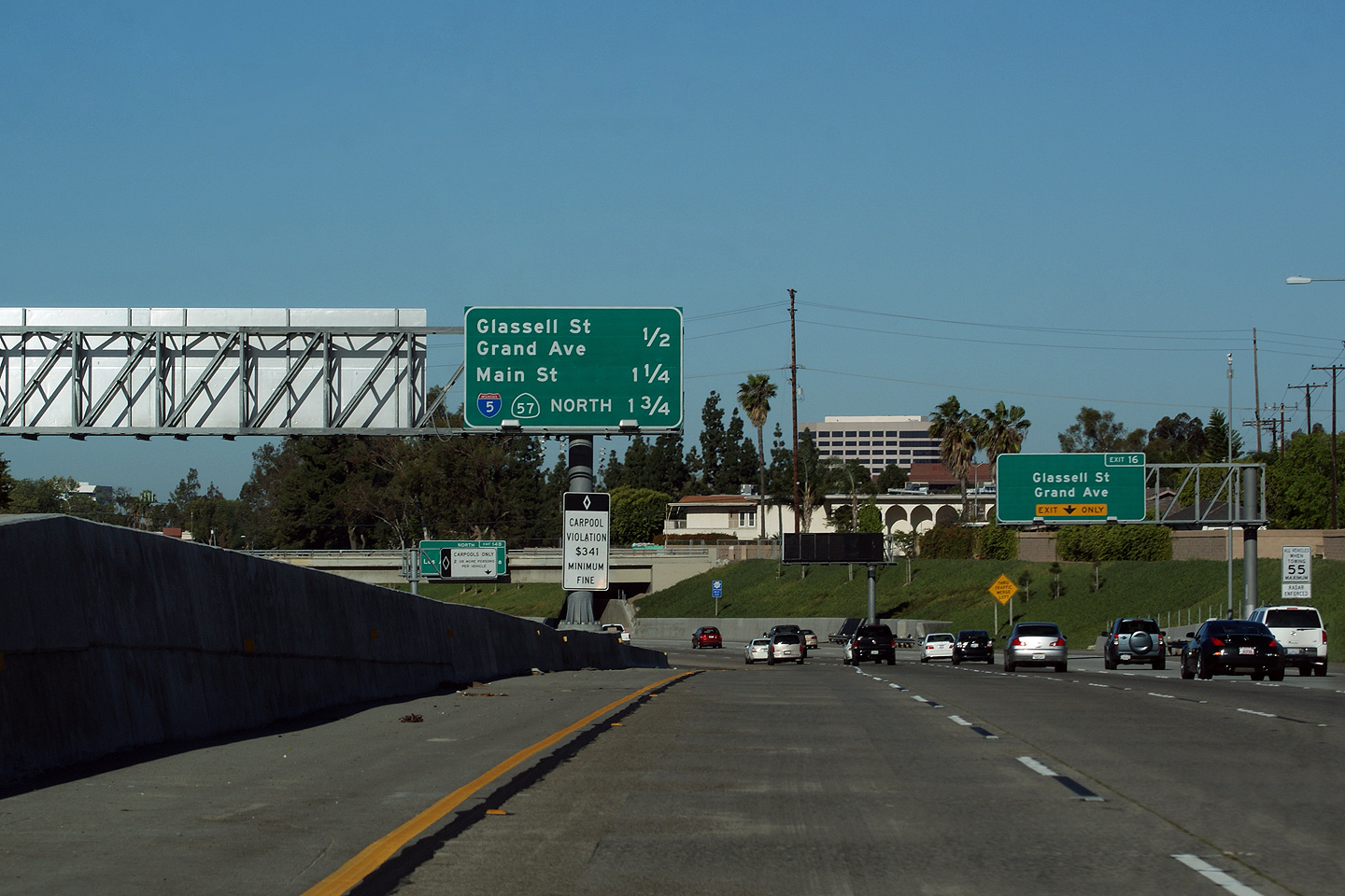
Orange County |
Exit signage for the ramps to Grand Avenue and Glassell Street. |
 |
||
|
Date: 4/07/2010 |
||||
|
Orange County |
Next exit signage along the Garden Grove just west of the 57 Freeway interchange. Left-mounted next exit signage is extremely rare along the Garden Grove Freeways. All of the 'lollipop' signs were removed during the 2005/06 highway reconstruction. |
 |
||
|
Date: 4/07/2010 |
||||
|
Orange County |
Signage right at the ramp from the 55 Freeway advising motorists that the 22 Freeway is also known as the Garden Grove Freeway. Before the freeway era, Highway 22 followed the neighbouring Garden Grove Road through Orange County -- hence the freeway name. |
 |
||
|
Date: 4/07/2010 |
||||
<- CA-21
CA Highways
CA-23 ->
AsphaltPlanet.ca
© 2010-17 AsphaltPlanet.ca.
Scott@asphaltplanet.ca
Page Created: May 31, 2010.
Last Updated: May 31, 2010.