AsphaltPlanet.ca > California > SR-57
Pictures on this
page are arranged in order from south to north. CA-57 North photos are
left-aligned in the last column, while CA-57 South photos are right-aligned.
Center-line pictures are centered within the last column.
|
Location |
Description |
Photo |
||
|
North- |
South- |
|||
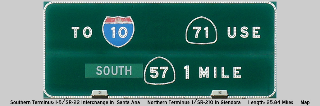
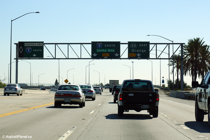
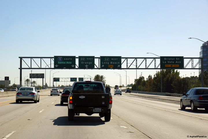
| The 57 Freeway ends at the Orange Crush interchange, where it intersects both the Interstate 5 and State Route 22 Freeways. Click here for Interstate 5 Images, and here for State Route 22 Images. | ||||
|
Orange County |
Southerly view at the southern terminus of the 57 Freeway. The lack of towering high-speed flyover ramps at this interchange masks the fact that the Orange Crush interchange is indeed a complex and massive interchange complex. |
 |
||
|
Date: 10/30/2013 |
High-res: (1440x960) (2400x1600) | |||
|
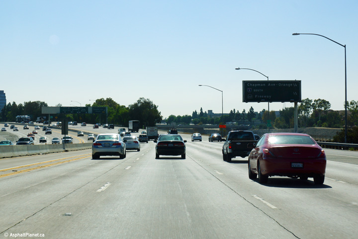
Orange County |
Overhead signage at the ramp to the 22 Freeway West. Traffic entering the freeway from the Chapman Avenue is relegated to a collector lane which limits incoming traffic to the ramp to the 22 Freeway West. |
 |
||
|
Date: 10/30/2013 |
High-res: (1440x960) (2400x1600) | |||
|
Orange County |
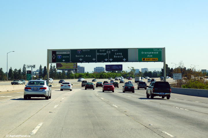
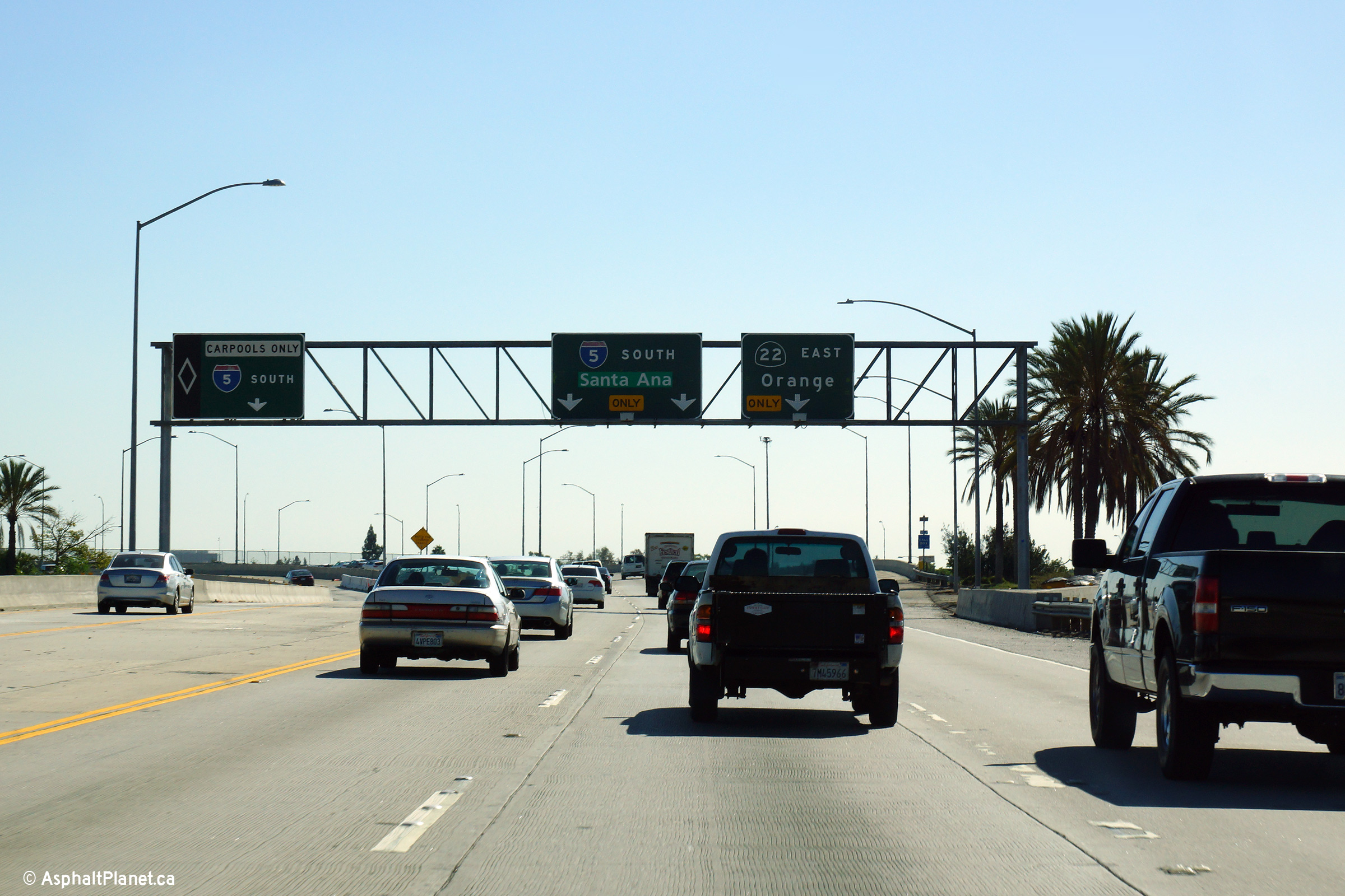
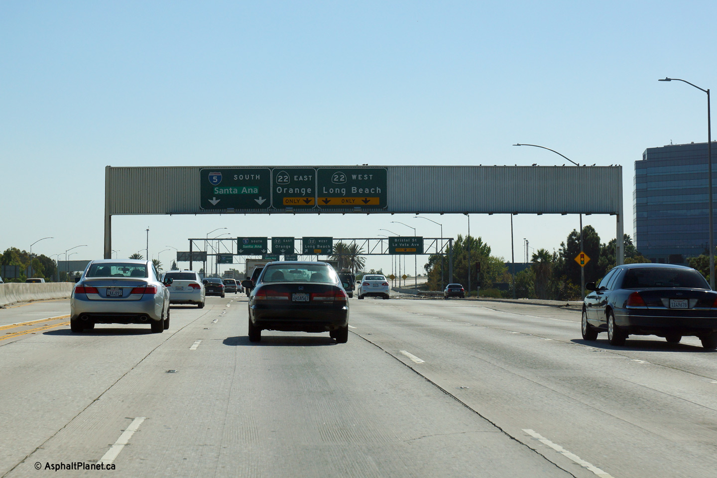
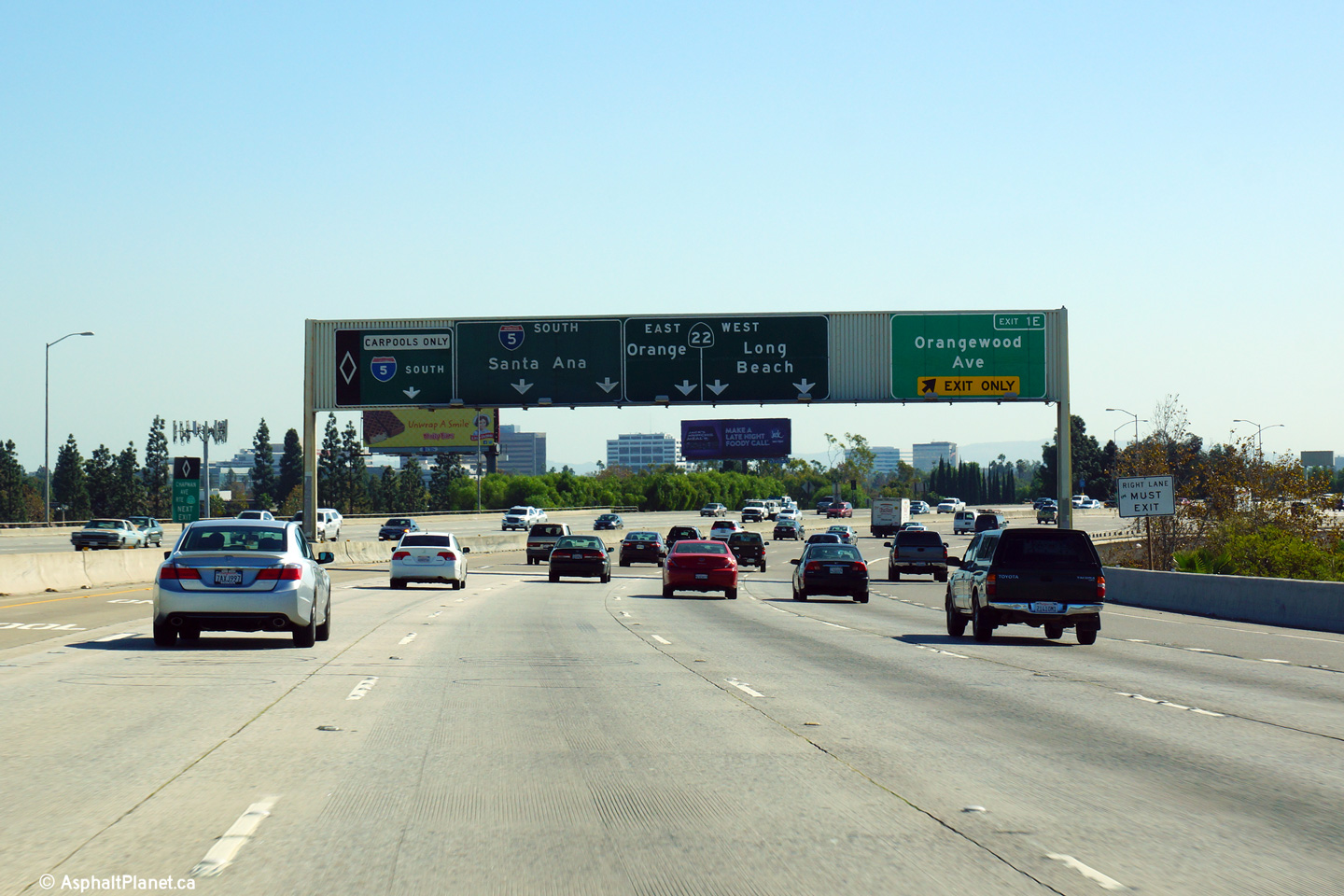
Advanced signage for the Orange Crush Interchange where the 57 Freeway ends dividing into a series of ramps bound for I-5 South and both directions of the 22 Freeway. There is no direct connection between the 57 Freeway South and I-5 North. |
 |
||
|
Date: 10/30/2013 |
High-res: (1440x960) (2400x1600) | |||
|
Orange County |
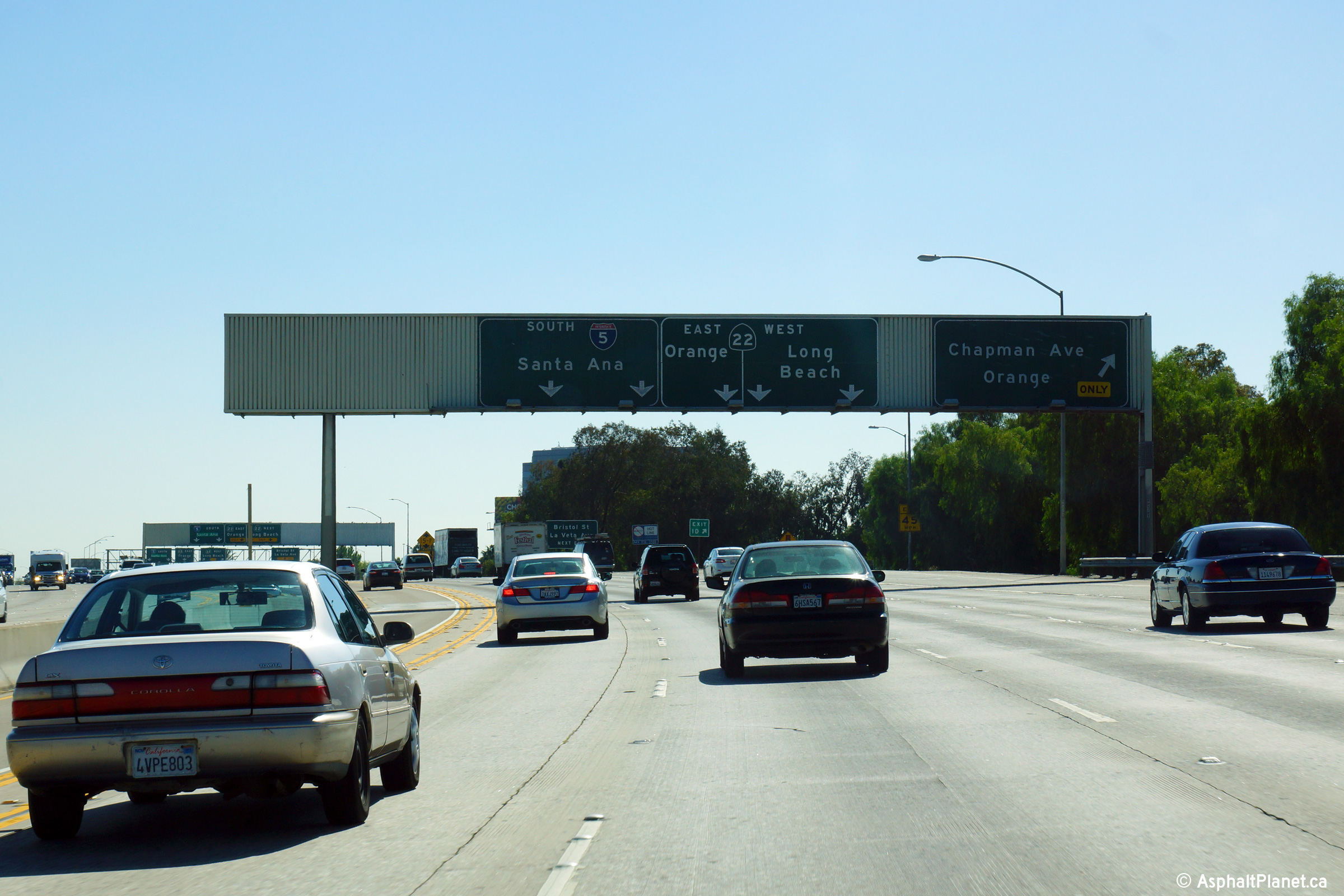
Southbound signage at the off-ramp to Chapman Avenue |
 |
||
|
Date: 10/30/2013 |
High-res: (1440x960) (2400x1600) | |||
|
Orange County |
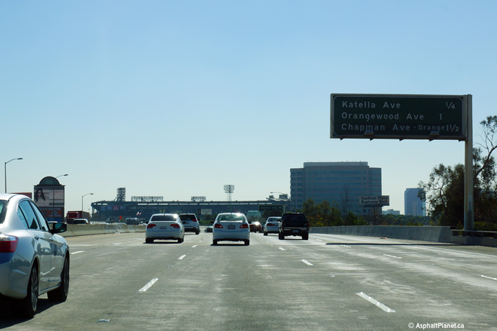
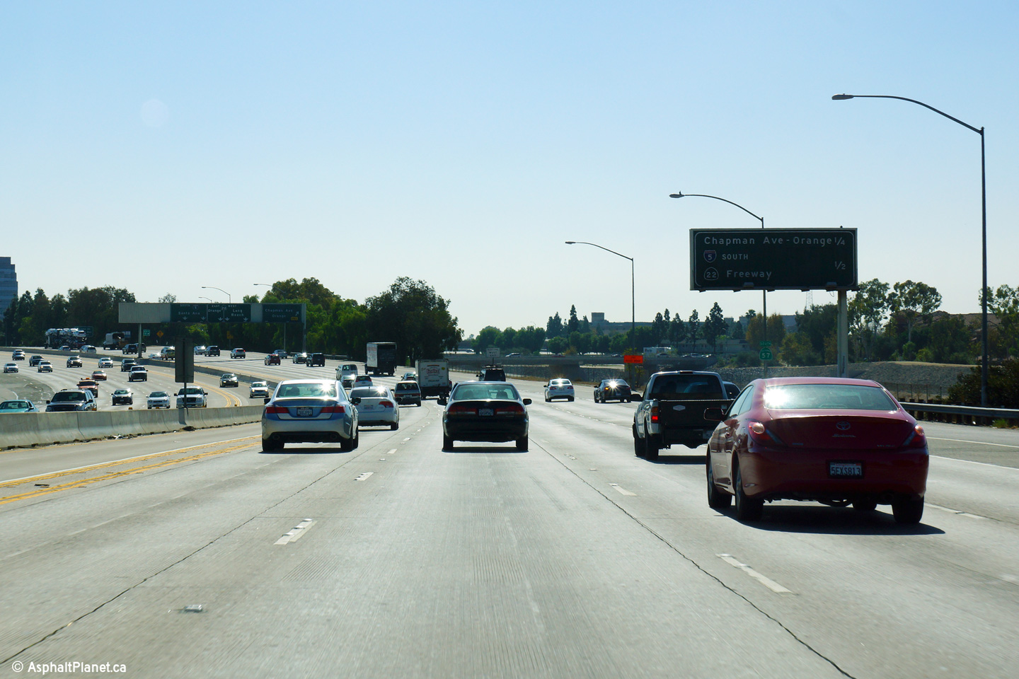
Interchange sequence signage southbound approaching the Chapman Avenue. |
 |
||
|
Date: 10/30/2013 |
High-res: (1440x960) (2400x1600) | |||
|
Orange County |
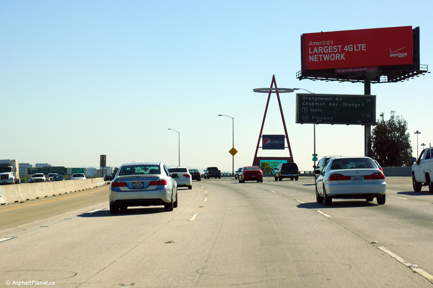
Southbound signage at the ramp to Orangewood Avenue. This is the first in the series of pull-through signs that explains the lane assignments for the upcoming Orange Crush interchange. |
 |
||
|
Date: 10/30/2013 |
High-res: (1440x960) (2400x1600) | |||
|
Orange County |
Southbound interchange sequence signage in advance of the Orangewood Avenue interchange. |
 |
||
|
Date: 10/30/2013 |
High-res: (1440x960) (2400x1600) | |||
|
Orange County |
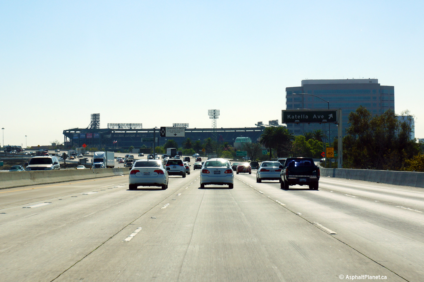
Partial overhead signage for the ramp to Katella Avenue. Angel Stadium of Anaheim (home to the Los Angeles Angels of Anaheim) is visible behind the overhead signage. |
 |
||
|
Date: 10/30/2013 |
High-res: (1440x960) (2400x1600) | |||
|
Orange County |
Interchange sequence signage in advance of the Katella Avenue interchange. |
 |
||
|
Date: 10/30/2013 |
High-res: (1440x960) (2400x1600) | |||
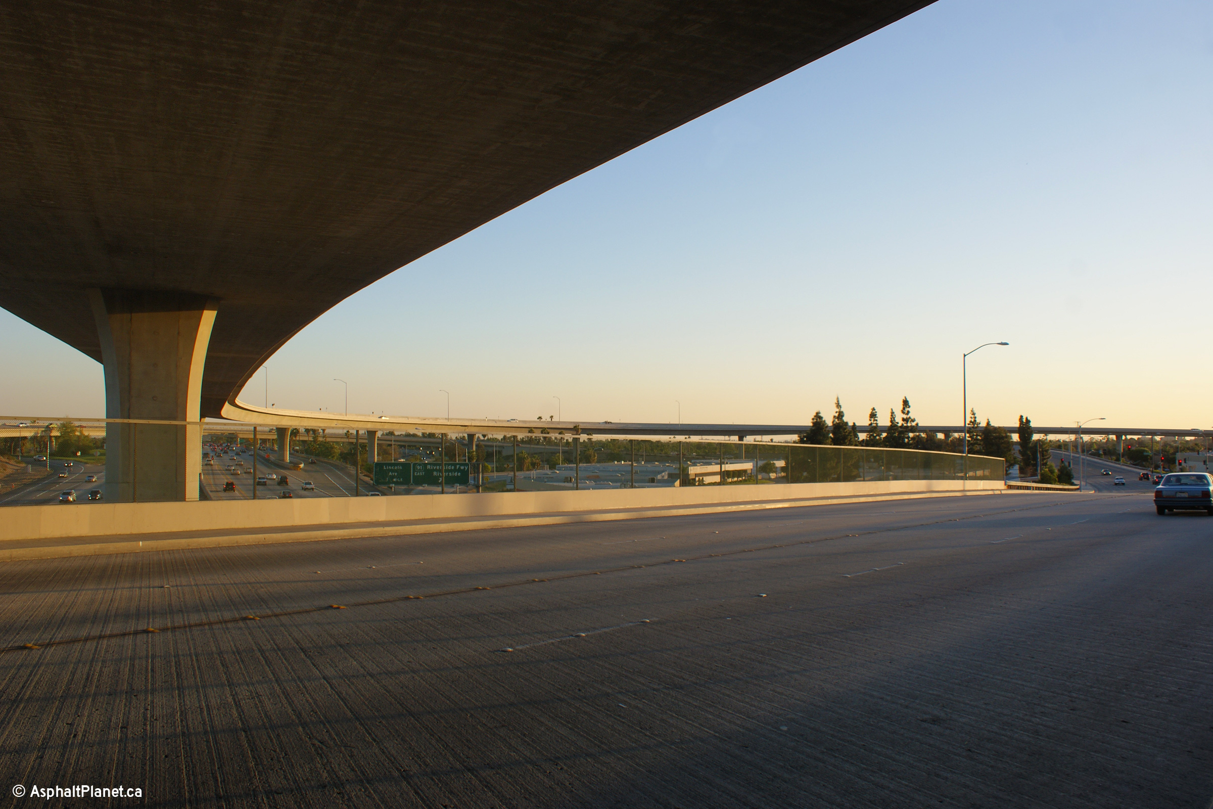
|
Orange County |
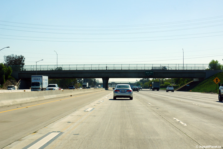
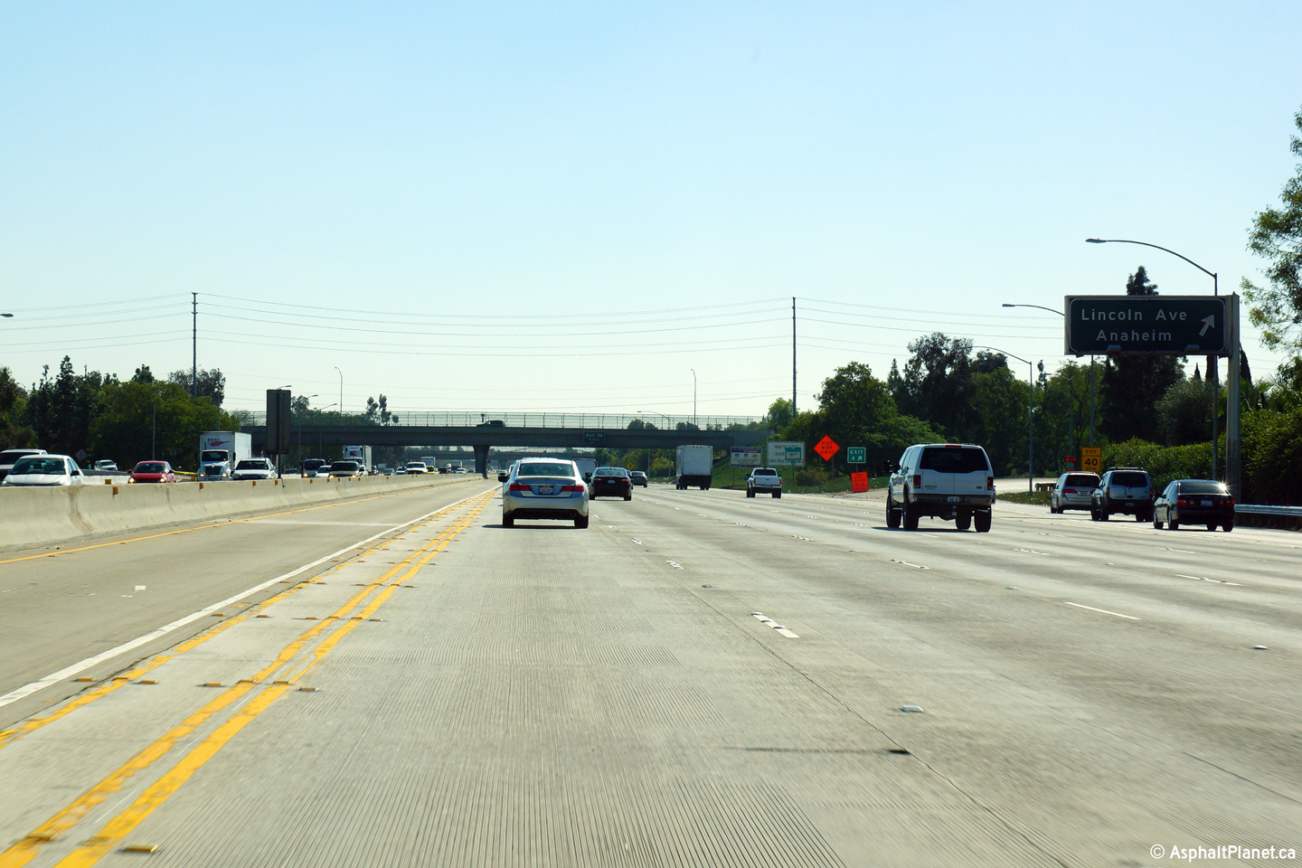
View as the twelve lane 57 freeway passes beneath the Lincoln Avenue overcrossing. |
 |
||
|
Date: 10/30/2013 |
High-res: (1440x960) (2400x1600) | |||
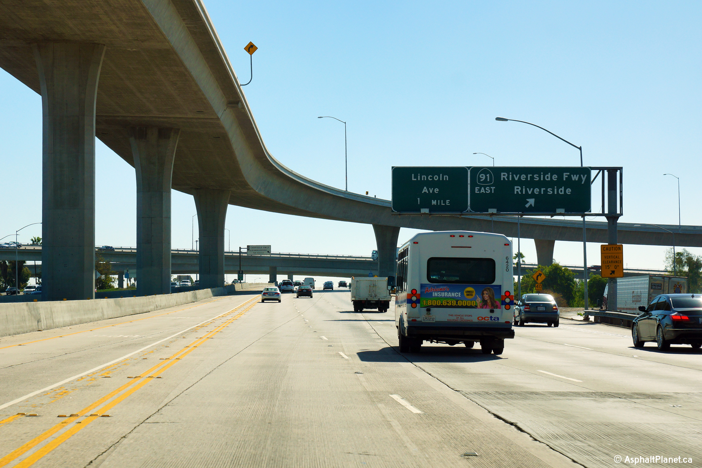
|
Orange County |
Southbound view as the off-ramp to Lincoln Avenue departs from the southbound lanes of the freeway. |
 |
||
|
Date: 10/30/2013 |
High-res: (1440x960) (2400x1600) | |||
| State Route 91 is the Riverside Freeway and links Gardena in South Central LA to I-215 in Riverside. Click here for State Route 91 Images. | ||||
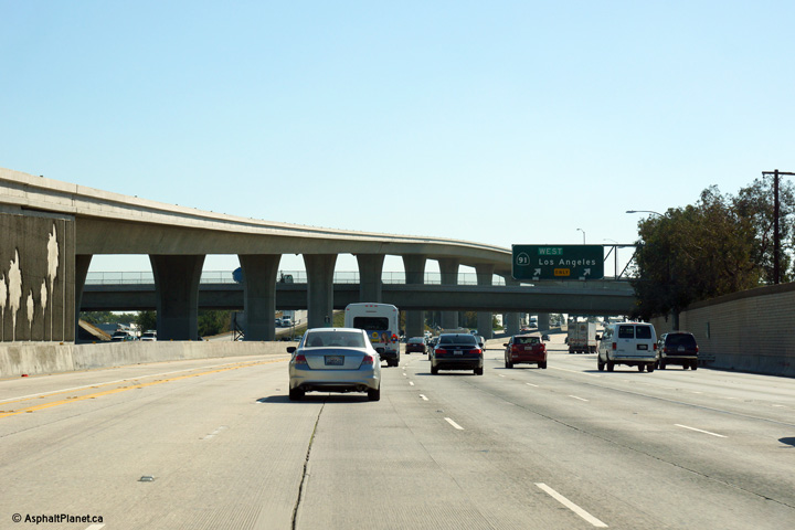
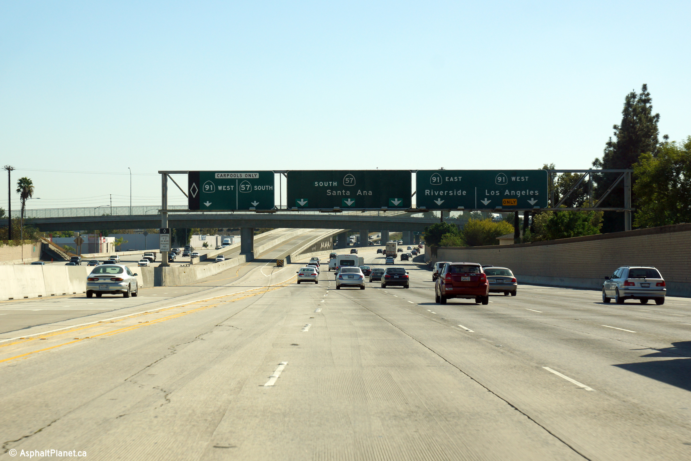
|
Orange County |
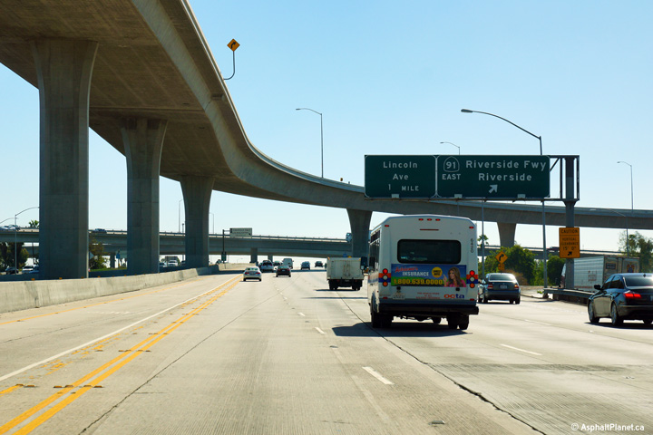
Partial overhead signage for the ramp to the 91 Freeway East. |
 |
||
|
Date: 10/30/2013 |
High-res: (1440x960) (2400x1600) | |||
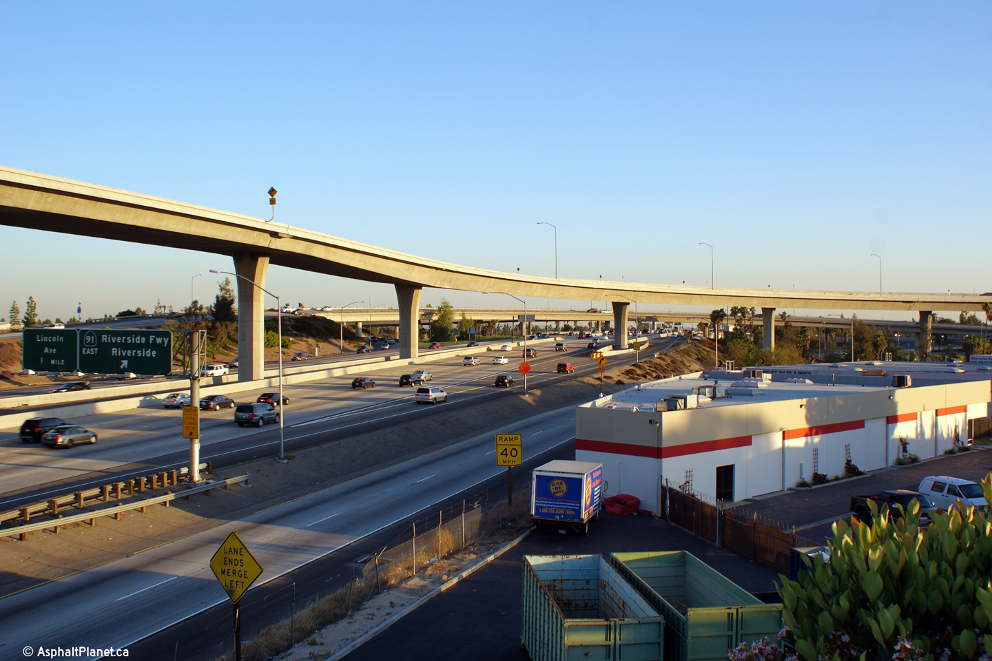
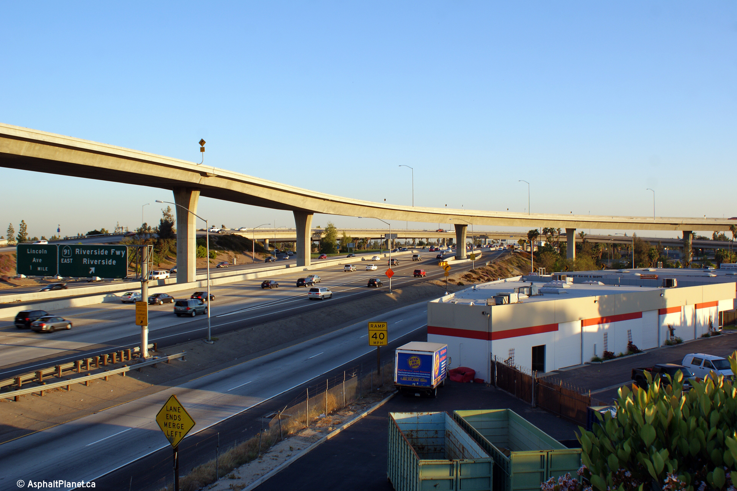
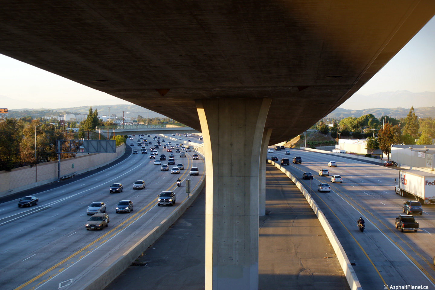
|
Orange County |
Southerly view from the Miraloma Avenue overpass towards the 91 Freeway interchange. The HOV lane flyover dwarfs the surrounding interchange. |
 |
||
| High-res: (1440x960) (2400x1600) | ||||
 |
||||
|
Date: 4/06/2010 |
High-res: (1440x960) (2400x1600) | |||
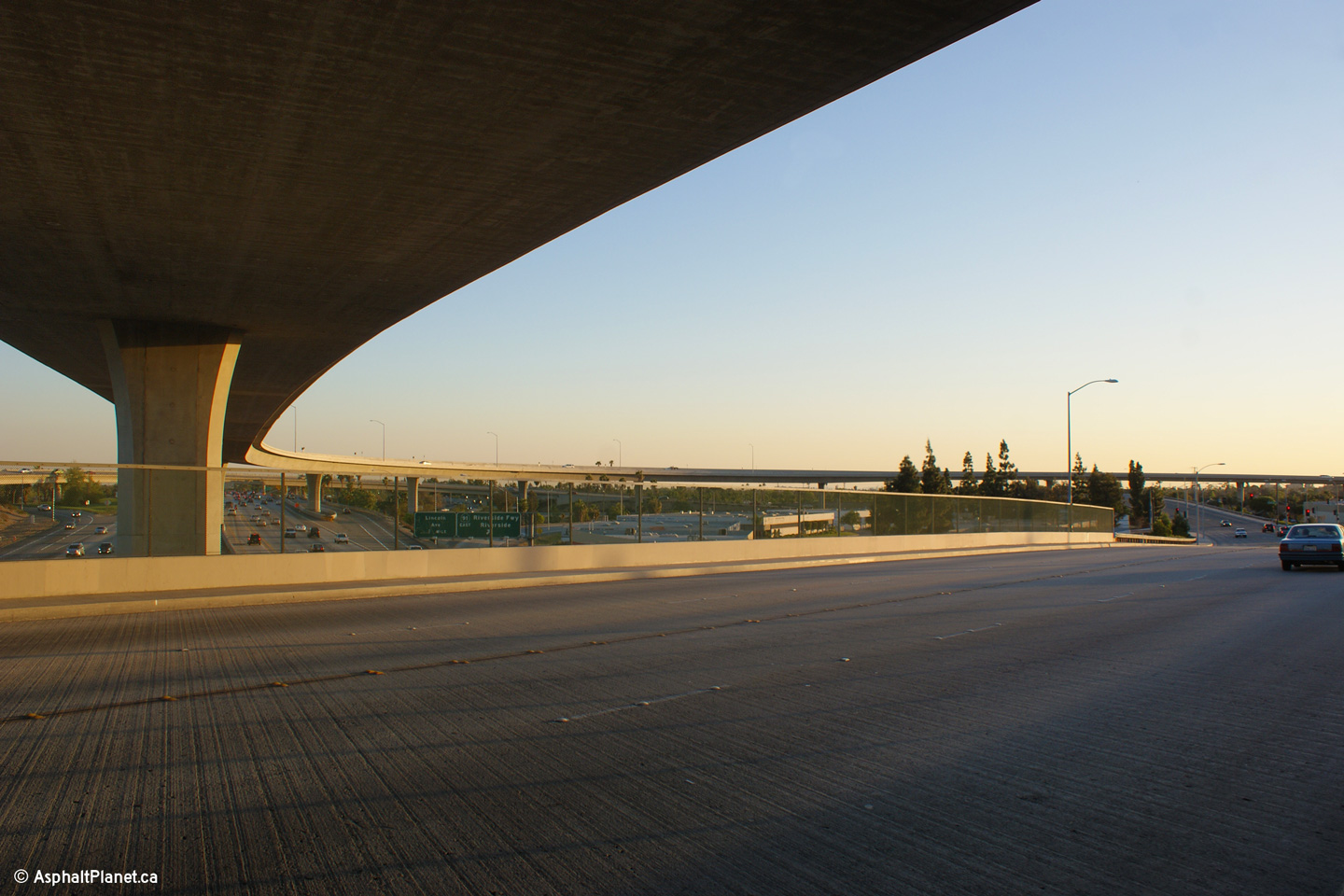
|
Orange County |
This view looks northerly from the Miraloma Avenue overpass. The high-speed HOV connector towers over the Miraloma Avenue overpass |
 |
||
|
Date: 4/06/2010 |
High-res: (1440x960) (2400x1600) | |||
|
Orange County |
Southerly view approaching the ramp to State Route 91 West. |
 |
||
|
Date: 10/31/2013 |
High-res: (1440x960) (2400x1600) |
|||
|
Orange County |
Overhead gantry in advance of the 91 Freeway interchange. |
 |
||
|
Date: 10/31/2013 |
High-res: (1440x960) (2400x1600) |
|||
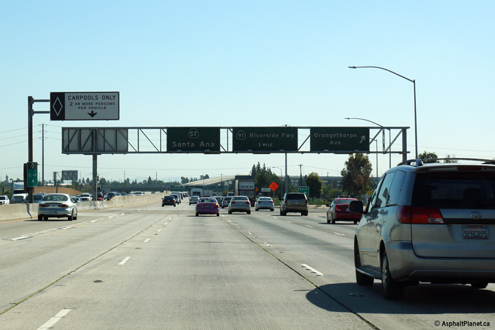
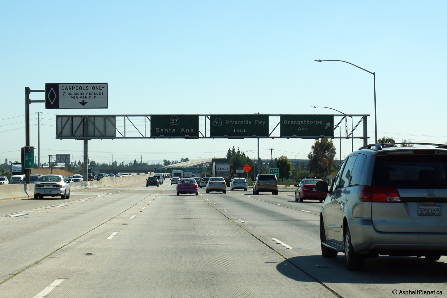
|
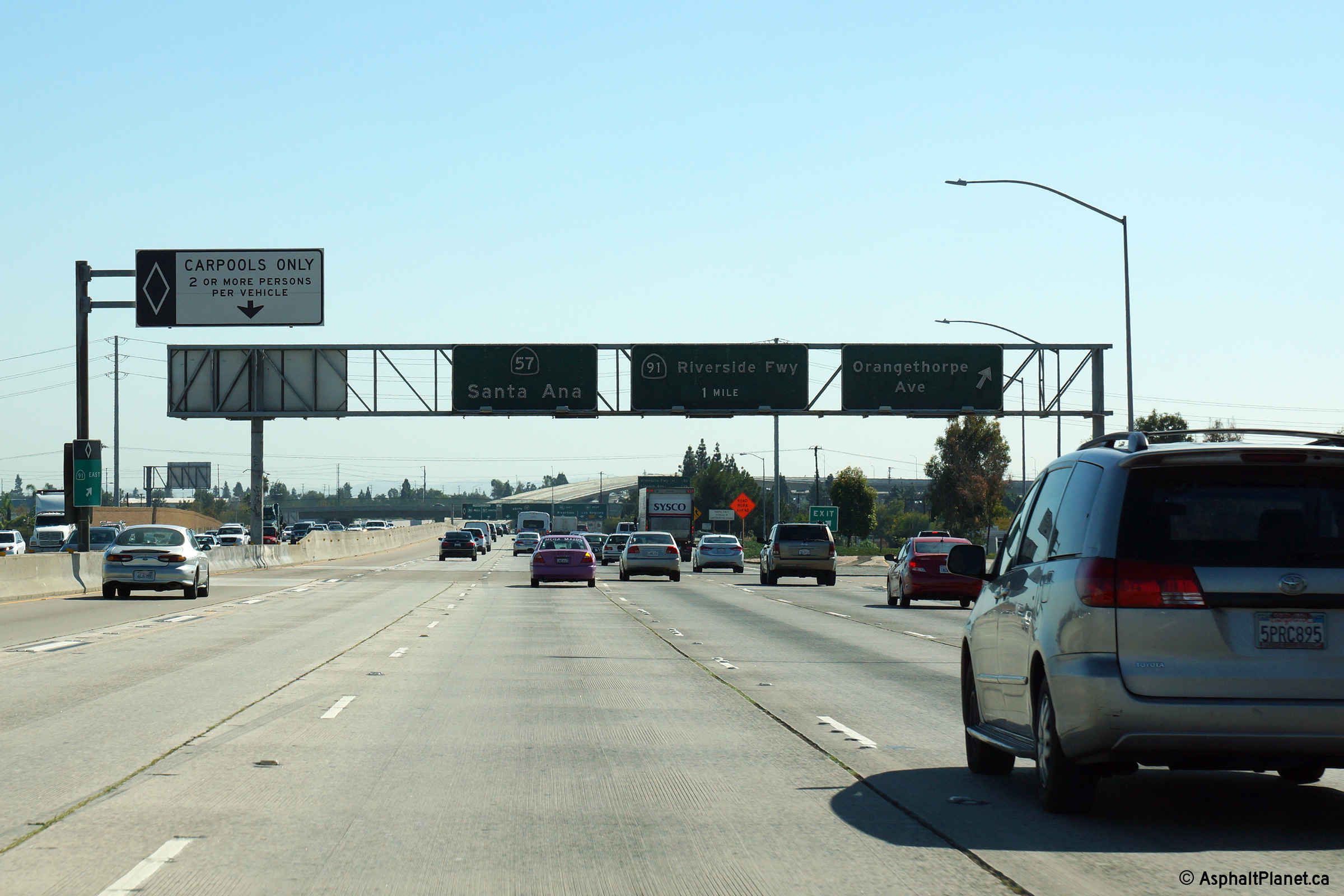
Orange County |
Overhead signage at the Orangethorpe Avenue interchange. |
 |
||
|
Date: 10/30/2013 |
High-res: (1440x960) (2400x1600) | |||
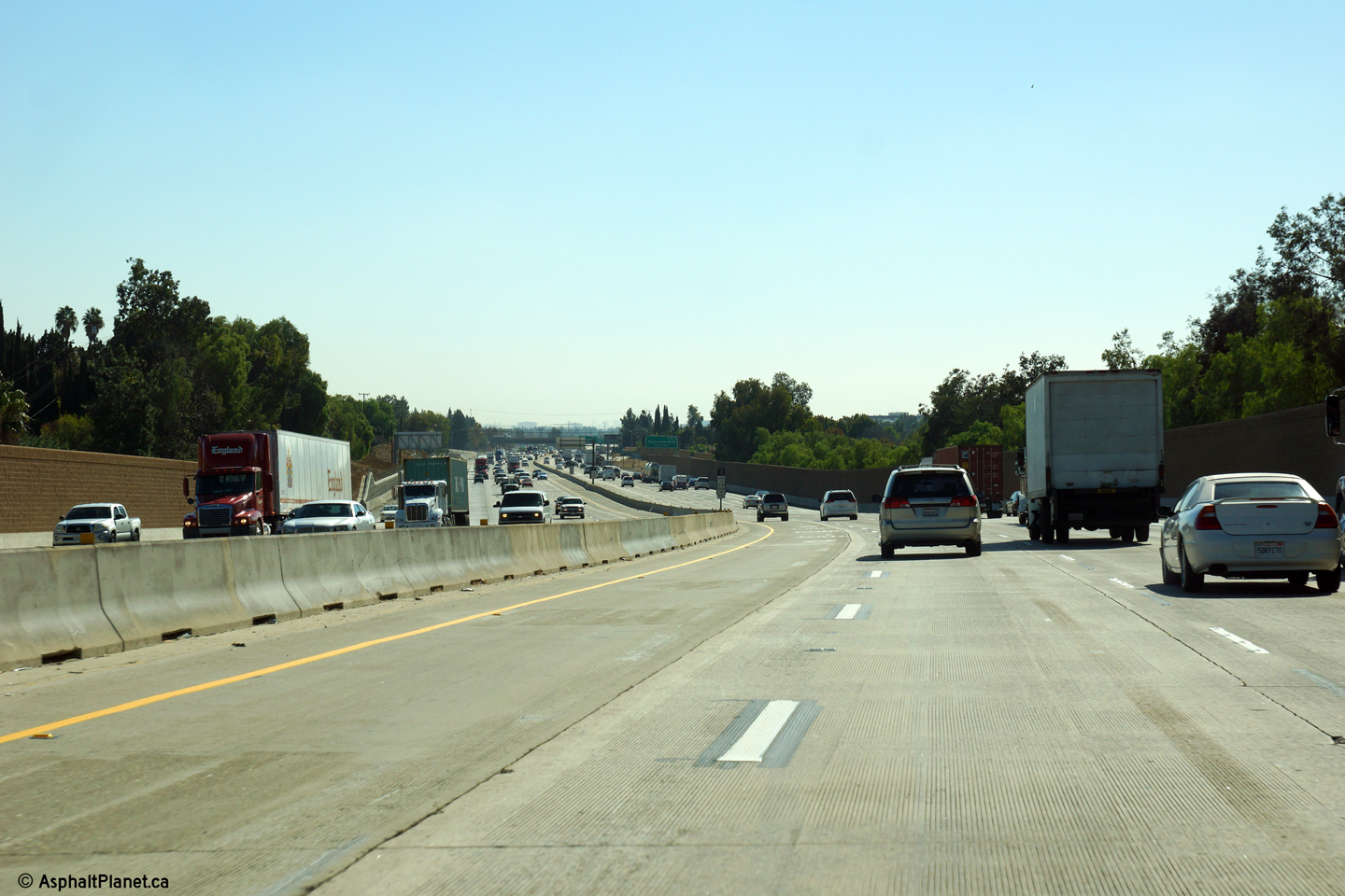
|
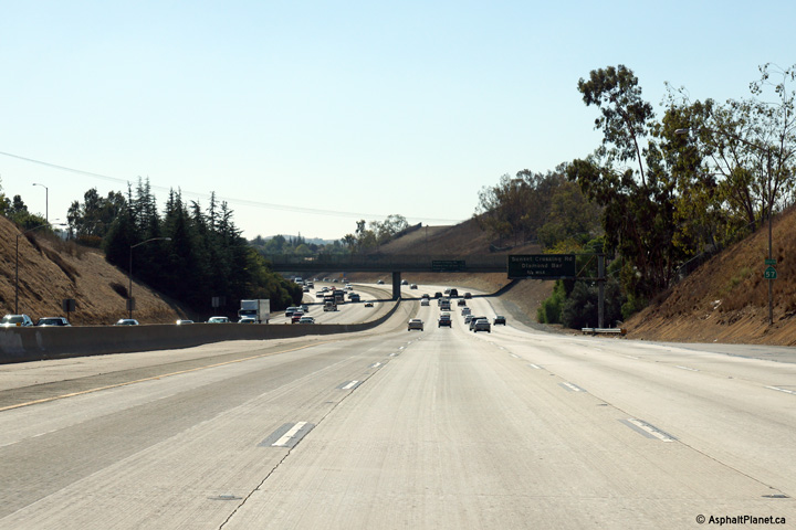
Orange County |
This view looks southerly as the 57 Freeway rounds a curve north of the Yorba Linda Drive interchange. The Carpool lanes are open access along this stretch of freeway. |
 |
||
|
Date: 10/30/2013 |
High-res: (1440x960) (2400x1600) | |||
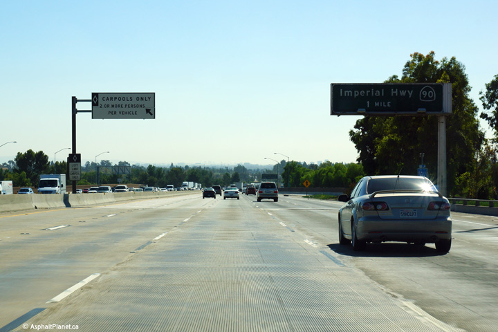
|
Orange County |
Advanced signage for the ramp to the Imperial Highway. |
 |
||
|
Date: 10/30/2013 |
High-res: (1440x960) (2400x1600) | |||
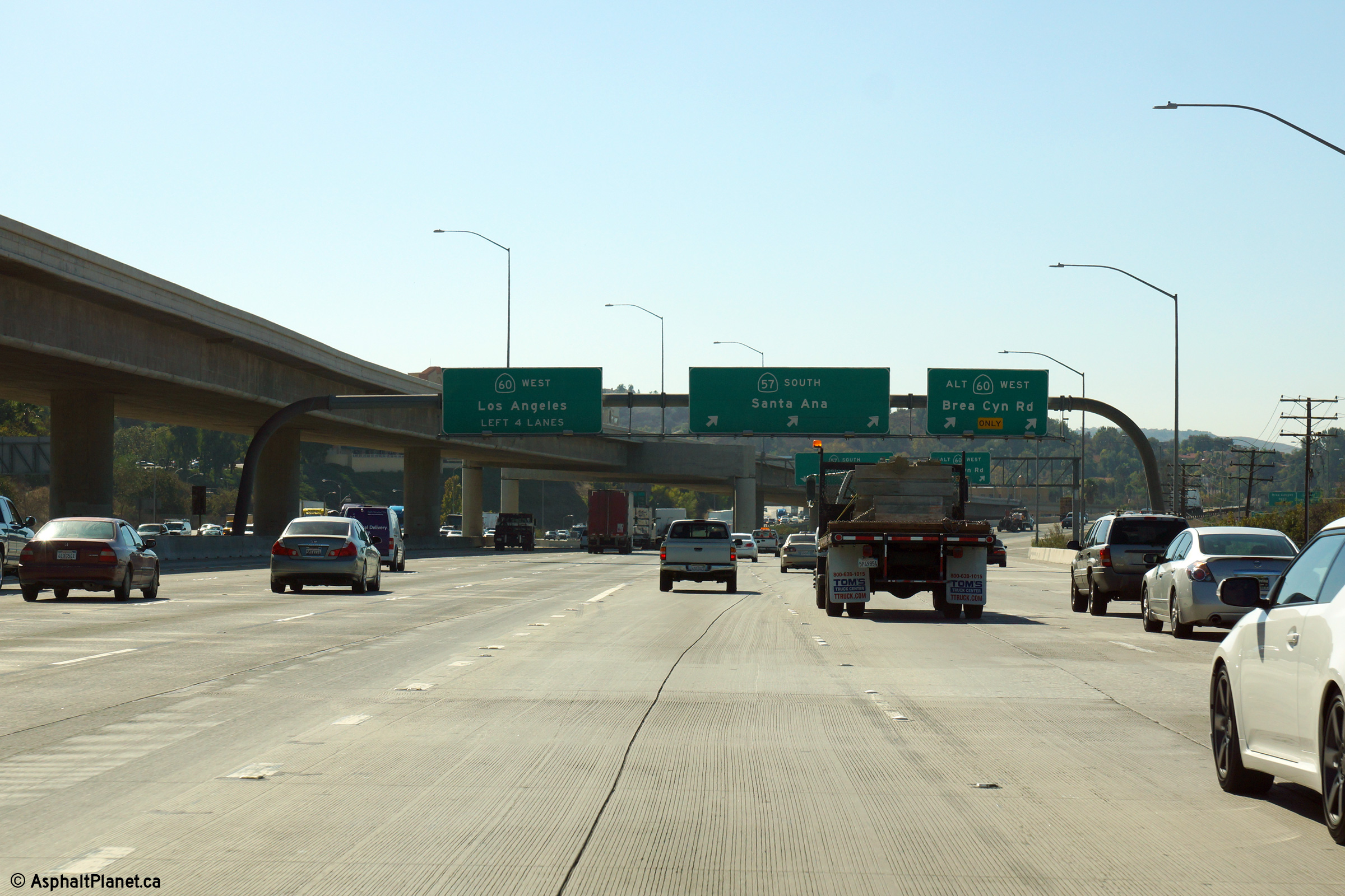
| West of the 57 Freeway, SR-60 leads traffic westerly into Downtown LA terminating at the East Los Angeles interchange. Click here for SR-60-West Images. | ||||
|
Los Angeles County |
Southbound signage as the southbound lanes of the 57 Freeway being to diverge from the westbound lanes of the 60 Freeway. |
 |
||
|
Date: 10/30/2013 |
High-res: (1440x960) (2400x1600) | |||
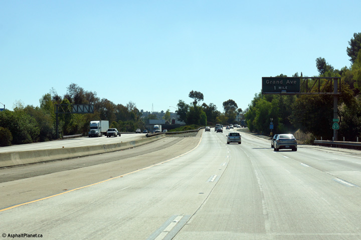
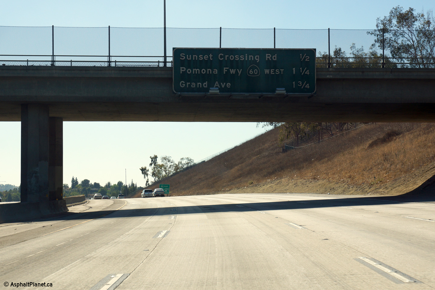
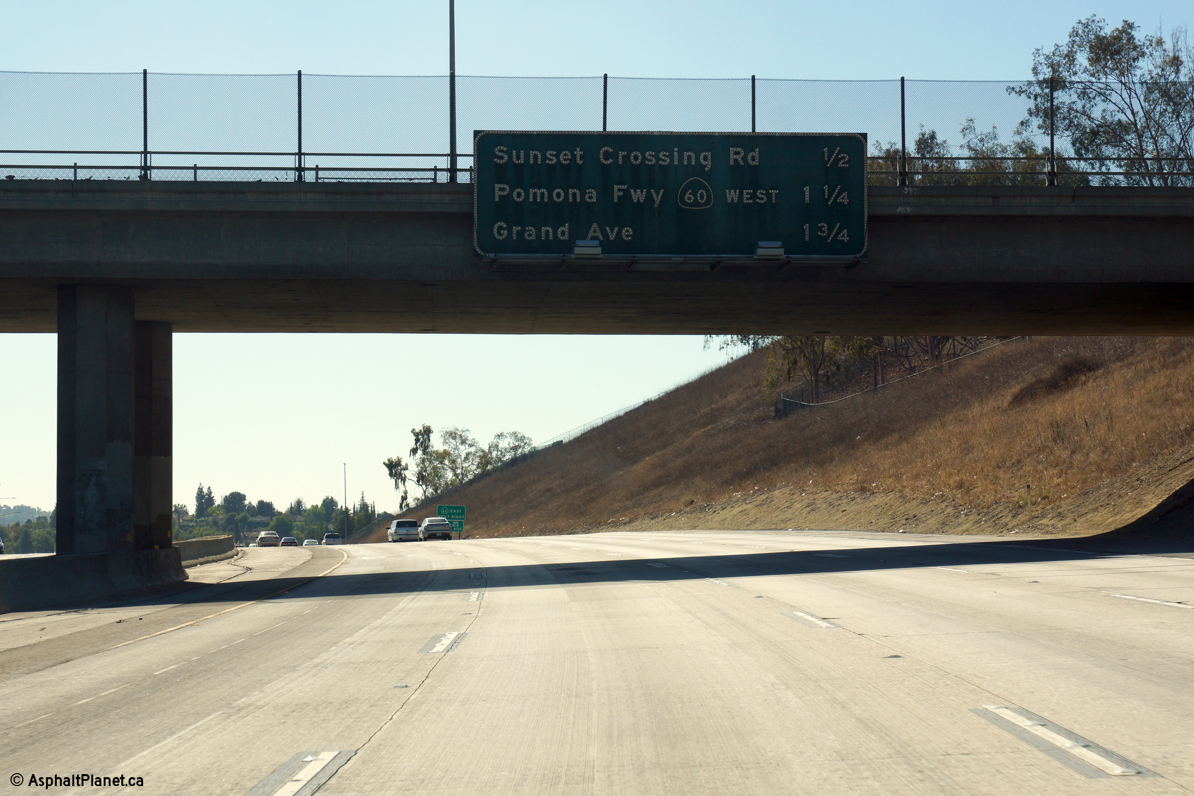
|
Los Angeles County |
Advanced signage for the Grand Avenue interchange. Just beyond the pictured curve southbound traffic along the 57 Freeway merges with westbound SR-60 traffic. This photo illustrates that space has been reserved in the median of the 57 Freeway to build additional ramps to the SR-60 freeway in the future. |
 |
||
|
Date: 10/30/2013 |
High-res: (1440x960) (2400x1600) | |||
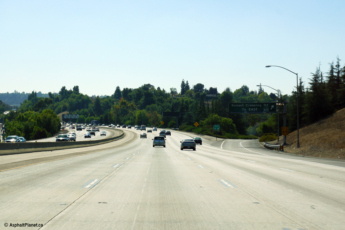
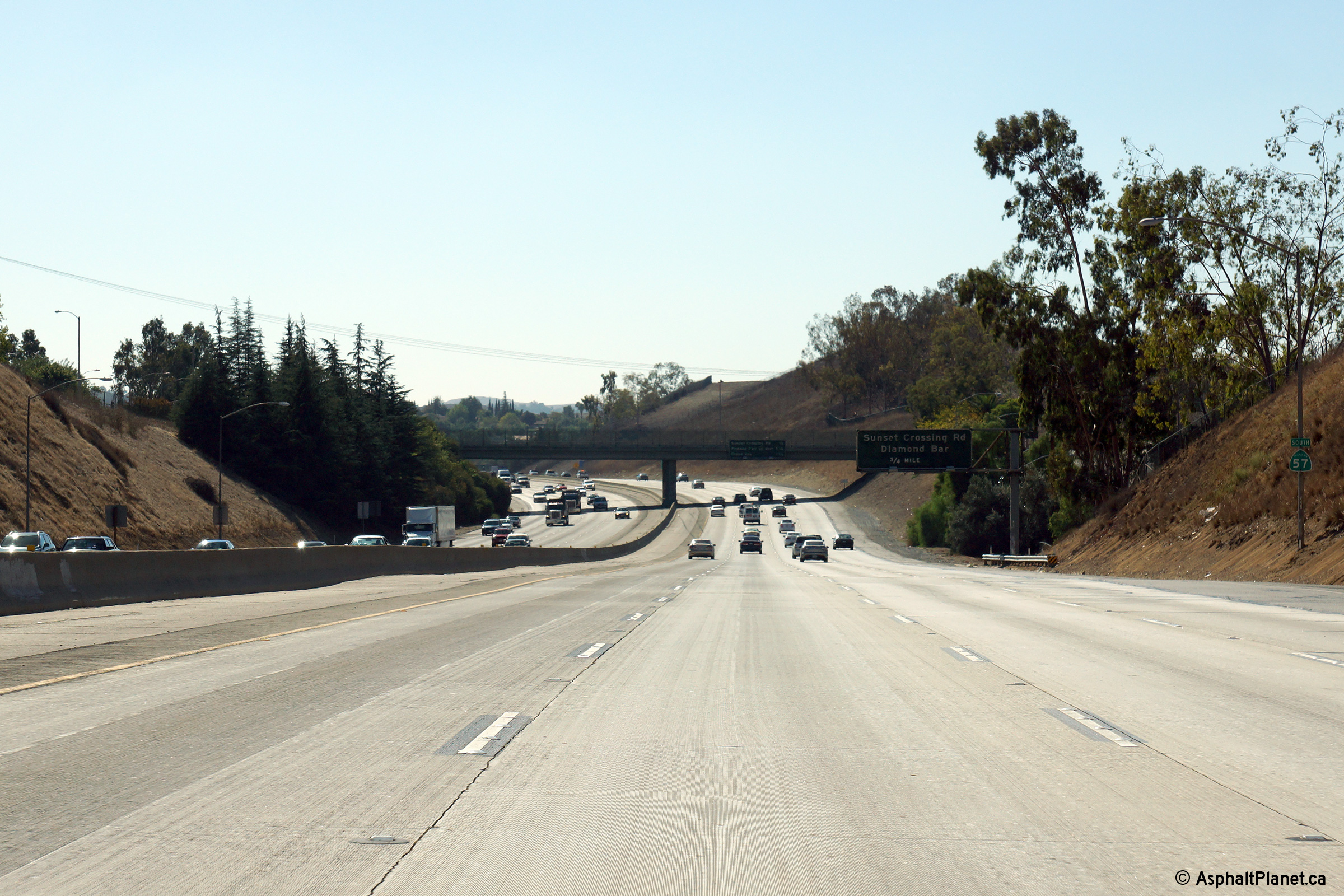
|
Los Angeles County |
Southerly view approaching the Sunset Crossing Road. Traffic bound for the eastbound direction of the 60 Freeway are directed to exit the 57 Freeway at this interchange. There are no direct ramps linking southbound SR-57 to SR-60 East, or vice versa, at the upcoming SR-60 interchange. |
 |
||
|
Date: 10/30/2013 |
High-res: (1440x960) (2400x1600) | |||
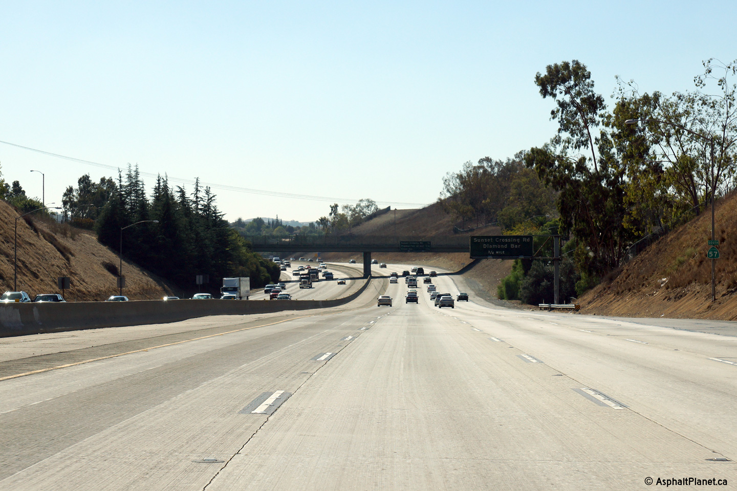
|
Los Angeles County |
Interchange sequence signage in advance of the Sunset Crossing Road interchange affixed to the Valley Road overcrossing. |
 |
||
|
Date: 10/30/2013 |
High-res: (1440x960) (2400x1600) | |||
|
Los Angeles County |
Southerly view along SR-67 in between the Temple Avenue and Sunset Crossing interchanges. |
 |
||
|
Date: 10/30/2013 |
High-res: (1440x960) (2400x1600) | |||
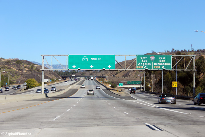
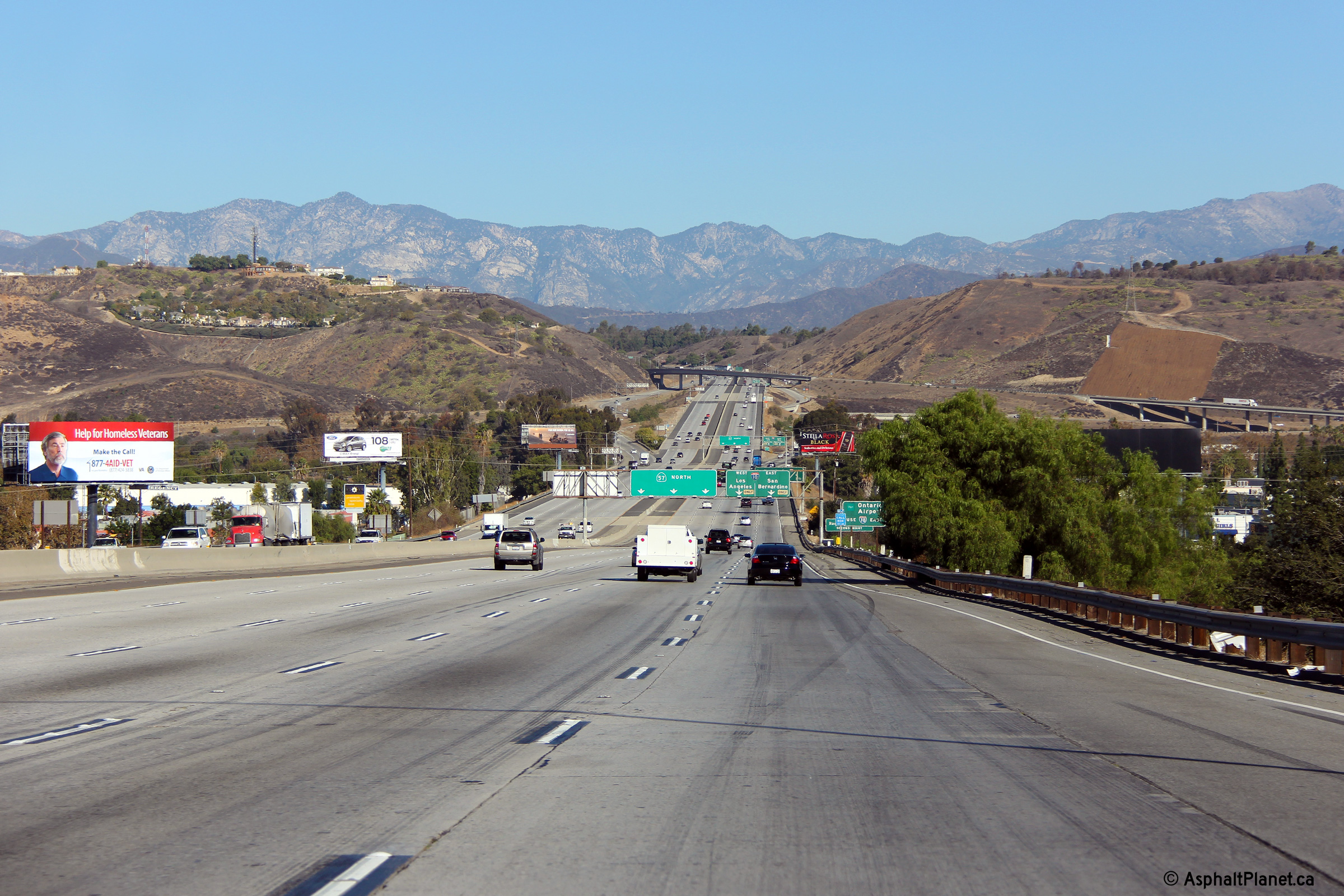
|
Los Angeles County |
View looking northerly along the 57 Freeway approaching the Kellogg Interchange with I-10 and CA-71 from just south of the Temple Avenue interchange. |
 |
||
|
Date: 11/06/2013 |
High-res: (1440x960) (2400x1600) | |||
|
Los Angeles County |
Advanced signage for the Kellogg Interchange. |
 |
||
|
Date: 11/06/2013 |
High-res: (1440x960) (2400x1600) | |||
|
Los Angeles County |
Interchange sequence signage in advance of the Interstate 10 interchange. |
 |
||
|
Date: 11/06/2013 |
High-res: (1440x960) (2400x1600) | |||
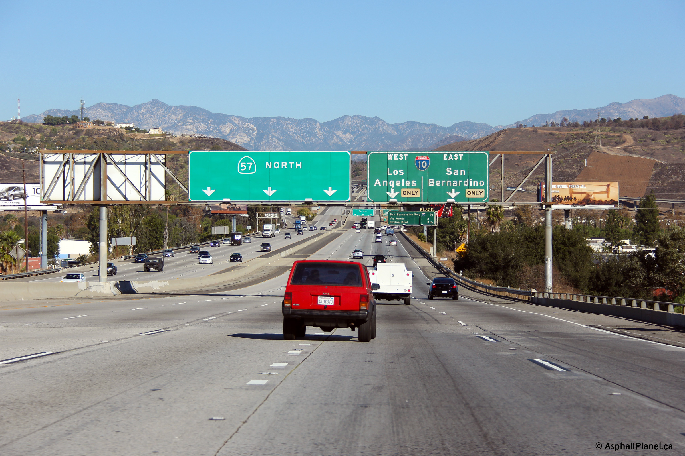
|
Los Angeles County |
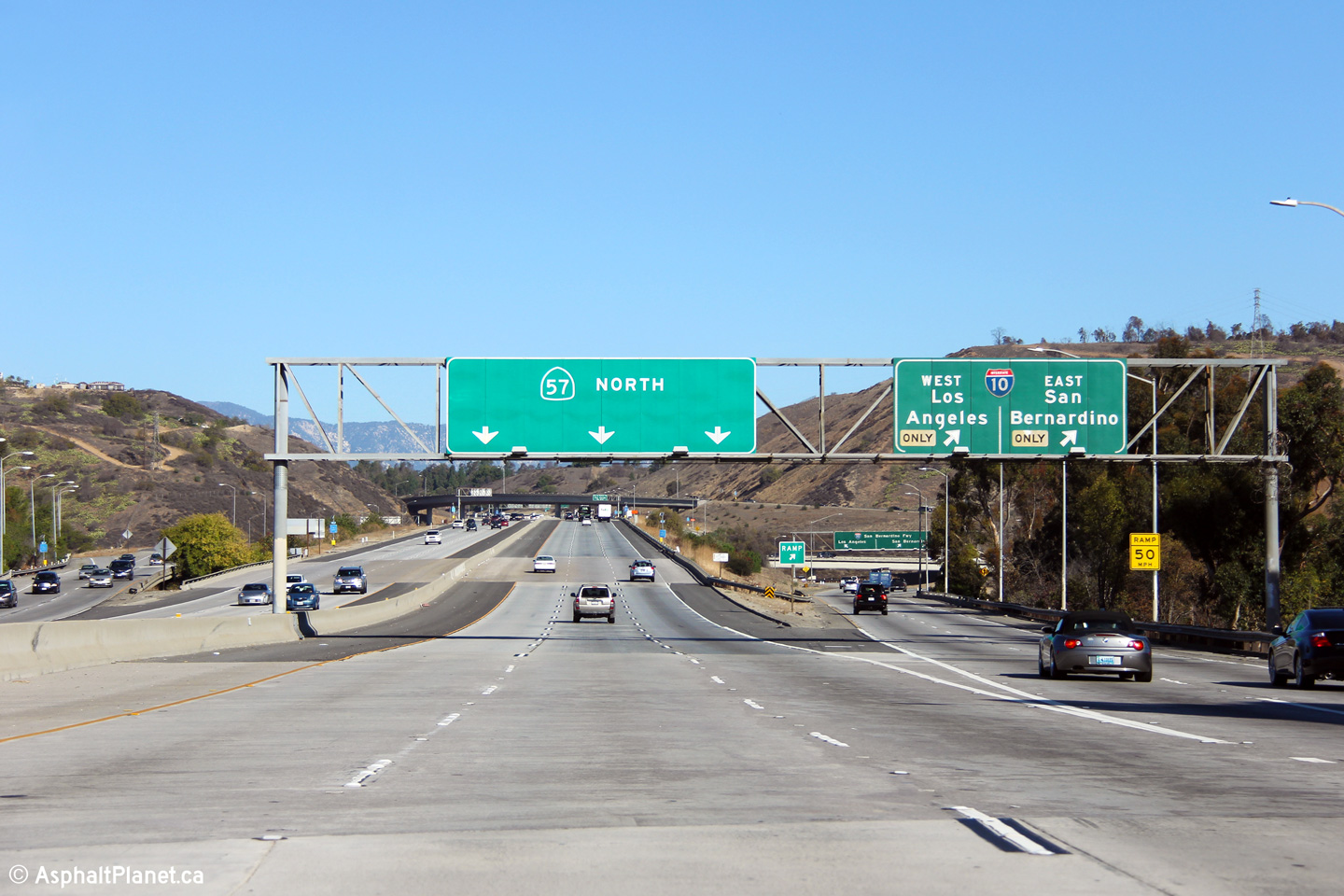
Northbound signage as the ramp to Interstate 10 leaves the mainline lanes of the 57 Freeway. |
 |
||
|
Date: 11/06/2013 |
High-res: (1440x960) (2400x1600) | |||
| Interstate 10 is the Christopher Columbus Trans-Continental Highway and runs between Santa Monica on the Pacific Ocean to Jacksonville, Florida on the Atlantic. Click here for Interstate 10 Images. | ||||
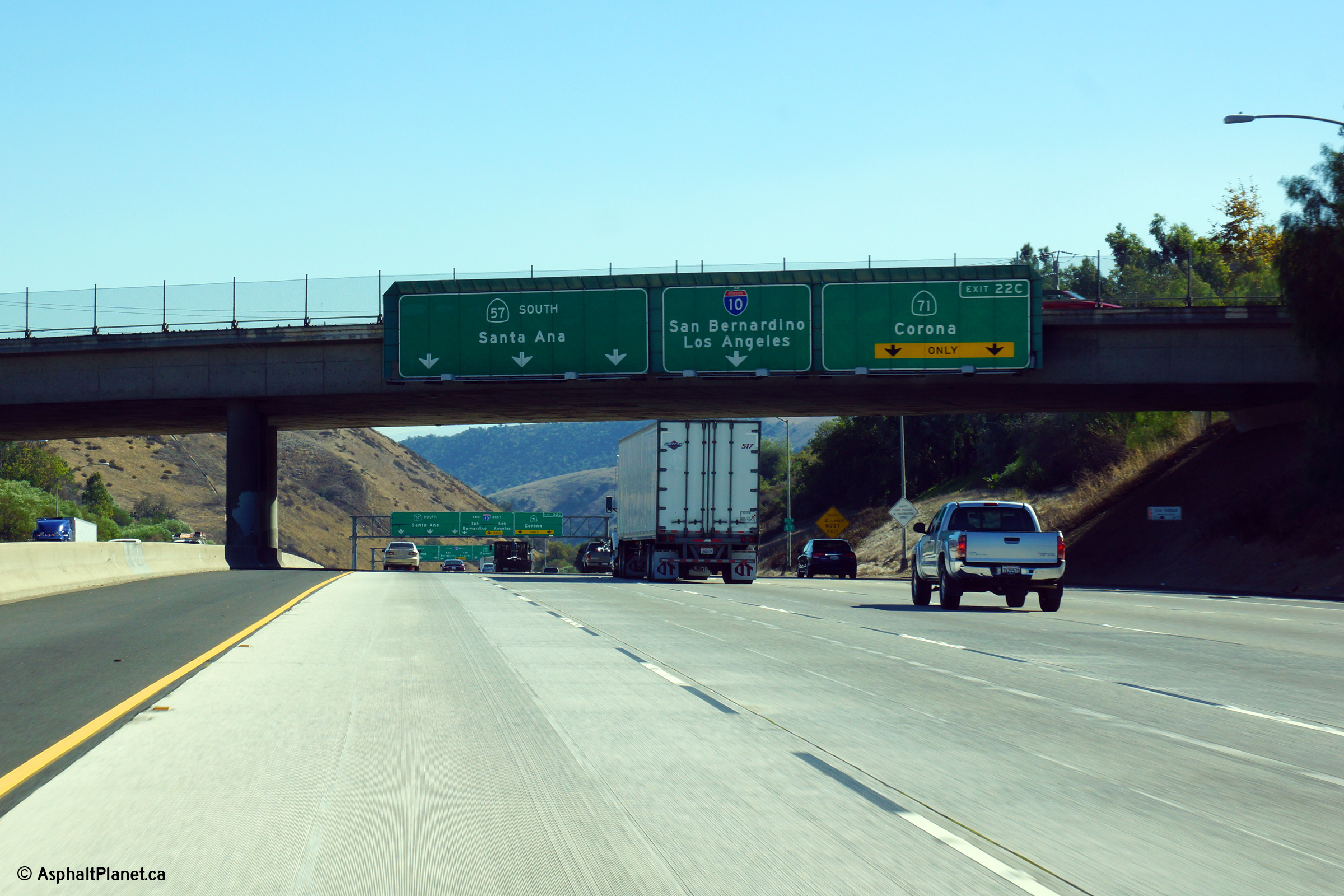
|
Los Angeles County |
View looking southerly along the 57 Freeway as it passes beneath the ramp to the 71 Freeway South. The 57 Freeway is the fourth level of the five level Kellogg Interchange. |
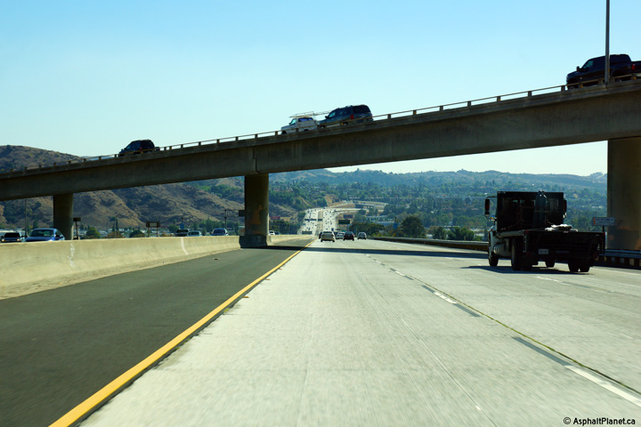 |
||
|
Date: 10/31/2013 |
High-res: (1440x960) (2400x1600) | |||
|
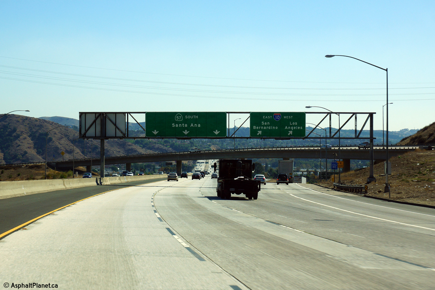
Los Angeles County |
This view looks southerly along the 57 Freeway as the ramp to both directions of I-10 depart the freeway mainline. |
 |
||
|
Date: 10/31/2013 |
High-res: (1440x960) (2400x1600) | |||
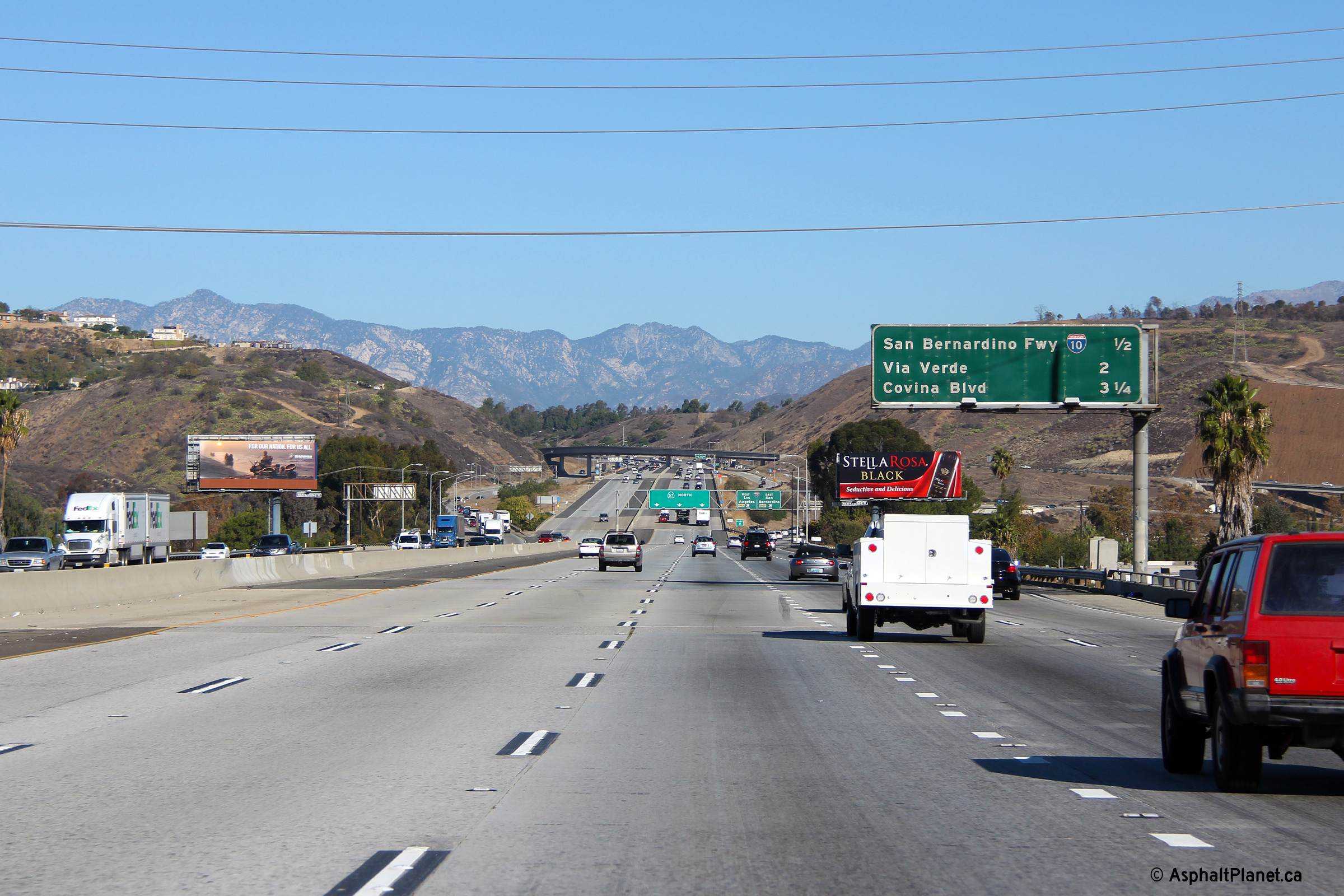
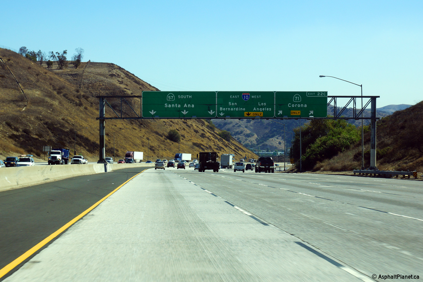
|
Los Angeles County |
Overhead signage where the ramp to the 71 Freeway departs from the 57 South. |
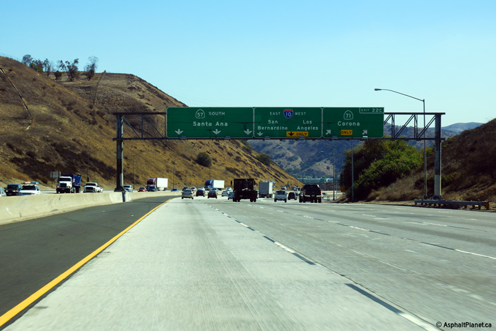 |
||
|
Date: 10/31/2013 |
High-res: (1440x960) (2400x1600) | |||
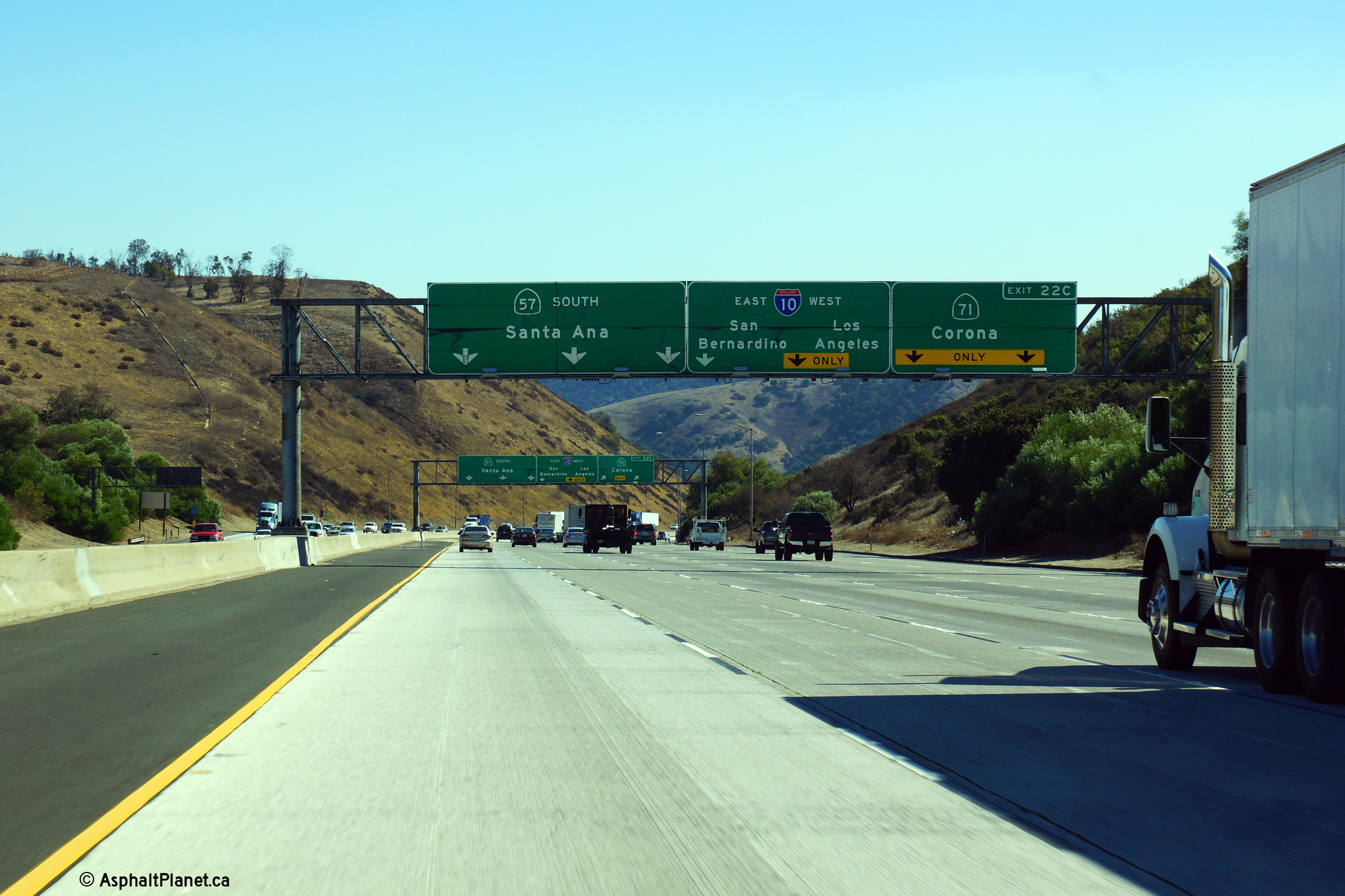
|
Los Angeles County |
Advanced overhead signage denoting the lane assignments for the upcoming Kellogg Interchange. |
 |
||
|
Date: 10/31/2013 |
High-res: (1440x960) (2400x1600) | |||
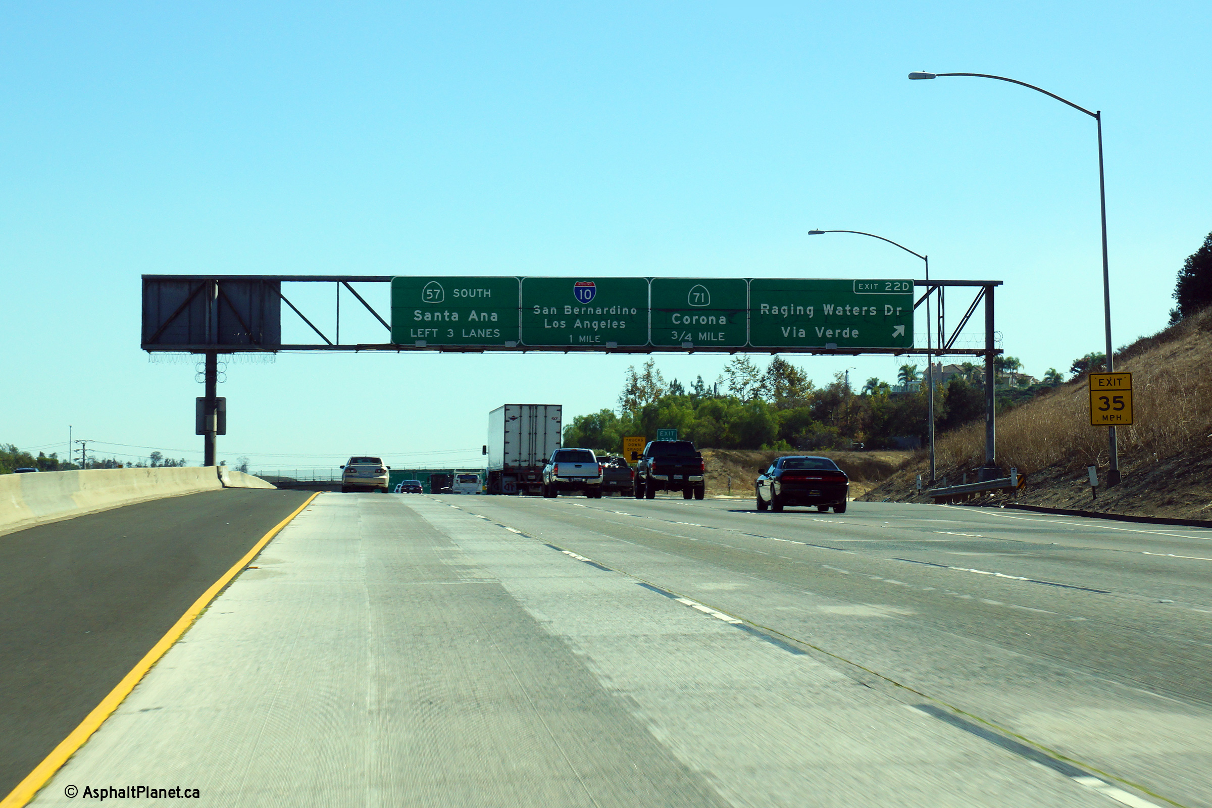
|
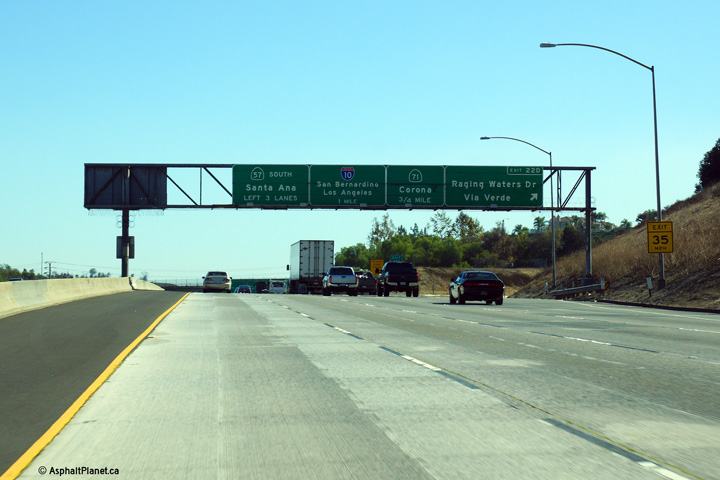
Los Angeles County |
Southbound signage for the Kellogg Interchange affixed to the Raging Waters Drive overpass. |
 |
||
|
Date: 10/31/2013 |
High-res: (1440x960) (2400x1600) | |||
|
Los Angeles County |
Southbound signage for the ramp to Raging Waters Drive |
 |
||
|
Date: 10/31/2013 |
High-res: (1440x960) (2400x1600) | |||
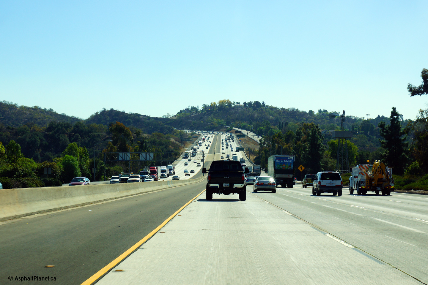
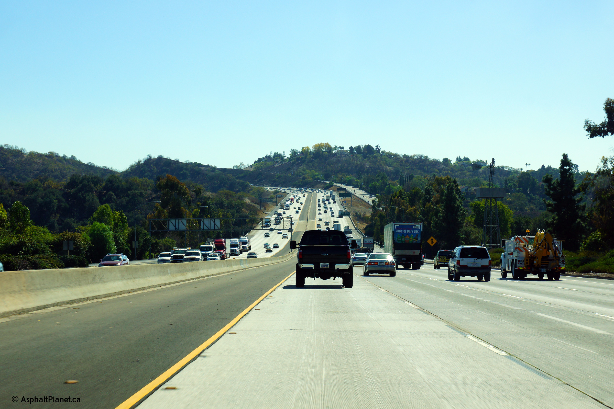
|
Los Angeles County |
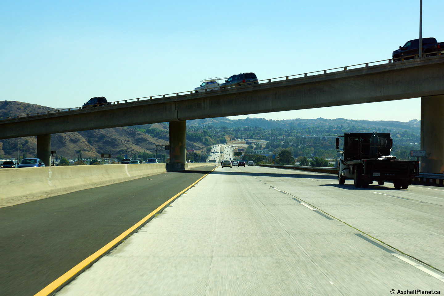
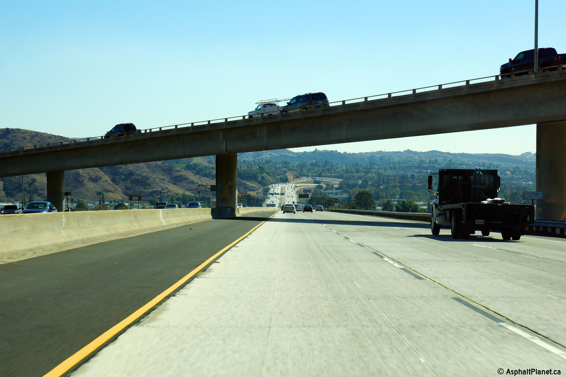
Northerly view as the 57 Freeway descends in to a large valley from just north of Raging Waters Drive |
 |
||
|
Date: 10/31/2013 |
High-res: (1440x960) (2400x1600) | |||
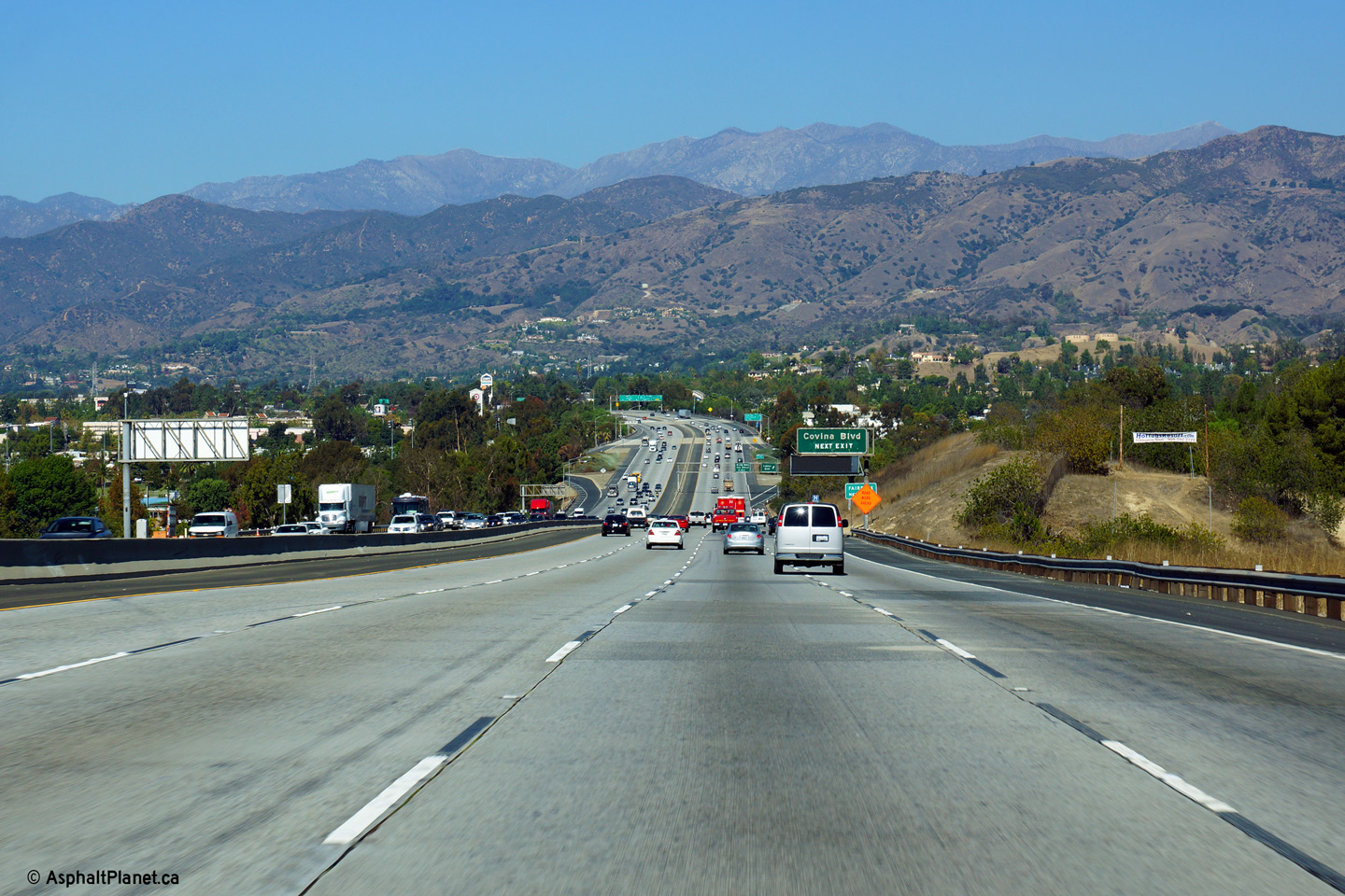
|
Los Angeles County |
Southerly view just south of the Covina Boulevard interchange. |
 |
||
|
Date: 10/30/2013 |
High-res: (1440x960) (2400x1600) | |||
|
Los Angeles County |
Northerly view at the off-ramp to the Arrow Highway. |
 |
||
|
Date: 10/31/2013 |
High-res: (1440x960) (2400x1600) | |||
|
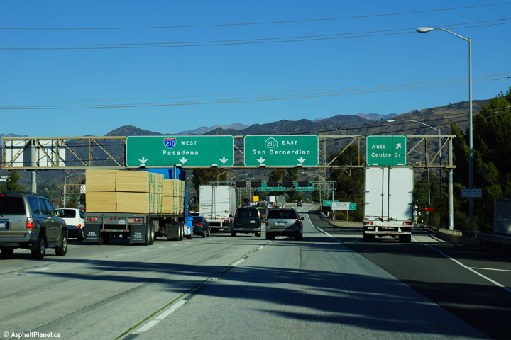
Los Angeles County |
Overhead signage at the off-ramp to Auto Centre Drive. |
 |
||
|
Date: 11/06/2013 |
High-res: (1440x960) (2400x1600) | |||
|
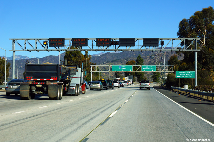
Los Angeles County |
Overhead signage indicating that the ramp meters have been activated on the ramp to I-210 West from the 57 Freeway. Caltrans meters many of its freeway on-ramps to control congestion on the mainline lanes of through freeways. |
 |
||
|
Date: 11/06/2013 |
High-res: (1440x960) (2400x1600) | |||
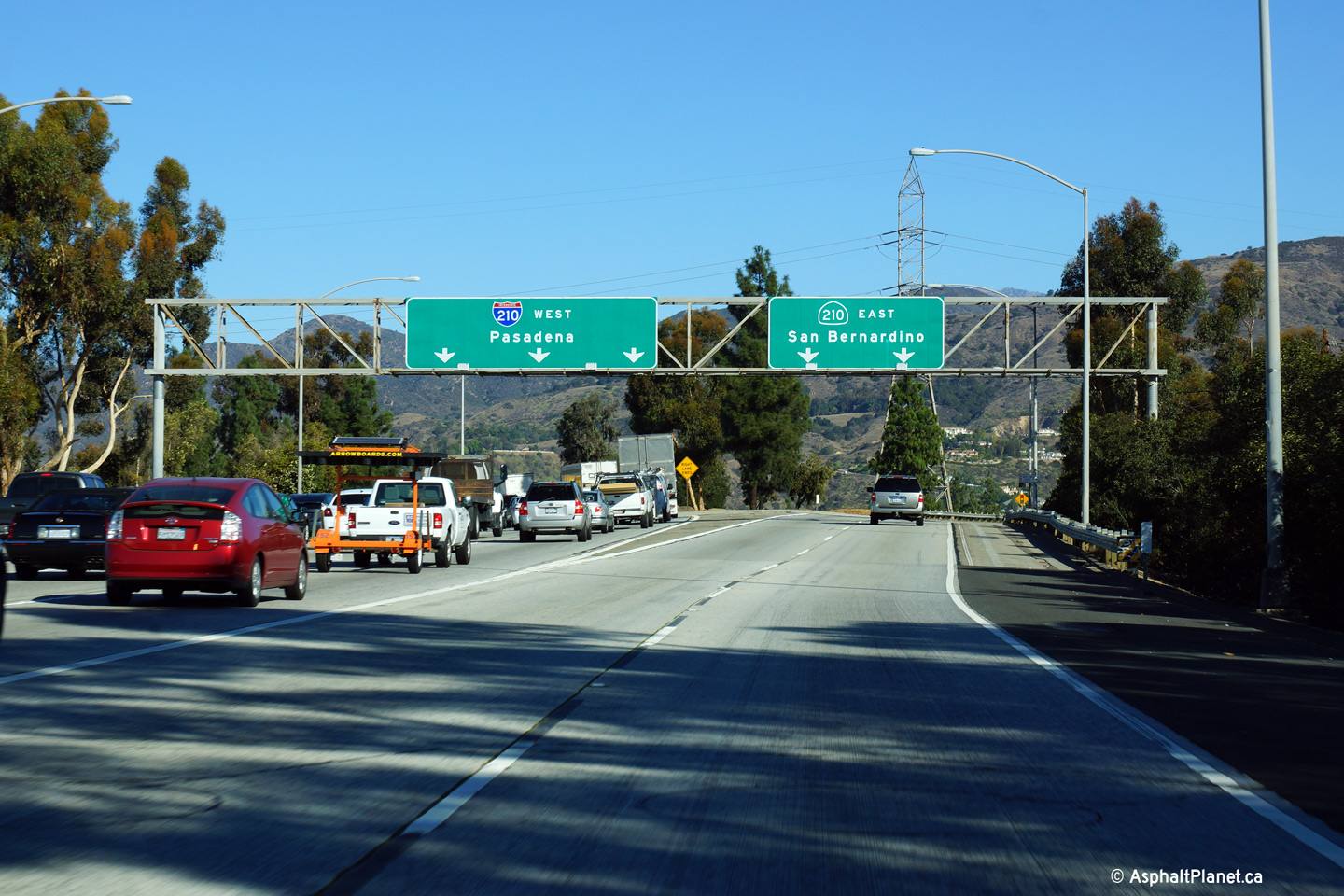
|
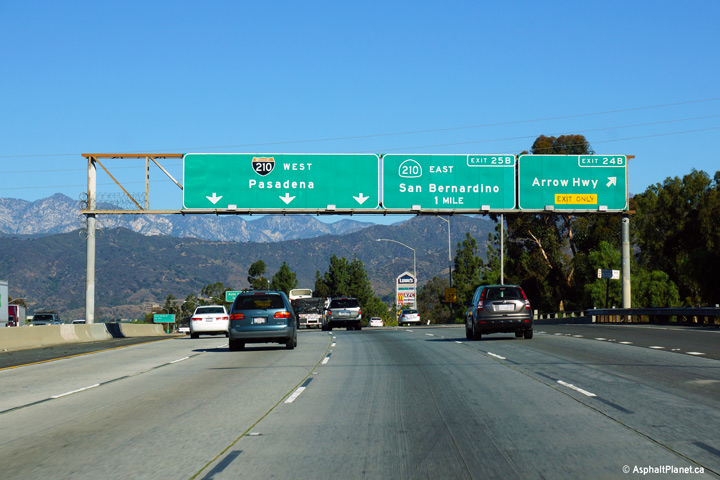
Los Angeles County |
Overhead signage at the end of the 57 Freeway at the 210 Freeway. |
 |
||
|
Date: 11/06/2013 |
High-res: (1440x960) (2400x1600) | |||
| Interstate 210 serves as the northern by-pass for the Greater Los Angeles area stretching from Sylmar to Redlands. Click here for Interstate 210 Images. | ||||
<- CA-56
CA Highways
CA-58 ->
AsphaltPlanet.ca
© 2010-14 AsphaltPlanet.ca.
Scott@asphaltplanet.ca
Page Created: April 17, 2014.
Last Updated: April 17, 2014.