AsphaltPlanet.ca > California > SR-60
Pictures on this page are arranged in order from west to east. CA-60 East photos are left-aligned in the last column, while CA-60 West photos are right-aligned. Center-line pictures are centered within the last column.
|
Location |
Description |
Photo |
||
|
East- |
West- |
|||
| Interstate 5 is the principle north-south interstate along the US West Coast. Click here for Interstate 5 Images. | ||||
|
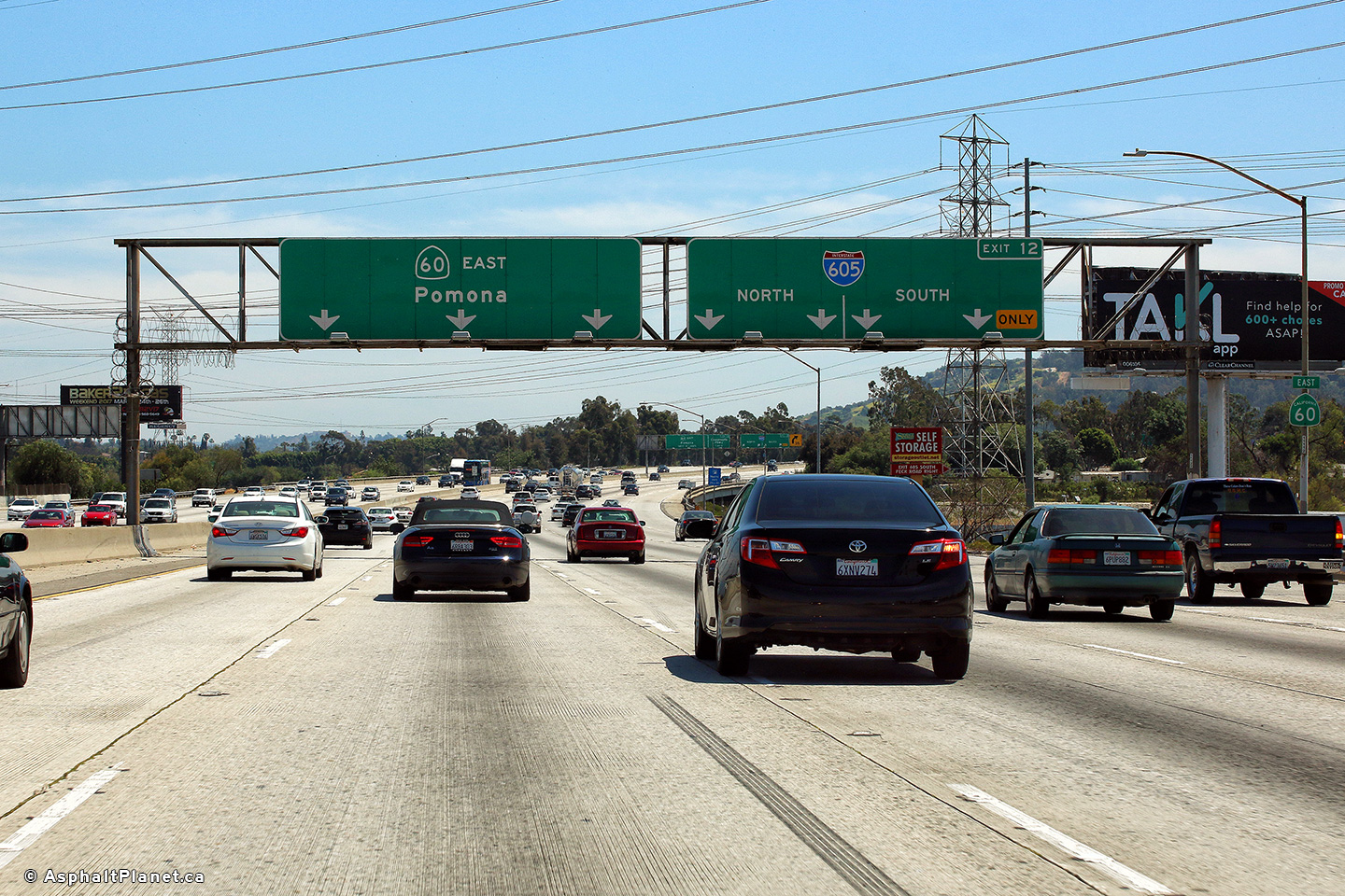
Los Angeles County |
Eastbound advanced signage for the off-ramp to the 605 Freeway. |
 |
||
|
Date: 4/16/2017 |
High-res: (1440x960) (2400x1600) |
|||
|
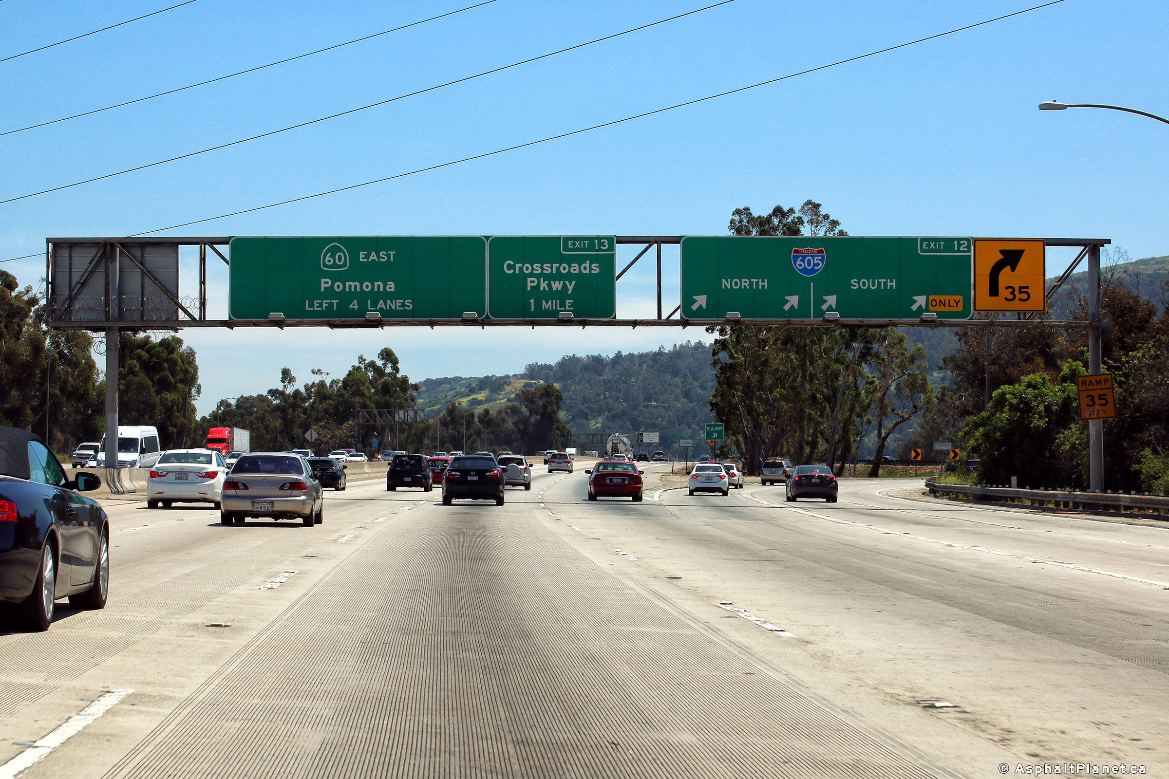
Los Angeles County |
View looking easterly at the off-ramp to the 605 Freeway. The Pomona Freeway is the top level of what is a fairly ordinary freeway to freeway interchange by Southern California standards. |
 |
||
|
Date: 4/16/2017 |
High-res: (1440x960) (2400x1600) |
|||
| Interstate 605 leads north-south through the Los Angeles Basin. Click here for Interstate 605 Images. | ||||
|
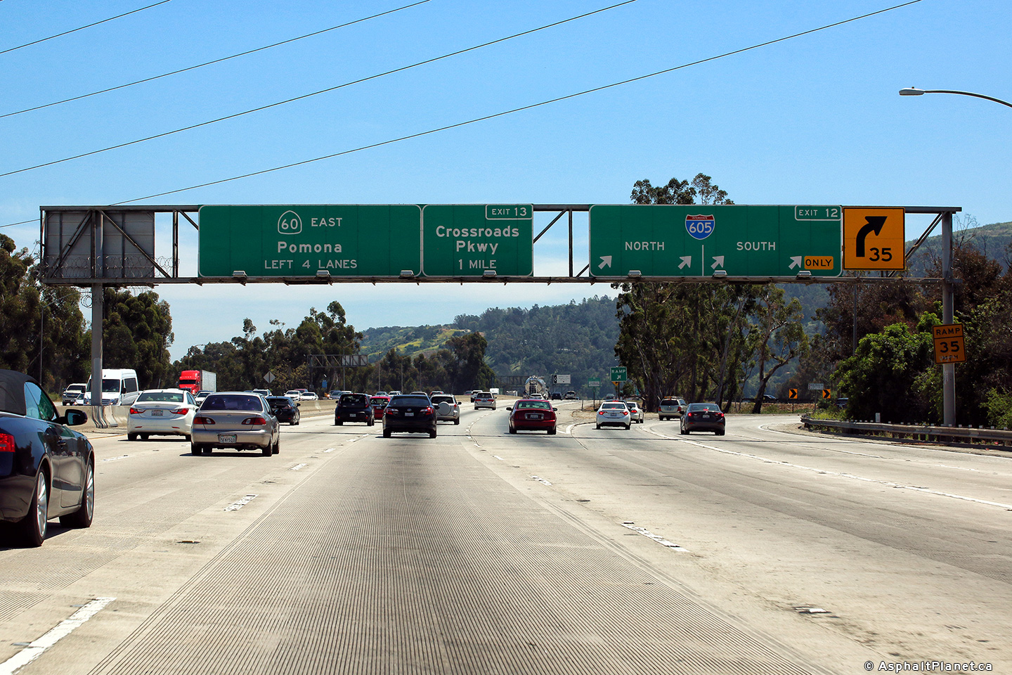
Los Angeles County |
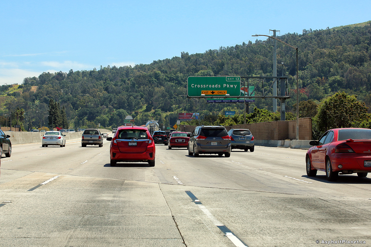
The first interchange located to the east of the 605 Freeway interchange is that of Crossroads Parkway. |
 |
||
|
Date: 4/05/2010 |
High-res: (1440x960) (2400x1600) |
|||
|
Los Angeles County |
Signage at the eastbound off-ramp to Crossroads Parkway. |
 |
||
|
Date: 4/16/2017 |
High-res: (1440x960) (2400x1600) |
|||
|
Los Angeles County |
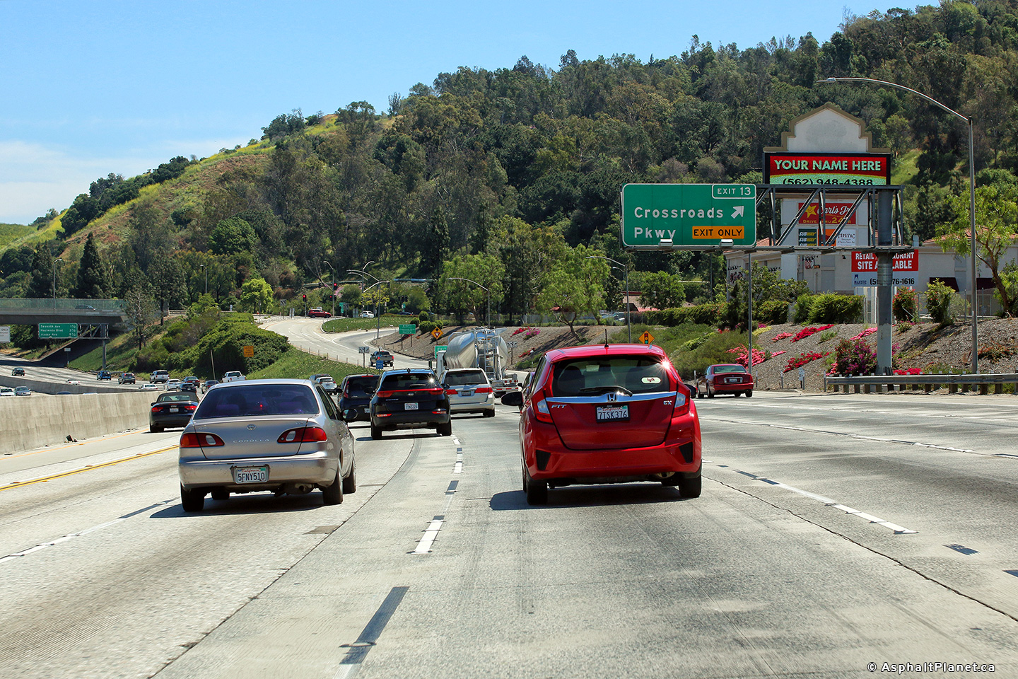
Eastbound interchange sequence signage within the footprint of the Crossroads Parkway. |
 |
||
|
Date: 4/16/2017 |
High-res: (1440x960) (2400x1600) |
|||
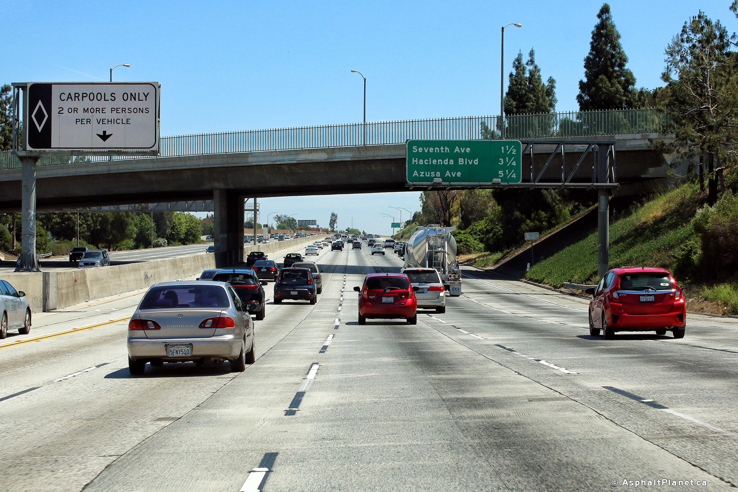
|
Los Angeles County |
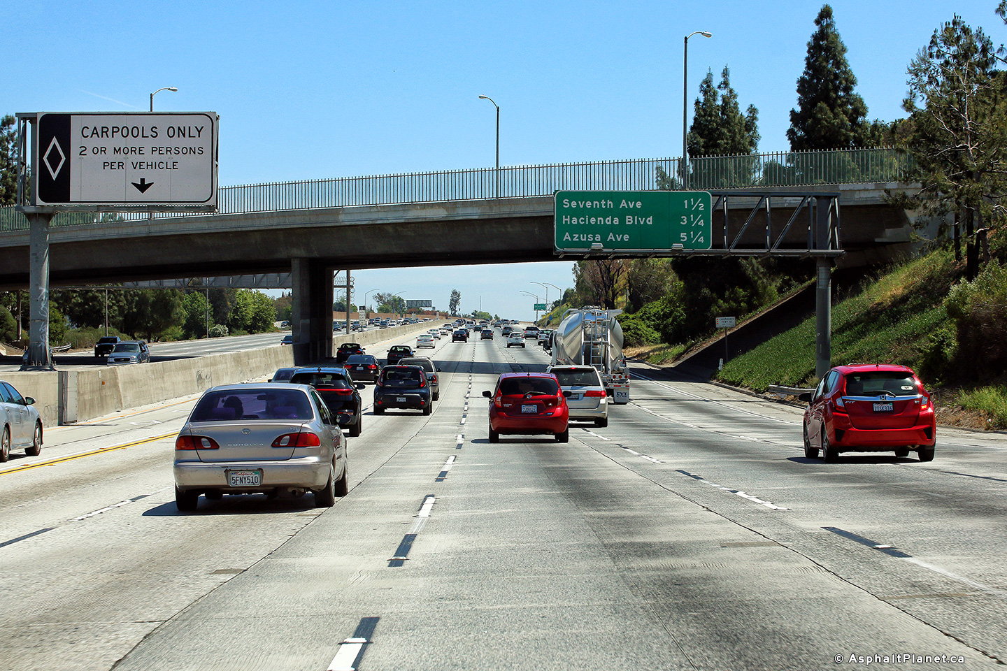
Eastbound signage one mile in advance of the Seventh Avenue interchange. |
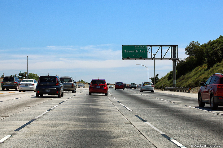 |
||
|
Date: 4/16/2017 |
High-res: (1440x960) (2400x1600) |
|||
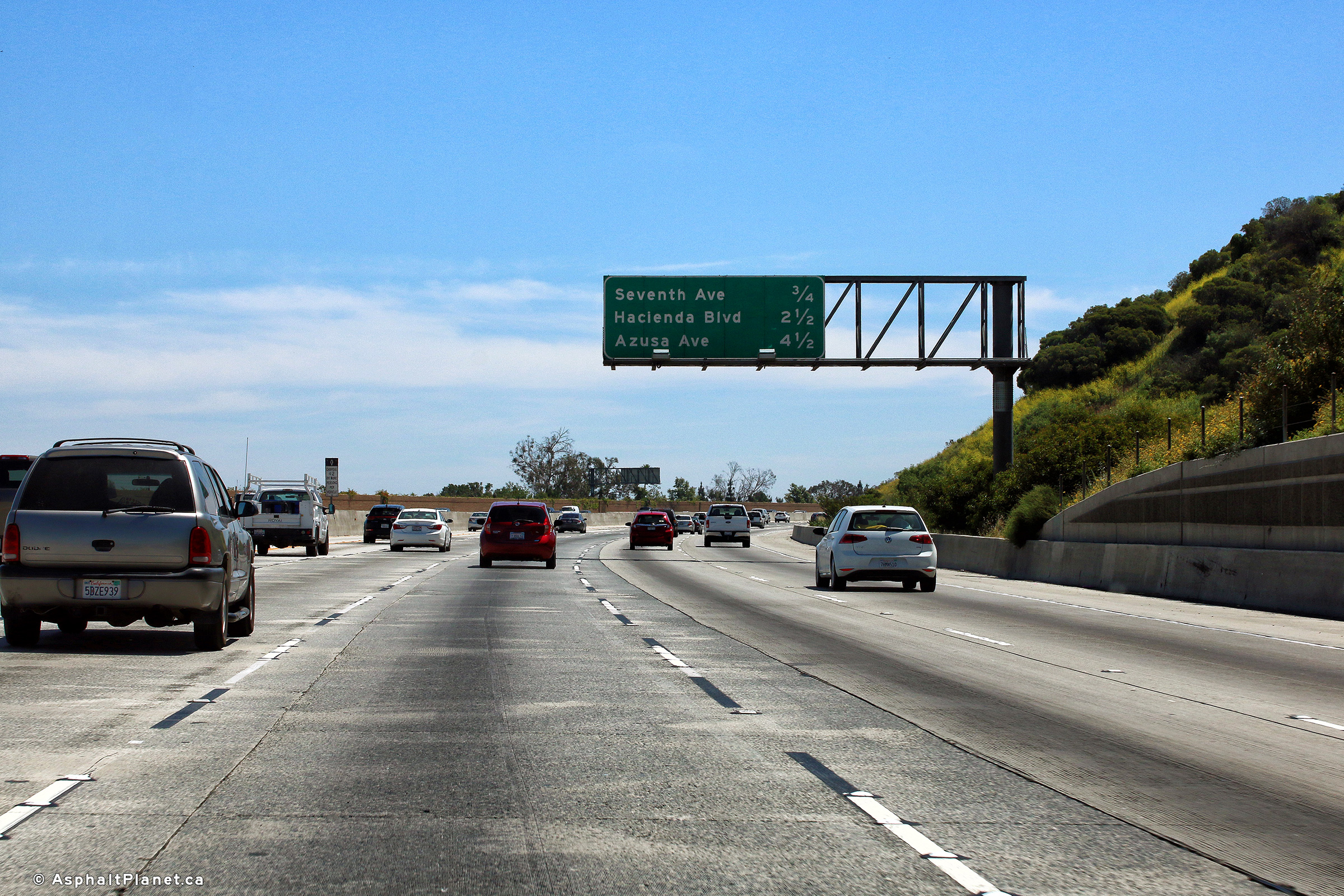
|
Los Angeles County |
Interchange sequence signage in advance of the Seventh Avenue interchange. |
 |
||
|
Date: 4/16/2017 |
High-res: (1440x960) (2400x1600) |
|||
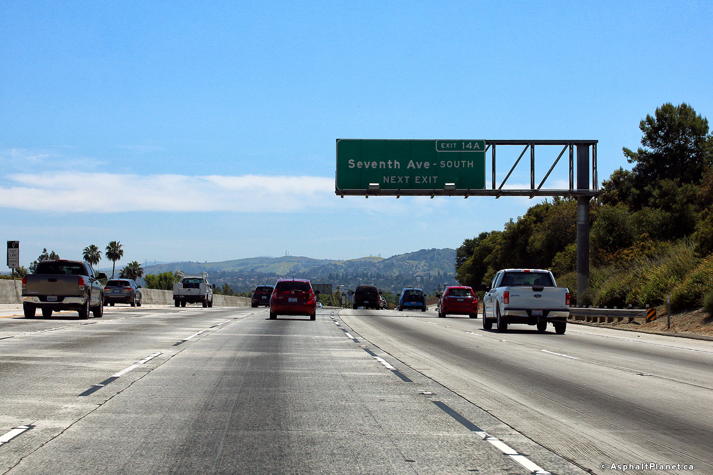
|
Los Angeles County |
Signage in advance of the off-ramp to Seventh Avenue South. |
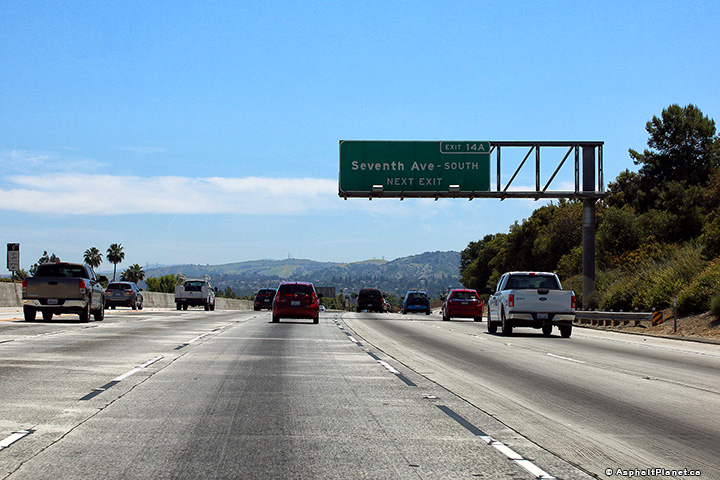 |
||
|
Date: 4/16/2017 |
High-res: (1440x960) (2400x1600) |
|||
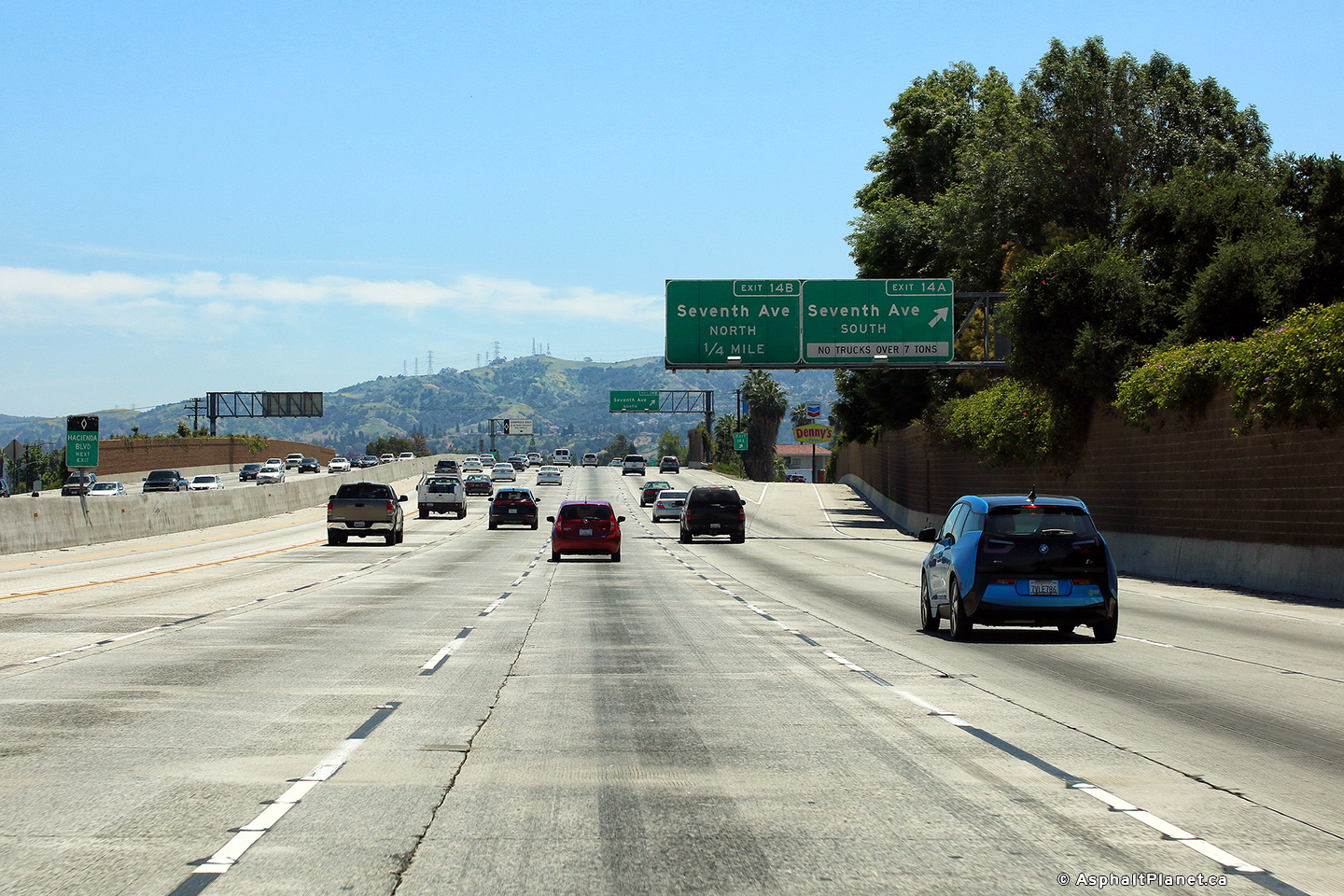
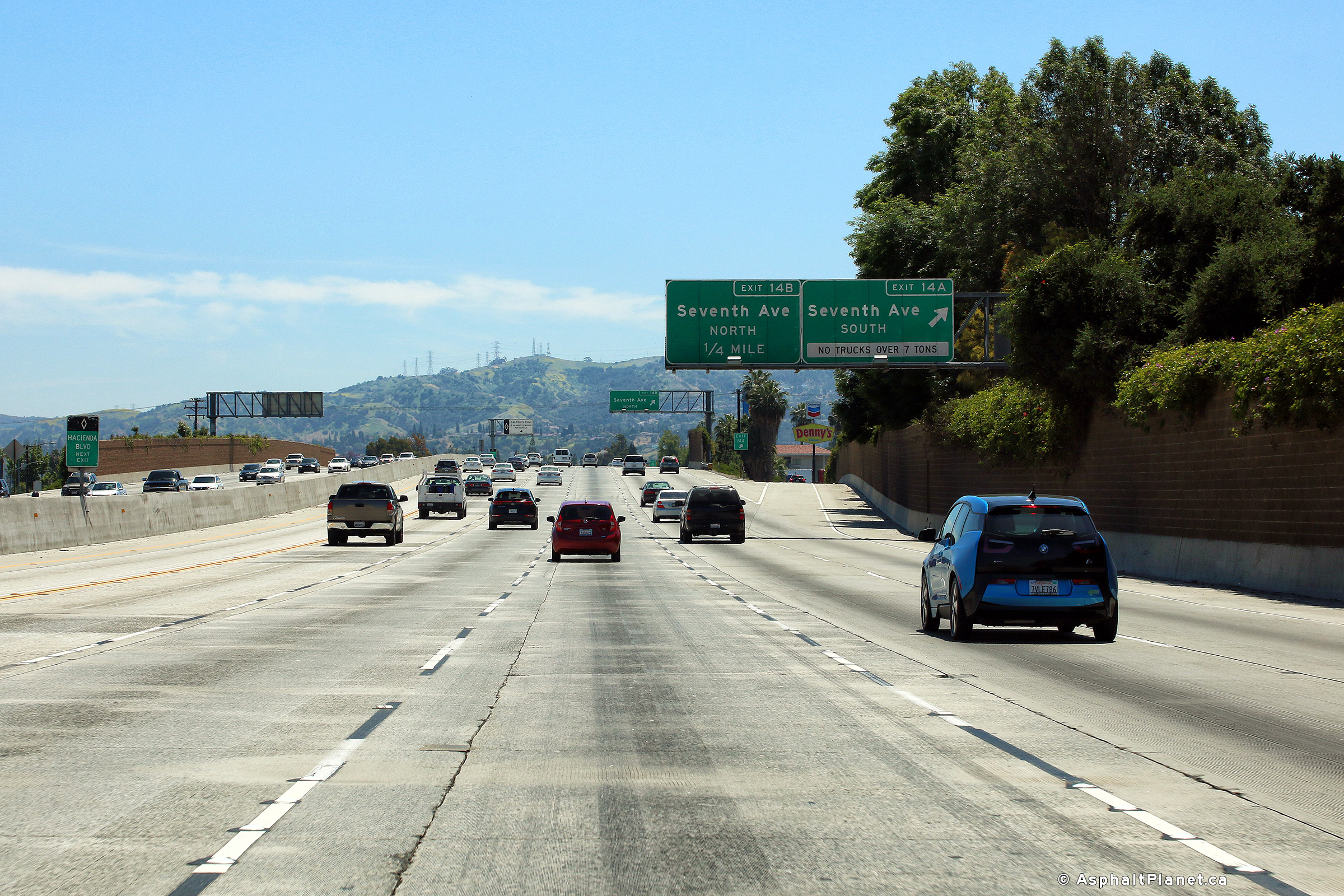
|
Los Angeles County |
Signage at the off-ramp to Seventh Avenue South. |
 |
||
|
Date: 4/16/2017 |
High-res: (1440x960) (2400x1600) |
|||
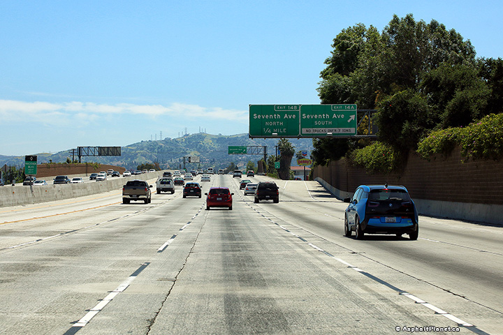
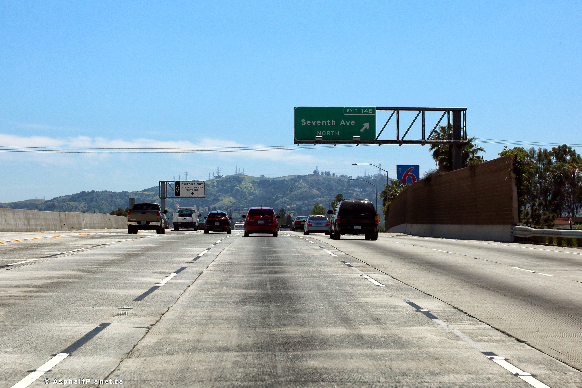
|
Los Angeles County |
View looking easterly at the off-ramp to Seventh Avenue North. |
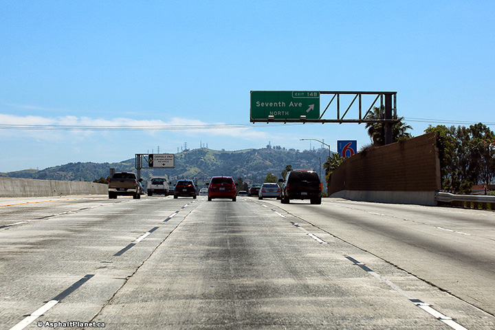 |
||
|
Date: 4/16/2017 |
High-res: (1440x960) (2400x1600) |
|||
|
Los Angeles County |
Advanced signage for the the Hacienda Boulevard interchange. |
 |
||
|
Date: 4/16/2017 |
High-res: (1440x960) (2400x1600) |
|||
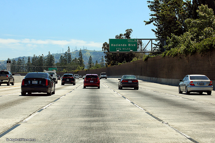
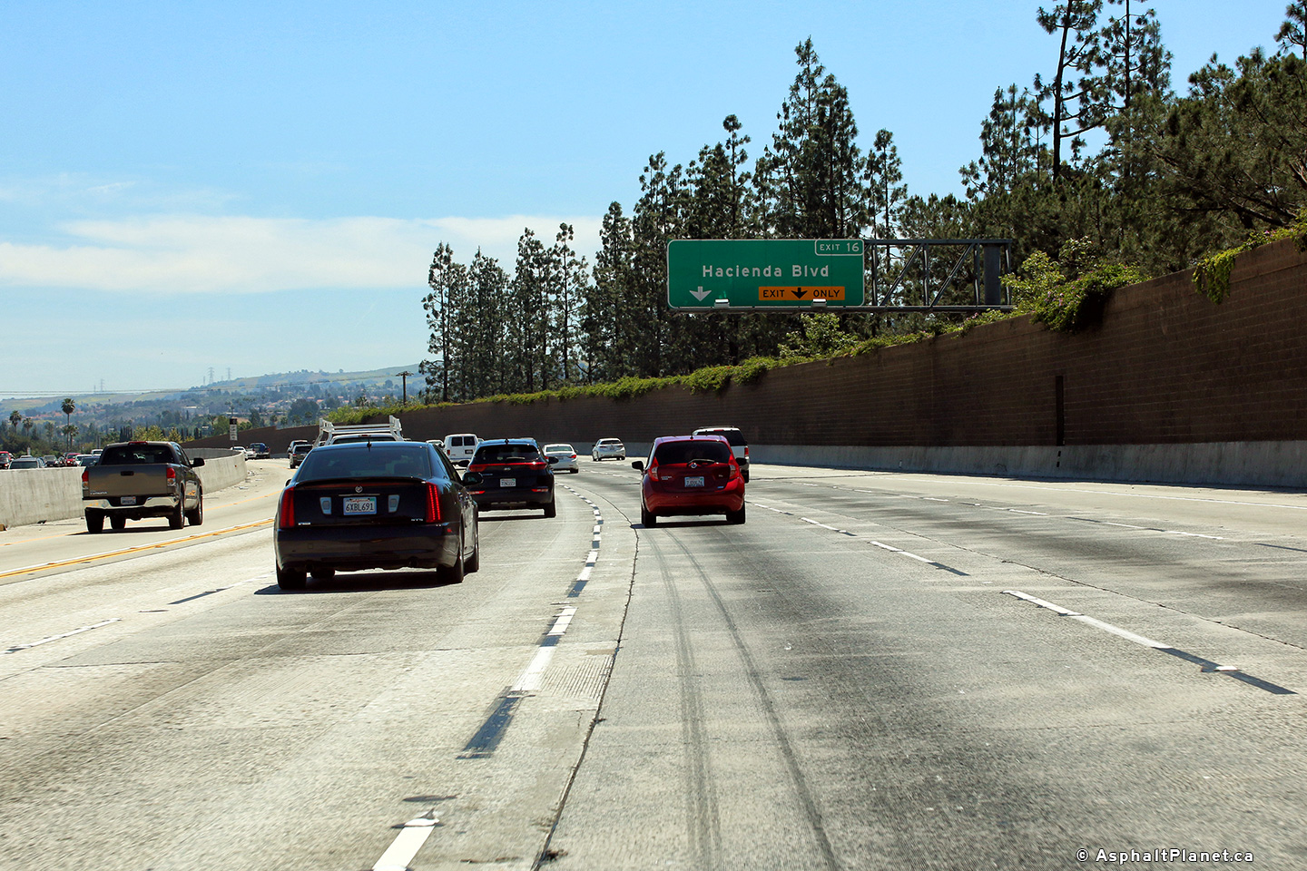
|
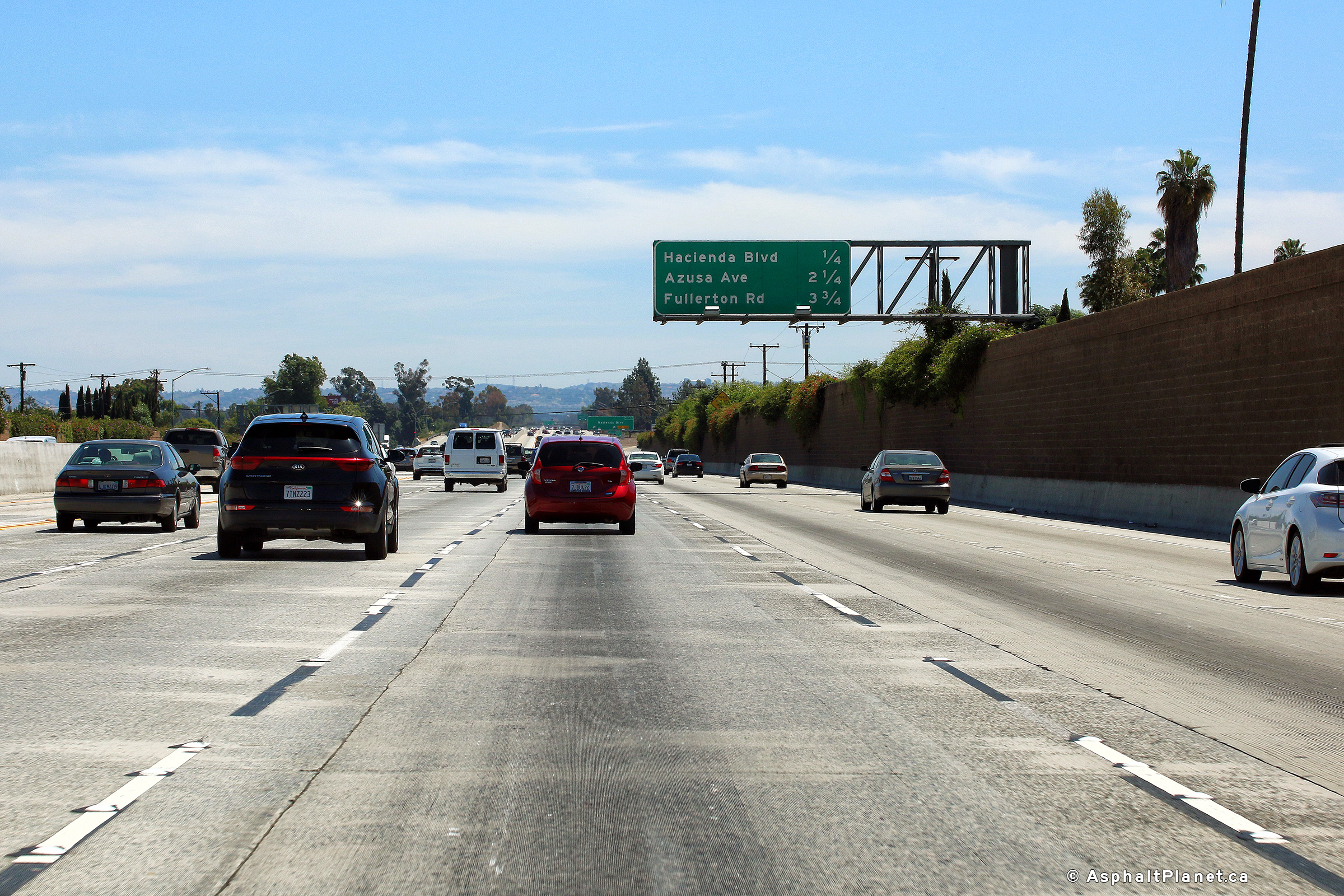
Los Angeles County |
Advanced signage for the Hacienda Boulevard interchange. The fifth lane of SR-60 departs at Hacienda Boulevard. |
 |
||
|
Date: 4/16/2017 |
High-res: (1440x960) (2400x1600) |
|||
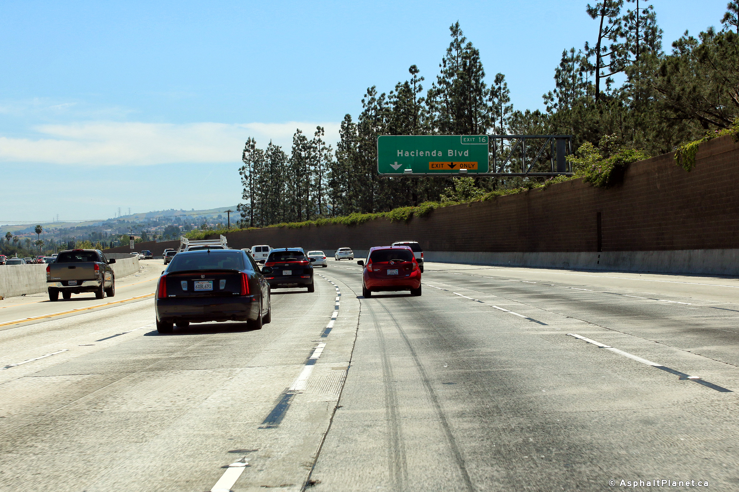
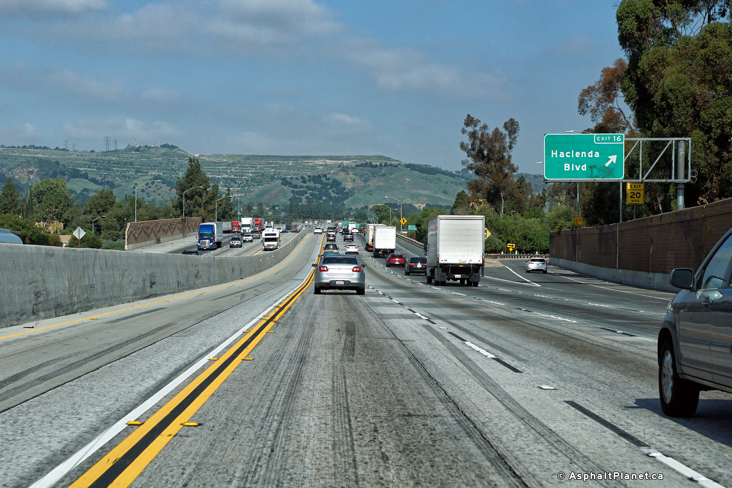
|
Los Angeles County |
Interchange sequence in advance of the Hacienda Boulevard interchange. |
 |
||
|
Date: 4/16/2017 |
High-res: (1440x960) (2400x1600) |
|||
|
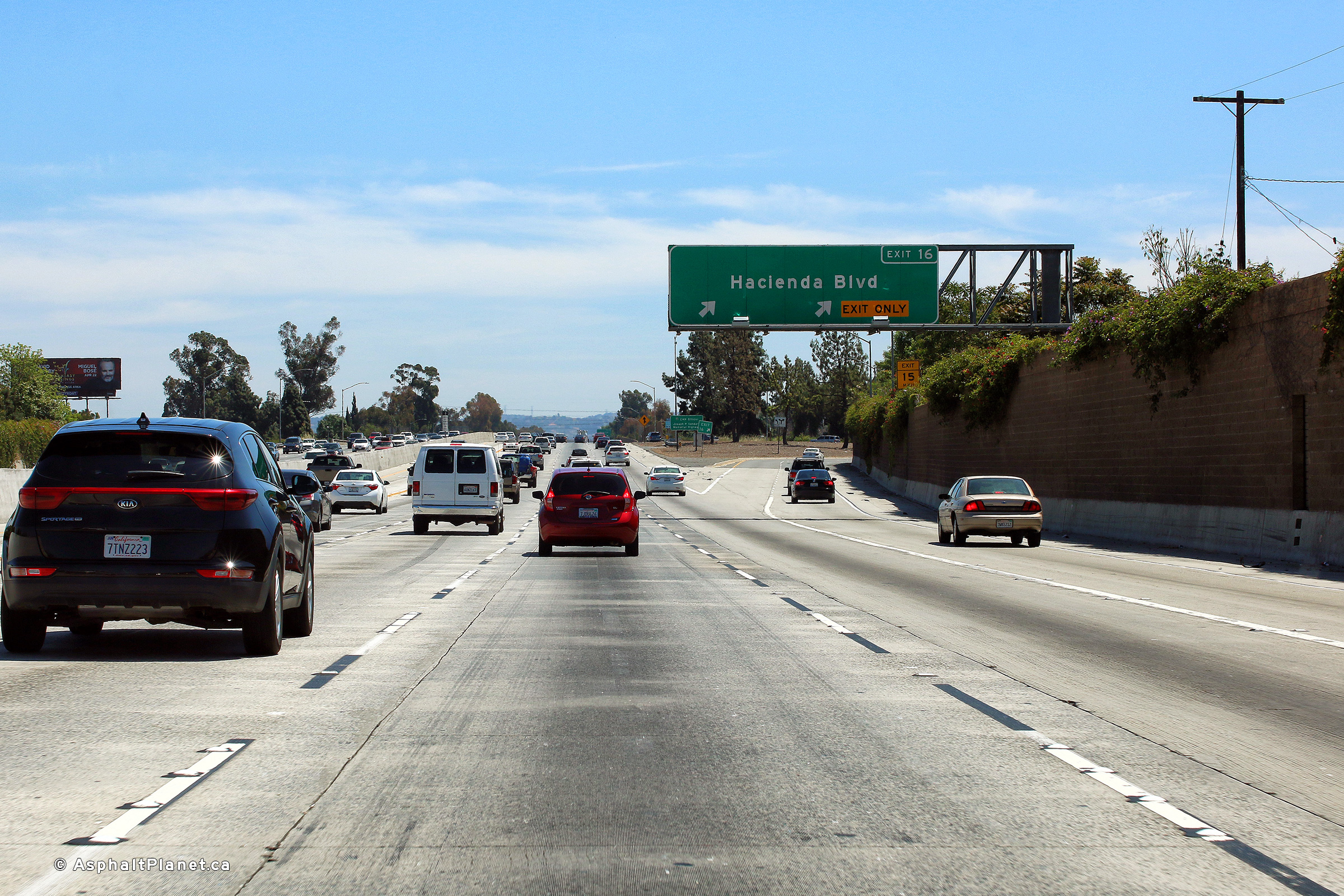
Los Angeles County |
Easterly view at the off-ramp to Hacienda Boulevard. The fifth eastbound general purpose lane that commenced at the I-605 interchange departs at Hacienda Boulevard. |
 |
||
|
Date: 4/16/2017 |
High-res: (1440x960) (2400x1600) |
|||
|
Los Angeles County |
View looking westerly at the off-ramp to Hacienda Boulevard. |
 |
||
|
Date: 4/13/2016 |
High-res: (1440x960) (2400x1600) |
|||
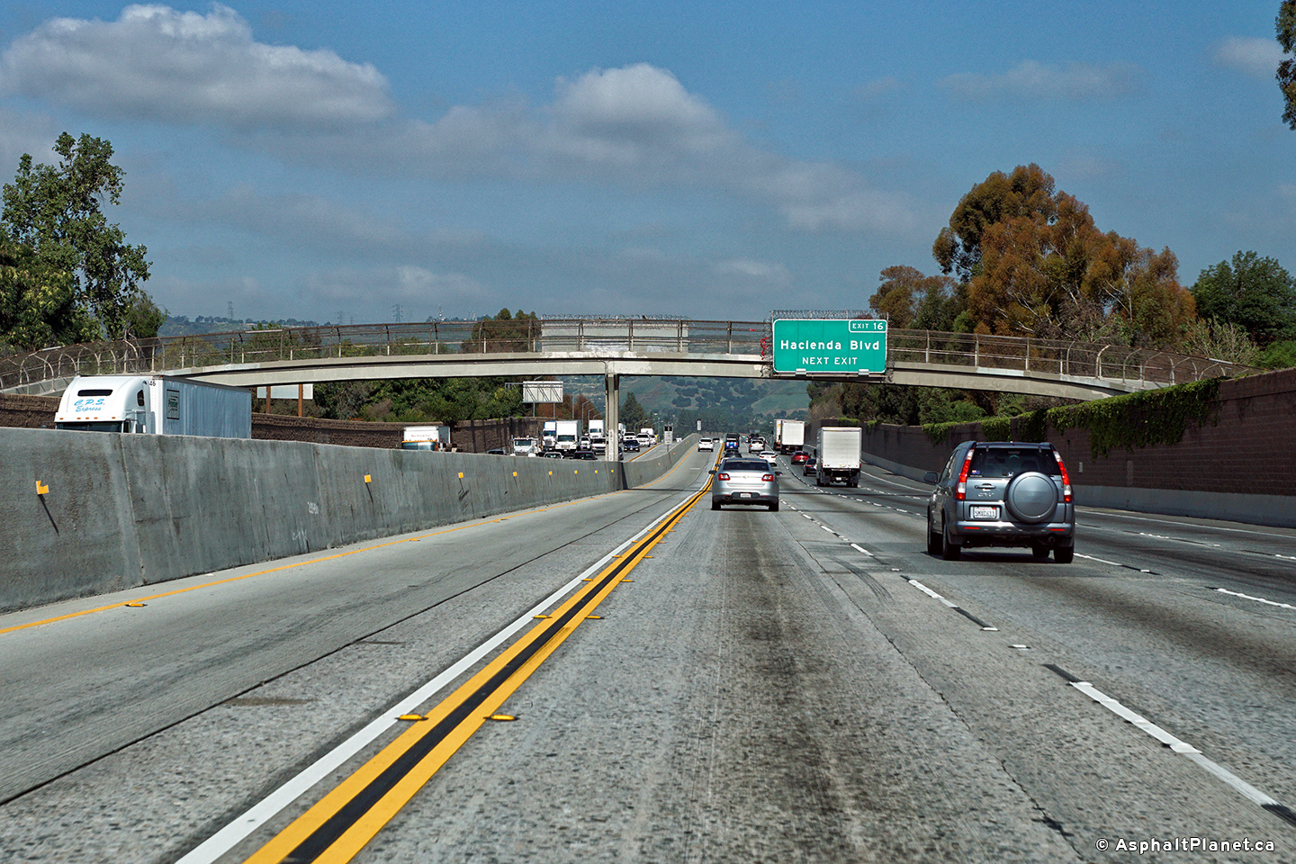
|
Los Angeles County |
An advanced signage for the westbound off-ramp to Hacienda Boulevard interchange has been affixed to the pictured pedestrian overpass. |
 |
||
|
Date: 4/13/2016 |
High-res: (1440x960) (2400x1600) |
|||
|
Los Angeles County |
Signage in advance of the Azusa Street interchange. |
 |
||
|
Date: 4/16/2017 |
High-res: (1440x960) (2400x1600) |
|||
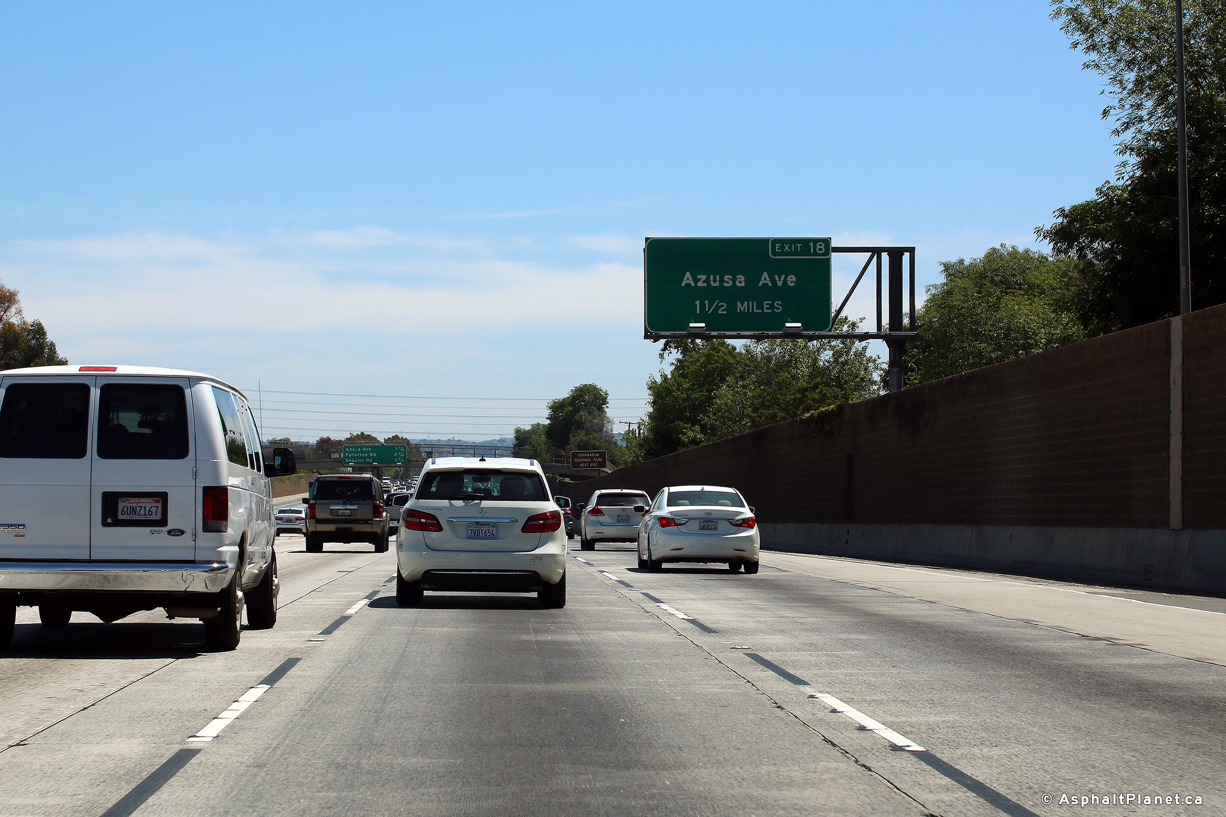
|
Los Angeles County |
Advanced signage for the Azusa Street interchange. |
 |
||
|
Date: 4/16/2017 |
High-res: (1440x960) (2400x1600) |
|||
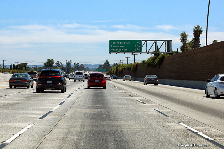
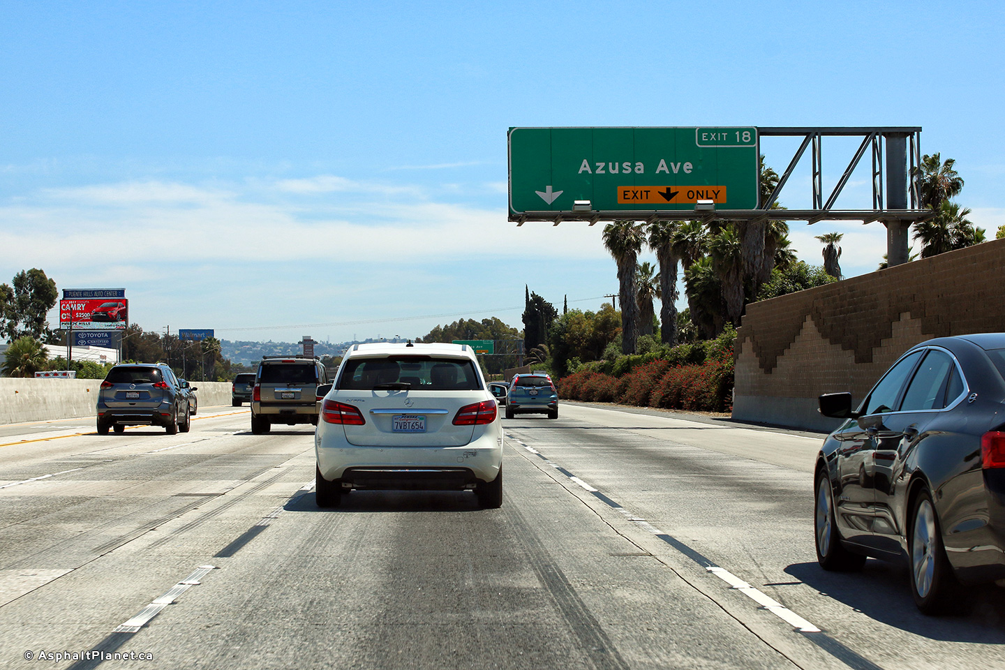
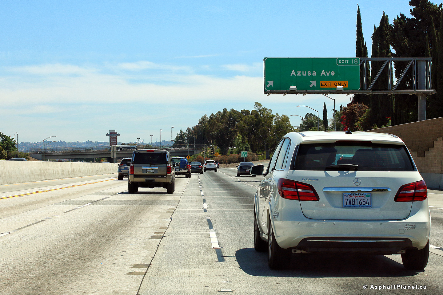
|
Los Angeles County |
Signage for the eastbound off-ramp to Azusa Avenue. Further north, Azusa Avenue is part of California State Route 39. |
 |
||
|
Date: 4/16/2017 |
High-res: (1440x960) (2400x1600) |
|||
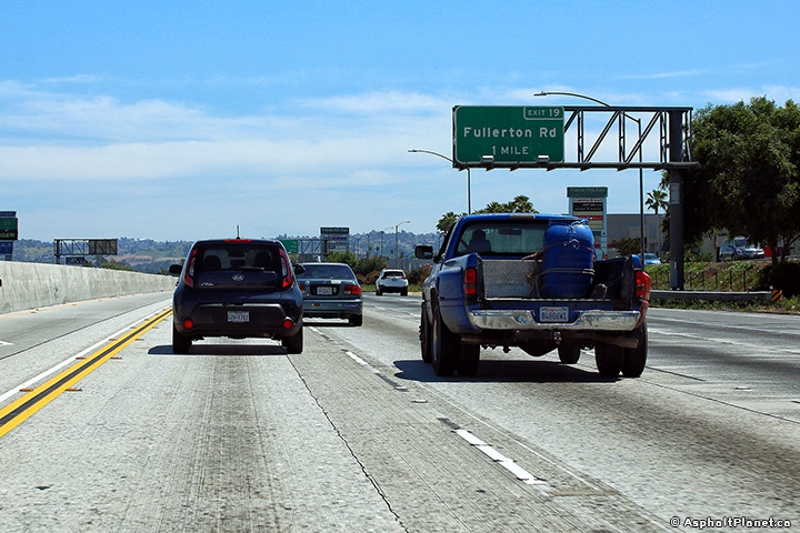
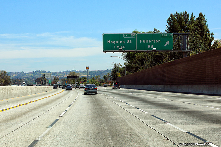
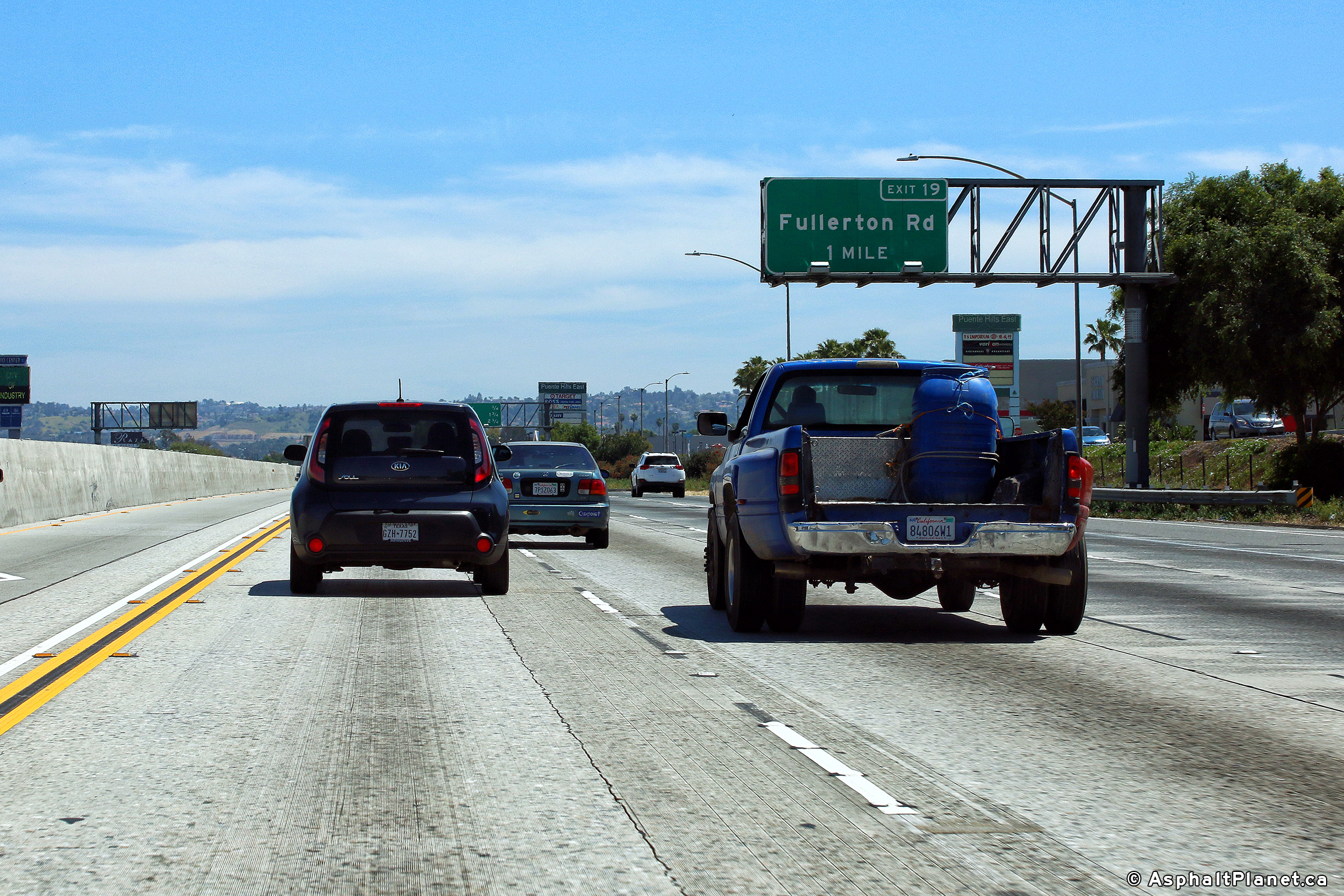
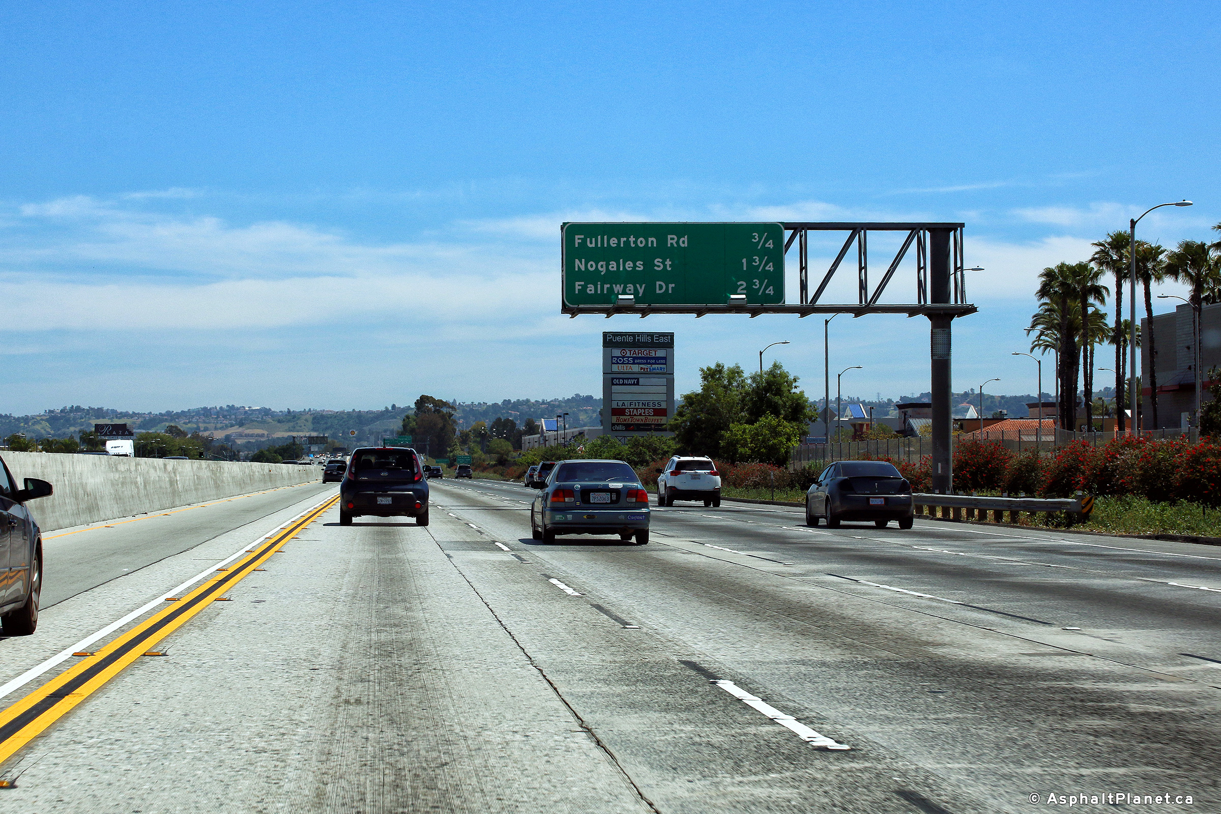
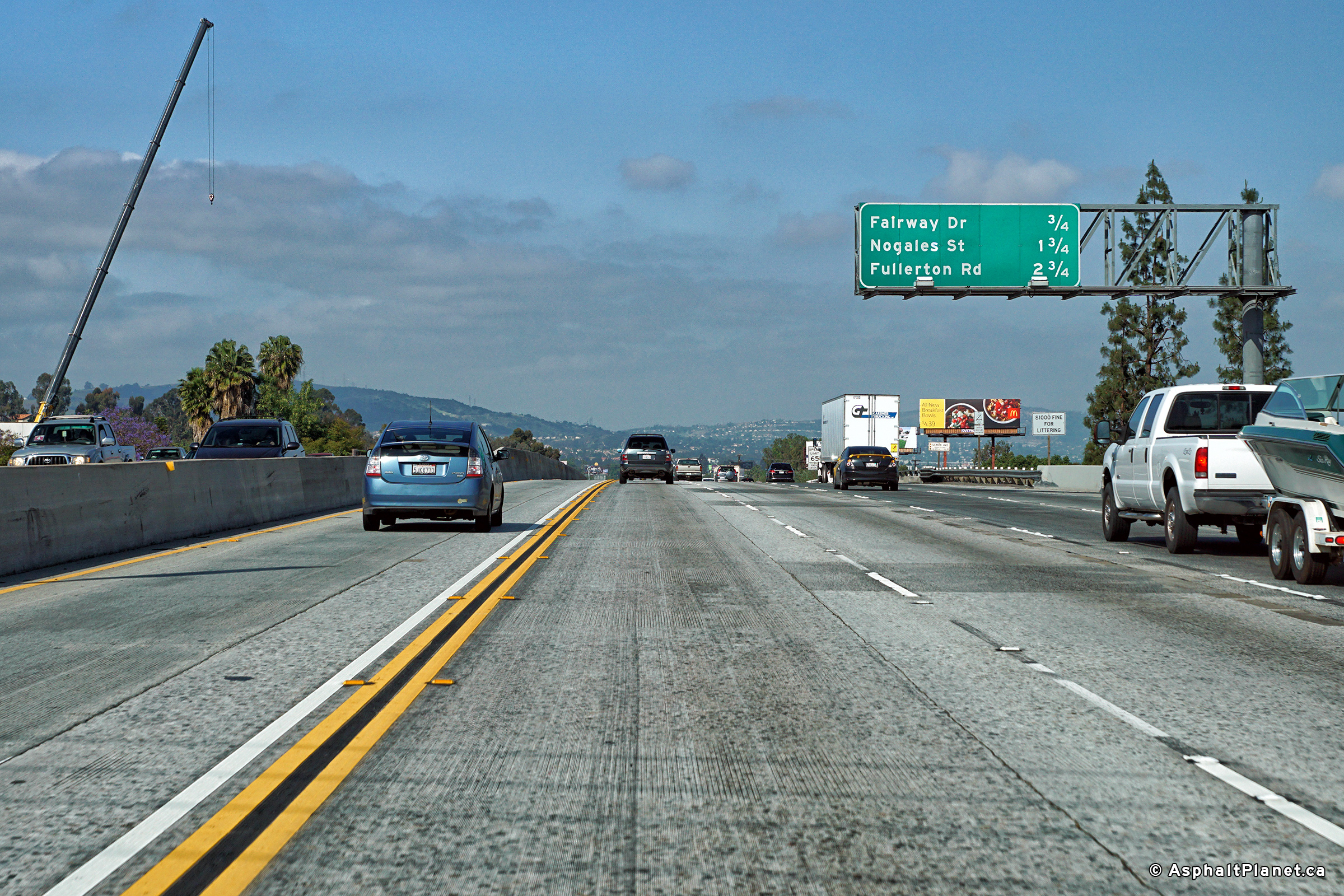
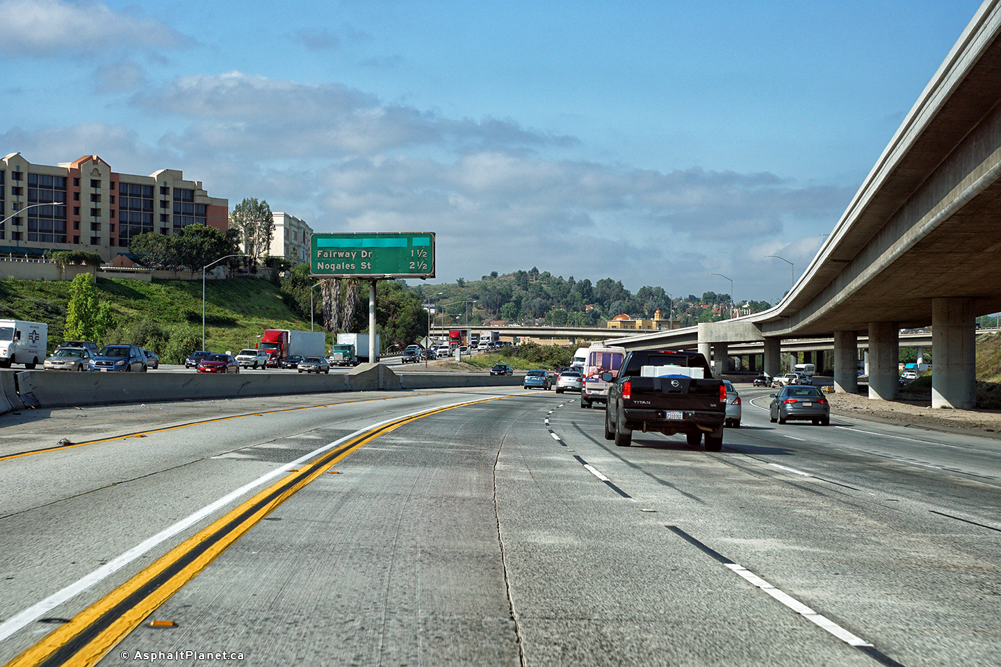
|
Los Angeles County |
One mile advanced signage for Fullerton Road interchange. |
 |
||
|
Date: 4/16/2017 |
High-res: (1440x960) (2400x1600) |
|||
|
Los Angeles County |
Interchange sequence signage in advance of the Fullerton Road interchange. |
 |
||
|
Date: 4/16/2017 |
High-res: (1440x960) (2400x1600) |
|||
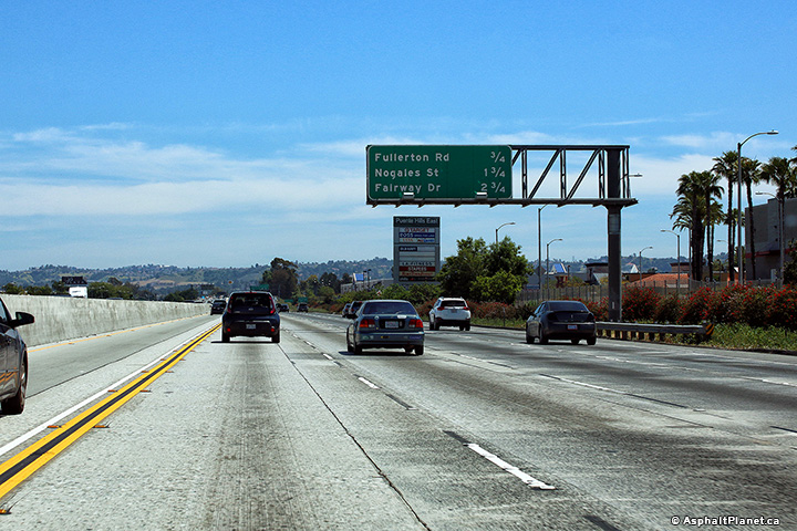
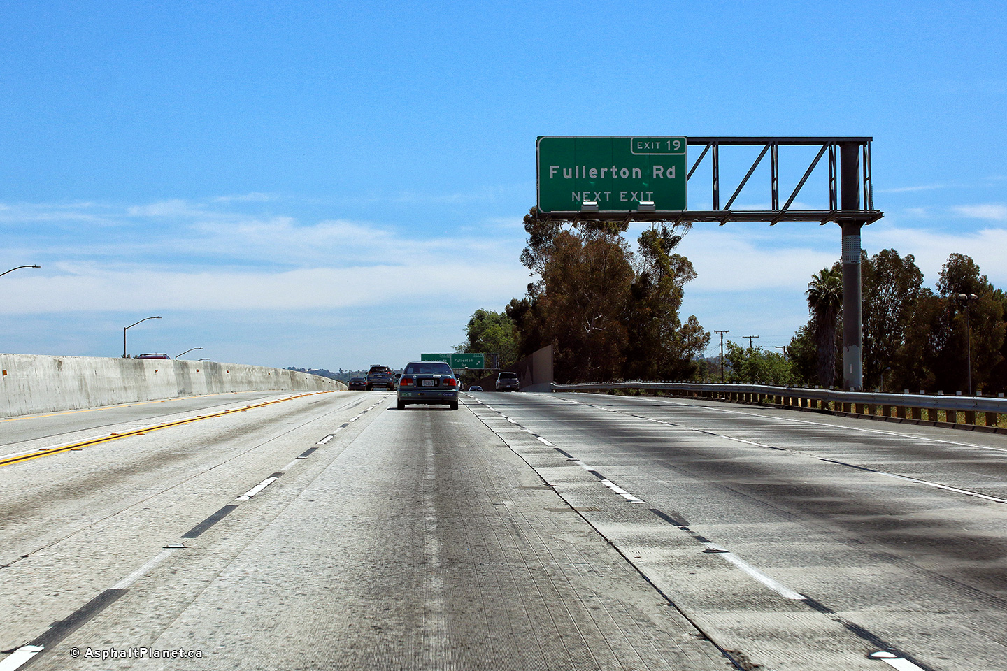
|
Los Angeles County |
Signage approaching the eastbound off-ramp to Fullerton Road. |
 |
||
|
Date: 4/16/2017 |
High-res: (1440x960) (2400x1600) |
|||
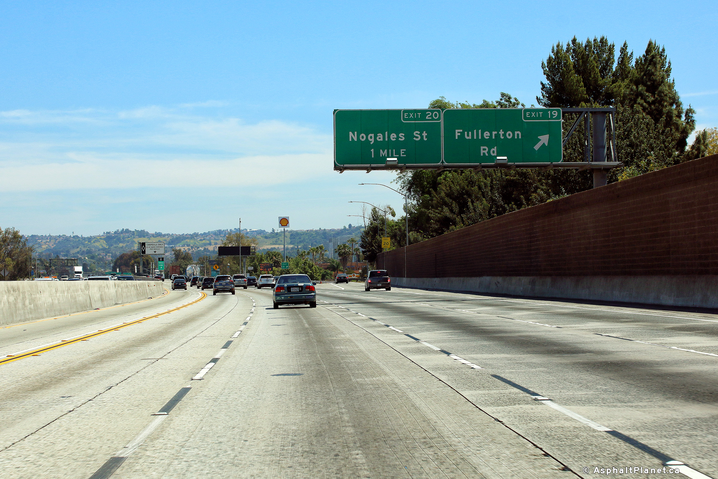
|
Los Angeles County |
View looking easterly at the off-ramp to Fullerton Road. |
 |
||
|
Date: 4/16/2017 |
High-res: (1440x960) (2400x1600) |
|||
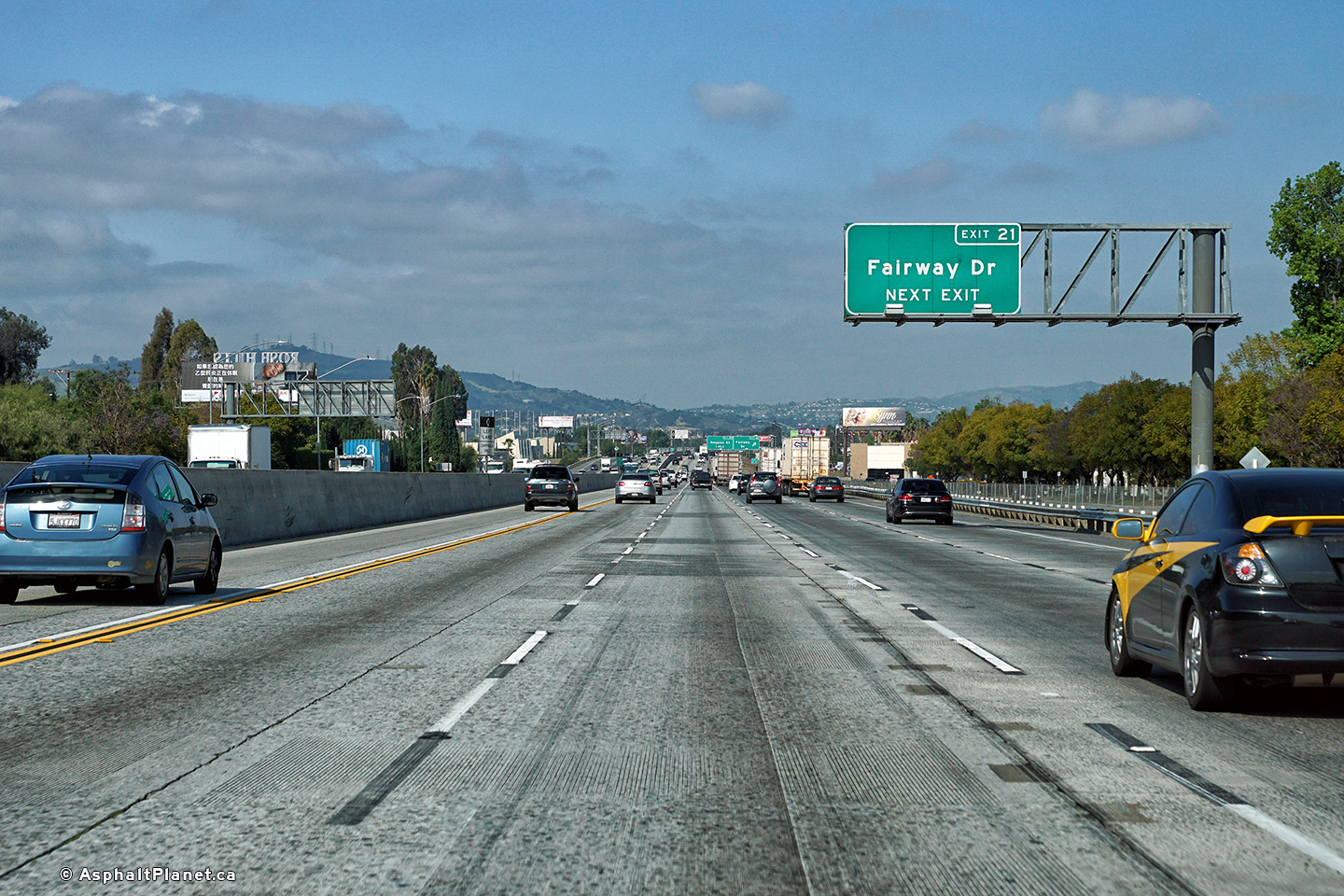
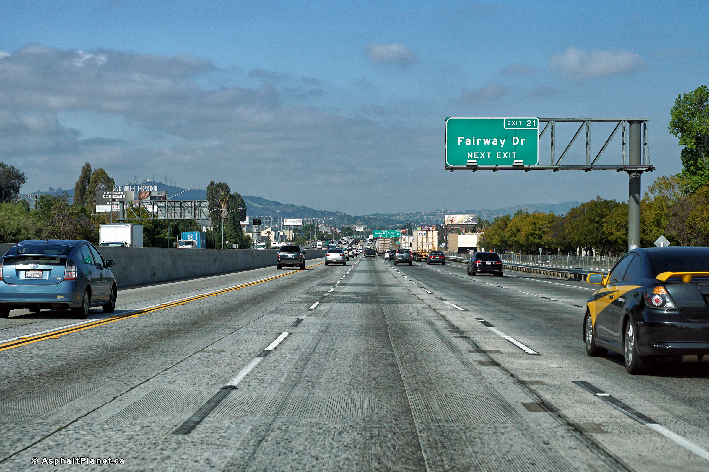
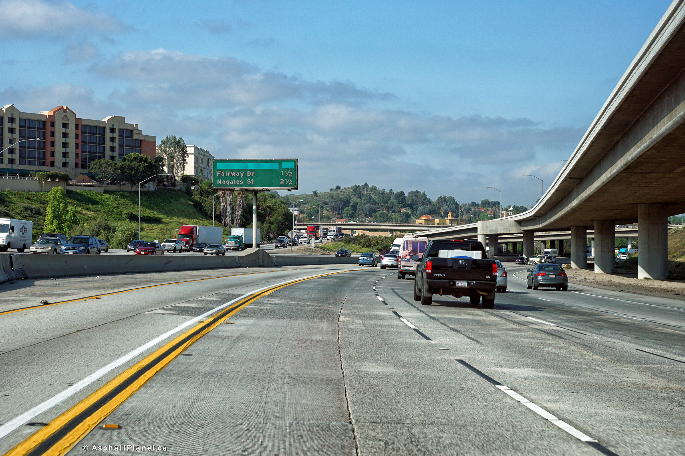
|
Los Angeles County |
View looking westerly at the off-ramp to Fairway Drive. |
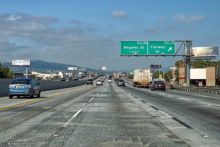 |
||
|
Date: 4/13/2016 |
High-res: (1440x960) (2400x1600) |
|||
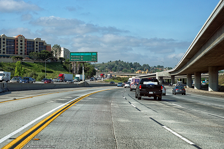
|
Los Angeles County |
Westbound advanced signage for the Fairway Drive interchange. |
 |
||
|
Date: 4/13/2016 |
High-res: (1440x960) (2400x1600) |
|||
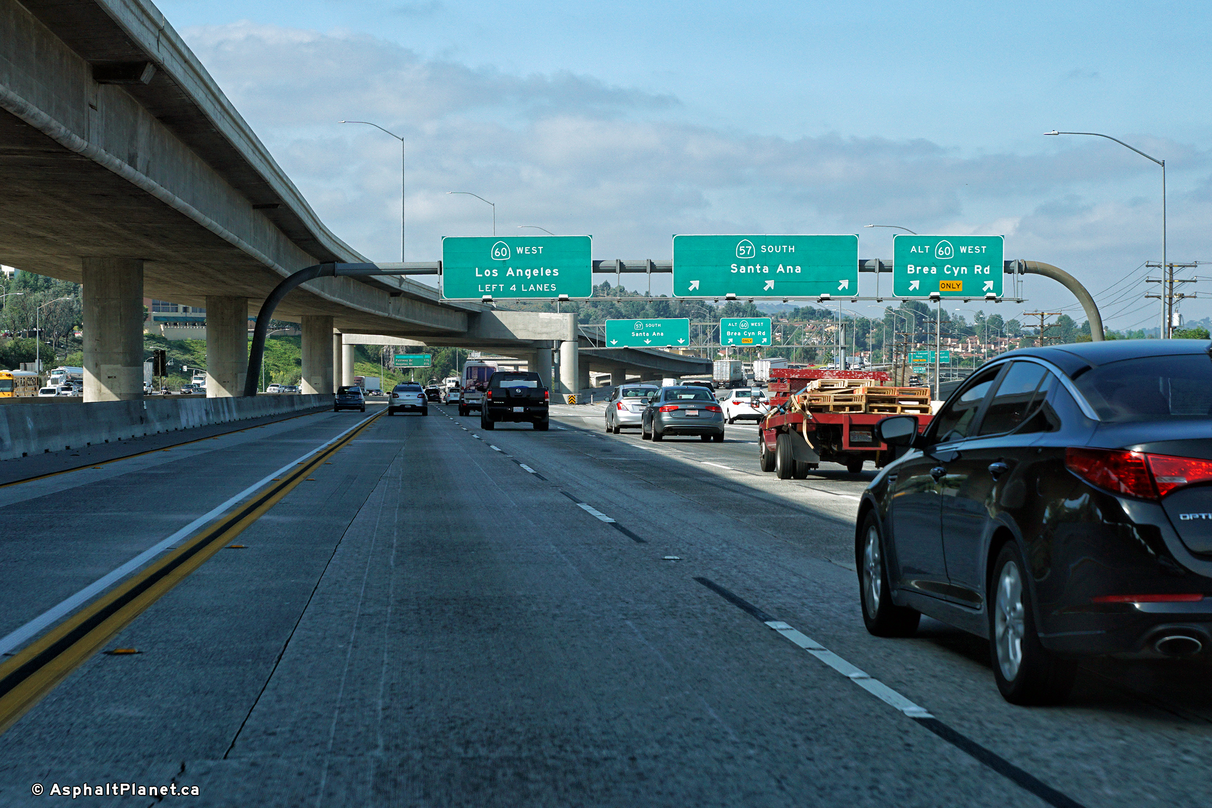
|
Los Angeles County |
Interchange sequence signage situated west of the of the SR-57 interchange. |
 |
||
|
Date: 4/13/2016 |
High-res: (1440x960) (2400x1600) |
|||
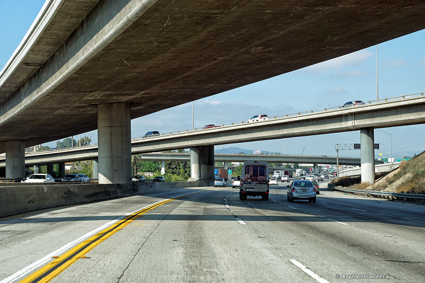
| SR-57 continues southerly from SR-60 to the Orange Crush Interchange at I-5 in Orange County. Click here for SR-57-South Images. | ||||
|
Los Angeles County |
View looking westerly as SR-60 passes through the southern SR-57 interchange. |
 |
||
|
Date: 4/13/2016 |
High-res: (1440x960) (2400x1600) |
|||
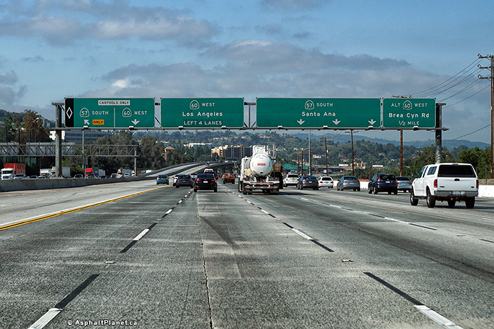
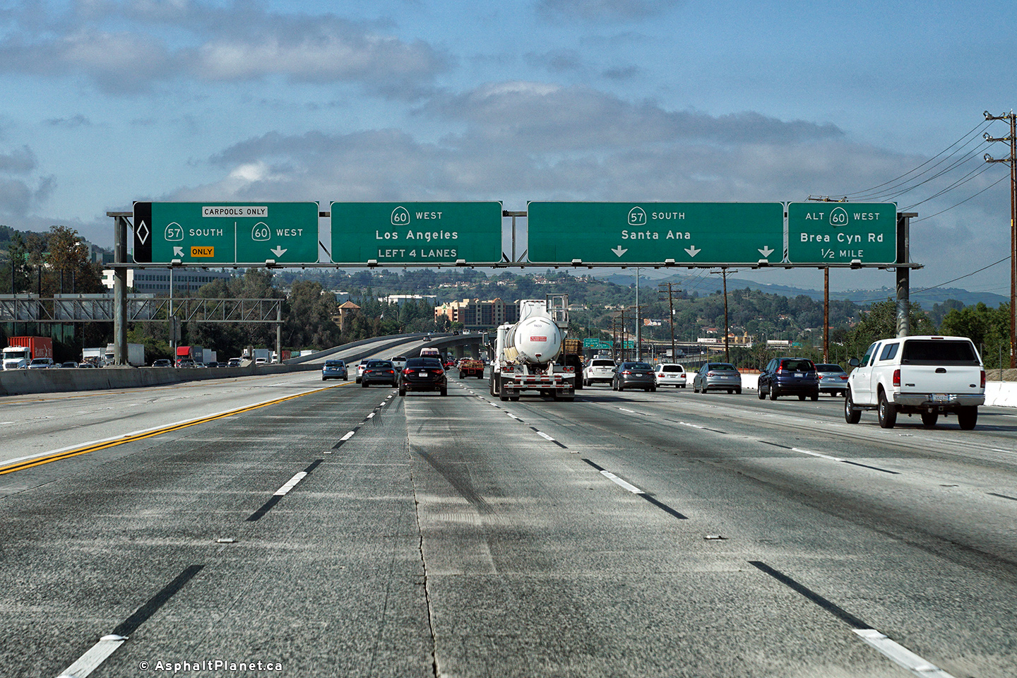
|
Los Angeles County |
The long elevated flyover linking the carpool lanes on SR-57 passes to the northern side of the 60 Freeway before departing for the median of SR-57 south of this interchange. |
 |
||
|
Date: 4/13/2016 |
High-res: (1440x960) (2400x1600) |
|||
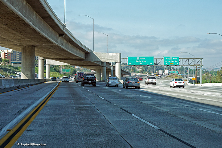
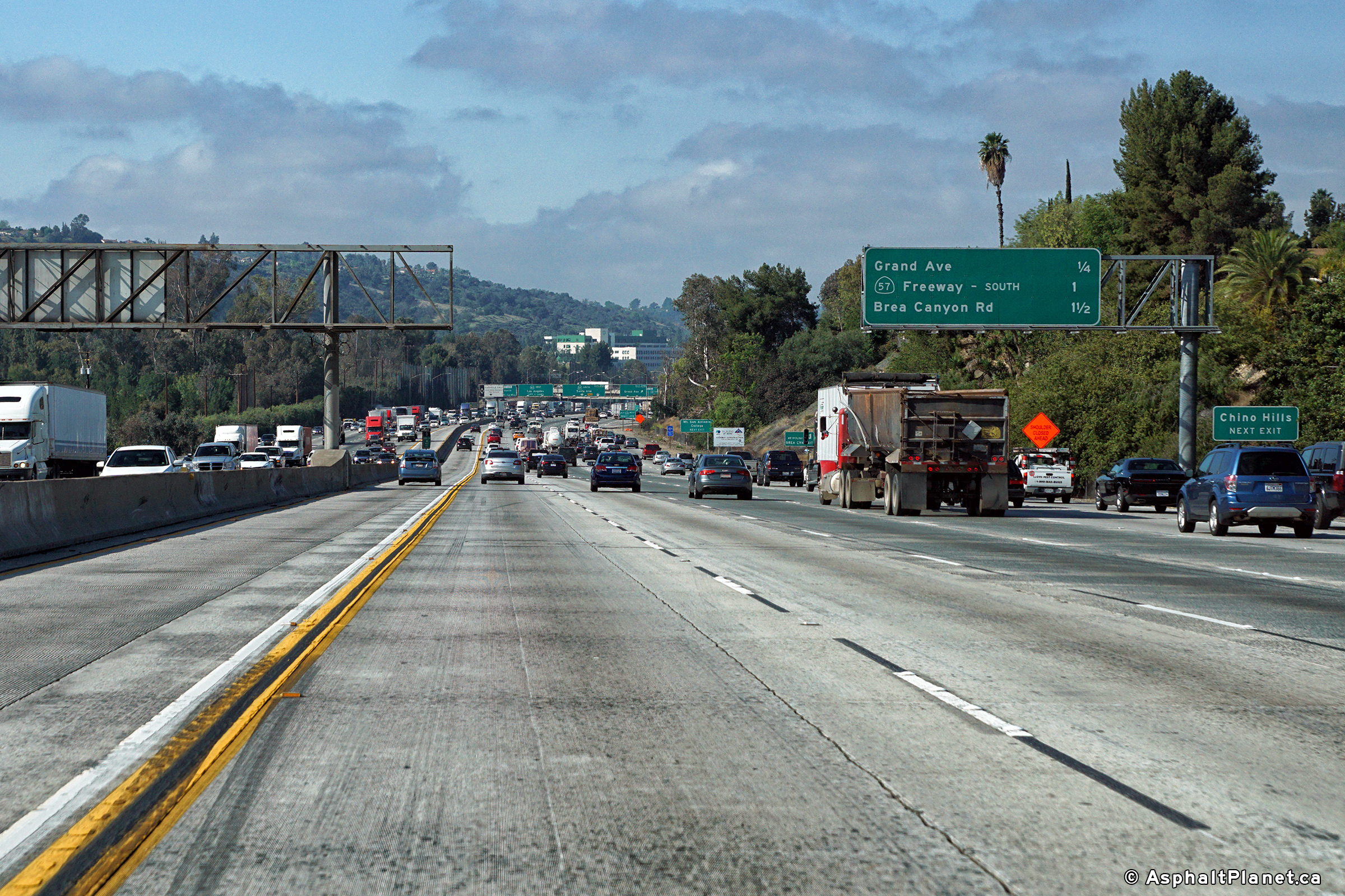
|
Los Angeles County |
The westbound off-ramp to Brea Canyon Road departs from the ramp that carries traffic to the southbound side of SR-57. |
 |
||
|
Date: 4/13/2016 |
High-res: (1440x960) (2400x1600) |
|||
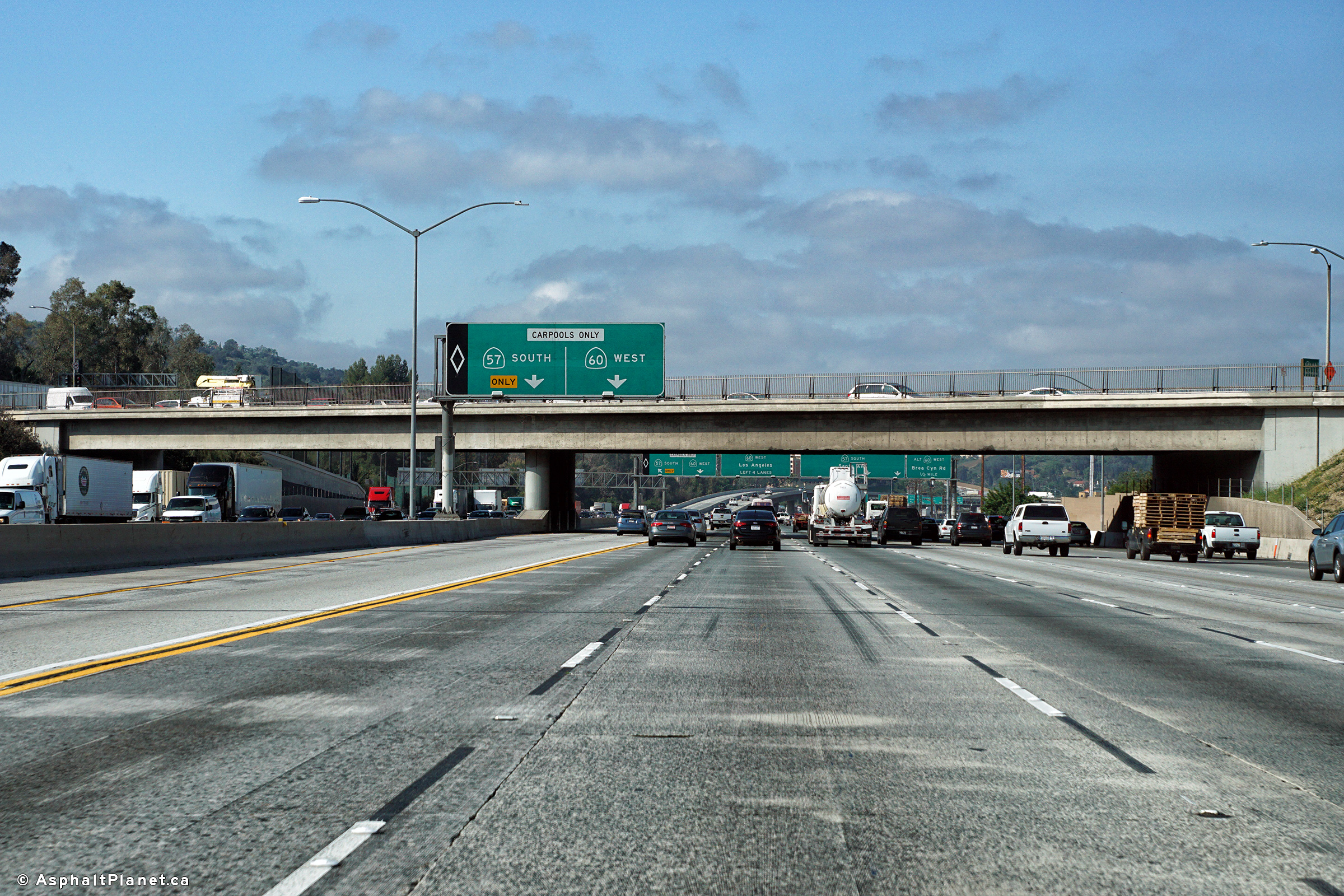
|
Los Angeles County |
View looking westerly as the off-ramp to SR-57 South departs from the freeway mainline of SR-60. |
 |
||
|
Date: 4/13/2016 |
High-res: (1440x960) (2400x1600) |
|||
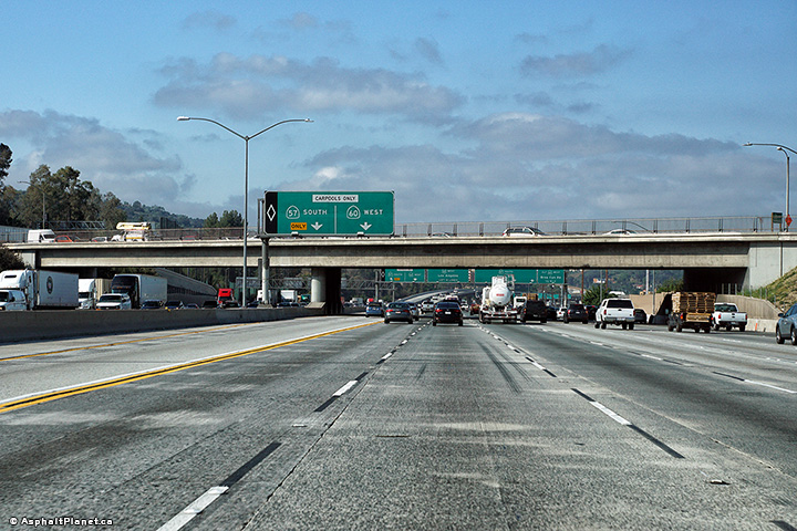
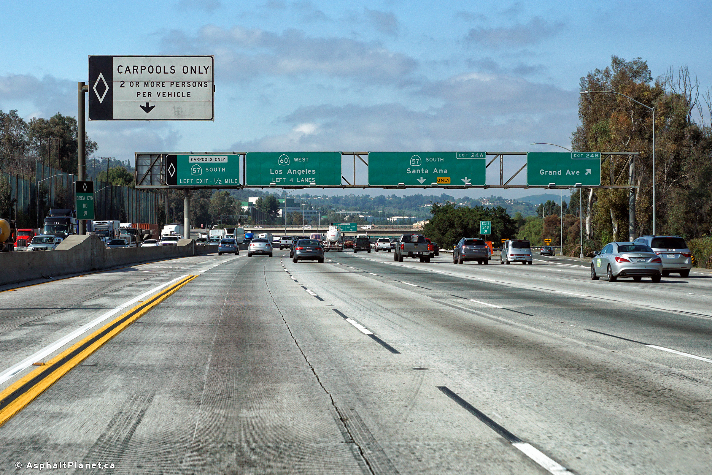
|
Los Angeles County |
Signage as the ramp to the SR-57 Carpool lane departs from the SR-60 carpool lane. |
 |
||
|
Date: 4/13/2016 |
High-res: (1440x960) (2400x1600) |
|||
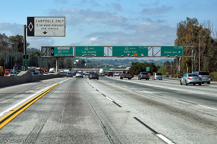
|
Los Angeles County |
Signage in advance of the carpool lane ramp to the southbound side of SR-57. The Grand Avenue overpass is visible just beyond the signage. |
 |
||
|
Date: 4/13/2016 |
High-res: (1440x960) (2400x1600) |
|||
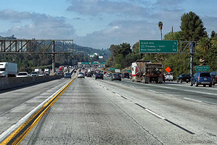
|
Los Angeles County |
Signage at the westbound off-ramp to Grand Avenue. |
 |
||
|
Date: 4/13/2016 |
High-res: (1440x960) (2400x1600) |
|||
|
Los Angeles County |
Interchange sequence signage approaching the Grand Avenue interchange. |
 |
||
|
Date: 4/13/2016 |
High-res: (1440x960) (2400x1600) |
|||
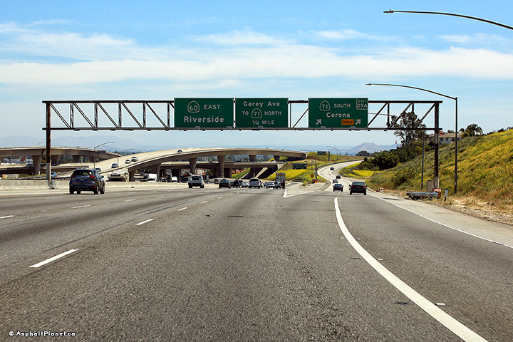
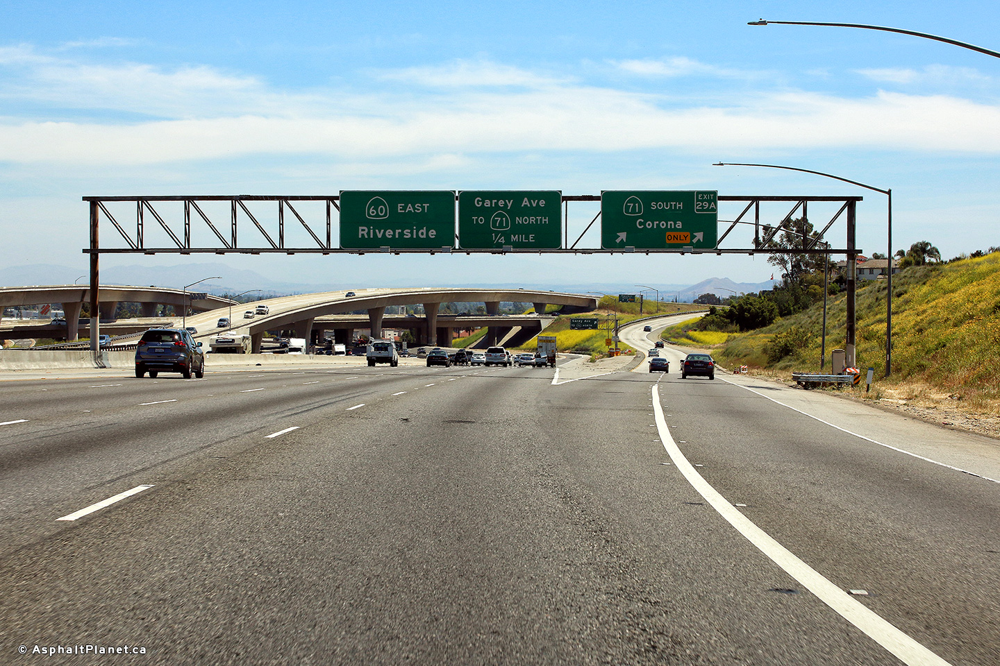
|
Los Angeles County |
View looking easterly as the off-ramp to SR-71 South departs from the Pomona Freeway. |
 |
||
|
Date: 4/16/2017 |
High-res: (1440x960) (2400x1600) |
|||
| SR-71 runs diagonally from I-10 to SR-91. Click here for SR-71 Images. | ||||
<- CA-59
CA Highways
CA-61 ->
AsphaltPlanet.ca
© 2010-17 AsphaltPlanet.ca.
Scott@asphaltplanet.ca
Page Created: July 13, 2017.
Last Updated: July 13, 2017.