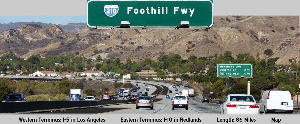
AsphaltPlanet.ca > California > Interstate 210
Pictures on this page are arranged in order from west to east. I-210 East photos are left-aligned in the last column, while I-210 West photos are right-aligned. Center-line pictures are centered within the last column.
|
Location |
Description |
Photo |
||
|
East- |
West- |
|||
|
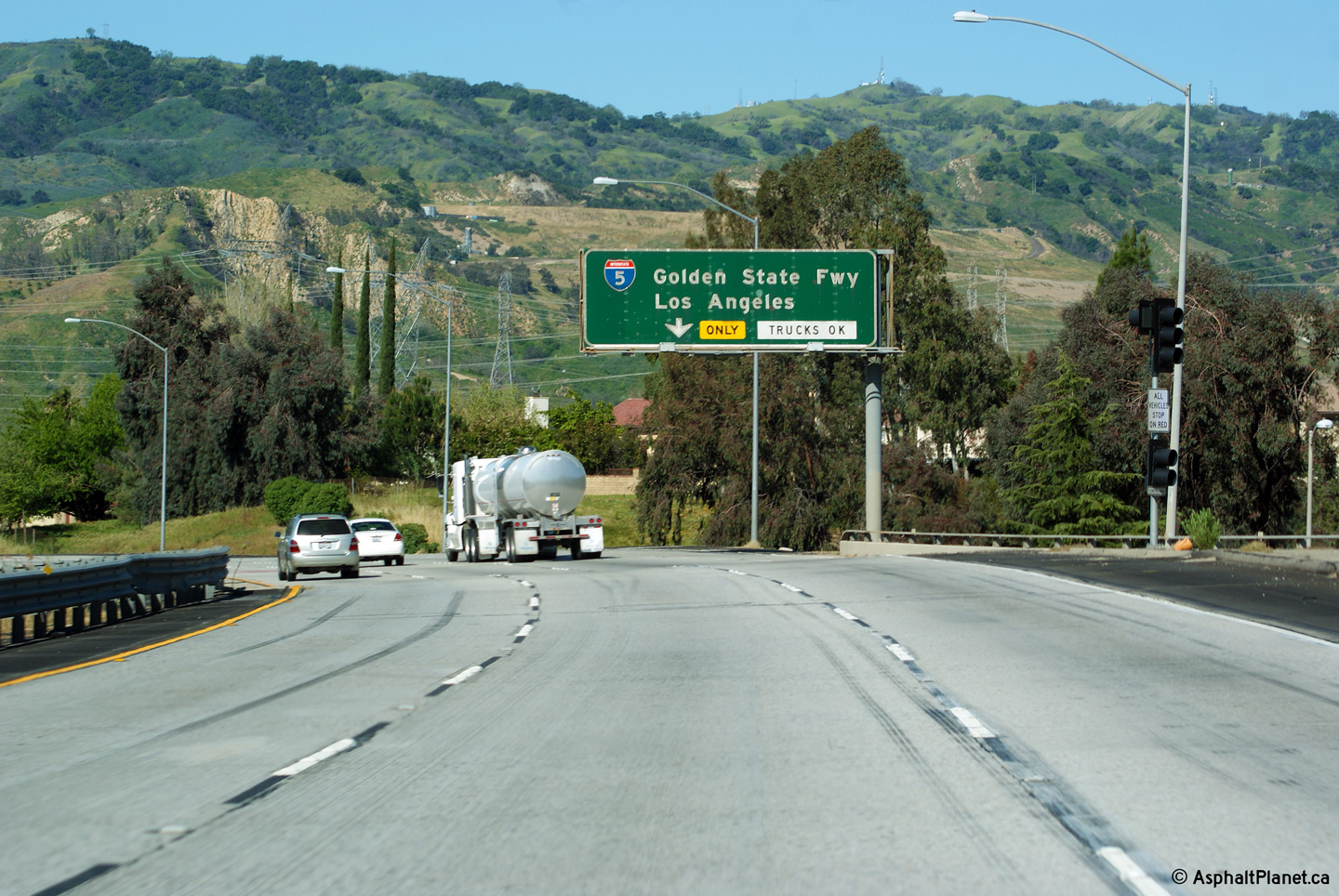
The Golden State Freeway (I-5) is the principal north-south interstate in California stretching from the Mexican Border to Oregon. Click here for Interstate 5 Images. |
||||
|
Los Angeles County |
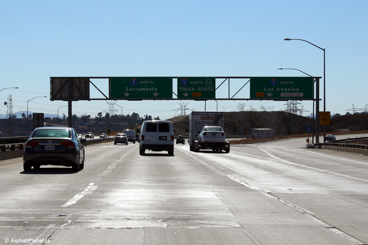
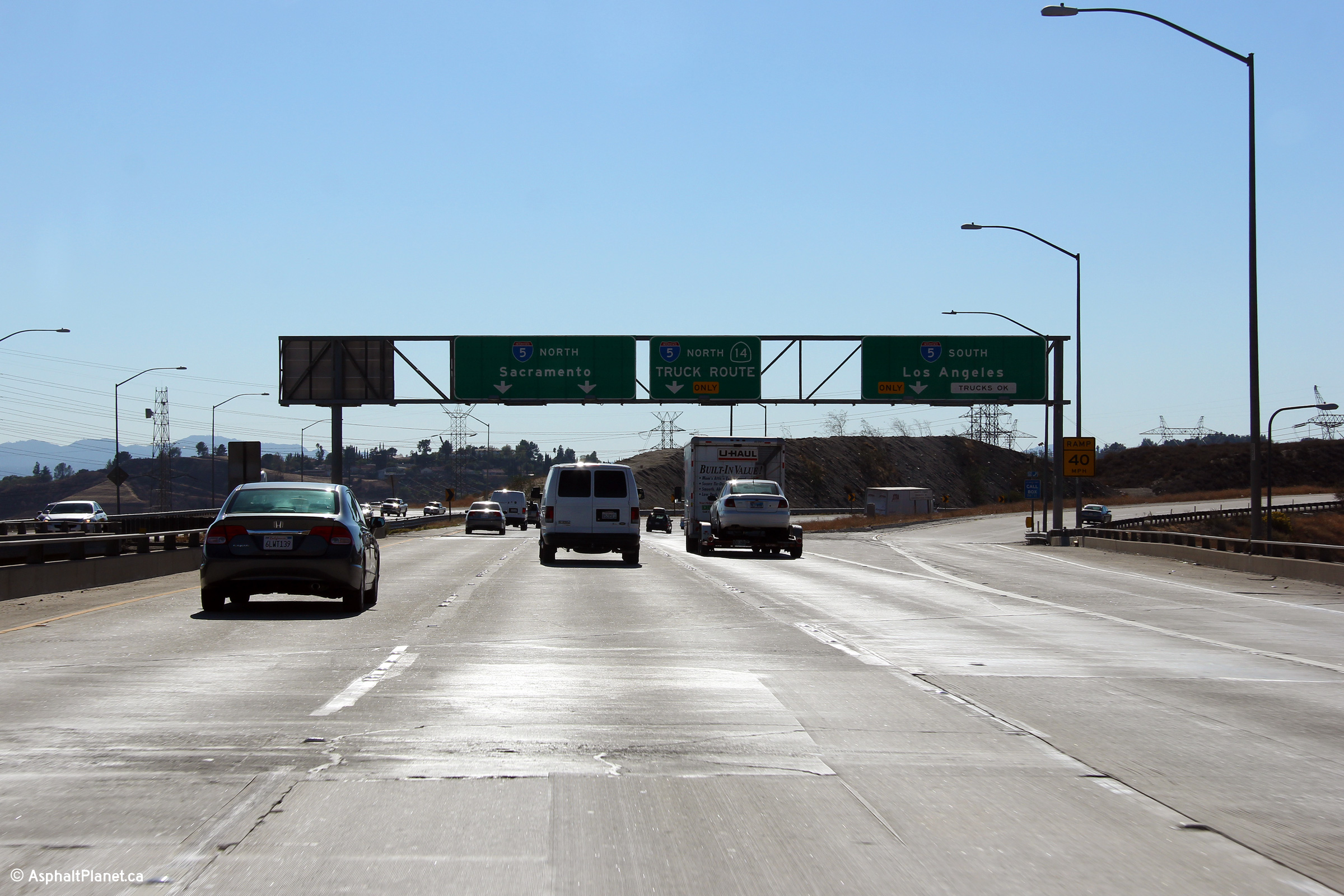
Signage at the diverge for the Golden State Freeway interchange. Since my last visit to California in 2010, the signage at the I-5 interchange has been replaced. The former button copy signage indicated I-5 as the Golden State Freeway -- a designation that has been deliberately omitted from the current signage. |
|
||
|
Date: 4/05/2010 |
High-res: (1440x960) (2400x1600) |
|||
|
Los Angeles County |
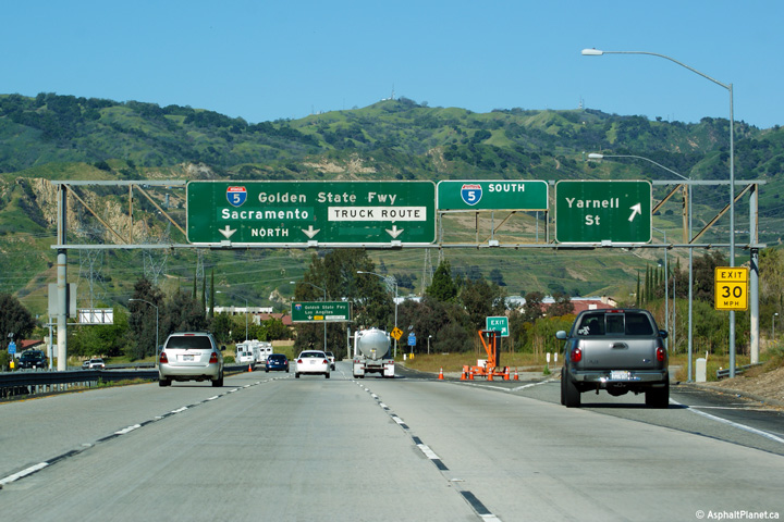
Overhead signage in advance of the Golden State Freeway interchange, denoting that the incoming ramp from Yarnell Street will depart for Interstate 5 South. |
|
||
|
Date: 11/06/2013 |
High-res: (1440x960) |
|||
|
Los Angeles County |
Signage at the westbound off-ramp to Yarnell Avenue. |
|
||
|
Date: 11/06/2013 |
High-res: (1440x960) (2400x1600) |
|||
|
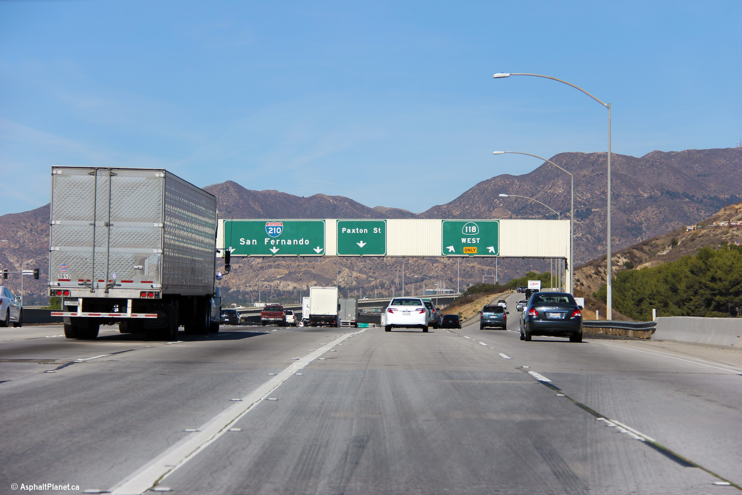
The Simi Valley Freeway (CA-118) leads westerly from I-210 through both the San Fernando and Simi Valleys to Ventura via Moore Park. Click here for Highway 118 Images. |
||||
|
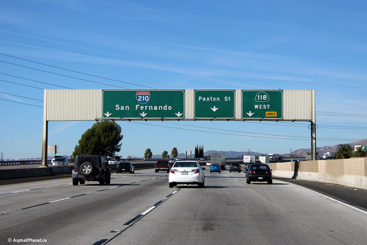
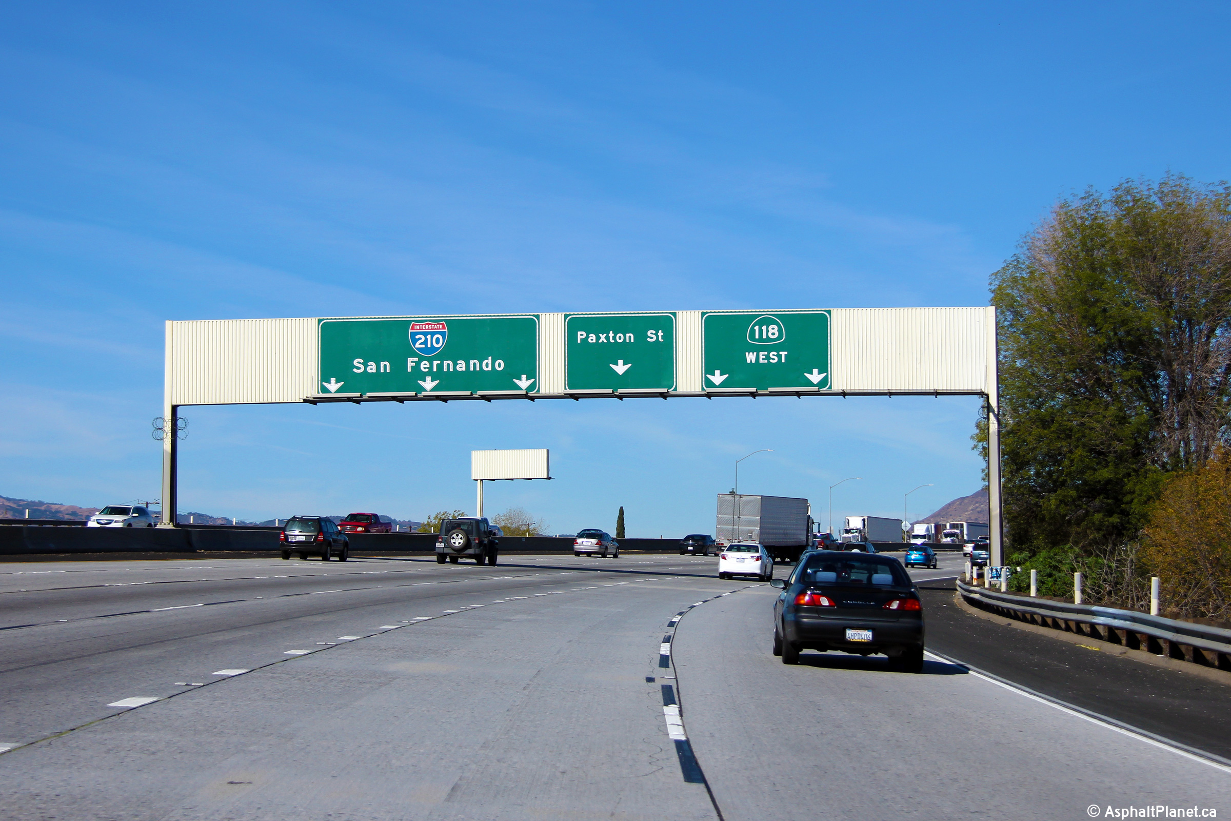
Los Angeles County |
The signage at the off-ramp to Highway 118 was nearly obscured by the pictured large truck when I took this photo. |
|
||
|
Date: 11/06/2013 |
High-res: (1440x960) (2400x1600) |
|||
|
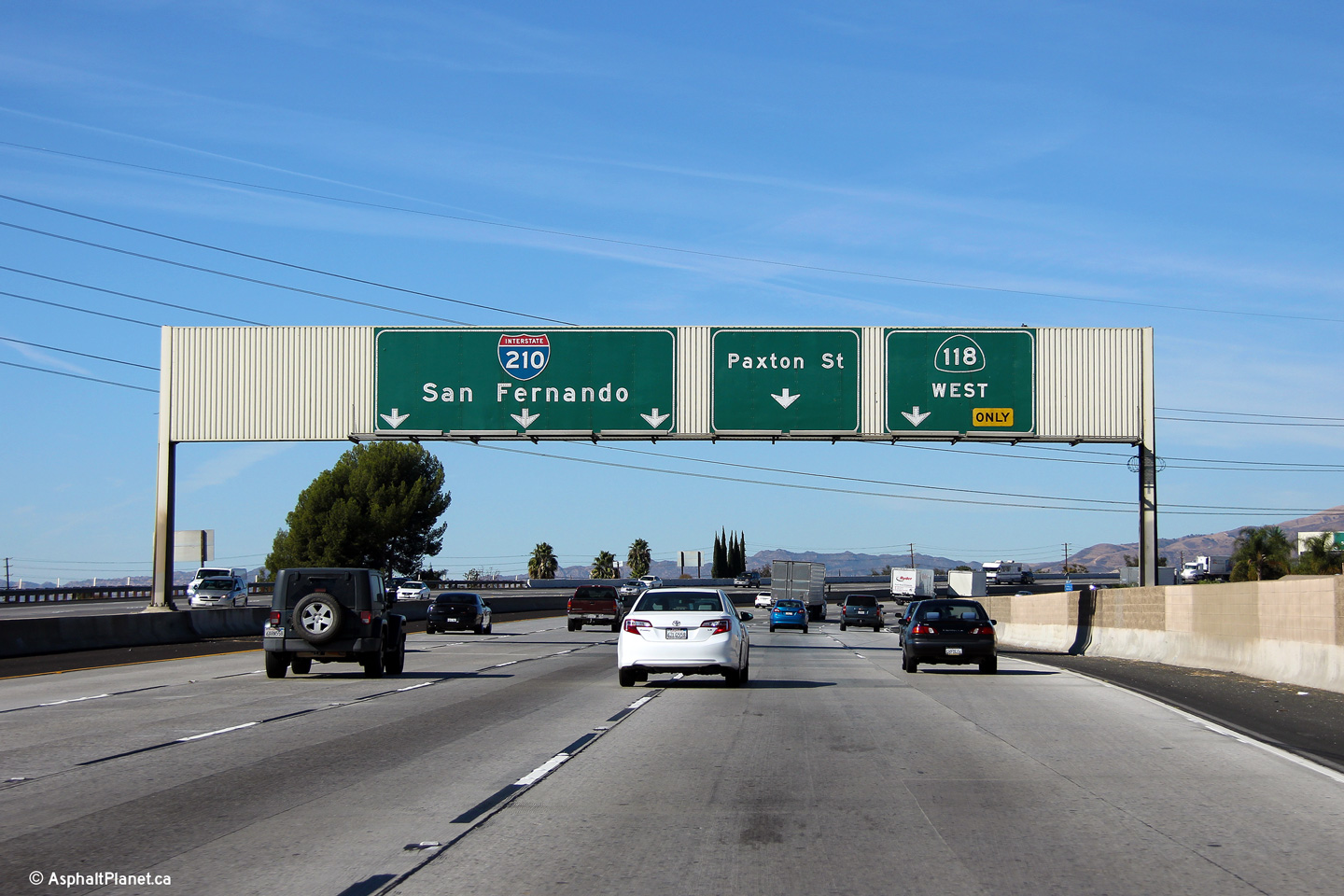
Los Angeles County |
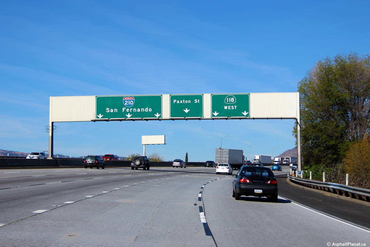
Second of three westbound lane assignment signs for the Highway 118 interchange. |
|
||
|
Date: 11/06/2013 |
High-res: (1440x960) (2400x1600) |
|||
|
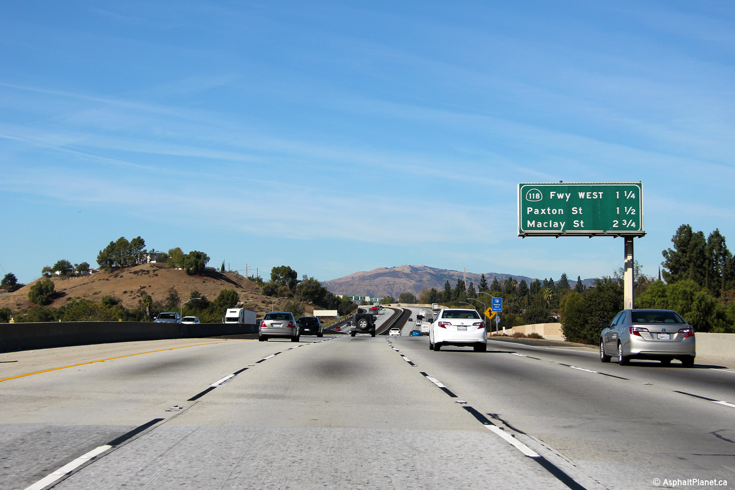
Los Angeles County |
This is the first of three westbound pull-through signs for the Highway 118 interchange. |
|
||
|
Date: 11/06/2013 |
High-res: (1440x960) (2400x1600) |
|||
|
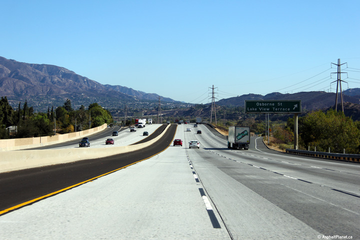
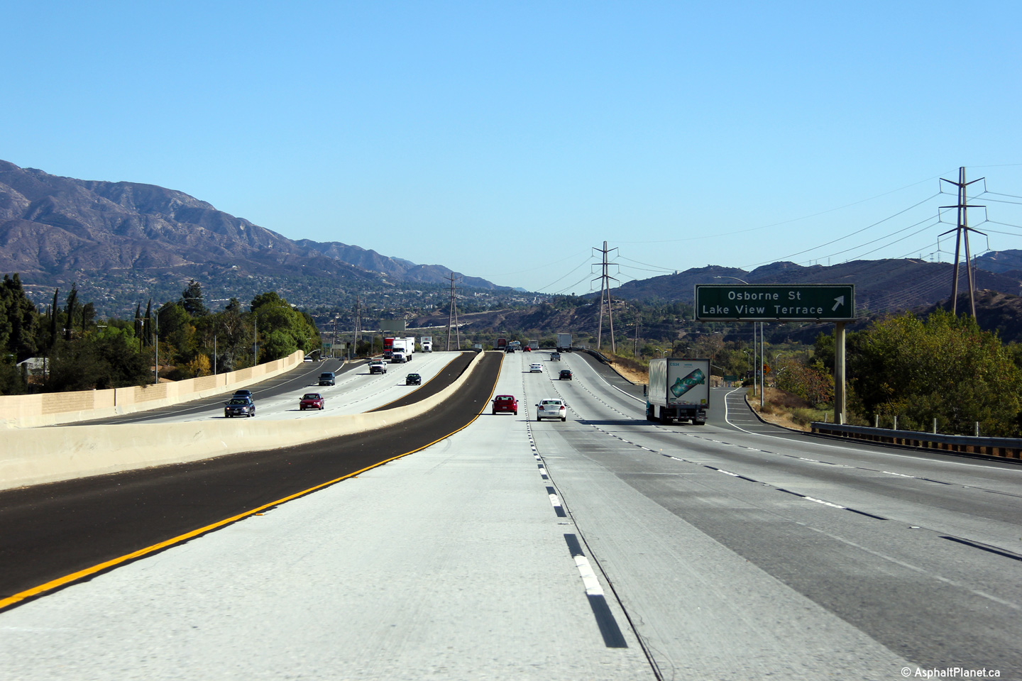
Los Angeles County |
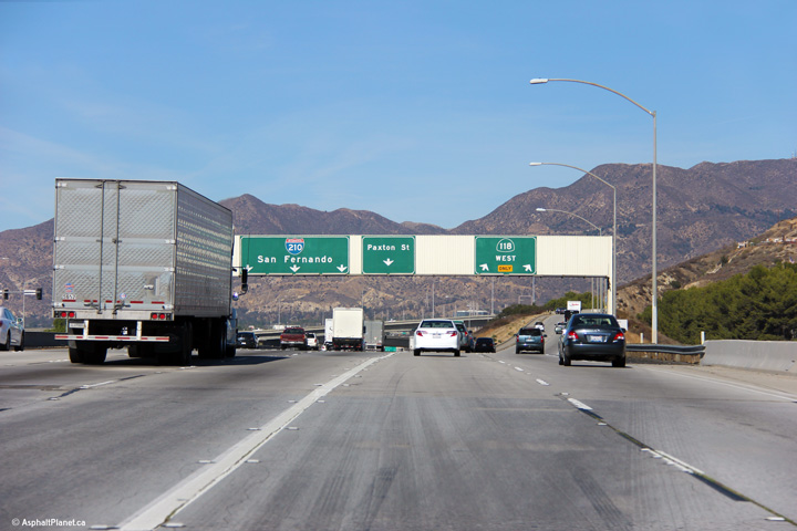
Looking westerly as I-210 passes overtop of the Foothill Boulevard underpass at the Osborne Street exit. The next westerly exit is for CA-118 (the Simi Valley / Ronald Reagan Freeway). |
|
||
|
Date: 11/06/2013 |
High-res: (1440x960) (2400x1600) |
|||
|
Los Angeles County |
View looking easterly at the Osborne Street interchange. |
|
||
|
Date: 11/05/2013 |
High-res: (1440x960) (2400x1600) |
|||
|
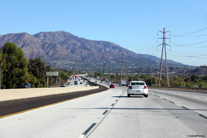
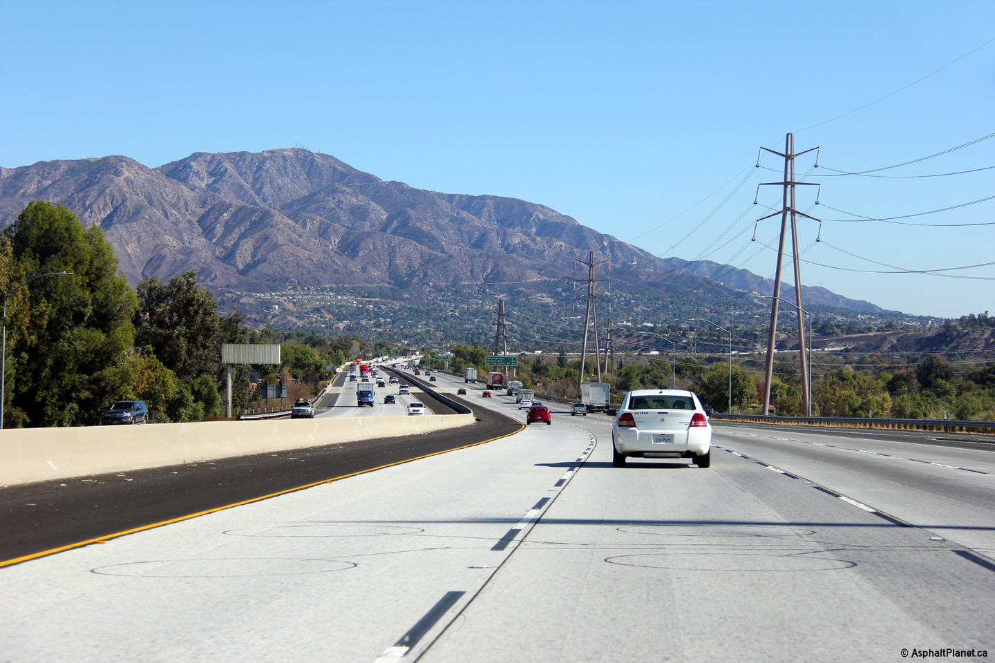
Los Angeles County |
This view looks easterly from just east of the Osborne Street underpass. The San Gabriel Mountain Range looms in the distance. |
|
||
|
Date: 11/05/2013 |
High-res: (1440x960) (2400x1600) |
|||
|
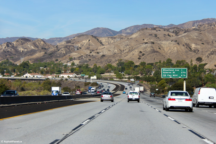
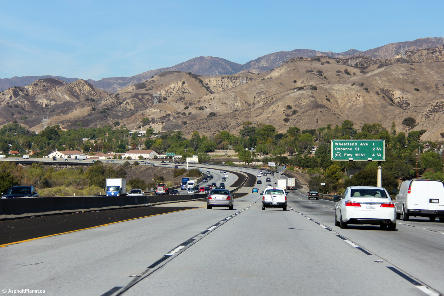
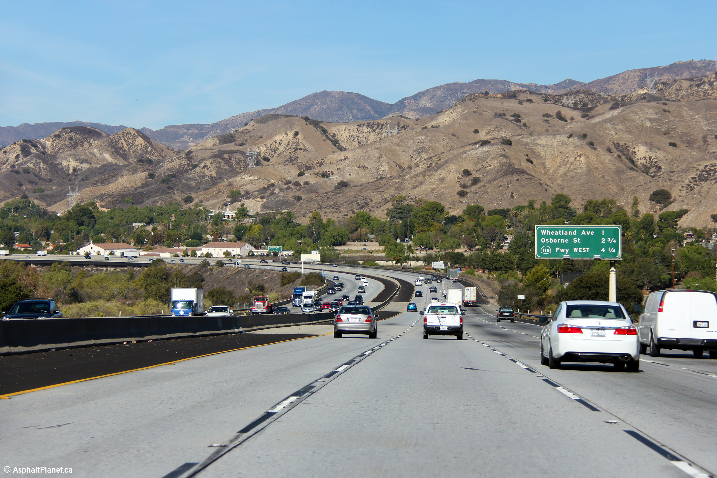
Los Angeles County |
Advanced signage for the Osborne Street exit located just beyond the underpass that carries the Foothill Freeway overtop of Wheatland Avenue. |
|
||
|
Date: 11/06/2013 |
High-res: (1440x960) (2400x1600) |
|||
|
Los Angeles County |
Eastbound interchange sequence sign located just beyond the Wheatland Avenue interchange. The Foothill Freeway crosses overtop of the Tujunga Wash immediately beyond this signage. |
|
||
|
Date: 11/05/2013 |
High-res: (1440x960) (2400x1600) |
|||
|
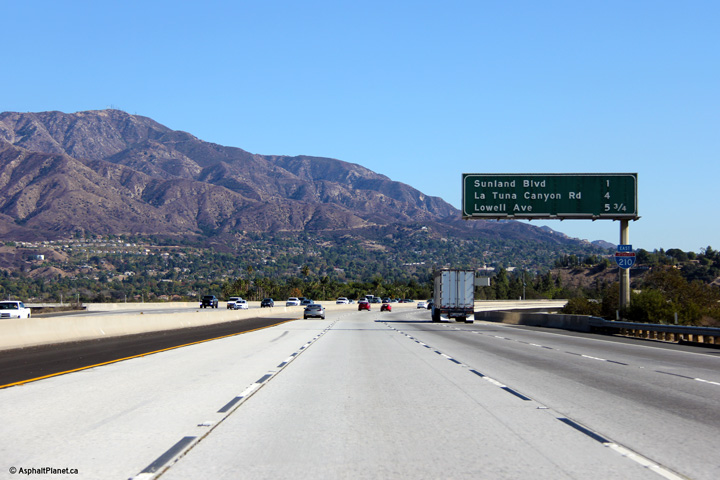
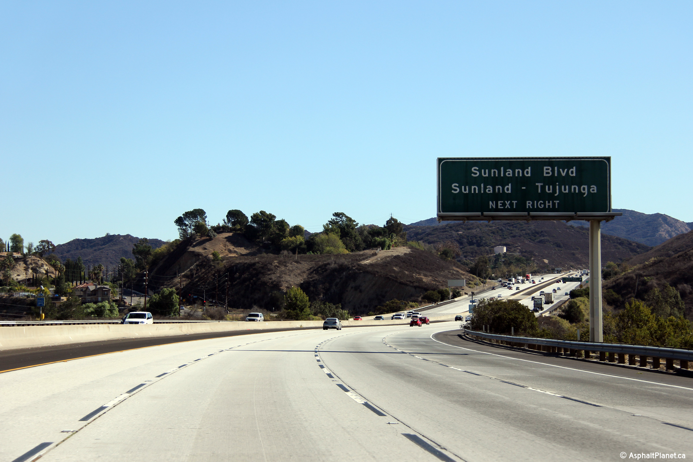
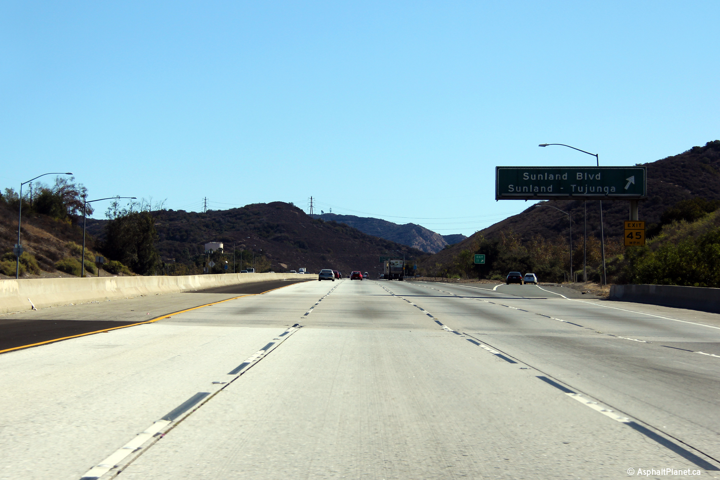
Los Angeles County |
Advanced signage for the upcoming Sunland Boulevard interchange. Beyond the Tujunga Wash, the Foothill Freeway passes through a narrow pass between the San Gabriel and Verdugo Mountains. |
|
||
|
Date: 11/05/2013 |
High-res: (1440x960) (2400x1600) |
|||
|
Los Angeles County |
Signage as I-210 descends into the San Fernando Valley just beyond the Sunland Boulevard interchange. |
|
||
|
Date: 11/06/2013 |
High-res: (1440x960) (2400x1600) |
|||
|
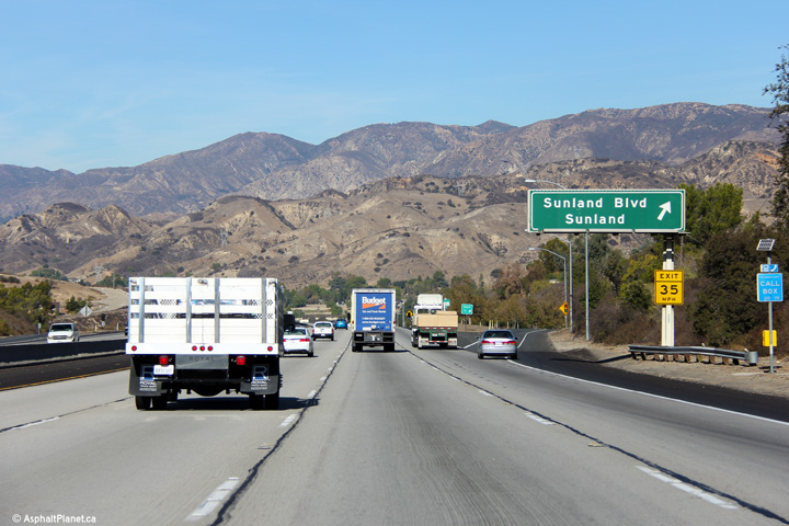
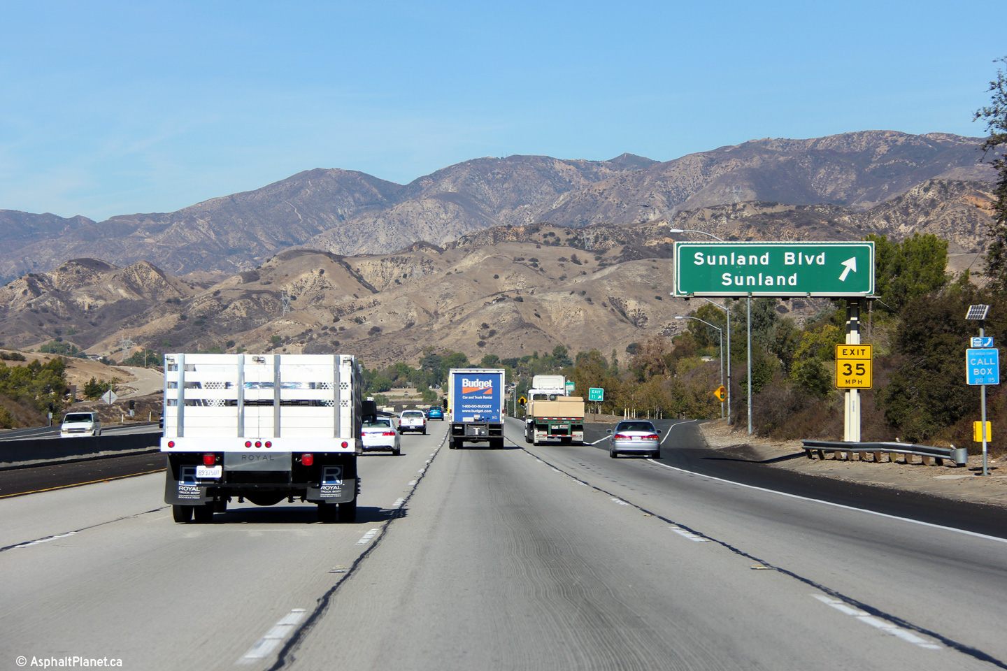
Los Angeles County |
Signage for the off-ramp to Sunland Boulevard. |
|
||
|
Date: 11/05/2013 |
High-res: (1440x960) (2400x1600) |
|||
|
Los Angeles County |
Signage on the ramps from Highway 118 West to Interstate 5. |
|
||
|
Date: 11/06/2013 |
High-res: (1440x960) (2400x1600) |
|||
|
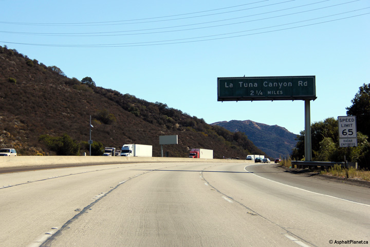
Los Angeles County |
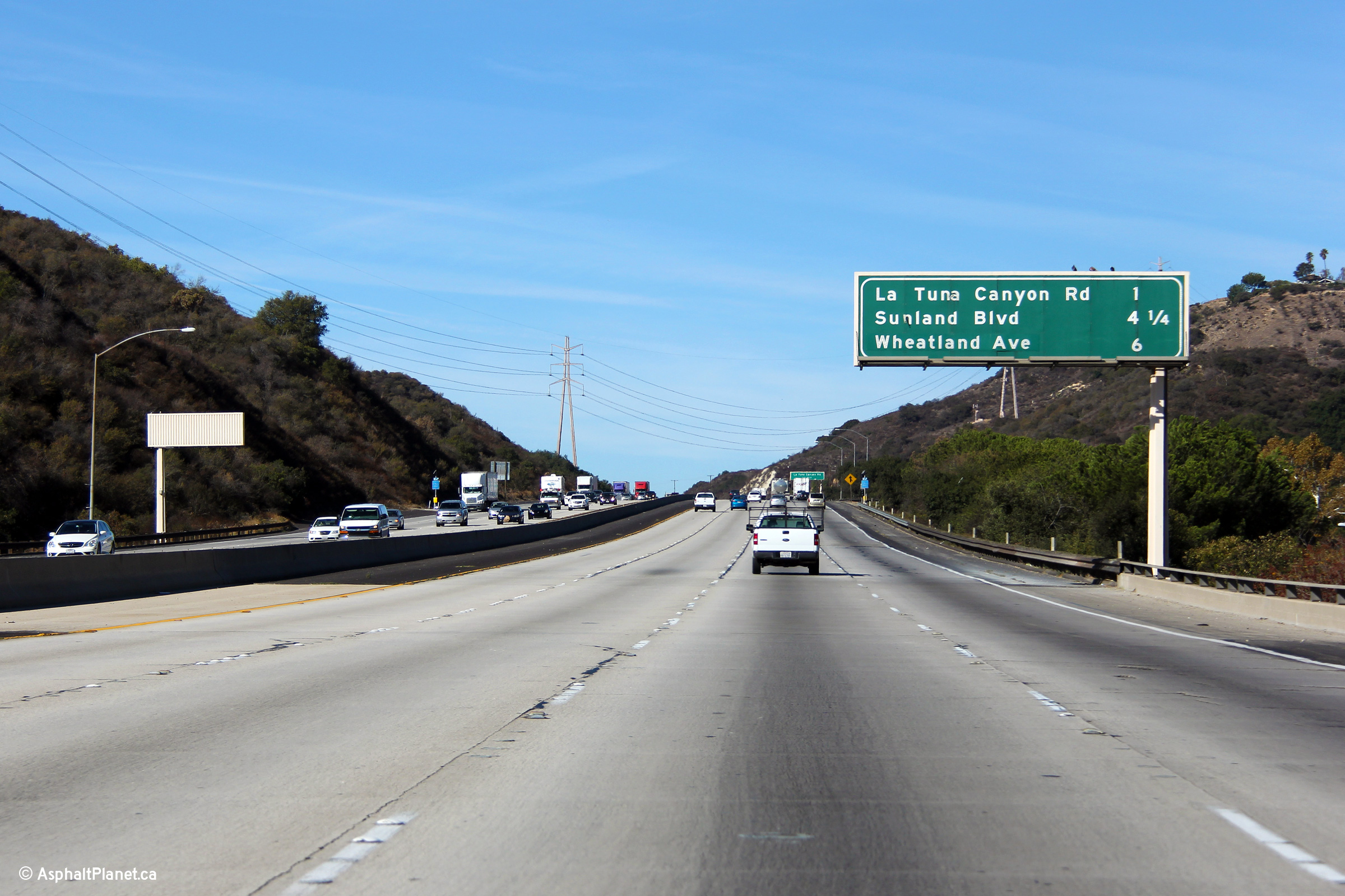
Advanced signage for the ramp to La Tuna Canyon Road. |
|
||
|
Date: 11/05/2013 |
High-res: (1440x960) (2400x1600) |
|||
|
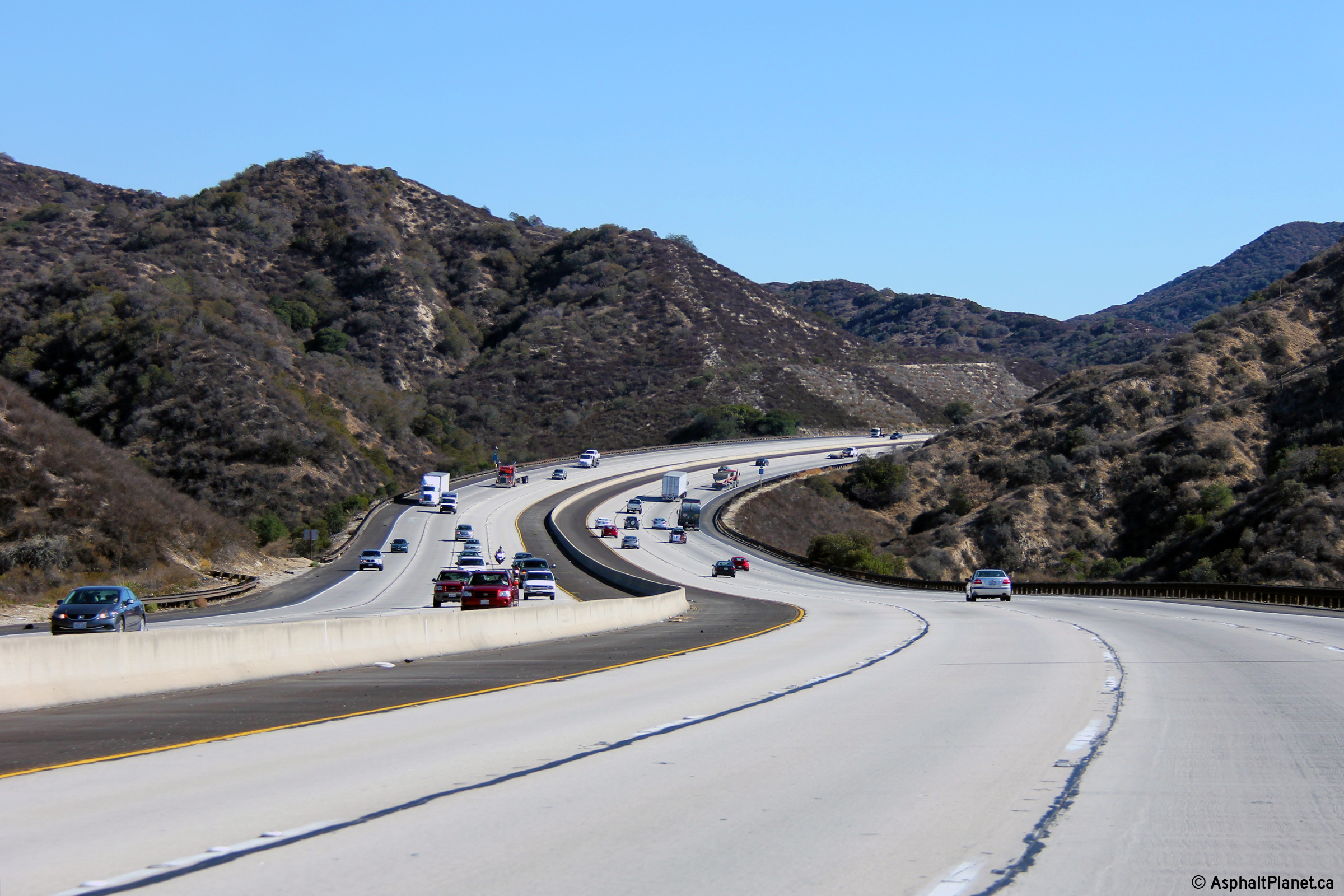
Los Angeles County |
Easterly view as the Foothill Freeway winds around a reversing curve through the foothills of the Verdugo Mountains |
|
||
|
Date: 11/05/2013 |
High-res: (1440x960) (2400x1600) |
|||
|
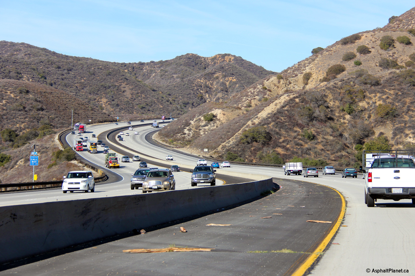
Los Angeles County |
I liked this reversing curve so much, I took photos of it in both directions. |
|
||
|
Date: 11/06/2013 |
High-res: (1440x960) (2400x1600) |
|||
|
Los Angeles County |
This interchange sequence signage is located immediately to the west of the Honolulu Avenue underpass. |
|
||
|
Date: 11/06/2013 |
High-res: (1440x960) (2400x1600) |
|||
|
Los Angeles County |
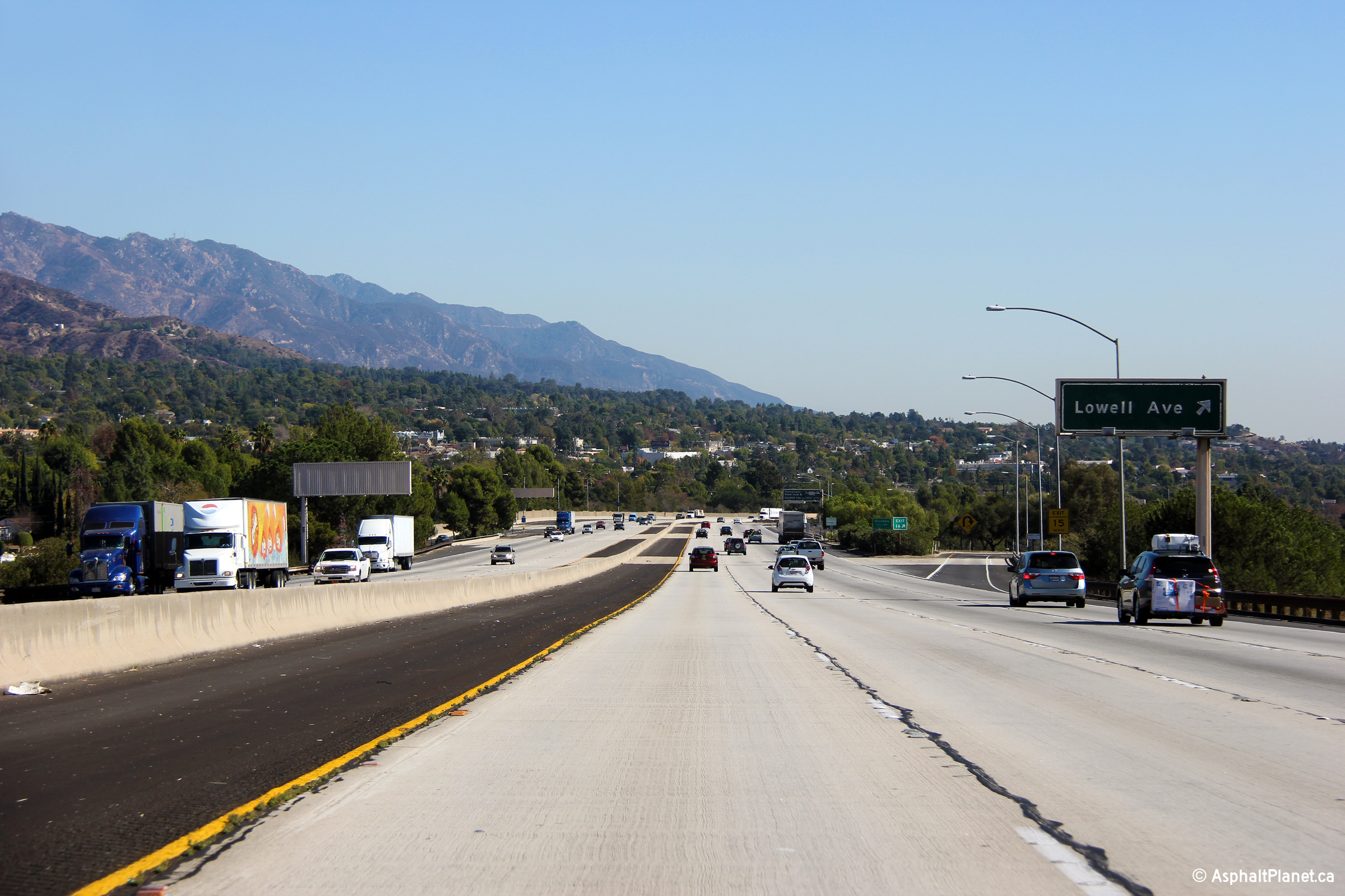
Easterly view at the off-ramp to Lowell Avenue. |
|
||
|
Date: 11/05/2013 |
High-res: (1440x960) (2400x1600) |
|||
|
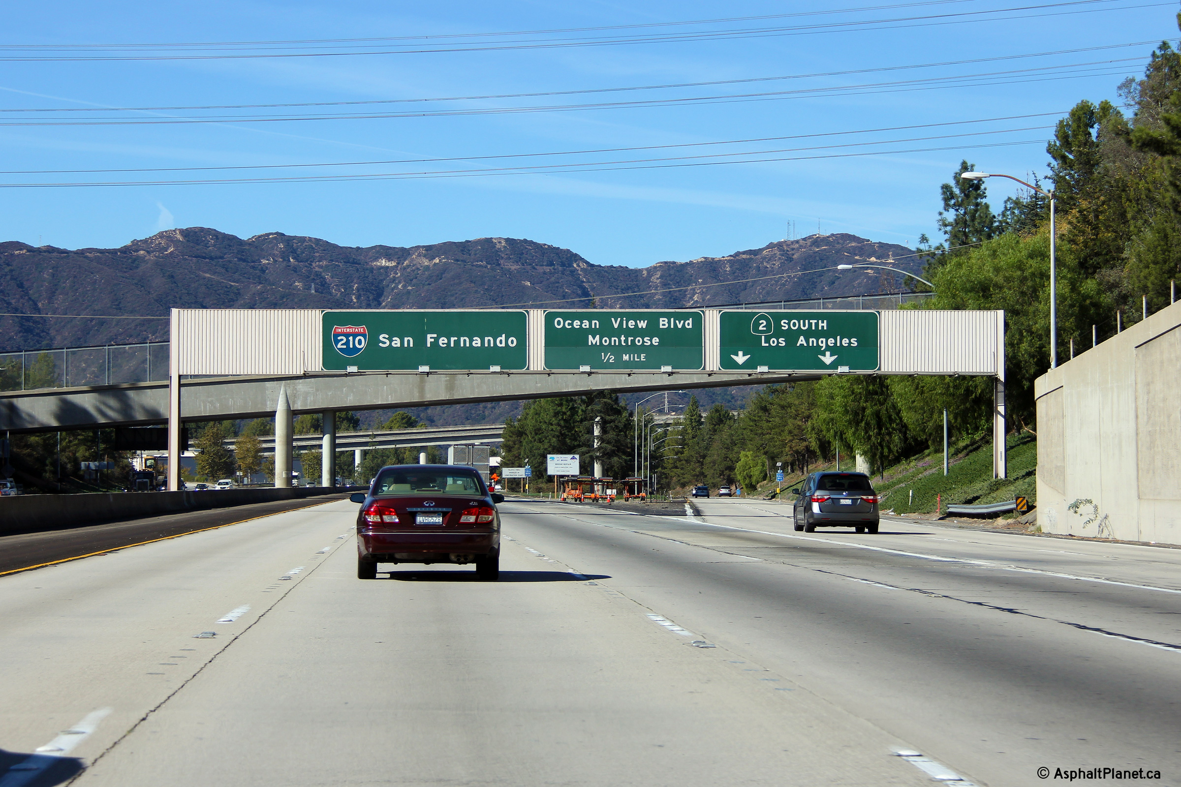
Los Angeles County |
Just east of the Lowell Avenue interchange sits this interchange sequence sign. The 'L' in Ocean View Boulevard on the sign appears to be slowly succumbing to the inevitability of gravity. |
|
||
|
Date: 11/05/2013 |
High-res: (1440x960) (2400x1600) |
|||
|
Los Angeles County |
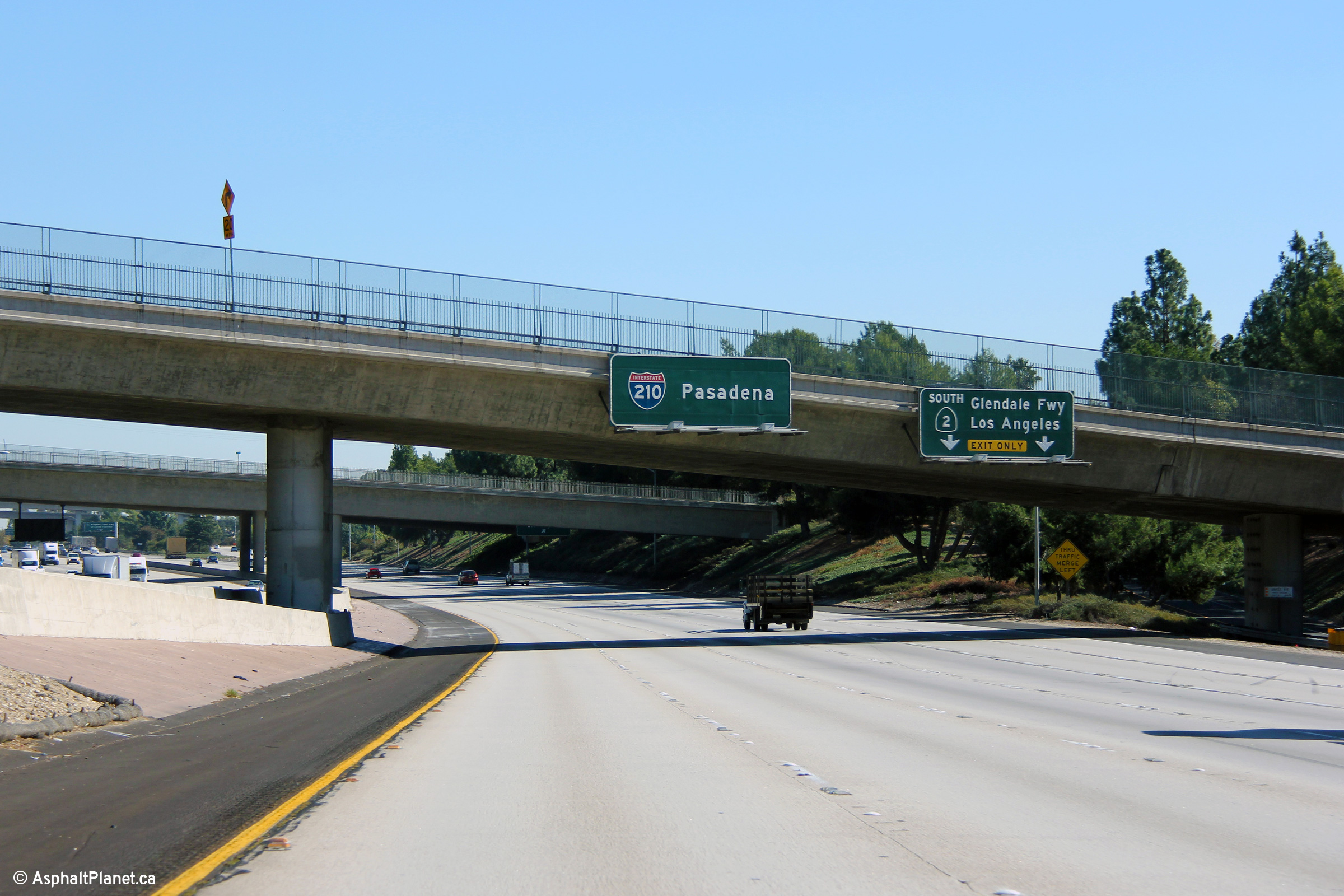
Advanced signage for the ramp to the Glendale Freeway. |
|
||
|
Date: 11/05/2013 |
High-res: (1440x960) (2400x1600) |
|||
|
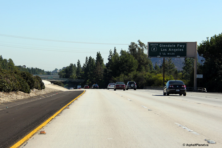
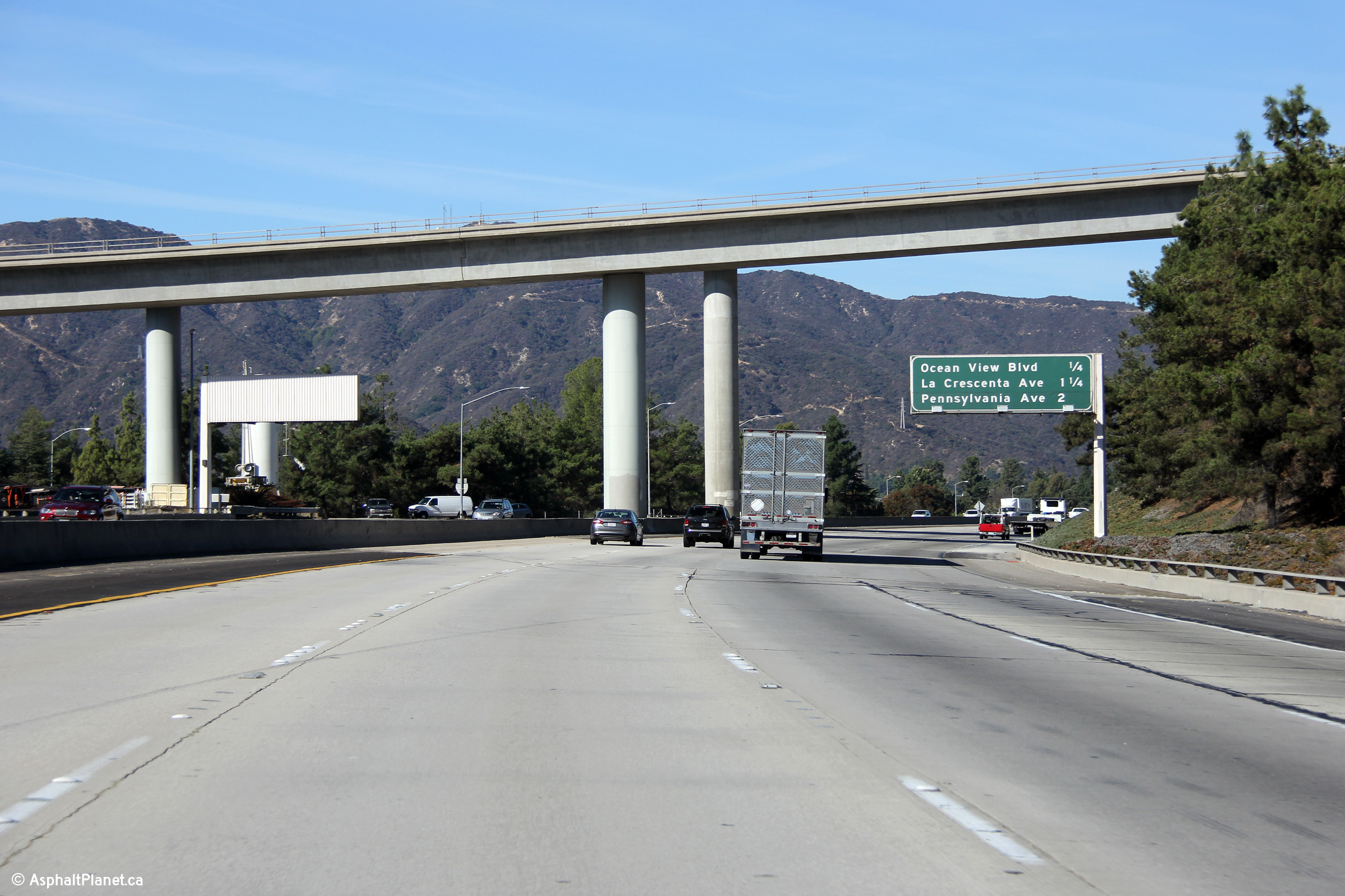
Los Angeles County |
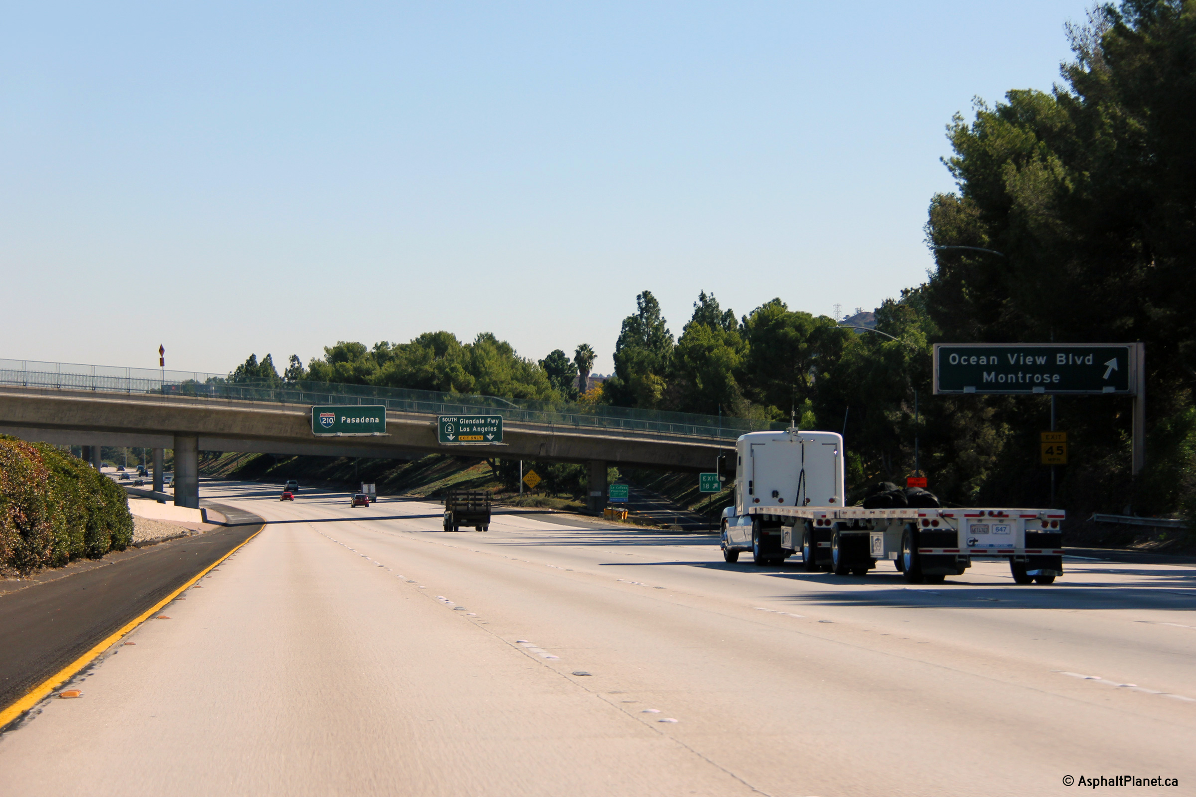
The exit for Ocean View Boulevard is located in close proximity to the off-ramp that leads to the Glendale Freeway South. |
|
||
|
High-res: (1440x960) (2400x1600) |
||||
|
|
||||
|
Date: 11/05/2013 |
High-res: (1440x960) (2400x1600) |
|||
|
Los Angeles County |
Ground mounted turn-off signage for the ramp to the Glendale Freeway |
|
||
|
Date: 11/05/2013 |
High-res: (1440x960) (2400x1600) |
|||
|
Los Angeles County |
Advanced signage for the Angeles Crest Highway interchange located near the flyover ramps that connect the Glendale Freeway to Foothill Boulevard. |
|
||
|
Date: 11/05/2013 |
High-res: (1440x960) (2400x1600) |
|||
|
The Glendale Freeway (CA-2) leads southerly from I-210 towards Downtown Los Angeles terminating just south of I-5. Click here for Highway 2 Images. |
||||
|
Los Angeles County |
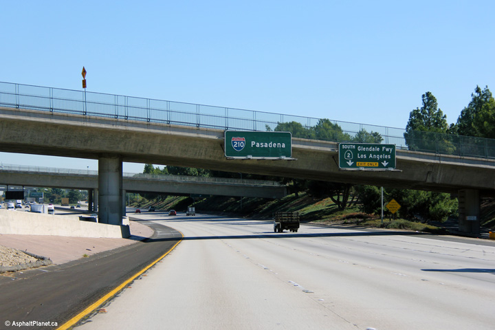
Westbound interchange sequence signage underneath the flyover ramps that link the Glendale Freeway (CA-2) to Foothill Boulevard to the north. |
|
||
|
Date: 11/06/2013 |
High-res: (1440x960) (2400x1600) |
|||
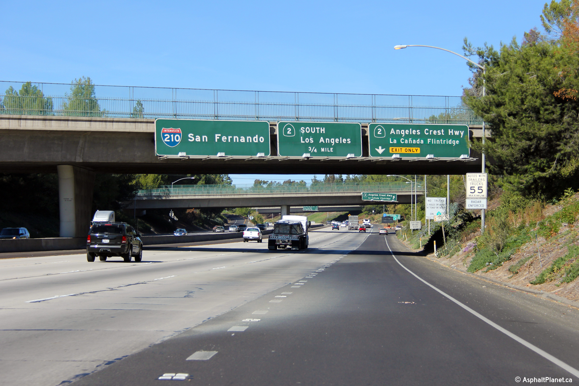
|
Los Angeles County |
The advanced signage for the Angeles Crest Highway interchange is suspended from the Alta Canyada Road overpass. |
|
||
|
Date: 11/05/2013 |
High-res: (1440x960) (2400x1600) |
|||
|
Los Angeles County |
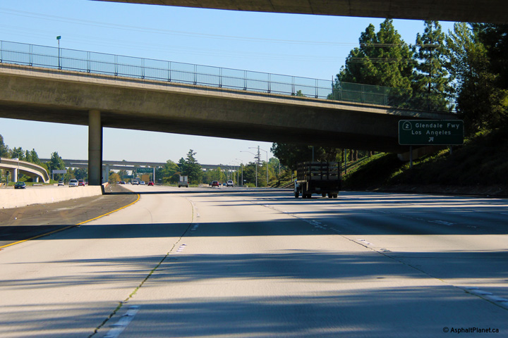
Westbound view along Interstate 210 as the ramp to the Glendale Freeway departs on the right hand side. The Glendale Freeway carries California Highway 2 Southerly towards Interstate 5 and Downtown Los Angeles. The Glendale Freeway represents a short freeway segment along Highway 2 which is ordinarily a lowly surface street. |
|
||
|
Date: 11/06/2013 |
High-res: (1440x960) (2400x1600) |
|||
|
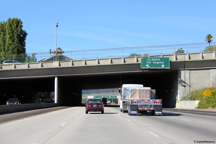
Los Angeles County |
The Foothill Freeway passes beneath through a short tunnel segment where the freeway passes beneath Foothill Boulevard and Memorial Park. |
|
||
|
Date: 11/05/2013 |
High-res: (1440x960) (2400x1600) |
|||
|
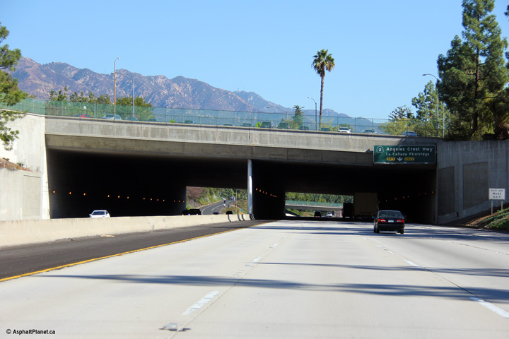
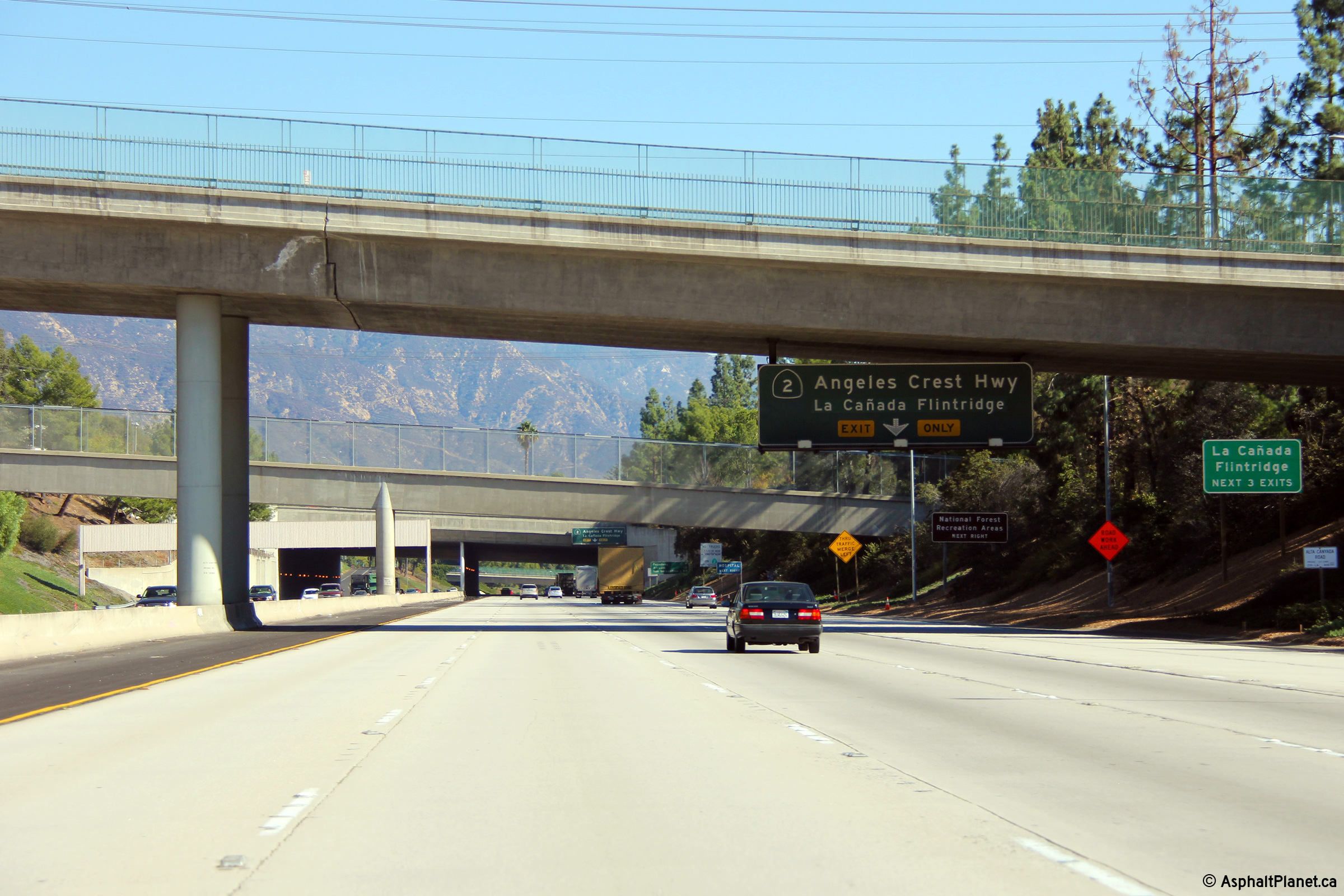
Los Angeles County |
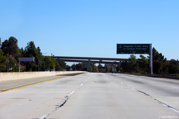
Overhead guide signage affixed to the Foothill Boulevard Tunnel. Highway 2 runs concurrent with Interstate 210 for a distance of just over a mile. North of Interstate 210, California Highway 2 follows the Angeles Crest Highway where it promptly ascends into the San Gabriel Mountains. The Angeles Crest Highway has been described as one of North America's most beautiful highways. |
|
||
|
Date: 11/06/2013 |
High-res: (1440x960) (2400x1600) |
|||
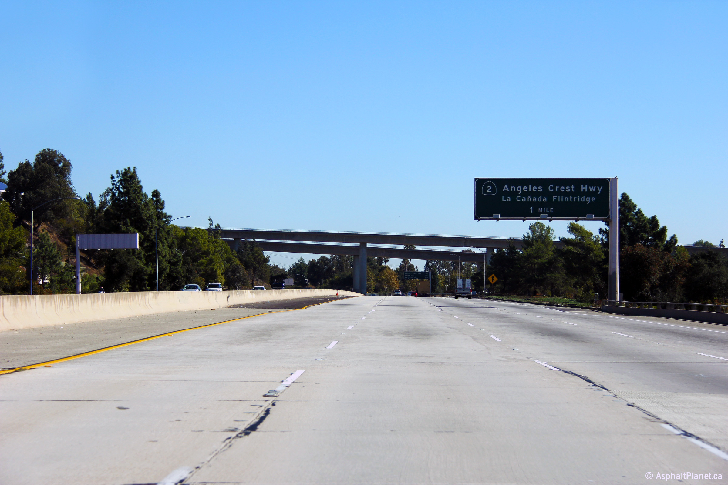
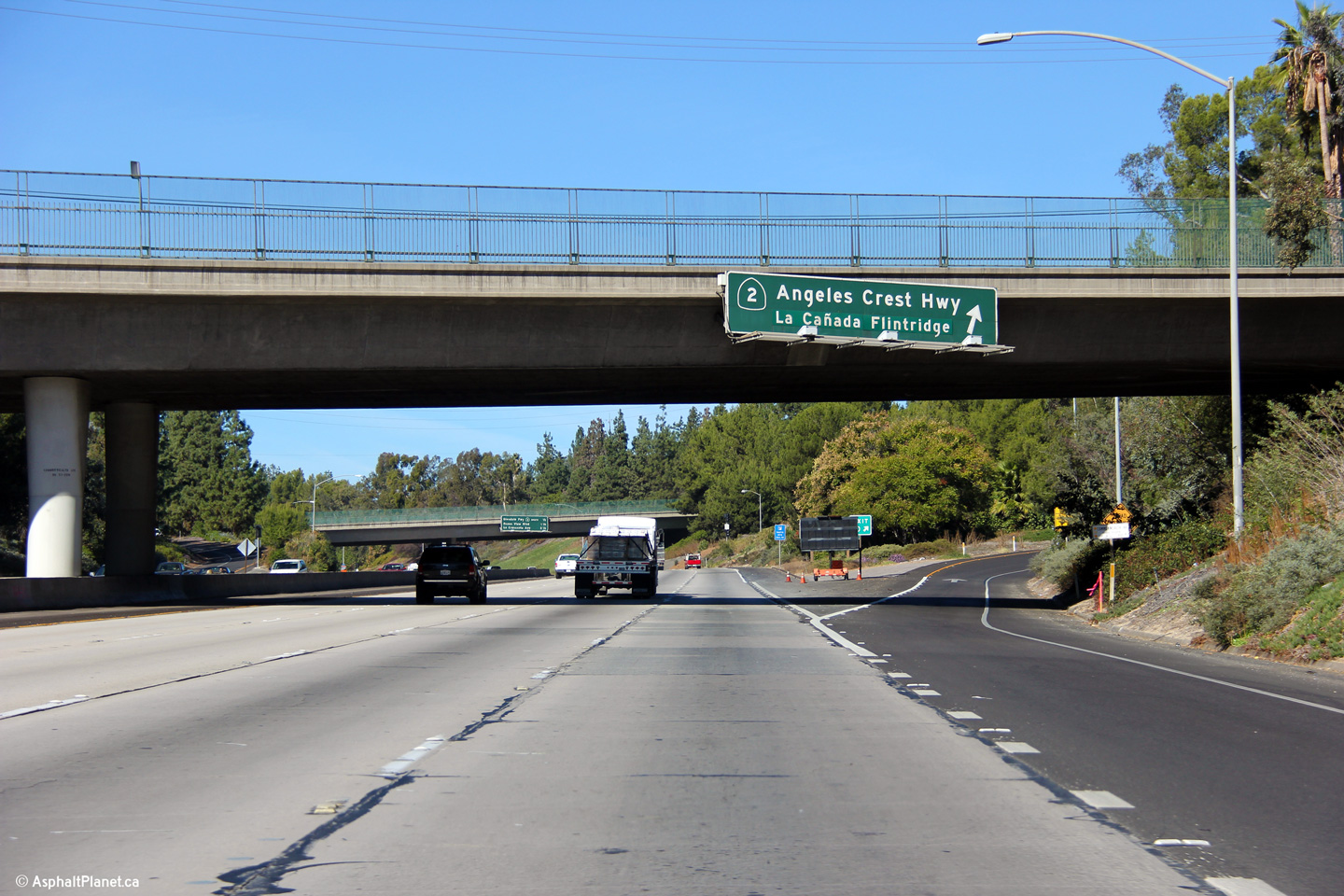
|
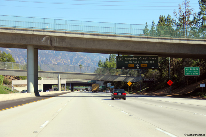
Los Angeles County |
Overhead signage at the westbound off-ramp to the Angeles Crest Highway (CA-2) North. |
|
||
|
Date: 11/06/2013 |
High-res: (1440x960) (2400x1600) |
|||
|
Los Angeles County |
Pull-through signage denoting the separate off-ramps to both legs of Highway 2. |
|
||
|
Date: 11/06/2013 |
High-res: (1440x960) (2400x1600) |
|||
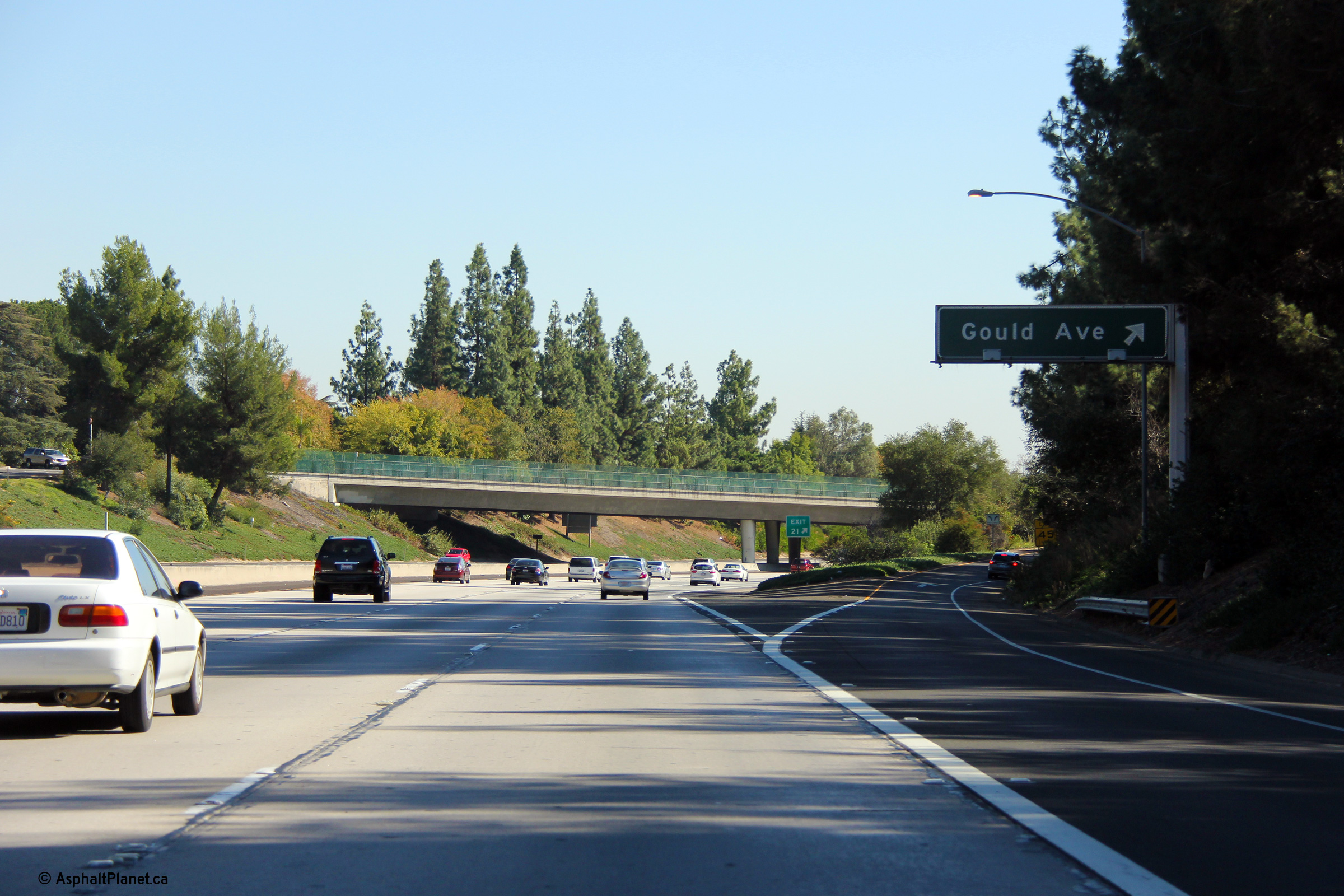
|
Los Angeles County |
Easterly view at the off-ramp to to Gould Avenue. |
|
||
|
Date: 11/05/2013 |
High-res: (1440x960) (2400x1600) |
|||
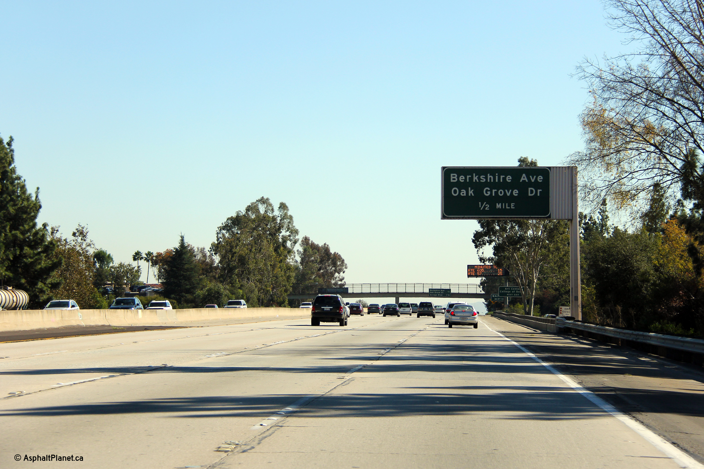
|
Los Angeles County |
Easterly view as the I-210 winds along the hillside at Exit 22A. |
|
||
|
Date: 11/05/2013 |
High-res: (1440x960) (2400x1600) |
|||
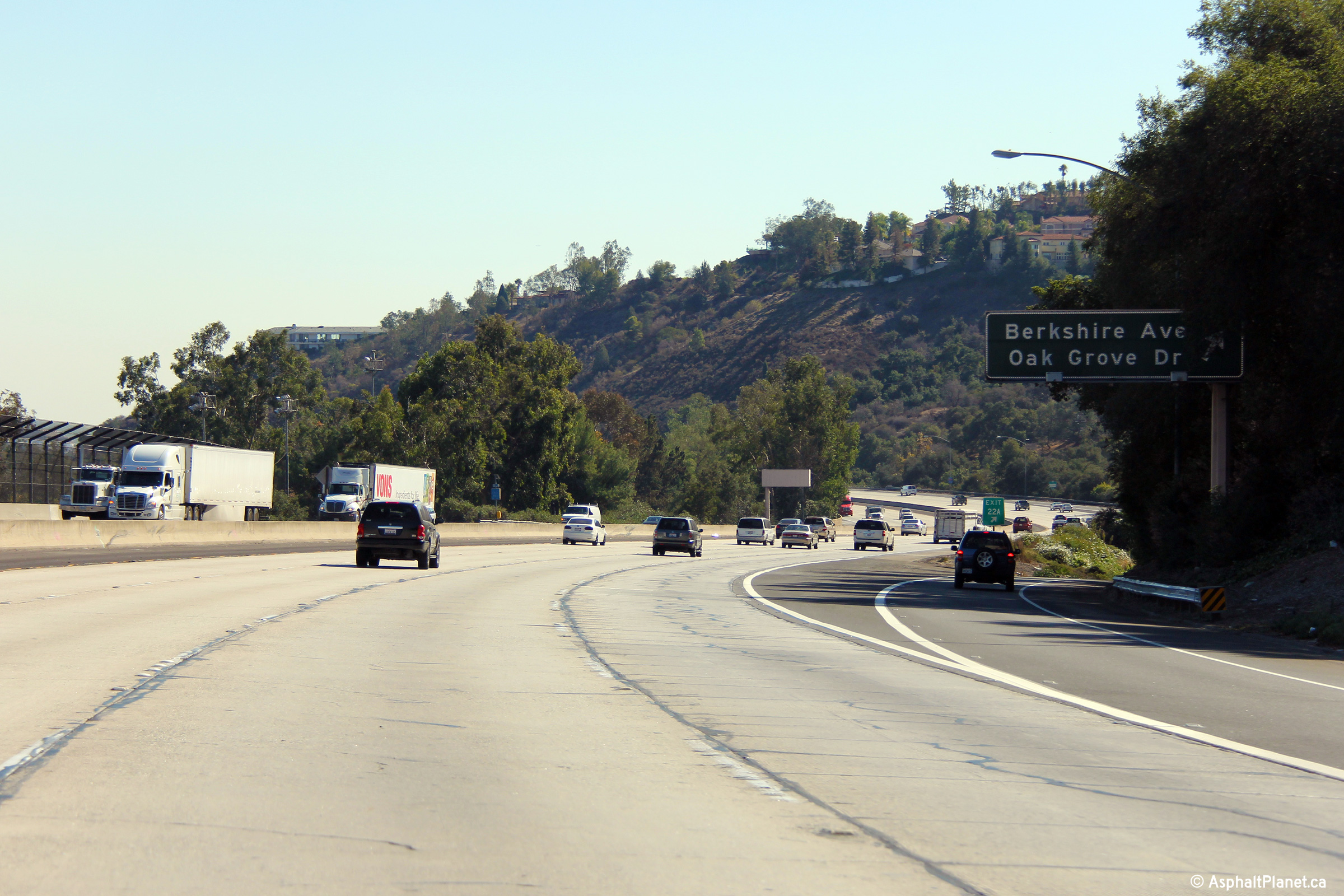
|
Los Angeles County |
Easterly view as the I-210 winds along the hillside at Exit 22A. |
|
||
|
Date: 11/05/2013 |
High-res: (1440x960) (2400x1600) |
|||
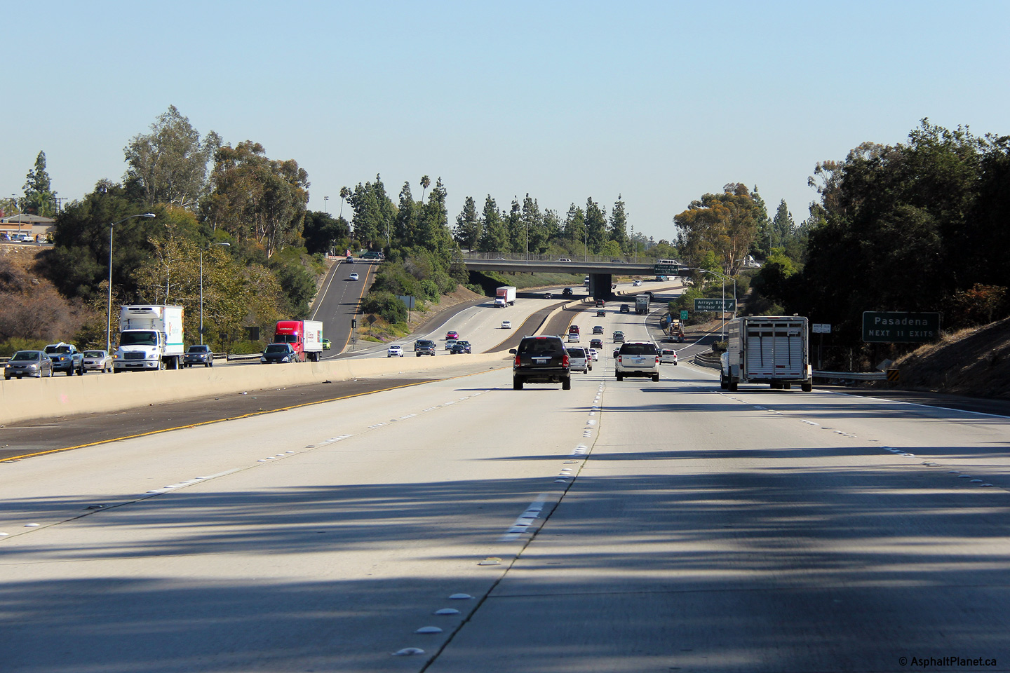
|
Los Angeles County |
Easterly view as the Foothill Freeway enters the City of Pasadena nearing Exit 22B. |
|
||
|
Date: 11/05/2013 |
High-res: (1440x960) (2400x1600) |
|||
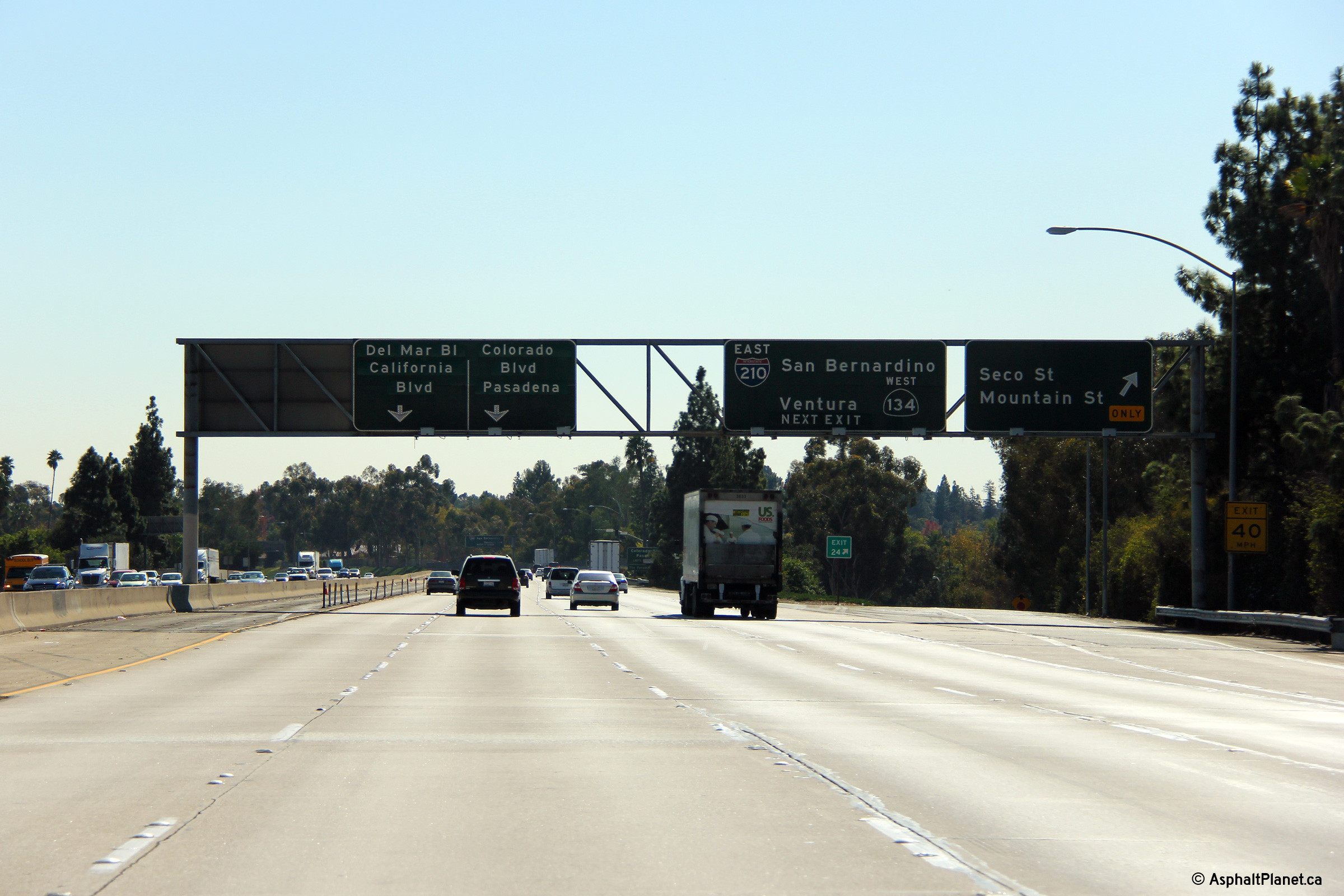
|
Los Angeles County |
Signage at the Seco Street and Mountain Street exit in Pasadena. This exit is signed with the first advanced signage for the upcoming Highway 134 interchange. |
|
||
|
Date: 11/05/2013 |
High-res: (1440x960) (2400x1600) |
|||
|
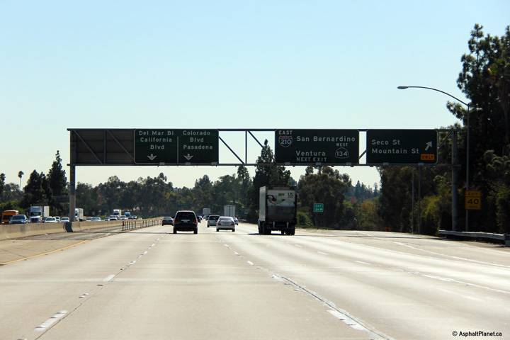
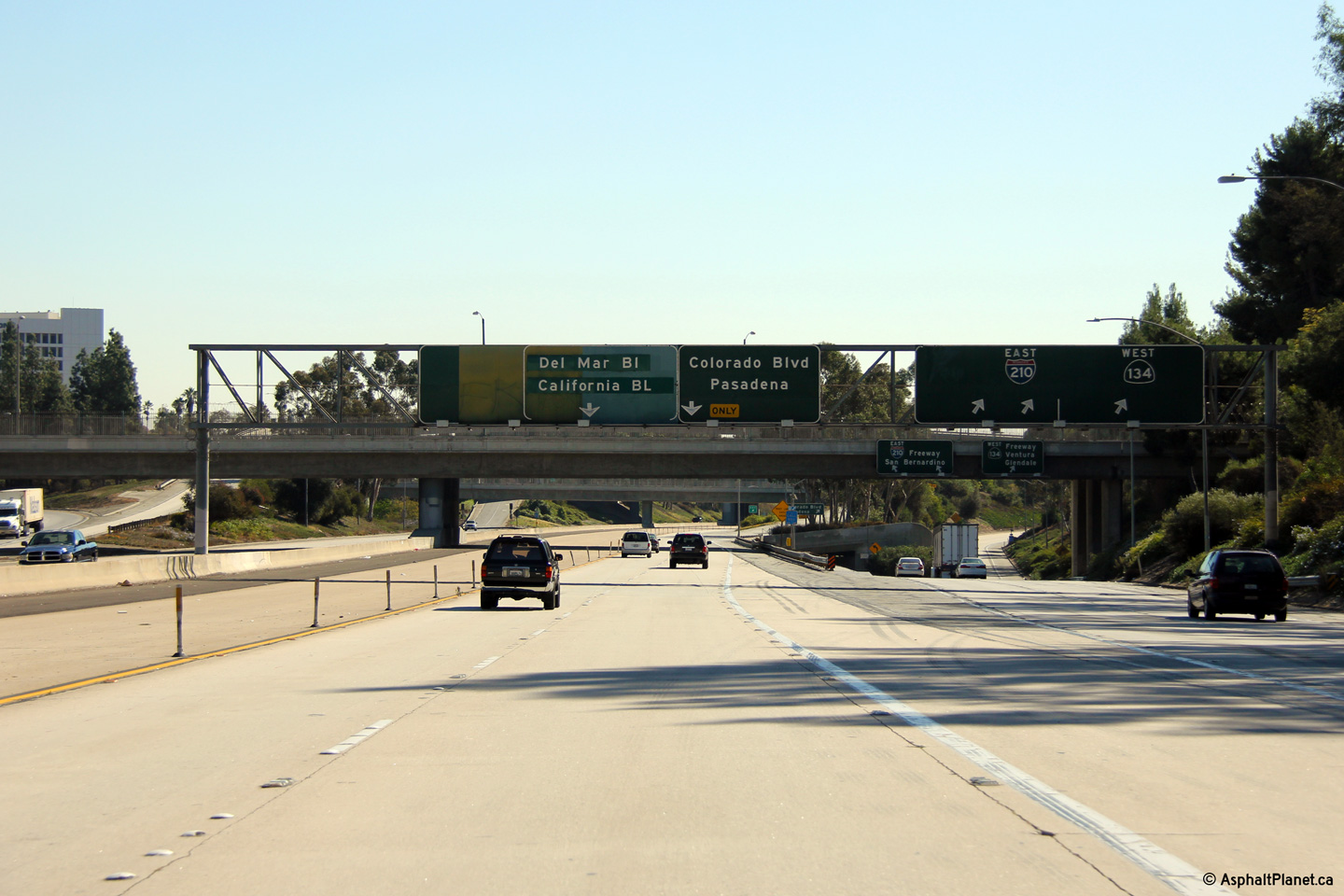
Los Angeles County |
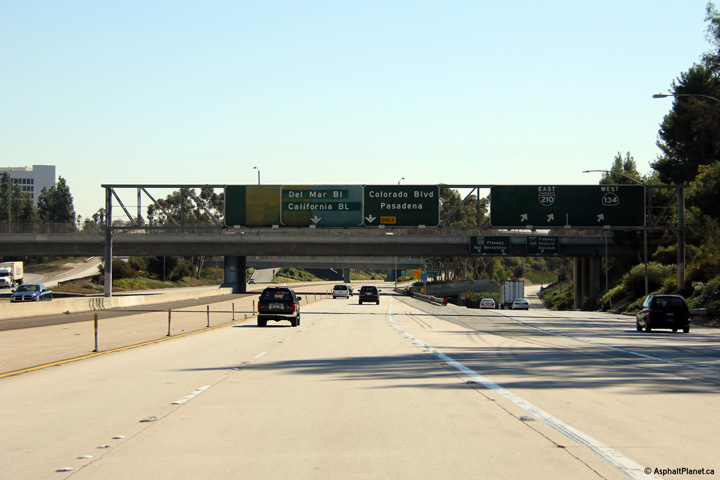
Easterly view at the Highway 134 interchange. The 210 Freeway exits the through freeway to the right and leads through a tunnel making a left hand movement continuing easterly as an eastern extension of the Ventura Freeway (still known as the Foothill Freeway). The through freeway at this interchange continues for a short distance and then ends. This through freeway was intended to be the northern extension of the never completed 710 Freeway. |
|
||
|
Date: 11/05/2013 |
High-res: (1440x960) (2400x1600) |
|||
|
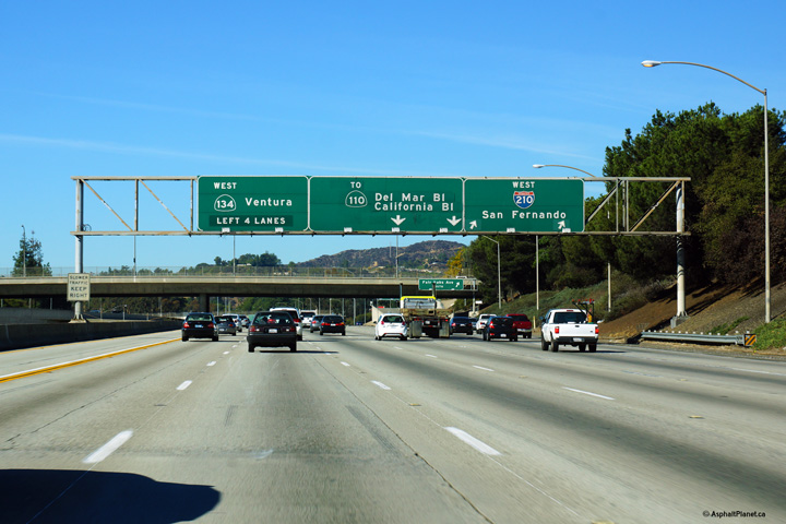
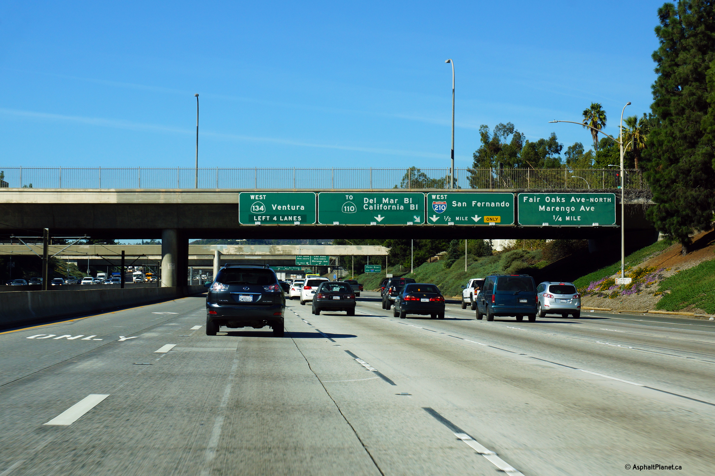
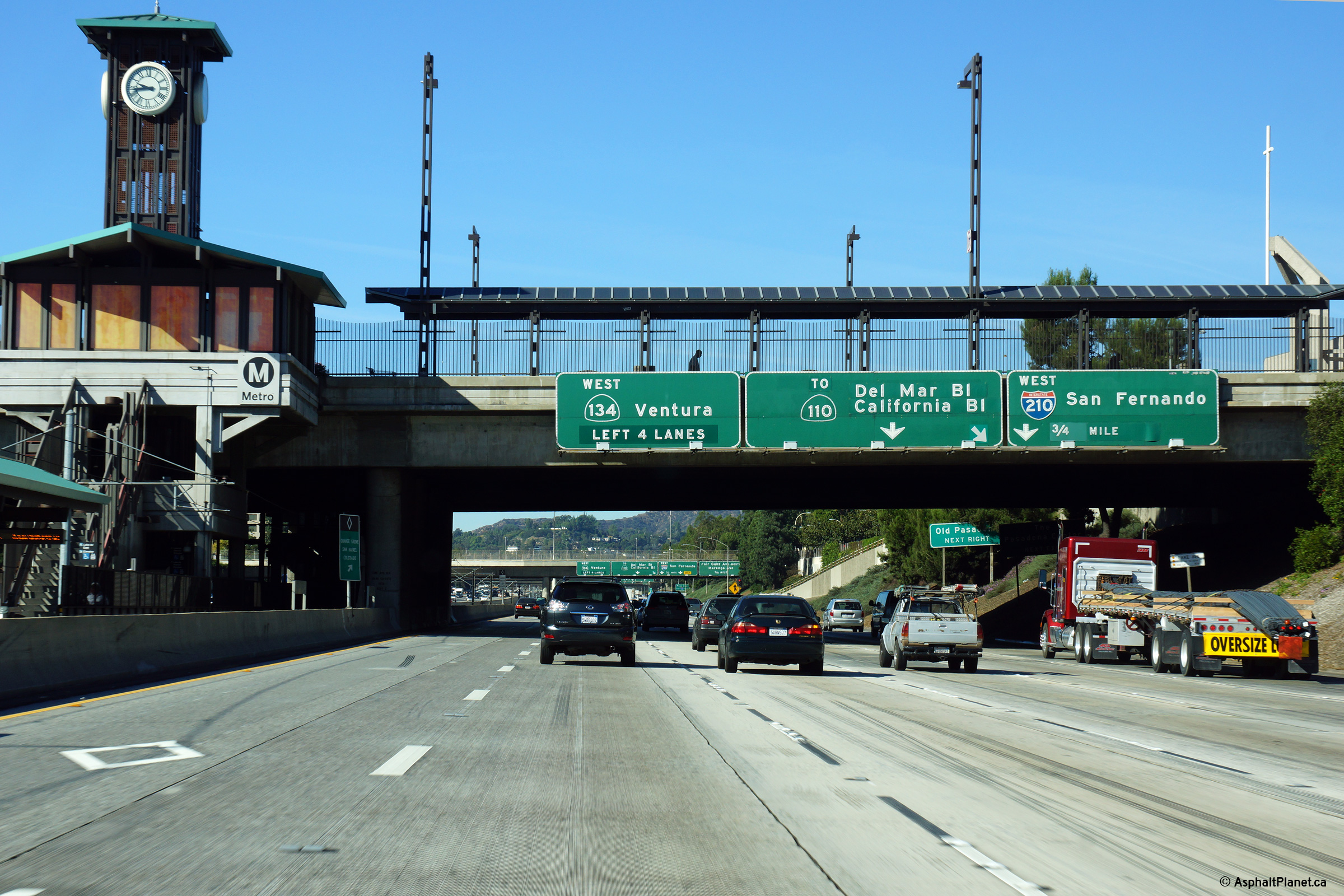
Los Angeles County |
Final westbound overhead signage denoting the Highway 134 interchange. The Foothill Freeway departs the through highway at this interchange bound for the San Fernando Valley. The ramp trail-blazed to Highway 110 was originally supposed to link with Interstate 710, however the 710 freeway has been stalled through Pasadena due to local opposition for decades. |
|
||
|
Date: 11/06/2013 |
High-res: (1440x960) (2400x1600) |
|||
|
Los Angeles County |
Second round of lane assignment signage for the upcoming Highway 134 interchange affixed to the El Molino Avenue overpass. |
|
||
|
Date: 11/06/2013 |
High-res: (1440x960) (2400x1600) |
|||
|
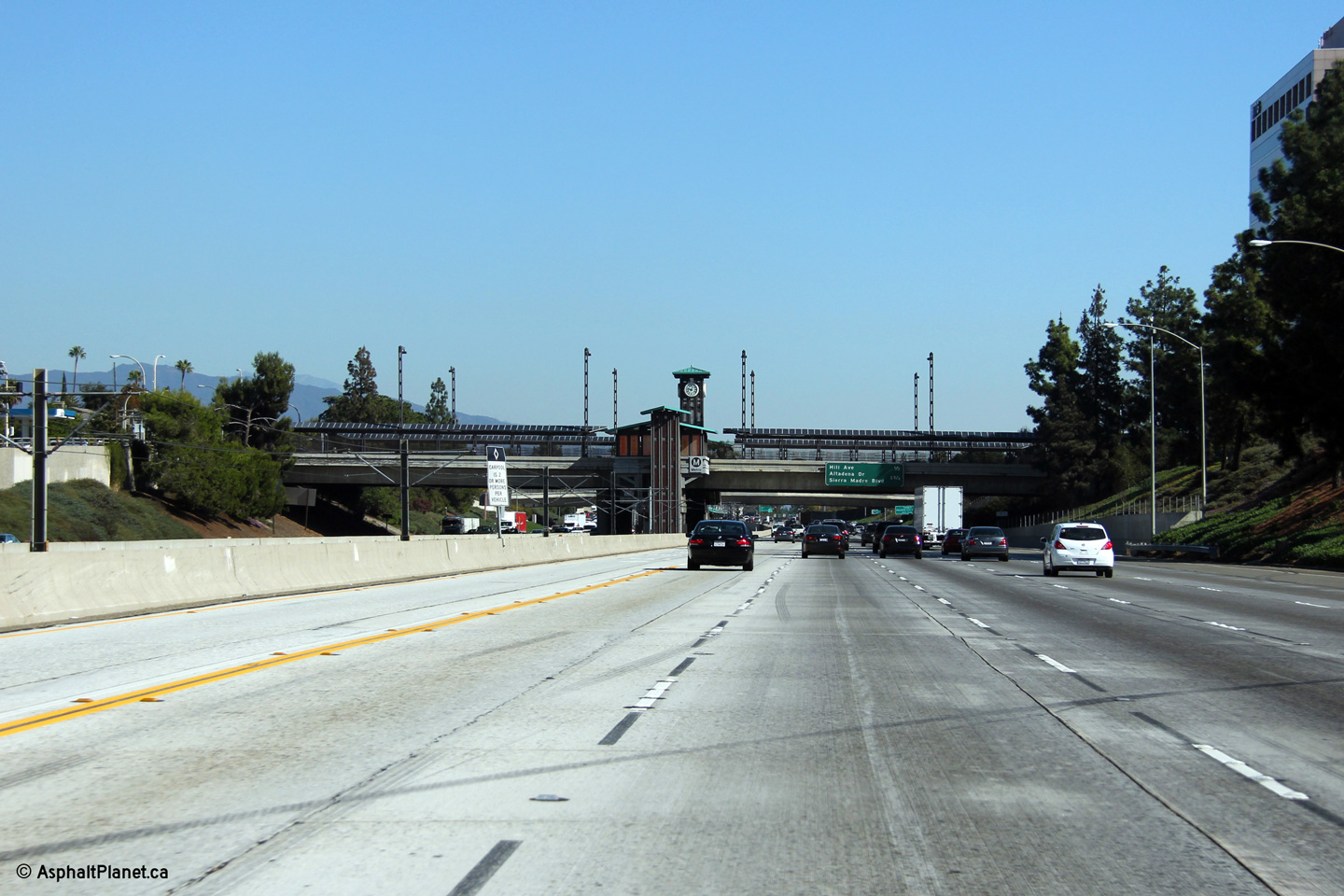
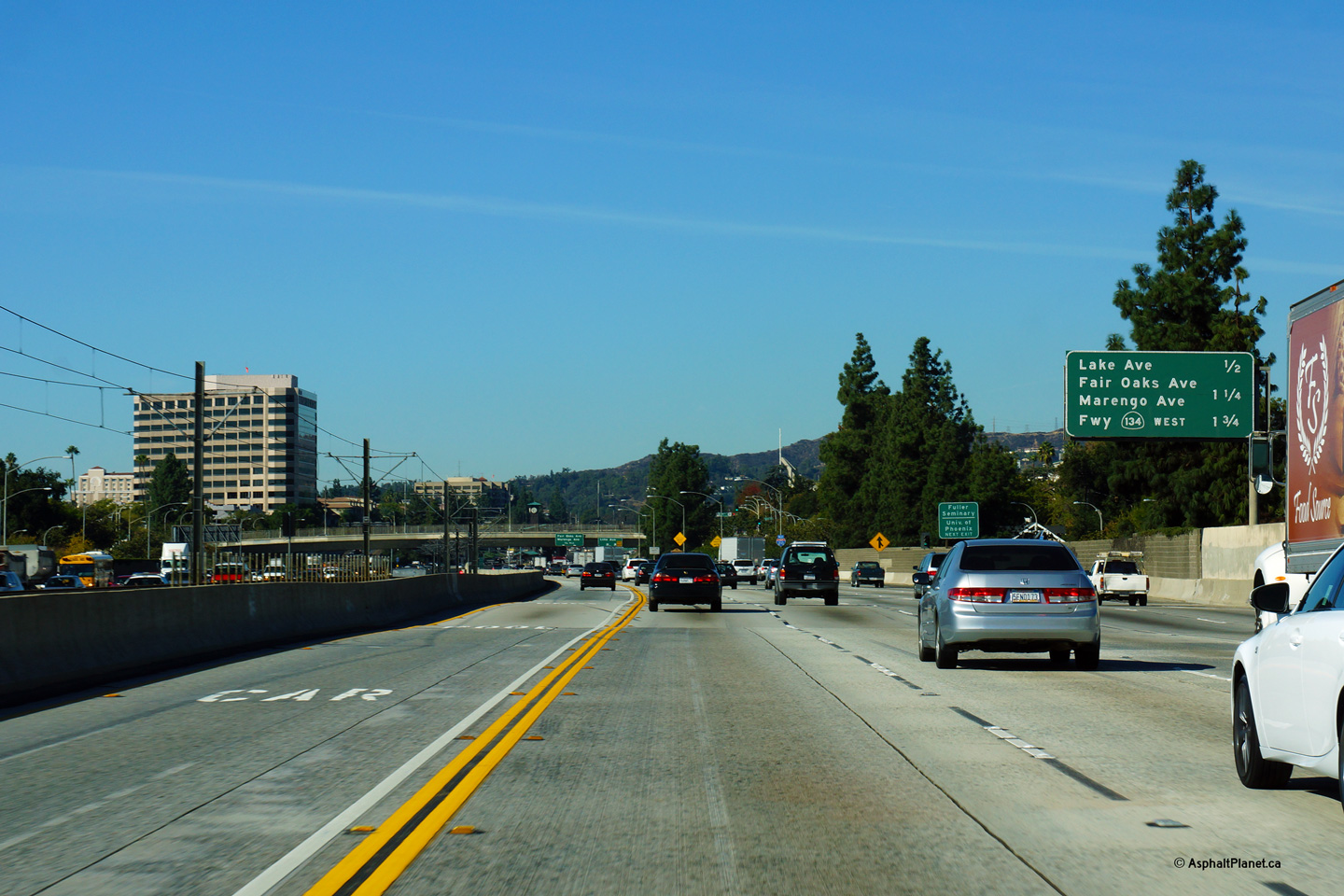
Los Angeles County |
Easterly view as I-210 passes beneath the Lake Avenue overpass. The Lake Station on Metro's Gold Line is situated in the median of the freeway at the Lake Street underpass. |
|
||
|
Date: 11/05/2013 |
High-res: (1440x960) (2400x1600) |
|||
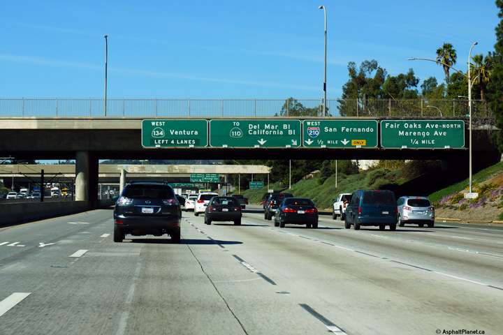
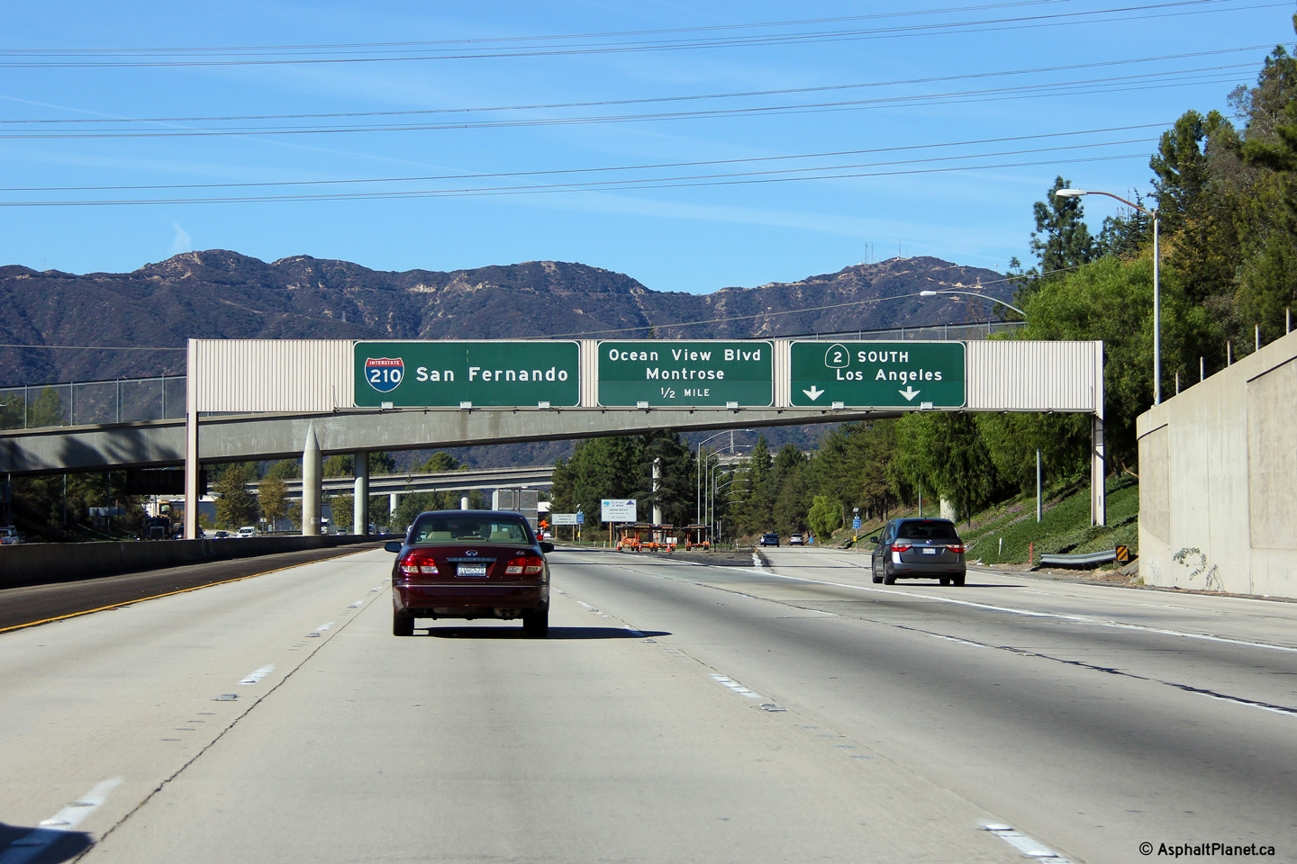
|
Los Angeles County |
Westbound lane assignment signage for the upcoming interchange between the Foothill Freeway, the stub of the Long Beach Freeway and the Ventura Freeway. Through traffic on I-210 must keep to the right at the upcoming interchange. |
|
||
|
Date: 11/06/2013 |
High-res: (1440x960) (2400x1600) |
|||
|
Los Angeles County |
Interchange sequence signage approaching the Lake Avenue interchange. |
|
||
|
Date: 11/06/2013 |
High-res: (1440x960) (2400x1600) |
|||
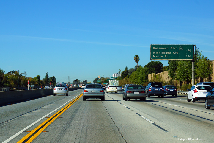
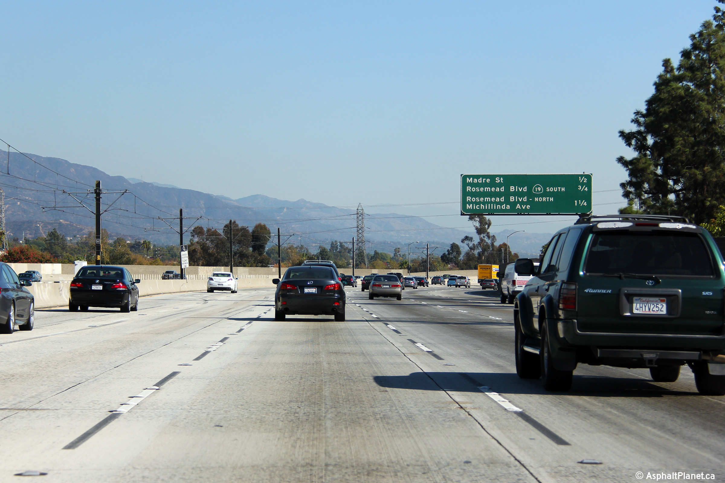
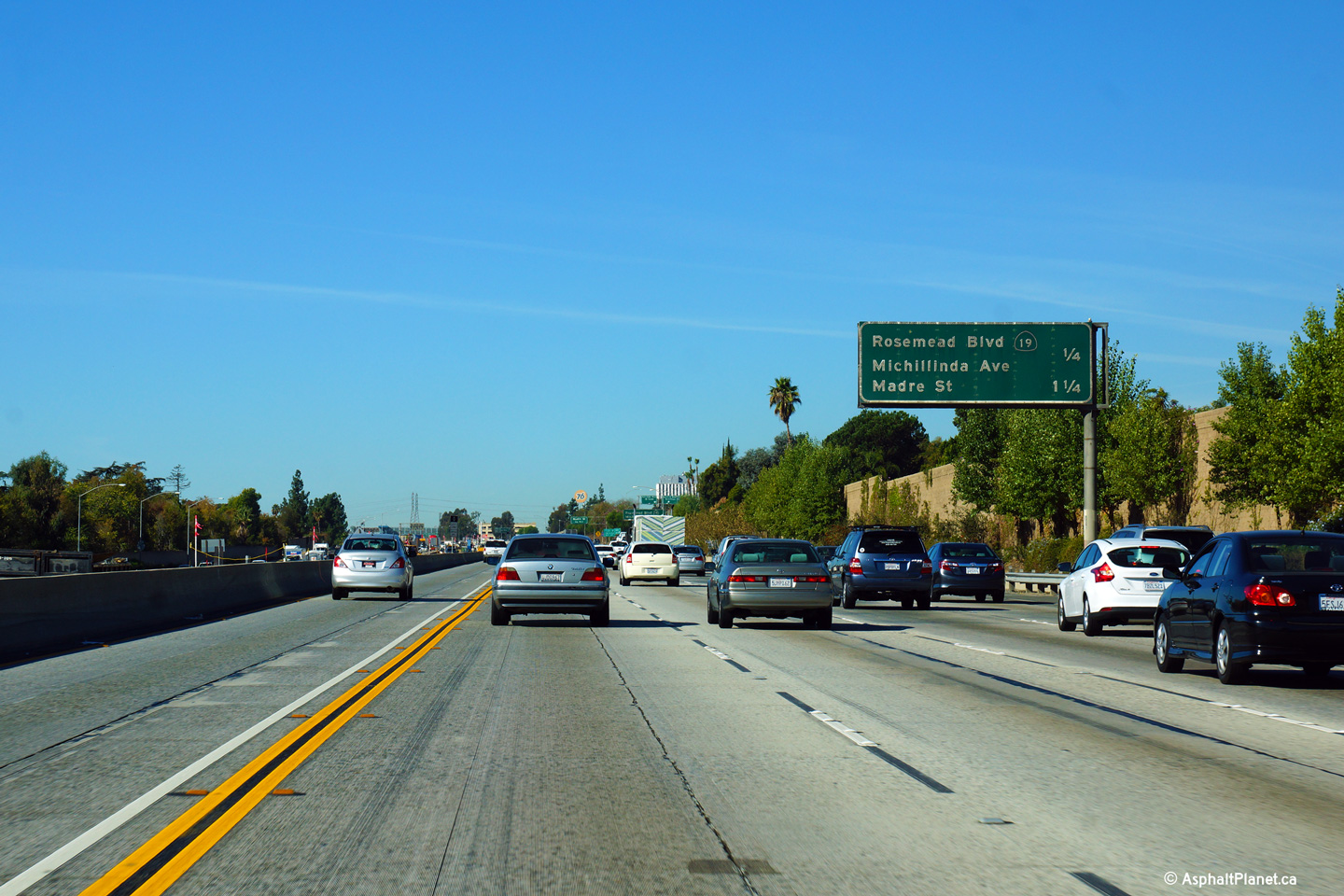
|
Los Angeles County |
Interchange sequence signage approaching the Madre Street interchange. |
|
||
|
Date: 11/05/2013 |
High-res: (1440x960) (2400x1600) |
|||
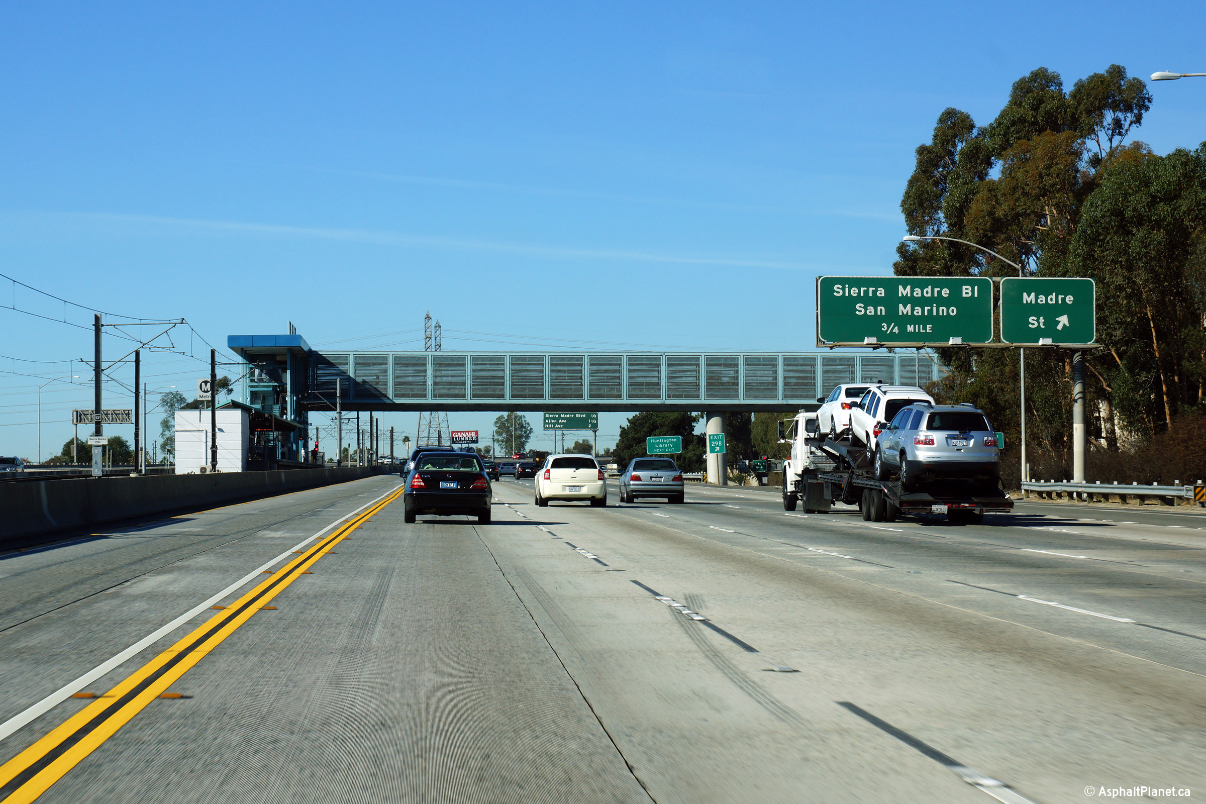
|
Los Angeles County |
This view looks westerly at the Madre Street off-ramp. When this photo was taken, the pictured Metro LRT station (Sierra Madre Villa Station) in the median of the Foothill Freeway was the eastern terminus of Metro's Gold Line LRT. An extension to Downtown Azusa is currently under construction that will see the line extended to the east that is expected to be operational in 2016. |
|
||
|
Date: 11/06/2013 |
High-res: (1440x960) (2400x1600) |
|||
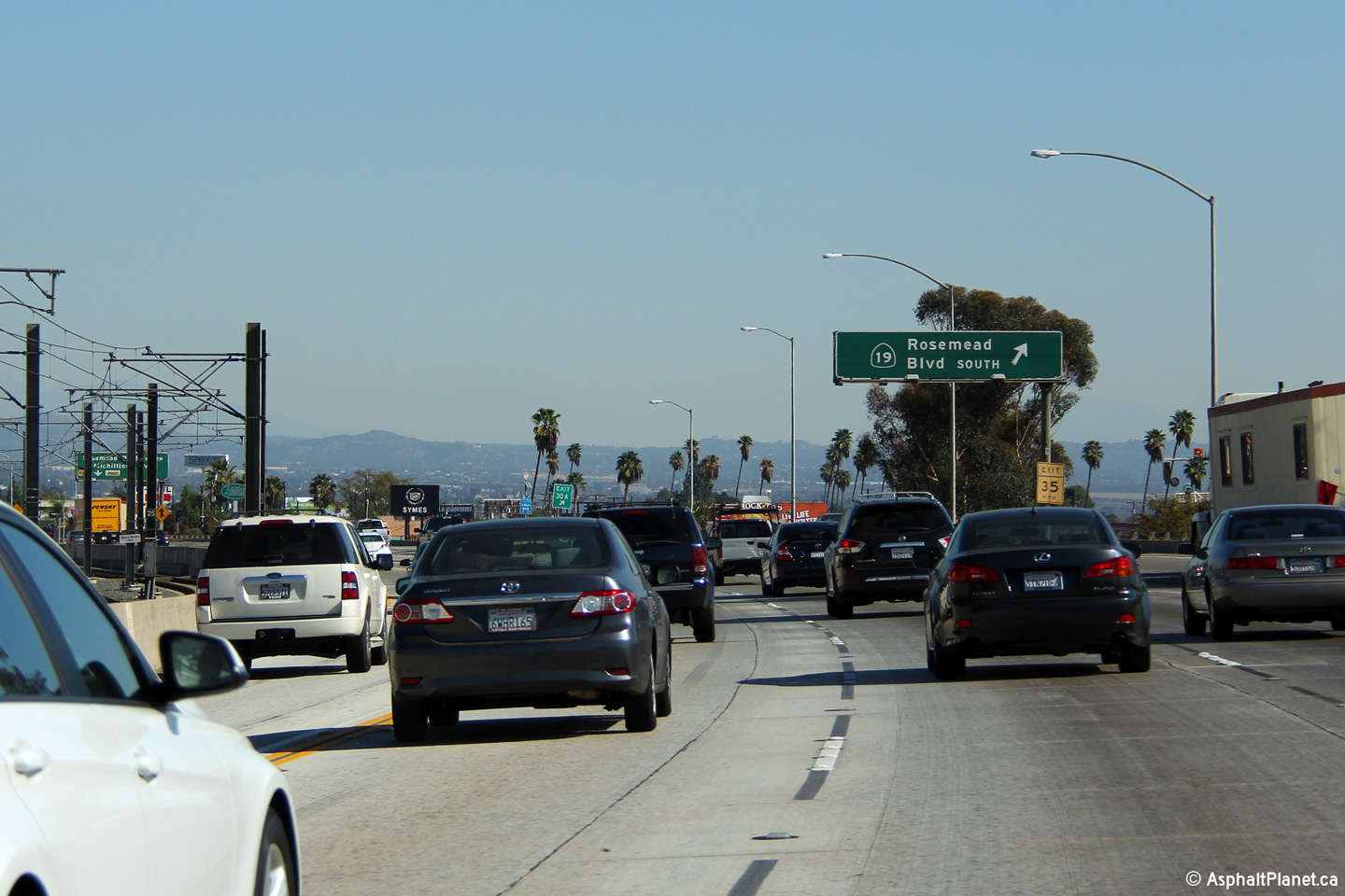
|
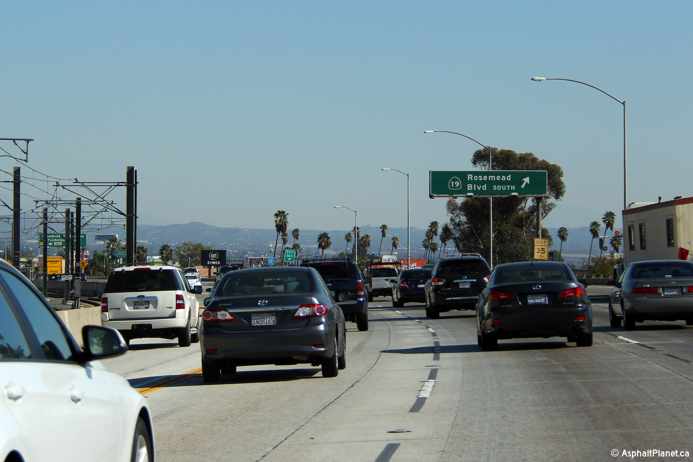
Los Angeles County |
Signage for the off-ramp to Rosemead Boulevard South from the eastbound lanes of the Foothill Freeway. Traffic destined to Rosemead Boulevard North must continue along the Foothill Freeway for the next off-ramp. |
|
||
|
Date: 11/05/2013 |
High-res: (1440x960) (2400x1600) |
|||
|
Los Angeles County |
Signage for the northbound exit to Madre Street from I-210 East. |
|
||
|
Date: 11/05/2013 |
High-res: (1440x960) (2400x1600) |
|||
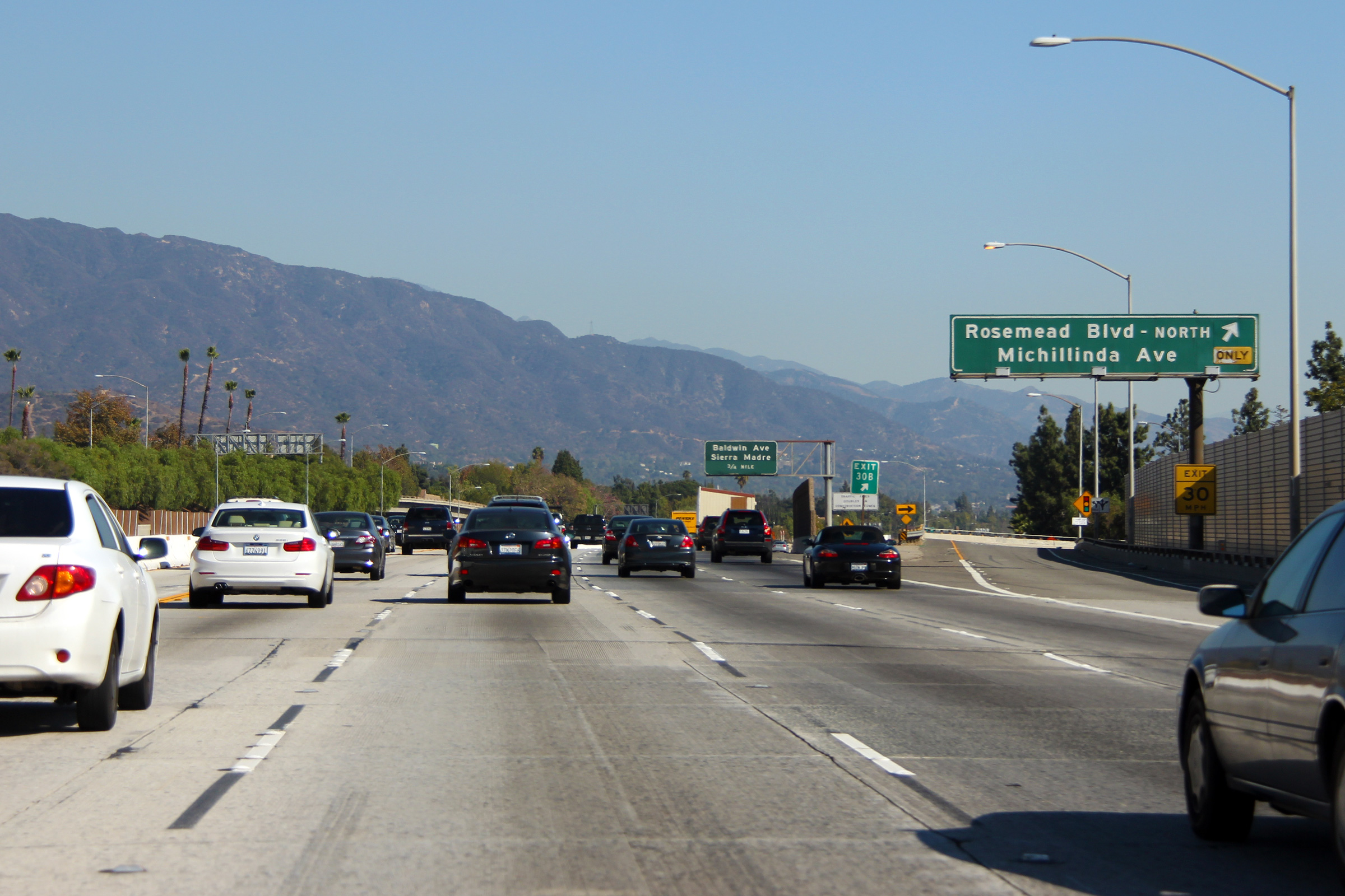
|
Los Angeles County |
Westbound interchange sequence signage approaching the Rosemead Boulevard interchange. |
|
||
|
Date: 11/06/2013 |
High-res: (1440x960) (2400x1600) |
|||
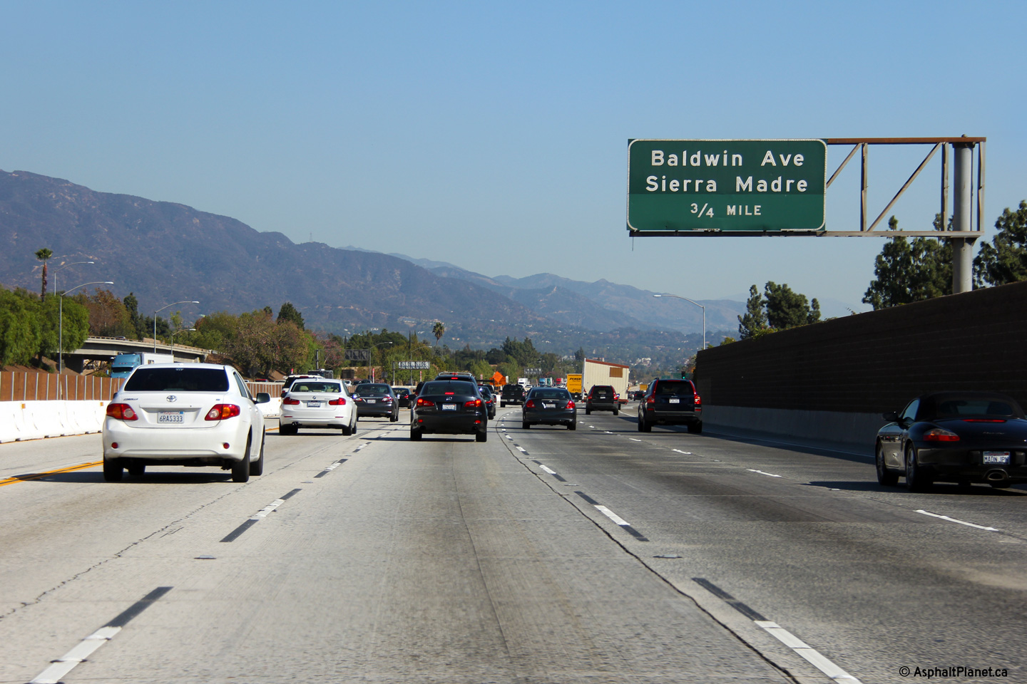
|
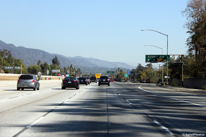
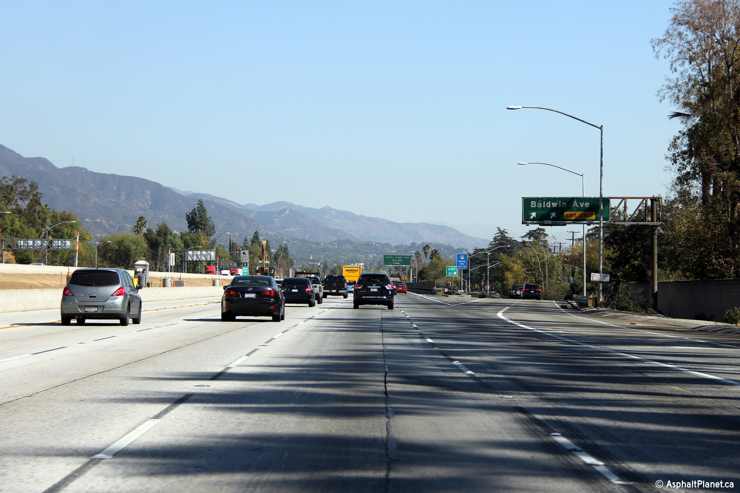
Los Angeles County |
Advanced signage for the ramp to Baldwin Avenue. |
|
||
|
Date: 11/05/2013 |
High-res: (1440x960) (2400x1600) |
|||
|
Los Angeles County |
Signage at the eastbound off-ramp to Baldwin Avenue. |
|
||
|
Date: 11/05/2013 |
High-res: (1440x960) (2400x1600) |
|||
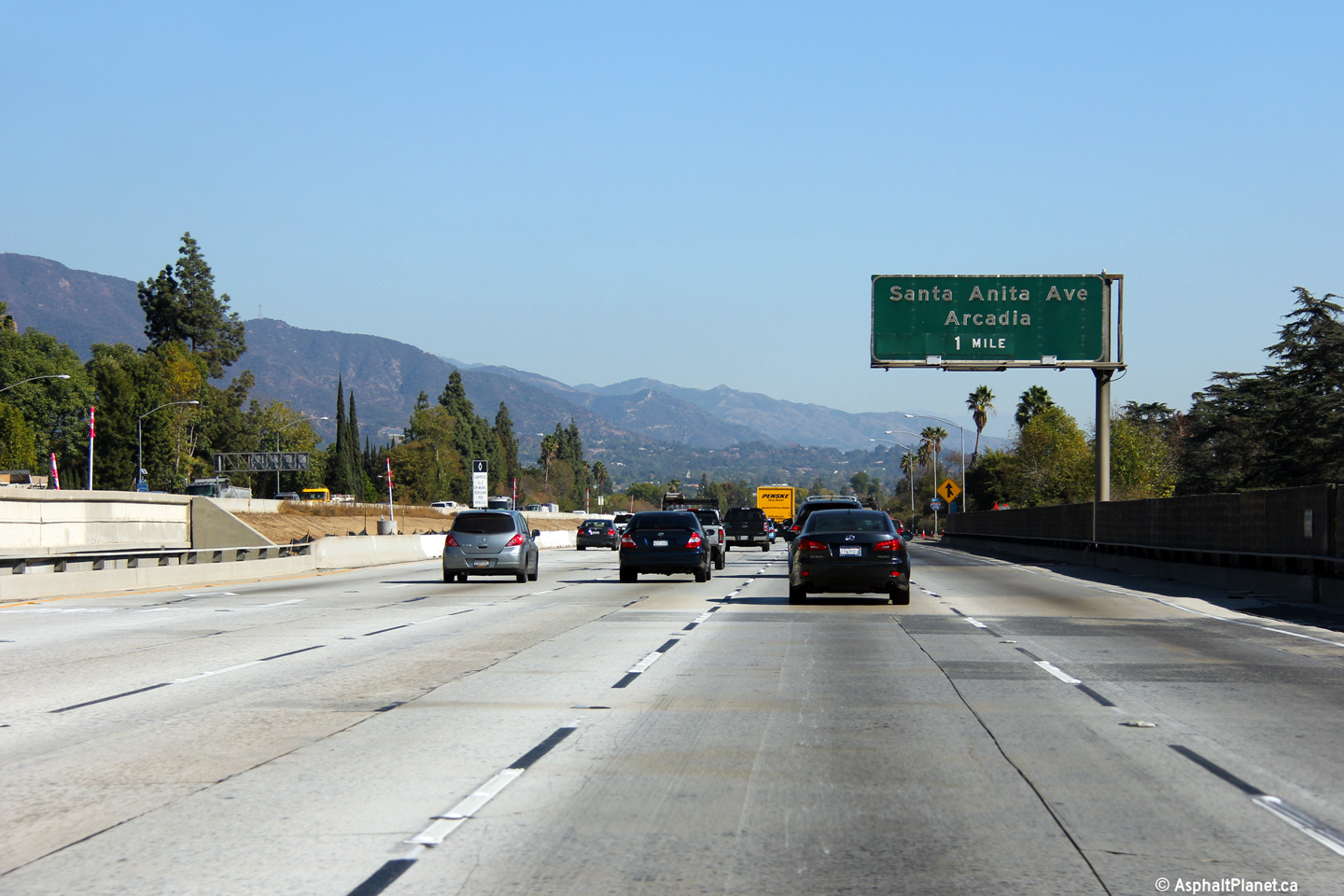
|
Los Angeles County |
Advanced signage for the ramp to Santa Anita Avenue located just beyond the Baldwin Street underpass. |
|
||
|
Date: 11/05/2013 |
High-res: (1440x960) (2400x1600) |
|||
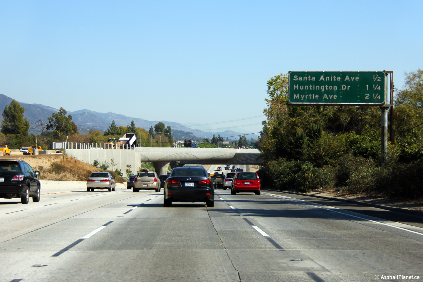
|
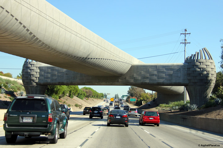
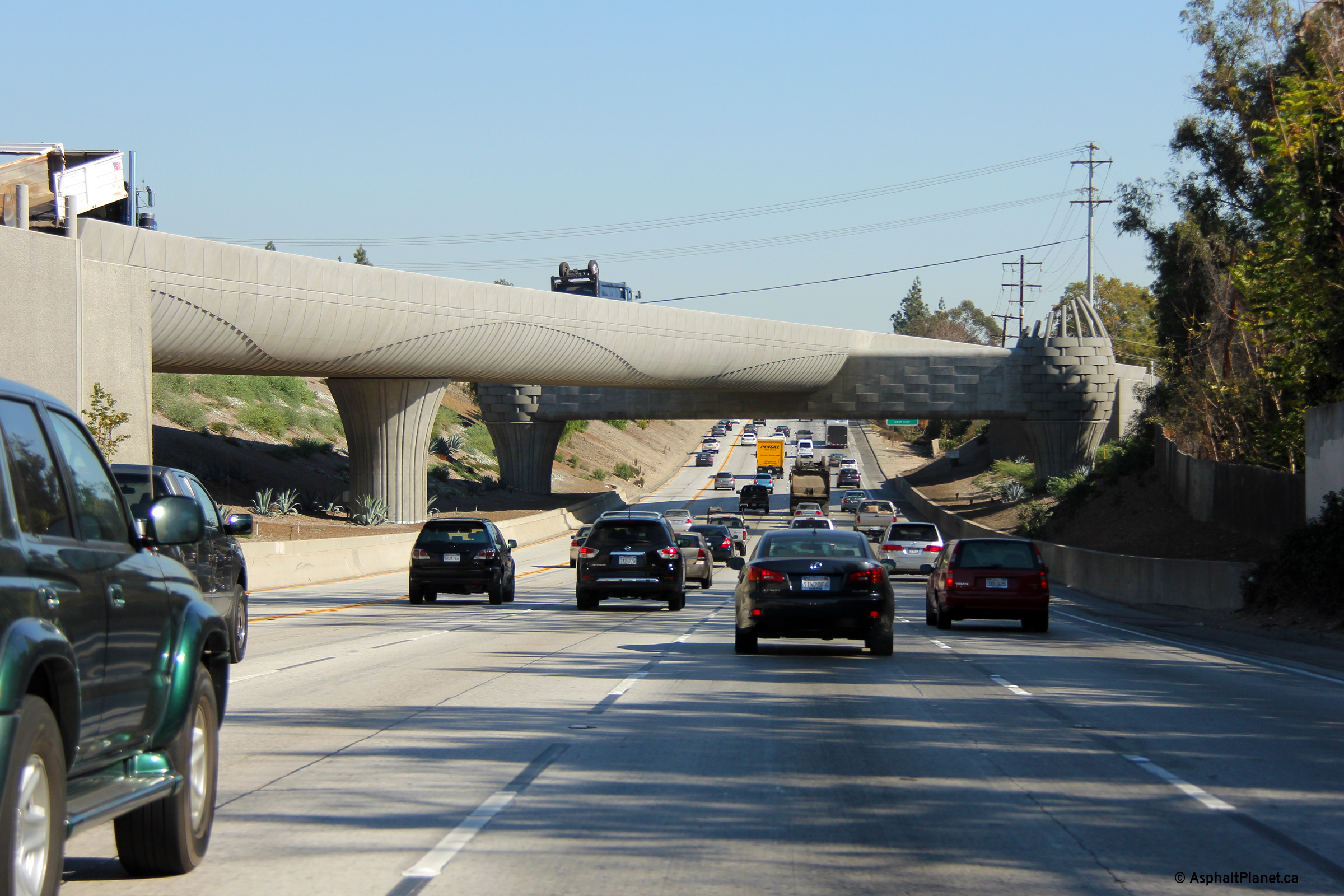
Los Angeles County |
An interchange sequence sign stands in front of the innovative structure that will carry Metro's future Gold Line LRT extension easterly from Pasadena. |
|
||
|
Date: 11/05/2013 |
High-res: (1440x960) (2400x1600) |
|||
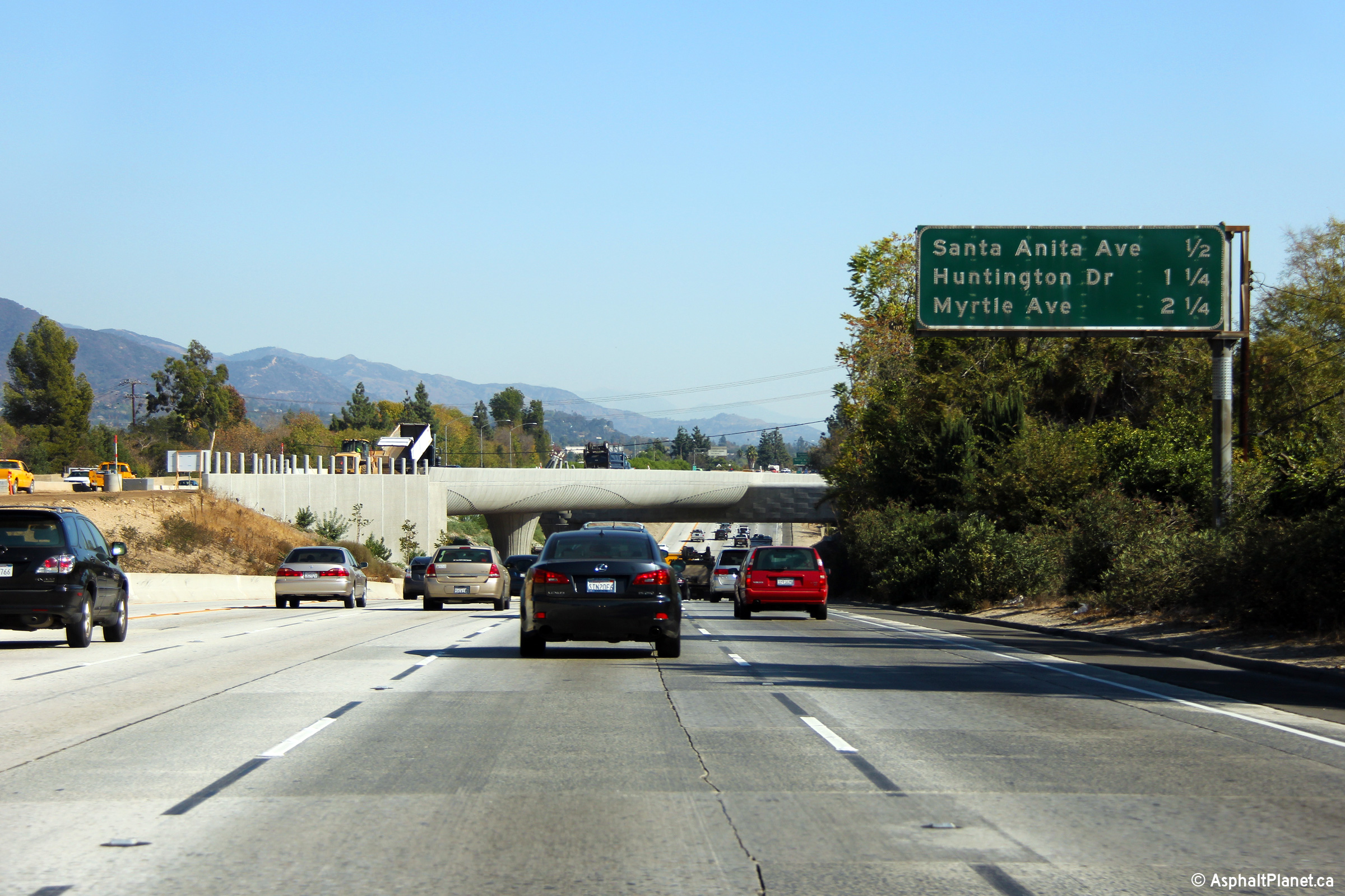
|
Los Angeles County |
Two views looking easterly as the eastbound lanes of I-210 pass beneath the future extension of Metro's Gold Line LRT. An attractive weaving pattern was molded into the structures concrete surface. The first phase of Metro's Gold Line LRT extension is scheduled to be completed by November 2016. |
|
||
|
High-res: (1440x960) (2400x1600) |
||||
|
|
||||
|
Date: 11/05/2013 |
High-res: (1440x960) (2400x1600) |
|||
|
Los Angeles County |
Advanced signage for the upcoming 605 Freeway interchange. |
|
||
|
Date: 11/05/2013 |
High-res: (1440x960) (2400x1600) |
|||
|
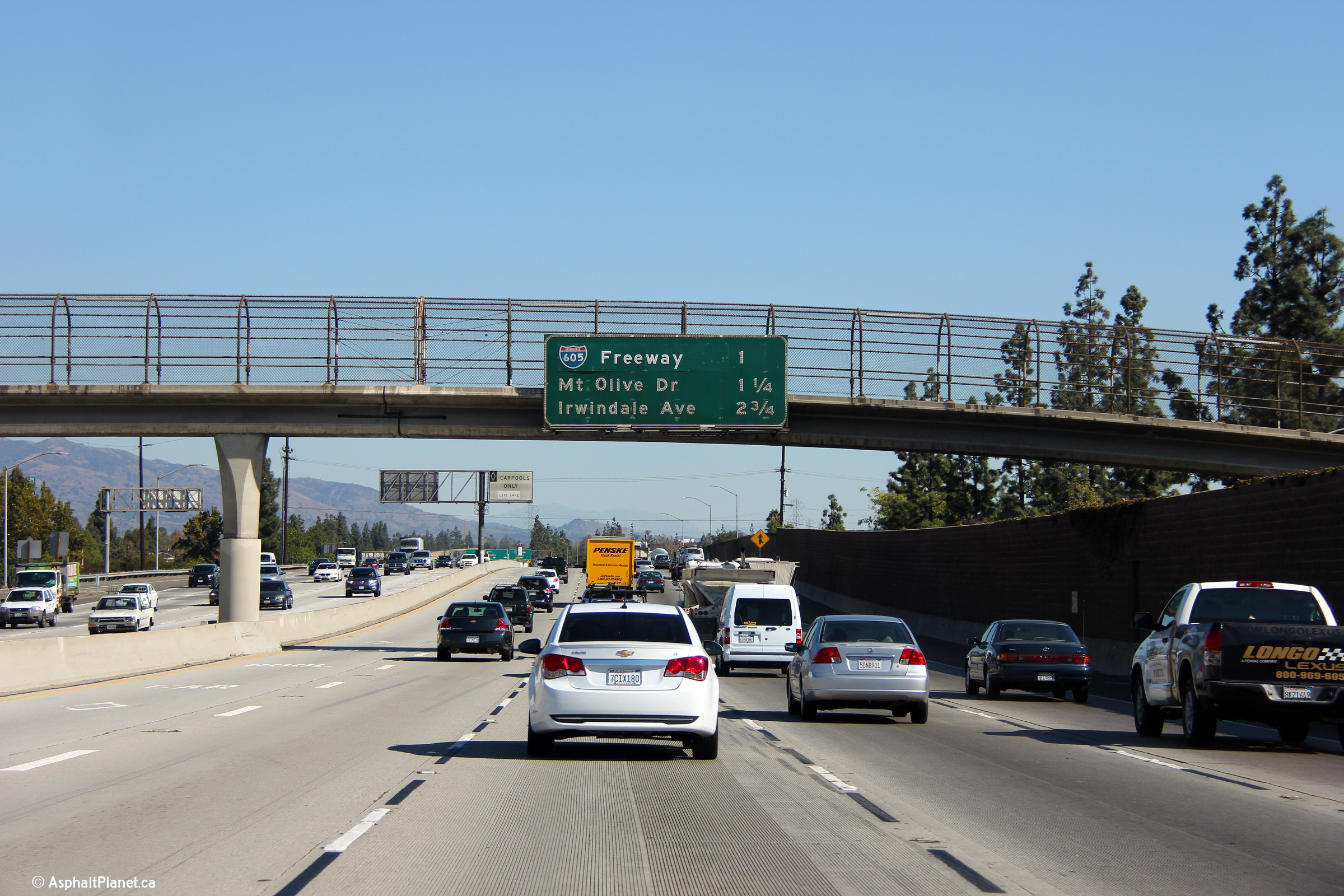
Los Angeles County |
An interchange sequence sign has been affixed to the pictured Duarte Pedestrian overpass. The text for the 605 freeway has been overlaid -- I have no idea what would have been written underneath, perhaps a reference to the 605 as the San Gabriel River Freeway. |
|
||
|
Date: 11/05/2013 |
High-res: (1440x960) (2400x1600) |
|||
|
Los Angeles County |
The former button-copy signage on the advanced pull-through gantry for the 605 Freeway interchange has been replaced with reflective signage. |
|
||
|
Date: 11/05/2013 |
High-res: (1440x960) (2400x1600) |
|||
|
Los Angeles County |
Easterly view as the ramp to the 605 Freeway diverges from the mainline lanes of I-210. |
|
||
|
Date: 11/05/2013 |
High-res: (1440x960) (2400x1600) |
|||
|
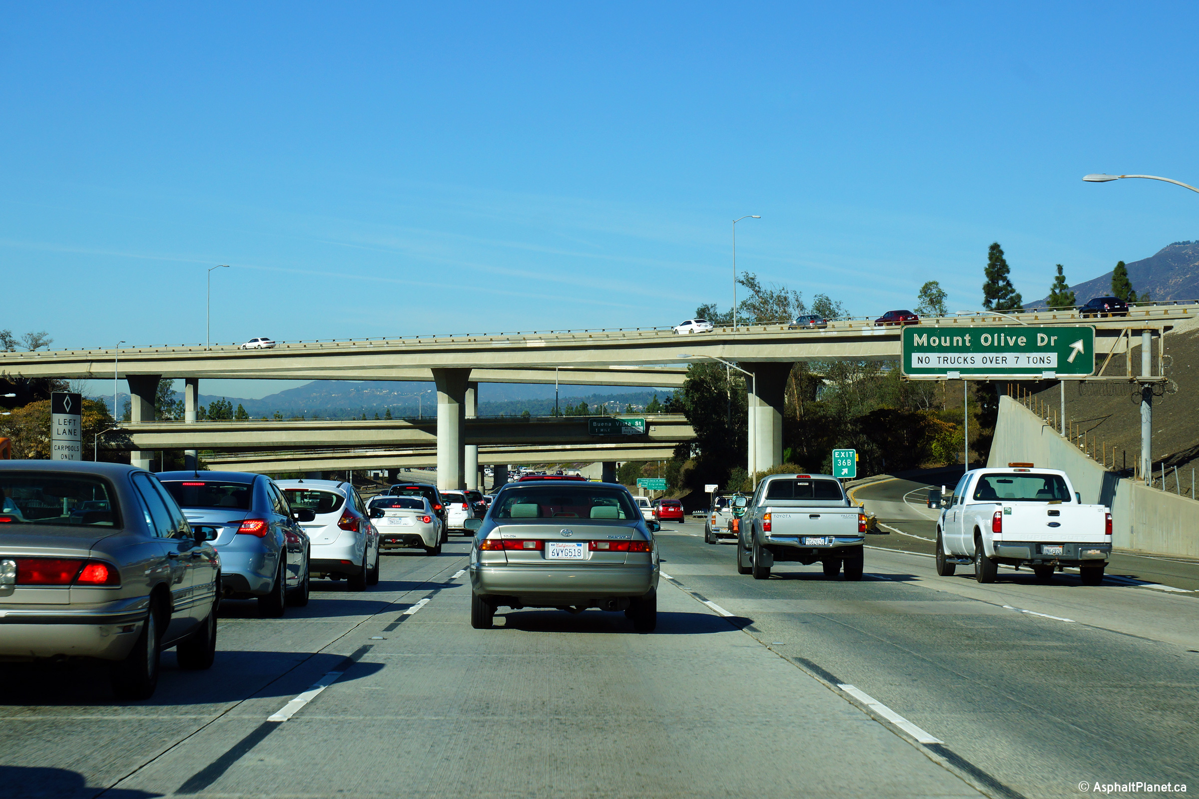
The San Gabriel River Freeway (I-605) carries traffic southerly from the 210 Freeway to the San Diego Freeway at Seal Beach. Click here for Interstate 605 Images. |
||||
|
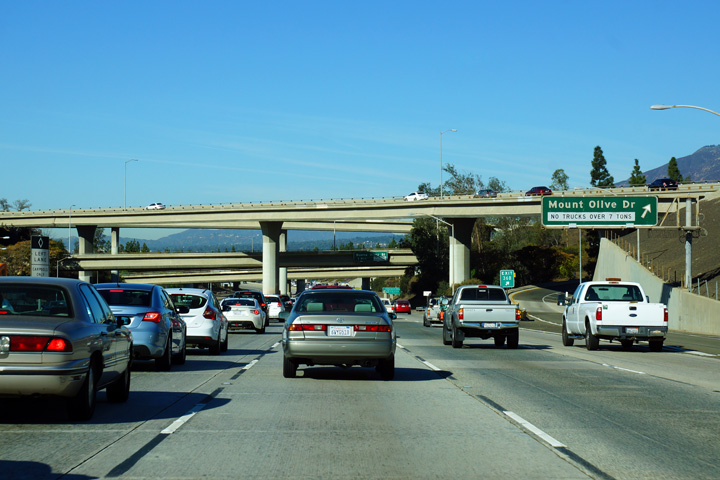
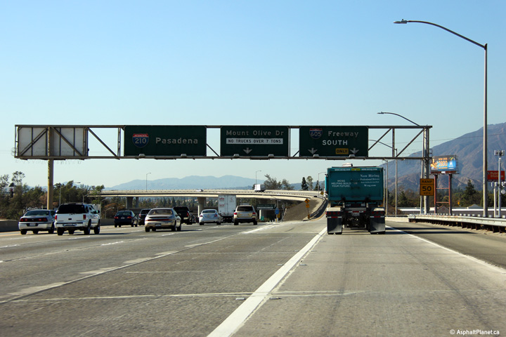
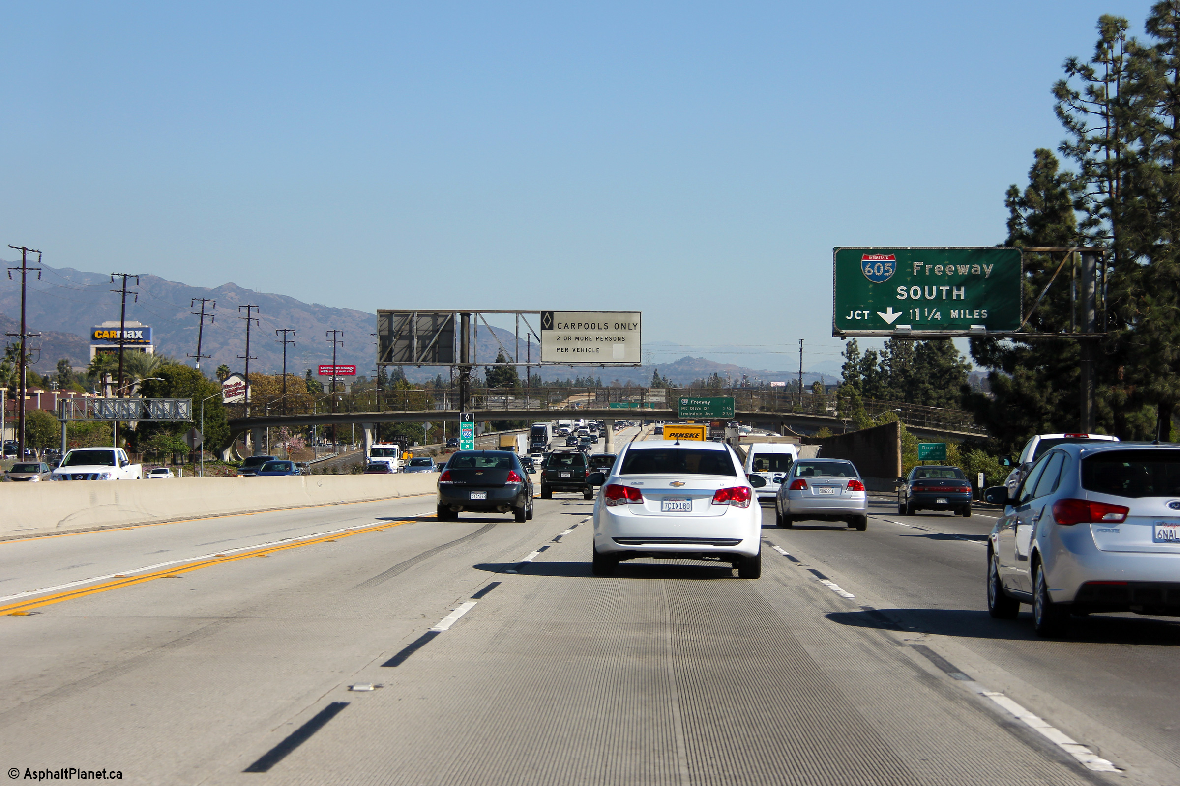
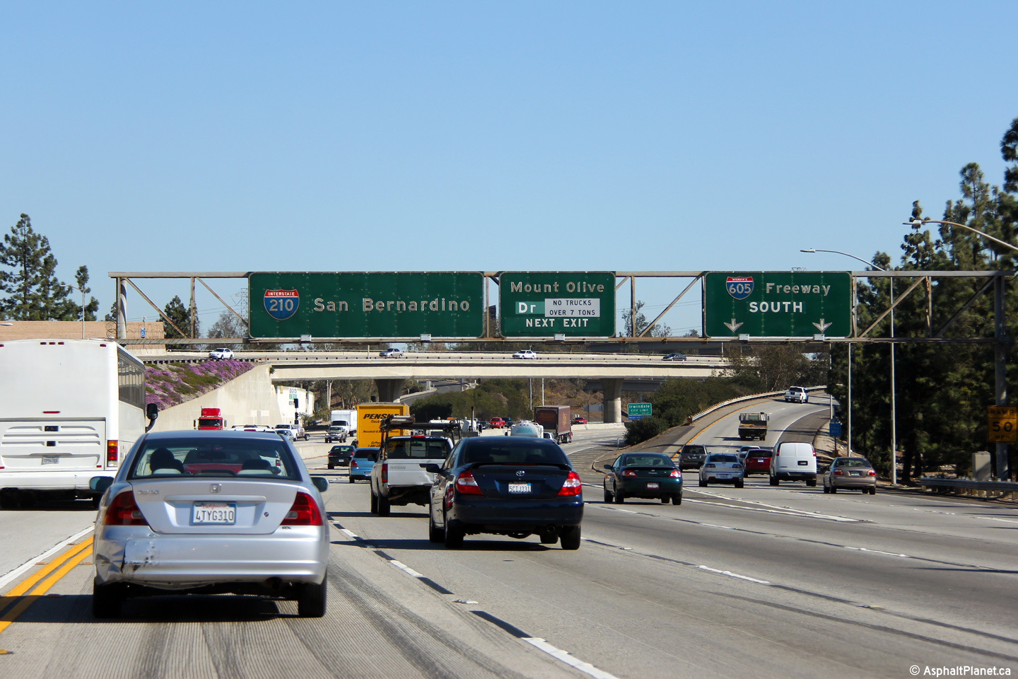
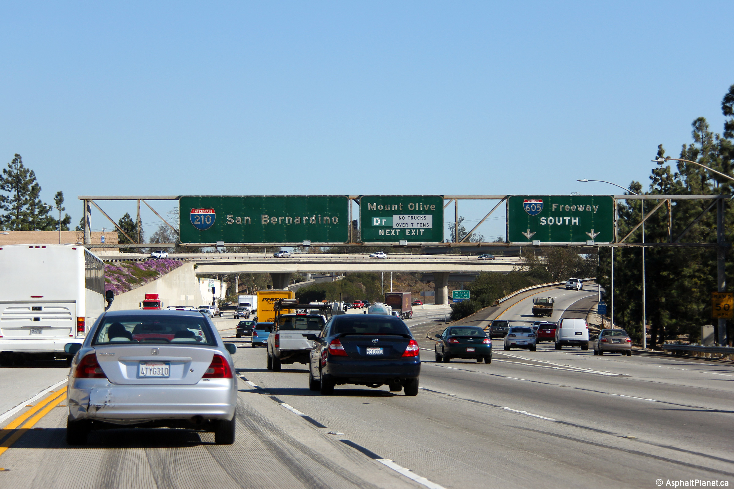
Los Angeles County |
Westbound signage for the off-ramp to Mount Olive Road. Despite the ramp meters stopping traffic from the ramp from I-605 North to the 210 West, traffic on the 210 slowed through the 605 interchange. This photo was taken at the end of the morning rush hour. |
|
||
|
Date: 11/06/2013 |
High-res: (1440x960) (2400x1600) |
|||
|
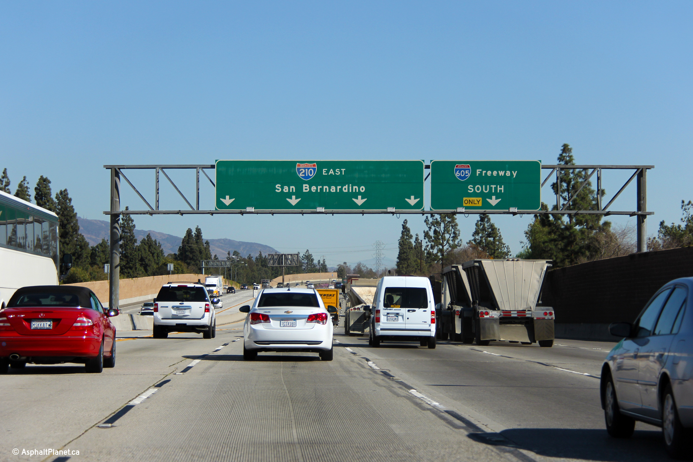
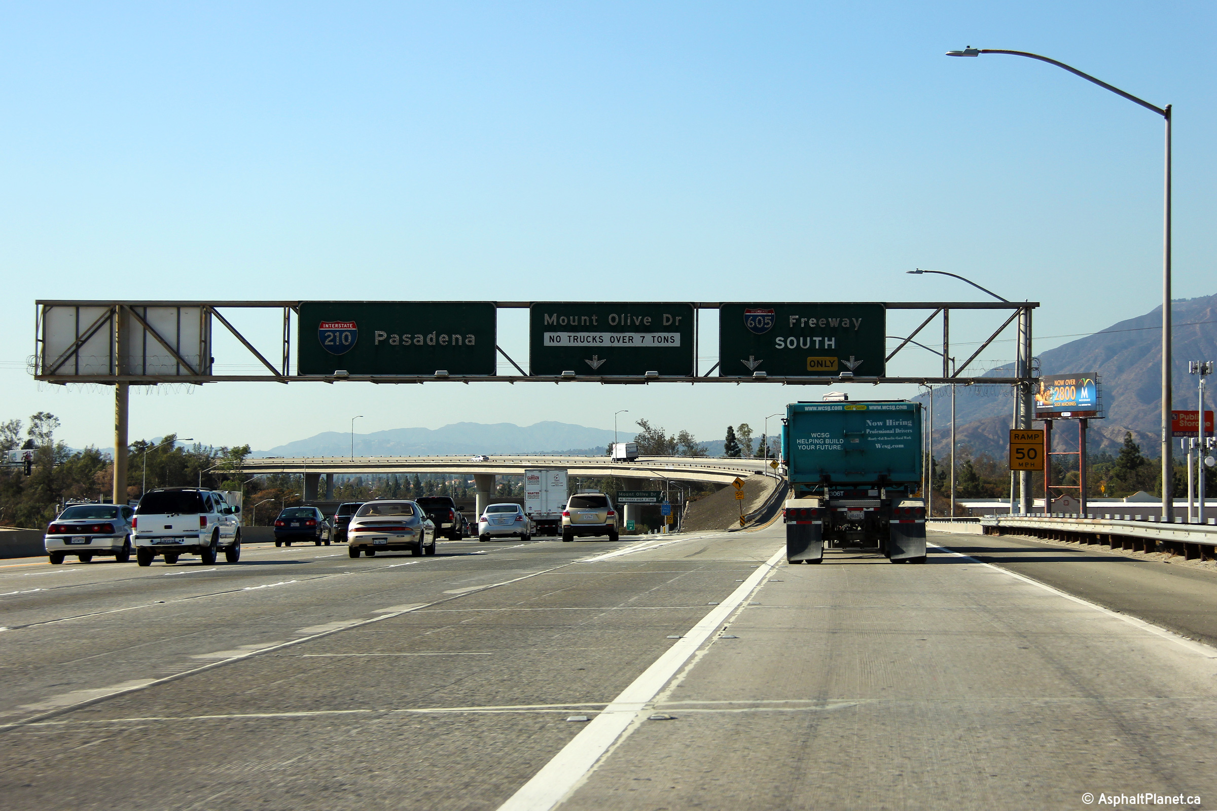
Los Angeles County |
Westbound signage at the ramp to I-605 South. |
|
||
|
Date: 11/05/2013 |
High-res: (1440x960) (2400x1600) |
|||
|
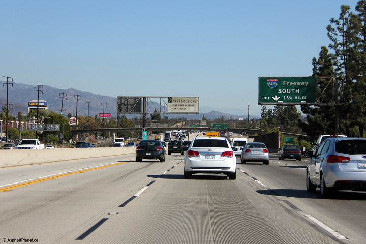
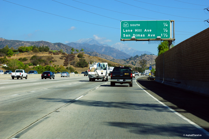
Los Angeles County |
Advanced signage for the 57 Freeway interchange. |
|
||
|
Date: 10/30/2013 |
High-res: (1440x960) (2400x1600) |
|||
|
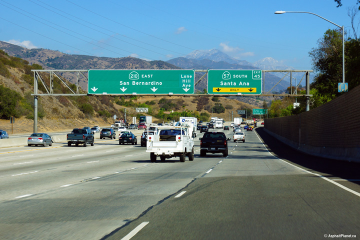
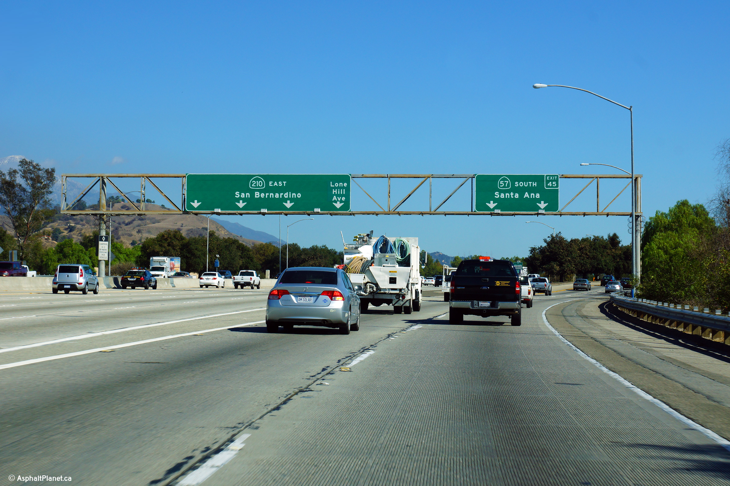
Los Angeles County |
Interchange sequence signage in advance of the 57 Freeway interchange |
|
||
|
Date: 10/30/2013 |
High-res: (1440x960) (2400x1600) |
|||
|
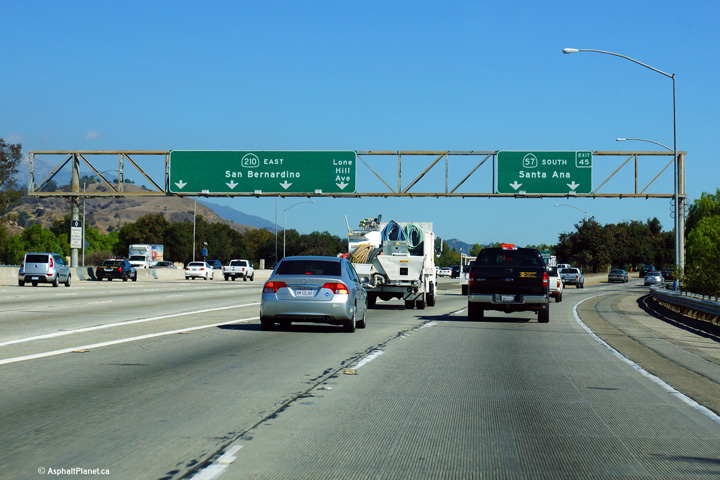
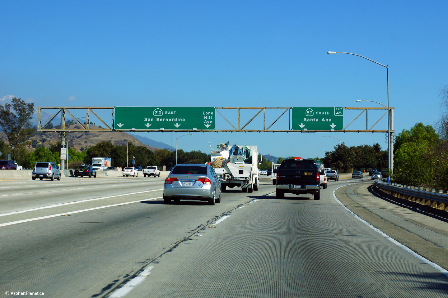
Los Angeles County |
Signage at the eastbound off-ramp to the 57 Freeway. Despite being a full freeway east of the 57 Freeway, I-210 ends at this interchange and is known as SR-210 east of this point to where it meets the 10 Freeway in Pomona. Before I-210 was extended easterly to Redlands, it turned south at this junction following today's 57 Freeway until the 10 Freeway three miles to the south. |
|
||
|
Date: 10/30/2013 |
High-res: (1440x960) (2400x1600) |
|||
<- I-205
CA Highways
I-215 ->
AsphaltPlanet.ca
© 2010-2014 AsphaltPlanet.ca.
Scott@asphaltplanet.ca
Page Created: December 30, 2013.
Last Updated: December 30, 2013.


