AsphaltPlanet.ca > California > State Route 2
Pictures on this page are arranged in order from south to north. CA-2
North photos are left-aligned in the last column, while CA-2 South photos are right-aligned.
Center-line pictures are centered within the last column.
|
Location |
Description |
Photo |
||
|
North- |
South- |
|||
|
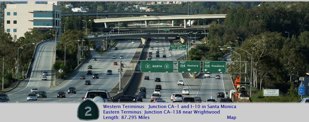
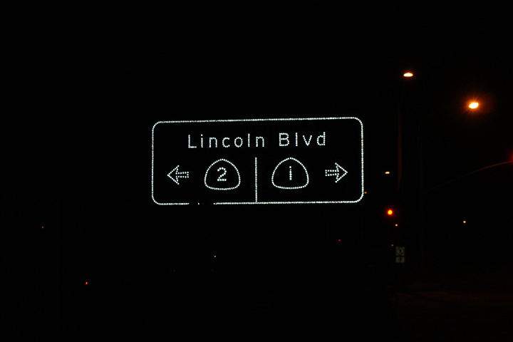
Los Angeles County |
Signage at the off-ramp from the Interstate 10 Eastbound. At this intersection, Highway 1 (The Pacific Coast Highway) departs southerly along Lincoln Boulevard, bound for Orange County. Highway 2 formerly began its journey easterly at Lincoln Boulevard, bound for the Los Angeles Crest Highway via Santa Monica Boulevard -- also known as historic U.S. Route 66. I say used to begin its journey at Lincoln Boulevard, because according to the author's 2009 Rand McNally Los Angeles Road Atlas, Highway 2's western terminus is now at the Santa Monica City Limits, and not at Lincoln Boulevard as this sign suggests. |
 |
||
|
Date: 3/27/2010 |
||||
|
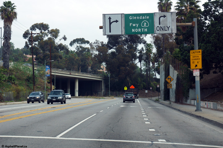
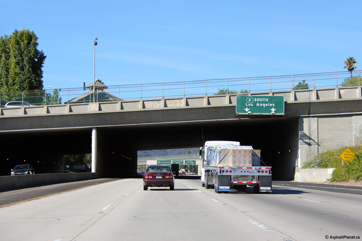
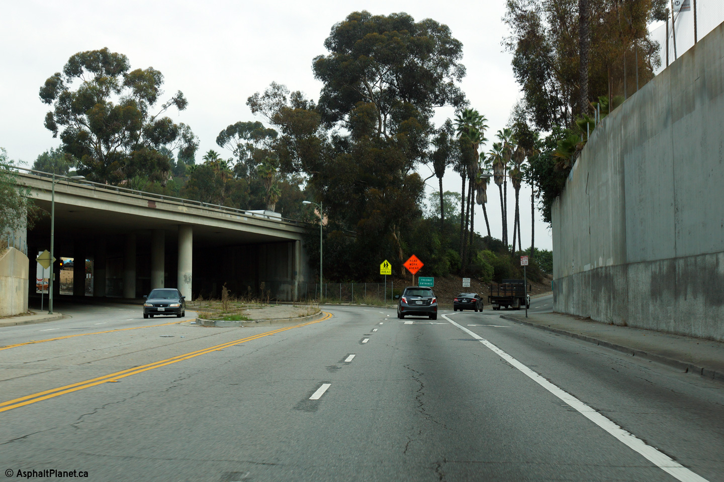
Los Angeles County |
Two views looking northerly along Glendale Boulevard at the start of the Glendale Freeway. Through traffic must follow the ramp to the right to follow the Glendale Freeway. |
 |
||
|
High-res: (1440x960) (2400x1600) |
||||
 |
||||
|
Date: 12/11/2014 |
High-res: (1440x960) (2400x1600) |
|||
|
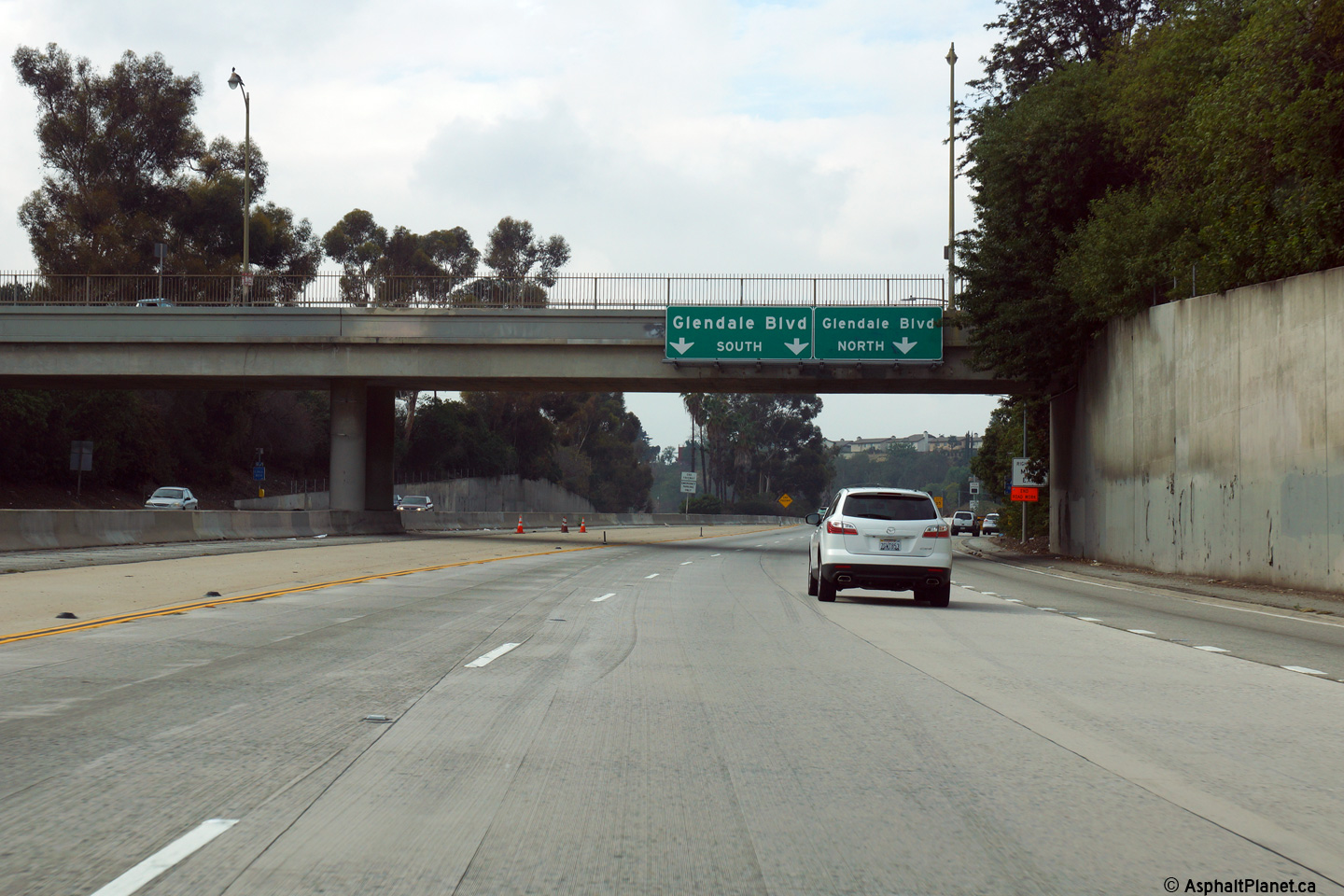
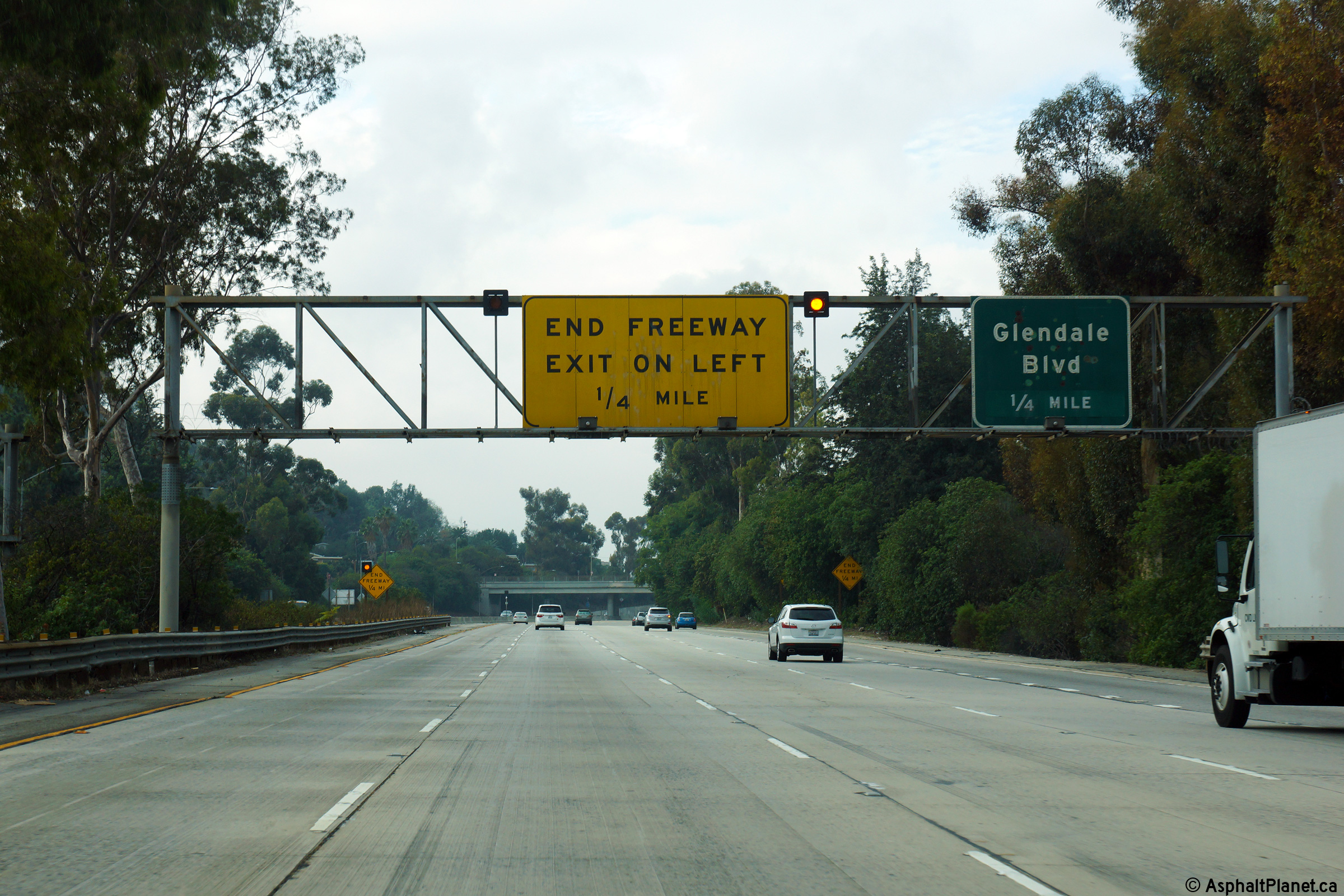
Los Angeles County |
Overhead signage affixed the the Oak Glen Place overpass denoting the lane assignments for Glendale Boulevard. |
 |
||
|
Date: 12/11/2014 |
High-res: (1440x960) (2400x1600) |
|||
|
Los Angeles County |
Westbound view along Interstate 210 as the ramp to the Glendale Freeway departs on the right hand side. The Glendale Freeway carries California Highway 2 Southerly towards Interstate 5 and Downtown Los Angeles. The Glendale Freeway represents a short freeway segment along Highway 2 which is ordinarily a lowly surface street. |
 |
||
|
Date: 12/11/2014 |
High-res: (1440x960) (2400x1600) |
|||
|
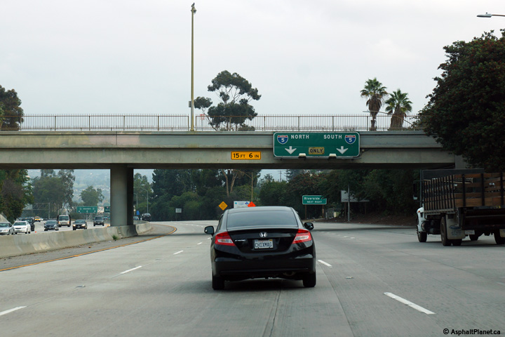
Los Angeles County |
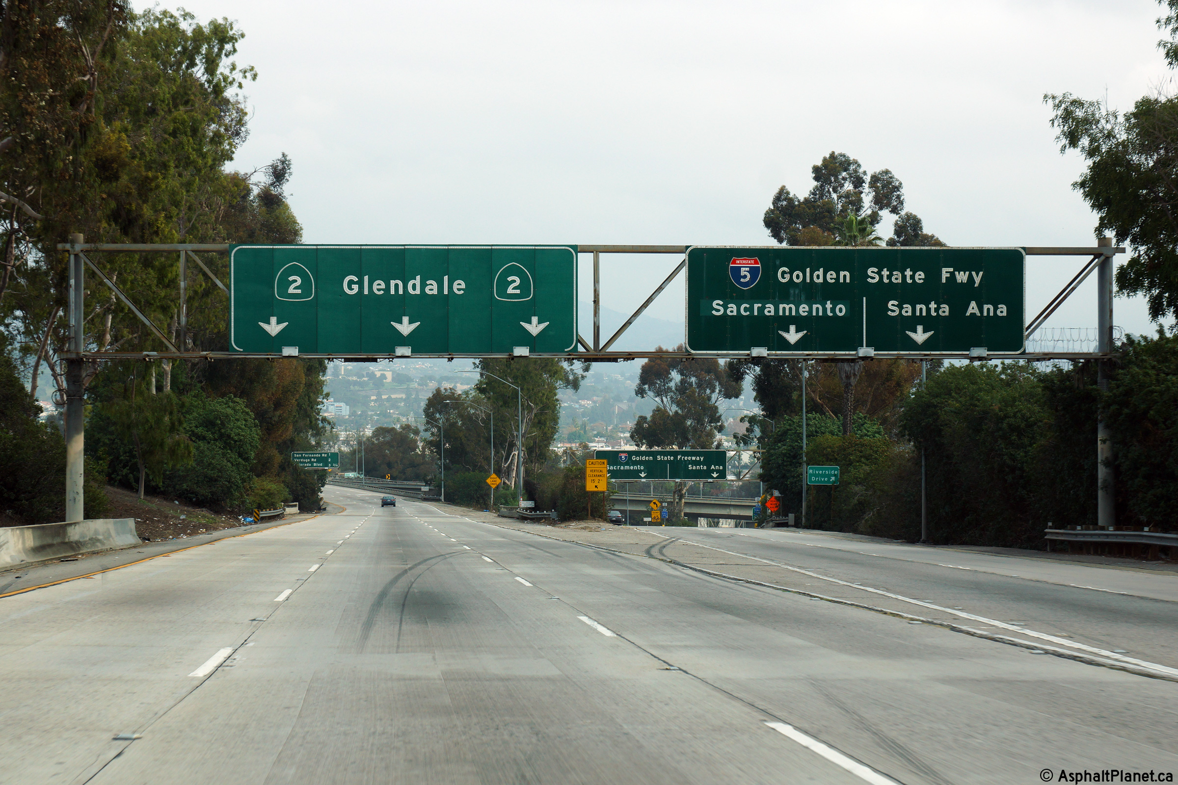
Advanced signage for the upcoming Interstate 5 interchange. |
 |
||
|
Date: 12/11/2014 |
High-res: (1440x960) (2400x1600) |
|||
|
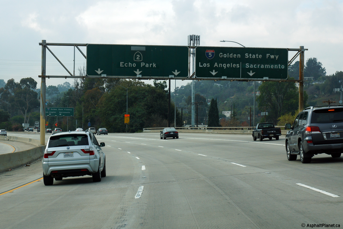
Los Angeles County |
Northbound signage at the off-ramp to the Golden State Freeway. |
 |
||
|
Date: 12/11/2014 |
High-res: (1440x960) (2400x1600) |
|||
| The 5 Freeway is the principal north-south freeway through California. Click here for Interstate 5 Images. | ||||
|
Los Angeles County |
Southbound signage at the I-5 interchange. The Glendale Freeway ends about 1 mile south of this interchange. |
 |
||
|
Date: 12/11/2014 |
High-res: (1440x960) (2400x1600) |
|||
|
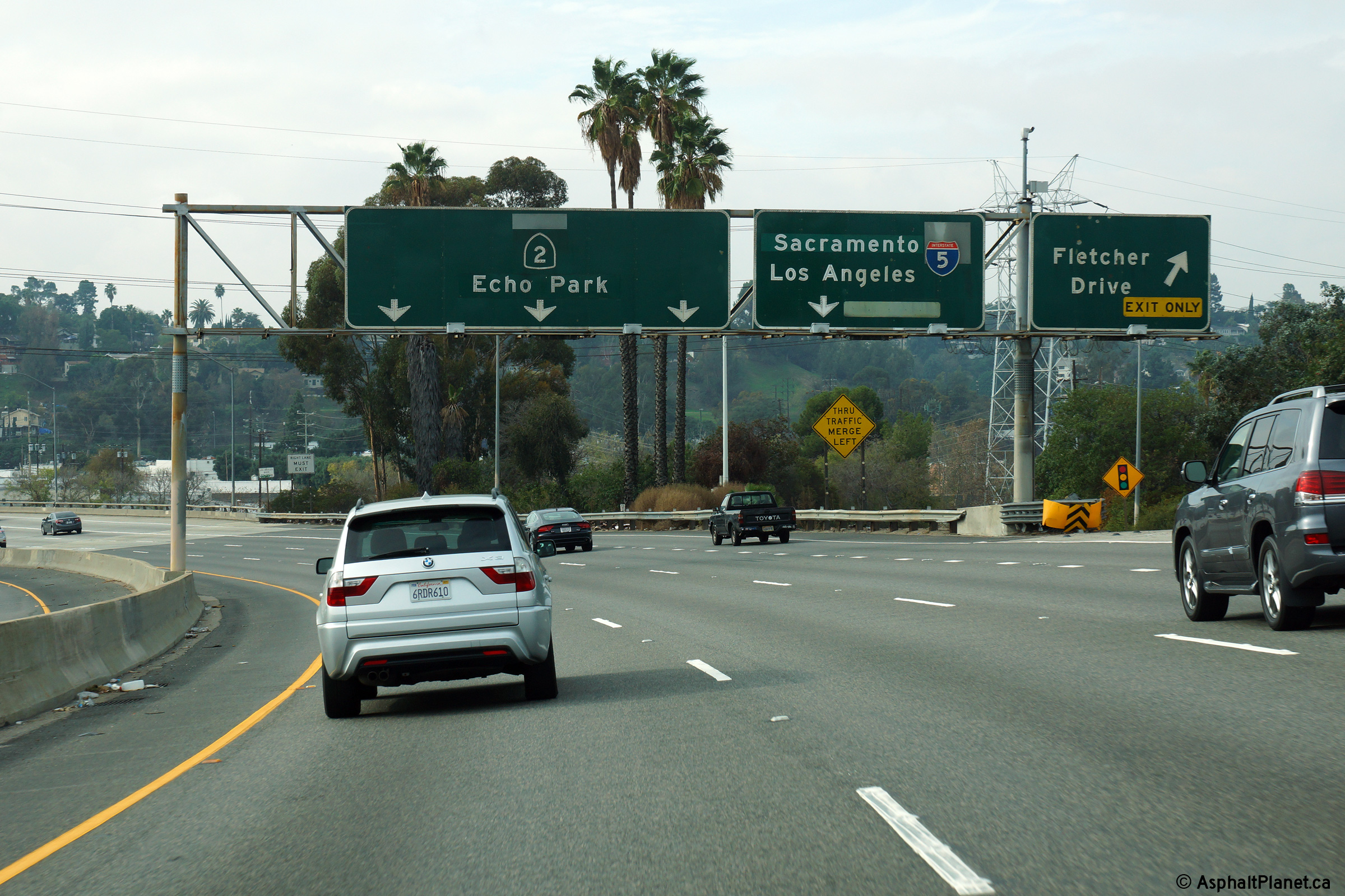
Los Angeles County |
Overhead signage, southbound, at the off-ramp to Fletcher Drive. |
 |
||
|
Date: 12/11/2014 |
High-res: (1440x960) (2400x1600) |
|||
|
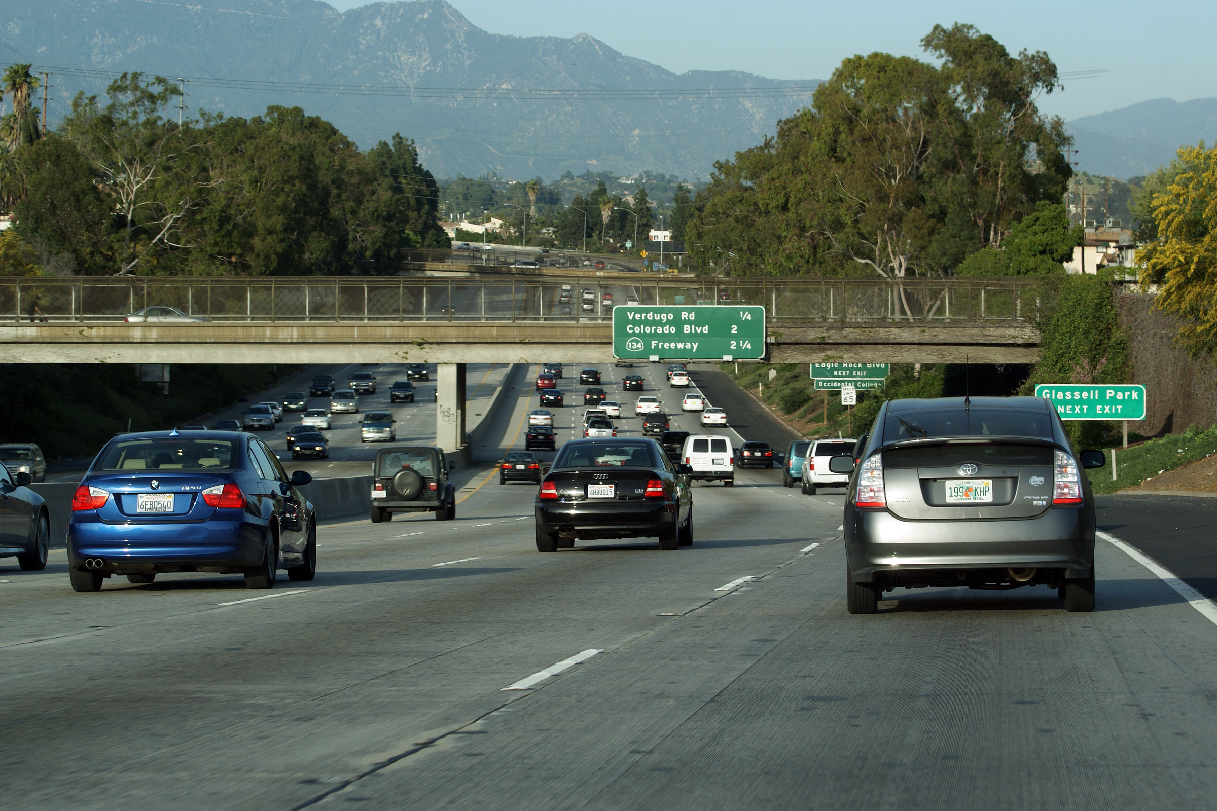
Los Angeles County |
Northbound view taken about halfway between the San Fernando Road and Verdugo Road interchanges along the Glendale Freeway. From Interstate 5 northerly, the Glendale Freeway climbs slowly higher and higher in elevation as it approaches the high San Gabriel Mountains. The San Gabriel Range is visible in the distance. Later, Highway 2 is one of the few highways in Los Angeles County that traverses the mountain range as a non-freeway high mountain road. |
 |
||
|
Date: 3/26/2010 |
High-res: (1440x960) (2400x1600) |
|||
|
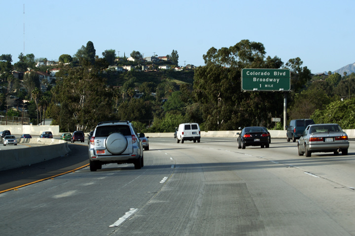
Los Angeles County |
Advanced signage for the Colorado Boulevard interchange. |
 |
||
|
Date: 3/26/2010 |
||||
|
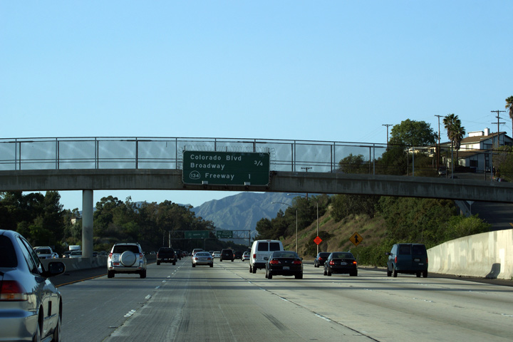
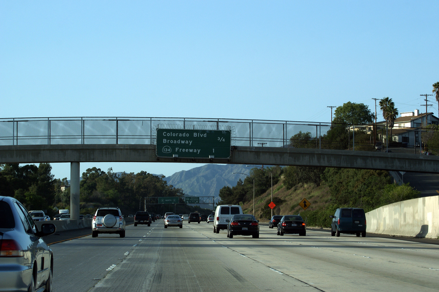
Los Angeles County |
Overhead advanced next exit signage affixed to a pedestrian bridge along the Glendale Freeway. |
 |
||
|
Date: 3/26/2010 |
||||
|
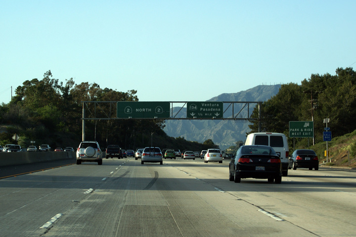
Los Angeles County |
The first round of lane assignment signage along California Highway 2 approaching the Highway 134 interchange. |
 |
||
|
Date: 3/26/2010 |
||||
|
Los Angeles County |
Exit signage at the Colorado Street interchange and in advance of the Highway 134 interchange. |
 |
||
|
Date: 3/26/2010 |
High-res: (1440x960) (2400x1600) |
|||
|
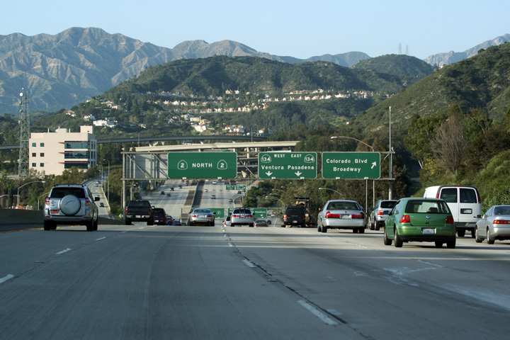
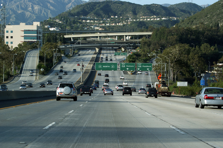
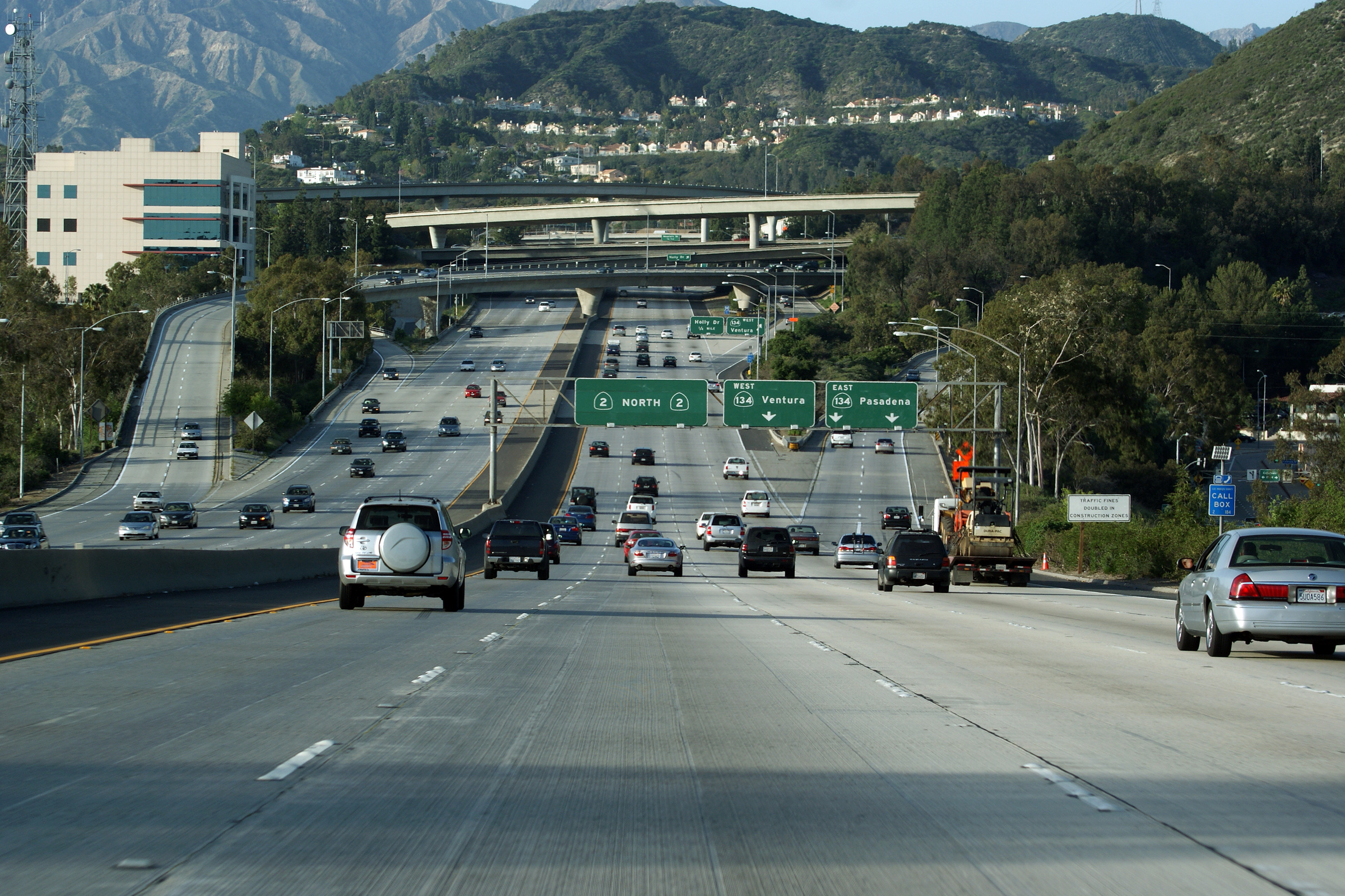
Los Angeles County |
This view looks northerly along California Highway 2 approaching the Highway 134 interchange. The scale of the large 4-level interchange with Highway 134 is exaggerated by the large hill that the interchange is situated upon. |
 |
||
|
Date: 3/26/2010 |
High-res: (1440x960) (2400x1600) |
|||
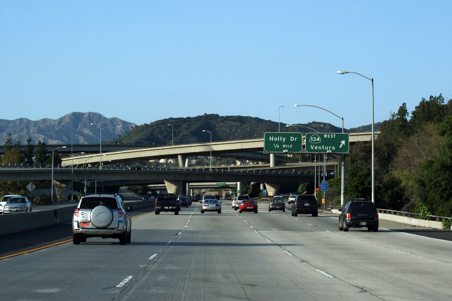
|
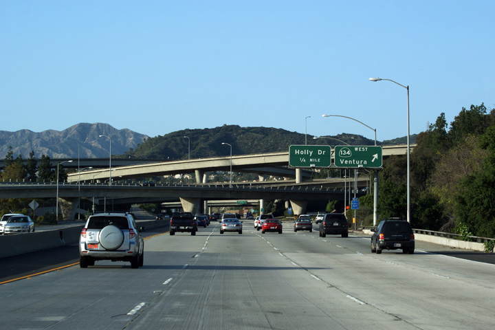
Los Angeles County |
Overhead signage at the four-level Highway 134 (Ventura Freeway) interchange. The ramp to Holly Boulevard is very much intertwined with the large Highway 134 interchange. |
 |
||
|
Date: 3/26/2010 |
High-res: (1440x960) (2400x1600) |
|||
|
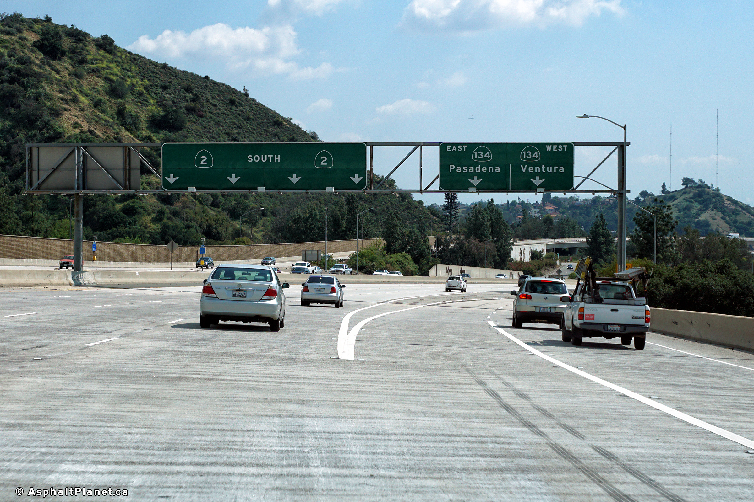
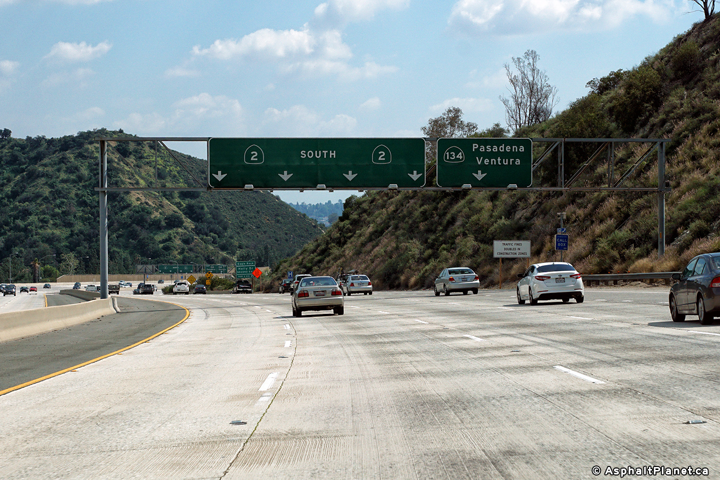
Los Angeles County |
Signage at the southbound off-ramp to the SR-134 interchange. |
|
||
|
Date: 11/05/2013 |
High-res: (1440x960) (2400x1600) |
|||
|
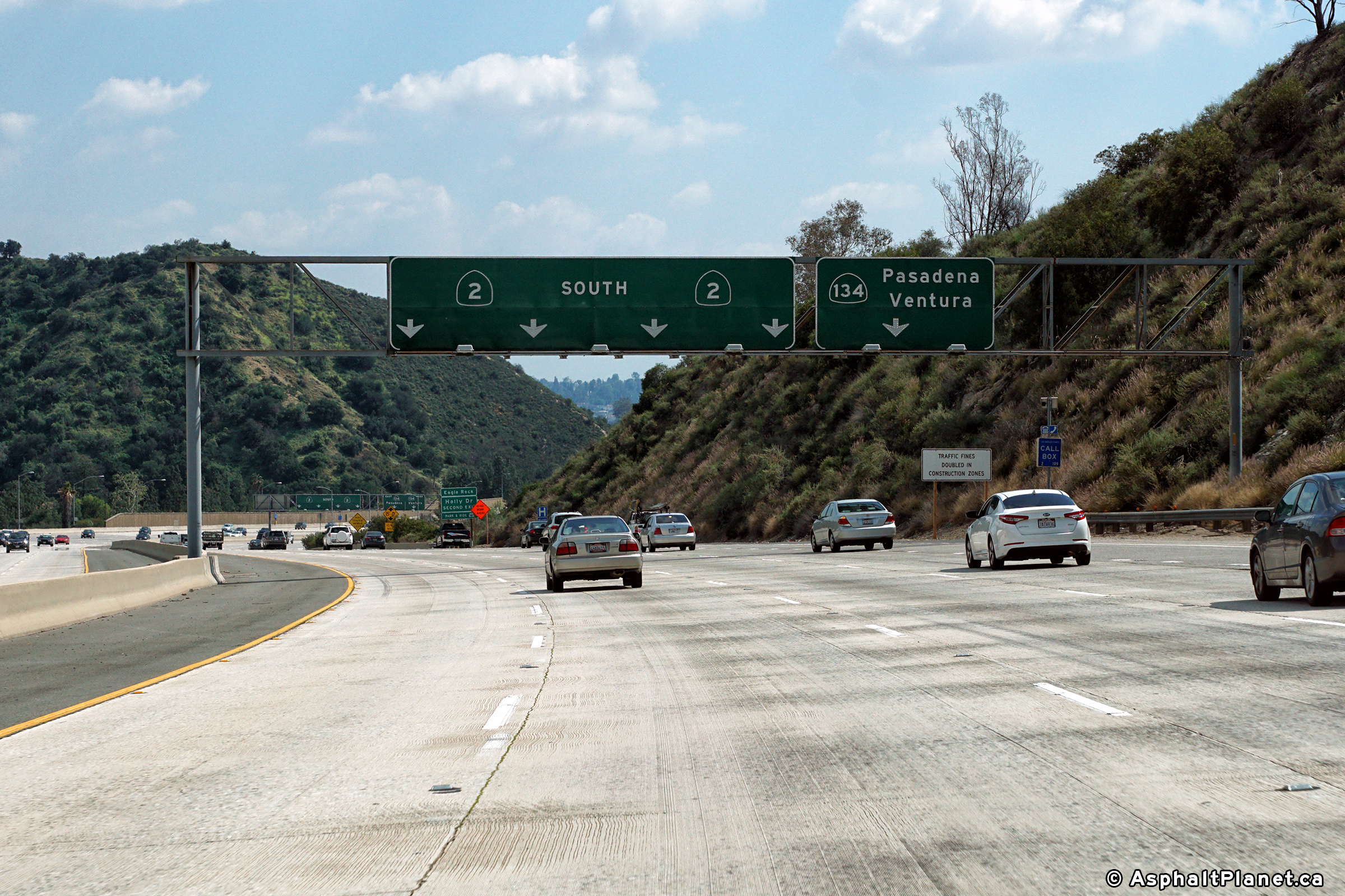
Los Angeles County |
Southbound advance lane assignment signage approaching the SR-134 interchange. |
 |
||
|
Date: 11/05/2013 |
High-res: (1440x960) (2400x1600) |
|||
|
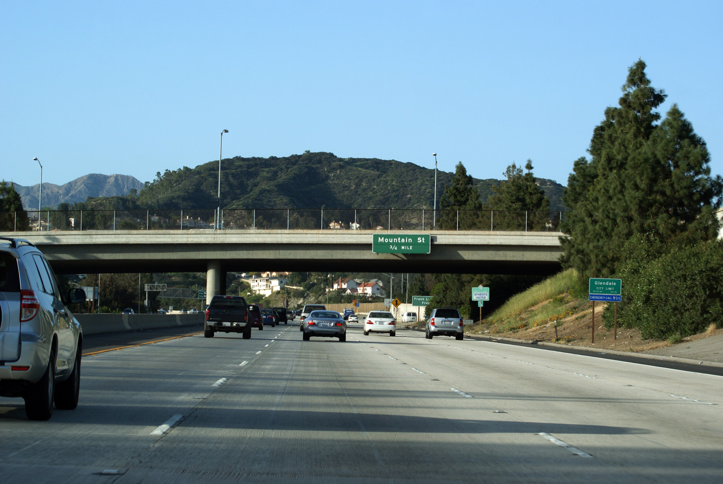
Los Angeles County |
Overhead advanced signage in advance of Mountain Road affixed to the Glenoaks Boulevard overpass. The name Mountain Road seems apt given the terrain that Highway 2 climbs through as freeway traffic propels through the City of Glendale. A paper map cannot at all portray how undulating the Cities of Glendale and Pasadena are. Of course, the real mountains, the San Gabriel's dwarf the hills of the populated regions of Los Angeles County exponentially. |
 |
||
|
Date: 3/26/2010 |
High-res: (1440x960) (2400x1600) |
|||
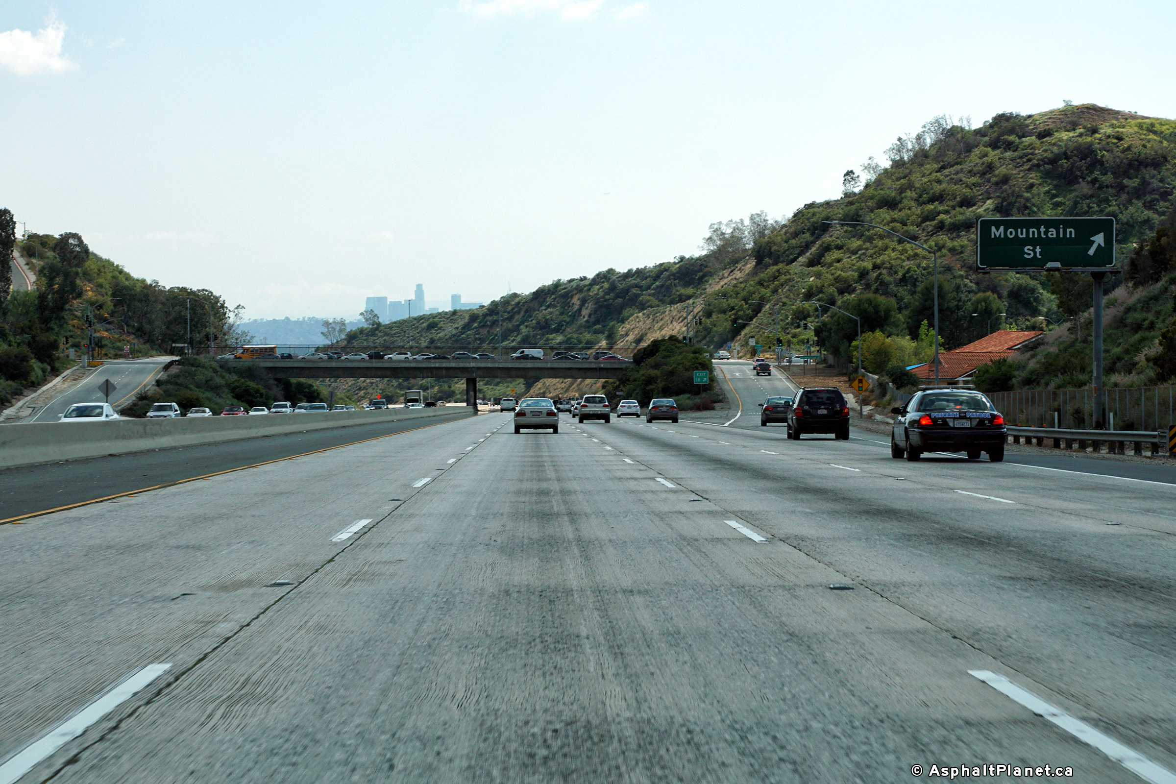
|
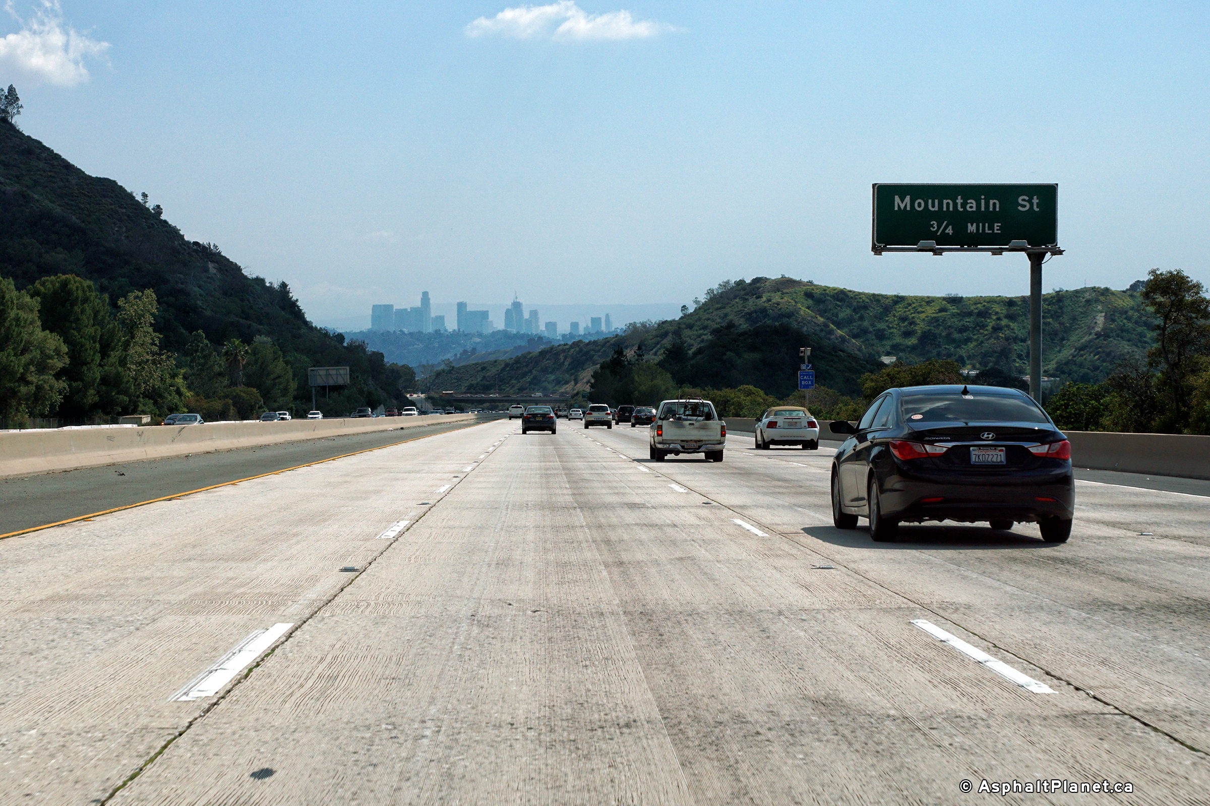
Los Angeles County |
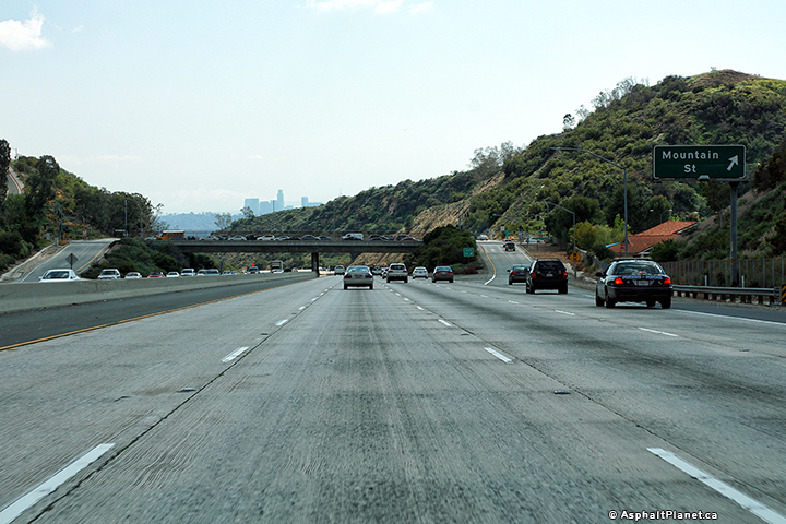
Southbound signage at the off-ramp to Mountain Road. |
|
||
|
Date: 11/05/2013 |
High-res: (1440x960) (2400x1600) |
|||
|
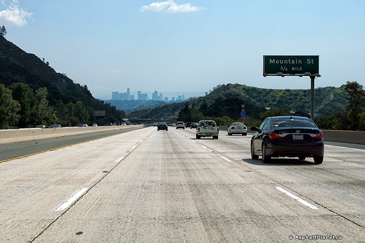
Los Angeles County |
Southbound advanced signage for the Mountain Road interchange. |
|
||
|
Date: 11/05/2013 |
High-res: (1440x960) (2400x1600) |
|||
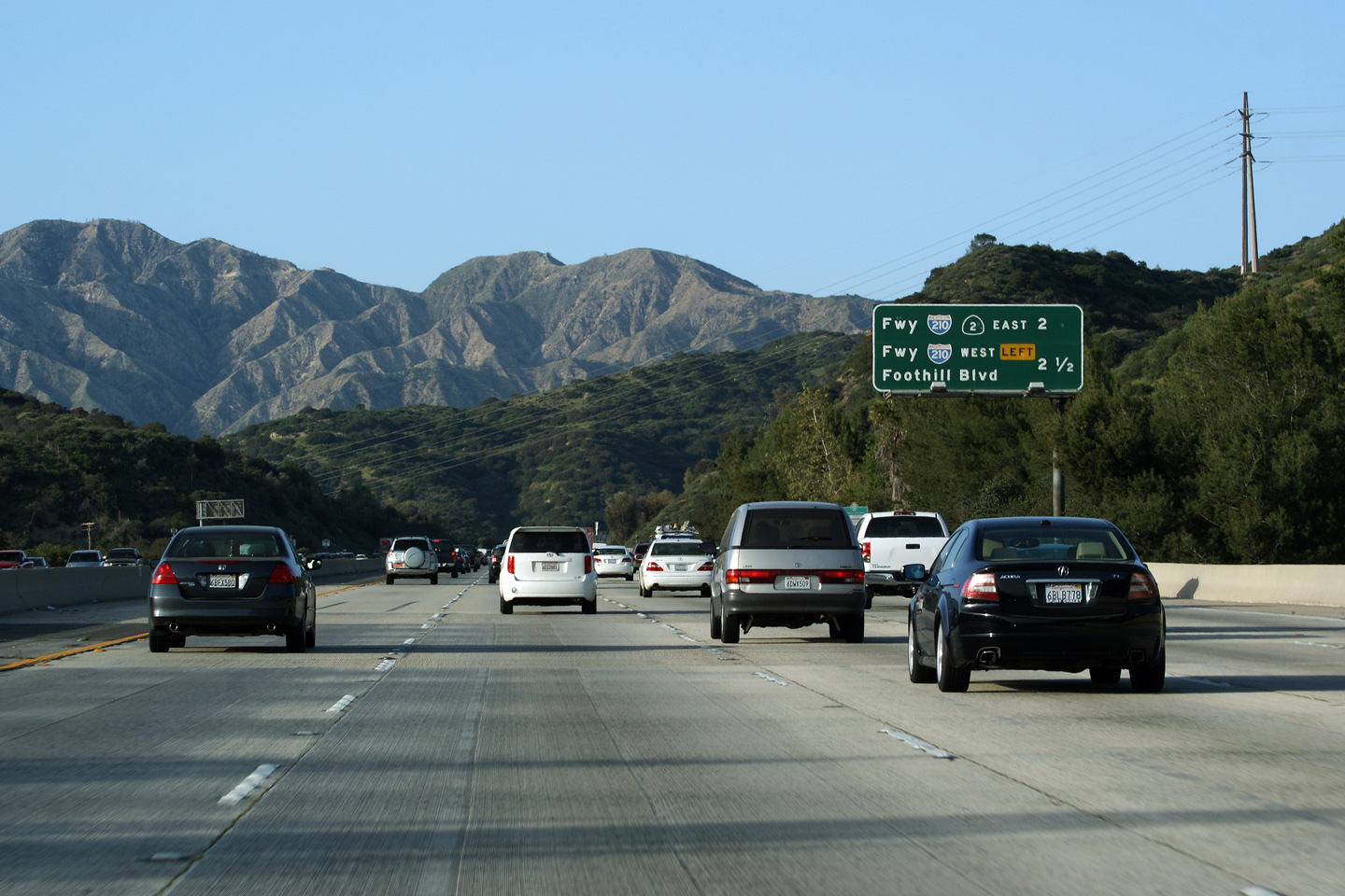
|
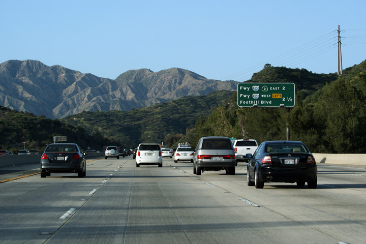
Los Angeles County |
Next exit signage in advance of the Interstate 210 interchange. It is interesting that the ramp to the I-210 East is signed concurrently with Highway 2. In a technical sense, since Highway 2 runs concurrently with the Foothill Freeway (I-210) for just over a mile, Interstate 210 doesn't actually depart Highway 2 for over three miles, a distance much further then the ramp to I-210 West. |
 |
||
|
Date: 3/26/2010 |
||||
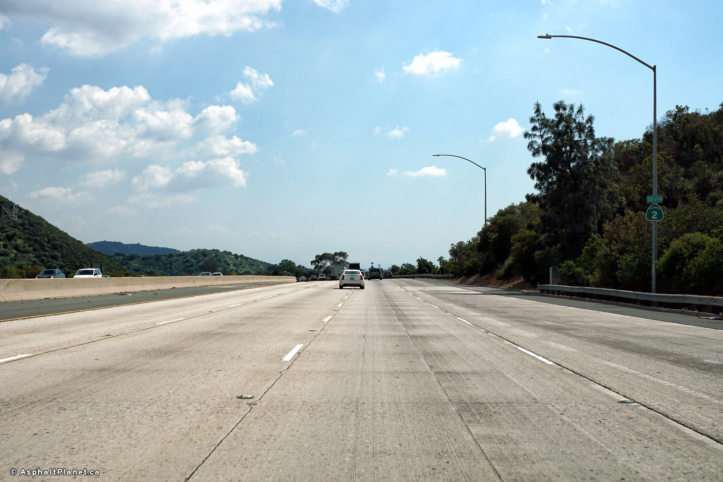
|
Los Angeles County |
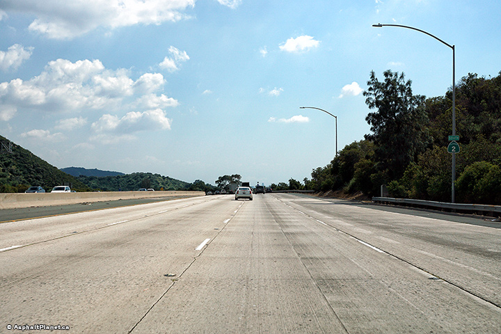
View looking southerly just south of the Foothill Freeway interchange. |
|
||
|
Date: 11/05/2013 |
High-res: (1440x960) (2400x1600) |
|||
|
Los Angeles County |
This is the first in a series of Northbound advanced signs in advance of the Interstate 210 interchange. A short freeway stub continues northerly past I-210 allowing traffic to access Foothill Boulevard. Despite this stub to Foothill Boulevard I feel confident to say that the Glendale Freeway (Hwy 2) will never be extended northerly. The San Gabriel Mountains are simply too enormous to punch a freeway through. |
 |
||
|
Date: 3/26/2010 |
||||
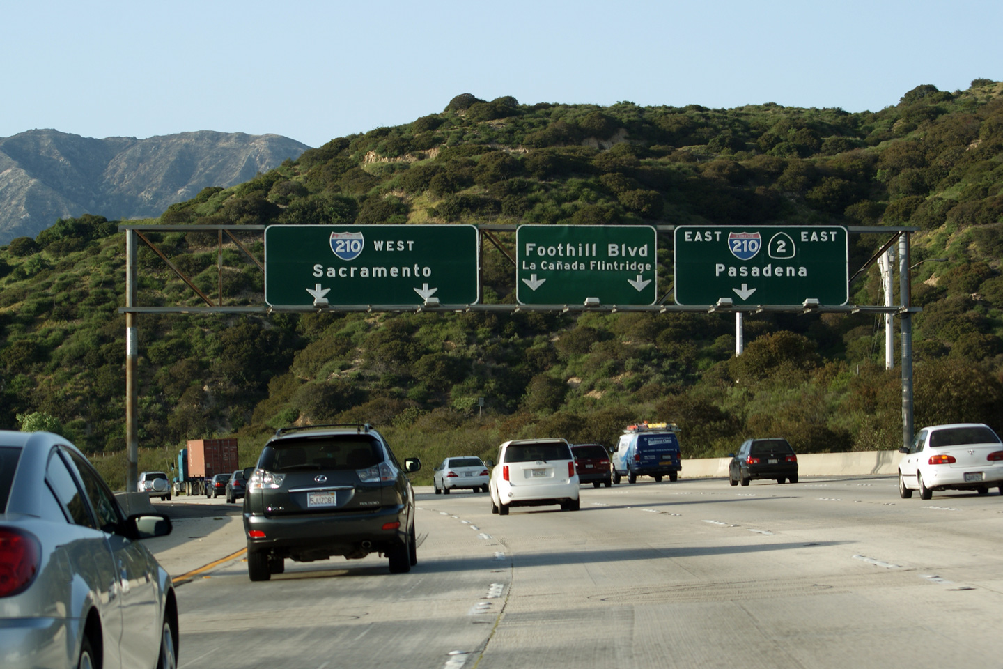
|
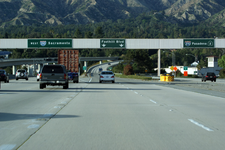
Los Angeles County |
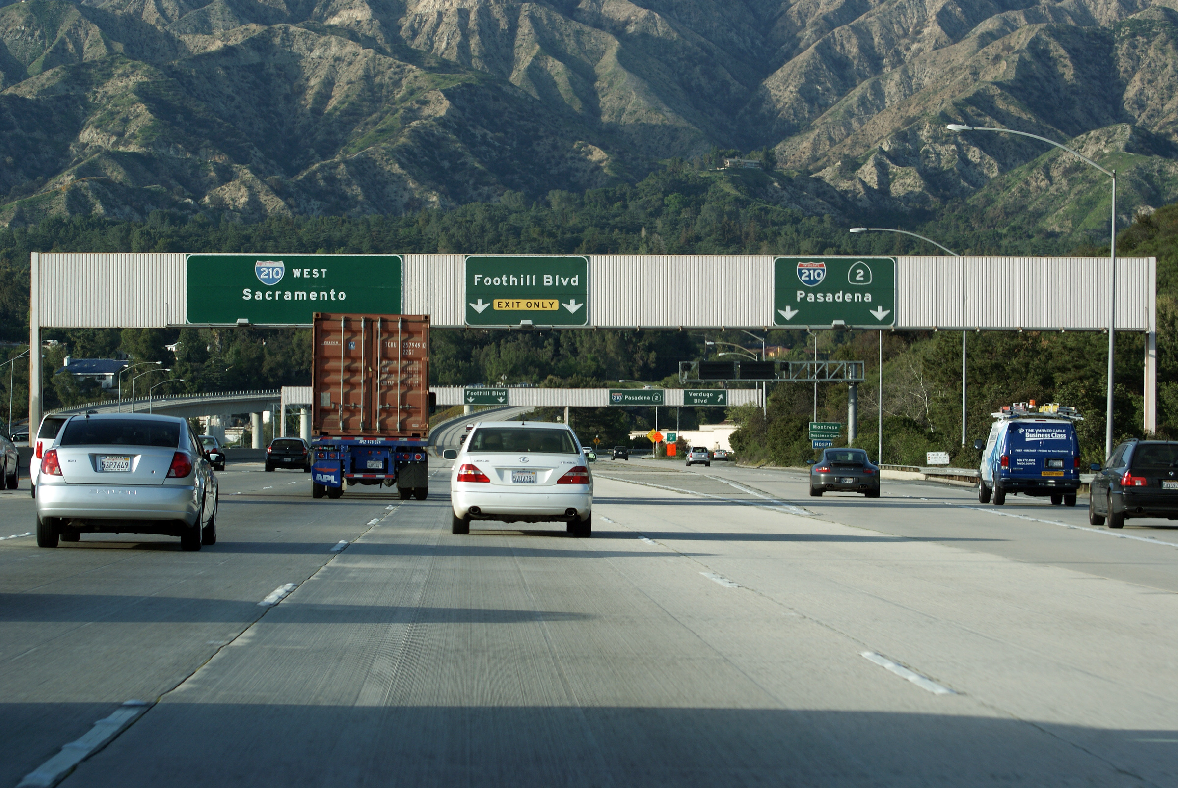
This overhead sign denotes the split from Highway 2 to the ramps to Interstate 210 West and Foothill Boulevard. Note the bare hills beyond the 210 Freeway. Not even resourceful suburban developers have figured out a way to condemn the beautiful foothills of the San Gabriel Mountain Range to a destiny filled with suburban house farms. |
 |
||
|
Date: 3/26/2010 |
High-res: (1440x960) (2400x1600) |
|||
|
Los Angeles County |
This is the final northbound exit signage for the Interstate 210 interchange. The ramp to I-210 West is a massive three-lane fly-under. The wide ramp is needed to store queued vehicles for times when Caltrans activate the ramp meters at the end of the ramp. Freeway to freeway ramp meters are a common in Southern California. Their basic operating principal is that queuing is controlled on the entrance ramp, and vehicles are released from the ramp metering traffic signal at a rate which will not impede throughput on the through freeway -- which is in this case I-210. During non-peak times, the ramp meters are deactivated in Southern California. |
 |
||
|
Date: 3/26/2010 |
||||
| Interstate 210 continues north-westerly from the Glendale Freeway bound for Interstate 5 at Sylmar. Click here for I-210 West Images. | ||||
|
Los Angeles County |
Westbound view along Interstate 210 as the ramp to the Glendale Freeway departs on the right hand side. The Glendale Freeway carries California Highway 2 Southerly towards Interstate 5 and Downtown Los Angeles. The Glendale Freeway represents a short freeway segment along Highway 2 which is ordinarily a lowly surface street. |
|
||
|
Date: 11/06/2013 |
High-res: (1440x960) (2400x1600) |
|||
|
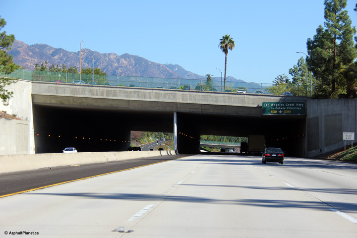
Los Angeles County |
The Foothill Freeway passes beneath through a short tunnel segment where the freeway passes beneath Foothill Boulevard and Memorial Park. |
|
||
|
Date: 11/05/2013 |
High-res: (1440x960) (2400x1600) |
|||
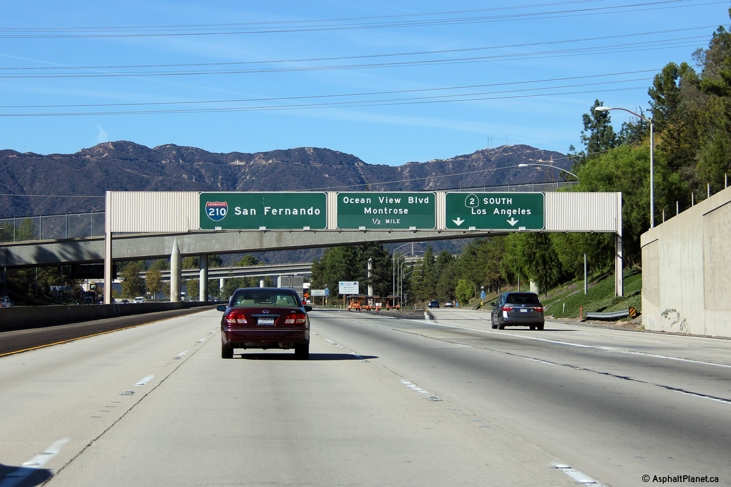
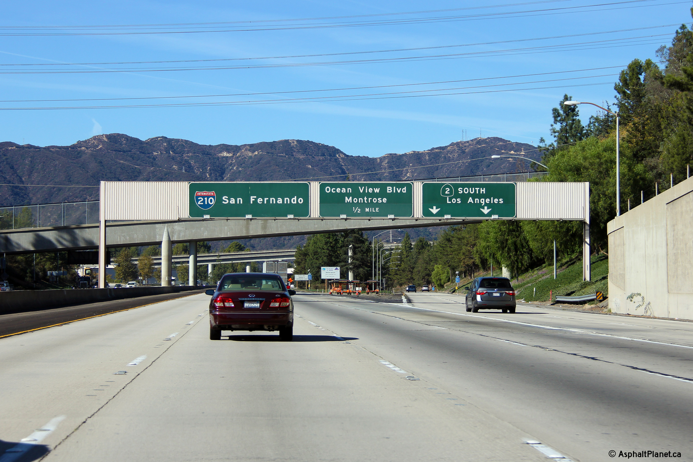
|
Los Angeles County |
Overhead guide signage affixed to the Foothill Boulevard Tunnel. Highway 2 runs concurrent with Interstate 210 for a distance of just over a mile. North of Interstate 210, California Highway 2 follows the Angeles Crest Highway where it promptly ascends into the San Gabriel Mountains. The Angeles Crest Highway has been described as one of North America's most beautiful highways. |
|
||
|
Date: 11/06/2013 |
High-res: (1440x960) (2400x1600) |
|||
| Interstate 210 continues easterly from the Angeles Crest Highway bound for the Ventura Freeway in Pasadena and beyond. Click here for I-210 East Images. | ||||
<- CA-1
CA Highways
CA-3 ->
AsphaltPlanet.ca
© 2010-15 AsphaltPlanet.ca.
Scott@asphaltplanet.ca
Page Created: February 12, 2011.
Last Updated: January 17, 2015.

