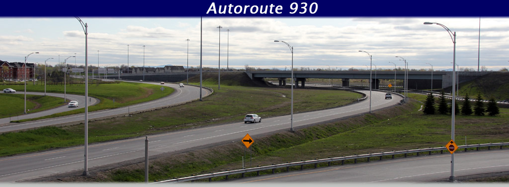
AsphaltPlanet.ca > Quebec > Autoroute 930
|
Western Terminus: Route 132 in Delson. Eastern Terminus: Autoroute 30 in Candiac. Routing: Autoroute 930 follows a former alignment of Autoroute 30 that was by-passed in 2011 when a new alignment of Autoroute 30 was built to the south of the existing alignment. Autoroute 930 is only approximately 2.5 km in length. Links:
|
Pictures on
this page are arranged in order from south to north. A-930 East photos are
left-aligned in the last column, while A-930 West photos are right-aligned.
Center-line pictures are centered within the last column.
|
Location |
Description |
Photo |
||
|
East- |
West- |
|||
|
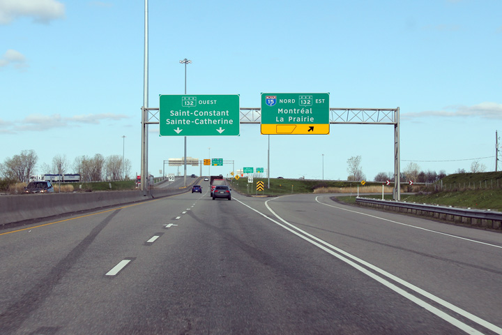
Autoroute 930 ends at a cloverleaf interchange with Route 132 and Autoroute 15. Click here for A-30 images. |
||||
|
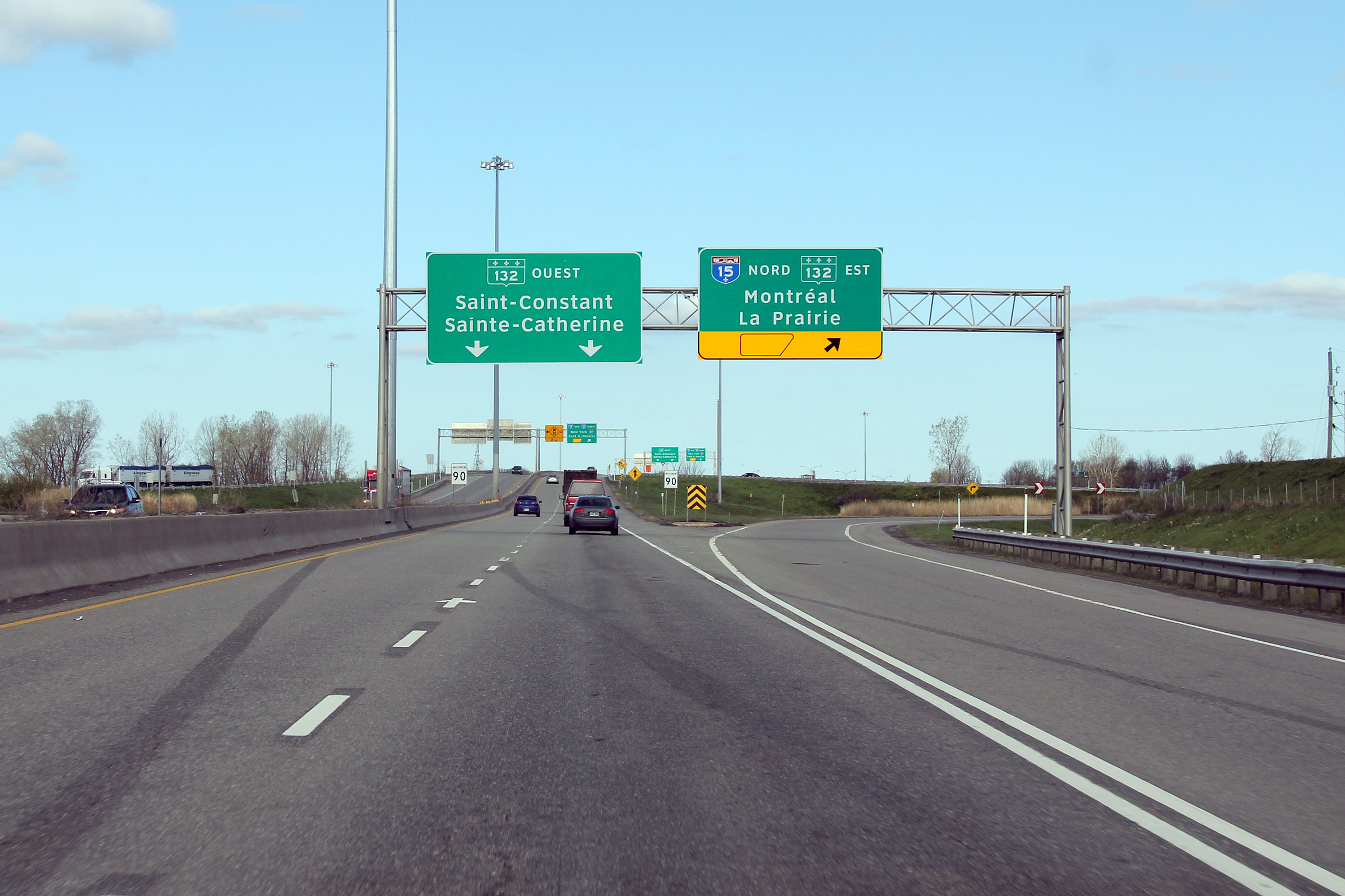
M.R.C. de Roussillon |
Signage at the loop ramp to Autoroute 15 South. Autoroute 930 ends at this interchange. Route 132 continues ahead.
Signalisation à la bretelle en boucle vers l'autoroute 15 sud. L'autoroute 930 se termine à cet échangeur. La route 132 se continue à venir. |
 |
||
|
Date: 5/5/2012 |
High-res: (1440x960) (2400x1600) | |||
|
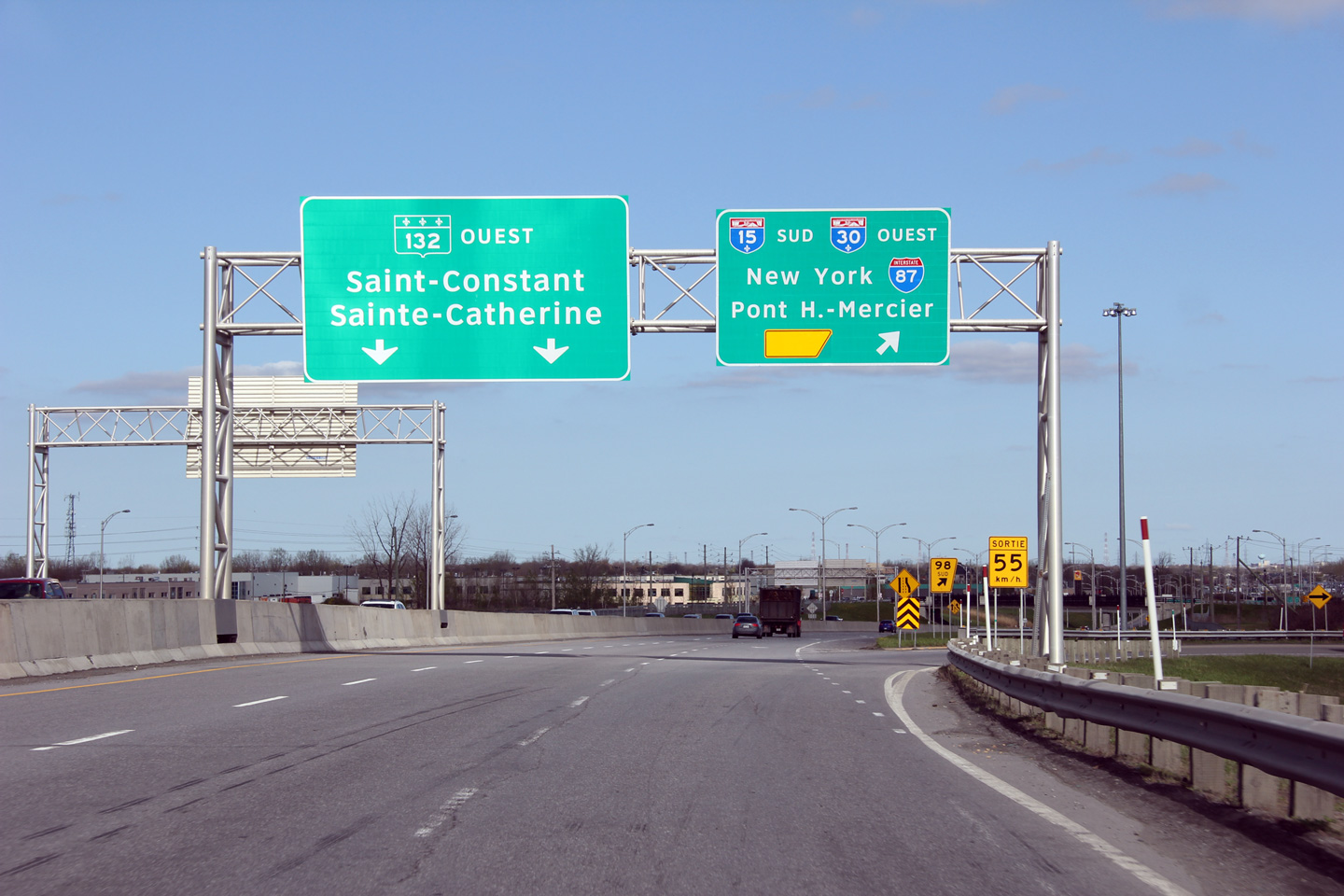
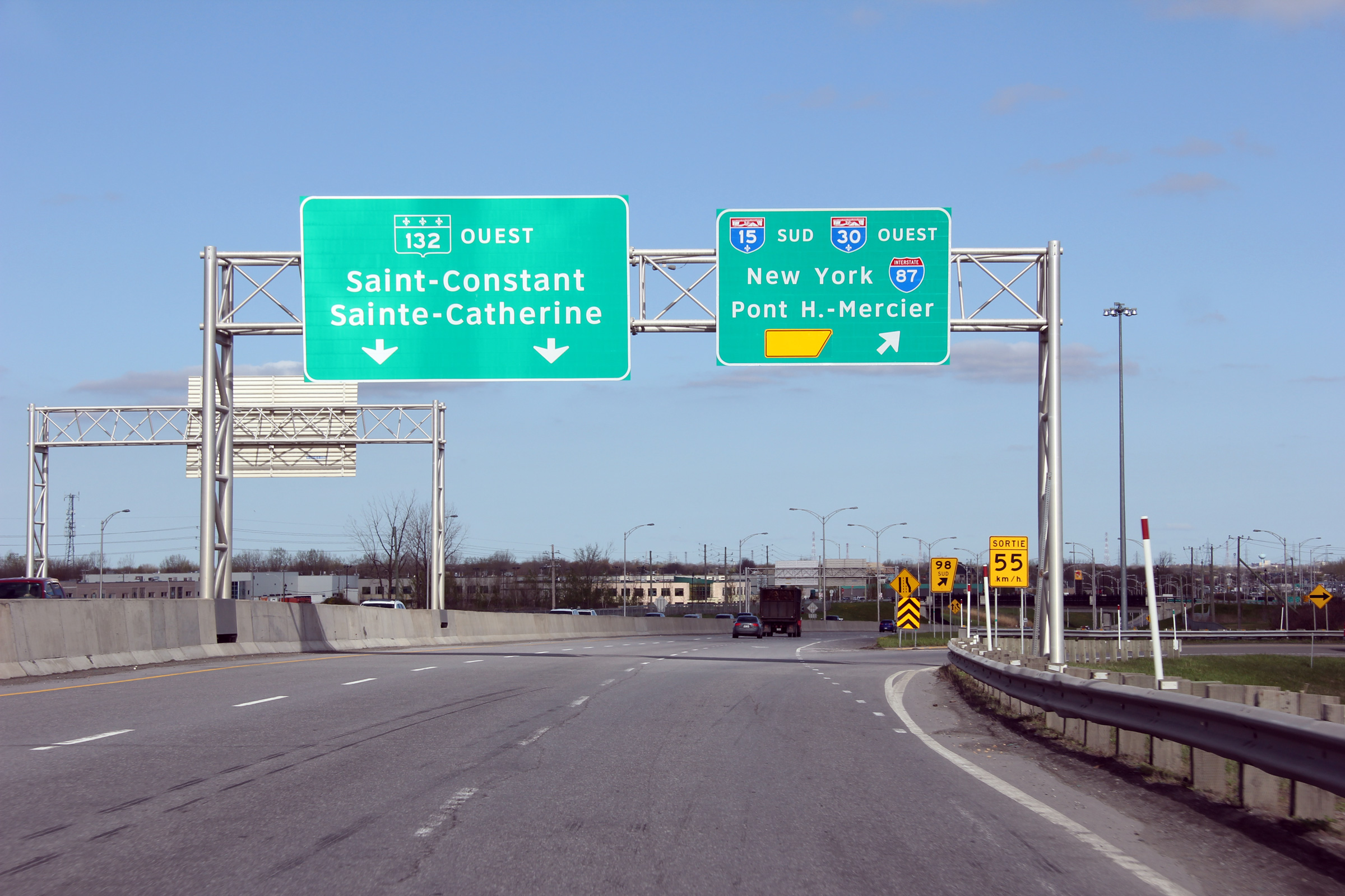
M.R.C. de Roussillon |
Advanced signage for the loop ramp to A-15 South. The freeway continues for approximately 2km west of the A-15 interchange before it becomes a traffic clogged arterial highway.
Signalisation avancé pour la bretelle en boucle vers l'aut. 15 Sud. L'autoroute continue à venir pour environ 2 km au ouest de l'échangeur avec l'aut. 15 après quoi il devient une route arterielle encombée. |
 |
||
|
Date: 5/5/2012 |
High-res: (1440x960) | |||
|
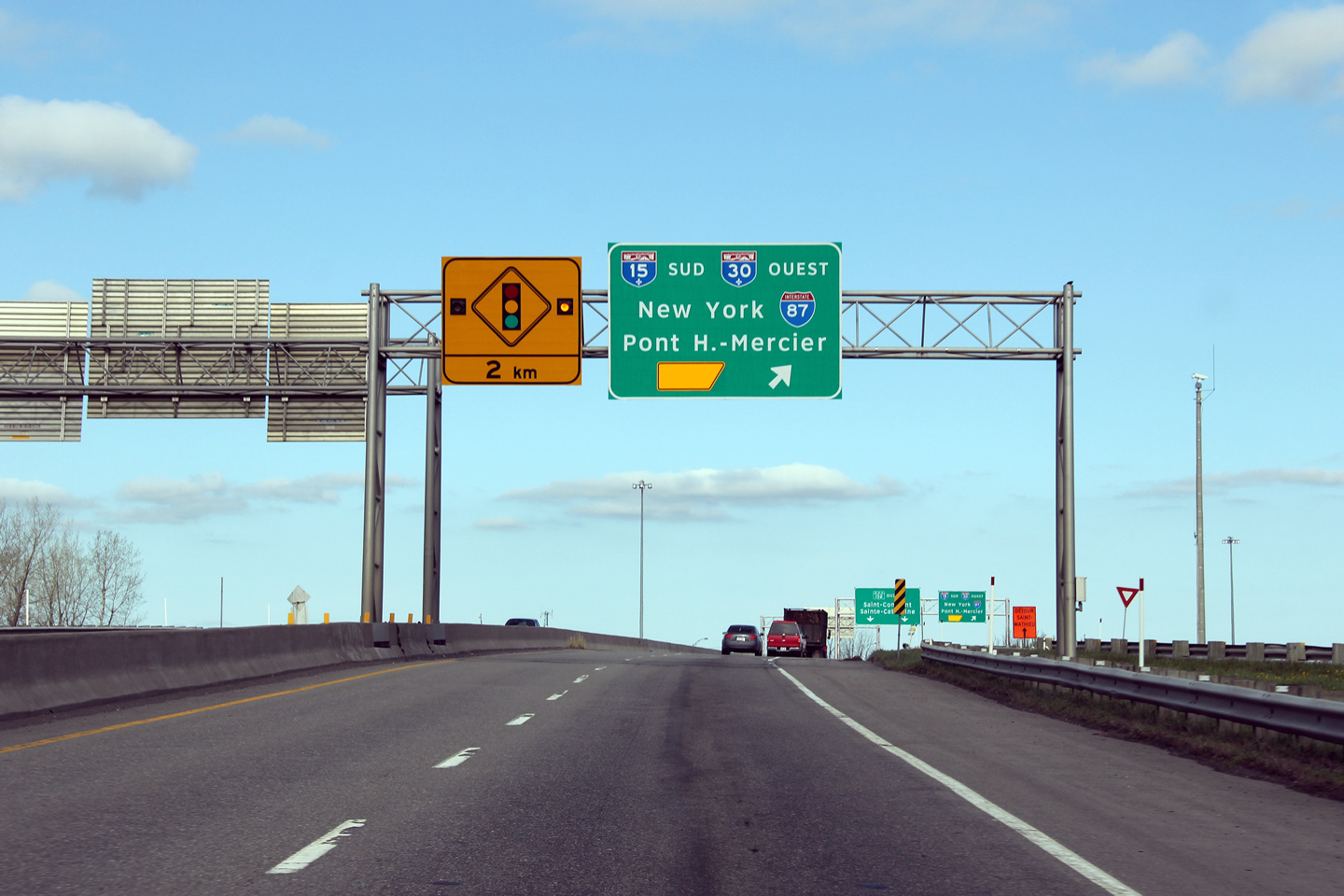
M.R.C. de Roussillon |
Overhead signage for the ramp to A-15 North towards Downtown Montreal.
Signalisation aérienne à la bretelle vers la centre-ville de Montréal et l'aut. 15 nord. |
 |
||
|
Date: 5/5/2012 |
High-res: (1440x960) (2400x1600) | |||
|
M.R.C. de Roussillon |
View looking westerly from the Jean-Leman Boulevard overpass towards the cloverleaf interchange with Autoroute 15.
View en direction ouest à partir du pont d'étagement du boul. Jean-Leman vers l'échangeur en trèfle avec l'aut. 15. |
 |
||
| High-res: (1440x960) (2400x1600) | ||||
|
|
||||
|
Upper: 7/24/2011 Lower: 5/5/2012 |
High-res: (1440x960) (2400x1600) | |||
|
M.R.C. de Roussillon |
Two views looking easterly from the Boulevard Jean-Leman overpass. The upper photo shows the structure carrying the new Autoroute 30 extension under construction while the lower photo shows the completed highway configuration.
Deux vues vers l'est à partir du pont d'étagement du boul Jean-Leman. La photo supérieure a été prise avant la construction de l'autoroute 30 a été achevée, tandis que la photo inférieure a été prise après la fin de construction. |
|
||
| High-res: (1440x960) (2400x1600) | ||||
 |
||||
|
Upper: 7/24/2011 Lower: 5/5/2012 |
High-res: (1440x960) (2400x1600) | |||
|
Autoroute 30 runs roughly parallel to the South Shore through the Southern Montréal Metro to Sorel-Tracey. Click here for A-30 images. |
||||
<- A-730
PQ Highways
A-955 ->
Asphaltplanet.ca
© 2011-13 Scott Steeves.
AsphaltPlanet@asphaltplanet.ca.
Page Created: January 1, 2013.
Last Updated: January 1, 2013.

