AsphaltPlanet.ca > Québec > Autoroute 30 > Page 2
|
Autoroute 30 |
| <- Page 1 |
|
Page 4 -> |
Pictures on this page are arranged in order from west to east. A-30 East photos are left-aligned in the last column, while A-30 west photos are right-aligned. Center-line pictures are centered within the last column.
|
Location |
Description |
Photo |
||
|
East- |
West- |
|||
|
Autoroute 30 photos continue westerly towards Vaudreuil via Page 2. Click here for Page 1 images. |
||||
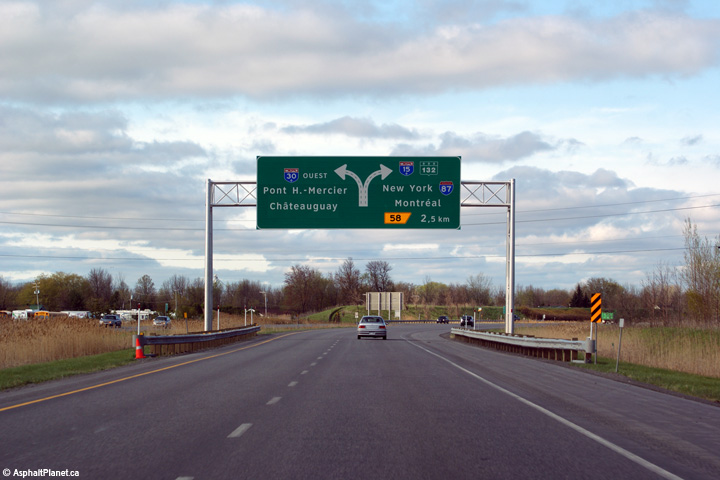
|
A-30 ends at Route 132 in Sainte-Catharine. The highway begins easterly again at A-15 in Candiac. Click here for A-15 images. |
||||
|
MRC de Roussillon |
This view looks westerly along Autoroute 30 from the Rang St-André overpass towards the CPR overpass.
Cette photo regarde vers le ouest le long de l'autoroute 30 depuis le pont d'étagement du rang St-André. |
 |
||
|
Date: 5/02/2012 |
High-res: (1440x960) (2400x1600) | |||
|
MRC de Roussillon |
Easterly view from the Rang St-André towards the Autoroute 930 interchange.
Vue en direction est depuis le rang St-André vers l'échangeur avec l'autoroute 930. |
 |
||
|
Date: 5/02/2012 |
High-res: (1440x960) (2400x1600) | |||
|
MRC de Roussillon |
Easterly view as Autoroute 30 merges with Autoroute 930.
Vue vers l'est comme la bretelle de l'autoroute 930 joint avec l'autoroute 30.. |
 |
||
|
Date: 7/16/2009 |
High-res: (1440x960) (2400x1600) | |||
|
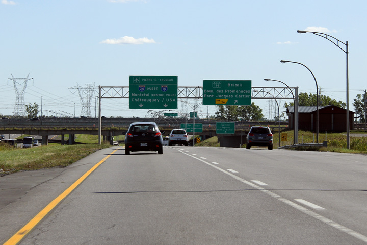
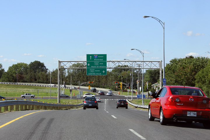
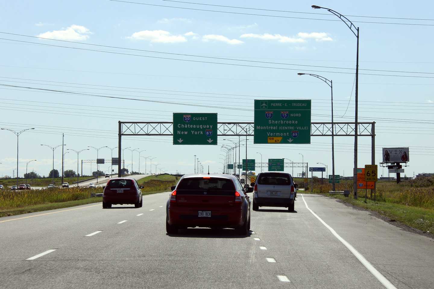
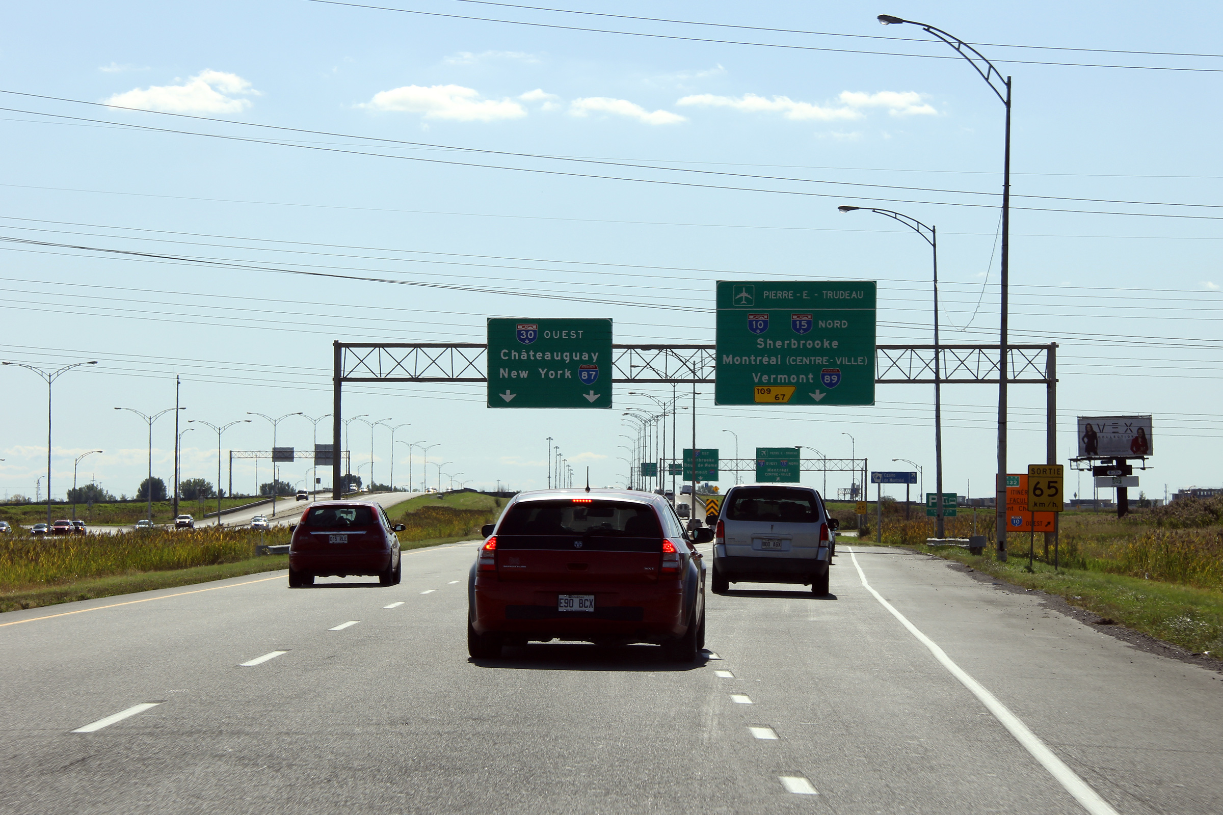
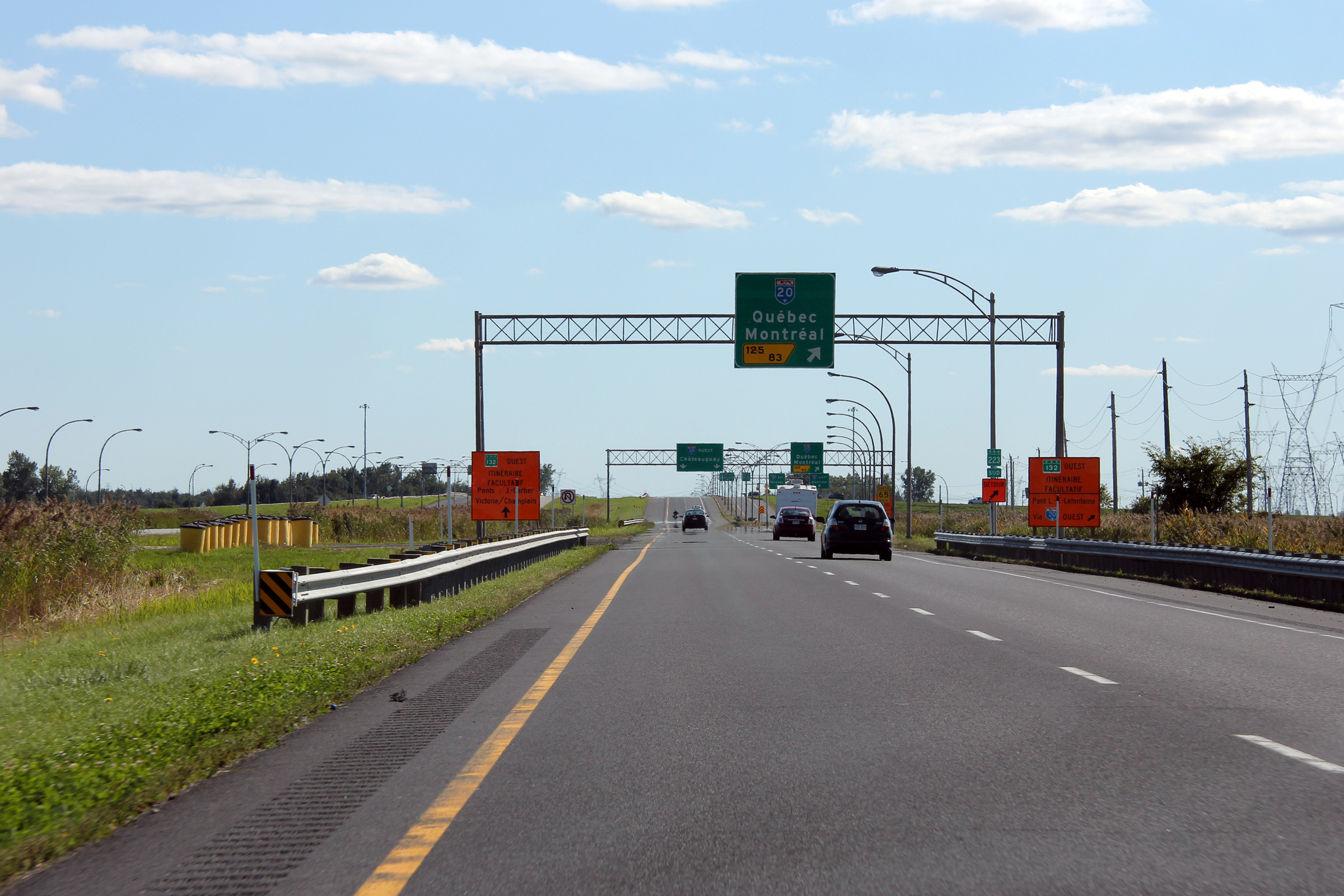
MRC de Roussillon |
Westbound advanced signage in advance of the Autoroute 930 interchange. This photo was taken before Autoroute 30 was extended to Vaudreuil-Dorion, so the westbound control city indicated on the signage was still Châateauguay.
Signalisation aérienne en direction ouest devant l'échangeur avec l'autoroute 930. |
 |
||
|
Photographer:/b> Scott Steeves |
Date: 5/02/2012 |
High-res: (1440x960) (2400x1600) | ||
|
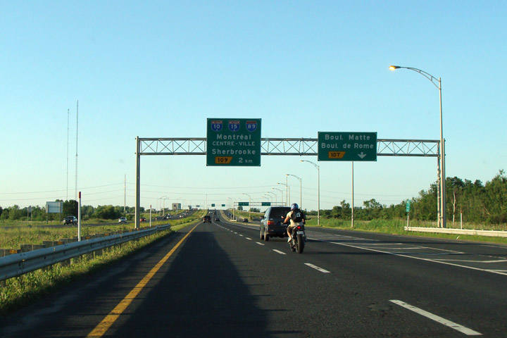
MRC de Roussillon |
Signage for the exit to Matte and Rome Boulevards.
Signalisation pour la sortie vers le boul. Matte et le boul Rome. |
 |
||
|
Date: 5/22/2015 |
High-res: (1440x960) | |||
|
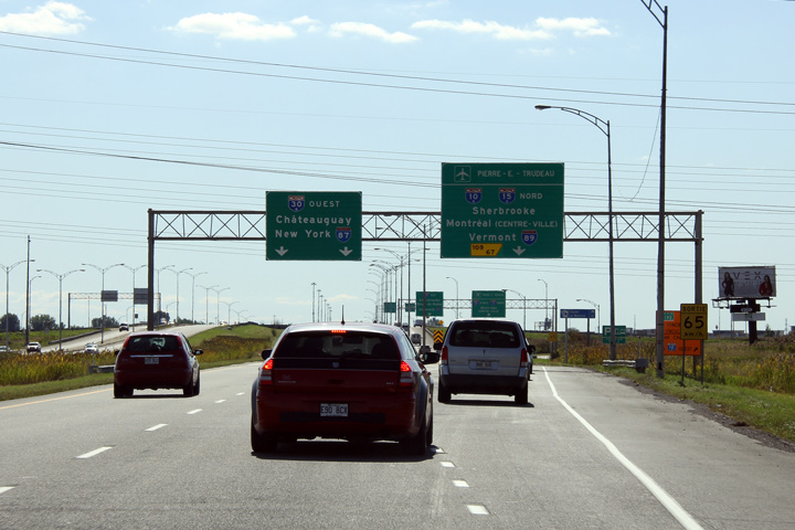
Autoroute 30 meets A-10 at a cloverleaf interchange near the sprawling Dix-30 shopping complex. Click here for A-10 images. |
||||
|
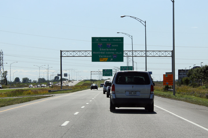
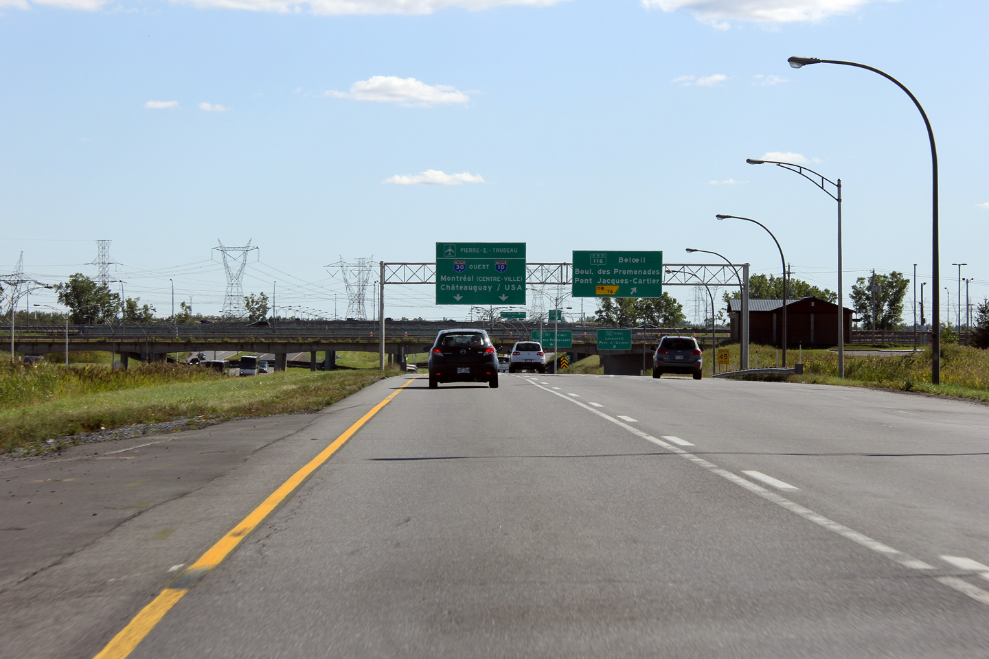
Agglomeration de Longueuil Brossard |
Overhead signage at the westbound ramp to A-10 from the westbound 30. A-30 meets A-10 at a cloverleaf interchange. From A-30, A-10 is the primary route into Downtown Montreal.
Signalisation aérienne à la bretelle de sorite vers l'aut. 10 depuis l'autoroute 30. L'aut 30 croise l'aut 10 à une échangeur en trèfle. Depuis l'aut. 30, l'aut. 10 est la route principal vers le centre-ville de Montréal. |
 |
||
|
Date: 18/9/2011 |
High-res: (1440x960) (2400x1600) | |||
|
Agglomeration de Longueuil Brossard |
Advanced signage for the ramp from A-30 to A-10.
Signalisation avancée pour la bretelle vers l'aut. 10. |
|
||
|
Date: 18/9/2011 |
High-res: (1440x960) (2400x1600) | |||
|
Ville de Longueuil |
Signage for the ramp to Exit 69.
Signalisation pour la bretelle vers sorite 69. |
 |
||
|
Date: 18/9/2011 |
High-res: (1440x960) (2400x1600) | |||
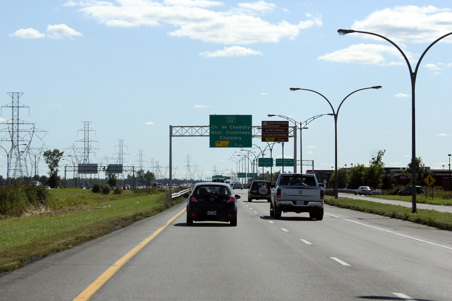
|
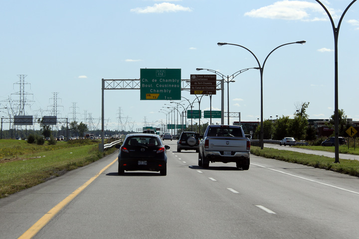
Ville de Longueuil |
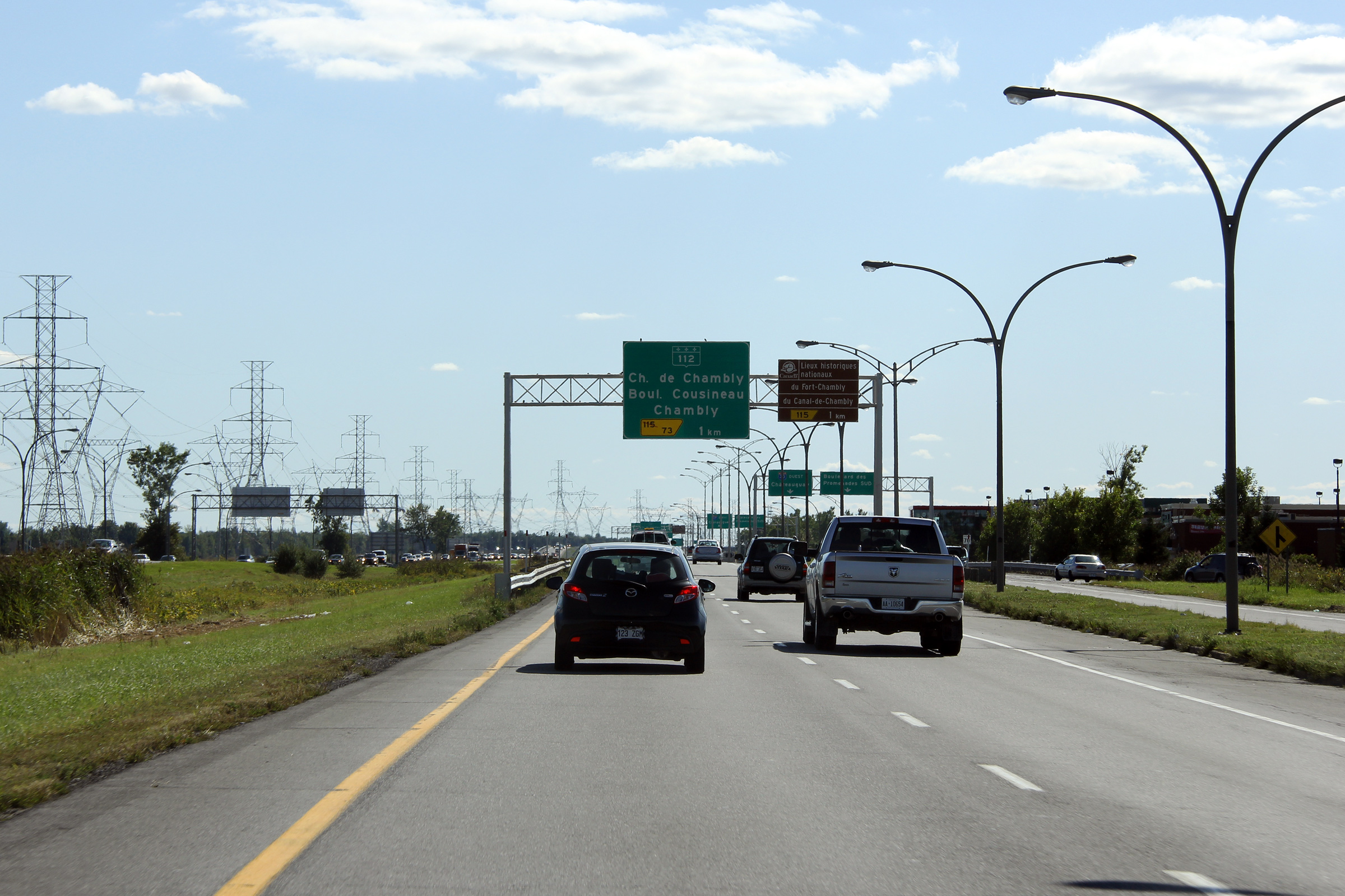
Advanced signage for Highway 112. Before Québec's great highway renumbering, Highway 112 was designated as Highway 1.
Signalisation avancéee pour la route 112. Dans le passé, la route 112 a été designé alors que la route 1. |
 |
||
|
Date: 18/9/2011 |
High-res: (1440x960) (2400x1600) | |||
|
Ville de Longueuil |
Overhead signage at the exit to Highway 116. The exit to Highway 116 is situated directly behind the mainline of the CN Railway.
Signalisation aérienne à la bretelle de sortie vers la route 116. La sortie vers la route 116 est situé après du viaduc ferroviaire principal du CN. |
 |
||
|
Date: 18/9/2011 |
High-res: (1440x960) (2400x1600) | |||
|
Autoroute 20 is the Trans-Canada Highway and is the principal highway between Montréal and Québec. Click here for A-20 images. |
||||
|
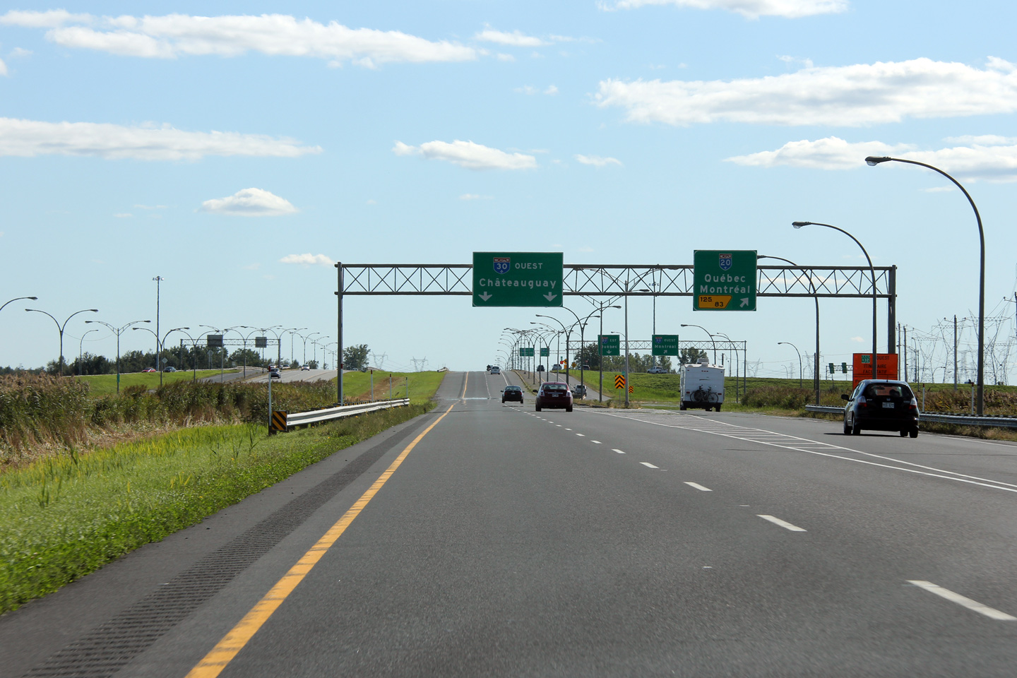
Agglomeration de Longueuil Boucherville |
Westerly view along Autoroute 30 at the ramp to the Autoroute 20 cloverleaf interchange.
Vue en direction ouest à la bretelle de sortie vers l'échangeur en trèfle de l'autoroute 20. |
|
||
|
Date: 18/9/2011 |
High-res: (1440x960) (2400x1600) | |||
|
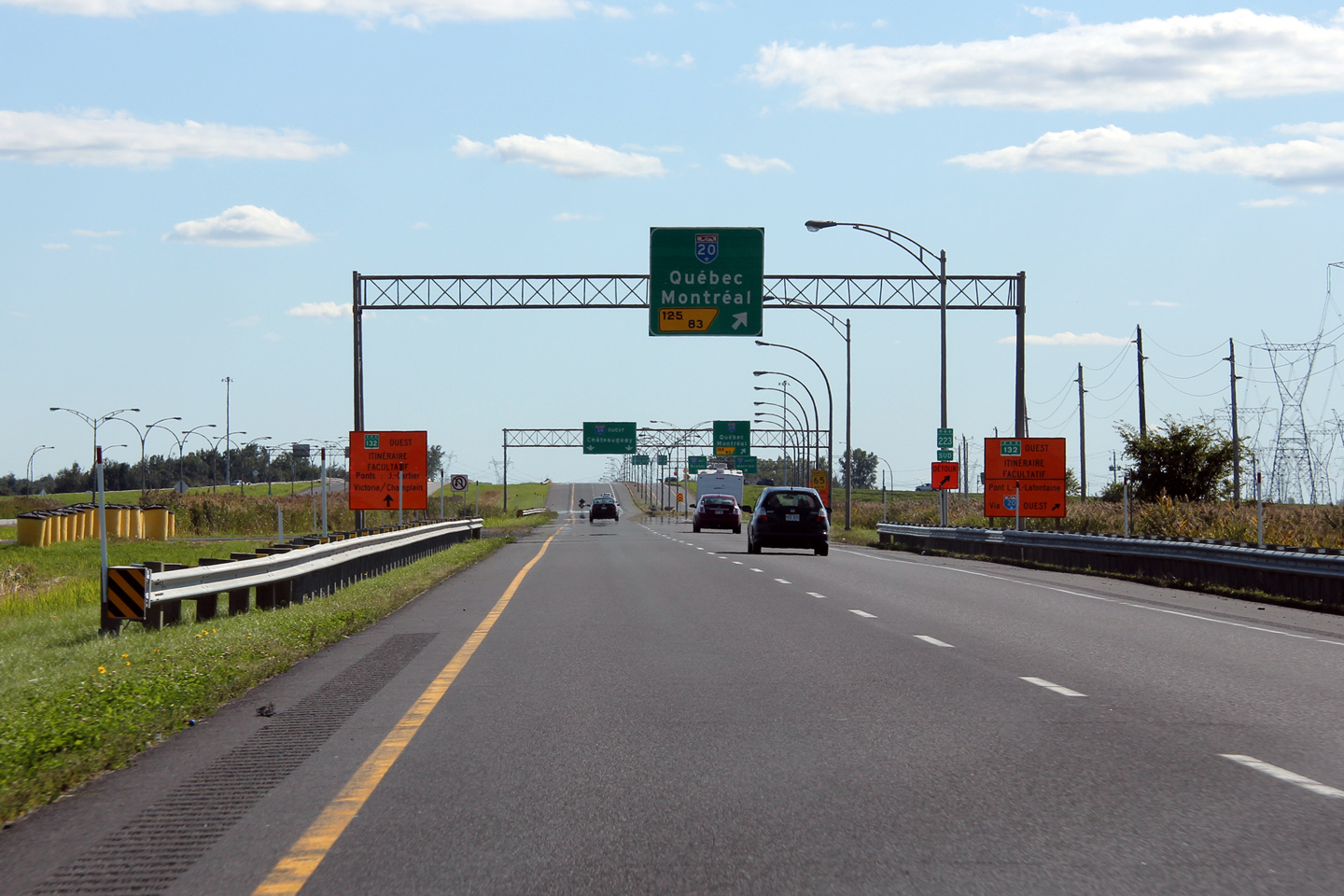
Agglomeration de Longueuil Boucherville |
Advanced signage for the Autoroute 20 interchange.
Signalisation avancée pour l'échangeur de l'autoroute 20. |
|
||
|
Date: 18/9/2011 |
High-res: (1440x960) (2400x1600) | |||
|
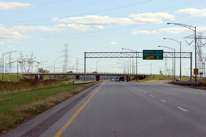
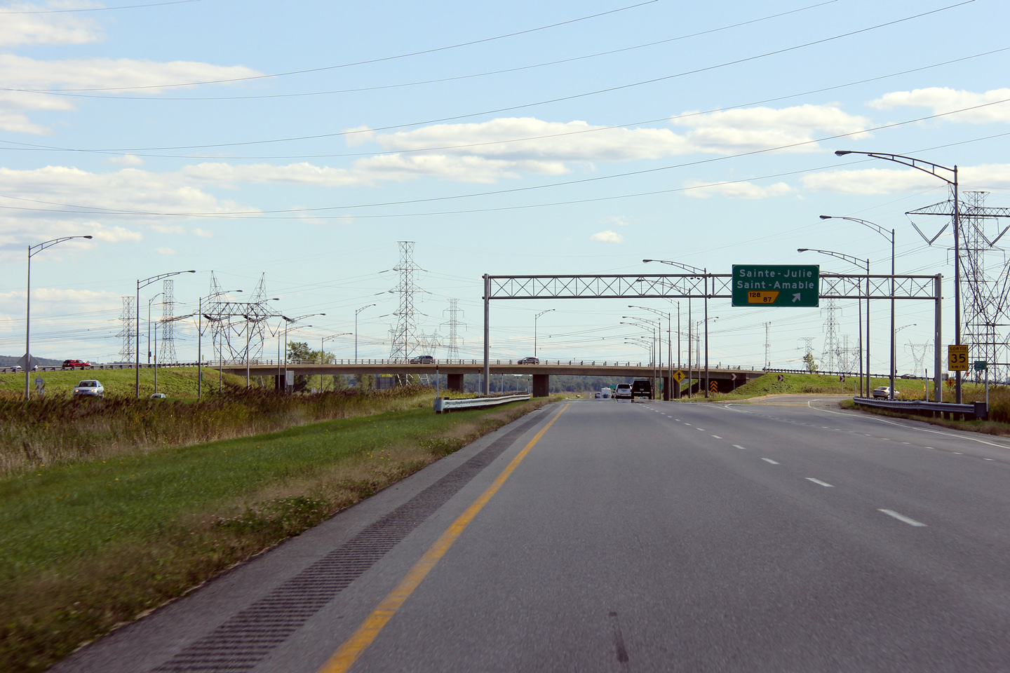
Agglomeration de Longueuil Varennes |
Exit to Sainte-Julie and Saint-Amable.
Sortie vers Sainte-Julie et Saint-Amable. |
|
||
|
Date: 18/9/2011 |
High-res: (1440x960) (2400x1600) | |||
|
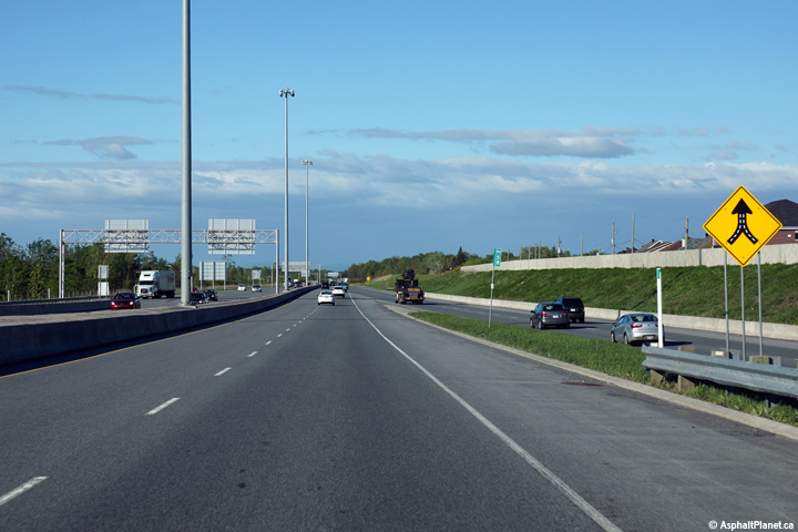
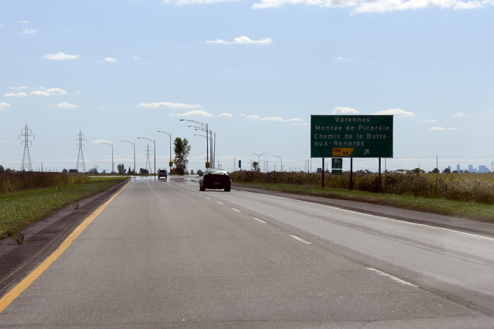
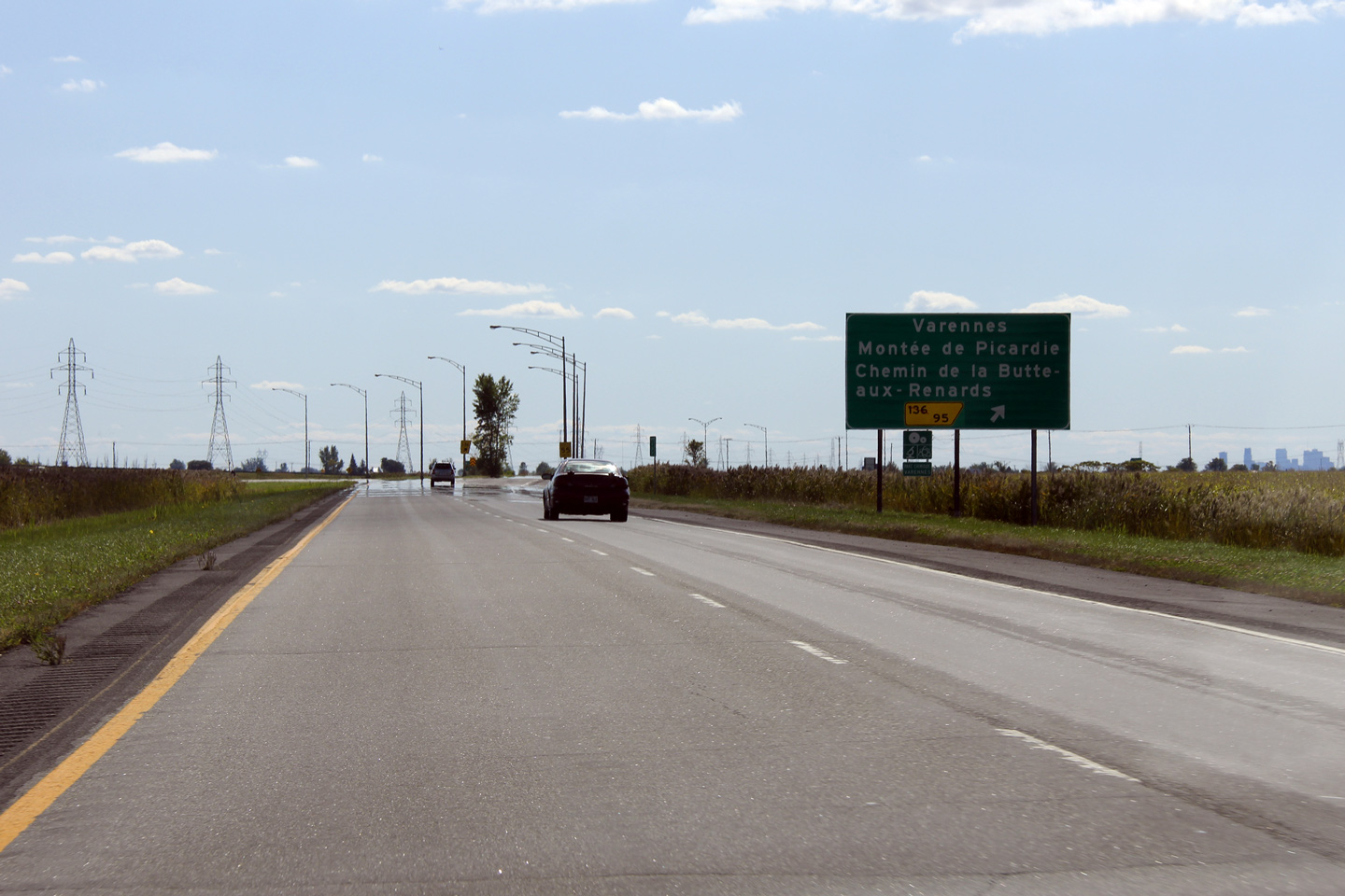
Agglomeration de Longueuil Saint-Bruno-de-Montarville |
Guide signage at the off-ramp for Varennes from Autoroute 30 West. The Montréal skyline is visible to the far right of the photo. Autoroute 30 west heads almost directly toward the Montréal skyline for several kilometres east of this exit. Downtown Montréal is nearly 30km away from this point.
Panneau à la bretelle de sortie vers Varennes depuis l'aut. 30 en direction ouest. La ligne d'horizon de Montréal est visible dans cette photo en l'extrême droite. L'autoroute 30 en direction ouest port vers la centre-ville de Montréal pour plusiers kilometres depuis cet échangeur en direction est. La Centre-Ville de Montréal est près de 30km loin d'ici. |
|
||
|
Date: 18/9/2011 |
High-res: (1440x960) (2400x1600) | |||
|
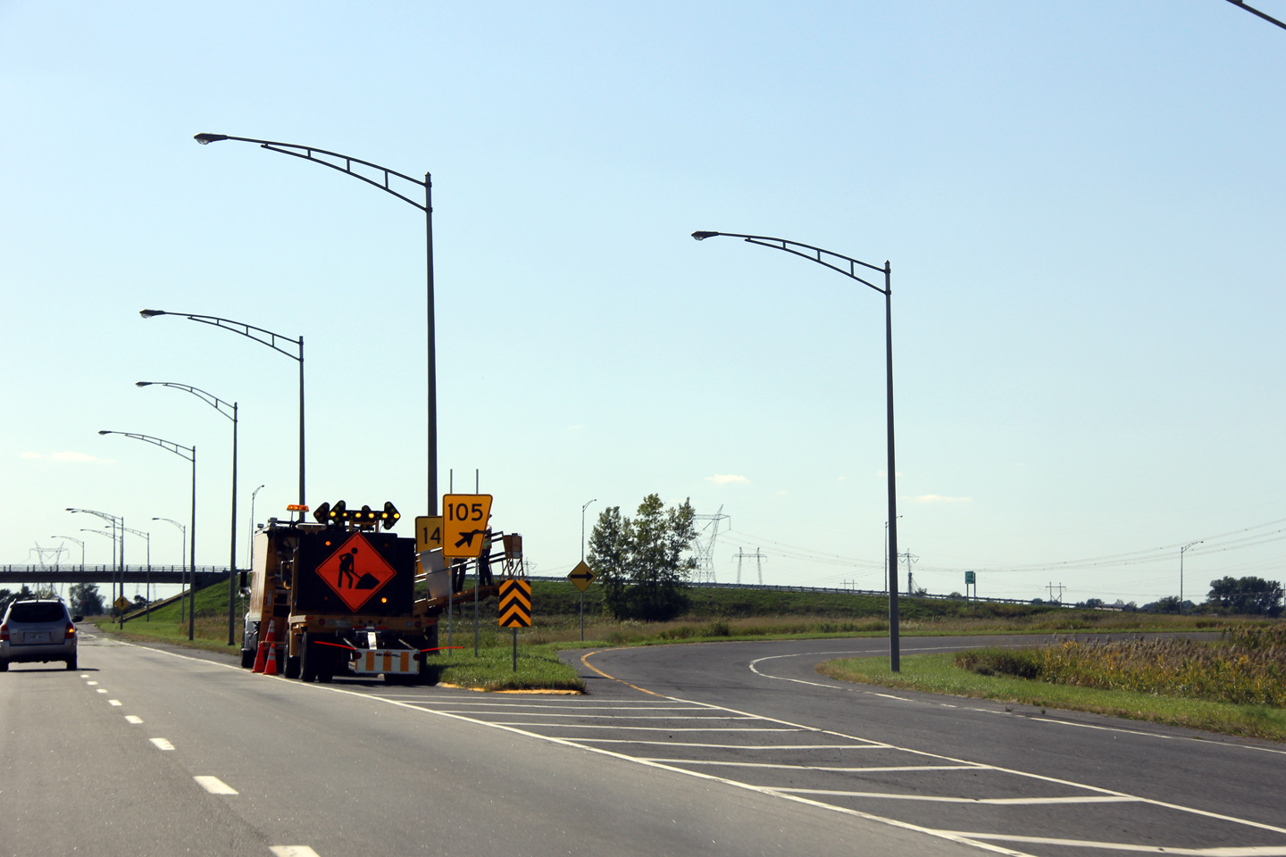
Agglomeration de Longueuil Saint-Bruno-de-Montarville |
Work crews were changing the exit number at the new exit 105 from the old exit 147. Exit numbers were originally applied to Autoroute 30 based along the distance from the U.S. Border at Dundee. With the Autoroute 30 extension across the Saint Lawrence River to Autoroute 40 at Vaudreuil, A-30's exit numbers have been changed to reflect the exit's position from the highways new western terminus at Vaudreuil, rather than Dundee.
Une bande de travailleurs sont changé la signalisation de sortie à la sortie 105 depuis l'ancien nombre de 147. Avant la renumérotation, les numéros de sorite sur l'autoroute 30 ont été basées sur leurs distance de la frontière des États-Unis à Dundee. En raison du prolongement de l'autoroute 30 à travers le fleuve Saint-Laurent, les numéros de sortie de l'autoroute 30 ont été modifiés pour refléter leur position depuis la nouveau terminus ouest à Vaundreuil. |
 |
||
|
Date: 18/9/2011 |
High-res: (1440x960) | |||
|
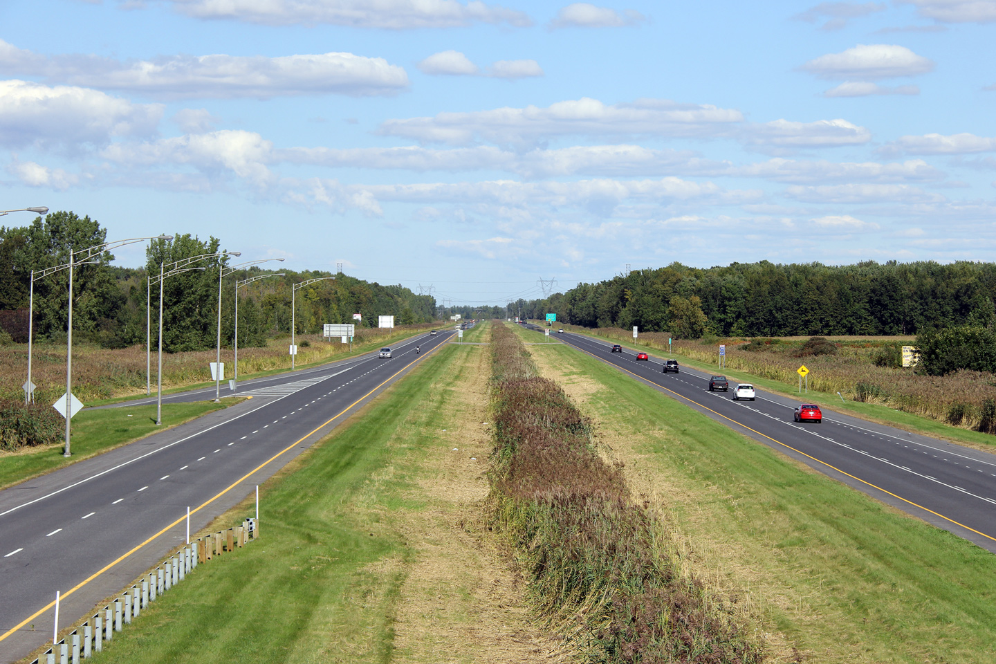
MRC de Lajemmerais Contrecoeur |
Westerly view towards Montréal from the Montée Lapierre overpass.
Vue en direction ouest vers Montréal depuis le pont d'étagement de la montée Lapierre. |
 |
||
|
Date: 18/9/2011 |
High-res: (1440x960) (2400x1600) | |||
|
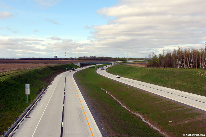
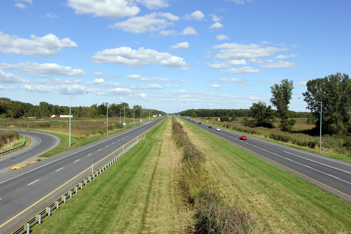
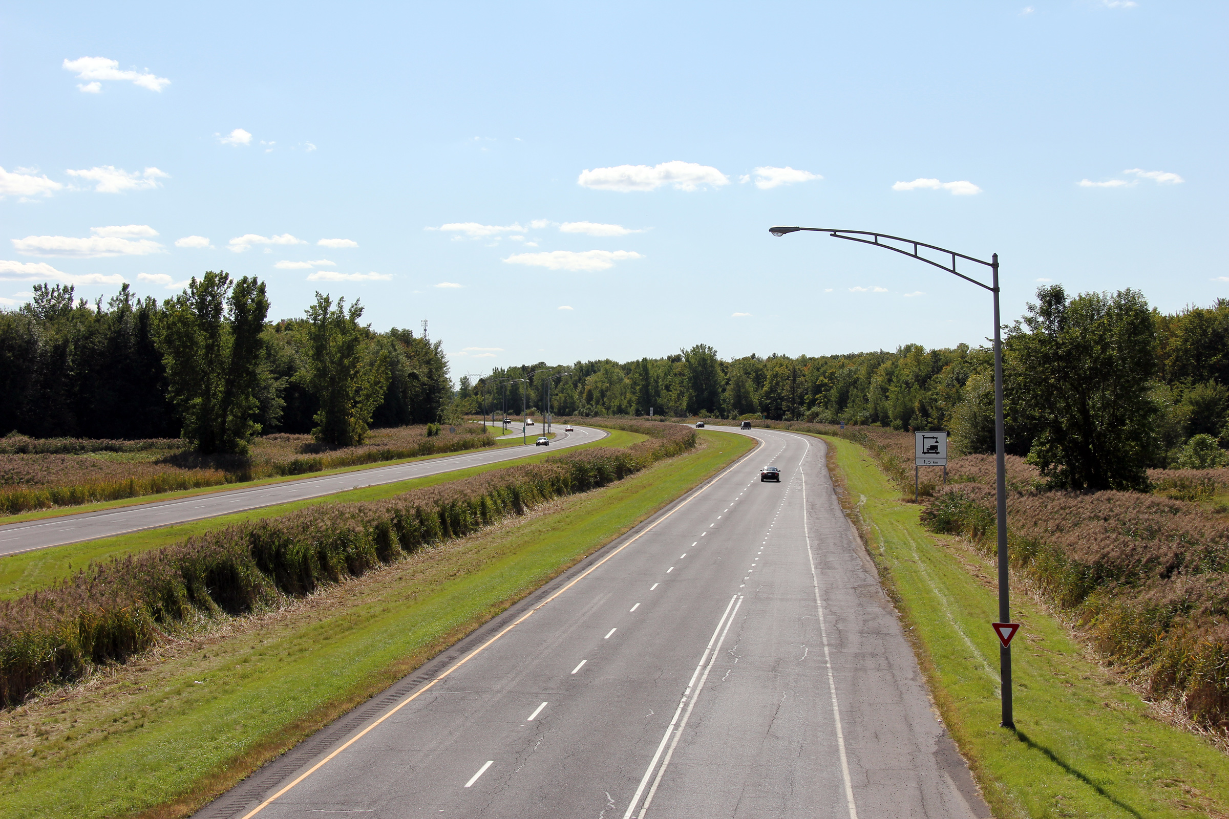
MRC de Lajemmerais Contrecoeur |
Easterly view along Autoroute 30 from Montée Lapierre. This photo illustrates how well the MTQ manicures the grounds surrounding its rural freeways. Grass is typically cut short adjacent to the travel lanes of the freeway, with a naturalized strip in the ditch of the median.
Vue en direction est depuis montée Lapierre. Cette photo éxplique que le MTQ soin des terre environnant les autoroutes rural. Les médians des autoroute rural typique sont contenu des gazon coup court près des chaussées avec une étroit langue naturel entrentenu dans le fossé. |
 |
||
| High-res: (1440x960) (2400x1600) | ||||
 |
||||
|
Date: 18/9/2011 |
High-res: (1440x960) (2400x1600) | |||
|
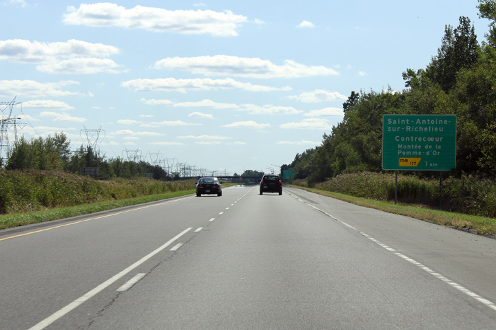
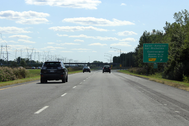
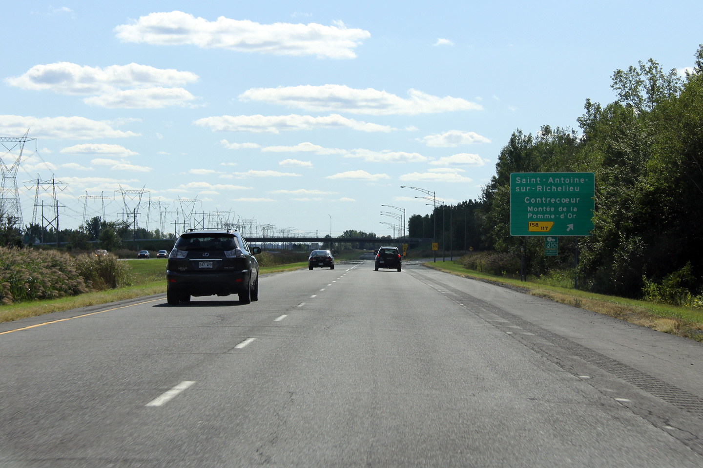
MRC de Lajemmerais Contrecoeur |
Signage for the exit to Saint-Antoine-sur-Richelieu.
Signalisation pour la sorite vers Saint-Antoine-sur-Richelieu. |
|
||
|
Date: 18/9/2011 |
High-res: (1440x960) (2400x1600) | |||
|
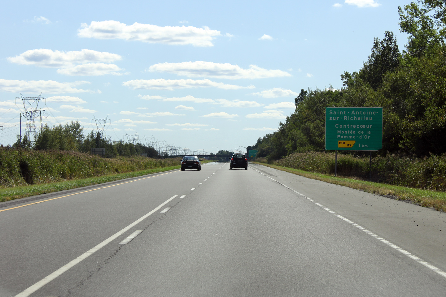
MRC de Lajemmerais Contrecoeur |
Advanced signage for the exit to Saint-Antoine-sur-Richelieu.
Signalisation avancée pour la sortie vers Saint-Antoine-sur-Richelieu. |
 |
||
|
Date: 18/9/2011 |
High-res: (1440x960) (2400x1600) | |||
|
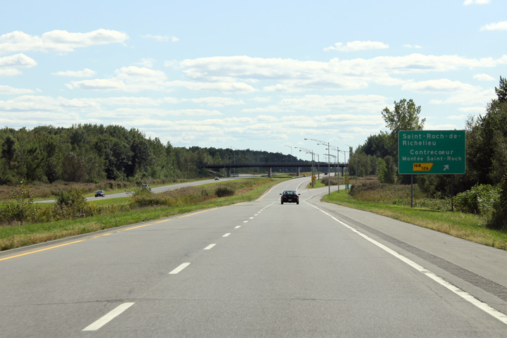
MRC de Lajemmerais Contrecoeur |
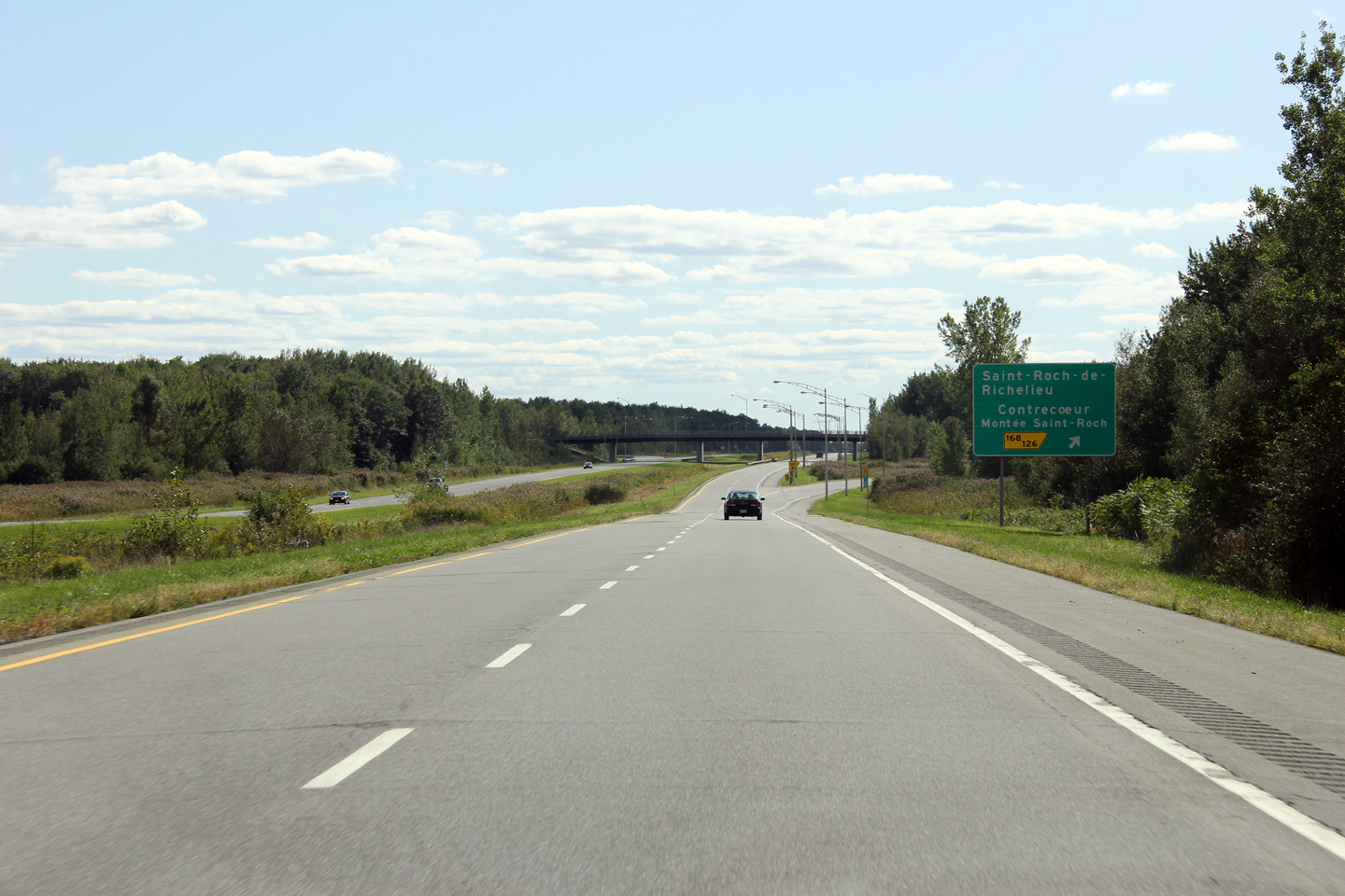
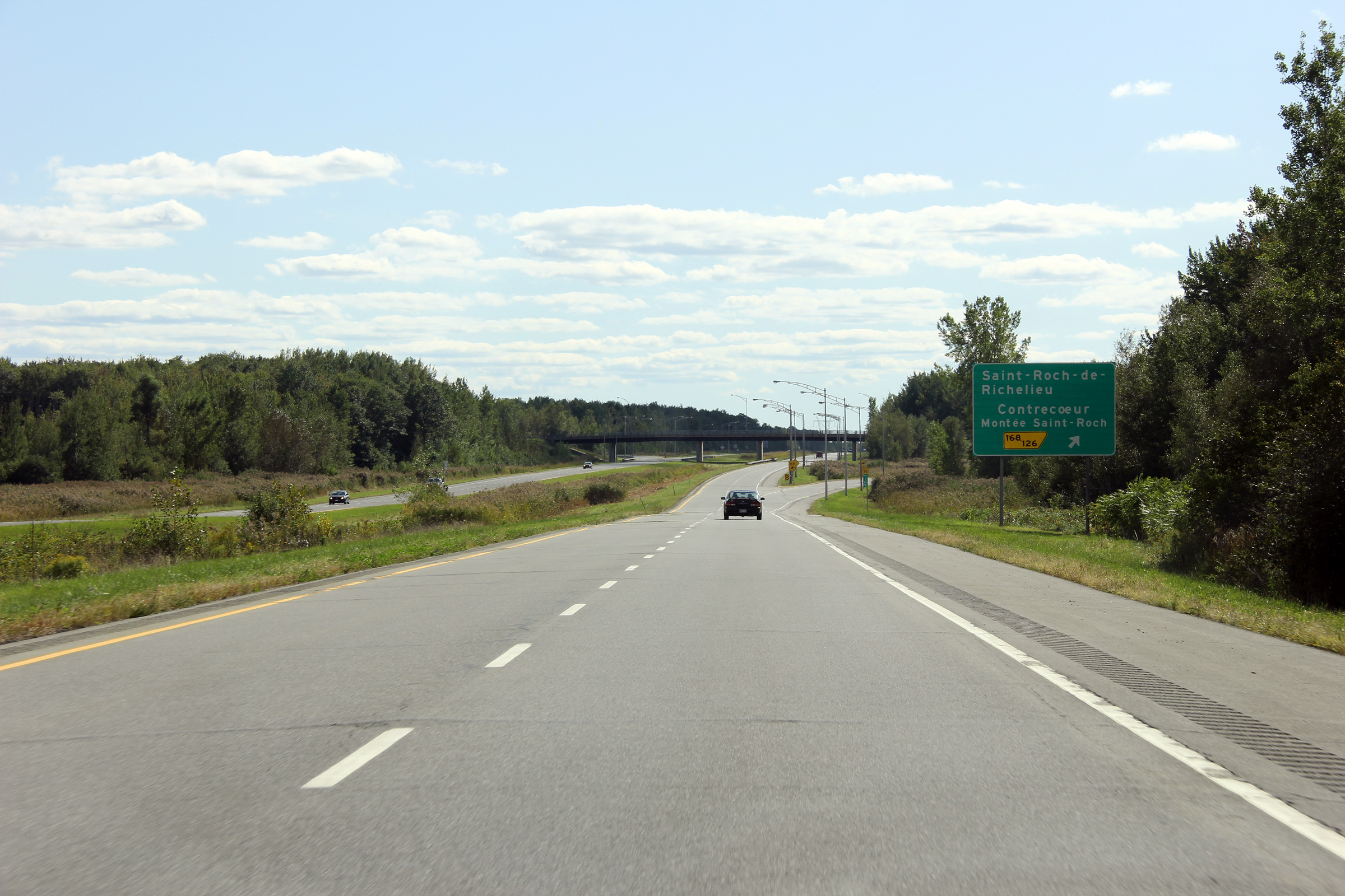
View as the off-ramp at the exit to Saint-Roch-de-Richelieu. This is a very typical view of Autoroute 30 between Montréal and Sorel-Tracy. The Saint Lawrence River valley is exceptionally flat through central Québec.
Vue alors que la bretelle de sortie vers Saint-Roch-de-Richelieu. Cette photo est une vue très typique de l'autoroute 30 entre Montréal et Sorel-Tracy. La vallée de la fleuve Saint-Laurent est exceptionellement plat dans le centre du Québec. |
|
||
|
Date: 18/9/2011 |
High-res: (1440x960) (2400x1600) | |||
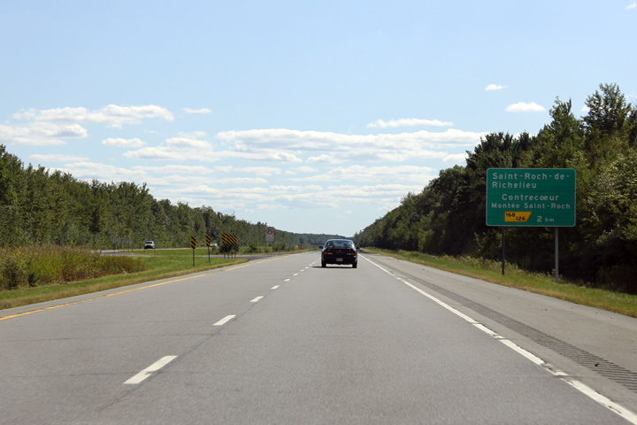
|
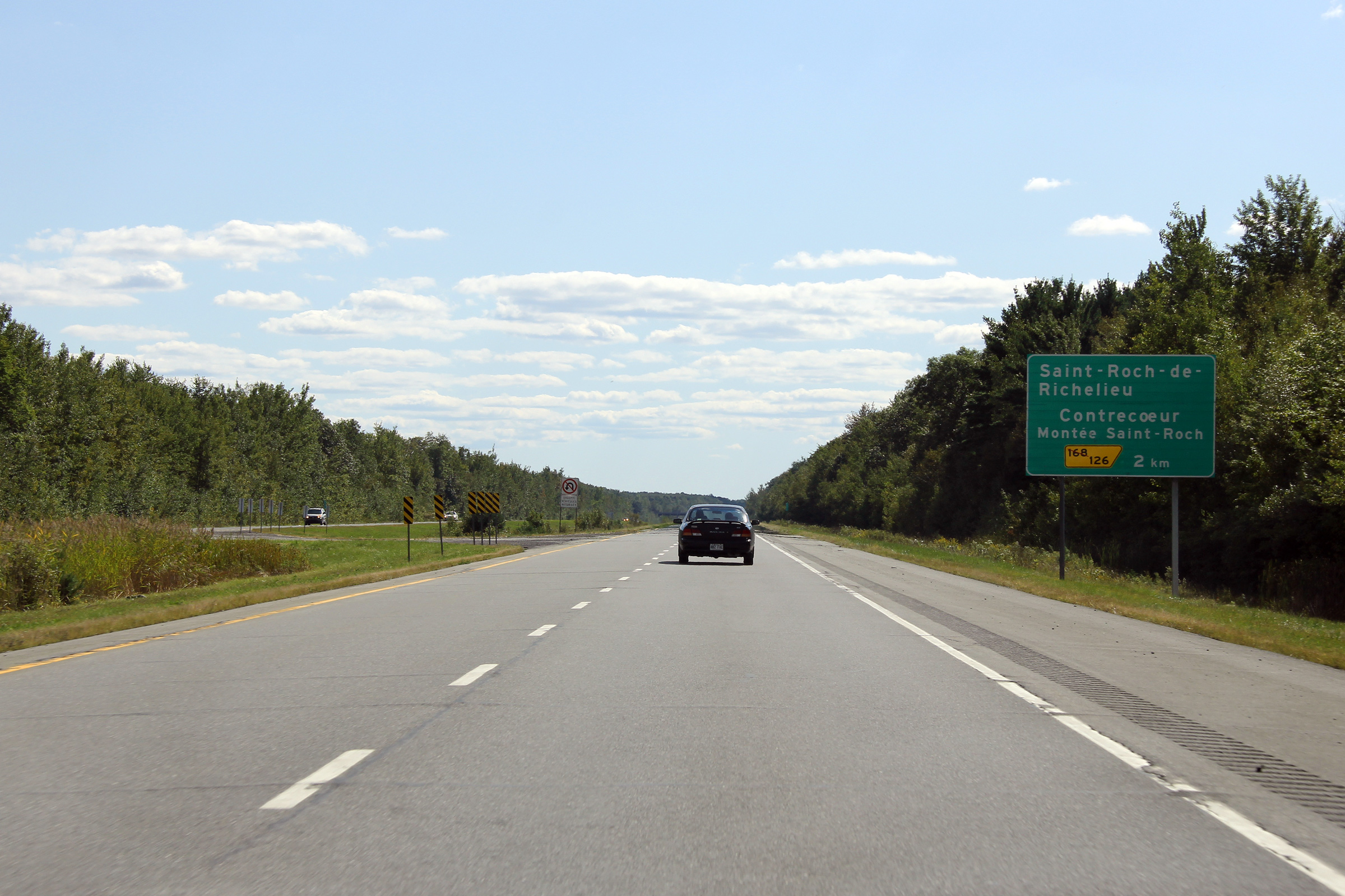
MRC de Lajemmerais Contrecoeur |
Advanced signage for the exit to Saint-Roch-de-Richelieu.
Signalisation avancée pour l'échangeur vers Saint-Roch-de-Richelieu. |
|
||
|
Date: 18/9/2011 |
High-res: (1440x960) (2400x1600) | |||
|
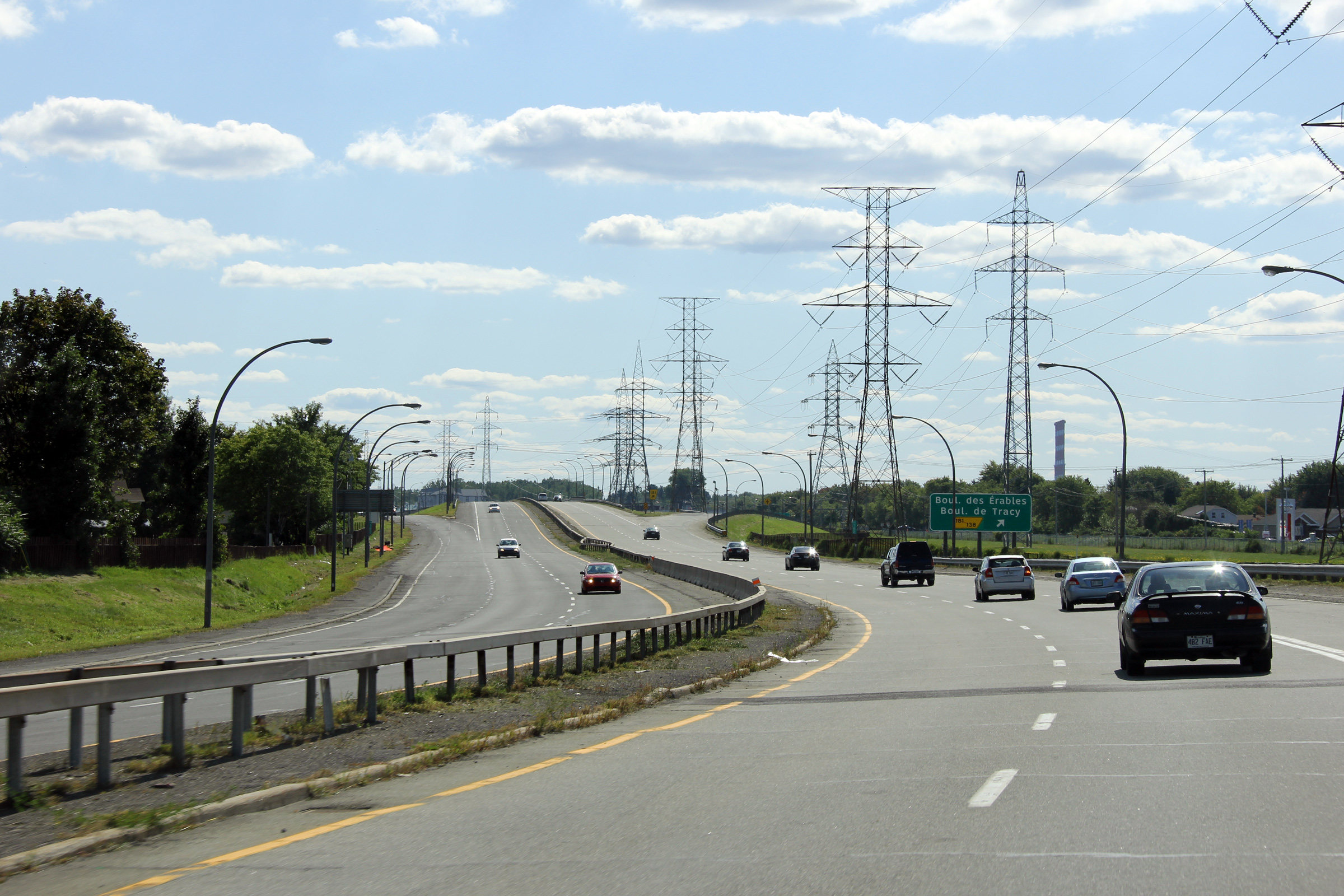
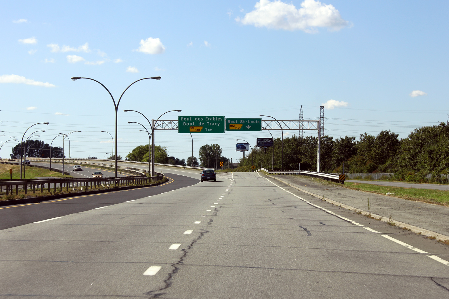
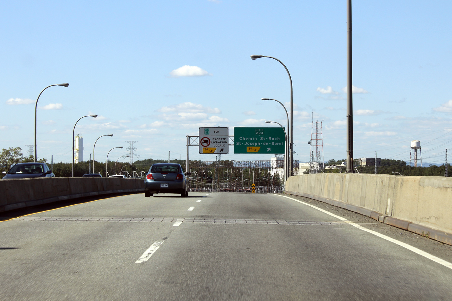
MRC Pierre-de-Saurel Sorel-Tracy |
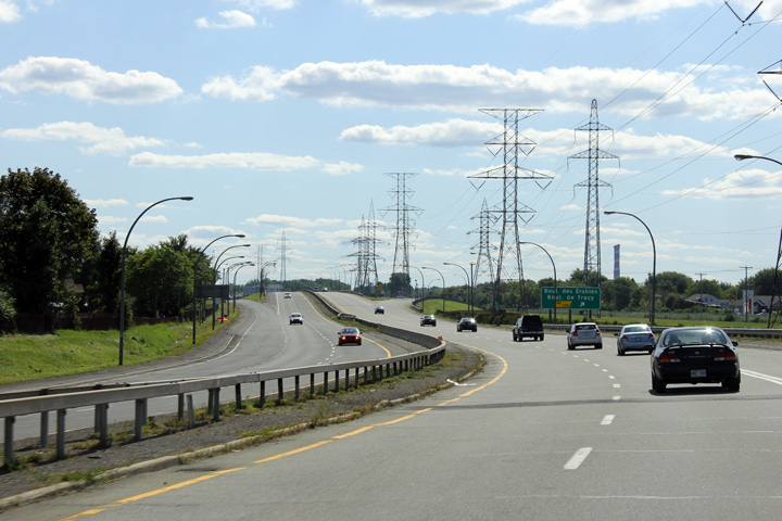
View looking westerly as the freeway descends from the Boul. St-Louis overpass on approach to the Boul. des Érables (Maple Boulevard) interchange.
Vue en direction ouest vers l'échangeur de boul. des Érables alors que l'autoroute descende du viaduc du boul. St-Louis. |
 |
||
|
Photographer: Scot Steeves |
Date: 18/9/2011 |
High-res: (1440x960) (2400x1600) | ||
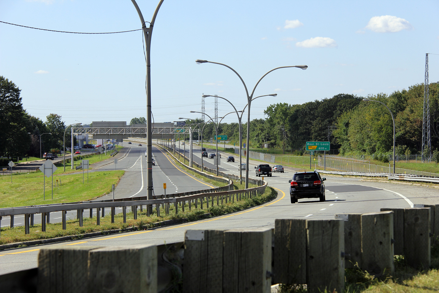
|
MRC Pierre-de-Saurel Sorel-Tracy |
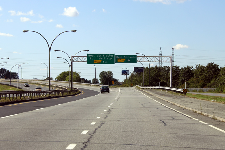
Overhead signage at the exit to Boul. St-Louis.
Signalisation aérienne à la bretelle de sortie vers le boul. St-Louis. |
 |
||
|
Photographer: Scot Steeves |
Date: 18/9/2011 |
High-res: (1440x960) (2400x1600) | ||
|
MRC Pierre-de-Saurel Sorel-Tracy |
Advanced signage for the Highway 133 exit.
Signalisation avancée avant de l'échangeur de la route 133. |
 |
||
|
Date: 18/9/2011 |
High-res: (1440x960) (2400x1600) | |||
|
MRC Pierre-de-Saurel Sorel-Tracy |
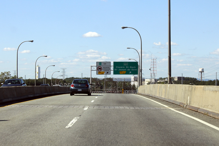
This view looks easterly along Autoroute 30 at the Route 233 interchange just before the Richelieu River bridge.
Cette photo en direction est le long de l'autoroute 30 à l'échangeur de la route 233 avant du pont de la rivière Richelieu. |
 |
||
|
Date: 18/9/2011 |
High-res: (1440x960) (2400x1600) | |||
|
MRC Pierre-de-Saurel Sorel-Tracy |
This photo of Autoroute 30 that looks west was taken at the foot of the long structure that carries the freeway over both the Richelieu River and Highway 233. The box-beam barrier that separates the opposing carriageways of the freeway is atypical of most freeways in Québec.
Cette photo de l'autoroute 30 a été prise en direction ouest au pied du pont longue qui port l'autoroute 30 au-dessus de la rivière Richelieu et la route 233. La barrière «box-beam» qui sépare les deux chaussées contre-sens de l'autoroute est atypique de beaucoup des autoroutes du Québec. |
 |
||
|
Date: 18/9/2011 |
High-res: (1440x960) (2400x1600) | |||
|
MRC Pierre-de-Saurel Sorel-Tracy |
This shot of Autoroute 30 was taken from the Richelieu River bridge approaching the exit to Highway 233.
Cette photo de l'autoroute 30 a été prise à partir du pont de la rivière Richelieu approche la sortie vers la route 233. |
 |
||
|
Date: 18/9/2011 |
High-res: (1440x960) (2400x1600) | |||
|
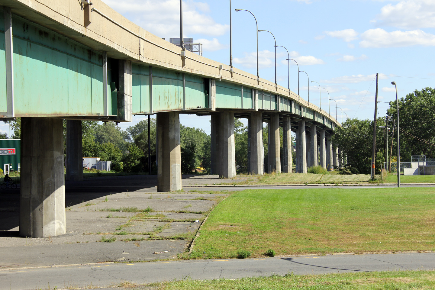
MRC Pierre-de-Saurel Sorel-Tracy |
This photo looks easterly at the underside of the Autoroute 30 viaduct that carries the freeway overtop of both Route 233 and the Richelieu River.
Cette photo regarde vers l'est sous le pont qui transporte l'autoroute 30 au-dessous tout les deux la rivière Richelieu et la route 233. |
 |
||
|
Date: 18/9/2011 |
High-res: (1440x960) (2400x1600) | |||
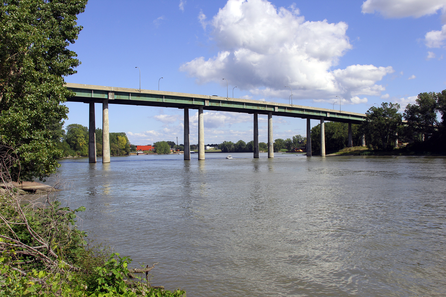
|
MRC Pierre-de-Saurel Sorel-Tracy |
Autoroute 30 crosses the Richelieu River on a high level bridge. The Richelieu River is navigable for a considerable distance south from the Saint Lawrence River.
L'autoroute 30 traverse la rivière Richelieu sur un haut pont élevé. La rivière Richelieu est navigable pour une grand distance au sud de la fleuve Saint-Laurent. |
 |
||
|
Date: 18/9/2011 |
High-res: (1440x960) (2400x1600) | |||
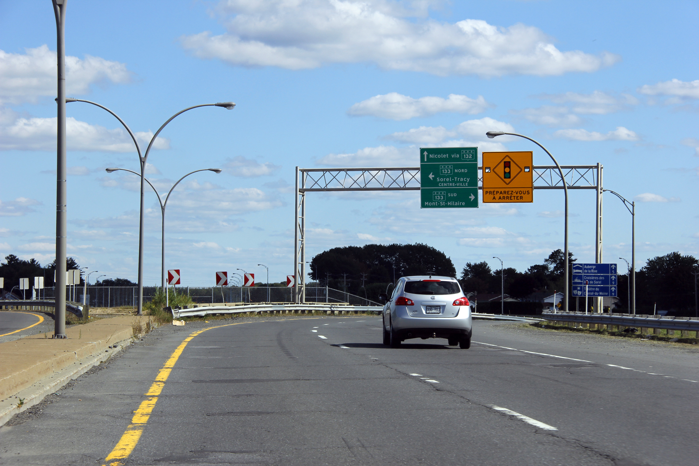
|
MRC Pierre-de-Saurel Sorel-Tracy |
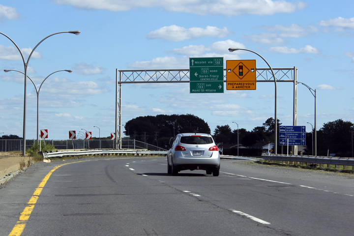
Autoroute 30 on approach to the signalized intersection with Highway 133. The eastbound and westbound carriageways of Autoroute 30 diverge to follow the future diamond interchange ramps to meet Highway 133 at independent traffic signals.
Vue vers l'est sur l'approche de la intersection signalèrent avec la route 133. Les chaussées contresens de l'autoroute 30 divergent pour suivre les futures bretelles de l'échangeur en losange à croiser la route 133 aux feux de circulation indépendante. |
 |
||
|
Date: 18/9/2011 |
High-res: (1440x960) (2400x1600) | |||
|
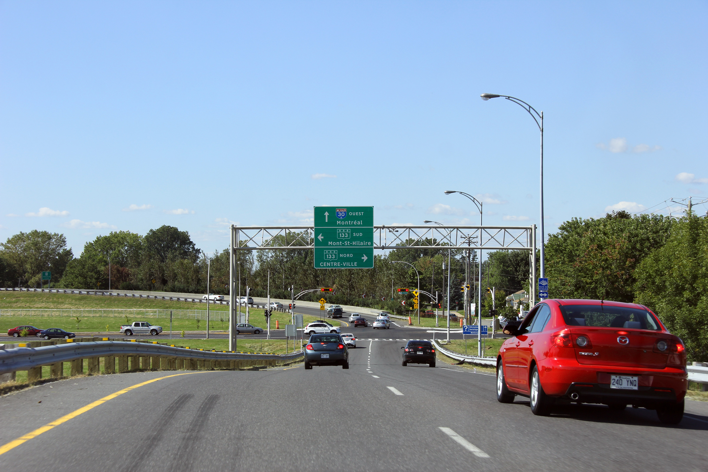
MRC Pierre-de-Saurel Sorel-Tracy |
Westerly view along Autoroute 30 at the Highway 133 signalized intersection. West of this intersection, the Autoroute 30 freeway begins.
Vue vers l'ouest le long de l'autoroute 30 à la intersection avec la route 133. Au ouest de ce carrefour, la route 30 devient une autoroute. |
 |
||
|
Date: 18/9/2011 |
High-res: (1440x960) (2400x1600) | |||
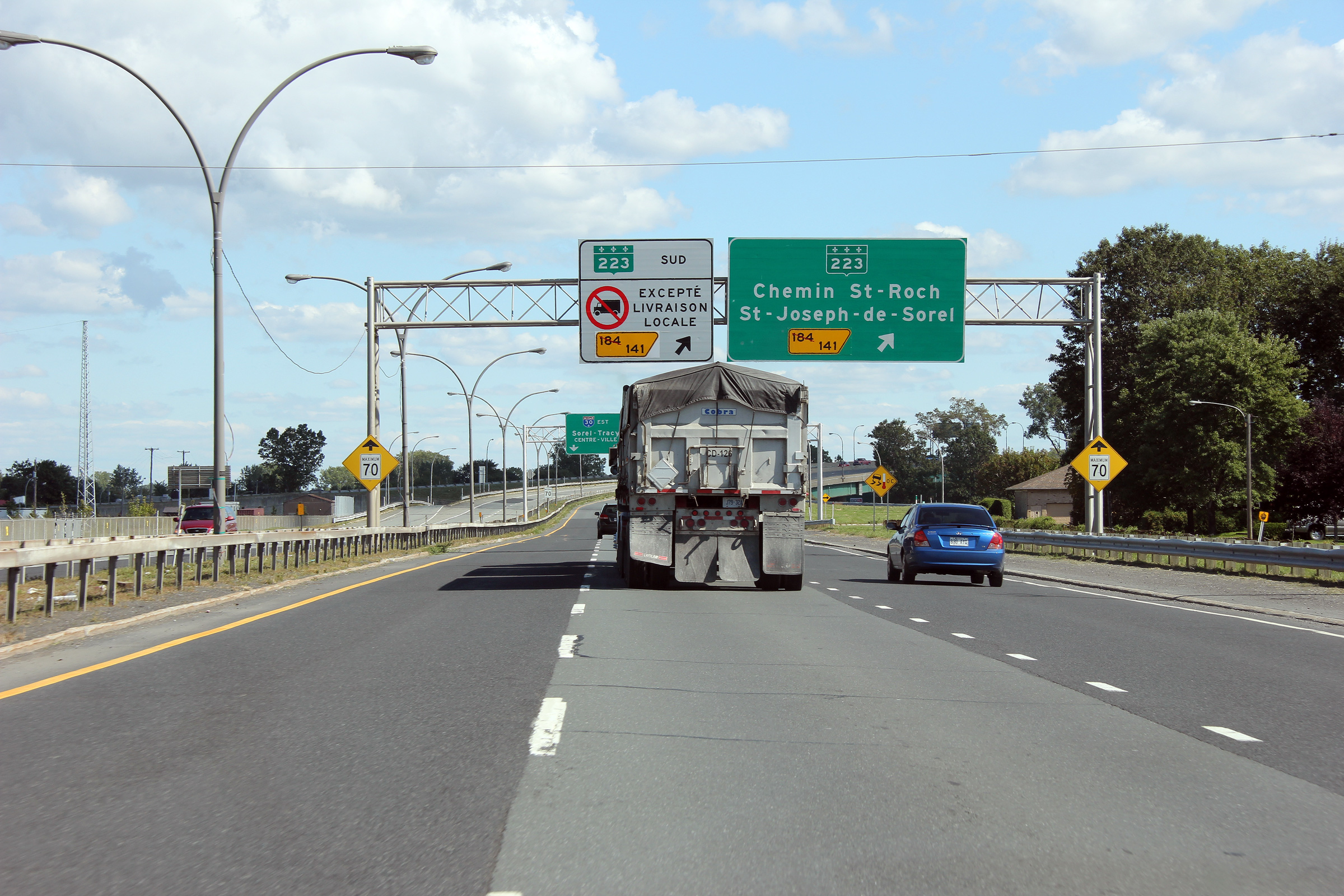
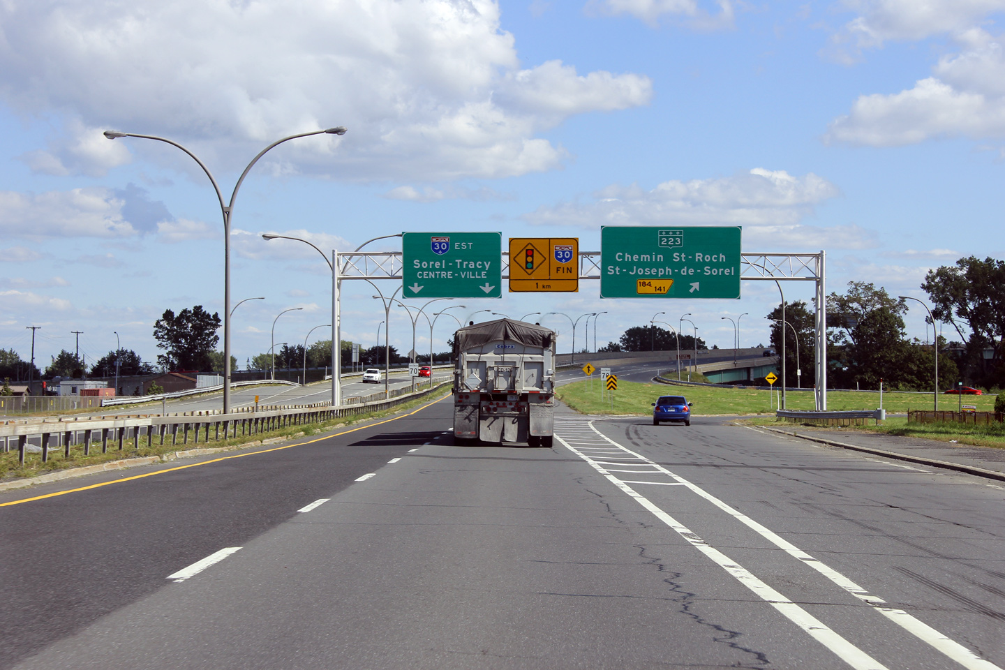
|
East of Sorel-Tracy, Route 132 is the principal highway along the South Shore. Click here for R-132 images. |
||||
<- Page 1 Back to Autoroute 30 Index Page 4 ->
© 2006-2015 AsphaltPlanet.ca.
AsphaltPlanet@asphaltplanet.ca
Page Created: August 6, 2009.
Last Updated: January 18, 2012.