AsphaltPlanet.ca > Quebec > Autoroute 15 > Page 1
|
Autoroute 15 |
| <- I-87 (NY) |
|
Page 2 -> |
Pictures on this page are arranged in order from south to north. A-15 North photos are left-aligned in the last column, while A-15 South photos are right-aligned. Center-line pictures are centered within the last column.
|
Location |
Description |
Photo |
||
|
North- |
South- |
|||
|
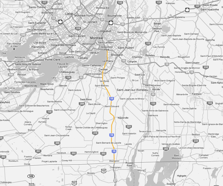
Autoroute 15 meets Autoroute between Sainte-Catherine and La Prairie. Click here for A-30 images. |
||||
|
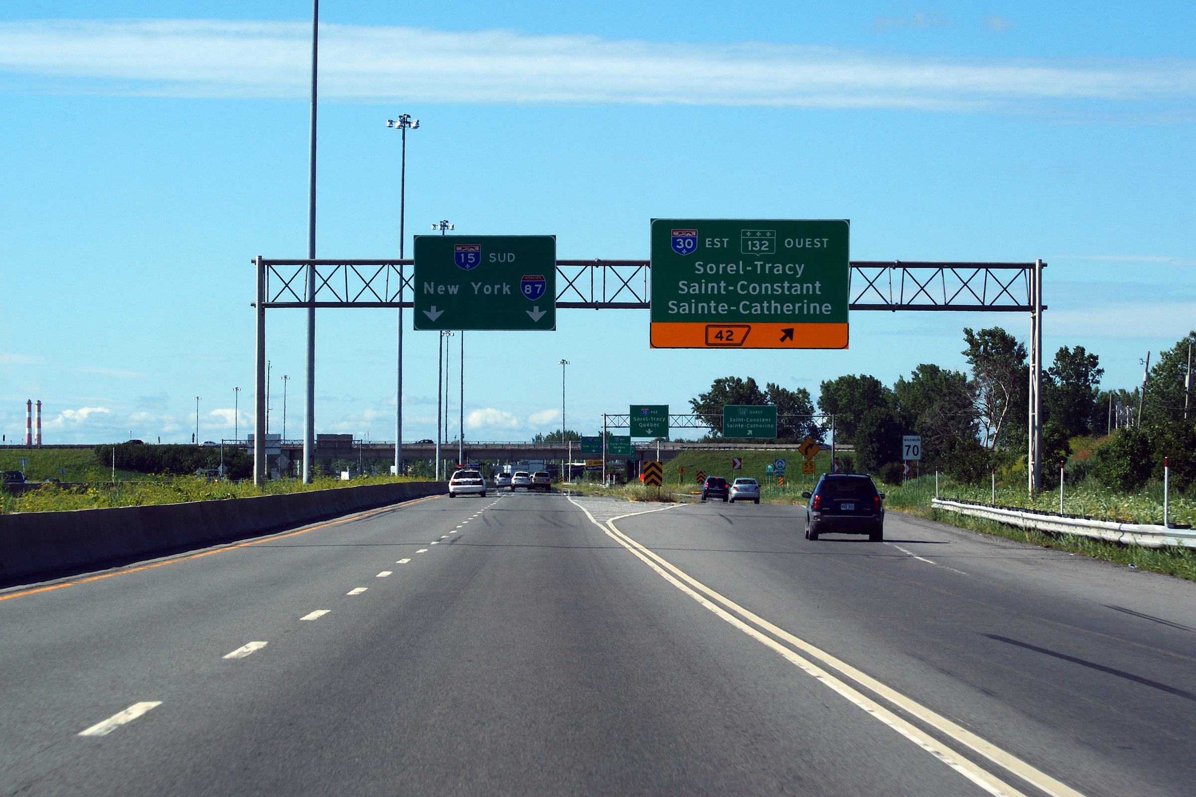
MRC de Roussillon |
Signage at the ramp to the collector lane for the Autoroute 930 / Route 132 cloverleaf.
Signalisation à la rampe des voies collectrices au trèfle de l'autoroute 930 et Route 132. |
 |
||
|
Date: 7/24/2011 |
High-res: (1440x960) (2400x1600) | |||
|
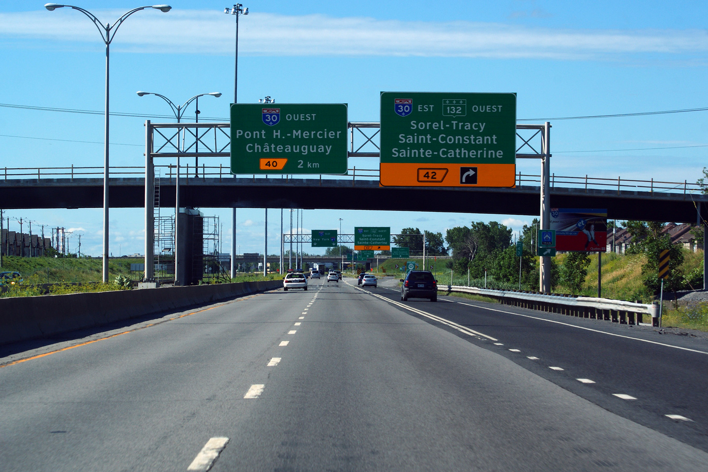
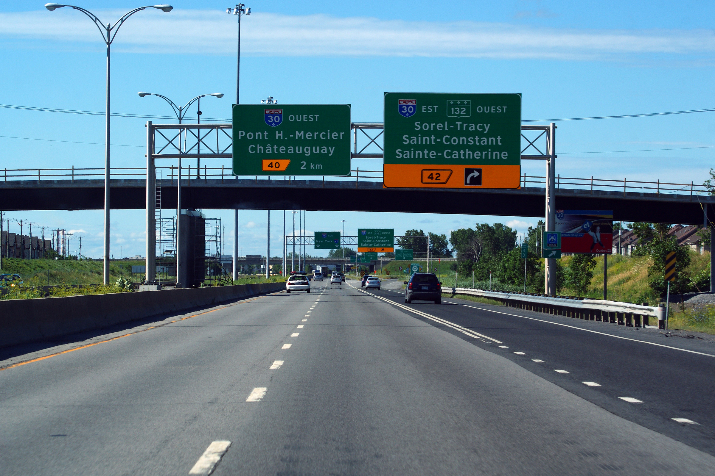
MRC de Roussillon |
Advanced signage for the Autoroute 930 / Route 132 cloverleaf
Signalisation avancée pour le trèfle de l'autoroute 930 et Route 132. |
 |
||
|
Date: 7/24/2011 |
High-res: (1440x960) (2400x1600) | |||
|
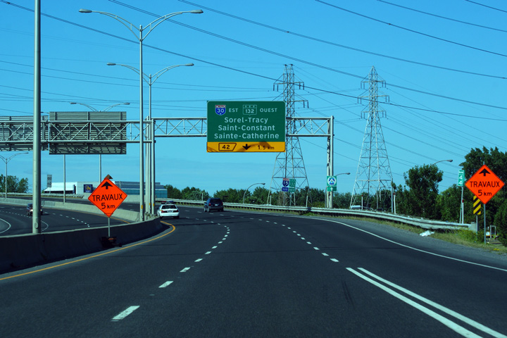
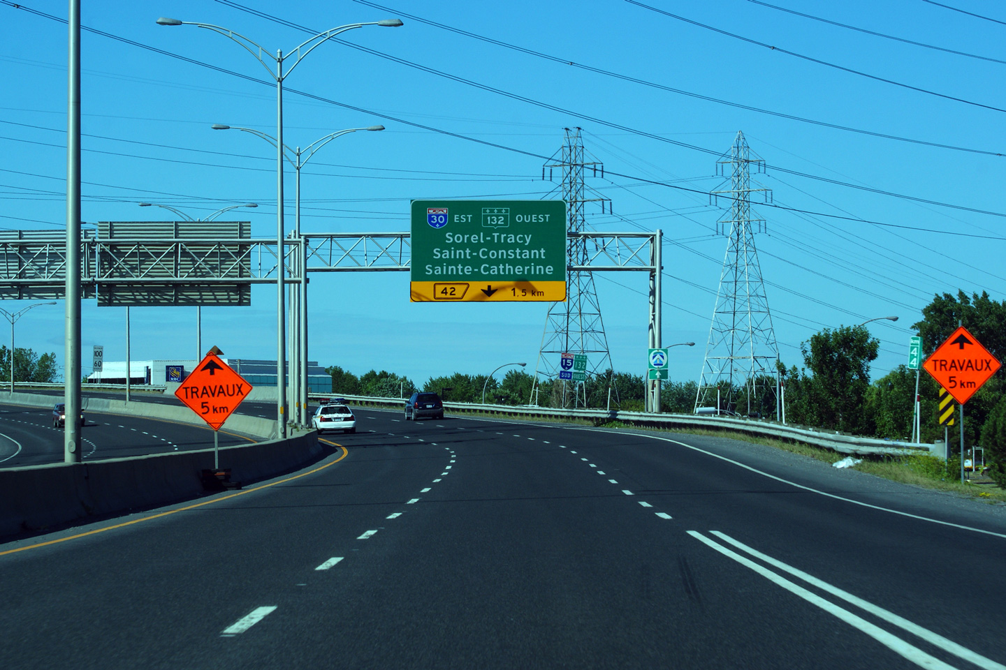
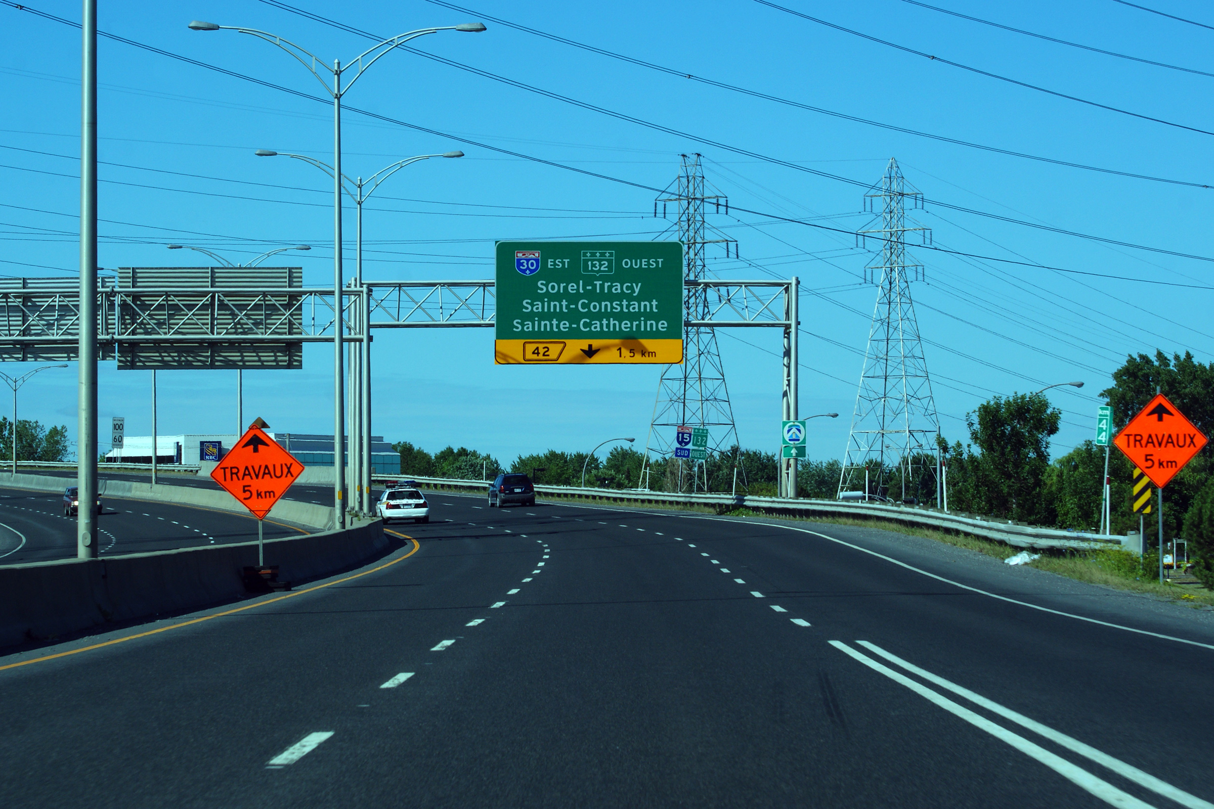
MRC de Roussillon |
Advanced signage indicating that the right-most lane departs the freeway for Autoroute 30-West (Autoroute 930) and Route 132 in 1.5km.
Signalisation avancée indiquant que la voie de droite départ l'autoroute 15 pour l'autoroute 930 et route 132. |
 |
||
|
Date: 7/24/2011 |
High-res: (1440x960) (2400x1600) | |||
|
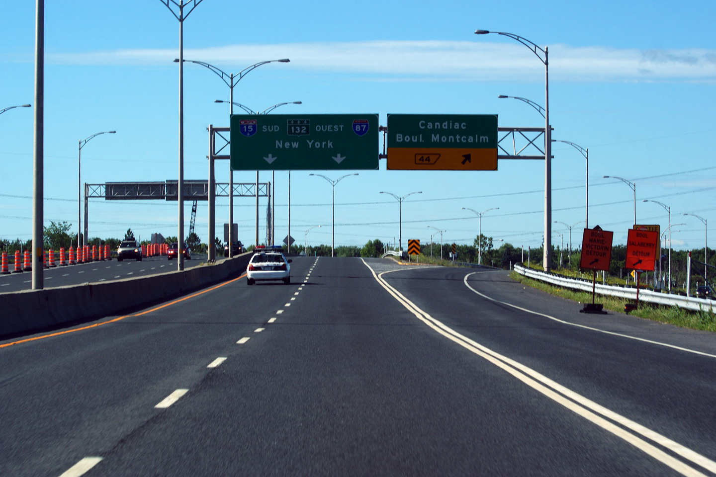
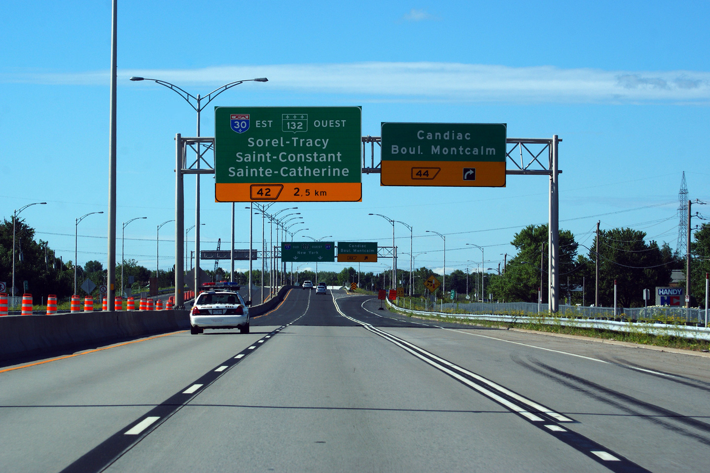
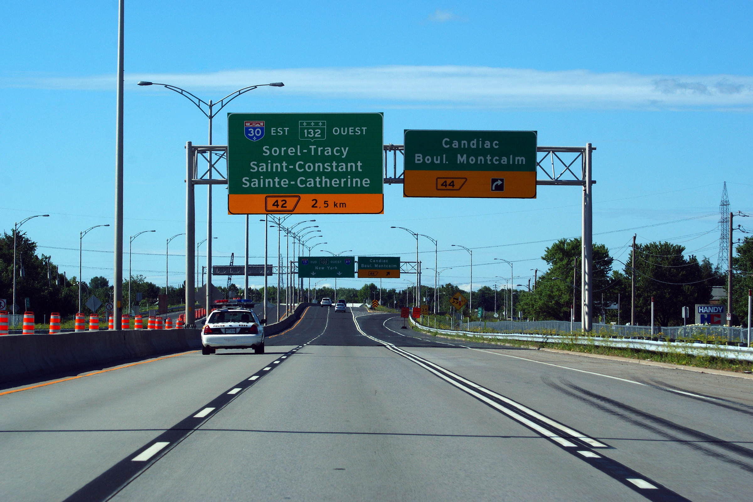
MRC de Roussillon |
Signage at the ramp to Candiac.
Signalisation à la bretelle de sortie vers Candiac. |
 |
||
|
Date: 7/24/2011 |
High-res: (1440x960) | |||
|
MRC de Roussillon |
Overhead advanced signage at the ramp for Candiac. The right-most freeway lane departs the autoroute for Candiac.
Signalisation avancée à la rampe pour Candiac. La voie d'extrême droite de l'autoroute quitte l'autoroute à Candiac. |
 |
||
|
Date: 7/24/2011 |
High-res: (1440x960) (2400x1600) | |||
|
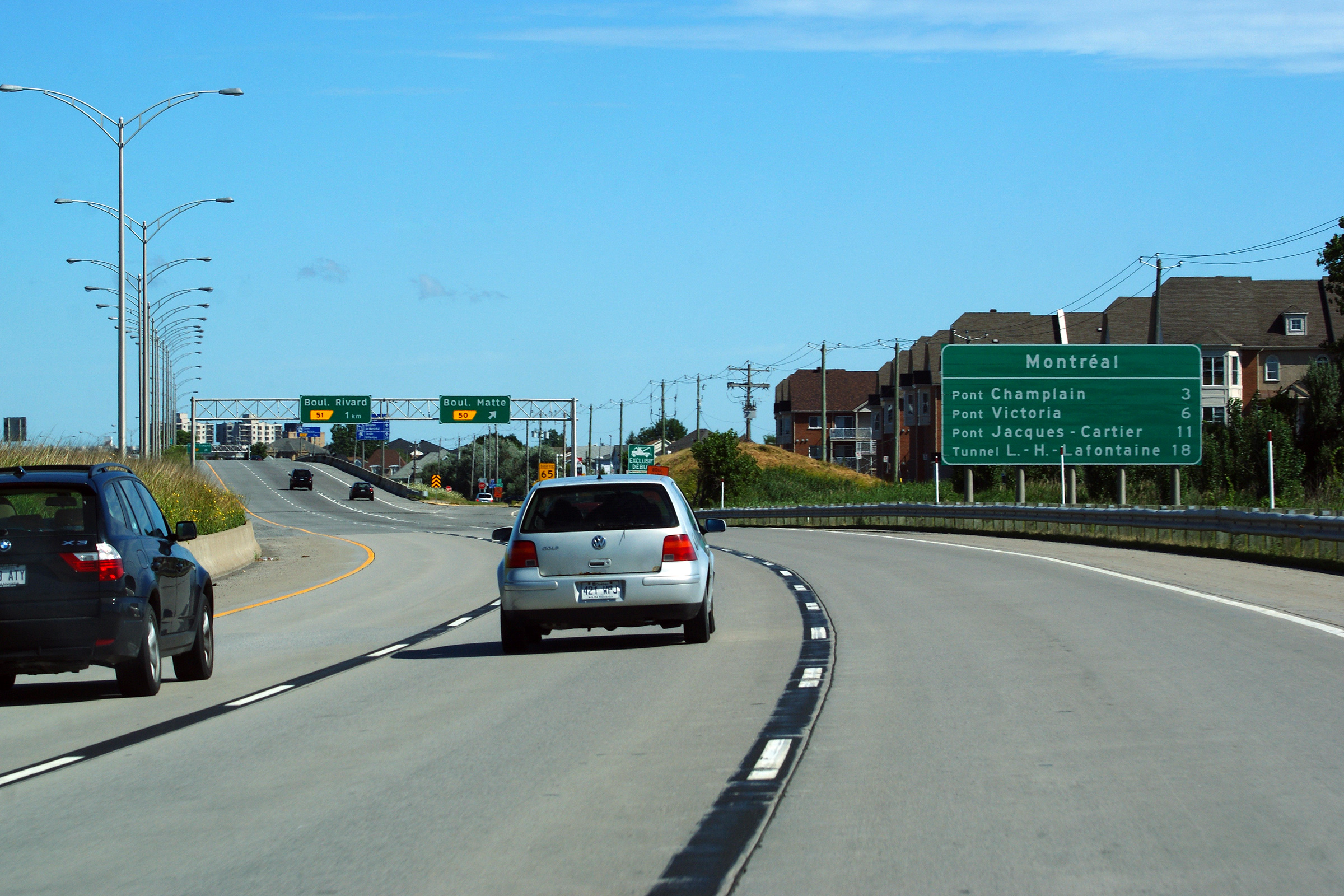
Agglomeration de Longueuil Brossard |
Signage just north of Rivière Saint-Jacques announcing the four access routes from the South Shore.
Signalisation juste au nord de la rivière Saint-Jacques annonçant les quatres routes vers Montreal. |
|
||
|
Date: 7/24/2011 |
High-res: (1440x960) (2400x1600) | |||
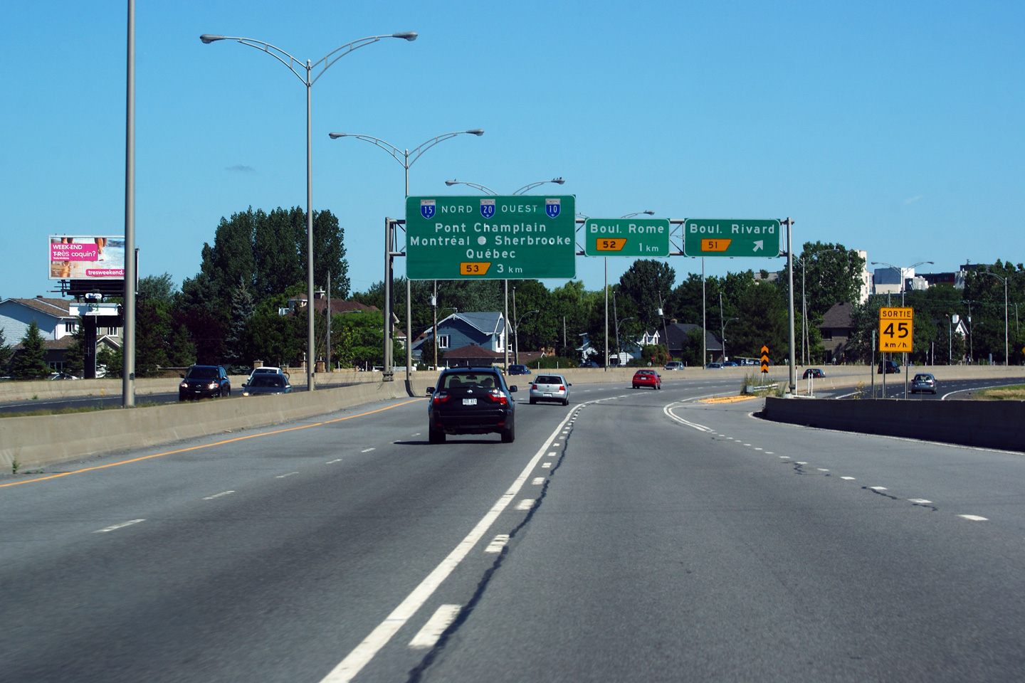
|
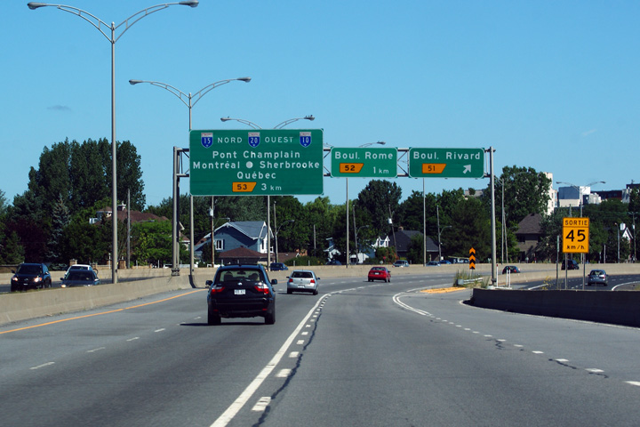
Agglomeration de Longueuil Brossard |
Overhead signs as the freeway curves easterly at the exit to Boul. Rivard.
L'autoroute fait une courbe vers l'est à la sortie du boul. Rivard. |
 |
||
|
Date: 7/24/2011 |
High-res: (1440x960) (2400x1600) | |||
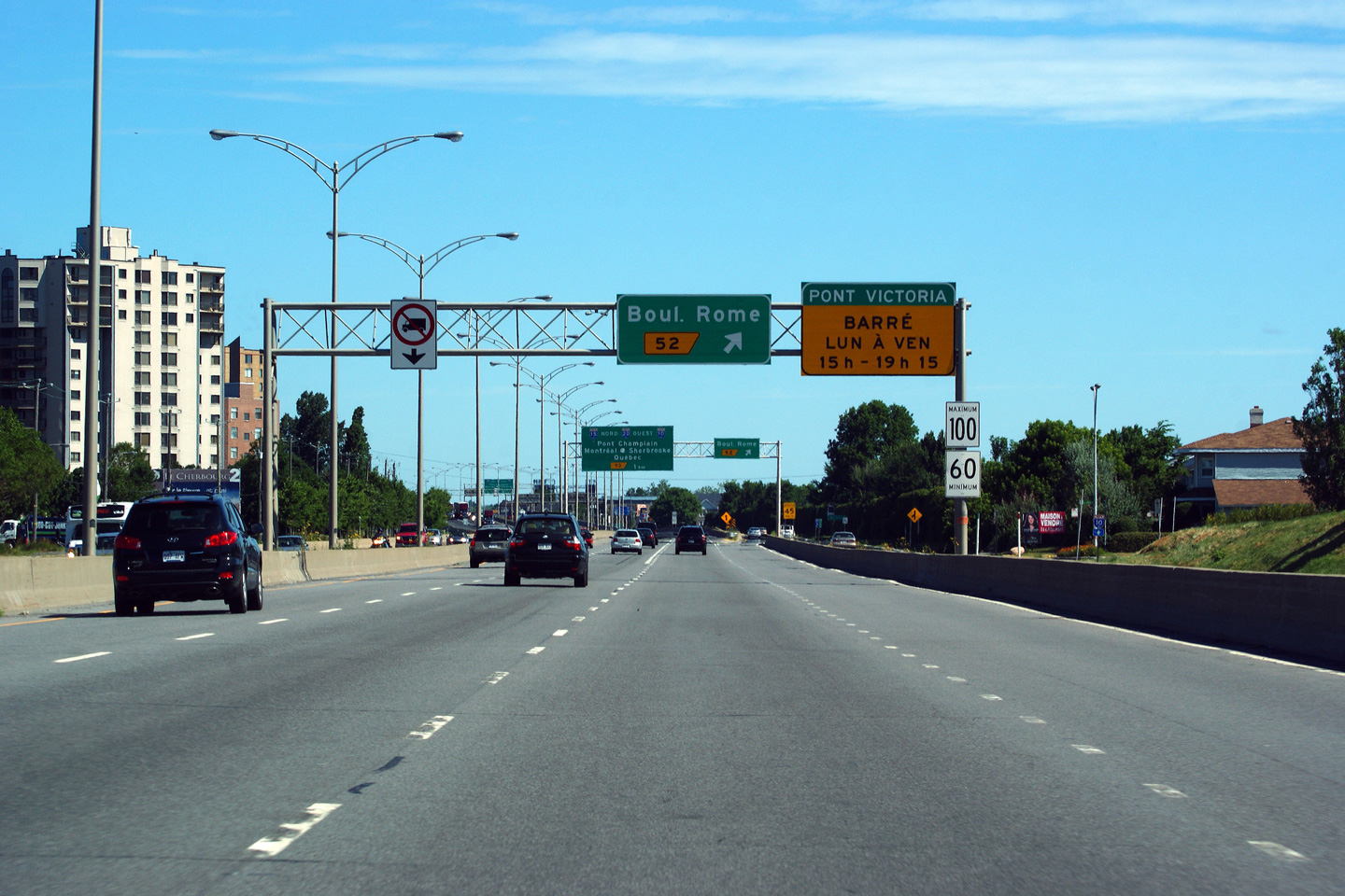
|
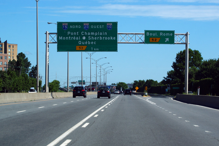
Agglomeration de Longueuil Brossard |
Advanced signage for Boul. Rome signed with signage indicating that Pont Victoria is closed to Montreal-bound traffic during the evening rush hour
Signalisation avancée pour le boul. Rome, avec un panneau indiquant que le pont Victoria est fermé à la circulation en direction de Montréal pendant les heures de pointe du soir. |
|
||
|
Date: 7/24/2011 |
High-res: (1440x960) (2400x1600) | |||
|
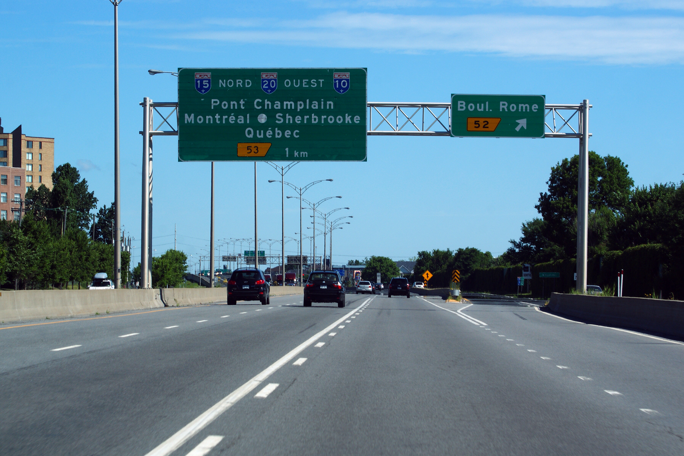
Agglomeration de Longueuil Brossard |
Signage at the off-ramp to Boul. Rome.
Signalisation à la bretelle de sortie à Boul. Rome. |
|
||
|
Date: 7/24/2011 |
High-res: (1440x960) (2400x1600) | |||
|
Agglomeration de Longueuil Brossard |
Advanced sign for the South Shore interchange at the foot of Pont Champlain.
Signalisation avancée pour l'échangeur de la rive-sud au pied du pont Champlain. |
 |
||
|
Date: 7/24/2011 |
High-res: (1440x960) | |||
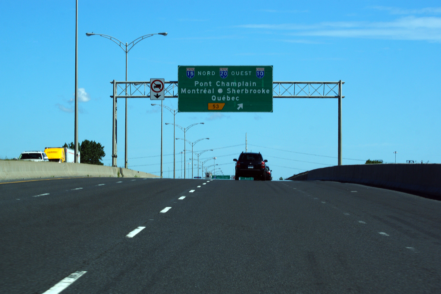
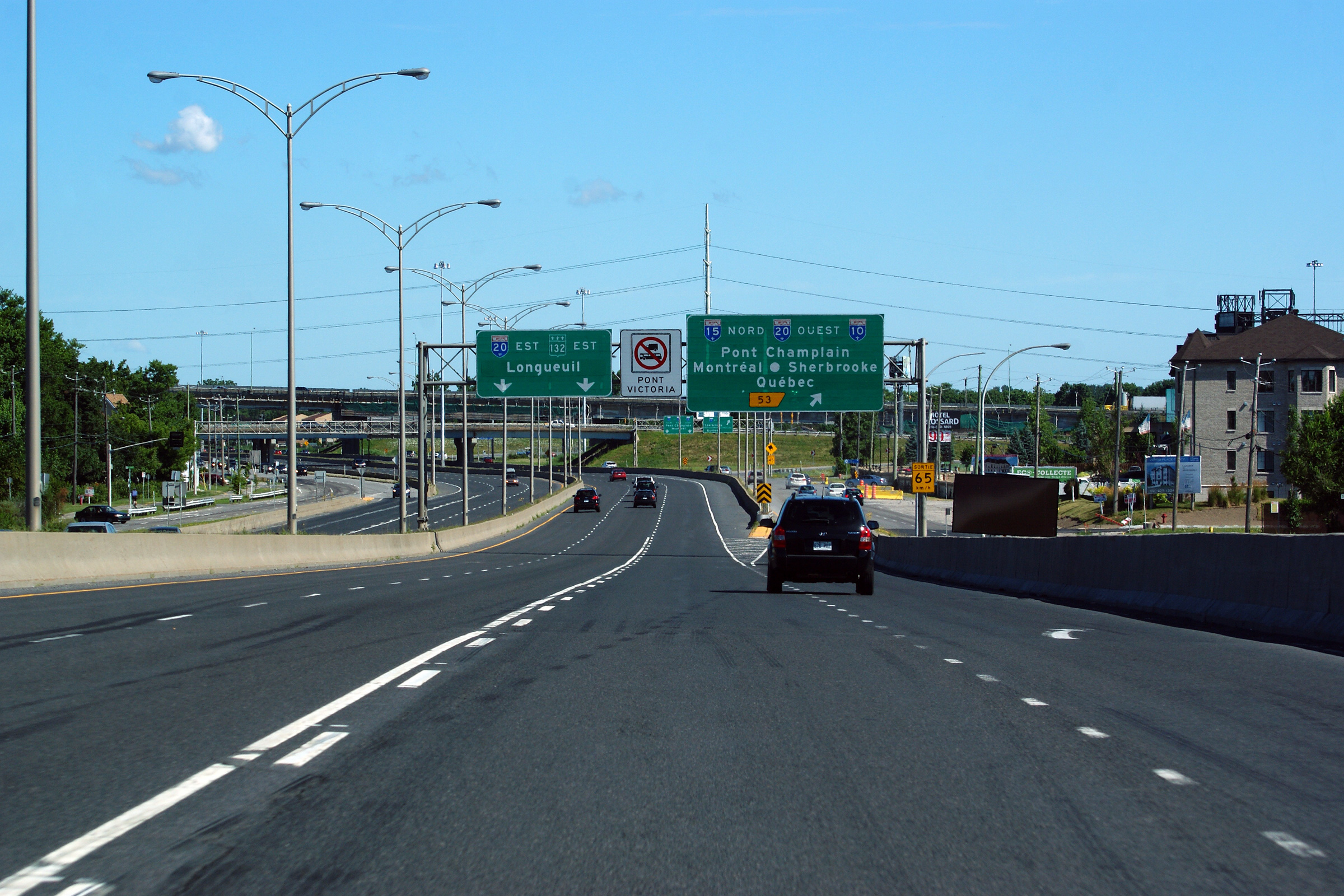
|
Agglomeration de Longueuil Brossard |
Signage for the ramp to Pont Champlain. Autoroute 15 departs the freeway mainline at this interchange where the highway follows the frontage road and a long single lane ramp before traversing the Saint Lawrence via Pont Champlain.
Signalisation pour la rampe à Pont Champlain. L'autoroute 15 quitte la voie principale de l'autoroute à cet échangeur, où elle suit la voie de desserte et une longue rampe à une voie avant de traverser le fleuve Saint-Laurent via le pont Champlain. |
|
||
|
Date: 7/24/2011 |
High-res: (1440x960) (2400x1600) | |||
|
Autoroute 15 meets both Autoroute 10 and 20 at a large interchange on the south shore. Click here for R-132-East images, here for A-10 images and here for A-20 images. |
||||
<- I-87 (NY) Back to Autoroute 15 Index Page 2 ->
© 2006-2011 Scott Steeves.
AsphaltPlanet@asphaltplanet.ca
Special thanks to Carl Tessier for assistance with French translations.
Page Created: December 13, 2008.
Last Updated: November 10, 2011.


