Location
Description
Photo
North-
Bound
South-
Bound
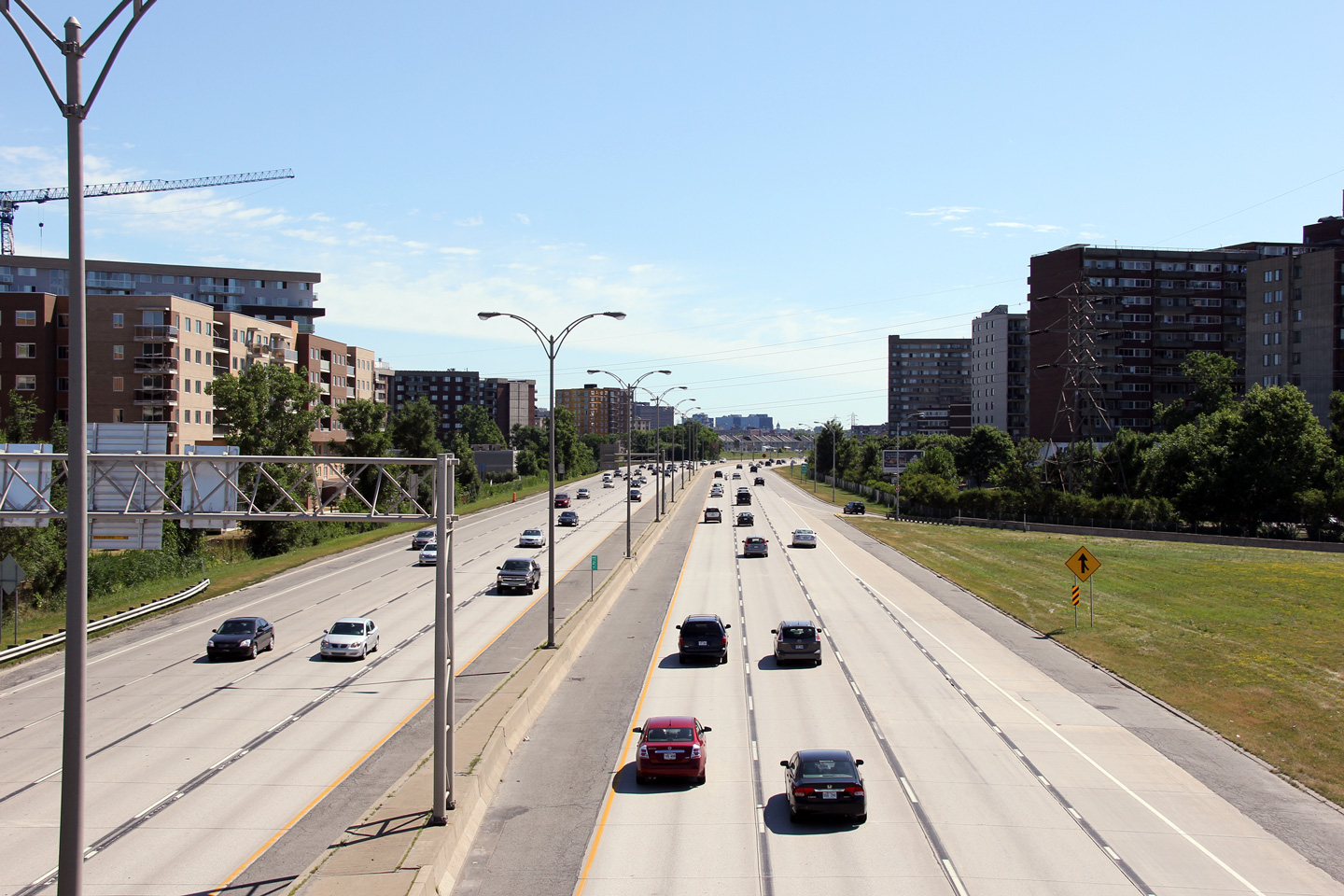
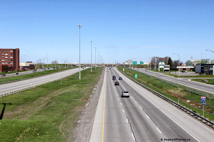
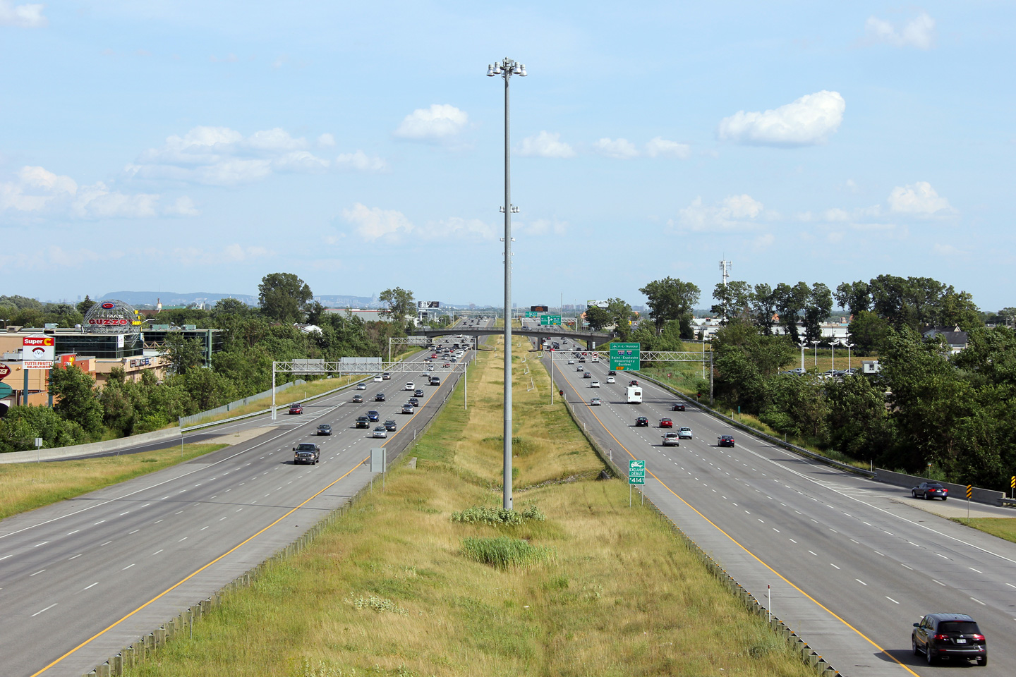
The Laurentian Autoroute ends at the Metropolitan Autoroute. A-15 continues southerly as Autoroute Décarie. Click here for A-40 images.
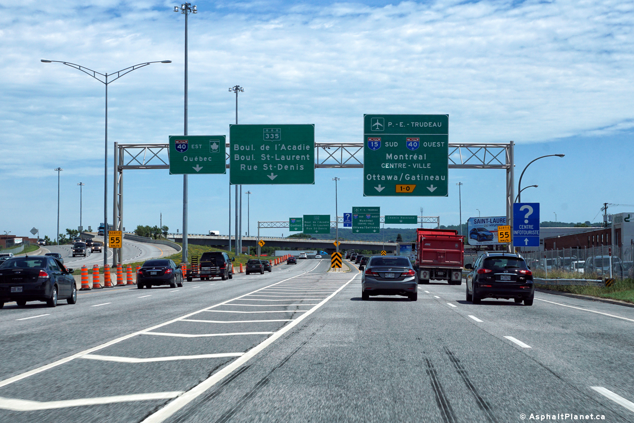
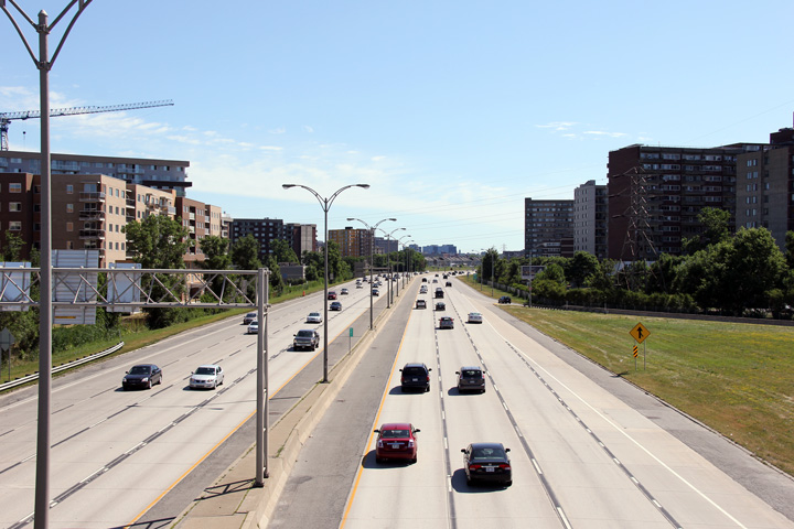
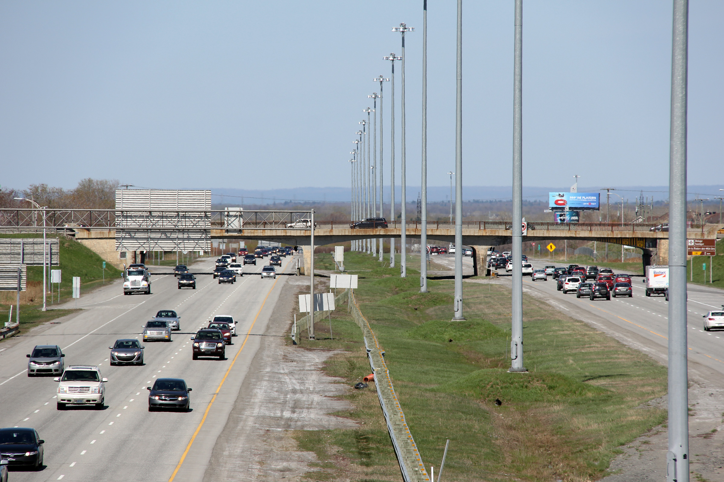
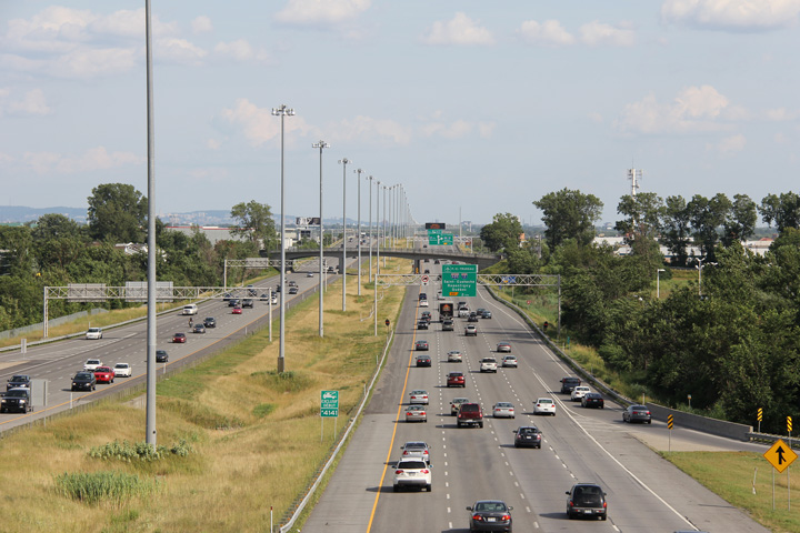
View looking southerly at the Autoroute 40 interchange. Both ramps allow movement both the mainline lanes of Autoroute 40, and to the service roads.
Date: 7/12/2016
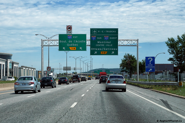
Signage as the ramp to Autoroute 40 splits.
Date: 7/12/2016
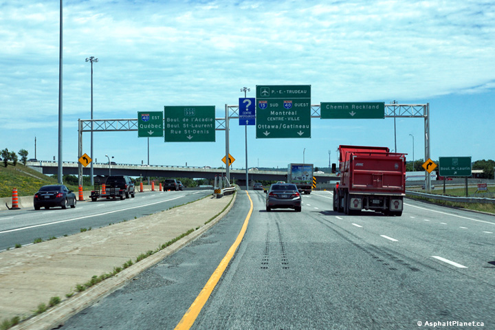
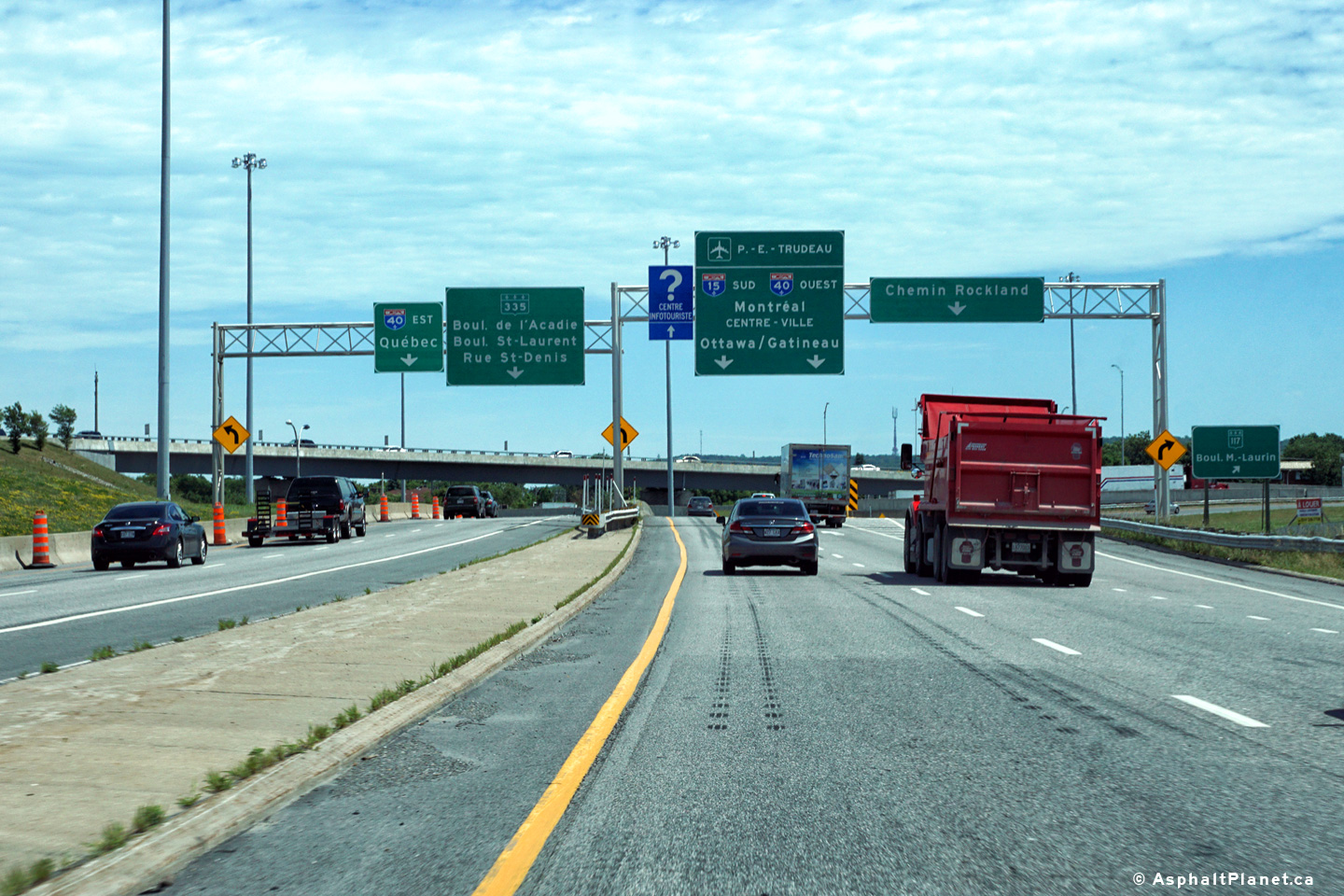
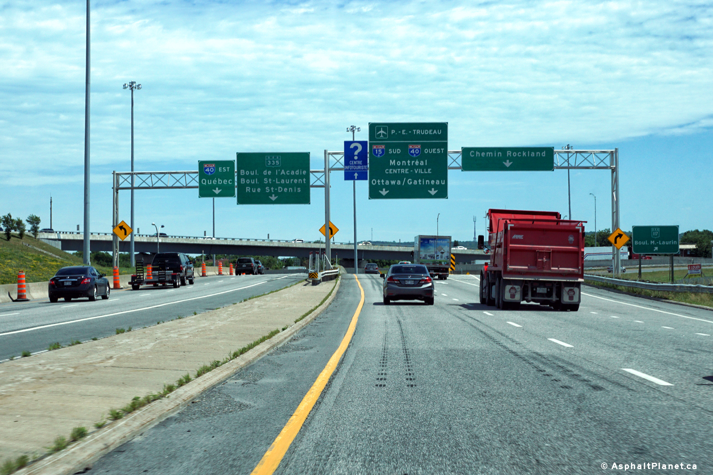
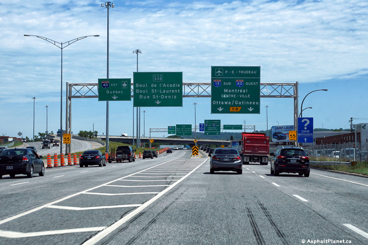
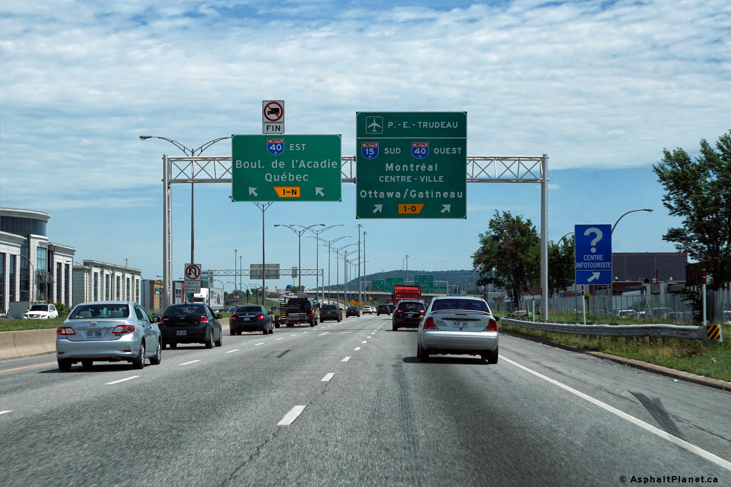
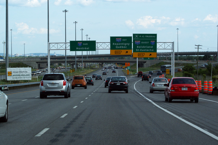
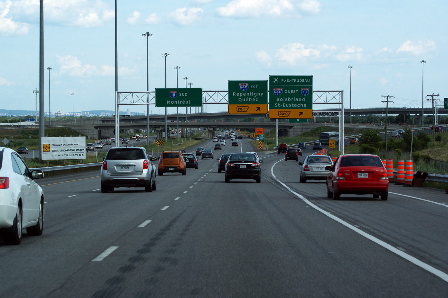
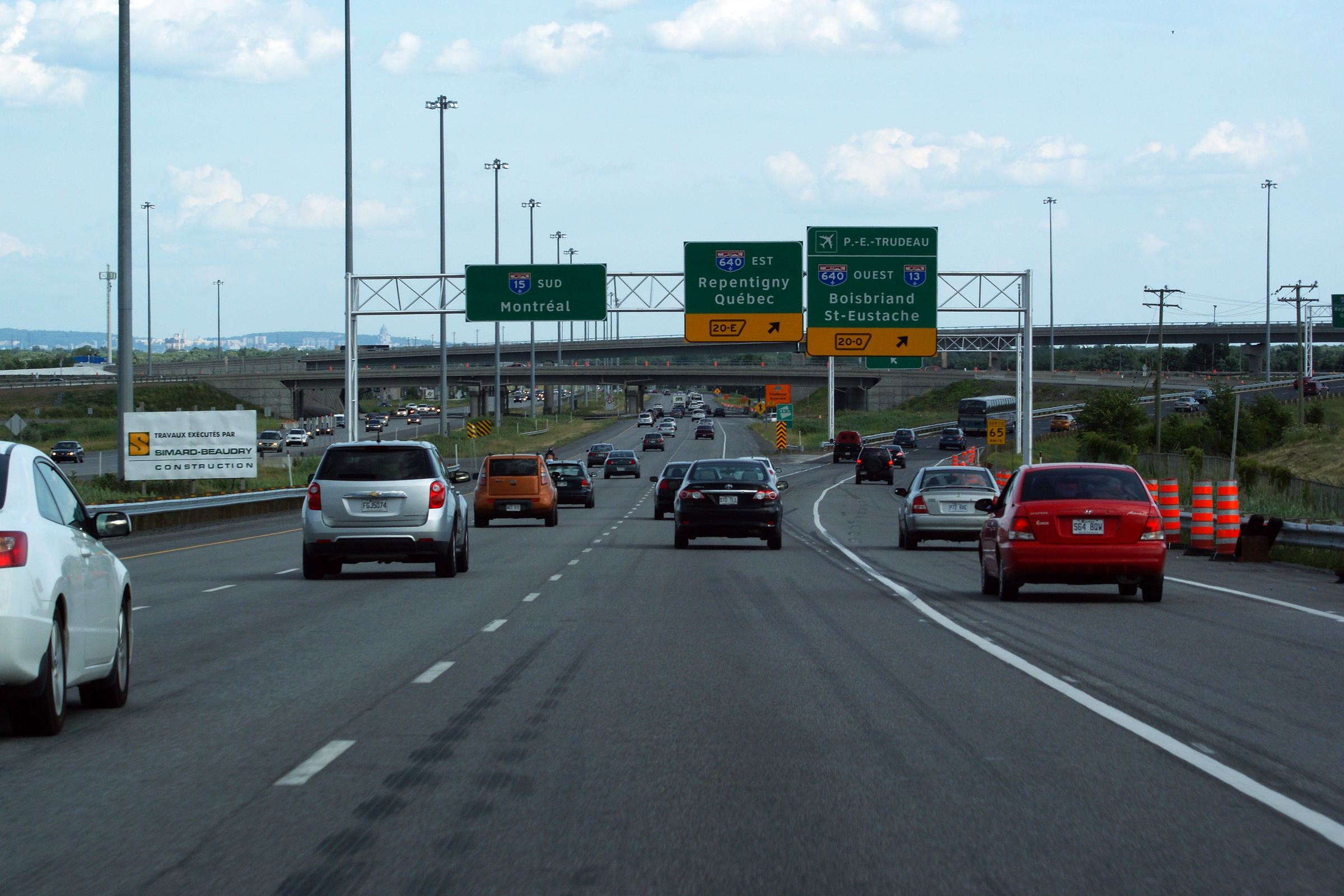
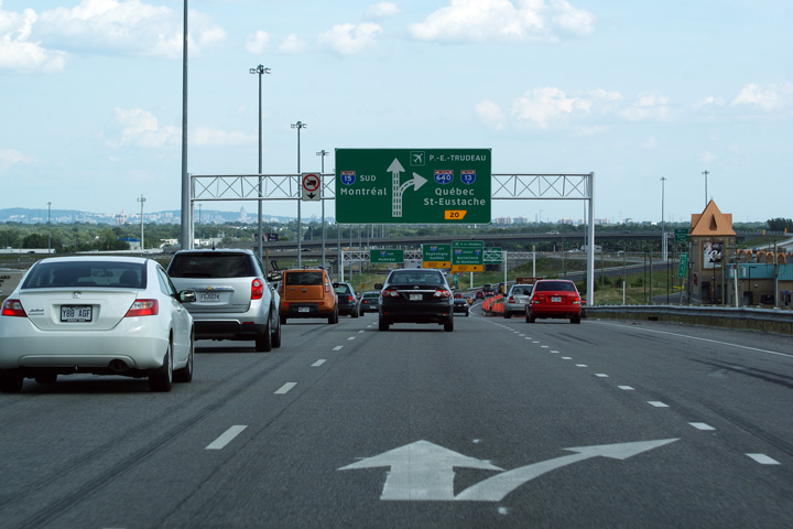
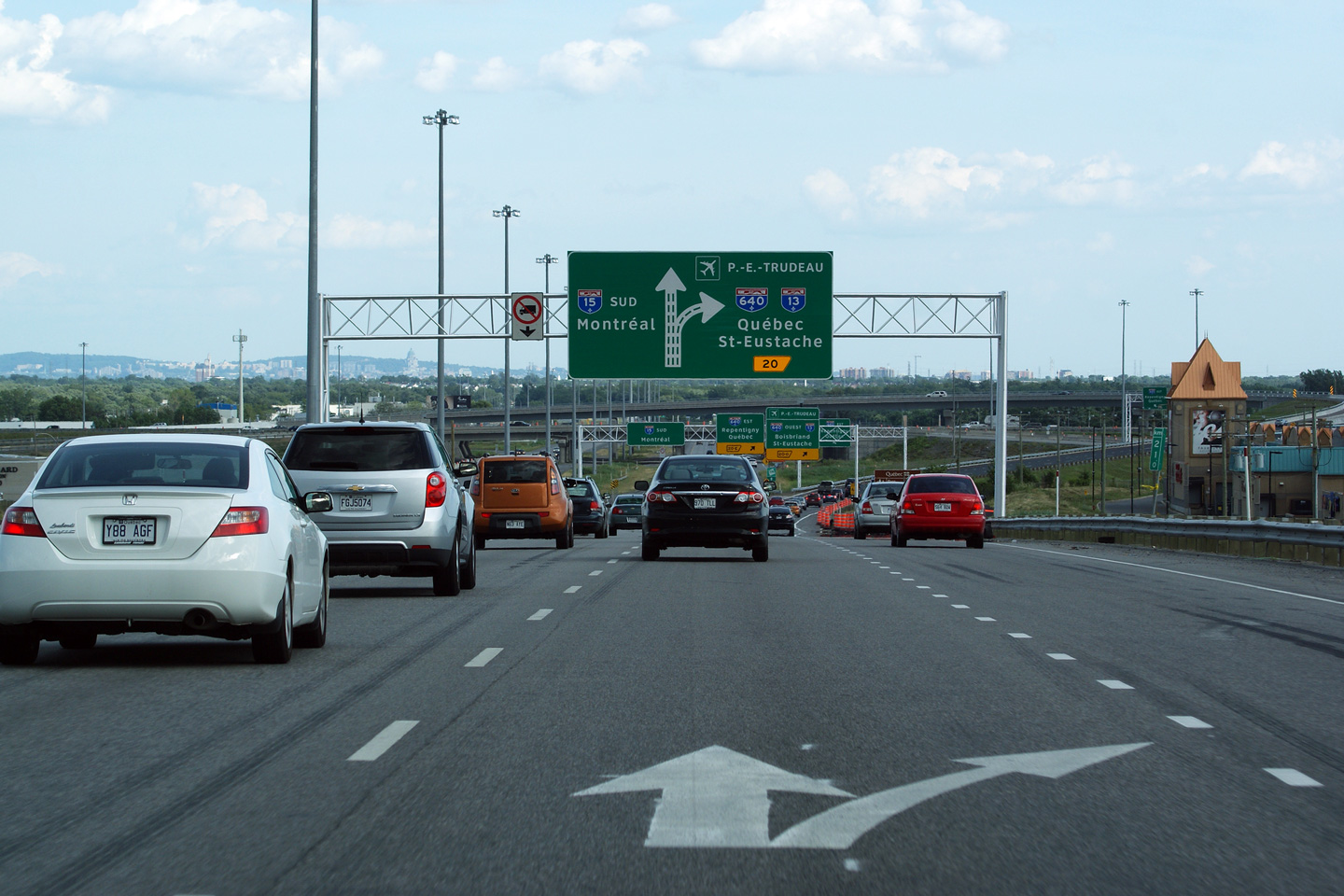
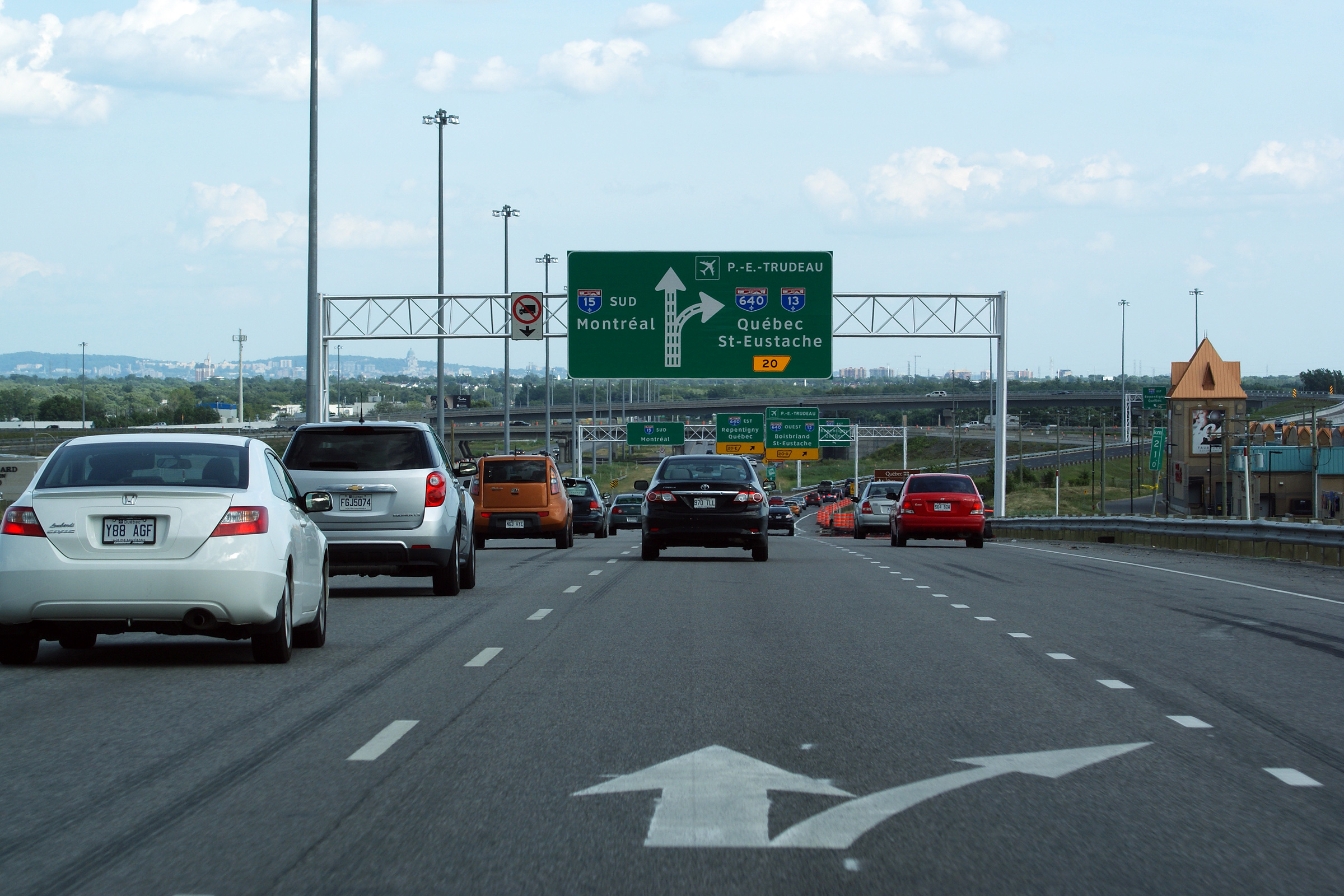
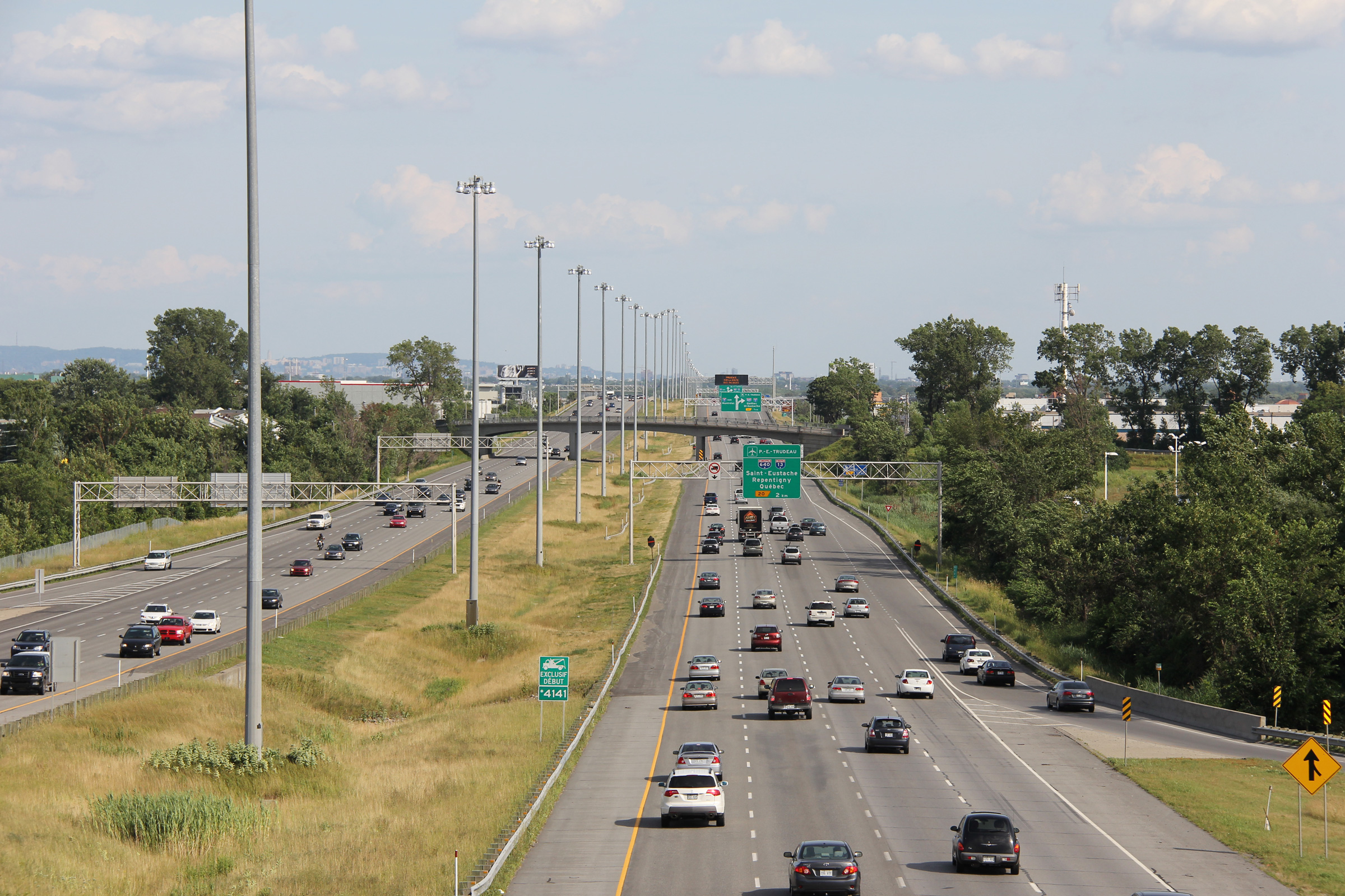
Southbound signage approaching the Autoroute 40 interchange. The left lanes of the freeway lead travelers easterly along Autoroute 40 East, while the right lanes of the freeway lead travelers towards A-40 West.
Date: 7/12/2016
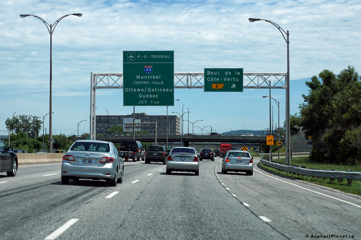
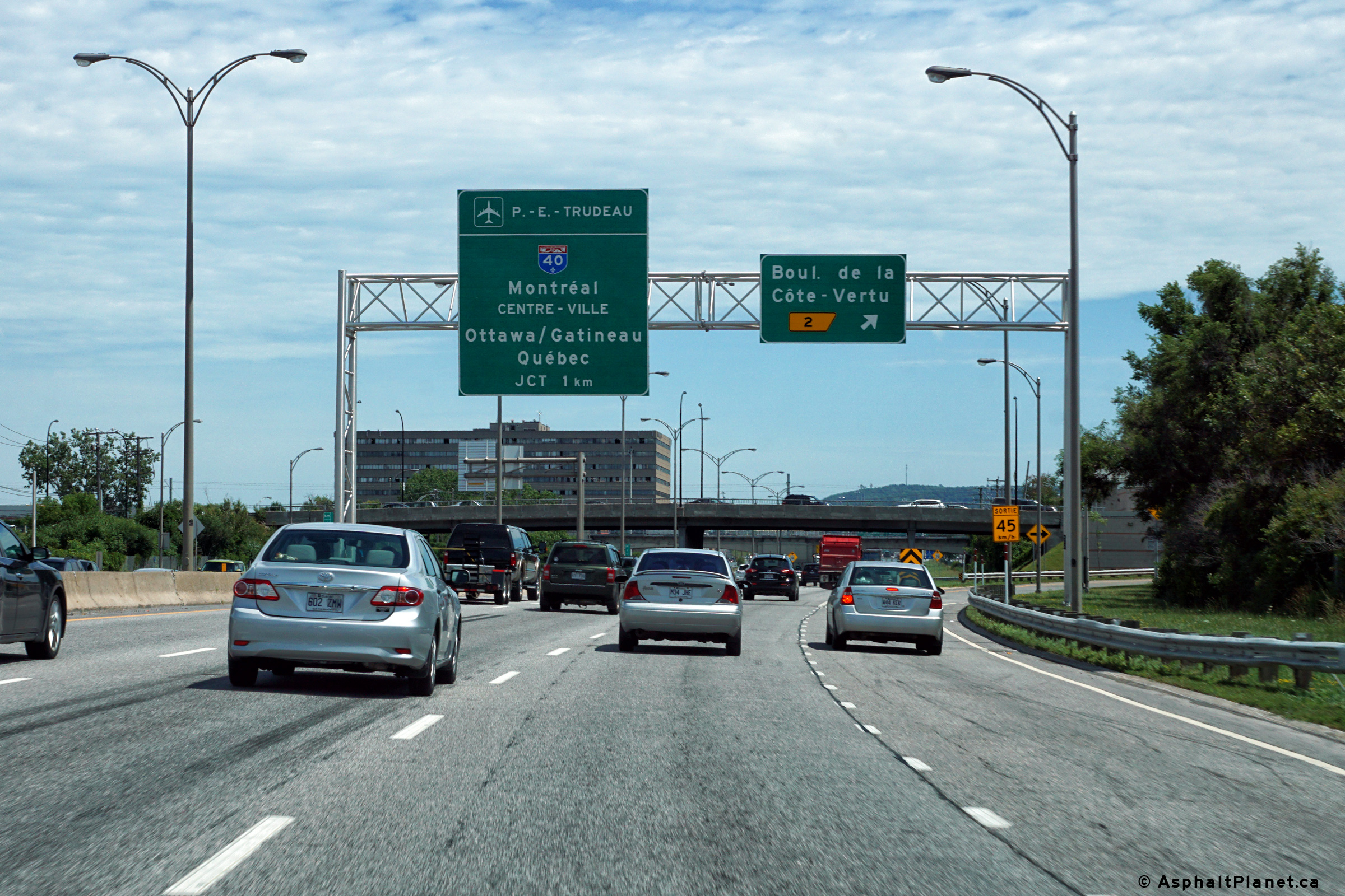
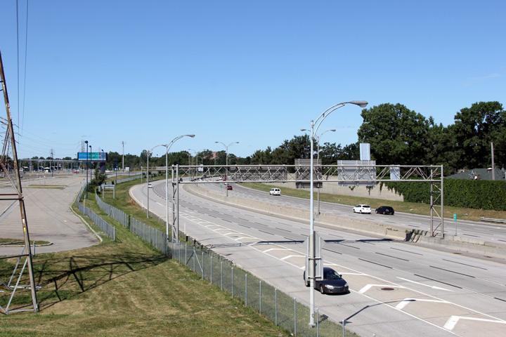
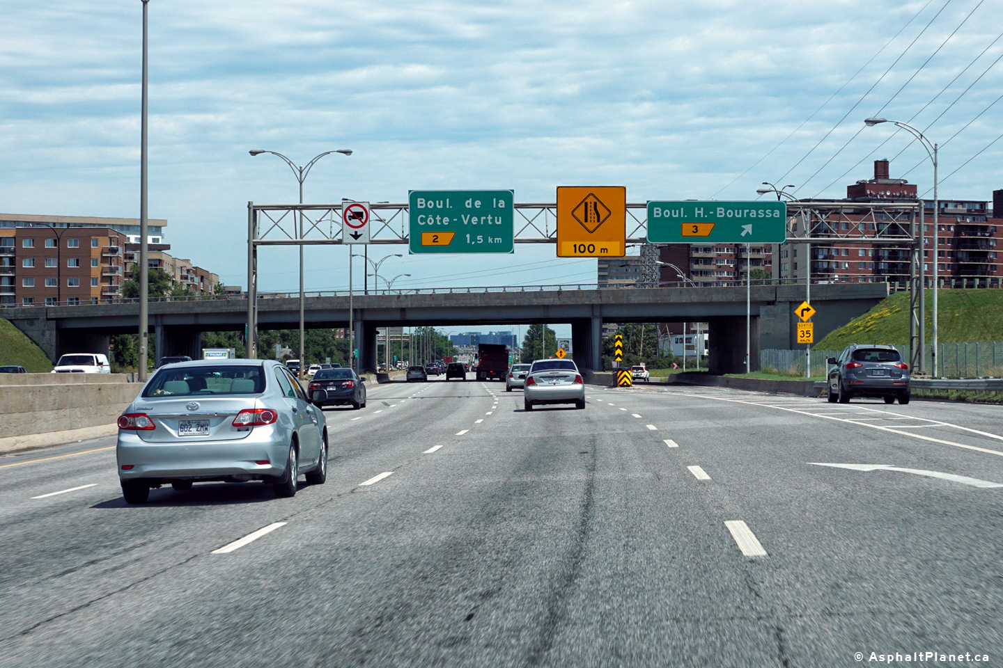
Southerly view at the off-ramp to Boulevard de la Côte-Vertu. Click here for an additional photograph of this signage assembly taken in July, 2011.
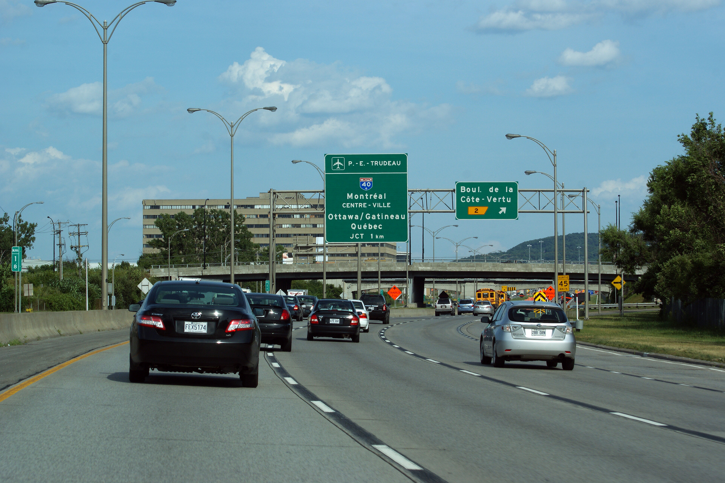

Date: 7/12/2016
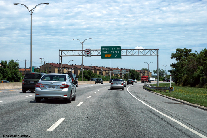
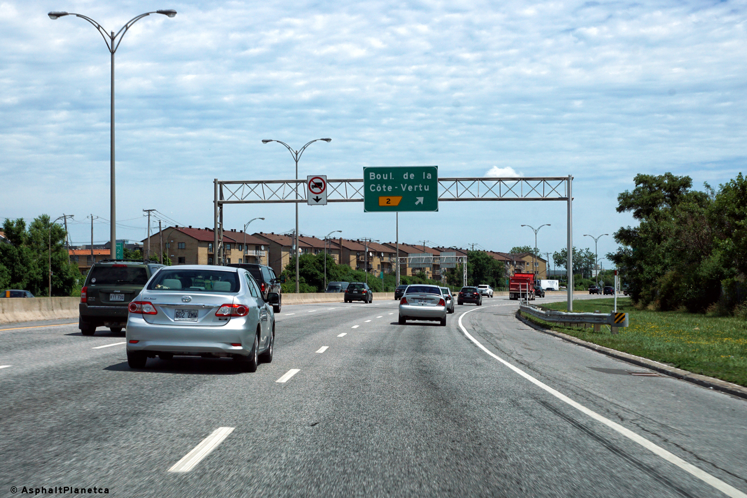
Southbound advanced signage for the Boulevard de la Côte-Vertu interchange.
Date: 7/12/2016
Southerly view from the Henri-Bourassa overpass.
Date: 7/24/2011
View looking northerly from the Boulevard Heni-Bourassa overpass.
Date: 7/24/2011
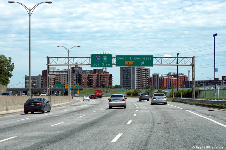
Southerly view at the off-ramp to Boulevard Henri-Bourassa.

Date: 7/12/2016
Southbound advanced signage for the Boulevard Henri-Bourassa interchange.
Date: 7/12/2016
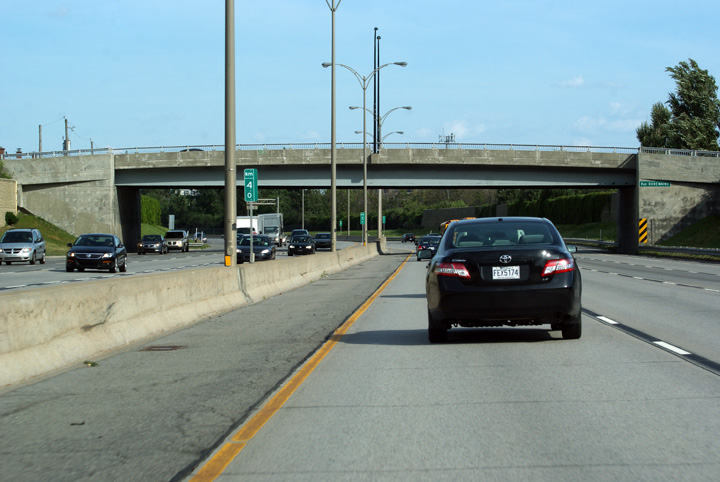
Southerly view as Autoroute 15 passes through the Rue Dudemaine overpass.
Date: 7/12/2016
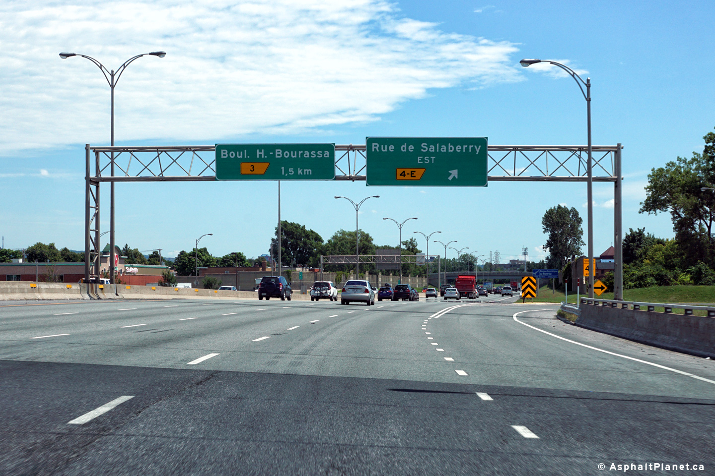
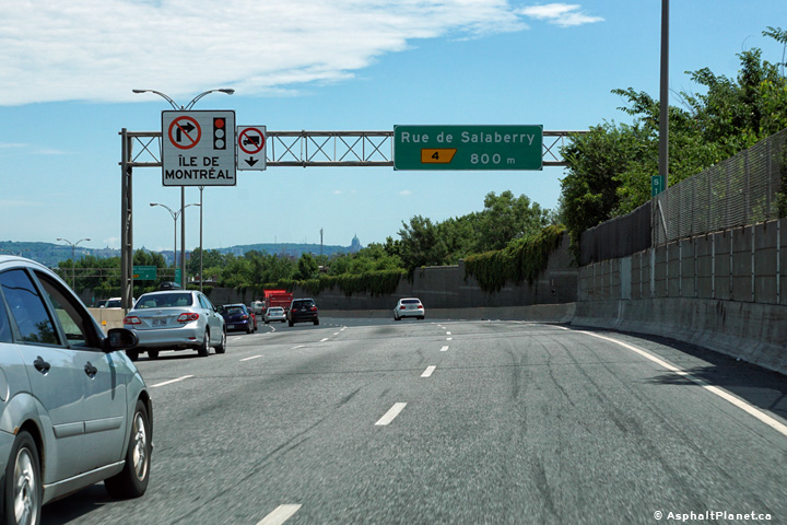
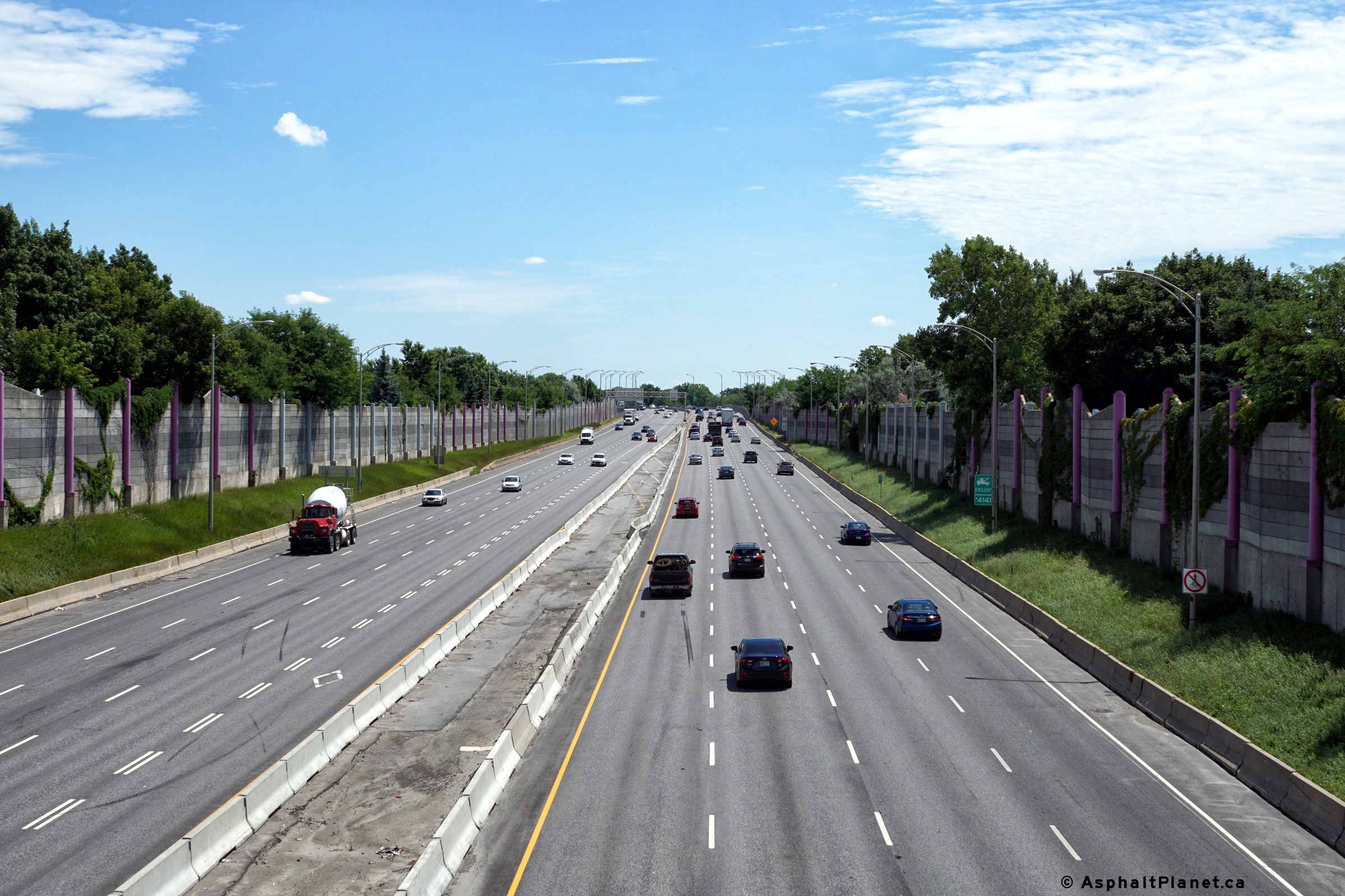
Southerly view at the southbound off-ramp to Rue de Salaberry East.

Date: 7/12/2016
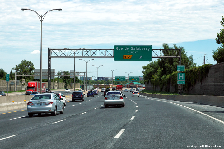
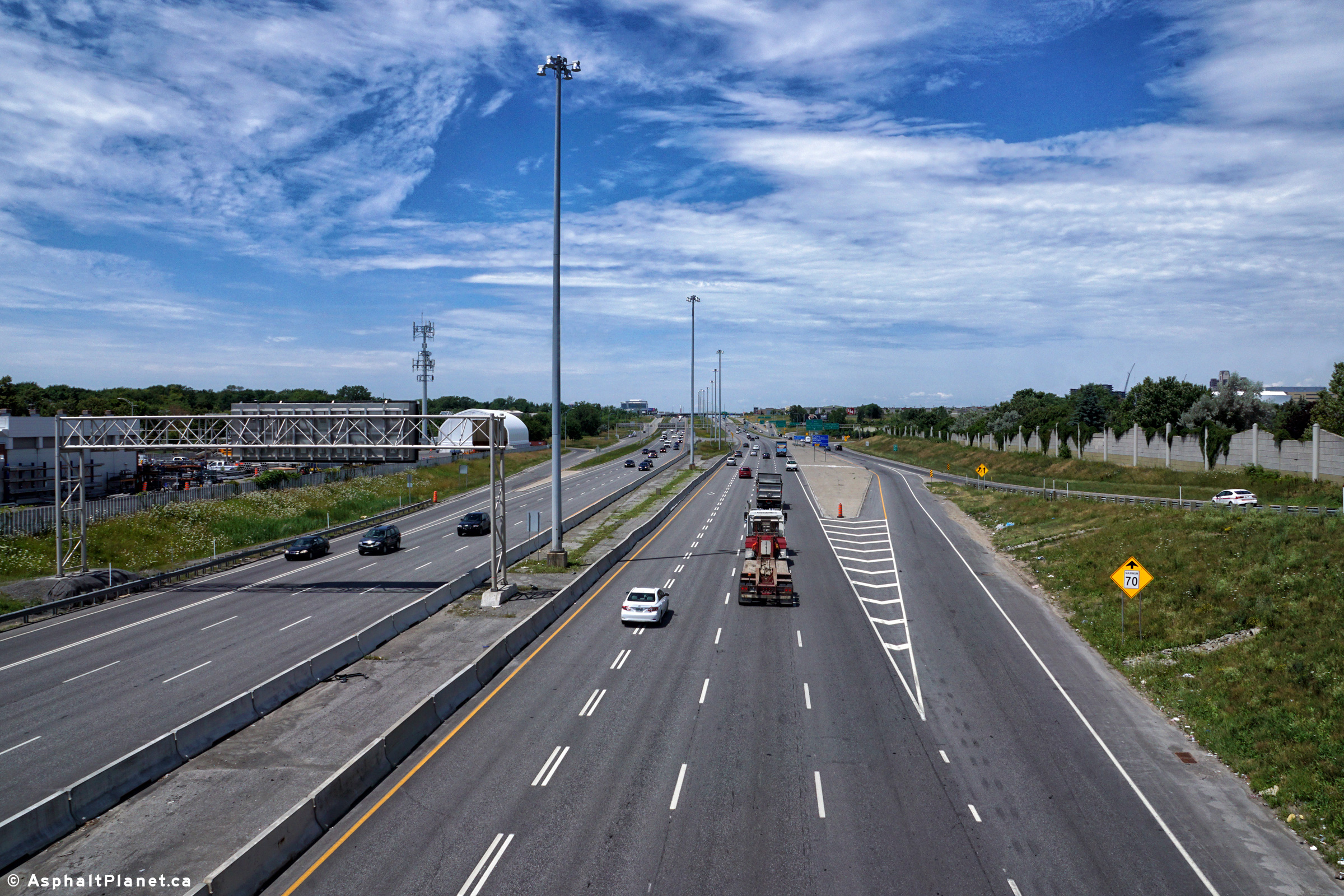
Southerly view at the off-ramp to Rue de Salaberry West.
Date: 7/12/2016
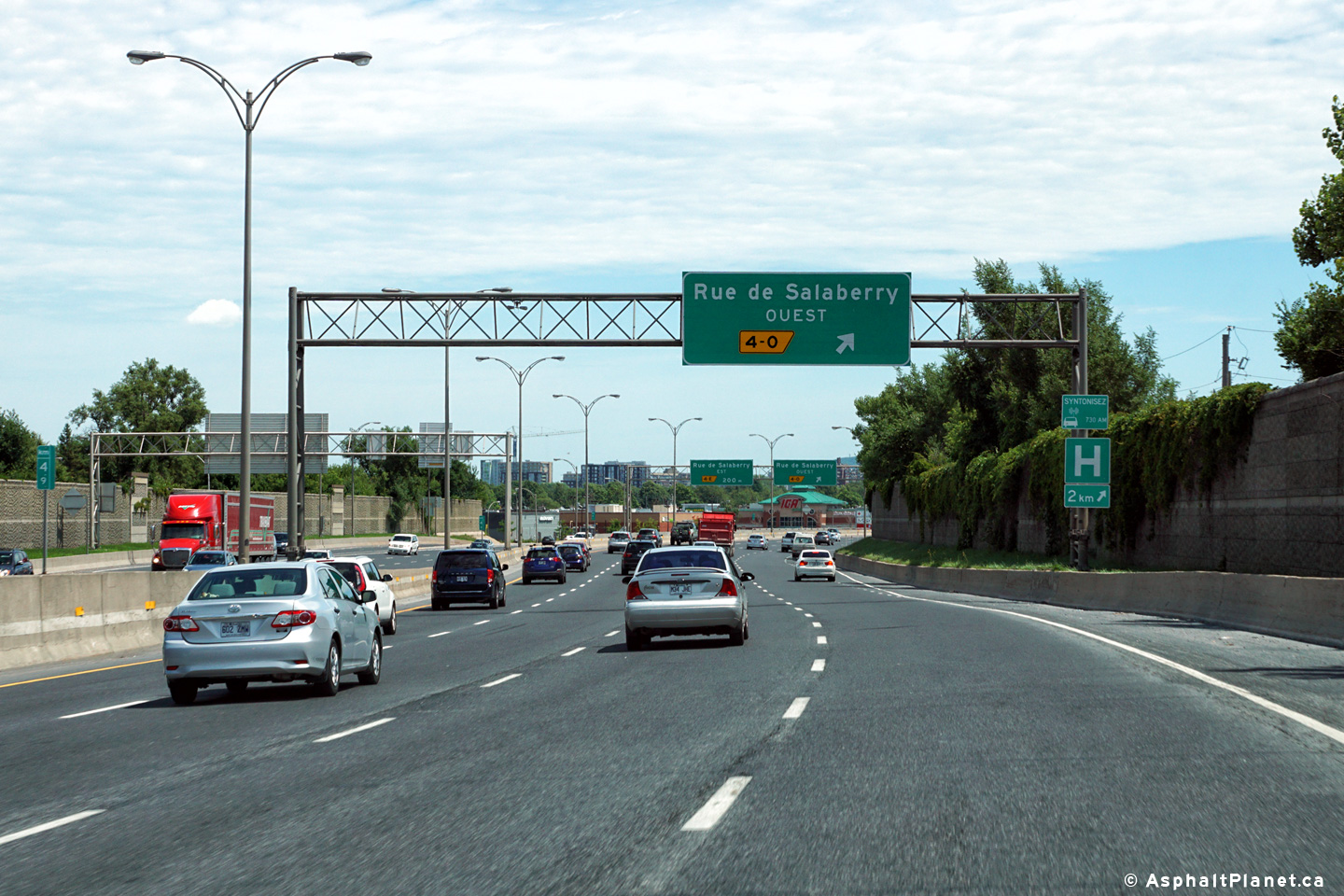
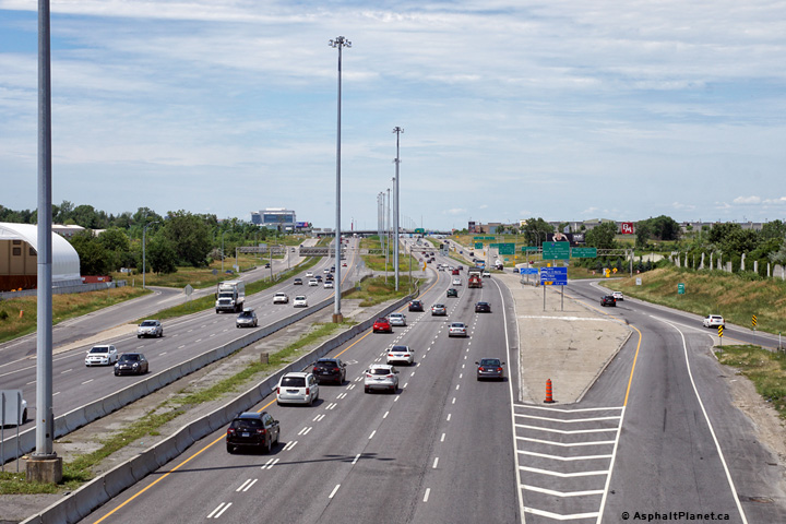
Southbound advanced signage for the off-ramp to Rue de Salaberry West.
Date: 7/23/2011
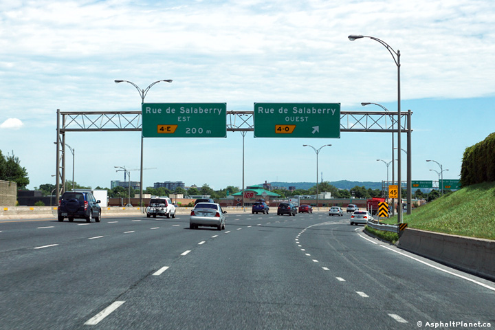
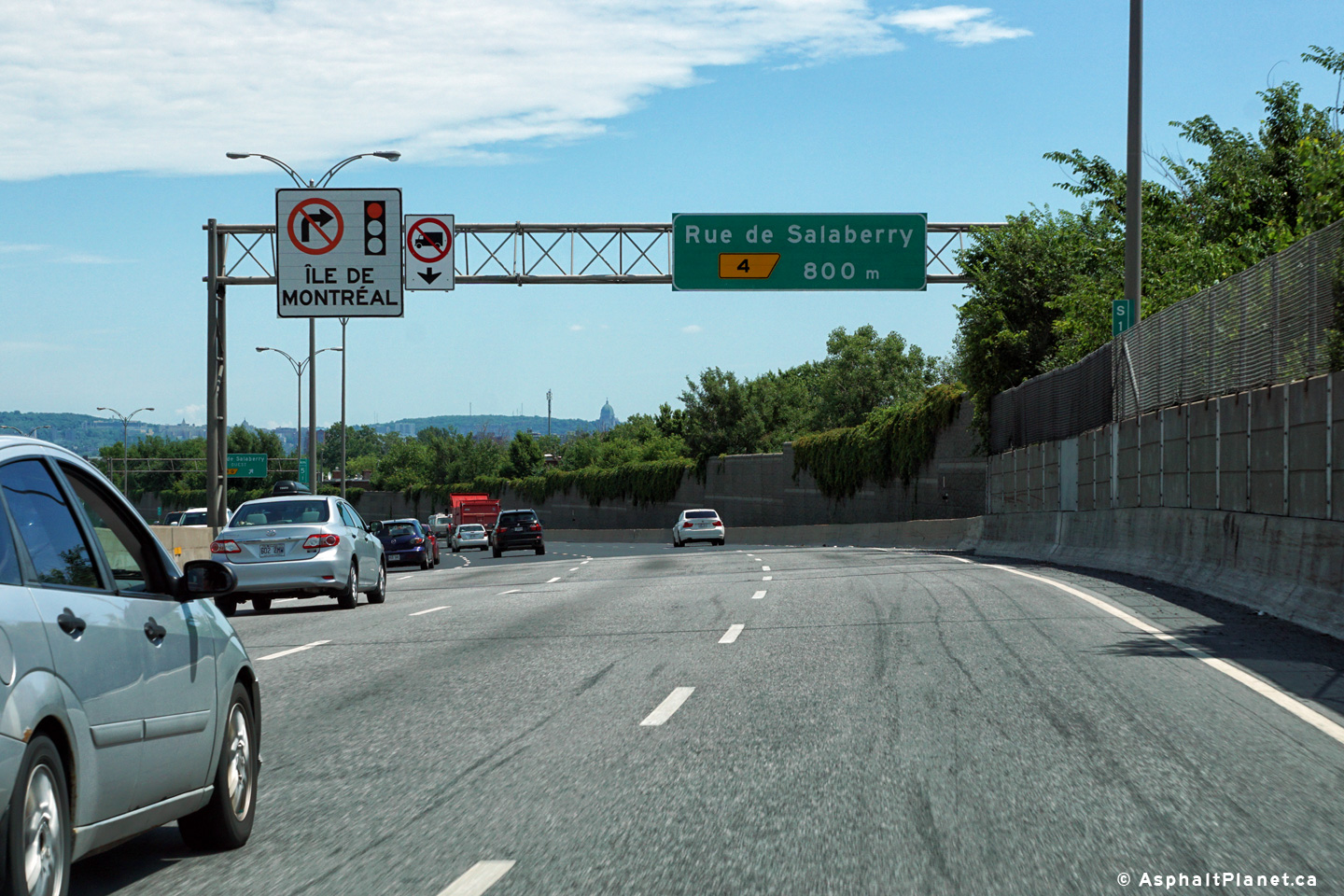
Southbound advanced signage for the Rue de Salaberry interchange.
Date: 7/23/2011
M.R.C. de Laval
Southerly view from the Boulevard Cartier overpass.

Date: 5/06/2012
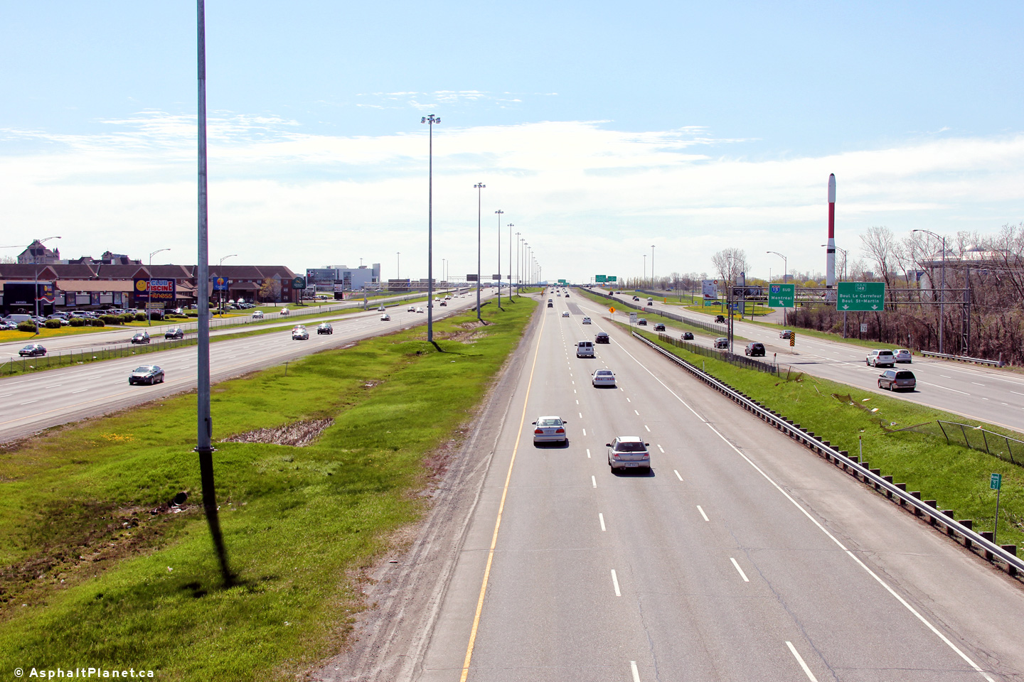
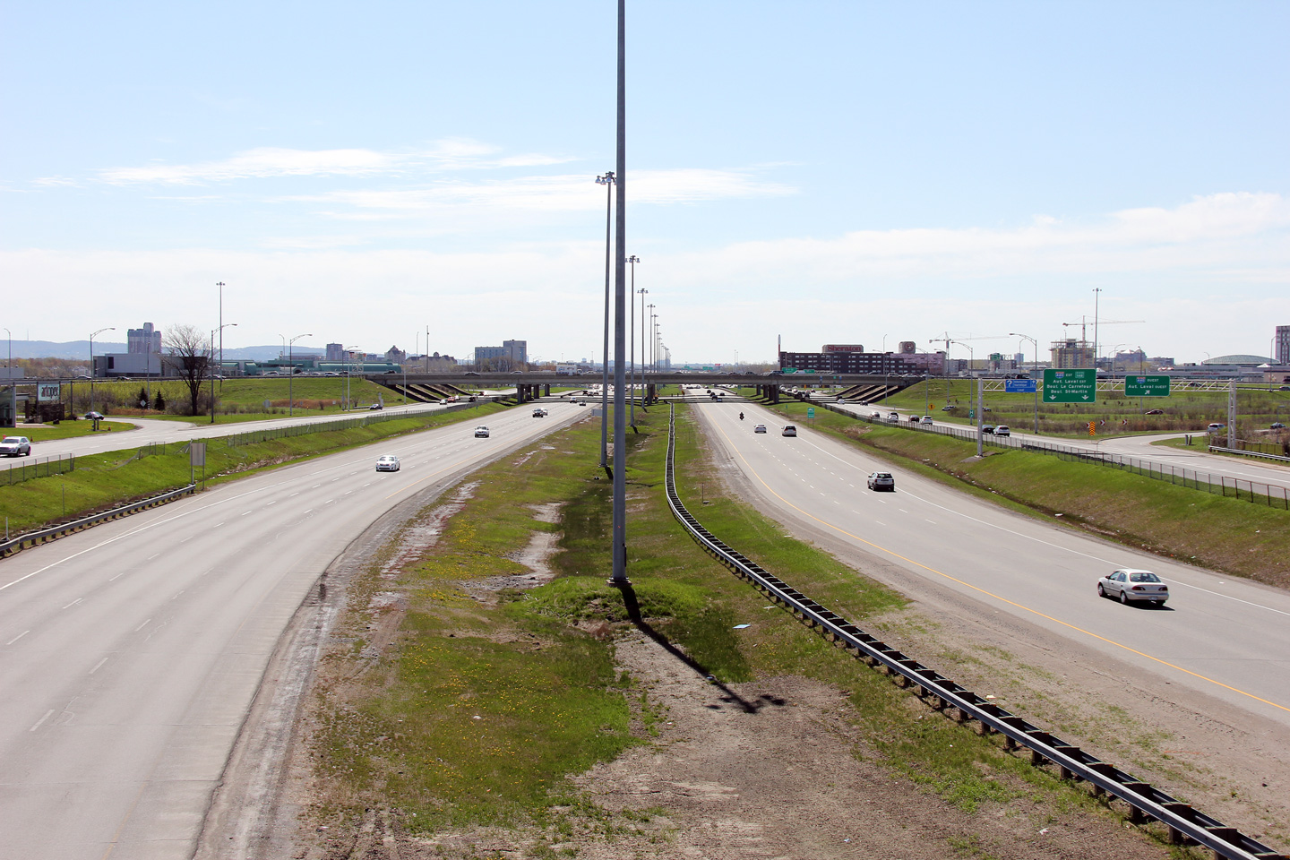
M.R.C. de Laval
Two daytime views looking northerly from Boulevard Cartier along Autoroute 15. The pedestals from the former conventional mast lighting system are visible in the median of the two carriageways.

Date: 5/06/2012
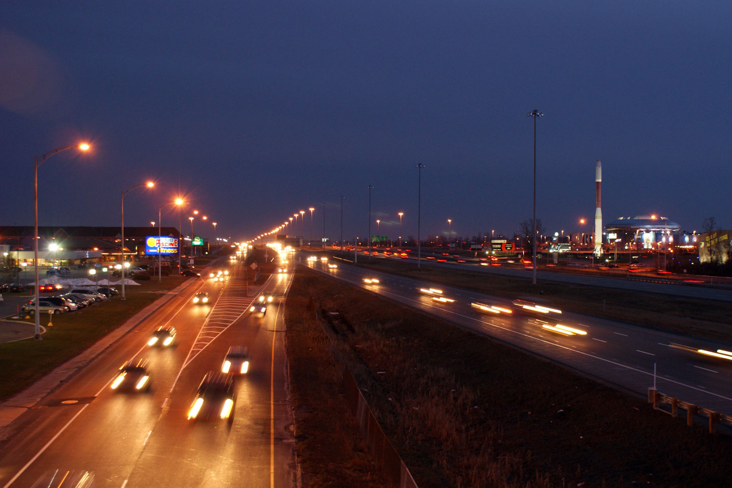
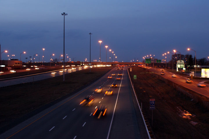
M.R.C. de Laval
Looking north from Boulevard Cartier towards Laval's shopping district at night. Traffic is amplified by the happy Montrealers hustling and bustling to and from their Christmas errands.
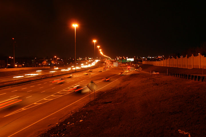
Date: 12/7/2008
M.R.C. de Laval
Southerly view from the Boulevard Le Carrefour overpass in Laval.

Date: 5/06/2012
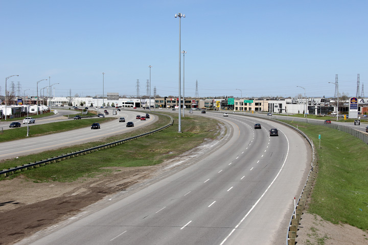
M.R.C. de Laval
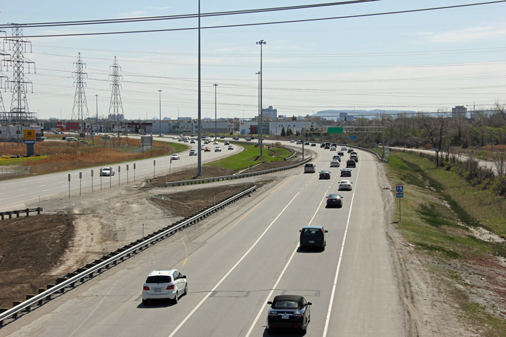
Two southerly views from the Boulevard Le Carrefour Overpass in Laval. A-15's extremely wide cross-section through Laval reminds a lot of Ontario's Highway 400 through Vaughan.


Date: 12/7/2008
M.R.C. de Laval
Daytime view looking northerly from Boulevard Le Carrefour in Laval.
Date: 5/06/2012
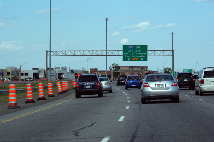
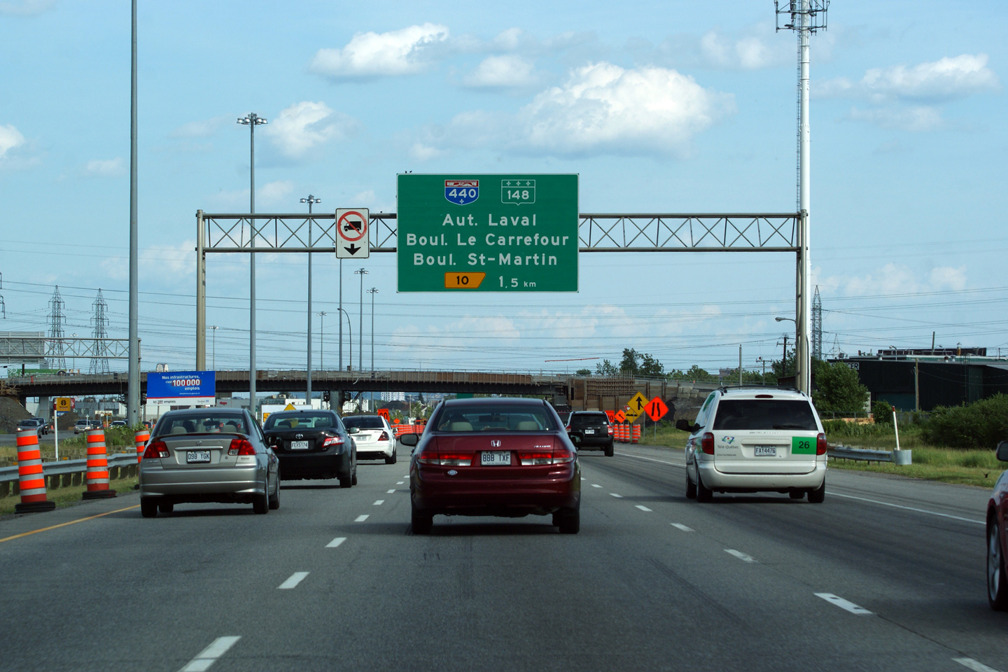
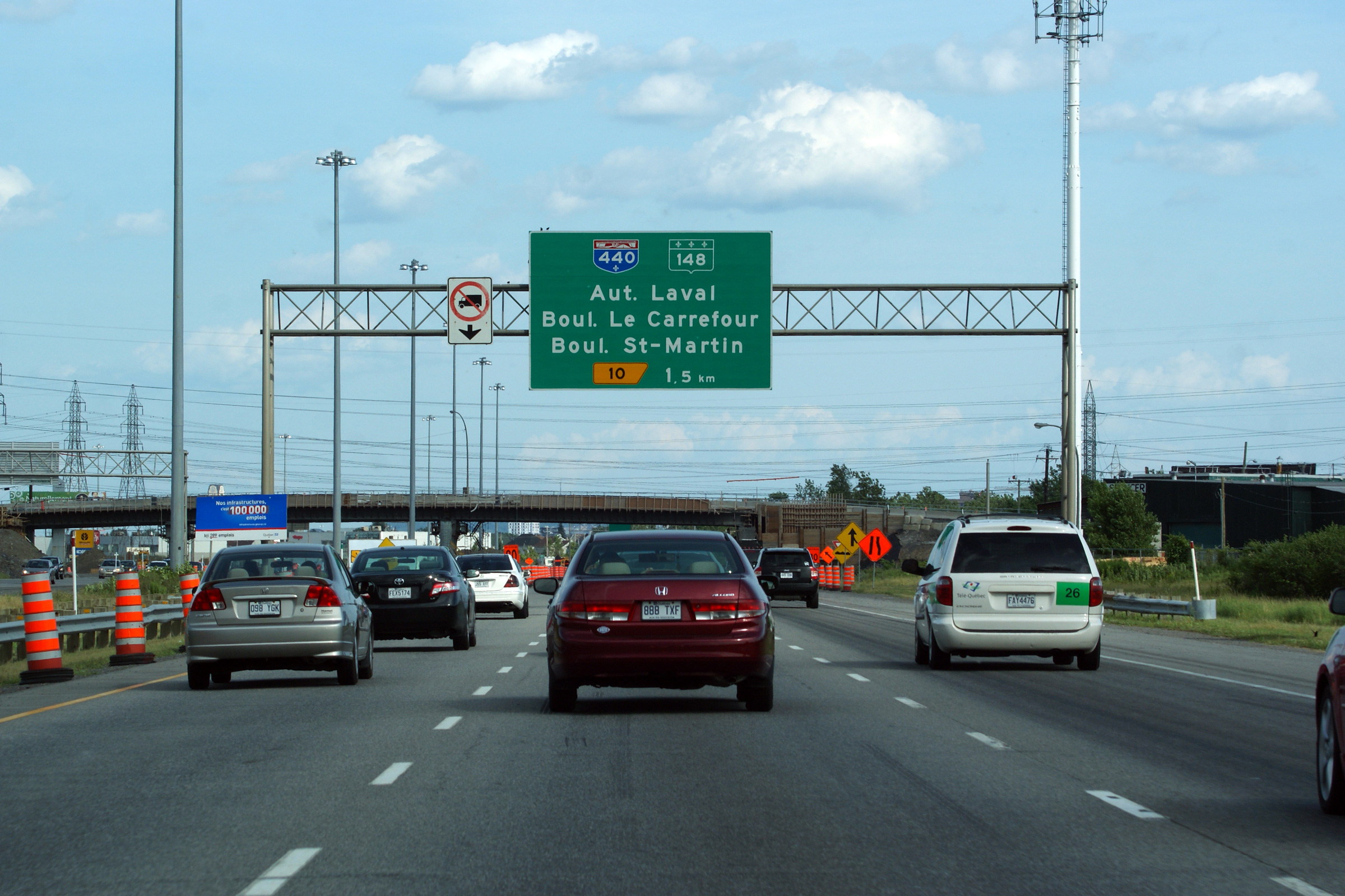
M.R.C. de Laval
Northerly view from Boulevard Le Carrefour in Laval towards Autoroute 440.
Date: 12/7/2008
Autoroute 440 is the Laval Autoroute. Click here for A-440 images.
M.R.C. de Laval
View looking southerly towards the Autoroute 440 cloverleaf interchange from the Boulevard Saint-Elzéar overpass.

Date: 5/06/2012
M.R.C. de Laval
This view looks northerly from the Boulevard Saint-Elzéar overpass.
Date: 5/06/2012
M.R.C. de Laval
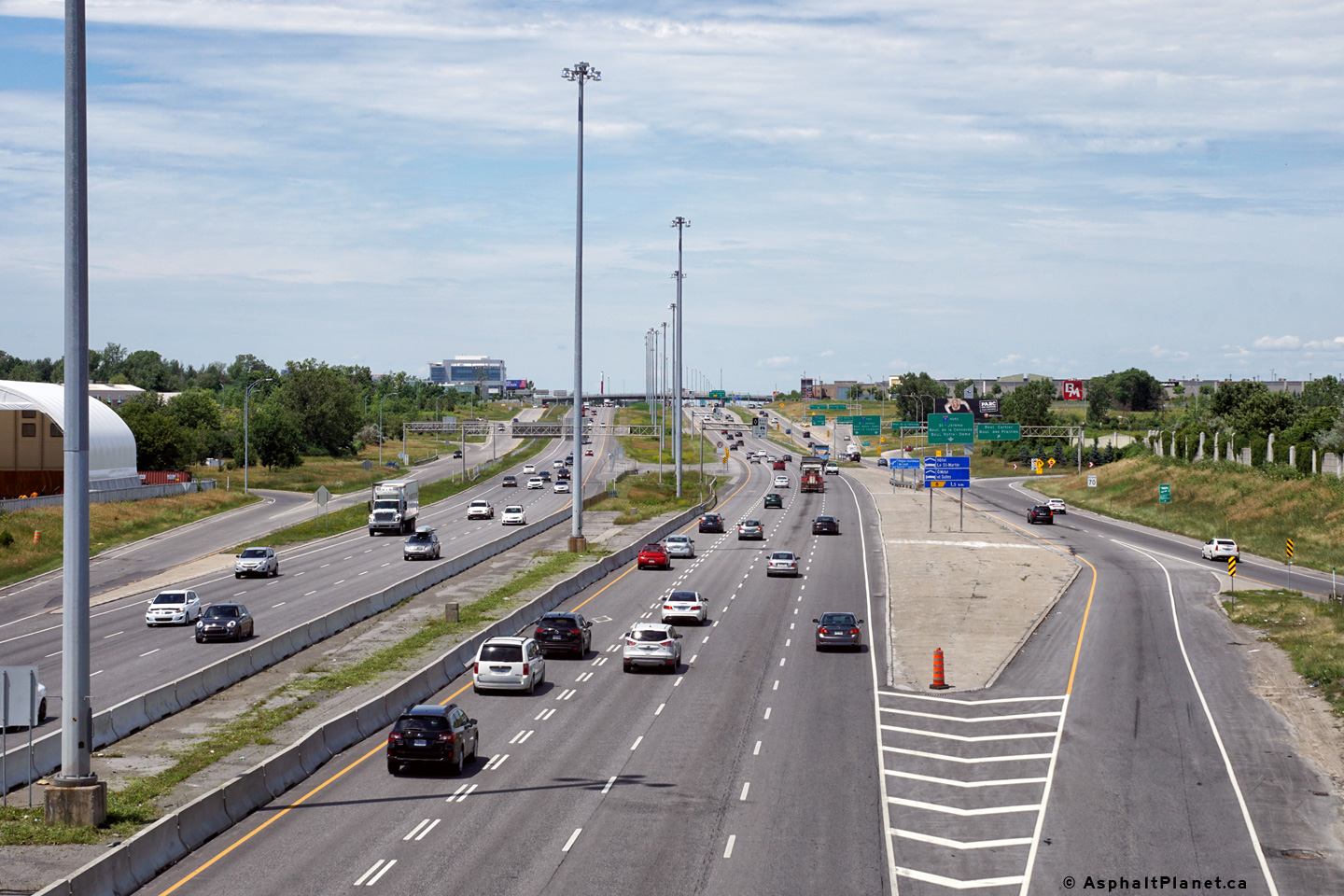
Signage at the southbound off-ramp to the Autoroute 440 interchange. Traffic bound for Autoroute 440 must exit at the freeway mainline at this location and then follow the service road for a short distance before encountering the Autoroute 440 cloverleaf.
Date: 7/23/2011
M.R.C. de Laval
Southbound advanced signage for the Autoroute 440 interchange.

Date: 7/23/2011
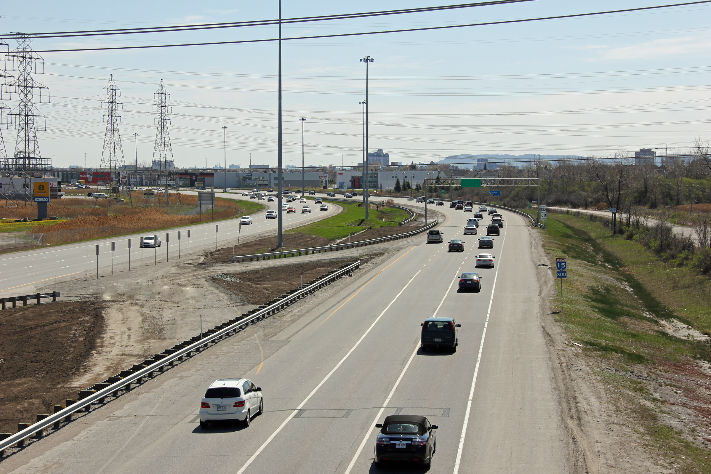
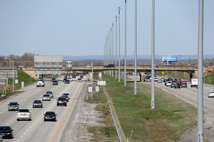
M.R.C. de Laval
Southerly view from the Boulevard Degenais overpass.
Date: 5/06/2012
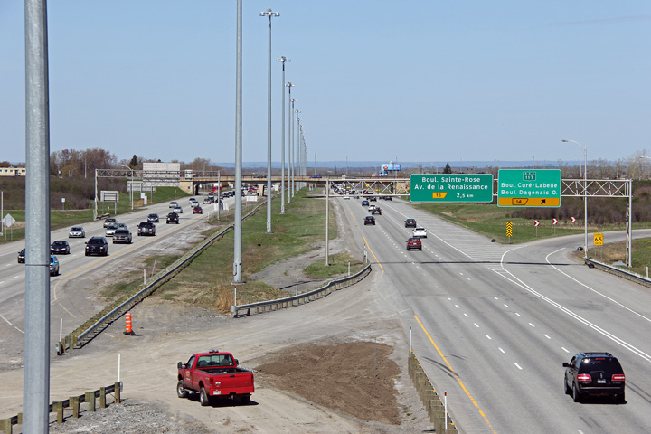
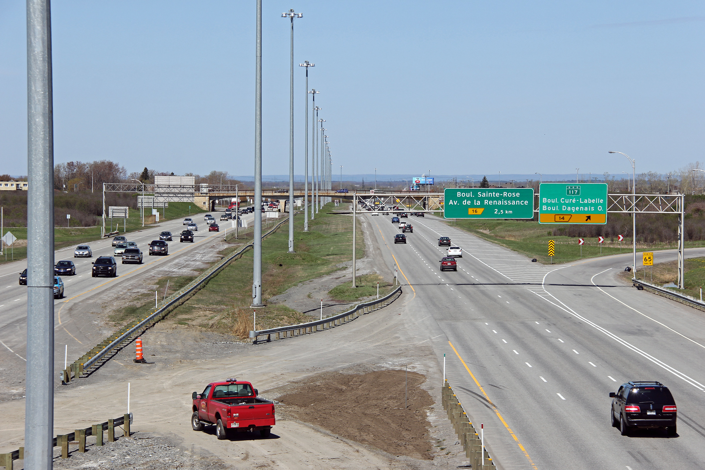
M.R.C. de Laval
Two views looking northerly towards the Route 117 interchange from Boulevard Dagenais.
Date: 5/06/2012
M.R.C. de Thérèse-de-Blainville
Broisbriand
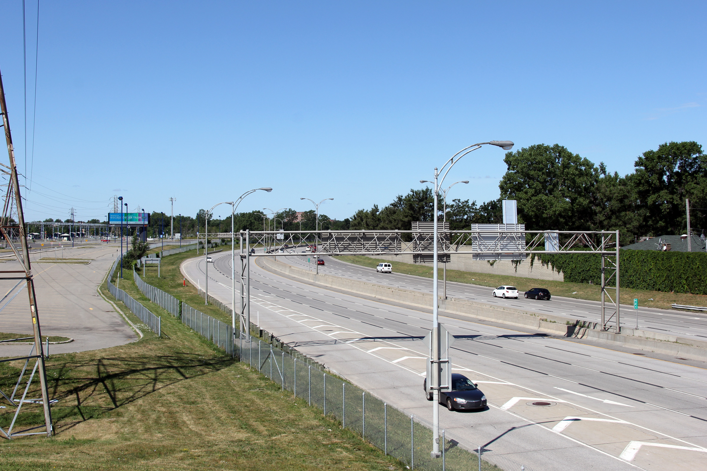
View looking south as the ramp from Autoroute 15 departs for Autoroute 640. A multi-year construction project was just wrapping up when this photo was taken that saw a new highs-peed flyover ramp constructed for south-east traffic replacing a busy loop ramp.
Date: 7/23/2011
M.R.C. de Thérèse-de-Blainville
Broisbriand
View looking south at the advanced signage approaching the A-640 interchange.
Date: 7/23/2011
M.R.C. de Thérèse-de-Blainville
Broisbriand
Two views looking southerly towards the Autoroute 640 interchange from the Rue St-Charles overpass.

Date: 7/23/2011
M.R.C. de Thérèse-de-Blainville
Broisbriand
View looking northerly from the Rue St-Charles overpass. An summer evening storm was approaching the city from the Laurentians when this photo was taken.

Date: 7/23/2011
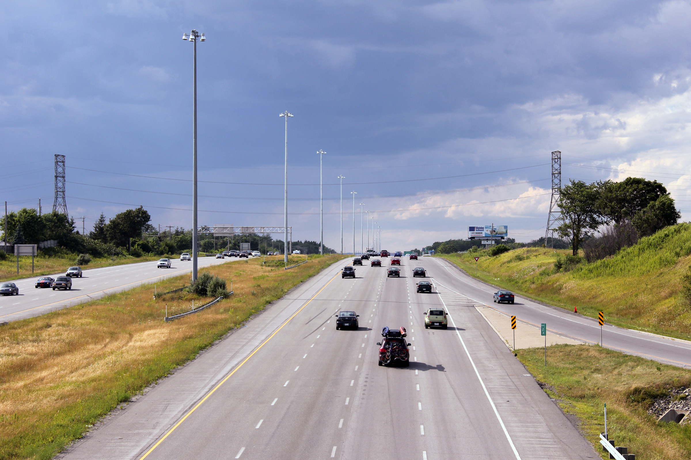
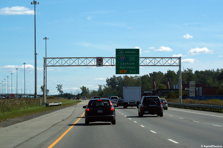
M.R.C. de Mirabel
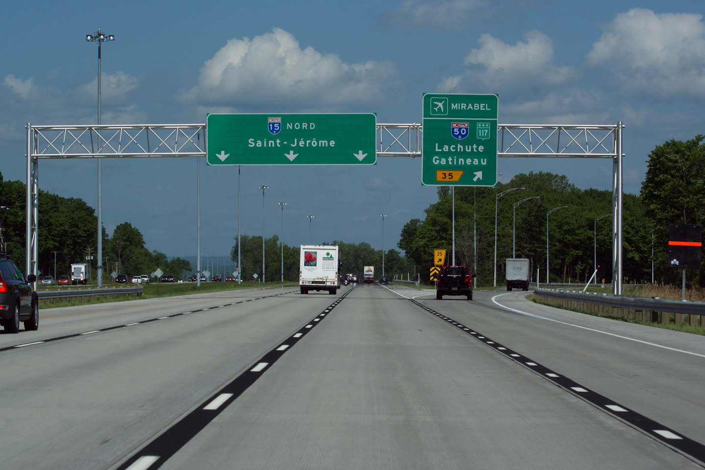
Advanced overhead signage for Autoroute 50. Autoroute 50 is a long freeway that extends west from A-15 paralleling the Ottawa River into Gatineau.

Date: 5/24/2010
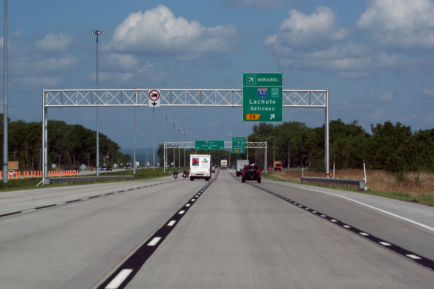
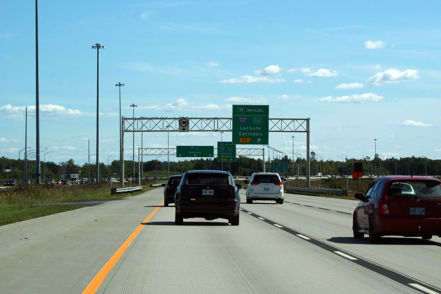
M.R.C. de Mirabel
Overhead guide signage at the split for A-50. While A-50 only leads west from A-15, a short ramp extension leads easterly linking both A-15, and A-50 with Route 117, located less than a kilometre to the east. R-117 is the old principal highway north from Montreal.

Date: 5/24/2010
Autoroute 50 leads westerly from Autoroute 15 bound for Gatineau. Click here for A-50 images.
M.R.C. de Mirabel
View looking southerly at the southbound off-ramp to Autoroute 50.
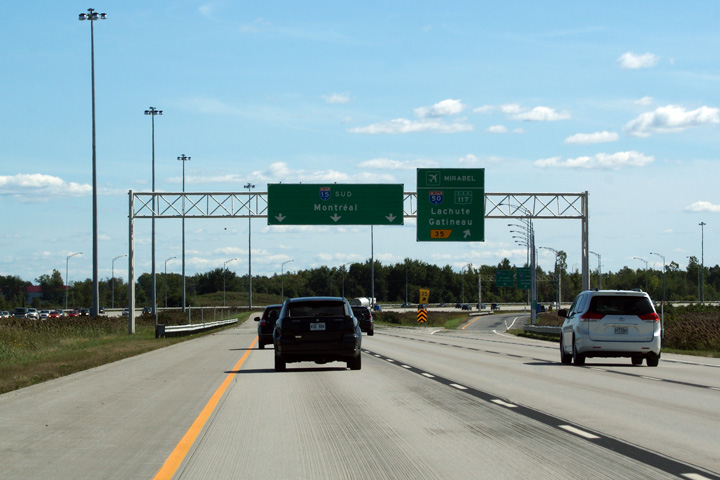
Date: 9/17/2011
M.R.C. de Mirabel
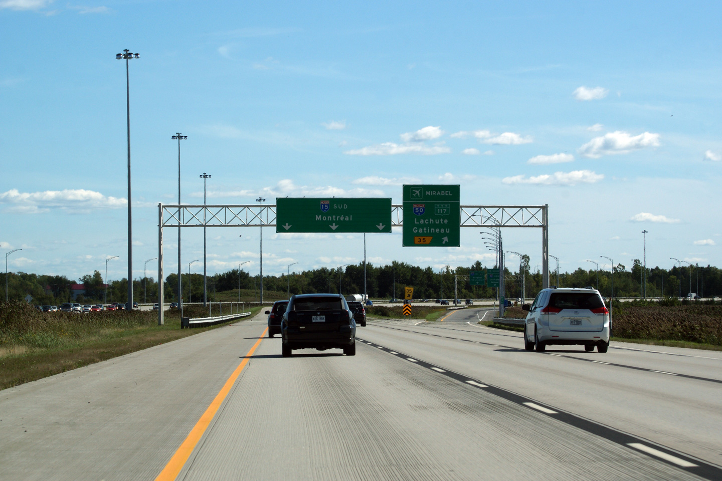
Southbound advanced signage for the Autoroute 50 interchange.
Date: 9/17/2011
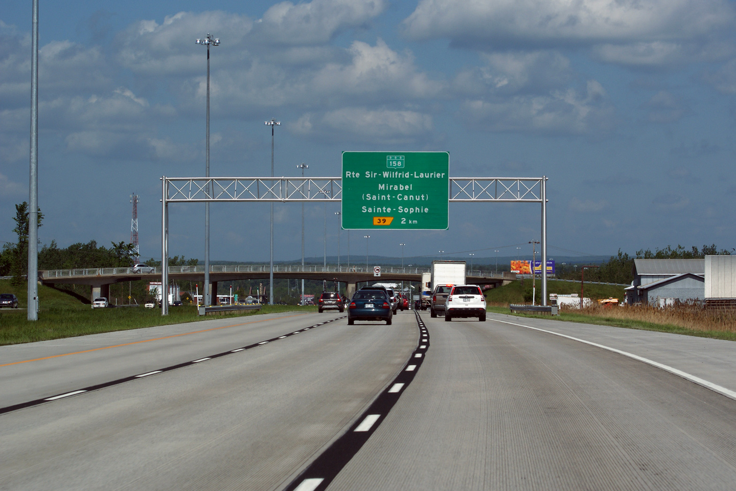
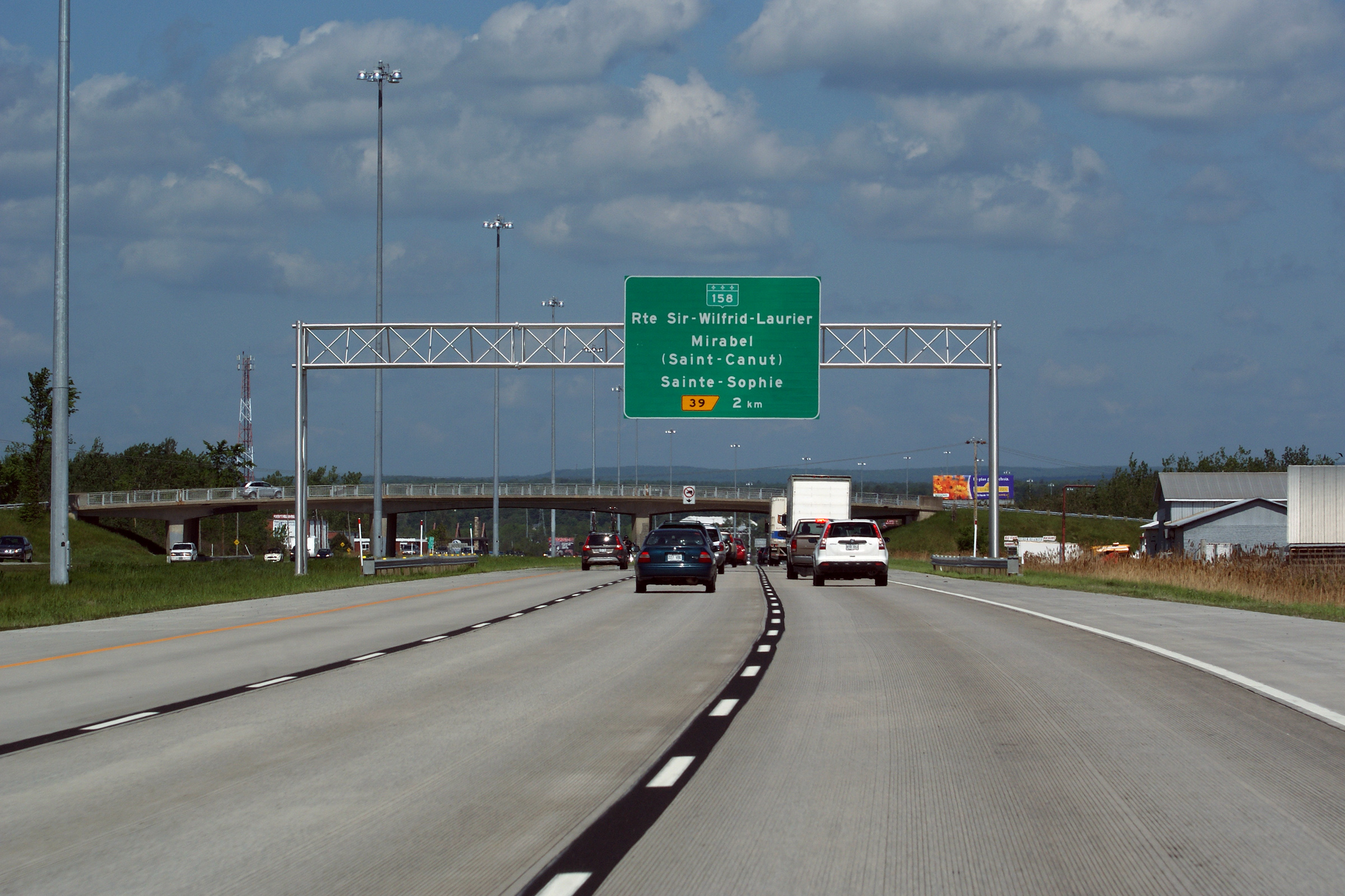
M.R.C. de Mirabel
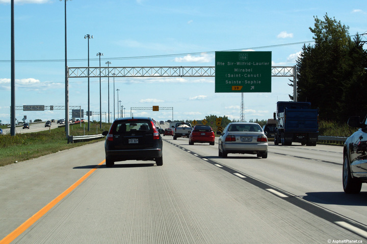
Overhead advanced signage for the R-158 interchange, situated just before Rang Ste-Marie overpass.

Date: 5/24/2010
M.R.C. de Mirabel
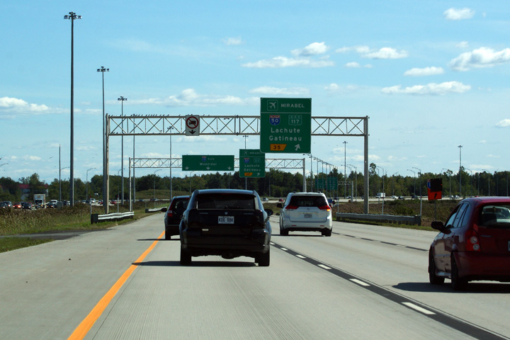
Southbound signage in advance of the Autoroute 50 interchange.
Date: 9/17/2011
M.R.C. de Mirabel
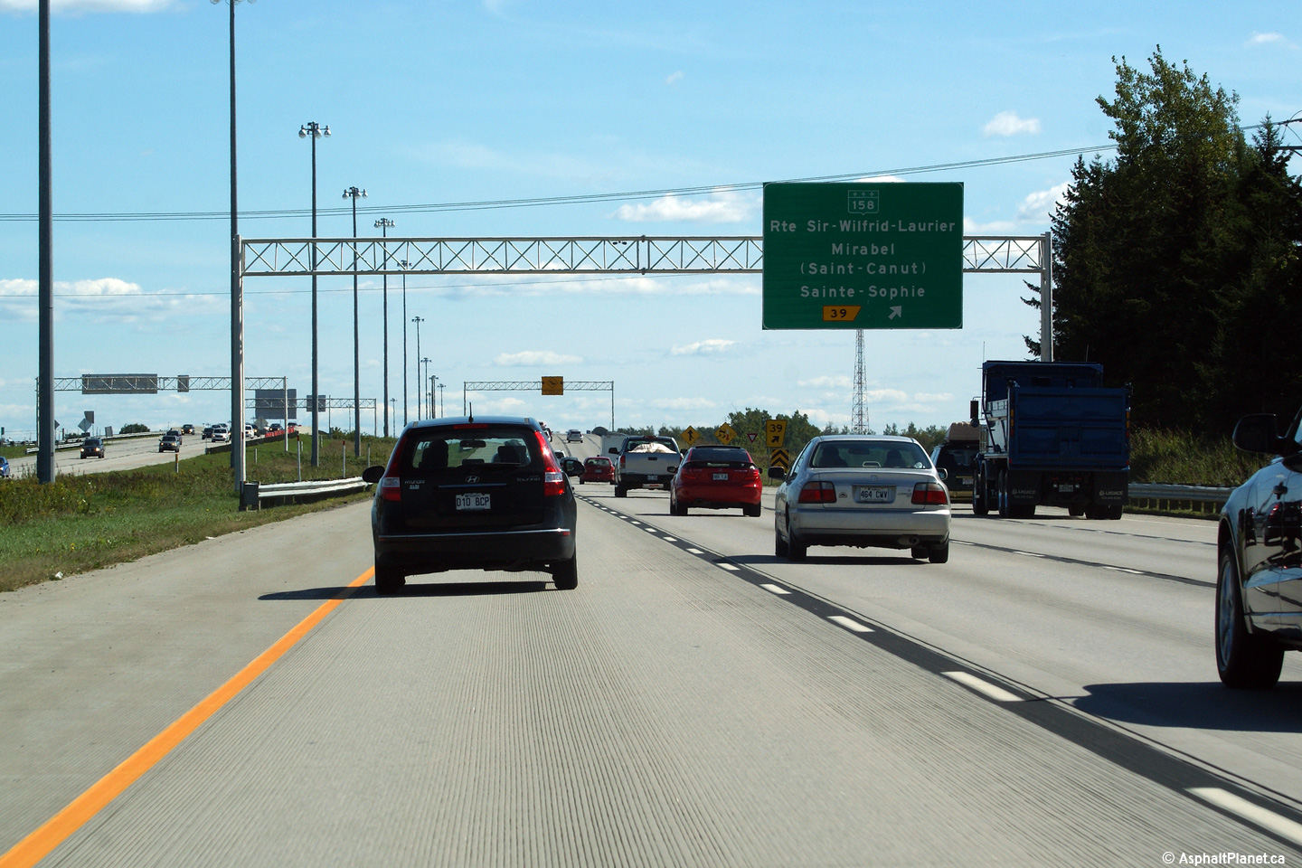
Southerly view approaching the Route 158 interchange.
Date: 9/17/2011