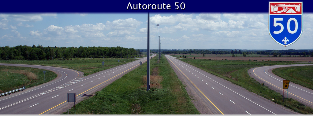
AsphaltPlanet.ca > Quebec > Autoroute 50
|
Western Terminus: R-148 interchange in Downtown Hull. Eastern Terminus: R-117 interchange southeast of St. Jerome. Routing: A-50 starts its trek through the the Ottawa Valley at the Boulevard des Alummettièrs interchange complex in Downtown Gatineau (Hull). A-50 progresses northerly through Hull, then turns easterly through Suburban Gatineau. A Northerly By-pass of Gatineau, Autoroute 550, was proposed to intersect with A-50 where the freeway turns easterly northeast of Downtown. A-550 would have linked to A-5 through Gatineau Park. A-50 continues along the north side of the Ottawa Valley around the southeast of Buckingham where it narrows to a Super-2. A-50 continues as a Super-2 through to Lachute, where it briefly widens to a four-lane freeway where it by-passes the small community. East of Highway 329, A-50 narrows back to a two-lane highway. Between Lachute and Aéroport Mirabel, the highway crosses two railways at-grade, and has two minor at-grade intersections. At Mirabel Airport, A-50 widens to a four lane freeway, maintaining this four lane cross-section easterly until it terminates at A-15 and R-117. The western-most interchange of A-50 in Hull is numbered 134. When originally conceived, A-50 was envisioned to continue westerly by-passing Highway 148 all the way to Pembroke Ontario. Such an extension is very unlikely to ever be realised. Links:
|
Pictures on this page are arranged in order from south to north. A-50 East
photos are left-aligned in the last column, while A-50 West photos are right-aligned.
Center-line pictures are centered within the last column.
|
Location |
Description |
Photo |
||
|
East- |
West- |
|||
|
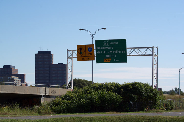
Autoroute 50 ends at Boulevard des Allumettieres near Downtown Hull. Westerly traffic continues along Route 148. Click here for R-148 images. |
||||
|
Ville de Gatineau |
R-148 piggybacks along Autoroute 50 through a small section of Gatineau. Autoroute 50 ends at Boulevard des Allumettieres, while R-148 continues westerly.
La route 148 chevauche l'aut. 50 à Gatineau. L'aut 50 se termine au boul. des Allumettières; la route 148, elle, s'étend vers l'ouest à la frontière ontarienne près de Pembroke. |
 |
||
|
Date: 5/24/2010 |
High-res: (1440x960) | |||
|
Ville de Gatineau |
Advanced signage for the eastbound ramp to Autoroute 5.
Signalisation avancée pour la bretelle en direction est vers l'autoroute 5. |
 |
||
|
Date: 7/01/2012 |
High-res: (1440x960) (2400x1600) | |||
|
Ville de Gatineau |
Eastbound signage at the ramp to A-5. The eastbound carriageway narrows to a single lane beyond the off-ramp.
Signalisation en direction est à la bretelle vers l'autoroute 5. Le chaussé en direction est s'étend à une voie au dèla de la bretelle de sortie. |
 |
||
|
Date: 7/01/2012 |
High-res: (1440x960) (2400x1600) | |||
|
Autoroute 5 progresses north from the Ottawa River towards Wakefield, QC. Click here for A-5 images. |
||||
|
Ville de Gatineau |
Westerly view from the Mtée Paiement overpass.
Vue vers l'ouest depuis le pont d'étagement de la mtée Paiement. |
 |
||
|
Date: 5/24/2010 |
High-res: (1440x960) (2400x1600) | |||
|
Ville de Gatineau |
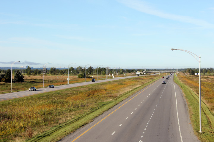
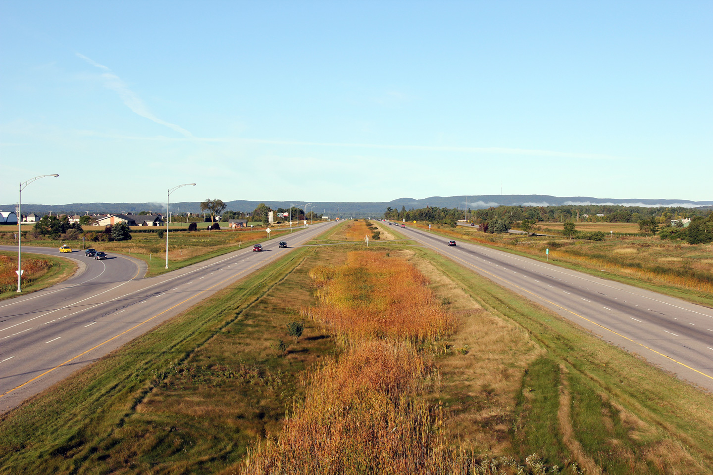
Easterly view from the Mtée Paiement overpass. Through suburban Ganiteau, Autoroute 50 has four lanes and a wide grassed median.
Vue vers l'est depuis le pont d'étagement de la mtée Paiement. En traversant la banlieue de Gatineau, l'aut. 50 à quatre voies et un terre-plein gazonné. |
 |
||
|
Date: 5/24/2010 |
High-res: (1440x960) (2400x1600) | |||
|
Ville de Gatineau |
Two views looking westerly from the Boul. des Laurentides overpass. Particularly in the lower photo, some of Ottawa and Gatineau's tall buildings can be seen dotting the horizon line.
Deux vues vers l'ouest depuis le viaduc du boul. des Laurentides. Particulièrement dans la photo inférieure, quelques hauts bâtiments d'Ottawa et de Gatineau sont visibles à l'horizon. |
 |
||
| High-res: (1440x960) (2400x1600) | ||||
 |
||||
|
Date: 5/24/2010 |
High-res: (1440x960) (2400x1600) | |||
|
Ville de Gatineau |
Easterly view from the Boul. des Laurentides overpass.
Vue vers l'est depuis le pont d'étagement du boul. des Laurentides. |
 |
||
|
Date: 5/24/2010 |
High-res: (1440x960) (2400x1600) | |||
|
Ville de Gatineau |
Easterly view approaching the Highway 315 interchange.
Vue vers l'est à la bretelle de sortie vers la route 315. |
 |
||
|
Date: 5/24/2010 |
High-res: (1440x960) (2400x1600) | |||
|
Ville de Gatineau |
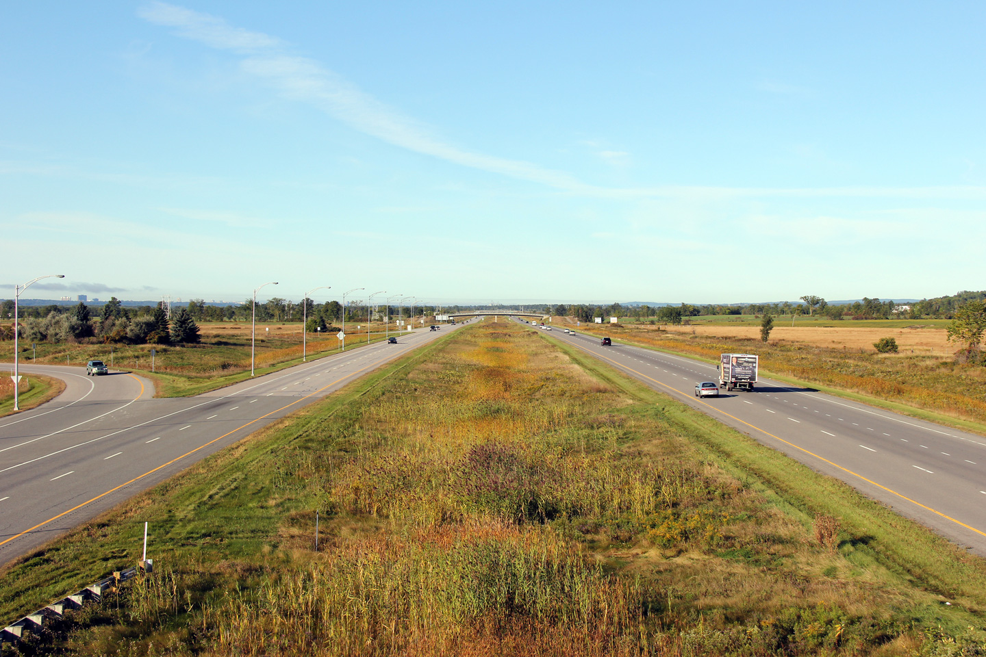
Autoroute 50 narrows from a four lanes to two between the Highway 315 interchange and the interchange with Chemin Lépine.
Entre les échangeurs avec la route 315 et le chemin Lépine, l'autoroute 50 se rétrécit de quatre voies à deux voies. |
 |
||
|
Date: 5/24/2010 |
High-res: (1440x960) (2400x1600) | |||
|
Ville de Gatineau |
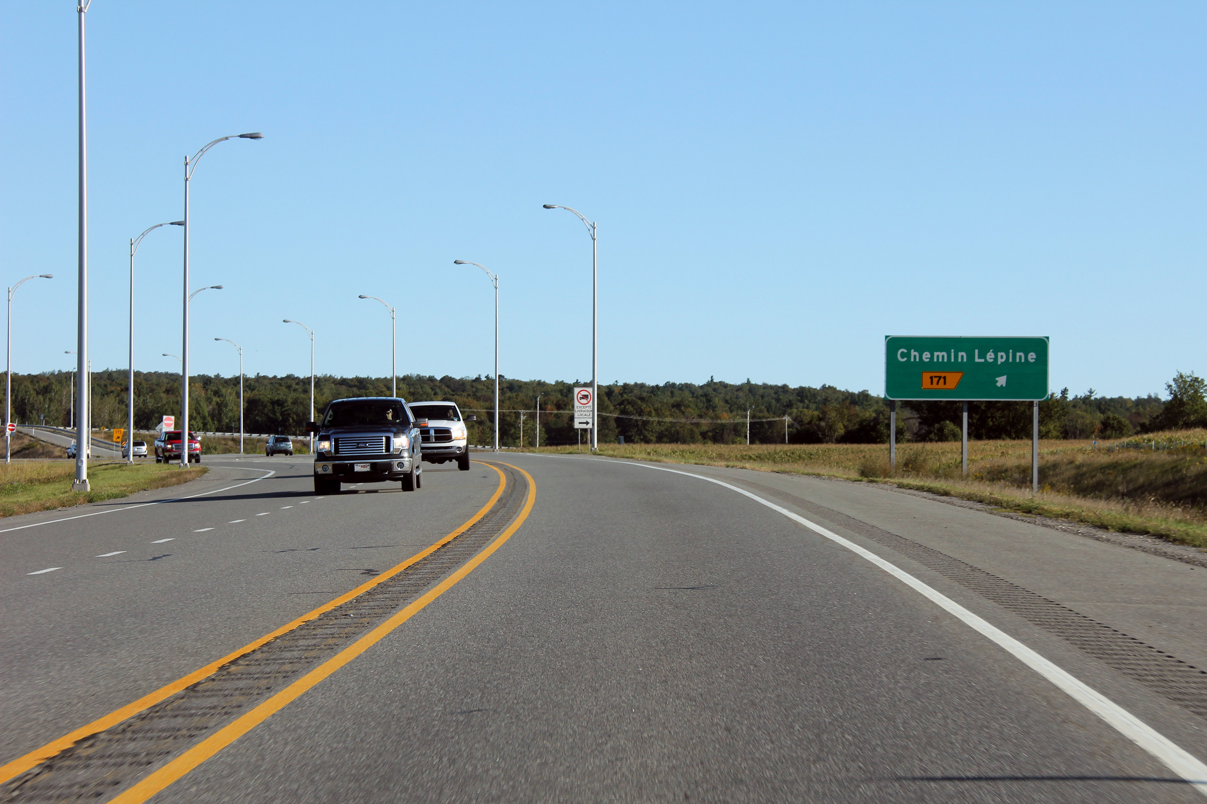
Easterly view approaching the ramp to Chemin Lépine.
Vue vers l'est juste avant la bretelle de sortie vers le chemin Lépine. |
 |
||
|
Date: 5/24/2010 |
High-res: (1440x960) (2400x1600) | |||
|
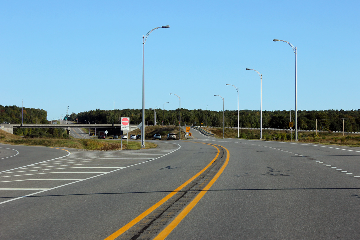
Ville de Gatineau |
Easterly view approaching the the Chemin Lépine overpass. The structure that carries Chemin Lépine overtop of Autoroute 50 was built wide enough for the eventual conversion of the highway to four lanes.
Vue vers l'est en direction du pont d'étagement du chemin Lépine. La structure qui porte le chemin Lépine au-dessus de l'autoroute été construite assez large pour l'élargissement éventuelle de la route à quatre voies. |
 |
||
|
Date: 5/24/2010 |
High-res: (1440x960) (2400x1600) | |||
|
Ville de Gatineau |
View looking westerly from the Chemin Lépine overpass.
Vue en direction ouest depuis le pont d'étagement du chemin Lépine. |
 |
||
|
Date: 5/24/2010 |
High-res: (1440x960) (2400x1600) | |||
|
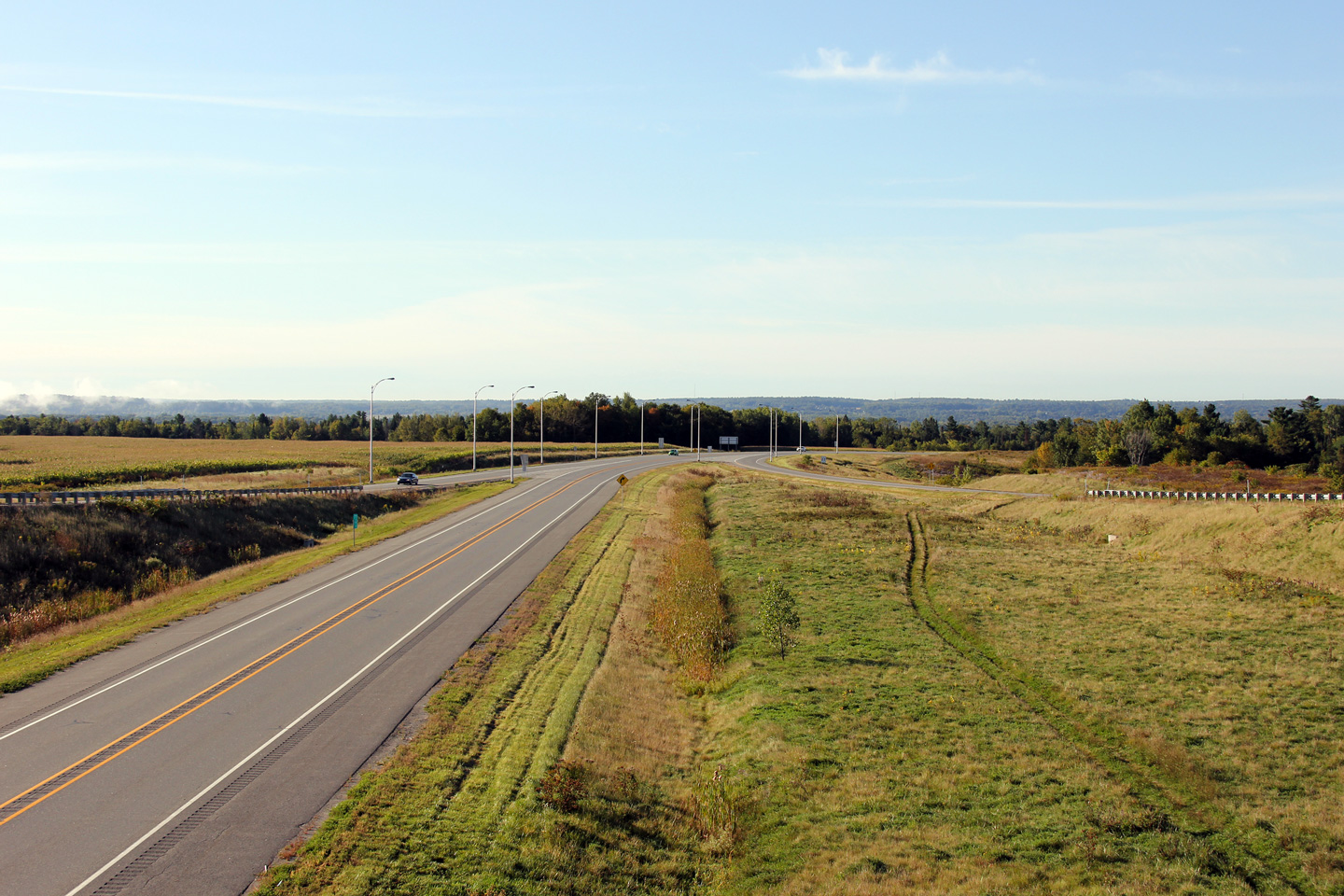
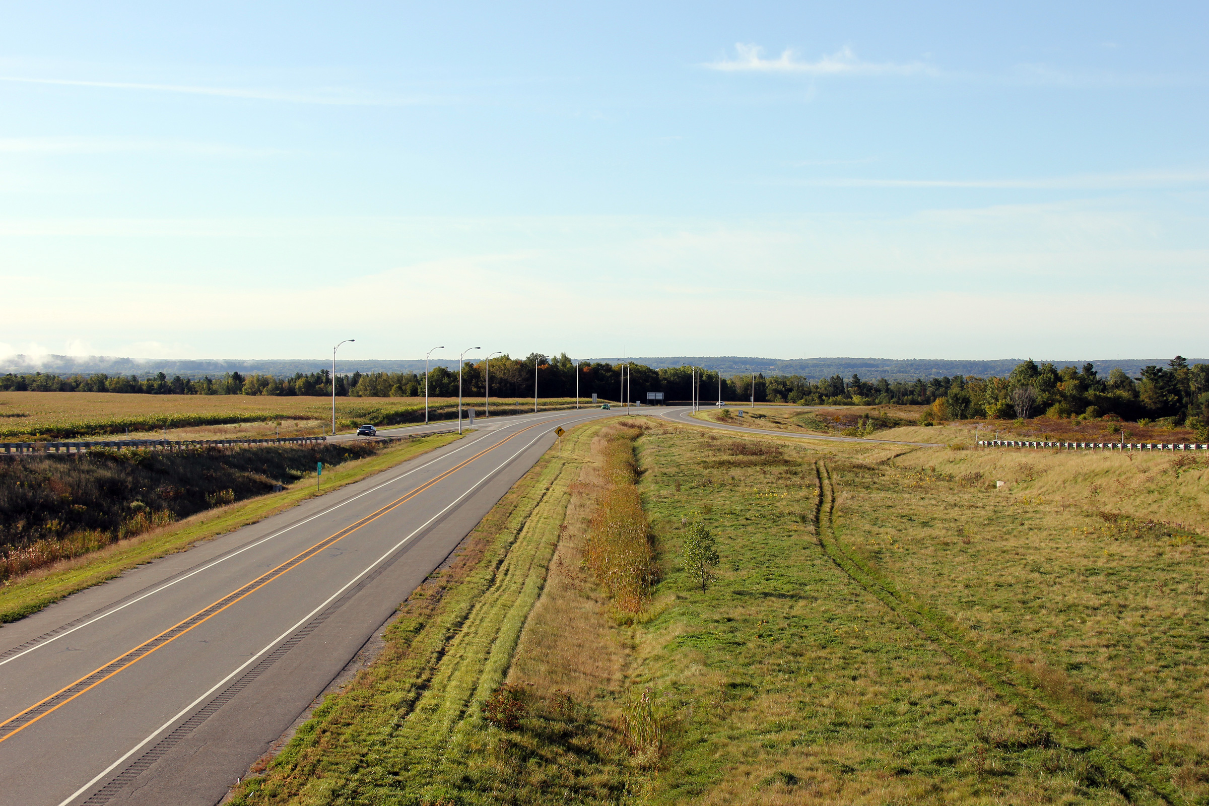
Ville de Gatineau |
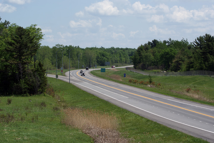
Two views looking easterly from the Lépine Road overpass. Autoroute 50 climbs up and down a large hill immediately to the east of this interchange.
Deux vues à partir du pont d'étagement du chemin Lépine. L'aut. 50 monte une grande colline immédiatement à l'est de cet échangeur. |
 |
||
| High-res: (1440x960) (2400x1600) | ||||
 |
||||
|
Date: 5/24/2010 |
High-res: (1440x960) (2400x1600) | |||
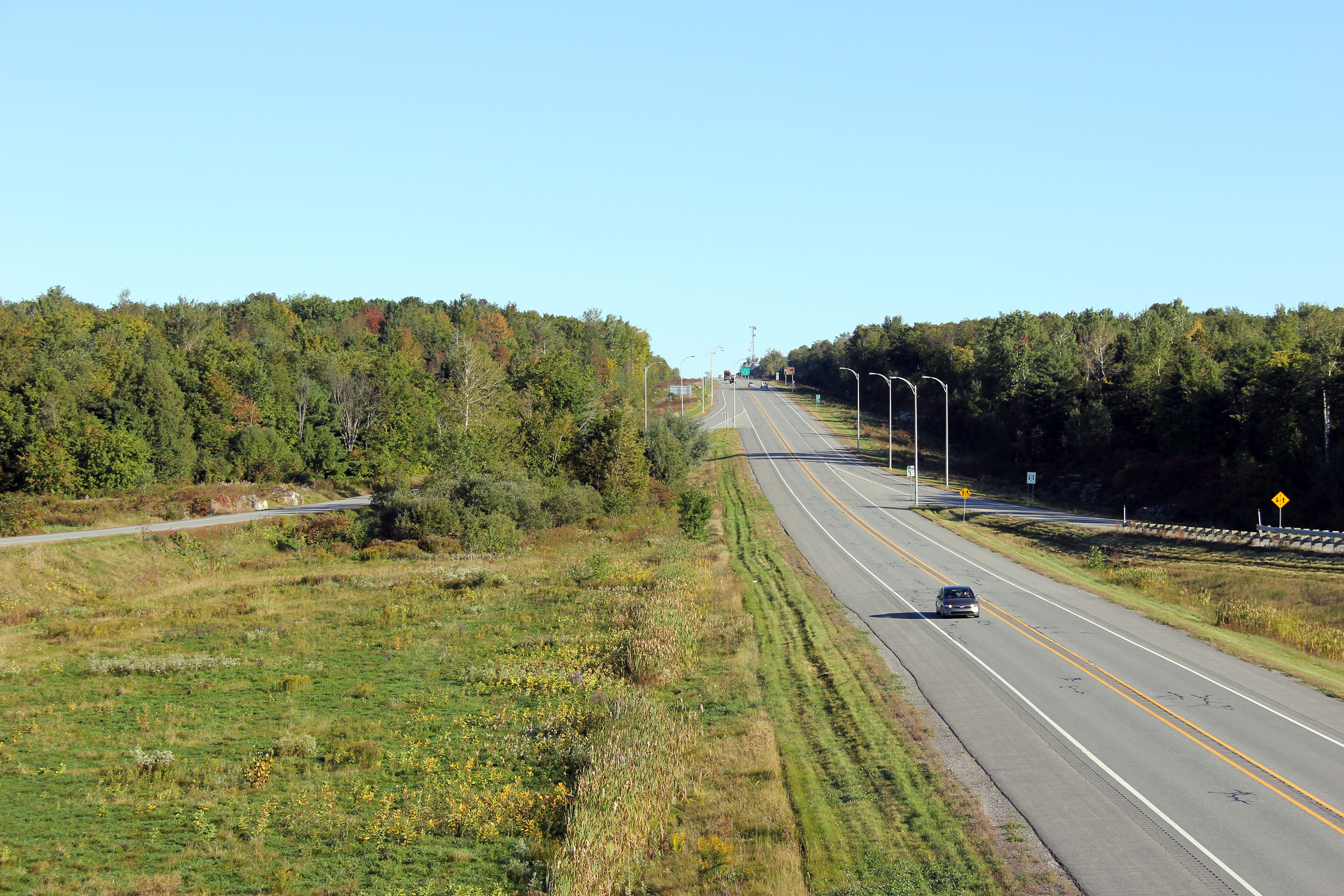
|
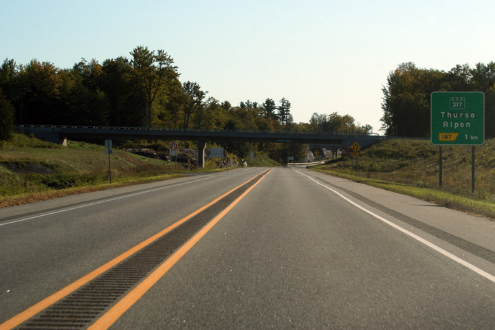
MRC de Papineau |
Easterly view into the early morning sun approaching the Highway 317 interchange.
Vue ensoleillée vers l'est, le soleil tôt du matin se lève au-dessus de l’échangeur de la Route 317. |
 |
||
|
Date: 5/24/2010 |
High-res: (1440x960) (2400x1600) | |||
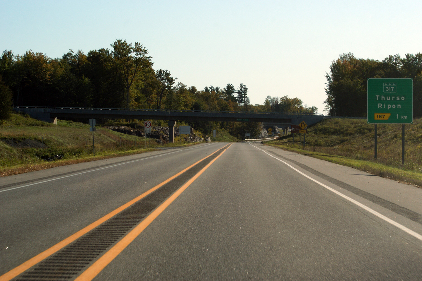
|
MRC de Papineau |
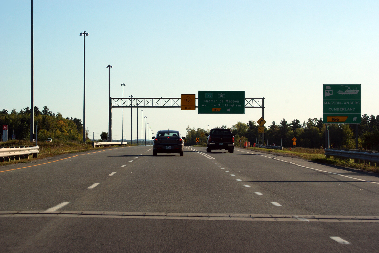
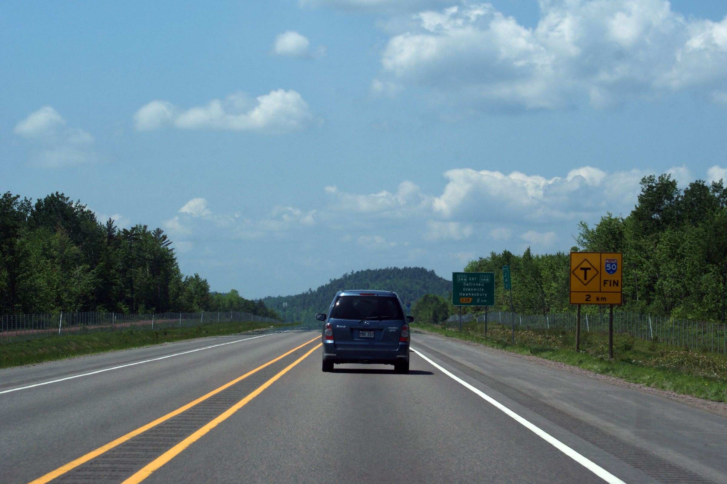
Signage at the eastbound exit to Highway 317. When this photo was taken, Autoroute 50 ended at this interchange. It will be extended easterly in 2012.
Signalisation à la bretelle de sortie vers la route 317. Lorsque cette photo a été prise, l'autoroute se terminait à cet échangeur. L'autoroute 50 sera prolongée vers l'est en 2012. |
 |
||
|
Date: 5/24/2010 |
High-res: (1440x960) (2400x1600) | |||
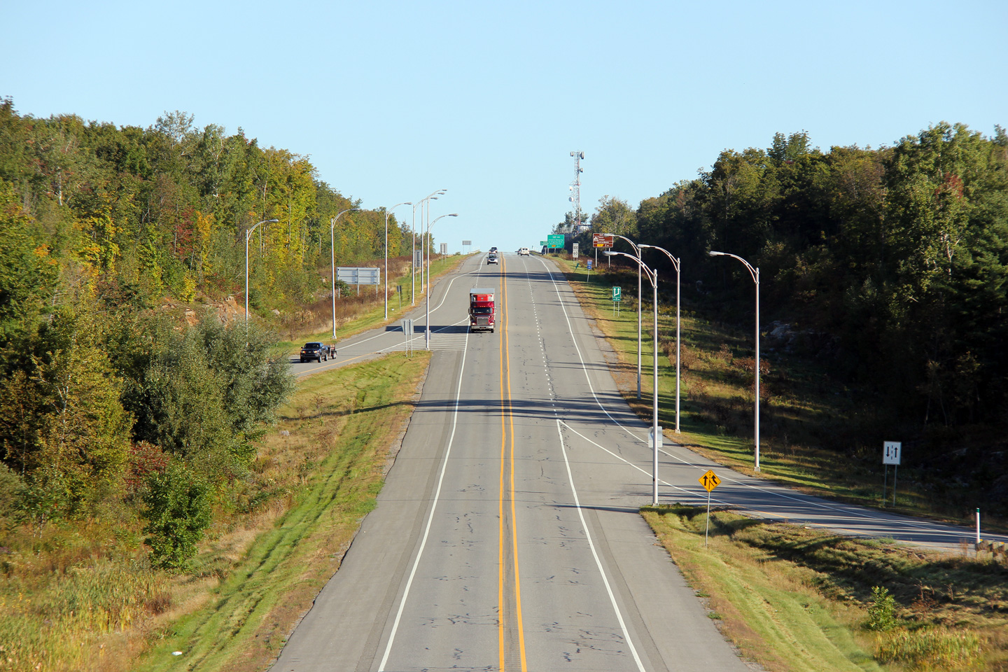
|
MRC de Papineau |
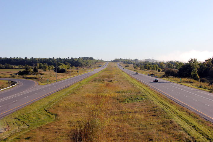
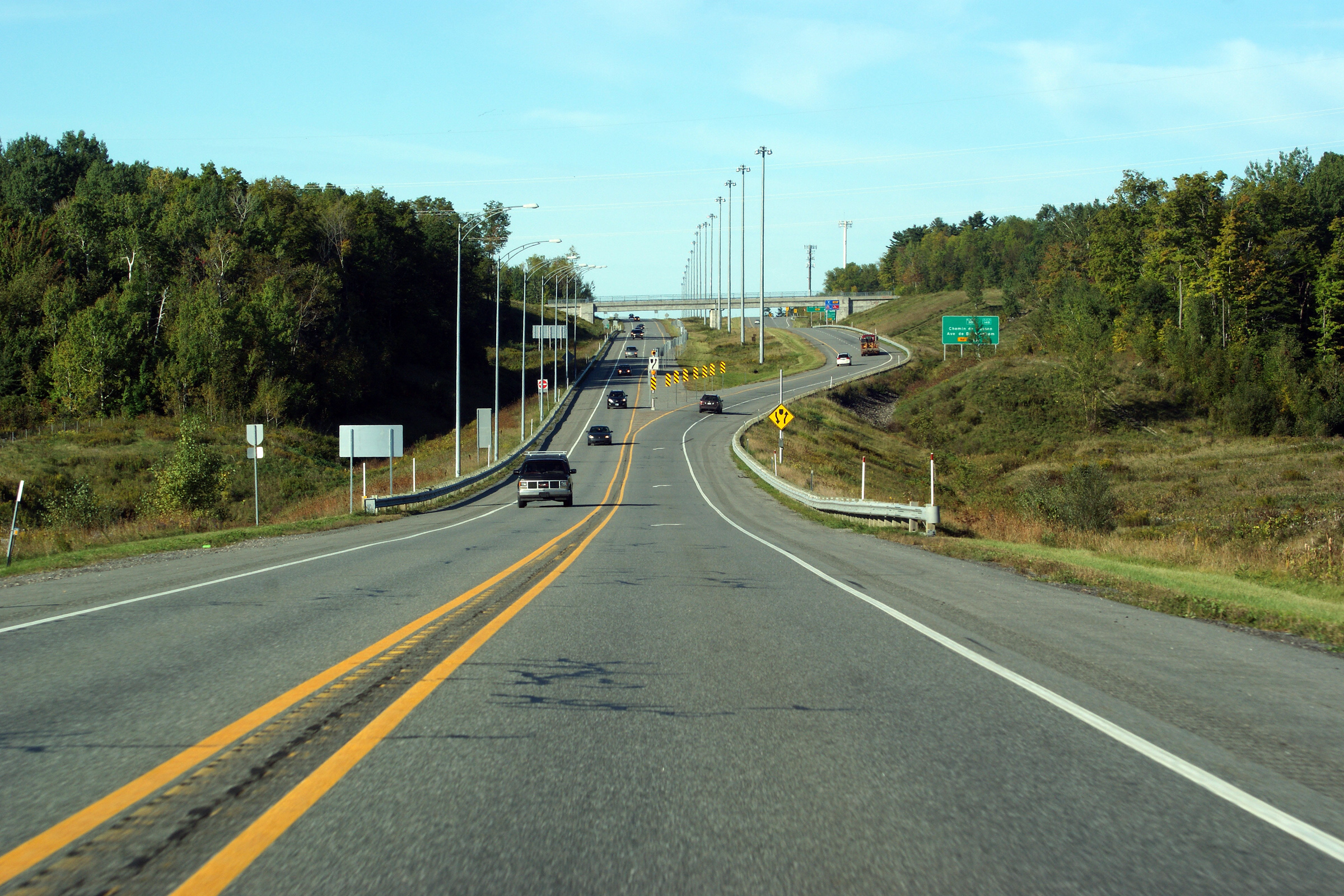
Westerly view along Autoroute 50 from the Route 317 overpass. At the time that this photo was taken, the Gatineau segment of Autoroute 50 ended at an interchange with Route 317.
Vue vers l'ouest le long de l'autoroute 50 depuis le pont d'étagement de la route 317. Quand cette photo a été prise, le tronçon Gatineau de l'autoroute 50 se terminait à l'échangeur de la route 317. |
 |
||
|
Date: 5/24/2010 |
High-res: (1440x960) (2400x1600) | |||
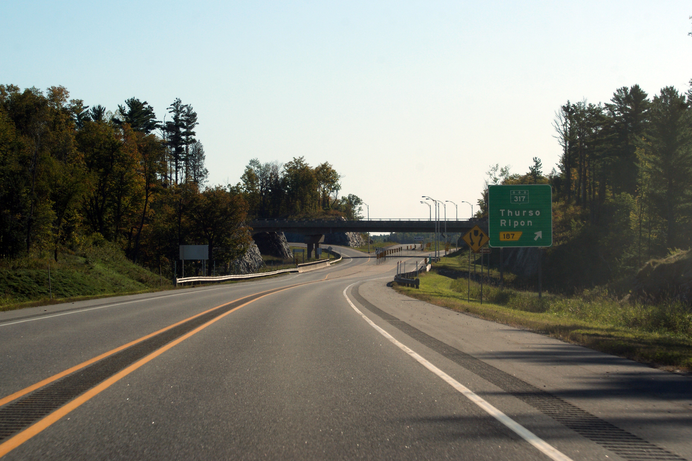
|
MRC de Papineau |
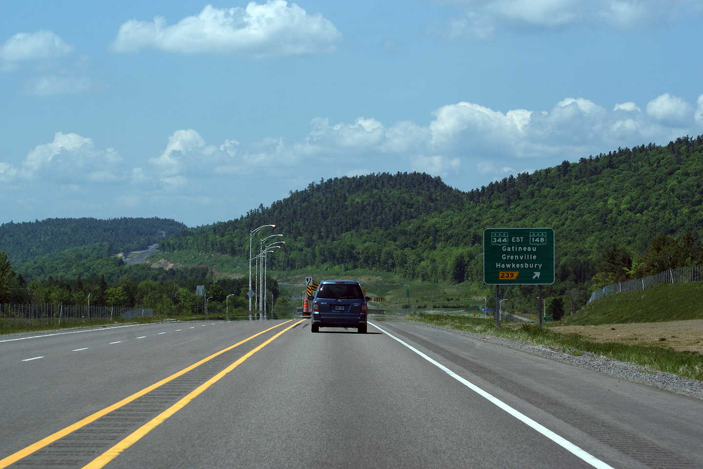
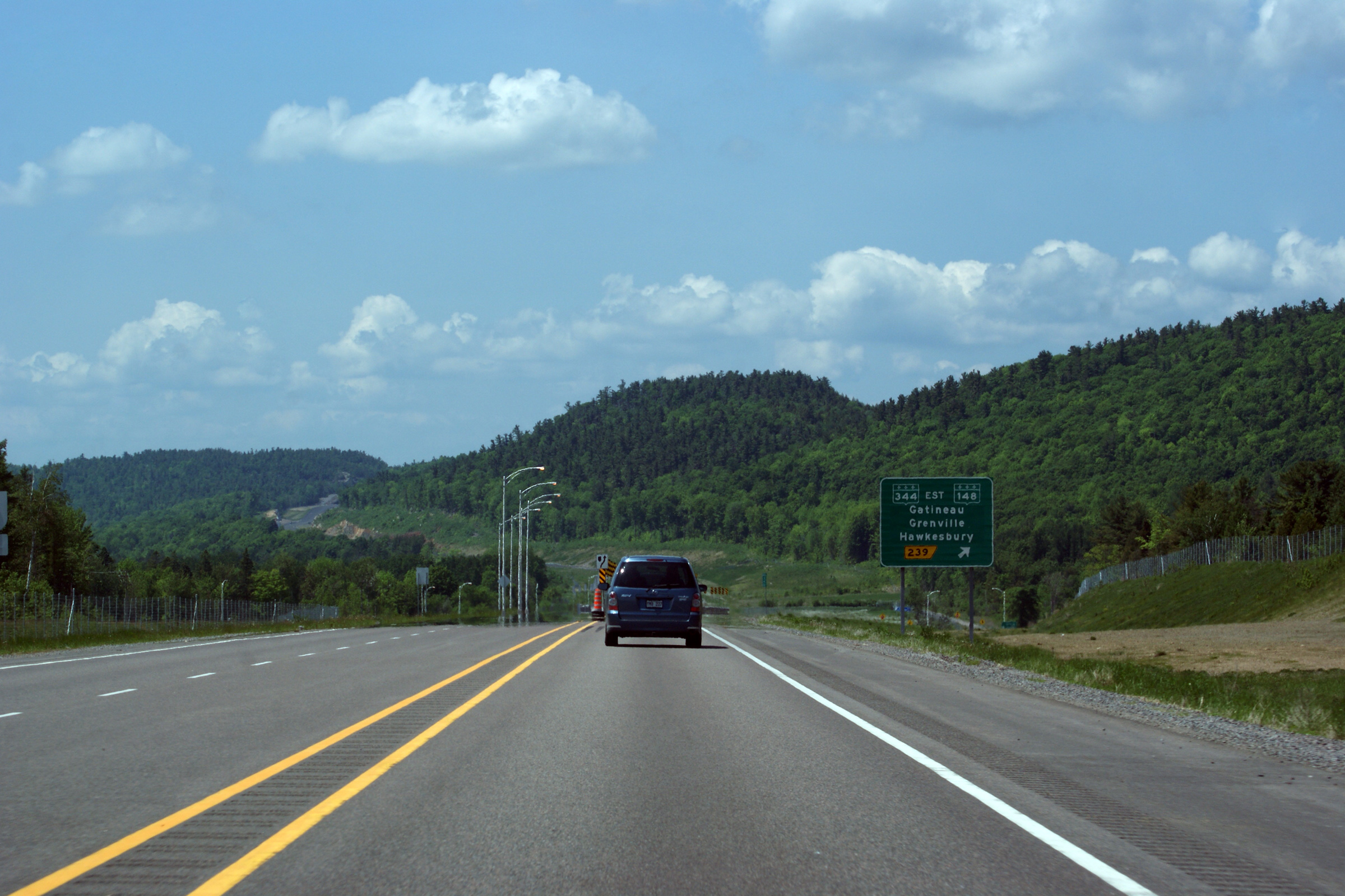
Easterly view from the Route 317 overpass. The final segment of Autoroute 50 is set to open in the Fall of 2012 between this interchange and Route 323 north of Montebello.
Vue vers l'est depuis le pont d'étagement de la route 317. Le tronçon final de l'autoroute 50 qui liera Gatineau et Montréal a été ouvert à l'automne de 2012 entre cet échangeur et l'échangeur avec la route 323 au nord de Montebello. |
 |
||
|
Date: 5/24/2010 |
High-res: (1440x960) (2400x1600) | |||
|
MRC d'Argenteuil |
Westerly view from the Kilmar overpass.
Vue en direction ouest à partir du pont d'étagement du chemin Kilmar. |
 |
||
|
Date: 5/24/2010 |
High-res: (1440x960) (2400x1600) | |||
|
MRC d'Argenteuil |
Two views looking easterly from the Kilmar Road overpass.
Deux vues vers l'est à partir du pont d'étagement du chemin Kilmar. |
 |
||
| High-res: (1440x960) (2400x1600) | ||||
 |
||||
|
Date: 5/24/2010 |
High-res: (1440x960) (2400x1600) | |||
|
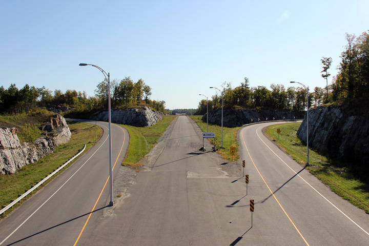
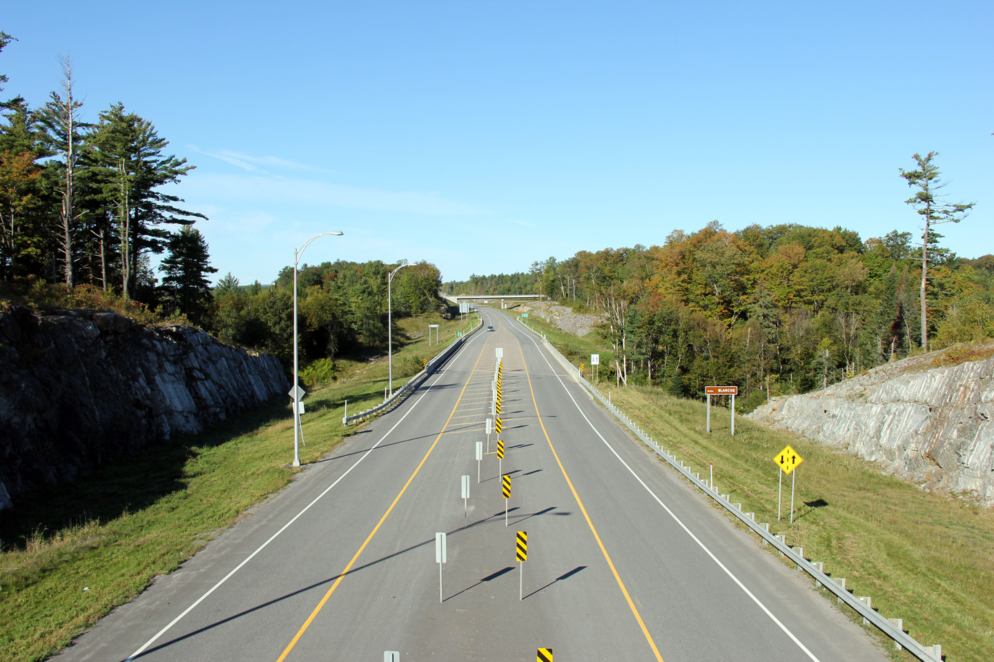
MRC d'Argenteuil |
View looking westerly as Highway 50 passes through a substantially rock cut located approximately 1km to the east of the Kilmar Road interchange.
Vues vers l'ouest lorsque l'autoroute passe à travers un grand talus rocheux situé à un kilomètre à l'est de l'échangeur du chemin Kilmar. |
 |
||
|
Date: 5/24/2010 |
High-res: (1440x960) (2400x1600) | |||
|
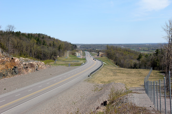
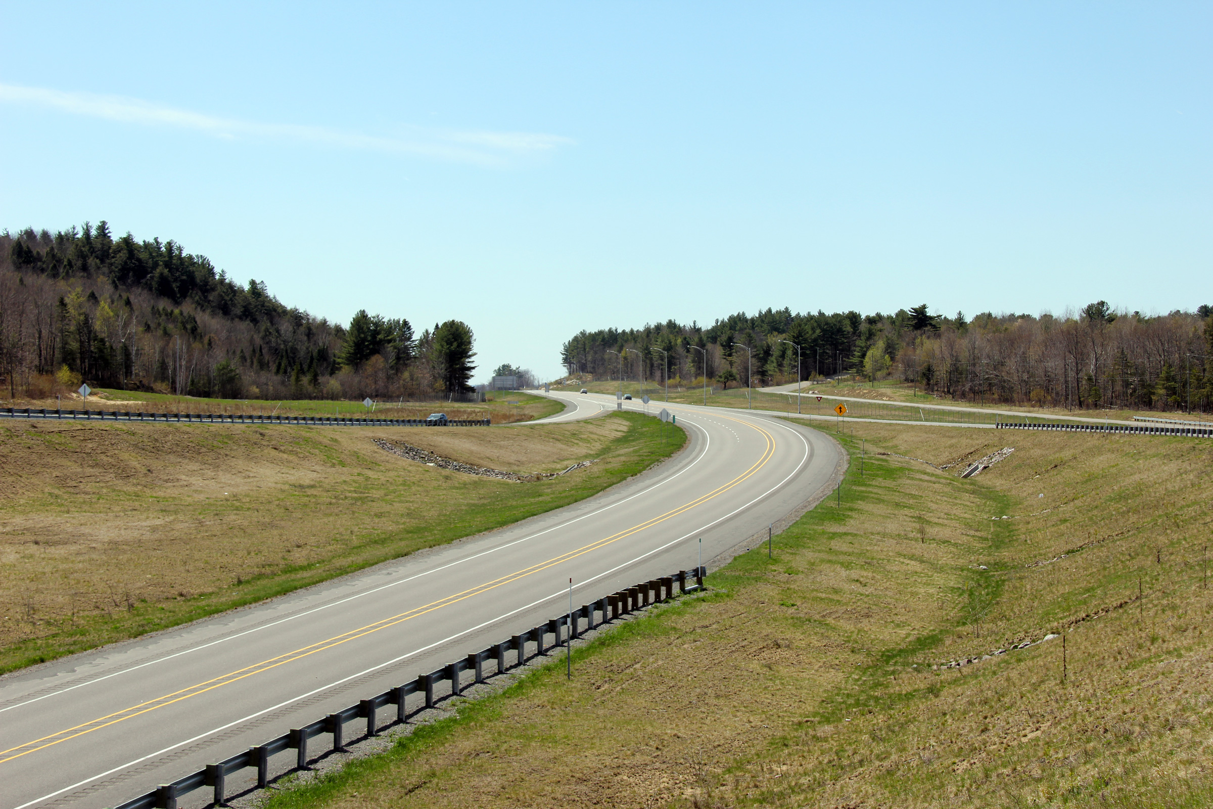
MRC d'Argenteuil |
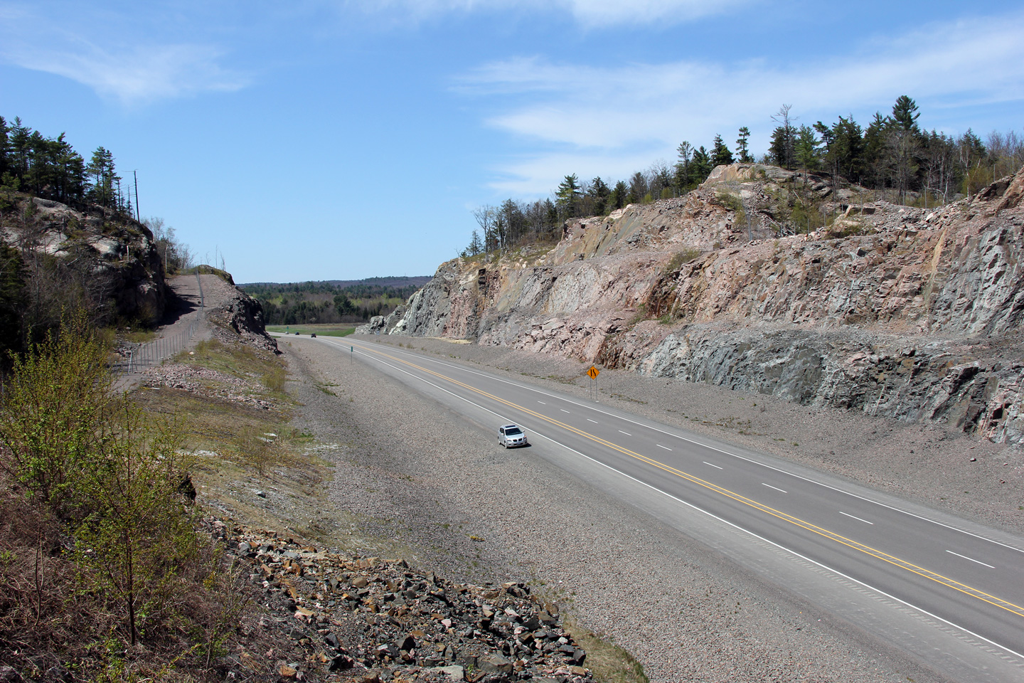
This view looks easterly from high atop a rock outcrop as Autoroute 50 descends a large hill towards the Highway 344 interchange.
Ce point de vue est tourné vers l'est depuis un sommet rocheux où l'autoroute 50 descend en une colline vers l'échangeur avec la route 344. |
 |
||
|
Date: 5/24/2010 |
High-res: (1440x960) (2400x1600) | |||
|
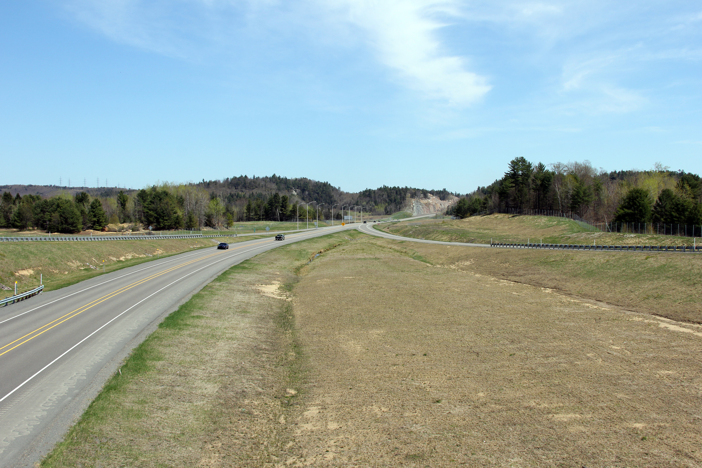
MRC d'Argenteuil |
This view looks westerly approaching the ramp to Route 344.
Vue vers l'ouest à la bretelle de sortie vers la route 344. |
 |
||
|
Date: 5/24/2010 |
High-res: (1440x960) (2400x1600) | |||
|
MRC d'Argenteuil |
Two westbound signs advising motorists of the former western terminus of Autoroute 50 at Route 344.
Deux panneaux en direction ouest qui conseil les conducteurs de l'ancien terminus ouest de l'aut. 50 à la route 344. |
 |
||
| High-res: (1440x960) (2400x1600) | ||||
 |
||||
|
Date: 5/24/2010 |
High-res: (1440x960) | |||
|
MRC d'Argenteuil |
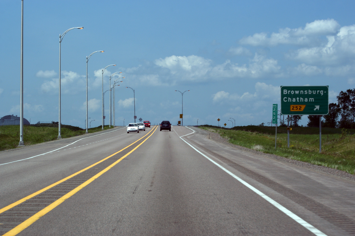
Westbound exit signage for the exit to Brownsburg and Chatham.
Signalisation en direction ouest pour la sortie vers Brownsburg et Chatham. |
 |
||
|
Date: 5/24/2010 |
High-res: (1440x960) | |||
|
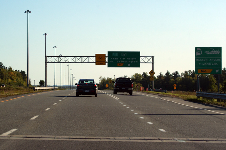
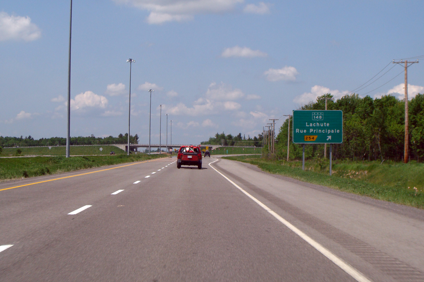
MRC d'Argenteuil |
Easterly view from the Highway 148 overpass along Autoroute 50 along the Lachute Bypass. Autoroute 50 has a brief four lane segment through Lachute
Vue vers l'est à partir du pont d'étagement de la route 148 à l'ouest de Lachute. L'aut. 50 a brièvement quatre voies pour le tronçon qui traverse Lachute. |
 |
||
|
Date: 5/24/2010 |
High-res: (1440x960) (2400x1600) | |||
|
Highway 148 is the principal arterial along the north side of the Ottawa River. Click here for R-148 images. |
||||
|
MRC d'Argenteuil |
Westbound view as Autoroute 50 approaches the Highway 148 interchange in Western Lachute.
Vue vers l'ouest à l'approche de l'échangeur avec la route 148 à l’ouest de Lachute. |
 |
||
|
Date: 5/24/2010 |
High-res: (1440x960) (2400x1600) | |||
|
MRC d'Argenteuil |
Westbound view as Autoroute 50 approaches the Highway 148 interchange in Western Lachute.
Vue vers l'ouest à l'approche de l'échangeur avec la route 148 à la ouest de Lachute. |
 |
||
|
Date: 5/24/2010 |
High-res: (1440x960) | |||
|
MRC d'Argenteuil |
Westbound advanced signage for the Highway 148 interchange as Autoroute 50 crosses over Rivière du Nord.
Signalisation avancée en direction ouest pour la bretelle de sortie vers la route 148. Au-delà de ce panneau, l'aut. 50 traverses la Rivière du Nord. |
 |
||
|
Date: 5/24/2010 |
High-res: (1440x960) | |||
|
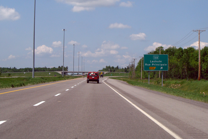
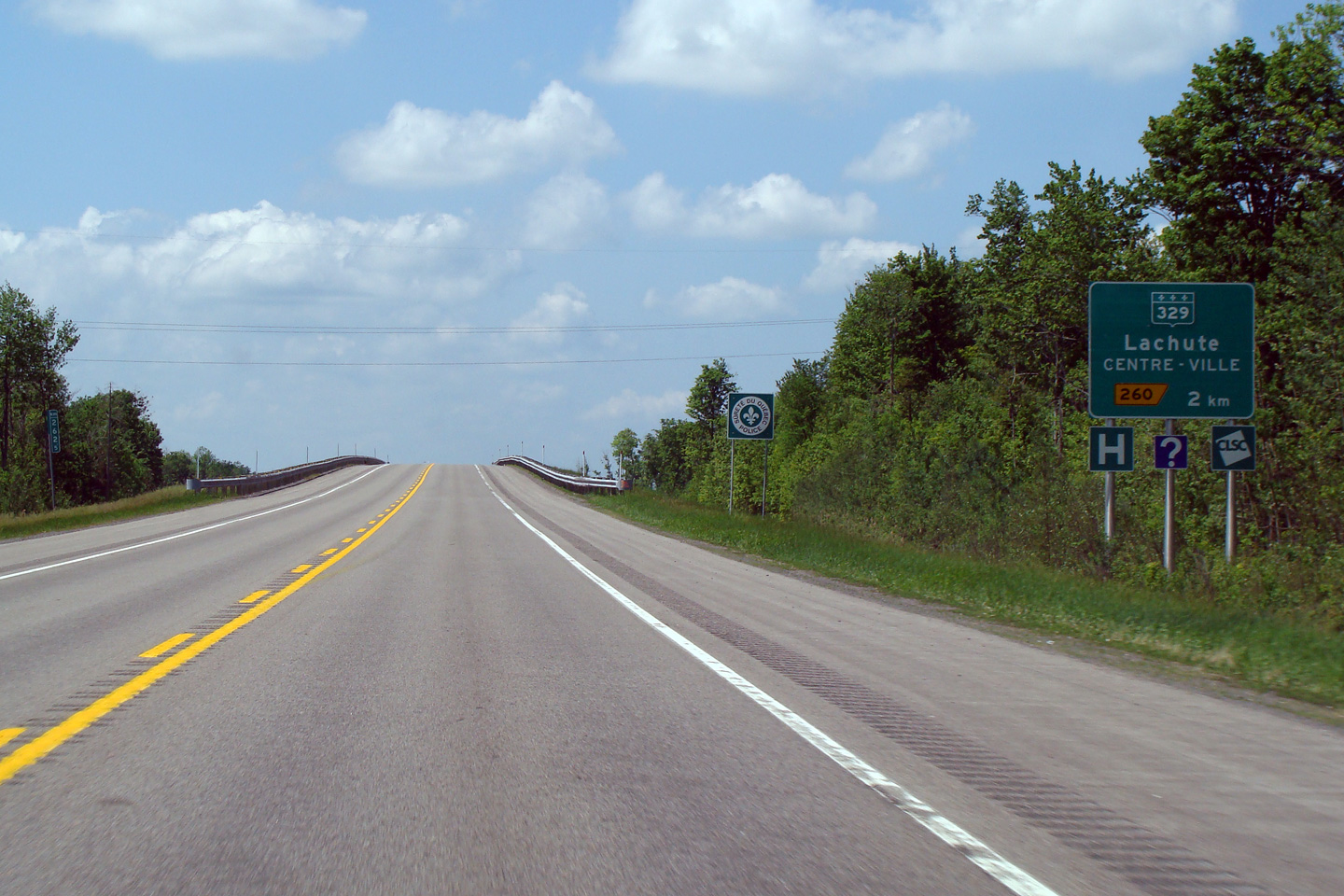
MRC d'Argenteuil |
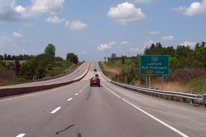
Overhead guide signage at the ramp to Highway 329 leading to Downtown Lachute.
Signalisation aérienne à la bretelle de sortie vers la route 329 et le centre-ville de Lachute |
 |
||
|
Date: 5/24/2010 |
High-res: (1440x960) | |||
|
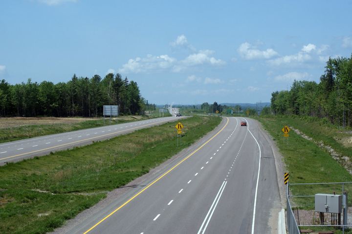
MRC d'Argenteuil |
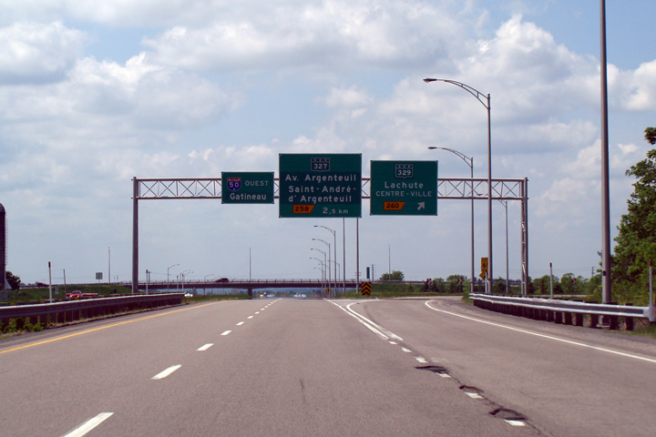
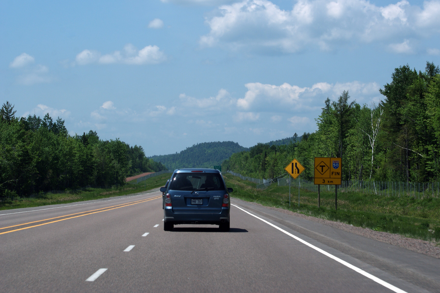
Advanced signage for the Highway 329 interchange. Just outside of frame, Autoroute 50 divides into a multi-lane highway.
Signalisation avancée pour l'échangeur avec la route 329. Au-delà de la colline, l'autoroute 50 devient une autoroute à quatre voies. |
 |
||
|
Date: 5/24/2010 |
High-res: (1440x960) | |||
|
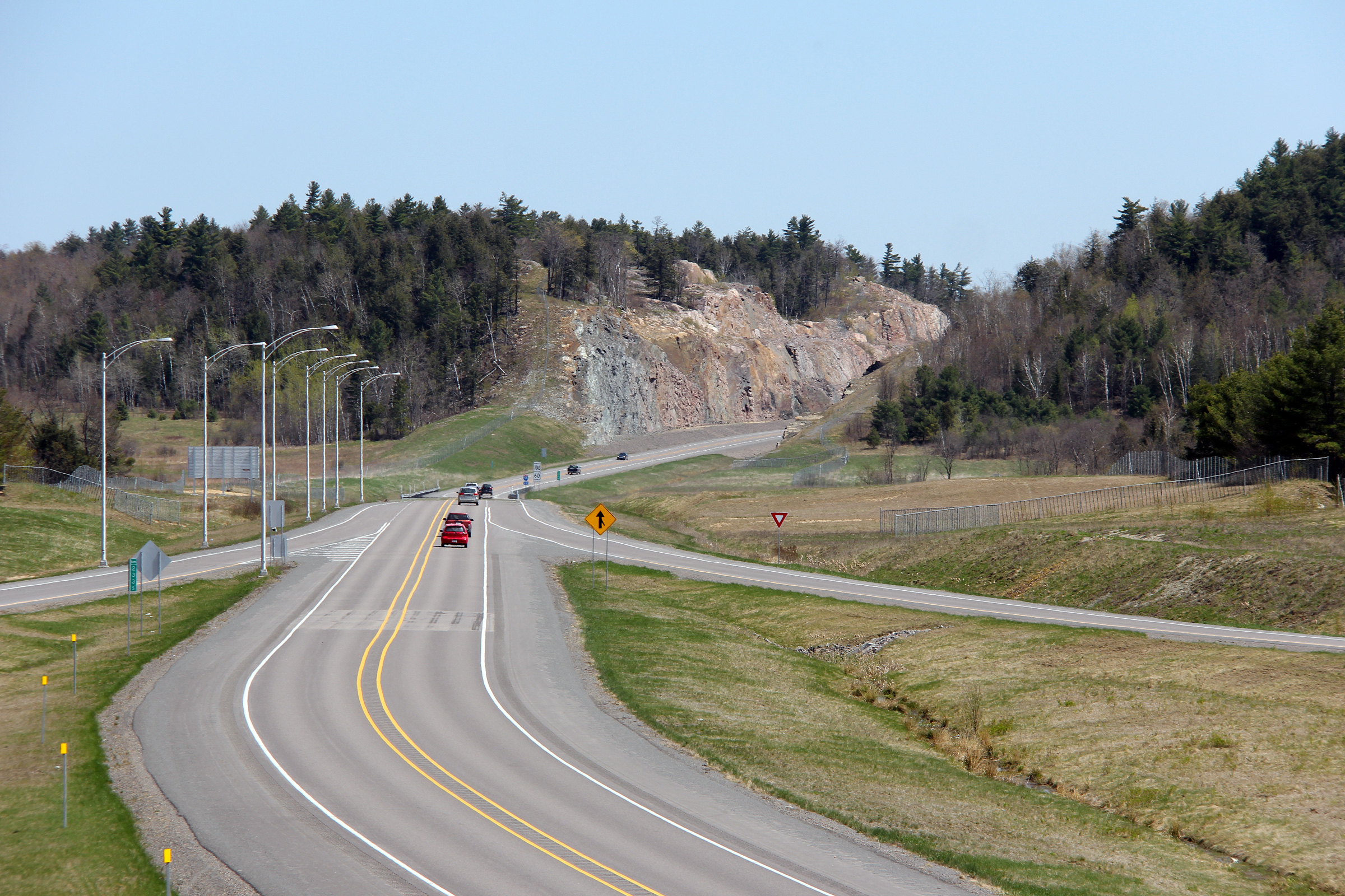
MRC de Mirabel |
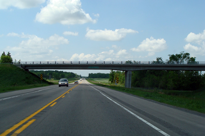
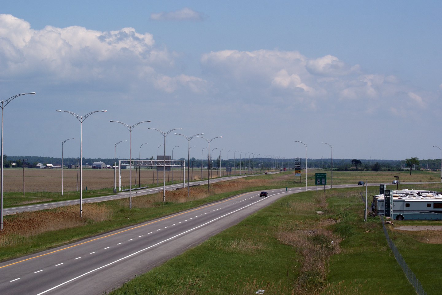
Westerly view as Autoroute 50 passes underneath of the Chemin des Sources overpass. A-50 is very obviously designed to be widened to a four-lane freeway in the future.
Vue en direction ouest où l'autoroute 50 passe en-dessous du pont d'étagement du chemin des Sources. L'aut. 50 est clairement conçu pour être élargit à 4 voies dans l’avenir. |
 |
||
|
Date: 5/24/2010 |
High-res: (1440x960) | |||
|
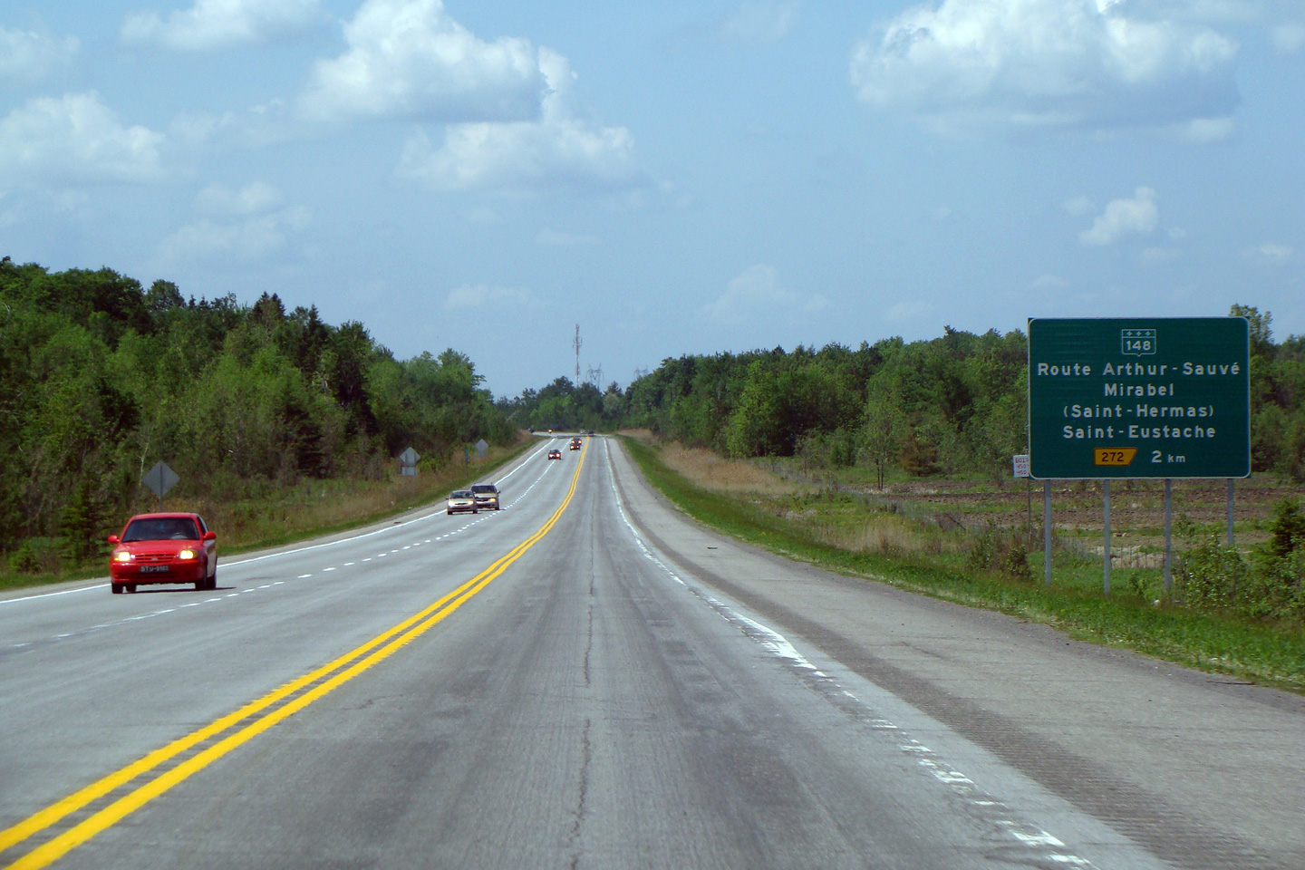
MRC de Mirabel |
Westerly view along A-50 in advance of the Route 148 interchange. Despite being a staged freeway, MTQ has constructed several long passing lanes along the single carriageway sections of Autoroute 50 to aid traffic flow.
Vue vers l'ouest le long de l'aut. 50 près de l'échangeur avec la route 148. Le MTQ a construit plusieurs voies de dépassement suffisamment longues pour aider la fluidité de la circulation sur l'autoroute 50. |
 |
||
|
Date: 5/24/2010 |
High-res: (1440x960) | |||
|
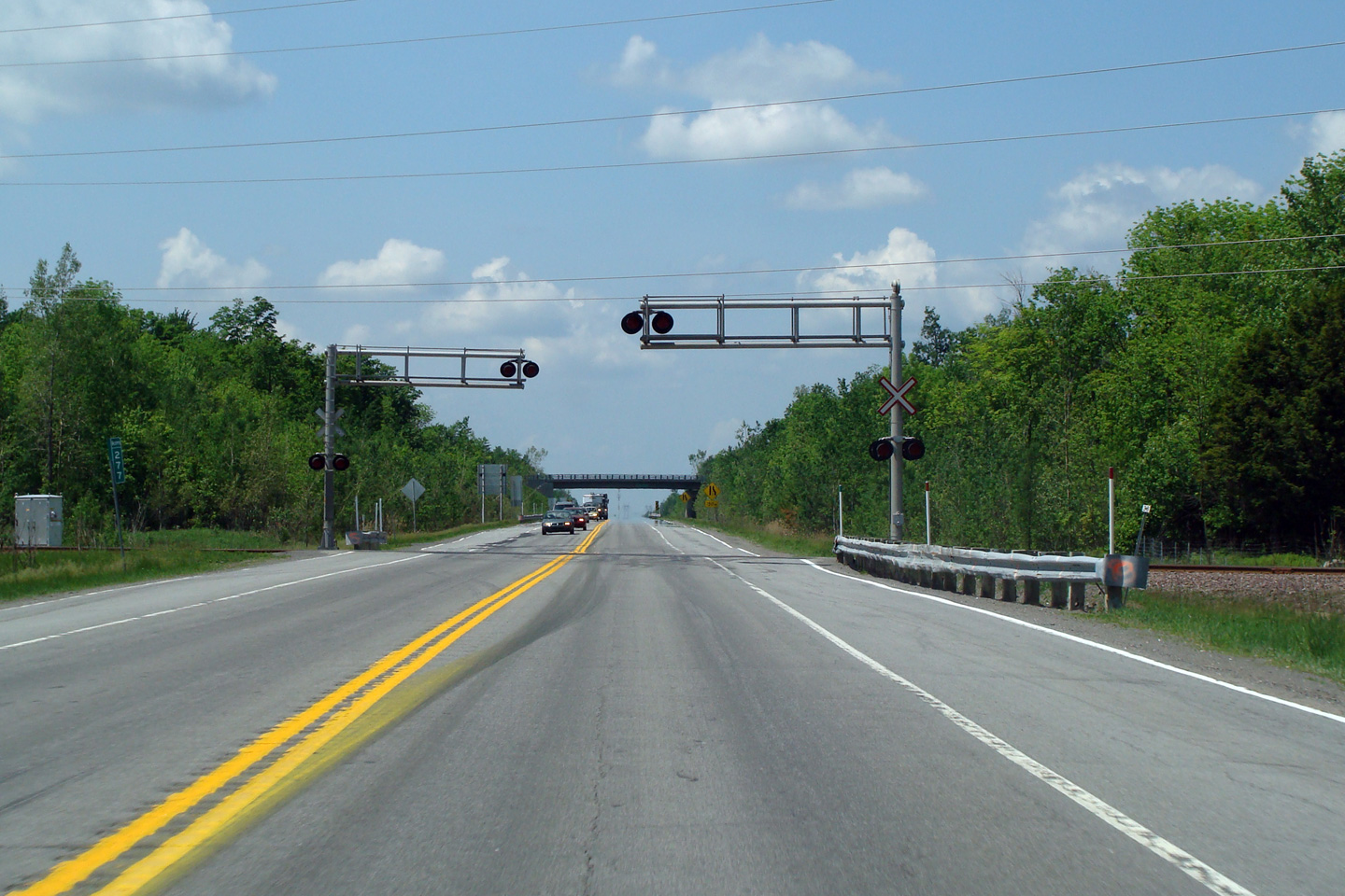
MRC de Mirabel |
Westerly view along A-50 approaching one of two at-grade railway crossings along A-50 between Lachute and Mirabel. Vehicles that are required by law to stop at all railway crossings (such as school busses) are directed to stop on the paved shoulder so that they do not interfere with general high-speed highway traffic.
Vue vers l'ouest à l’approche d'un des deux passages à niveau le long de l'autoroute entre Lachute et Mirabel. Les véhicules qui ont l’obligation, selon la loi, de s’arrêter à tous les passages à niveau (comme les autobus scolaires), sont dirigés vers une voie d’accotement pour ne pas ralentir la circulation de l’autoroute. |
 |
||
|
Date: 5/24/2010 |
High-res: (1440x960) | |||
|
MRC de Mirabel |
Westerly view from the Chemin St-Simon overpass. Autoroute 50 meets Chemin St-Simon at a A2 partial cloverleaf interchange
Vue vers l'ouest à partir du pont d'étagement du chemin St.-Simon. L'aut. 50 croise le chemin St-Simon et l’on retrouve un échangeur en trèfle partiel de type A2. |
 |
||
|
Date: 5/24/2010 |
High-res: (1440x960) (2400x1600) | |||
|
MRC de Mirabel |
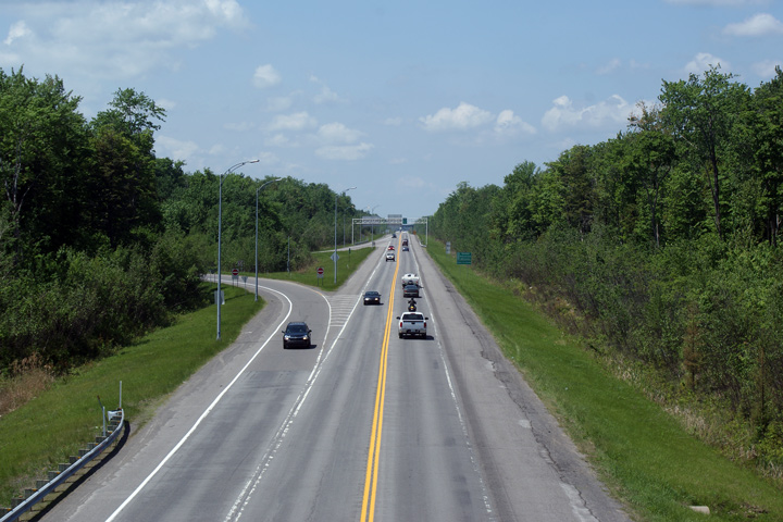
This view looks easterly along Autoroute 50 from the Chemin St-Simon overpass. Autoroute 50 passes through a variety of forested and agricultural landscapes as the highway progresses easterly from Gatineau to Montreal.
Vue en direction est à partir du pont d'étagement du chemin St-Simon. Entre Gatineau et Montréal, l'autoroute 50 traverse une grande variété de paysages forestiers et agricoles. |
 |
||
|
Date: 5/24/2010 |
High-res: (1440x960) (2400x1600) | |||
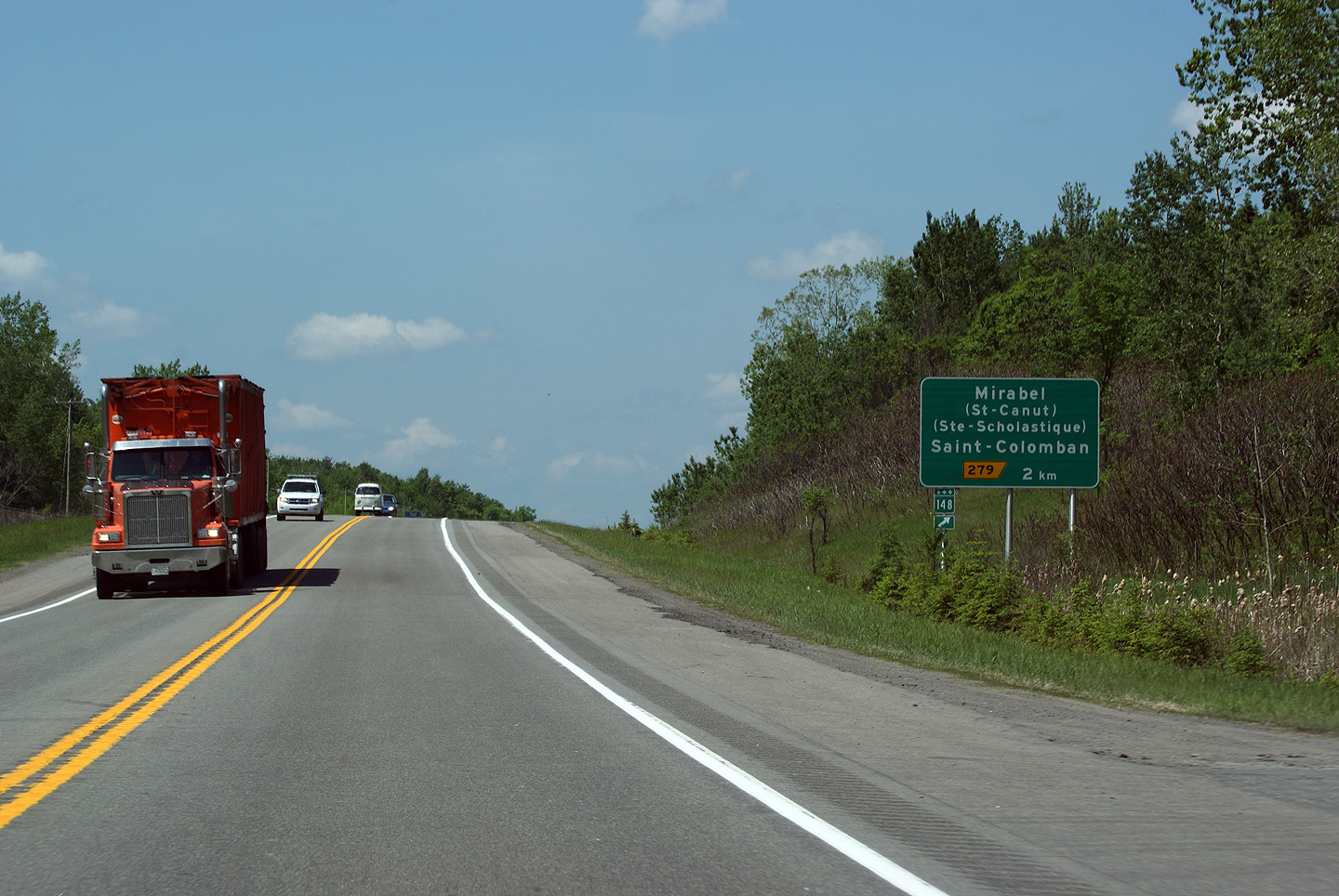
|
MRC de Mirabel |
Westbound advanced signage for the Chemin Simon Interchange. Note how the signage references the community of Mirabel, with Saint-Canut and Sainte-Scholastique in brackets. The Municipality of Mirabel was created in 1971 with the amalgamation of eight former townships. During the 1970s it was envisioned that MRC de Mirabel would house a new city to service Mirabel Airport. While population growth has been steady, particularly in the 2000s, today (in 2011) MRC de Mirabel is still predominantly rural.
Signalisation avancée en direction ouest pour l'échangeur avec le chemin Simon. Notez la façon dont on fait référence aux communautés de Mirabel, où Saint-Canut et Sainte-Scholastique sont entre parenthèse. La ville de Mirabel a été créée en 1971 et plus tard elle a été fusionnée avec 8 villages en 2001. Durant les années 70, il était envisagé que la MRC de Mirabel habiterait une nouvelle ville pour servir l’Aéroport de Mirabel. Même si l’accroissement de la population a été constante, particulièrement dans les années 2000, la MRC de Mirabel est toujours majoritairement rurale. |
 |
||
|
Date: 5/24/2010 |
High-res: (1440x960) | |||
|
MRC de Mirabel |
This is the western-most of two at-grade intersections along Autoroute 50 west of Aéroport Mirabel. This intersection appears to be lightly used.
Cette intersection est la plus a l’ouest le long de l’autoroute 50 à l’ouest de l’Aéroport de Mirabel. Ce carrefour est peu utilisé. |
 |
||
|
Date: 5/24/2010 |
High-res: (1440x960) | |||
|
MRC de Mirabel |
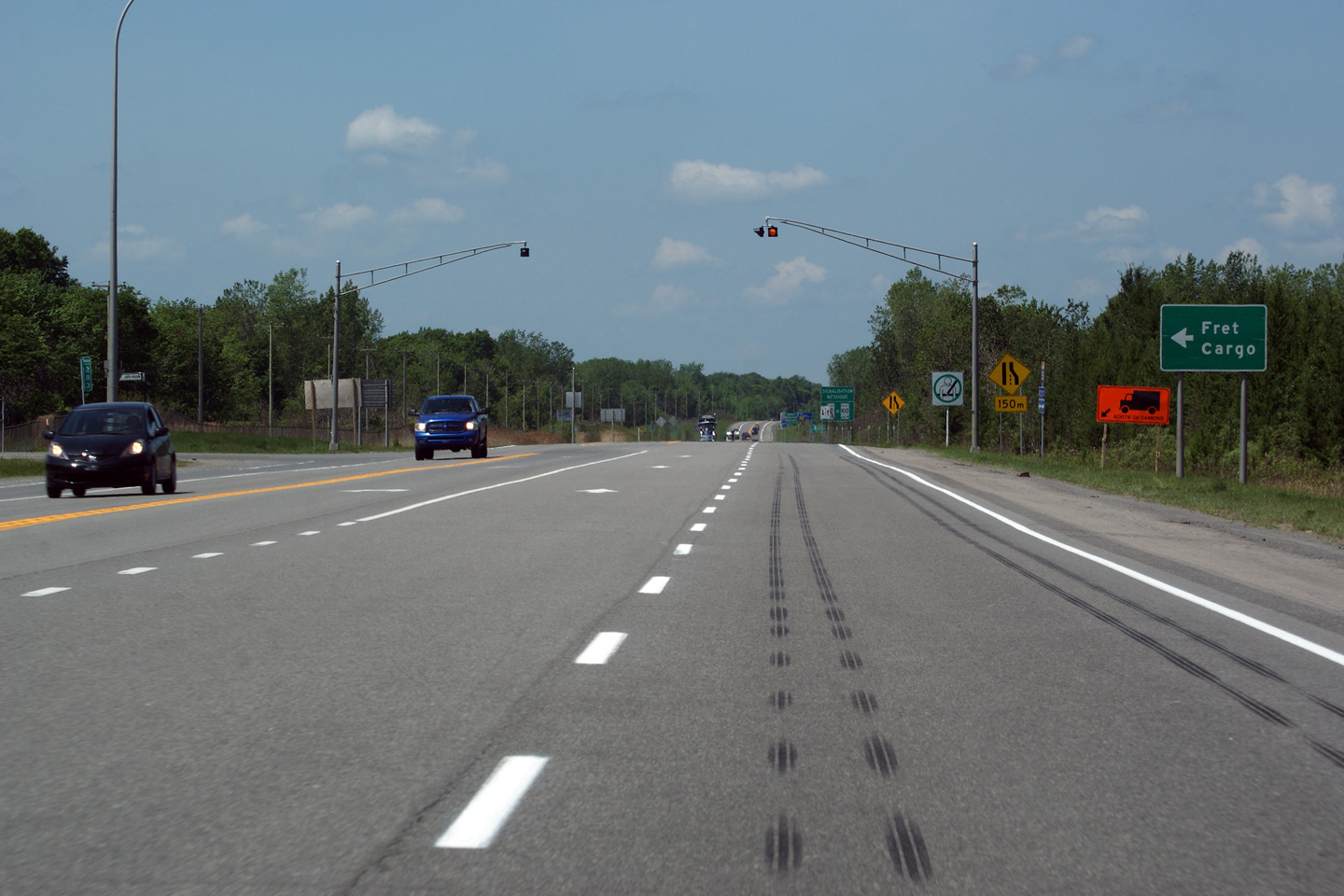
This photograph was shot from the westbound driving lane along Autoroute 50 approaching the eastern at-grade intersection along A-50. Autoroute 50 is generally a super-2 expressway where it is a two-lane highway, these at-grade intersections are the exception not the rule. In the case of the pictured at-grade intersection, it serves a well used access road to the cargo section of Mirabel Airport. Because of the high volume of traffic (particularly truck traffic) that utilizes this intersection, it should be replaced by an interchange.
Cette photo a été prise en direction ouest vers une intersection avec un chemin de dessert de l'aéroport. L’autoroute 50 est régulièrement une autoroute Super-2 avec seulement 2 voies de circulation. Une intersection comme celle-ci est plutôt rare le long de l’autoroute 50. Cette intersection est utilisée comme chemin d’accès pour la section cargo de l’Aéroport de Mirabel. L’intersection reçoit un grand volume de circulation, (surtout par des camions) et elle devrait être remplacée par un véritable échangeur autoroutier. |
 |
||
|
Date: 5/24/2010 |
High-res: (1440x960) (2400x1600) | |||
|
MRC de Mirabel |
Westbound view along Autoroute 50 from Mirabel's Rue Service A1. Autoroute 50 narrows from a four lane freeway to a two lane highway in this photo.
Vue en direction ouest le long de l'autoroute 50 à partir du pont d'étagement du chemin de service A1. L'aut. 50 se rétrécit de quatre voies à deux voies à l'est de cette photo. |
 |
||
|
Date: 5/24/2010 |
High-res: (1440x960) (2400x1600) | |||
|
MRC de Mirabel |
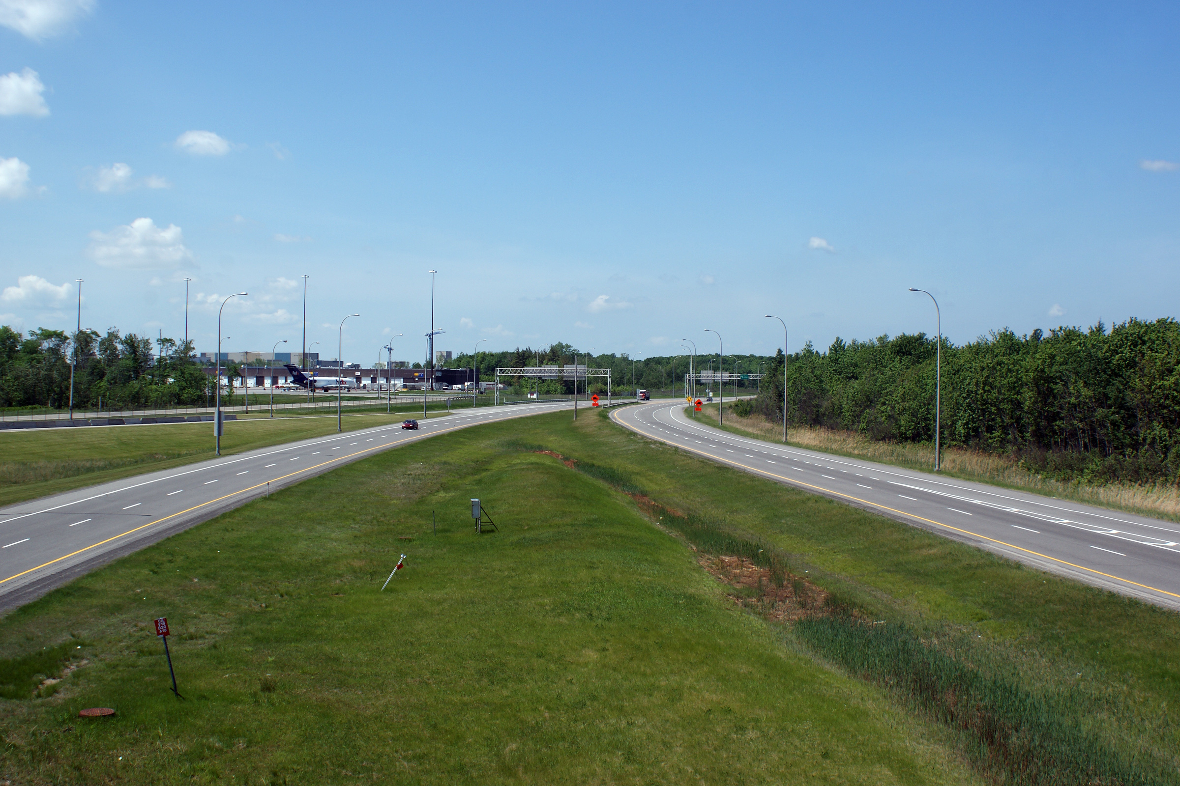
Easterly view from the Rue Service A1 overpass. The boondoggle that became Mirabel Airport is a source of major frustration with the Federal Government of Canada for the residents of Mirabel. A considerable amount of private farm land was expropriated by the Trudeau Government for the construction of Montreal's Mirabel Airport. Similar land was expropriated by the Federal Government in the 1970s in Pickering Ontario to eventually construct a new super-airport to replace Toronto's Pearson. The Federal Government still owns the Pickering lands, and has been threatening to construct the facility in recent years.
Vue en direction est à partir du pont d'étagement du chemin de service A1.Ce gâchis qu’est devenu l’Aéroport de Mirabel est une grande source de frustration des résidents de Mirabel envers le gouvernement fédéral. Une grande quantité de fermes ont été expropriées par le gouvernement Trudeau pour la construction de cet aéroport. Une situation similaire est arrivée dans les années 70 à Pickering (Ontario) lorsque le gouvernement fédéral a exproprié des terres pour y construire un nouveau super-aéroport qui aurait remplacé l’Aéroport Pearson de Toronto. Le gouvernement fédéral est encore propriétaire des terres à Pickering et le projet de construction semble être revenu au feuilleton depuis les dernières années. |
 |
||
|
Date: 5/24/2010 |
High-res: (1440x960) (2400x1600) | |||
|
Mirabel Airport has an extensive terminal and parking area that has been abandoned. Click here Mirabel Airport Images. |
||||
|
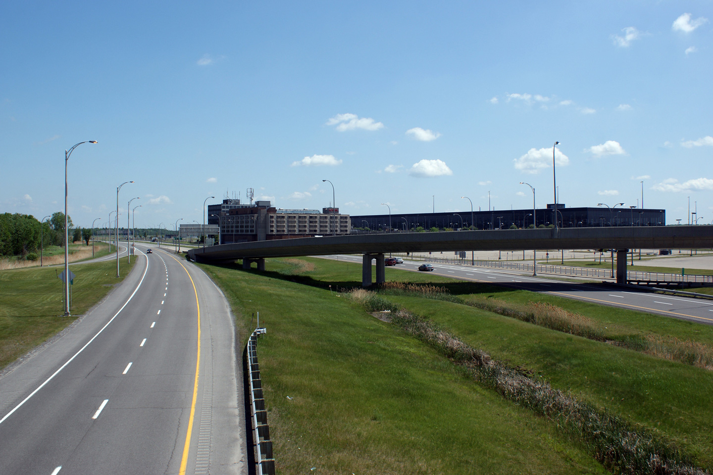
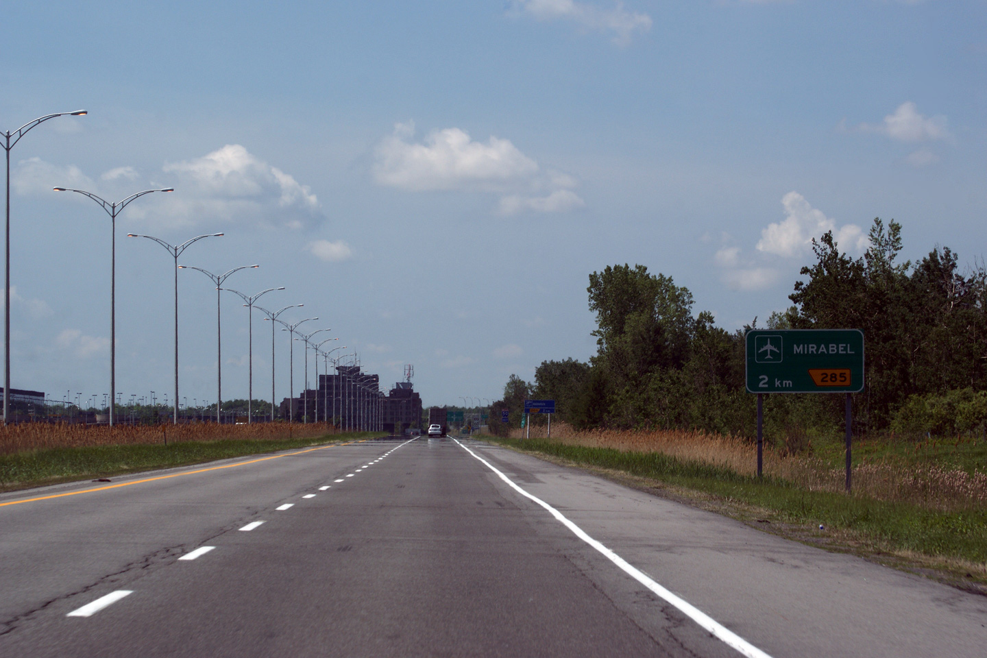
MRC de Mirabel |
Easterly view from the high-speed flyover ramp along A-50 looking east. The now abandoned Chateau Aeroport-Mirabel Hotel dominates the right side of the photograph. Mirabel Airport came to fruition under Pierre Trudeau's Federal Liberal Government during the 1970s. Today (in 2011) it represents one of Canada's largest abandoned publicly-funded facilities. Ironically (and unbelievably), in 2004 Dorval Airport was re-designated as Trudeau Airport. Dorval Airport was to be closed in favour of Mirabel Airport under Trudeau's tenure as Prime Minister.
Vue en direction est à partir du pont d'étagement de la bretelle de sortie vers l'aéroport de l'autoroute 50 est. L’hôtel Le Château Aéroport Mirabel, maintenant abandonné, domine la partie droite de la photo. L’aéroport de Mirabel a vue le jour sous le gouvernement libéral de Pierre-Eliott Trudeau pendant les années 70. Aujourd’hui, cet aéroport représente la plus grande infrastructure publique abandonnée du Canada. Ironiquement, en 2004, l’Aéroport de Dorval (sur l’Île de Montréal) a été nommé l’Aéroport Pierre-Elliot Trudeau. Lorsque que Trudeau était premier ministre, l’Aéroport de Dorval devait être fermé au profit de celui de Mirabel. |
 |
||
|
Date: 5/24/2010 |
High-res: (1440x960) (2400x1600) | |||
|
MRC de Mirabel |
Westbound overhead guide signage for the ramp to the passenger terminal to Mirabel Airport from Autoroute 50. The two lane left hand ramp to Mirabel is effectively obsolete since the passenger terminal of Mirabel Airport closed in 2004.
Signalisation aérienne en direction ouest pour la bretelle de sortie vers l'aérogare de Mirabel. La bretelle de sortie vers l'aérogare de Mirabel est maintenant obsolète puisque le terminal a été fermé définitivement en 2004. |
 |
||
|
Date: 5/24/2010 |
High-res: (1440x960) | |||
|
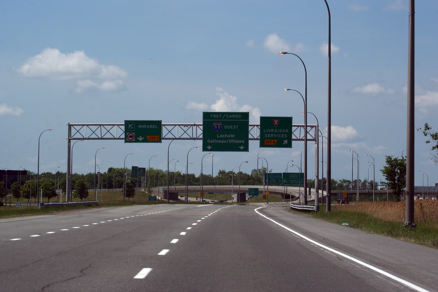
MRC de Mirabel |
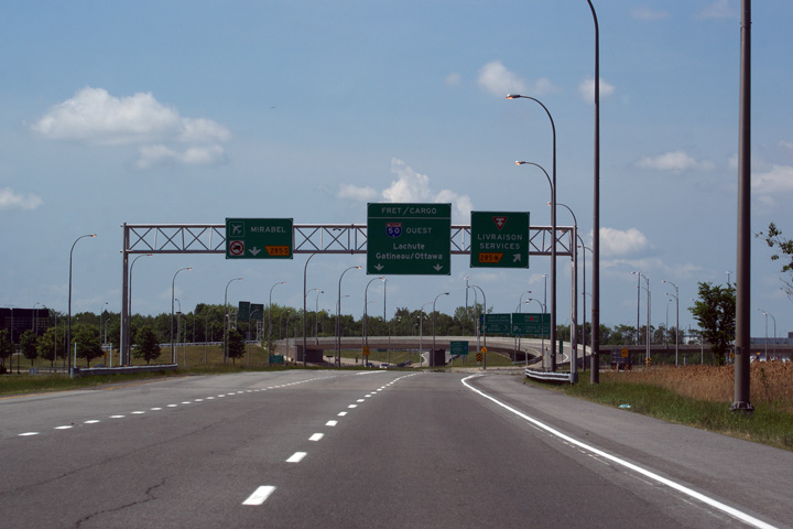
This westbound advanced diagram sign advises motorists of the left hand exit ramp to Mirabel Airport as well as the right hand exit ramp for delivery services. The abandoned 354 Chateau Aeroport-Mirabel Hotel lays dormant immediately to the south of the freeway.
Panneau à diagramme indiquant la sortie à gauche vers l'Aéroport de Mirabel et la sortie à droite vers le service de livraison. L’hôtel Le Château Aéroport-Mirabel maintenant abandonné est situé immédiatement au sud de l’autoroute. |
 |
||
|
Date: 5/24/2010 |
High-res: (1440x960) | |||
|
MRC de Mirabel |
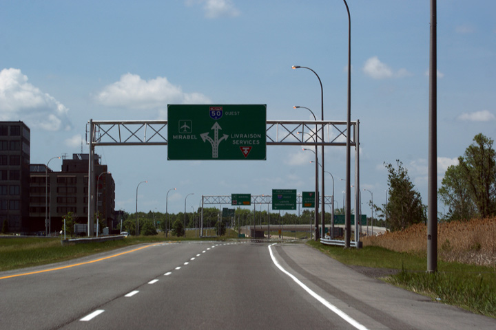
Westbound signage in advance of the left hand exit to Mirabel Airport. Left exit's in Quebec are marked with a yellow trapezoid that points to the left, instead of to the right.
Signalisation avancée pour la sortie à gauche vers l'aéroport Mirabel. Au Québec, les sorties à gauche sont reconnaissable par le trapèze jaune qui pointe vers la gauche au lieu de vers la droite. |
 |
||
|
Date: 5/24/2010 |
High-res: (1440x960) | |||
|
MRC de Mirabel |
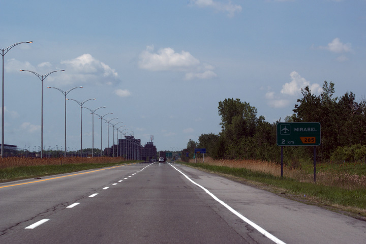
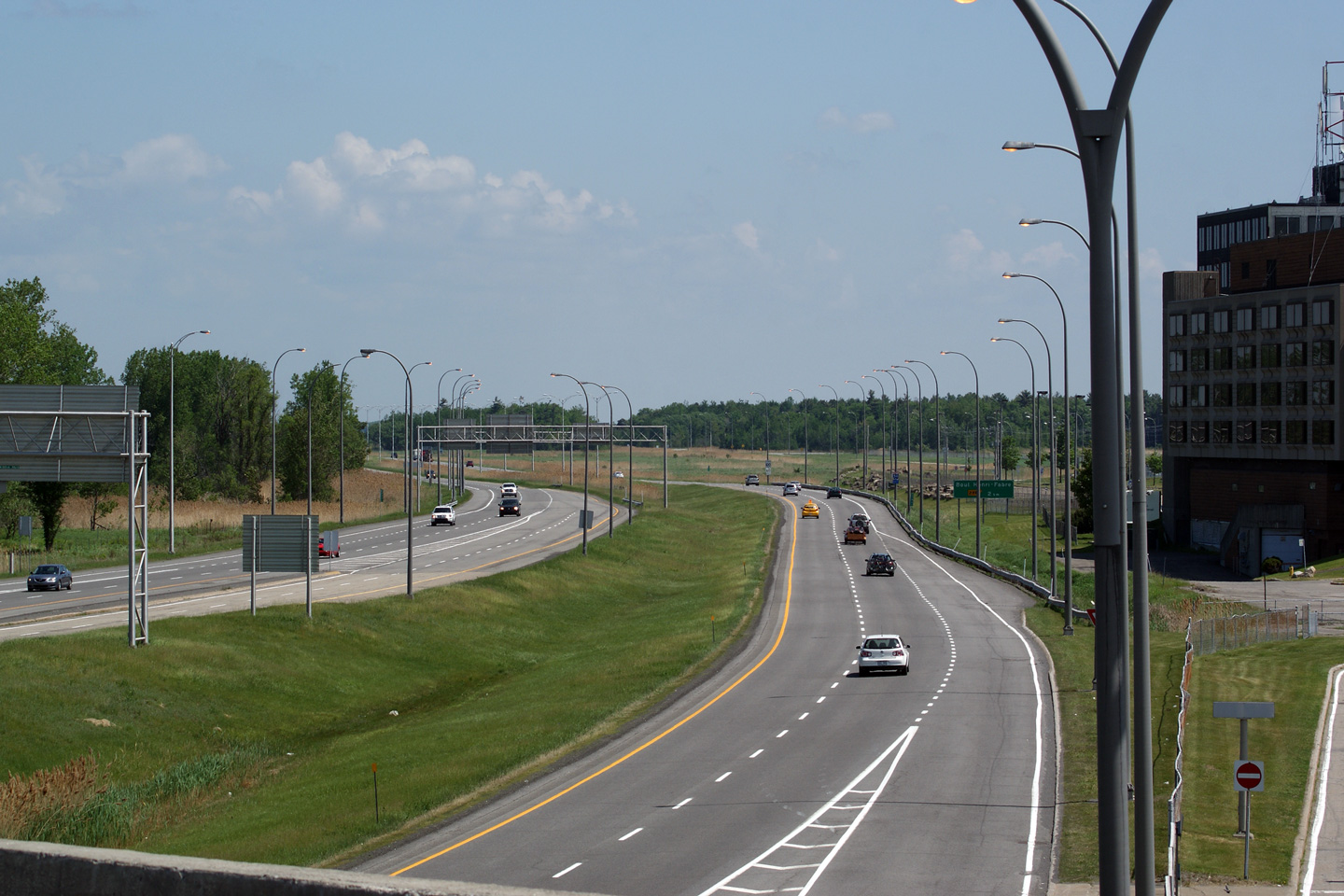
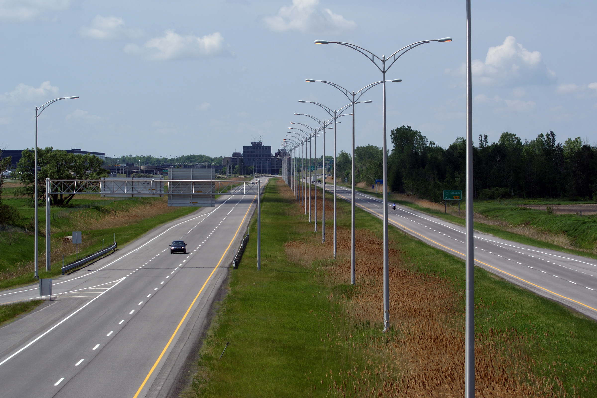
This view looks westerly towards Mirabel Airport from the Chemin Belanger overpass. Despite the freeway's rural surroundings, Autoroute 50 is continuously lit between Mirabel Airport and Autoroute 15.
Vue en direction ouest vers l'aéroport Mirabel à partir du pont d'étagement du chemin Bélanger. L'autoroute 50 est illuminé en permanence entre l'aéroport Mirabel et l'autoroute 15 malgré l'environnement rural. |
 |
||
|
Date: 5/24/2010 |
High-res: (1440x960) (2400x1600) | |||
|
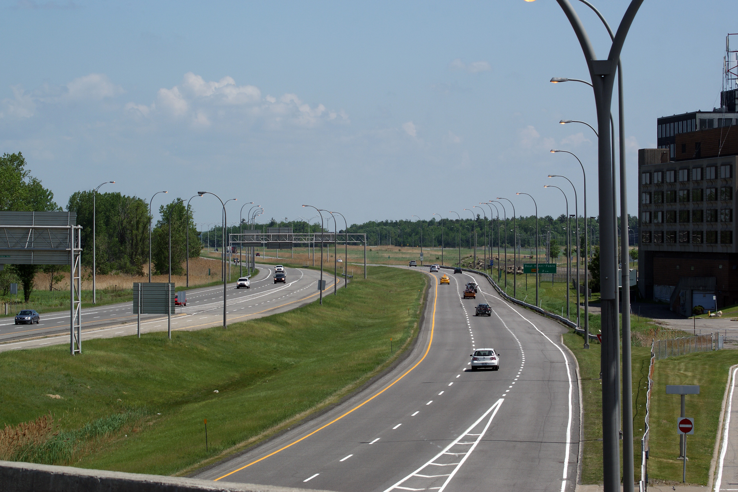
MRC de Mirabel |
Easterly view from the Ch. Belanger overpass. The wide median east of Belanger Road would have accommodated an interchange with Autoroute 13 that was never constructed.
Vue vers l'est à partir du pont d'étagement du chemin Bélanger. La large médiane gazonné à l’est du chemin Bélanger aurait logé un échangeur avec l'autoroute 13, qui n'a jamais été construit. |
 |
||
|
Date: 5/24/2010 |
High-res: (1440x960) | |||
|
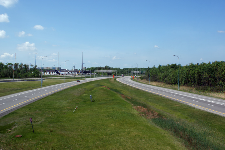
MRC de Mirabel |
Easterly signage in advance of the ramp to Autoroute 15 south.
Signalisation avancée pour la bretelle vers l'aut. 15 sud. |
 |
||
|
Date: 7/01/2012 |
High-res: (1440x960) (2400x1600) | |||
|
MRC de Mirabel |
Easterly view at the ramp to A-15 south.
Vue vers l'est à la bretelle de sortie vers l'A 15 sud. |
 |
||
|
Date: 7/01/2012 |
High-res: (1440x960) (2400x1600) | |||
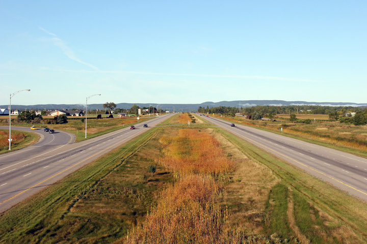
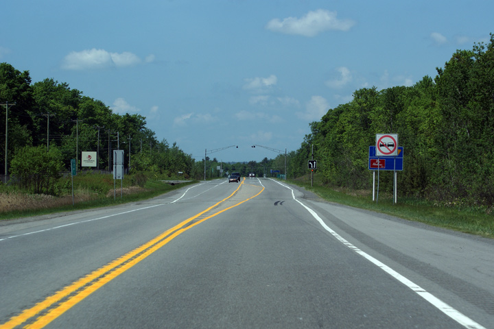
|
MRC de Mirabel |
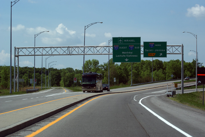
Autoroute 50 ends at Route 117 just beyond the A-15 interchange.
L'A 50 se termine à la route 117 au-delà de l'échangeur avec l'A 15. |
 |
||
|
Date: 7/01/2012 |
High-res: (1440x960) (2400x1600) | |||
|
Autoroute 50 crosses Autoroute 15 just south of St. Jerome. Autoroute 15 is the principal north-south freeway through Western Quebec. Click here for A-15 images. |
||||
|
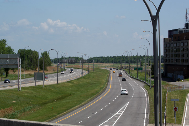
MRC de Mirabel |
Easterly view at the ramp to Autoroute 15 North.
Vue vers l'est à la bretelle de sortie vers l'A 15 nord. |
 |
||
|
Date: 7/01/2012 |
High-res: (1440x960) (2400x1600) | |||
|
MRC de Mirabel |
Westbound overhead signage for the ramp to Autoroute 15 North. Autoroute 50 continues about a kilometre east of Autoroute 15 to Route 117, as more or less a ramp extension, hence the westbound signage.
Signalisation aérienne vers l’ouest à la bretelle de sortie vers l'aut. 15 nord. L’autoroute 50 continue environ 1 km à l’est de l’Autoroute 15 jusqu’à la route 117. L’extension est plus ou moins une extension de la bretelle, d’où la signalisation indiquant la direction ouest. |
 |
||
|
Date: 5/24/2010 |
High-res: (1440x960) | |||
<- A-40
PQ Highways
A-70 ->
Asphaltplanet.ca
© 2010-2011 Scott Steeves.
AsphaltPlanet@asphaltplanet.ca
Special thanks to Mathieu Thériault for assistance
with French translations
Page Created: February 5, 2011.
Last Updated: February 5, 2011.