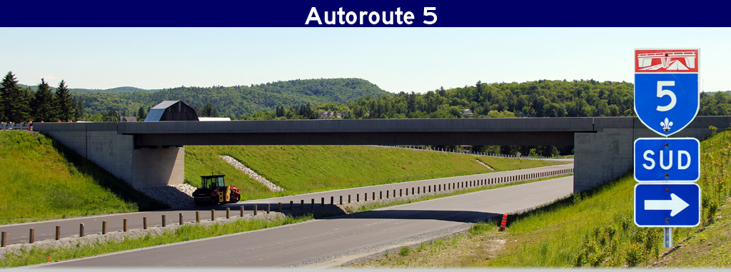
AsphaltPlanet.ca > Quebec > Autoroute 5
|
Southern Entrance:
Ontario border/The Macdonald-Cartier Bridge in Ottawa. -- A-5 continues
into Ontario as King Edward Avenue.
Northern Terminus: R-366/Ch MacLaren immediately north of the Wakefield By-pass. Length: ~24km Regions: Gatineau, Collines-de-l'Outaouais Routing: Autoroute 5 begins at the foot of the Macdonald-Cartier Bridge in Gatineau. Pont Macdonald-Cartier Links A-5 in Gatineau, Quebec to Ottawa, Ontario. The freeway continues northerly through Gatineau and into the northern suburbs along the western side of the Gatineau River. The terrain the freeway passes through becomes increasingly more rugged as the highway progresses further and further into the Gatineau Hills. In Chelsea Township the freeway abruptly ends at a signalized intersection with R-105. After a roughly 5km gap in the highway, A-5 begins once again as the four-lane at grade by-pass of Wakefield. Links:
|
Pictures on this page are arranged in order from south to north. A-5 North photos are left-aligned in the last column, while A-5 South photos are right-aligned. Center-line pictures are centered within the last column.
|
Location |
Description |
Photo |
||
|
North- |
South- |
|||
|
Ville de Gatineau |
View looking northerly along A-5 at the north end of the Macdonald-Cartier Bridge. The Macdonald-Cartier Bridge is one of several Federally maintained bridges that cross the Ottawa River -- this might explain why the exit signage found along the bridge looks slightly different then what is typically found in Quebec. |
|
||
|
Date: 12/9/2009 |
High-res | |||
|
Ville de Gatineau |
Southerly view from the Rue Laurier Overpass towards Ottawa and the Macdonald-Cartier Bridge. A-5 ends at the foot of this bridge. A freeway was once conceived in Ontario to Link A-5 to Highway 417, however nowadays such a connection is almost inconceivable. |
|
||
|
Date: 12/9/2009 |
||||
|
Ville de Gatineau |
This is the opposing view from the Rue Laurier Overpass. A-5 meets Boul. Maisonneuve at a large and complex interchange. Boul. Maisonneuve is the primary route into Downtown Hull from both A-5 and the Macdonald-Cartier Bridge. |
|
||
|
Date: 12/9/2009 |
||||
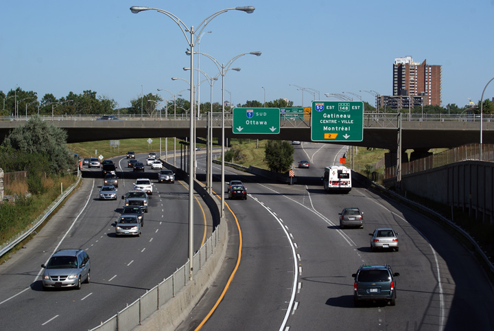
|
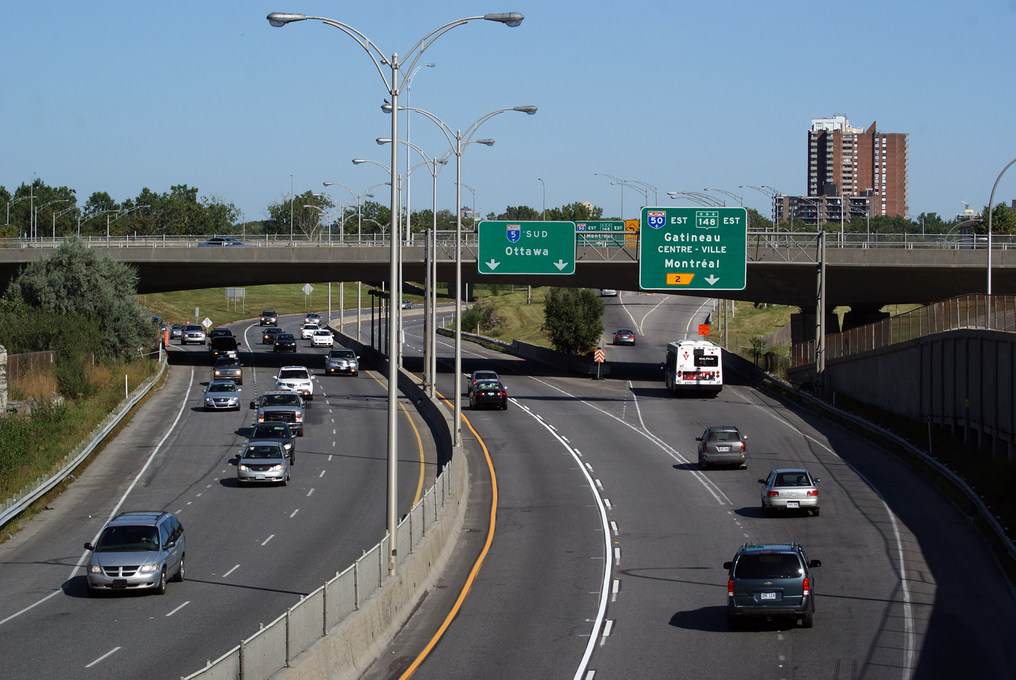
Ville de Gatineau |
Exit signage for Autoroute 50 and Highway 148 East. There is no direct connection between A-5 and Highway 148-West (Boul des Allumettieres). The A-5/A-50 interchange was constructed decades before R-148 was extended through Gatineau Park. |
|
||
|
Date: 12/9/2009 |
High-res | |||
|
A-50/R-148 intersects A-5 just east of A-50's western terminus in Hull. Click here for R-148 images. |
||||
|
Ville de Gatineau |
This view looks south towards the A-50 interchange from the CP Railway overpass. The junction of Autoroute's 5 and 50 is situated atop Lac de la Carriere -- a series of connector roads connect the two freeways. |
|
||
|
Date: 12/9/2009 |
||||
|
Ville de Gatineau |
Northerly view as the Autoroute passes through a series of interesting Quebec overpasses. I have to hand it to Quebec Highway Engineers, many of the province's overpasses are not simple concrete beam with pier designs, rather they are attractive 'abstract' designs. |
|
||
|
Date: 12/9/2009 |
High-res | |||
|
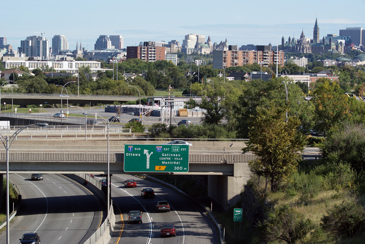
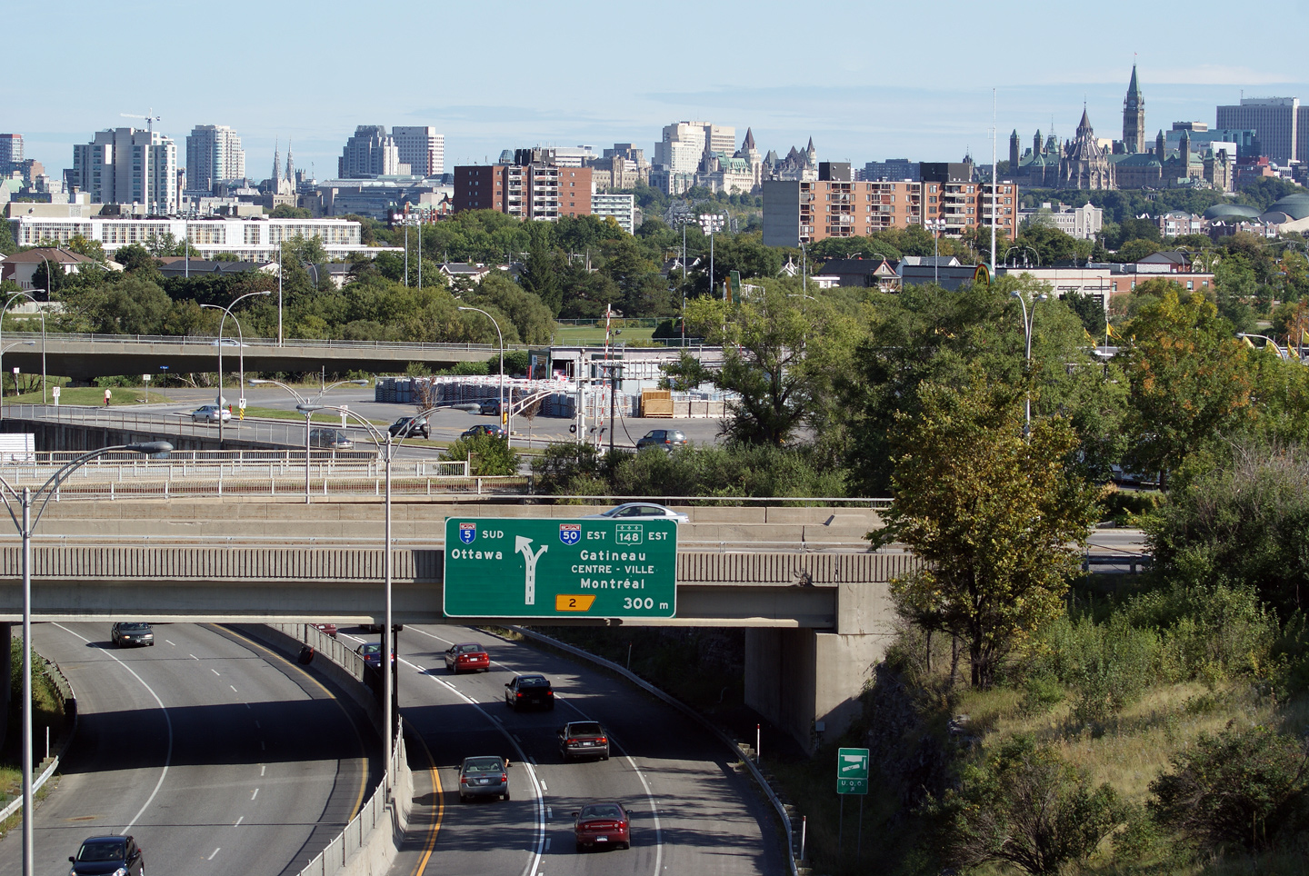
Ville de Gatineau |
Southerly view from the Galeries d'Hull parking lot towards A-5 and the Ottawa Skyline. The Peace Tower, the centrepiece of Canada's Parliamentary Complex, dominates the skyline. |
|
||
|
Date: 12/9/2009 |
||||
|
Ville de Gatineau |
Northerly view from the parking lot at the Galeries d'Hull. |
|
||
|
Date: 12/9/2009 |
||||
|
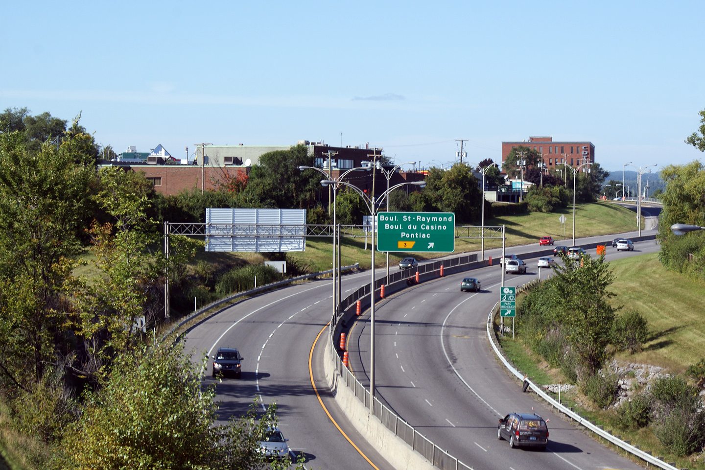
Ville de Gatineau |
Southerly view from the Boul. du Casino overpass. As the street name would imply, Boul. du Casino leads to Hull's Lac Leamy Casino. Lac Leamy Casino is a government owned Casino, serving the Greater Ottawa/Outaouais Region. Quebec was the second province in Canada, after Manitoba, to legalize Gambling. |
|
||
|
|
||||
|
Date: 12/9/2009 |
||||
|
Ville de Gatineau |
This view looks north from Boul. du Casino. During the 2008/09 construction season, Autoroute 5 through Hull was resurfaced. The concrete that had existed on the highway was in very poor condition dating back to the freeways original 1960s era construction. MTQ has been fairly aggressively repairing the Autoroute network during the past decade. For a time, much of the Quebec Freeway network was quite deteriorated. |
|
||
|
Date: 12/9/2009 |
||||
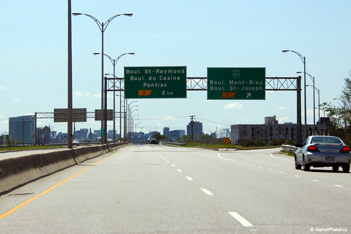
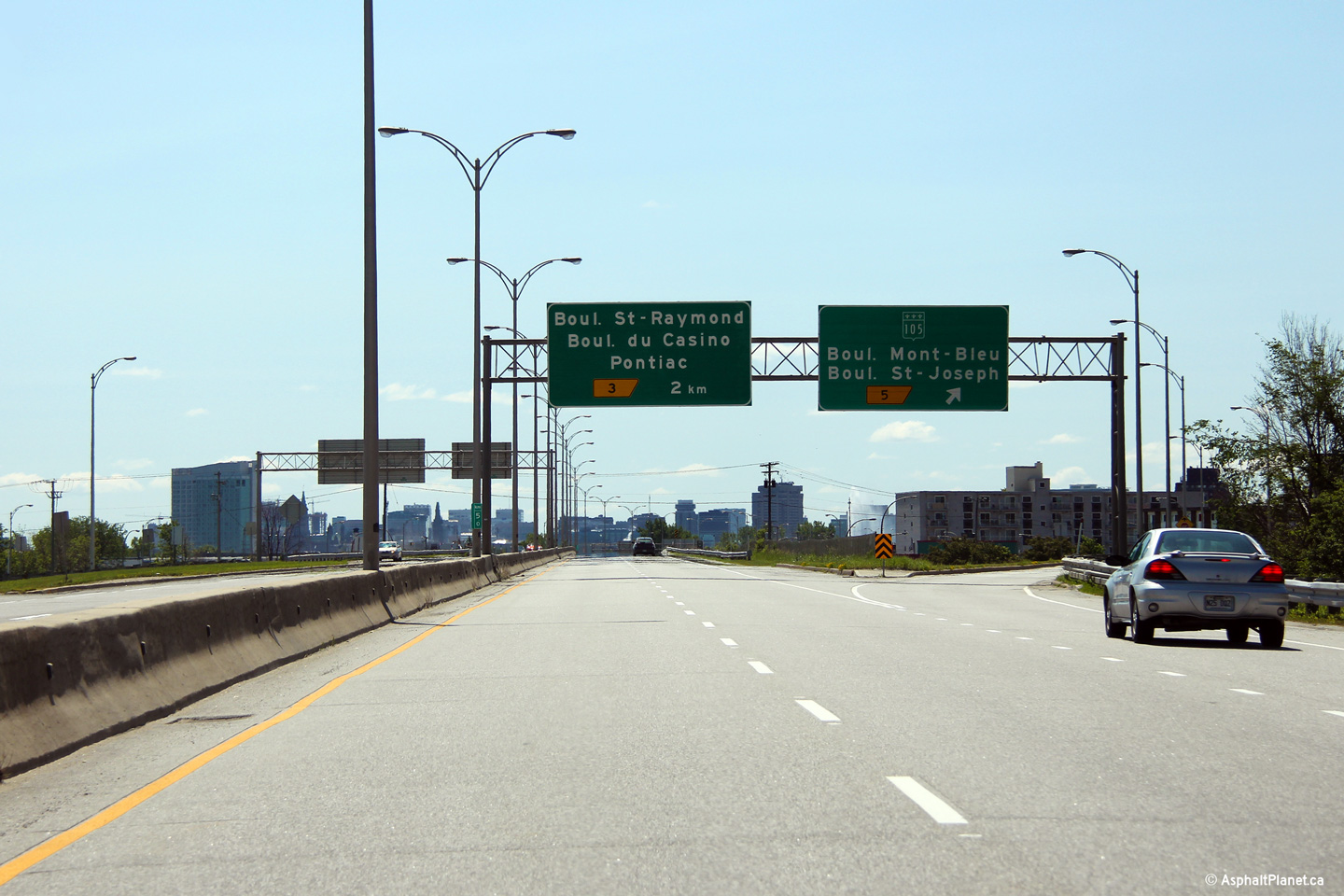
|
Ville de Gatineau |
Overhead signage facing southbound motorists at the Route 105 interchange |
|
||
|
Date: 19/06/2013 |
High-res: (1440x960) (2400x1600) |
|||
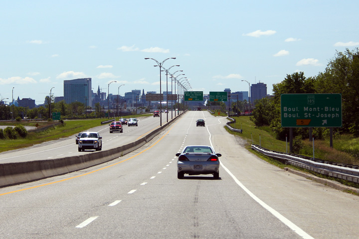
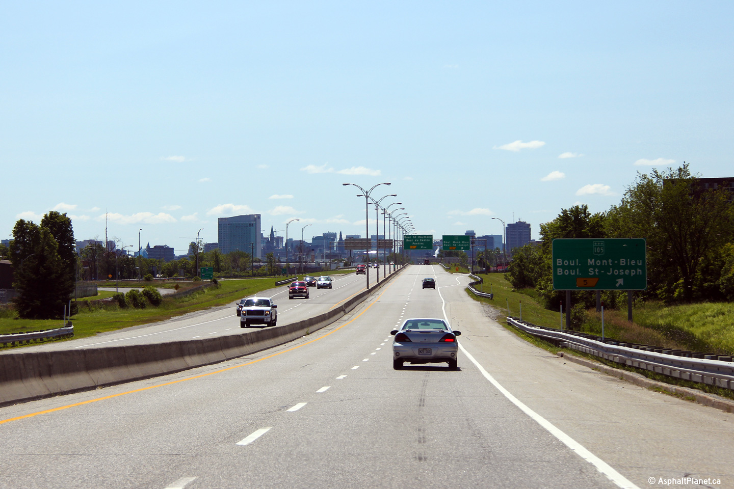
|
Ville de Gatineau |
Southbound signage approaching the Route 105 interchange. |
|
||
|
Date: 19/06/2013 |
High-res: (1440x960) (2400x1600) |
|||
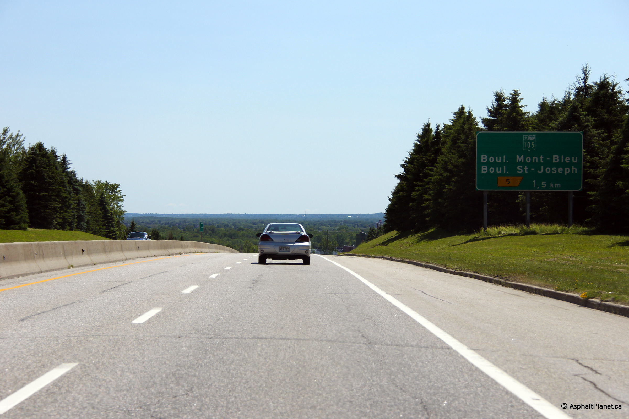
|
Ville de Gatineau |
Signage 1.5km in advance of the Route 105 interchange. |
|
||
|
Date: 19/06/2013 |
High-res: (1440x960) (2400x1600) |
|||
|
Ville de Gatineau |
Southerly view from the Boul. des Hautes-Plaines overpass. Interchanges are generally very well lit along A-5. |
|
||
|
Date: 9/13/2009 |
||||
|
Ville de Gatineau |
Northerly view from the Boul. des Hautes-Plaines overpass. Notice the size of the hills visible to the north -- this view is only 8km north of the Ottawa River(!). The Outaouais Region is the third most populated region in the province. The City spreads along the north side of the river, but cannot penetrate too far inland due to the substantial terrain. |
|
||
|
Date: 13/9/2009 |
||||
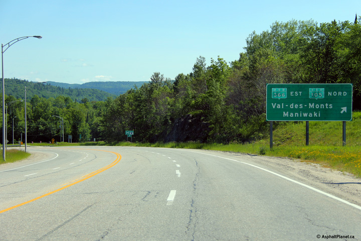
|
MRC de Collines-de l'Outaouais |
View looking northerly along the reversing curve between Exit's 12 and 13. Both Old Chelsea and Tenaga are now wealthy Gatineau suburbs featuring large McMansions on executive estates. As the town's name would indicate, their is a substantial Anglophone population in Chelsea. |
|
||
|
Date: 13/9/2009 |
||||
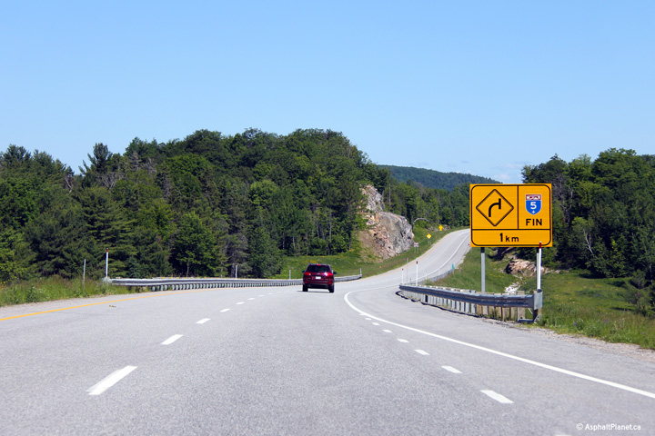
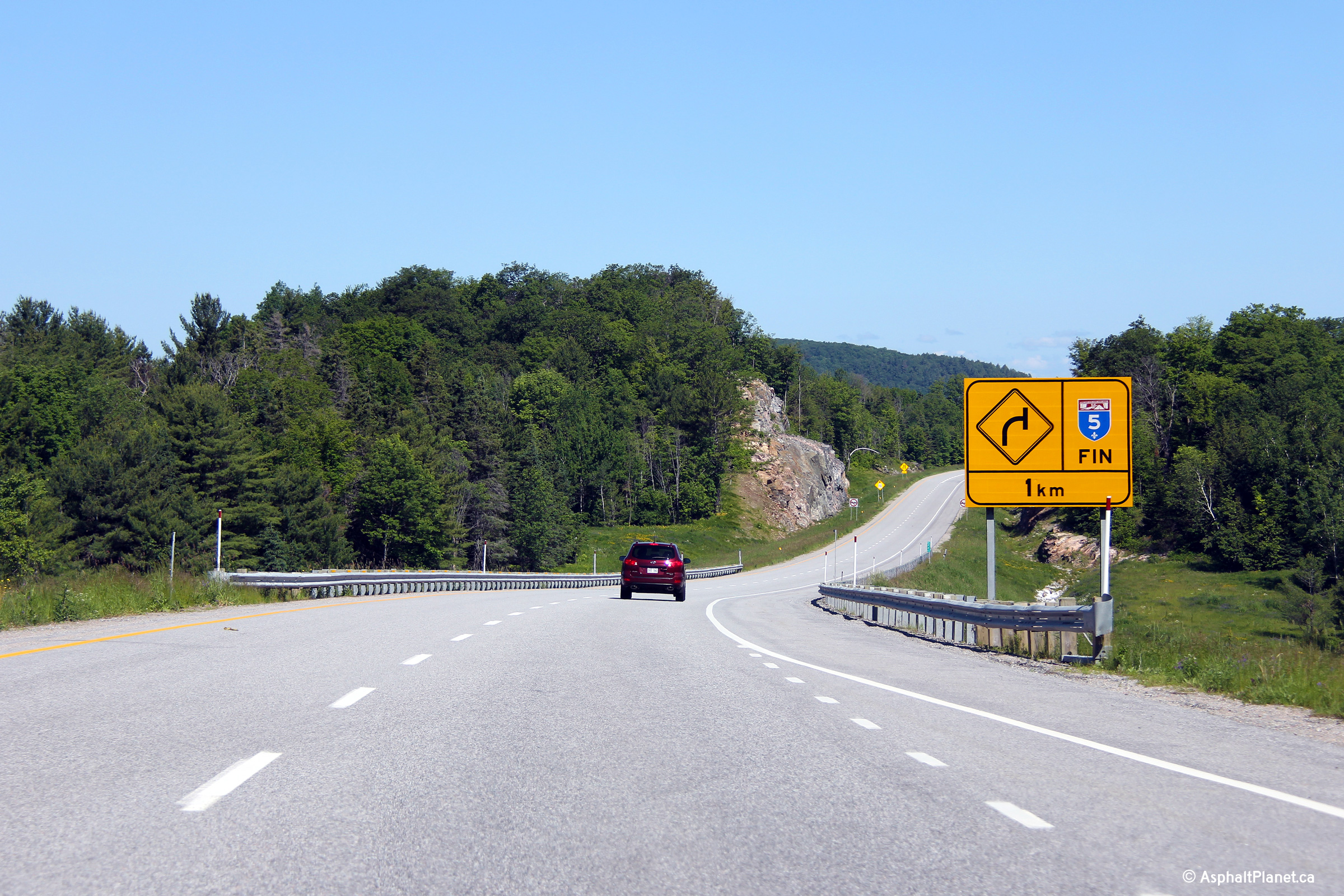
|
MRC de Collines-de l'Outaouais |
Advanced signage marking the former end of Autoroute 5, amid the approaching Gatineau Hills. What I found striking about this photo (and the view when I took the photo) was that a driver can't see the freeway exiting the valley ahead. The Gatineau Hills are a stark contrast to the near pancake flat plains of the Lower Ottawa Valley in Ontario. |
|
||
|
Date: 13/9/2009 |
||||
|
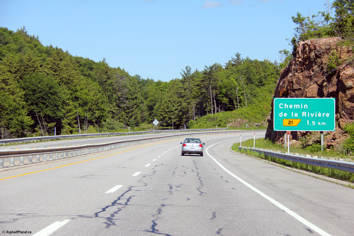
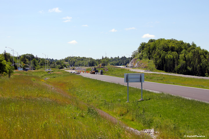
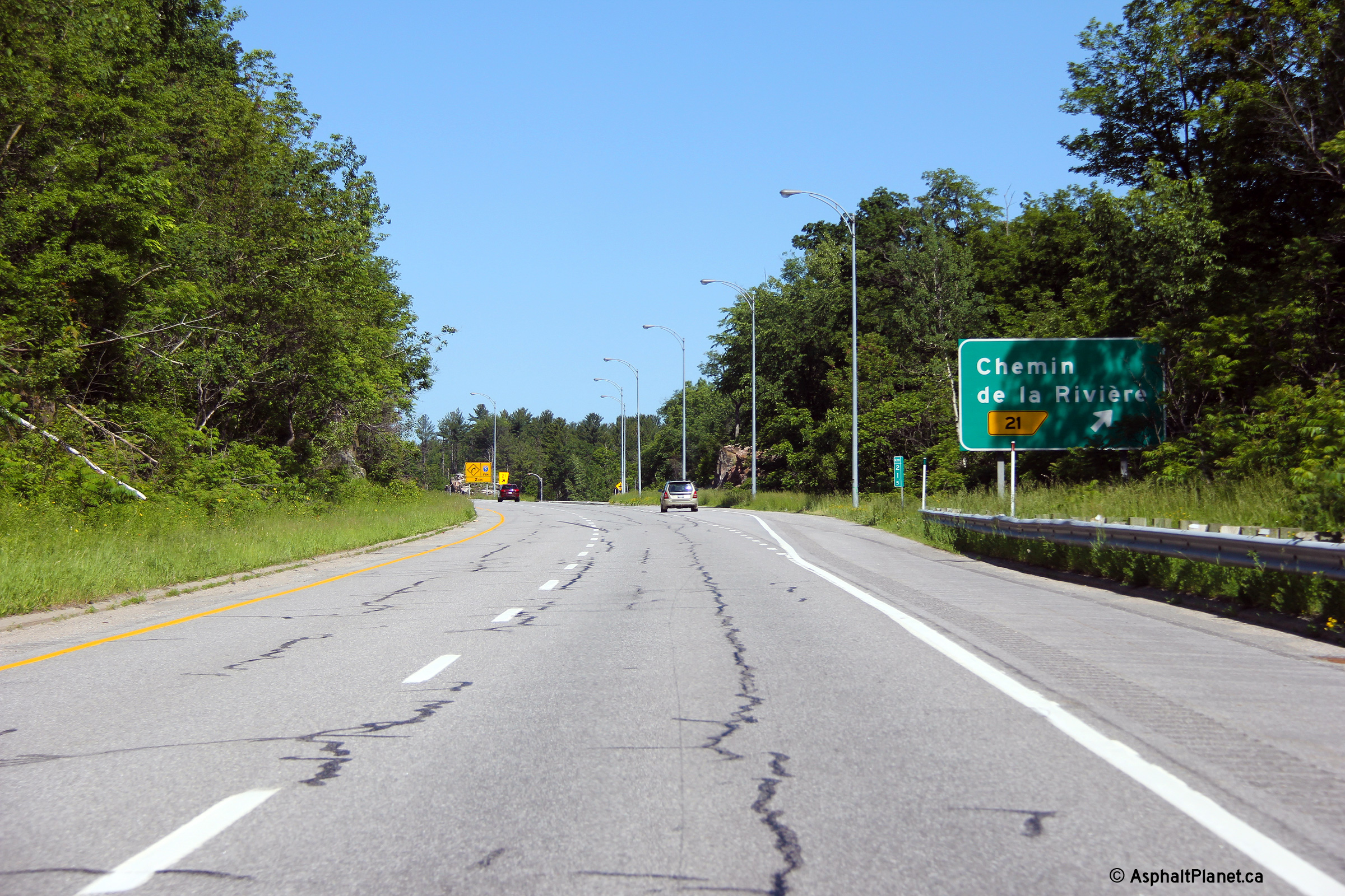
MRC de Collines-de l'Outaouais |
Advanced signage for the ramp to River Road. A-5 ended at the River Road interchange until the highway was extended to R-105 in 2009. |
 |
||
|
Date: 19/06/2013 |
High-res: (1440x960) (2400x1600) |
|||
|
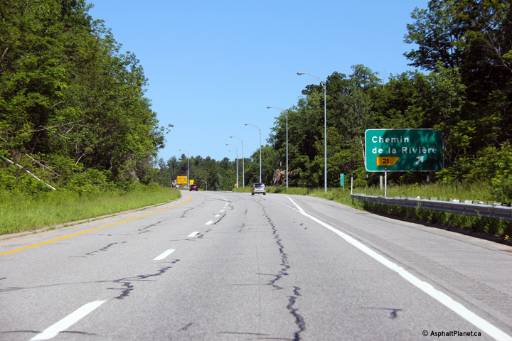
MRC de Collines-de l'Outaouais |
Signage for the off-ramp to River Road. |
 |
||
|
Date: 19/06/2013 |
High-res: (1440x960) (2400x1600) |
|||
|
MRC de Collines-de l'Outaouais |
Signage denoting the northern terminus of A-5 approaching the R-105 intersection. |
 |
||
|
Date: 19/06/2013 |
High-res: (1440x960) (2400x1600) |
|||
|
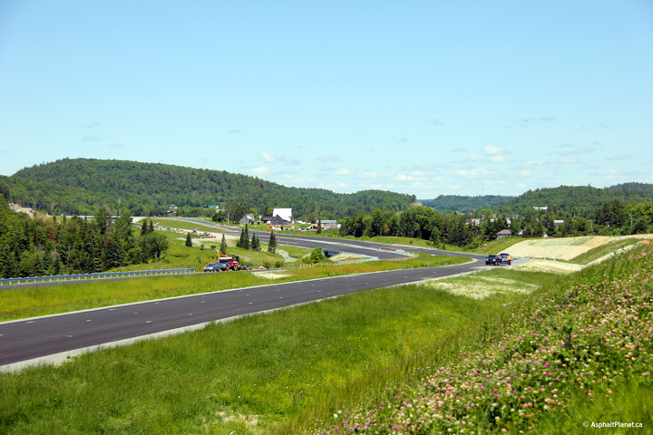
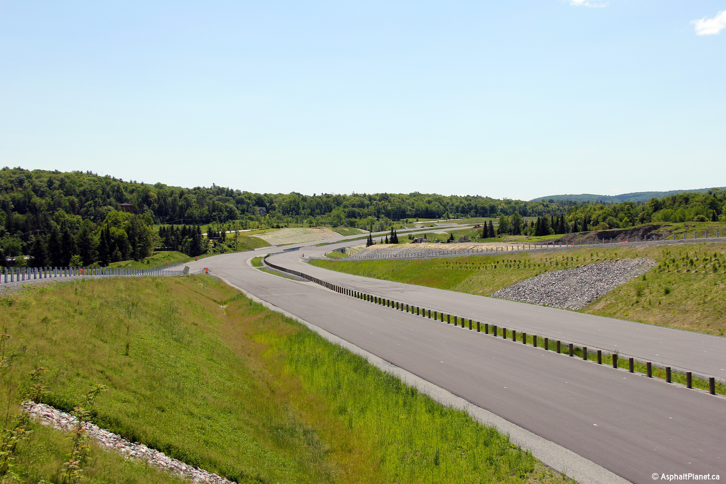
MRC des Collines-de-l'Outaouais Chelsea |
View looking southerly on the future extension of Autoroute 5 towards the current end of the highway. |
|
||
|
Date: 19/06/2013 |
High-res: (1440x960) (2400x1600) |
|||
|
MRC des Collines-de-l'Outaouais Chelsea |
Southerly view towards the future interchange with Chemin Cross Loop. |
|
||
|
Date: 19/06/2013 |
High-res: (1440x960) (2400x1600) |
|||
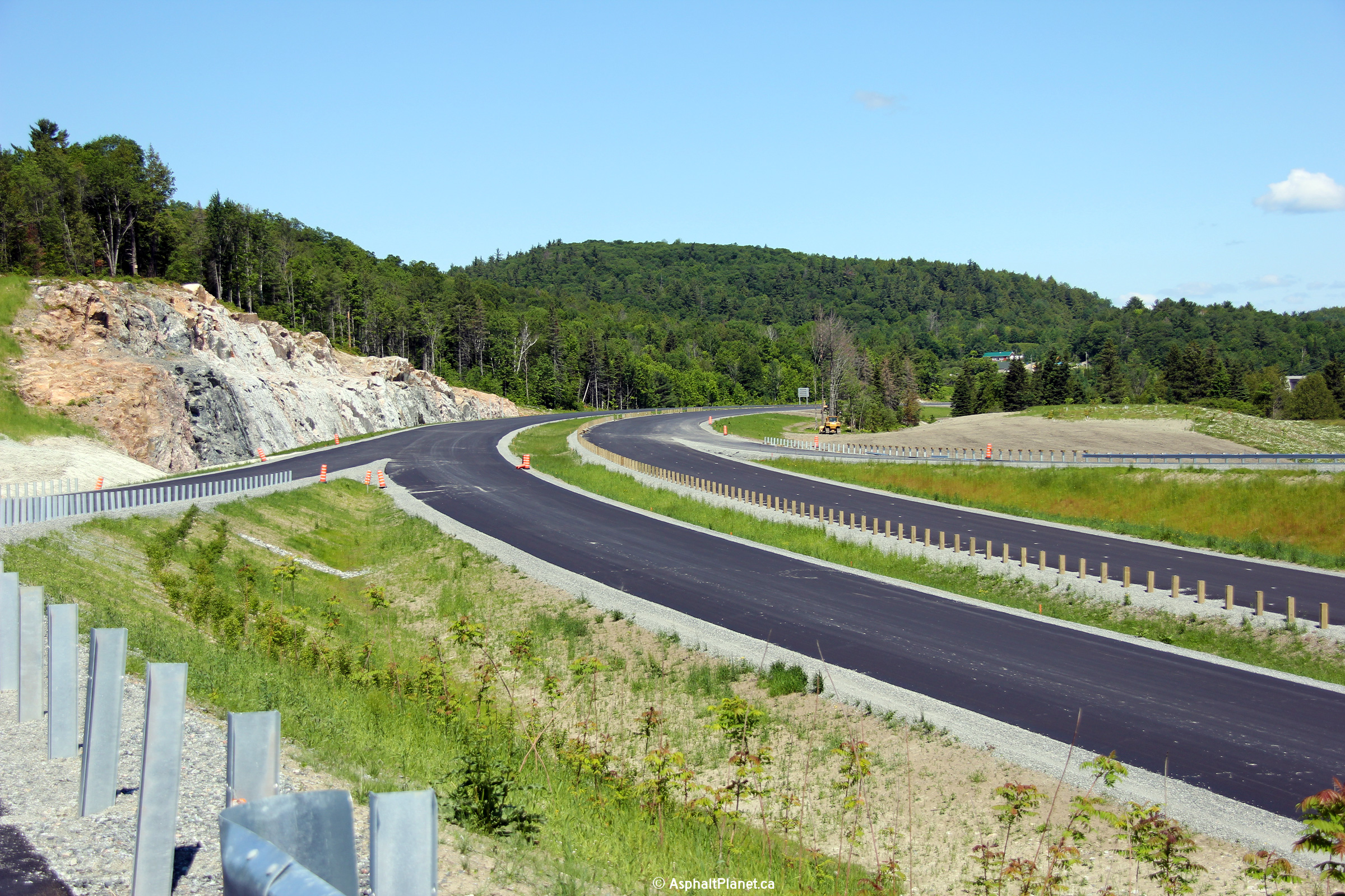
|
MRC des Collines-de-l'Outaouais Chelsea |
View looking southerly from the Chemin Cross Loop overpass. This section of Autoroute 5 has a very narrow median. |
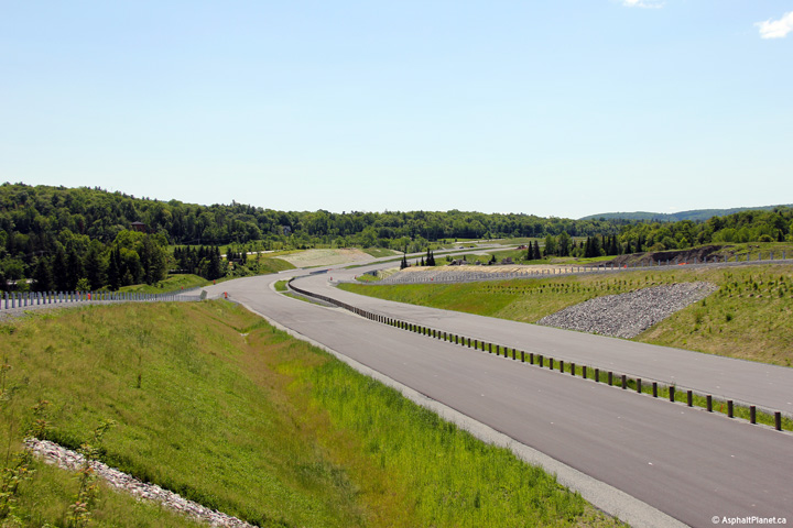 |
||
|
Date: 19/06/2013 |
High-res: (1440x960) (2400x1600) |
|||
|
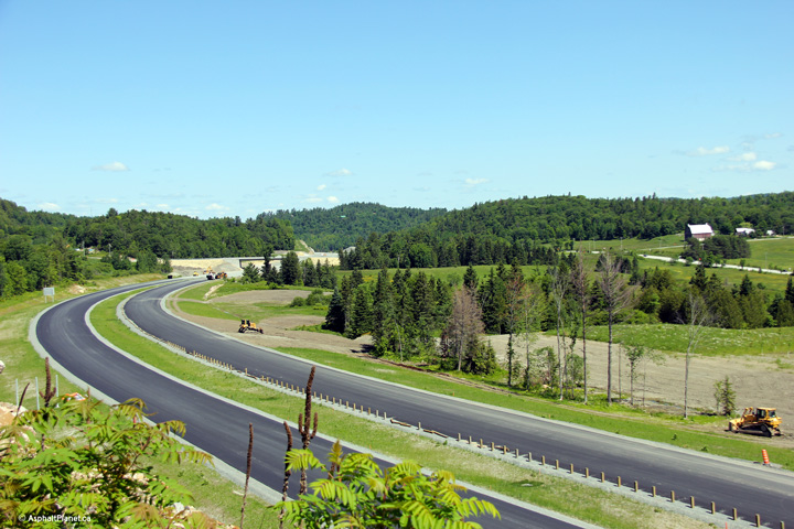
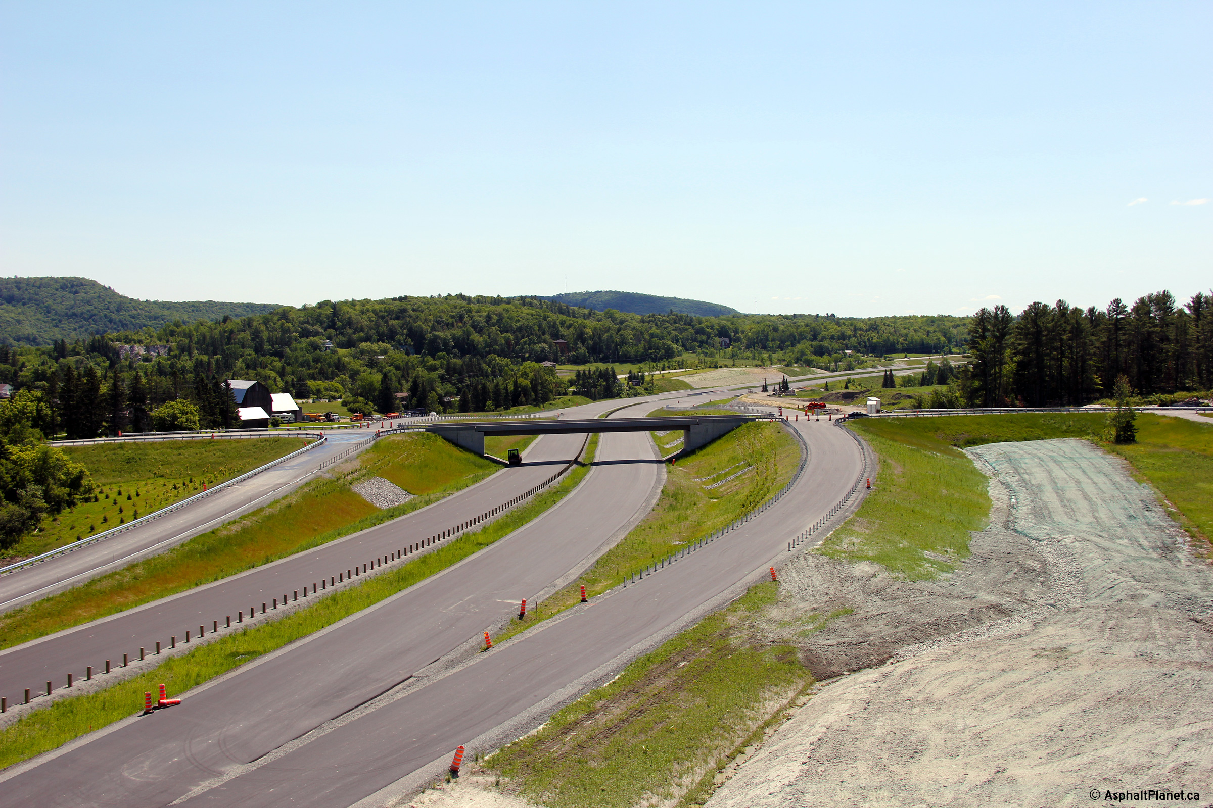
MRC des Collines-de-l'Outaouais Chelsea |
Northerly view from the Chemin Cross Loop overpass. Construction on this section of highway was nearly completed when this photo was taken. It is scheduled to open to traffic in 2014. |
|
||
|
Date: 19/06/2013 |
High-res: (1440x960) (2400x1600) |
|||
|
MRC des Collines-de-l'Outaouais Chelsea |
Southerly view towards the Chemin Cross Loop overpass from a high rock outcrop on the west side of the highway. |
 |
||
|
Date: 19/06/2013 |
High-res: (1440x960) (2400x1600) |
|||
|
MRC des Collines-de-l'Outaouais Chelsea |
Northerly view towards the Chemin Carman overpass from the same rock outcrop as the previous photo. |
|
||
|
Date: 19/06/2013 |
High-res: (1440x960) (2400x1600) |
|||
|
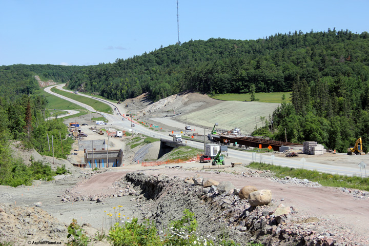
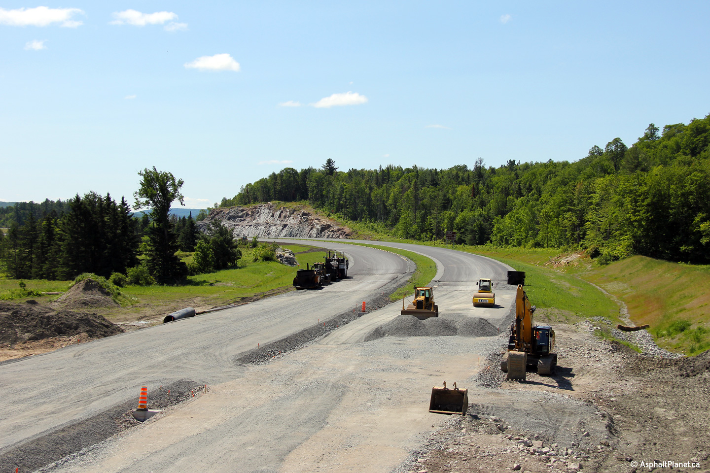
MRC des Collines-de-l'Outaouais Chelsea |
Southerly view from the Chemin Carman overpass. During June of 2013, construction activities were markedly more advanced on the southern portion of the extension than the northern portion of the new highway. |
 |
||
|
Date: 19/06/2013 |
High-res: (1440x960) (2400x1600) |
|||
|
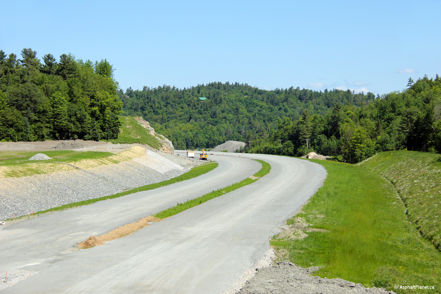
MRC des Collines-de-l'Outaouais Chelsea |
View looking northerly along the future highway from the Chemin Carman overpass. |
|
||
|
Date: 19/06/2013 |
High-res: (1440x960) (2400x1600) |
|||
|
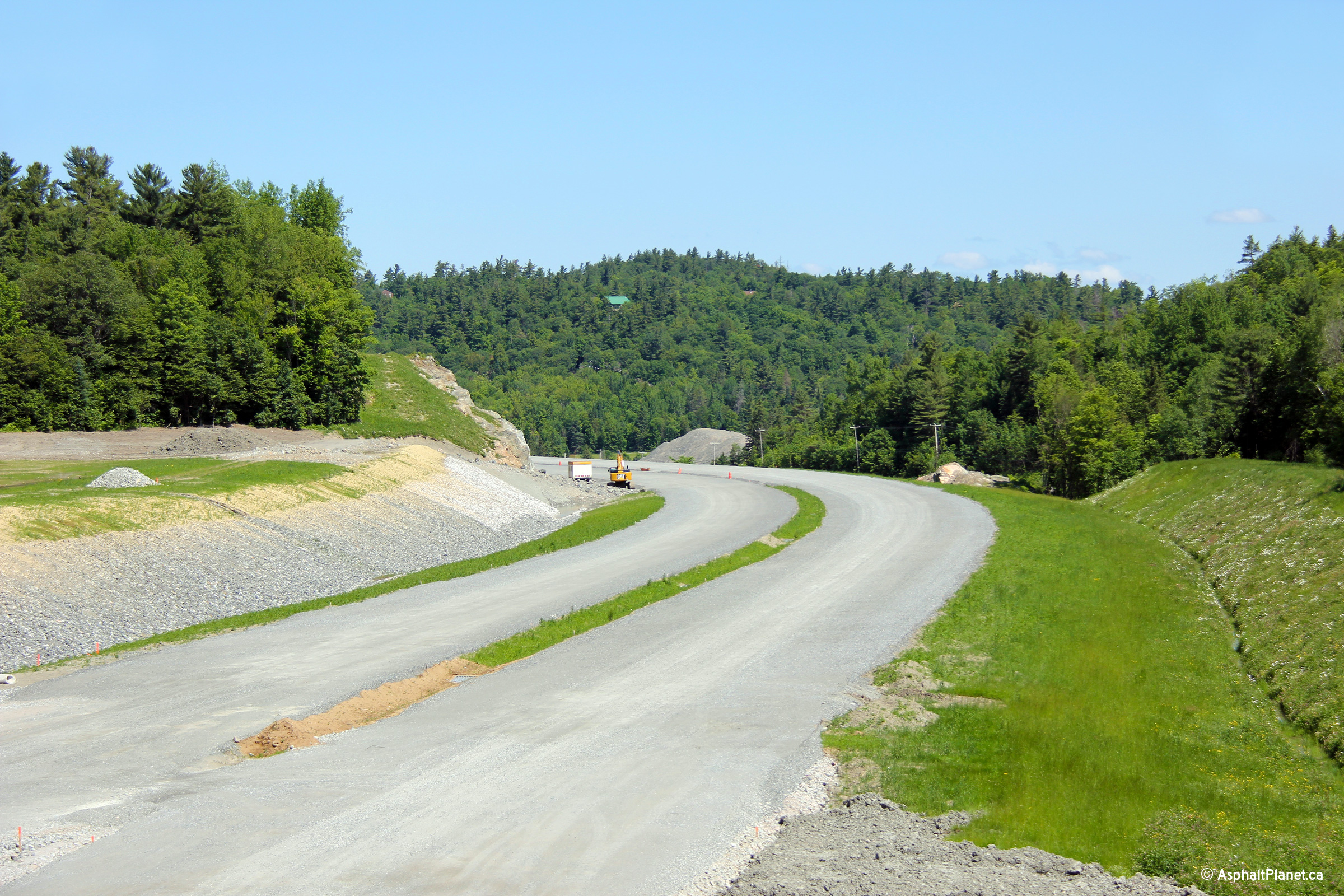
MRC des Collines-de-l'Outaouais Chelsea |
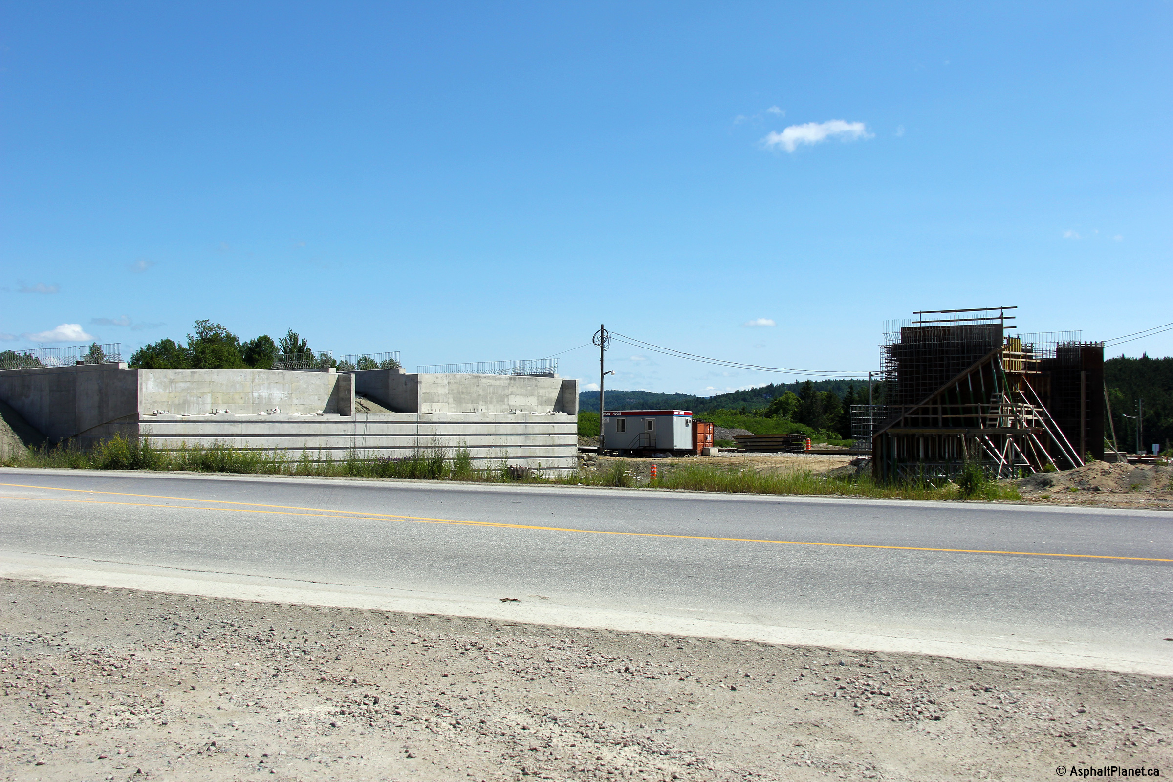
View looking westerly through the future Hwy 366 underpass. A-5 will pass overtop of Hwy 366 at this interchange when the expressway is completed. |
|
||
|
Date: 9/13/2009 |
High-res: (1440x960) (2400x1600) |
|||
|
MRC des Collines-de-l'Outaouais Chelsea |
Northerly view as A-5 crosses the La Pêche River. |
|
||
|
Date: 19/06/2013 |
High-res: (1440x960) (2400x1600) |
|||
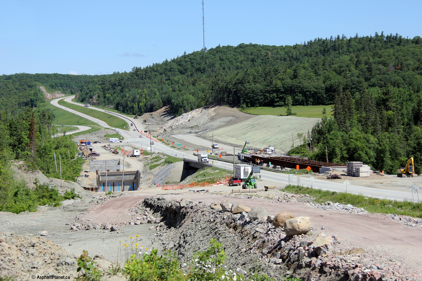
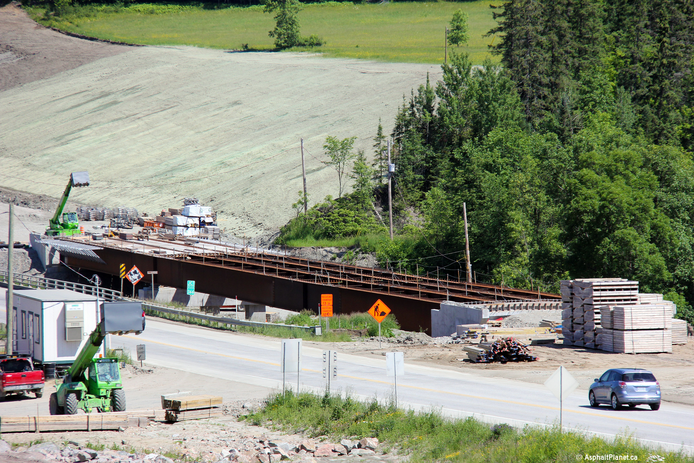
|
MRC des Collines-de-l'Outaouais La Pêche |
Close-up view of the then unfinished structure that will carry the northbound lanes overtop of the La Pêche River. |
|
||
|
Date: 19/06/2013 |
High-res: (1440x960) (2400x1600) |
|||
|
MRC des Collines-de-l'Outaouais La Pêche |
View looking southerly approaching the west leg of Route 366. |
|
||
|
Date: 19/06/2013 |
High-res: (1440x960) (2400x1600) |
|||
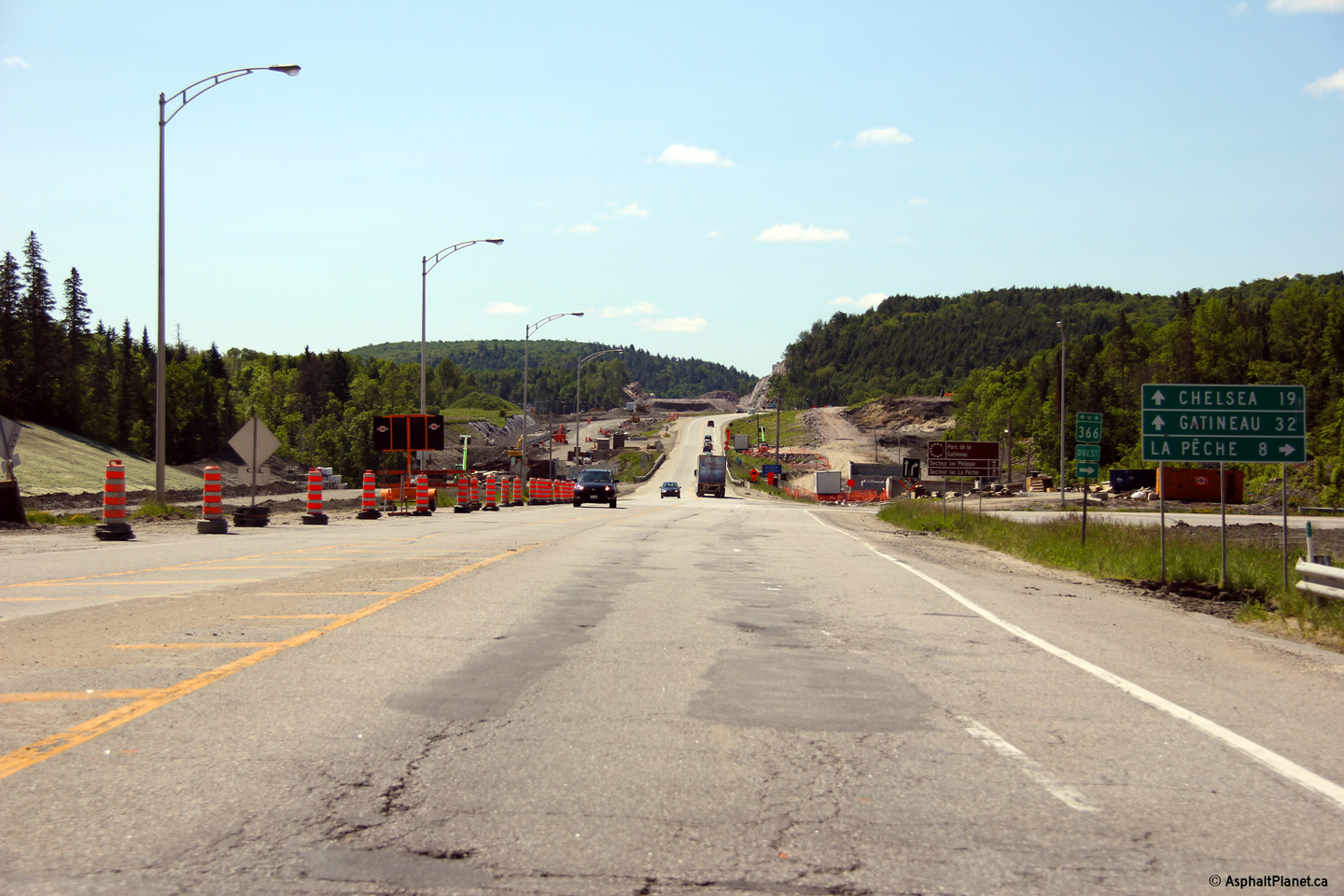
|
MRC des Collines-de-l'Outaouais La Pêche |
The Wakefield By-pass is signed as Autoroute 5. The two lane segment of highway that links the southern segment of A-5 to the Wakefield By-pass is signed only as R-105. |
|
||
|
Date: 19/06/2013 |
High-res: (1440x960) (2400x1600) |
|||
|
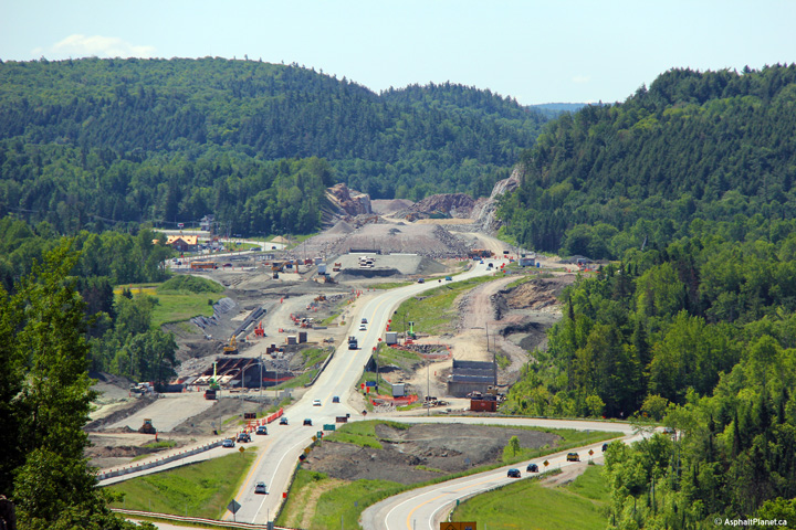
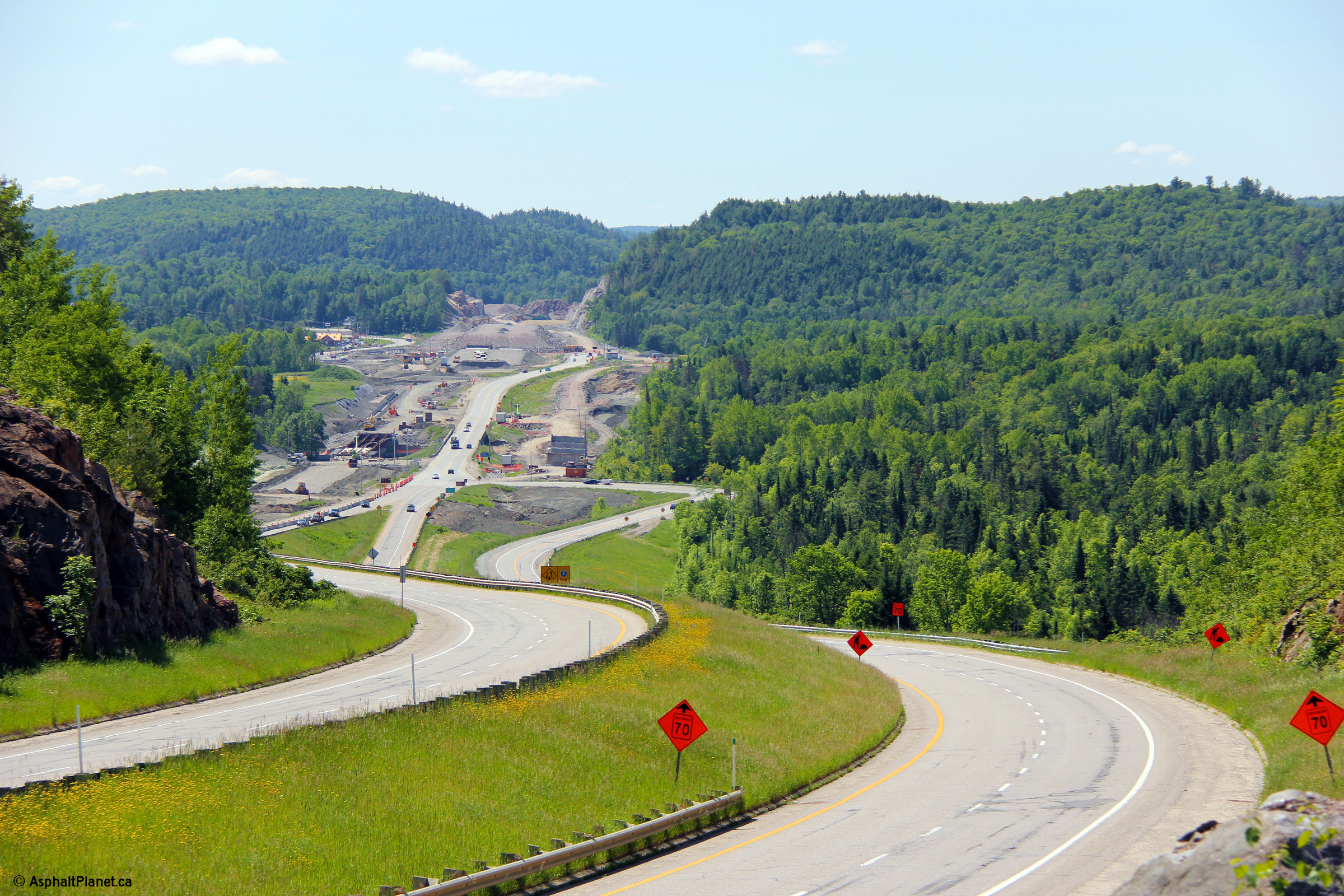
MRC des Collines-de-l'Outaouais La Pêche |
A view looking southerly from the top of the hill before construction started to widen Autoroute 5 south of the Wakefield By-pass. |
|
||
|
Date: 13/09/2009 |
High-res: (1440x960) (2400x1600) |
|||
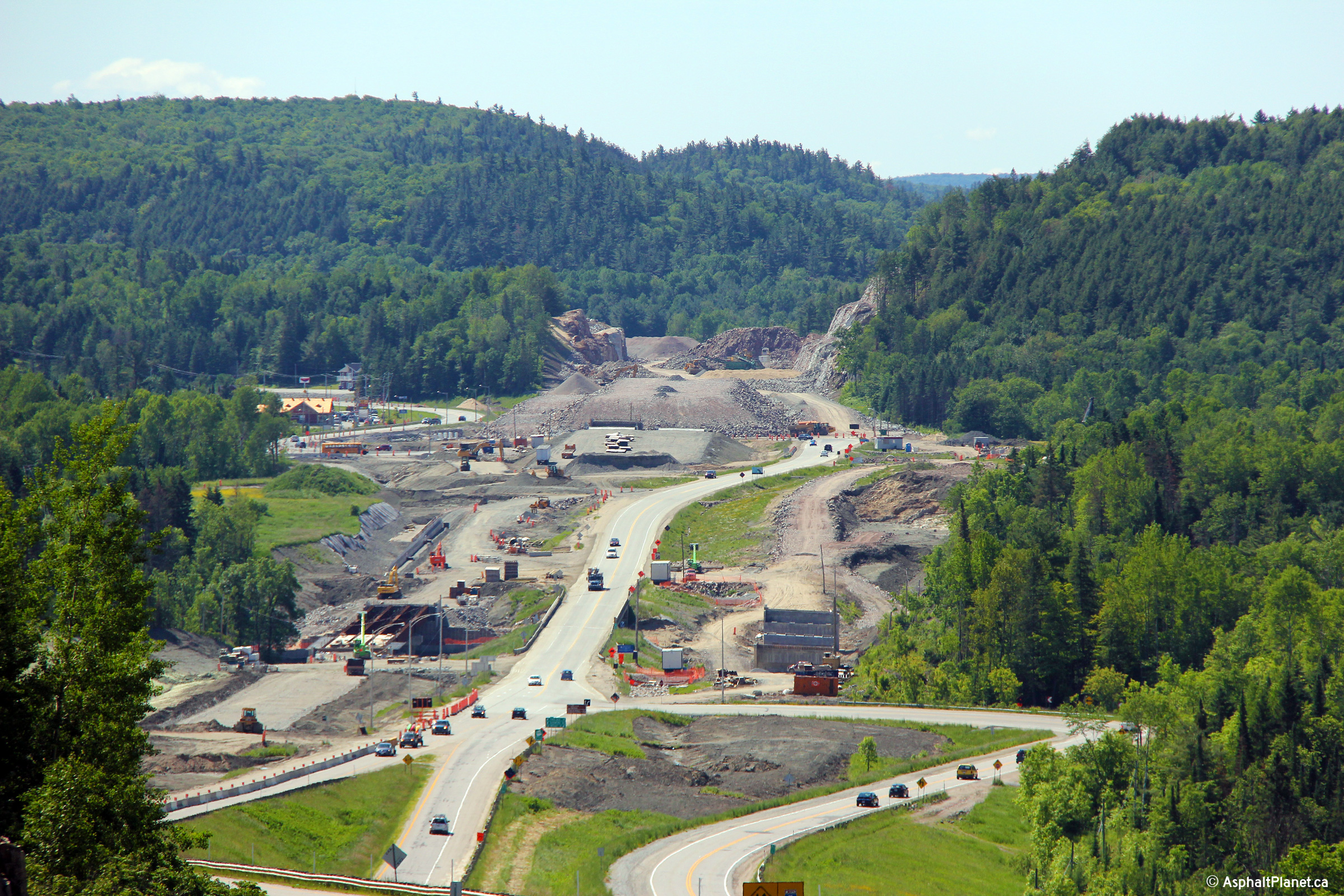
|
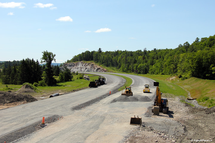
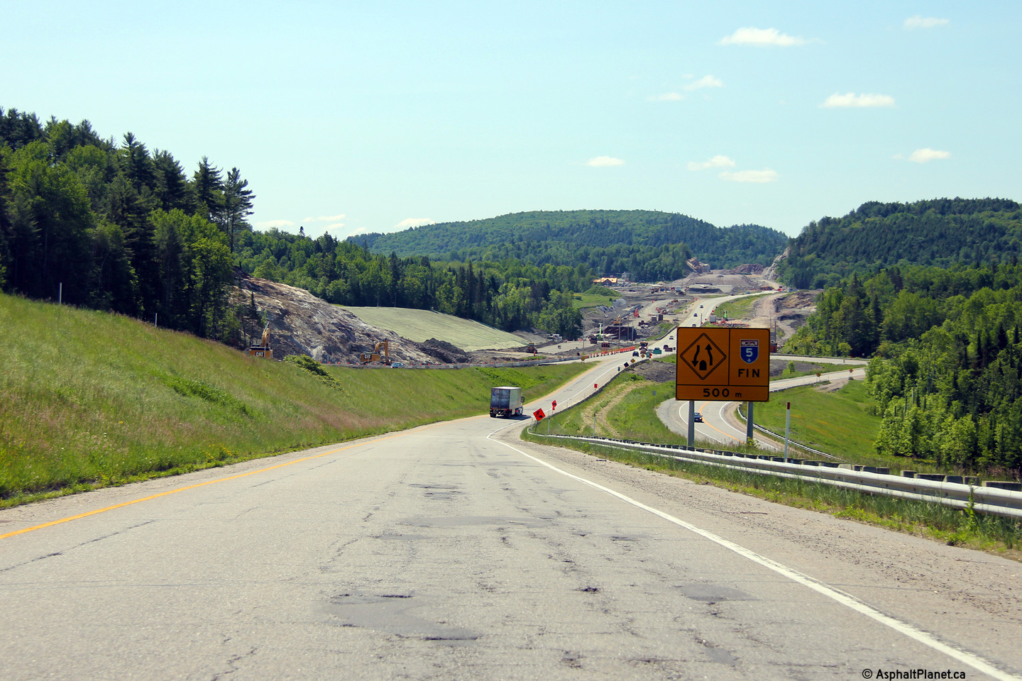
MRC des Collines-de-l'Outaouais La Pêche |
Two views of the Wakefield By-pass during the construction project that will see the remaining length of A-5 south of Wakefield converted to a four lane freeway. |
|
||
|
High-res: (1440x960) (2400x1600) |
||||
|
|
||||
|
Date: 19/06/2013 |
High-res: (1440x960) (2400x1600) |
|||
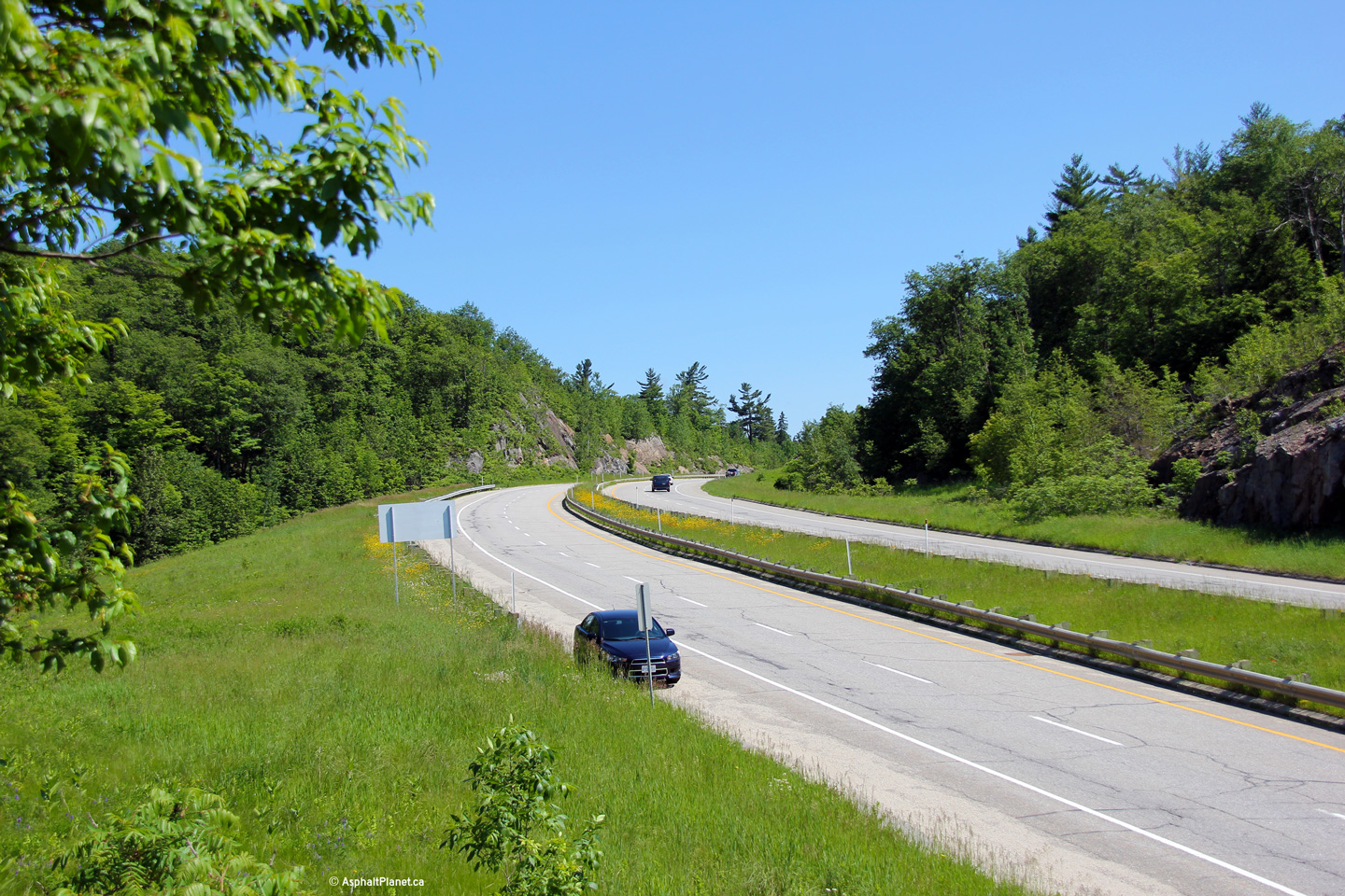
|
MRC des Collines-de-l'Outaouais La Pêche |
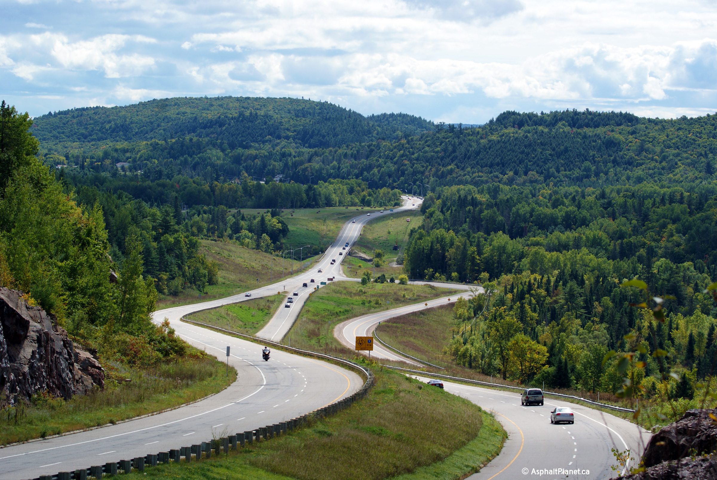
Northerly view along A-5 from the same vantage points as the previous photos. This is taken about halfway around the Wakefield by-pass. |
|
||
|
Date: 19/06/2013 |
High-res: (1440x960) (2400x1600) |
|||
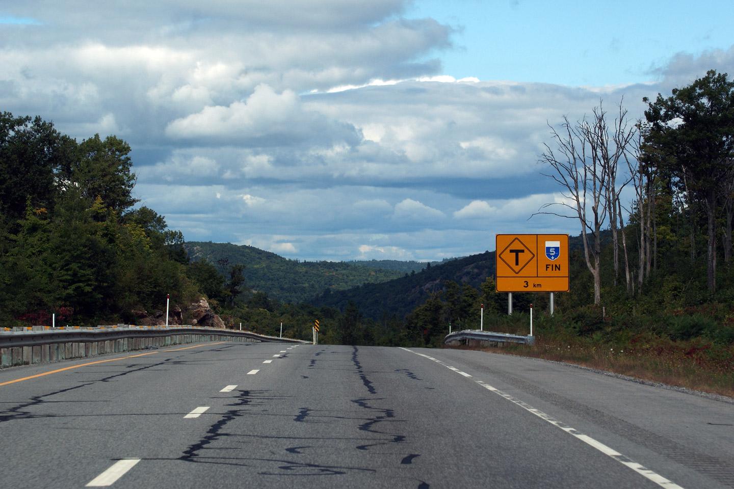
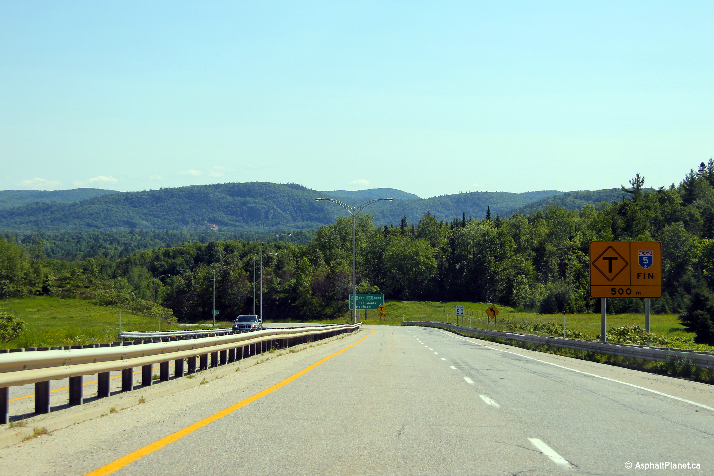
|
MRC des Collines-de-l'Outaouais La Pêche |
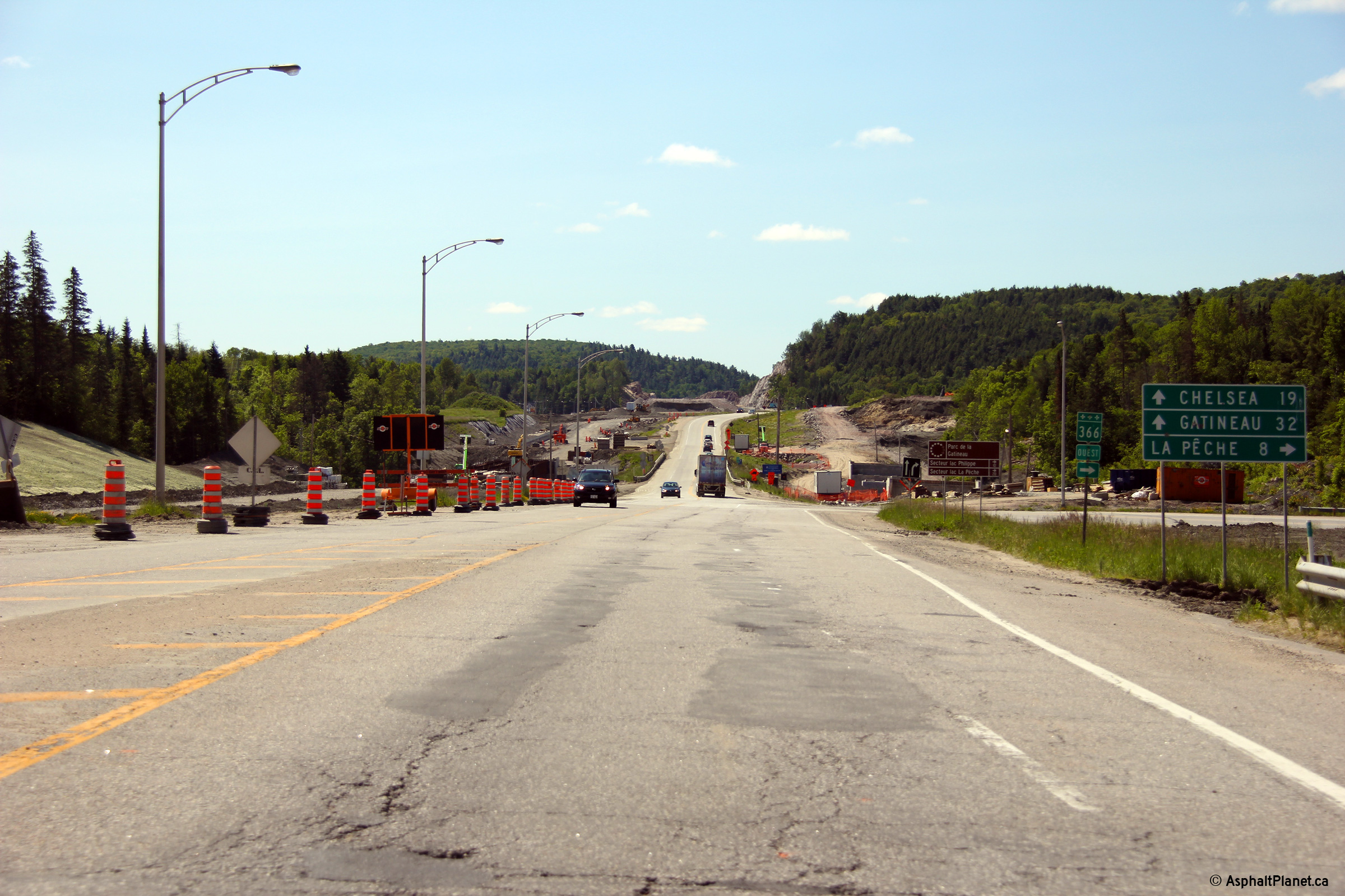
Signage denoting the northern terminus of A-5 approaching the R-105 intersection. |
 |
||
|
Date: 19/06/2013 |
High-res: (1440x960) (2400x1600) |
|||
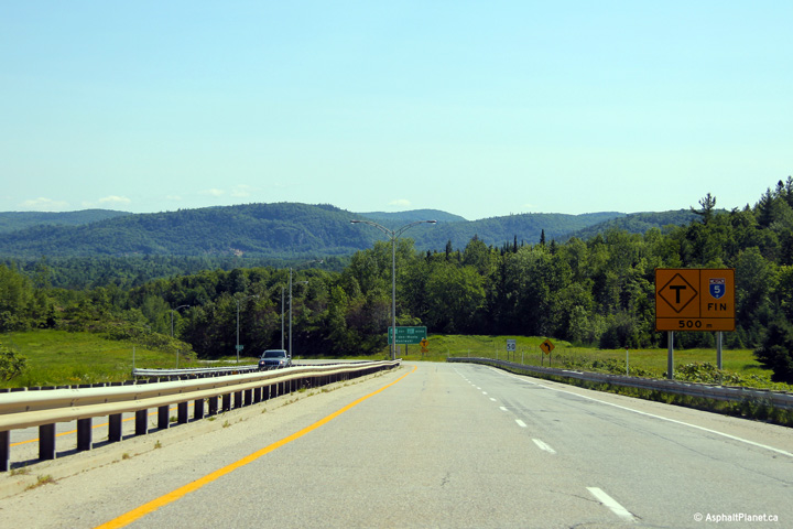
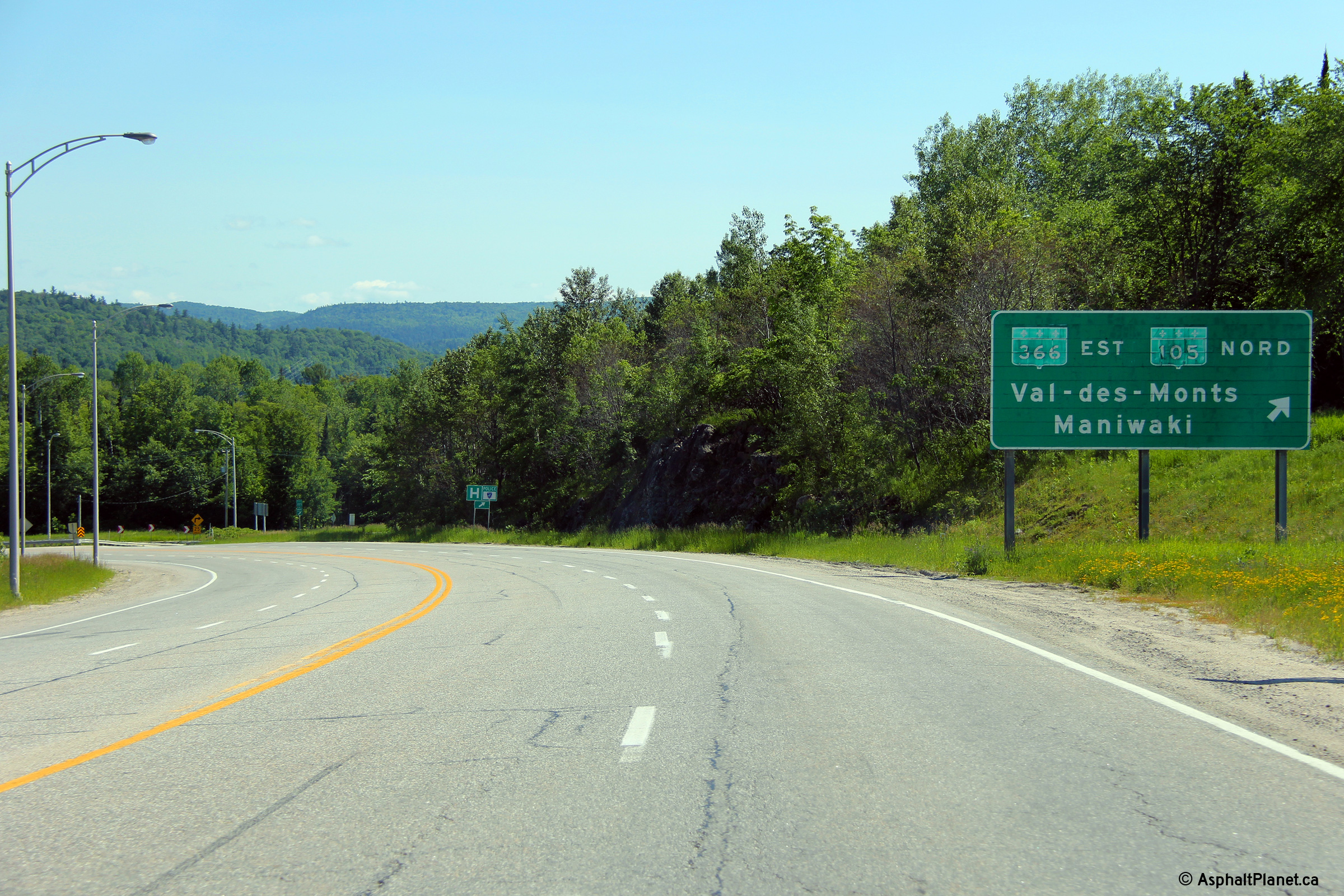
|
MRC des Collines-de-l'Outaouais La Pêche |
Autoroute 5 ends at an at-grade intersection with Chemin McLaren. According to the MTQ website, A-5 will be extended by an additional 1km north of the this intersection to meet Route 105 directly. This construction will be completed in 2016. |
 |
||
|
Date: 19/06/2013 |
High-res: (1440x960) (2400x1600) |
|||
PQ Highways
A-10 ->
AsphaltPlanet.ca
© 2010-14 AsphaltPlanet.ca.
AsphaltPlanet@asphaltplanet.ca
Page Created: September 24, 2009.
Last Updated: December 9, 2013


