|
Proper Municipality Name |
Photo Description |
Photo |
|
Pictures taken
from driver's perspective appear offset from centre-line pictures: |
East-
Bound |
West-
Bound |
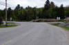
Municipality of Whitestone
District of Parry Sound |
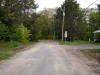
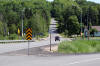
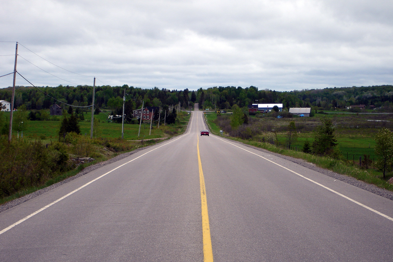
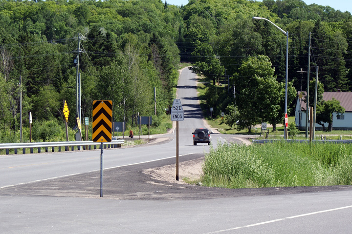
This view looks westerly at the
eastern terminus of Highway 520 at Ardbeg. As you can see, there is
not much to Ardbeg -- it is a railway town located along the CN Railway line
between Toronto and Sudbury.
Photo taken: May 22nd, 2006.
|
Low-res
High-res |
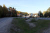
Municipality of Whitestone
District of Parry Sound |
This photo looks east towards the Bunny Trail.
The Bunny Trail is a long road that runs from Highway 124 at Waubamik
connecting to Ardbeg.
Photo taken: May 22nd, 2006. |
Low-res
High-res |
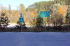
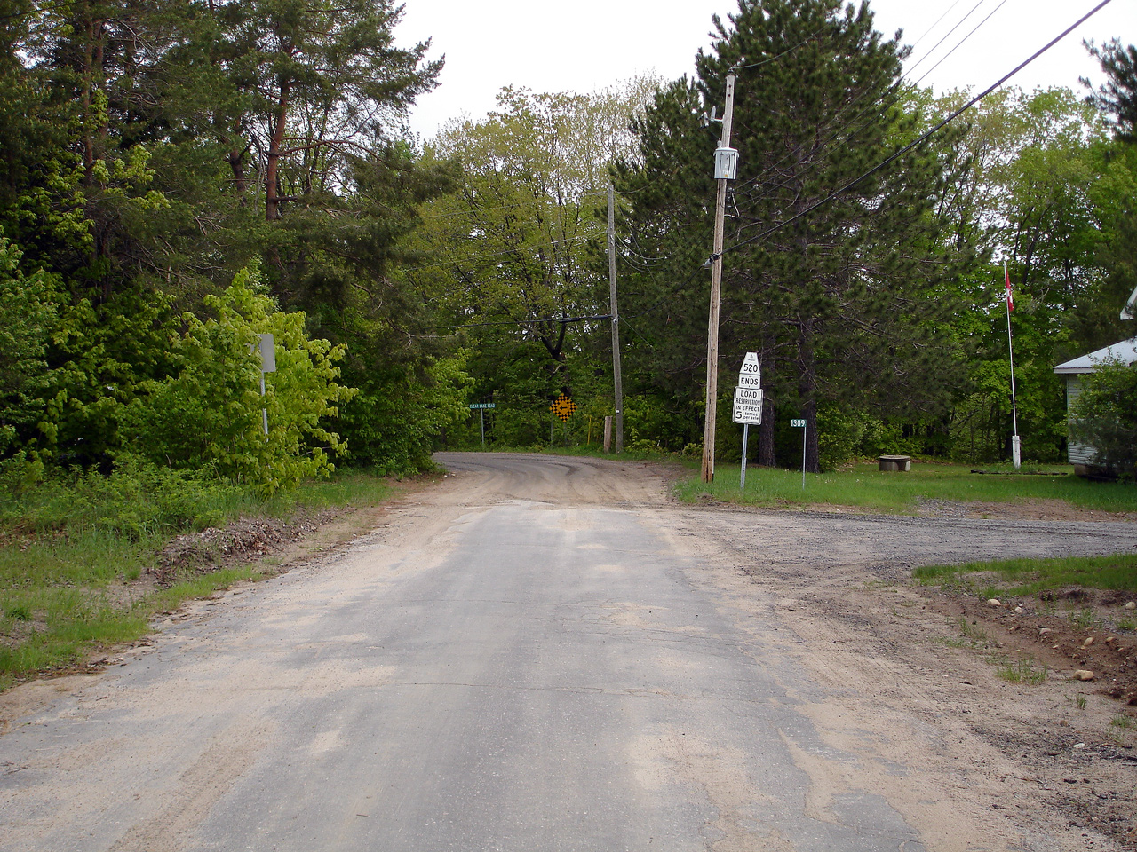
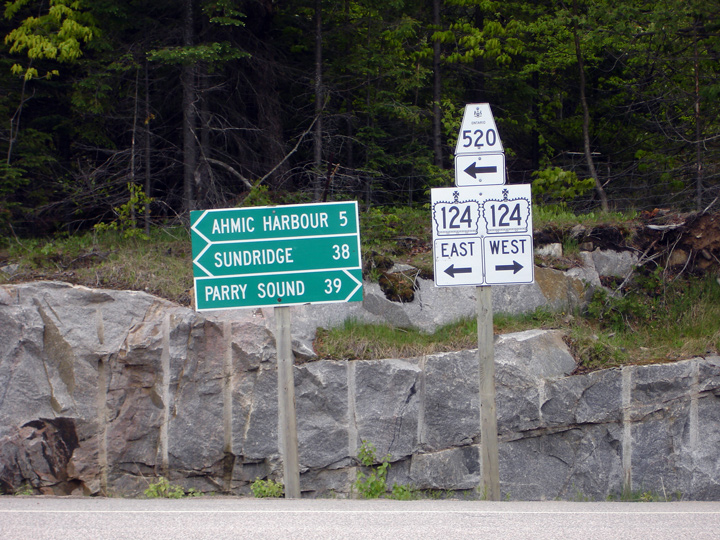
Municipality of Whitestone
District of Parry Sound |
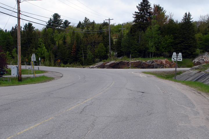
View looking westerly at the westbound junction assembly for Highway
124-West. Highway 520 runs concurrent with Highway 124 for 15 km.
Photo taken: May 22nd, 2006. |
 |
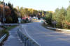
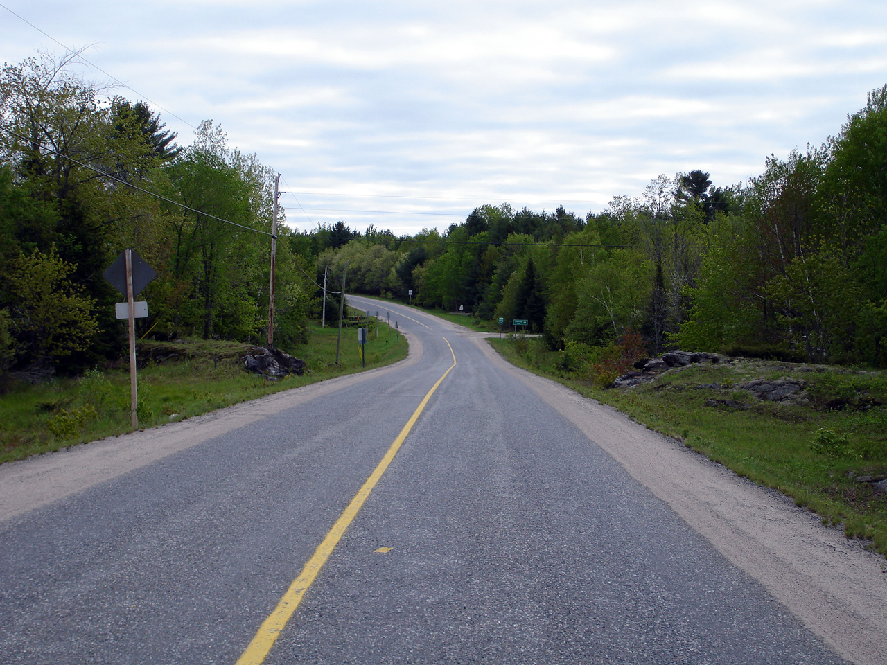
Municipality of Magnetawan
District of Parry Sound |
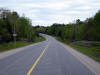
View looking westerly along Highway 520 as the highway approaches the
Highway 124-East junction. This road is immaculate for a secondary
highway. Photo taken: May 22nd, 2006. |
Low-res
High-res |
|
Highway 510 leads north-easterly
from Magnetawan to Highway 124.
Click here for Highway 510 images. |
Municipality of Magnetawan
District of Parry Sound |
View looking westerly leaving Magnetawan as Highway 510 splits from Highway
520.
Photo taken: May 22nd, 2006. |
Low-res
High-res |
Village of Burk's Falls
District of Parry Sound |
View looking westerly along Highway 520 as the highway follows the northern
bank of the Magnetawan River.
Photo taken: October 8th, 2011. |

(720x480)
(1440x960)
(2400x1600) |
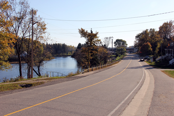
Village of Burk's Falls
District of Parry Sound |
Highway 520 enters Burk's Falls following the north shore of the Magnetawan
River, in this photo it leaves the riverbank to join Ontario Street (Burk's
Falls' principal street, formerly Highway 11) at a 90 degree angle.
Highway 520 technically continues as an East-West highway through Burk's
Falls, however for the sake of this website, cardinal directions along
Ontario Street will be north south -- with the eastbound direction becoming
the southbound direction.
Photo taken: October 8th, 2011. |
(720x480)
(1440x960)
(2400x1600) |
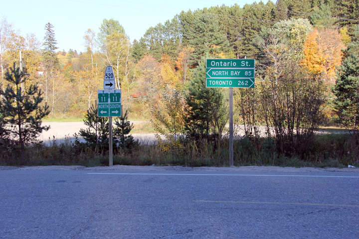
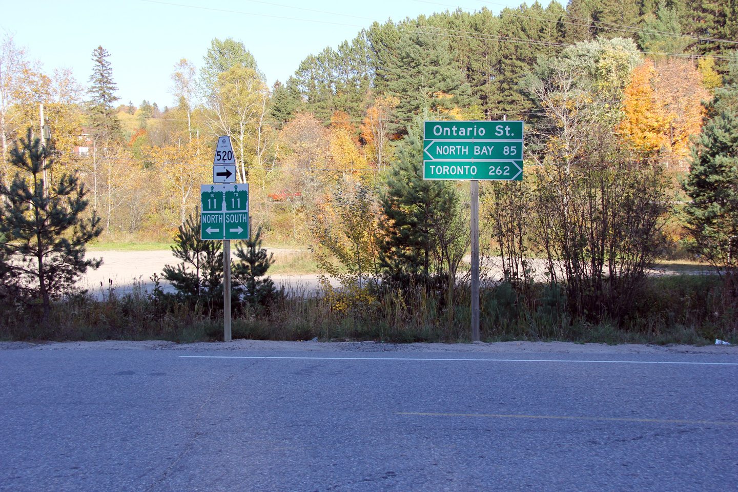
Village of Burk's Falls
District of Parry Sound |
Eastbound signage at the Ontario Street intersection. Both directions
of Highway 11 are accessible by turning in either direction at this
intersection.
Photo taken: October 8th, 2011. |
(720x480)
(1440x960) |
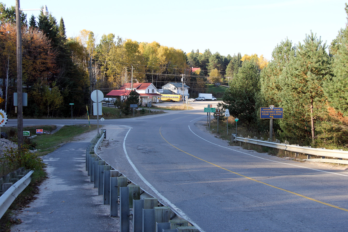
Village of Burk's Falls
District of Parry Sound |
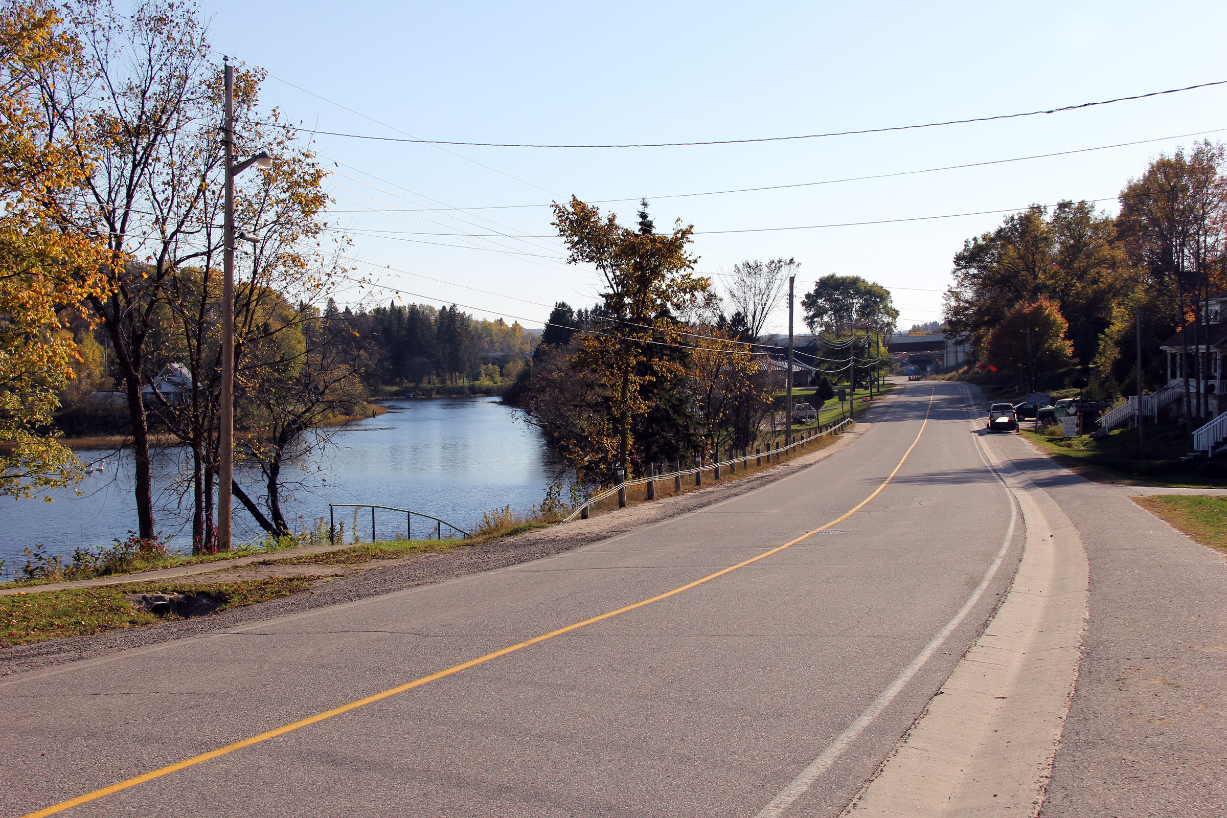
View looking northerly along Ontario Street as Highway 520 departs Burk's
Falls' main street to follow the north bank of the Magnetawan River towards
the village of Magnetawan. Ontario Street was part of Highway 11 until the
current Burk's Falls By-pass was opened to traffic. While I am unsure
of the specific year that the Burk's Falls By-pass opened to traffic, it was
either late in the 1970s,
or very early in the 1980s. Straight ahead along Ontario Street is Highway 11. At the time this photo was taken, a new
interchange was being constructed to link Ontario Street to the four-lane
Highway 11 that is set to be completed in 2012.
Photo taken: October 8th, 2011. |
(720x480)
(1440x960)
(2400x1600) |
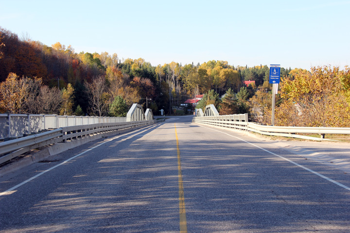
Village of Burk's Falls
District of Parry Sound |
This view looks southerly across the Magnetawan River bridge into Downtown
Burk's Falls.
Photo taken: October 8th, 2011. |

(720x480)
(1440x960)
(2400x1600) |
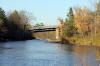
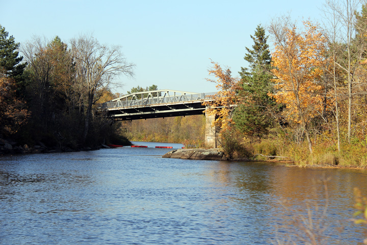
Village of Burk's Falls
District of Parry Sound |
The Magnetawan River bridge has been constructed with a considerable grade
to fit the highway into the surrounding topography.
Photo taken: October 8th, 2011. |
(720x480)
(1440x960)
(2400x1600) |
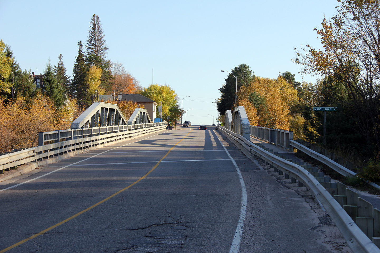
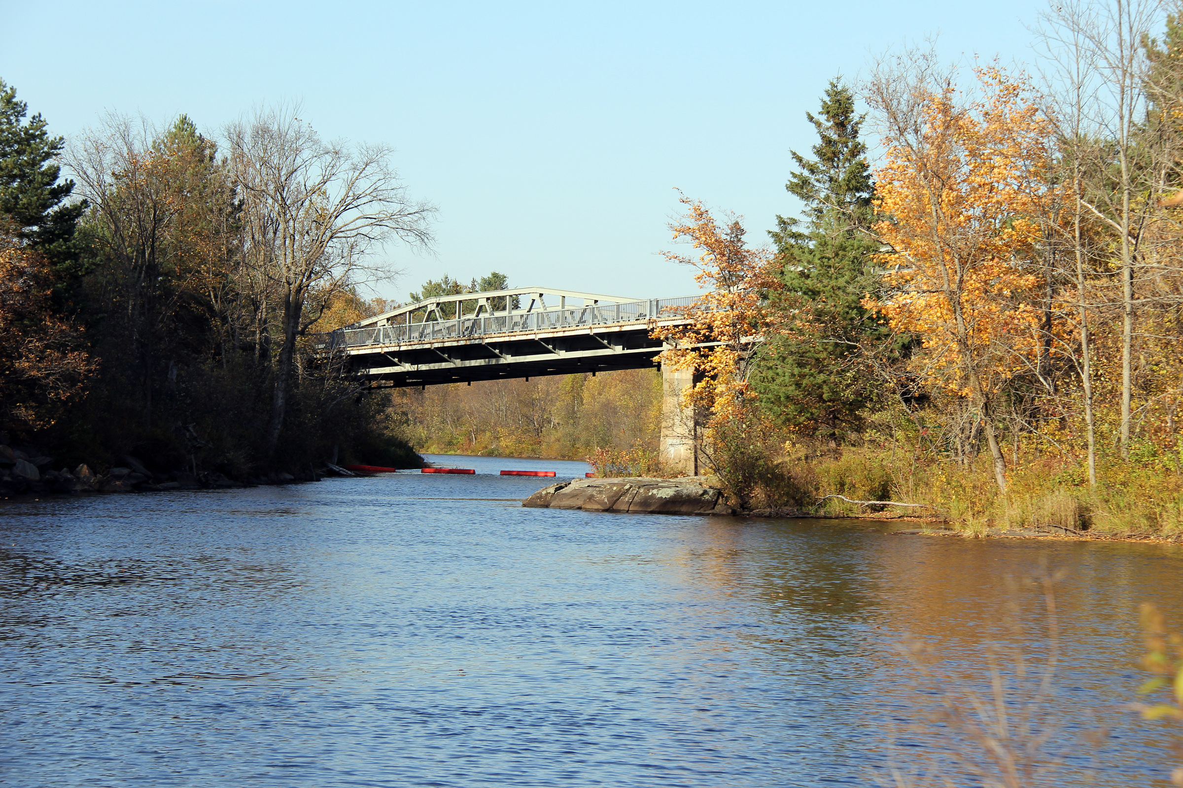
Village of Burk's Falls
District of Parry Sound |
Northerly view as Ontario Street crosses the Magnetawan River Bridge.
The Magnetawan River bridge was constructed in 1930 by the Canadian Bridge
Company of Walkerville Ontario.
Photo taken: October 8th, 2011. |
(720x480)
(1440x960)
(2400x1600) |
Village of Burk's Falls
District of Parry Sound |
This view looks south (east as far as Highway 520's concerned) as Ontario
Street climbs out of the Magnetawan River Valley and into Burk's Falls'
historic central business district.
Photo taken: October 8th, 2011. |

(720x480)
(1440x960)
(2400x1600) |
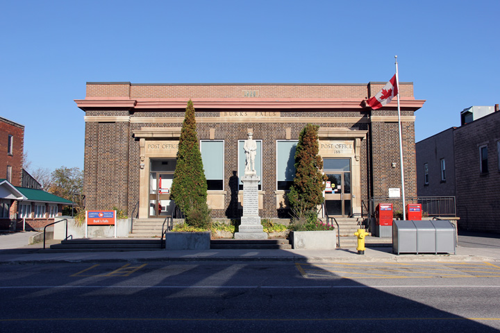
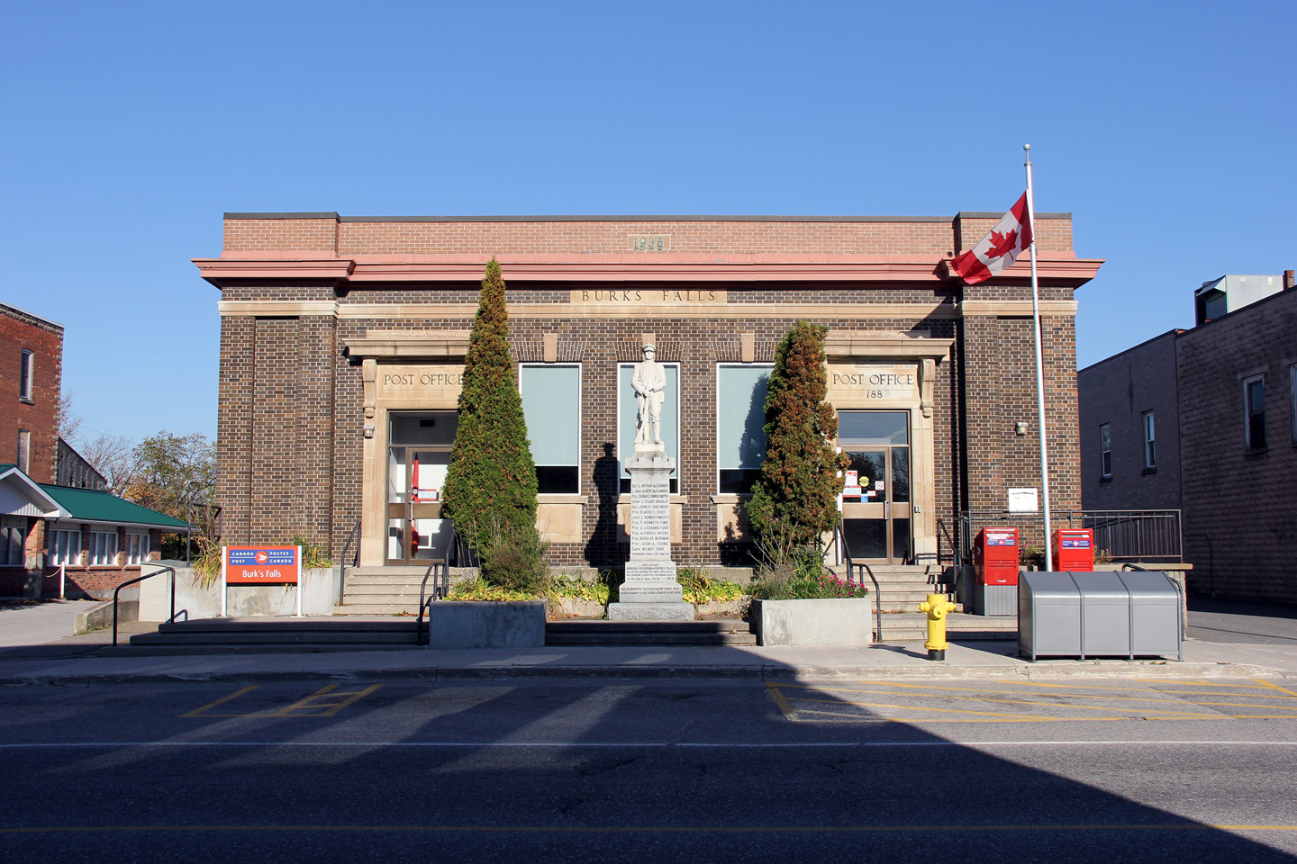
Village of Burk's Falls
District of Parry Sound |
View of the regal Burk's Falls Post Office building which proudly has a
central spot along the village's Main Street. Burk's Fall's Post
Office was constructed in 1938, the same year as the Magnetawan River bridge
opened to traffic a few hundred metres to the north.
Photo taken: October 8th, 2011. |

(720x480)
(1440x960)
(2400x1600) |
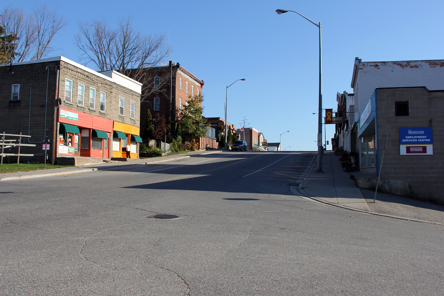
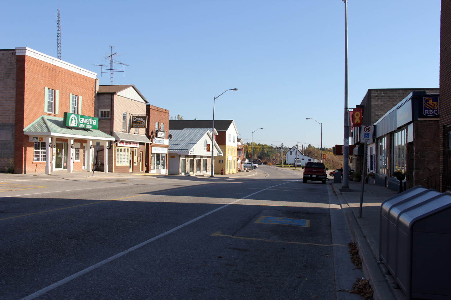
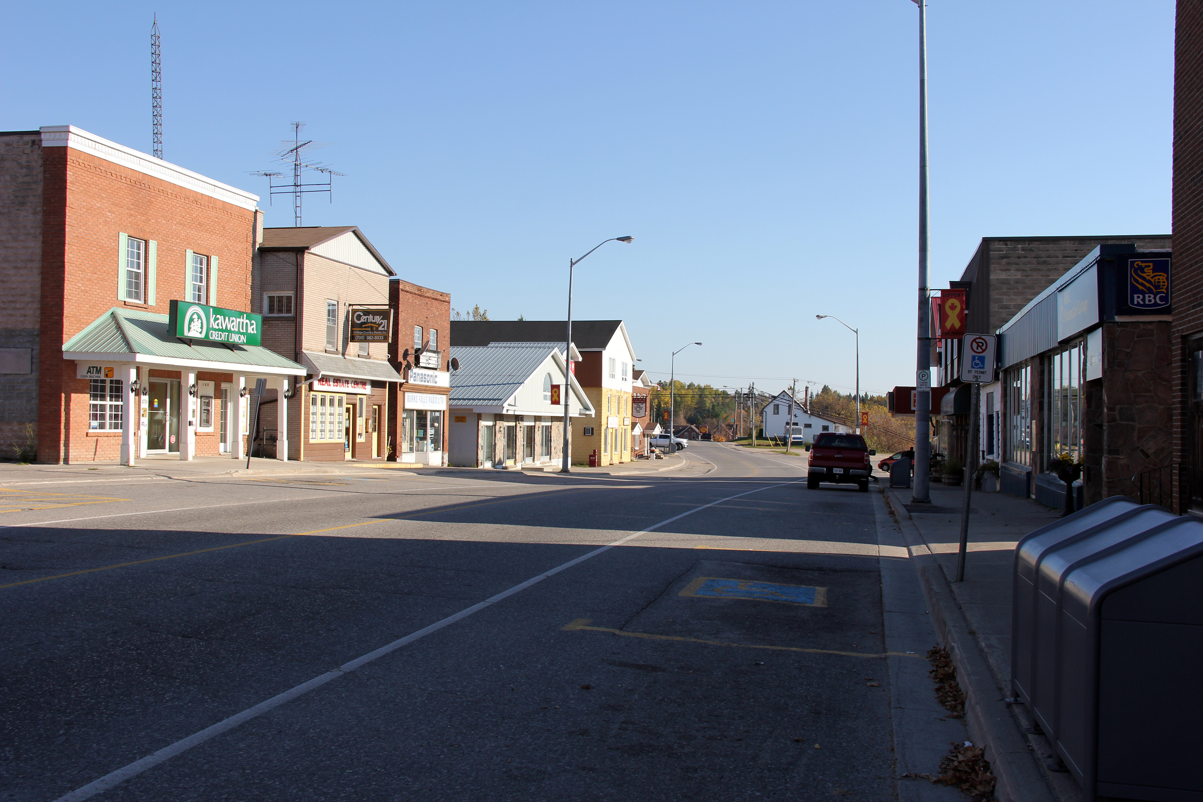
Village of Burk's Falls
District of Parry Sound |
Southerly view along Ontario Street through Burk's Falls. Burk's Falls
has one of the larger downtowns of any of the towns along Highway 11 between
Huntsville and North Bay.
Photo taken: October 8th, 2011. |

(720x480)
(1440x960)
(2400x1600) |
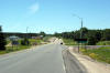
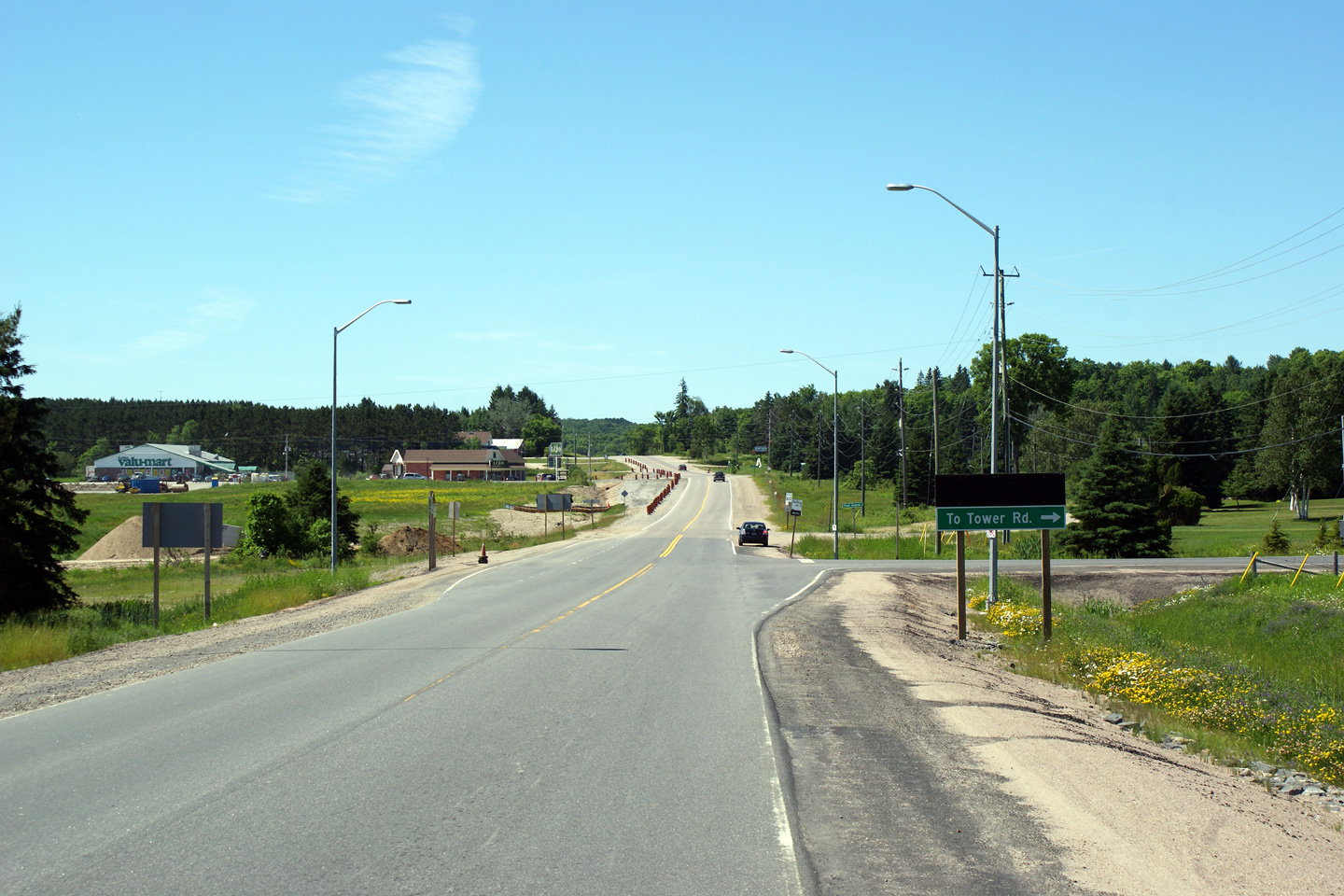
Township of Armour
District of Parry Sound |
Northerly view along Highway 520 approaching Burk's Falls. Since this
photo was taken, a Tim Horton's coffee shop has been constructed adjacent to
the LCBO and Food Land to the left of the highway in the photo. Burk's
Falls features the only Tim Horton's between Huntsville and North Bay.
Photo taken: June 27th, 2009. |
(720x480)
(1440x960)
(2400x1600) |
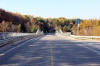
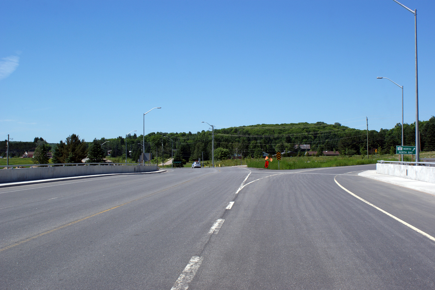
Township of Armour
District of Parry Sound |
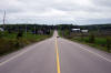
Northerly view across the Highway 11 overpass structure at the south edge of
Burk's Falls. At the time this photo was taken, Highway 520 met a
two-lane incarnation of Highway 11 at an interchange. It wasn't until later
in 2010 that the four lane Highway 11 was extended northerly to this
interchange. As of late 2011, Highway 11 narrowed from four-lanes to two,
just north of the Hwy 520 interchange. |
(720x480)
(1440x960)
(2400x1600) |
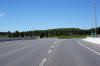
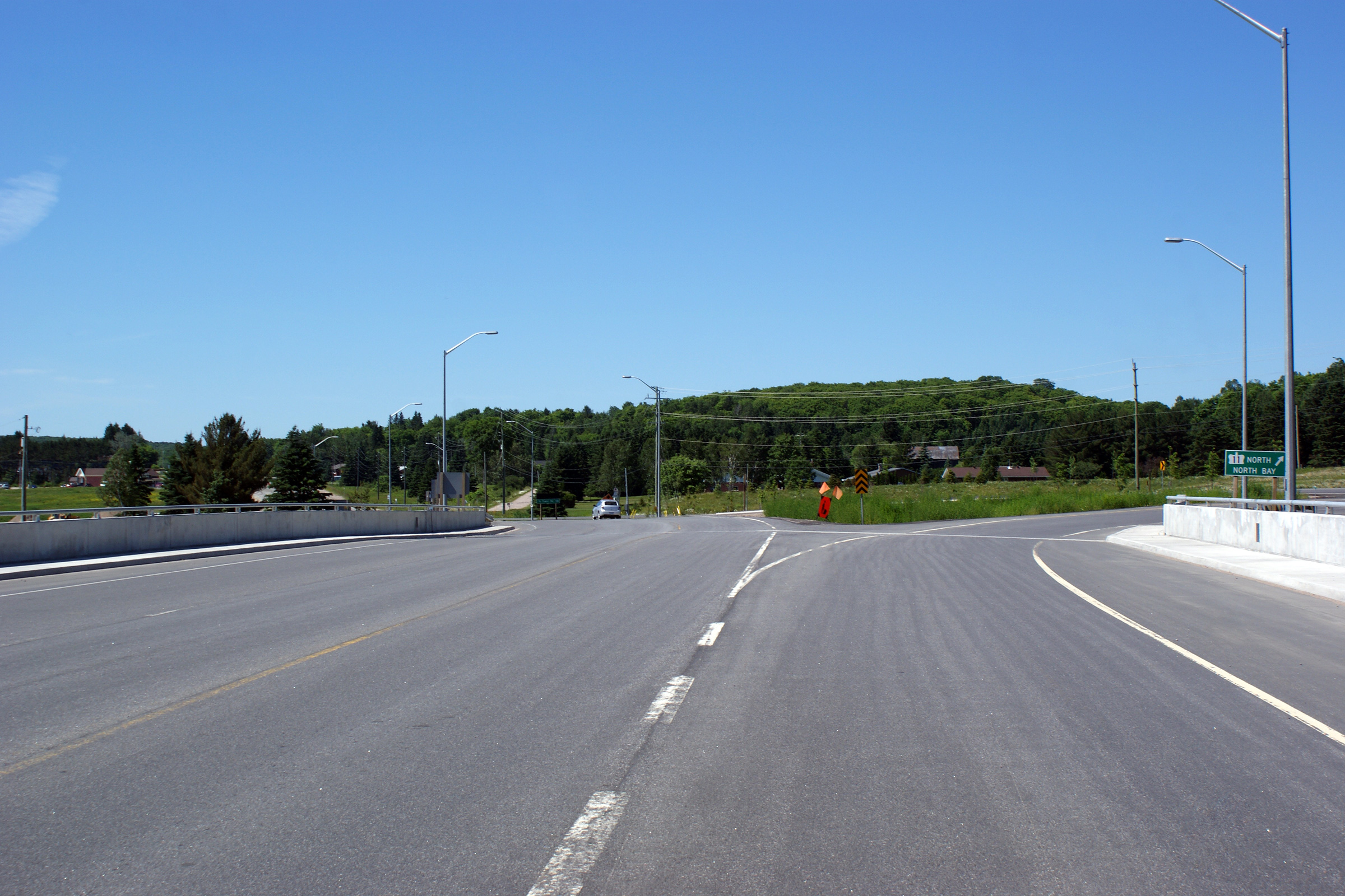
Township of Armour
District of Parry Sound |
Southerly view across the Highway 11 overpass structure at the south edge of
Burk's Falls. Straight ahead, while Highway 520 ends at Highway 11,
the road continues southerly as the Ferguson Road, the original alignment of
what became Highway 11 south of Burk's Falls.
Photo taken: June 27th, 2011. |

(720x480)
(1440x960)
(2400x1600) |
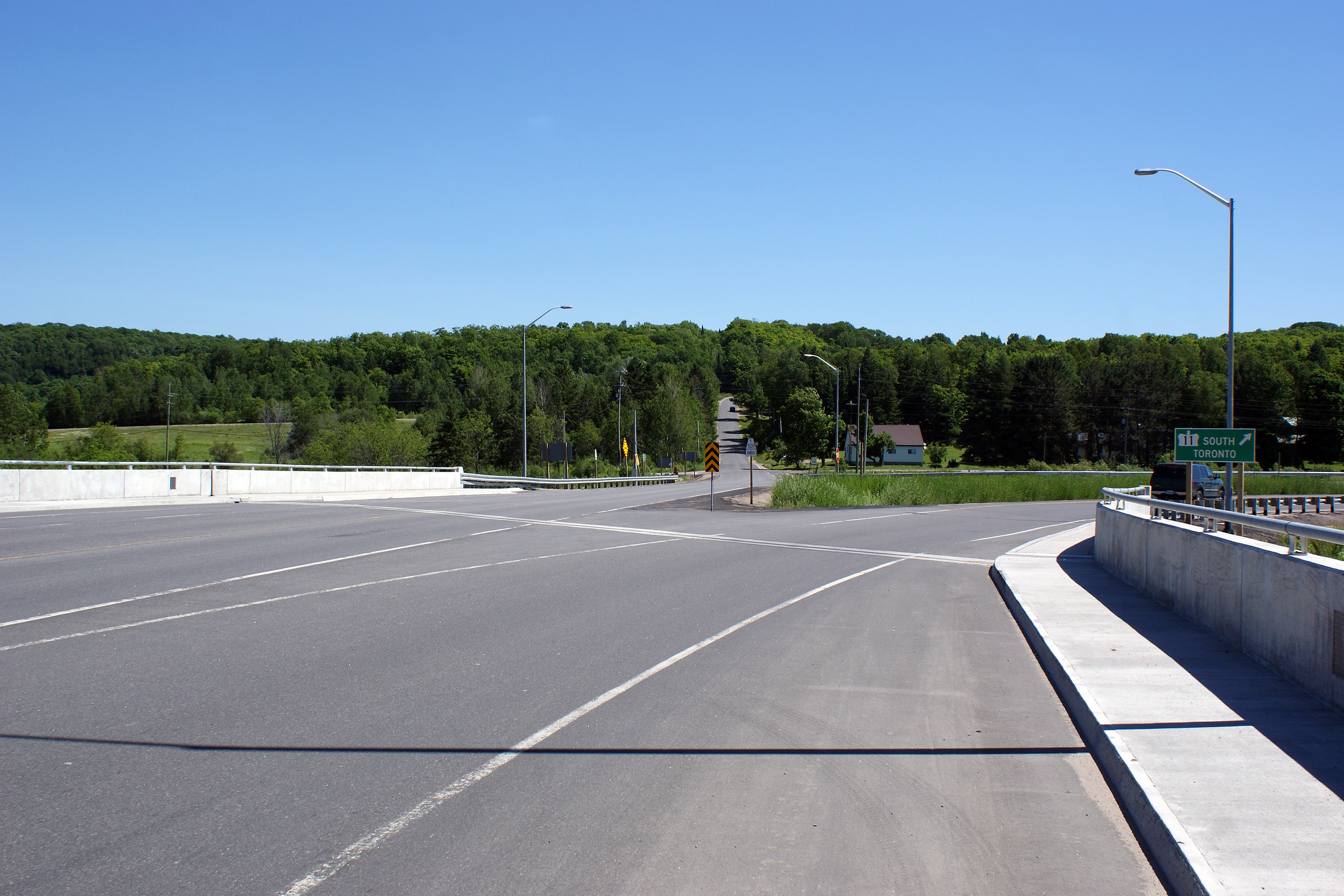
Township of Armour
District of Parry Sound |
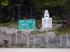
Eastbound ends sign for Highway 520 located at the Highway 11 interchange.
Photo taken: June 27th, 2009. |
 Low
Res Low
Res
High Res |


 Low
Res
Low
Res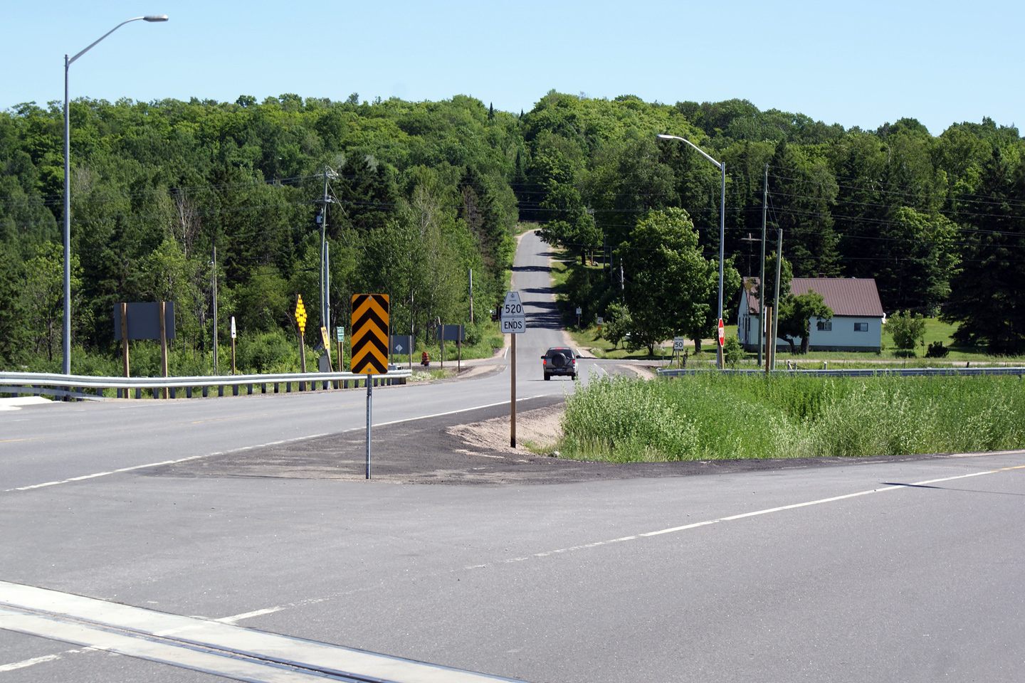