Secondary
Highway 631 - www.OntHighways.com
One of Ontario's longest Secondary
Highway's, Highway 631 runs the long and remote distance between Highway 17 at
White River, and Highway 11 west of Hearst. The highways purpose is to
serve the remote community of Hornepayne. Without Highway 631, Hornepayne
would only be accessible by the CN Rail-line that passes through the centre of the
community.
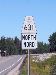
Secondary Highway 631 Shield
|
|
Southern Terminus:
Highway 17 in White River
Northern Terminus: Highway 11
Length: 170.0km
Multiplexes: None
Orientation: North-South
Regions
Served: Algoma and Cochrane Districts
AADT (2002):
Highest: 540, from Hornepayne to Highway 11;
Lowest: 400, from Highway 17 to Hornepayne.
Road Info: Highway 631 is in
excellent shape for the highways entire long length. Aside from the
odd sharper then necessary curve, travel along Highway 631 is very pleasant
at the highway's 80km/h speed limit. |
Communities and Intersections along and Highway 631 from South to North:
|
Proper
Municipality Name |
Community Name |
Distance |
Intersecting
Road |
| Township of White River |
White River |
0km / 170.km |
King's Highway 17 |
| Township of Hornepayne |
Hornepayne |
99.1km / 70.9km |
Second Street |
|
At Becker Raod: NB: Turn Left towards
Highway 11. SB: Turn Right towards Downtown Hornepayne. |
| Township of Hornepayne |
Hornepayne |
100.0km / 70.0km |
Becker Road |
| Township of Hornepayne |
Hornepayne |
102.1km / 67.9km |
Round House Road |
| Algoma - Cochrane District Boundary |
----- |
163.6km / 6.4km |
----- |
| District of Cochrane |
----- |
170km / 0km |
King's Highway 11 |
|
Highway 631 ENDS |
<- Highway 630
www.OntHighways.com - Home
Highway 632 ->
Copyright (c) 2004-2007, Scott Steeves (Webmaster)
webmaster@onthighways.com
Page last updated: September 9th, 2007
Page created: September 9th, 2007