Secondary
Highway 613 - www.OntHighways.com
Highway 613 is one of the longer
secondary highways in Rainy River district, stretching north-south between
Highway 602 and the very beautiful Lake Despair.
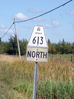
Secondary Highway 613 Shield
|
|
Southern Terminus: Junction Highway
602 West of Fort Frances Northern Terminus:
Lake Despair
Length: 40.1km
Multiplexes: None
Orientation: North-South
Regions Served: Rainy River District
AADT
(2004): Highest: 620, from Highway 11/71 northerly to Lake
Despair;
Lowest: 110, from Highway 602 north to Highway 11/71.
Road Info: Highway 613 is paved
for the highways entire length. The southern portions of the highway
pass through flat farm land while the more northern reaches of the highway
pass through a much more rugged landscape as the highway begins to enter the
Canadian Shield. Highway 613 is posted with an 80km/h speed limit |
|
Highway 613 information: |
|
|
OntHighways.com |
|
Detailed Route information available
below
Virtual Tour of Highway
613 (Coming Soon!) |
|
Communities and Intersections along and Highway 613 from South to North:
|
Proper
Municipality Name |
Community Name |
Distance |
Intersecting
Road |
| Township of La Vallee |
----- |
0km / 40.1km |
Secondary Highway 602 |
| Township of La Vallee |
----- |
11.1km / 29.0km |
King's Highway 11/71 |
| District of Rainy River |
----- |
24.1km / 16.0km |
Dance Boundary Road |
| District of Rainy River |
Lake Despair |
40.1km / 0km |
----- |
|
Highway 613 ENDS |
<- Highway 612
www.OntHighways.com - Home
Highway 614 ->
Copyright (c) 2004-2007, Scott Steeves (Webmaster)
webmaster@onthighways.com
Page last updated: September 27h, 2007
Page created: September 27h, 2007