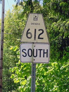
Secondary
Highway 612 - www.OntHighways.com
Highway 612 currently runs south
from Highway 69 near Gordon Bay to the Muskoka/Parry Sound Boundary. At
the height of Highway 612's length, it ran south into Muskoka District (along
what is now Muskoka Road 11) and met Highway 103 just south of MacTier.
The southern portion of Highway 612 was decommissioned when the District
Municipality of Muskoka was formed in the early 1970s. The entire historic
length of Highway 612 is actually the original Highway 69 alignment through
MacTier. The Highway 69-Mactier Bypass was completed in the 1950s.

Secondary Highway 612 Shield
|
|
Southern Terminus:
| |
Current: Highway 612 currently ends at the
Muskoka - Parry Sound boundary. |
| |
Historic: Highway 612 continued southerly
through MacTier and ended at Highway 103. Highway 103 was later
re-designated as Highway 69, as it is currently known. |
Northern Terminus: Highway 69 junction near Gordon Bay
Length:
Current: 4.2 km. Historic:
(approximately) 11.3 km
Multiplexes: None
Orientation: North-South
Regions Served: Parry Sound District
AADT (2002):
530, for the entire (current) length of Highway 612.
Road Info: Highway 612 is paved
and has an 80km/h speed limit for its entire length. Traffic is light,
and pavement conditions are generally smooth, having only a few small rough
patches. |
|
Highway 612 information: |
|
|
OntHighways.com |
|
Detailed Route information available
below
Virtual Tour of Highway
612 (Coming Soon!) |
|
Communities and Intersections along and Highway 612 from South to North:
|
Proper Municipality Name |
Community Name |
Distance |
Intersecting Road |
| Muskoka Lakes - Seguin Boundary |
----- |
0 km / 4.2 km |
Healy Lake Road |
| Township of Seguin |
Dock Siding |
--- |
----- |
| Township of Seguin |
----- |
4.2 km / 0 km |
King's Highway 69 |
|
Highway 612 Ends |
<- Highway 611
www.OntHighways.com - Home
Highway 613 ->
Copyright (c) 2004-2007, Scott Steeves (Webmaster)
webmaster@onthighways.com
Page last updated: September 26h, 2007
Page created: January 29th, 2005
