Secondary
Highway 610 - www.OntHighways.com
Highway 610 runs predominantly
east-west through the northeastern portion of Timmins. It was downloaded
in its entirety in 1997, as it served primarily local traffic.
Interestingly, Highway 610 is a former alignment of Highway 67. It was
part of Highway 67 before Highway 101 became the predominant route between
Timmins and Highway 11.
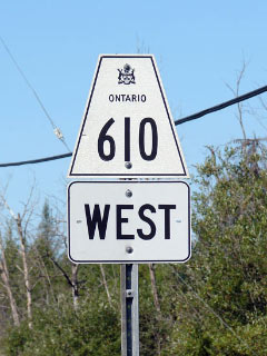
Secondary Highway 610 Shield - Copyright Josh Anderchek - Used
with permission
|
|
Western Terminus: Junction Highway 101
just east of Hoyle Eastern Terminus: Junction Highway
67 near the Timmins Iroquois Falls Boundary
Length: 18.3km
Multiplexes: None
Orientation: East-West
Regions Served: Cochrane District
AADT (1994):
400, for the entire length of Highway 610
Status: Totally downloaded.
Highway 610 was not assigned a number, but rather named Fredrickhouse Lake
Road.
Road Info: Highway 611 is
surfaced with tar and chip for its entire length and is posted with an
80km/h speed limit. |
|
Highway 610 information: |
|
|
OntHighways.com |
|
Detailed Route information available
below
Virtual Tour of Highway 610 (Coming Soon!) |
|
Communities and Intersections along and Highway 610 from West to East:
|
Proper
Municipality Name |
Community Name |
Distance |
Intersecting
Road |
| City of Timmins |
----- |
0km / 18.3km |
King's Highway 101 |
| City of Timmins |
Connaught |
--- |
----- |
| City of Timmins |
----- |
18.3km / 0km |
Highway 67 (Municipal Road) |
|
Highway 610 ENDS |
<- Highway 609
www.OntHighways.com - Home
Highway 611 ->
Copyright (c) 2004-2007, Scott Steeves (Webmaster)
webmaster@onthighways.com
Page last updated: September 29th, 2007
Page created: September 29th, 2007