AsphaltPlanet.ca >
OntHighways > Highway 67 > Images
King's Highway
67 - www.OntHighways.com
Before downloading, Highway 67 ran
from Highway 101 just east of Timmins northeasterly into Iroquois Falls, via a
short multiplex with Highway 11. In 1997/98, Highway 67 was shortened at
both ends. In 1997 Highway 67 was shortened by 1.1km when it was
downloaded through much of urban Iroquois Falls (coinciding with the
decommissioning of both Highway's 577 and 578). In 1998, Highway 67 was
shortened again, this time by 24.5 km, as all portions south of Highway 11 were
handed over to local authorities. Highway 67 now runs the 9.8km distance
from Highway 11 into Iroquois Falls.
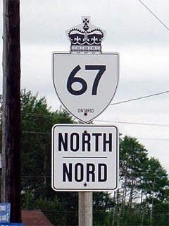 New Style King's
Highway 67 Shield
|
|
Southern Terminus:
Pre 1997: Junction Highway 101 between Hoyle and Shilling
Current: Junction Highway 11 just north of
Porquis Junction
Northern Terminus:
Pre-1997: Junction Highway 578 in Iroquois
Falls
Current: Junction Highway 577 in Iroquois Falls
Length: Pre-1997:
35.4km. Current: 9.8km
Multiplexes: Currently none,
before downloading there was a 2.6 km multiplex with Highway 11.
Freeway: No
AADT: Highest (2002): 2,050, from
Highway 11 northerly to Iroquois Falls;
Lowest (1994): 800, from Highway 610 northerly to Highway 11.
Road Info: Coming Soon! |
Communities and Major Intersections along Highway 67 from South to North:
|
Proper Municipality Name |
Community Name |
Distance |
Intersecting Road |
|
Highway 67 was downloaded south
of Highway 11 in 1998. The highway is now simply known as Municipal
Road |
| City of Timmins |
----- |
0 km / 35.4 km |
King's Highway 101 |
| City of Timmins |
Barbers Bay |
9.4 km / 26.0 km |
Highway 610 (Frederickhouse Lake Road) |
| Timmins - Iroquois Falls Boundary |
Timmins - Iroquois Falls Limits |
9.9 km / 25.5 km |
----- |
|
At Highway 11-South: NB:
Turn Left towards Hearst. SB: Ramp to the right towards Timmins |
| Town of Iroquois Falls |
----- |
21.9 km / 13.5 km |
King's Highway 11-South |
|
At Highway 11-North: NB:
Ramp to the right towards Iroquois Falls. SB: Turn left towards North
Bay |
| Town of Iroquois Falls |
Porquis |
24.5 km / 10.9 km |
King's Highway 11-North |
|
At Main Street & Victoria Road:
NB: Turn Right towards Downtown. SB: Turn Left towards Highway 11. |
| Town of Iroquois Falls |
Iroquois Falls |
24.3 km / 1.1 km |
Highway 577 (Main Street-East) |
|
Current (1998) Northern Terminus
of Highway 67 is located at Highway 577 in Iroquois Falls. |
|
At Highway 577: NB: Turn
Left onto Synagogue Street. SB: Turn Right towards Highway 11 on
Main Street |
| Town of Iroquois Falls |
Iroquois Falls |
35.4 km / 0 km |
Highway 578 (Anson Drive) |
|
Highway 67 ENDS |
<- Highway
66
www.OntHighways.com - Home
Highway 69 ->
Copyright (c) 2004-2011, AsphaltPlanet.ca
AsphaltPlanet@asphaltplanet.ca
Page last updated: October 4th, 2005
Page created: October 4th, 2004