King's Highway 101 - www.OntHighways.com

Highway 101 is a long highway that spans the Northeastern part of the province.  Much of Highway 101 passes through very remote areas of Ontario, where the route sees little traffic.  An exception to this is through the Timmins area, where the highway is exceptionally busy.  There is not another continuous east-west route through Timmins, so both local and through traffic must utilize Highway 101.  While no section of Highway 101 was downloaded in 1997/98, much of the suburban portions of Highway 101 near Timmins were transferred to local jurisdiction and are now covered by a connecting link agreement.


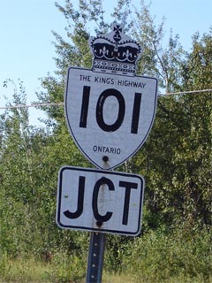
Old Style Highway 101 Shield

  Western Terminus:  Junction Highway 17 just west of Wawa

Eastern Terminus:  Quebec Route 388 at the Ontario/Quebec Boundary

Length:  476.0km

Multiplexes:  6.4km with Highway 11 near Matheson, and 7.6km with Highway 129 south of Chapleau.

Freeway:  No

AADT (2002):  Highest:  8,300, from Highway 576 east to the Timmins connecting link;

                             Lowest:  310, from Highway 651 to the Algoma-Sudbury District Boundary.

Road info:  Highway 101 is a very long and diverse road that stretches across Northeastern Ontario.  Between Wawa and Timmins the highway is very remote and winds through the often rugged Northern Ontario landscape.  Between Timmins and Highway 11, the highway is quite busy, is straight, and follows terrain that is reminiscent of some regions of Southern Ontario.  East of Matheson, the highway again winds its way through rugged and remote terrain.  Much of Highway 101 has a rural speed limit of 80km/h with the exceptions of between Wawa and Highway 547, and between Timmins and Highway 11 where a 90km/h has been posted.


Highway 101 information:


OntHighways.com  

Detailed Route information available below
Virtual Tour of Highway 101


TheKingsHighway.ca   History of Highway 101
Photographic History of Highway 101

Communities and Major Intersections located along Highway 101 from West to East:

Proper Municipality Name Community Name Distance Intersecting Road
Township of Michipicoten ----- 0km / 476.5km King's Highway 17

At Broadway Ave in Wawa:  EB: Turn Right towards Chapleau.  WB: Turn Left towards Highway 17.

Township of Michipicoten Wawa --- Broadway Ave
District of Algoma ----- 21.7km / 454.8km Secondary Highway 547
District of Algoma ----- 66.4km / 410.1km Secondary Highway 631

At Highway 129-South:  EB: Turn Left towards Chapleau.  WB: Turn Right towards Wawa.

District of Sudbury ----- 131.2km / 345.3km King's Highway 129-South

At Highway 129-South:  EB: Turn Right towards Timmins.  WB: Turn Left towards Thessalon.

District of Sudbury ----- 138.8km / 337.7km King's Highway 129-North
District of Sudbury ----- 232.5km / 244.0km Young Street (Highway 7072)
Timmins Boundary Timmins West Limit --- -----
City of Timmins ----- 311.2km / 165.3km King's Highway 144
City of Timmins Timmins 326.2km / 150.3km Highway 576 (Government Road)
City of Timmins Timmins 333.0km / 143.2km Highway 629 (Theriault Boulevard) & Cameron Street
City of Timmins Timmins 335.5km / 141.0km Secondary Highway 655
City of Timmins Schumacher --- -----
City of Timmins South Porcupine 343.1km / 133.4km Legion Drive
City of Timmins Porcupine --- -----
City of Timmins Hoyle 357.7km / 118.8km Frederickhouse Lake Road (Highway 610)
City of Timmins ----- 364.5km / 112.0km Nighthawk Peninsula Road (Road 803)
City of Timmins ----- 370.3km / 106.2km Highway 67 (Municipal Road)
Timmins - Black River-Matheson Boundary Timmins East Limits 376.2km / 100.3km -----
Township of Black River-Matheson Shillington 385.9km / 90.6km Secondary Highway 577
Township of Black River-Matheson ----- 395.6km / 80.9km King's Highway 11-North

At Highway 11-South:  EB: Turn Left towards Downtown Matheson.  WB: Turn Right towards Timmins.

Township of Black River-Matheson Matheson 402.0km / 74.5km King's Highway 11-South
Township of Black River-Matheson ----- 417.5km / 59.0km Secondary Highway 572
Township of Black River-Matheson ----- 453.8km / 22.7km Secondary Highway 672
Township of Black River-Matheson ----- 476.5km / 0km Quebec Route 388
Highway 101 ENDS

<-Highway 100          www.OntHighways.com - Home          Highway 102->


Copyright (c) 2004-2010, AsphaltPlanet.ca  AsphaltPlanet@asphaltplanet.ca

Page last updated:  February 26th, 2007

Page created:  February 26th, 2007