|
Proper Municipality Name |
Photo Description |
Photo |
|
Pictures taken
from driver's perspective appear offset from centre-line pictures: |
East-
Bound |
West-
Bound |
| City of Welland Regional
Municipality of Niagara |
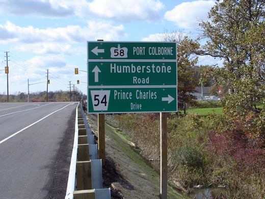
Signage denoting the Highway 58 junction
south of Welland. Before this intersection was resigned in 2006 there
was signage indicating the western terminus of Highway 58A.
Unfortunately similar signage was not erected during the re-signing.
Click here for Highway 58 images.
Picture size:55kb. |
 |
| City of Welland Regional
Municipality of Niagara |
View looking westerly along Highway 58A towards its western terminus at
Highway 58. Picture taken: October 15th,
2006. Size: 45kb. |
 |
| City of Welland Regional
Municipality of Niagara |
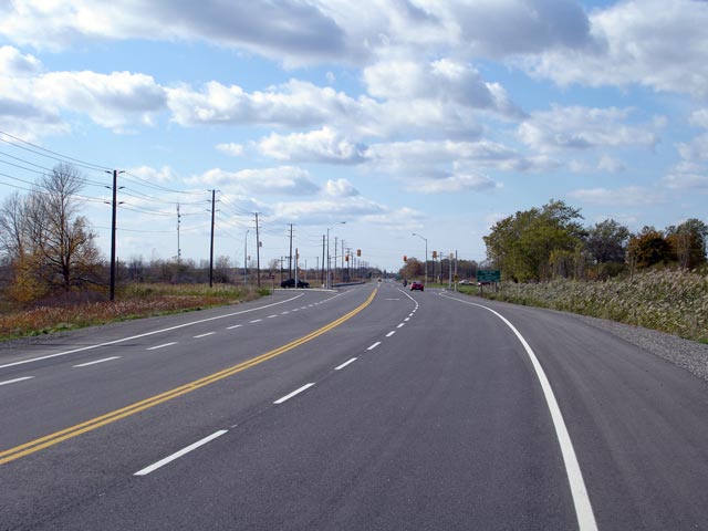
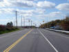
Looking east from just east of Highway 58
towards the West Bank Road junction. Picture taken: October 15th, 2006.
Size: 50kb |
 |
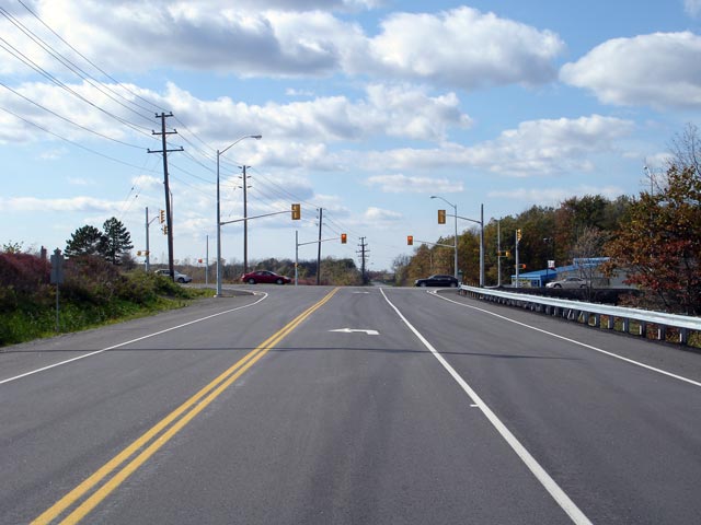
| City of Welland Regional
Municipality of Niagara |
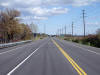
Looking west towards the signalized intersection with West Bank Road.
There are two signalized intersections along Highway 58A, this one at West
Bank Road, and at the western terminus at
Highway 58.
Picture taken: October 15th, 2006. Size: 50kb. |
 |
| City of Welland Regional
Municipality of Niagara |
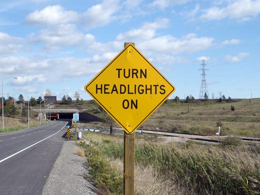
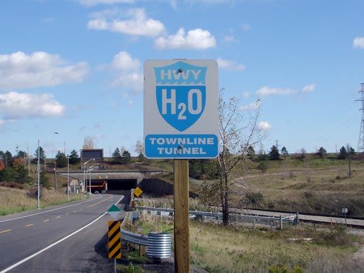
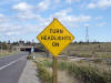
Signage approaching the Townline Tunnel advising drivers to turn on their
headlights before entering the tunnel. Although drivers are directed
to turn their headlights on before entering the tunnel, the tunnel
is continuously lit.
Picture size: 45kb. |
 |
| City of Welland Regional
Municipality of Niagara |
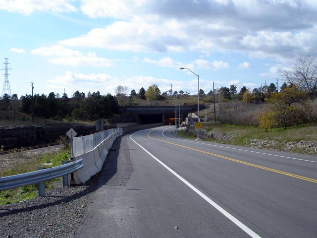
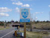
Signage approaching the western tunnel portal of the Townline Tunnel.
Signs similar to this have been erected at all of Welland Canal crossings in
Niagara Region. Picture size: 35kb. |
 |
| City of Welland Regional
Municipality of Niagara |
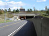
Looking east through the western Townline Tunnel portal.
The Townline Tunnel is subdivided into three smaller tunnels. The northernmost
carries Highway 58A, with the central and southern tunnels carrying two CP railway tracks.
Picture taken: October 15th, 2006. Size: 50kb. |
 |
| City of Welland Regional
Municipality of Niagara |
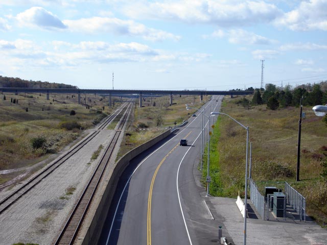
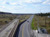
Looking westerly along Highway 58A from the Western tunnel portal towards
Highway 58. As is visible in the
photo, a lengthy trench has been cut out of the ground to maintain suitable grades for the
railway to climb from the tunnel to ground level.
Picture taken: October 15th, 2006. Size: 55kb. |
 |
| City of Welland Regional
Municipality of Niagara |
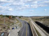
Looking east along Highway 58A from the tunnel entrance. Notice the
concrete barriers that have been placed along the south side of Highway 58A.
These barriers are placed as such so that drivers exiting the tunnel do not
mistake the headlights of an oncoming train for those of an oncoming vehicle.
Picture taken: October 15th, 2006. Size: 55kb. |
 |
| City of Welland Regional
Municipality of Niagara |
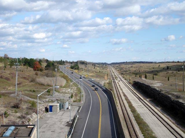
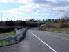
Looking west towards the west tunnel portal. Picture taken: October 15th,
2006. Size: 50kb. |
 |
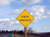
| City of Welland Regional
Municipality of Niagara |
Signage heading eastbound east of Townline Tunnel reminding drivers to check
their headlights after exiting the tunnel. Picture size: 30kb. |
 |