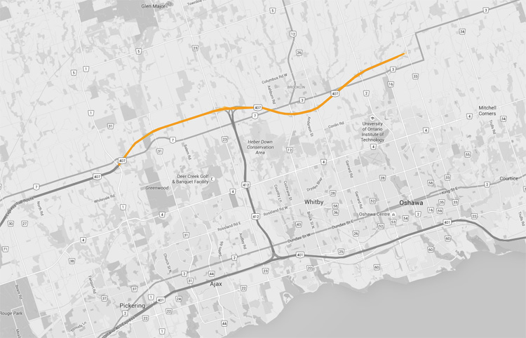
King's Highway 407 (Toll) - Images
<- Page 4 Page 5 - Pickering to Oshawa
Photos shown in this table are arranged from West to East:
|
Proper Municipality Name |
Photo Description |
Photo |
||
|
Pictures taken from driver's perspective appear offset from centre-line pictures: |
East- |
West- |
||
| Continued from Page 4 Images Click here for Page 4 images | ||||
|
For photos taken of the initial construction of the highway, click here. |
||||
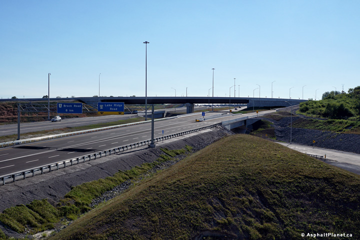
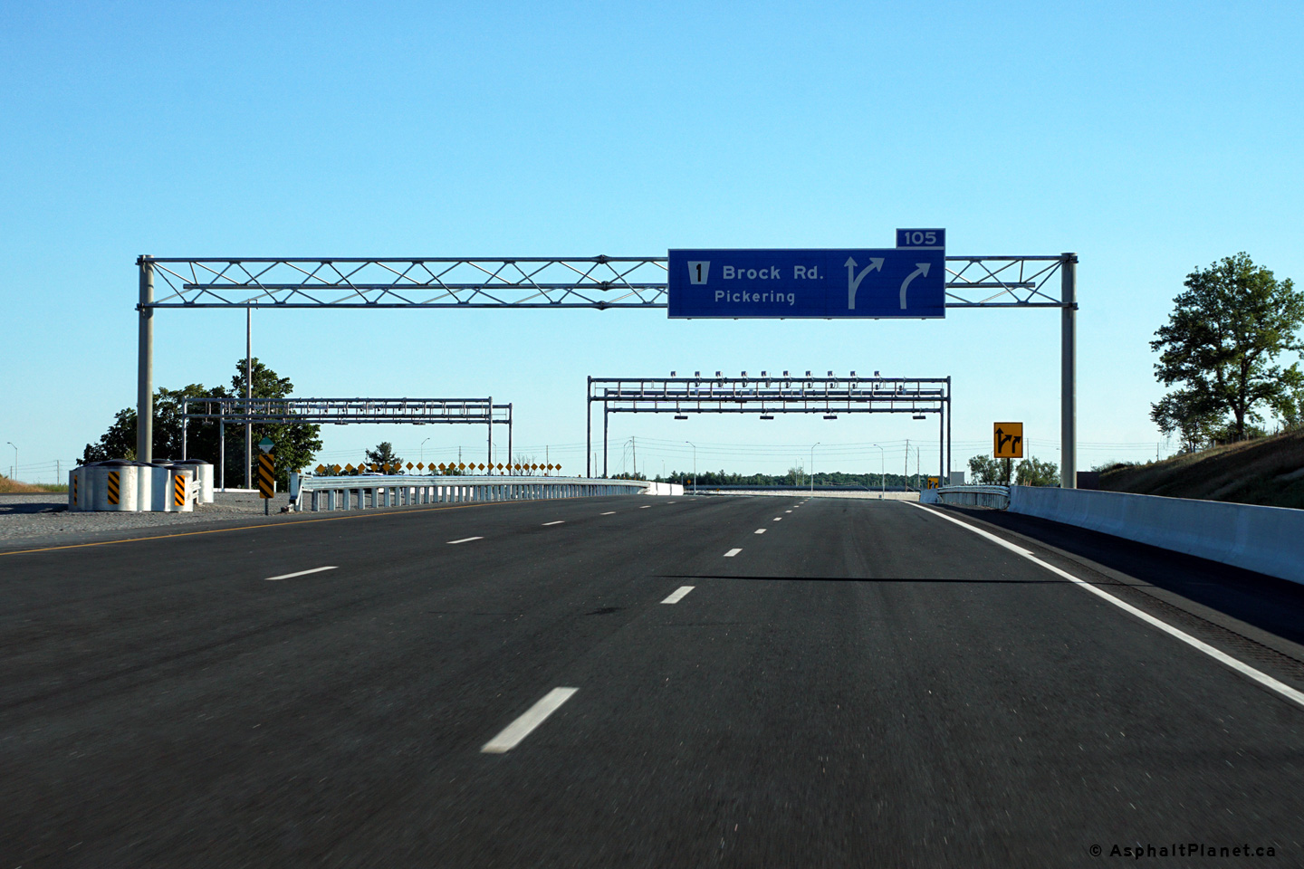
|
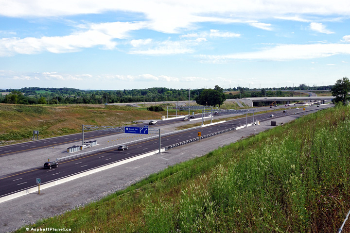
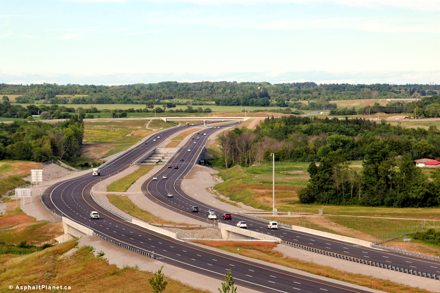
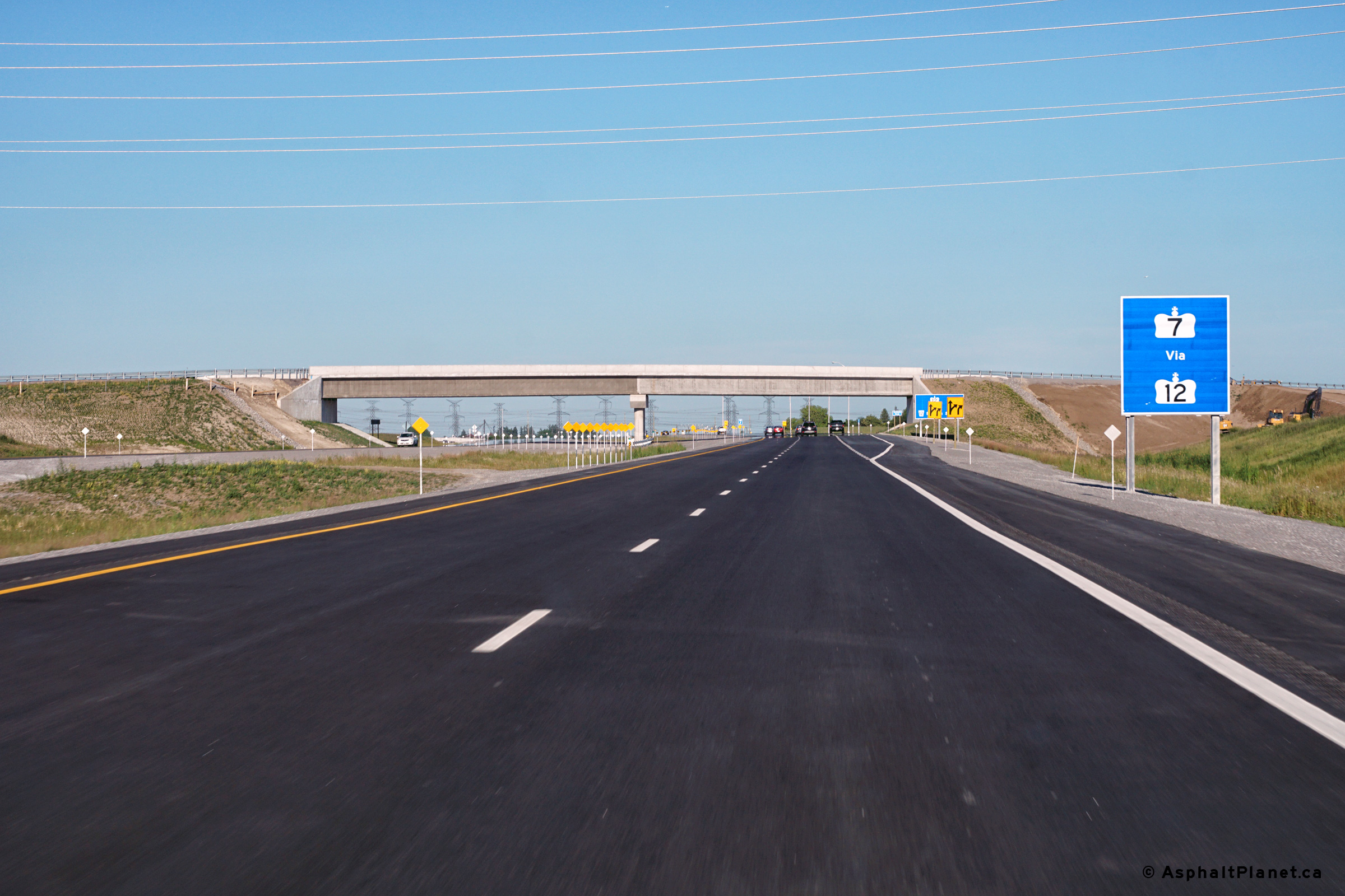
City of Pickering Regional Municipality of Durham |
View looking easterly from the Brock Road
interchange in Pickering. The Highway 7 overpass is visible
immediately to the east of the Brock Road interchange. Photos taken: July 15th, 2016. |
|||
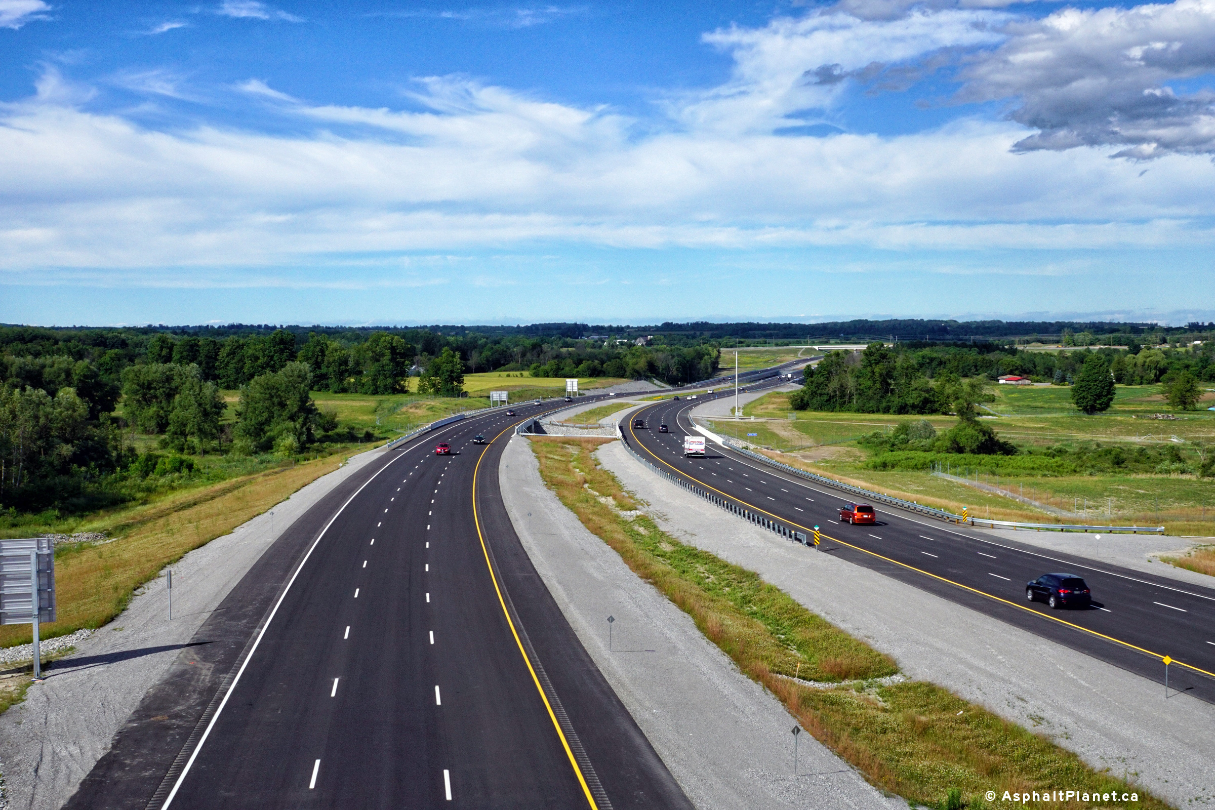
| City of Pickering Regional Municipality of Durham |
View looking westerly from the Highway 7 overpass along Highway 407 towards
the Brock Road interchange. Photo taken: July 15th, 2016. |
 (720x480) (1440x960) (2400x1600) |
||
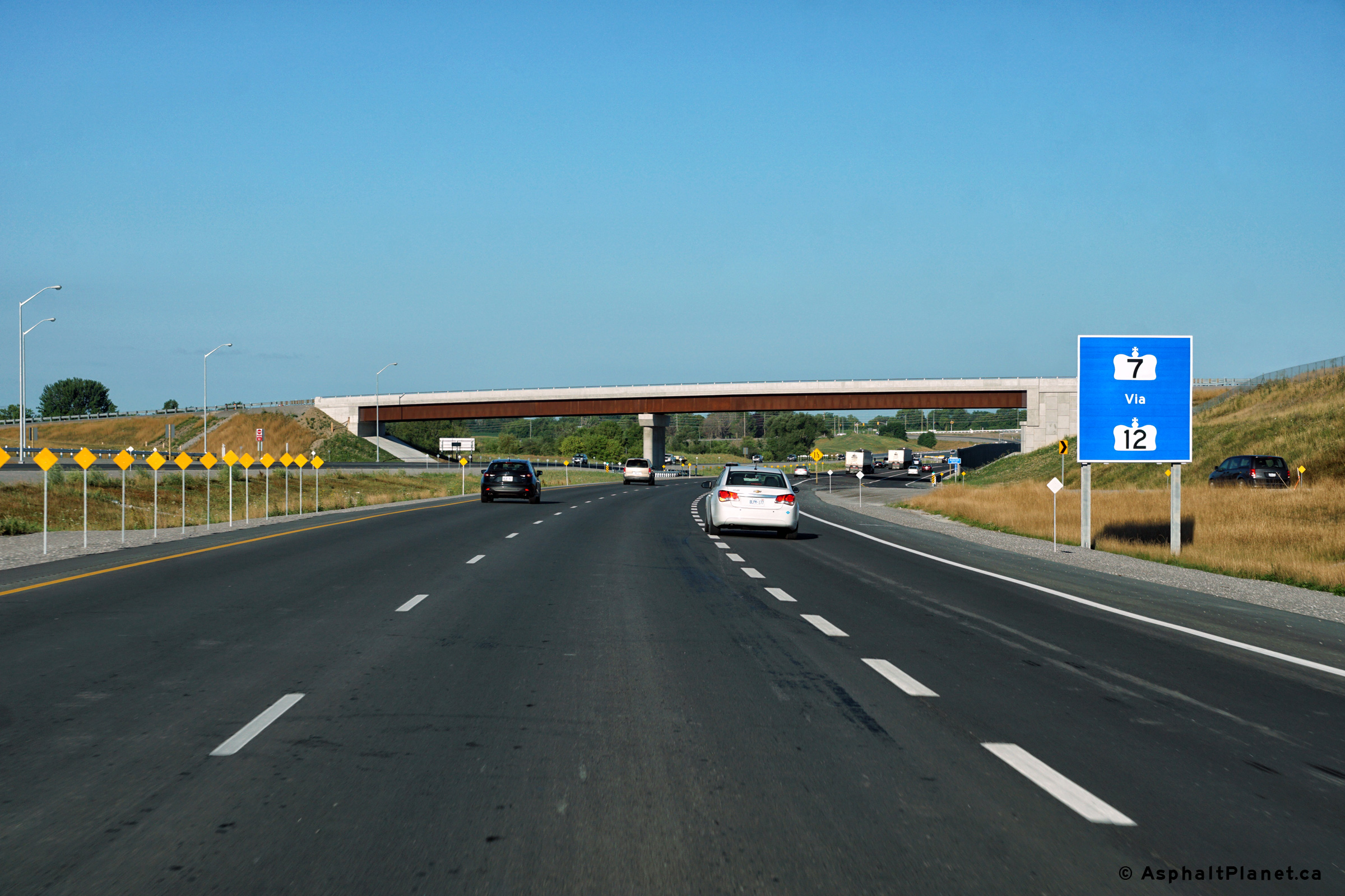
| City of Pickering Regional Municipality of Durham |
View looking easterly from the Highway 7 overpass. Photo taken: July 15th, 2016. |
 (720x480) (1440x960) (2400x1600) |
||
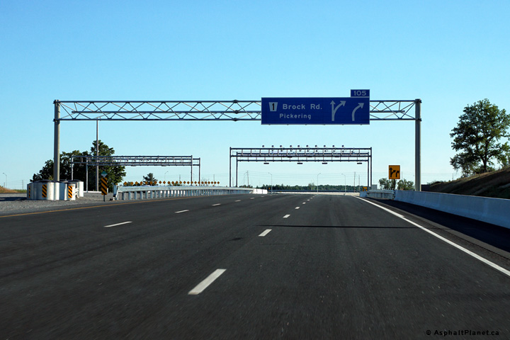
| City of Pickering Regional Municipality of Durham |
Signage at the westbound off-ramp to Brock Road. Photo taken: June 23rd, 2016. |
 (720x480) (720x480)(1440x960) (2400x1600) |
||
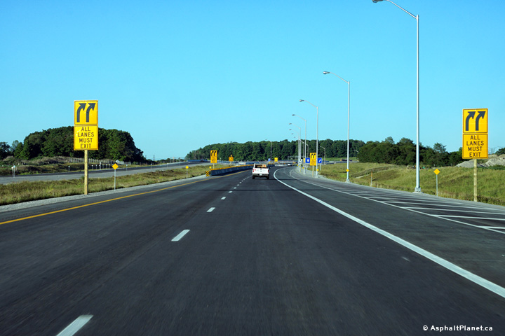
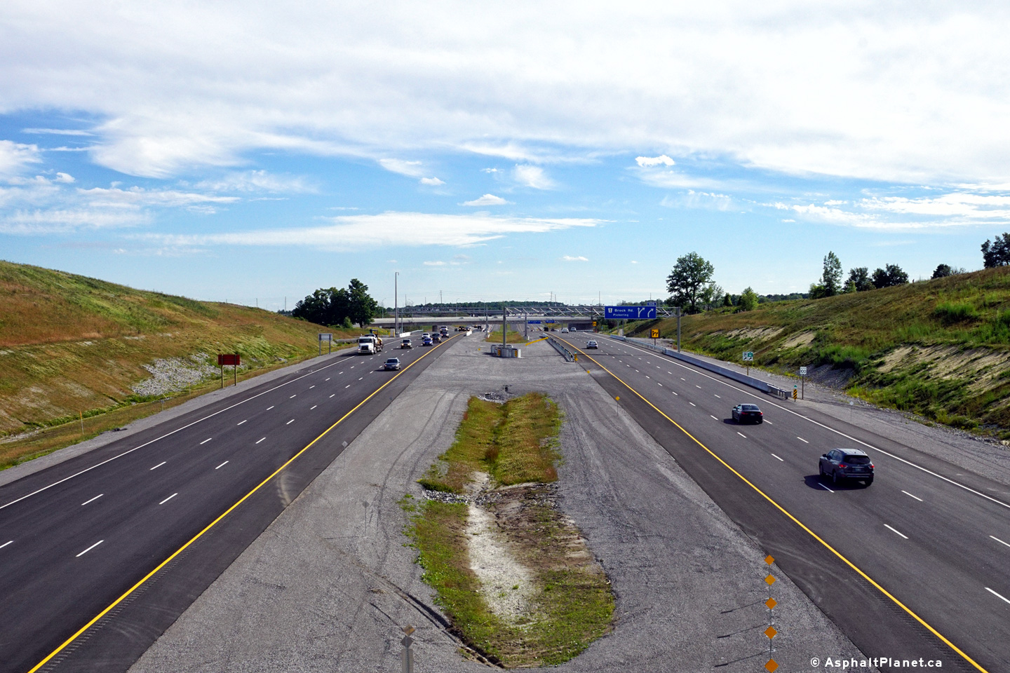
| City of Pickering Regional Municipality of Durham |
Signage advising westbound motorists that the provincial portion of Highway
407 ends just beyond the Brock Road interchange. Highway 407 ETR
begins west of Brock Road. Photo taken: June 23rd, 2016. |
 (720x480) (720x480)(1440x960) (2400x1600) |
||
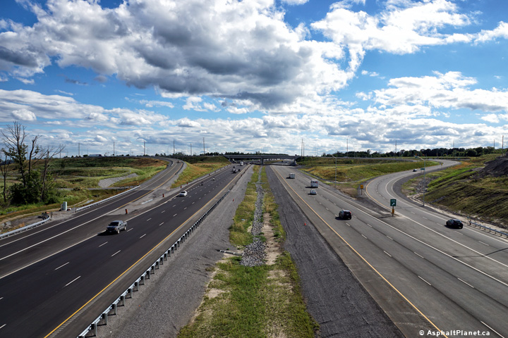
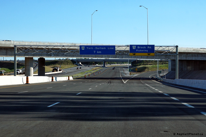
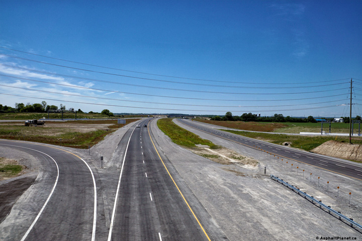
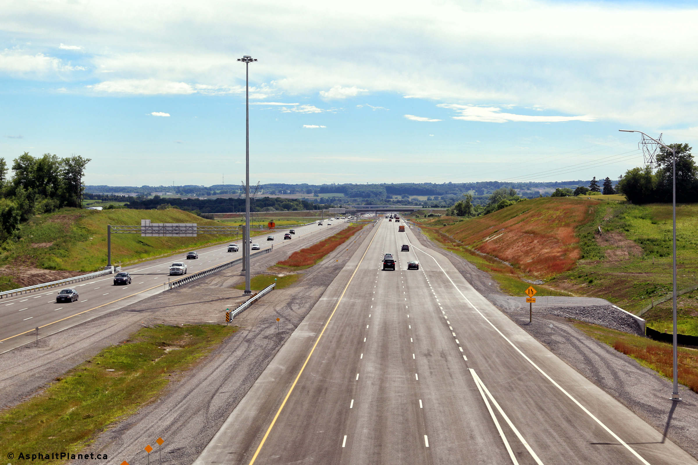
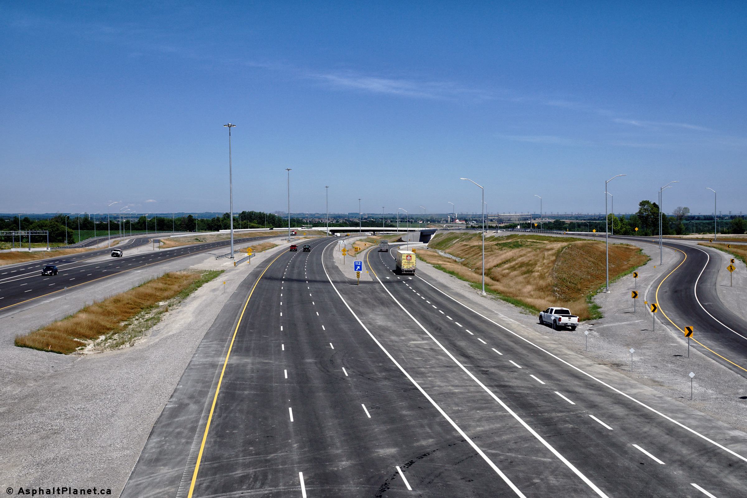
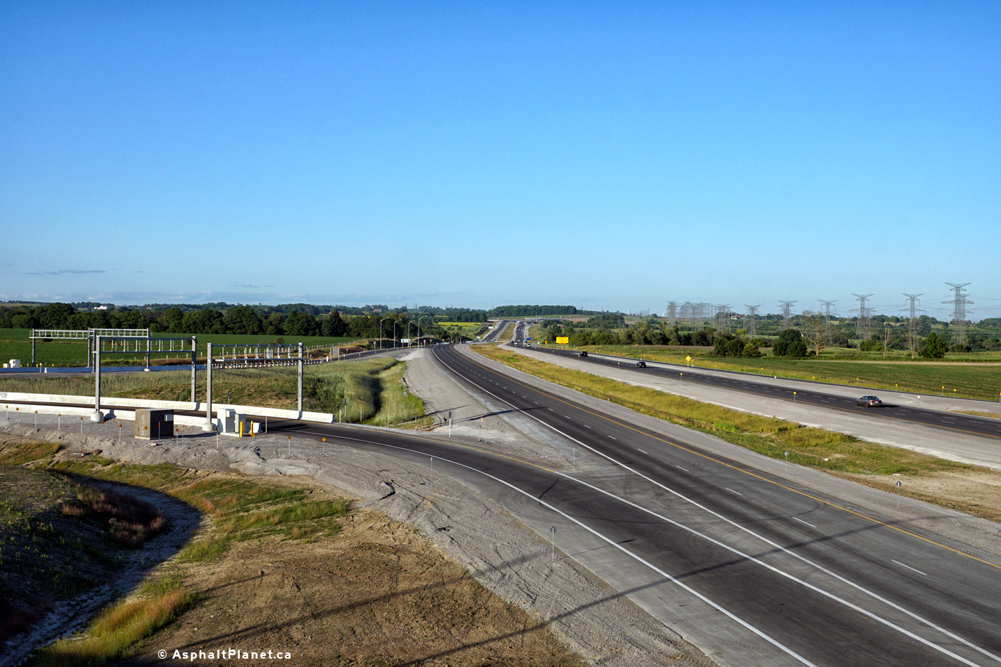
| City of Pickering Regional Municipality of Durham |
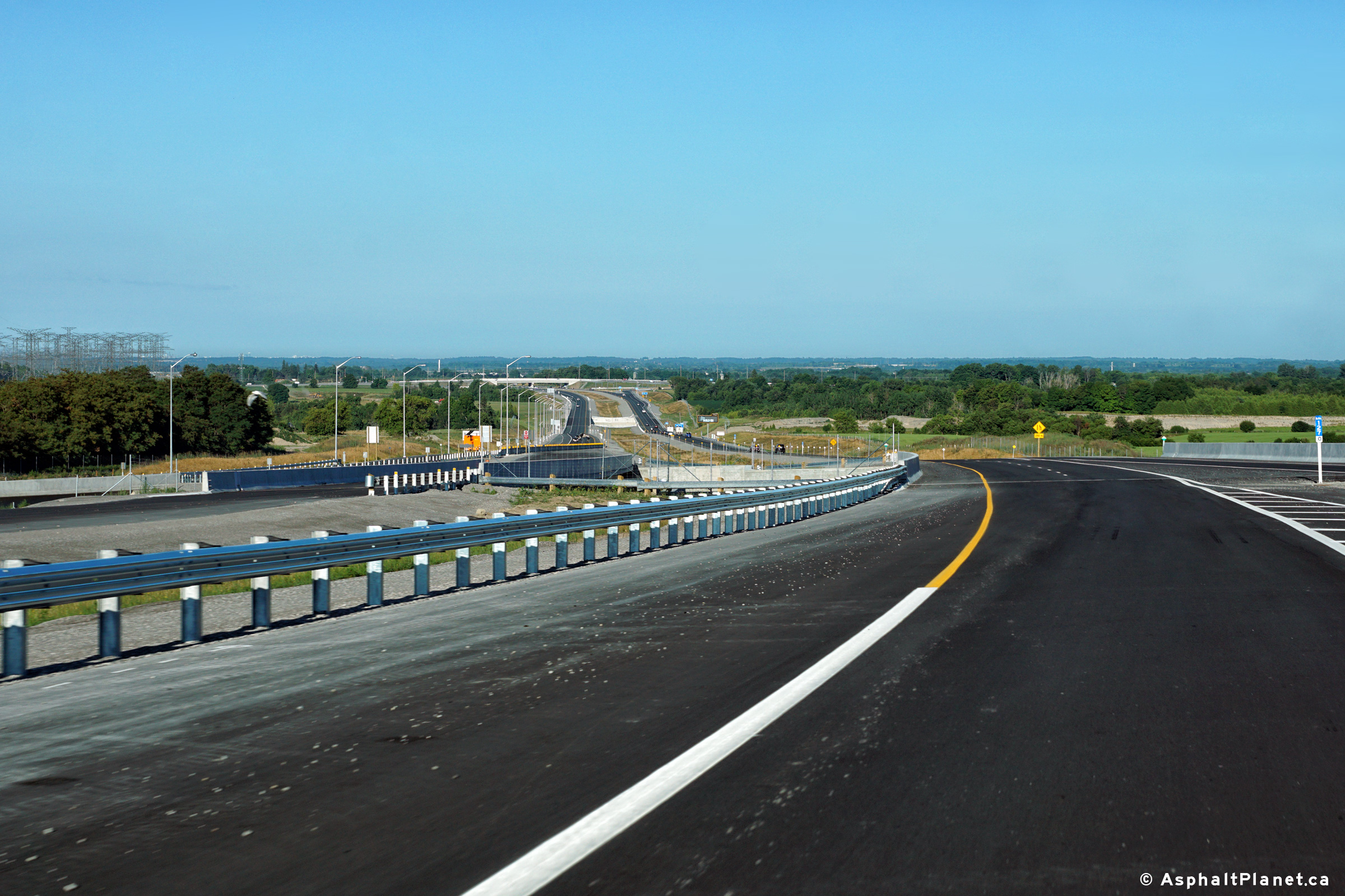
View looking westerly towards the Brock Road interchange from just west of
Sideline 14. When this photo was taken, work was still underway to
complete the westbound lanes through the Highway 7 grade separation. Photo taken: June 22nd, 2016. |
 (720x480) (1440x960) (2400x1600) |
||
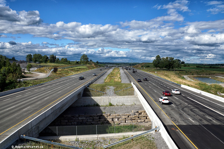
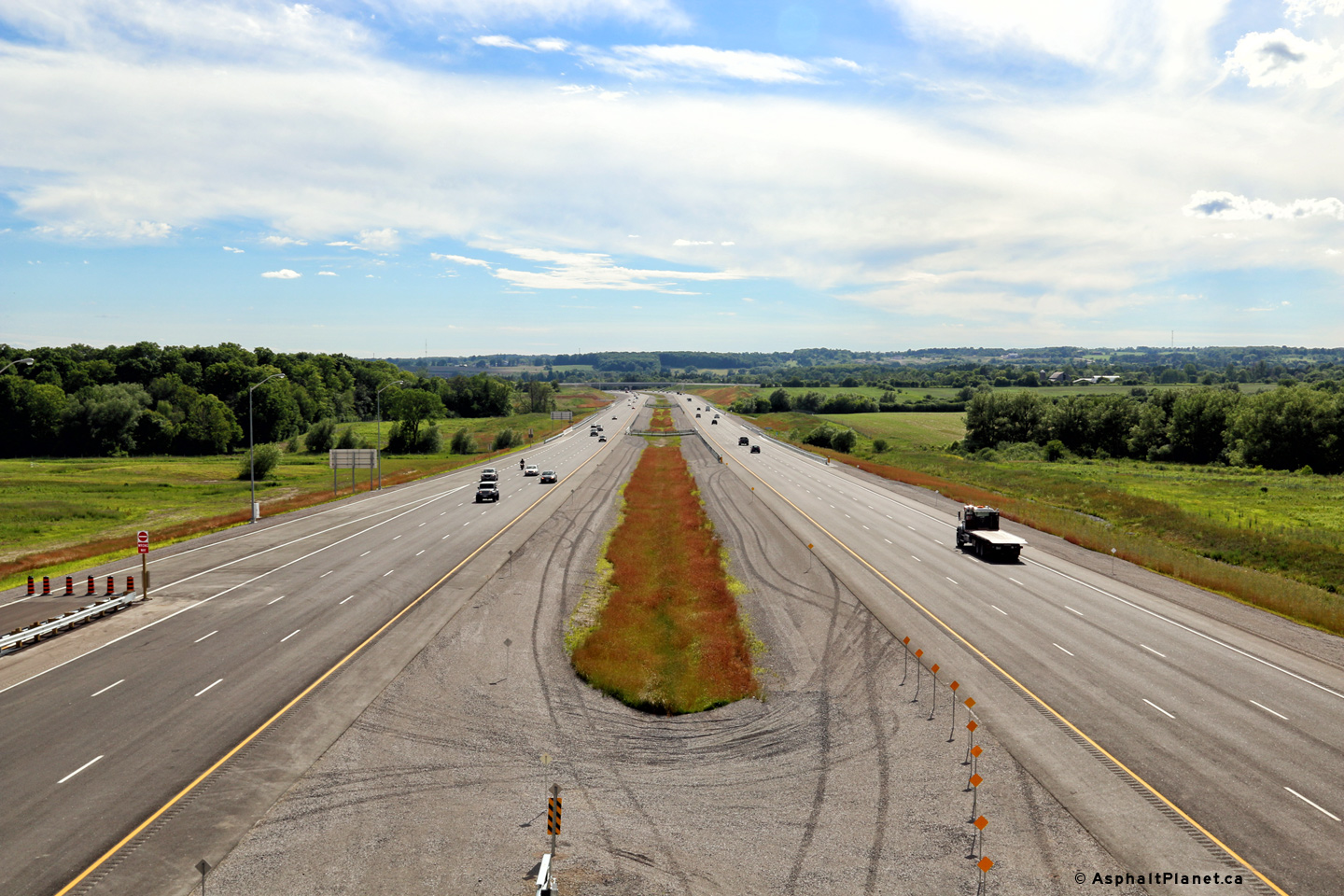
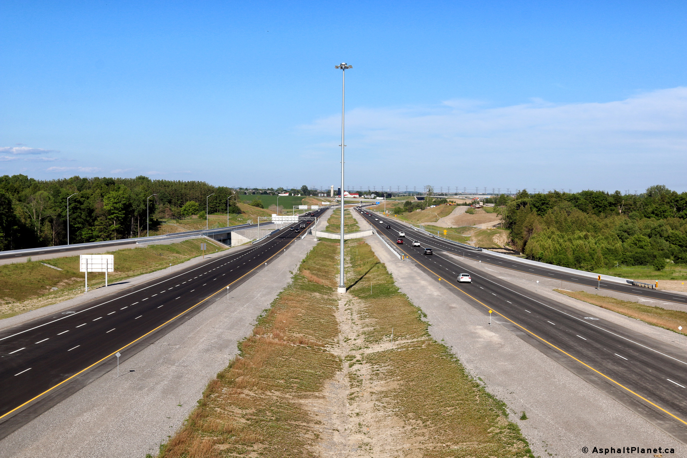
| City of Pickering Regional Municipality of Durham |
A series of views looking easterly from a high ridge to the north of Highway
407 and to the west of Sideline 14. Highway 407 passes over the east Duffins
Creek Valley in these photos. Photos taken: June 22nd, 2016. |
 (720x480) (1440x960) (2400x1600)  (720x480) (1440x960) (2400x1600) |
||
| City of Pickering Regional Municipality of Durham |
Westerly view from the Sideline 14 overpass. Photo taken: June 22nd, 2016. |
 (720x480) (1440x960) (2400x1600) |
||
| City of Pickering Regional Municipality of Durham |
Easterly view from the Sideline 14 overpass. Photo taken: June 22nd, 2016. |
 (720x480) (1440x960) (2400x1600) |
||
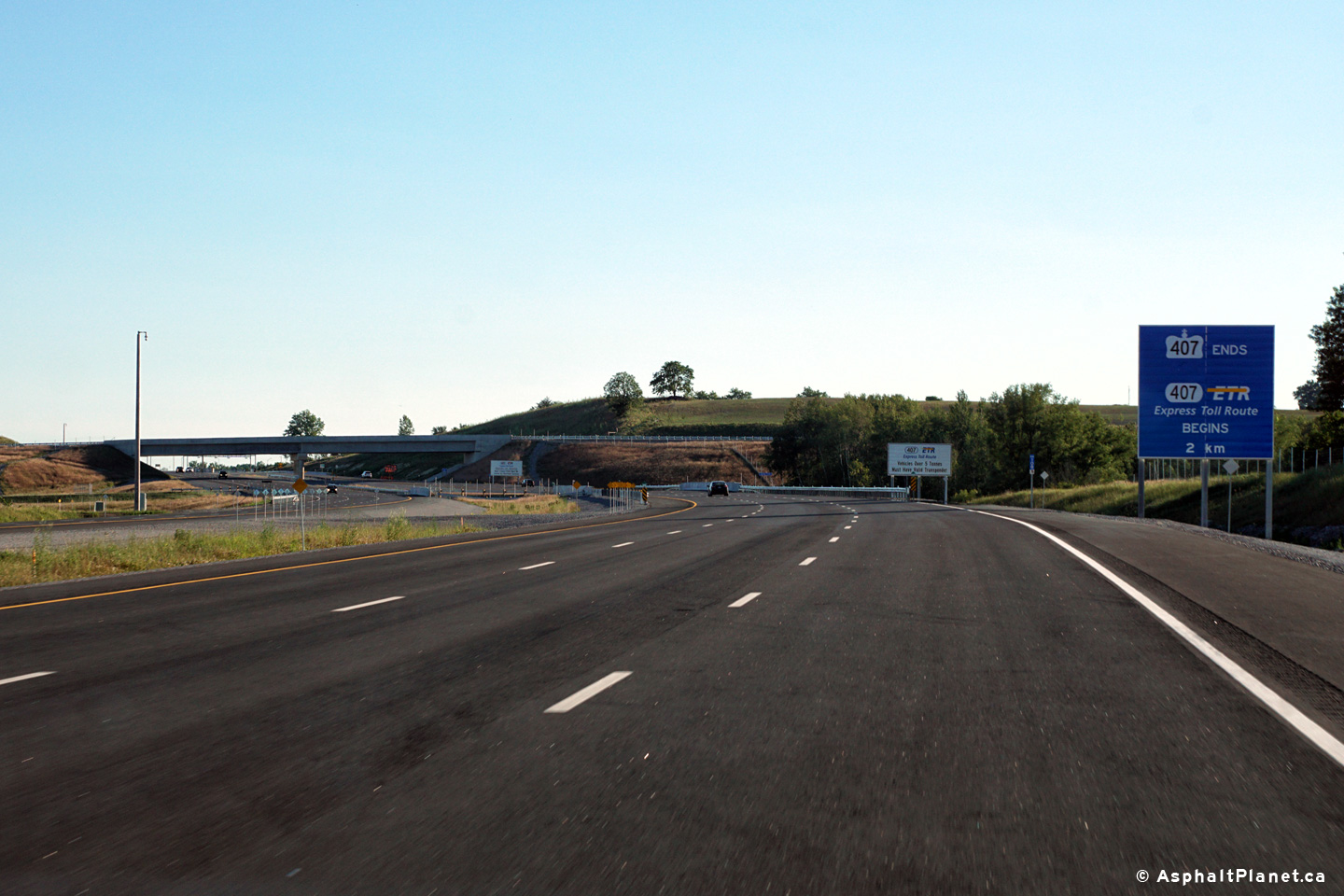
| City of Pickering Regional Municipality of Durham |
Advanced signage notifying westbound motorists that the provincial owned
section of Highway 407 ends ahead, and through motorists will be continuing
along Highway 407 ETR. While the provincial segment is free until
2017, tolls are still in effect on Highway 407 ETR. Photo taken: June 23rd, 2016. |
 (720x480) (720x480)(1440x960) (2400x1600) |
||
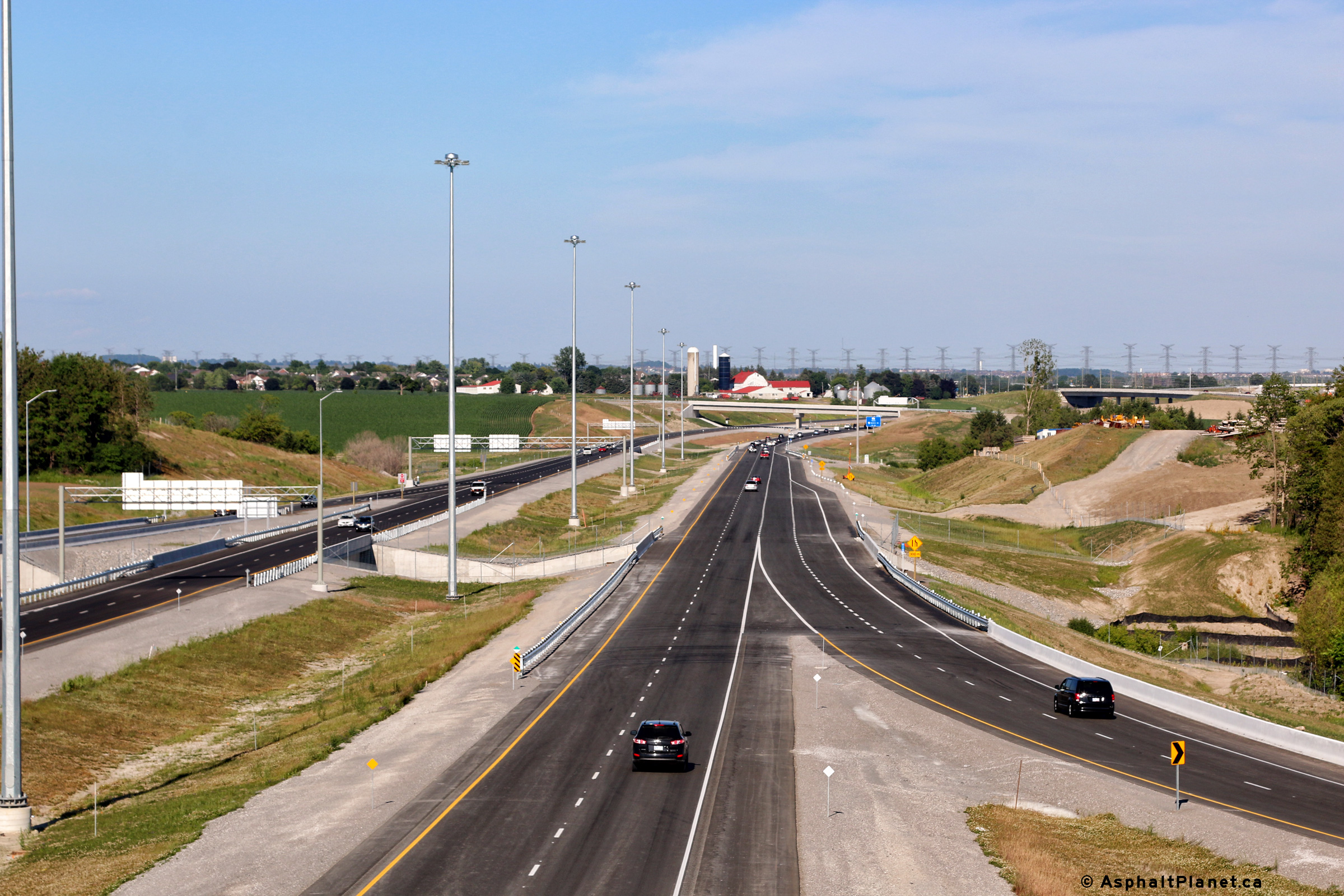
| City of Pickering Regional Municipality of Durham |
Views looking westerly from the Westney Road overpass along Highway 407. Photo taken: June 22nd, 2016. |
 (720x480) (1440x960) (2400x1600) 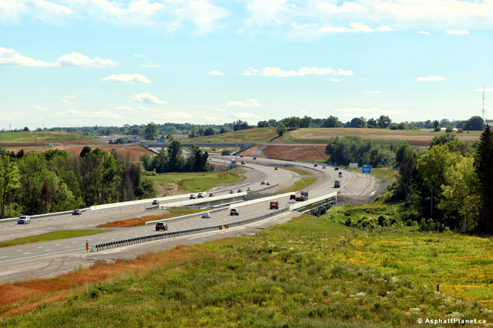 (720x480) (1440x960) (2400x1600) |
||
| City of Pickering Regional Municipality of Durham |
Easterly view from the Westney Road overpass. Photo taken: June 22nd, 2016. |
 (720x480) (1440x960) (2400x1600) |
||
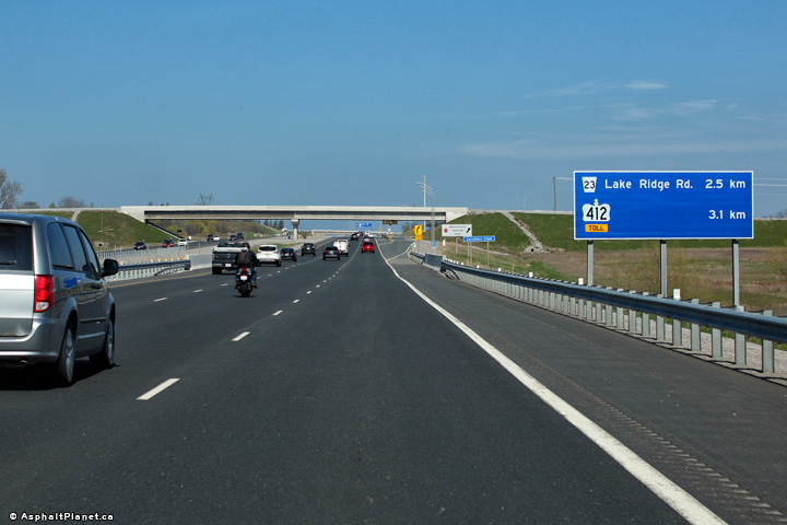
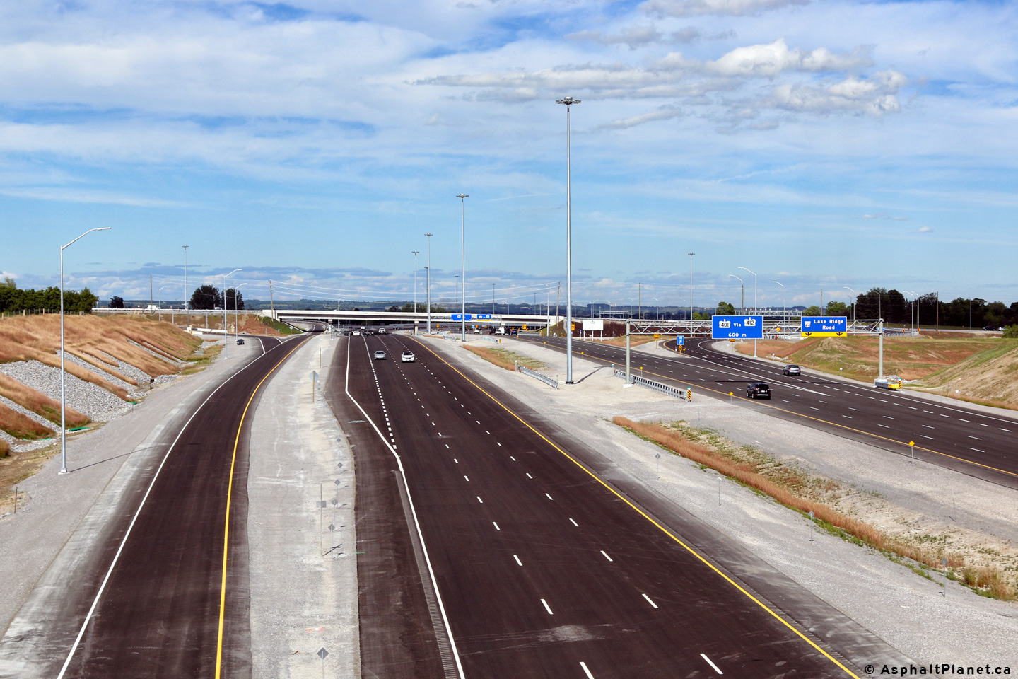
| City of Pickering Regional Municipality of Durham |
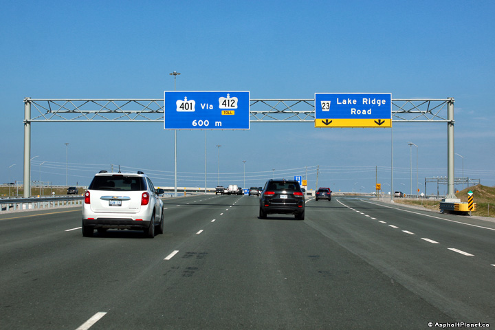
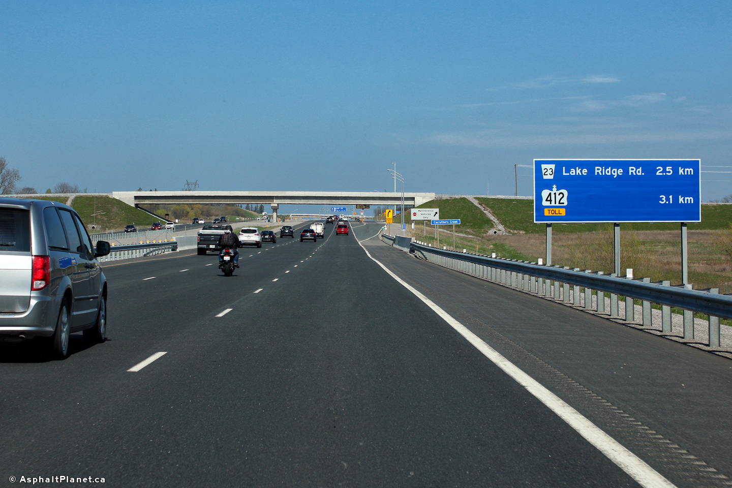
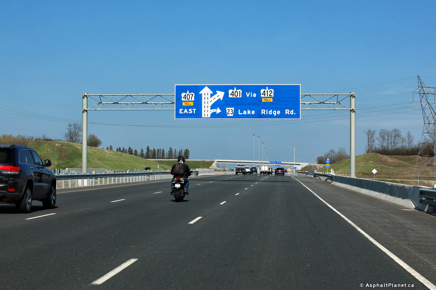
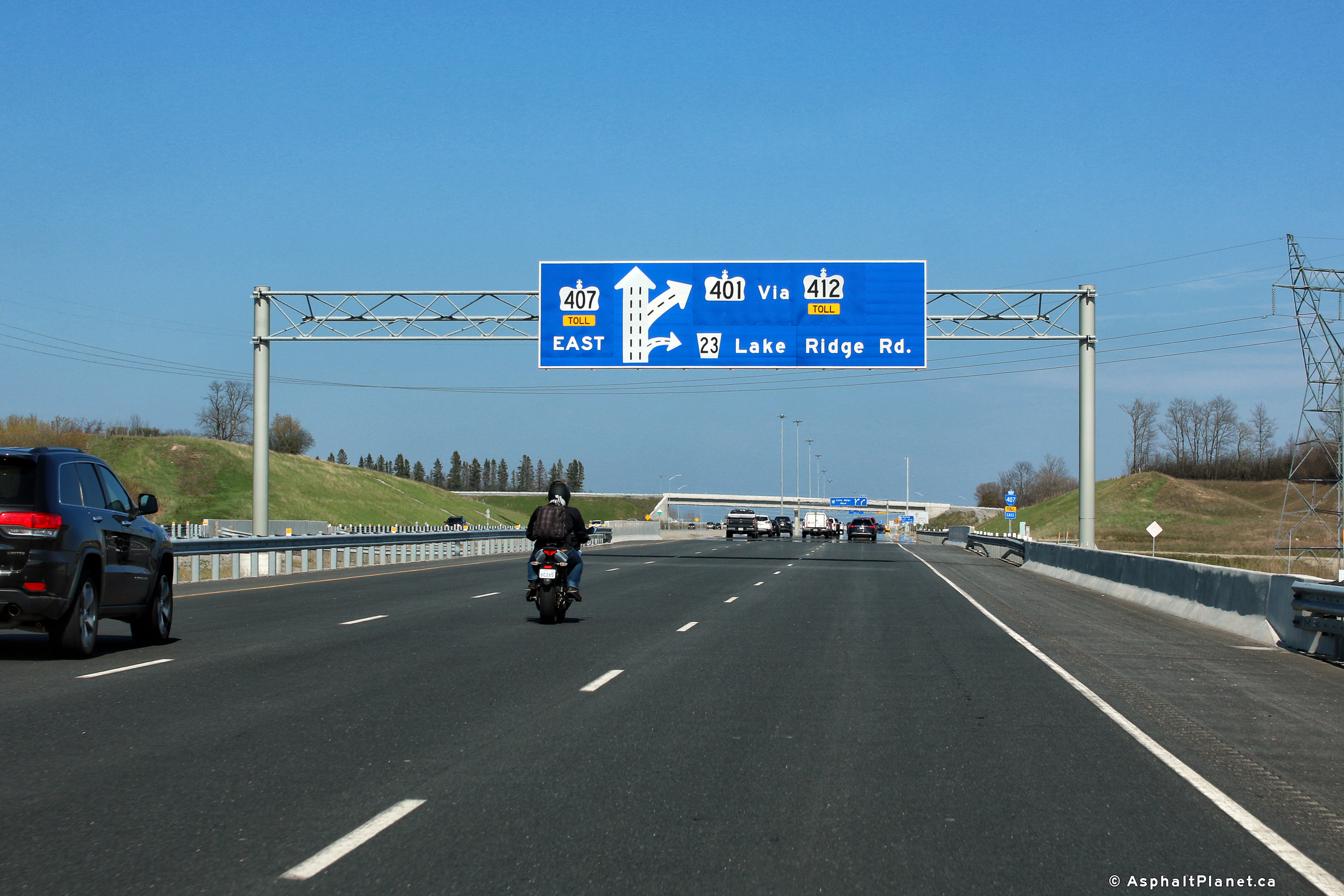
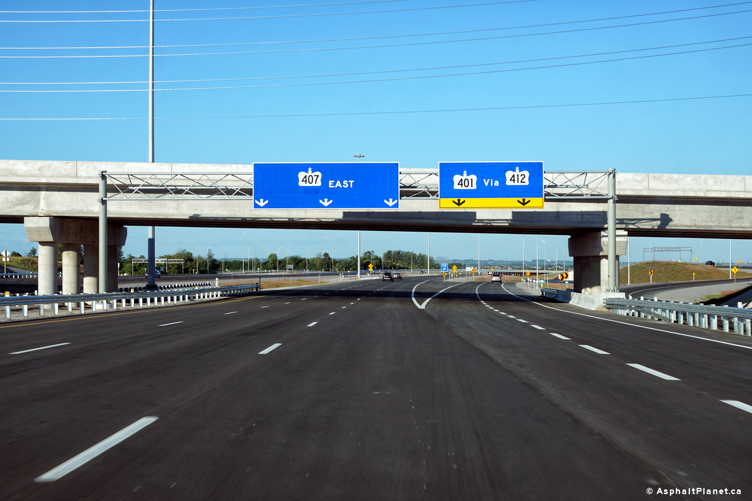
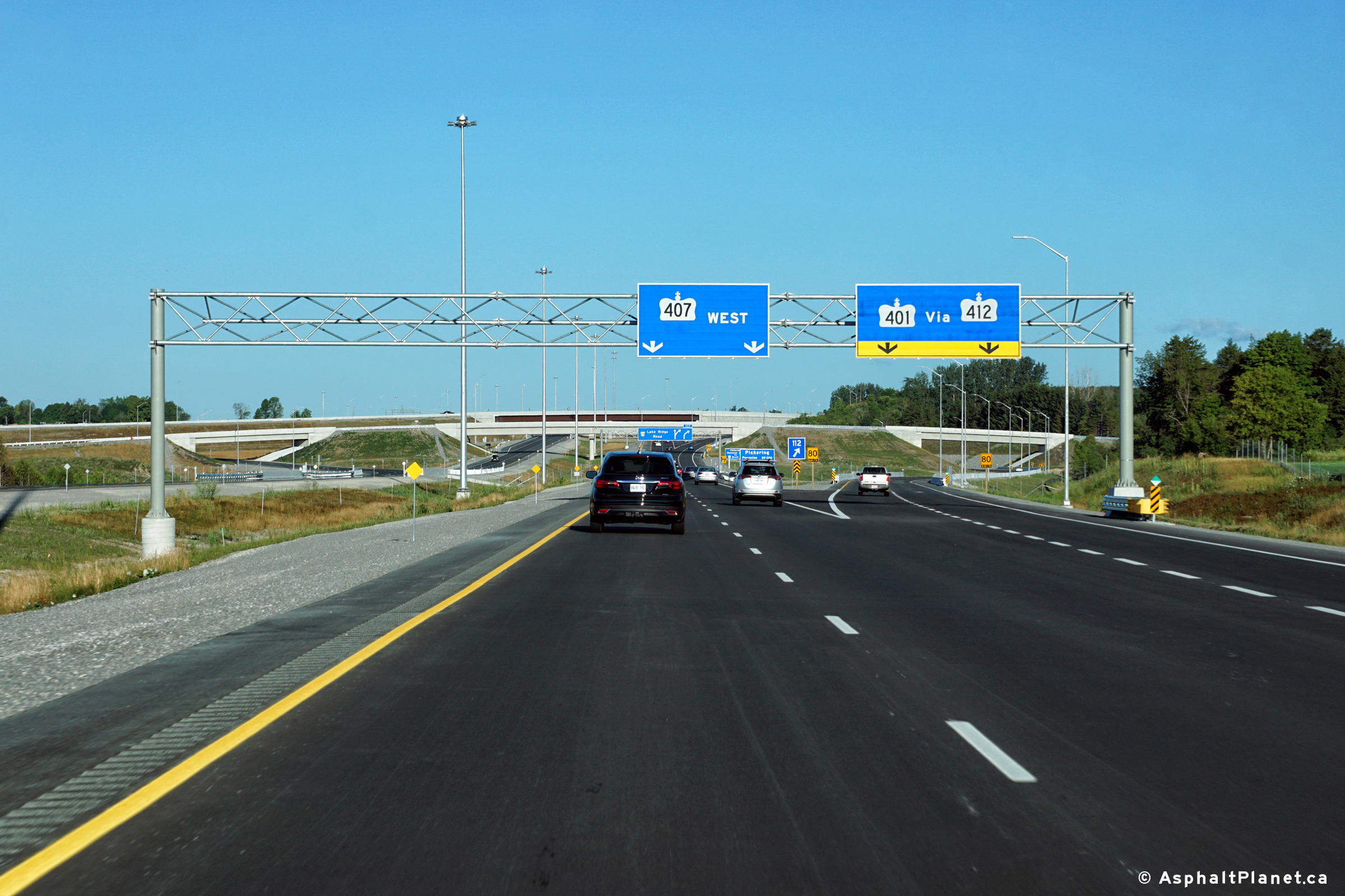
Ground mounted signage in advance of both the Lake Ridge Road and Highway
412 interchange. The 2017 photo shows the toll tab that has been added
to the signage to reflect the fact that since February 1, 2017 Highway 412
operates as a toll highway. Upper photo taken: June 23rd, 2016. Lower photo taken: April 28th, 2017. |
 (720x480) (720x480)(1440x960) (2400x1600) |
||
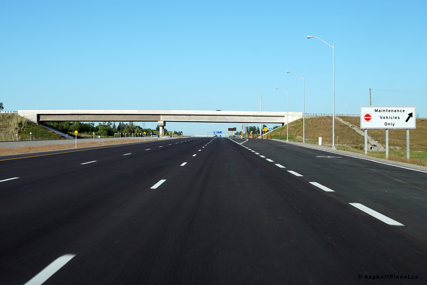
| City of Pickering Regional Municipality of Durham |
Signage for the maintenance access road at the Salem Road overpass.
Despite leading only to a maintenance patrol yard, this ramp has been
striped in the same manner as a conventional interchange. Photo taken: June 23rd, 2016. |
 (720x480) (720x480)(1440x960) (2400x1600) |
||
| City of Pickering Regional Municipality of Durham |
View looking westerly from the Salem Road overpass along Highway 407.
The slip ramp for maintenance vehicles entering the patrol yard is visible
adjacent to the eastbound lanes of the freeway. Photo taken: June 22nd, 2016. |
 (720x480) (1440x960) (2400x1600) 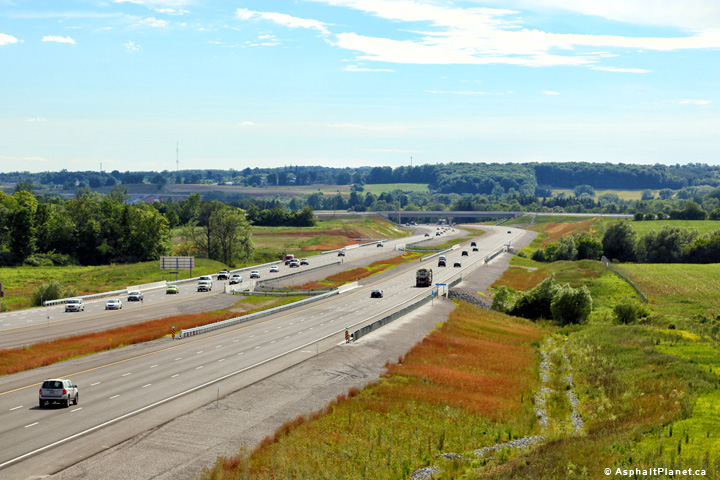 (720x480) (1440x960) (2400x1600) |
||
| City of Pickering Regional Municipality of Durham |
Two views looking easterly from the Salem Road overpass along Highway 407.
The upper photo highlights the maintenance access road that provides access
to the patrol yard located immediately to the east of the Salem Road
overpass. This access will be removed once the deferred Salem Road
interchange is opened to traffic. Photos taken: June 22nd, 2016. |
 (720x480) (1440x960) (2400x1600)  (720x480) (1440x960) (2400x1600) |
||
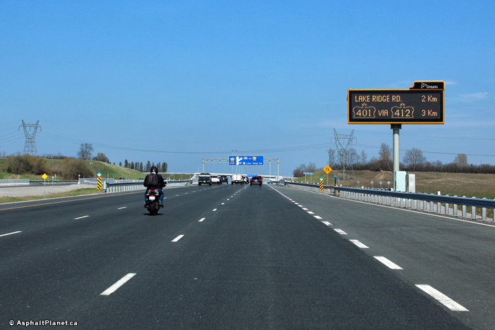
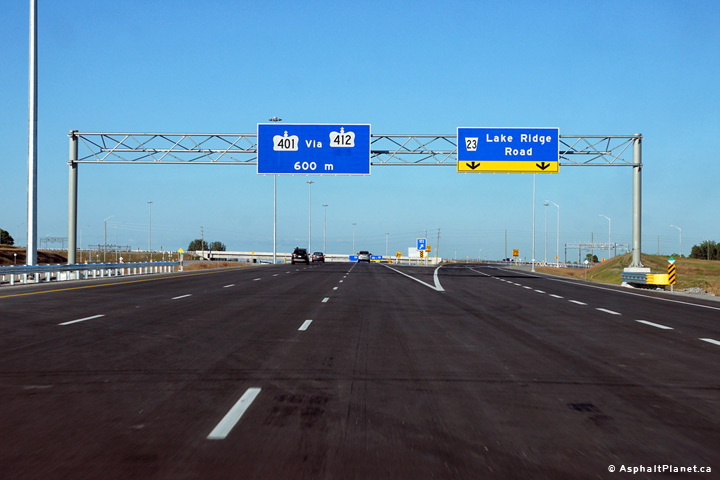
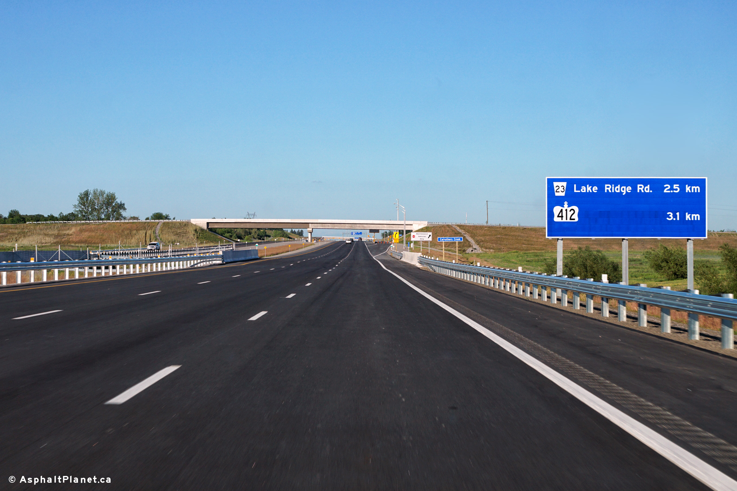
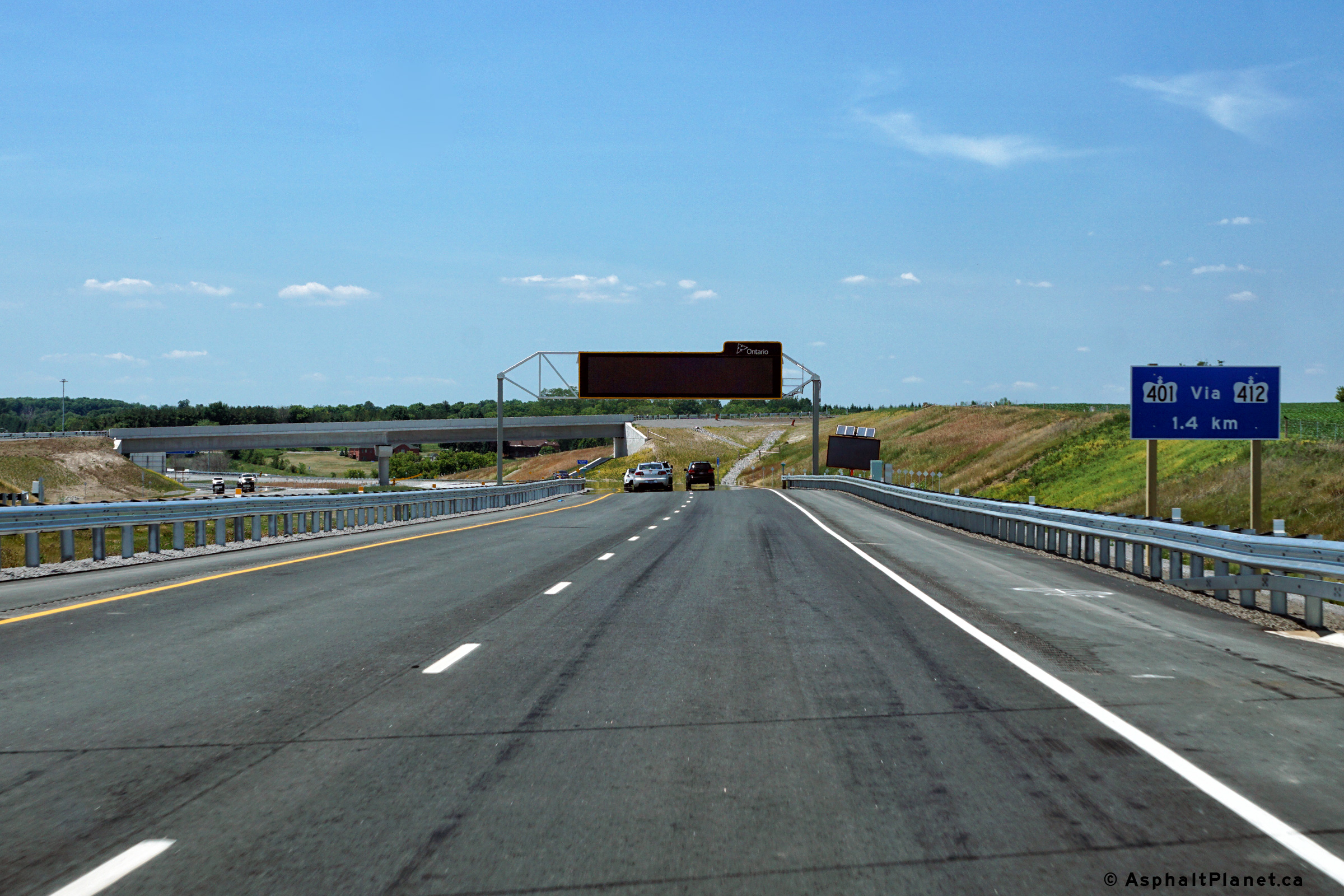
| City of Pickering Regional Municipality of Durham |
The CMS sign that stands in advance of the Highway 412 and Lake Ridge Road
interchange often serves as an additional pre-advance sign for the upcoming
interchanges. Photo taken: April 28th, 2017. |
 720x480) 720x480)(1440x960) (2400x1600) |
||
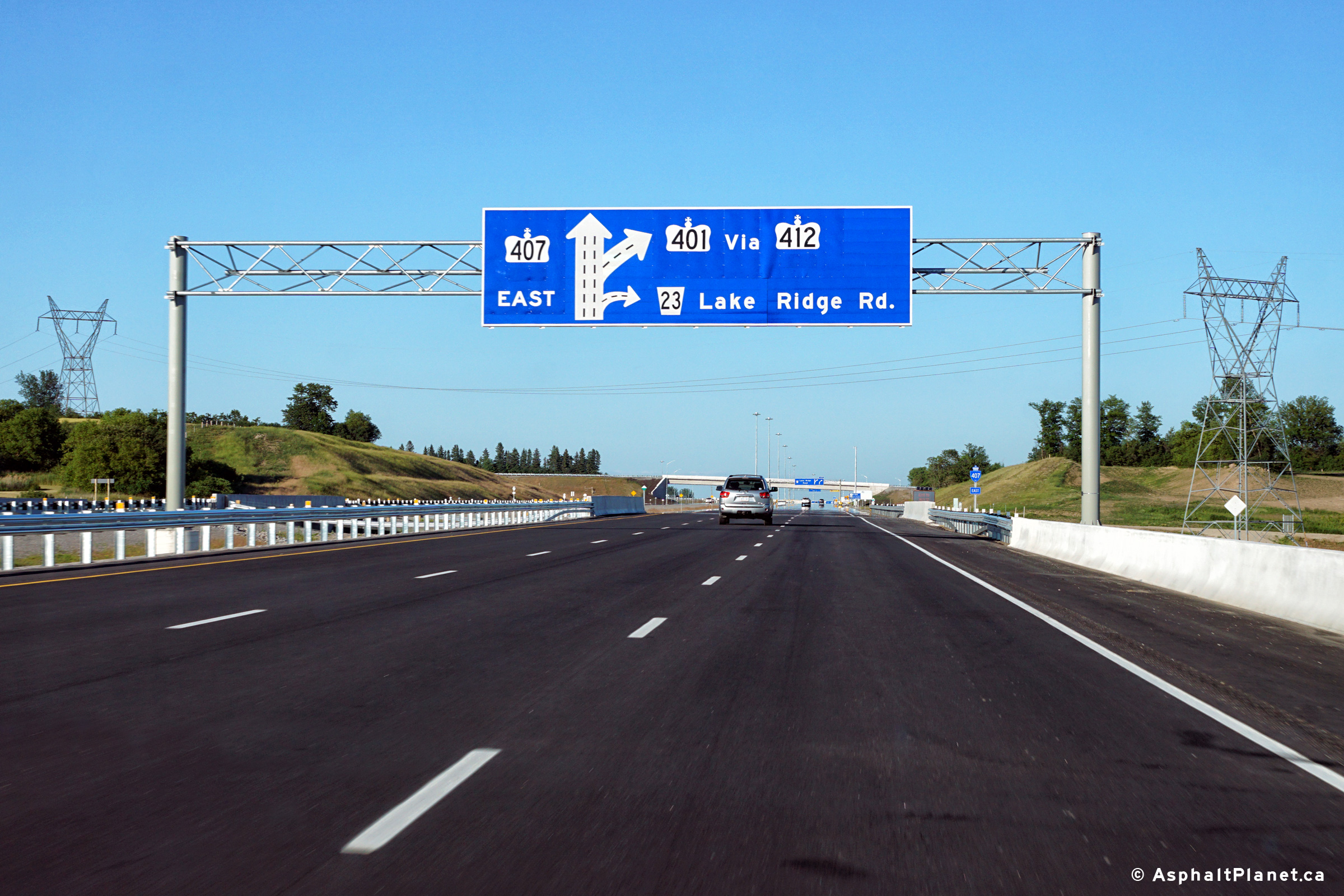
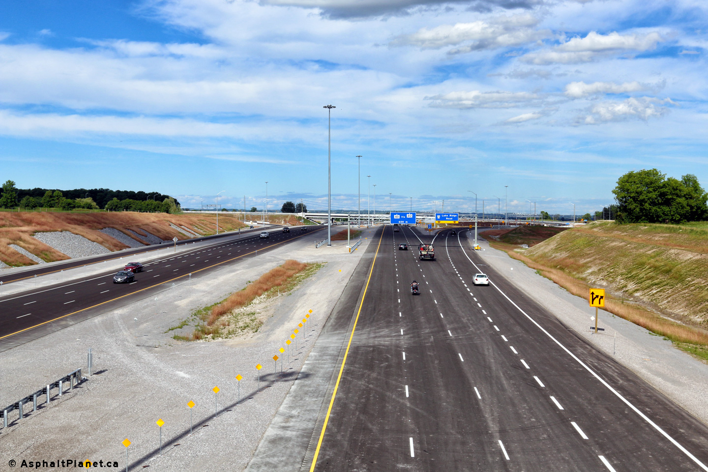
| City of Pickering Regional Municipality of Durham |
Advanced diagram sign for both the Lake Ridge Road and Highway 412
interchange. Upper photo taken: June 23rd, 2016. Lower photo taken: April 28th, 2017. |
 (720x480) (720x480)(1440x960) (2400x1600) |
||
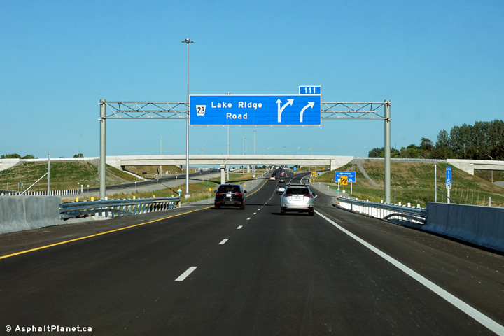
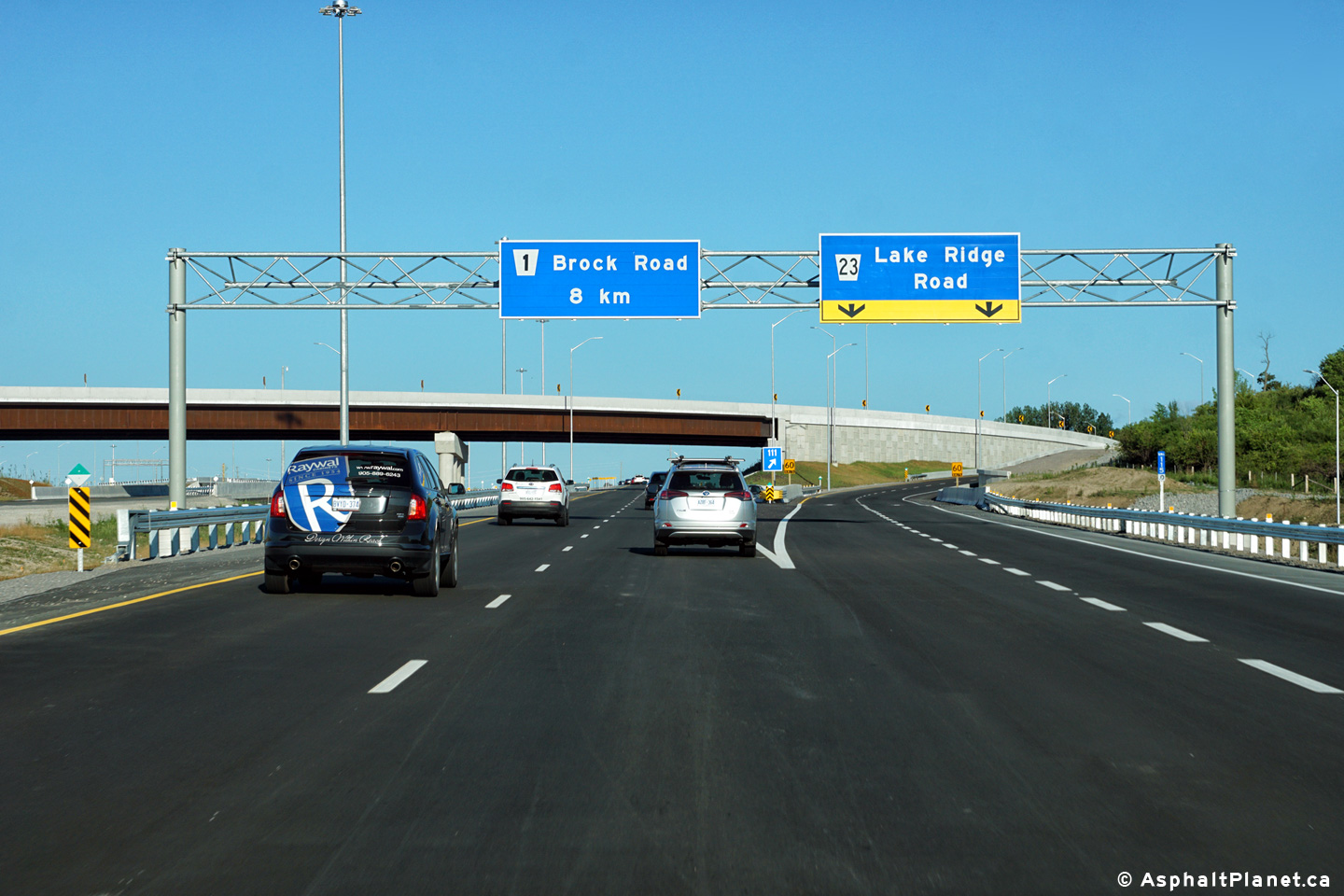
| City of Pickering Regional Municipality of Durham |
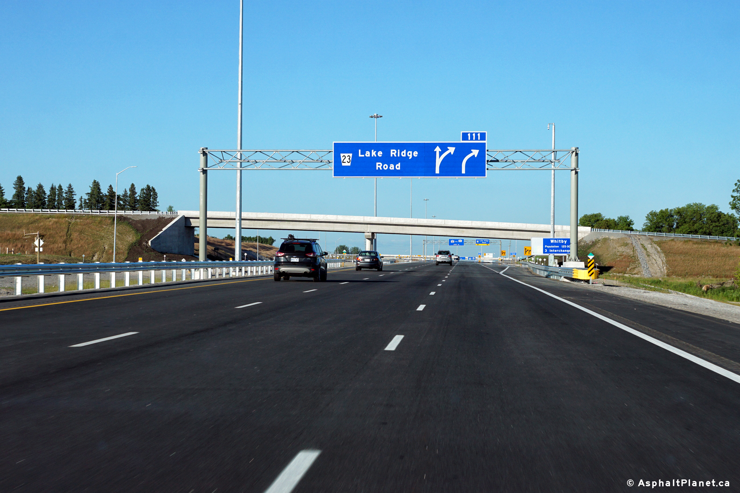
Eastbound advanced signage for the Lake Ridge Road interchange. Photo taken: June 23rd, 2016. |
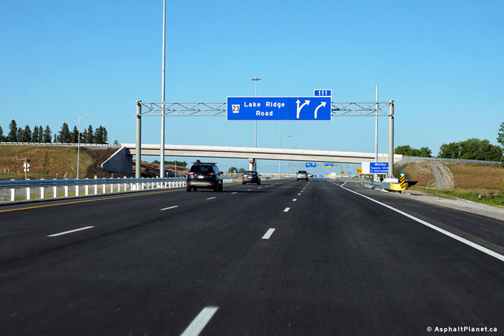 (720x480) (720x480)(1440x960) (2400x1600) |
||
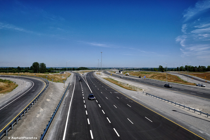
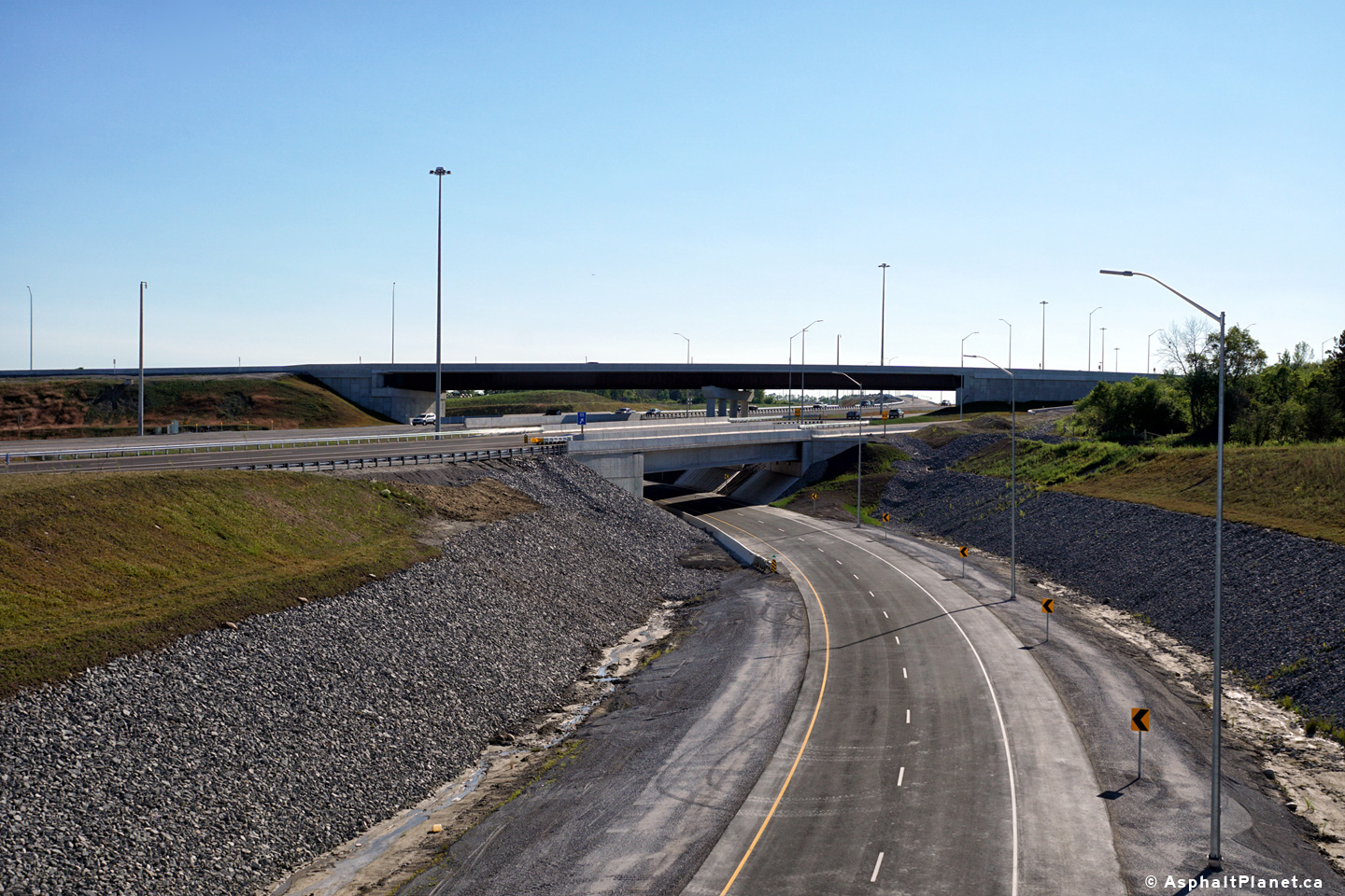
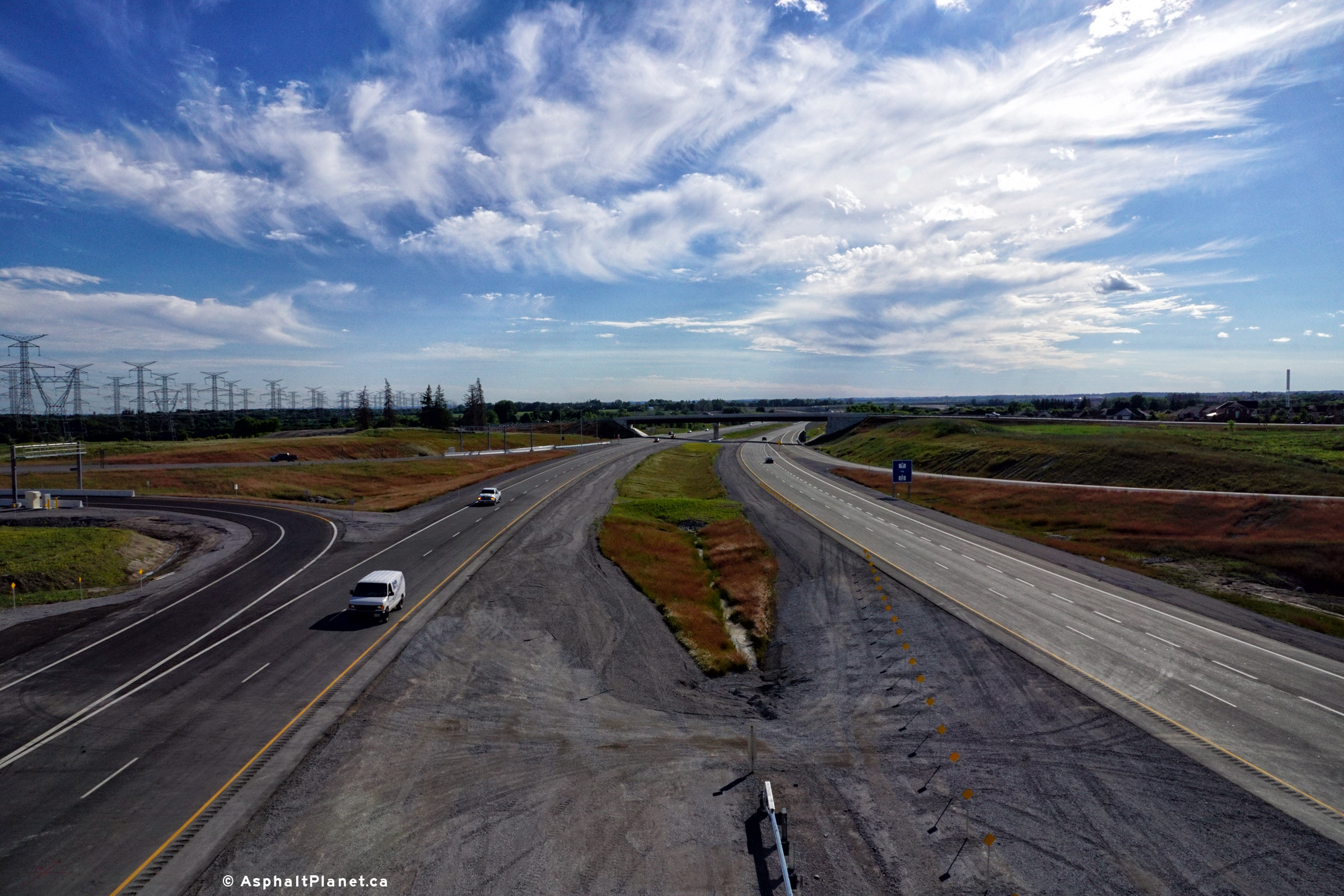
| City of Pickering Regional Municipality of Durham |
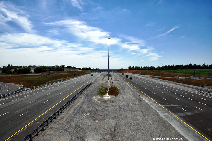
Two views looking westerly along Highway 407 from the Kinsale Road overpass. Photos taken: June 22nd, 2016. |
 (720x480) (1440x960) (2400x1600)  (720x480) (1440x960) (2400x1600) |
||
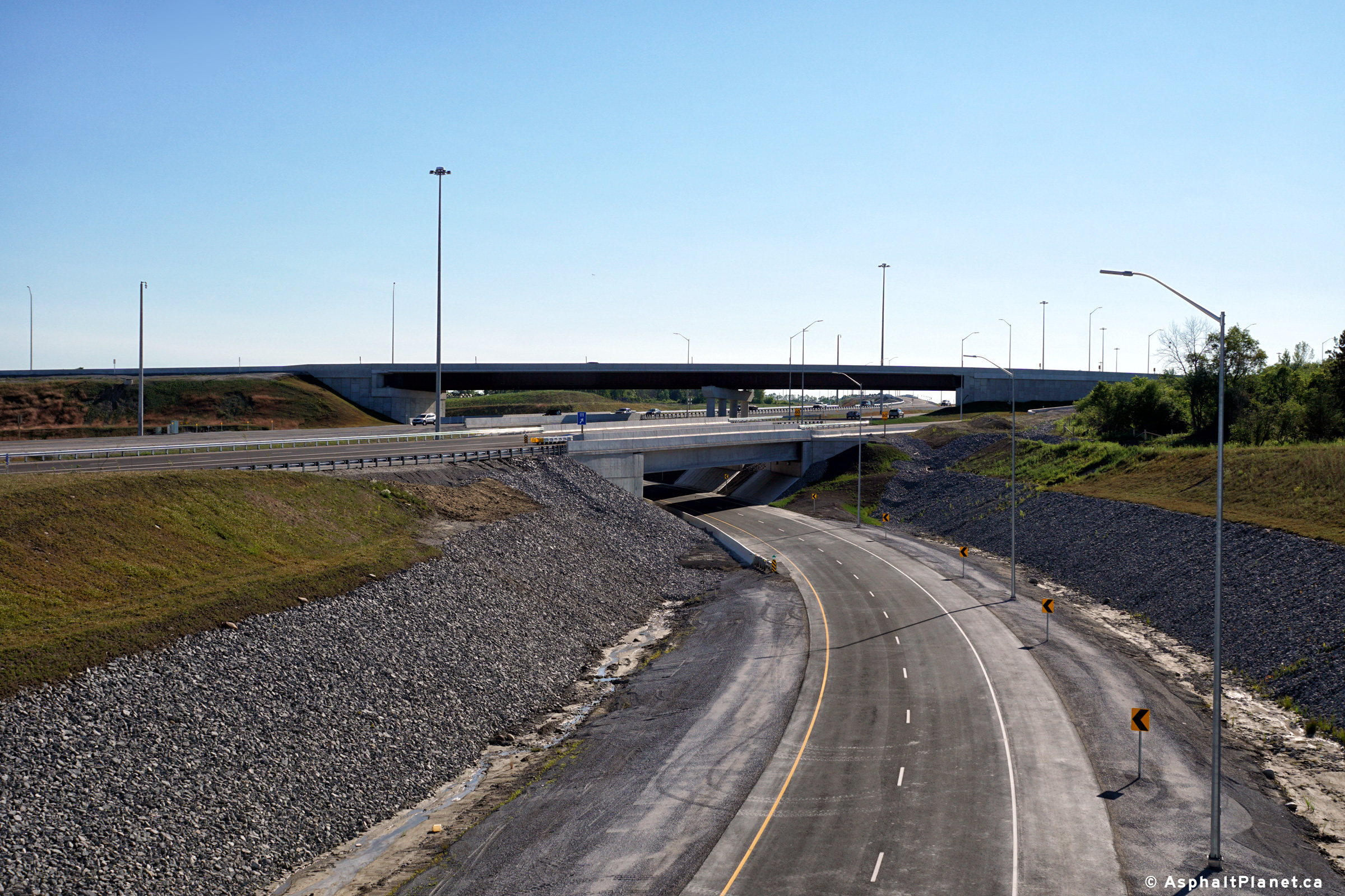
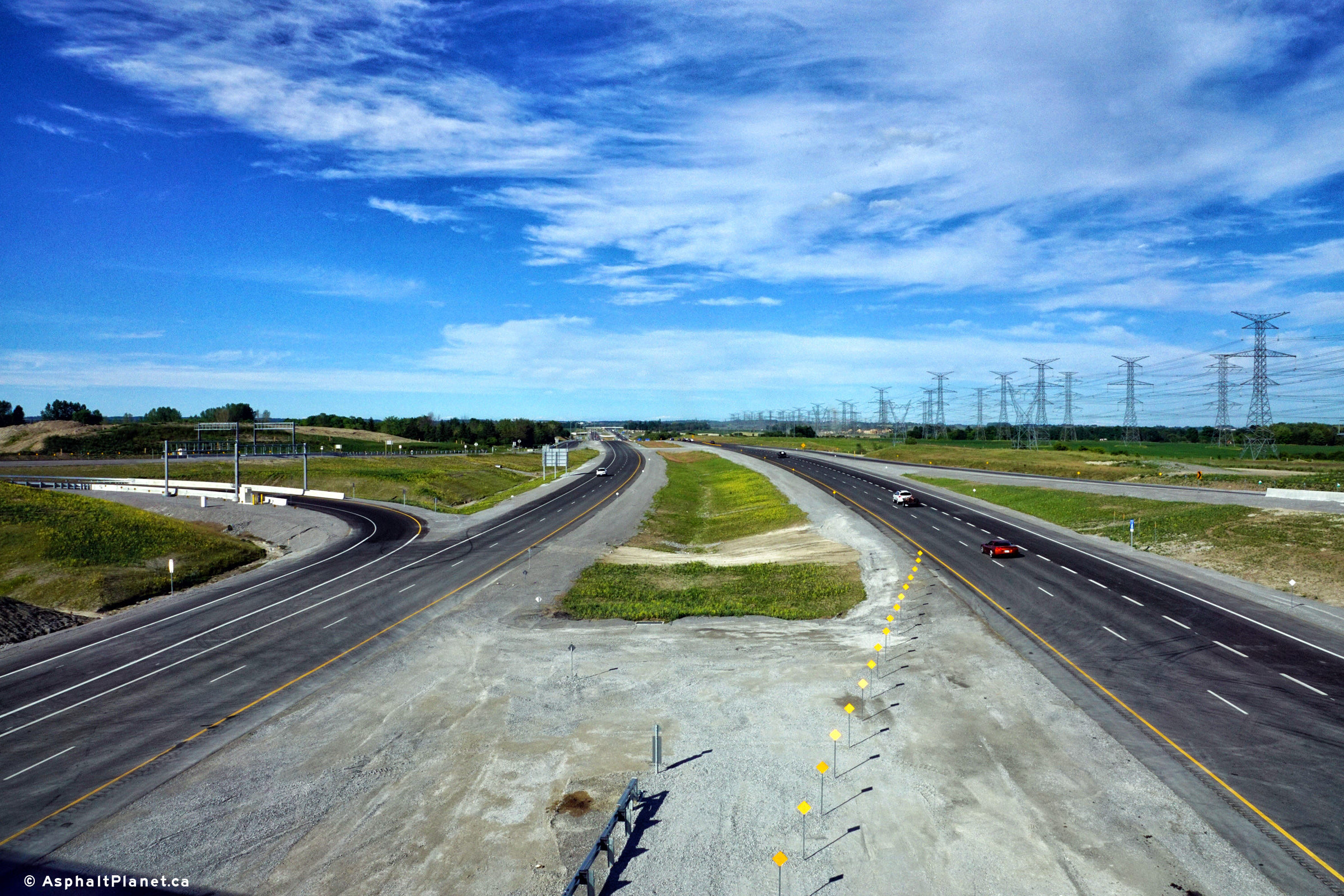
| City of Pickering Regional Municipality of Durham |
Two views looking easterly along Highway 407 towards the Lake Ridge Road
interchange from the Kinsale Road overpass. Due to its close proximity
to the Highway 412 interchange, both westbound on-ramps to Highway 407 join
to form a sub-collector ramp before joining the tollway's mainline beneath
the Kinsale Road overpass. Photo taken: June 22nd, 2016. |
 (720x480) (1440x960) (2400x1600) 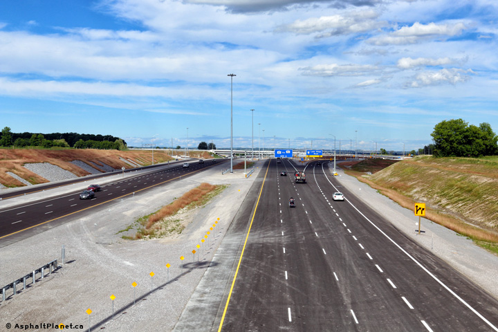 (720x480) (1440x960) (2400x1600) |
||
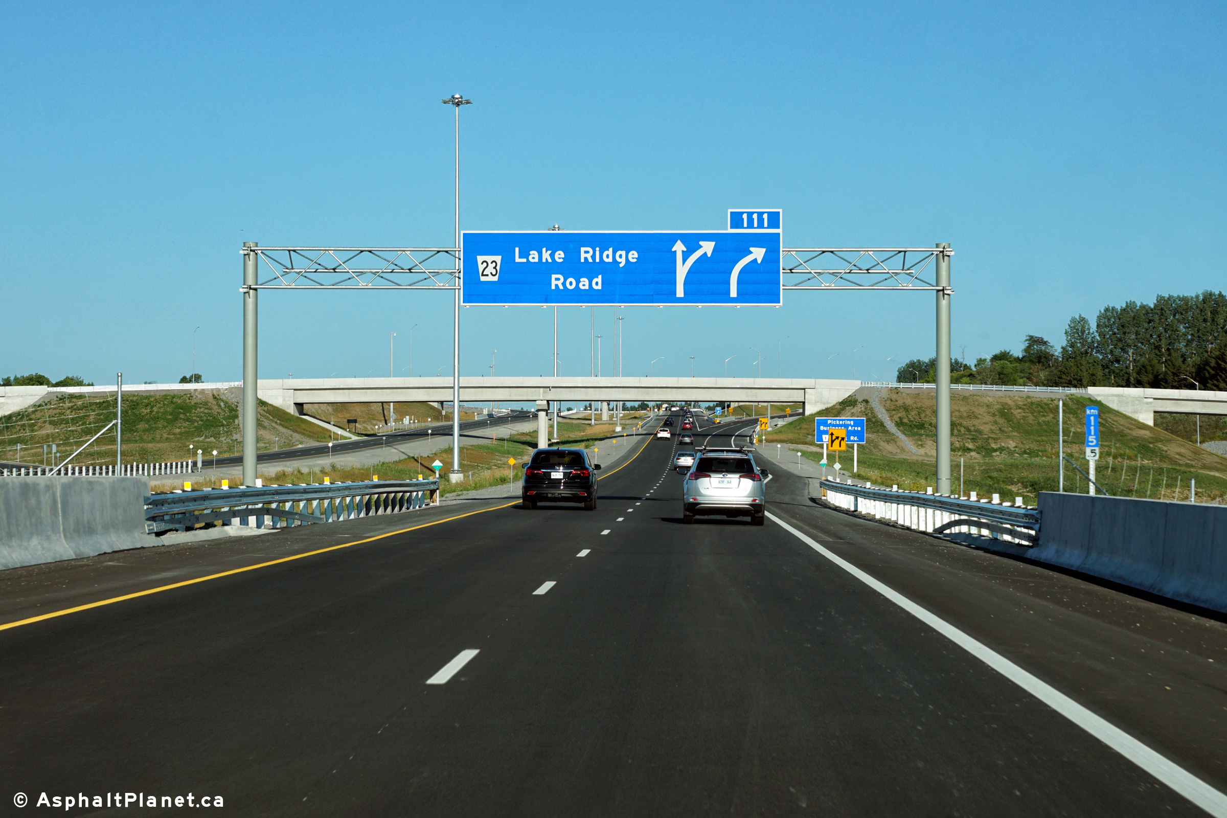
| City of Pickering Regional Municipality of Durham |
Eastbound signage at the off-ramp to Lake Ridge Road. Upper photo taken: June 23rd, 2016. Lower photo taken: April 28th, 2017. |
 (720x480) (720x480)(1440x960) (2400x1600) |
||
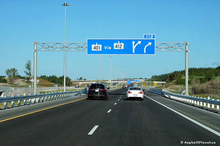
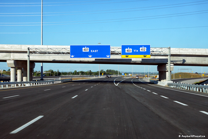
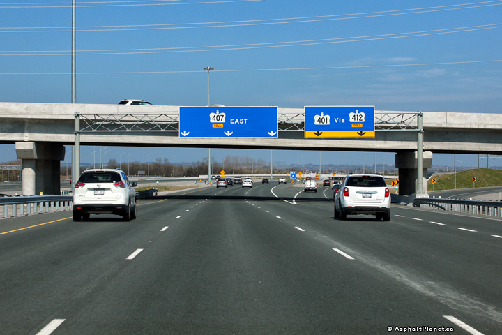
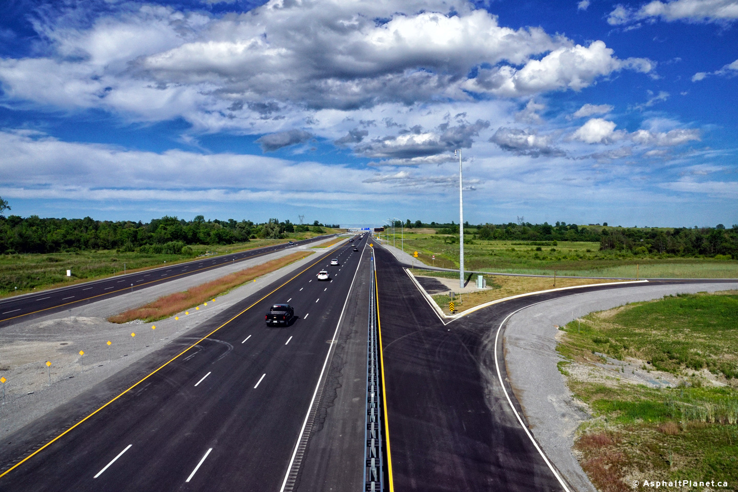
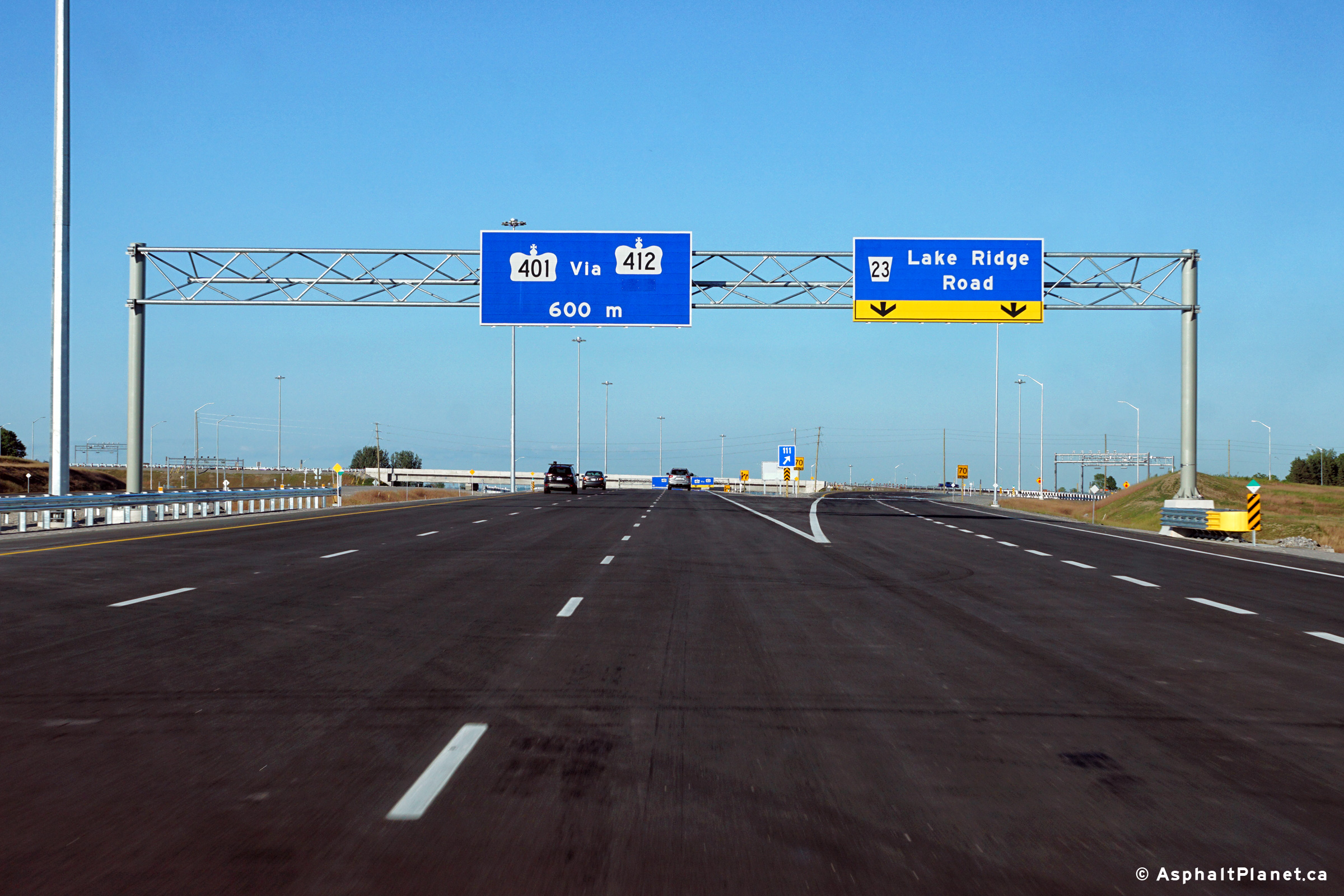
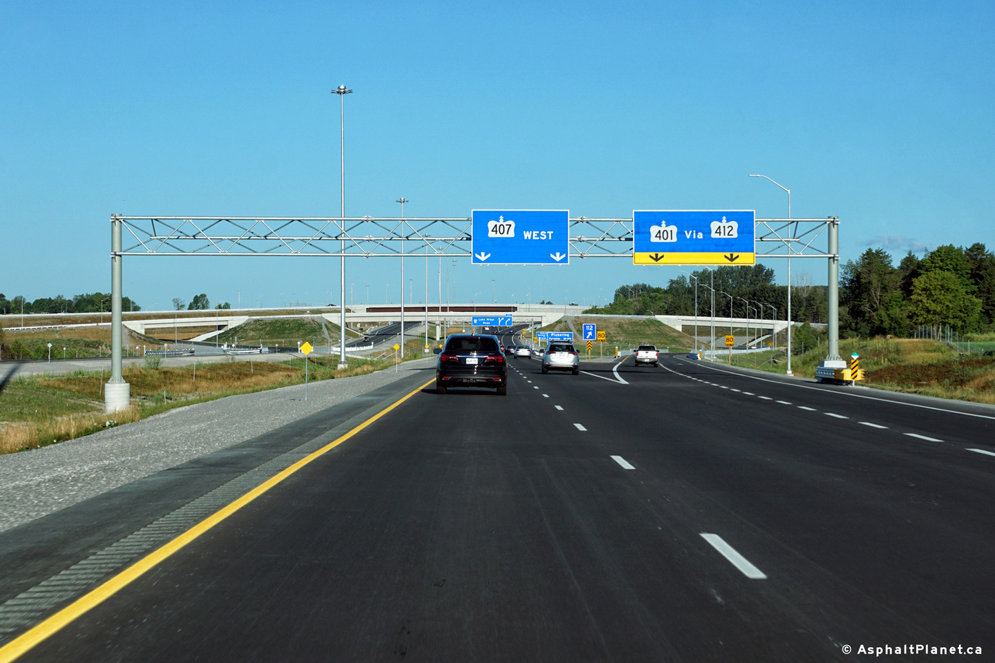
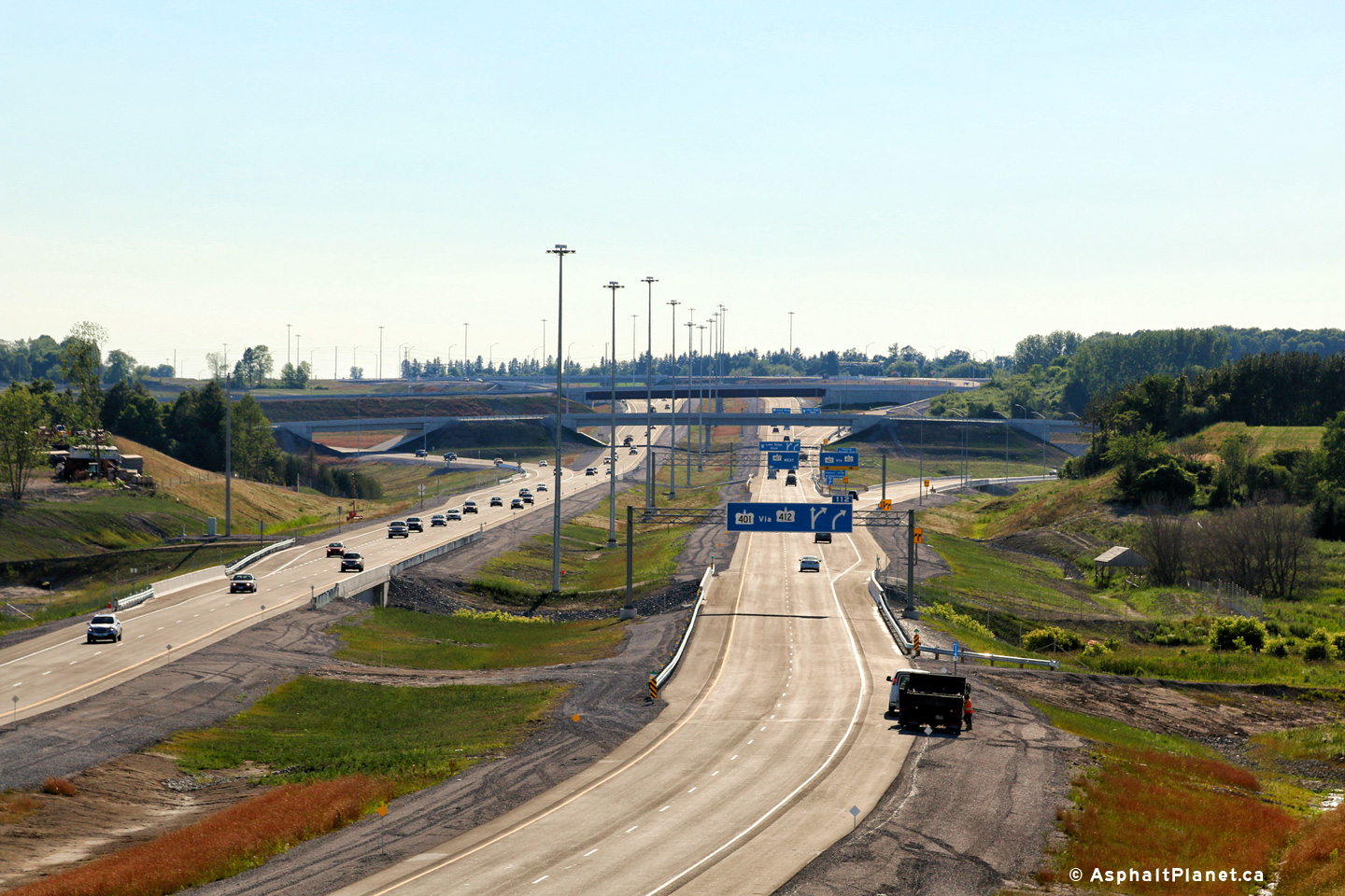
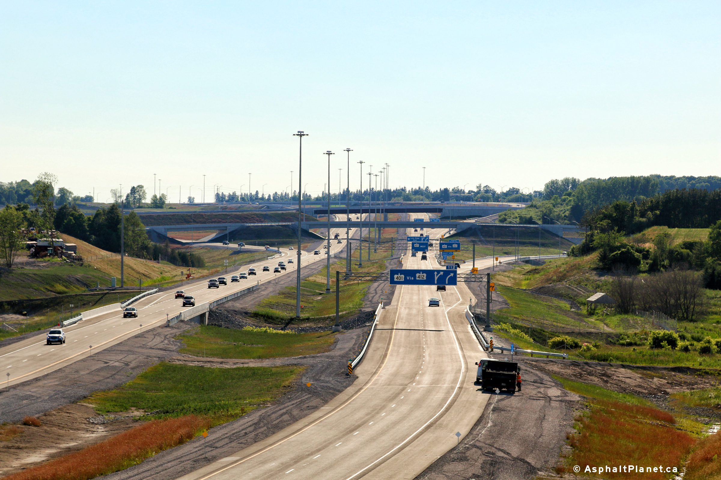
| City of Pickering Regional Municipality of Durham |
Easterly view as the ramp to Highway 412 departs from the mainline of
Highway 407. The Lake Ridge Road overpass is visible beyond the
signage. Upper photo taken: June 23rd, 2016. Lower photo taken: April 28th, 2017. |
|
||
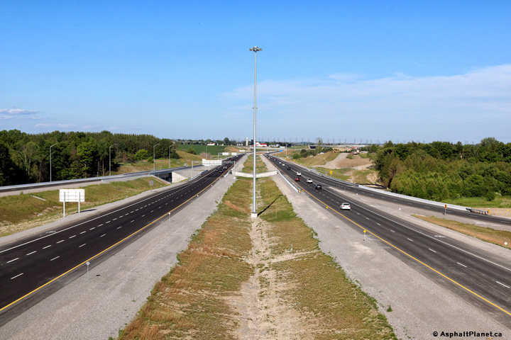
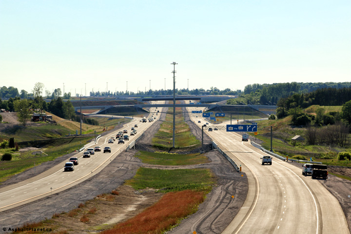
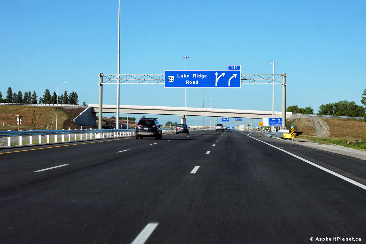
| City of Pickering Regional Municipality of Durham |
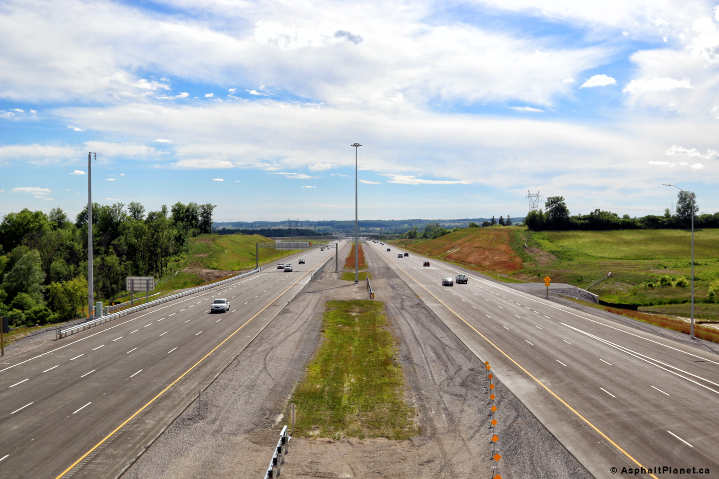
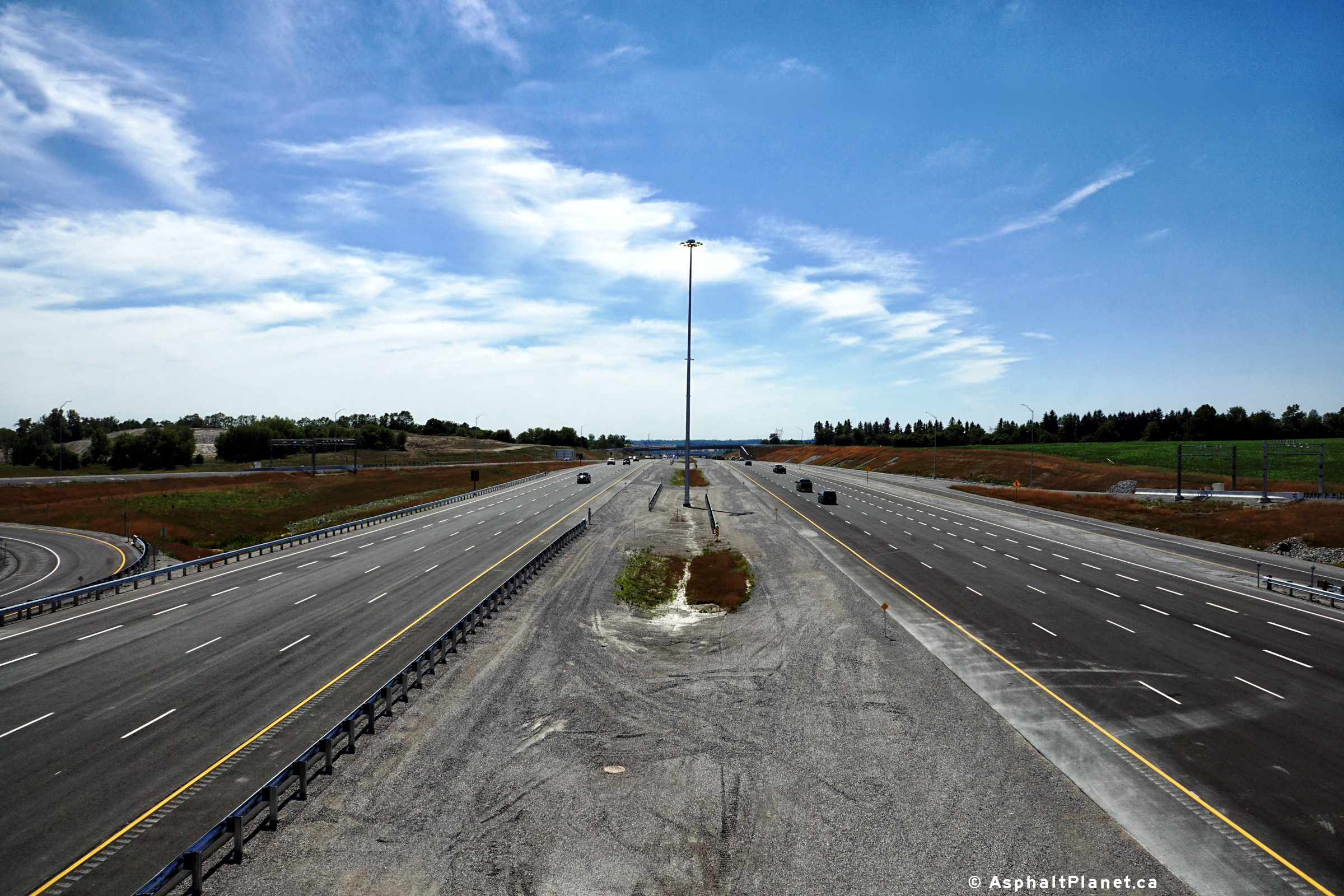
Two views looking westerly from the Lake Ridge Road overpass along Highway
407. Photos taken: July 4th, 2016. |
 (720x480) (1440x960) (2400x1600) 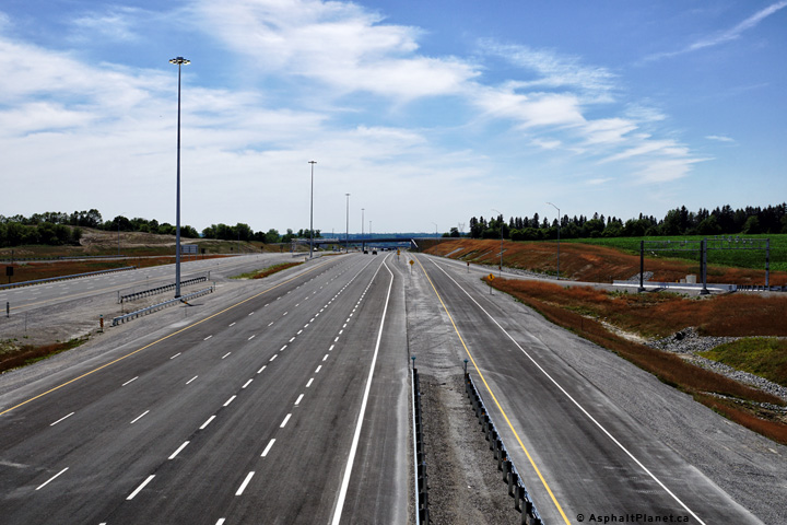 (720x480) (1440x960) (2400x1600) |
||
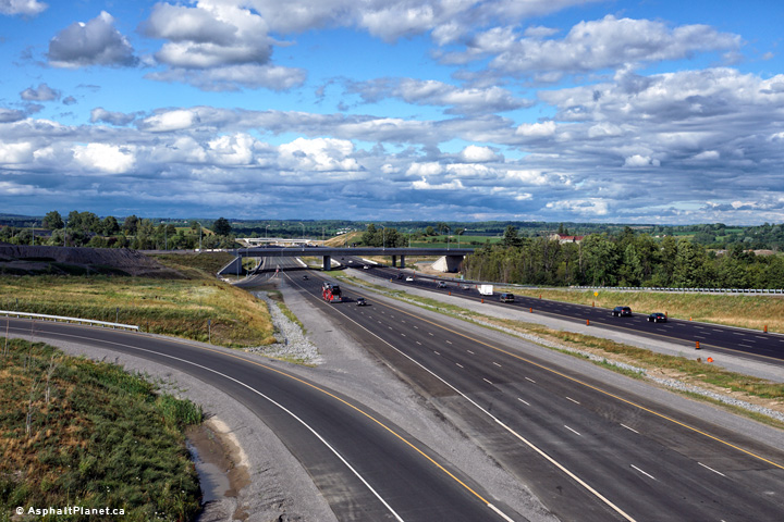
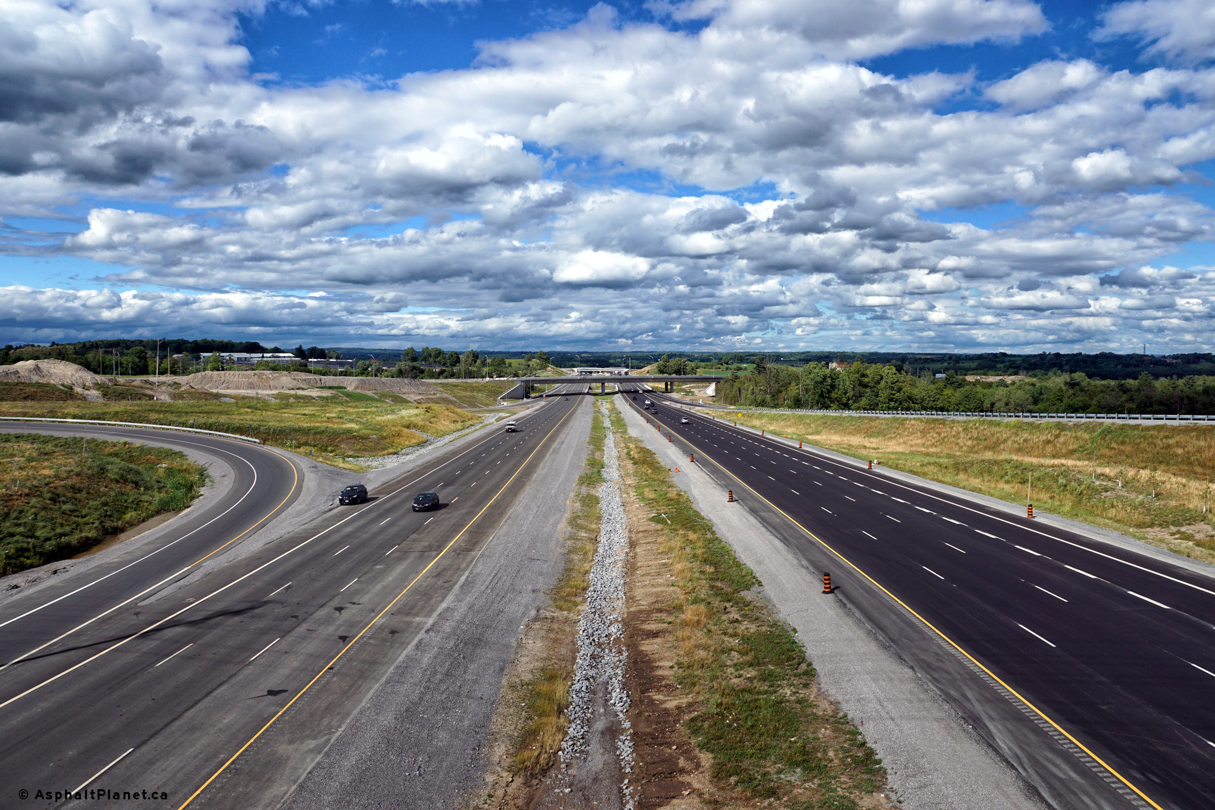
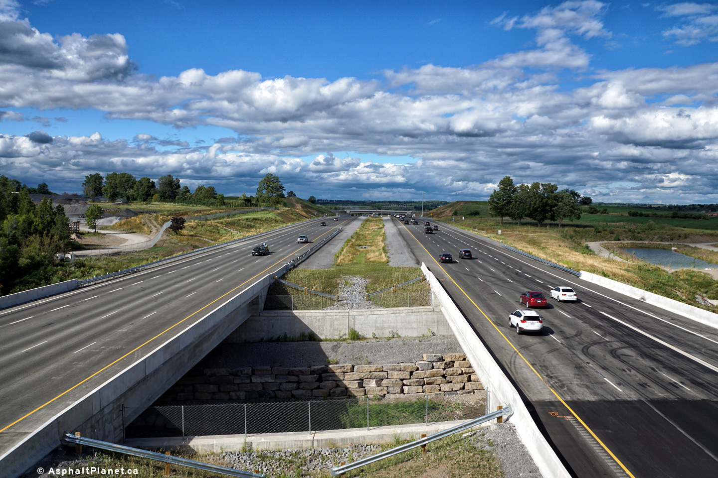
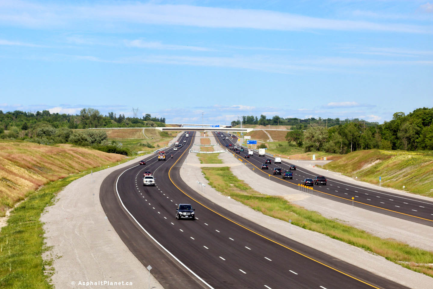
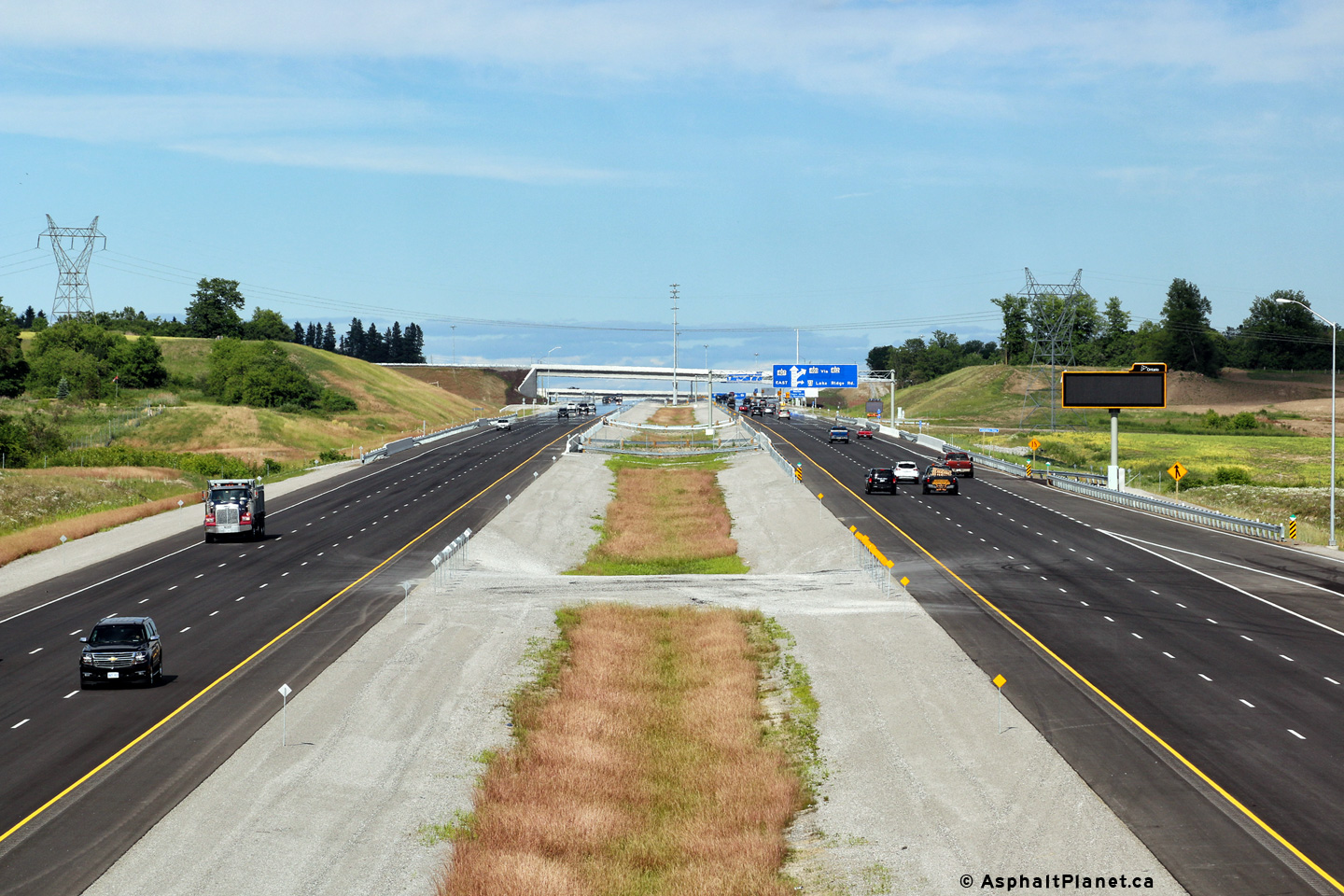
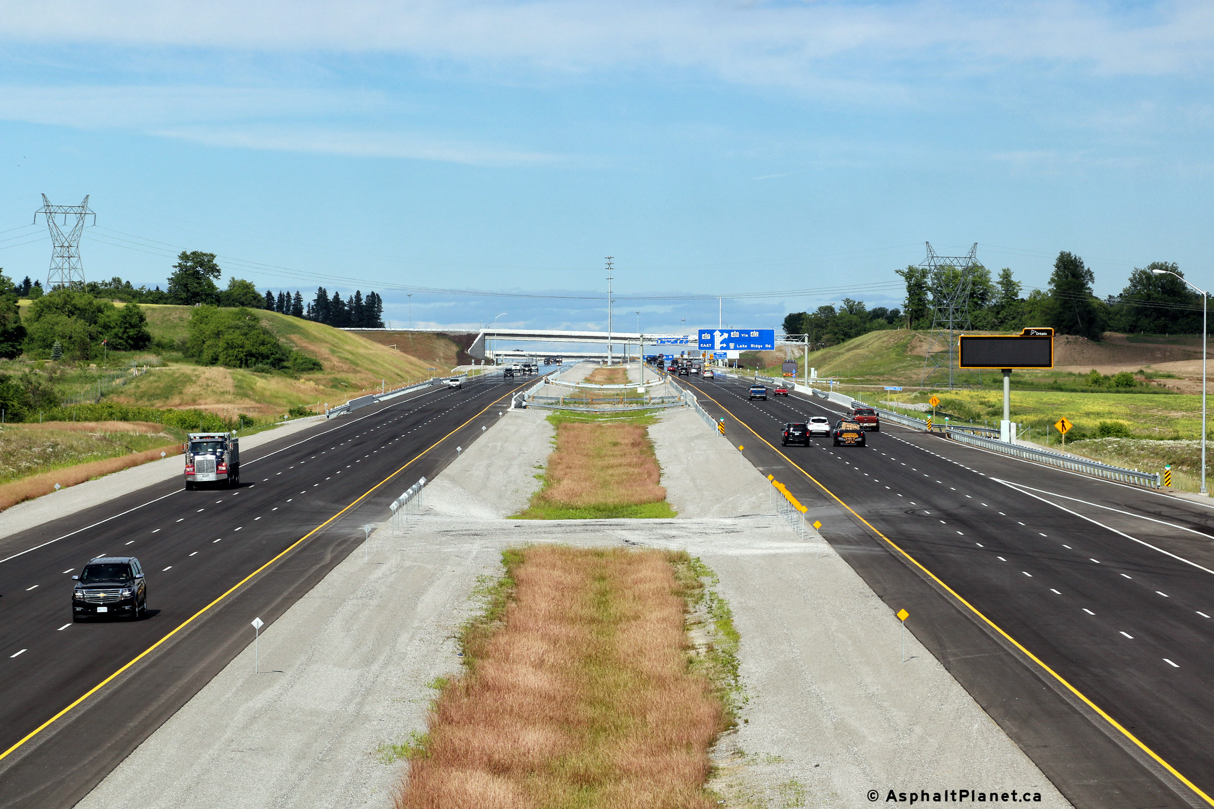
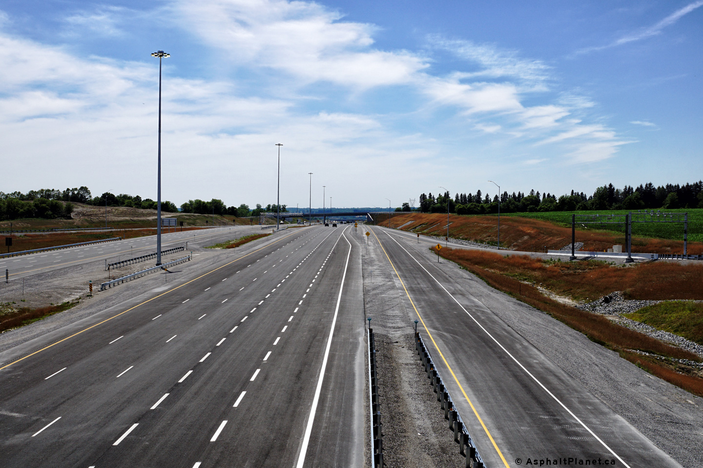
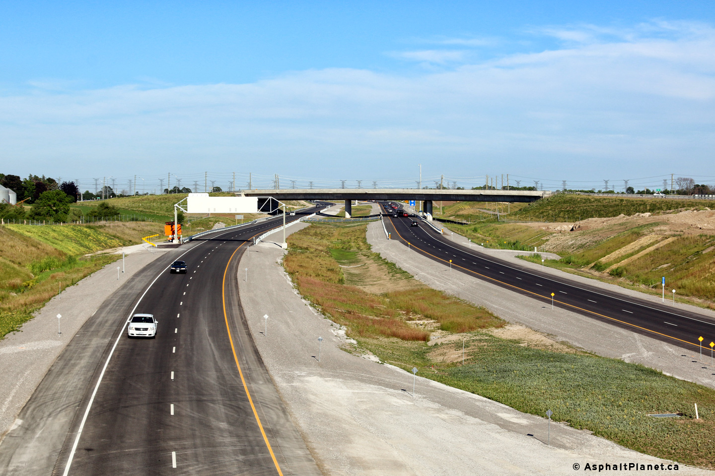
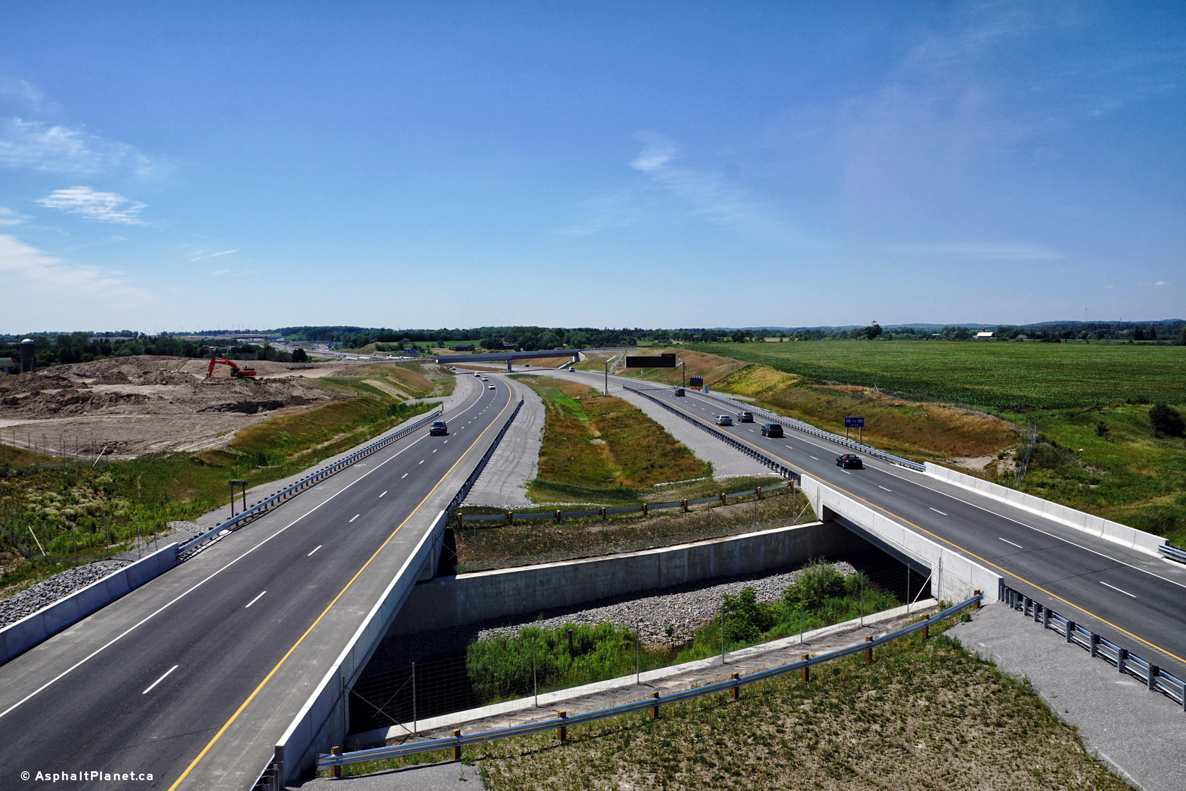
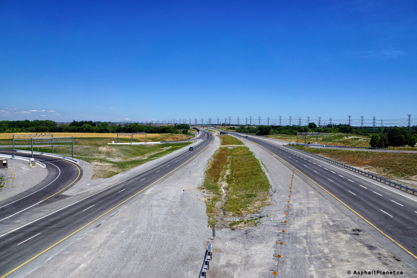
| Town of Whitby Regional Municipality of Durham |
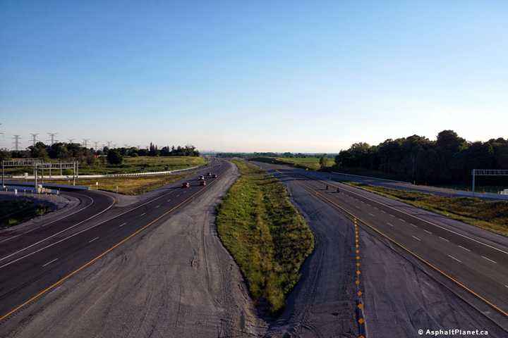
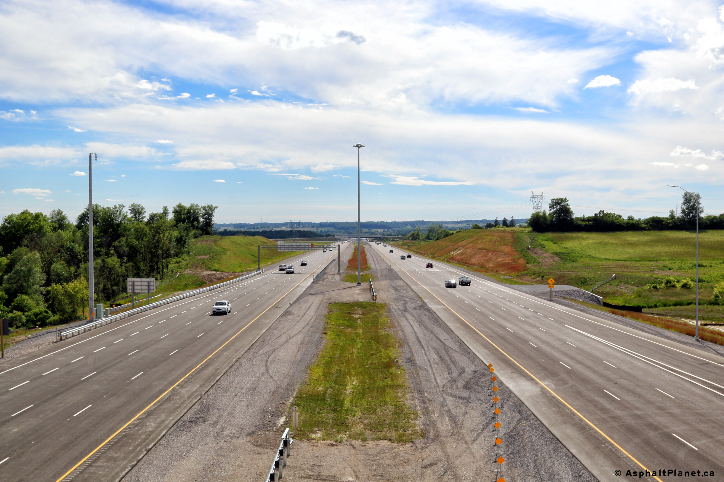
A series of three views looking easterly from the Lake Ridge Road overpass.
The Lake Ridge Road interchange is closely intertwined with the adjacent
Highway 412 interchange. The ramp from the eastbound lanes of the 407
to Highway 412 passes beneath the incoming on-ramp to Highway 407 East from
Lake Ridge Road. Photos taken: July 4th, 2016. |
 (720x480) (1440x960) (2400x1600) 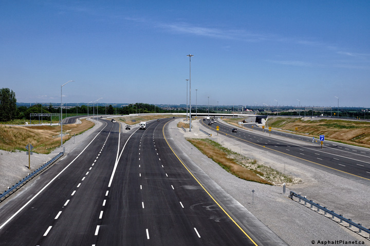 (720x480) (1440x960) (2400x1600)  (720x480) (1440x960) (2400x1600) |
||
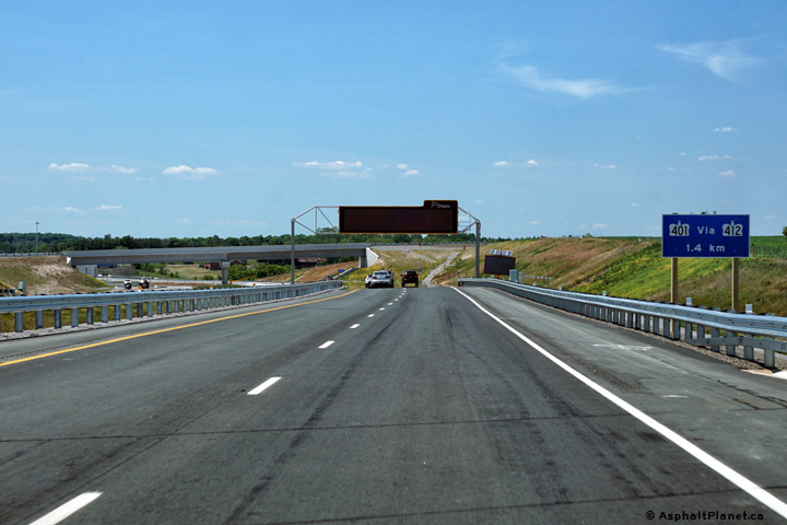
| Highway 412 links Highway 401 to Highway 407 through western Whitby. Click here for Highway 412 images. | ||||
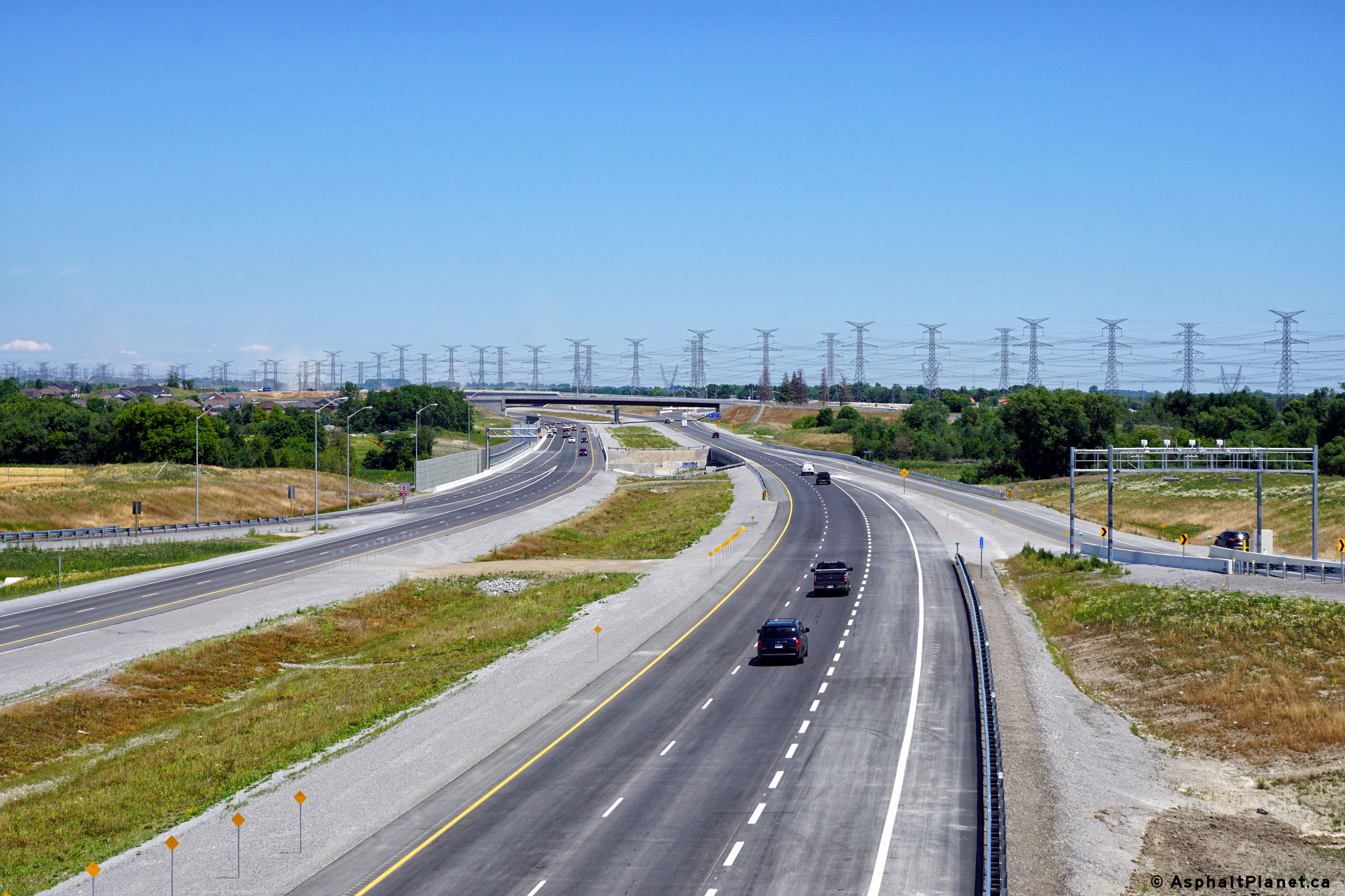
| Town of Whitby Regional Municipality of Durham |
Signage at the westbound off-ramp to Lake Ridge Road. The westbound
off-ramp to Lake Ridge Road snakes around the incoming on-ramp from Highway
412. Photo taken: July 19th, 2016. |
 (720x480) (720x480)(1440x960) (2400x1600) |
||
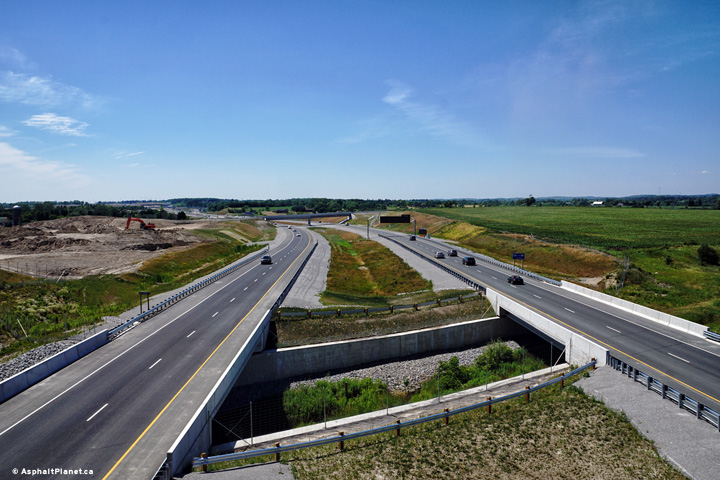
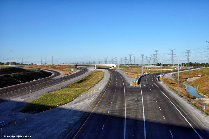
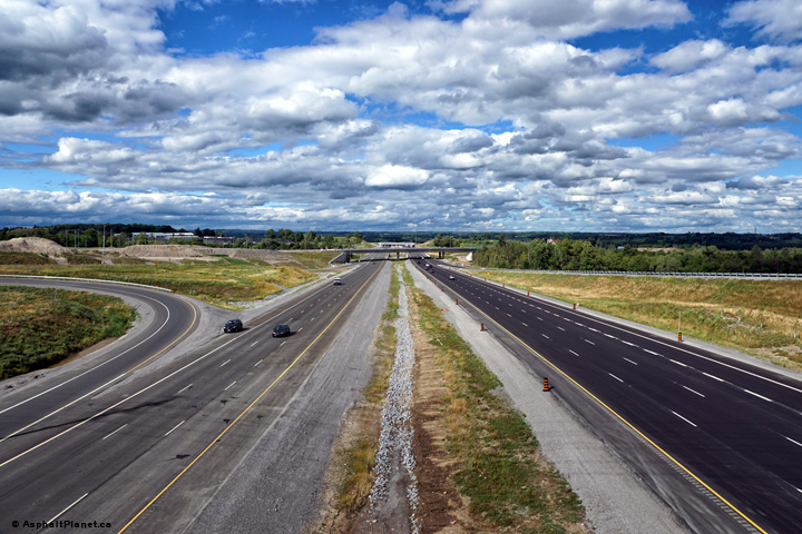
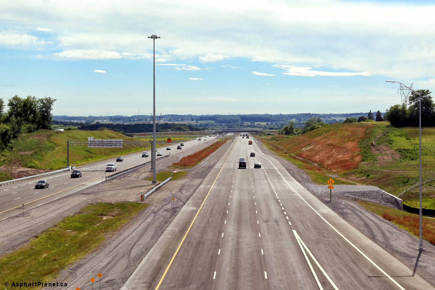
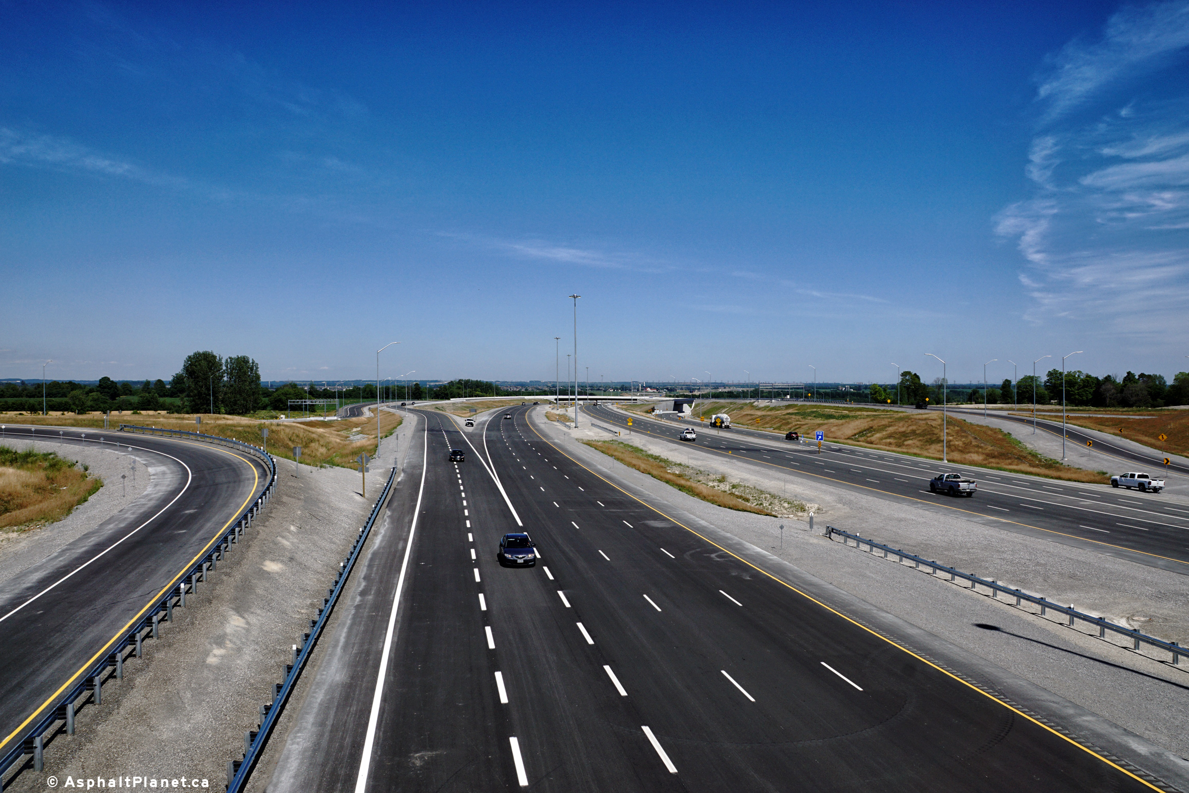
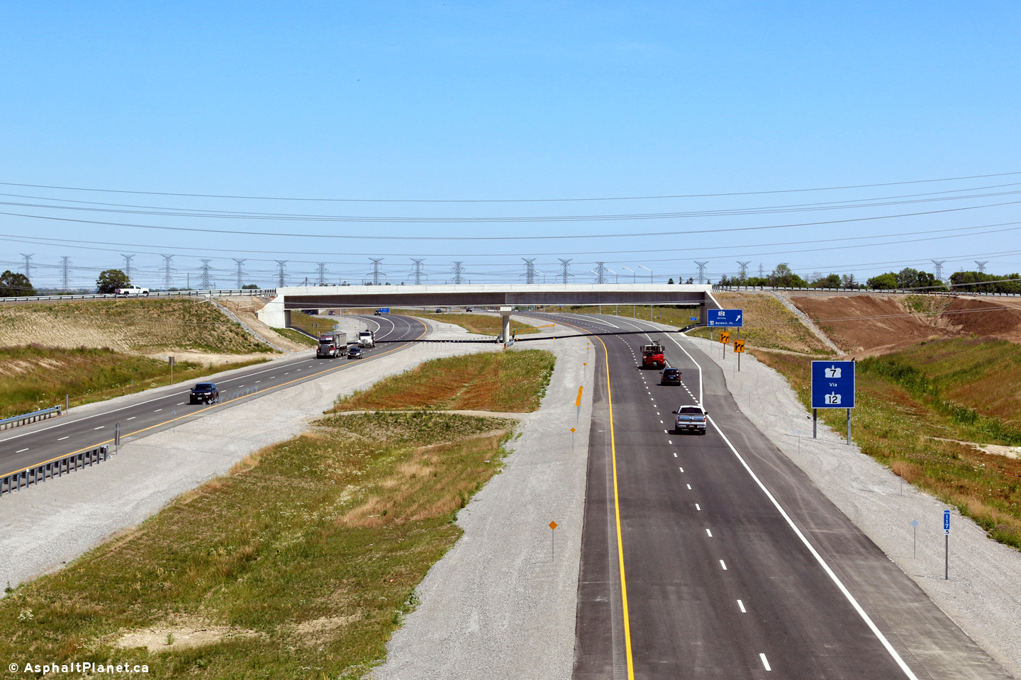
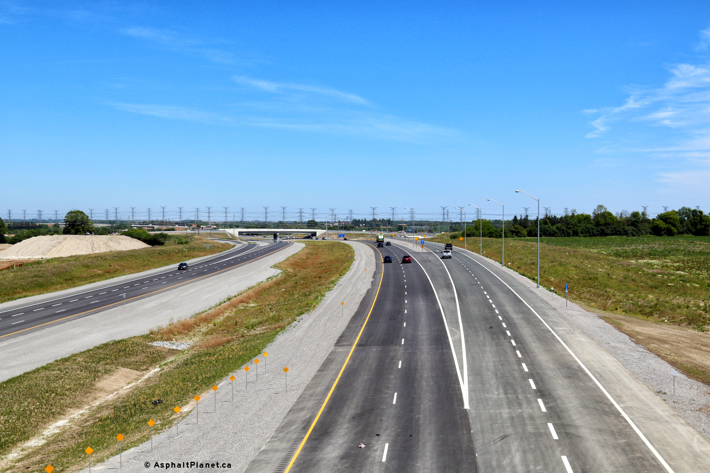
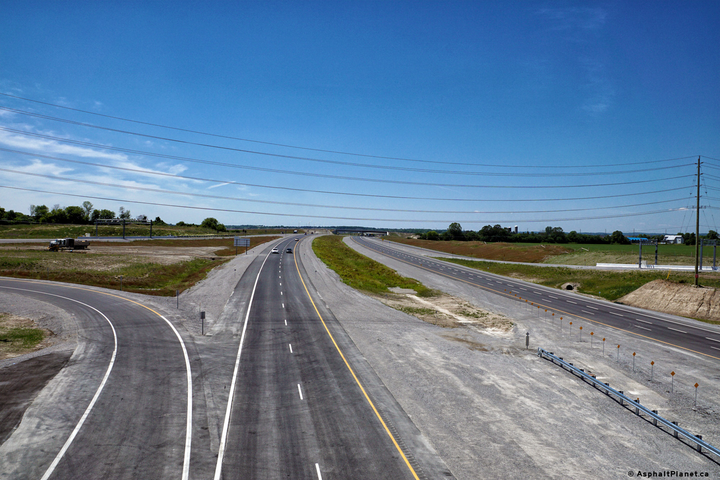
| Town of Whitby Regional Municipality of Durham |
Two views looking westerly of the three level interchange that links Highway
412 to Highway 407 from the Coronation Road overpass. Photos taken: June 22nd, 2016. |
 (720x480) (1440x960) (2400x1600)  (720x480) (1440x960) (2400x1600) |
||
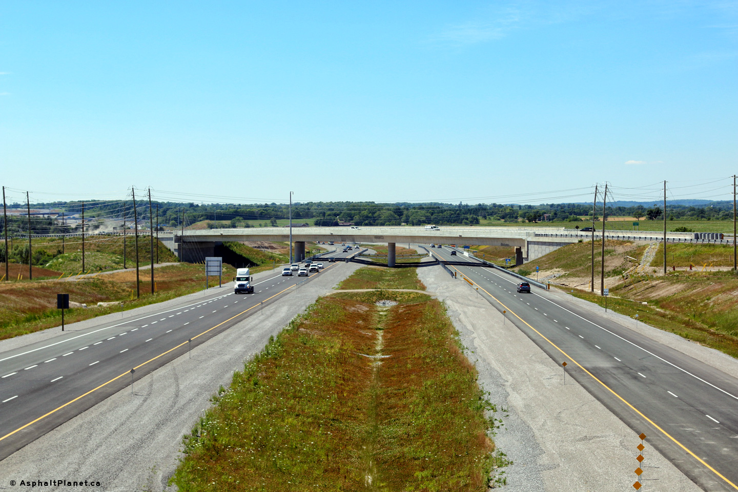
| Town of Whitby Regional Municipality of Durham |
Two views looking easterly towards Brooklin from the Coronation Road
overpass. Photos taken: June 22nd, 2016. |
 (720x480) (1440x960) (2400x1600) 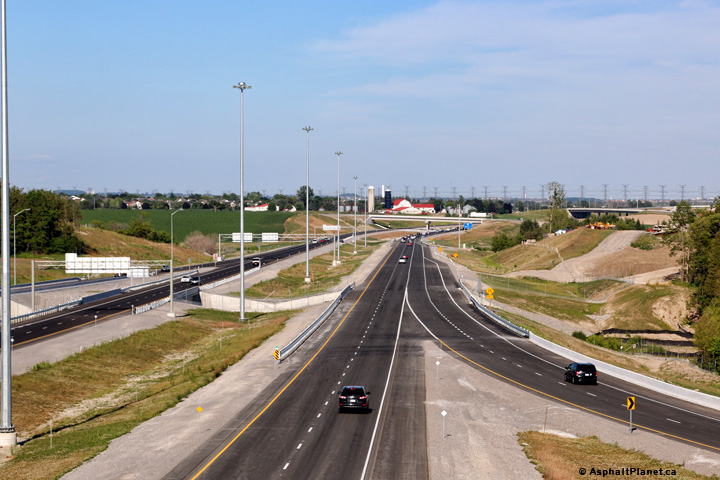 (720x480) (1440x960) (2400x1600) |
||
| Town of Whitby Regional Municipality of Durham |
Westbound advanced signage for the Lake Ridge Road interchange. Photo taken: July 19th, 2016. |
 (720x480) (720x480)(1440x960) (2400x1600) |
||
| Town of Whitby Regional Municipality of Durham |
Westbound signage at the off-ramp to Highway 412. Photo taken: July 19th, 2016. |
 (720x480) (720x480)(1440x960) (2400x1600) |
||
| Town of Whitby Regional Municipality of Durham |
Westbound advanced signage for the Highway 412 interchange. Photo taken: July 19th, 2016. |
 (720x480) (720x480)(1440x960) (2400x1600) |
||
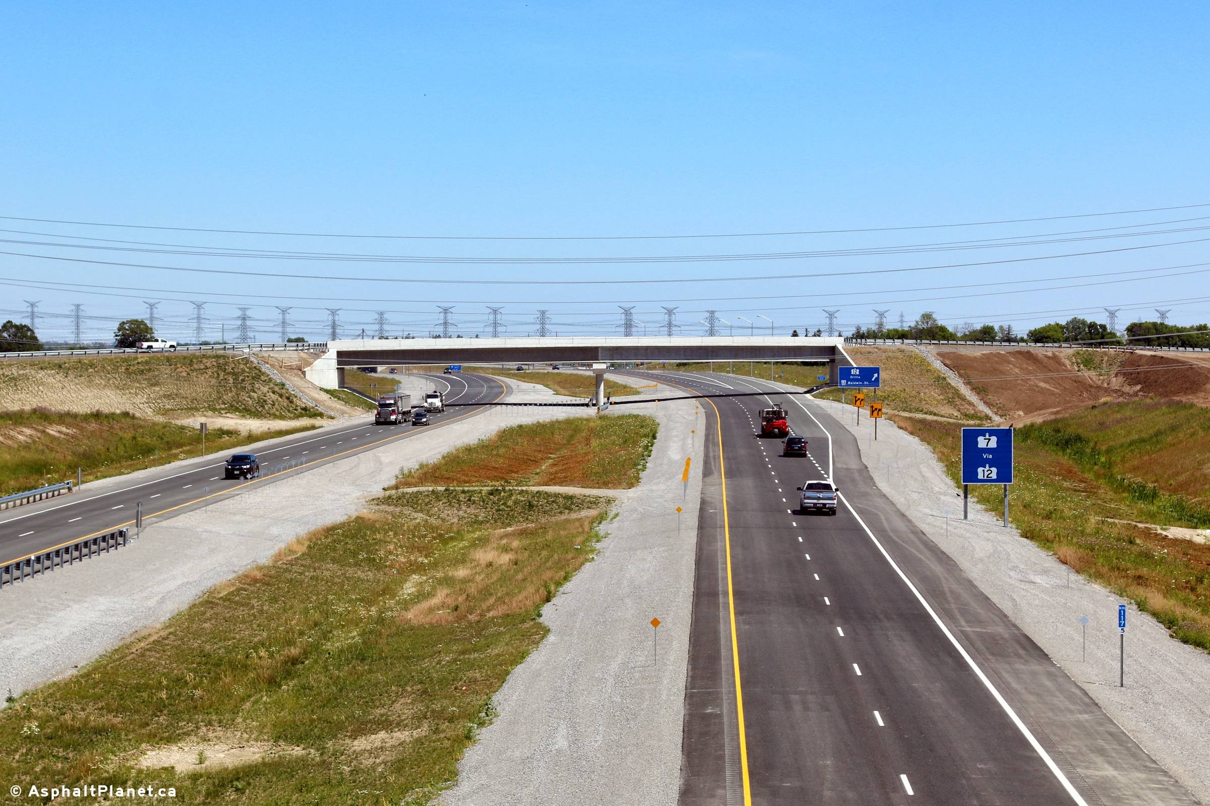
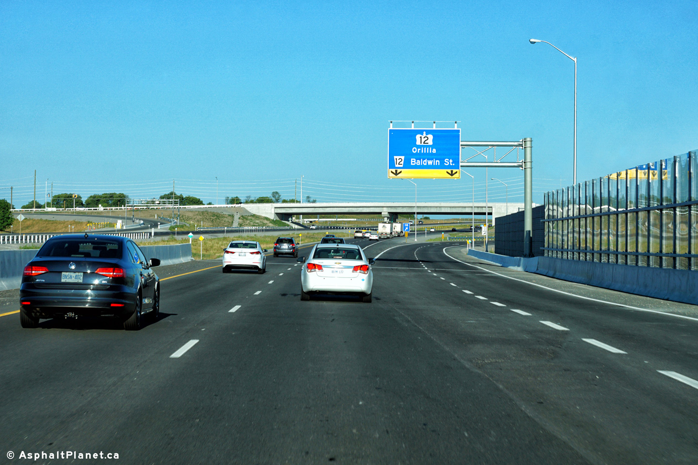
| Town of Whitby Regional Municipality of Durham |
Eastbound advanced signage for the Highway 12 interchange situated in
advance of the structure that carries Cochrane Street over the 407. Photo taken: June 23rd, 2016. |
|||
| Town of Whitby Regional Municipality of Durham |
Two views looking westerly towards the Highway 412 interchange from the
Cochrane Street overpass west of Brooklin. Photos taken: June 23rd, 2016. |
 (720x480) (1440x960) (2400x1600)  (720x480) (1440x960) (2400x1600) |
||
| Town of Whitby Regional Municipality of Durham |
View looking easterly from the Cochrane Street overpass towards the Highway
7 overpass. Photo taken: June 23rd, 2016. |
 (720x480) (1440x960) (2400x1600) |
||
| Town of Whitby Regional Municipality of Durham |
Westbound signage in advance of the Highway 412 interchange. I suspect
that once the overhead COMPASS signage is fully operation, it will typically
serve as a pre-advanced sign for the upcoming Highway 412 interchange. Photo taken: June 25th, 2016. |
 (720x480) (720x480)(1440x960) (2400x1600) |
||
| Town of Whitby Regional Municipality of Durham |
Two views looking westerly from the Highway 7 overpass along Highway 407.
Highway 407 crosses over a tributary to the Lynde River almost directly
beneath the Highway 7 flyover. Photos taken: July 4th, 2016. |
 (720x480) (1440x960) (2400x1600) 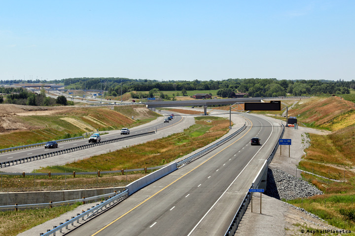 (720x480) (1440x960) (2400x1600) |
||
| Town of Whitby Regional Municipality of Durham |
View looking easterly from the Highway 7 overpass towards the Ashburn Road
grade separation. Photo taken: July 4th, 2016. |
 (720x480) (1440x960) (2400x1600) |
||
| Town of Whitby Regional Municipality of Durham |
Signage directing traffic bound for Highway 7 to follow the Highway 12
interchange. Photo taken: June 23rd, 2016. |
 (720x480) (720x480)(1440x960) (2400x1600) |
||
| Town of Whitby Regional Municipality of Durham |
The signage for the eastbound off-ramp to Highway 12 is situated immediately
before the Ashburn Road overpass. Photo taken: June 23rd, 2016. |
|||
| Town of Whitby Regional Municipality of Durham |
View looking westerly towards the Highway 7 overpass from the Ashburn Road
overpass. Photo taken: July 4th, 2016. |
 (720x480) (1440x960) (2400x1600) |
||
| Town of Whitby Regional Municipality of Durham |
View of the Highway 12 interchange as seen from the eastern side of the
Ashburn Road overpass. Photo taken: July 4th, 2016. |
 (720x480) (1440x960) (2400x1600) |
||
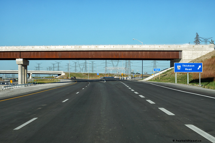
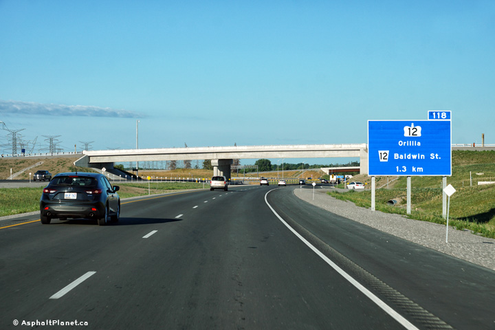
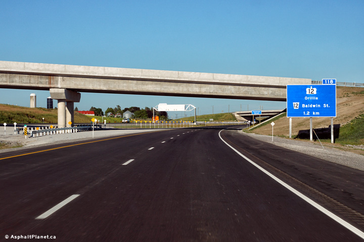
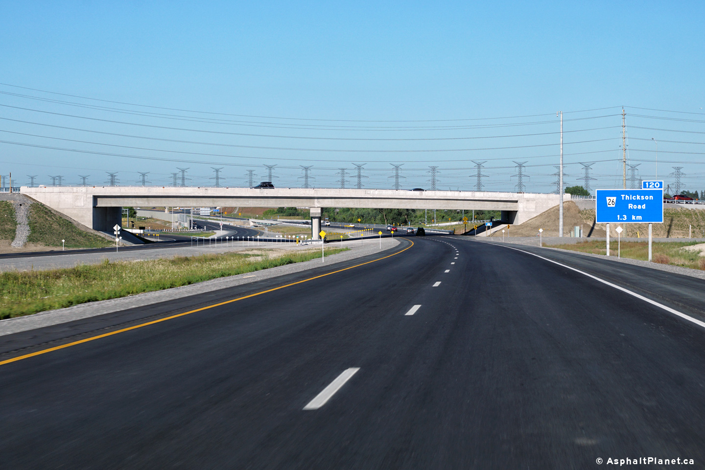
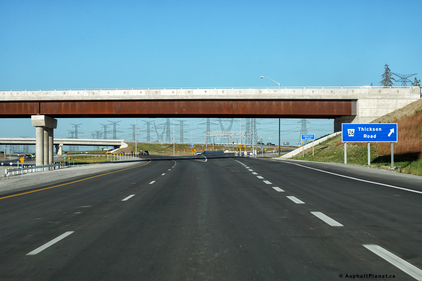
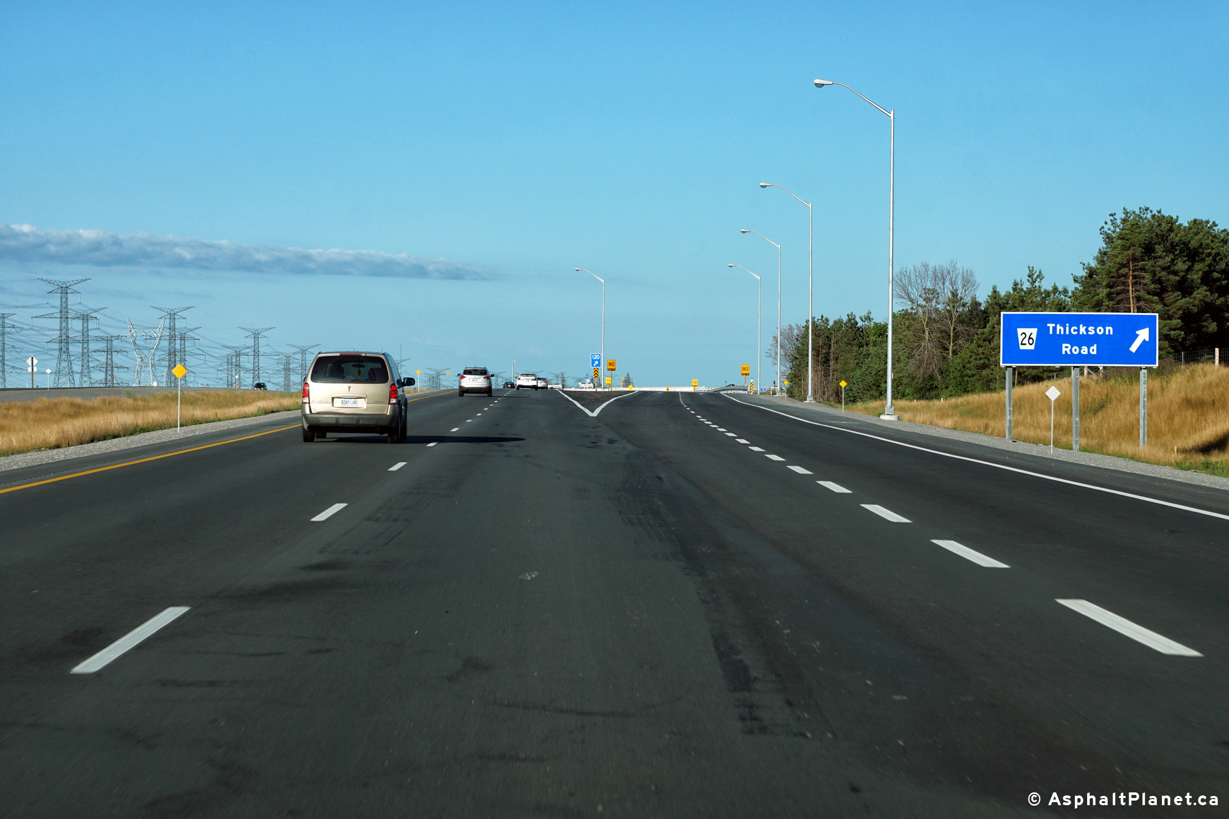
| Town of Whitby Regional Municipality of Durham |
Eastbound advanced signage for the Thickson Road interchange. The
Highway 12 overpass is visible beyond the ground mounted signage. Photo taken: June 23rd, 2016. |
 (720x480) (720x480)(1440x960) (2400x1600) |
||
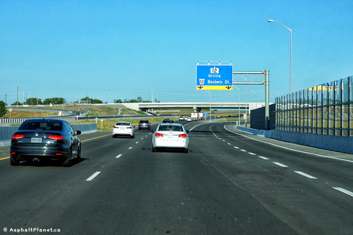
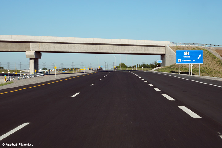
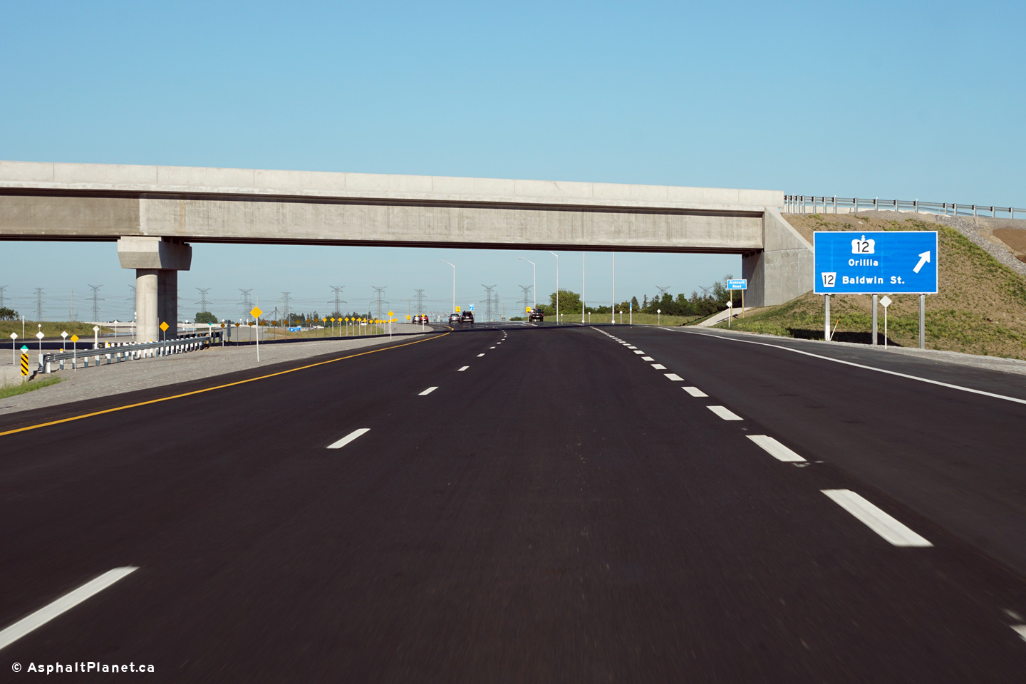
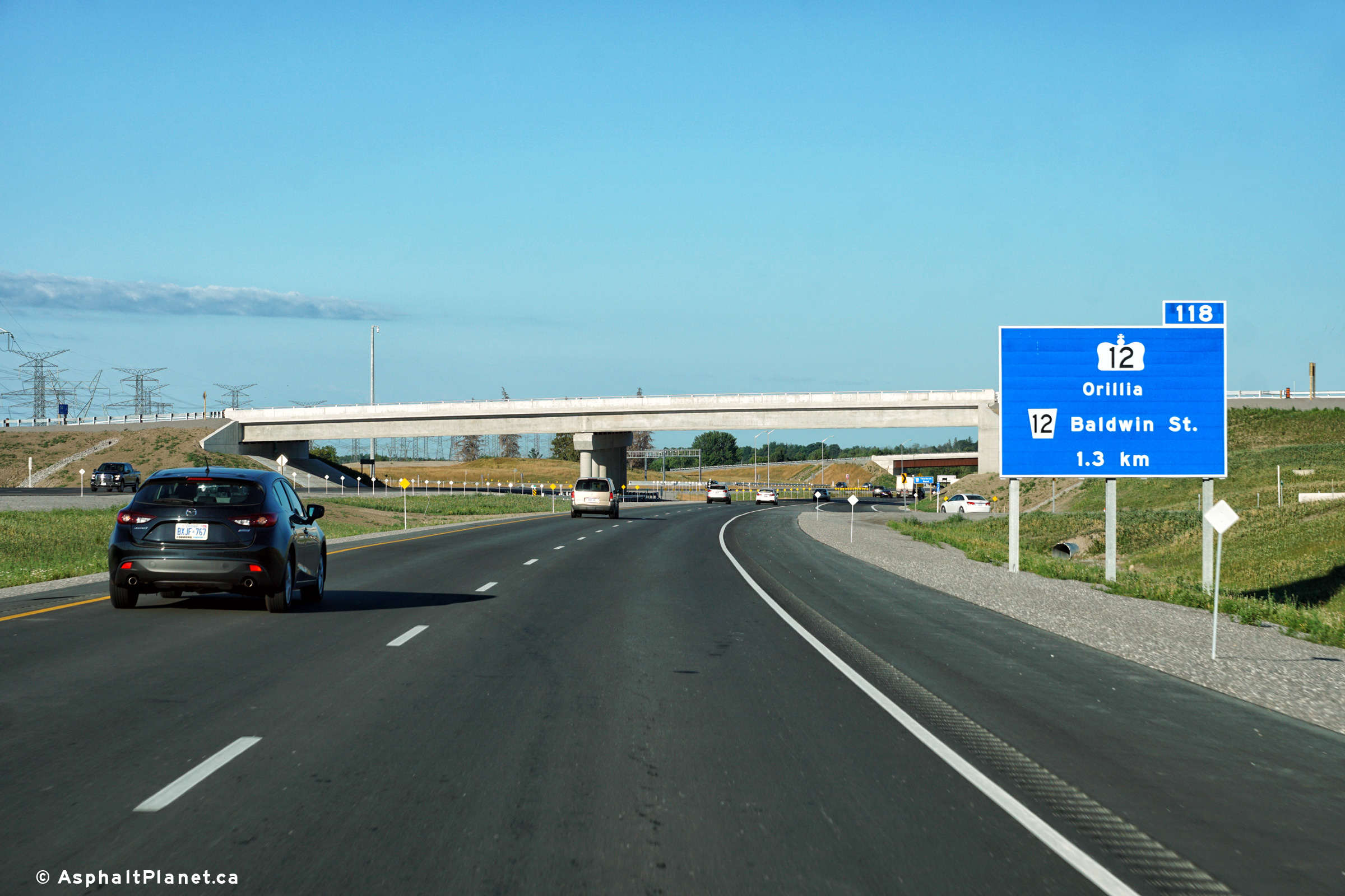
| Town of Whitby Regional Municipality of Durham |
Westerly view along Highway 407 from the Highway 12 interchange. Photo taken: July 4th, 2016. |
 (720x480) (1440x960) (2400x1600) |
||
| Highway 12 stretches northerly from Whitby to Midland via Orillia. Click here for Highway 12 images. | ||||
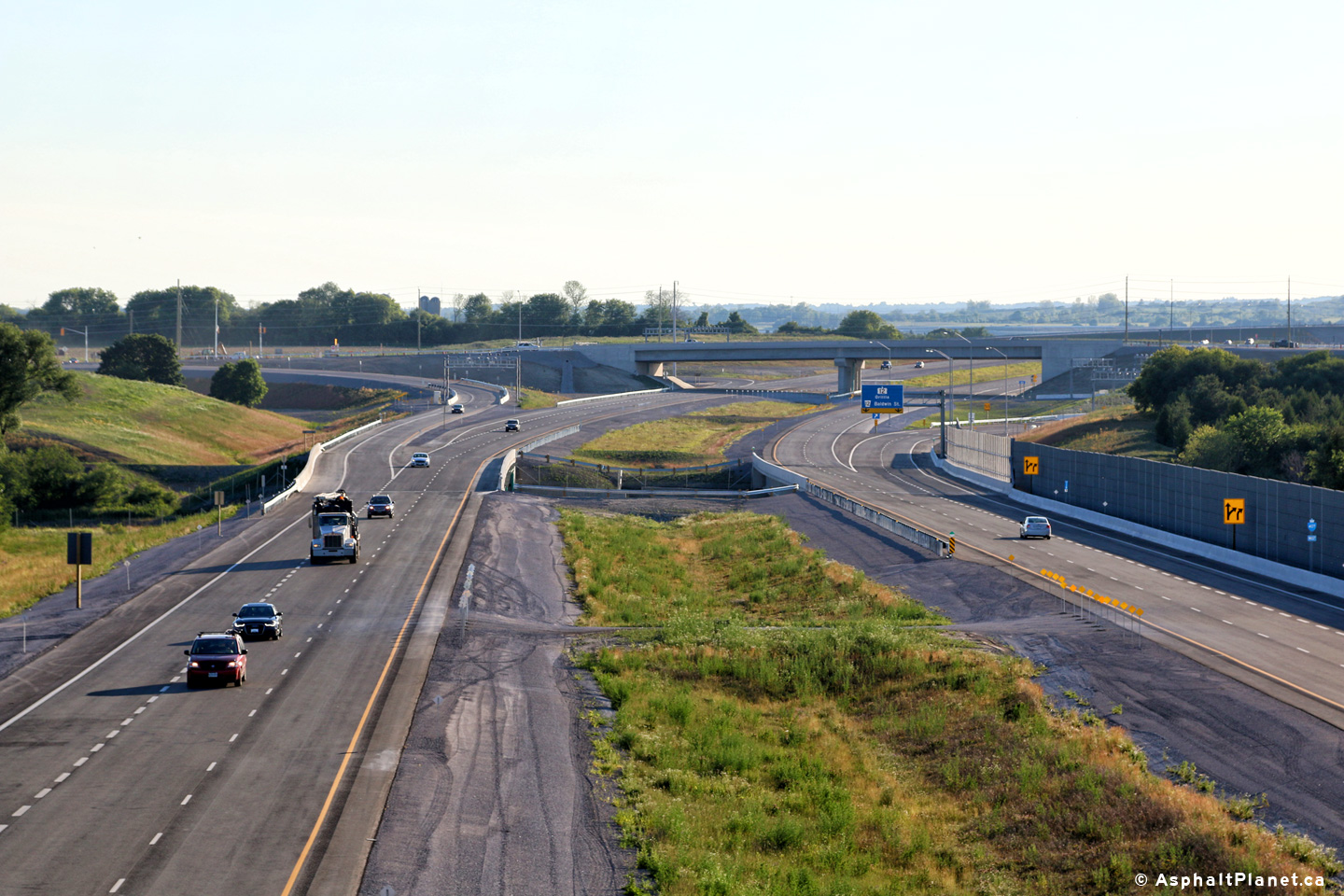
| Town of Whitby Regional Municipality of Durham |
Two views looking easterly along Highway 407 from the Highway 12
interchange. Photo taken: July 4th, 2016. |
 (720x480) (1440x960) (2400x1600)  (720x480) (1440x960) (2400x1600) |
||
| Town of Whitby Regional Municipality of Durham |
View at the westbound off-ramp to Highway 12. Photo taken: July 19th, 2016. |
 (720x480) (720x480)(1440x960) (2400x1600) |
||
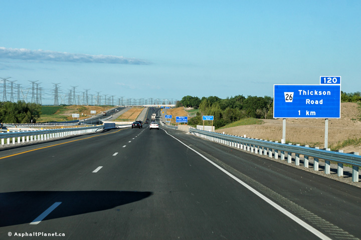
| Town of Whitby Regional Municipality of Durham |
Signage at the eastbound off-ramp to Thickson Road. The Anderson Road
overpass is visible beyond the signage. Photo taken: June 23rd, 2016. |
 (720x480) (720x480)(1440x960) (2400x1600) |
||
| Town of Whitby Regional Municipality of Durham |
Two views looking westerly from Anderson Road. Photos taken: June 23rd, 2016. |
 (720x480) (1440x960) (2400x1600) 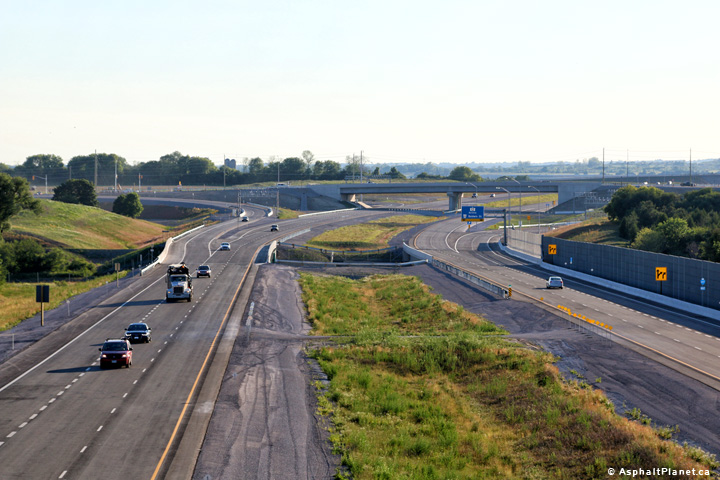 (720x480) (1440x960) (2400x1600) |
||
| Town of Whitby Regional Municipality of Durham |
Easterly view from the Anderson Road overpass towards the Thickson Road
interchange. Photo taken: June 23rd, 2016. |
 (720x480) (1440x960) (2400x1600) |
||
| Town of Whitby Regional Municipality of Durham |
Signage directing westbound motorists to follow Highway 12 to access Highway
7. Photo taken: July 19th, 2016. |
 (720x480) (720x480)(1440x960) (2400x1600) |
||
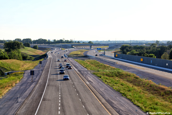
| Town of Whitby Regional Municipality of Durham |
View looking westerly from the Thickson Road overpass. Photo taken: June 22nd, 2016. |
 (720x480) (1440x960) (2400x1600) |
||
| Town of Whitby Regional Municipality of Durham |
Easterly view from the Thickson Road overpass. Photo taken: June 22nd, 2016. |
 (720x480) (1440x960) (2400x1600) |
||
| Town of Whitby Regional Municipality of Durham |
The westbound advanced signage for the Highway 12 interchange is situated in
the middle of the Thickson Road interchange. Photo taken: July 19th, 2016. |
 (720x480) (720x480)(1440x960) (2400x1600) |
||
| Town of Whitby Regional Municipality of Durham |
View looking westerly at the off-ramp to Thickson Road. Photo taken: July 19th, 2016. |
 (720x480) (720x480)(1440x960) (2400x1600) |
||
| Town of Whitby Regional Municipality of Durham |
Westbound advanced signage for the off-ramp to Thickson Road. Photo taken: July 19th, 2016. |
 (720x480) (720x480)(1440x960) (2400x1600) |
||
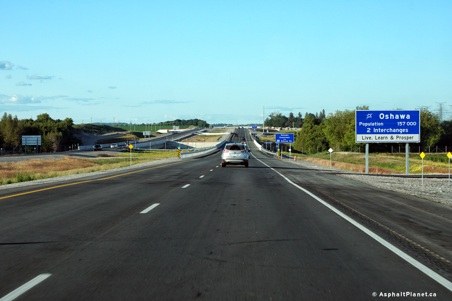
| City of Oshawa Regional Municipality of Durham |
Signage inviting motorists entering the City of Oshawa to Live, Learn, and
Prosper. Photo taken: June 23rd, 2016. |
 (720x480) (720x480)(1440x960) (2400x1600) |
||
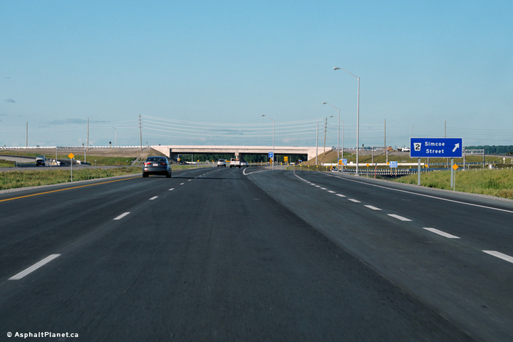
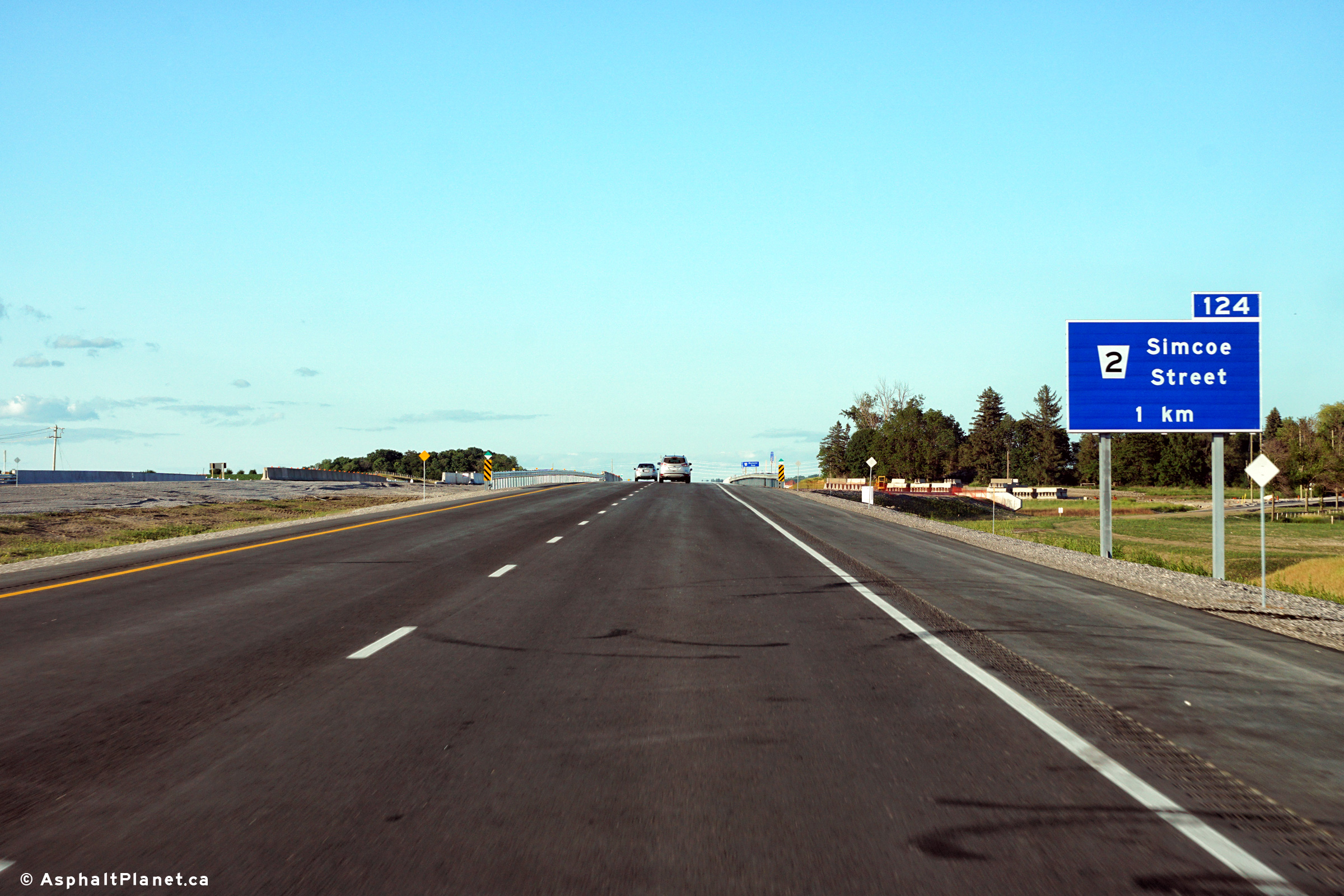
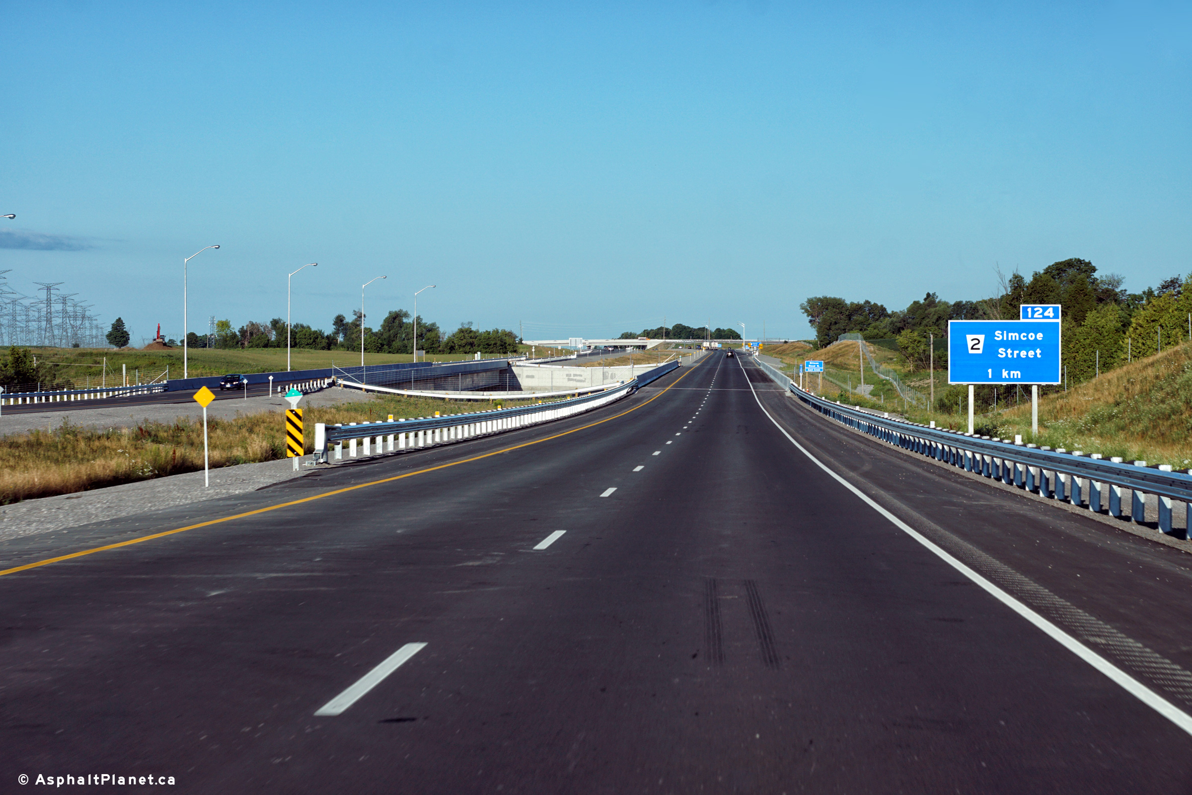
| City of Oshawa Regional Municipality of Durham |
Eastbound advanced signage for the Simcoe Street interchange. Photo taken: June 23rd, 2016. |
 (720x480) (720x480)(1440x960) (2400x1600) |
||
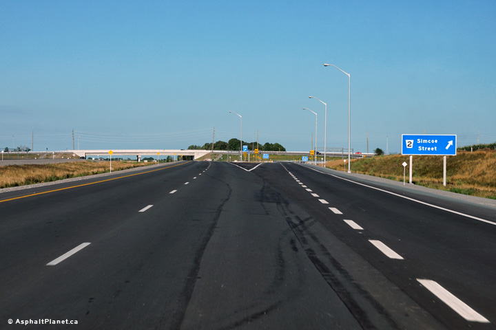
| City of Oshawa Regional Municipality of Durham |
View at the eastbound off-ramp to Simcoe Street. Photo taken: June 23rd, 2016. |
|||
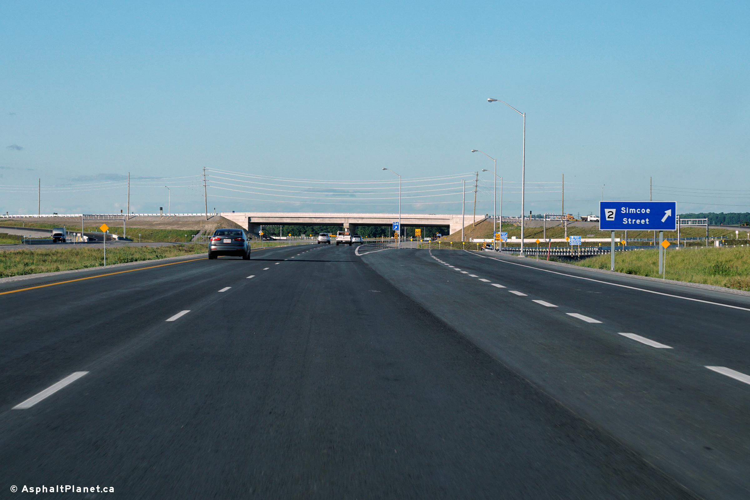
| City of Oshawa Regional Municipality of Durham |
Two views looking westerly from the Simcoe Street overpass. Photos taken: June 23rd, 2016. |
 (720x480) (1440x960) (2400x1600) 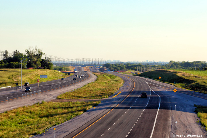 (720x480) (1440x960) (2400x1600) |
||
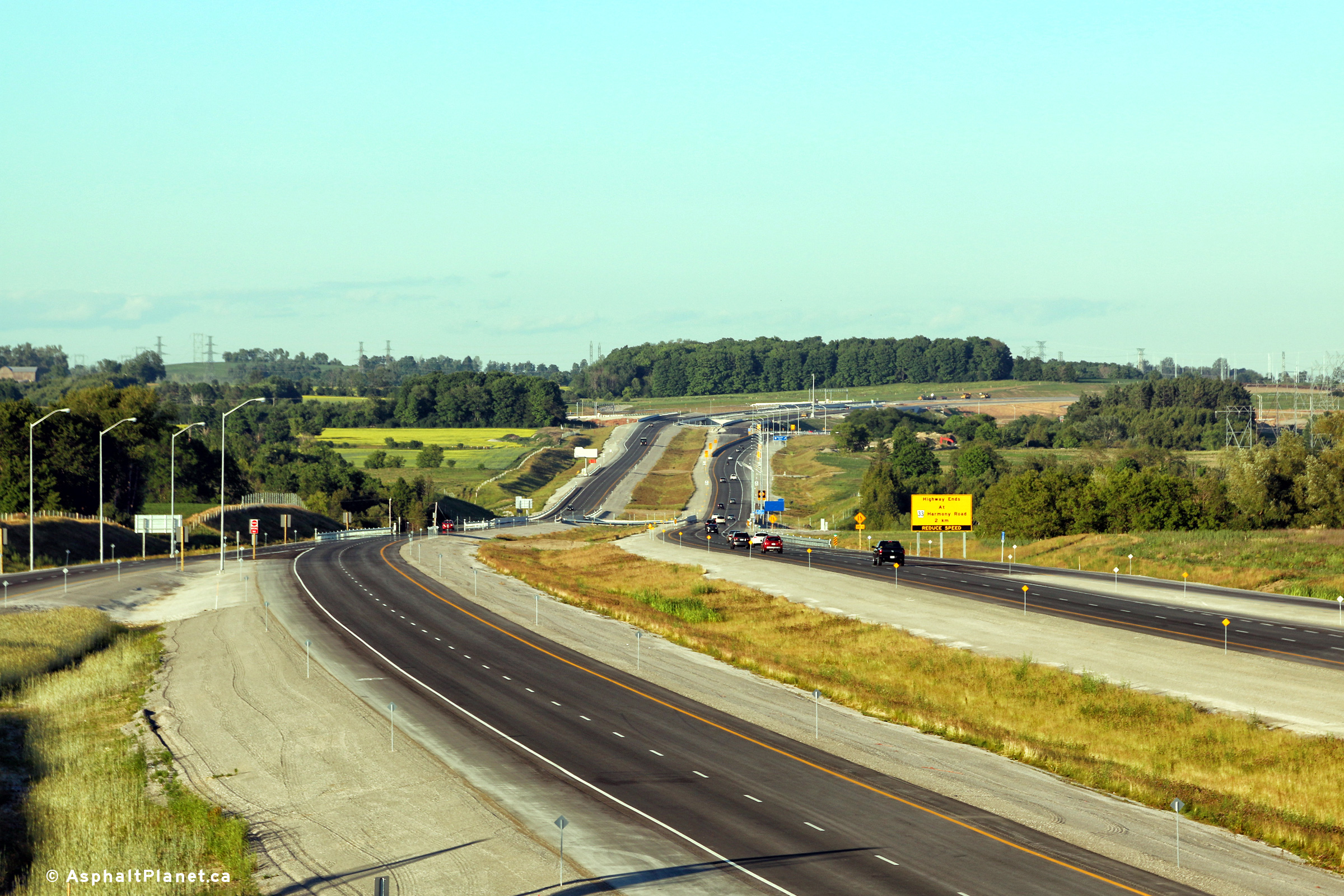
| City of Oshawa Regional Municipality of Durham |
Two views looking easterly from the Simcoe Street overpass in Oshawa.
Highway 407 ends just beyond the Simcoe Street interchange at Harmony Road. Photos taken: June 23rd, 2016. |
 (720x480) (1440x960) (2400x1600)  (720x480) (1440x960) (2400x1600) |
||
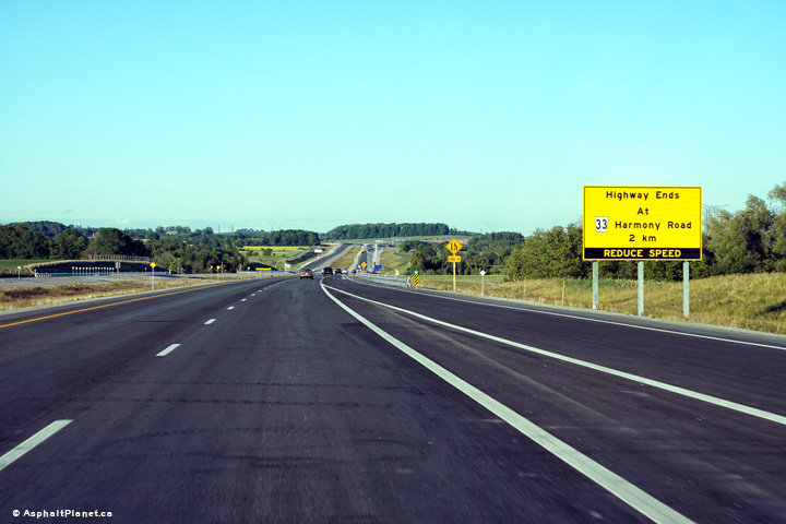
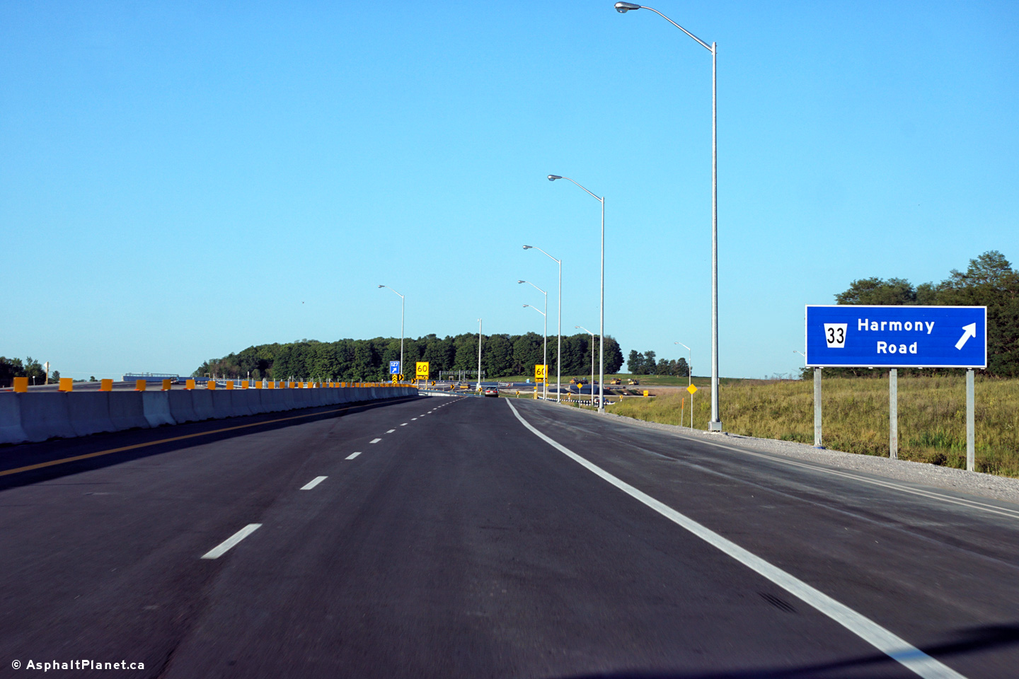
| City of Oshawa Regional Municipality of Durham |
Signage advising eastbound motorists of the impending eastern terminus of
Highway 407 at Harmony Road. Photo taken: June 23rd, 2016. |
 (720x480) (720x480)(1440x960) (2400x1600) |
||
| City of Oshawa Regional Municipality of Durham |
View looking westerly along Highway 407 at the off-ramp to Simcoe Street. Photo taken: July 19th, 2016. |
 (720x480) (720x480)(1440x960) (2400x1600) |
||
| City of Oshawa Regional Municipality of Durham |
Westbound advanced signage for the Simcoe Street interchange. Photo taken: July 19th, 2016. |
 (720x480) (720x480)(1440x960) (2400x1600) |
||
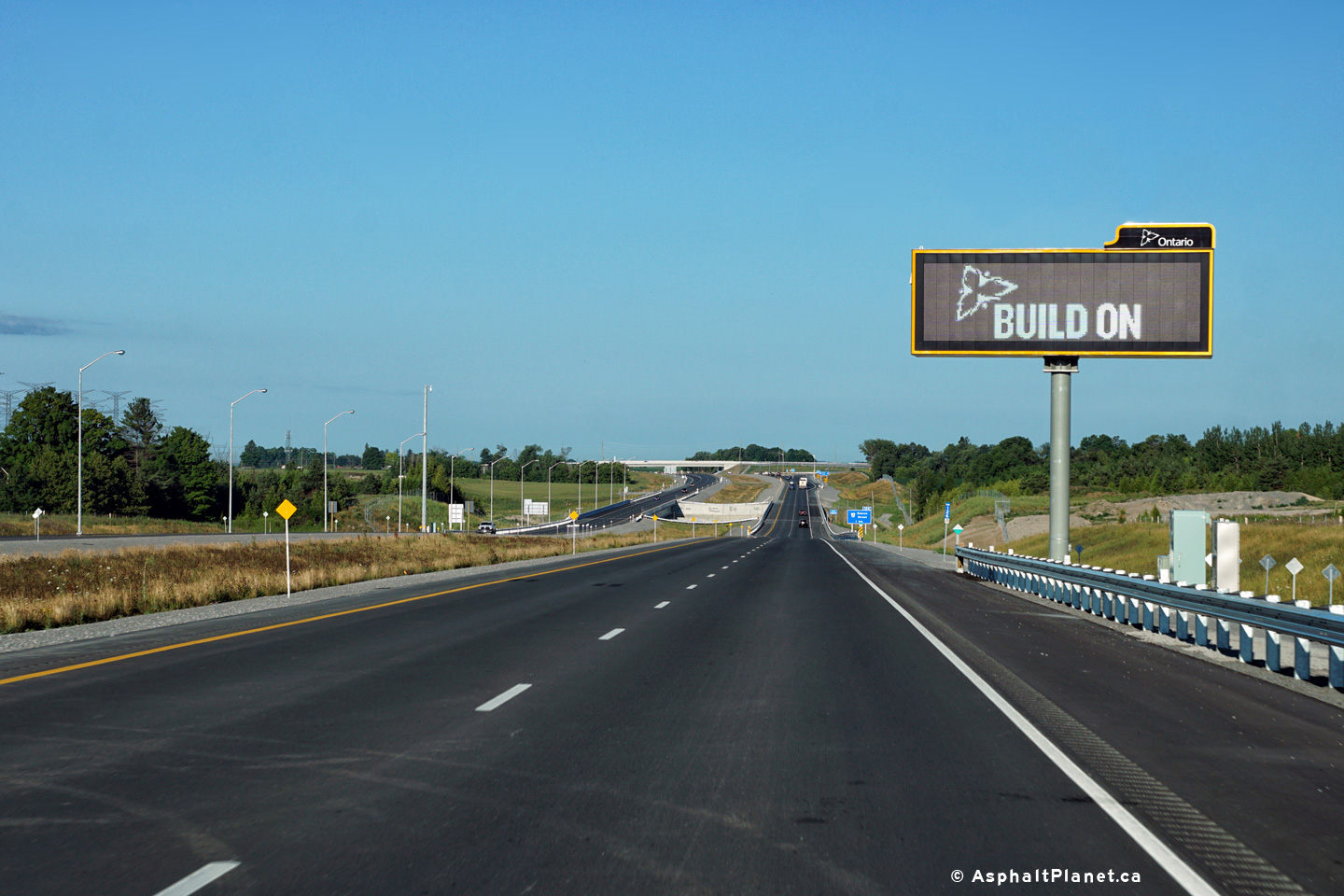
| City of Oshawa Regional Municipality of Durham |
Overhead COMPASS CMS signage facing westbound motorists just west of Harmony
Road. Signage testing was still underway when this photo was taken. Photo taken: July 19th, 2016. |
 (720x480) (720x480)(1440x960) (2400x1600) |
||
| City of Oshawa Regional Municipality of Durham |
For reasons that are not clear to me, the eastbound advanced signage for
Harmony Road has been covered up. Photo taken: June 23rd, 2016. |
 (720x480) (720x480)(1440x960) (2400x1600) |
||
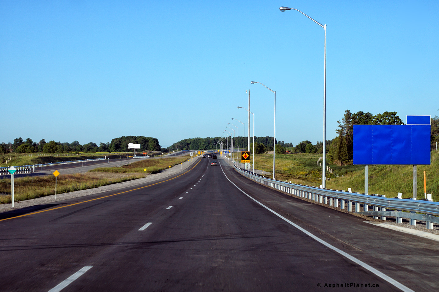
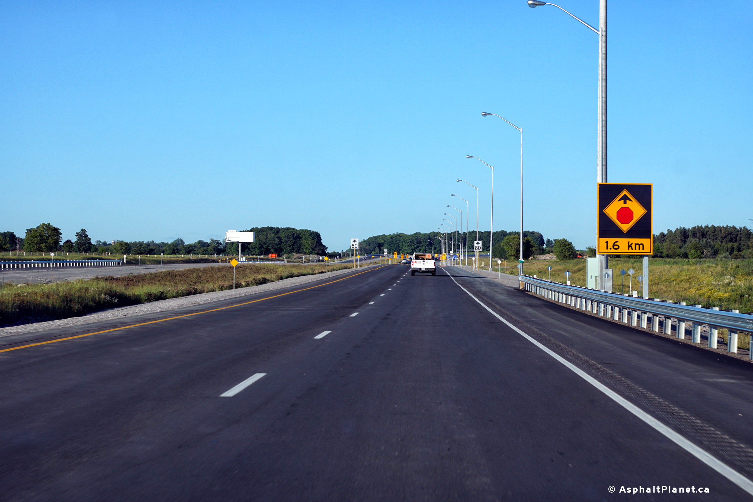
| City of Oshawa Regional Municipality of Durham |
Stop ahead signage approaching Harmony Road. Photo taken: June 23rd, 2016. |
 (720x480) (720x480)(1440x960) (2400x1600) |
||
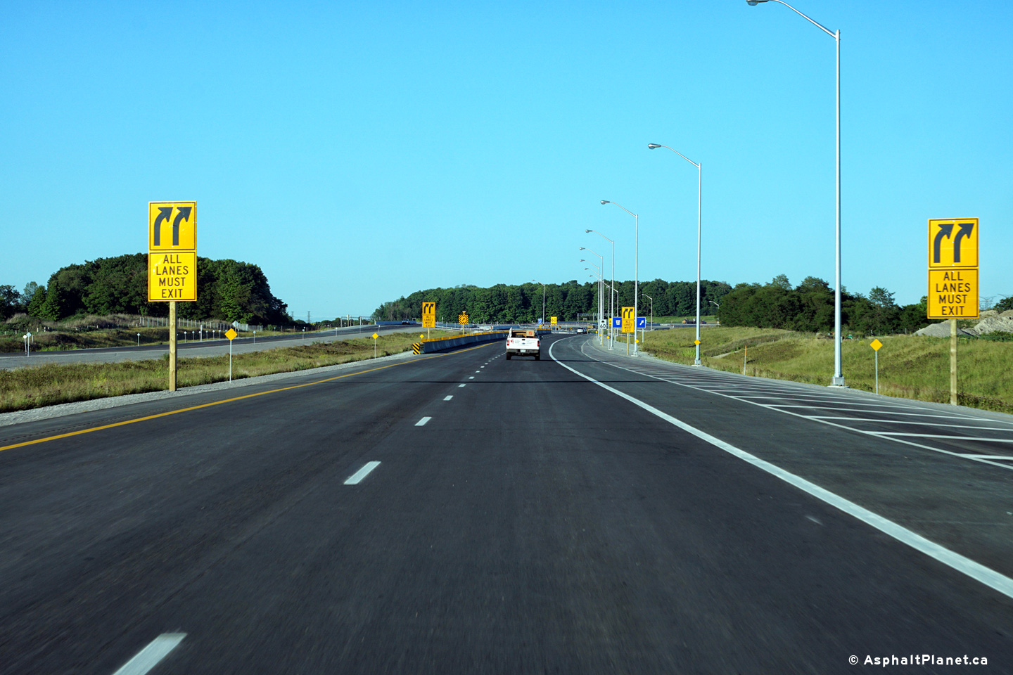
| City of Oshawa Regional Municipality of Durham |
Until Highway 407 is extended further in 2017, all eastbound traffic is
forced off the highway at the Harmony Road interchange. Photo taken: June 23rd, 2016. |
 (720x480) (720x480)(1440x960) (2400x1600) |
||
| City of Oshawa Regional Municipality of Durham |
Signage as the mainline lanes of Highway 407 are forced off at the Harmony
Road interchange. Photo taken: June 23rd, 2016. |
 (720x480) (720x480)(1440x960) (2400x1600) |
||
| City of Oshawa Regional Municipality of Durham |
View looking westerly along Highway 407 from the Harmony Road interchange. Photo taken: July 19th, 2016. |
 (720x480) (720x480)(1440x960) (2400x1600) |
||
<- Page 4 Images Highway 407 Images Index Page 6 Images ->
<- Highway 406 Images Back to Highway 407 Highway 409 Images ->
Copyright (c) 2004-2016, AsphaltPlanet.ca AsphaltPlanet@asphaltplanet.ca

