AsphaltPlanet.ca > OntHighways >
Highway 11 > Images
> Page 2B
King's Highway 11 - Images
<- Page 2A Page 2B - Orillia to Gravenhurst Page 2C ->
Photos shown in this table are arranged from South to North:
| Proper Municipality Name | Photo Description | Photo | ||
|
Pictures taken from driver's perspective appear offset from centre-line pictures: |
North- bound |
South- bound |
||
| Continued from Barrie to Orillia Images. | ||||
| Highway 12 continues West of Highway 11 at Orillia bound for Coldwater and Midland. Click here for Highway 12-West images. | ||||
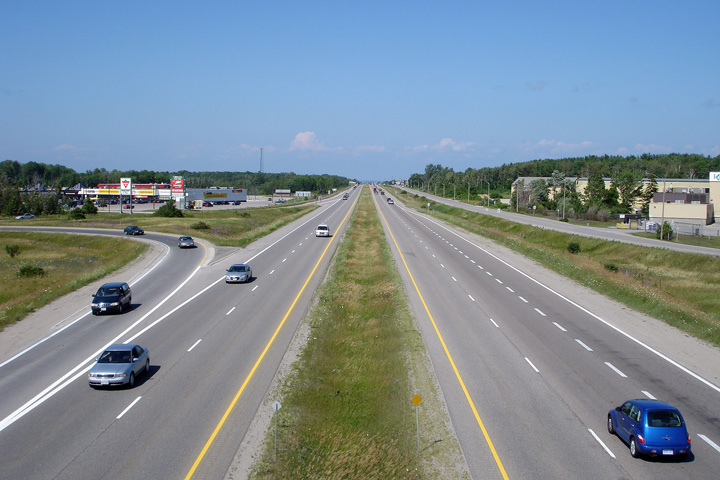
| City of Orillia County of Simcoe |
This view looks northerly along the Orillia By-pass from the
Highway 12-West
overpass. Photo taken: July 15th, 2006. |
 (720x480) (1440x960) |
||
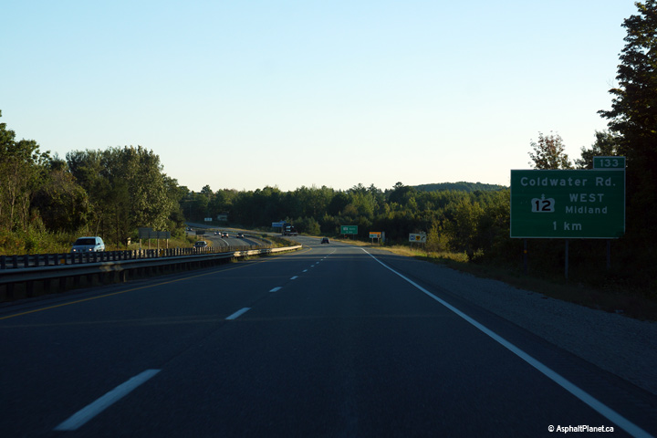
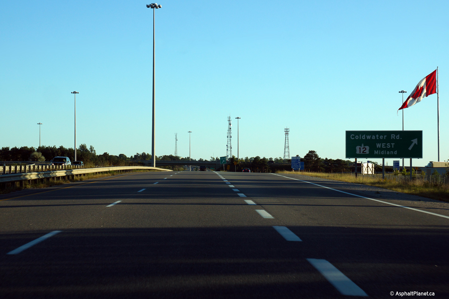
| City of Orillia County of Simcoe |
Signage at the southbound off-ramp to Highway 12-West and Coldwater Road. Photo taken: September 14th, 2015. |
 (720x480) (720x480)(1440x960) (2400x1600) |
||
| City of Orillia County of Simcoe |
Southbound advanced signage for the Highway 12 interchange. Photo taken: September 14th, 2015. |
 (720x480) (720x480)(1440x960) (2400x1600) |
||
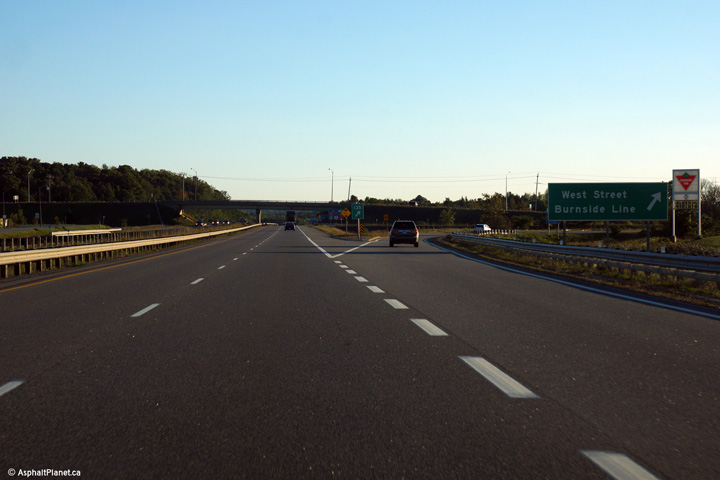
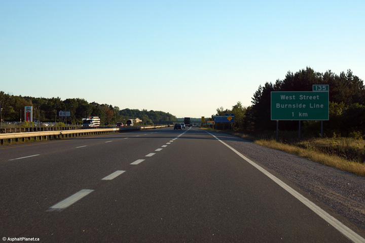
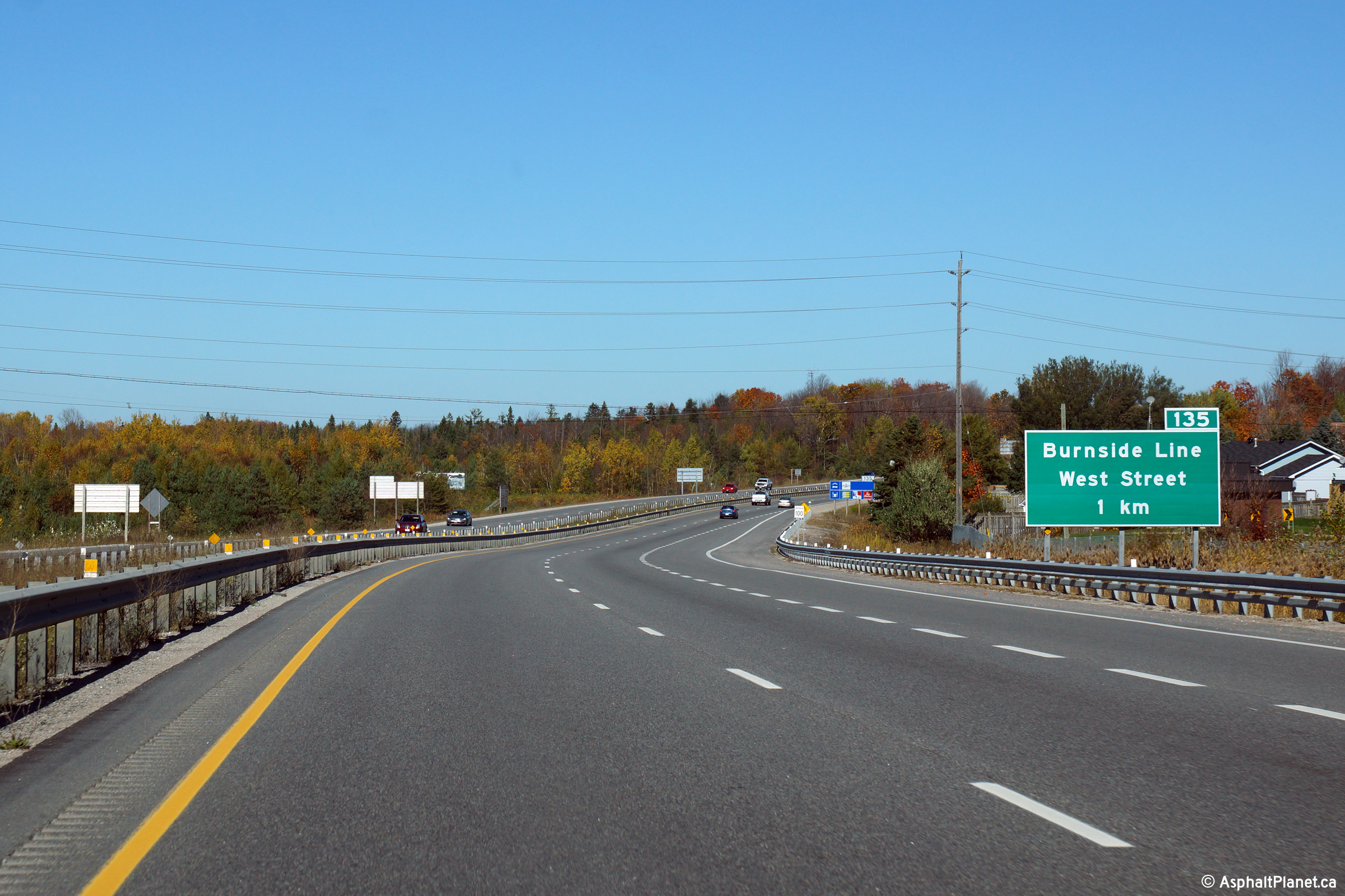
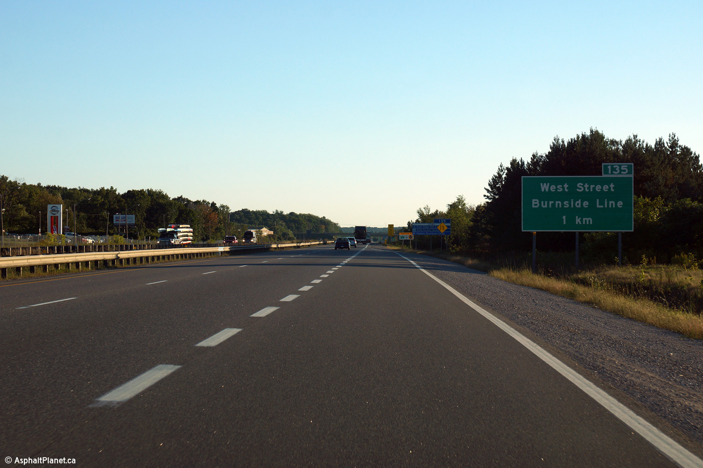
| City of Orillia County of Simcoe |
Northbound advanced signage for the West Street and Burnham Street
interchange. Photo taken: October 22nd, 2014. |
 (720x480) (720x480)(1440x960) (2400x1600) |
||
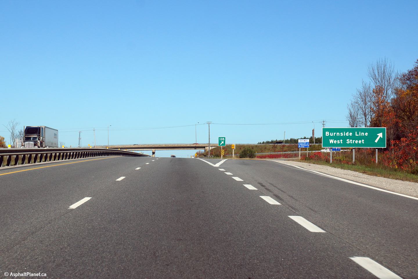
| City of Orillia County of Simcoe |
Signage at the northbound off-ramp to West Street and Burnham Street. Photo taken: October 22nd, 2014. |
 (720x480) (720x480)(1440x960) (2400x1600) |
||
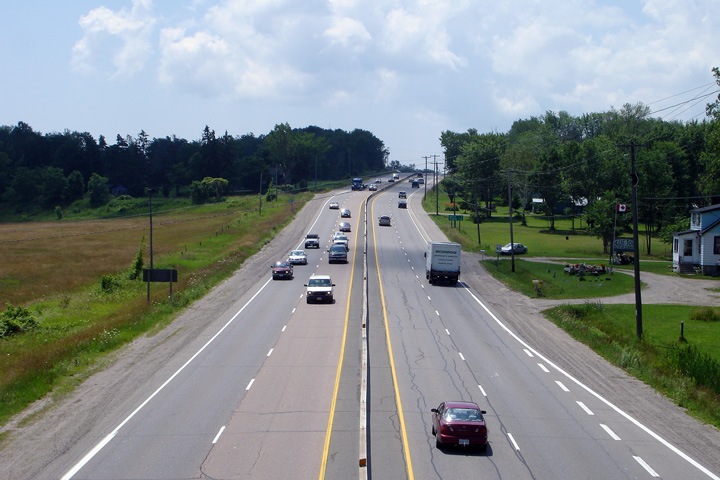
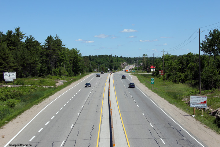
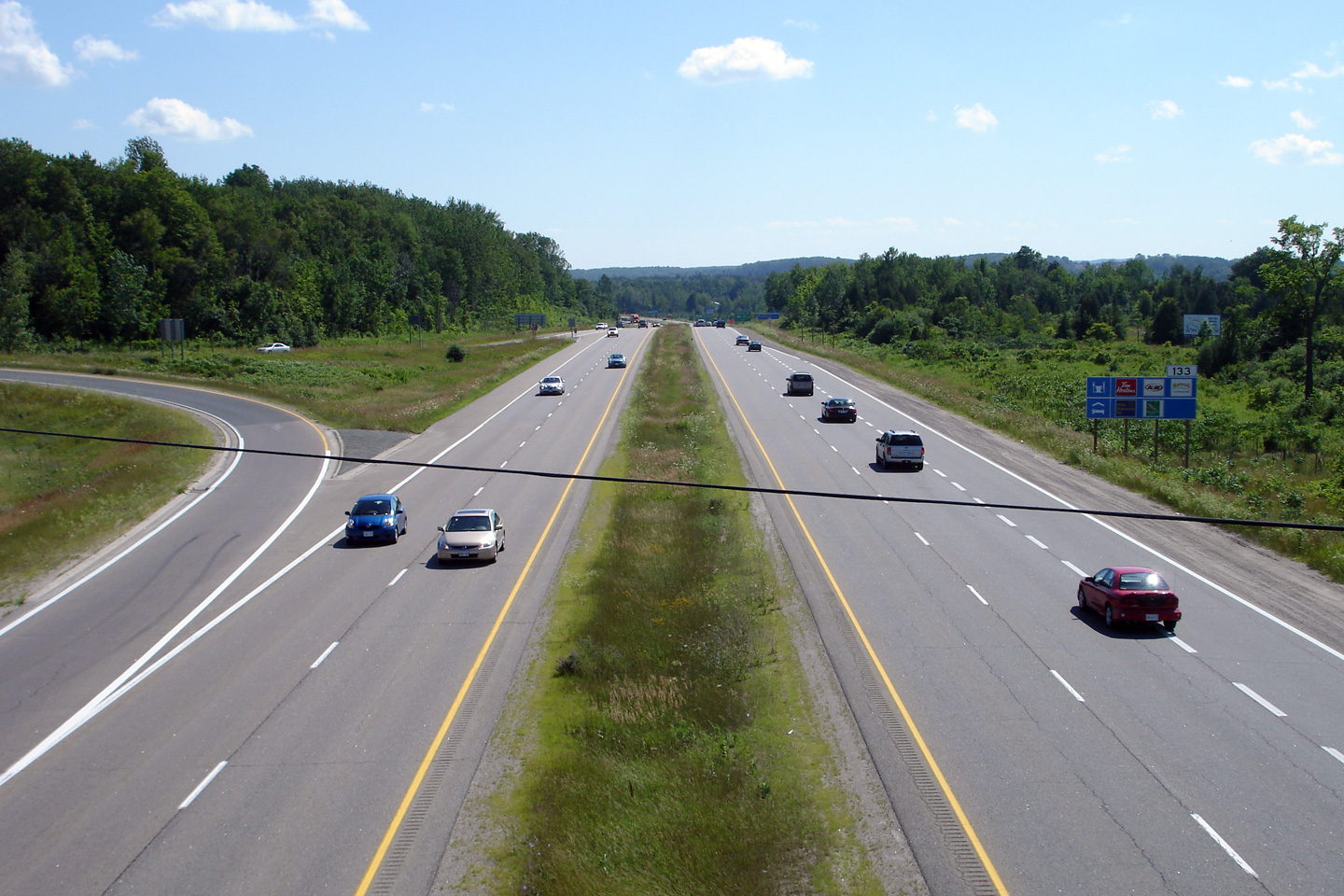
| City of Orillia County of Simcoe |
View looking southerly from the West Street overpass. During the
Spring of 2010 a continuous steel barrier was installed in the median of the
pictured
freeway to reduce the likelihood of cross-over collisions. Photo taken: July 15th, 2006. |
 (720x480) (1440x960) |
||
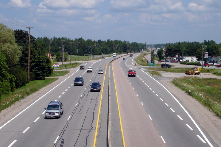
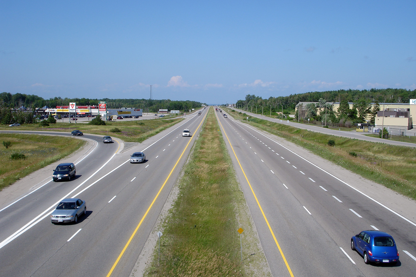
| City of Orillia County of Simcoe |
Northerly view along Highway 11 from West Street. Photo taken: July 15th, 2006. |
 (720x480) (1440x960) |
||
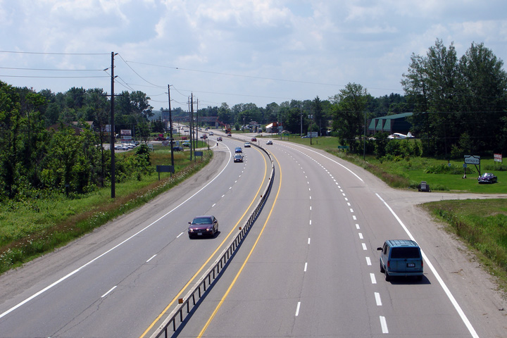
| City of Orillia County of Simcoe |
Southerly view at the off-ramp to the West Street and Burhnam Street
interchange. Photo taken: September 14th, 2015. |
 (720x480) (720x480)(1440x960) (2400x1600) |
||
| City of Orillia County of Simcoe |
Southbound advanced signage for the West Street and Burham Street
interchange. Photo taken: September 14th, 2015. |
 (720x480) (720x480)(1440x960) (2400x1600) |
||
| Township of Severn County of Simcoe |
Southerly view from the Telford Line cross-over. Photo taken: July 13th, 2006. |
 (720x480) (1440x960) |
||
| Township of Severn County of Simcoe |
This view looks northerly from the Telford Line cross-over. The curve
immediately visible north of Telford Line has somewhat of a kinked
alignment. Highway 11 was four-laned throughout the 1960s, following
an existing alignment where the numerous abutting properties somewhat
limited the ability of MTO's highway engineers to correct all vertical and
horizontal curves along the highway. Photo taken: July 13th, 2006. |
 (720x480) (1440x960) |
||
| Township of Severn County of Simcoe |
Southerly view from the Bayou Road cross-over. Photo taken: July 13th, 2006. |
 (720x480) (1440x960) |
||
| Township of Severn County of Simcoe |
Northerly view along Highway 11 from the Bayou Road cross-over. Photo taken: July 13th, 2006. |
 (720x480) (1440x960) |
||
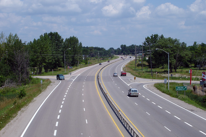
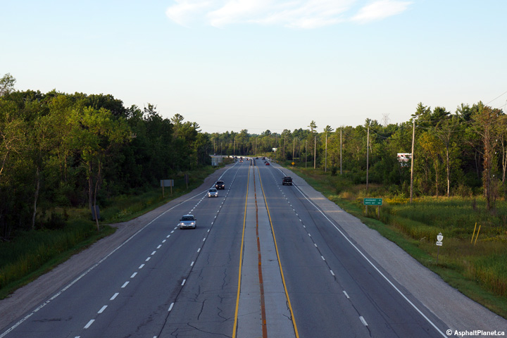
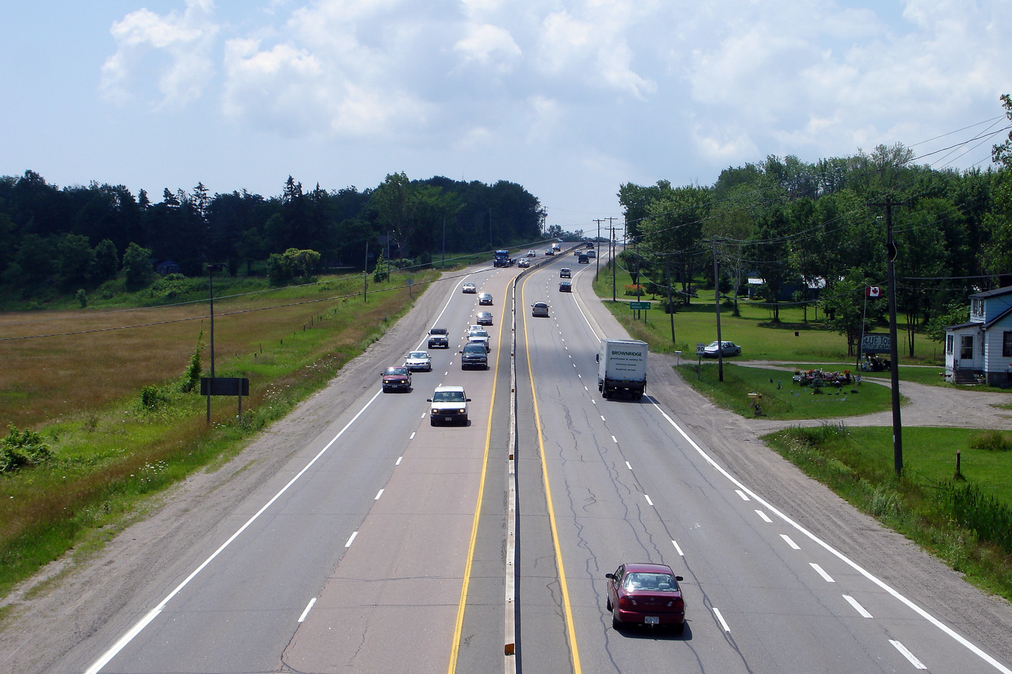
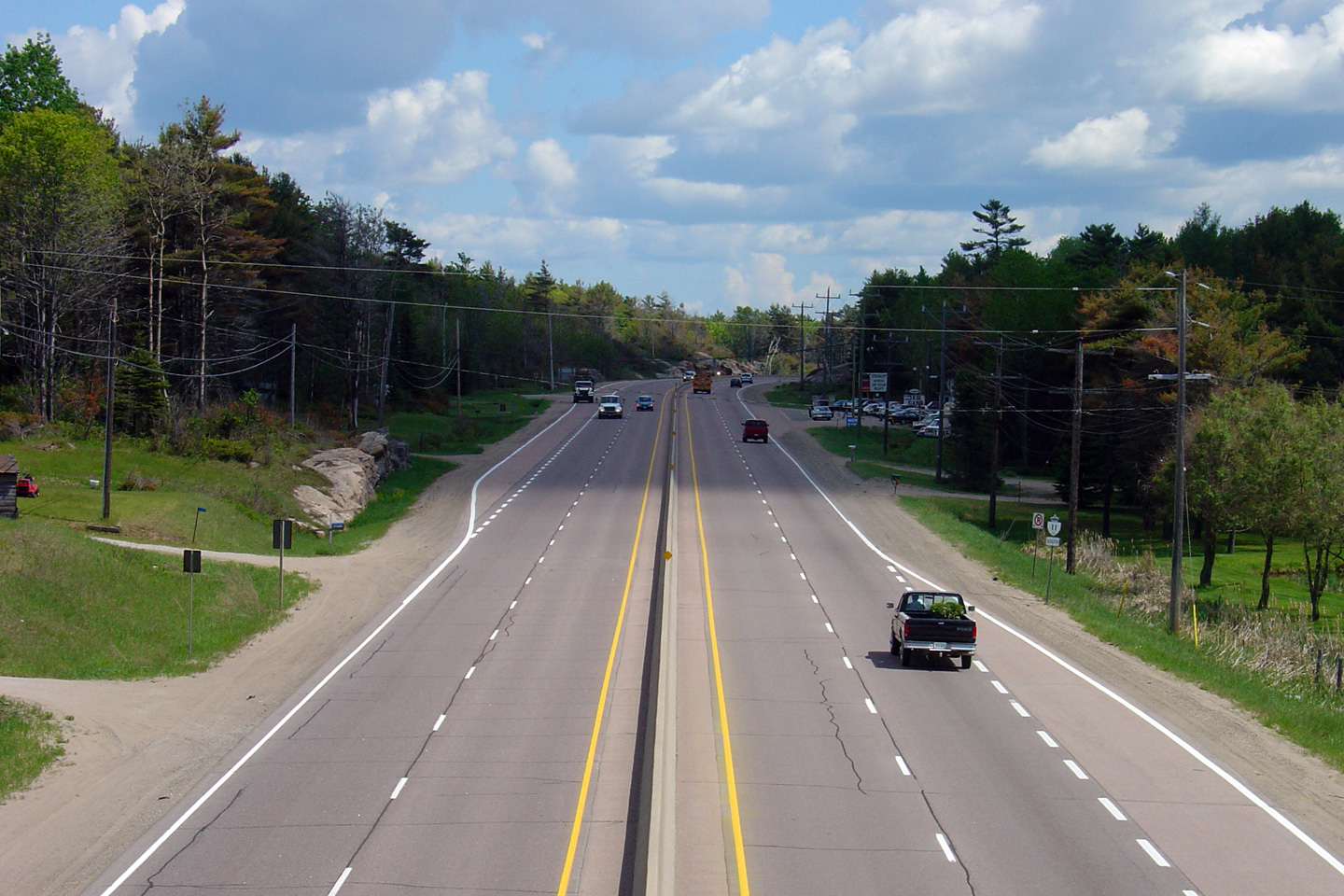
| Township of Severn County of Simcoe |
Southerly view along Highway 11 from the Sparrow Lake Road overpass.
Notice that Highway 11 has gravel outside shoulders in the vicinity of the
Sparrow Lake Road intersections. Gavel shoulders along RIRO sections
of Highway 11 hamper the operations of the expressway. Traffic exiting
or entering the expressway at private driveways is forced to slow and
accelerate in the right-hand (driving) lane of the expressway, rather than
along a paved shoulder. Photo taken: July 13th, 2006. |
 (720x480) (1440x960) |
||
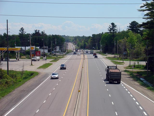
| Township of Severn County of Simcoe |
Northerly view from the South Sparrow Lake Road overpass. Because
Highway 11 was never by-passed with a controlled access highway, many of the
1950s era roadside motels and restaurants still stand alongside the highway. Photo taken: July 13th, 2006. |
 (720x480) (1440x960) |
||
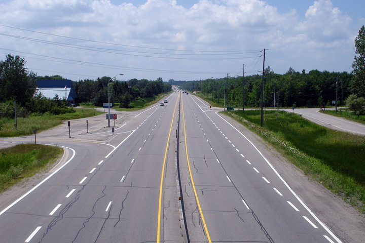
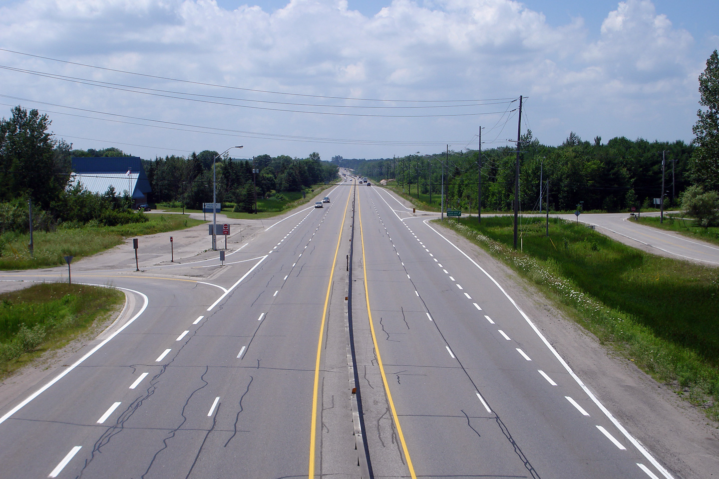
| Township of Severn County of Simcoe |
Southerly view from the Agnew Road overpass. Photo taken: July 13th, 2006. |
 (720x480) (1440x960) |
||
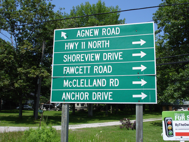
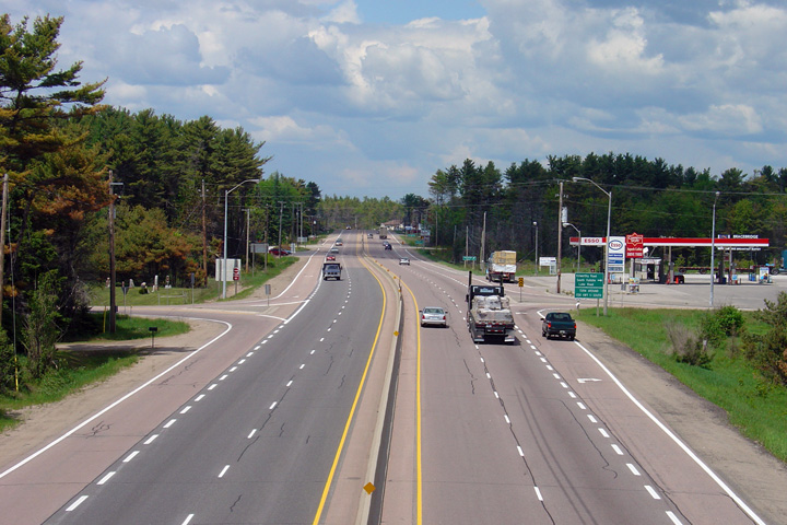
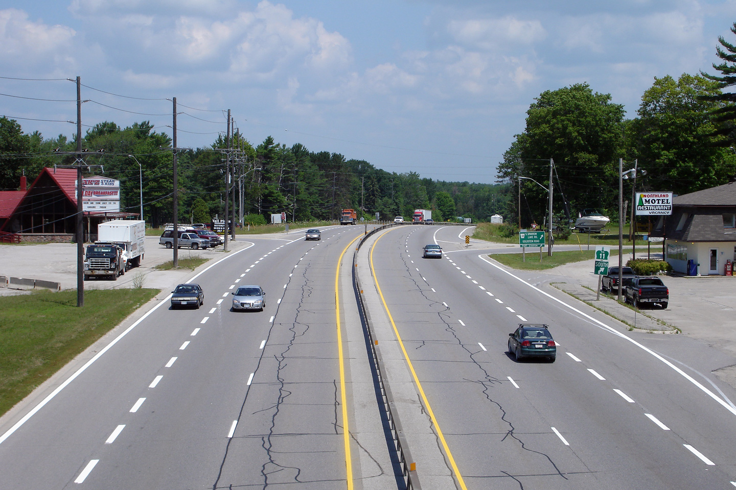
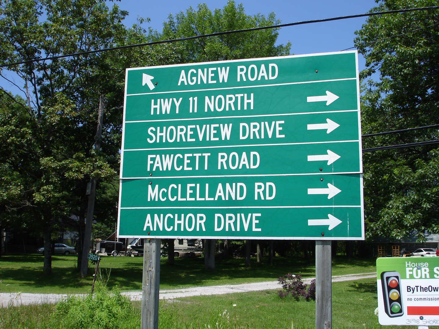
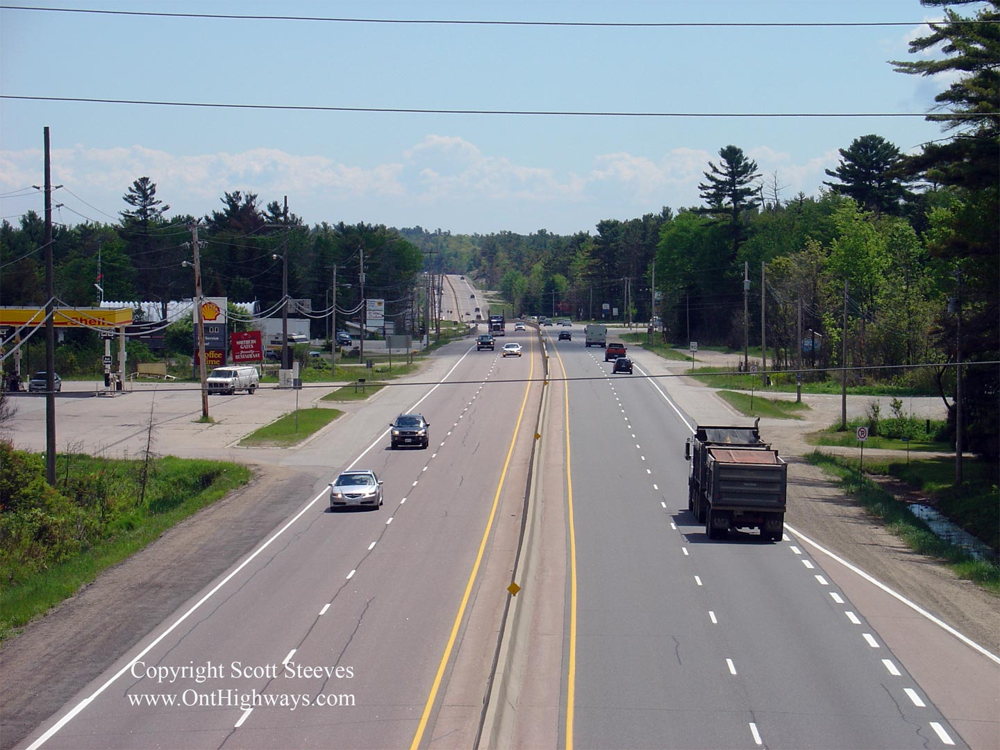
| Township of Severn County of Simcoe |
Signage advising drivers that they can reach pretty well any destination
from
this intersection. Highway 11 runs in close proximity to Lake Couchiching
in the vicinity of this photograph so many of the streets listed on this
signage are cottage access roads. Photo taken: July 13th, 2006. |
 (720x480) (1440x960) |
||
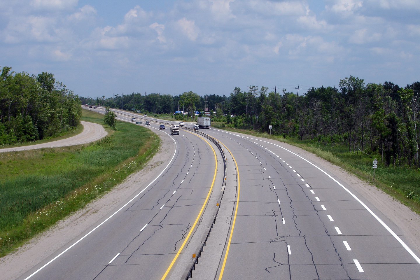
| Township of Severn County of Simcoe |
This view looks northerly from the Agnew Road overpass as Highway 11 curves
to cross overtop of the
Trent-Severn Canal. Photo taken: July 13th, 2006. |
 (720x480) (1440x960) |
||
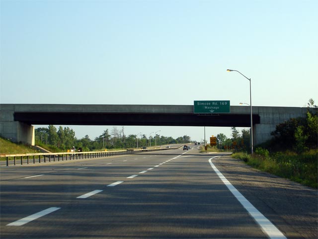
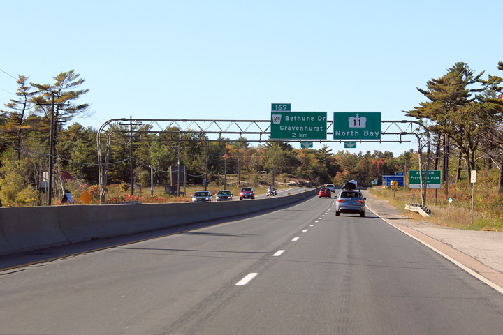
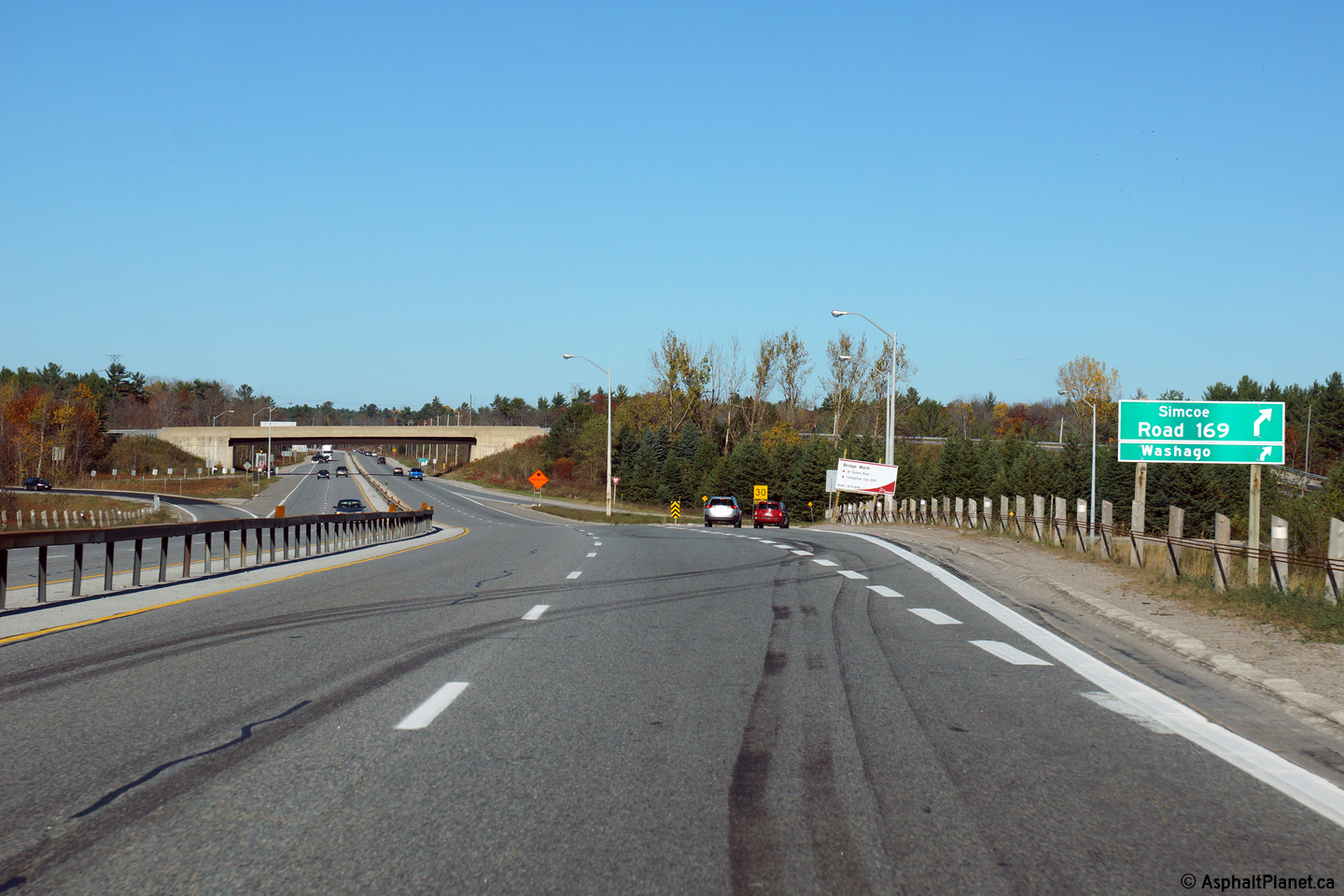
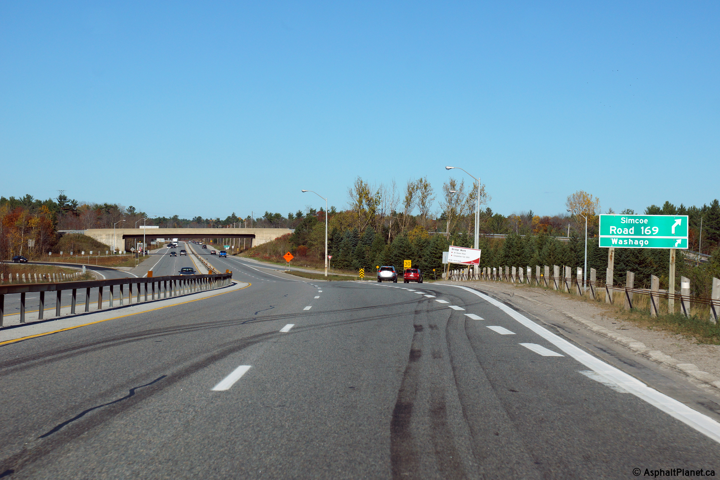
| Township of Severn County of Simcoe |
View looking northerly as the off-ramp to Highway 169 South departs from
Highway 11. Photo taken: October 22nd, 2014. |
 (720x480) (720x480)(1440x960) (2400x1600) |
||
| Township of Severn County of Simcoe |
View looking southerly from the Highway 169 overpass along Highway 11.
The southern Highway 11/169 ramp is a hybrid between a trumpet
interchange and a typical RIRO interchange. Notice the positive guidance
measures directing traffic around the loop ramp on the right hand side of
the photo. Click here for an alternate view from
this overpass, taken in June, 2005. Photo taken: August 25th, 2014 |
 (720x480) (1440x960) (2400x1600) |
||
| South of Highway 11 Highway 169 leads through Washago, terminating at Highway 12. Click here for Highway 169 images. | ||||
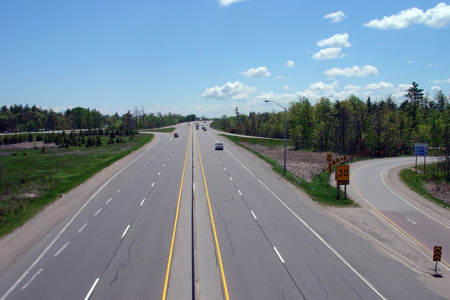
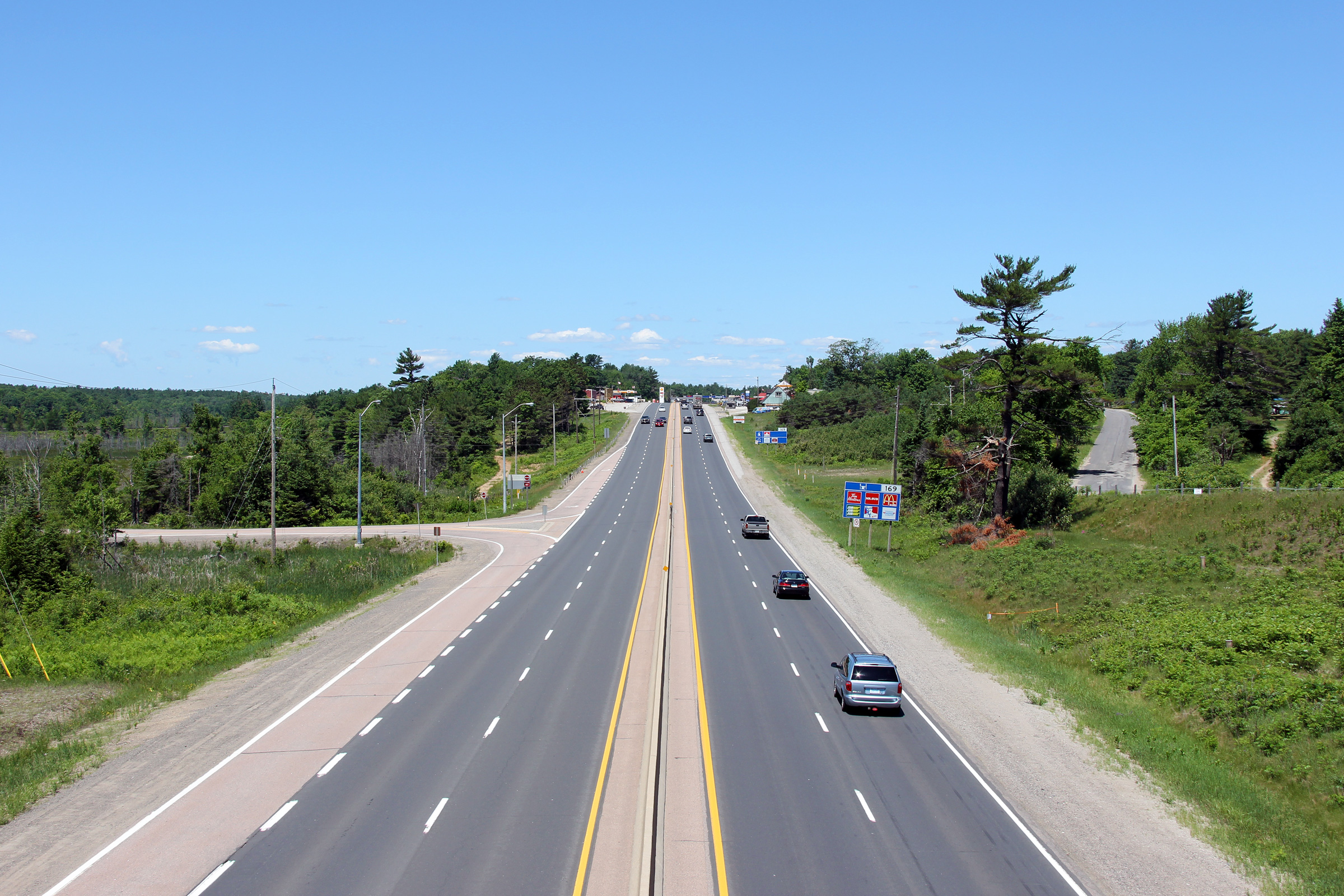
| Township of Severn County of Simcoe |
View looking northerly along Highway
11/169 from
the southern Highway 169 overpass. The Washago By-pass was completed
in 1955 as a controlled access highway.
Click here for an alternate view from
this overpass, taken in June, 2005. Photo taken: August 25th, 2014. |
 (720x480) (1440x960) (2400x1600) |
||
| Township of Severn County of Simcoe |
View driving south along
Highway 11 approaching
the Highway 169 overpass near Washago. Photo taken: July 13th, 2006. |
 |
||
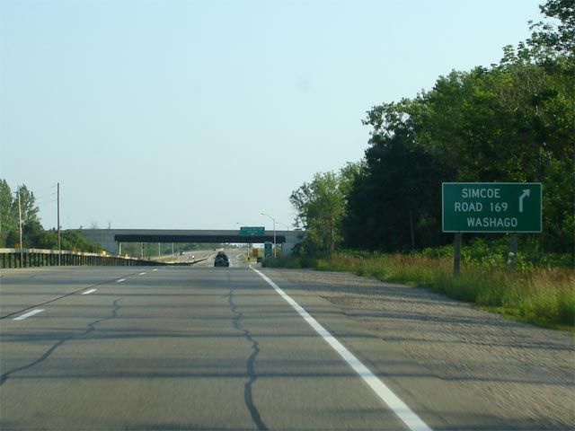
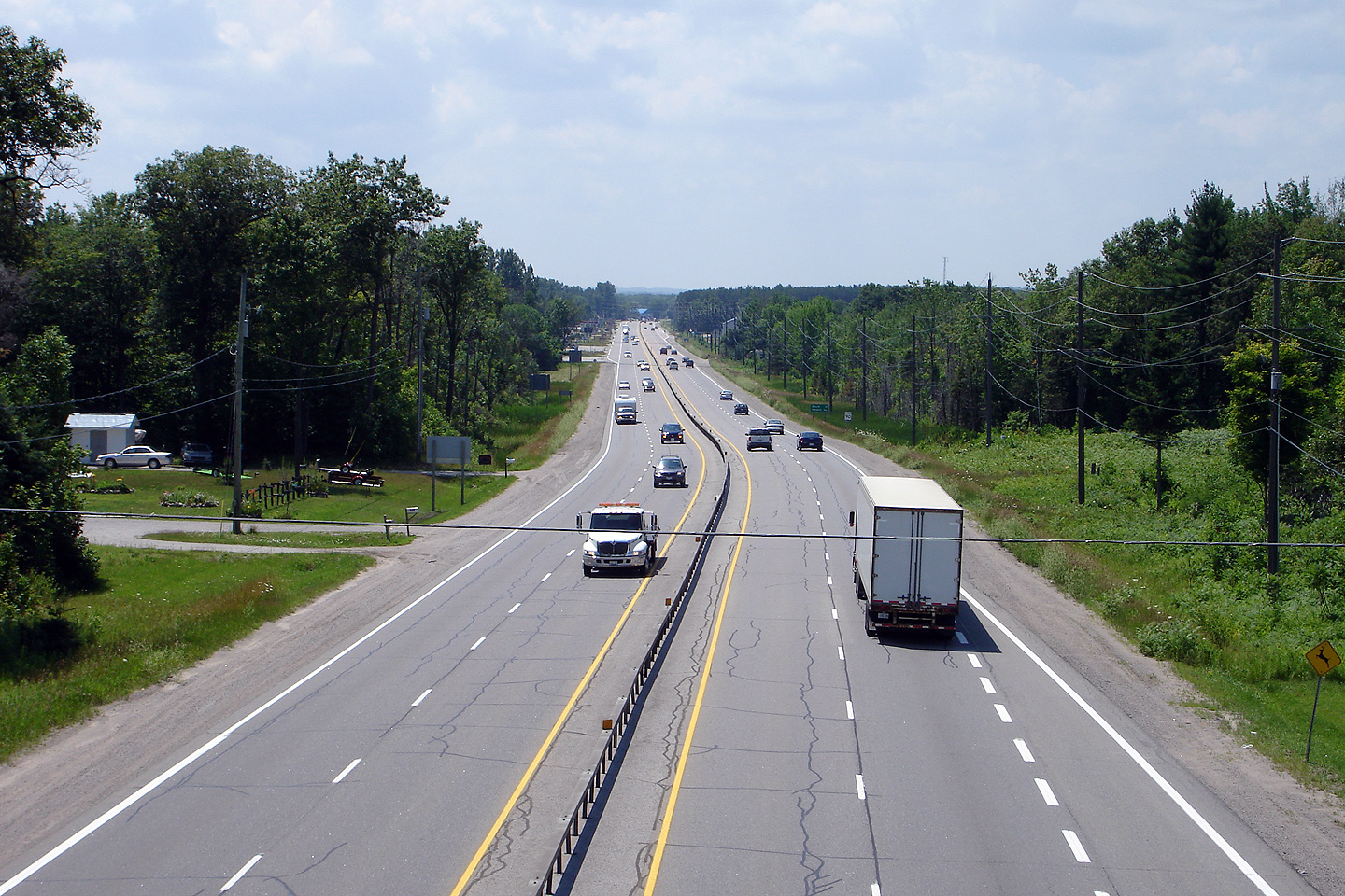
| Township of Severn County of Simcoe |
Advanced signage for the
Highway 169
interchange. Notice that the signage used on Highway 11 is not the
typical aluminum extruded signage that would normally be used on freeways.
Signage along the RIRO portions of Highway 11 is more indicative to what would
be used on a standard 2-lane highway. Photo taken: July 13th, 2006. |
 |
||
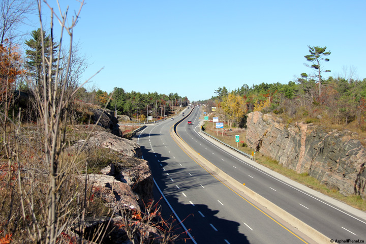
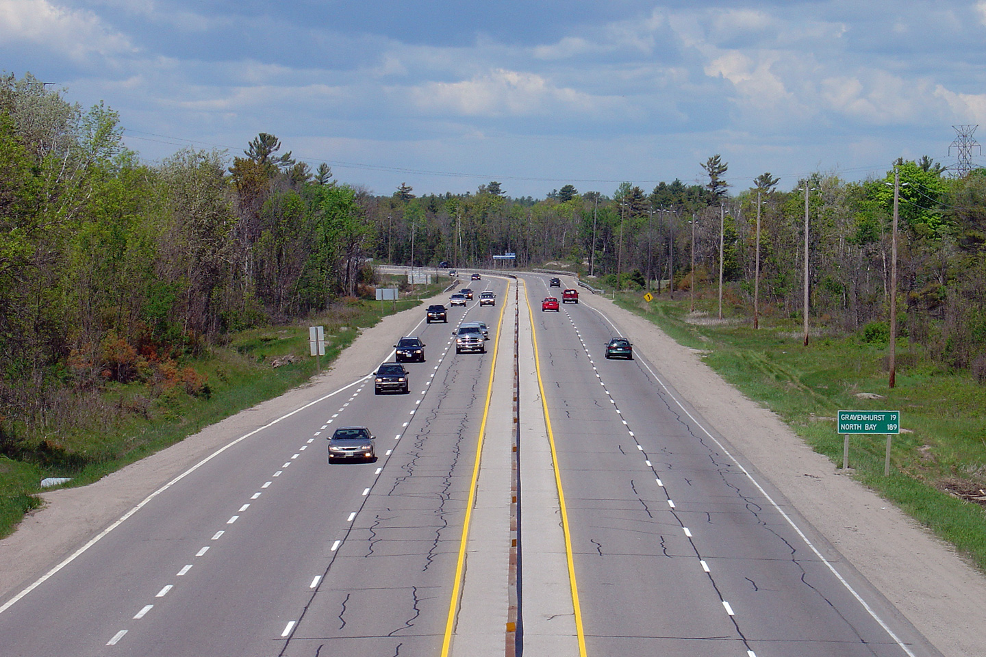
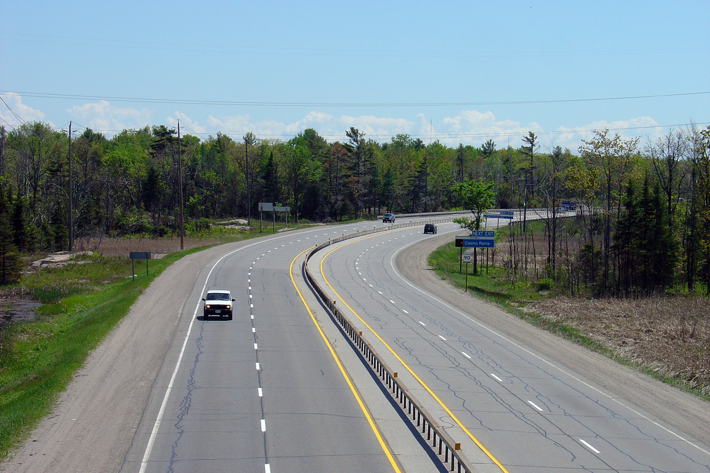
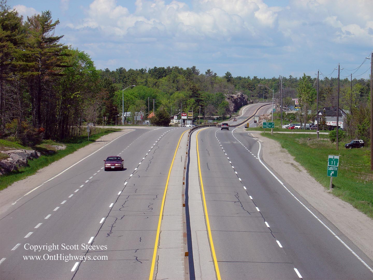
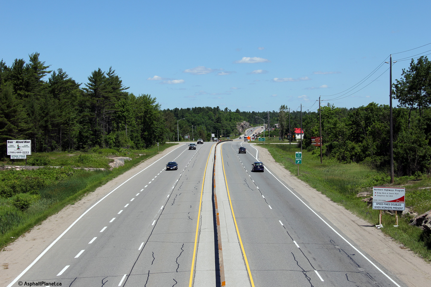
| Township of Severn County of Simcoe |
Looking south from the Coopers Falls Road
overpass. Click here for an
alternate view from this overpass, taken in June, 2005. Photo taken: June 23rd, 2012. |
 (720x480) (1440x960) (2400x1600) |
||
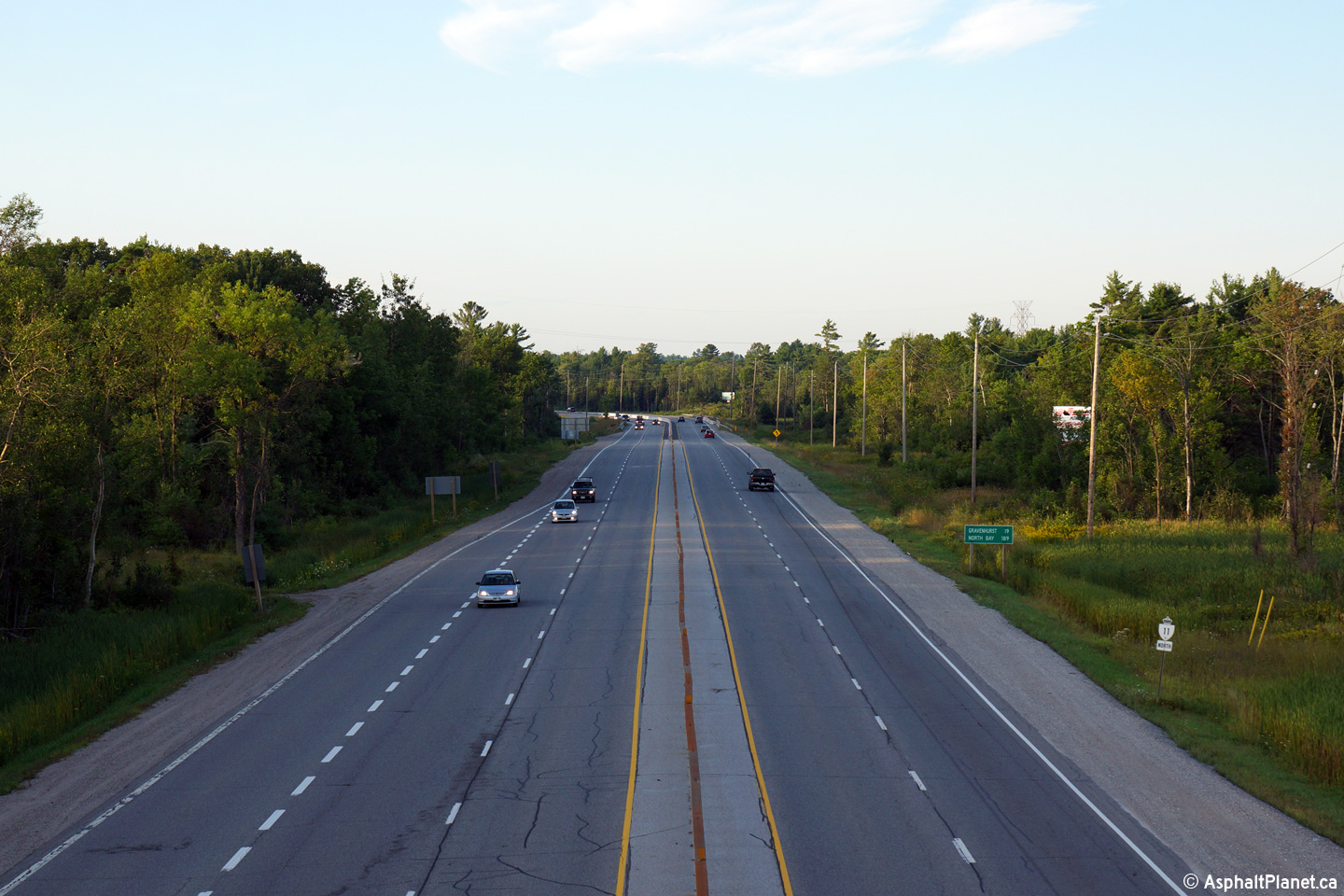
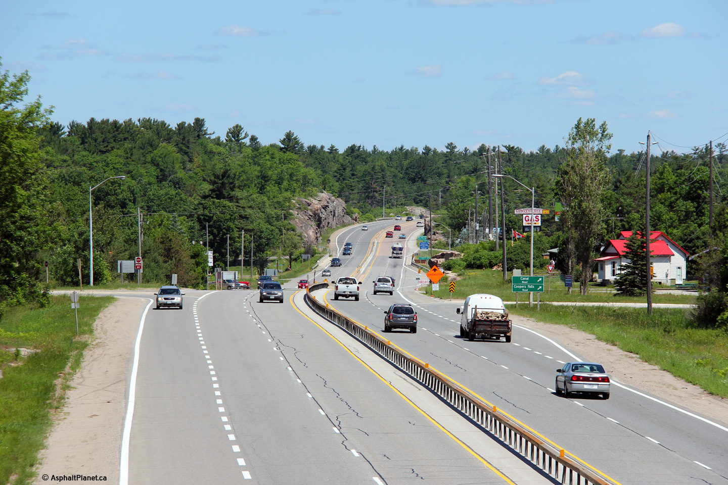
| Township of Severn County of Simcoe |
Highway 11 looking north from the Coopers Falls Road towards Severn Bridge
south of Gravenhurst. For several decades prior to the 1950s, Highway
11/169 was the only highway to cross the Sever River.
Until Highway 103 (today's Highway 69/400) was constructed northerly from
Wabaushene through to MacTier, Highway 11 was the only road to link southern
Ontario the Muskoka Region and beyond.
Click here for an alternate view from
this overpass, taken in June, 2005. Photo taken: June 23rd, 2012. |
 (720x480) (1440x960) (2400x1600)  (720x480) (1440x960) (2400x1600) |
||
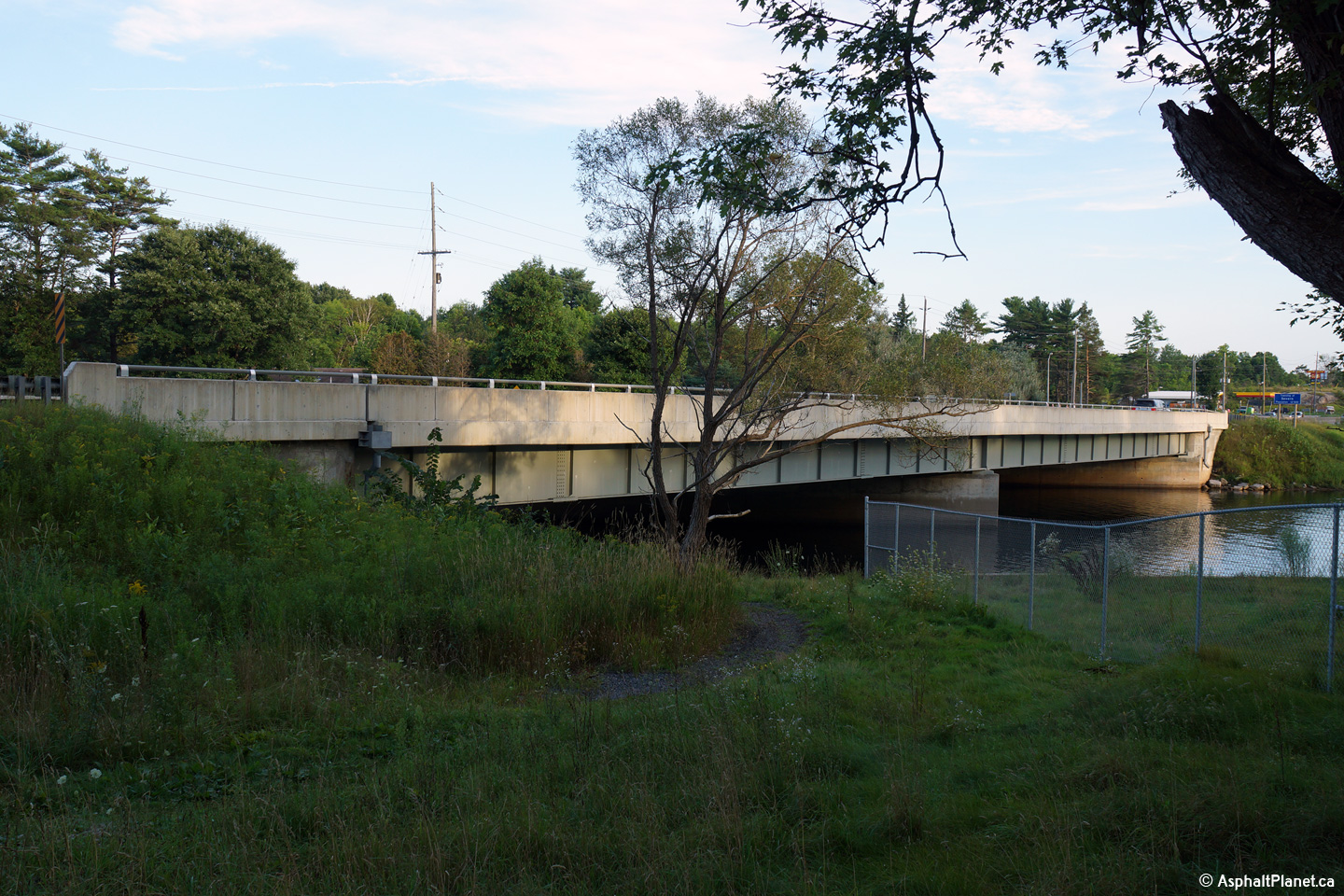
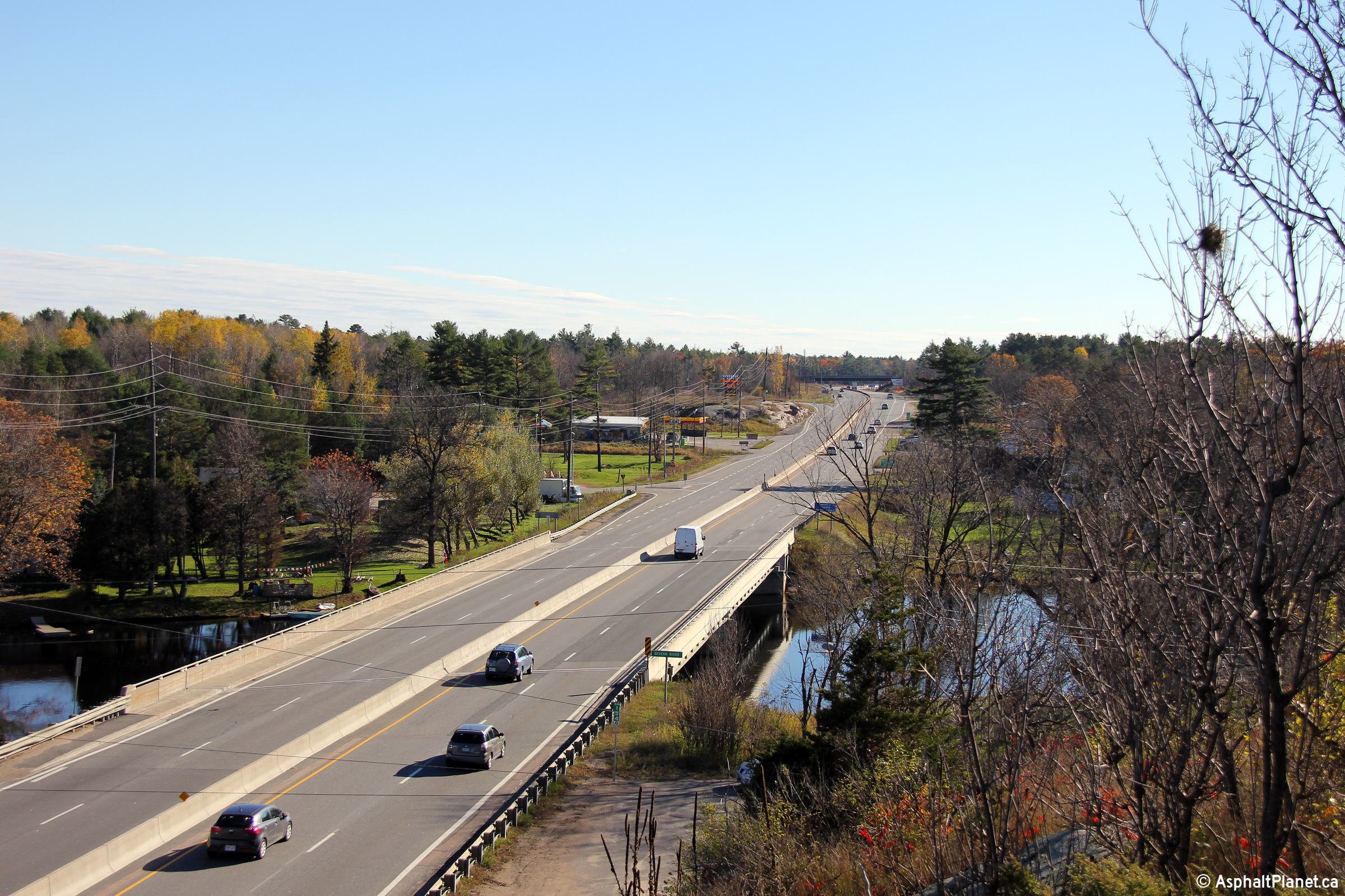
| Town of Gravenhurst District Municipality of Muskoka |
Views of both sides of the bridge that carries
Highway 11 overtop of the Severn River. Highway 11 ended at the Severn
River until 1937. Prior to 1937, all roads in northern Ontario were
maintained by the Department of Northern Development and Mines and were
unnumbered. Photos taken: August 25th, 2014. |
 (720x480) (1440x960) (2400x1600) 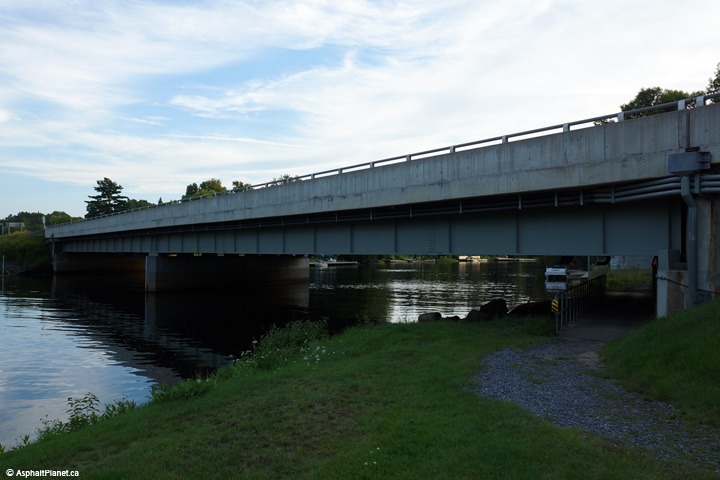 (720x480) (1440x960) (2400x1600) |
||
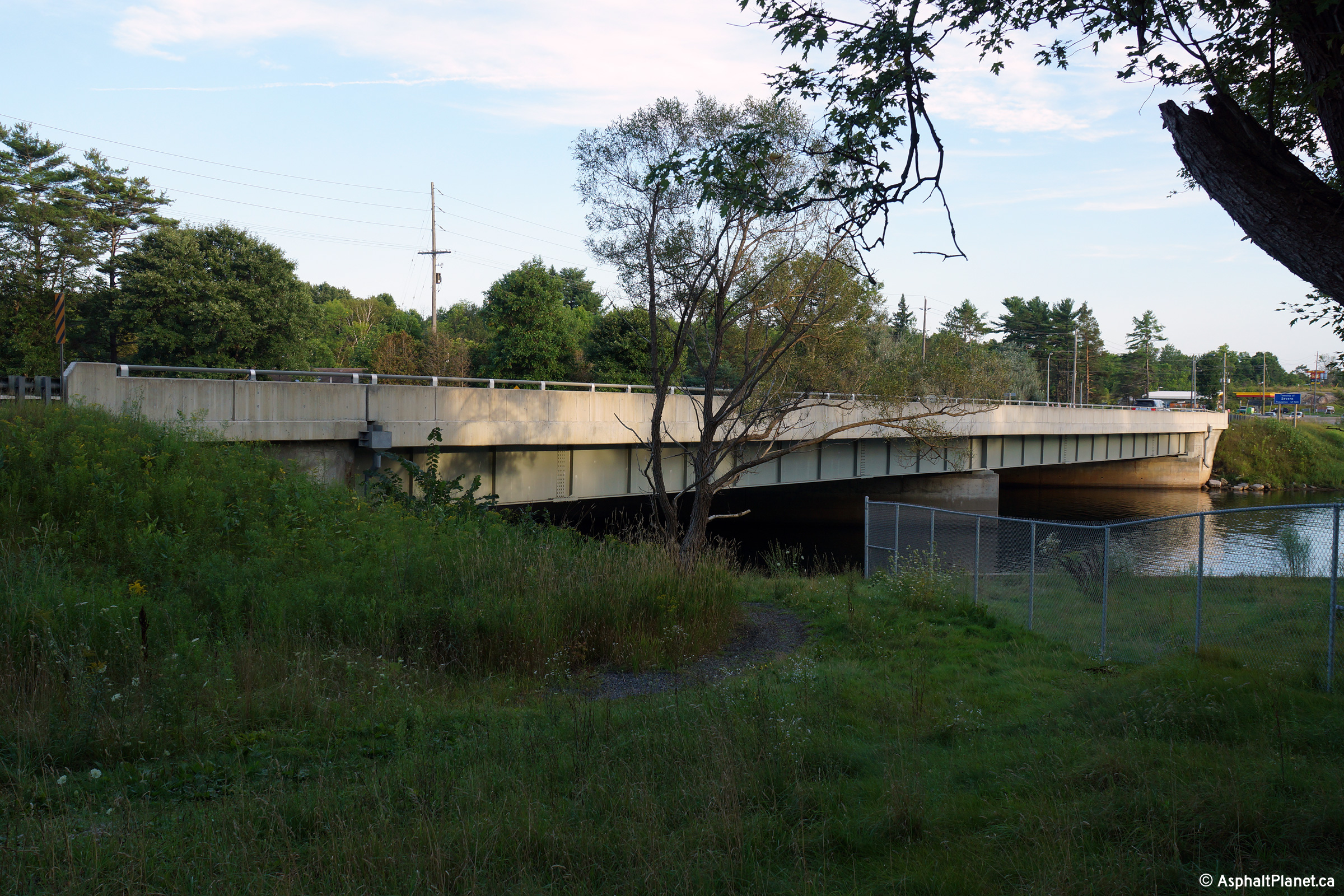
| Town of Gravenhurst District Municipality of Muskoka |
View looking southerly across the Severn River
bridge along Highway 11/169. Late in
2006 construction started to rehabilitate the Severn River bridge. The
structure was completed in two phases in 1966, when Highway 11 was first
4-laned. Upper photo taken: August 26th, 2006. Lower photo taken: October 22nd, 2014. |
 (720x480) (1440x960) (2400x1600) |
||
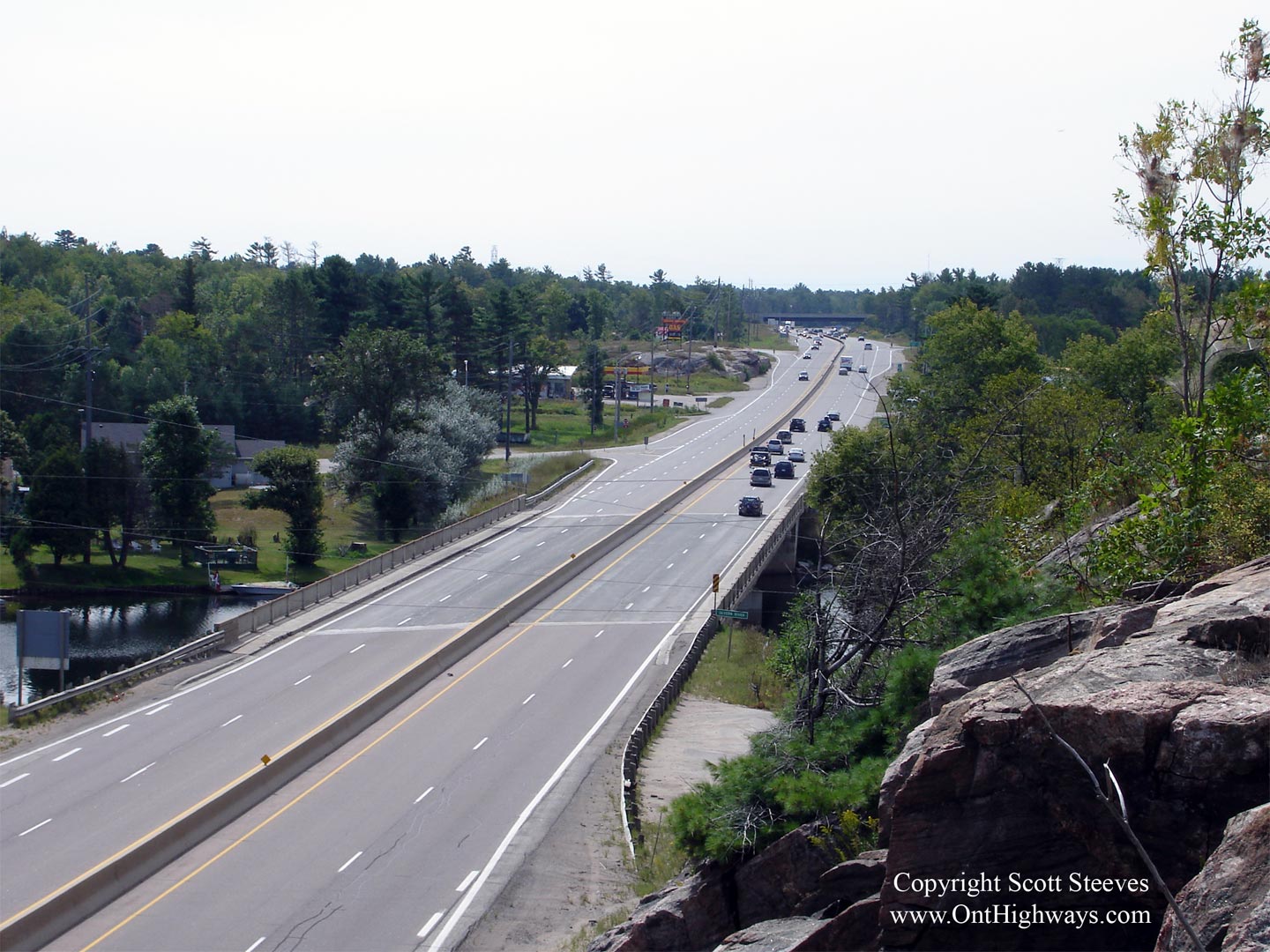
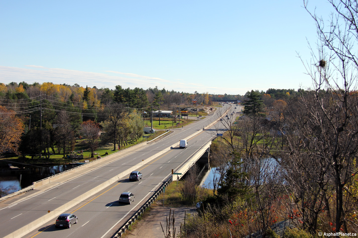
| Town of Gravenhurst District Municipality of Muskoka |
View looking northerly from just north of the
Severn River bridge. Click here for
an alternate view from this overpass, taken in August, 2006 Photo taken: October 22nd, 2014. |
 (720x480) (1440x960) (2400x1600) |
||
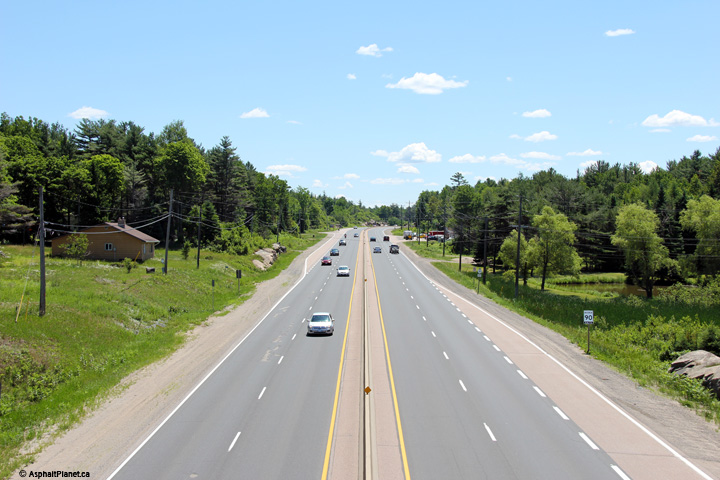
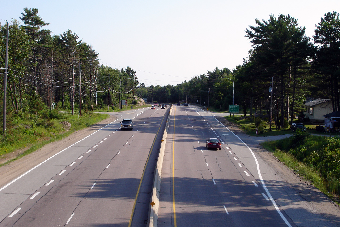
| Town of Gravenhurst District Municipality of Muskoka |
View looking southerly from the Sparrow Lake
Road 'D' overpass. Photo taken: June 30th, 2006. |
 (720x480) (1440x960) |
||
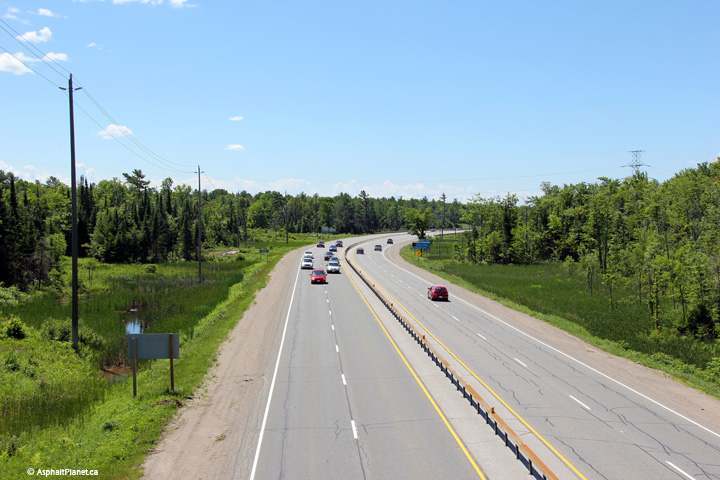
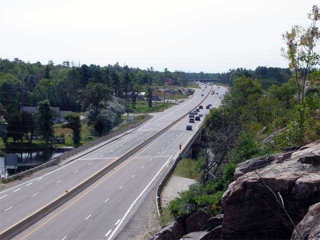
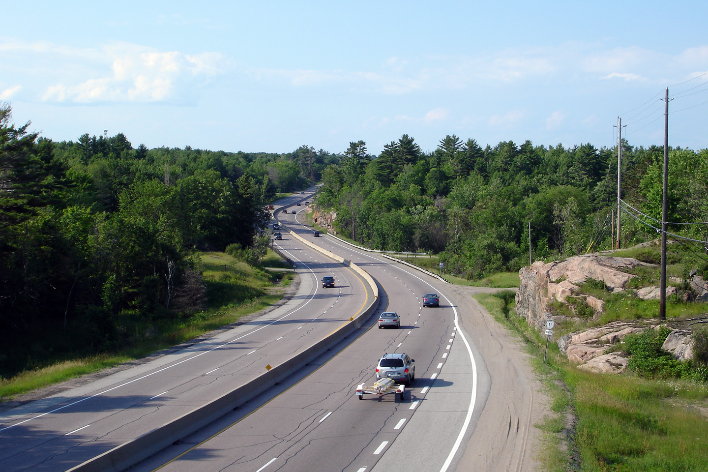
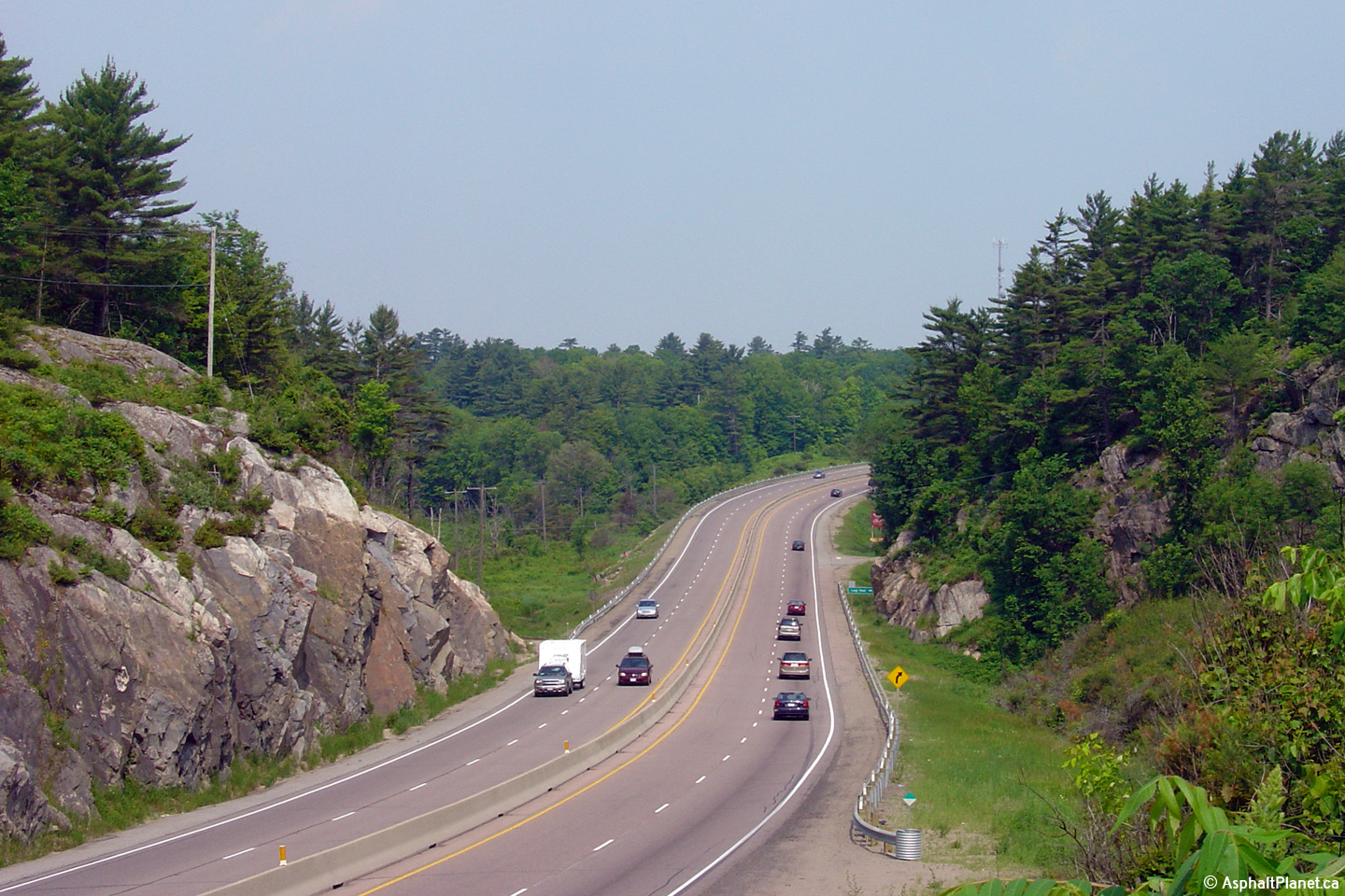
| Town of Gravenhurst District Municipality of Muskoka |
Looking northerly through a scenic reversing
curve along Highway 11/169 from the
Sparrow Lake Road 'D' overpass. North of the Severn River Highway
11/169 quickly makes the transition from the Great Lakes Lowlands to the
Canadian Shield. Photo taken: June 30th, 2006. |
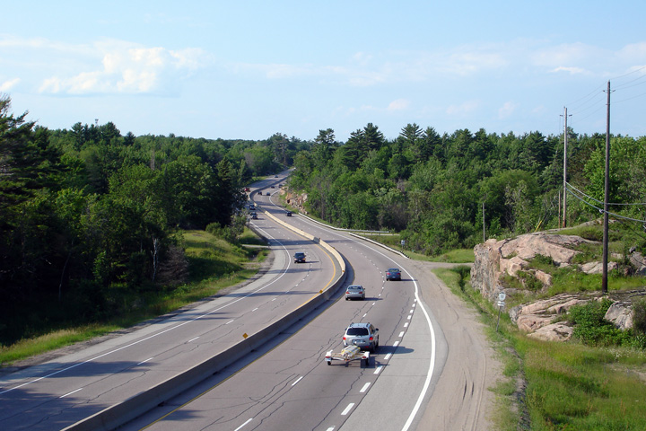 (720x480) (1440x960) |
||
| Town of Gravenhurst District Municipality of Muskoka |
View looking southerly from the South Kahshe
Lake Road overpass. Photo taken: June 1st, 2005. |
 (720x480) (1440x960) |
||
| Town of Gravenhurst District Municipality of Muskoka |
Looking northerly along Highway 11/169
from the South Kahshe Lake Road overpass. Photo taken: June 1st, 2005. |
 (720x480) (1440x960) |
||
| Town of Gravenhurst District Municipality of Muskoka |
View looking northerly along Highway 11/169
across Beaver Creek just south of Luigi Road. Photo taken: June 1st, 2005. |
 (720x480) (1440x960) |
||
| Town of Gravenhurst District Municipality of Muskoka |
Looking south along Highway 11/169
from the Sedore Road overpass. Click here for an alternate view from
this overpass, taken in June, 2005. Photo taken: June 23rd, 2012. |
 (720x480) (1440x960) (2400x1600) |
||
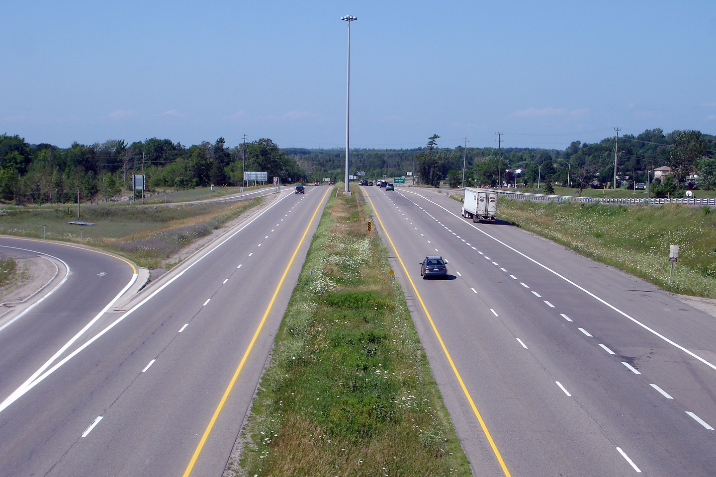
| Town of Gravenhurst District Municipality of Muskoka |
Looking north towards Gravenhurst from the
Sedore Road overpass. Click here for an alternate view from
this overpass, taken in June, 2005. Photo taken: June 23rd, 2012. |
 (720x480) (1440x960) (2400x1600) |
||
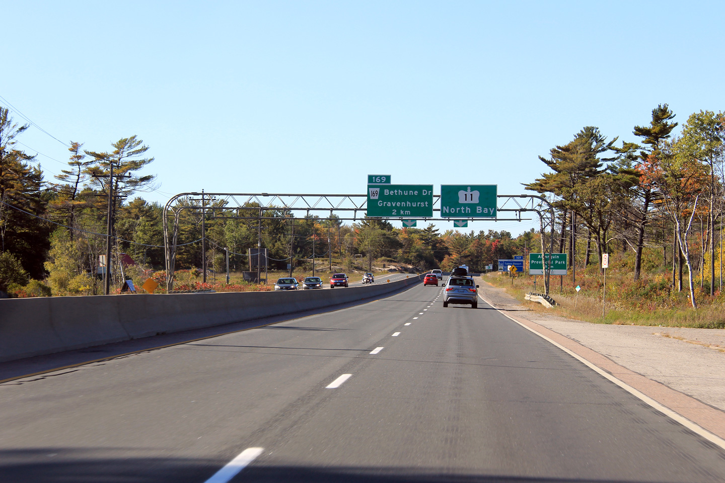
| Town of Gravenhurst District Municipality of Muskoka |
Advanced signage for the upcoming northern split
of Highway 169 from Highway 11. Photo taken: October 1st, 2011. |
 (720x480) (720x480)(1440x960) (2400x1600) |
||
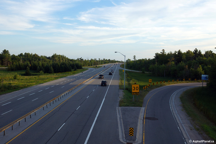
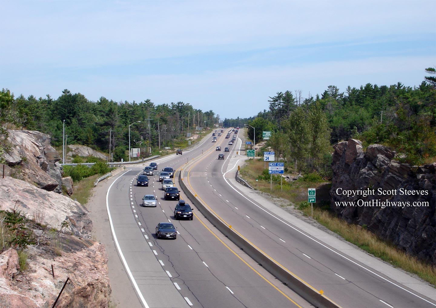
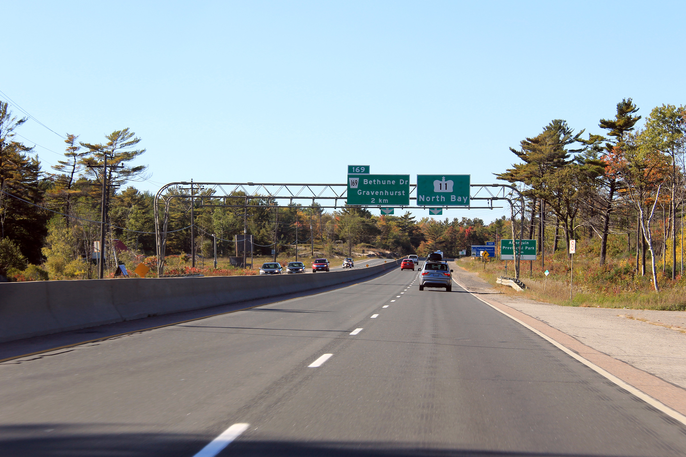
| Town of Gravenhurst District Municipality of Muskoka |
Diagramical signage approaching the northern
Highway 11/169 interchange. Notice
that the speed limit drops to 80km/h just before the interchange. This
speed limit drops due to the rather sharp right-hand curve just beyond the
off-ramp. At Highway 169, Highway 11 curves easterly as it swings
around Gull Lake on the Gravenhurst By-pass. Photo taken: October 1st, 2011. |
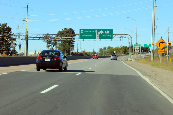 (720x480) (720x480)(1440x960) (2400x1600) |
||
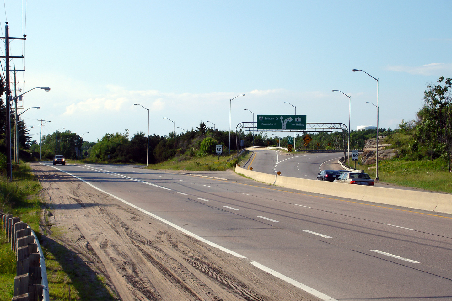
| Town of Gravenhurst District Municipality of Muskoka |
View looking northerly along Highway 11/169
at the northern interchange between the two highways. Notice the
diagramical sign is placed at the beginning of the ramp in this photo rather
then in advance of the interchange. The diagramical sign was erected
late in June of 2006 at the start of the off-ramp but was quickly moved to
the existing gantry downstream of the interchange. Photo taken: June 30th, 2006. |
 (720x480) (1440x960) |
||
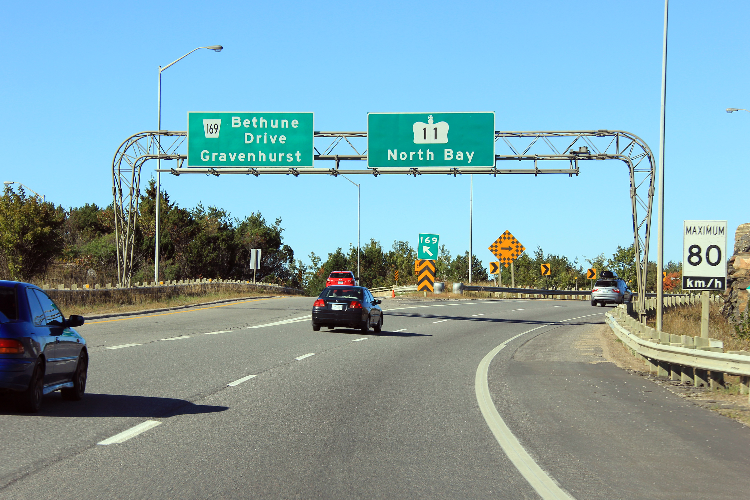
| Town of Gravenhurst District Municipality of Muskoka |
Overhead signage at the
Highway 169 exit from Highway 11 in
Gravenhurst. North of Gravenhurst, Highway 11 has been extensively
realigned and is now a mixed at-grade expressway and full freeway northerly
to North Bay. Photo taken: October 1st, 2011. |
 (720x480) (720x480)(1440x960) (2400x1600) |
||
| Continue north on Highway 11 via Gravenhurst to Huntsville Images | ||||
<- Page 2A Images Highway 11 Images Index Page 2C Images ->
<- Highway 10 Images Back to Highway 11 Highway 11A Images ->
Copyright (c) 2004-2016, Scott Steeves (Webmaster) AsphaltPlanet@asphaltplanet.ca