AsphaltPlanet.ca > Georgia > Interstate 285
Pictures on
this page are arranged in order clockwise along the length of Atlanta's Beltway.
The zero marker is at Washington Road, the furthest southeast point within the
beltway. Clockwise oriented photos are left-aligned, while
counter-clockwise photos appear right-aligned in the photo column below.
Center-line pictures are centered within the last column.
|
Location |
Description |
Photo |
||
|
Clock- |
Counterclock- |
|||
|
Interstate 75 is the State of Georgia's principal north-south freeway. Click here for Interstate 75 images. |
||||
|
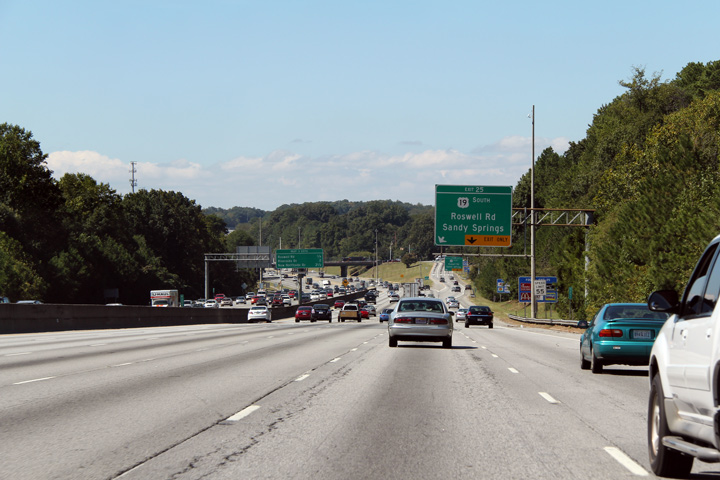
Fulton County |
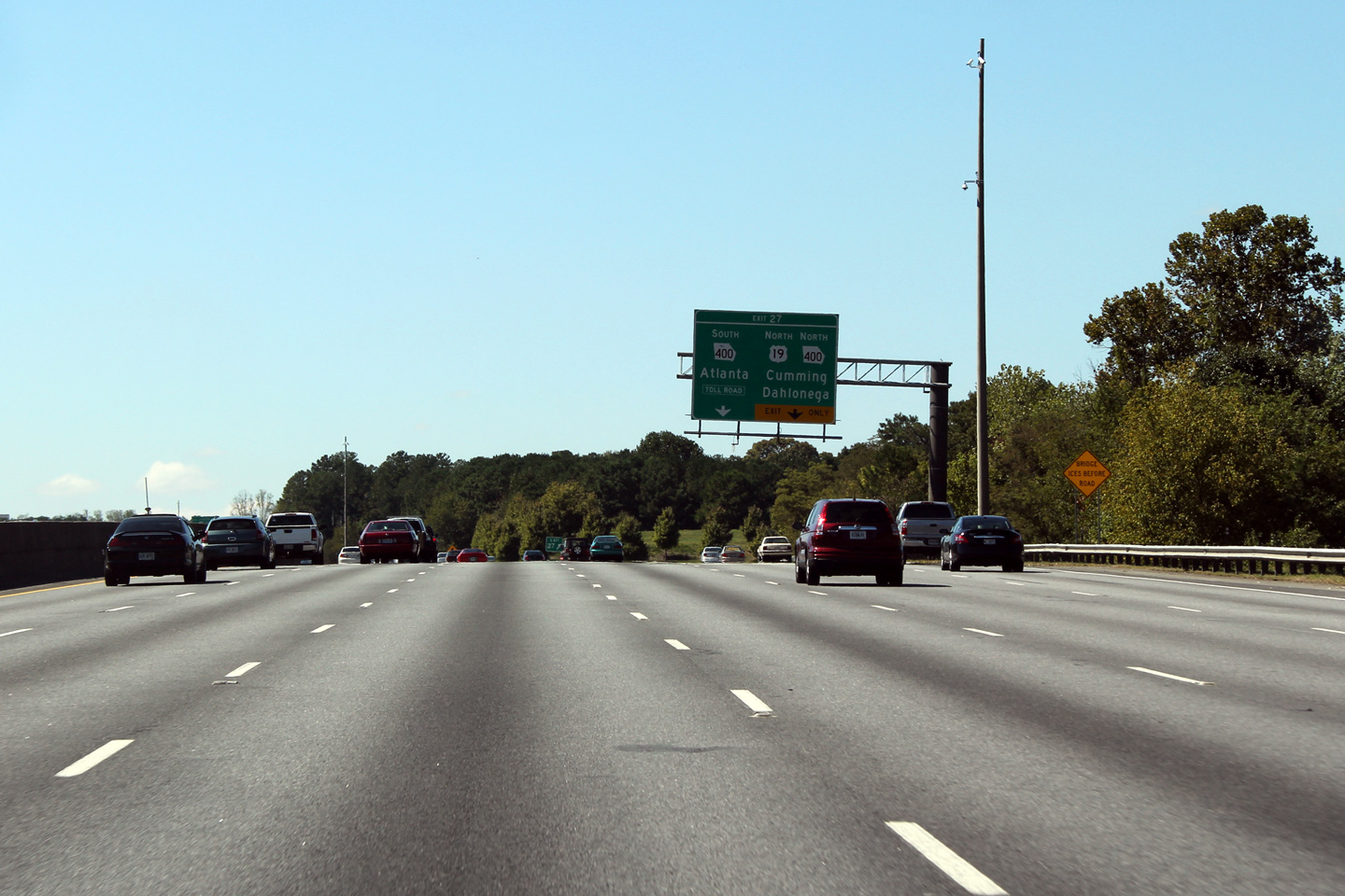
Westbound advanced signage for US-19 South along the I-285 beltway. In general, US-19 is paired with GA-400 with the two designations sharing the same four-lane alignment. However, since Highway 400 is tolled between I-85 and I-285, US-19 follows its historic alignment along surface streets into Downtown Atlanta |
 |
||
|
Date: 10/3/2010 |
High-res: (1440x960) (2400x1600) | |||
|
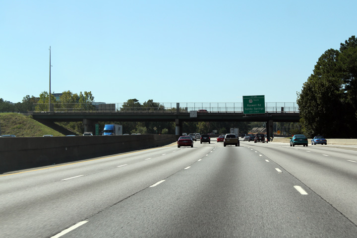
Fulton County |
Westerly view as I-285 passes underneath of the Highway 400 Southbound overpass in advance of the US-19 south interchange. The southbound lanes of Georgia Highway 400 pass overtop of I-285, while the northbound lanes pass underneath of the Beltway. |
 |
||
|
Date: 10/3/2010 |
High-res: (1440x960) (2400x1600) | |||
|
Georgia Toll Route 400 leads south from the I-285 beltway through Buckhead to Interstate 85 north of Midtown Atlanta. Click here for Georgia Toll Route 400 images. |
||||
|
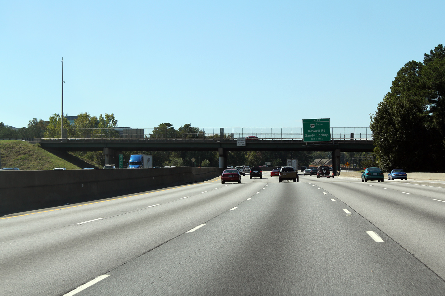
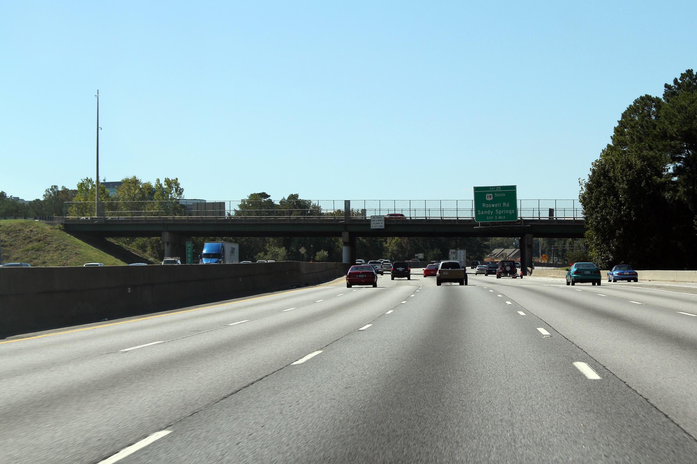
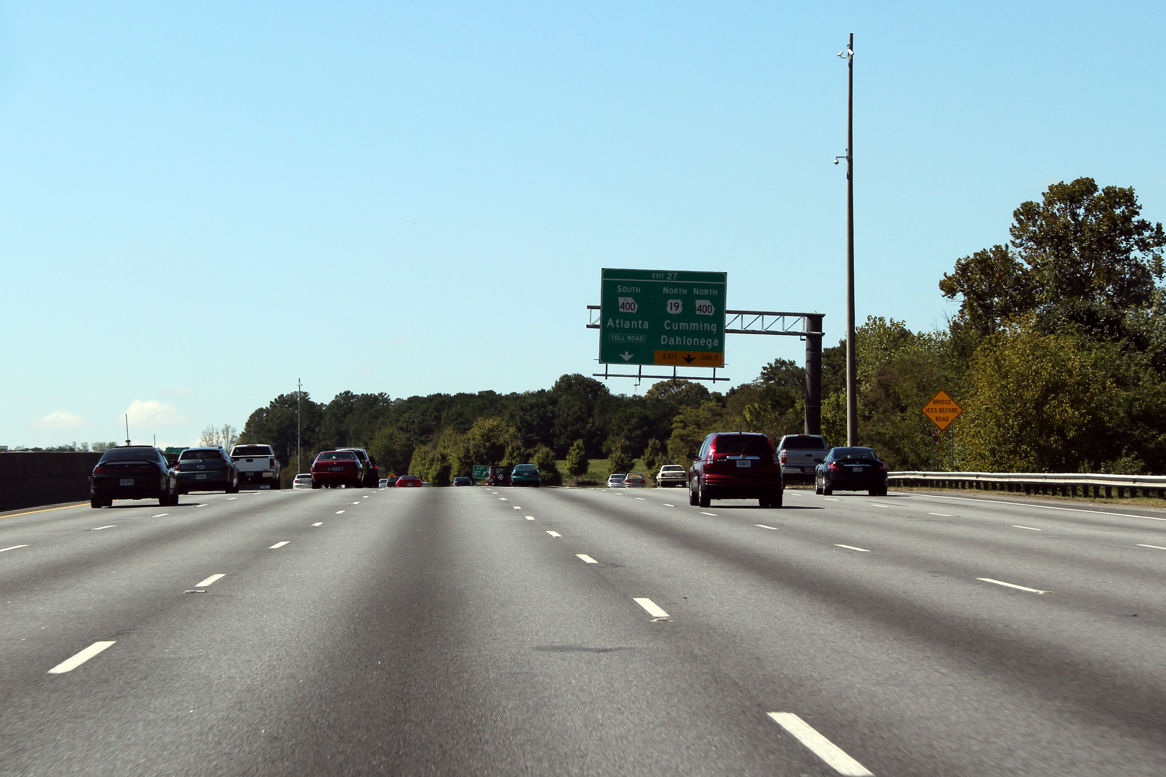
Fulton County |
Advanced signage for the US-19 North interchange, and the Georgia Highway 400 interchange. Georgia Highway 400 is a toll road south of the beltway with a single toll booth about halfway between the I-285 beltway and Interstate 85 near Downtown. |
 |
||
|
Date: 10/3/2010 |
High-res: (1440x960) (2400x1600) | |||
|
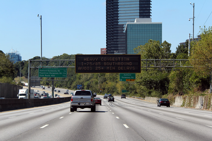
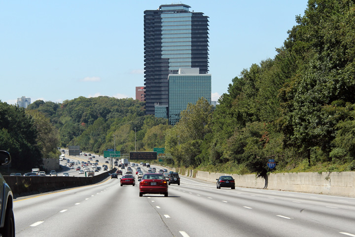
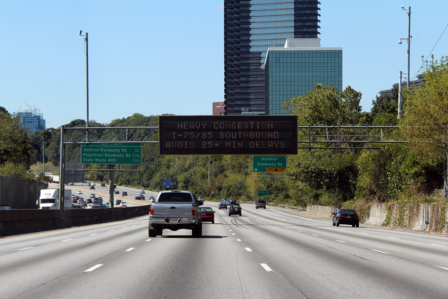
DeKalb County |
Westbound travel time signage along the beltway situated before the Twelve Ravine Drive building. There are numerous tall office buildings along Interstate 285 between the Cobb Cloverleaf at Interstate 75 and the Spaghetti Junction at Interstate 85. This office building is one of the most predominant buildings of the Perimeter City Commercial Complex. Note the heavy congestion along Interstate 75/85 South. The Downtown Connector in Atlanta is notorious for traffic congestion. |
 |
||
|
Date: 10/3/2010 |
High-res: (1440x960) (2400x1600) | |||
|
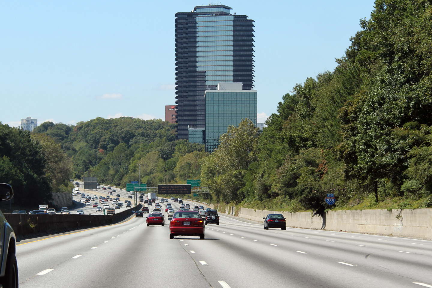
DeKalb County |
Westerly (clockwise) view along Interstate 285 still approaching the Perimeter City. Perimeter City gets its name from the fact it is located along Atlanta's Perimeter Highway. |
 |
||
|
Date: 10/3/2010 |
High-res: (1440x960) (2400x1600) | |||
|
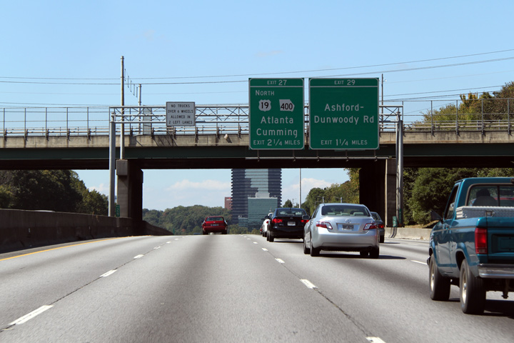
DeKalb County |
Westerly view along Interstate 285 approaching the Ashford-Dunwoody Road and US-19 interchange. Note the pairing of US-19 and Highway 400. It is common in Georgia for four-lane highways to have a '400' series designation. For example, I-285 is designated as GA-407 for the entire length of the Atlanta Beltway, however, that designation is never posted. Likewise, I-75 is GA-401, and I-85 is GA-403. |
 |
||
|
Date: 10/3/2010 |
High-res: (1440x960) (2400x1600) | |||
|
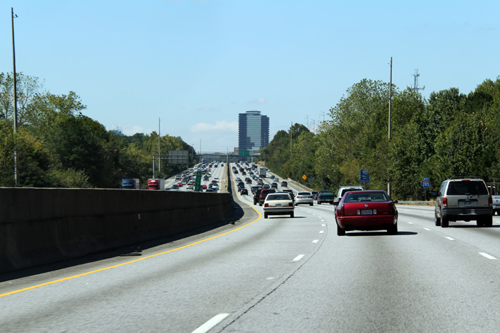
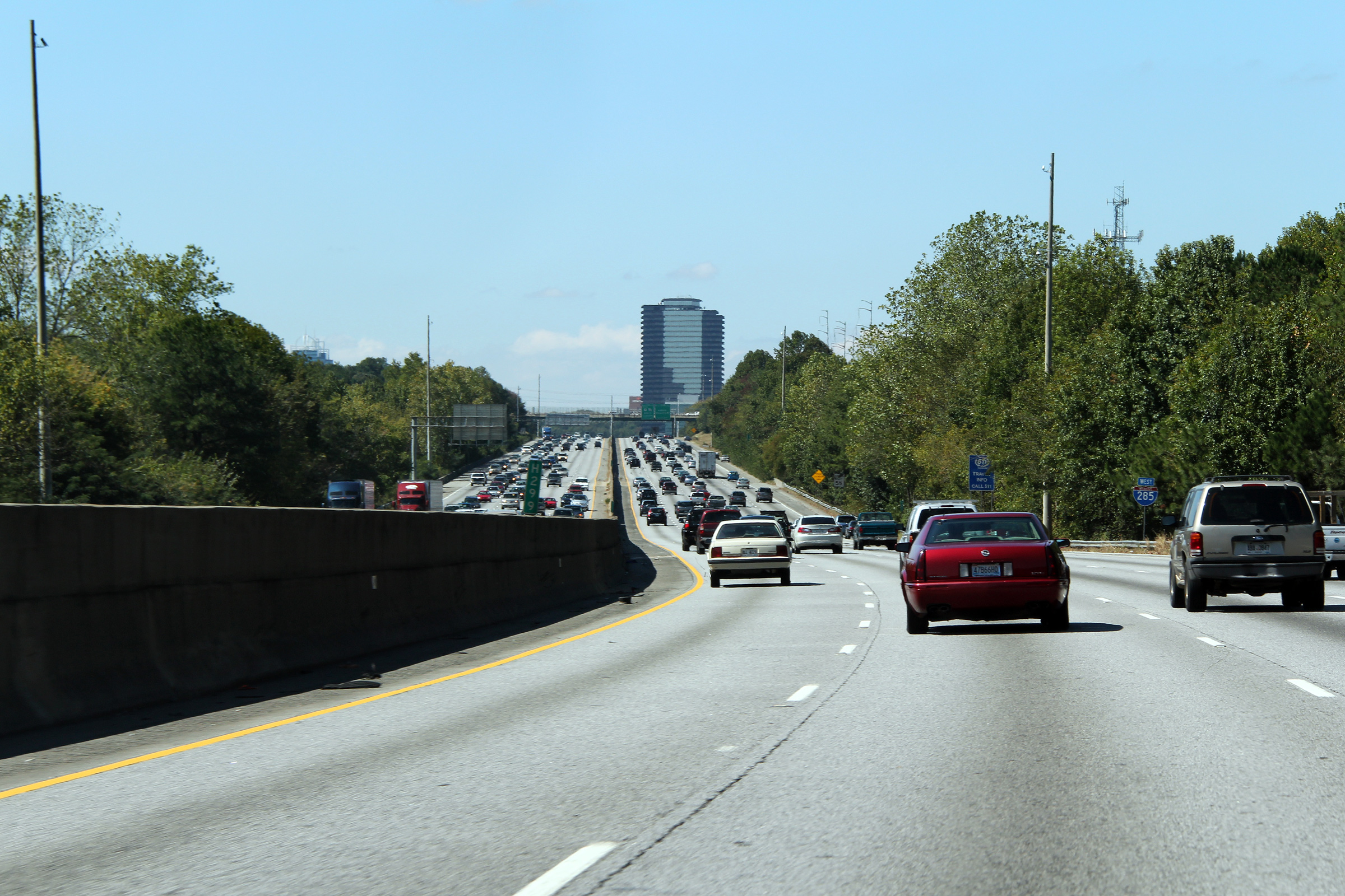
DeKalb County |
Westbound view along Interstate 85 as the Perimeter City Building enters into westbound view. |
 |
||
|
Date: 10/3/2010 |
High-res: (1440x960) (2400x1600) | |||
|
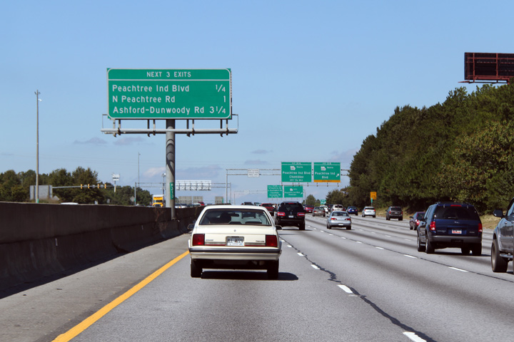
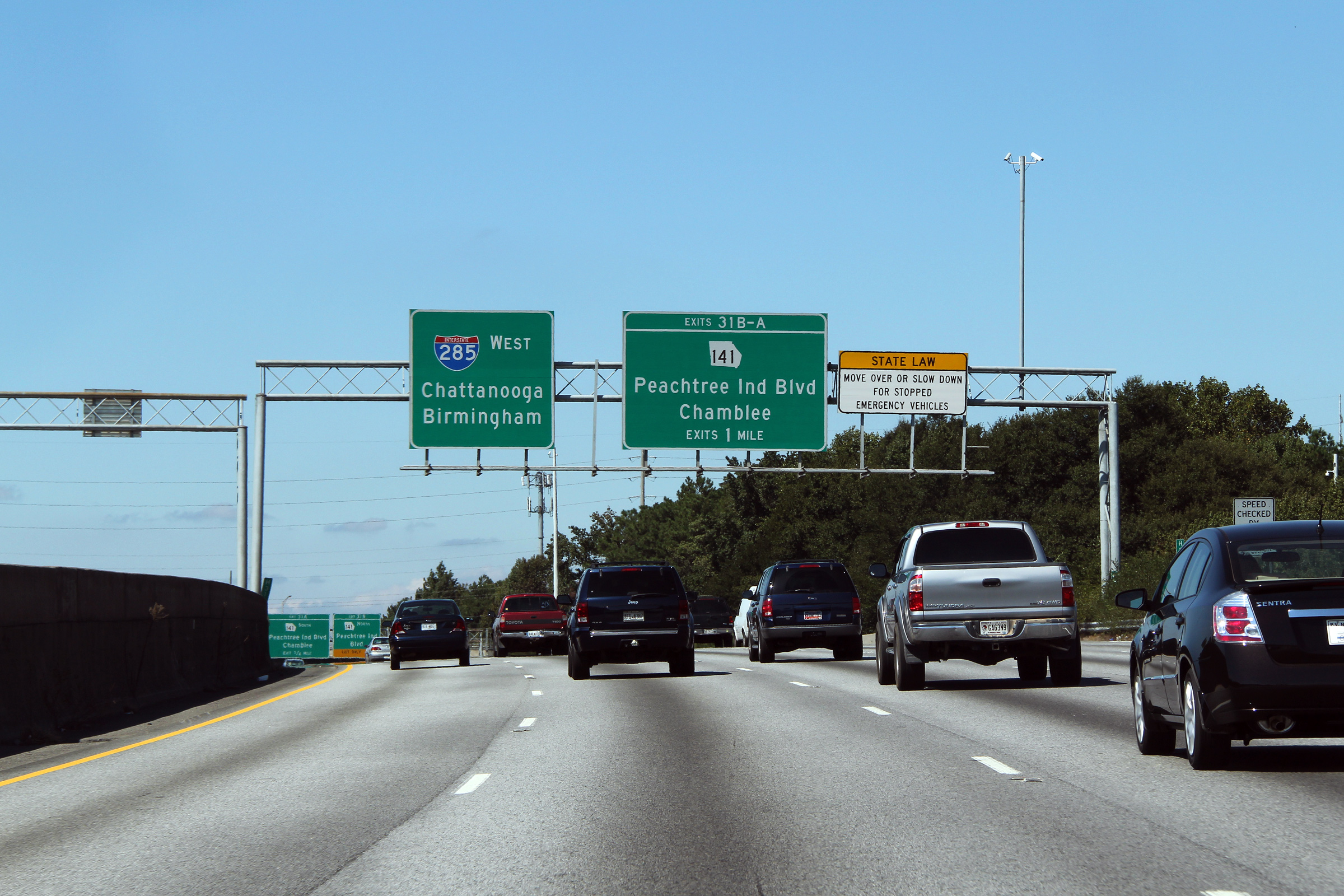
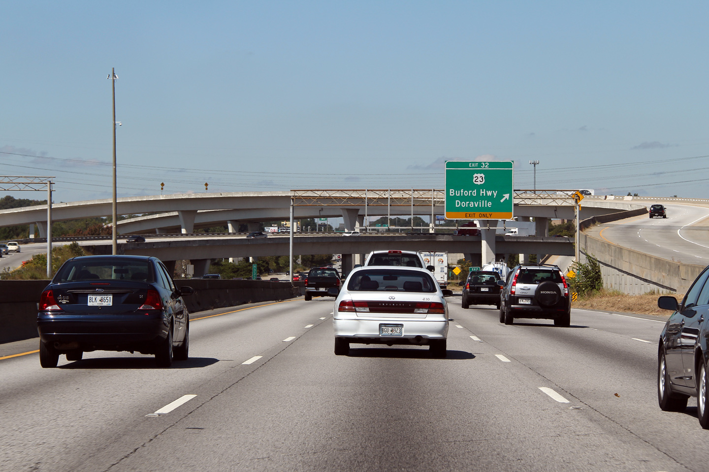
DeKalb County |
Next exit signage in advance of the Peachtree Industrial Boulevard interchange. |
 |
||
|
Date: 10/3/2010 |
High-res: (1440x960) (2400x1600) | |||
|
DeKalb County |
Westbound advanced signage for Peachtree Industrial Boulevard |
 |
||
|
Date: 10/3/2010 |
High-res: (1440x960) (2400x1600) | |||
|
DeKalb County |
Eastbound guide signage for the ramp to US Highway 23, complete with advanced signage for the Interstate 85 interchange. |
 |
||
|
Date: 10/3/2010 |
High-res: (1440x960) (2400x1600) | |||
|
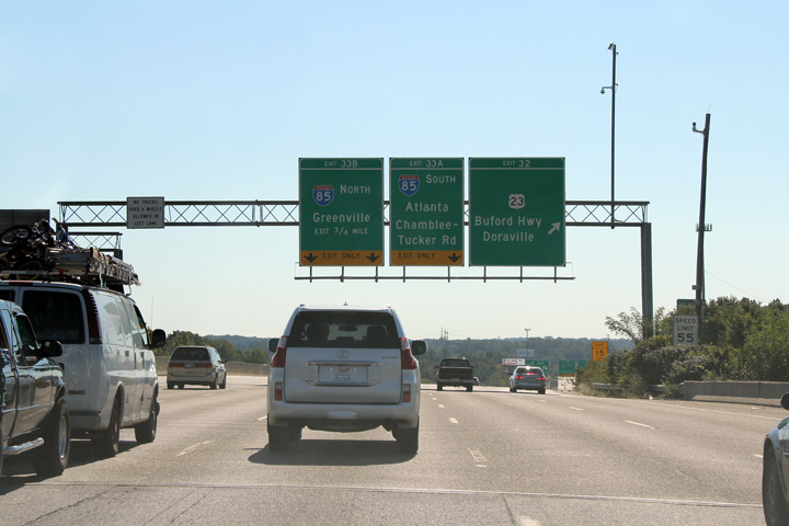
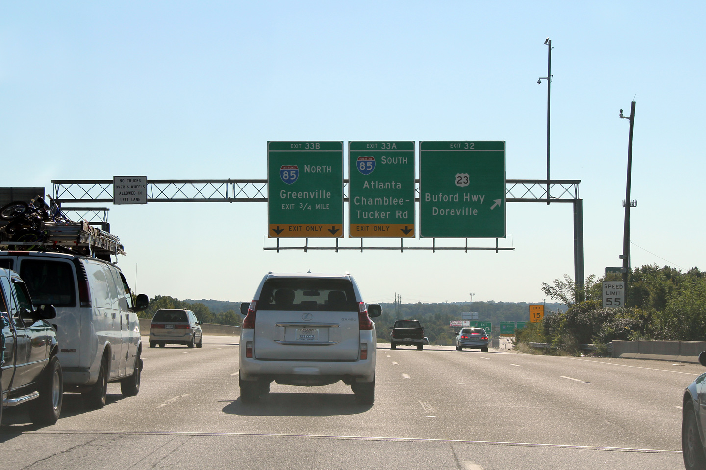
DeKalb County |
Eastbound overhead advanced signage for the Interstate 85 interchange. The Atlanta Beltway intersects Interstate 85 at a large four level directional stack intersection. This interchange is colloquially known as the `Spaghetti Junction`. |

|
||
|
Date: 10/3/2010 |
High-res: (1440x960) (2400x1600) | |||
|
DeKalb County |
This photo shows the ramp to Interstate 85 South from I-285 East as it joins an incoming ramp from US-23 before departing for Interstate 85 South. |
|
||
|
Date: 10/3/2010 |
High-res: (1440x960) (2400x1600) | |||
|
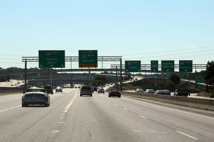
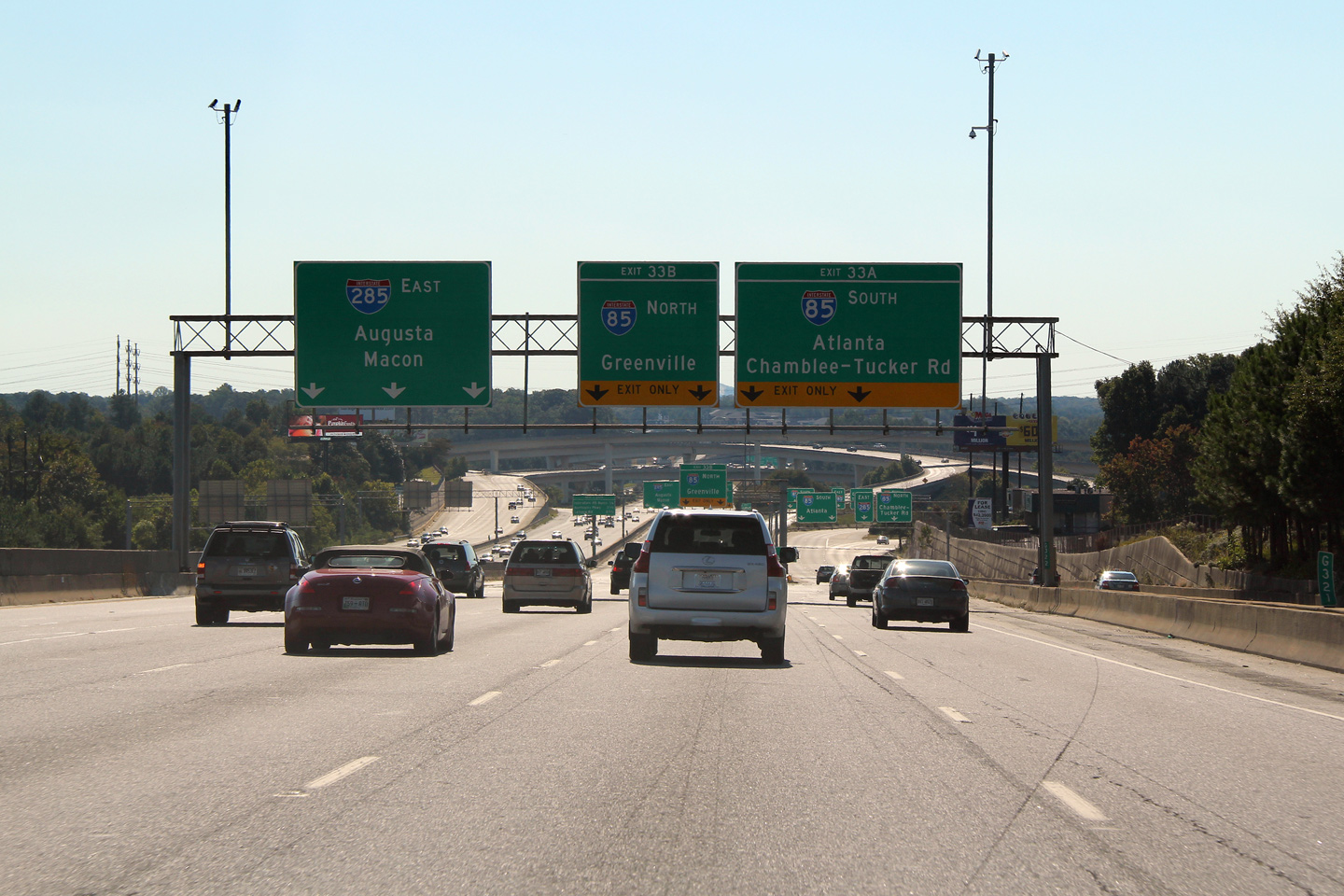
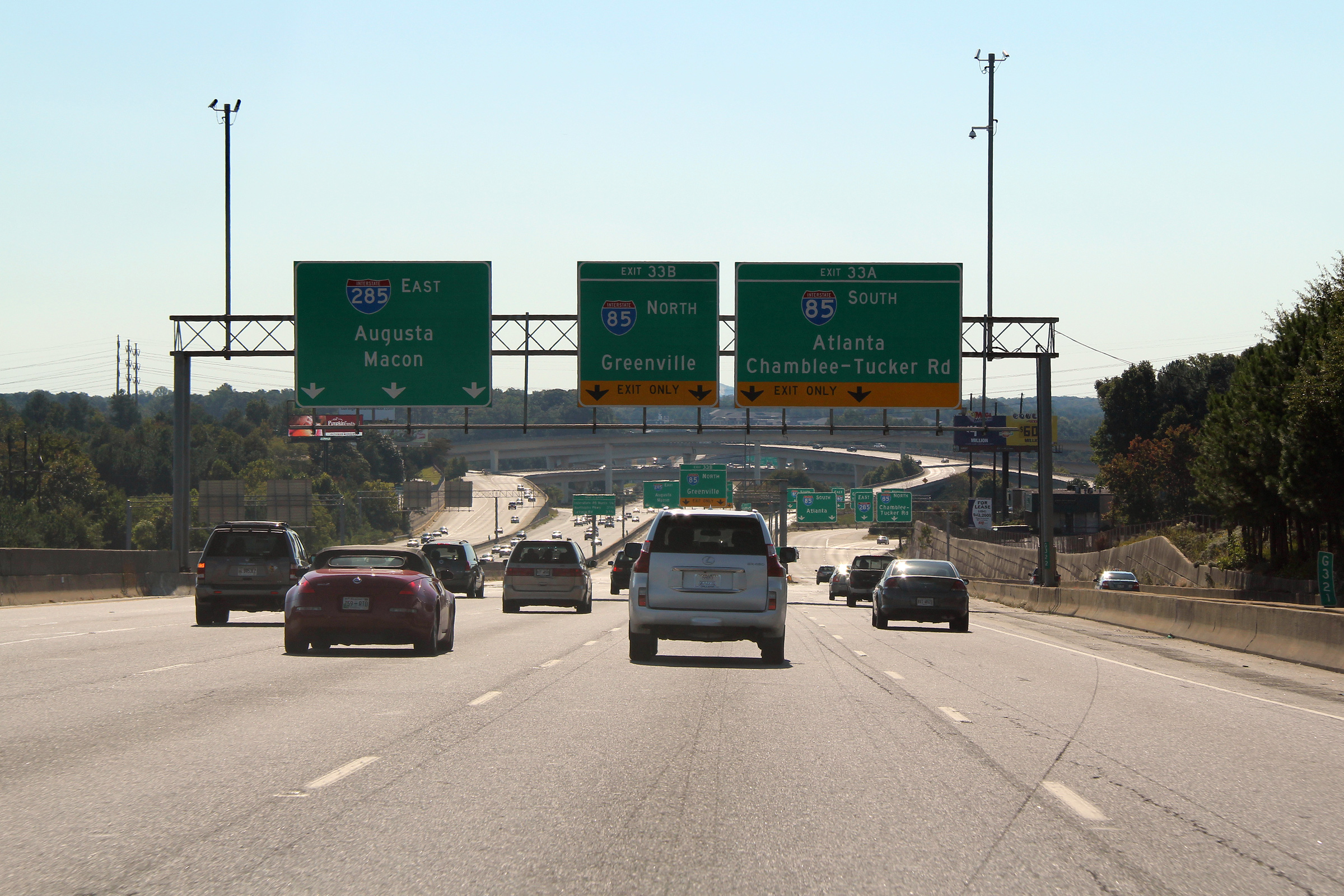
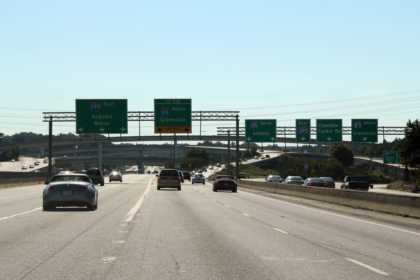
DeKalb County |
Eastbound view as Interstate 285 nears the large I-85 interchange. The collector lane between US-23 and Chamblee-Tucker Road splits for the I-285 interchange just before the diamond stack interchange. |
|
||
|
Date: 10/3/2010 |
High-res: (1440x960) (2400x1600) | |||
|
Interstate 85 runs diagonally on a northeasterly tangent through the Atlanta Metro Area. Click here for Interstate 85 images. |
||||
|
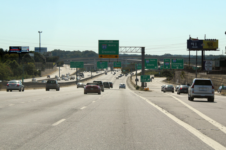
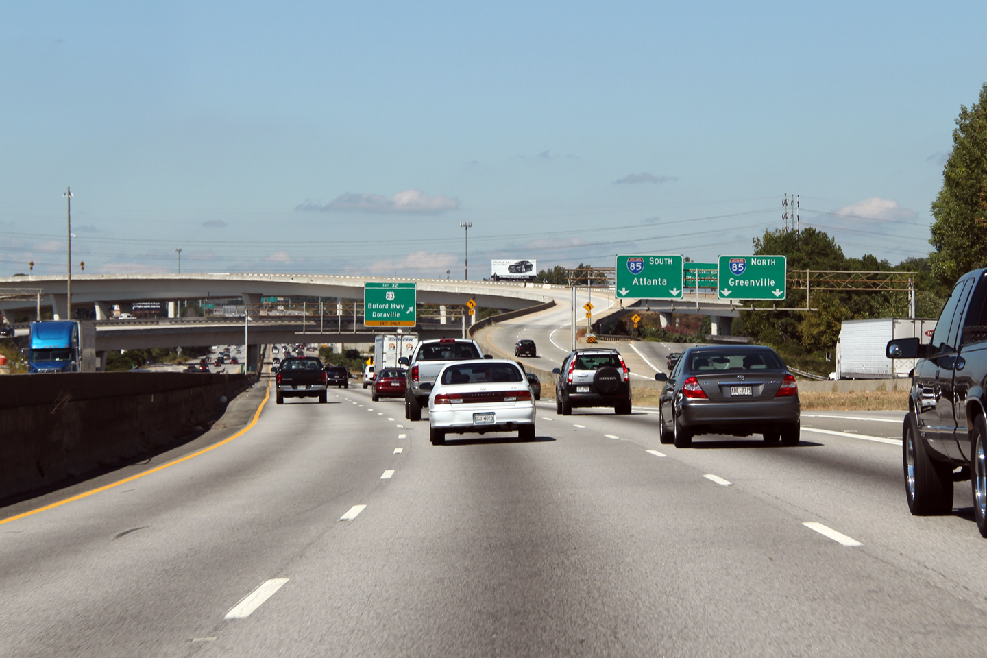
DeKalb County |
Westbound guide signage for the US-23 interchange. The large Interstate 85 interchange is (obviously) in view behind the overhead signage. |
 |
||
|
Date: 10/3/2010 |
High-res: (1440x960) (2400x1600) | |||
|
DeKalb County |
Westerly view approaching the Interstate 285 interchange. The collector ramp for the Interstate 285 interchange splits into North and South in this photo. |
 |
||
|
Date: 10/3/2010 |
High-res: (1440x960) (2400x1600) | |||
|
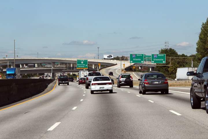
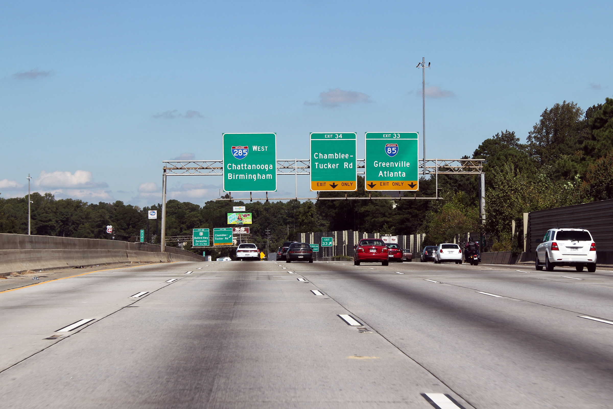
DeKalb County |
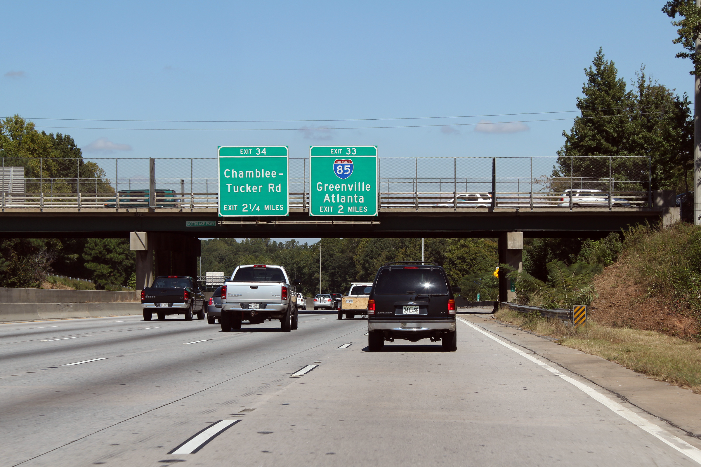
Northbound overhead signage at the ramp to Chamblee-Tucker Road. The off-ramp to Chamblee-Tucker Road passes overtop of the ramp to Interstate 85. There are several braided ramps along I-285 in the vicinity of the I-85 interchange. |
 |
||
|
Date: 10/3/2010 |
High-res: (1440x960) (2400x1600) | |||
|
DeKalb County |
Overhead signage as the ramp to Interstate 85 departs from Interstate 285. The ramp to I-85 forms a short collector lane running alongside the beltway for a quarter of a mile or so to separate ramp movements between Interstate 85 and Chamblee-Tucker Road. |
 |
||
|
Date: 10/3/2010 |
High-res: (1440x960) (2400x1600) | |||
|
DeKalb County |
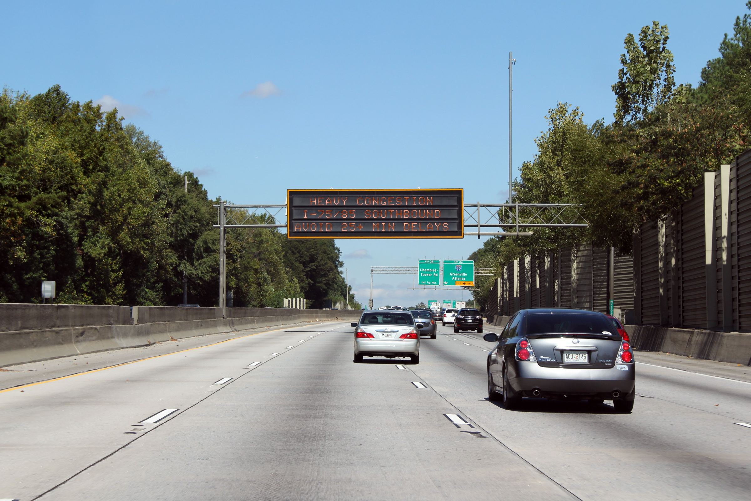
Northbound changeable message sign along the Atlanta Beltway advising motorists of heavy congestion along Interstate 75/85 through Downtown Atlanta. Atlanta has a sophisticated freeway management system, with regular changeable message signs advising drivers of real time road conditions. |
 |
||
|
Date: 10/3/2010 |
High-res: (1440x960) (2400x1600) | |||
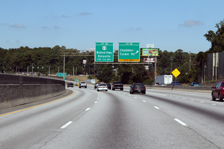
|
DeKalb County |
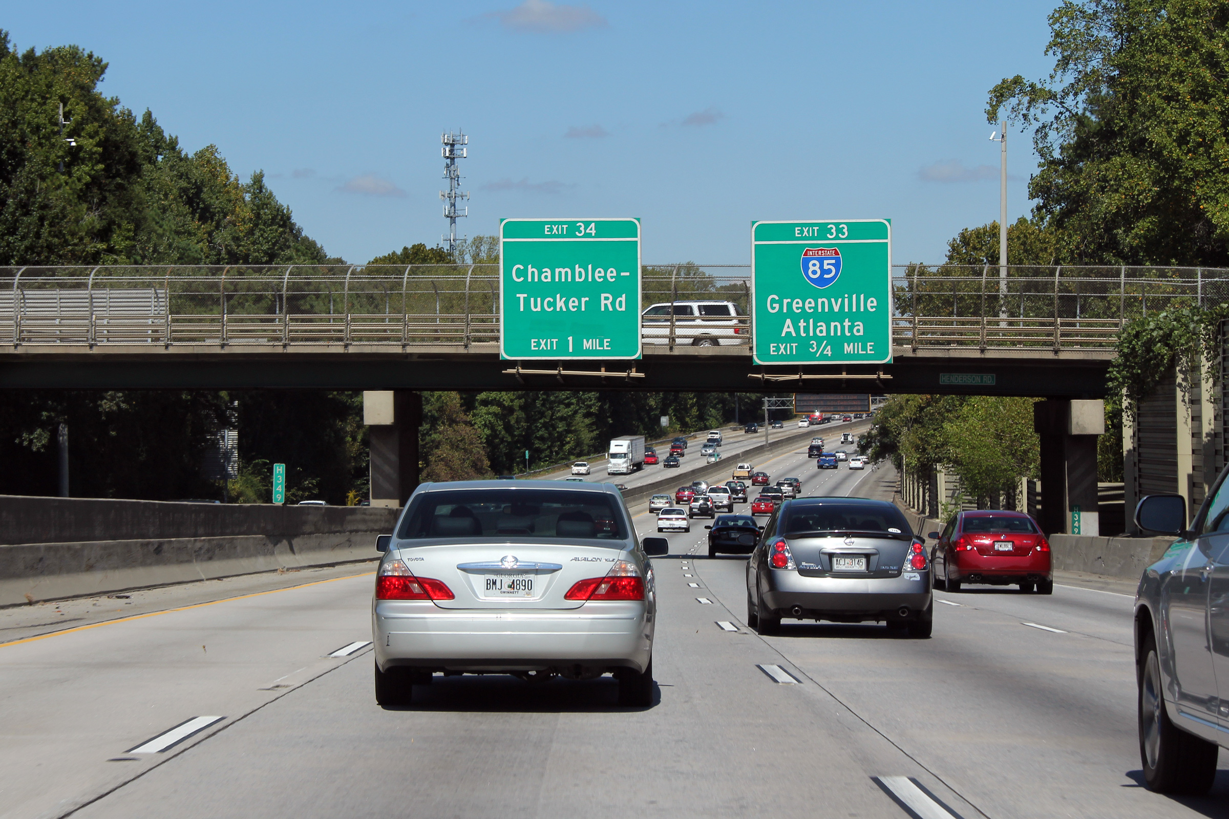
3/4 mile advanced guide signage for the I-85 interchange. |
 |
||
|
Date: 10/3/2010 |
High-res: (1440x960) (2400x1600) | |||
|
DeKalb County |
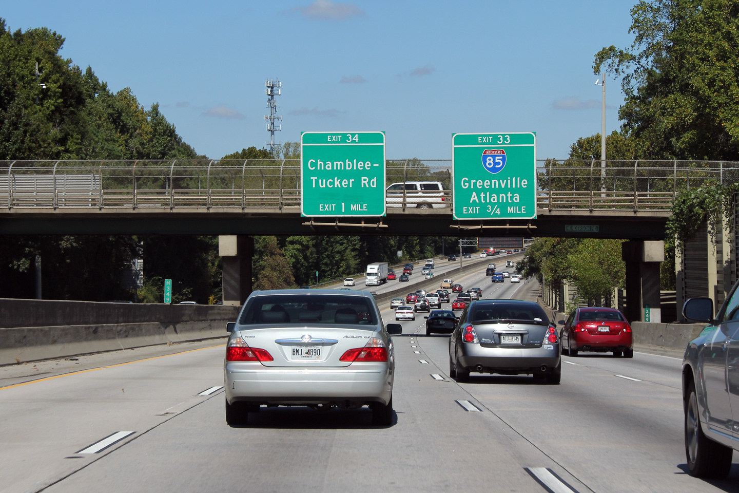
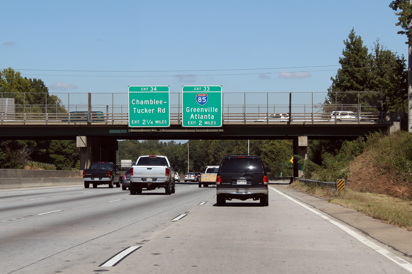
2 mile advanced signage along the northbound beltway for the Interstate 85 interchange. |
 |
||
|
Date: 10/3/2010 |
High-res: (1440x960) (2400x1600) | |||
|
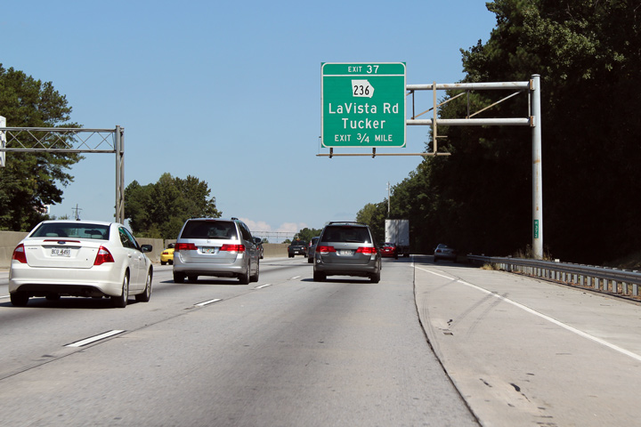
DeKalb County |
Advanced signage for Georgia Highway 236. It is typical among numerous states for the shape of their highway shield to be reflect the shape of the reflective state. |
 |
||
|
Date: 10/3/2010 |
High-res: (1440x960) (2400x1600) | |||
|
DeKalb County |
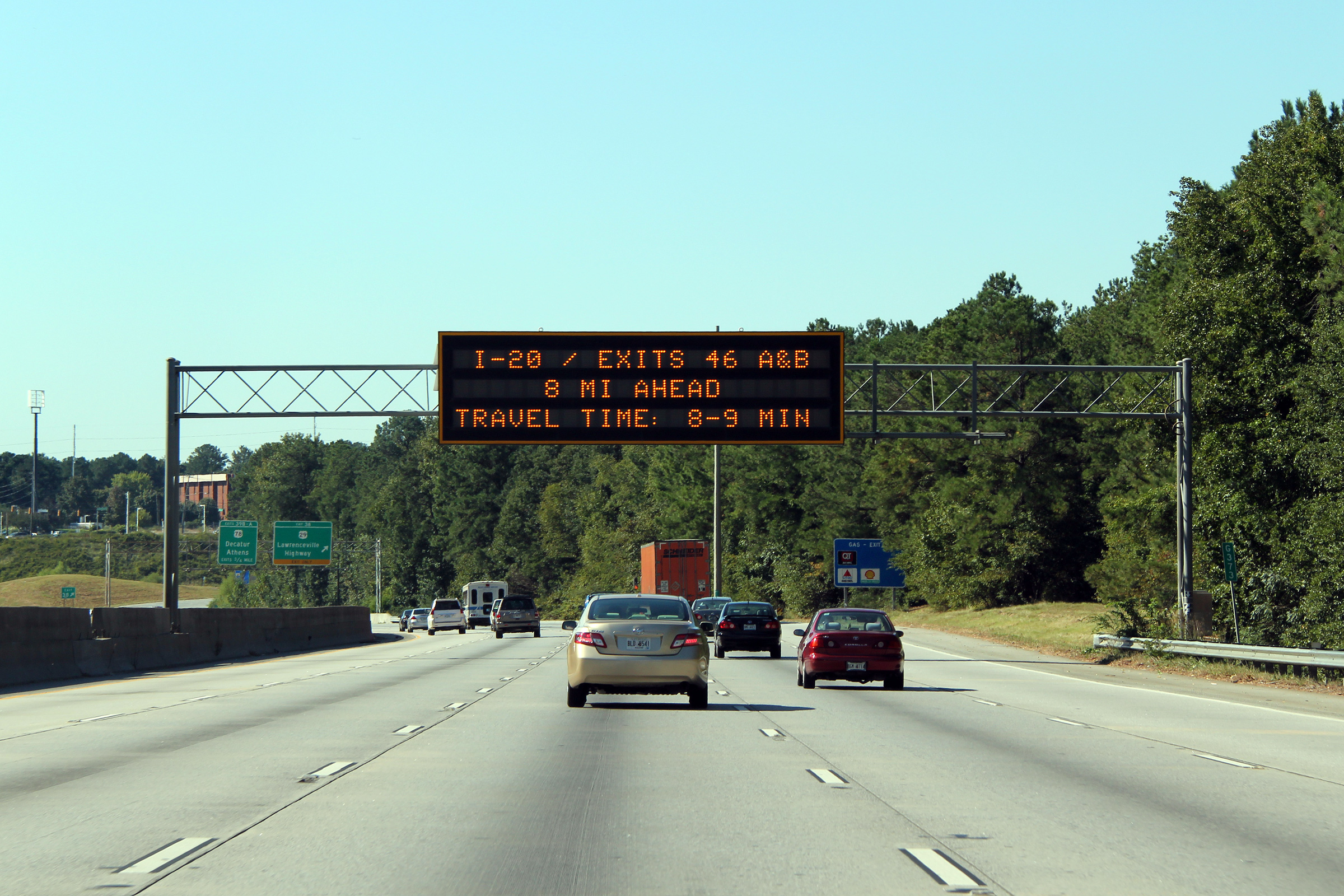
Changeable message sign along Interstate 285 southerly announcing a congestion free drive between this sign and Interstate 20. Metro Atlanta has an impressive traffic management system covering the freeways within Metro Atlanta, the system has been dubbed NaviGAtor by the Georgia Government. |

|
||
|
Date: 10/3/2010 |
High-res: (1440x960) (2400x1600) | |||
|
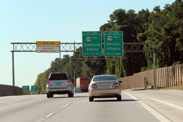
DeKalb County |
Advanced signage for the US-78 interchange along I-285. Note the 'state law' signage as well. This type of signage is becoming increasingly popular in the Northeast of the U.S. as well. |
|
||
|
Date: 10/3/2010 |
High-res: (1440x960) (2400x1600) | |||
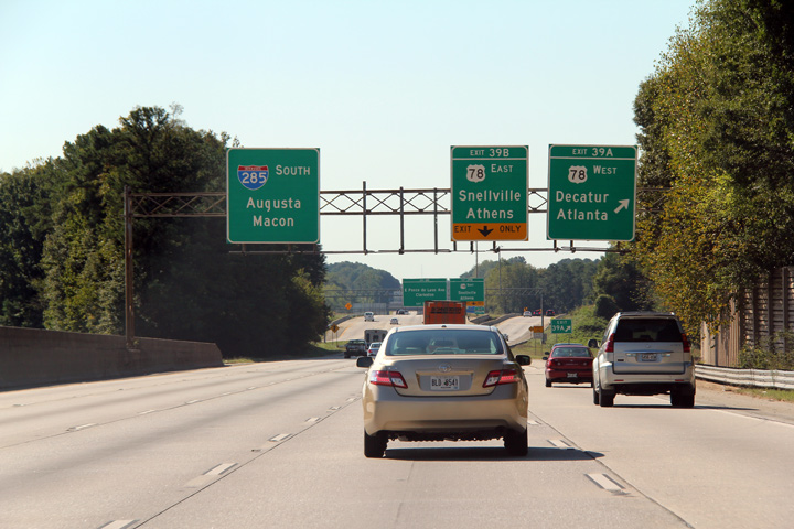
|
DeKalb County |
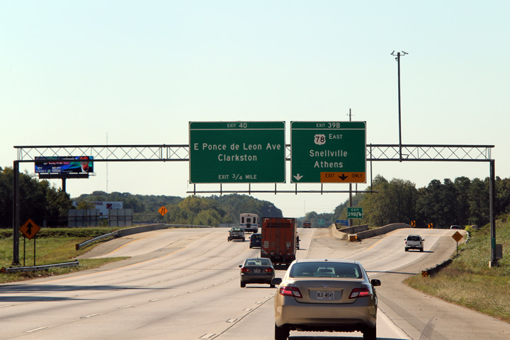
Signage at the ramp to US-Route 78 West into Atlanta, and in advance for the loop ramp to US Route 78 East. US 78 is a freeway in the vicinity of the Atlanta Beltway and for a considerable distance easterly. |
|
||
|
Date: 10/3/2010 |
High-res: (1440x960) (2400x1600) | |||
|
DeKalb County |
Overhead signage as the two lane loop ramp for US-78 West departs from Interstate 285 South. Note the incoming lane from US-78 West that joins the Atlanta Beltway on the left hand side. |
|
||
|
Date: 10/3/2010 |
High-res: (1440x960) (2400x1600) | |||
|
US-78 has a short expressway segment both east and west of I-285 for a short distance. It is known locally as the Stone Mountain Freeway. Click here for US Route 78 images. |
||||
<- SR-406
GA Highways
SR-408 ->
Asphaltplanet.ca
© 2010-2011 AsphaltPlanet.ca.
AsphaltPlanet@asphaltplanet.ca
Page Created: January 14, 2011.
Last Updated: January 14, 2011.