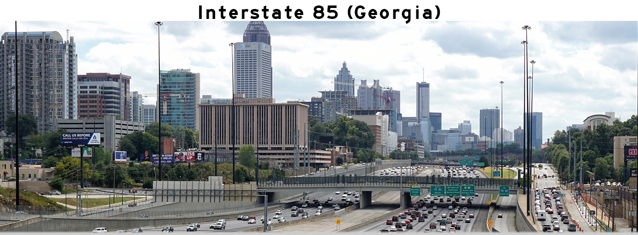
 Southern Entrance: Alabama State Line. Northern Entrance: South Carolina State Line Length in GA: 179.9 Miles |
AsphaltPlanet.ca > Georgia > Interstate 85
|
Southern Entrance: Alabama State Line. Northern Entrance: South Carolina State Line Length in GA: 179.9 Miles |
Pictures on
this page are arranged in order from south to north. I-85 North photos are
left-aligned in the last column, while I-85 South photos are right-aligned.
Center-line pictures are centered within the last column.
|
Location |
Description |
Photo |
||
|
North- |
South- |
|||
|
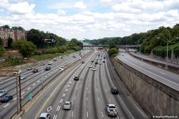
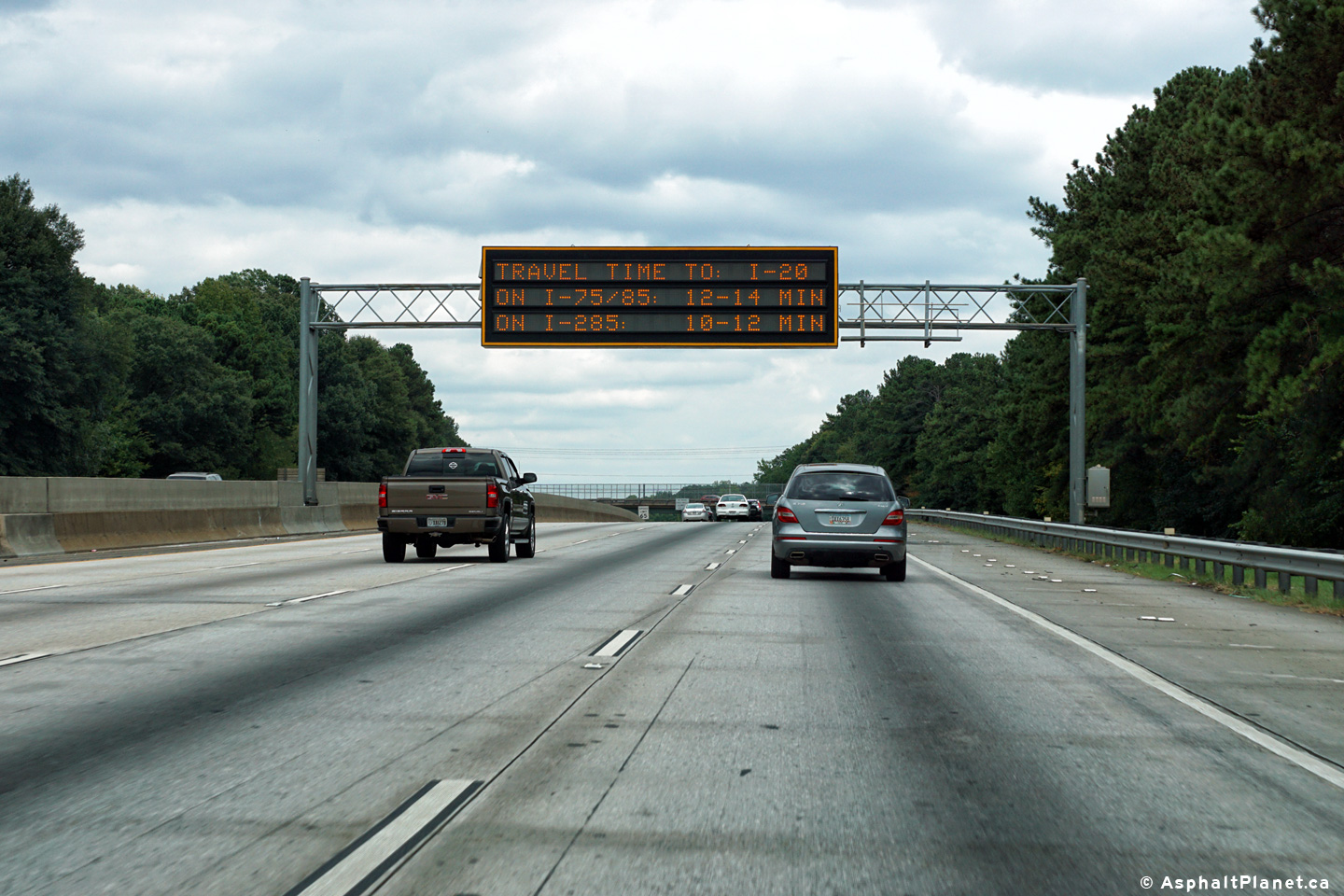
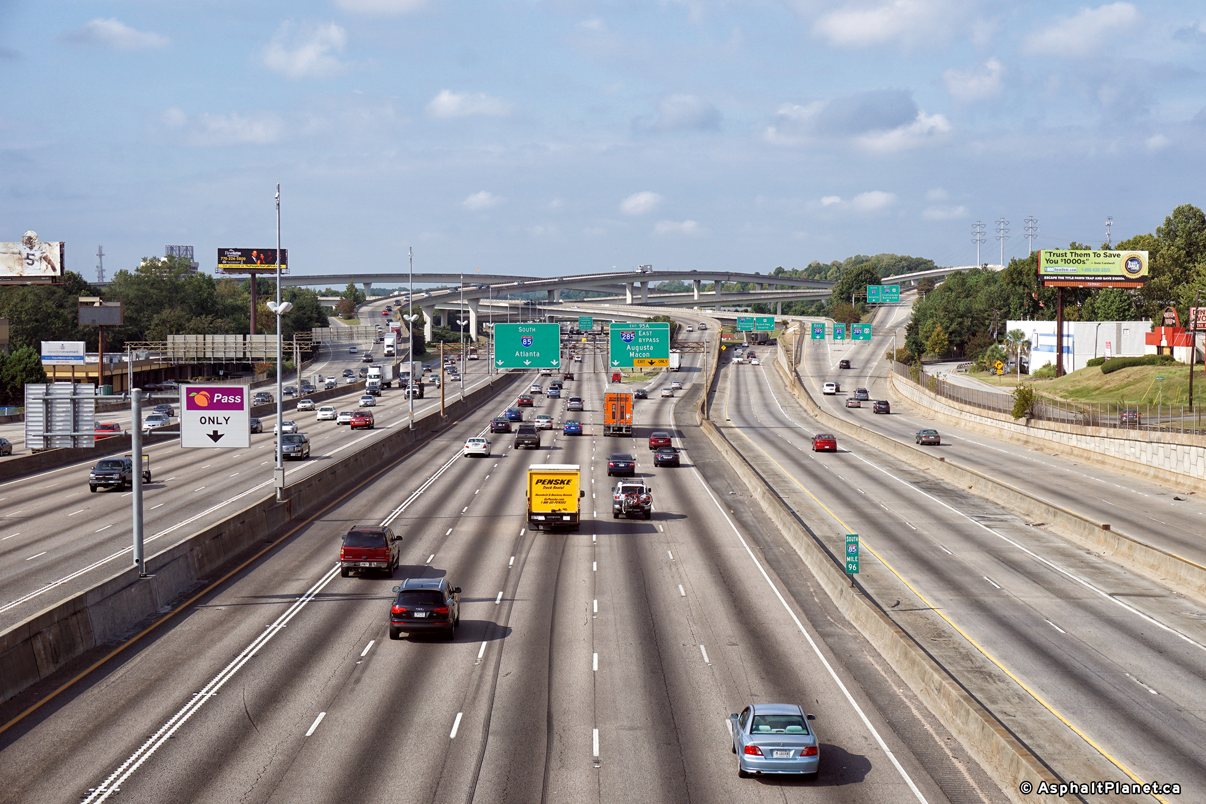
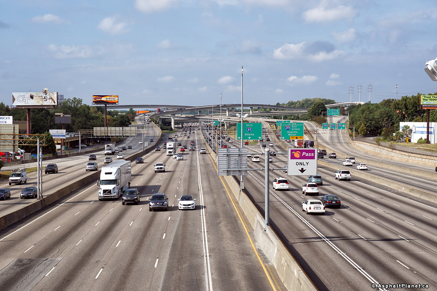
Fulton County |
Dynamic message signage advising motorists of travel time around Atlanta. |
|
||
|
Date: 9/17/2016 |
High-res: (1440x960) (2400x1600) | |||
|
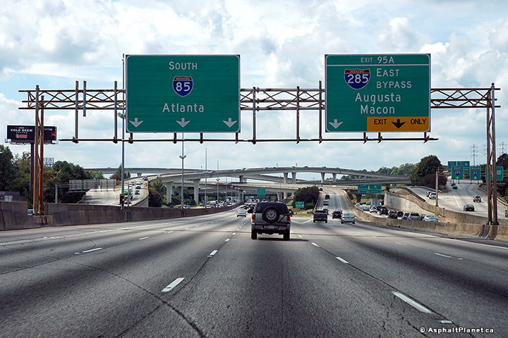
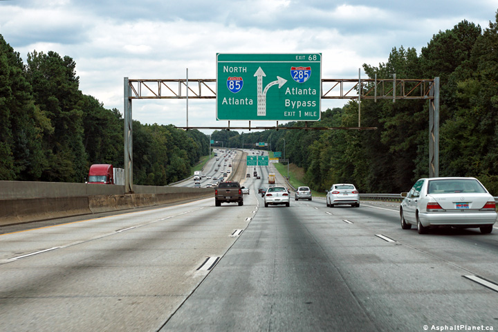
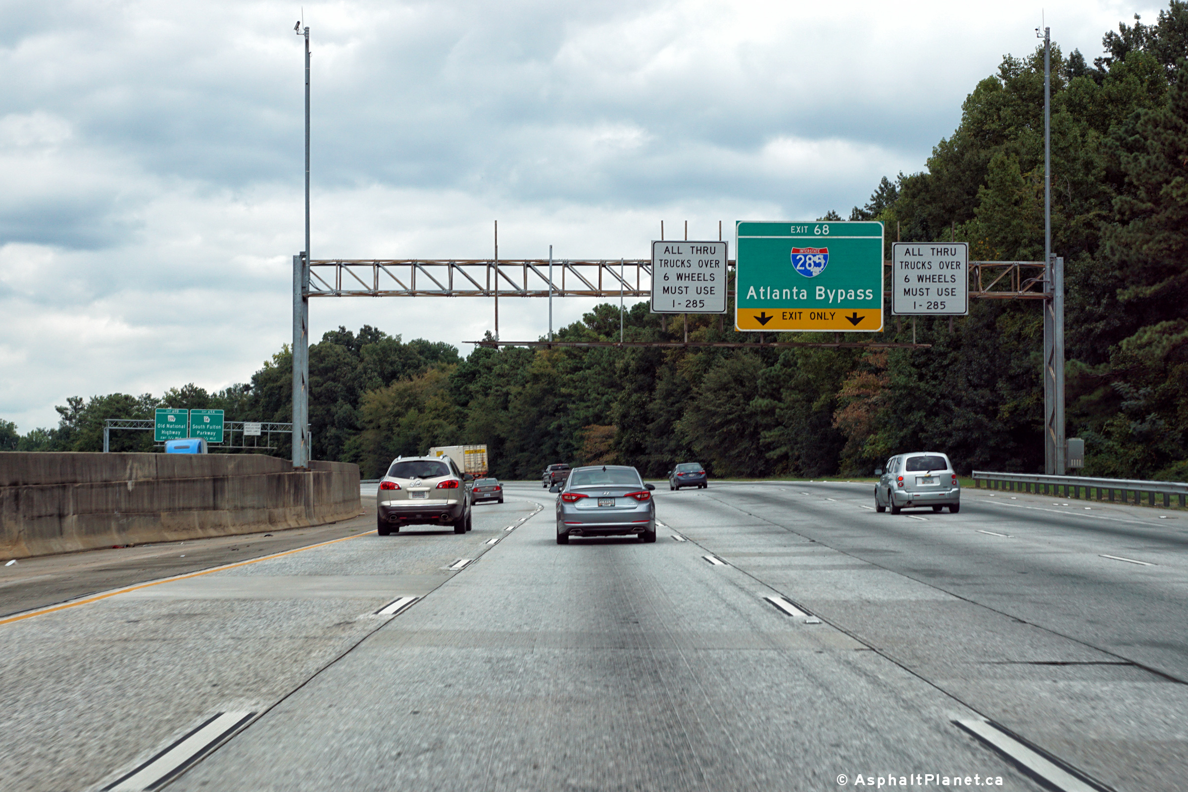
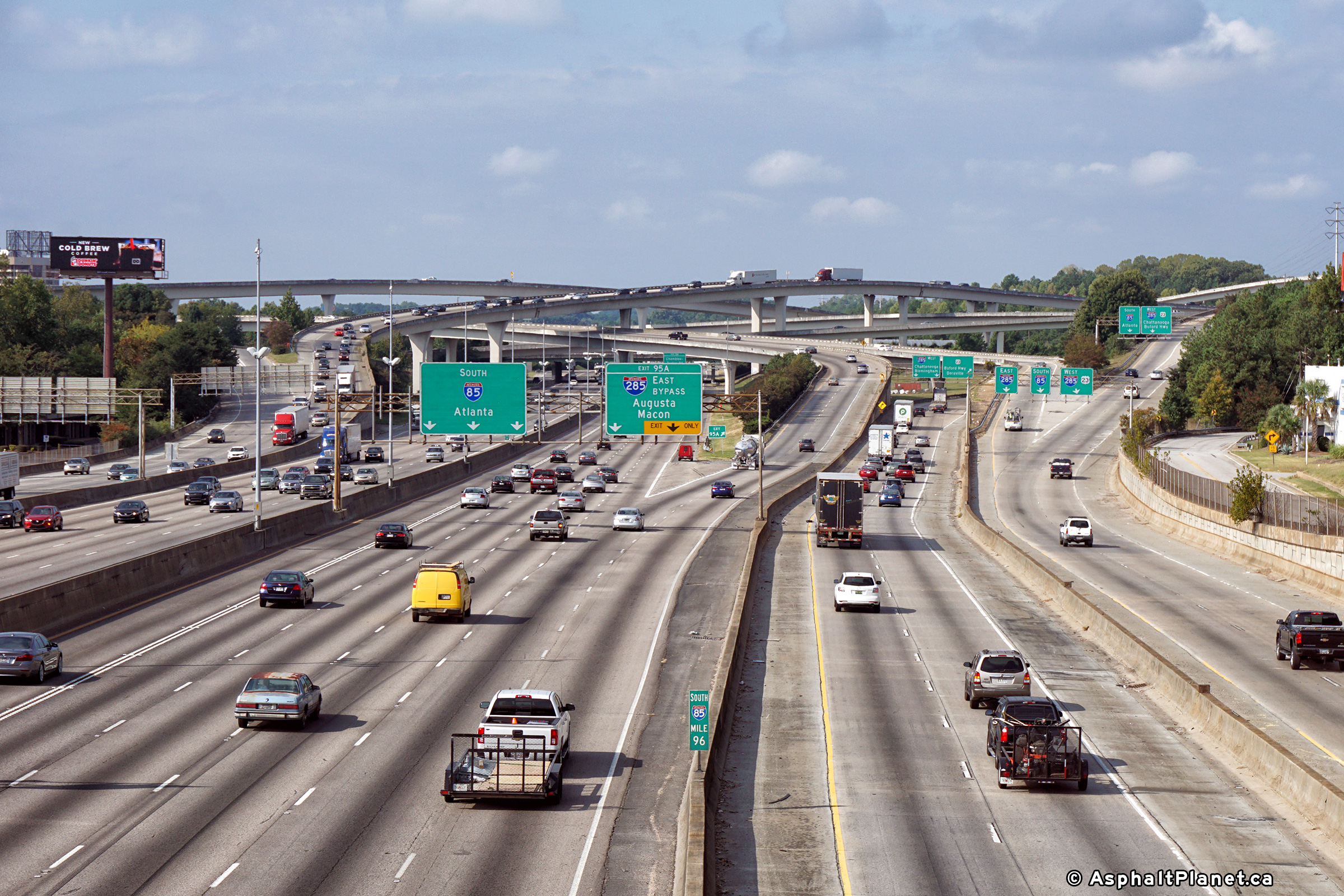
Fulton County |
Northbound advanced signage for the Interstate 285 interchange. |
|
||
|
Date: 9/17/2016 |
High-res: (1440x960) (2400x1600) | |||
|
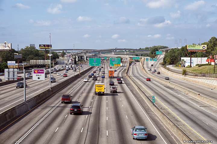
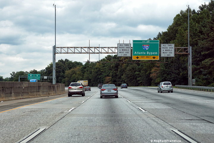
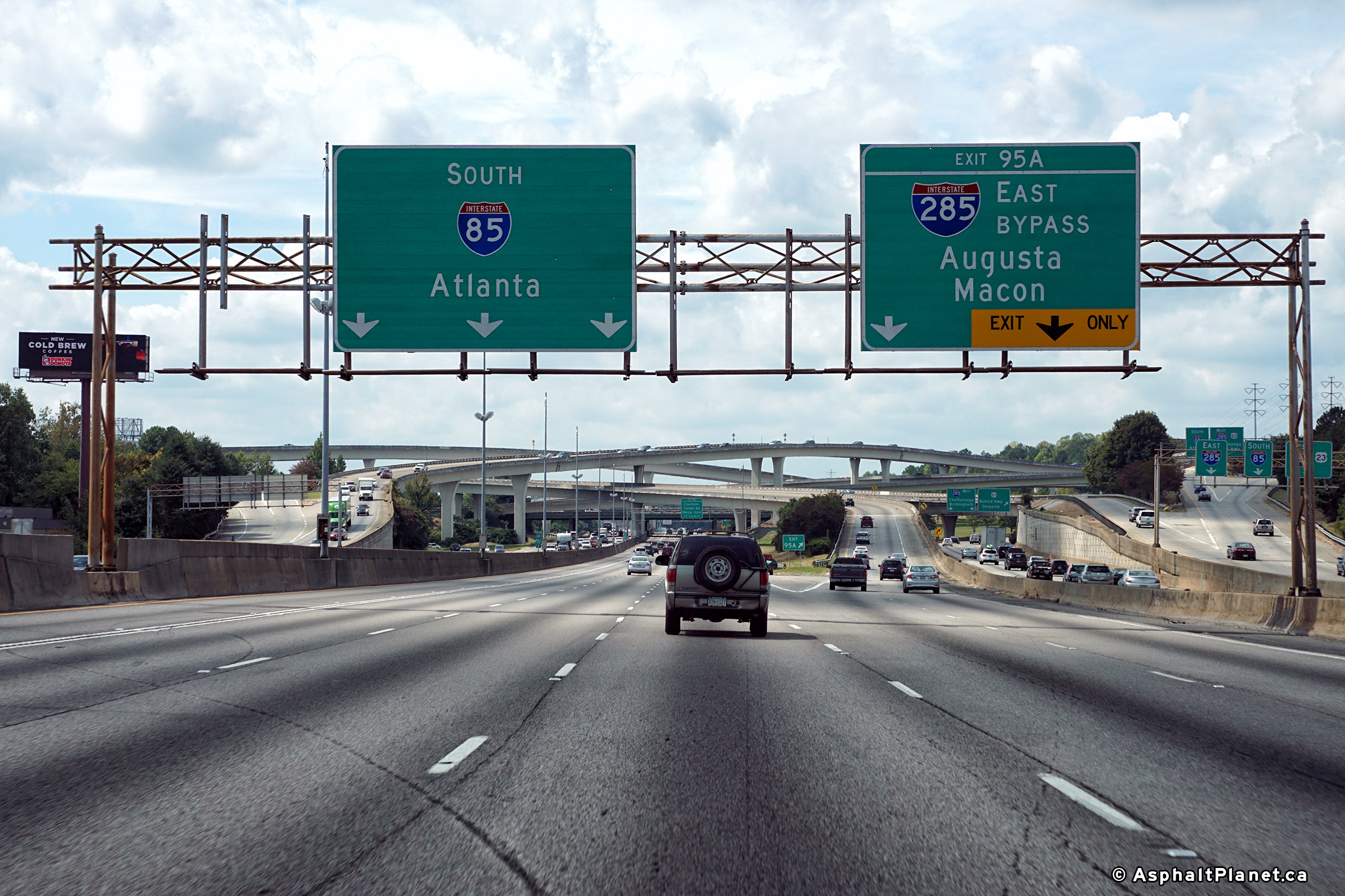
Fulton County |
Signage at the northbound off-ramp to I-285. |
|
||
|
Date: 9/17/2016 |
High-res: (1440x960) (2400x1600) | |||
|
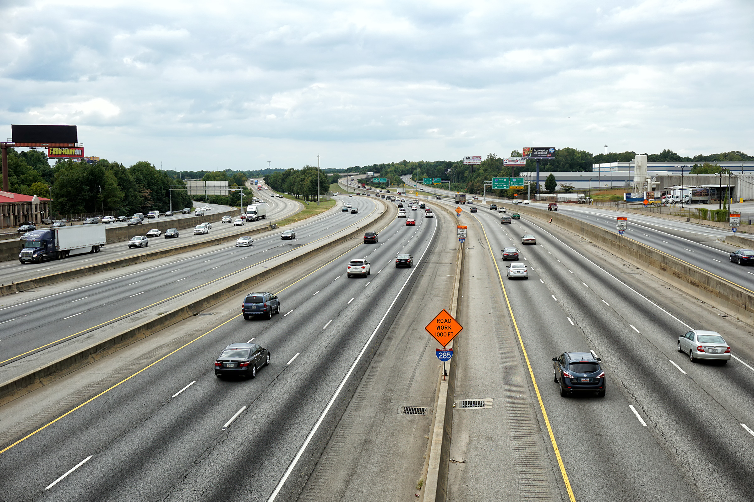
Fulton County |
Two views looking southerly from the Old National Trail Highway overpass. Interstate 85 runs concurrent with Interstate 285 for a short distance through this interchange. Although the two highways run concurrently they are separated from each other with unique carriageways. |
 |
||
| High-res: (1440x960) (2400x1600) | ||||
 |
||||
|
Date: 9/17/2016 |
High-res: (1440x960) (2400x1600) | |||
|
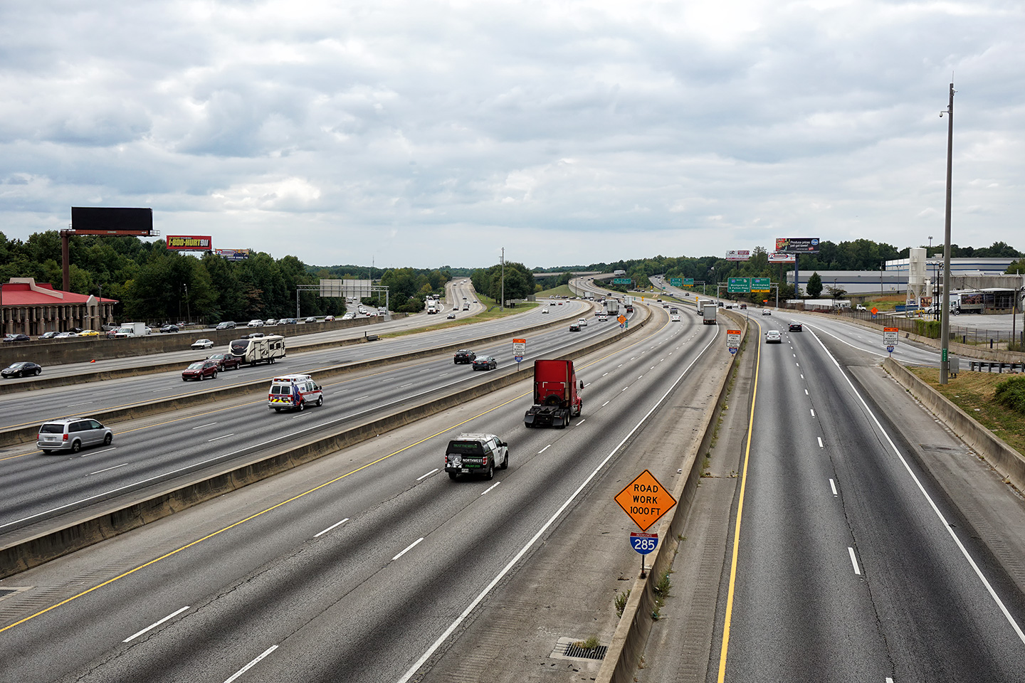
Fulton County |
Two northerly views looking northerly from the Old National Trail Highway overpass. |
 |
||
| High-res: (1440x960) (2400x1600) | ||||
 |
||||
|
Date: 9/17/2016 |
High-res: (1440x960) (2400x1600) | |||
|
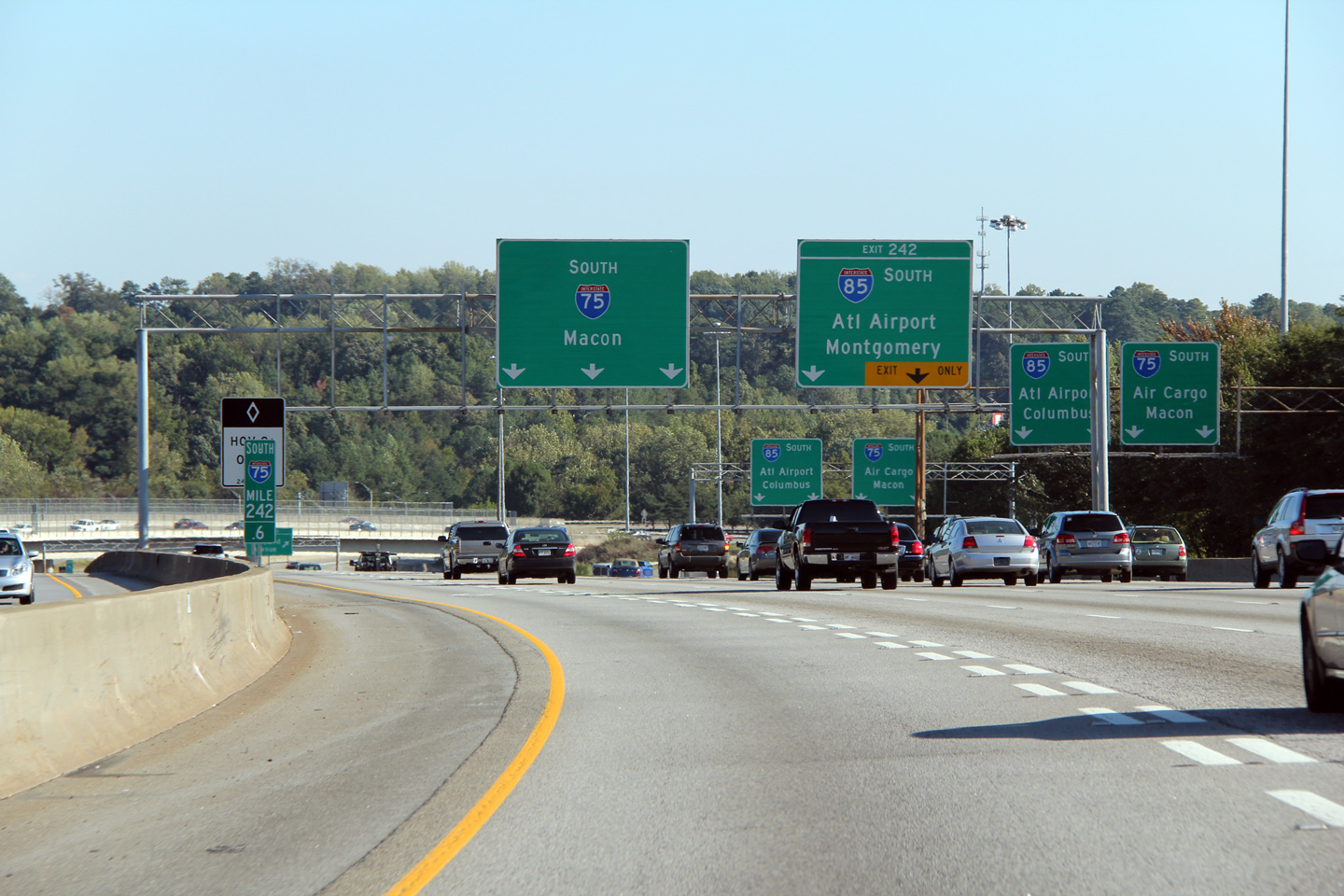
Fulton County |
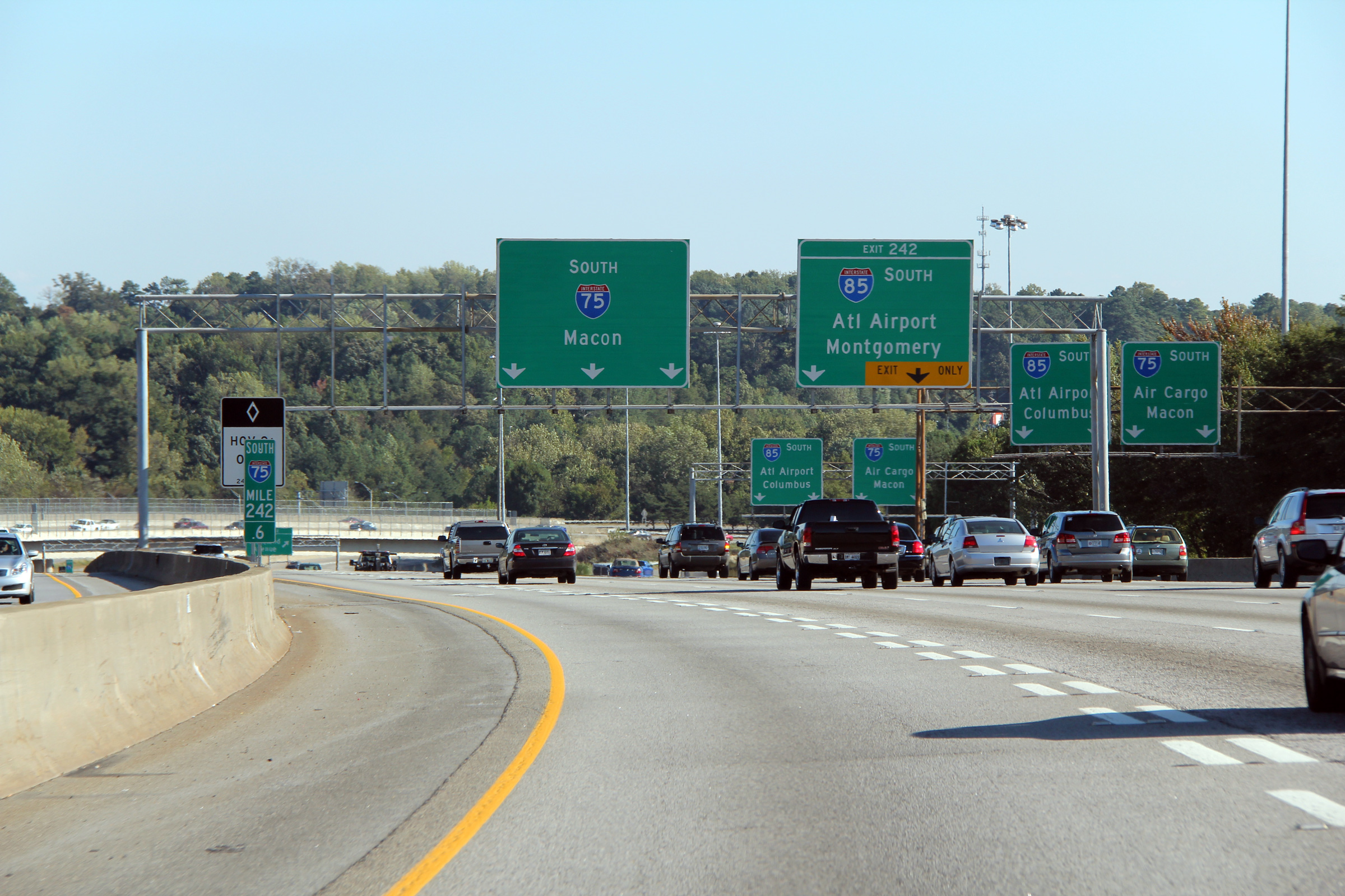
Southerly view approaching the southern I-75/85 split. Interstate 75 continues south of Atlanta on a slight easterly trajectory bound for Macon, and eventually Florida, while I-85 heads south-westerly -- bound for Montgomery, Alabama. |
 |
||
|
Date: 10/3/2010 |
High-res: (1440x960) (2400x1600) | |||
|
Fulton County |
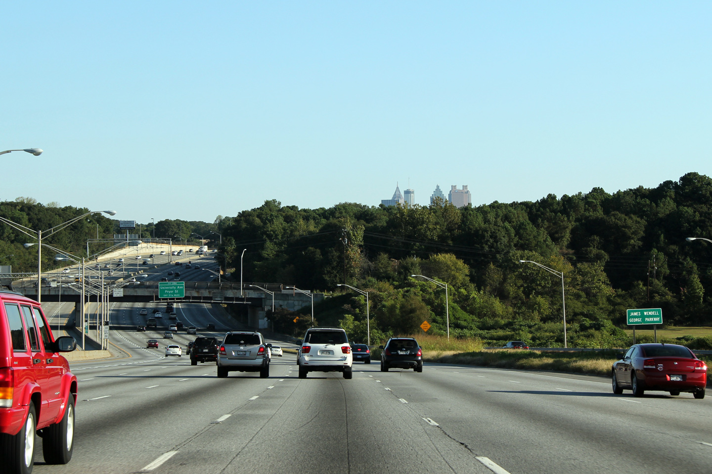
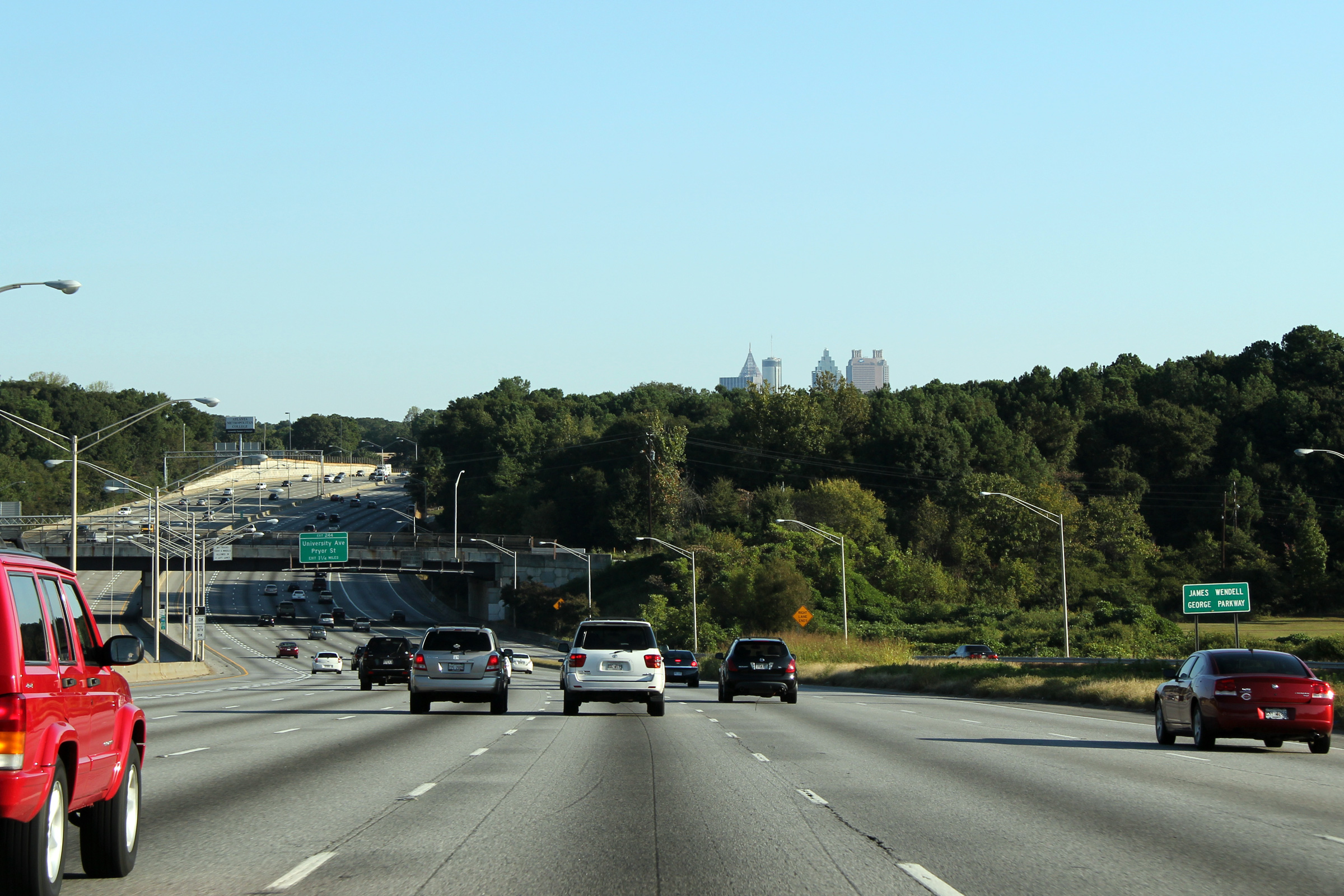
Northerly view approaching the Fair Drive overpass along Interstate 75. The Downtown Atlanta Skyline is just in view peaking over the tall Carolinian Forests that the South-eastern United States is famous for. |
|
||
|
Date: 10/2/2010 |
High-res: (1440x960) (2400x1600) | |||
|
Fulton County |
Northbound view approaching the Fulton Street and Central Avenue exit. The ramp to Central Avenue passes overtop of the Downtown Connector (I-75/85), as a high-speed directional ramp before merging with Central Avenue on the west side of the Freeway. Once Downtown, Central Avenue is one of Atlanta's most important north-south streets. |
|
||
|
Date: 10/2/2010 |
High-res: (1440x960) (2400x1600) | |||
|
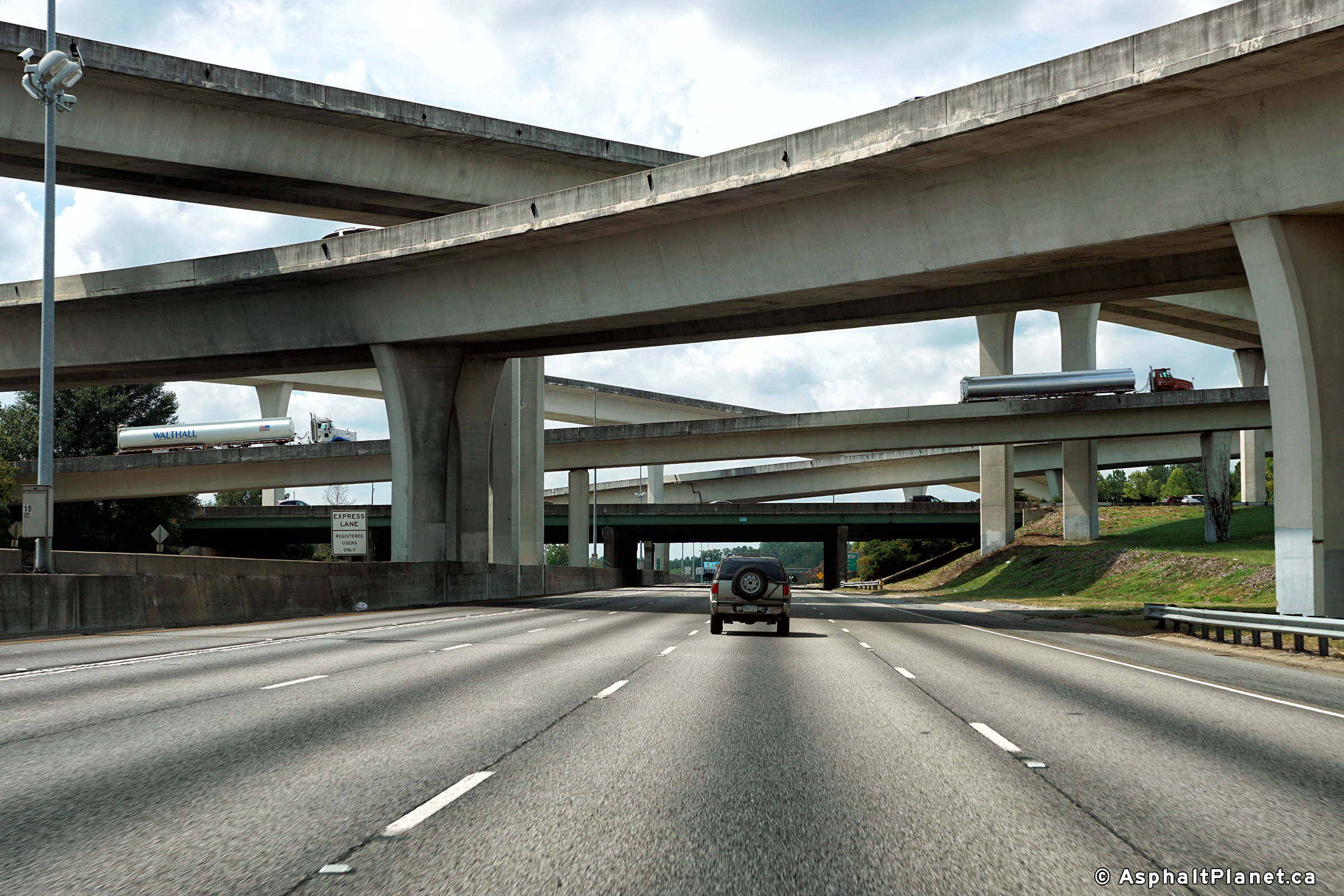
Fulton County |
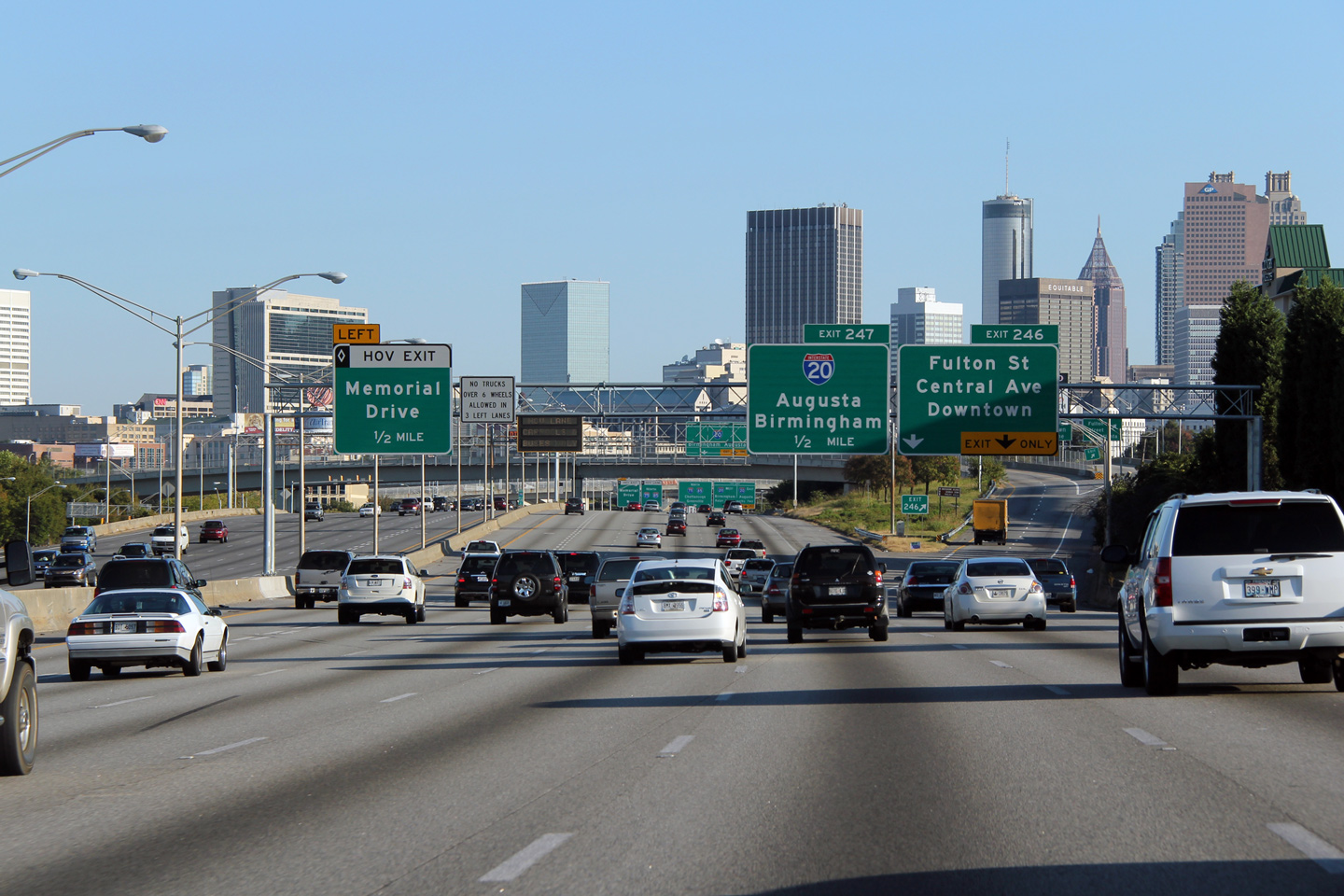
Overhead signage for the Interstate 20 interchange just south of Downtown on I-75/85. Interstate 20 meets the Downtown Connector at a fairly considerable stack interchange. The Interstate 20/75/85 interchange marks the south-eastern boundary of Downtown Atlanta. |
|
||
|
Date: 10/2/2010 |
High-res: (1440x960) (2400x1600) | |||
|
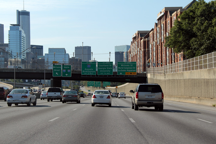
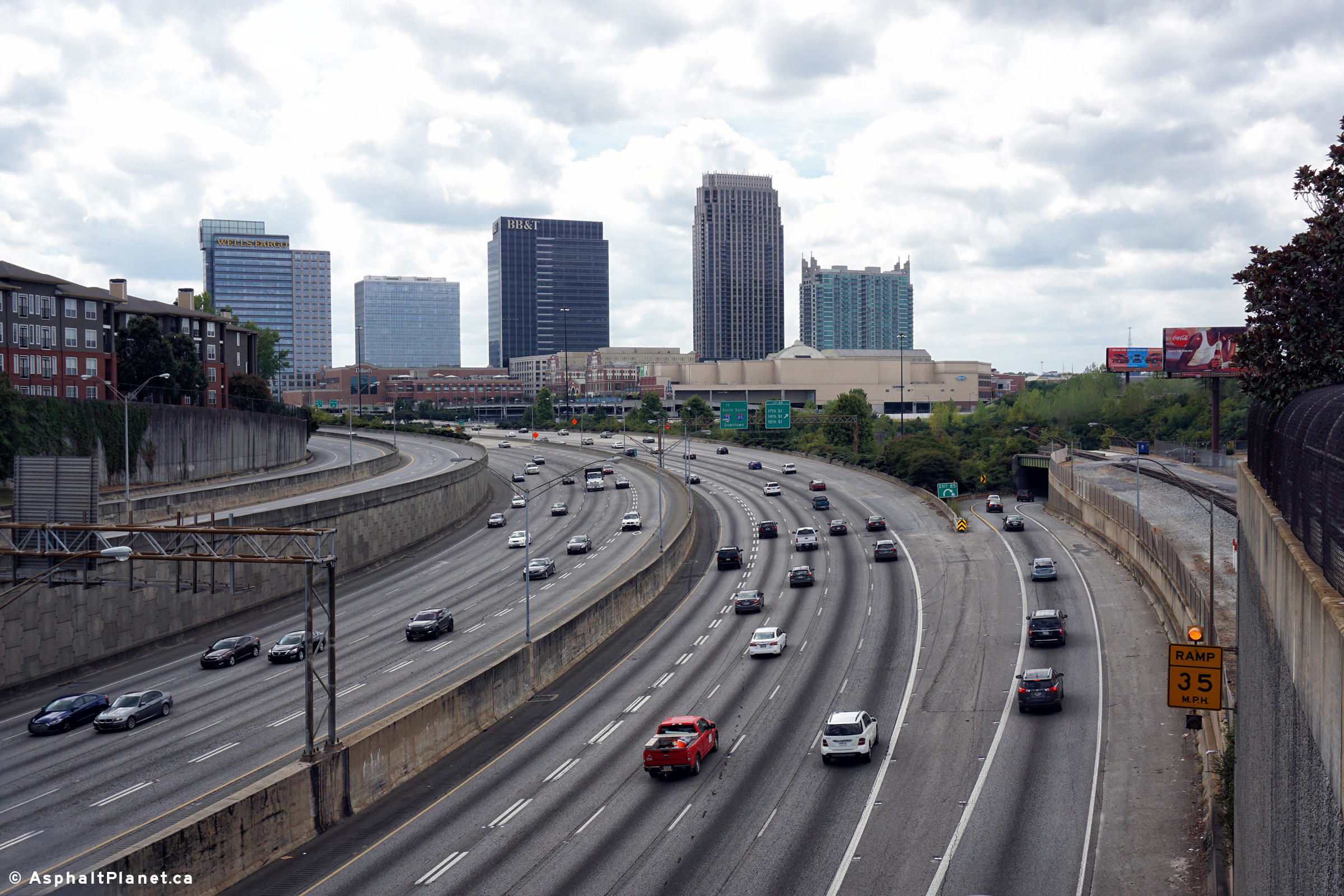
Fulton County |
Southerly view as the HOV lane exit to Williams Street departs from the southbound lanes of the Downtown Connector. Williams Street is one of the principal arterials through Downtown Atlanta. For a U.S. city, Downtown Atlanta is amazingly vibrant. There are several noteworthy attractions Downtown including the Georgia Aquarium, the World of Coke, and Centennial Olympic Park. |
 |
||
|
Date: 10/3/2010 |
High-res: (1440x960) (2400x1600) | |||
|
Fulton County |
Southbound guide view underneath of the North Avenue overpass. Georgia Institute of Technology is visible to the right of the freeway in this photo. The Downtown Atlanta Skyline is visible in the distance. |
 |
||
|
Date: 10/3/2010 |
High-res: (1440x960) (2400x1600) | |||
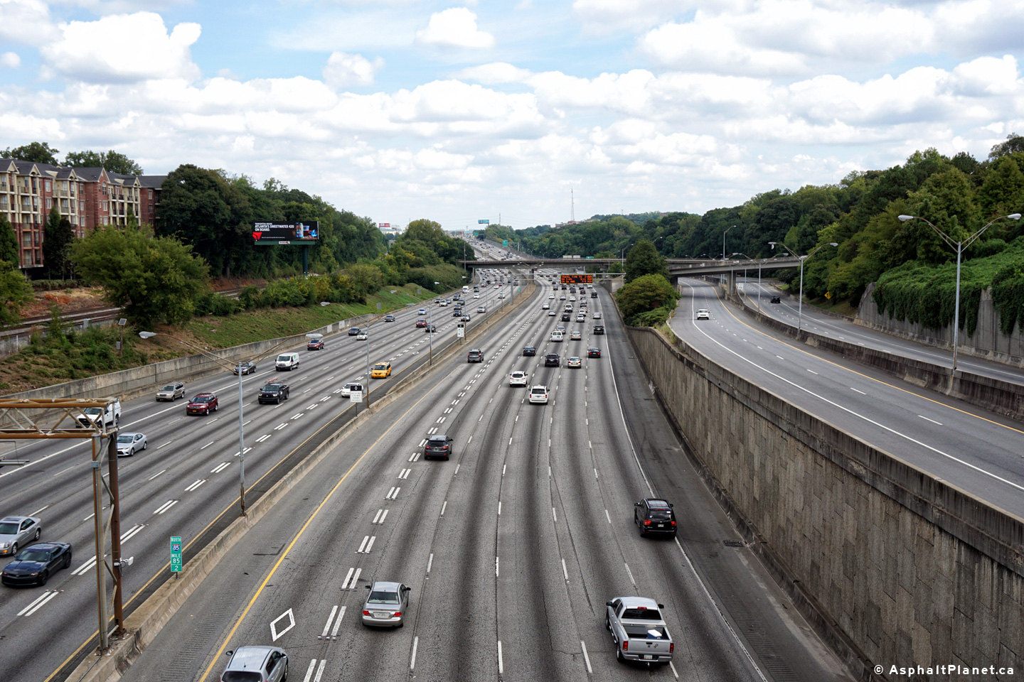
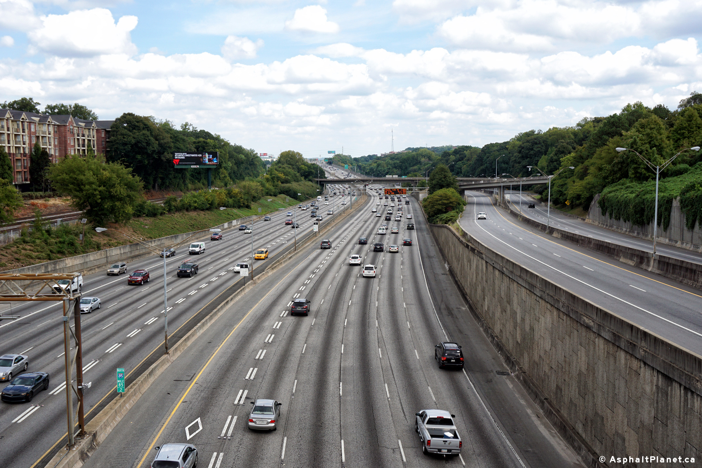
|
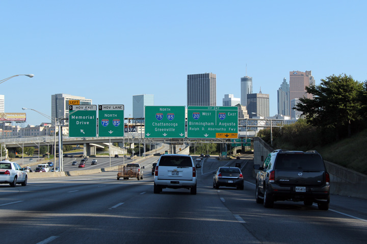
Fulton County |
This view looks southerly just past the point where I-75 converges with I-85 as the fourteen lane Downtown Connector passes underneath of the 14th Street underpass. |
 |
||
|
Date: 10/3/2010 |
High-res: (1440x960) (2400x1600) | |||
|
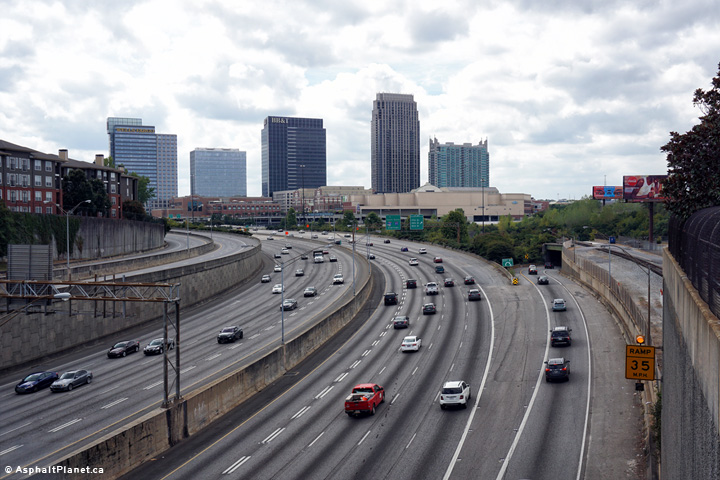
Fulton County |
Southerly view rounding the curve as South I-85 is joined by South I-75 to form Atlanta's Downtown Connector. Atlanta's Downtown Connector is one of the United State's most renowned freeways. |
 |
||
|
Date: 10/3/2010 |
High-res: (1440x960) (2400x1600) | |||
|
Fulton County |
Southerly view along Interstate 85 approaching the I-75 interchange from the Peachtree Road overpass. |
 |
||
|
Date: 9/17/2016 |
High-res: (1440x960) (2400x1600) | |||
|
Fulton County |
View looking northerly from the Peachtree Road overpass. The road on the right is Highway 13, the old alignment of Interstate 85. |
 |
||
|
Date: 9/17/2016 |
High-res: (1440x960) (2400x1600) | |||
|
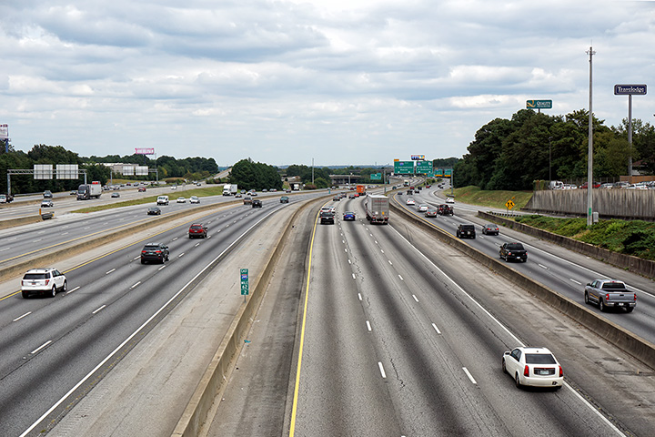
Fulton County |
Southbound signage for the ramp to Interstate 75 North. I-85 enters Atlanta from the north on a southwesterly tangent, so while this overhead signage is indeed leading to a wrong-way movement -- it is not as an abrupt direction change as the signage would suggest. |
 |
||
|
Date: 10/3/2010 |
High-res: (1440x960) (2400x1600) | |||
|
Fulton County |
Advanced signage for the ramp to Interstate 75-North from I-85 South. Even before the Downtown Connector begins, Interstate 85 is already a wide road. |
 |
||
|
Date: 10/3/2010 |
High-res: (1440x960) (2400x1600) | |||
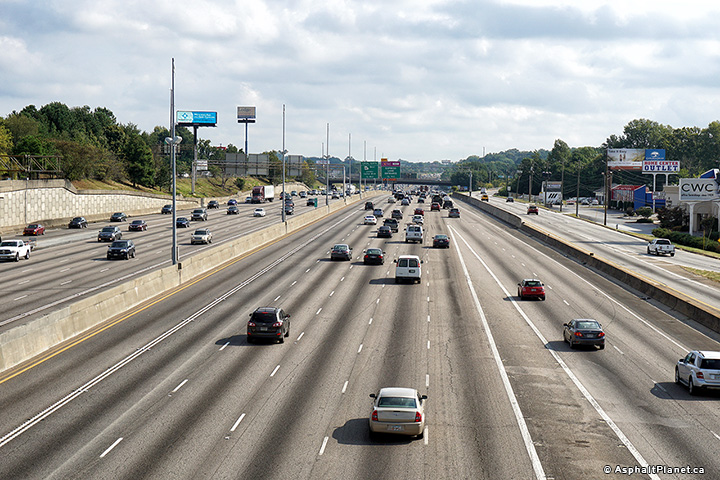
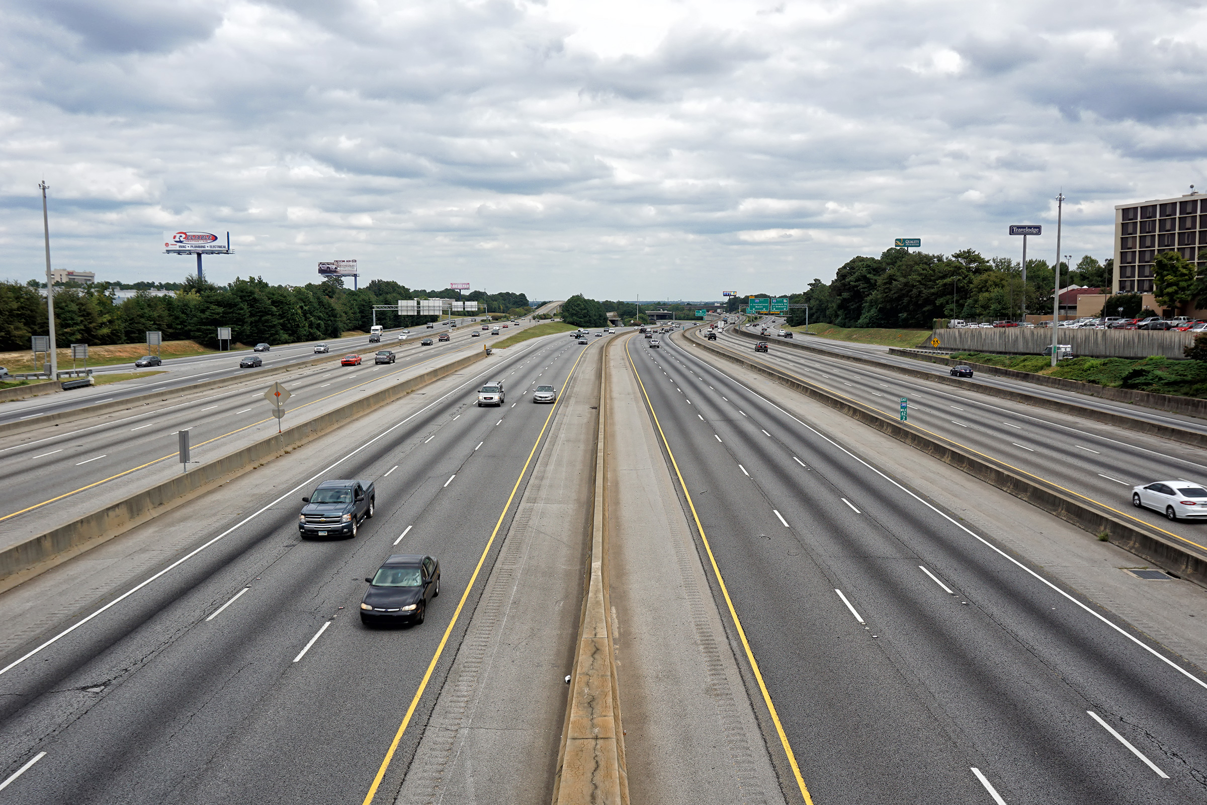
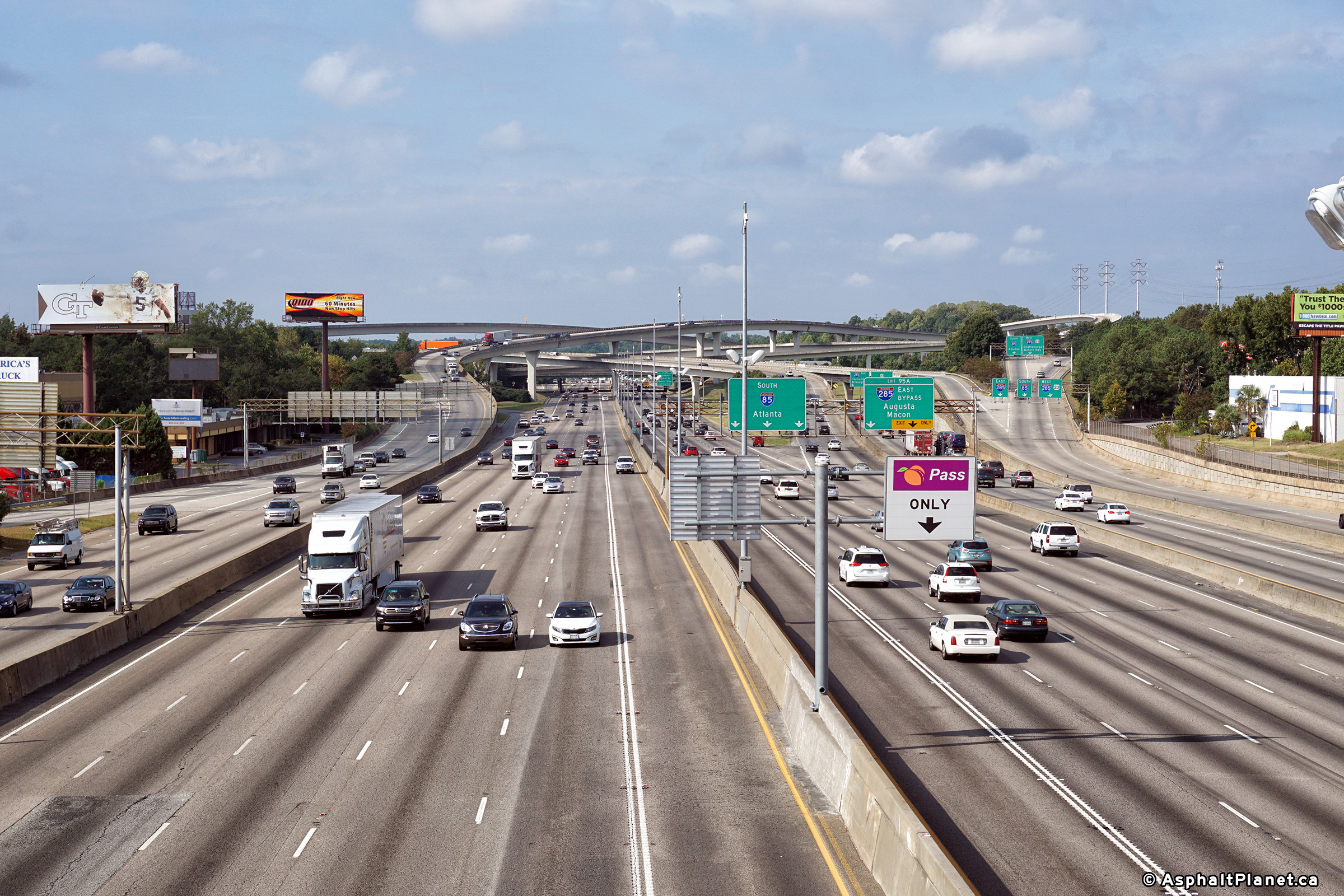
|
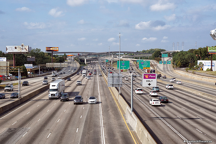
DeKalb County |
Southerly view driving through the I-285 interchange. |
 |
||
|
Date: 9/17/2016 |
High-res: (1440x960) (2400x1600) | |||
|
DeKalb County |
Southbound signage at the off-ramp to I-285 East. |
 |
||
|
Date: 9/17/2016 |
High-res: (1440x960) (2400x1600) | |||
|
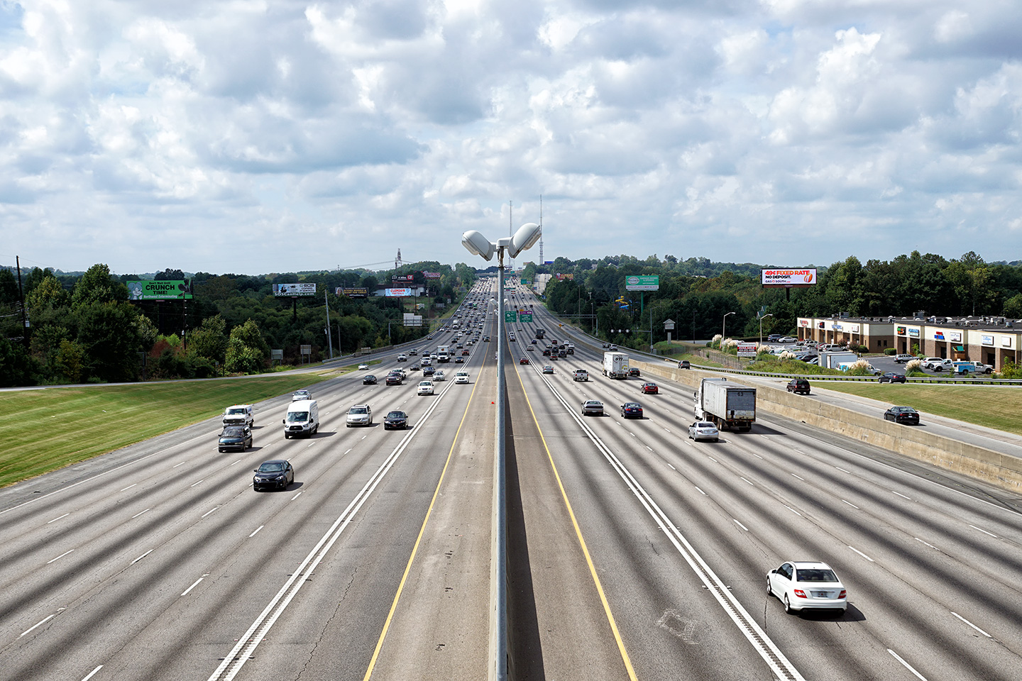
DeKalb County |
A series of three southbound views looking southerly from the Northcrest Road overpass towards the large I-285 Perimeter Highway interchange. The northern interchange between I-285 and I-85 is known locally as the Spaghetti Interchange. |
 |
||
| High-res: (1440x960) (2400x1600) | ||||
 |
||||
| High-res: (1440x960) (2400x1600) | ||||
 |
||||
|
Date: 9/17/2016 |
High-res: (1440x960) (2400x1600) | |||
|
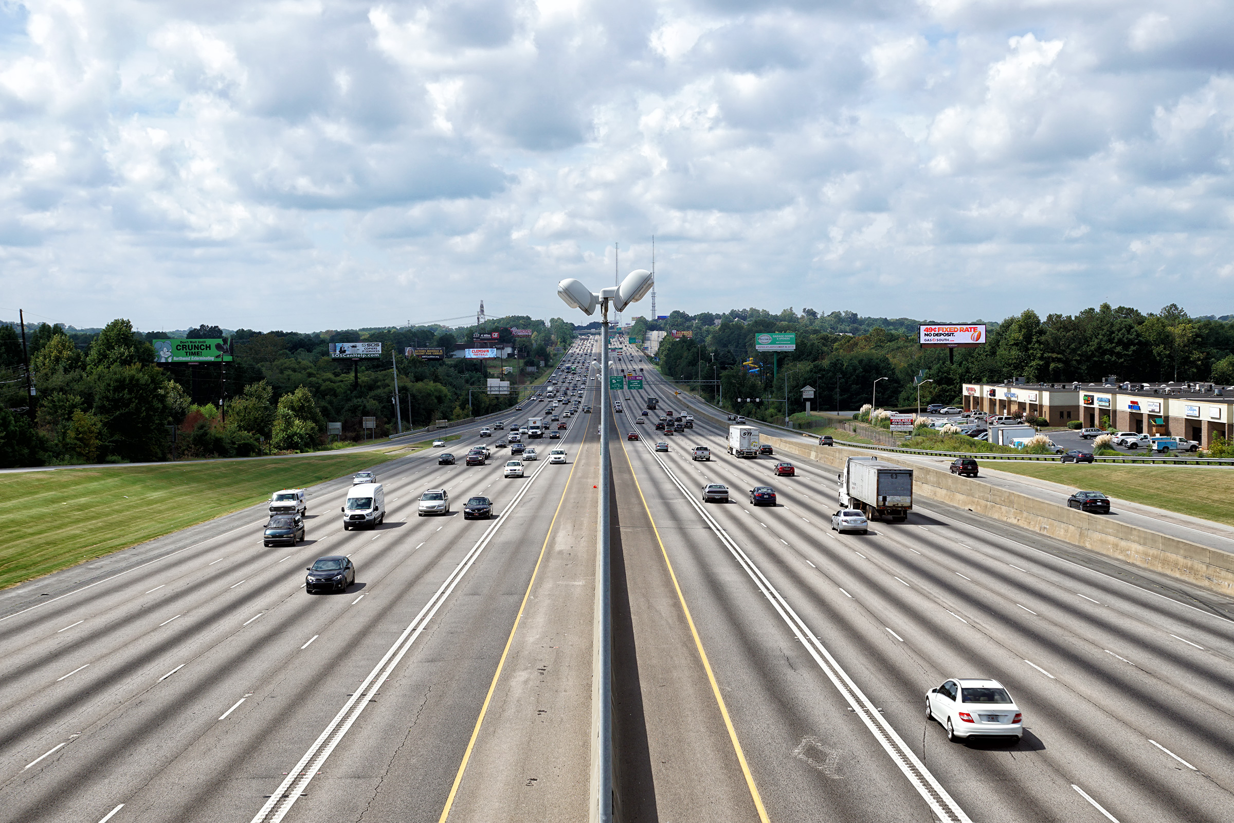
DeKalb County |
View looking northerly along I-85 from the Northcrest Road overpass. |
 |
||
|
Date: 9/17/2016 |
High-res: (1440x960) (2400x1600) | |||
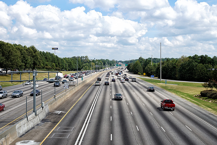
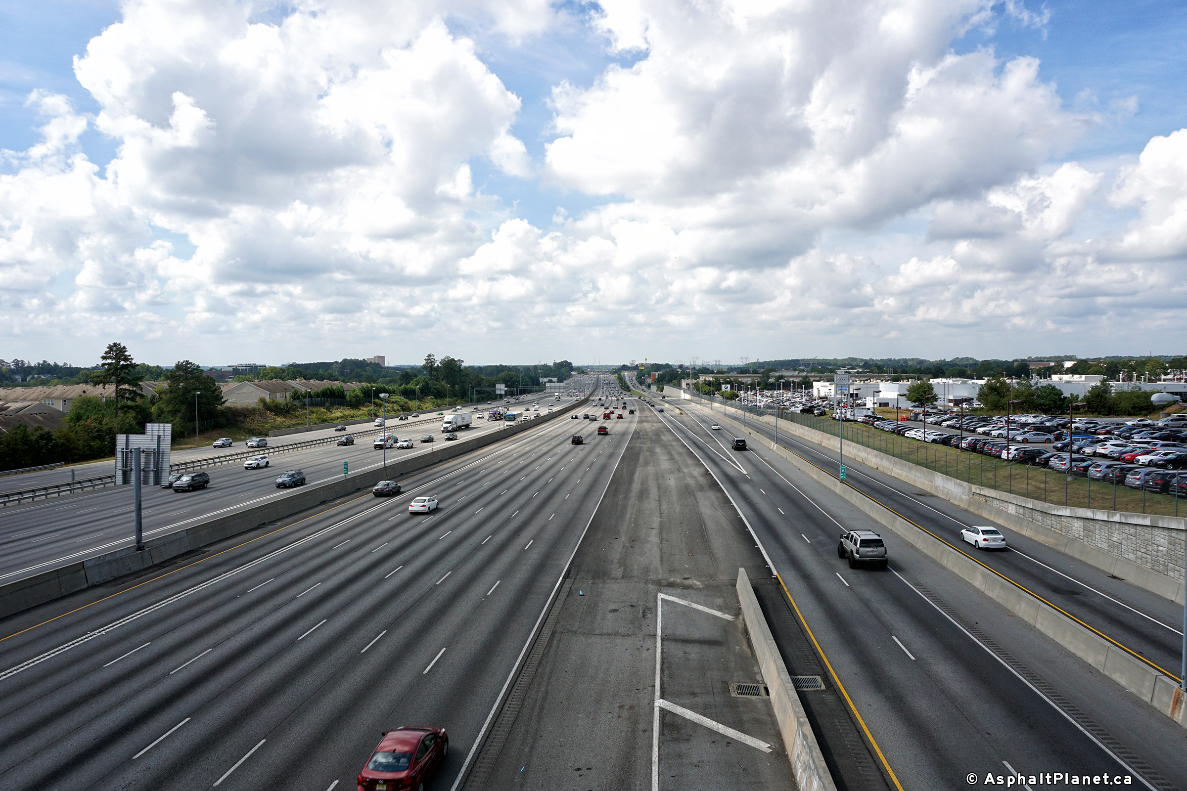
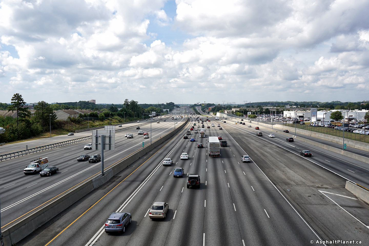
|
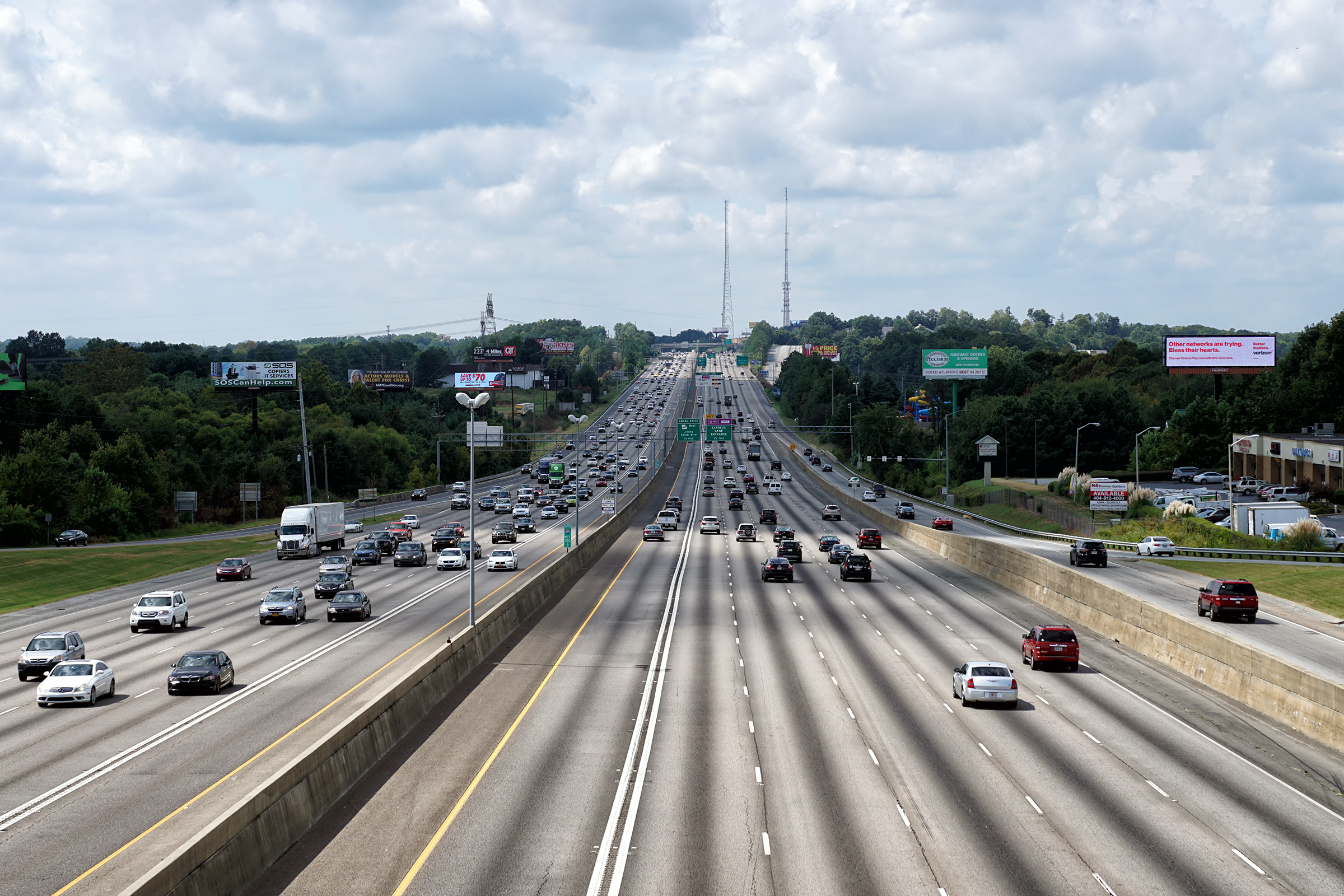
Gwinnett County |
Two views looking southerly along Interstate 85 from the Indian Trail Linburn Road overpass. |
 |
||
| High-res: (1440x960) (2400x1600) | ||||
 |
||||
|
Date: 9/17/2016 |
High-res: (1440x960) (2400x1600) | |||
|
Gwinnett County |
Two northerly views looking northerly from the Indian Trail Linburn Road overpass. |
 |
||
| High-res: (1440x960) (2400x1600) | ||||
 |
||||
|
Date: 9/17/2016 |
High-res: (1440x960) (2400x1600) | |||
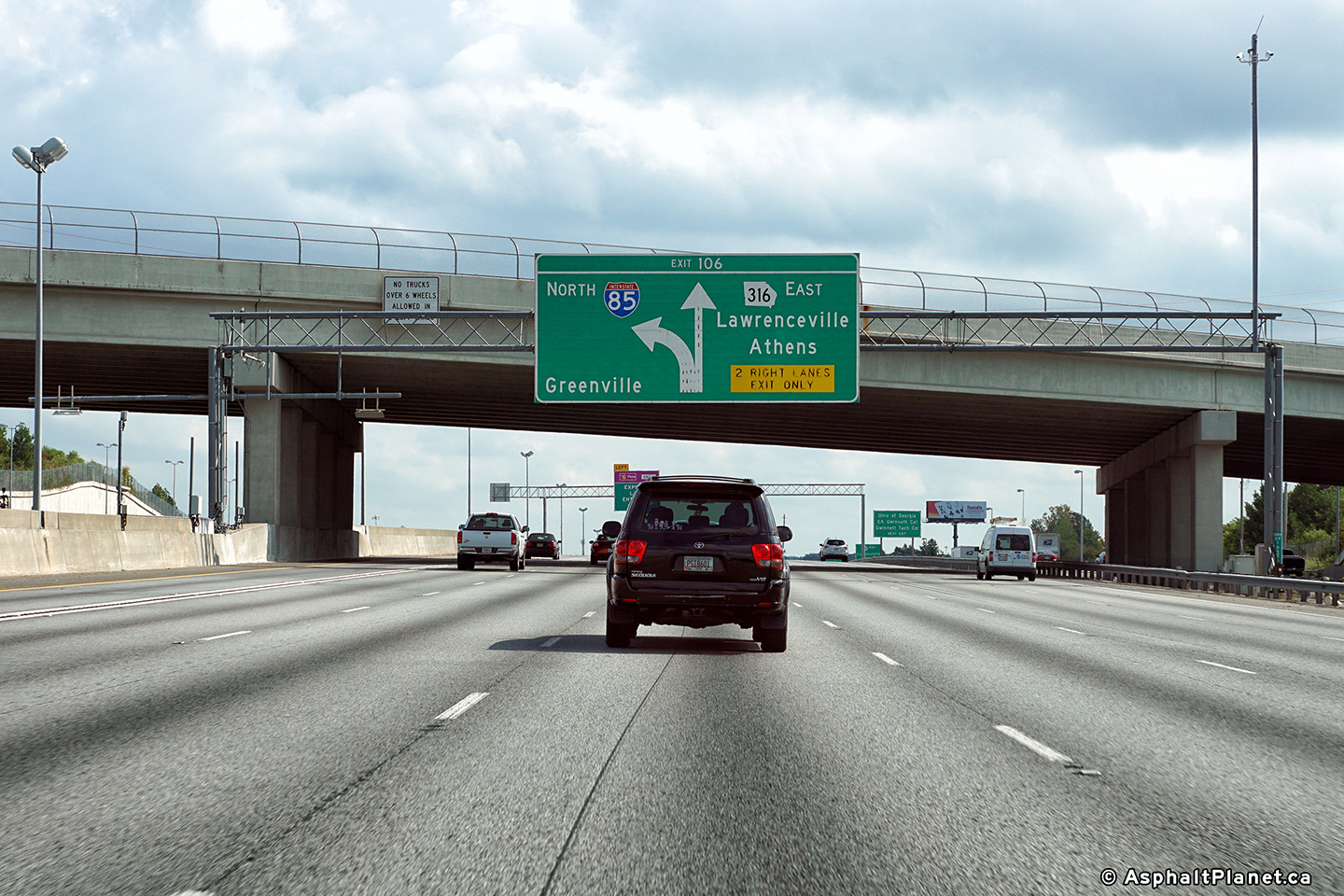
|
Gwinnett County |
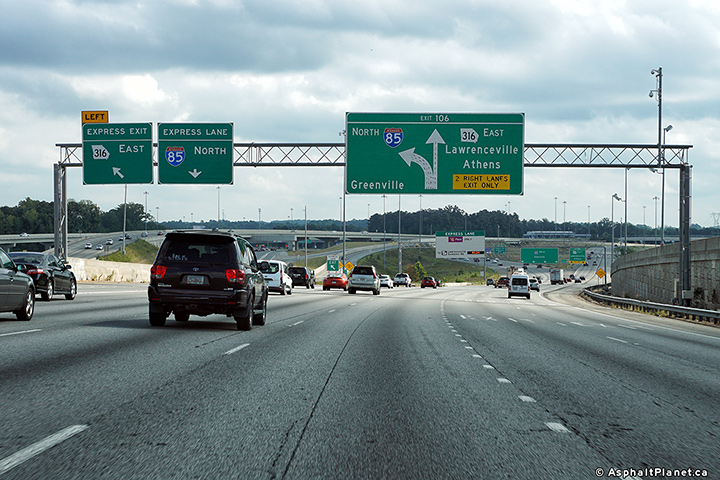
An additional northbound sign for the Highway 316 interchange in advance of the Old Norcross Road overpass. |
|
||
|
Date: 9/17/2016 |
High-res: (1440x960) (2400x1600) | |||
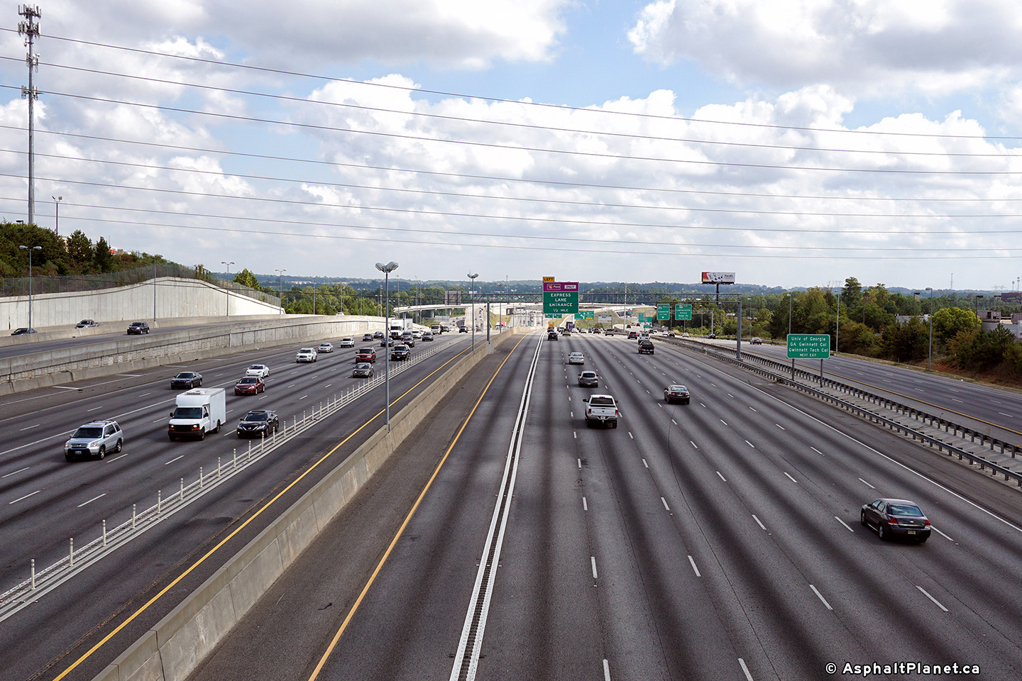
|
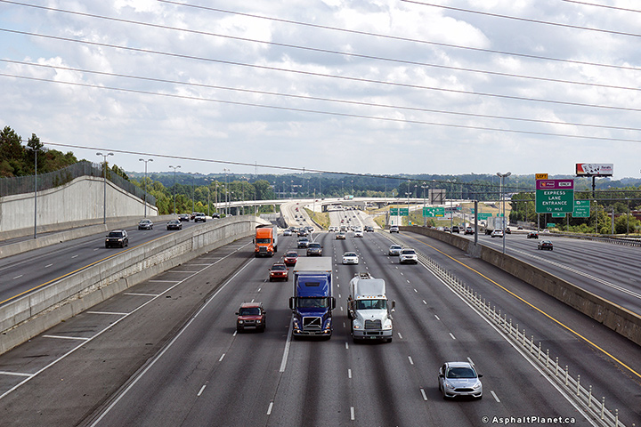
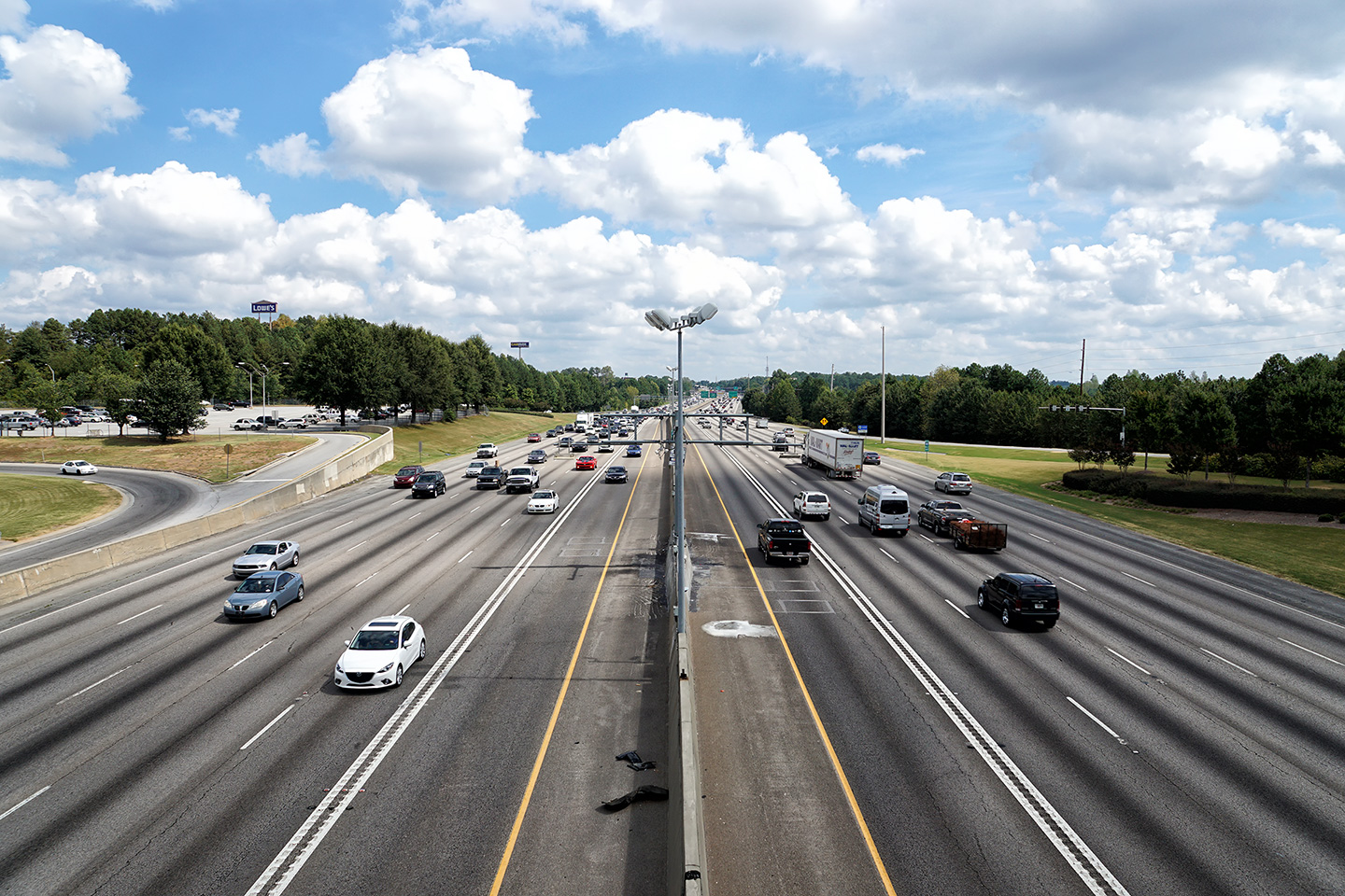
Gwinnett County |
Southerly view along I-85 towards Downtown Atlanta from the Highway 316 interchange from the Old Norcross Road overpass. |
 |
||
| High-res: (1440x960) (2400x1600) | ||||
 |
||||
|
Date: 9/17/2016 |
High-res: (1440x960) (2400x1600) | |||
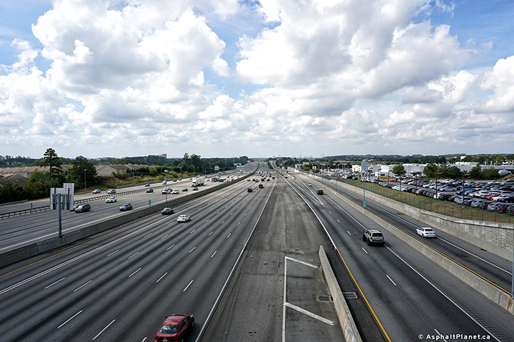
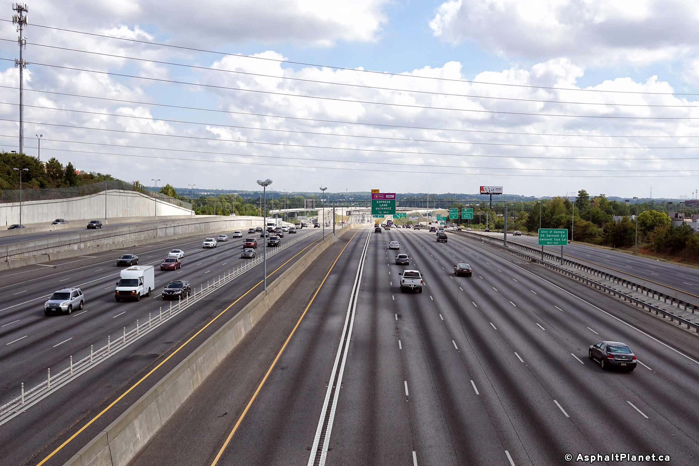
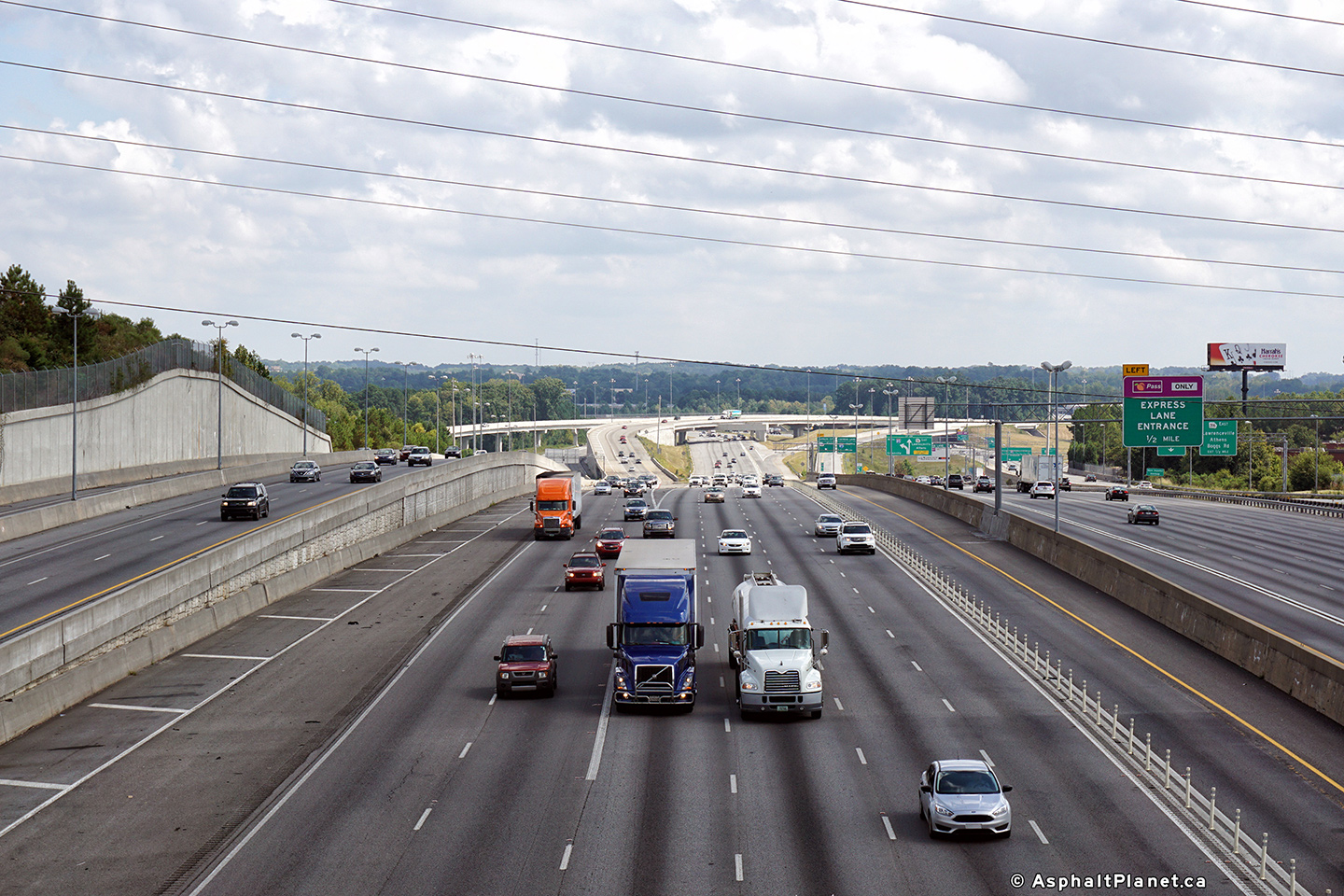
|
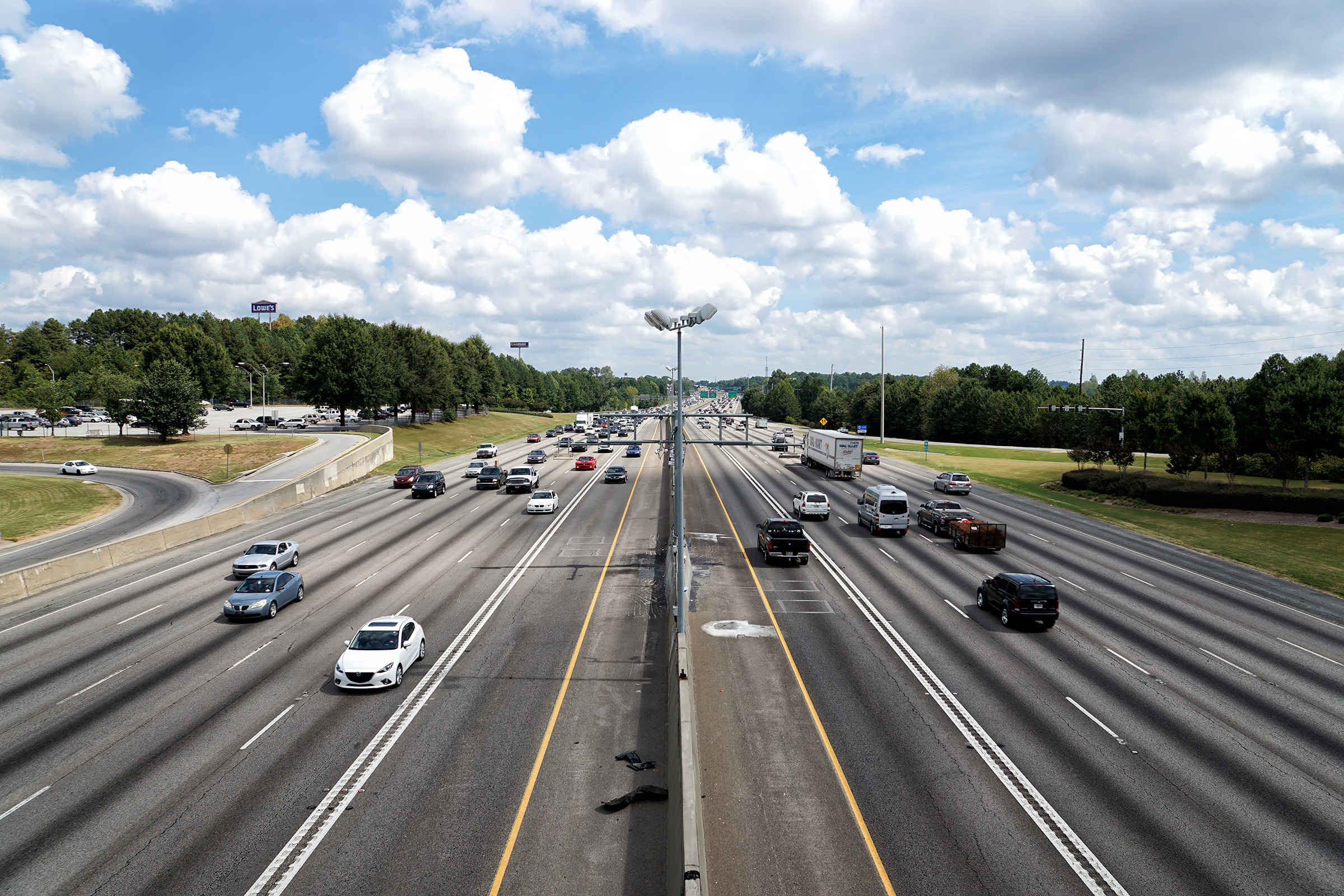
Gwinnett County |
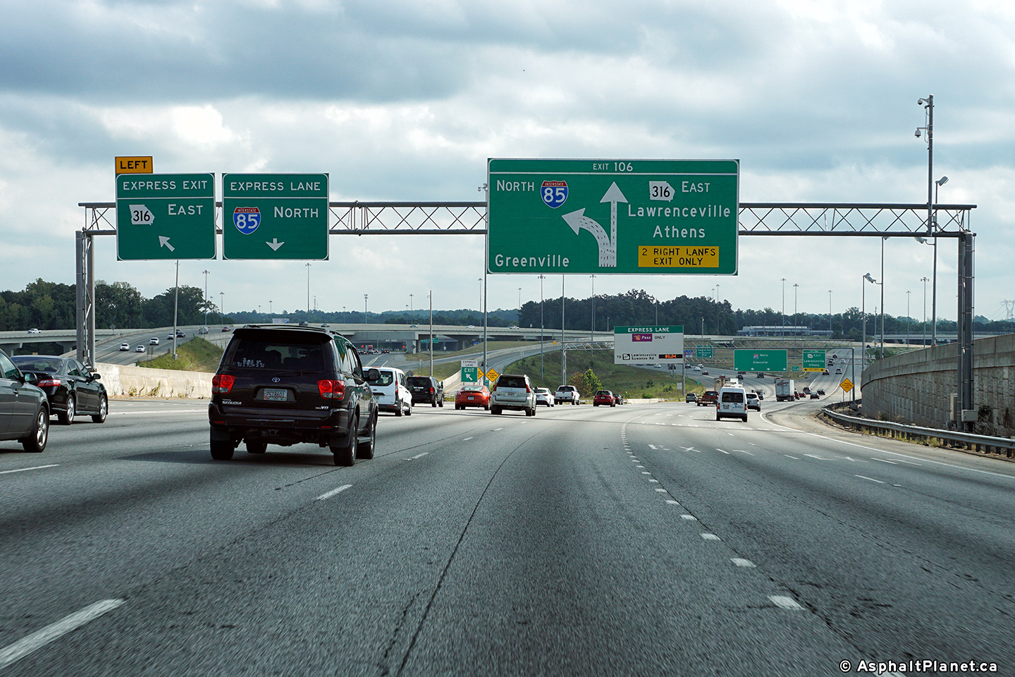
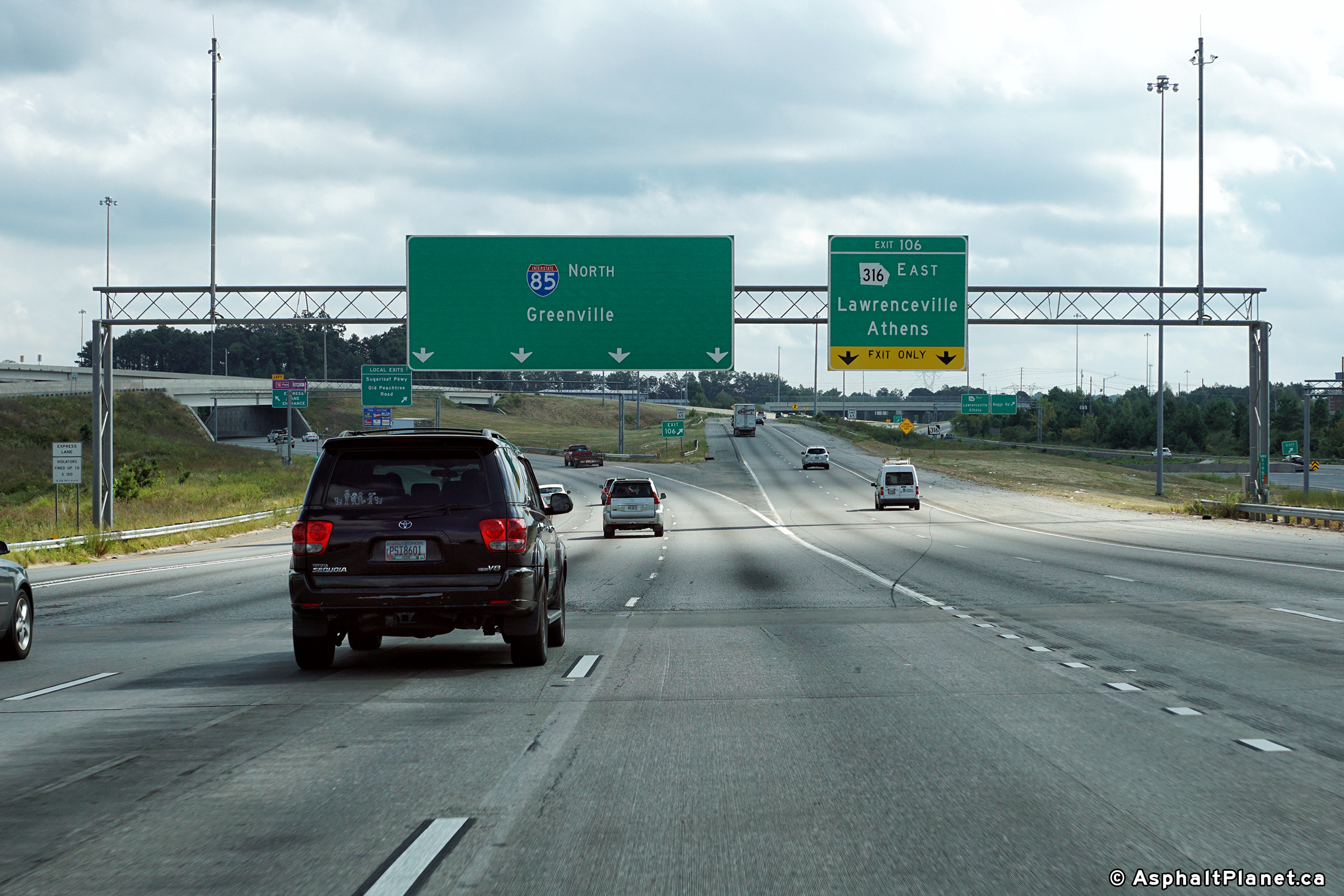
A series of three views looking northerly along I-85 towards the rather expansive Highway 316 interchange from the Old Norcross Road overpass. |
|
||
| High-res: (1440x960) (2400x1600) | ||||
|
|
||||
| High-res: (1440x960) (2400x1600) | ||||
|
|
||||
|
Date: 9/17/2016 |
High-res: (1440x960) (2400x1600) | |||
|
Gwinnett County |
Northbound advanced signage for the off-ramp to Highway 316. |
|
||
|
Date: 9/17/2016 |
High-res: (1440x960) (2400x1600) | |||
|
Gwinnett County |
Overhead signage for the northbound off-ramp to Highway 316. |
|
||
|
Date: 9/17/2016 |
High-res: (1440x960) (2400x1600) | |||
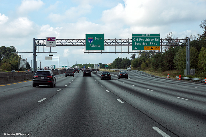
|
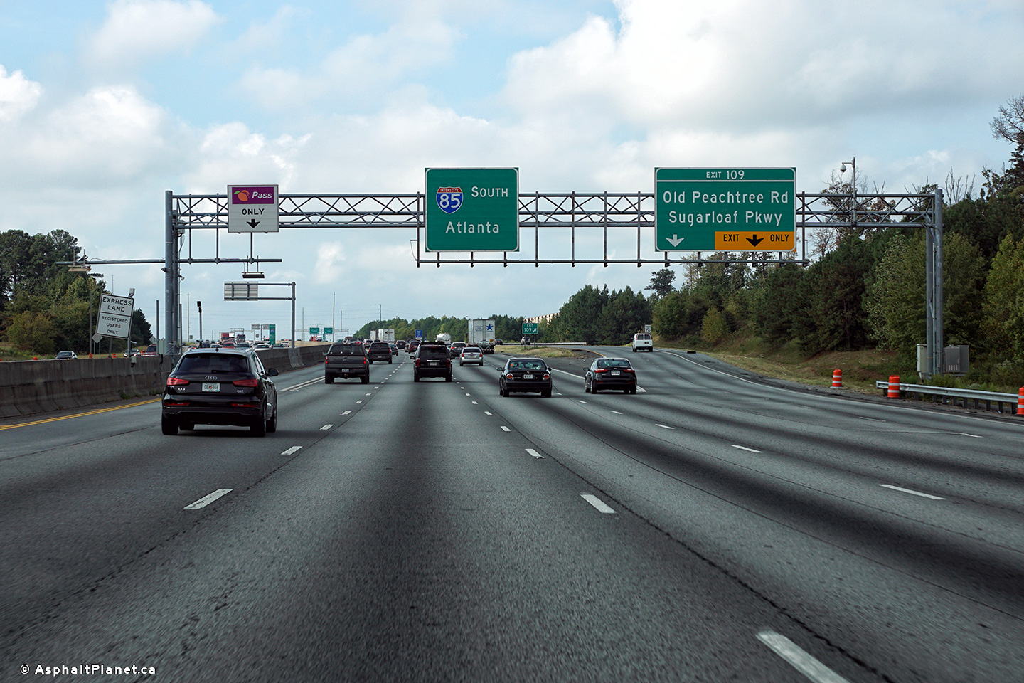
Gwinnett County |
Southbound off-ramp to the collector lanes from which the Old Peachtree Road and Sugarloaf Parkway ramps depart from. |
 |
||
|
Date: 9/17/2016 |
High-res: (1440x960) (2400x1600) | |||
<- I-75
GA Highways
I-95 ->
Asphaltplanet.ca
© 2010 AsphaltPlanet.ca.
AsphaltPlanet@asphaltplanet.ca
Page Created: October 5, 2010.
Last Updated: July 30, 2018


