AsphaltPlanet.ca > California > SR-91
Pictures on this page are arranged in order from west to east. CA-91 East photos are left-aligned in the last column, while CA-91 West photos are right-aligned. Center-line pictures are centered within the last column.
|
Location |
Description |
Photo |
||
|
East- |
West- |
|||
|
Los Angeles County |
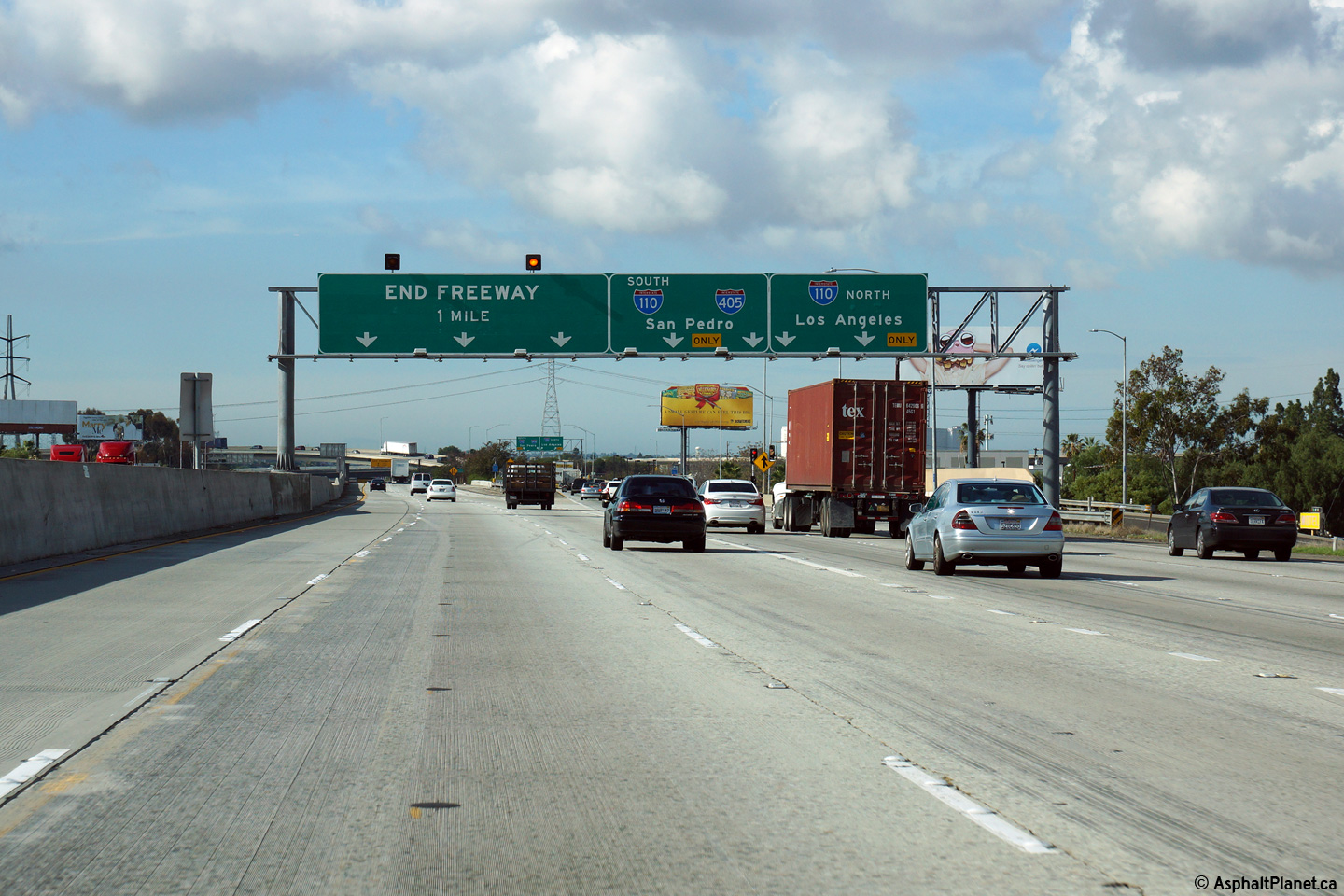
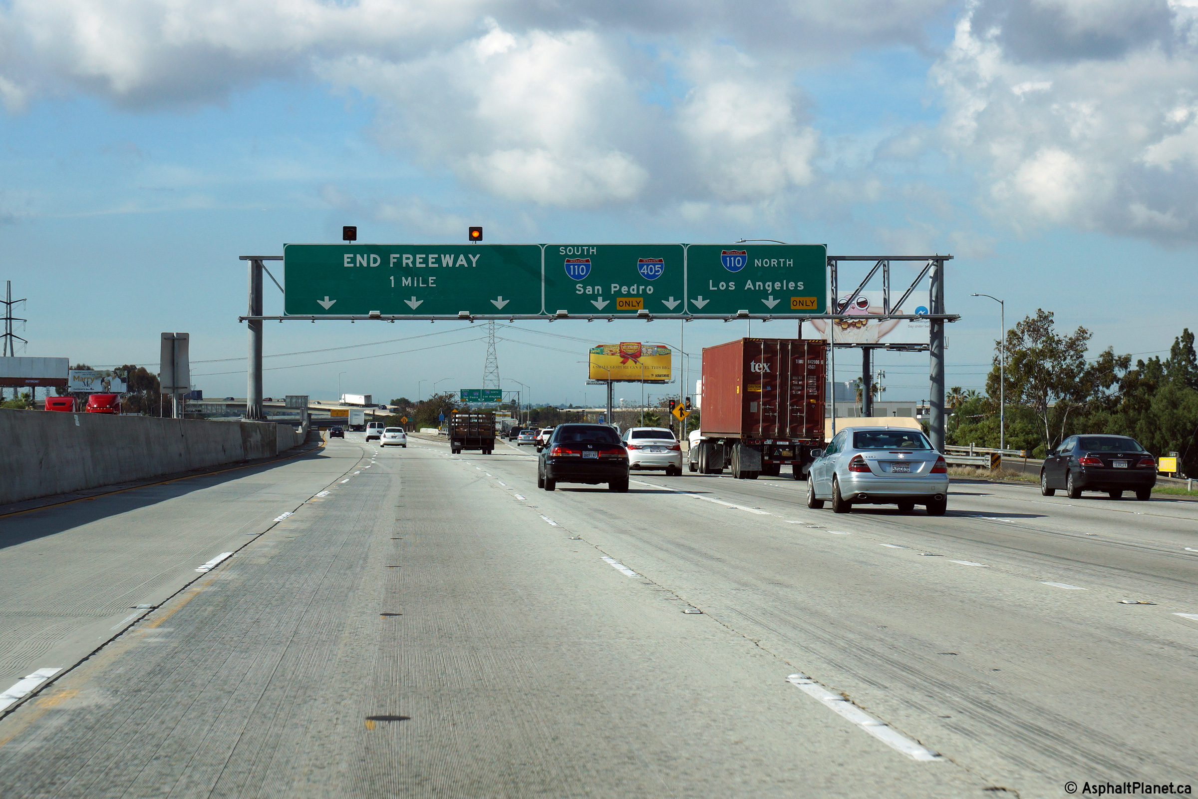
Westerly view at the western terminus of SR-91 at the 110 Freeway interchange. |
 |
||
|
Date: 11/05/2013 |
High-res: (1440x960) (2400x1600) |
|||
|
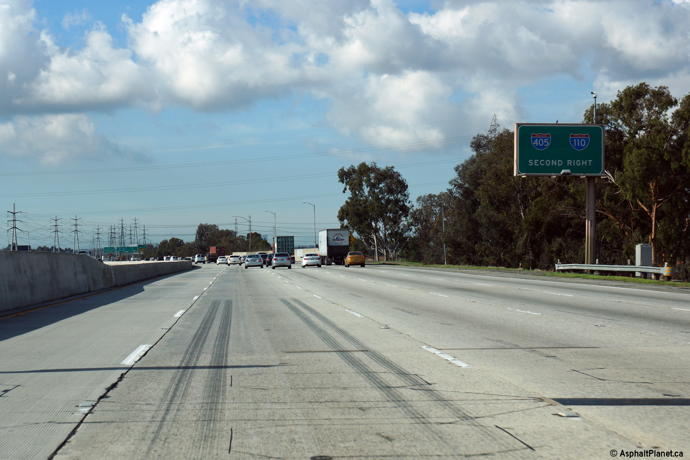
Los Angeles County |
Westbound advanced signage for the I-110 interchange. |
 |
||
|
Date: 11/05/2013 |
High-res: (1440x960) (2400x1600) |
|||
|
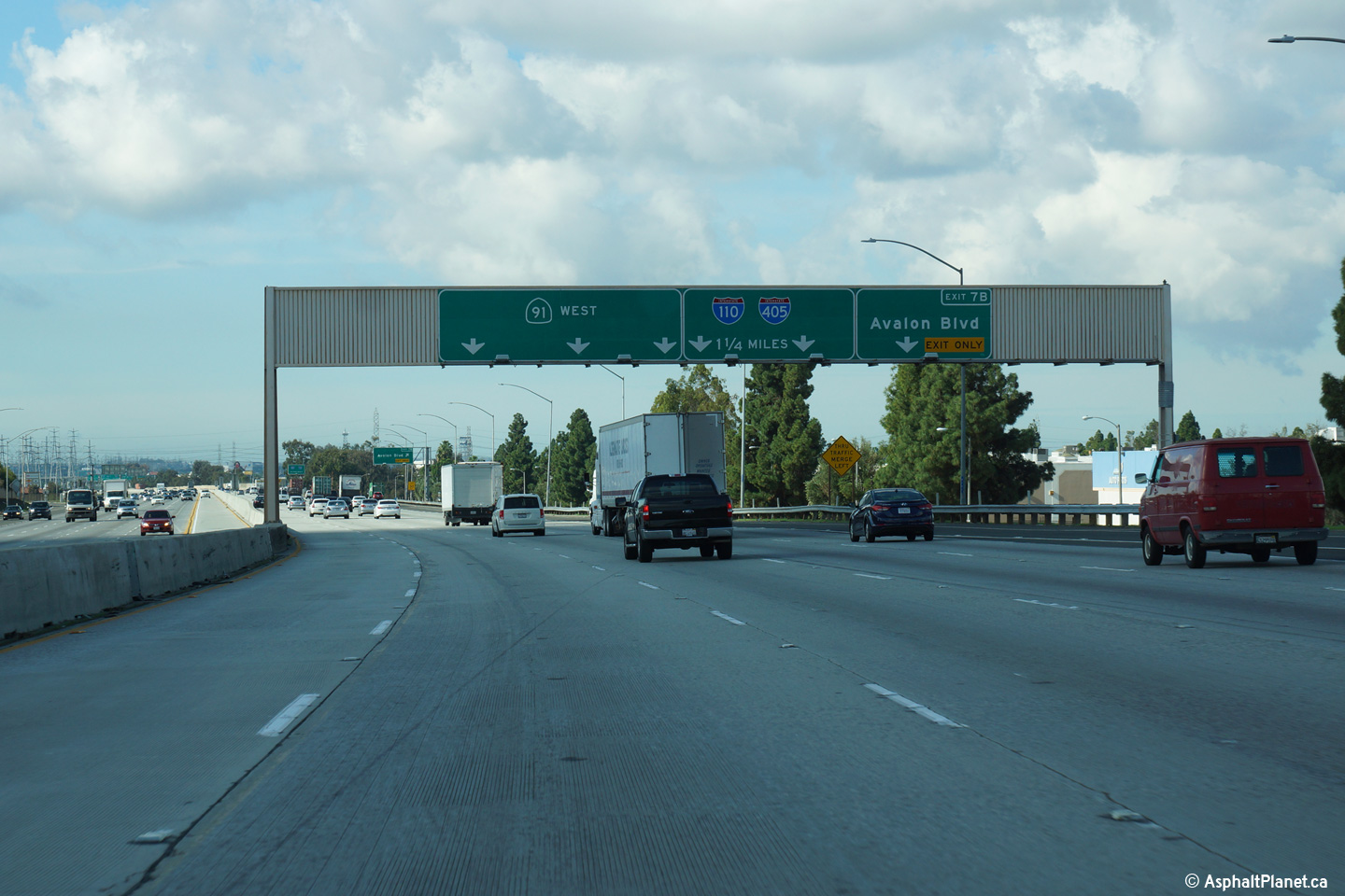
Los Angeles County |
Lane assignment signage approaching the Avalon Boulevard interchange. |
 |
||
|
Date: 11/05/2013 |
High-res: (1440x960) (2400x1600) |
|||
|
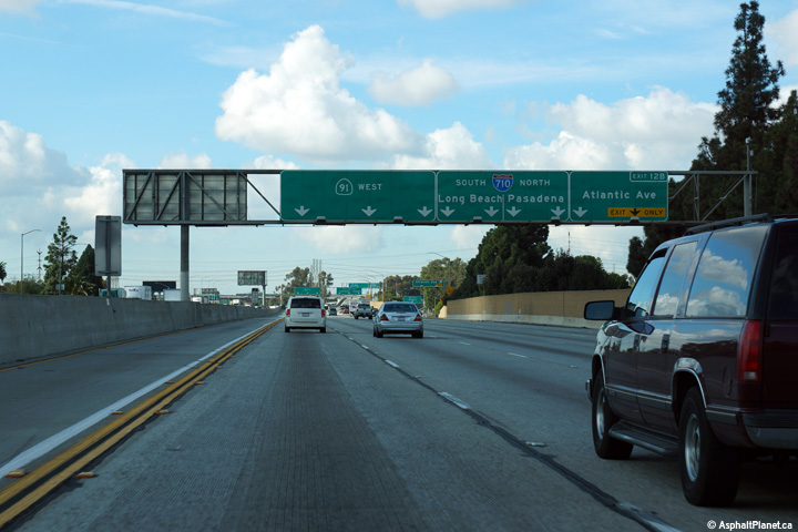
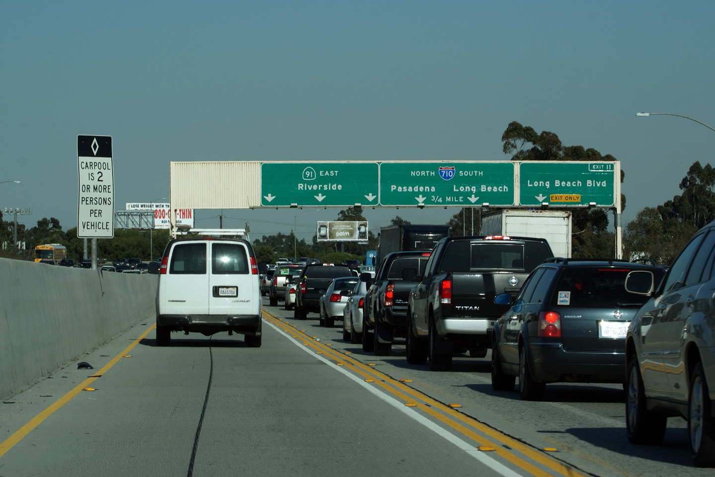
Los Angeles County |
Guide signage in advance of the Long Beach Freeway interchange. A fair number of the old button copy signs at the western end of the 91 Freeway have been replaced with modern reflective sheeting. |
|
||
|
Date: 4/06/2010 |
||||
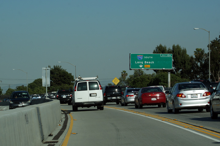
|
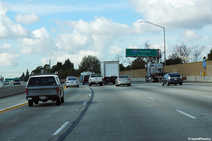
Los Angeles County |
Advanced sign for the ramp to I-710 South. |
|
||
|
Date: 4/06/2010 |
||||
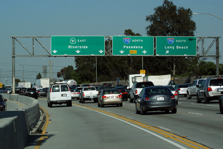
|
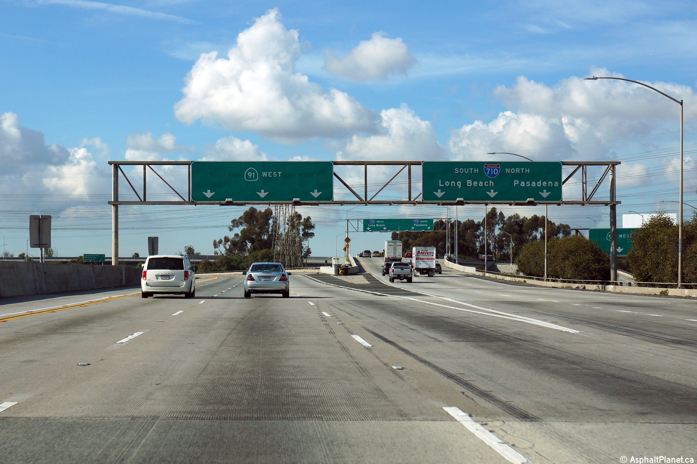
Los Angeles County |
Another guide signage for the Long Beach Freeway interchange. The 91 Freeway intersects the Long Beach Freeway at a complicated interchange where the ramps are generally situated to the east of the Long Beach Freeway -- adjacent to what's left of the Los Angeles River. |
|
||
|
Date: 4/06/2010 |
||||
|
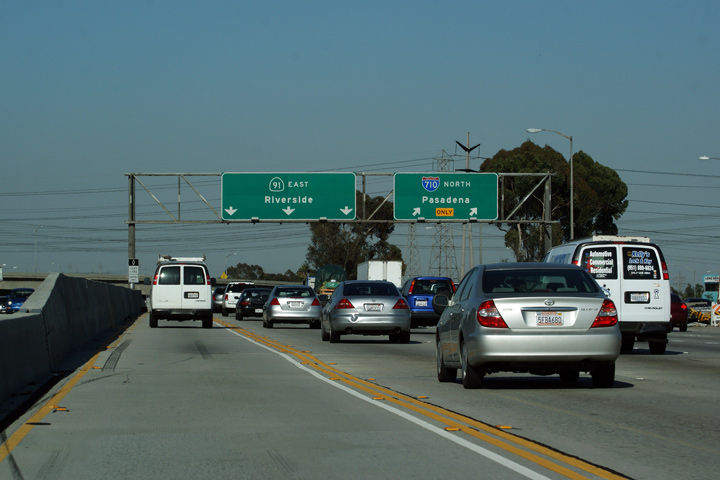
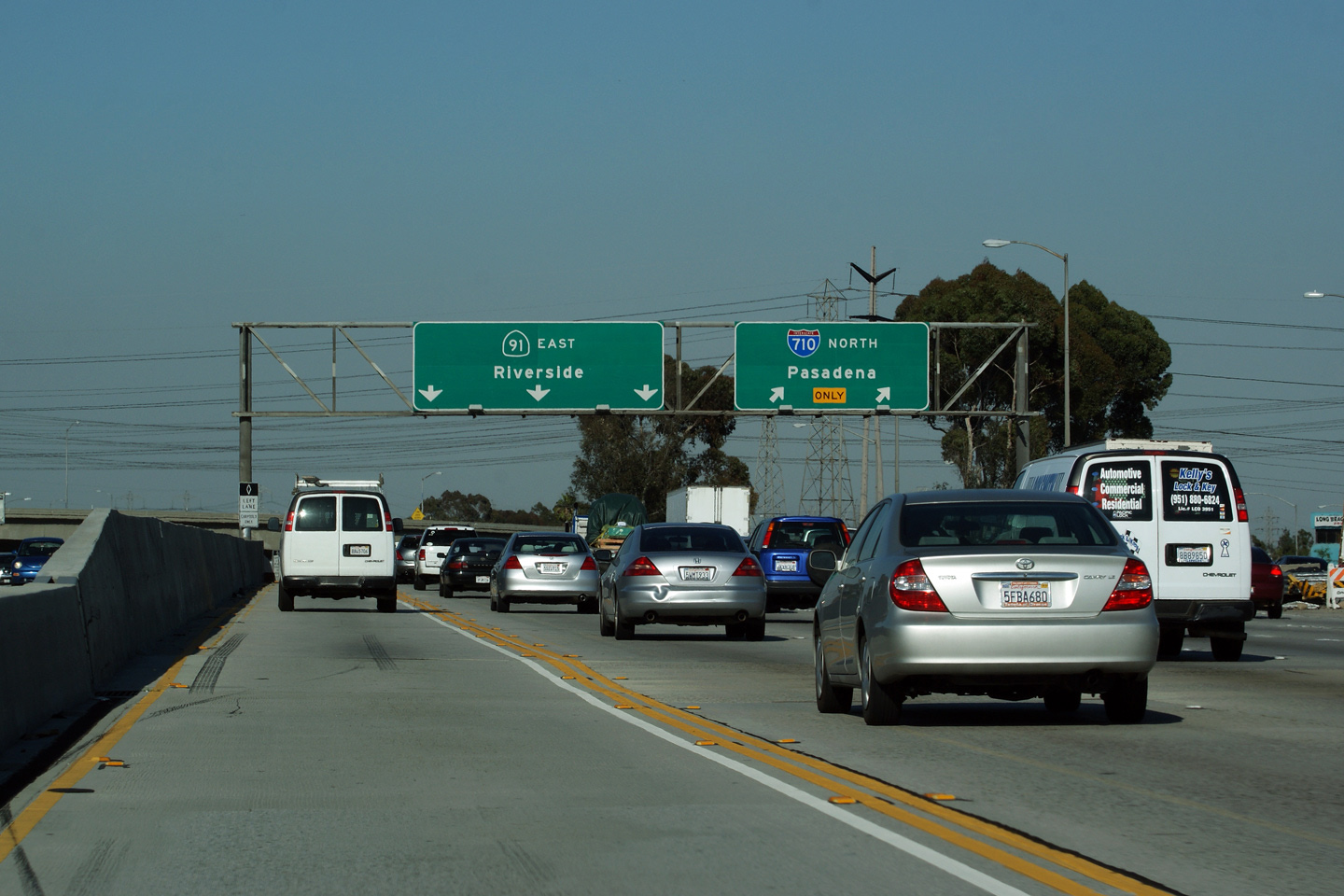
Los Angeles County |
Pull-through signage at the ramp to the 710 Freeway North. Note that the pull-through signage doesn't include any reassurance for motorists utilizing the Carpool (HOV) lane. |
|
||
|
Date: 4/06/2010 |
||||
|
Los Angeles County |
Signage at the westbound off-ramp to Interstate 710. |
 |
||
|
Date: 11/05/2013 |
High-res: (1440x960) (2400x1600) |
|||
|
Los Angeles County |
Westbound signage in advance of the Atlantic Avenue interchange. |
 |
||
|
Date: 11/05/2013 |
High-res: (1440x960) (2400x1600) |
|||
|
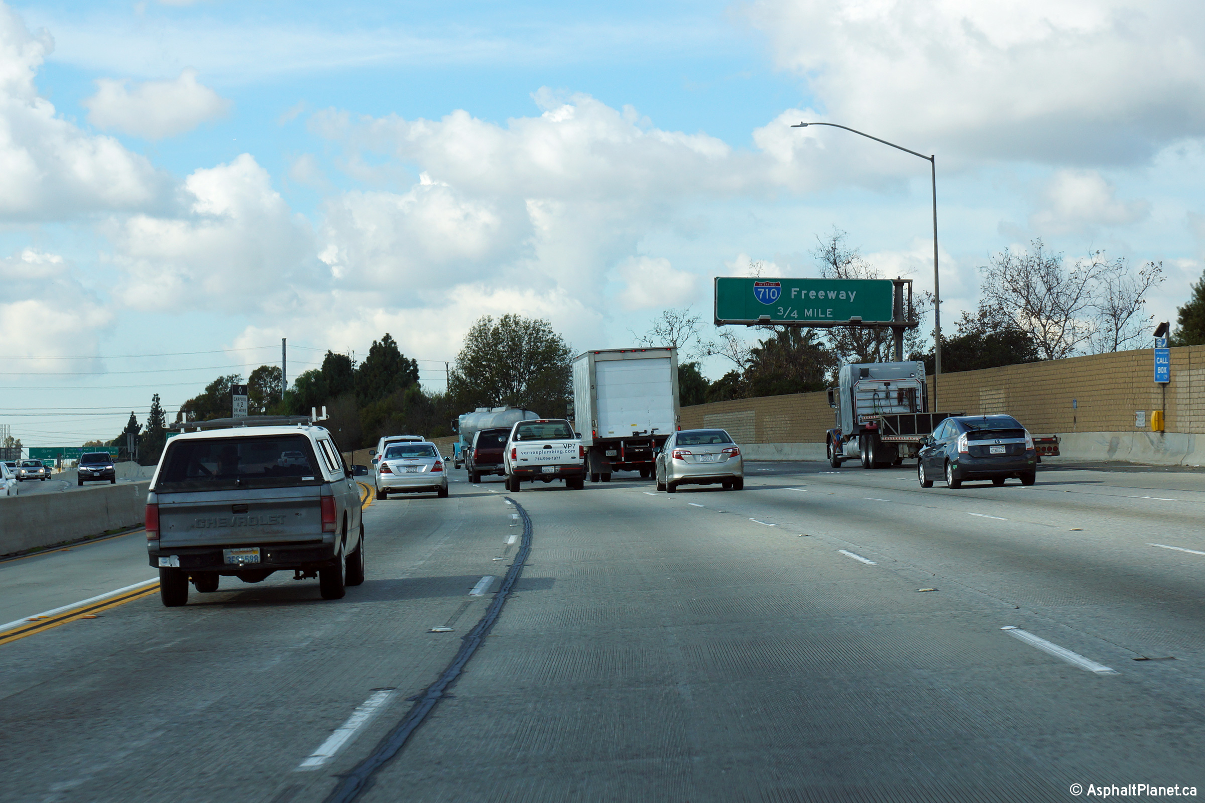
Los Angeles County |
Advanced signage for the westbound off-ramp to the 710 Freeway. |
 |
||
|
Date: 11/05/2013 |
High-res: (1440x960) (2400x1600) |
|||
|
Los Angeles County |
Next exit signage located to the east of the Long Beach Freeway interchange. |
|
||
|
Date: 4/06/2010 |
||||
|
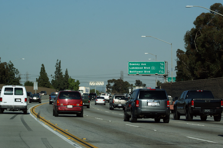
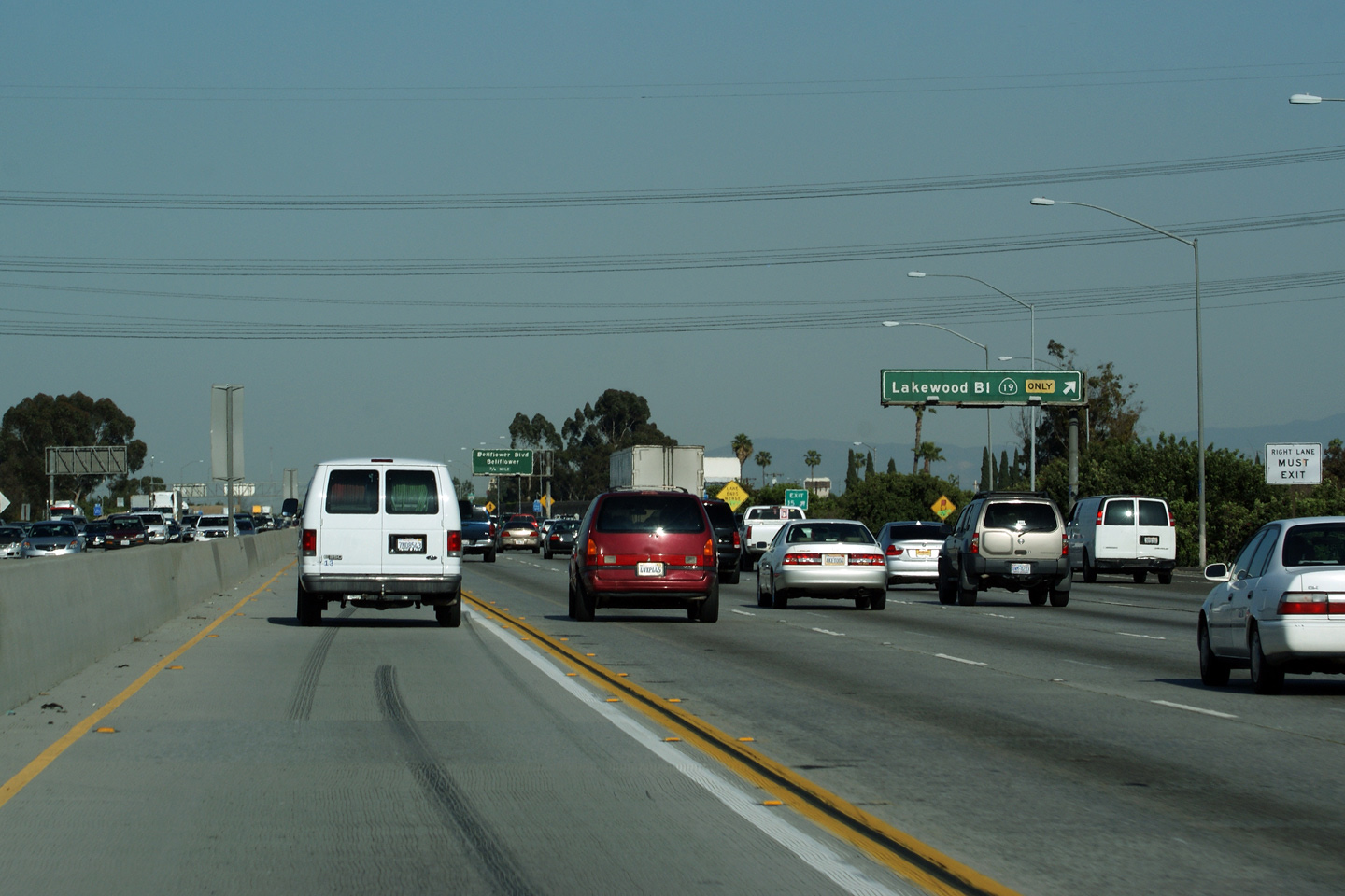
Los Angeles County |
Exit signage for Lakewood Boulevard. Lakewood Boulevard is part of California Highway 19. The Highway 19 designation has been slowly disappearing from Suburban Los Angeles as CalTrans continues to divest itself of expensive to maintain urban highways. Currently (April, 2010) Highway 19 ends at the South City Limits of Downey, about 3/4 of a mile south of the Century Freeway. |
|
||
|
Date: 4/06/2010 |
||||
|
Los Angeles County |
Another example of next exit signage -- this time announcing the 605 Freeway interchange. |
|
||
|
Date: 4/06/2010 |
||||
|
Los Angeles County |
Advanced signage for the 605 Freeway. These eastbound shots were taken near rush hour, much of the 91 freeway is stop and go during peak periods. |
|
||
|
Date: 4/06/2010 |
||||
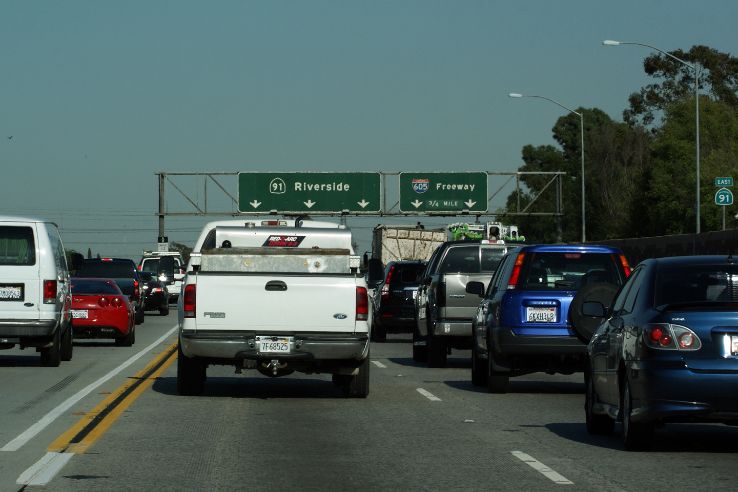
|
Los Angeles County |
Second advanced sign for the 605 Freeway. |
|
||
|
Date: 4/06/2010 |
||||
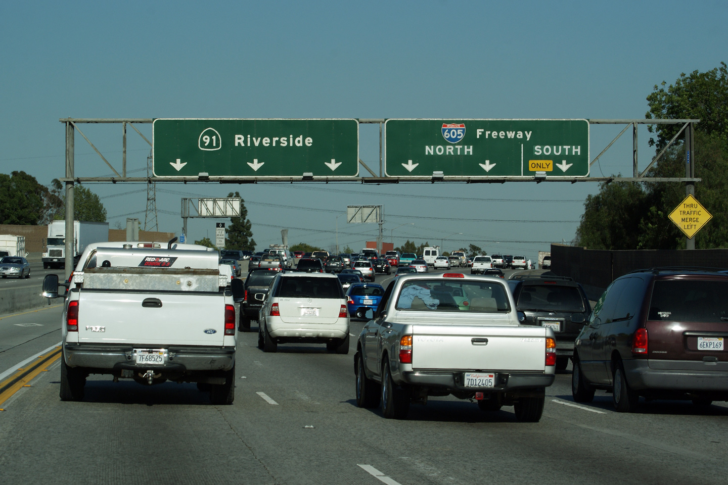
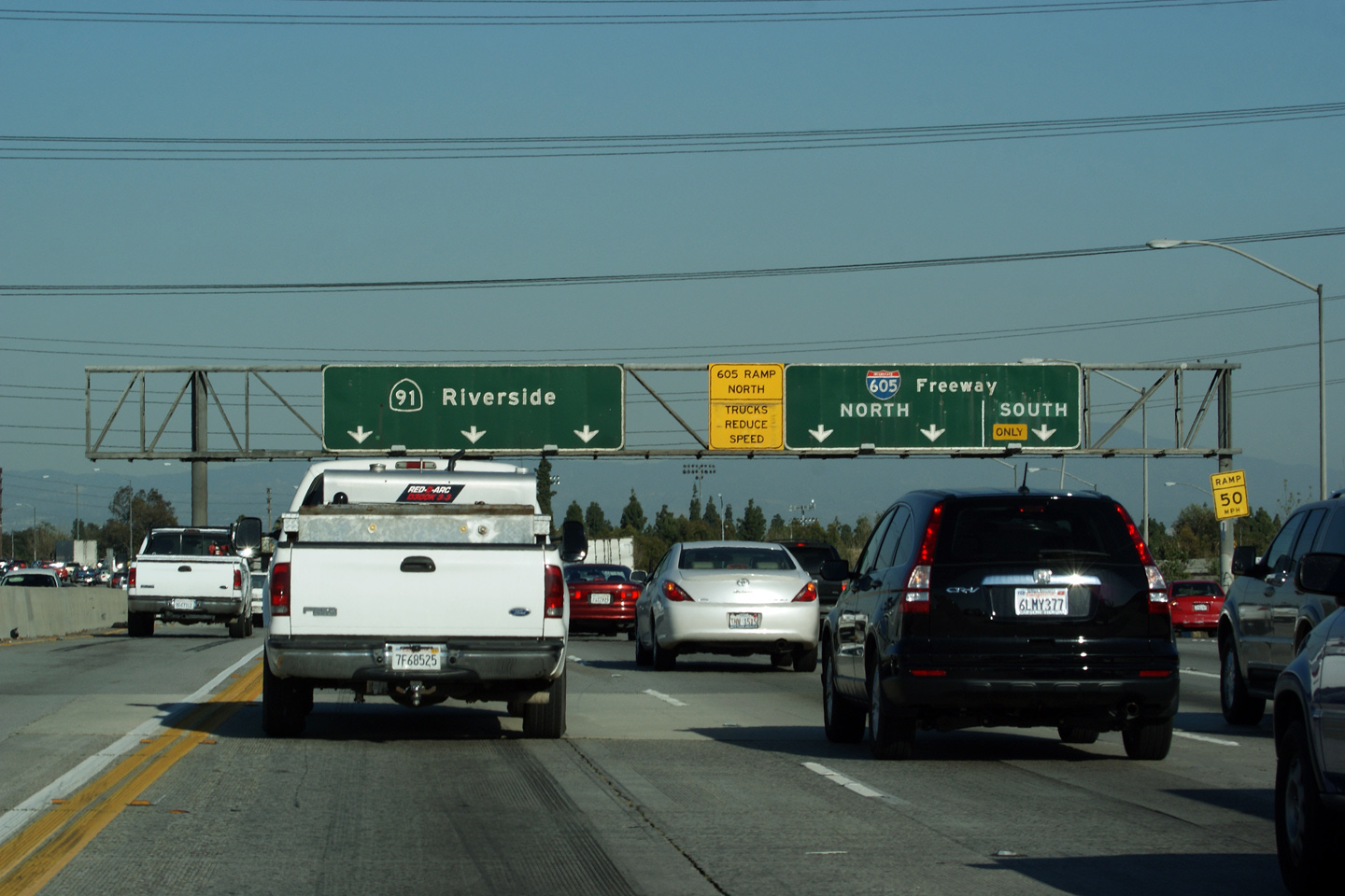
|
Los Angeles County |
Exit signage for the 605 Freeway. The 605 Freeway meets the 91 Freeway at a cloverstack interchange. The yellow advisory sign directing trucks to slow down stands on the gantry warning vehicles that the freeway to freeway ramp curls around the loop ramp from the 605-South to the 91-East instead of being a high-speed fly-over. |
|
||
|
Date: 4/06/2010 |
||||
| I-605 is the San Gabriel River Freeway and runs along the eastern edge of Los Angeles County between the 405 and 210 freeways. Click here for Interstate 605 Images. | ||||
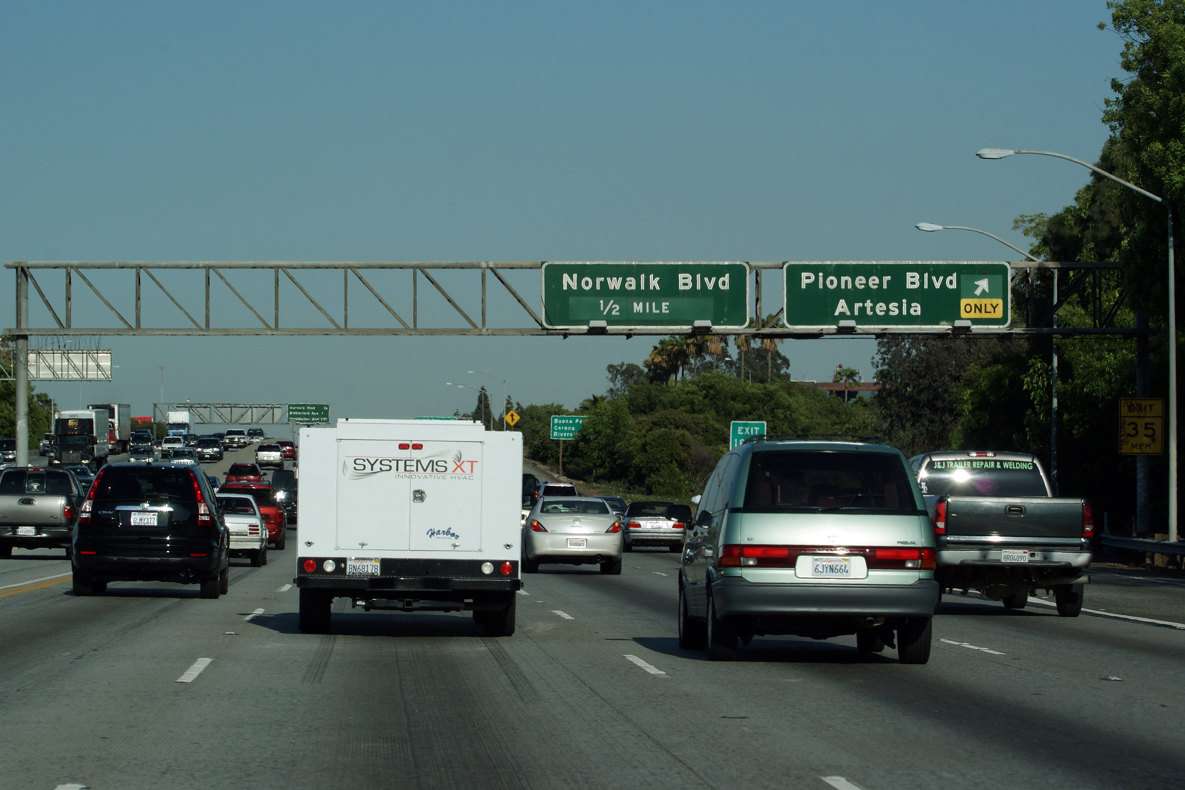
|
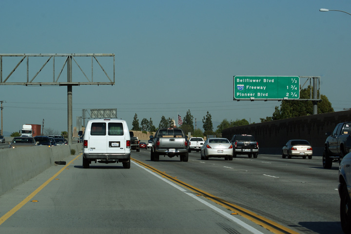
Los Angeles County |
Full width overhead gantry for the Pioneer Boulevard interchange. Pioneer Boulevard serves the small suburb of Artesia. The 91 freeway is dubbed the Artesia Freeway through Los Angeles County, because of its close proximity to Artesia Boulevard, the main east-west arterial through the community of Artesia. |
|
||
|
Date: 4/06/2010 |
High-res: (1440x960) (2400x1600) |
|||
|
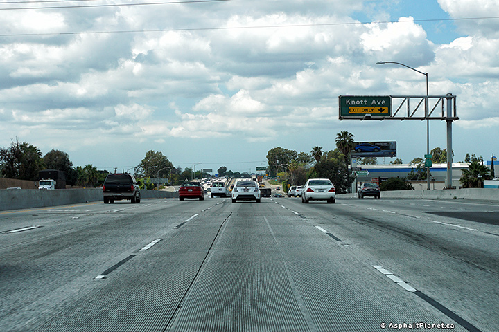
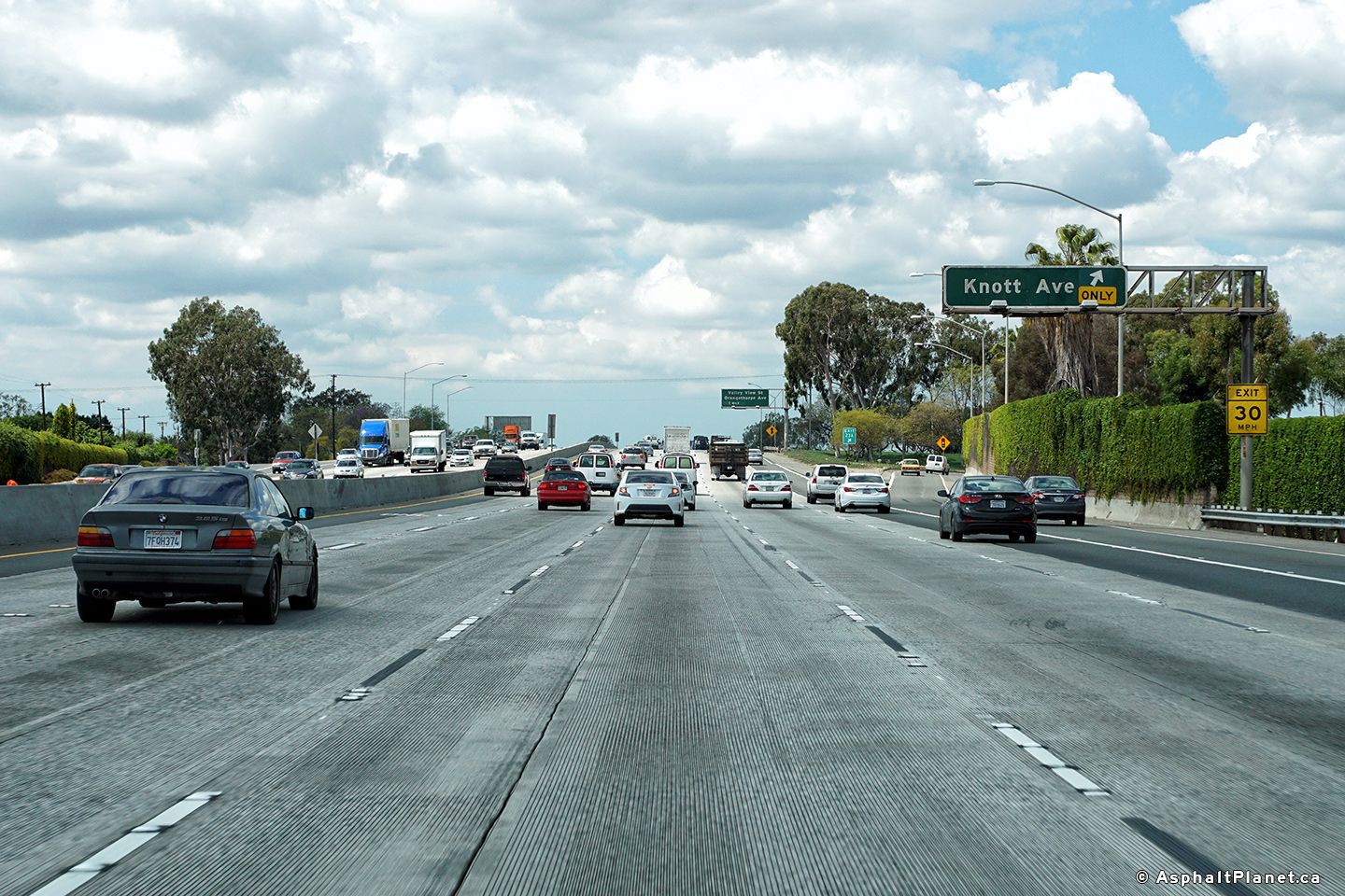
Los Angeles County |
View looking westerly at the off-ramp to Knott Avenue. |
 |
||
|
Date: 4/11/2016 |
High-res: (1440x960) (2400x1600) |
|||
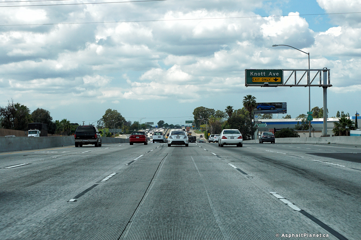
|
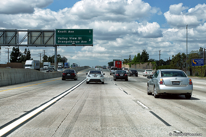
Los Angeles County |
Westbound advanced signage for the Knott Avenue interchange. |
 |
||
|
Date: 4/11/2016 |
High-res: (1440x960) (2400x1600) |
|||
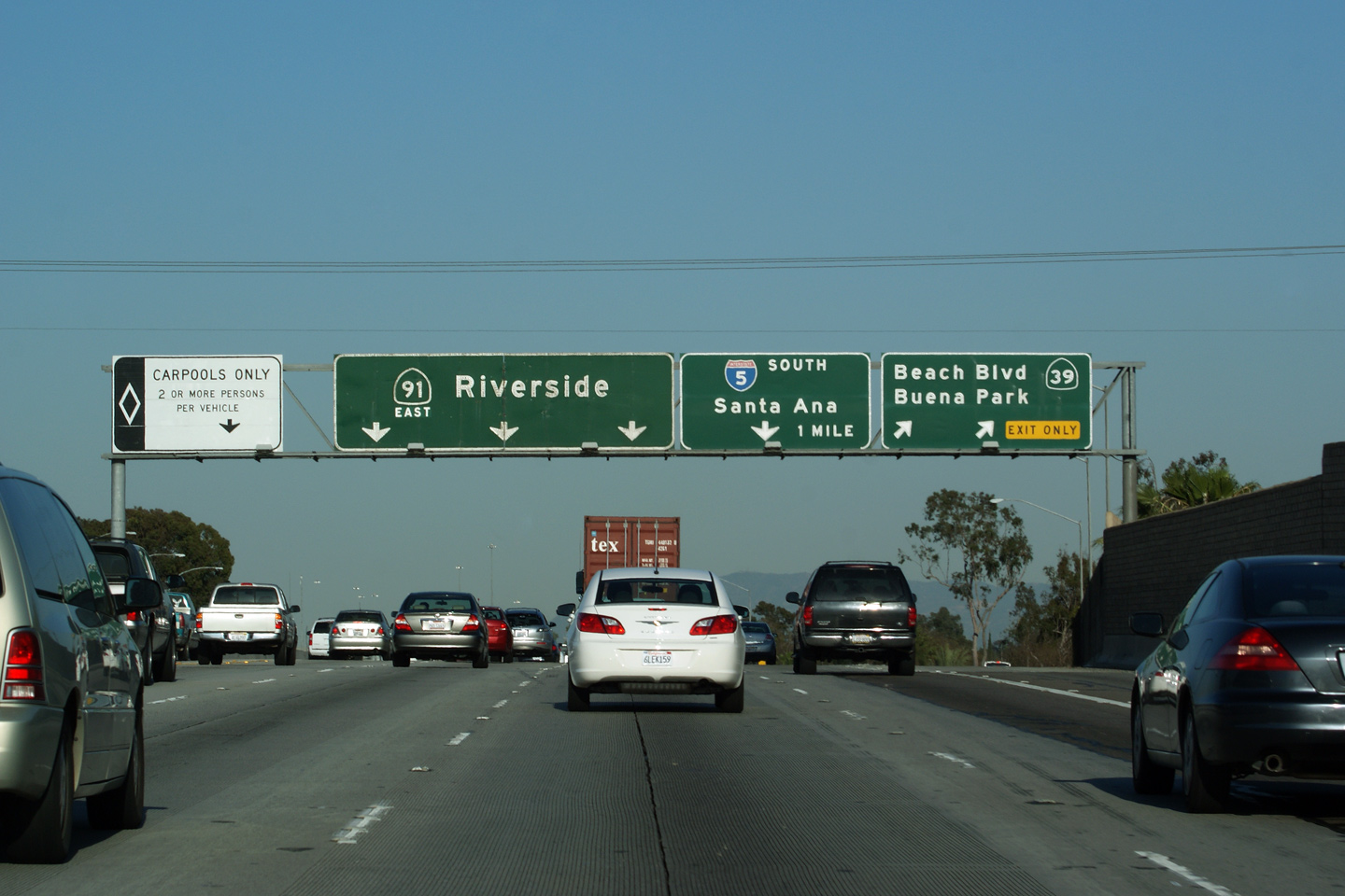
|
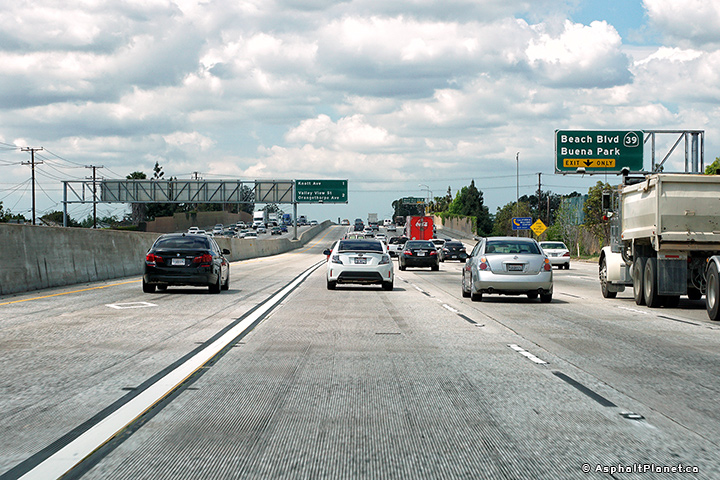
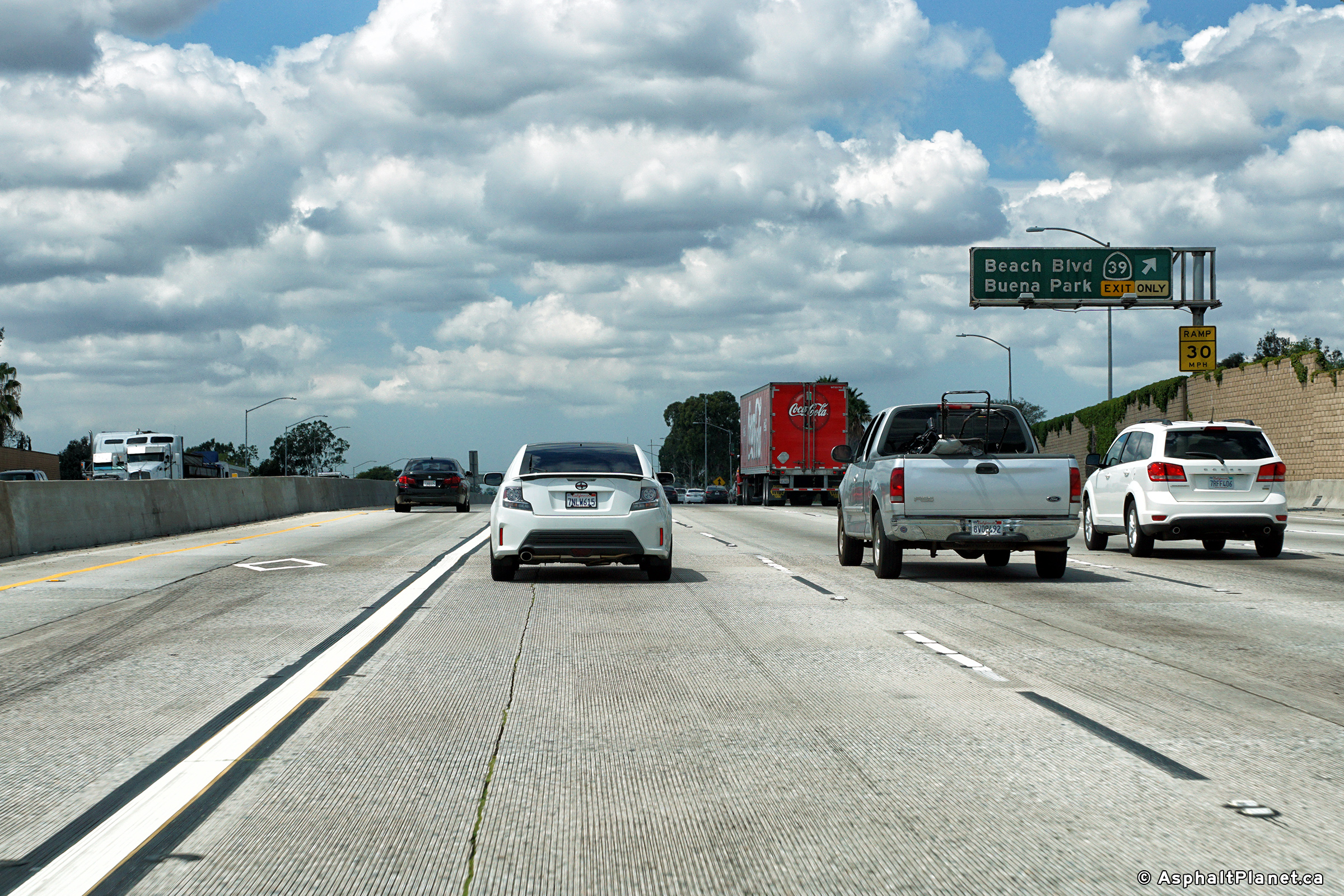
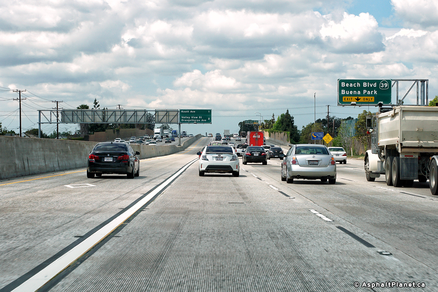
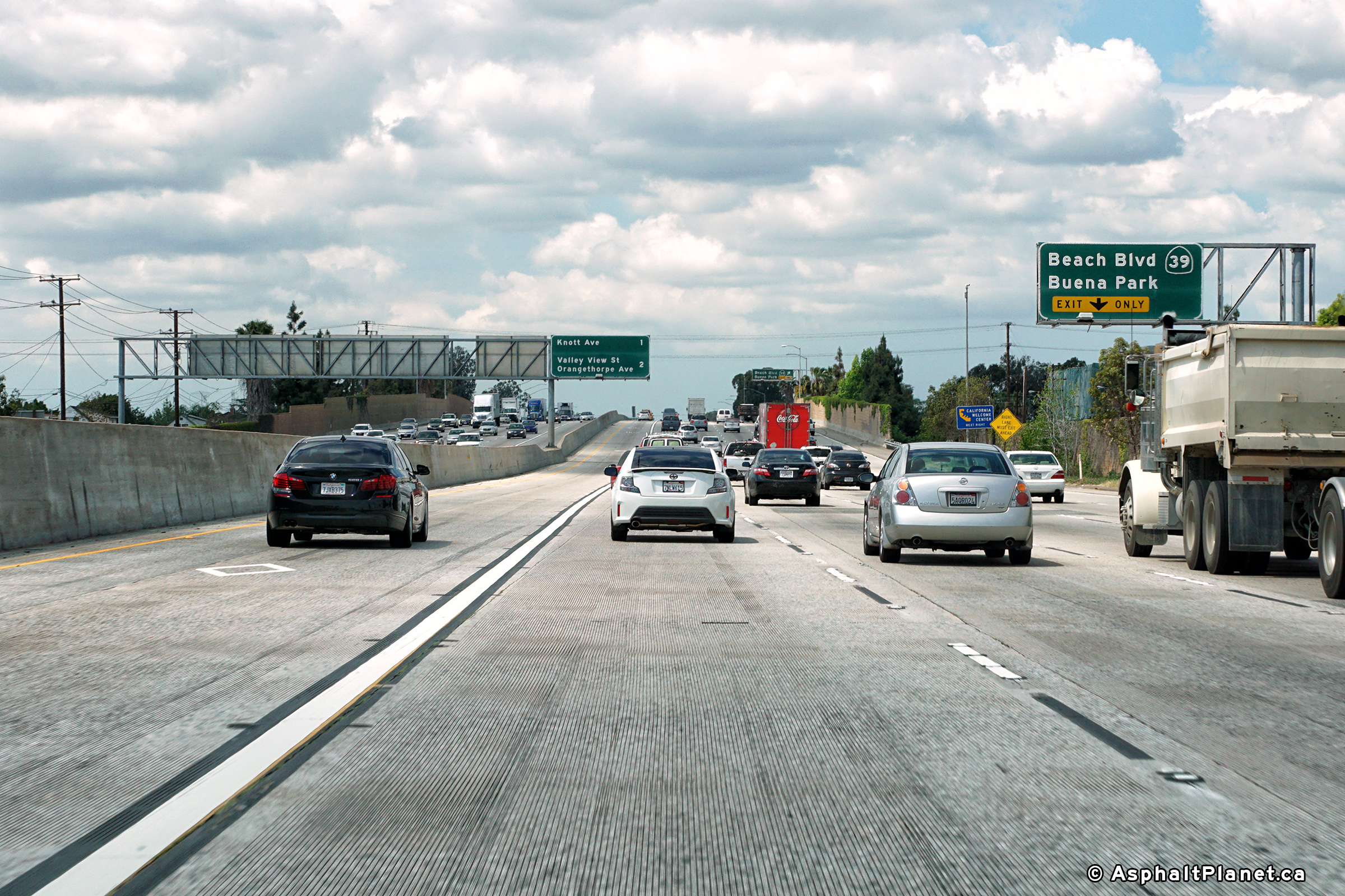
Orange County |
Signage at the exit for Beach Boulevard. Typical of a full gantry California overhead sign, this overhead conveys a considerable amount of information. |
|
||
|
Date: 4/06/2010 |
||||
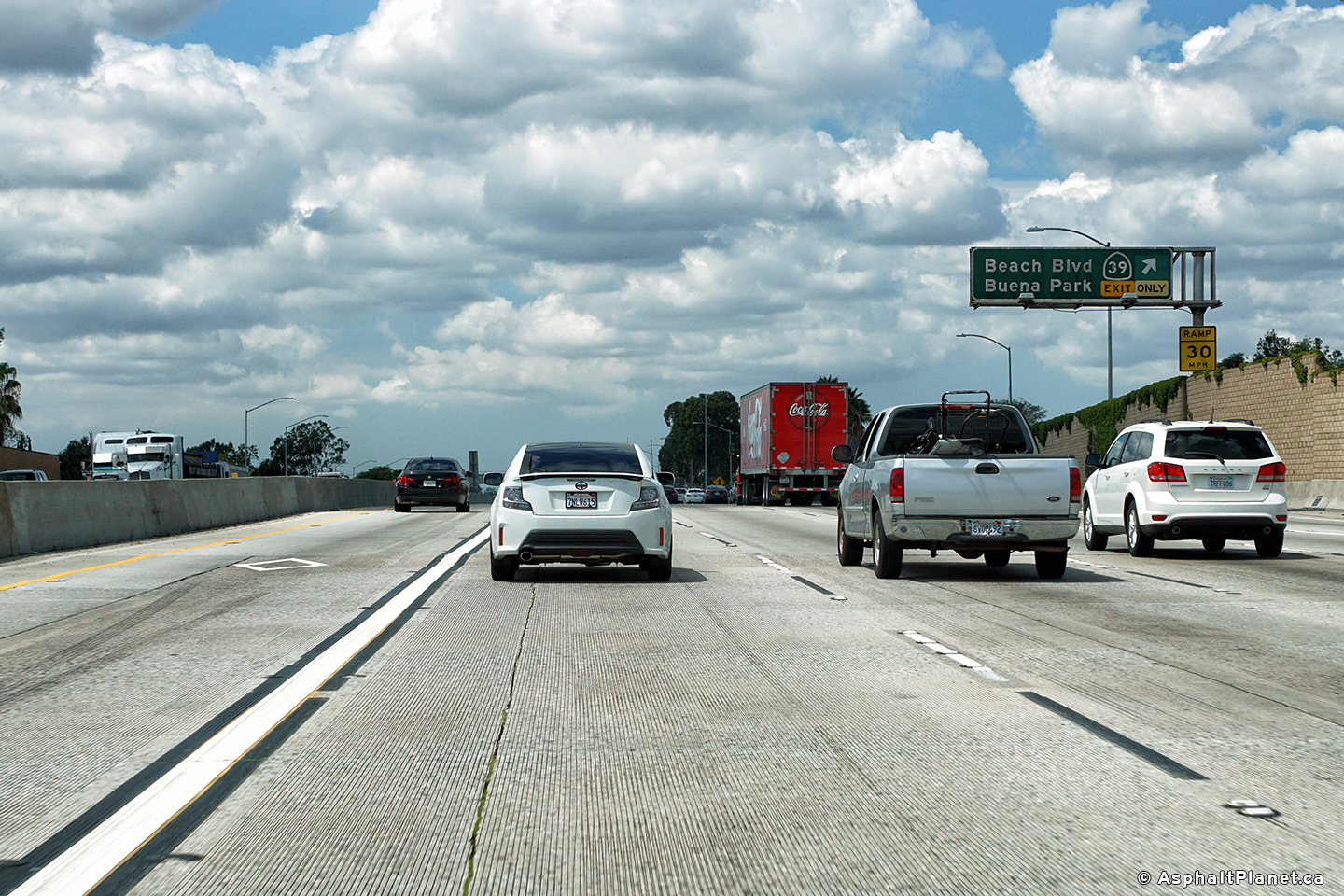
|
Orange County |
View at the westbound off-ramp to Beach Boulevard. |
 |
||
|
Date: 4/11/2016 |
High-res: (1440x960) (2400x1600) |
|||
|
Orange County |
Westbound interchange sequence signage. |
 |
||
|
Date: 4/11/2016 |
High-res: (1440x960) (2400x1600) |
|||
|
Orange County |
The incoming on-ramp from the 5 Freeway quickly departs at Beach Boulevard, as is indicated on the advanced signage for Beach Boulevard. |
 |
||
|
Date: 4/11/2016 |
High-res: (1440x960) (2400x1600) |
|||
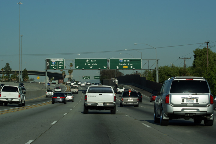
|
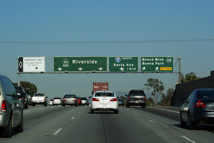
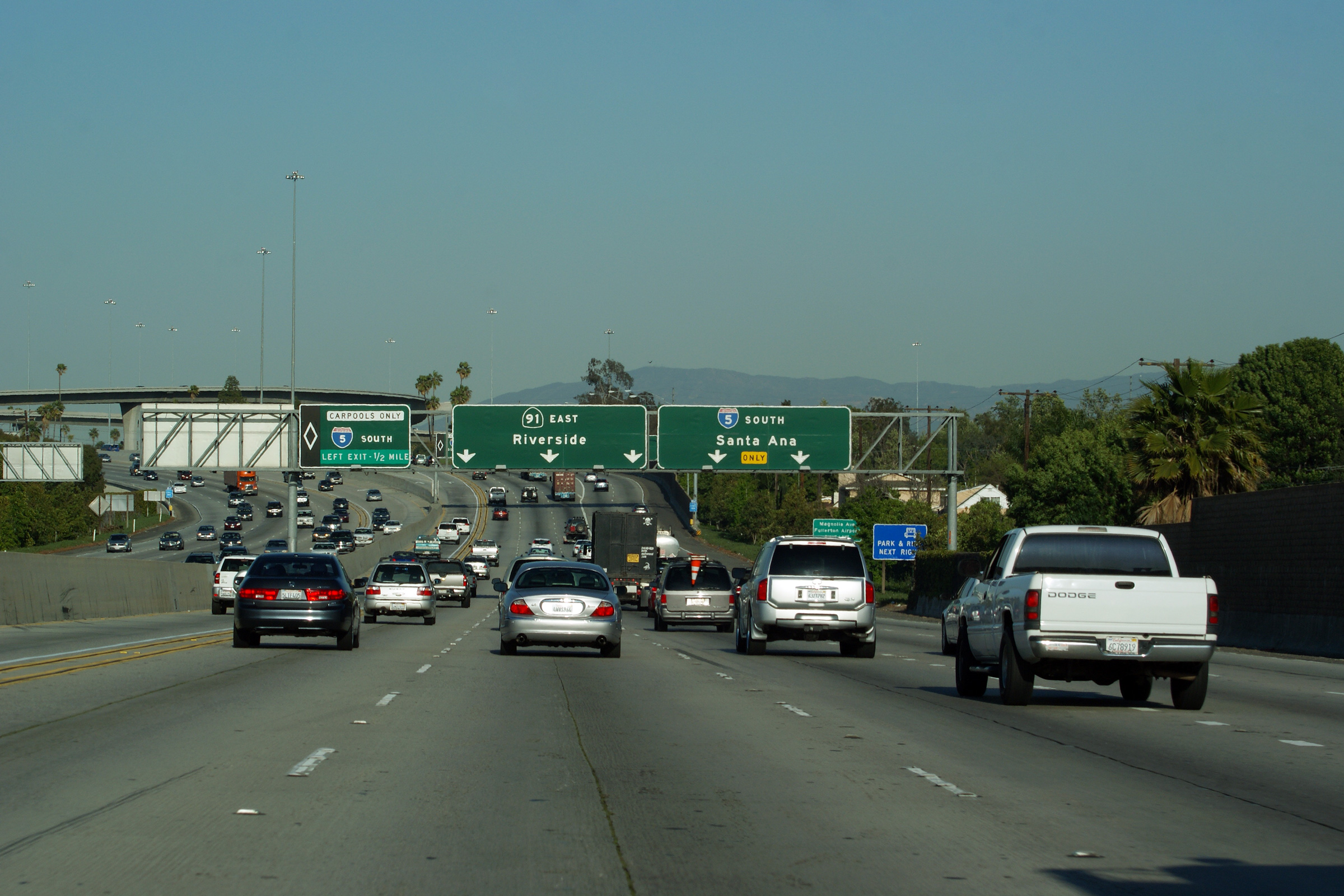
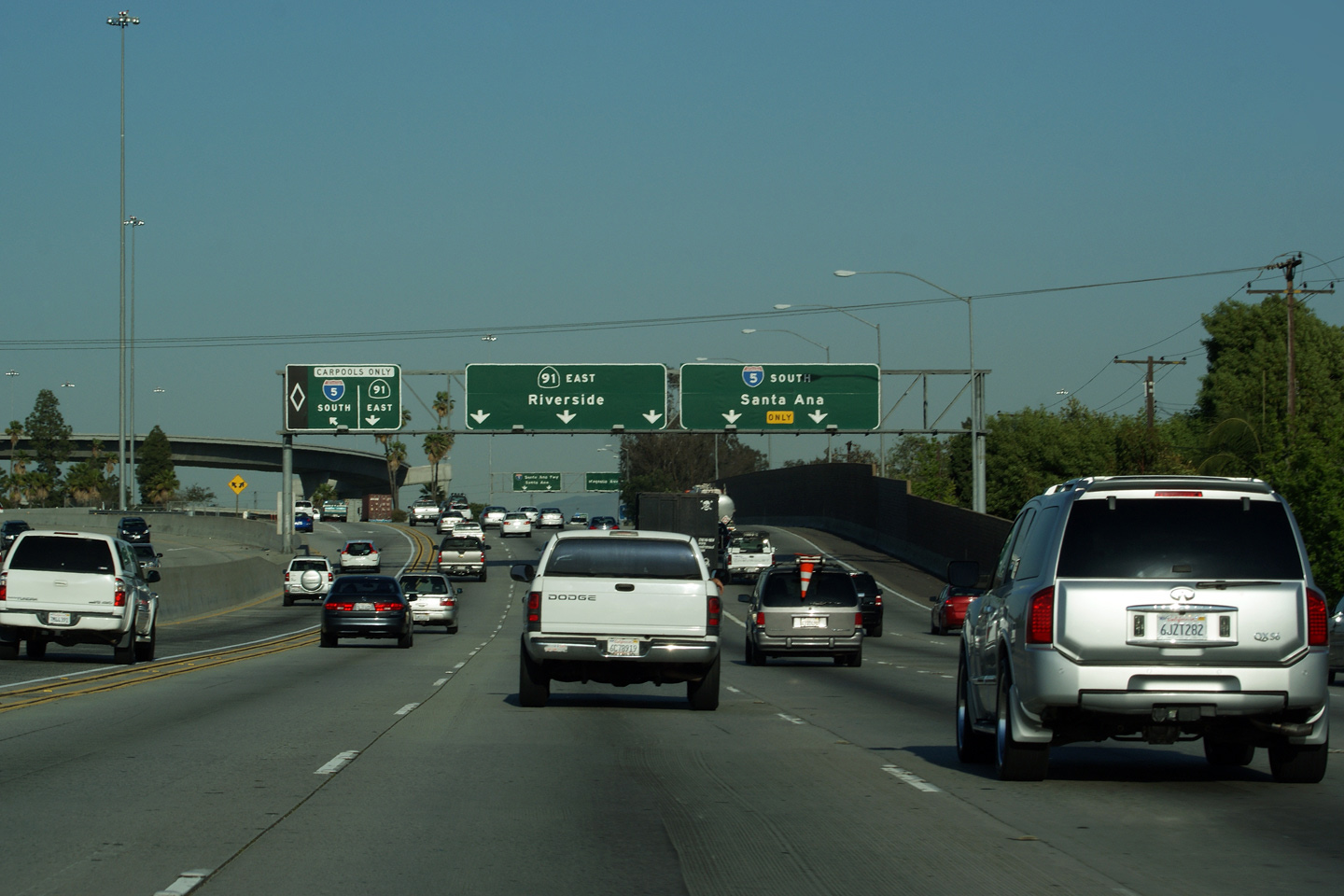
Orange County |
Overhead signage in advance to the ramp to Interstate 5-South. The 91/I-5 interchange is not a full movement connection due to the skew at which I-5 meets the 91 Freeway. |
|
||
|
Date: 4/06/2010 |
High-res: (1440x960) (2400x1600) |
|||
|
Orange County |
Overhead sign at the I-5 interchange. |
|
||
|
Date: 4/06/2010 |
||||
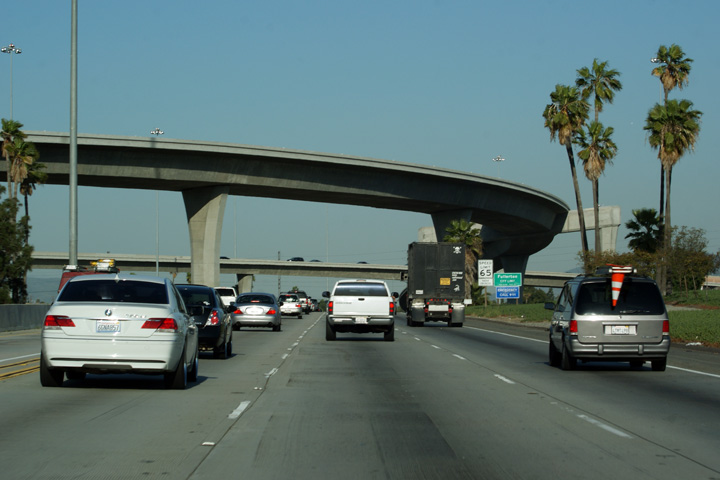
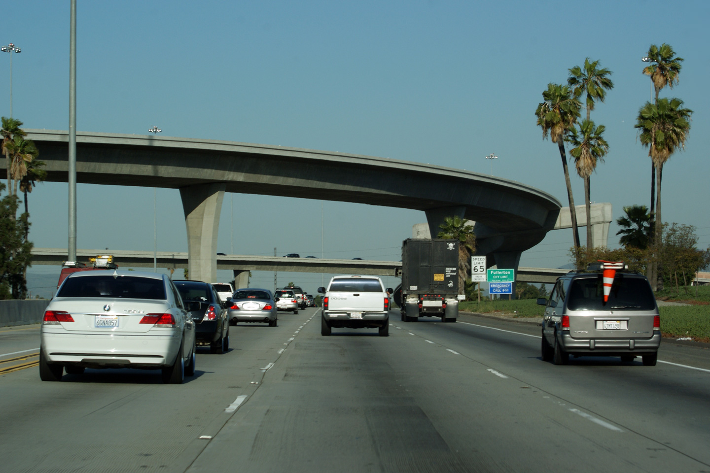
|
Orange County |
Passing underneath of the high-speed flyover that links Interstate 5 south to Route 91 East. Route 91 occupies the second level of a very complex three level interchange. |
|
||
|
Date: 4/06/2010 |
||||
| Interstate 5 is the principle north-south interstate through California. Click here for Interstate 5 Images. | ||||
|
Orange County |
View looking westerly through the I-5 interchange along the 91 Freeway. The ramp from I-5 North to the 91 Freeway West. |
 |
||
|
Date: 4/11/2016 |
High-res: (1440x960) (2400x1600) |
|||
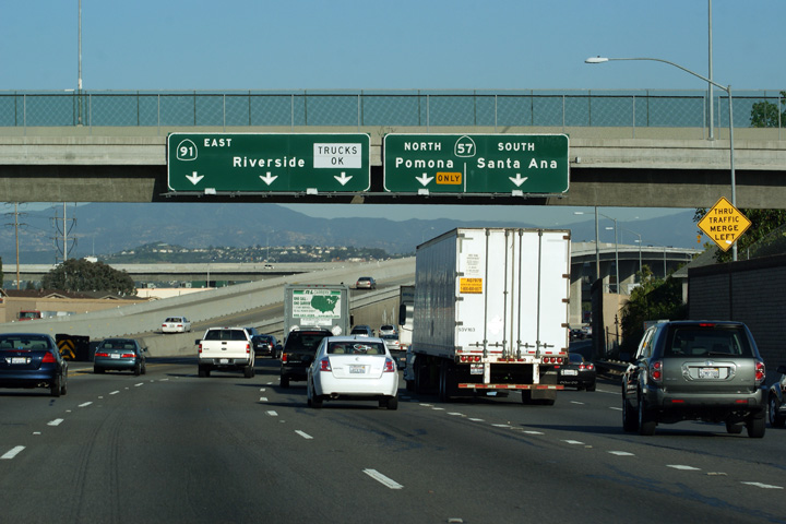
|
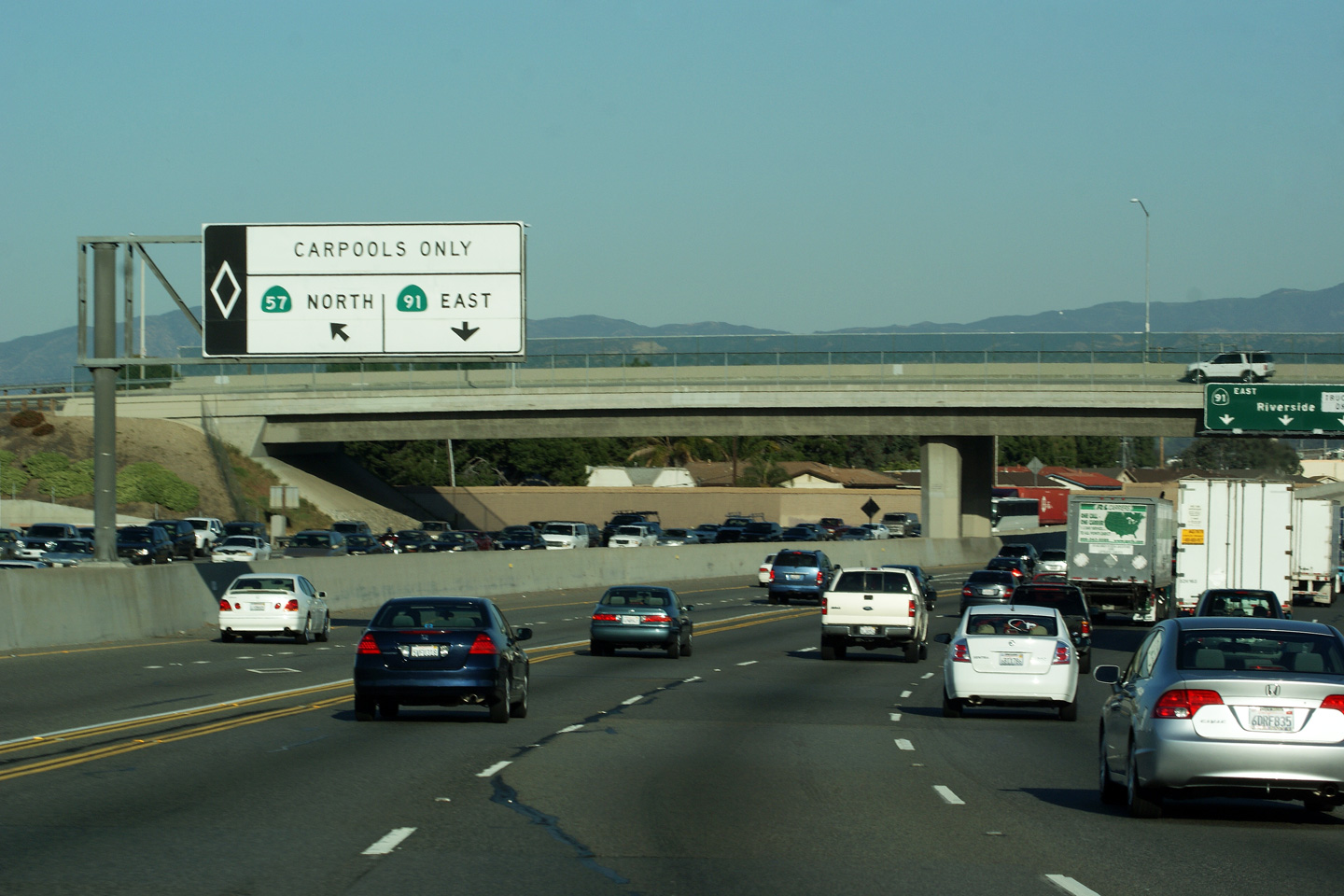
0range County |
Green sign denoting the Carpool Lane flyover from the 91-East to the 57-North. Contrast this signage to the pole mounted signage advising drivers of the Carpool lane exit to the general purpose lanes for the ramp to the 57 Freeway South. My home jurisdiction of Ontario does a far better job of signing exits from the HOV lane to the general purpose lanes. |
|
||
|
Date: 4/06/2010 |
High-res: (1440x960) (2400x1600) |
|||
|
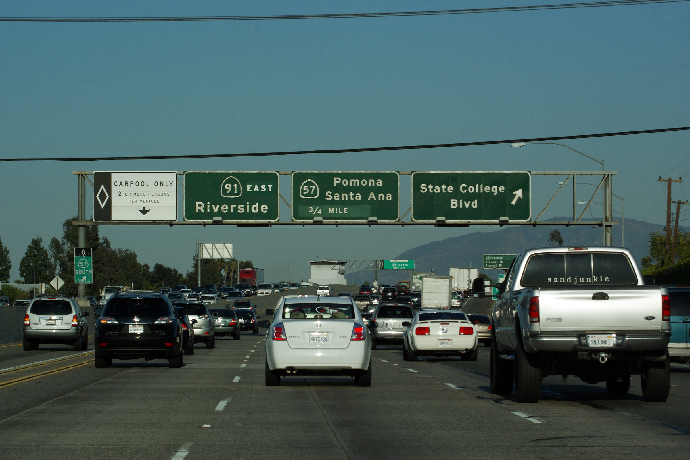
Orange County |
Full gantry overhead signage at the exit to State College Boulevard. |
 |
||
|
Date: 4/06/2010 |
High-res: (1440x960) (2400x1600) |
|||
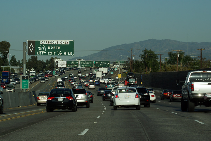
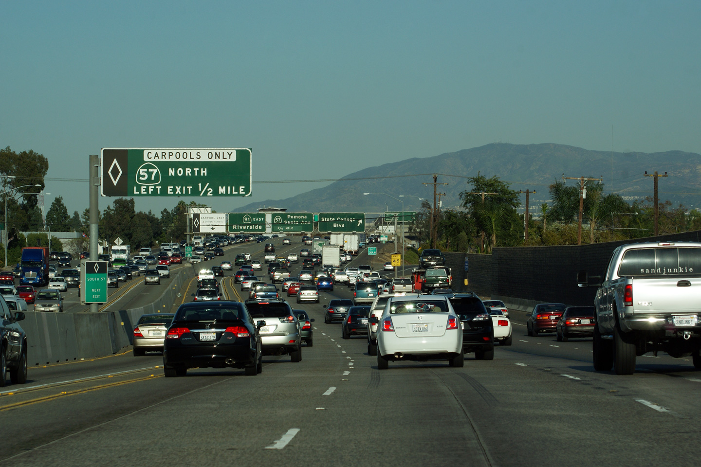
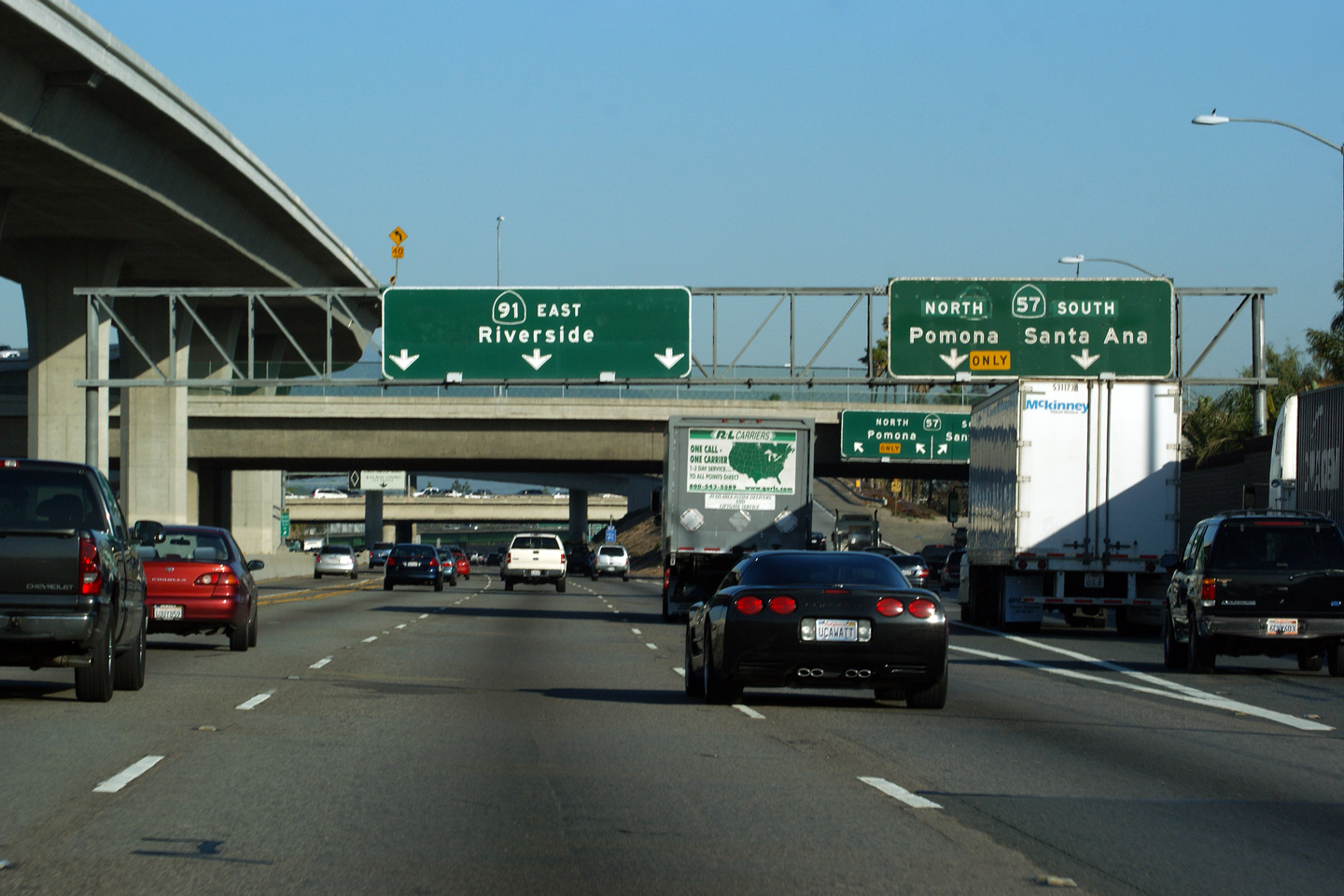
|
Orange County |
Interchange sequence sign along the 91 Freeway approaching the 57 Freeway. |
|
||
|
Date: 4/06/2010 |
||||
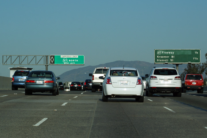
|
Orange County |
Carpool lane signage explaining how the carpool lanes divide to provide a direct high-speed flyover to the northbound carpool lane on the 57 Freeway. |
 |
||
|
Date: 4/06/2010 |
||||
|
Orange County |
Overhead signage over the general purpose lanes affixed to the Placentia Avenue overpass in advance of the interchange with the 57 Freeway. |
 |
||
|
Date: 4/06/2010 |
||||
|
Orange County |
Two views looking easterly along the 91 Freeway approaching the 57 Freeway interchange from the Placentia Avenue overpass. |
 |
||
|
High-res: (1440x960) (2400x1600) |
||||
 |
||||
|
Date: 4/06/2010 |
High-res: (1440x960) (2400x1600) |
|||
|
Orange County |
Signage for the general purpose off-ramp to the 57 Freeway. |
|
||
|
Date: 4/06/2010 |
||||
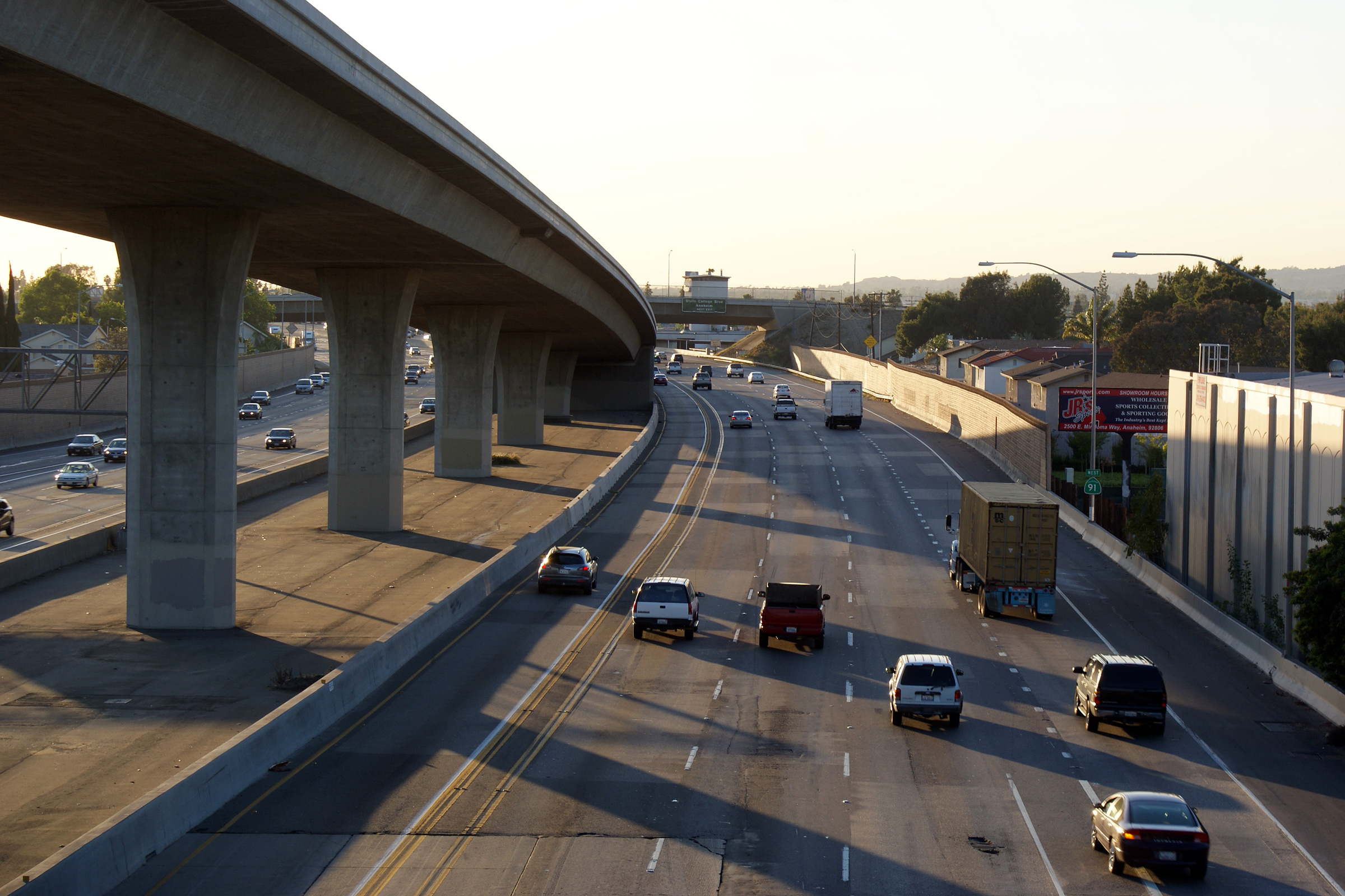
|
Orange County |
Westerly view from the Sunkist Street overpass along Route 91. The high-speed flyover ramp that links the Carpool lanes from Route 91 West to Route 57 North touches back to ground level to the west of Sunkist Street. |
|
||
|
Date: 4/06/2010 |
High-res: (1440x960) (2400x1600) |
|||
|
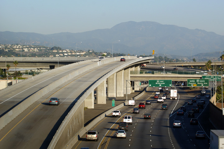
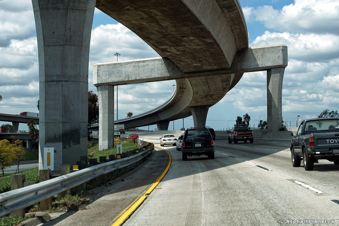
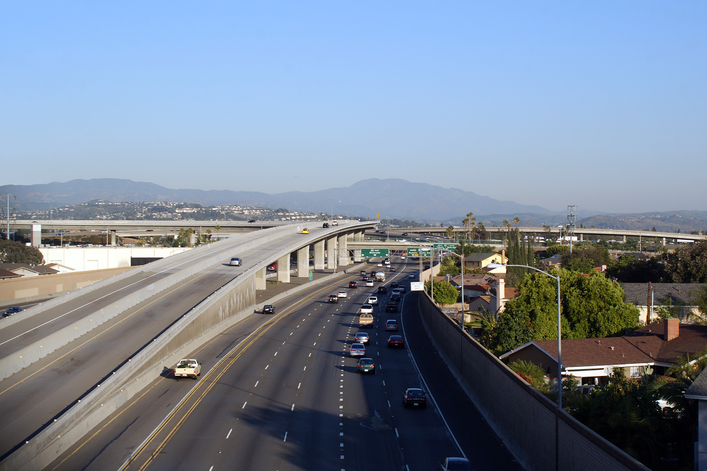
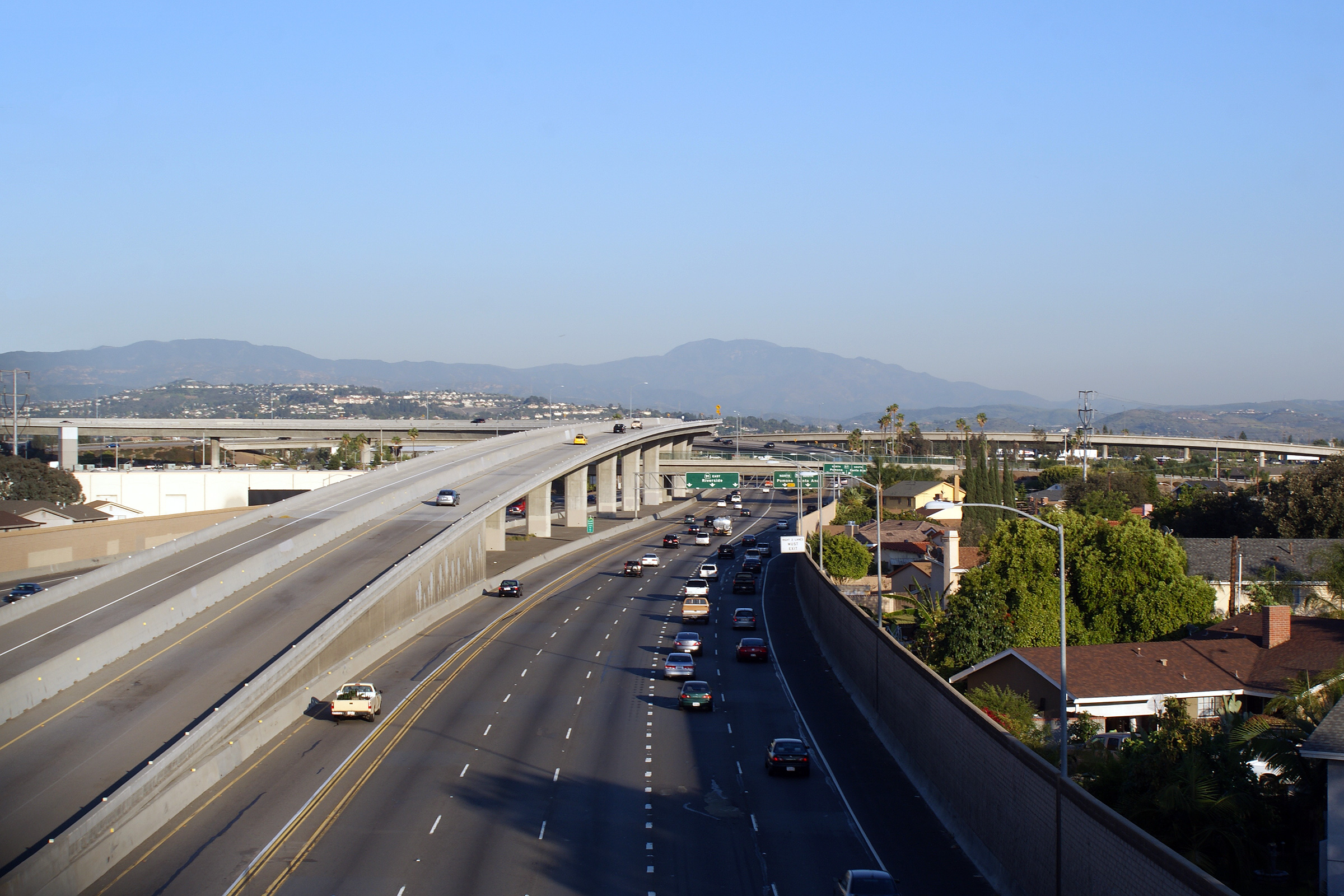
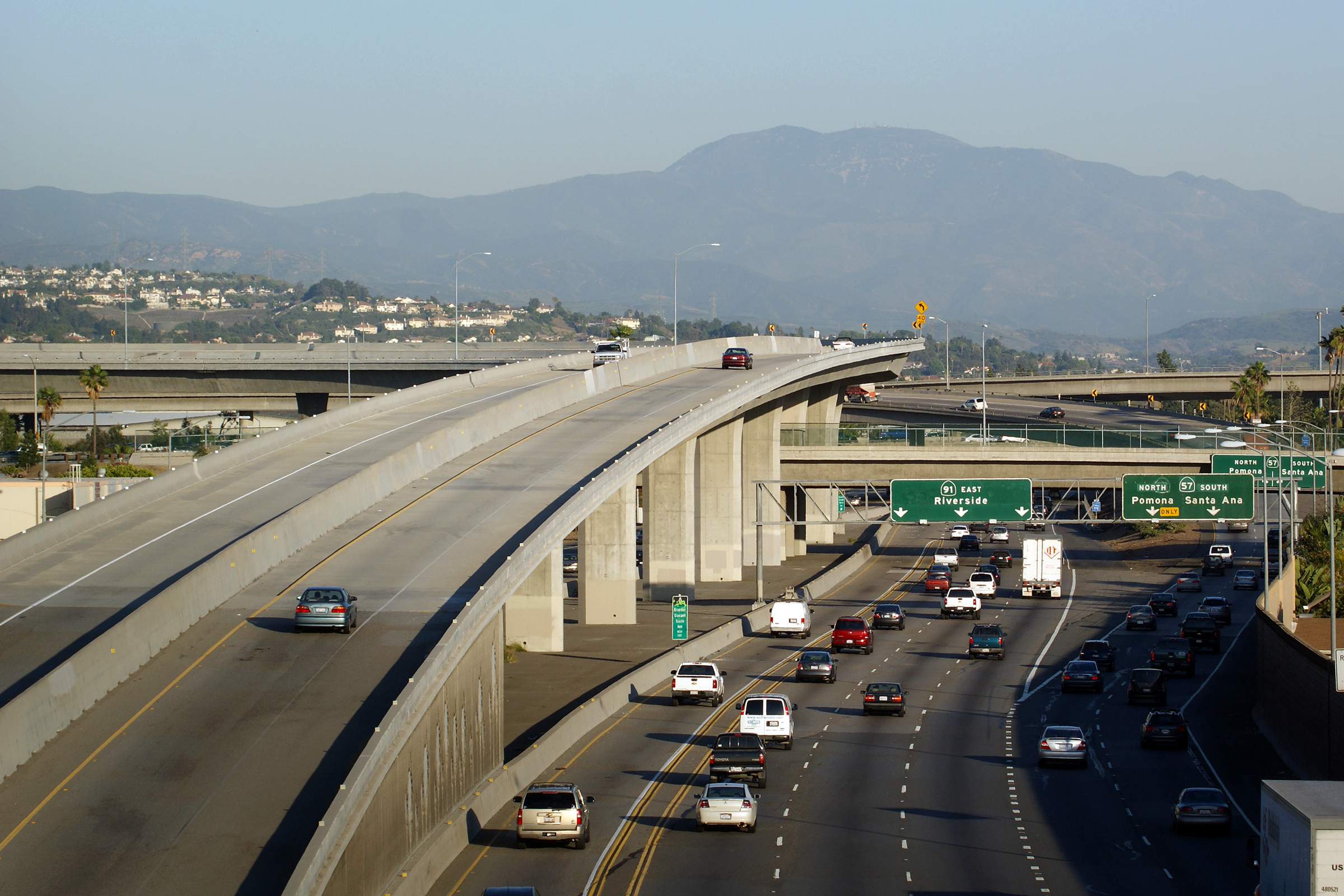
Orange County |
Four views looking easterly towards the Highway 57 interchange along Highway 91 from the Sunkist Street overpass. The most dominant part of this interchange is the soaring HOV lane flyover that carries carpool traffic between Highway 91 to the west and Highway 57 to the north. |
 |
||
|
High-res: (1440x960) (2400x1600) |
||||
 |
||||
|
High-res: (1440x960) (2400x1600) |
||||
|
|
||||
|
High-res: (1440x960) (2400x1600) |
||||
 |
||||
|
Date: 4/06/2010 |
High-res: (1440x960) (2400x1600) |
|||
| State Route 57 Links I-5 at the Orange Crush interchange to I-210 in eastern Los Angeles County. Click here for State Route 57 Images. | ||||
|
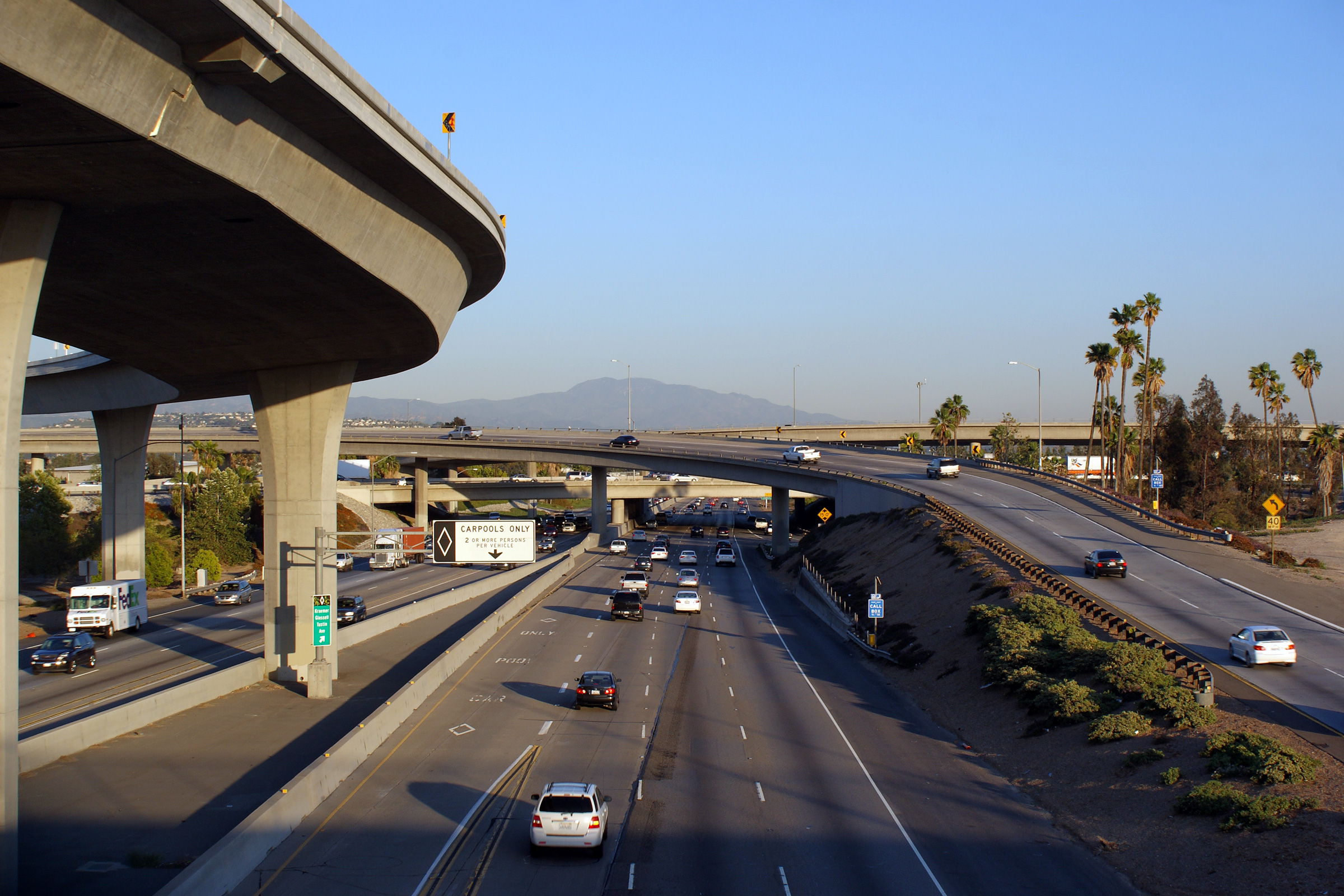
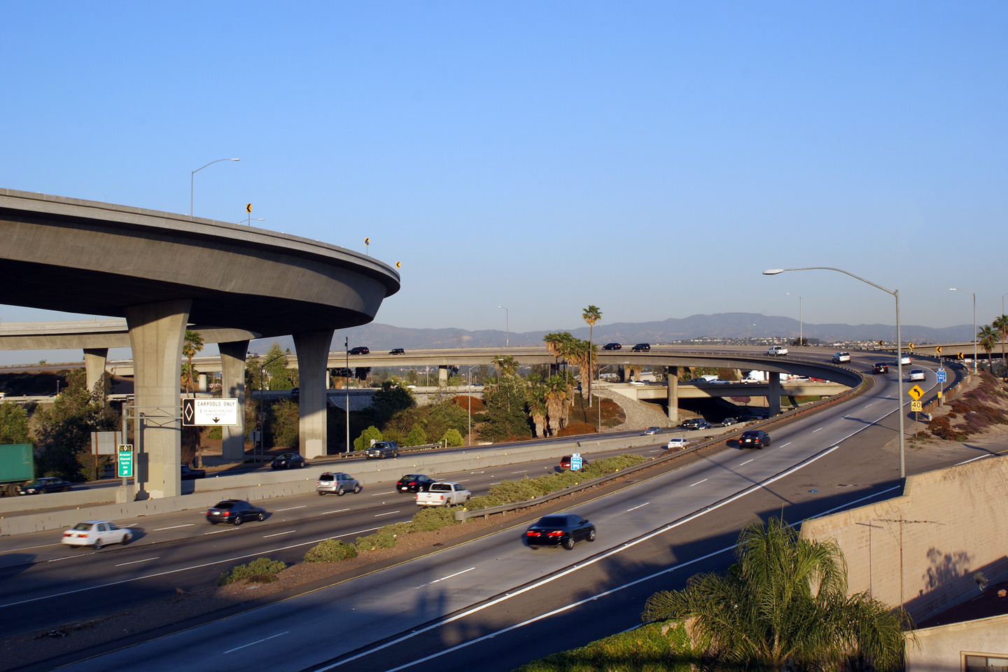
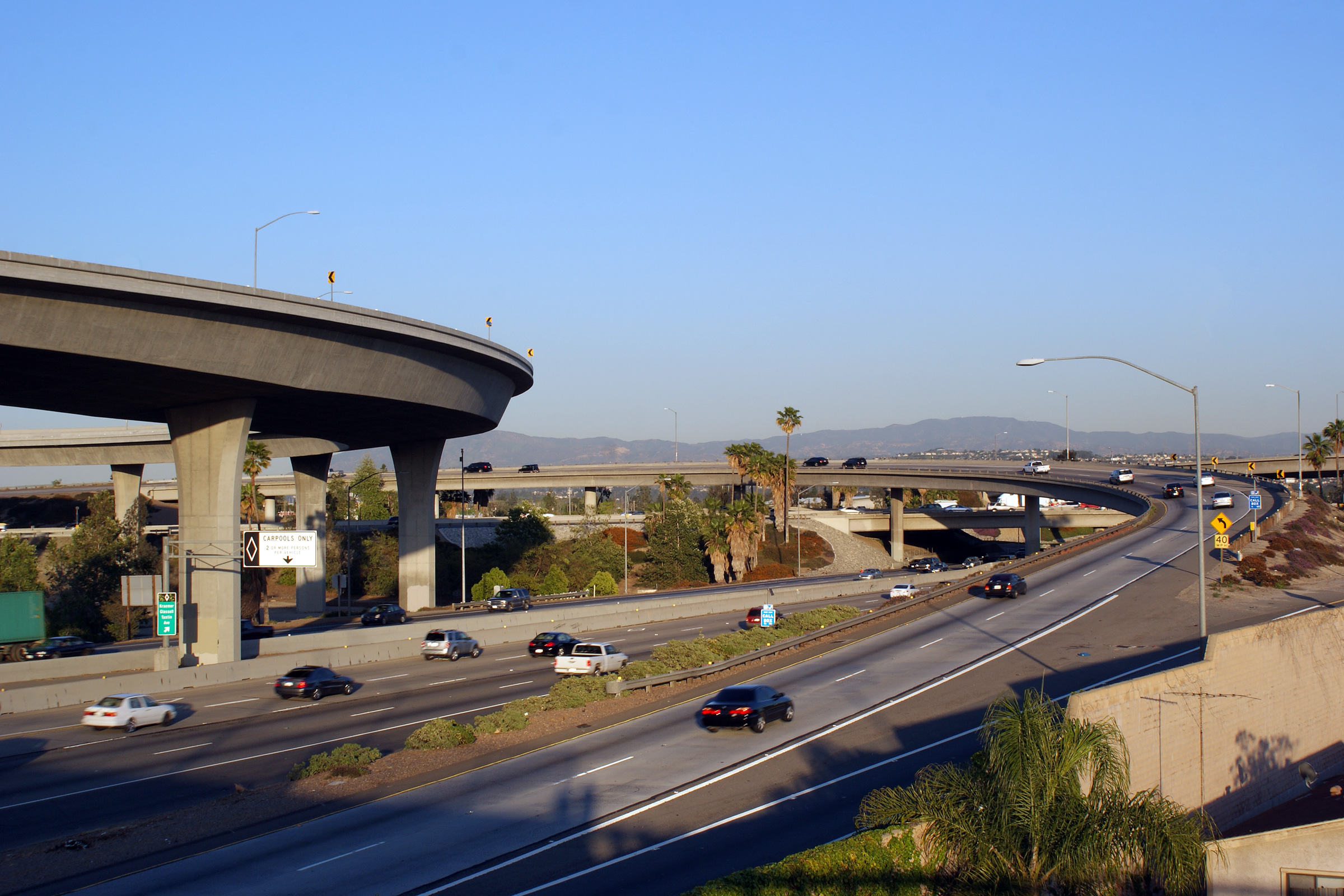
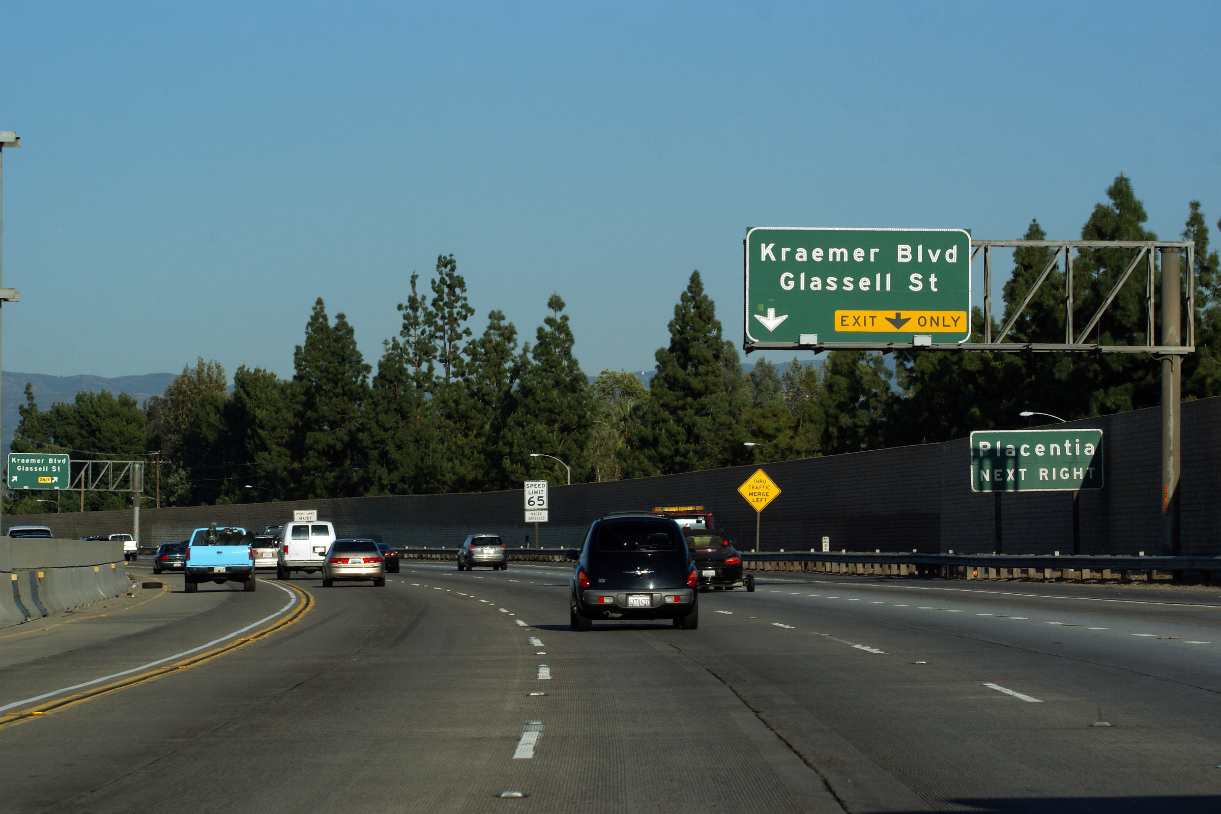
Orange County |
Now east of the 57 Freeway interchange, Highway 91 meets Kraemer Blvd at a partial cloverleaf interchange. |
 |
||
|
Date: 4/06/2010 |
High-res: (1440x960) (2400x1600) |
|||
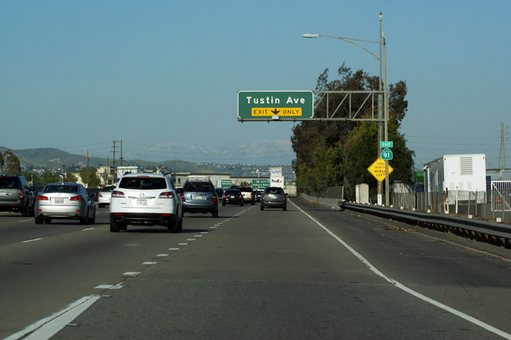
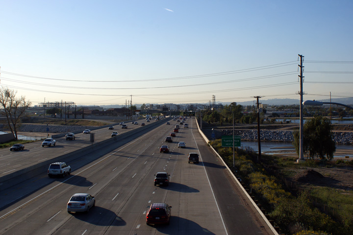
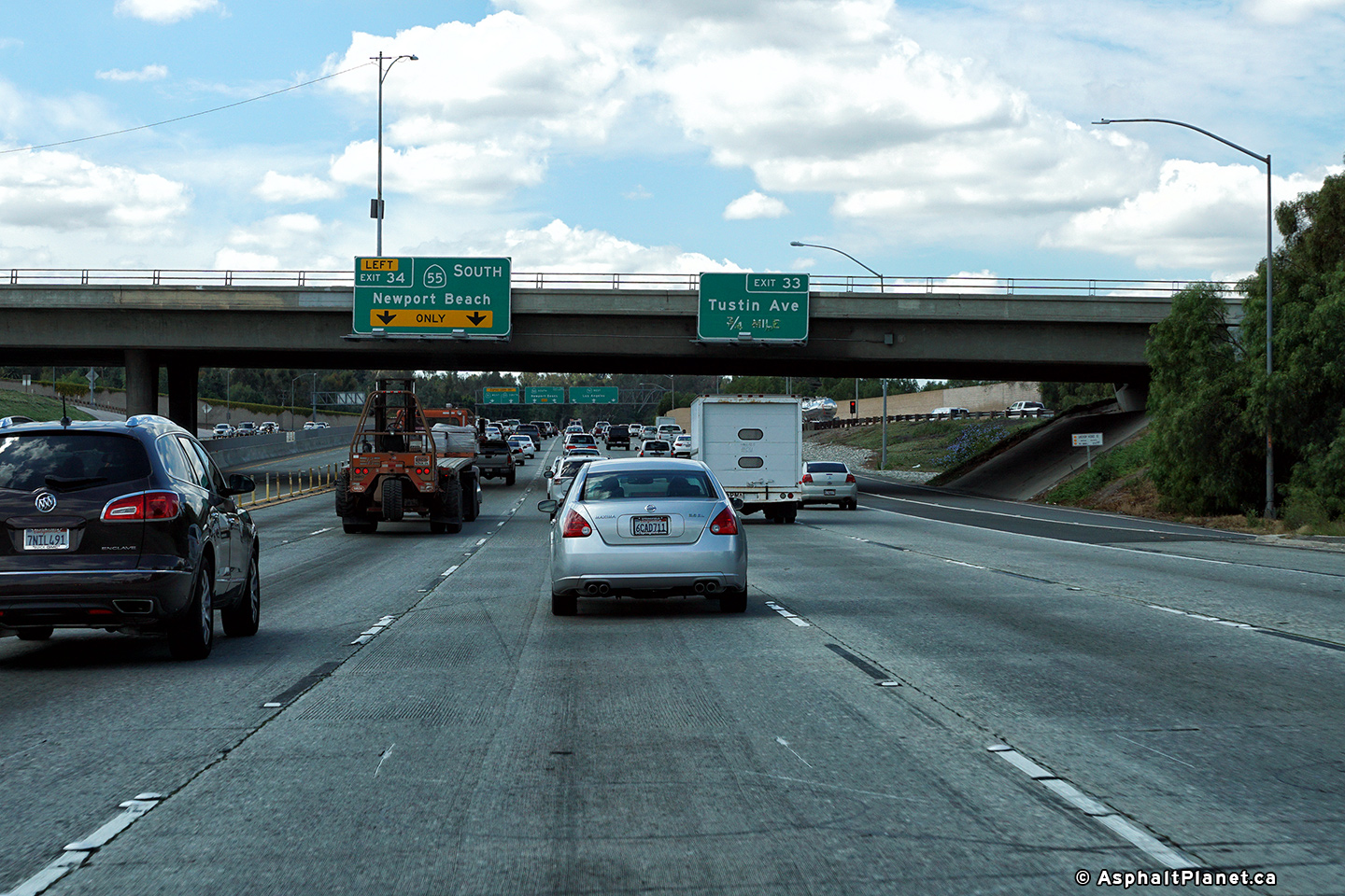
|
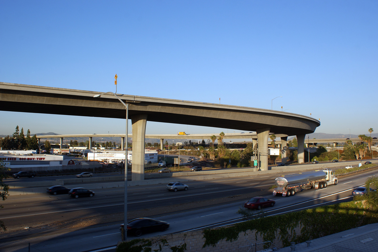
Orange County |
East of Kraemer Blvd, the 91 Freeway meets Tustin Avenue. |
 |
||
|
Date: 4/06/2010 |
High-res: (1440x960) (2400x1600) |
|||
|
Orange County |
Located immediately west of the Tustin Avenue overpass stands this overhead signage outlining the lane assignments along the 91 Freeway for the upcoming 55 Freeway interchange. |
|
||
|
Date: 4/06/2010 |
||||
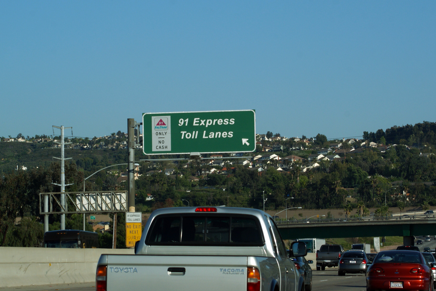
|
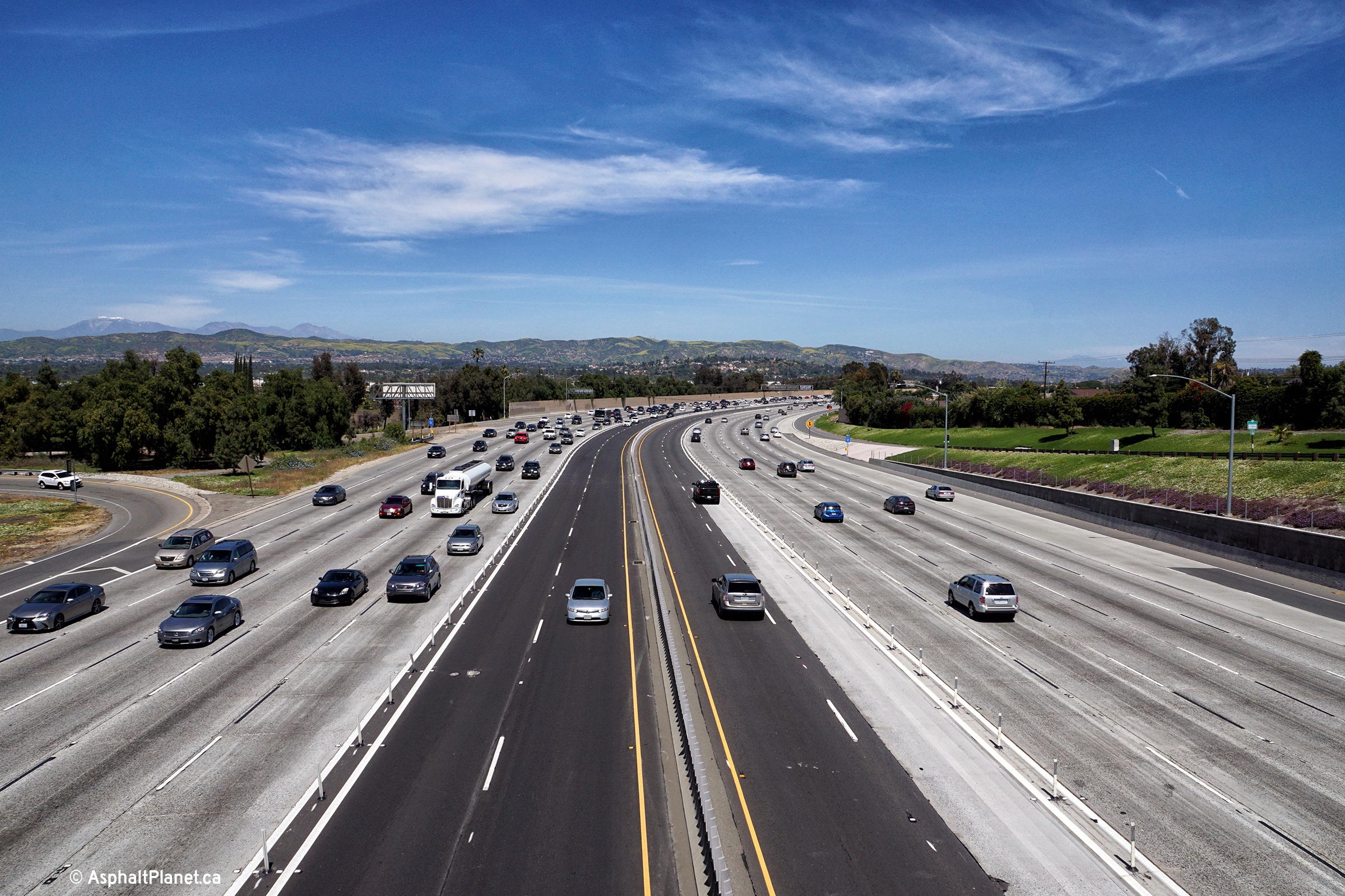
Orange County |
Overhead signage for the 91 Express Toll Lanes that begin beyond the 55 Freeway interchange. The 91 Express Toll Lanes are a set of high occupancy toll lanes (two per direction) that offer a high speed tolled alternative to the oft congested mainline lanes of Highway 91 through eastern Orange County. Carpools are permitted to use the 91 Express Toll Lanes provided they have an account registered with FasTrak (California's tolling agency) though even carpools still must pay discounted toll rates during peak hours. |
 |
||
|
Date: 4/06/2010 |
||||
|
Orange County |
Westerly view along the 91 Freeway from the Riverdale Avenue overpass. Just west of the Riverdale Avenue overpass, the 91 Freeway crosses the large Santa Ana River. |
|
||
|
Date: 4/06/2010 |
High-res: (1440x960) (2400x1600) |
|||
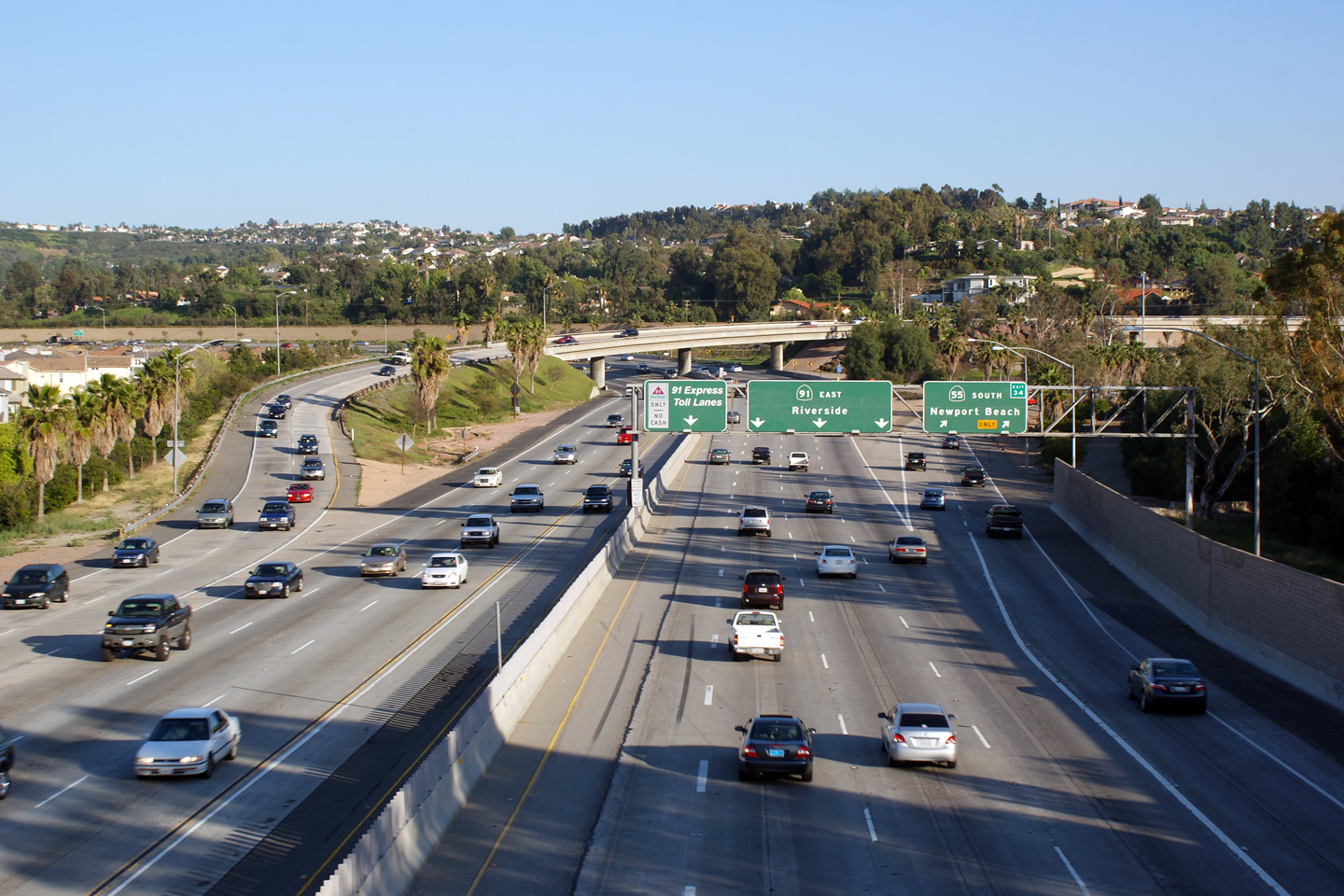
|
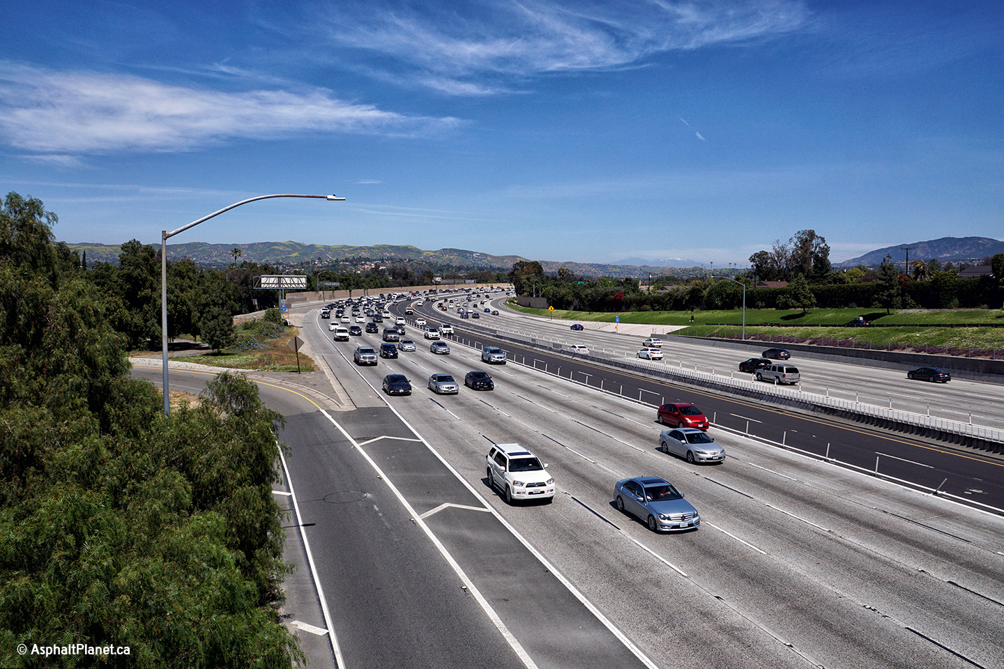
Orange County |
Easterly view from the Riverdale Avenue overpass towards the 55 Freeway interchange. |
 |
||
|
Date: 4/06/2010 |
High-res: (1440x960) (2400x1600) |
|||
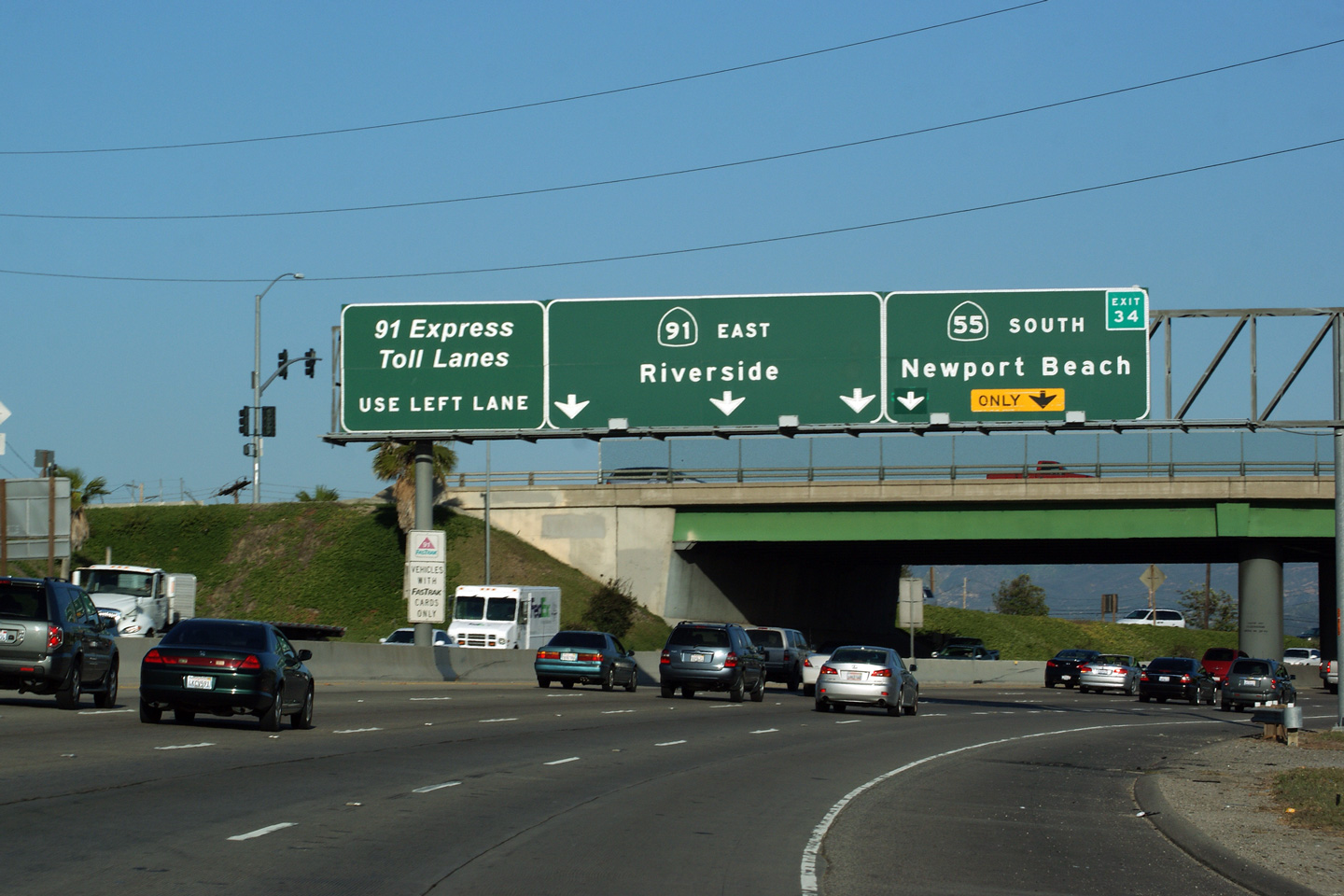
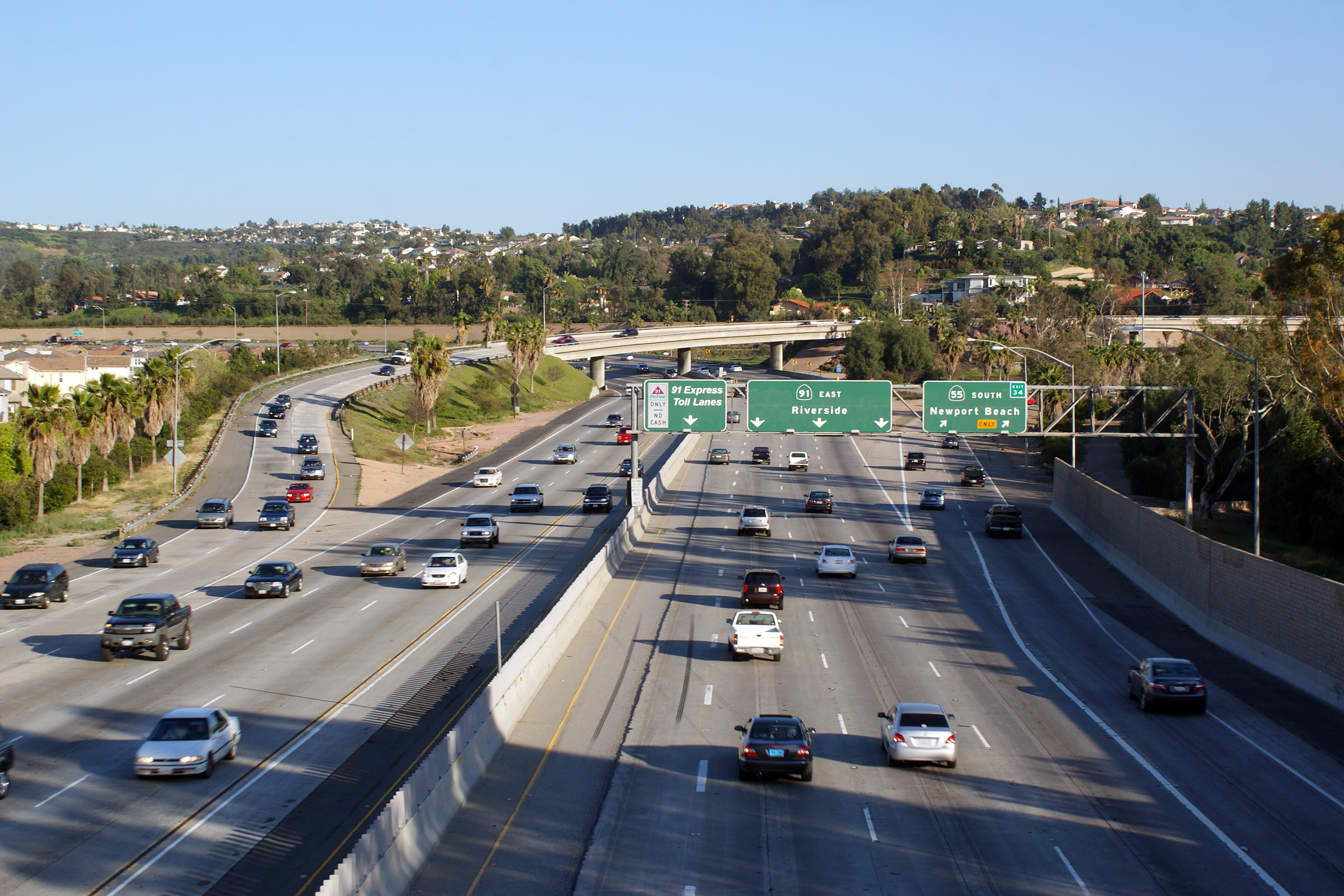
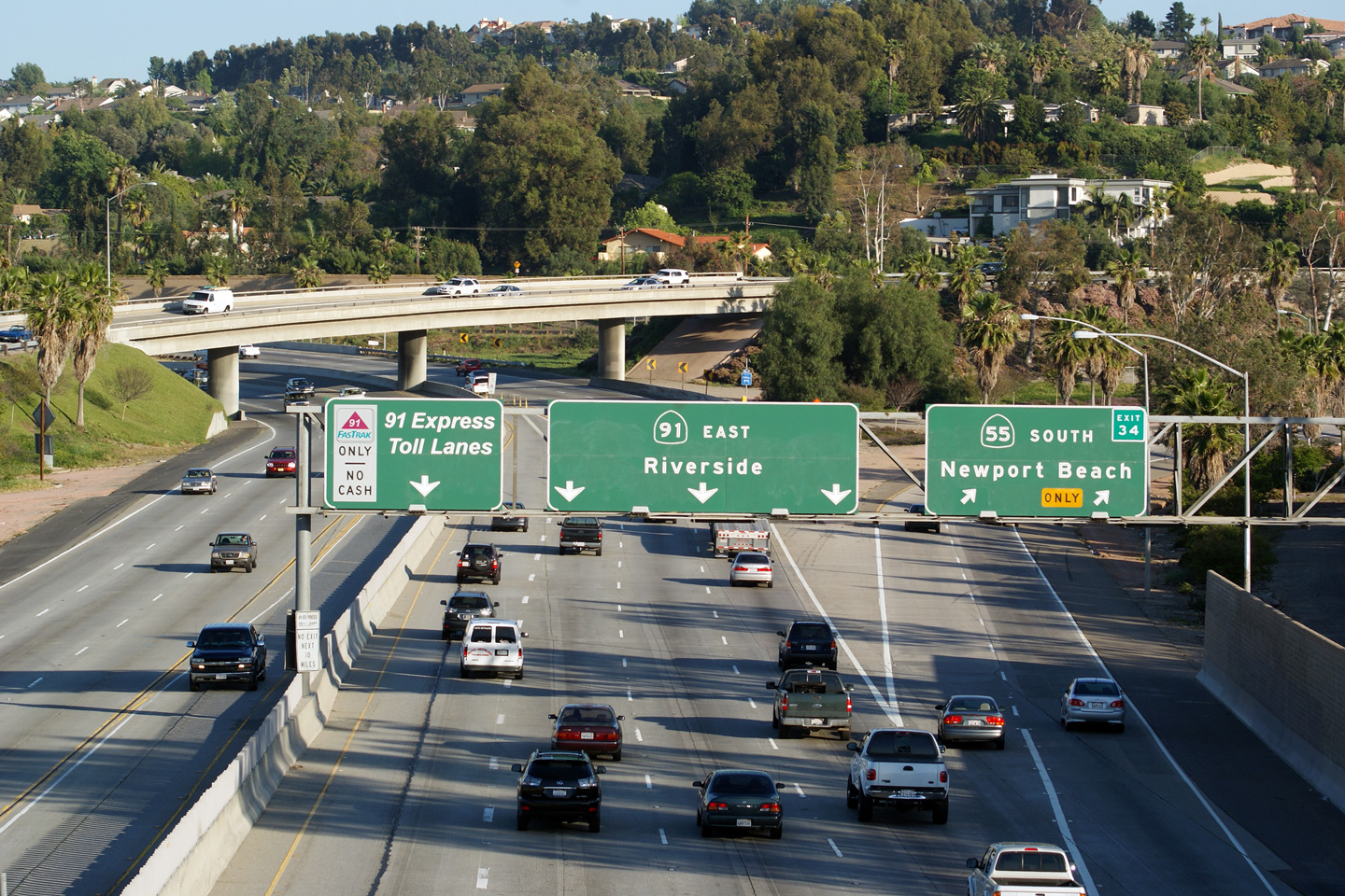
|
Orange County |
Overhead signage at the 55 Freeway interchange. |
|
||
|
Date: 4/06/2010 |
High-res: (1440x960) (2400x1600) |
|||
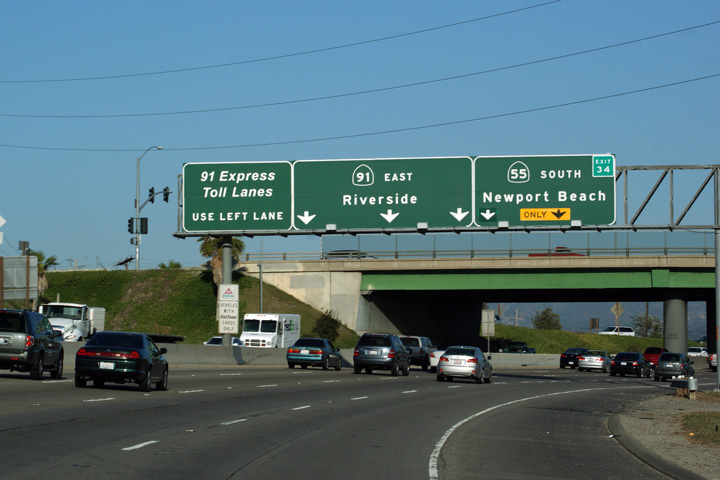
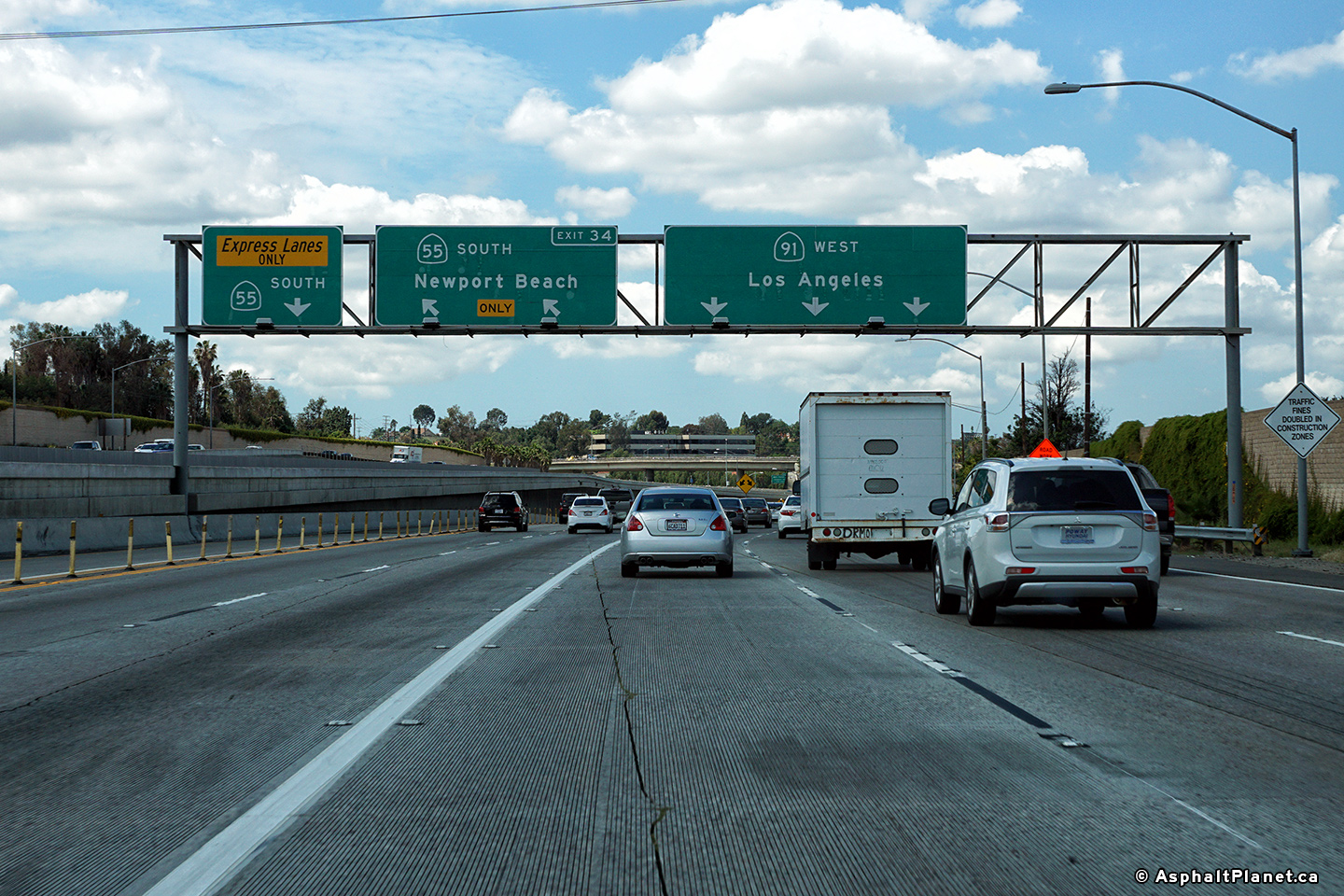
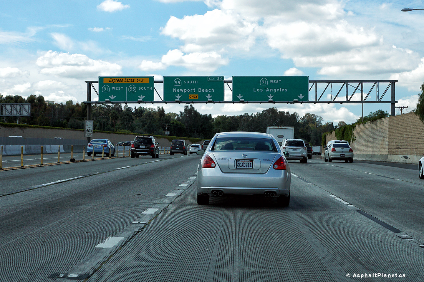
|
Orange County |
Overhead signage at the off-ramp to the 55 Freeway South. This ramp departs from the left side of the 91 Freeway. |
 |
||
|
Date: 4/11/2016 |
High-res: (1440x960) (2400x1600) |
|||
|
Orange County |
Westerly view at the western terminus of SR-91 at the 110 Freeway interchange. |
 |
||
|
Date: 4/11/2016 |
High-res: (1440x960) (2400x1600) |
|||
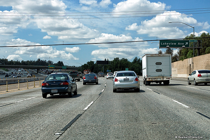
|
Orange County |
View looking easterly as the 91 Freeway passes beneath the Lakeview Avenue interchange. Lakeview Avenue is the first interchange located easterly of the 55 Freeway interchange. |
|
||
|
Date: 11/05/2013 |
High-res: (1440x960) (2400x1600) |
|||
|
Orange County |
Two views looking westerly along the 91 Freeway approaching the 55 Freeway interchange from the Lakeview Avenue overpass. |
 |
||
|
High-res: (1440x960) (2400x1600) |
||||
 |
||||
|
Date: 4/16/2017 |
High-res: (1440x960) (2400x1600) |
|||
|
Orange County |
Easterly view from the Lakeview Avenue overpass along the 91 Freeway. |
 |
||
|
High-res: (1440x960) (2400x1600) |
||||
 |
||||
|
Date: 4/16/2017 |
High-res: (1440x960) (2400x1600) |
|||
|
Orange County |
Westbound signage affixed to the Lakeview Avenue overpass. |
 |
||
|
Date: 4/11/2016 |
High-res: (1440x960) (2400x1600) |
|||
|
Orange County |
Signage at the westbound off-ramp to Lakeview Avenue. |
 |
||
|
Date: 4/11/2016 |
High-res: (1440x960) (2400x1600) |
|||
|
Orange County |
Westbound interchange sequence signage approaching the Lakeview Avenue interchange. |
 |
||
|
Date: 4/11/2016 |
High-res: (1440x960) (2400x1600) |
|||
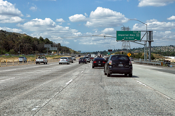
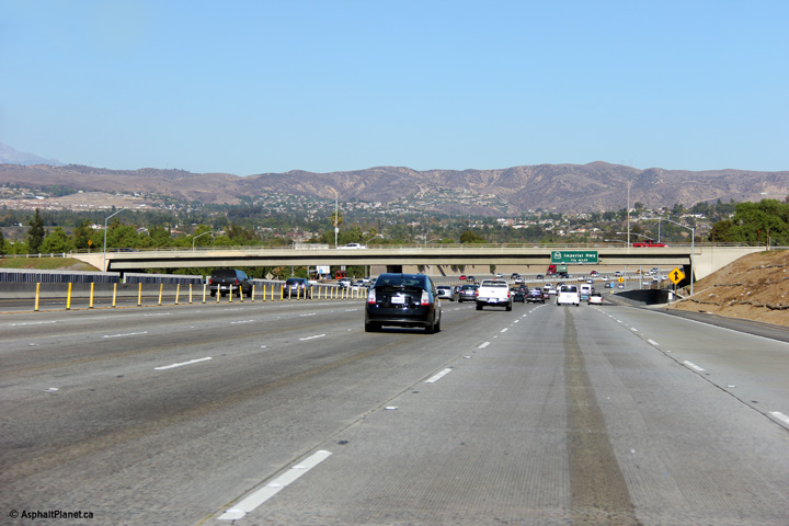
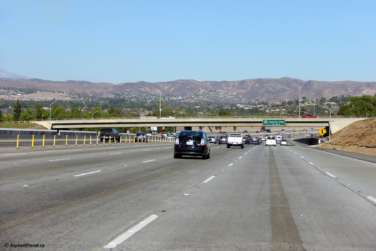
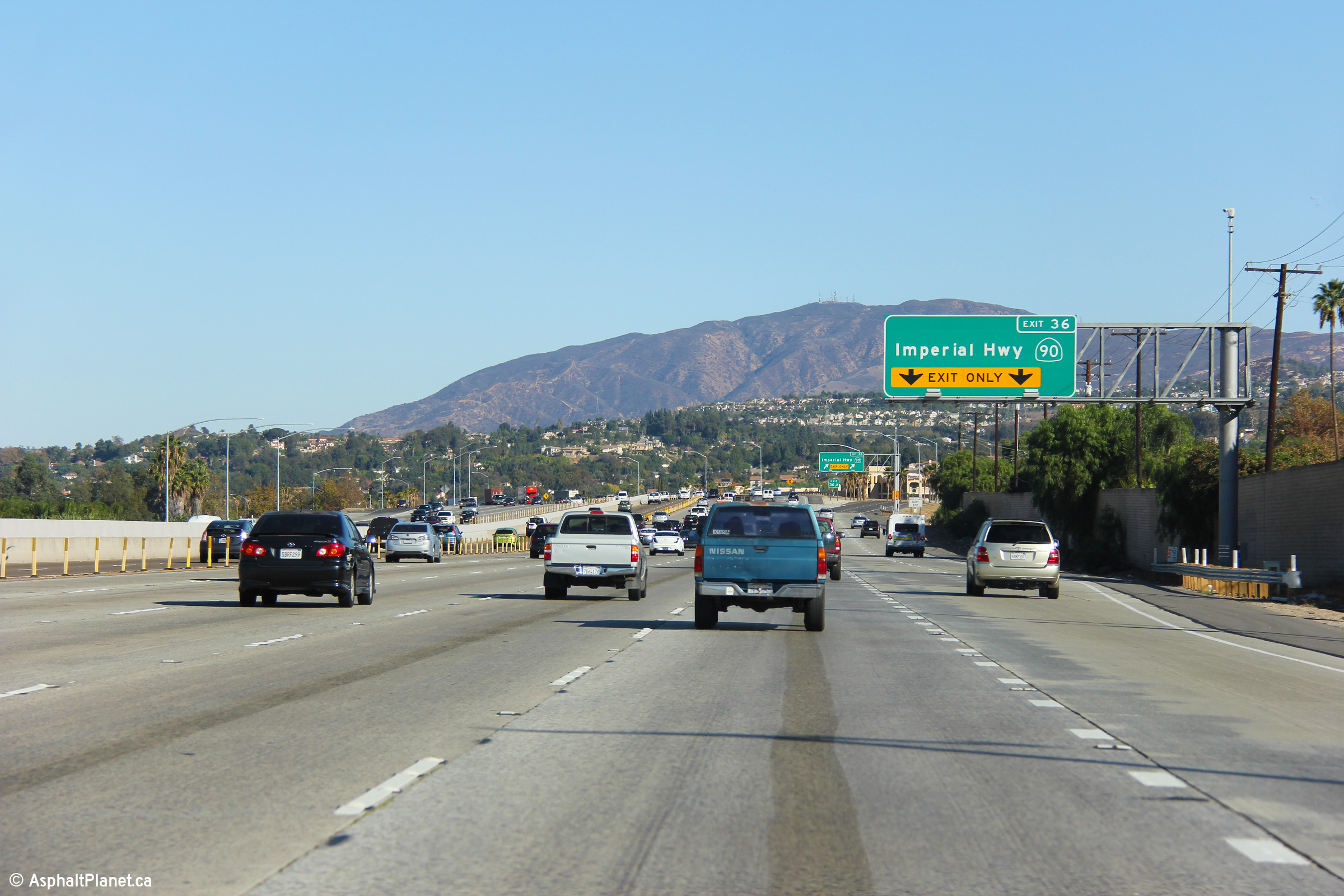
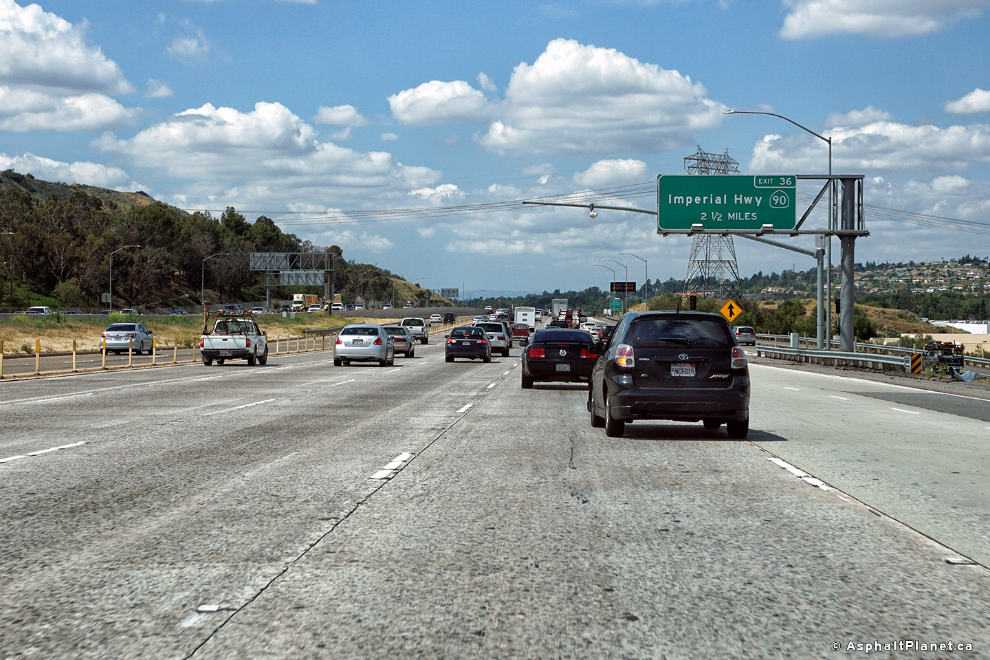
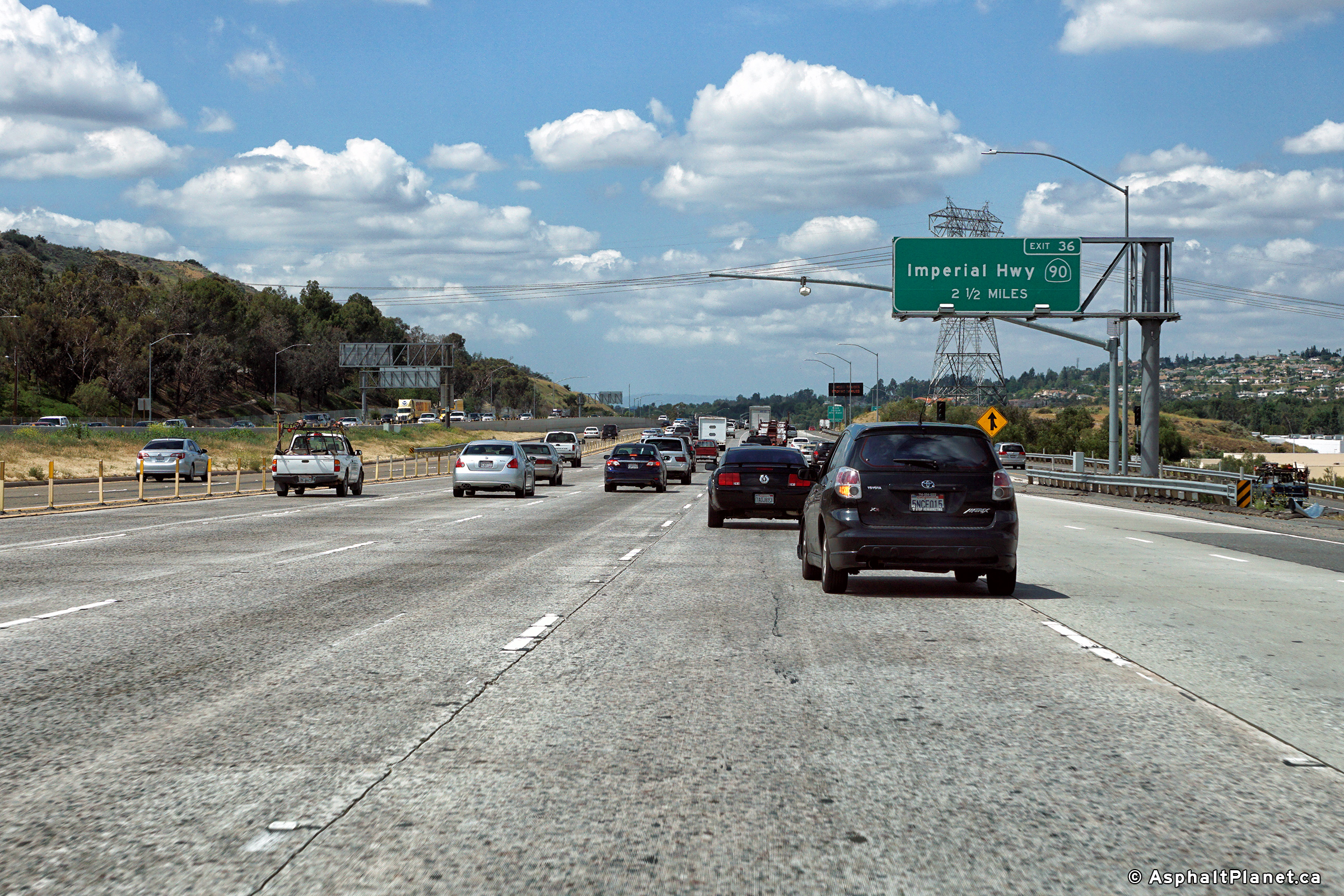
|
Orange County |
Eastbound advanced signage approaching the Imperial Highway interchange. The right-most freeway lane of the 91 Freeway departs the freeway mainline at the Imperial Highway interchange. |
|
||
|
Date: 11/05/2013 |
High-res: (1440x960) (2400x1600) |
|||
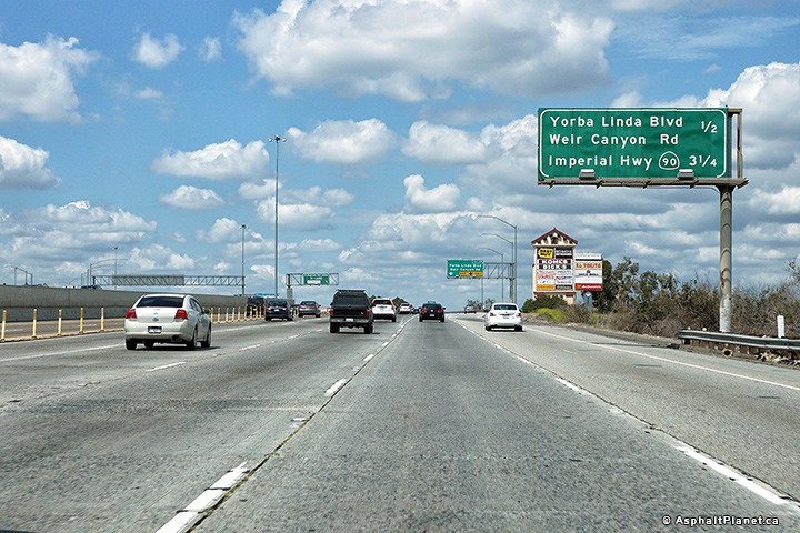
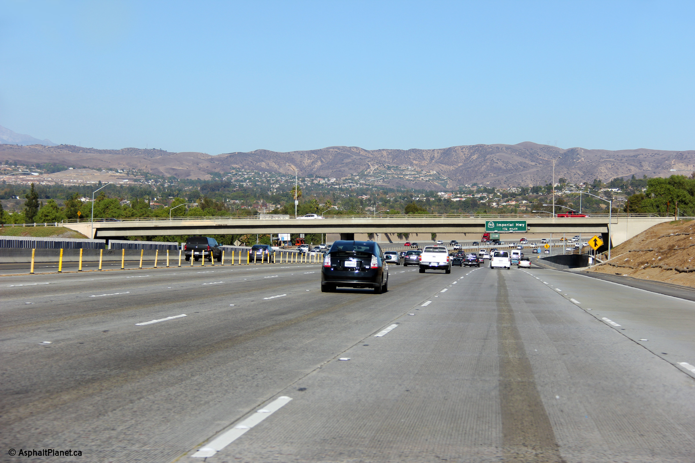
|
Orange County |
This interchange sequence sign stands just beyond the Imperial Highway interchange. |
 |
||
|
Date: 11/05/2013 |
High-res: (1440x960) (2400x1600) |
|||
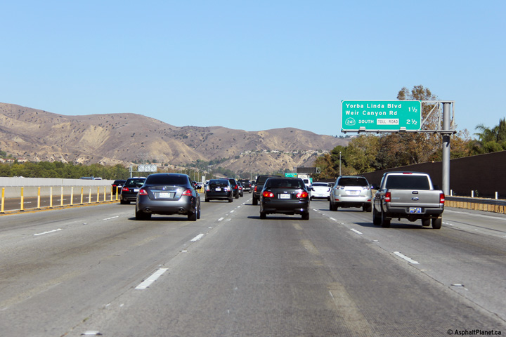
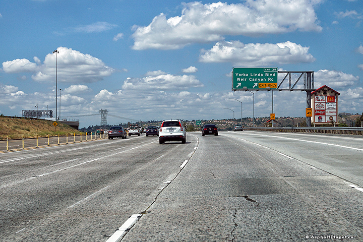
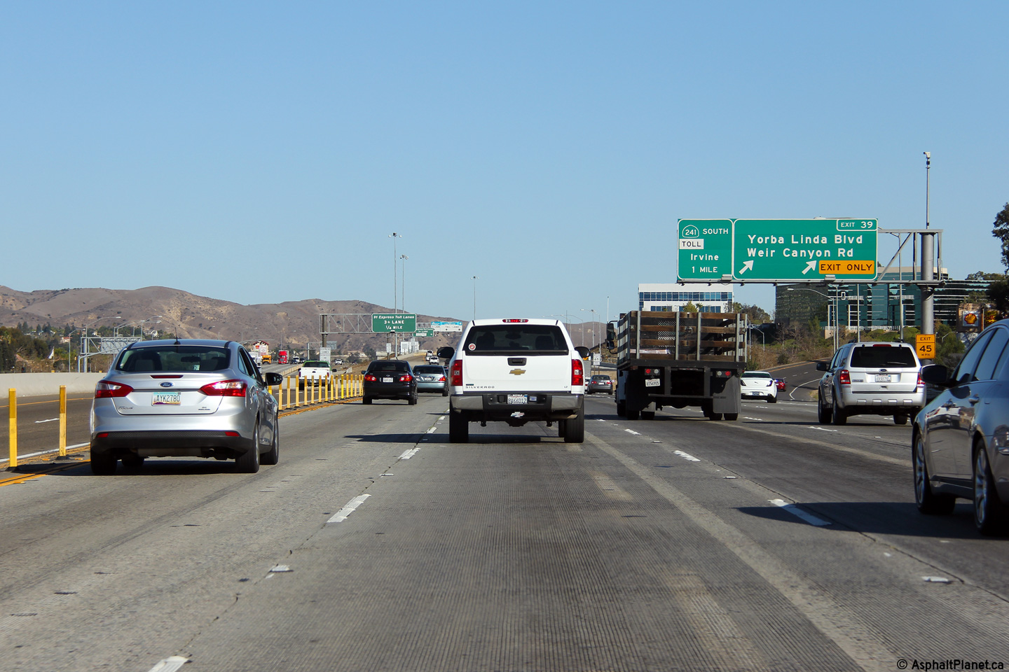
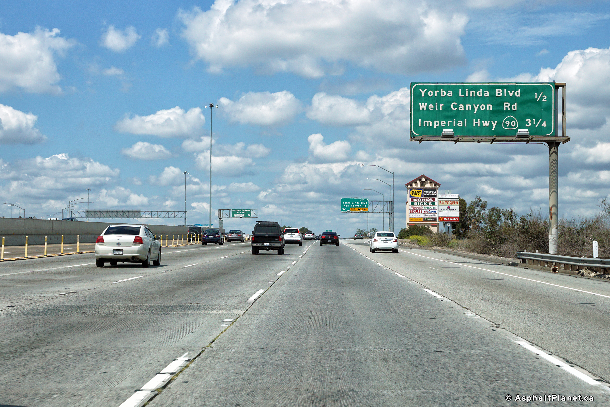
|
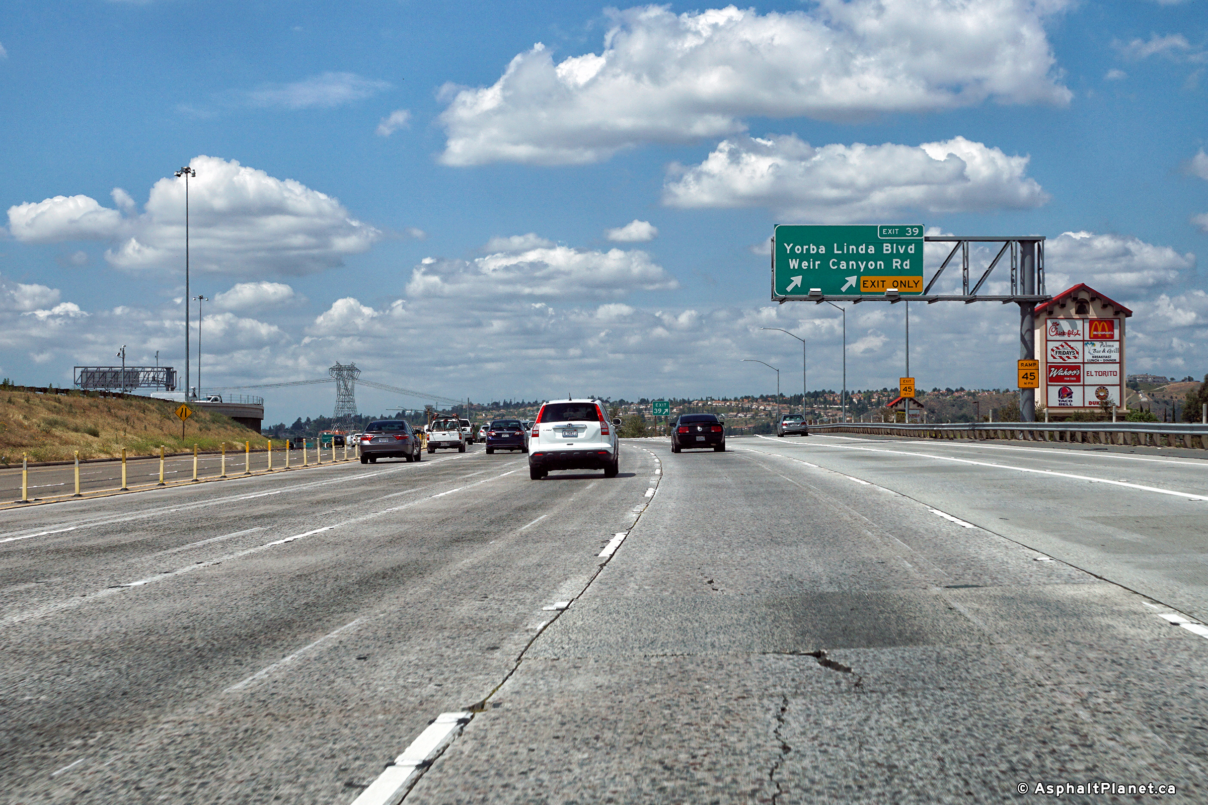
Orange County |
Signage at the eastbound off-ramp to Yorba Linda Boulevard and Weir Canyon Road. |
|
||
|
Date: 11/05/2013 |
High-res: (1440x960) (2400x1600) |
|||
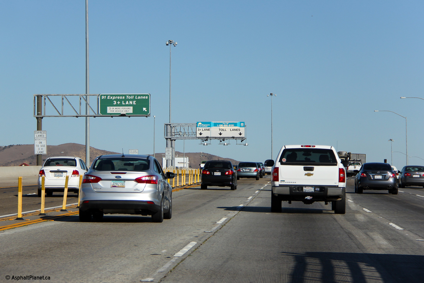
|
Orange County |
Signage over the 91 Express Toll Lanes advising high occupant vehicle users to enter into the left-most lane in order to avoid paying the full toll rate for use of the 91 Express Lanes. This is the only tolling station along the length of the 91 Express Lanes. |
 |
||
|
Date: 4/06/2010 |
High-res: (1440x960) (2400x1600) |
|||
|
Orange County |
Westbound advanced signage for the Imperial Highway interchange. |
 |
||
|
Date: 4/11/2016 |
High-res: (1440x960) (2400x1600) |
|||
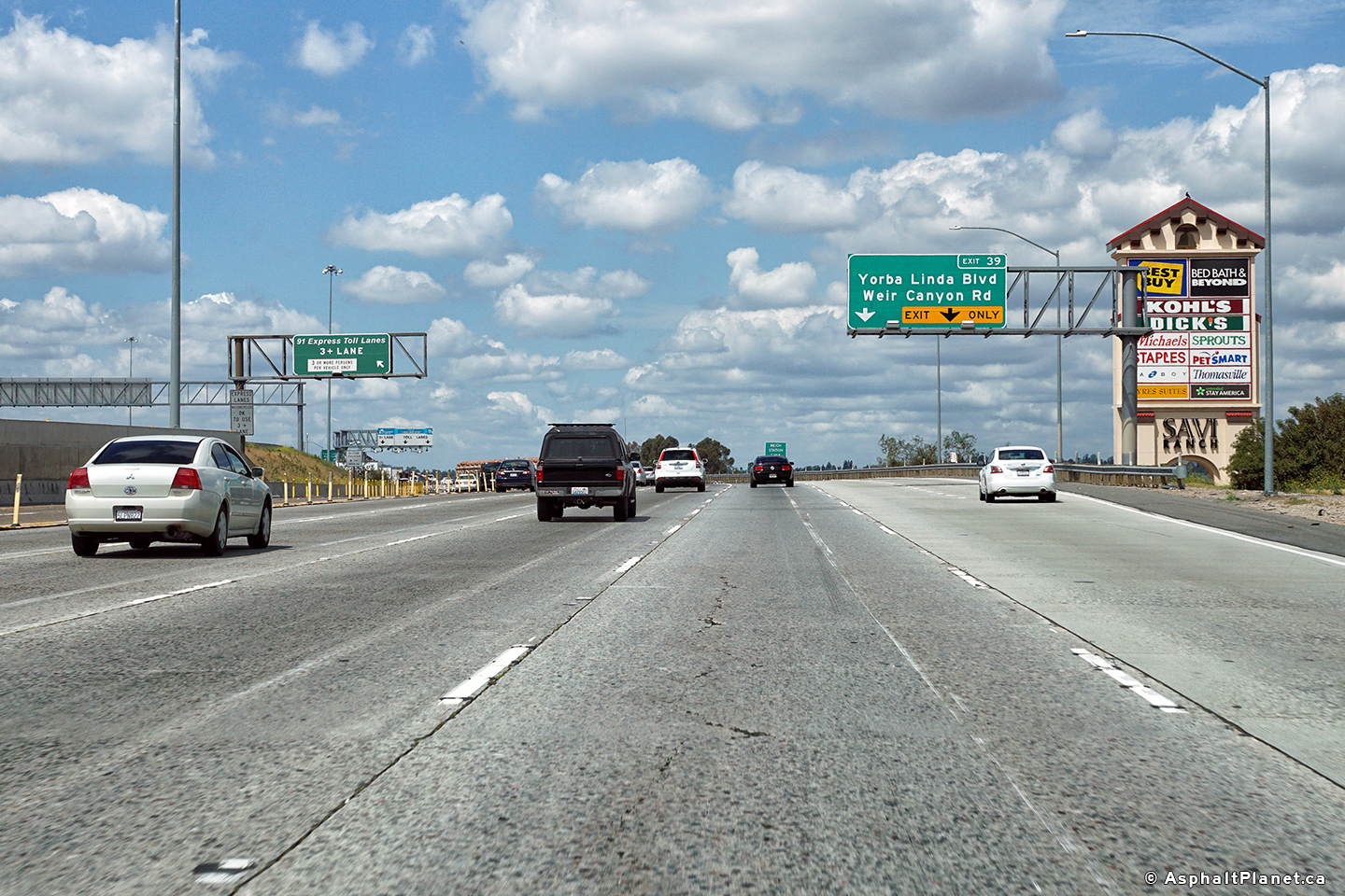
|
Orange County |
Signage at the westbound off-ramp to Yorba Linda Boulevard. |
 |
||
|
Date: 4/11/2016 |
High-res: (1440x960) (2400x1600) |
|||
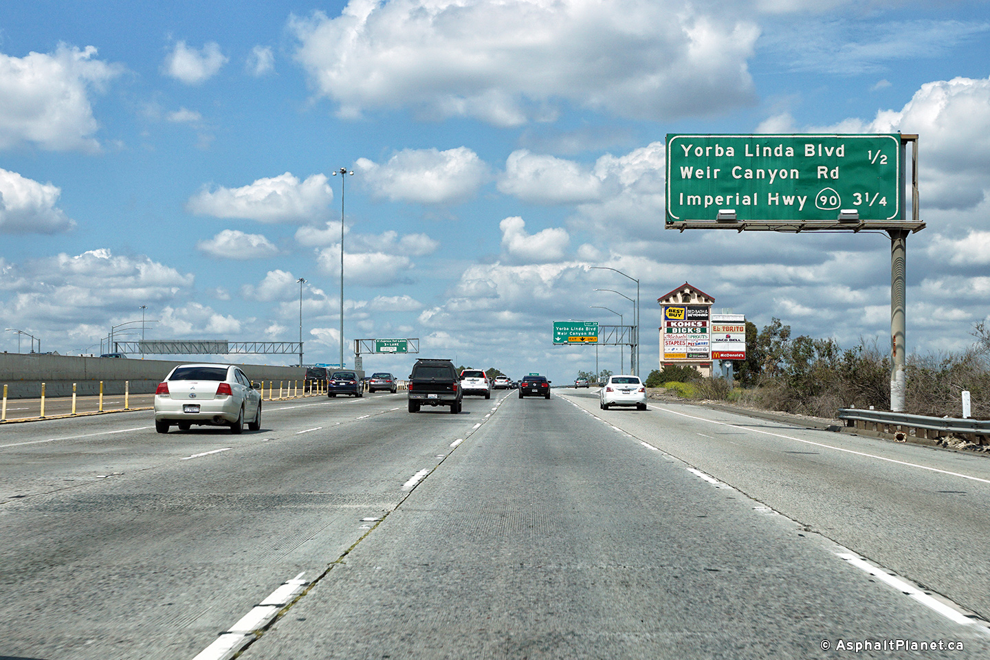
|
Orange County |
Westbound advanced signage for the off-ramp to Yorba Linda Boulevard. |
 |
||
|
Date: 4/11/2016 |
High-res: (1440x960) (2400x1600) |
|||
|
Orange County |
Interchange sequence signage approaching the Yorba Linda Boulevard interchange. |
 |
||
|
Date: 4/11/2016 |
High-res: (1440x960) (2400x1600) |
|||
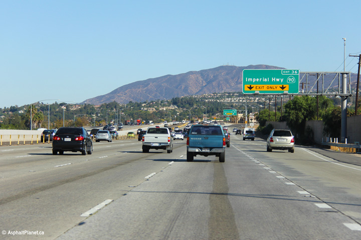
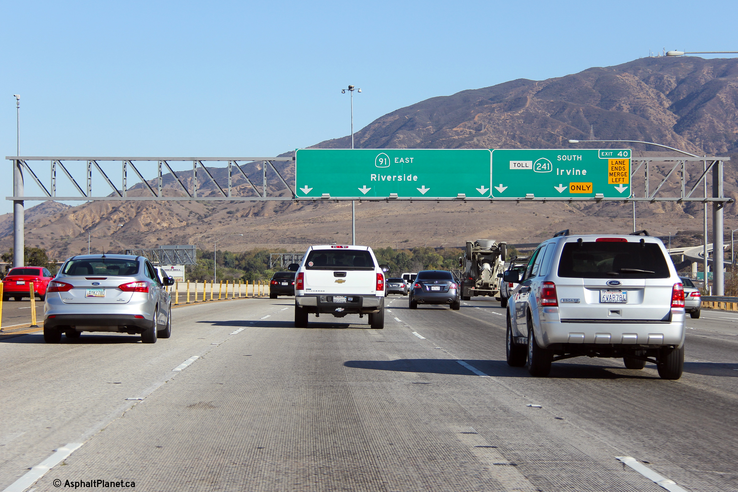
|
Orange County |
Advanced signage approaching the Toll 241 interchange. |
 |
||
|
Date: 11/05/2013 |
High-res: (1440x960) (2400x1600) |
|||
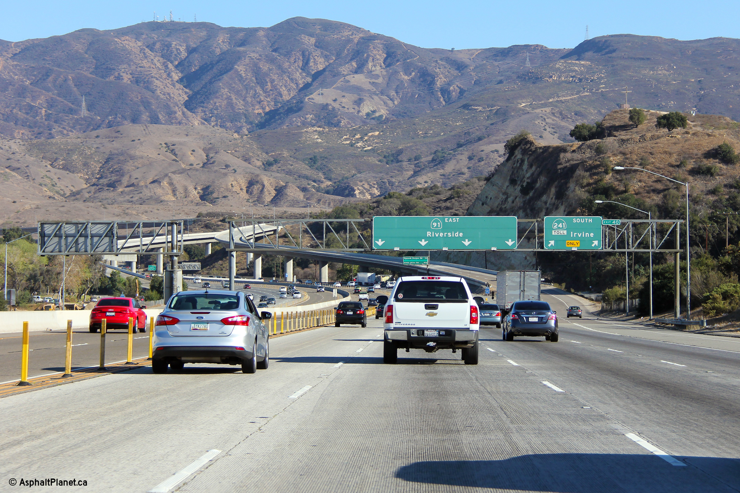
|
Orange County |
Overhead signage at the ramp to SR-241 Toll. Toll 241 leads southerly from the 91 Freeway through the foothills on the eastern edge of various Orange County Cities. |
 |
||
|
Date: 11/05/2013 |
High-res: (1440x960) (2400x1600) |
|||
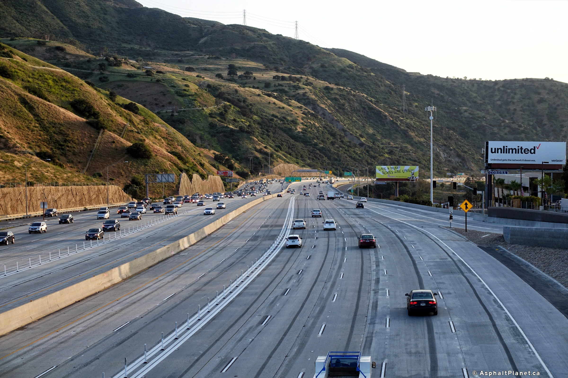
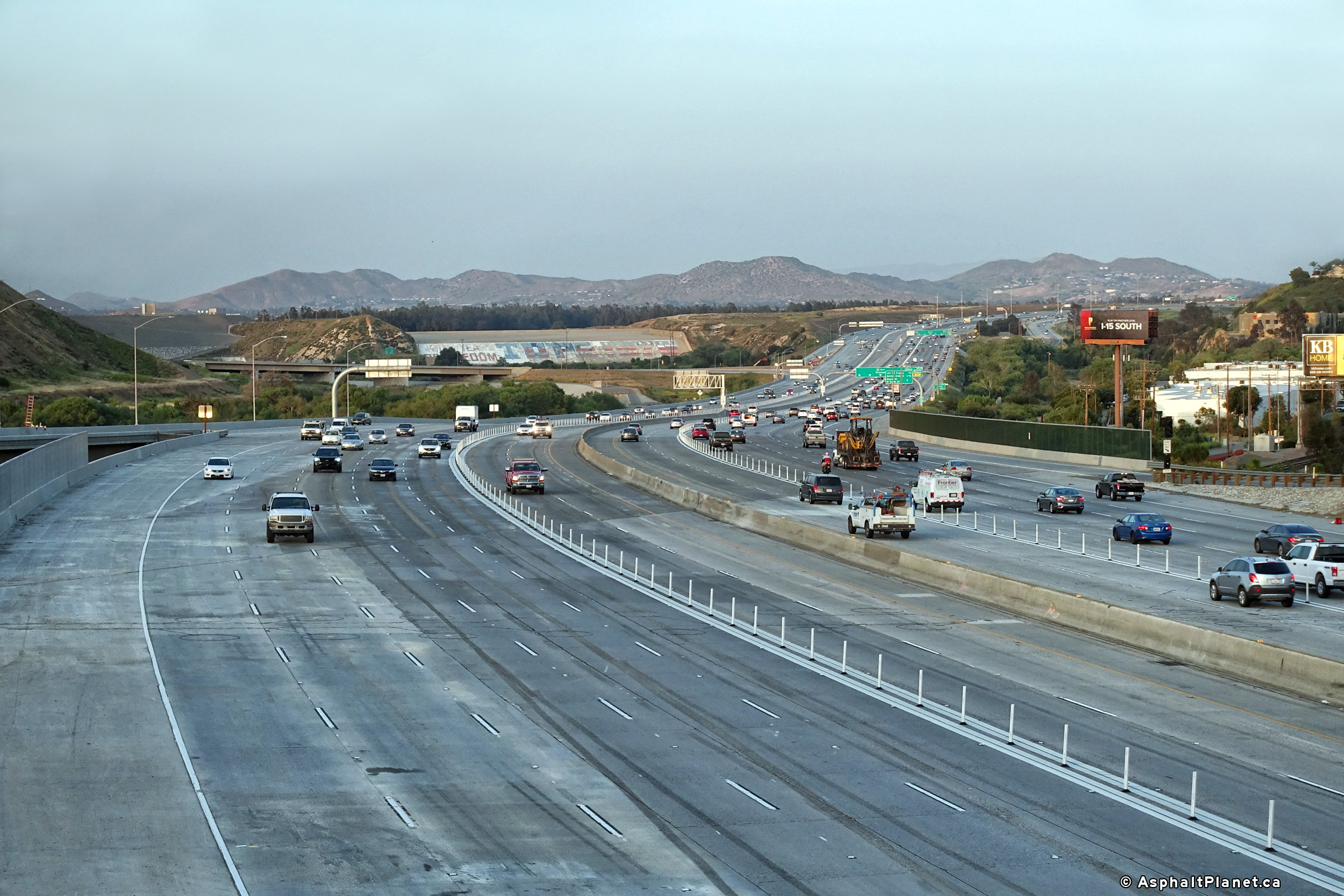
| Riverside County |
View looking westerly from the Green River Road overpass towards the recently widened section of State Route 91. |
|
||
|
Date: 4/11/2017 |
High-res: (1440x960) (2400x1600) |
|||
| Riverside County |
This view looks easterly from the Green River Road overpass towards the SR-71 interchange. The dam that impounds the Santa Ana River can be seen on the left side of the photo. |
|
||
|
Date: 4/11/2017 |
High-res: (1440x960) (2400x1600) |
|||
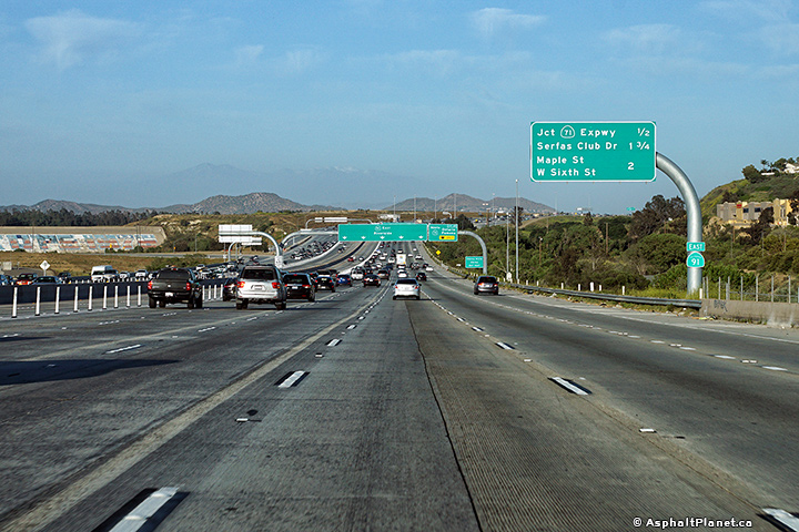
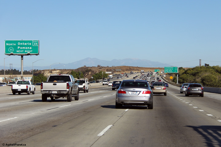
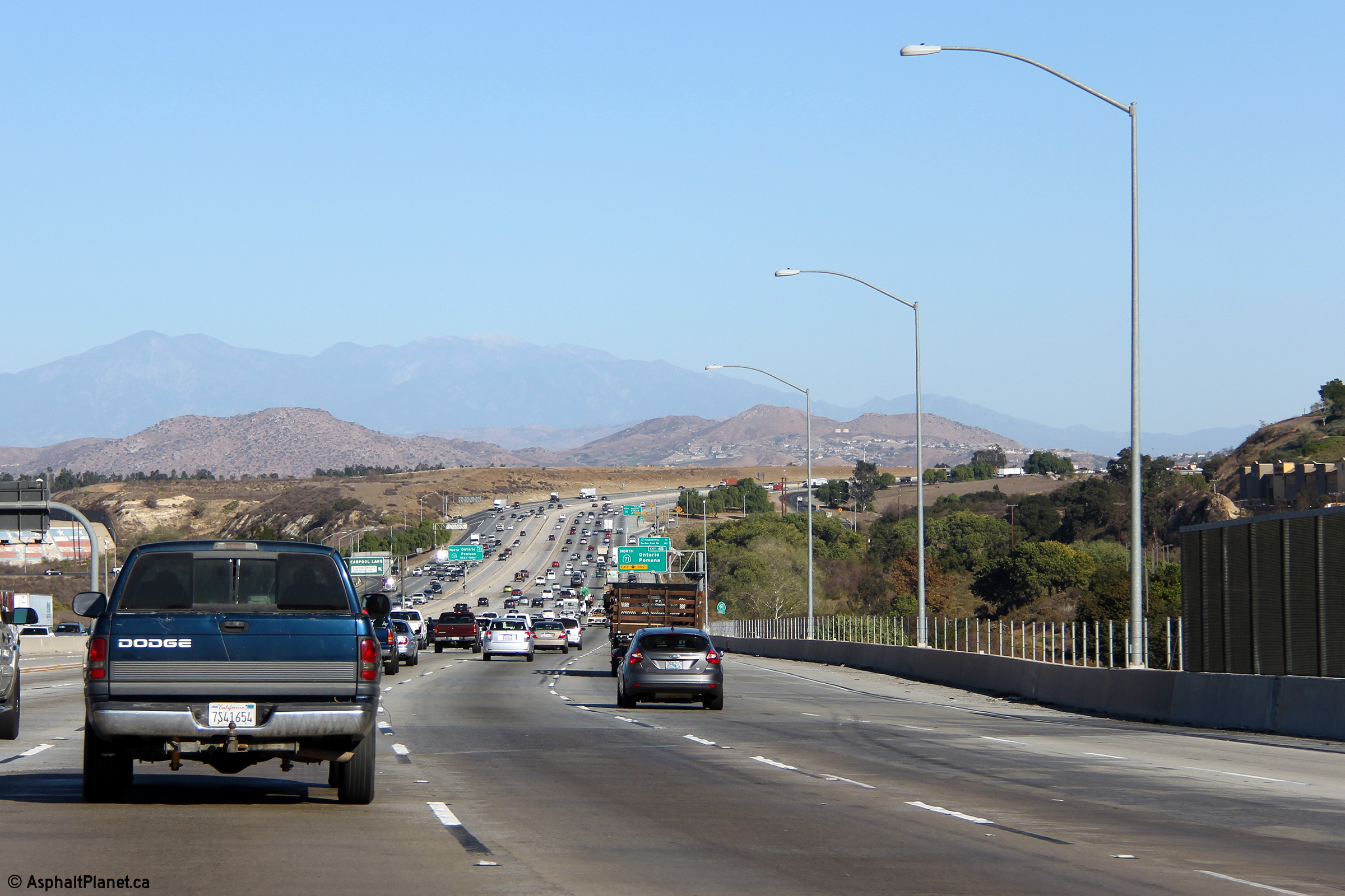
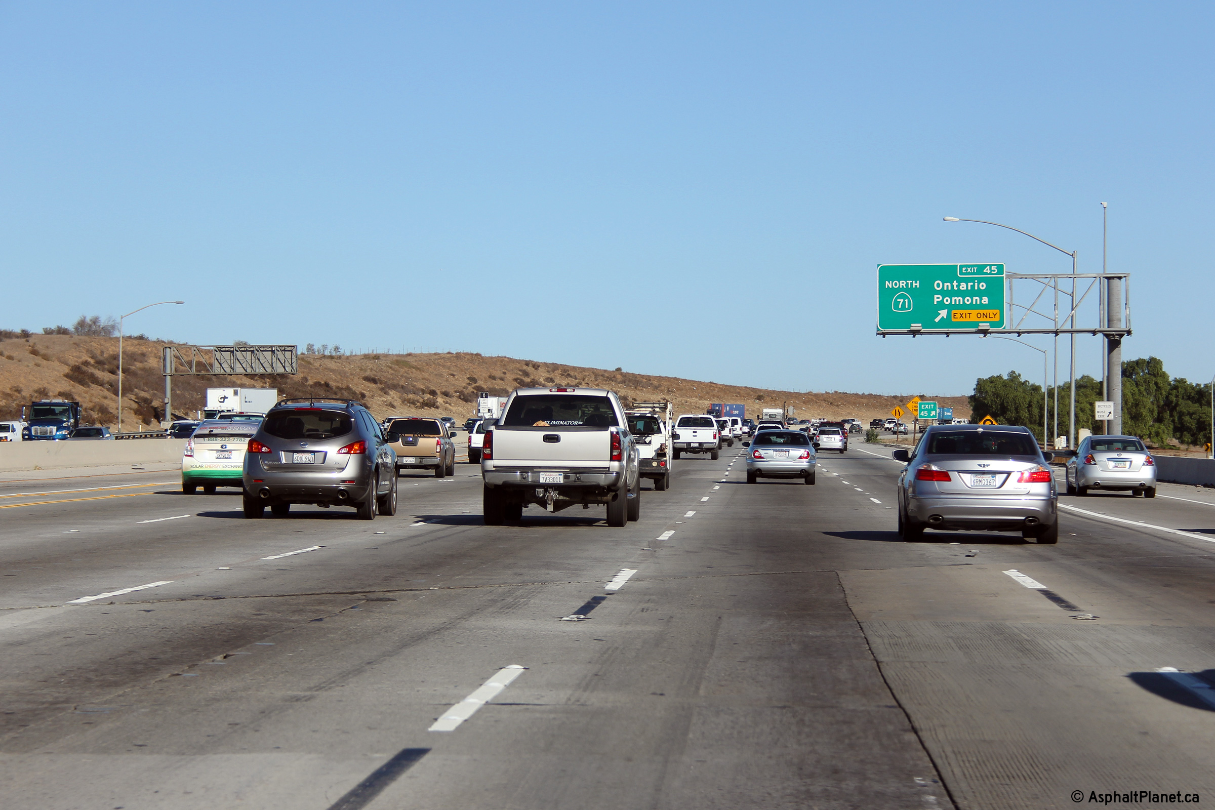
| Riverside County |
Eastbound interchange sequence signage located between Green River Road and the 71 Freeway. Click here for an additional view from a similar vantage point taken in November, 2013. |
 |
||
|
Date: 11/05/2013 |
High-res: (1440x960) (2400x1600) |
|||
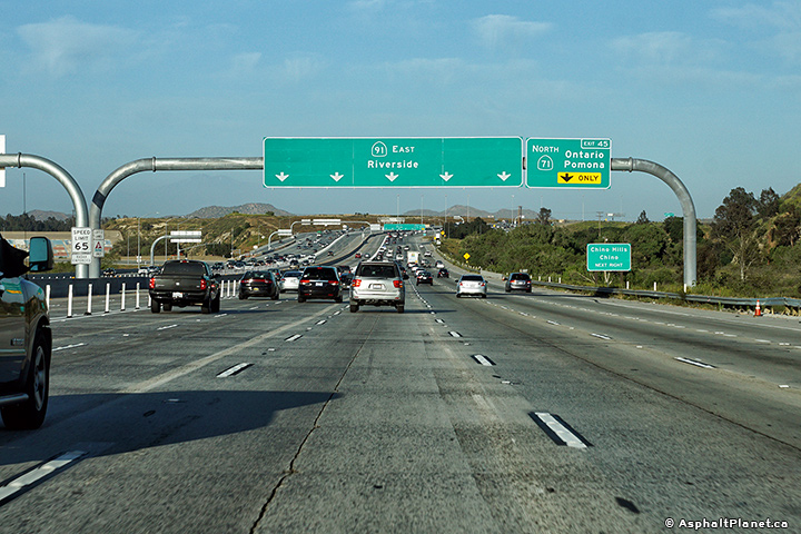
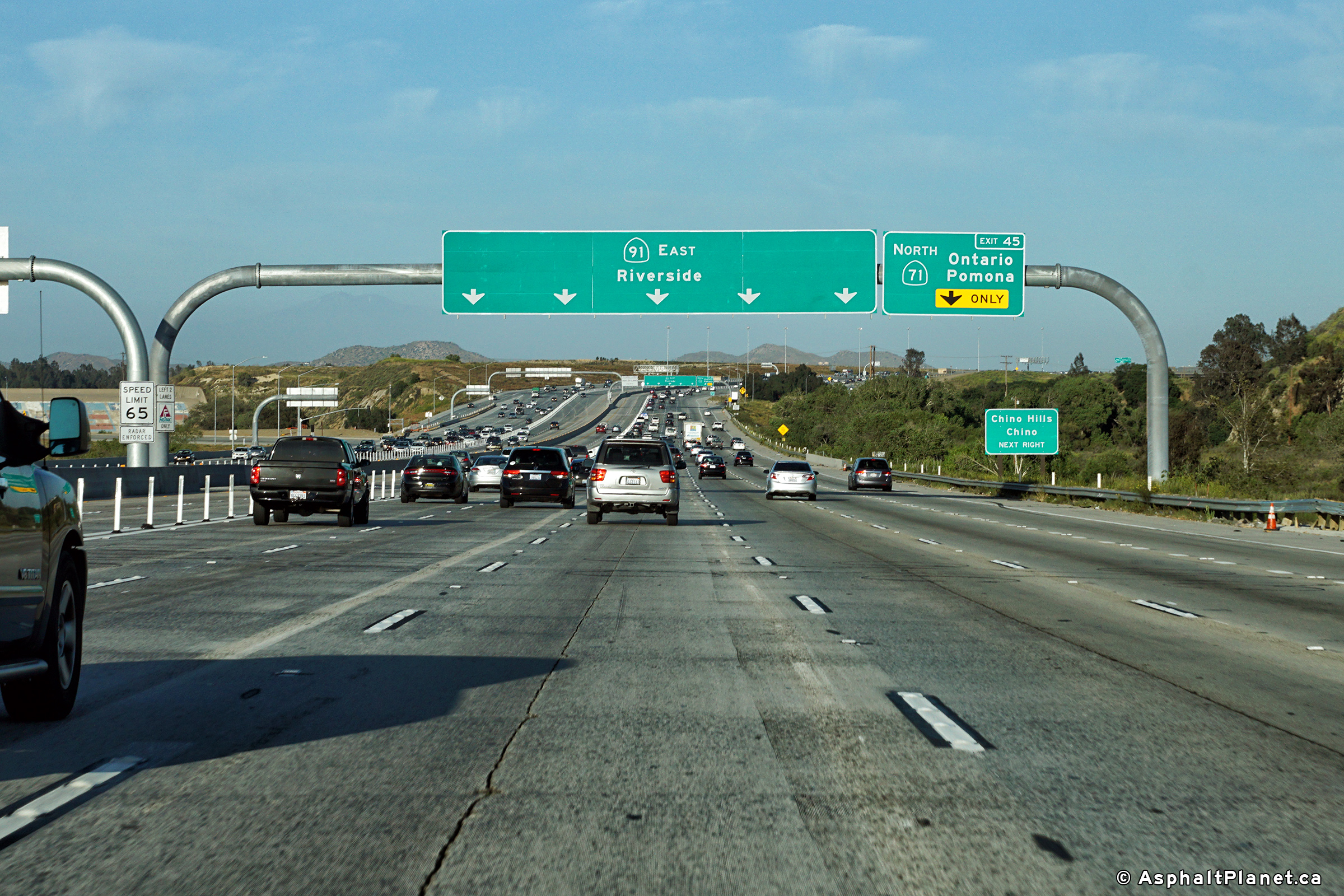
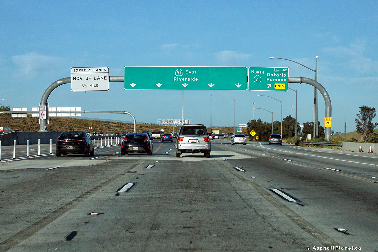
| Riverside County |
Two views looking easterly approaching the 71 Freeway interchange. The upper photo was taken before the Express Toll Lanes were extended through Riverside County, while the lower photo was taken after the new lanes had opened to traffic.
Upper Photo: 11/05/2013
Lower photo: 4/15/2017 |
 |
||
|
High-res: (1440x960) (2400x1600) |
||||
 |
||||
|
Date: as noted |
High-res: (1440x960) (2400x1600) |
|||
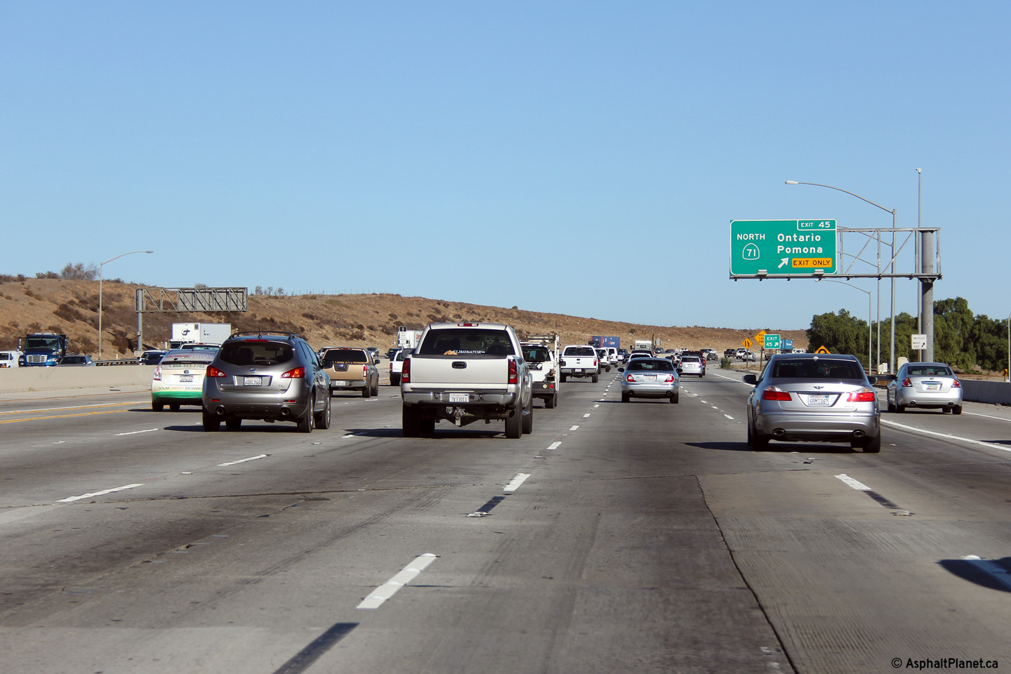
| Riverside County |
Two views looking easterly as the ramp to the 71 Freeway departs sharply from the freeway mainline.
Upper Photo: 11/05/2013
Lower photo: 4/15/2017 |
 |
||
|
High-res: (1440x960) (2400x1600) |
||||
 |
||||
|
Date: as noted |
High-res: (1440x960) (2400x1600) |
|||
| State Route 71 takes traffic northwesterly from the 91 freeway to I-10 and the 57 Freeway at the Kellogg Interchange. Click here for State Route 71 Images. | ||||
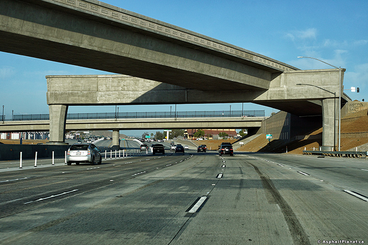
| Riverside County |
View looking easterly as CA-71 passes beneath the flyover ramp that carries traffic from main street to the westbound lanes of SR-91. |
 |
||
|
Date: 4/15/2017 |
High-res: (1440x960) (2400x1600) |
|||
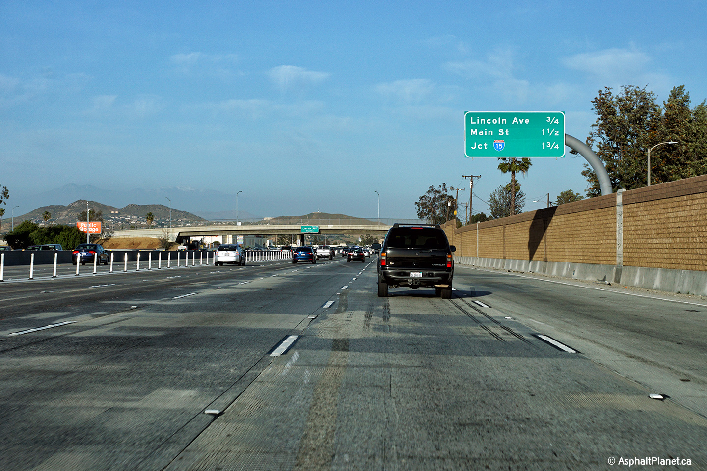
| Riverside County |
Interchange sequence signage in advance of the eastbound off-ramp to Lincoln Boulevard. |
 |
||
|
Date: 4/15/2017 |
High-res: (1440x960) (2400x1600) |
|||
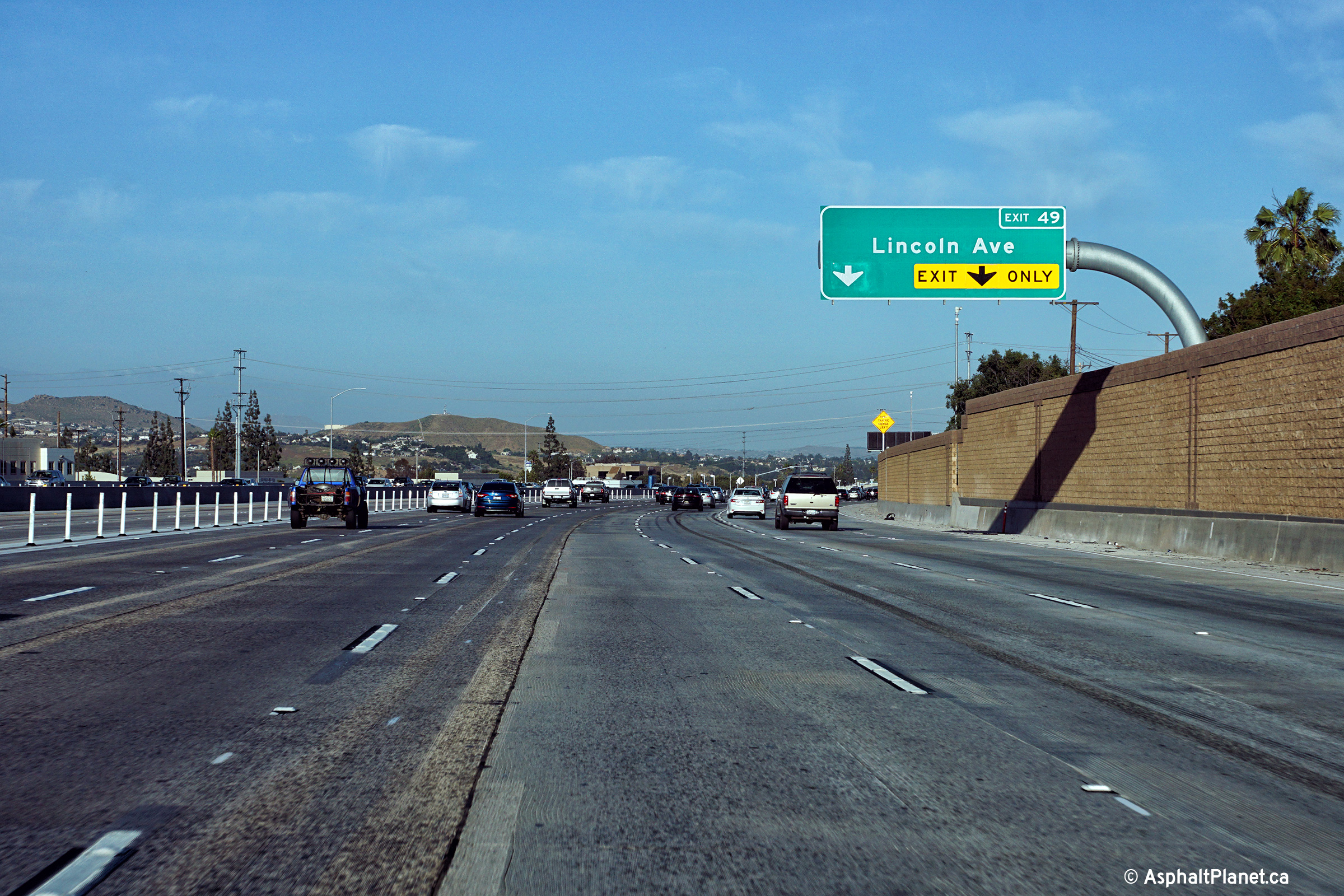
| Riverside County |
Eastbound advanced signage for the off-ramp to Lincoln Boulevard. |
 |
||
|
Date: 4/15/2017 |
High-res: (1440x960) (2400x1600) |
|||
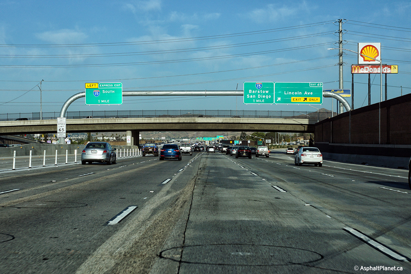
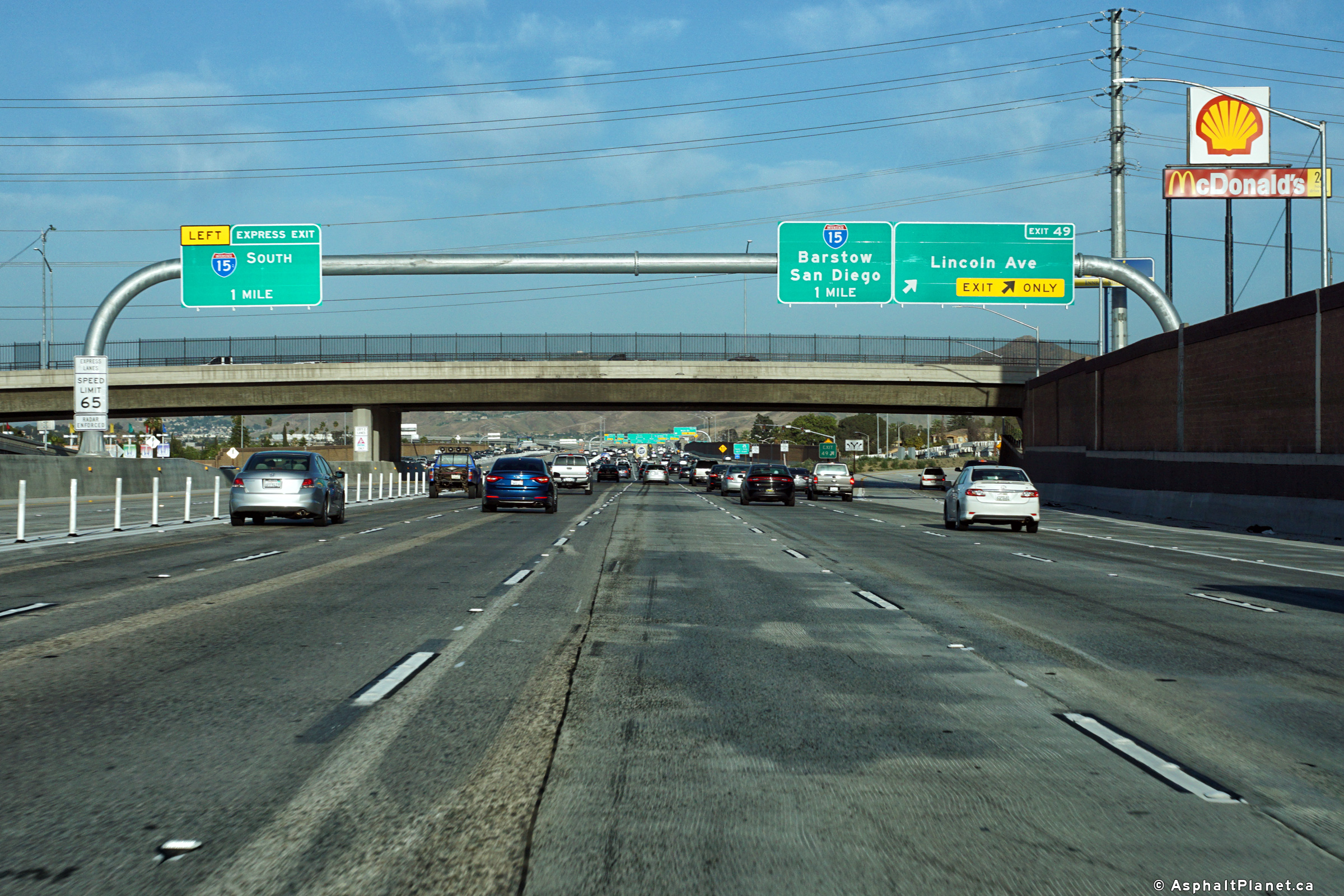
| Riverside County |
Signage at the eastbound off-ramp to Lincoln Boulevard. |
 |
||
|
Date: 4/15/2017 |
High-res: (1440x960) (2400x1600) |
|||
| Interstate 15 is the major north-south interstate through the Inland Empire. Click here for Interstate 15 Images. | ||||
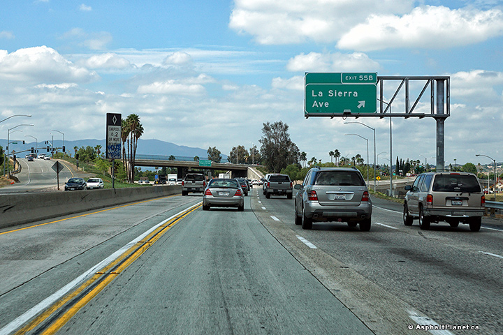
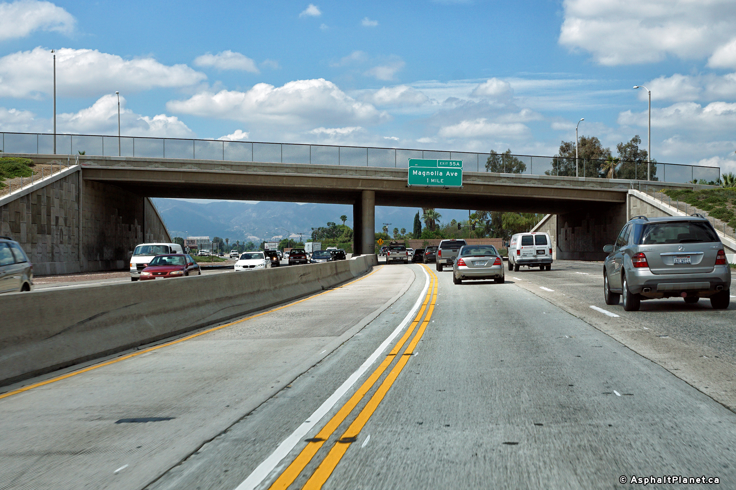
|
Riverside County |
An advanced sign for the Magnolia Avenue interchange has been affixed to the overpass for La Sierra Avenue. |
 |
||
|
Date: 4/11/2016 |
High-res: (1440x960) (2400x1600) |
|||
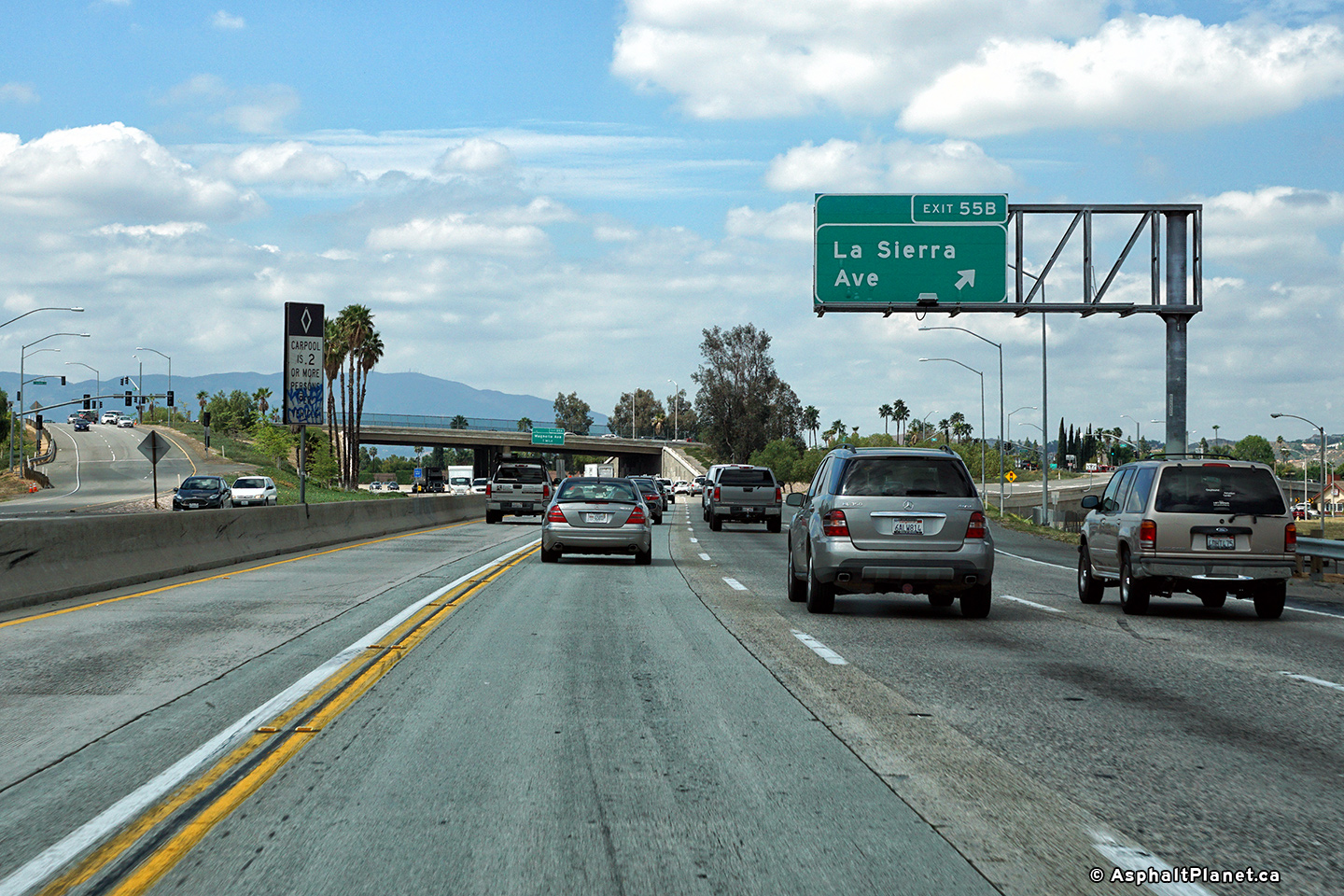
|
Riverside County |
Signage facing westbound motorists at the off-ramp to La Sierra Avenue. |
 |
||
|
Date: 4/11/2016 |
High-res: (1440x960) (2400x1600) |
|||
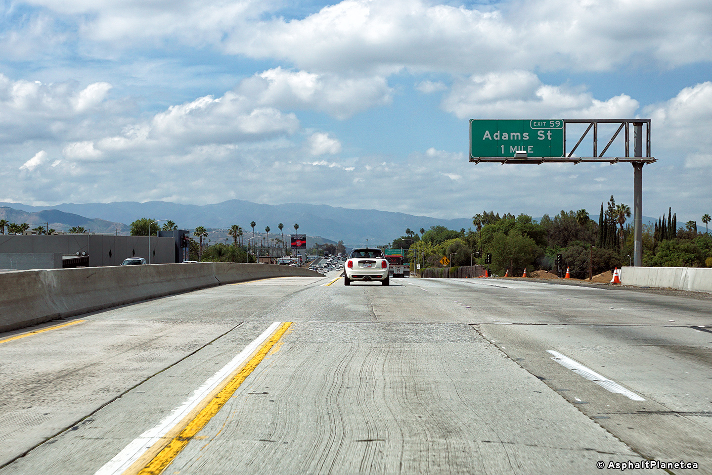
|
Riverside County |
An advanced sign for the Van Buren Blvd interchange has been affixed to the Adams Street overpass. |
 |
||
|
Date: 4/11/2016 |
High-res: (1440x960) (2400x1600) |
|||
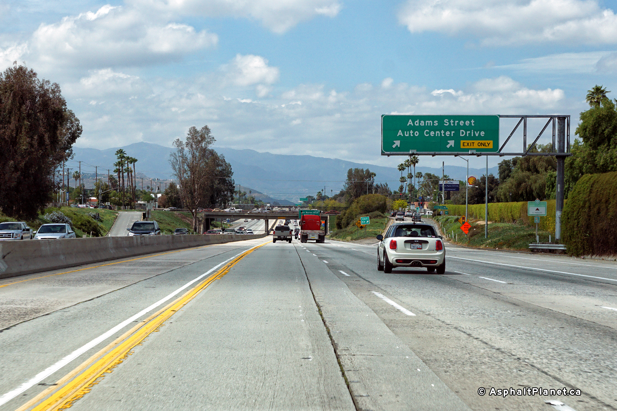
|
Riverside County |
Signage for the westbound off-ramp to Adams Street and Auto Center Drive. |
 |
||
|
Date: 4/11/2016 |
High-res: (1440x960) (2400x1600) |
|||
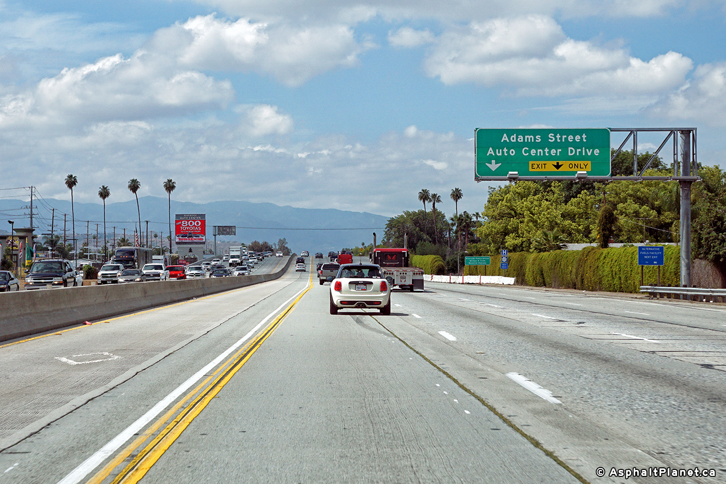
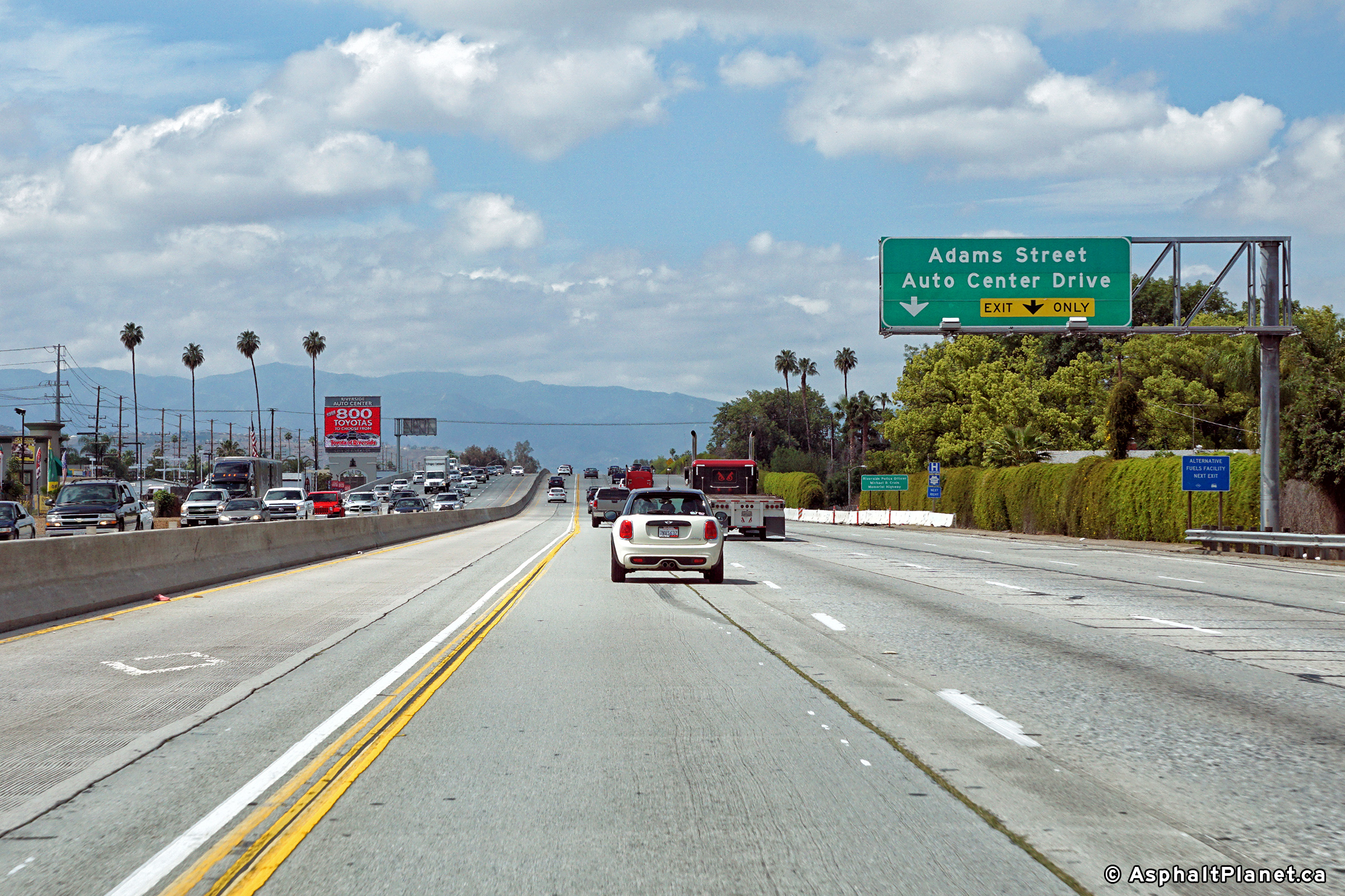
|
Riverside County |
Advanced signage for the multi-lane westbound off-ramp to Adams Street. |
 |
||
|
Date: 4/11/2016 |
High-res: (1440x960) (2400x1600) |
|||
|
Riverside County |
View at the westbound off-ramp to Madison Street. |
 |
||
|
Date: 4/11/2016 |
High-res: (1440x960) (2400x1600) |
|||
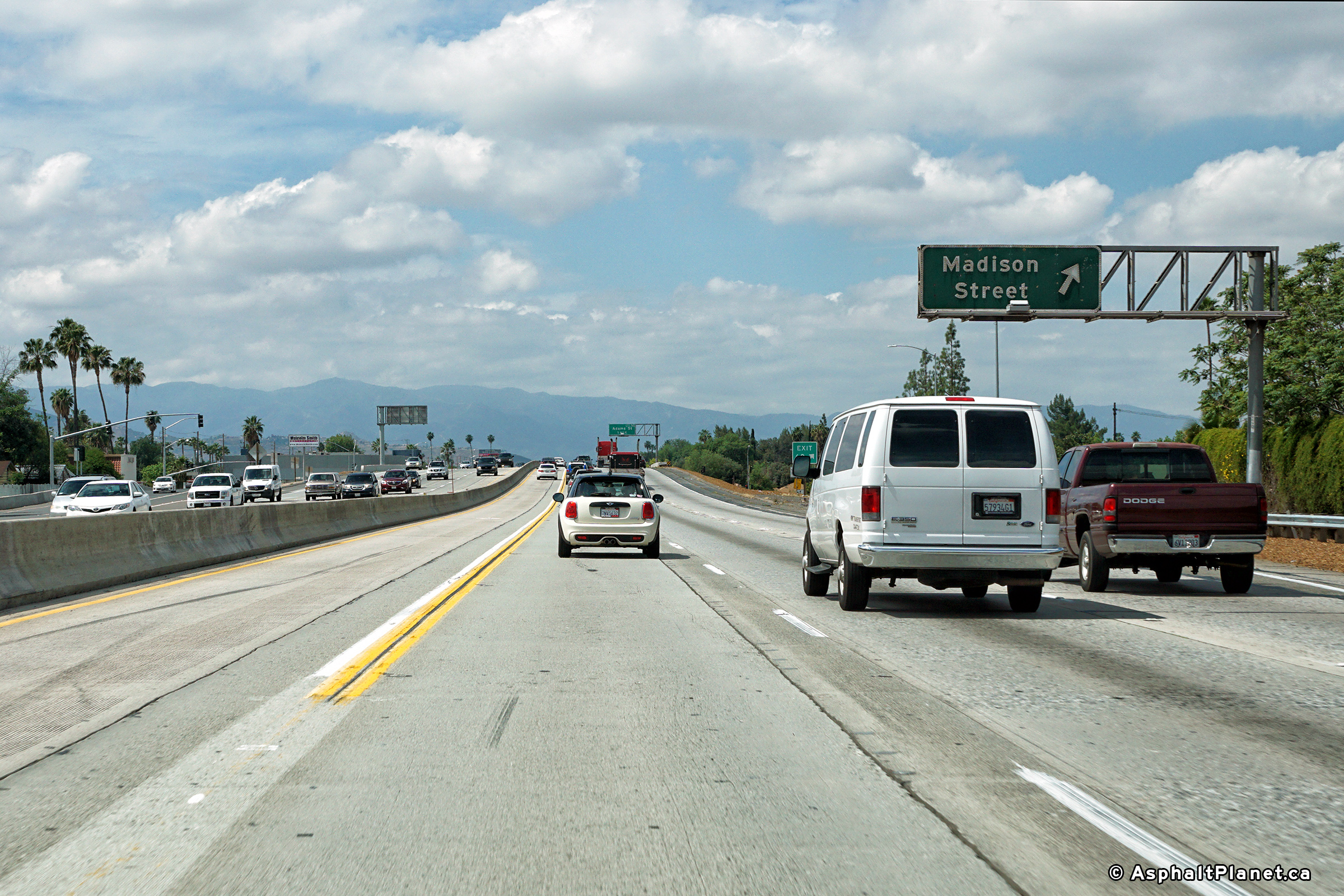
|
Riverside County |
View at the westbound off-ramp to Madison Street. |
 |
||
|
Date: 4/11/2016 |
High-res: (1440x960) (2400x1600) |
|||
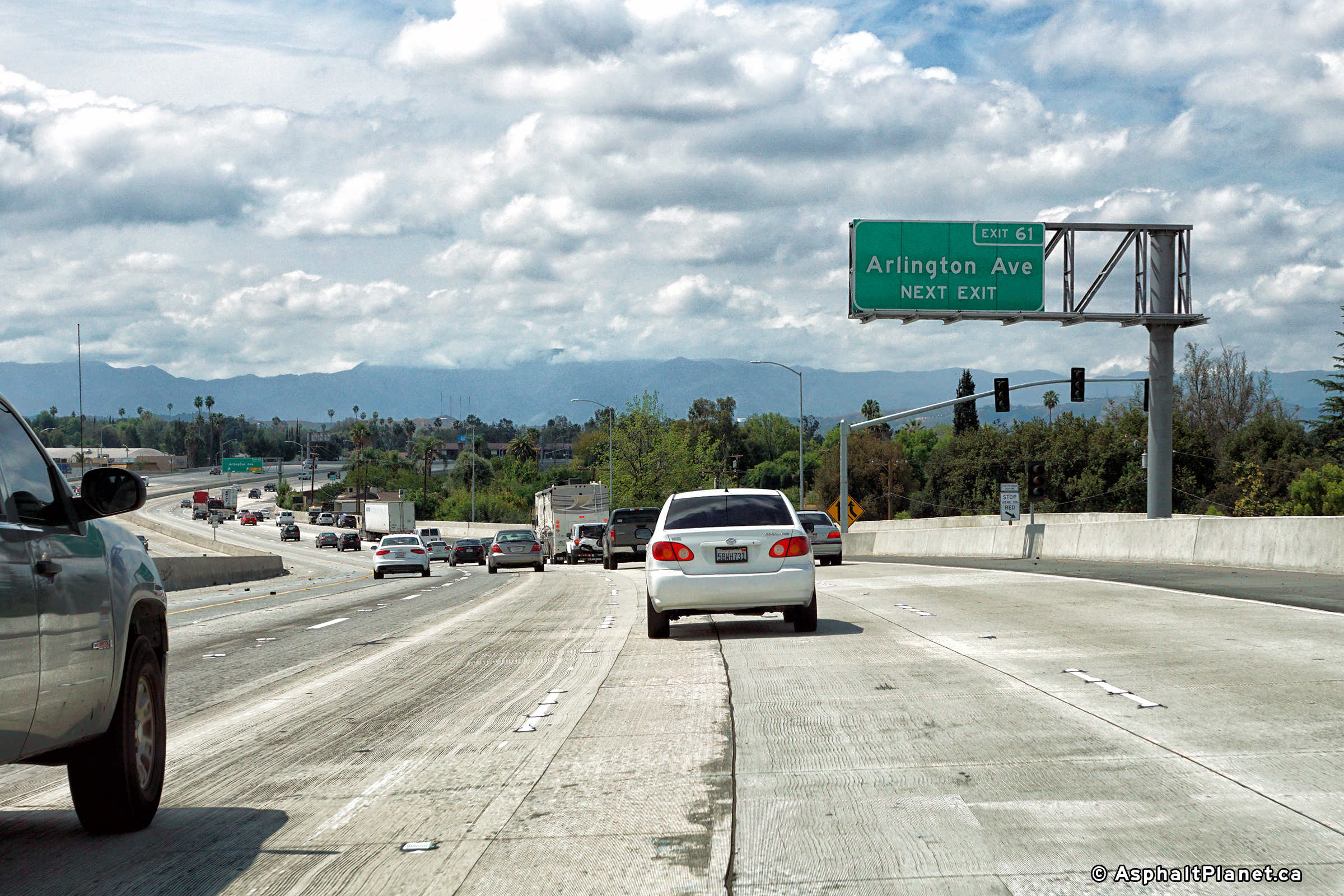
|
Riverside County |
Signage at the westbound off-ramp to Arlington Avenue. |
 |
||
|
Date: 4/11/2016 |
High-res: (1440x960) (2400x1600) |
|||
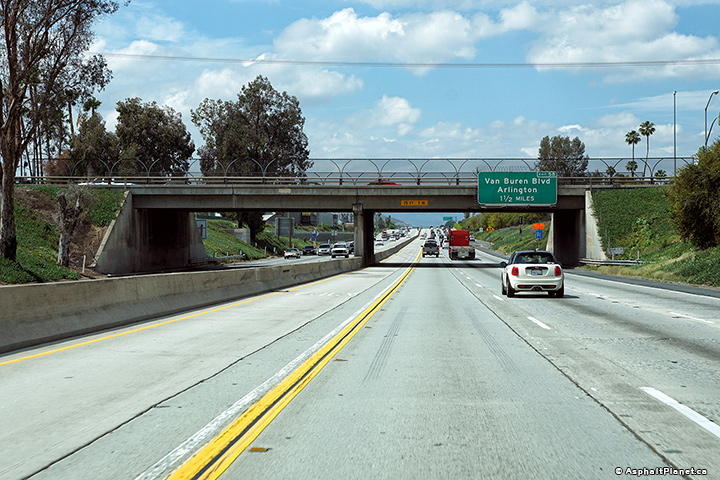
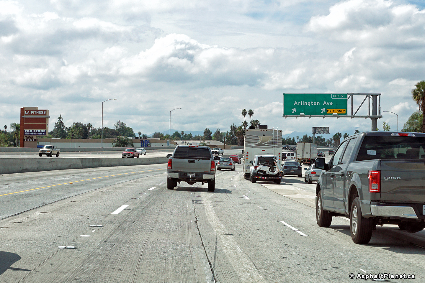
|
Riverside County |
Westbound advanced signage for the off-ramp to Arlington Avenue. |
 |
||
|
Date: 4/11/2016 |
High-res: (1440x960) (2400x1600) |
|||
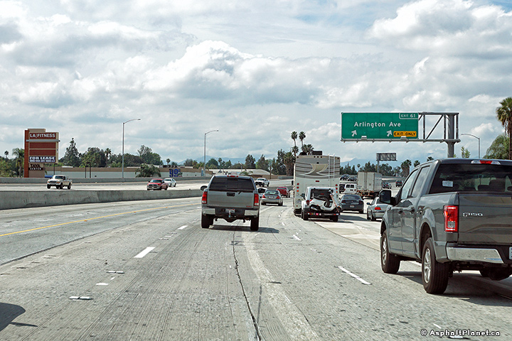
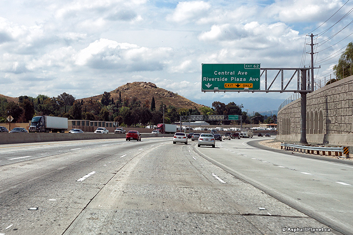
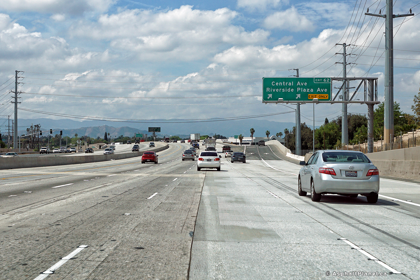
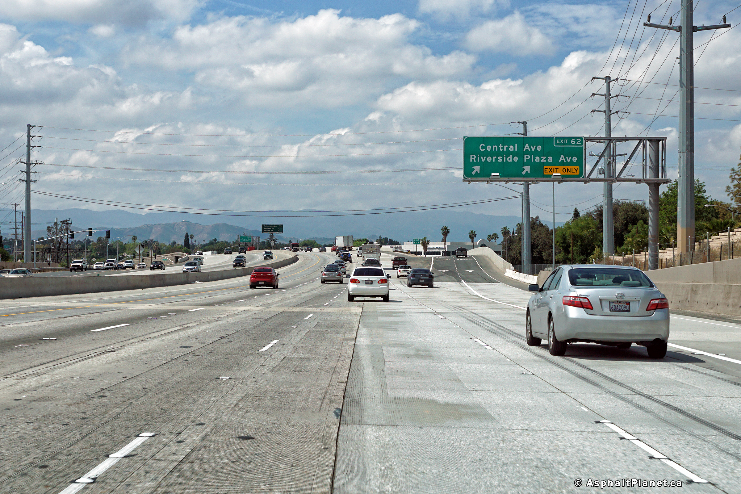
|
Riverside County |
View looking westerly at the off-ramp to Central Avenue. |
 |
||
|
Date: 4/11/2016 |
High-res: (1440x960) (2400x1600) |
|||
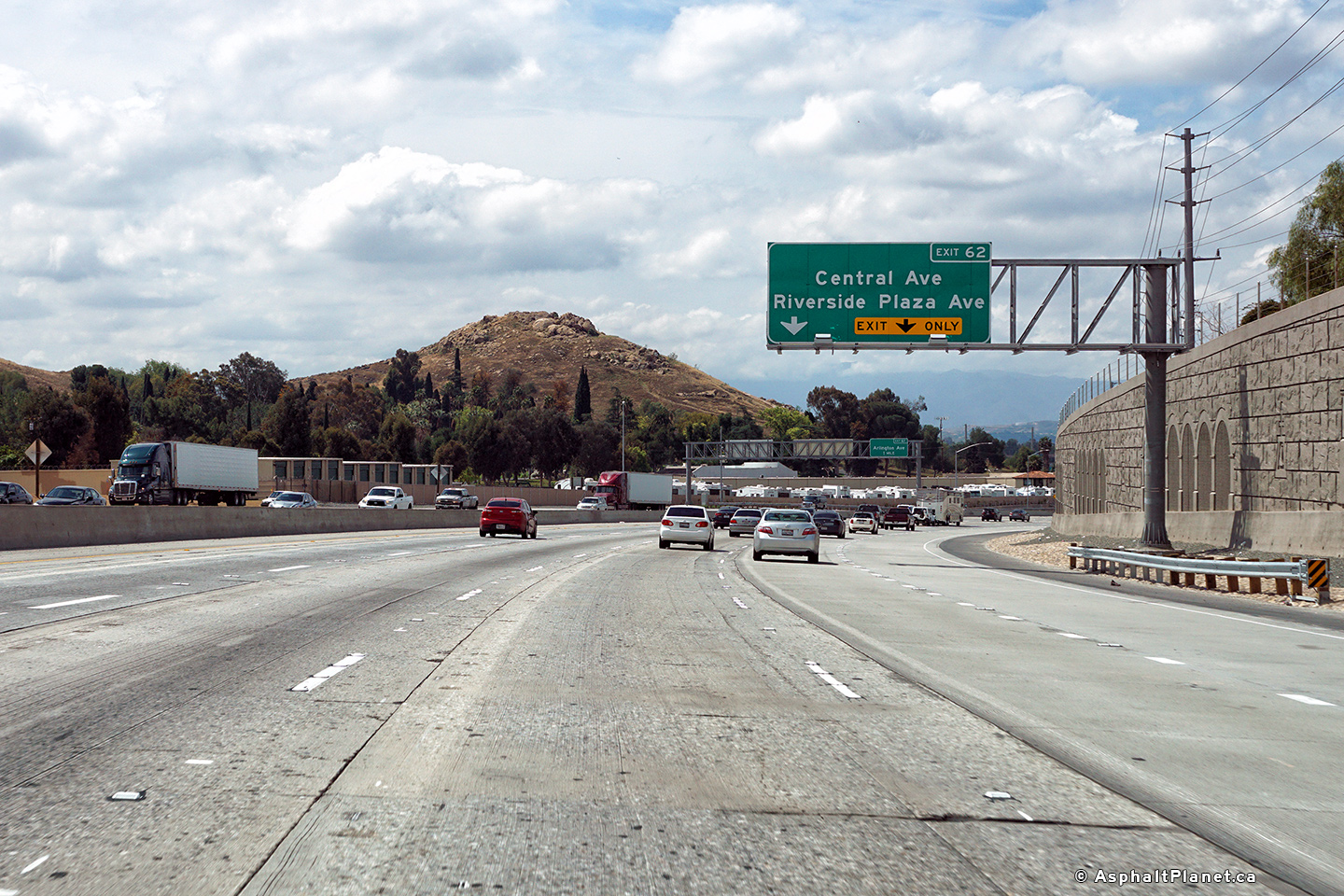
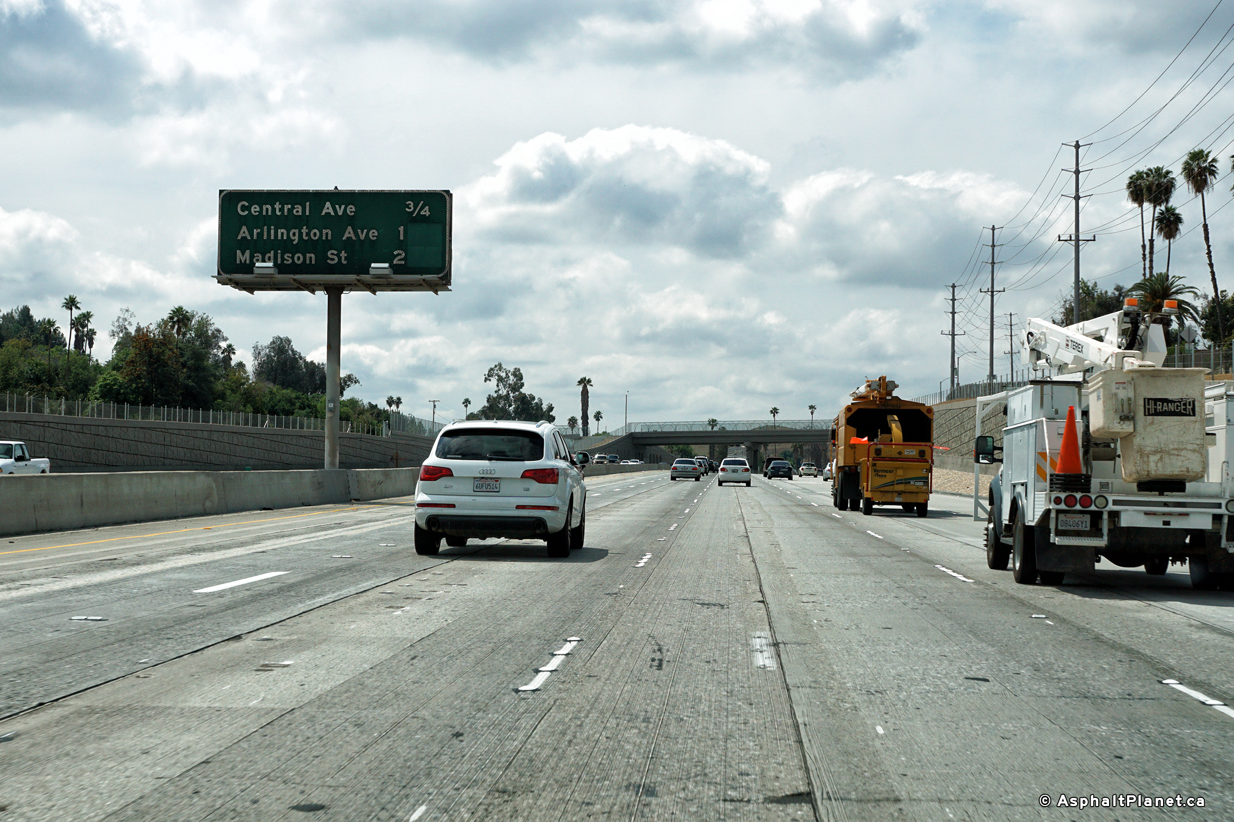
|
Riverside County |
Westbound advanced sigange for the Central Avenue intercahnge. |
 |
||
|
Date: 4/11/2016 |
High-res: (1440x960) (2400x1600) |
|||
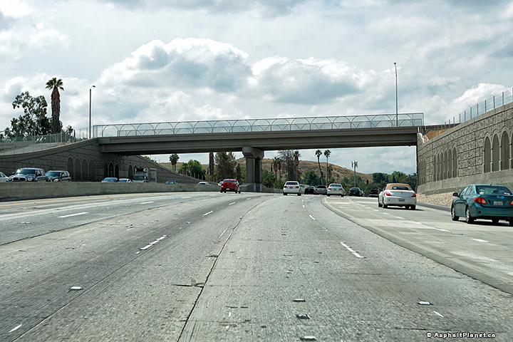
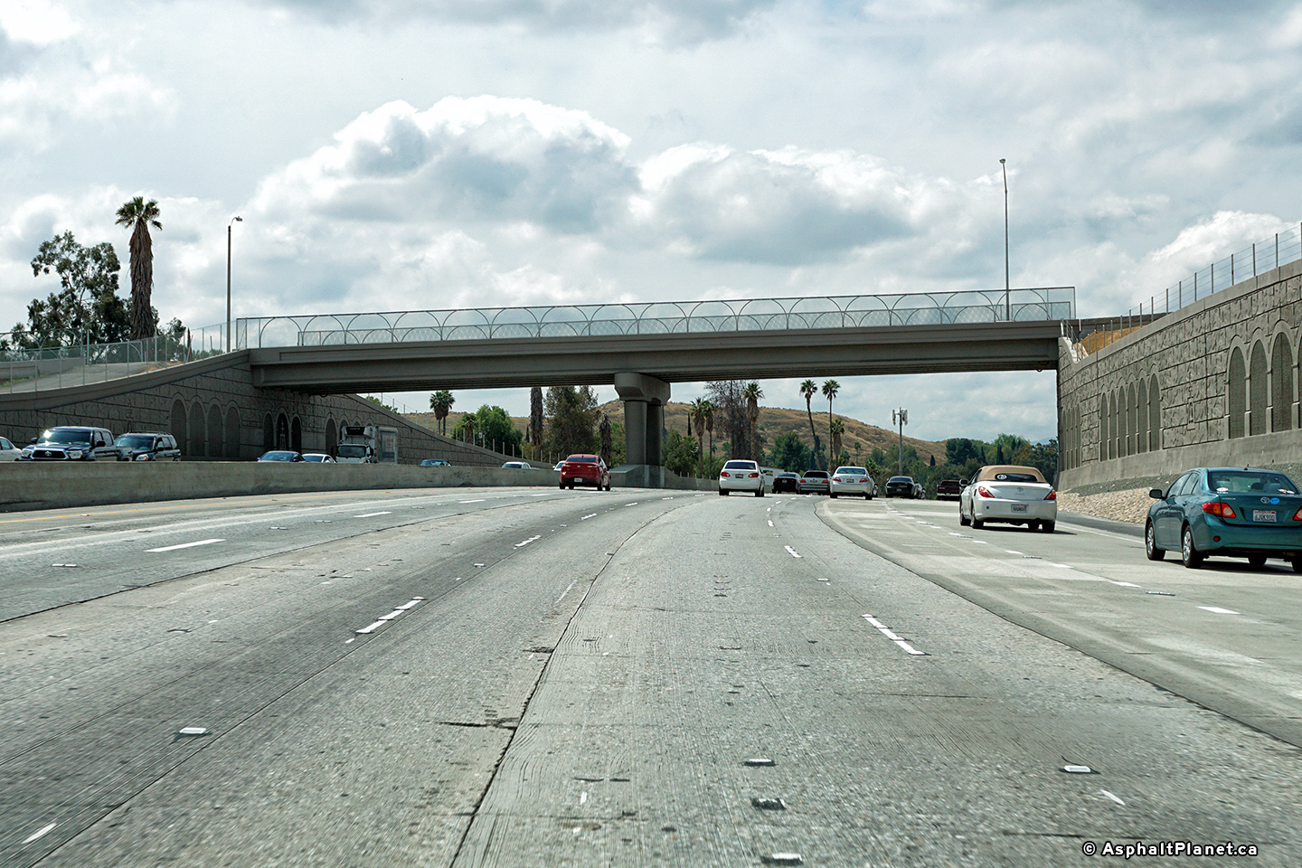
|
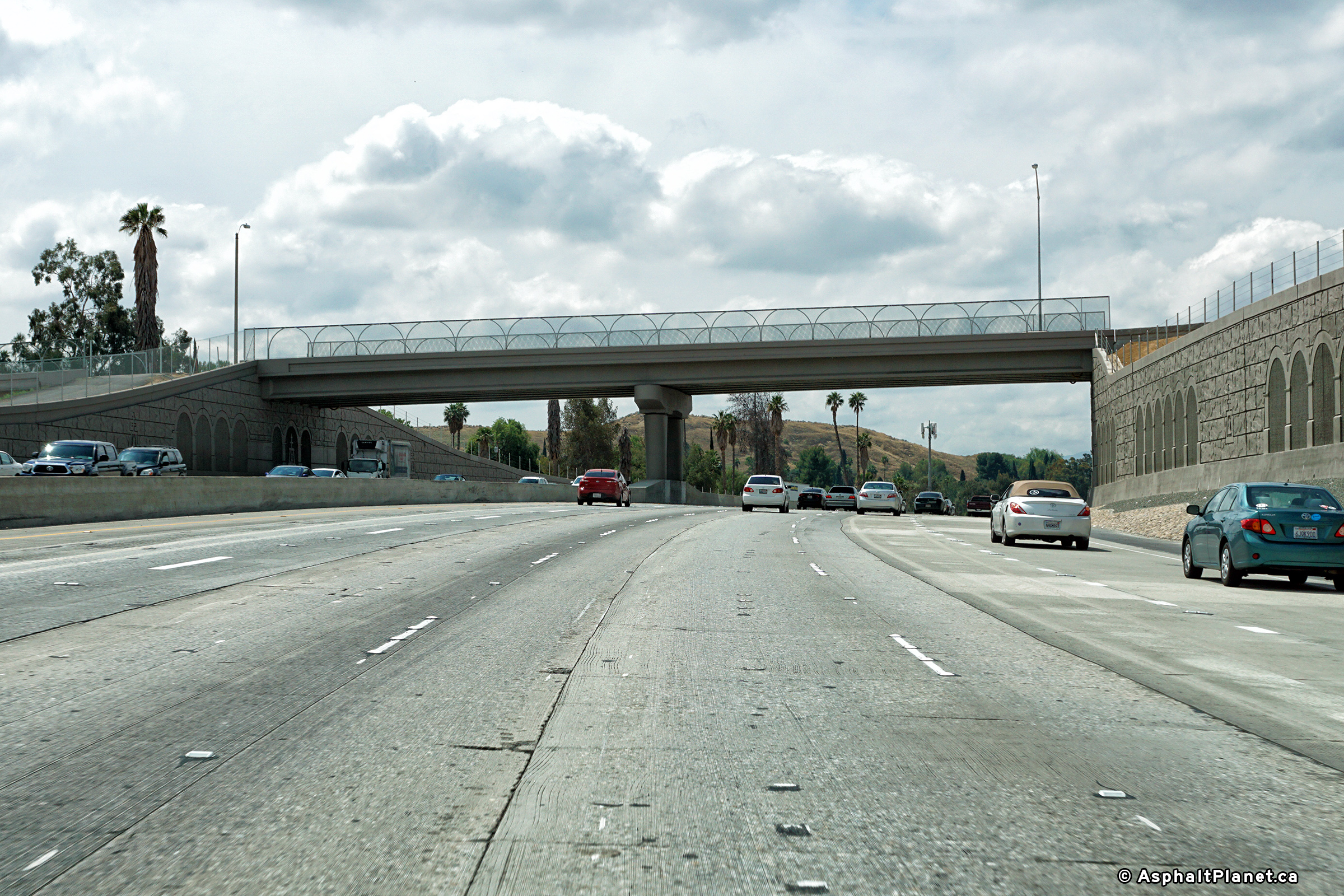
Riverside County |
View looking westerly along the 91 Freeway as the freeway passes beneath the Ivy Street overcrossing. |
 |
||
|
Date: 4/11/2016 |
High-res: (1440x960) (2400x1600) |
|||
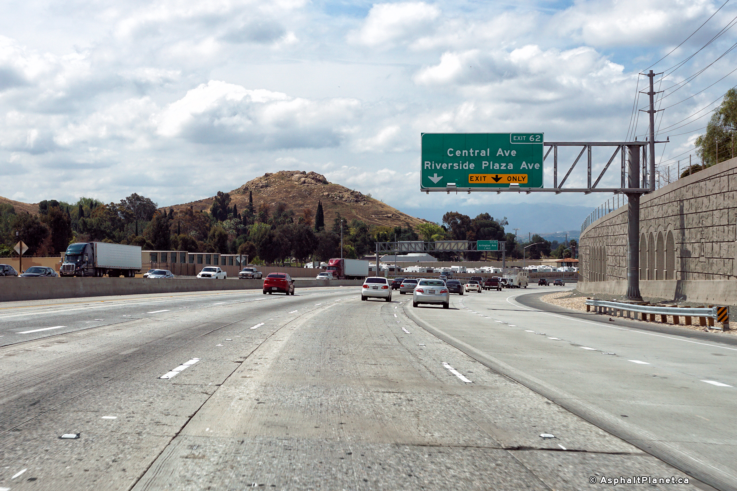
|
Riverside County |
Westbound interchange sequence signage in advance of the Central Avenue interchange. |
 |
||
|
Date: 4/11/2016 |
High-res: (1440x960) (2400x1600) |
|||
|
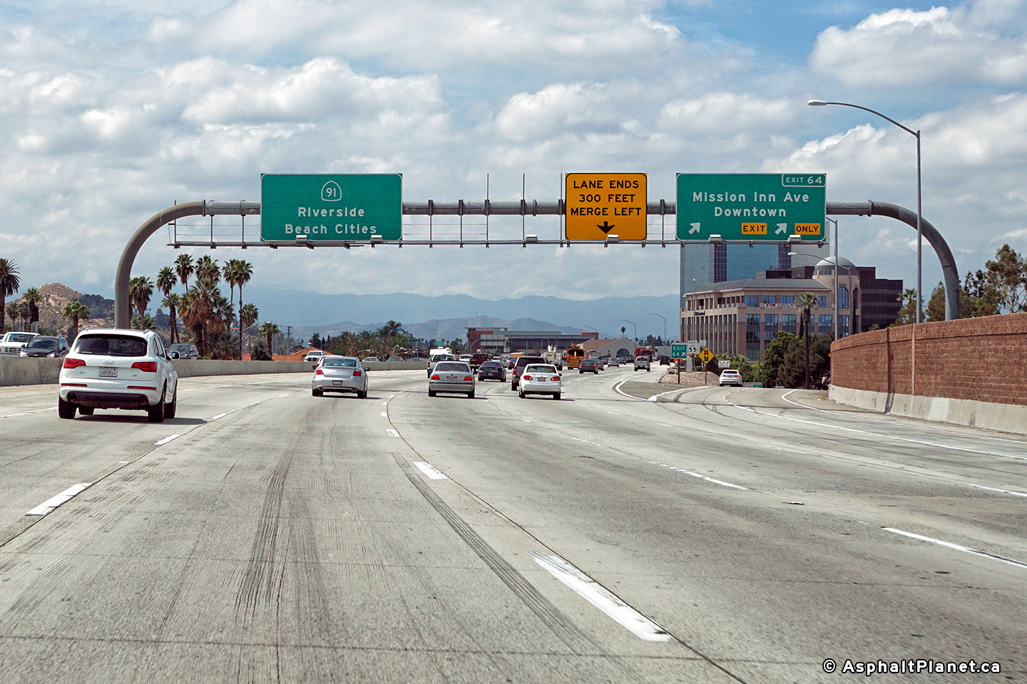
Riverside County |
Westbound signage at the off-ramp to Mission Inn Avenue to Downtown Riverside. |
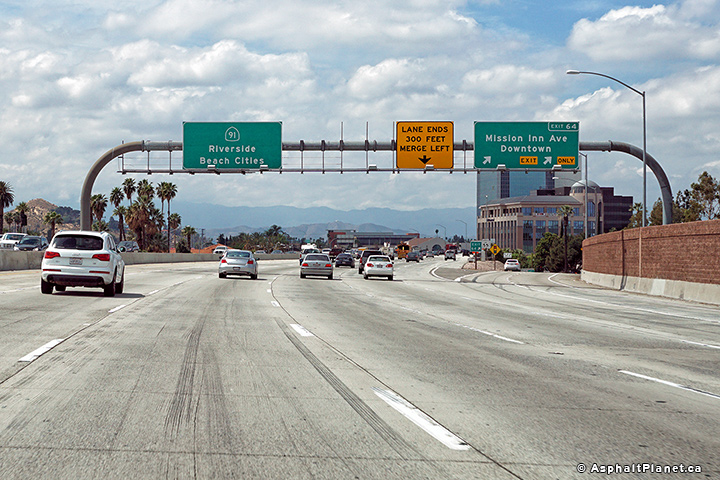 |
||
|
Date: 4/11/2016 |
High-res: (1440x960) (2400x1600) |
|||
|
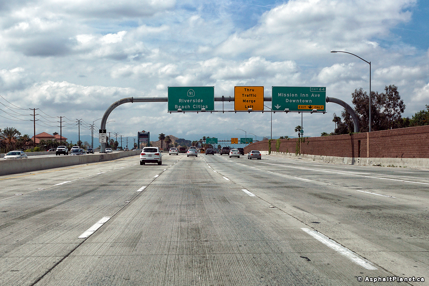
Riverside County |
The off-ramp to Mission Inn Avenue departs quickly after the on-ramp from the 60 Freeway joins the 91. |
 |
||
|
Date: 4/11/2016 |
High-res: (1440x960) (2400x1600) |
|||
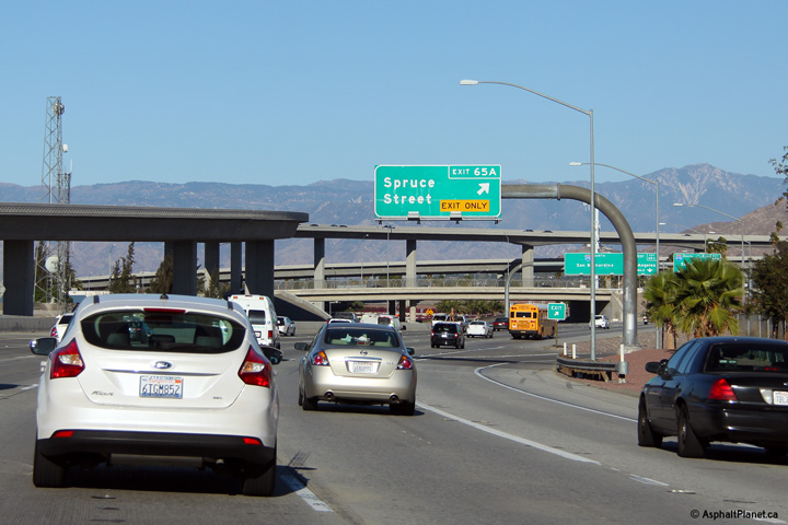
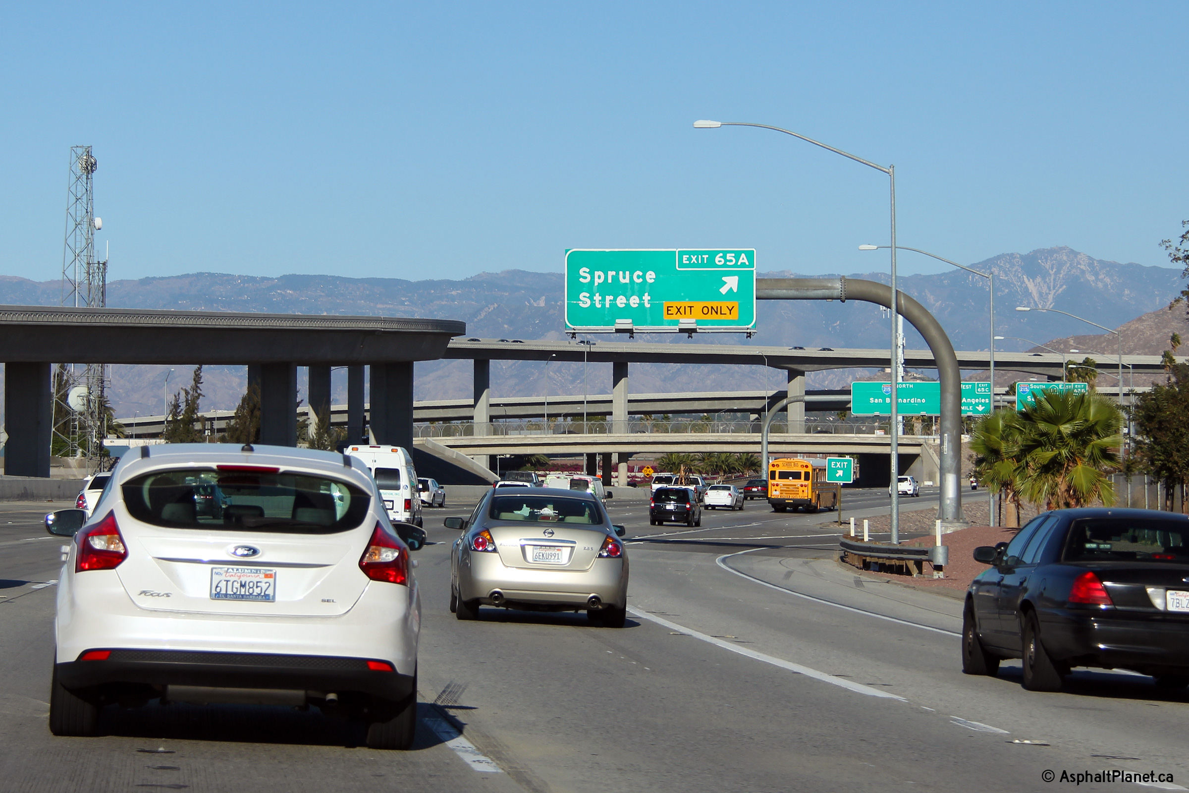
|
Riverside County |
Easterly, view approaching the Spruce Street interchange. This sign at the Spruce Street interchange also serves as the advanced signage for the large Route 60 and Interstate 215 interchange ahead. |
|
||
|
Date: 11/05/2013 |
High-res: (1440x960) (2400x1600) |
|||
|
Riverside County |
This view looks easterly at the eastbound off-ramp to Spruce Street. |
 |
||
|
Date: 11/05/2013 |
High-res: (1440x960) (2400x1600) |
|||
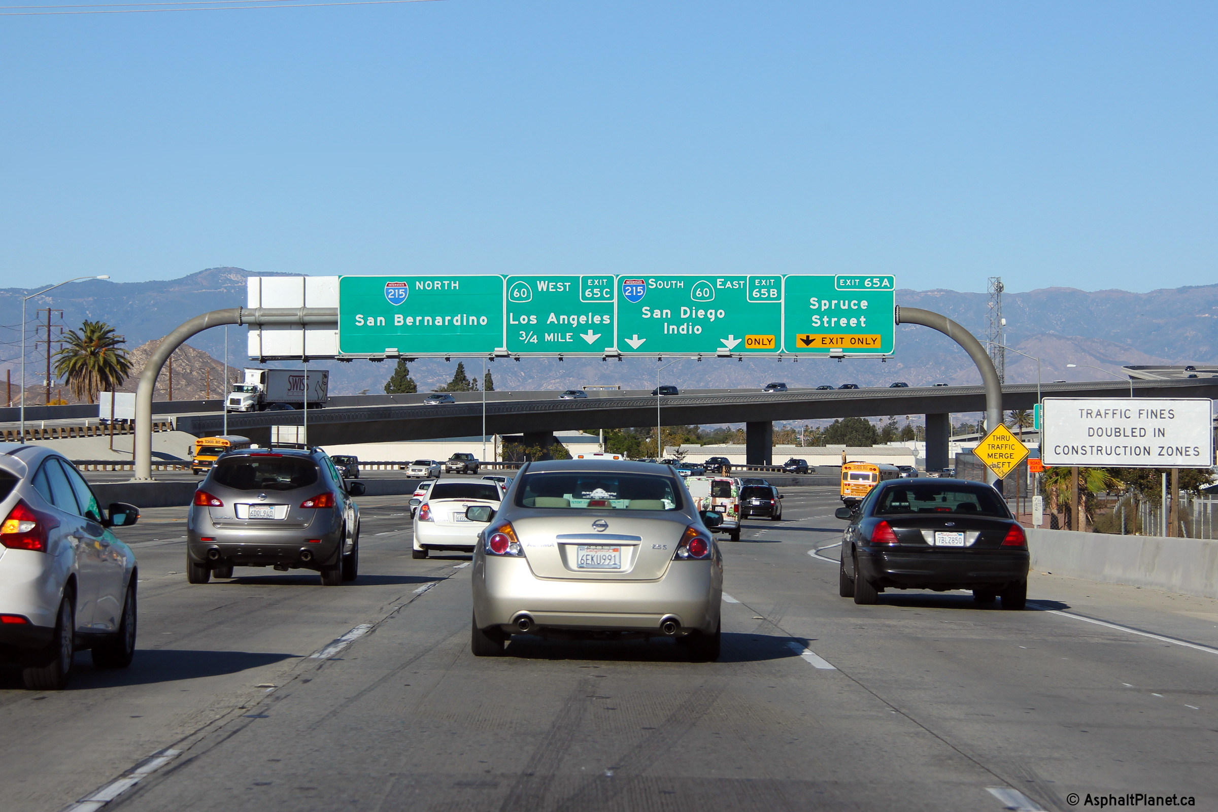
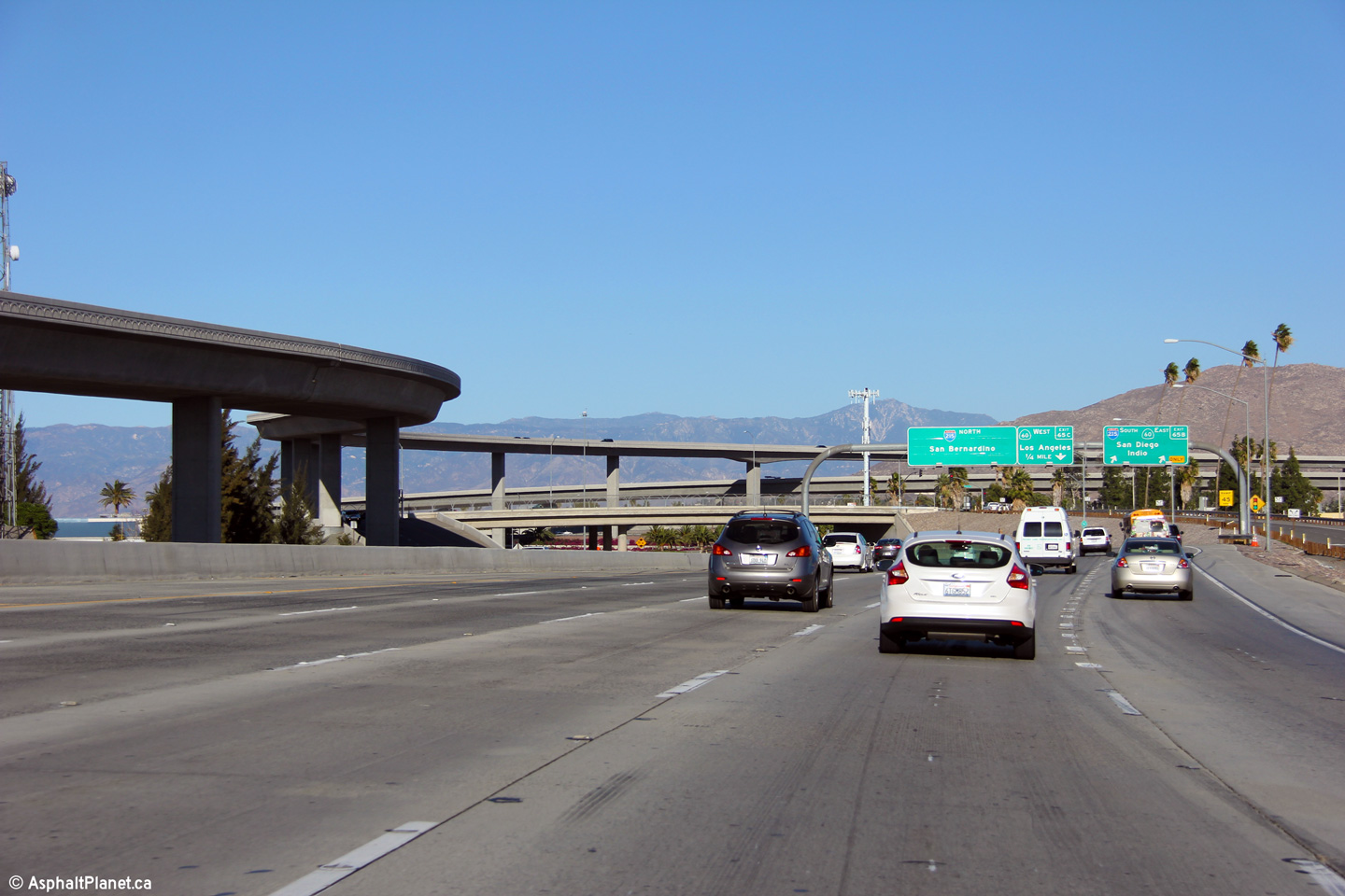
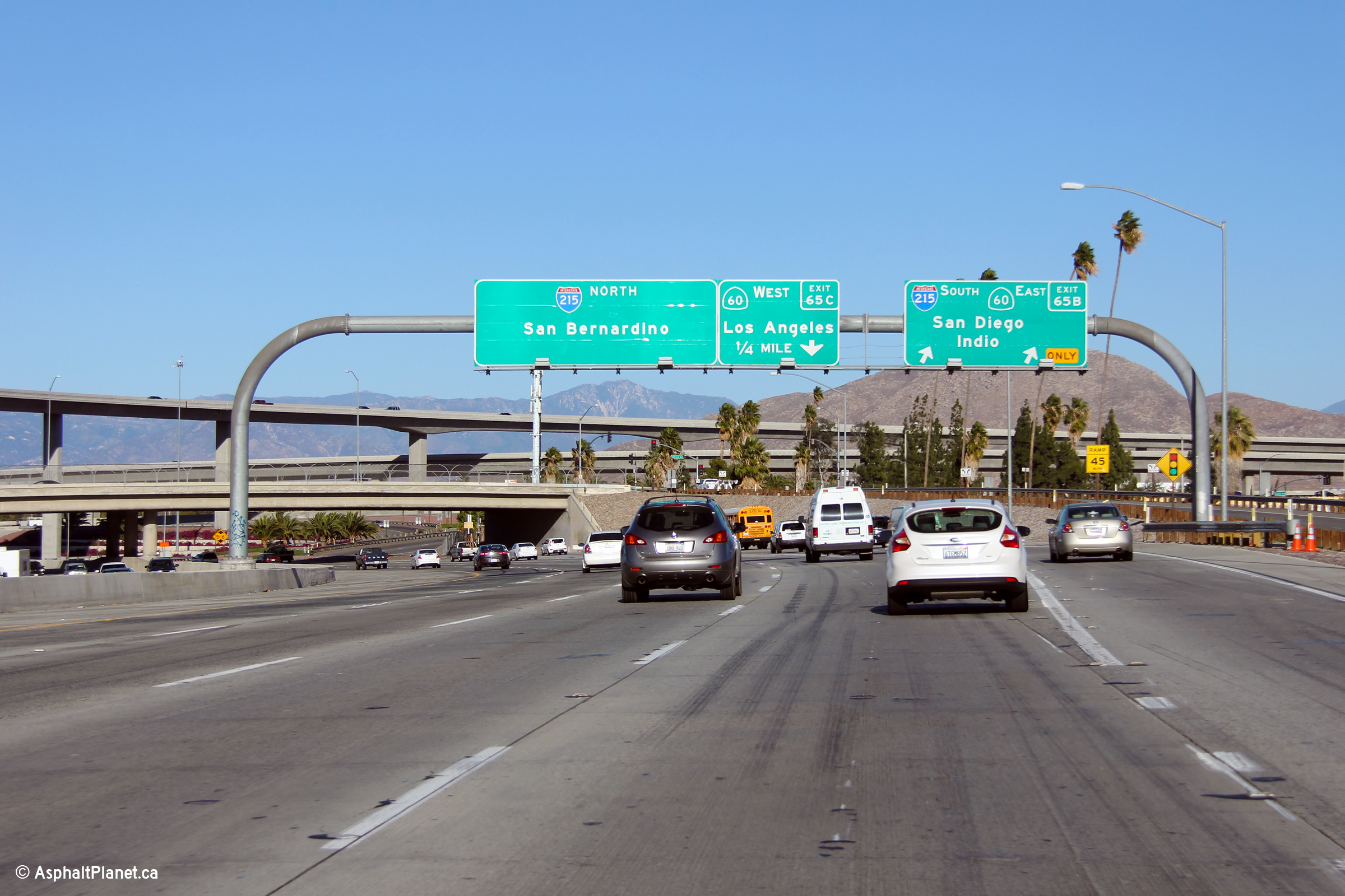
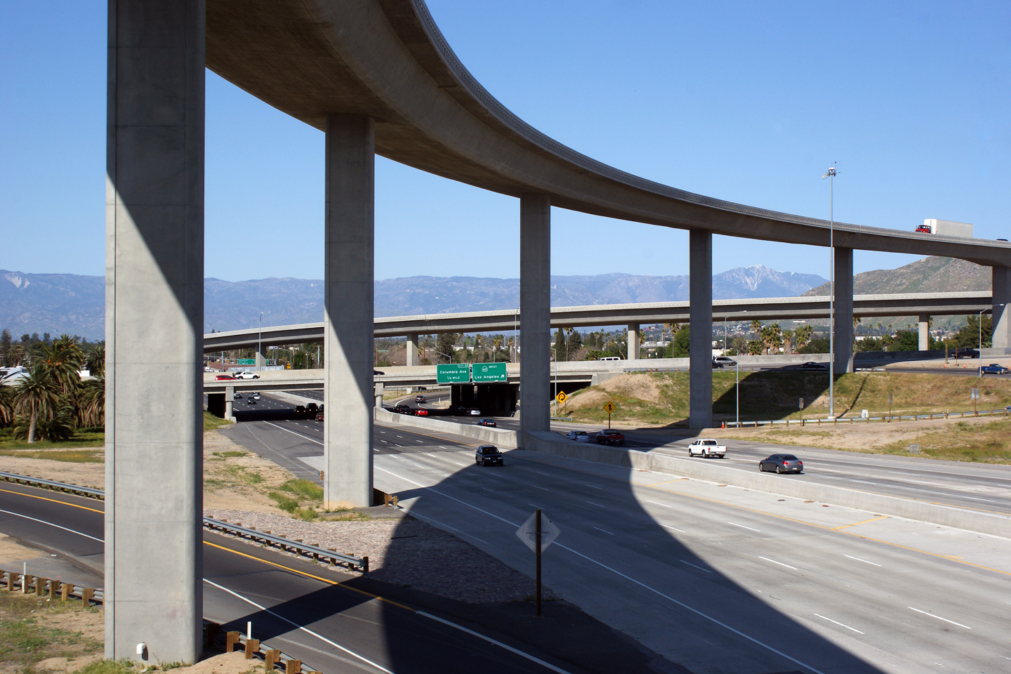
|
Riverside County |
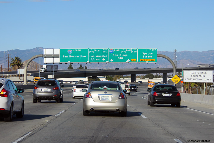
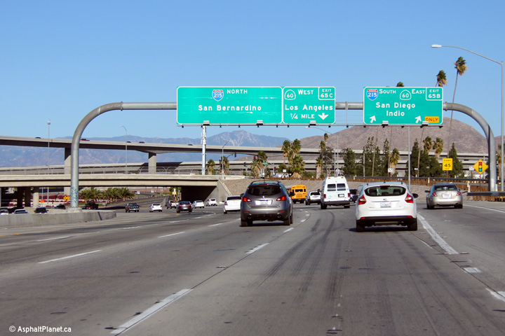
Two views approaching the large SR-60 and I-215 interchange just north of Downtown Riverside. |
 |
||
|
High-res: (1440x960) (2400x1600) |
||||
|
|
||||
|
Date: 11/05/2013 |
High-res: (1440x960) (2400x1600) |
|||
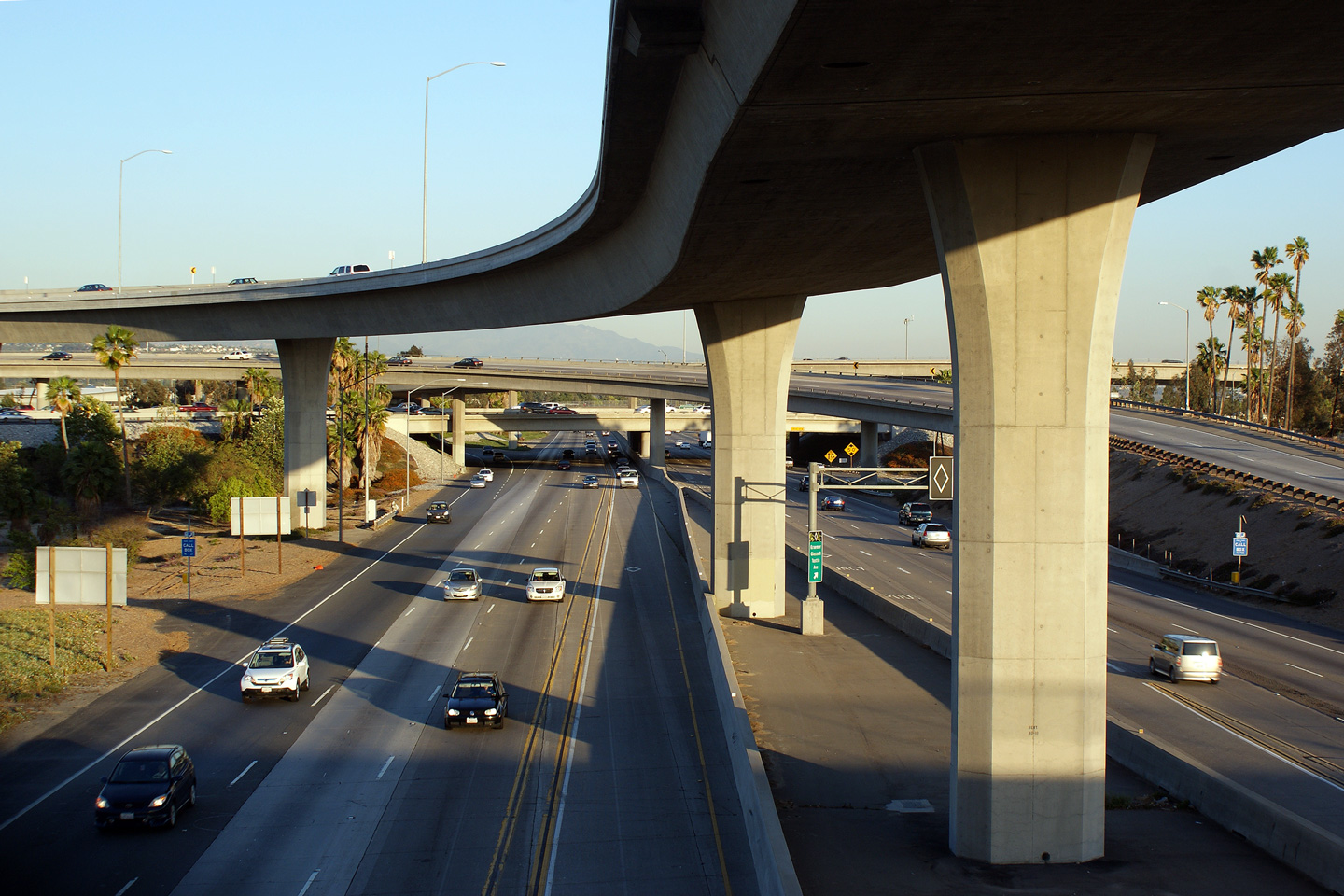
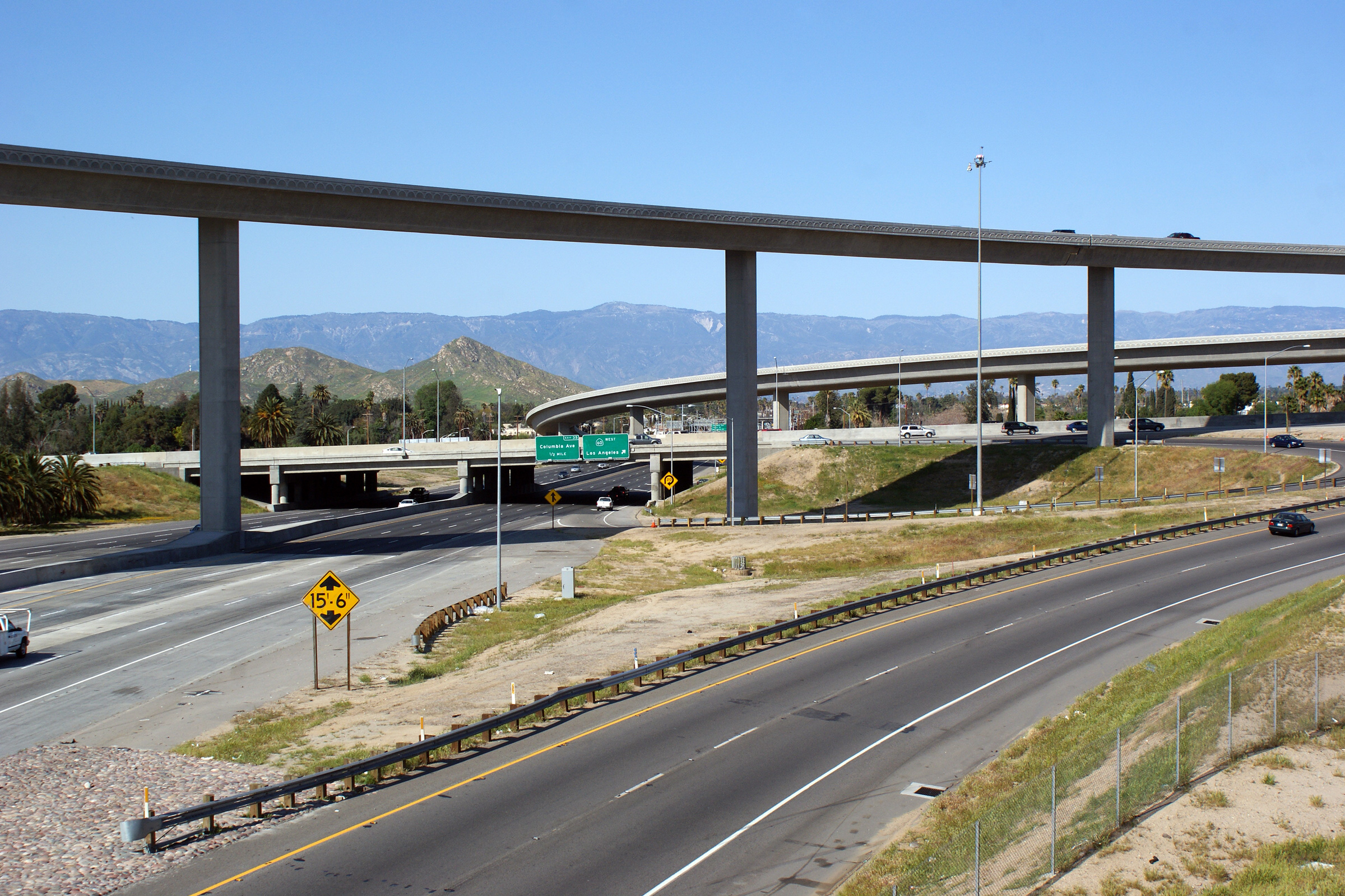
|
Riverside County |
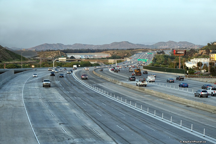
Two views looking northerly from the Spruce Street overpass towards the massive flyover that links Highway 60 Westbound to Highway 91 Southbound. This absolutely massive structure was constructed in 2007. |
 |
||
|
High-res: (1440x960) (2400x1600) |
||||
|
|
||||
|
Date: 3/28/2010 |
High-res: (1440x960) (2400x1600) |
|||
<- CA-90
CA Highways
CA-92 ->
AsphaltPlanet.ca
© 2010-18 AsphaltPlanet.ca.
Scott@asphaltplanet.ca
Page Created: April 22, 2010.
Last Updated: March 15, 2018


