AsphaltPlanet.ca > California > SR-71
Pictures on this
page are arranged in order from south to north. CA-71 North photos are
left-aligned in the last column, while CA-71 South photos are right-aligned.
Center-line pictures are centered within the last column.
|
Location |
Description |
Photo |
||
|
North- |
South- |
|||
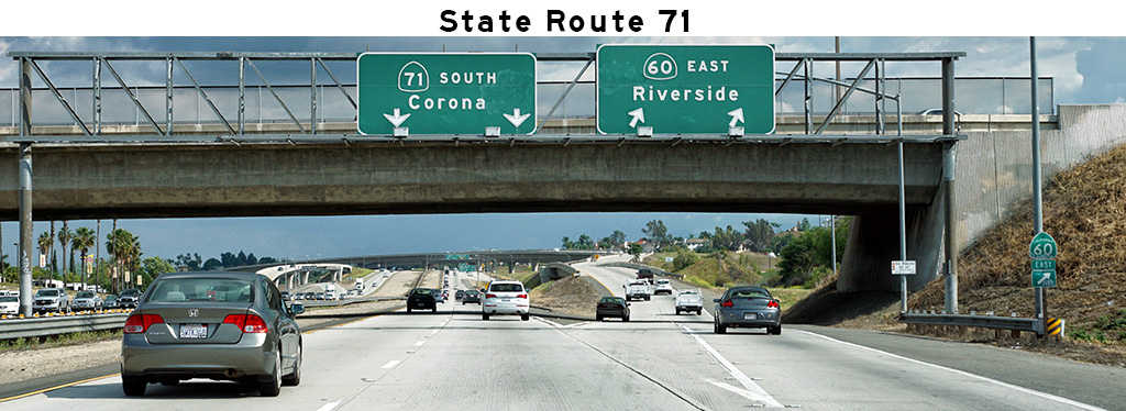
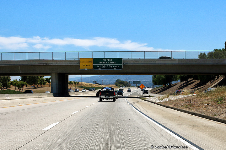
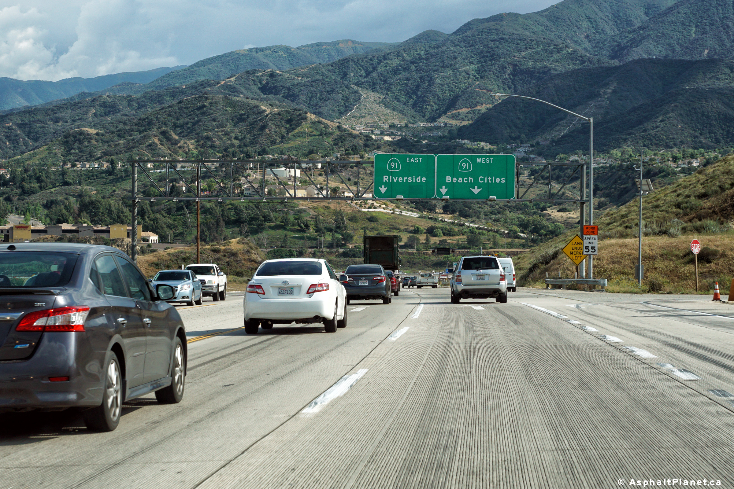
| SR-71 ends at SR-91, the Riverside Freeway. SR-91 extends east and west of SR-71. Click here for SR-91 Images. | ||||
|
Riverside County |
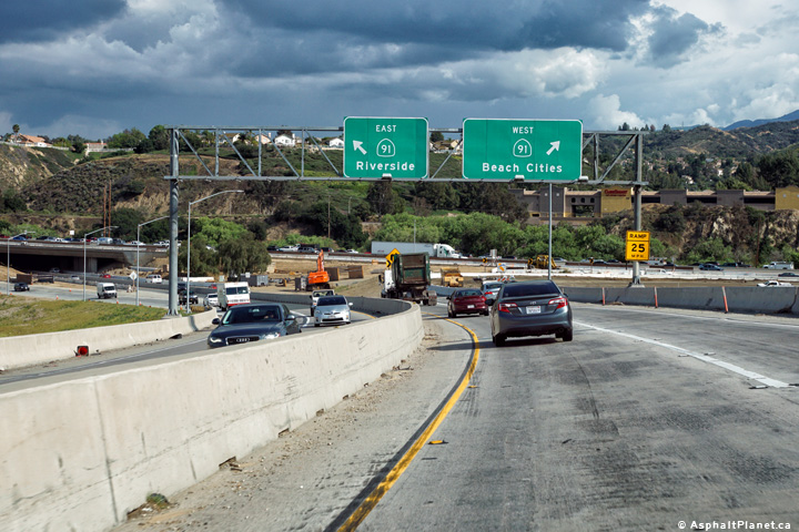
Southbound signage at the off-ramp to SR-91. The left lane carries traffic towards the eastbound side of SR-91, while the right lane carries traffic the westbound side of SR-91. |
 |
||
|
Date: 4/11/2016 |
High-res: (1440x960) (2400x1600) | |||
|
\Riverside County |
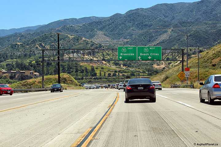
Southbound advanced signage approaching the SR-91 interchange. Click here for an additional photo taken during April, 2006. |
 |
||
|
Date: 4/16/2017 |
High-res: (1440x960) (2400x1600) | |||
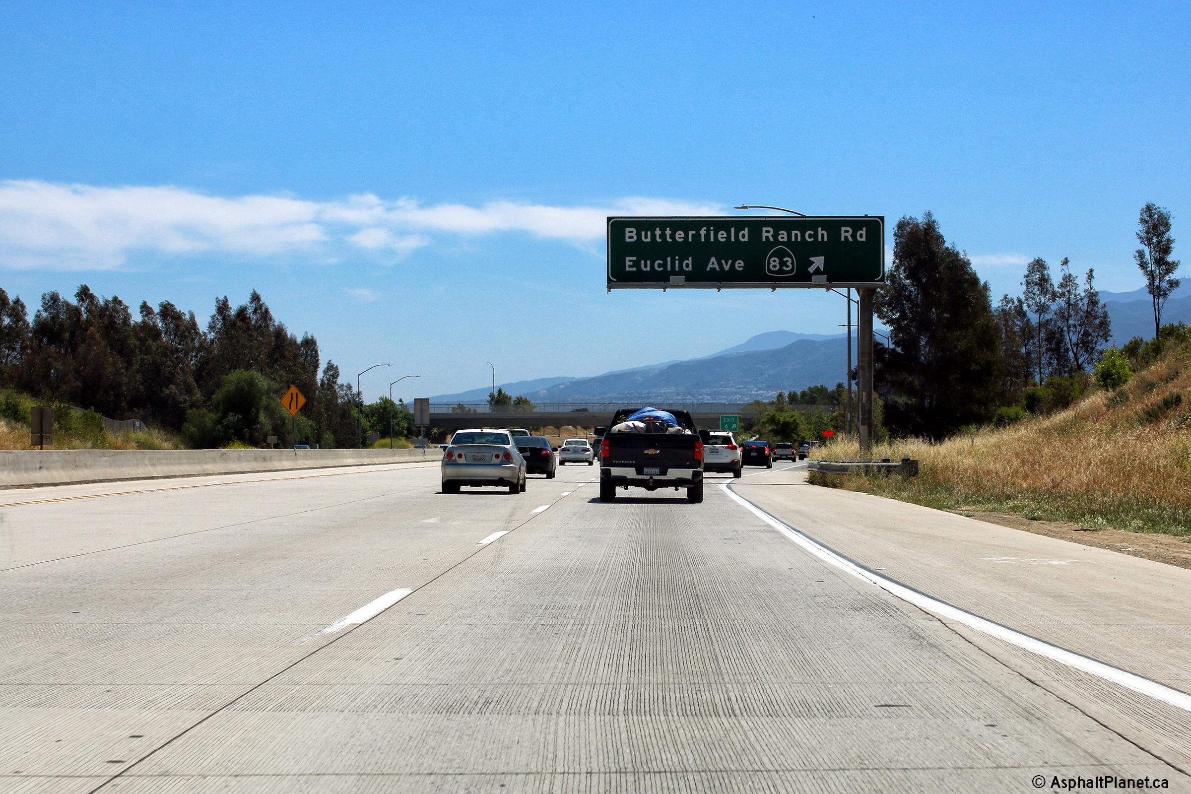
|
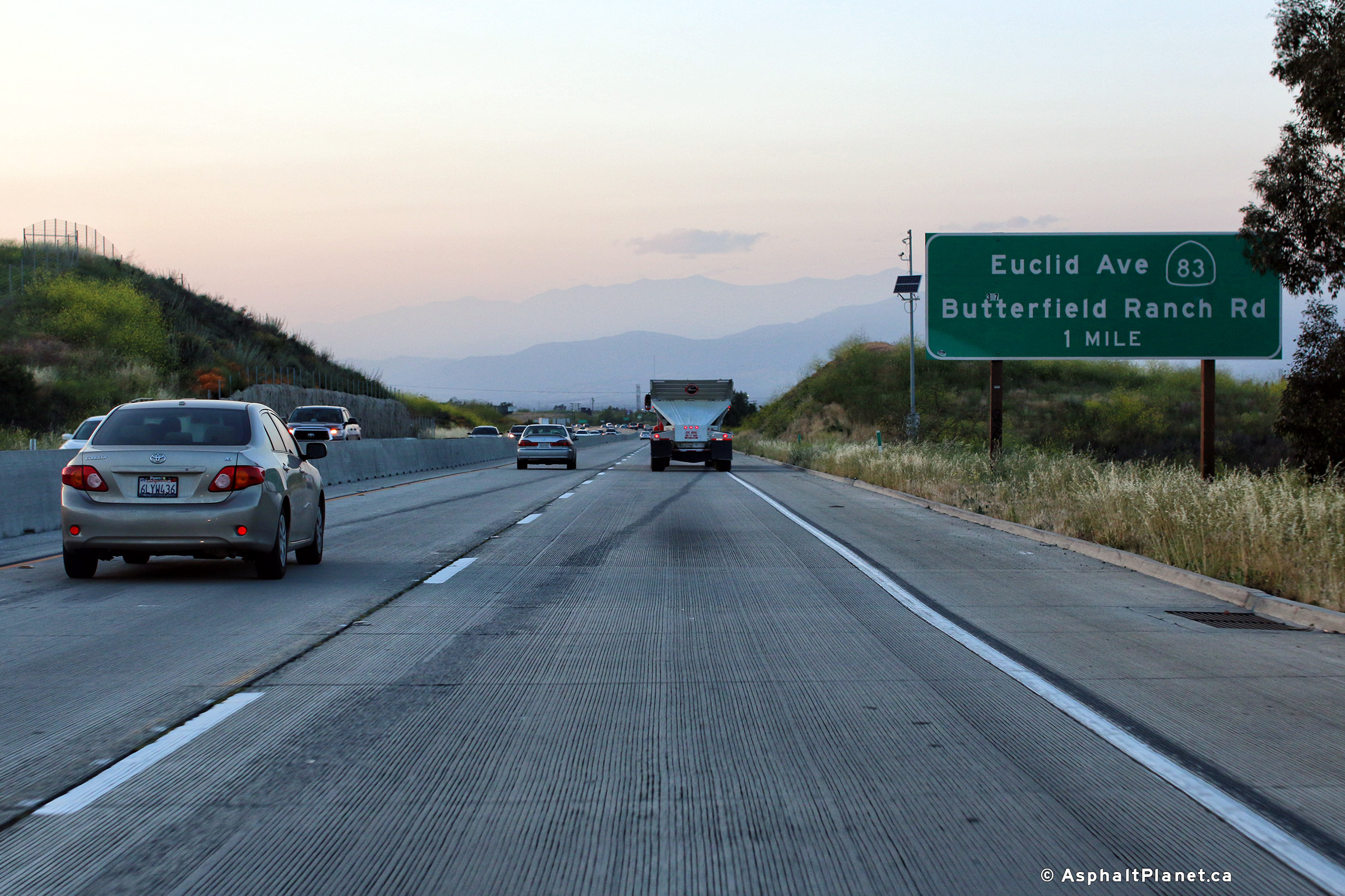
San Bernardino County |
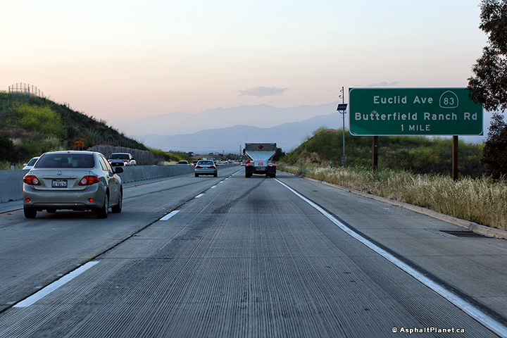
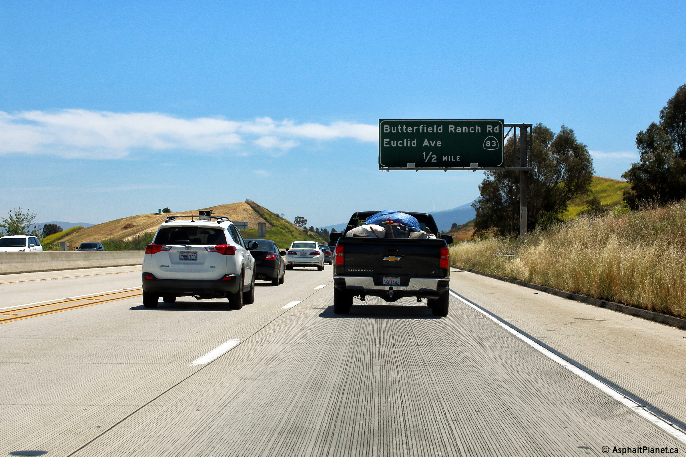
Advanced signage for the State Route 83 interchange. |
 |
||
|
Date: 4/11/2017 |
High-res: (1440x960) (2400x1600) |
|||
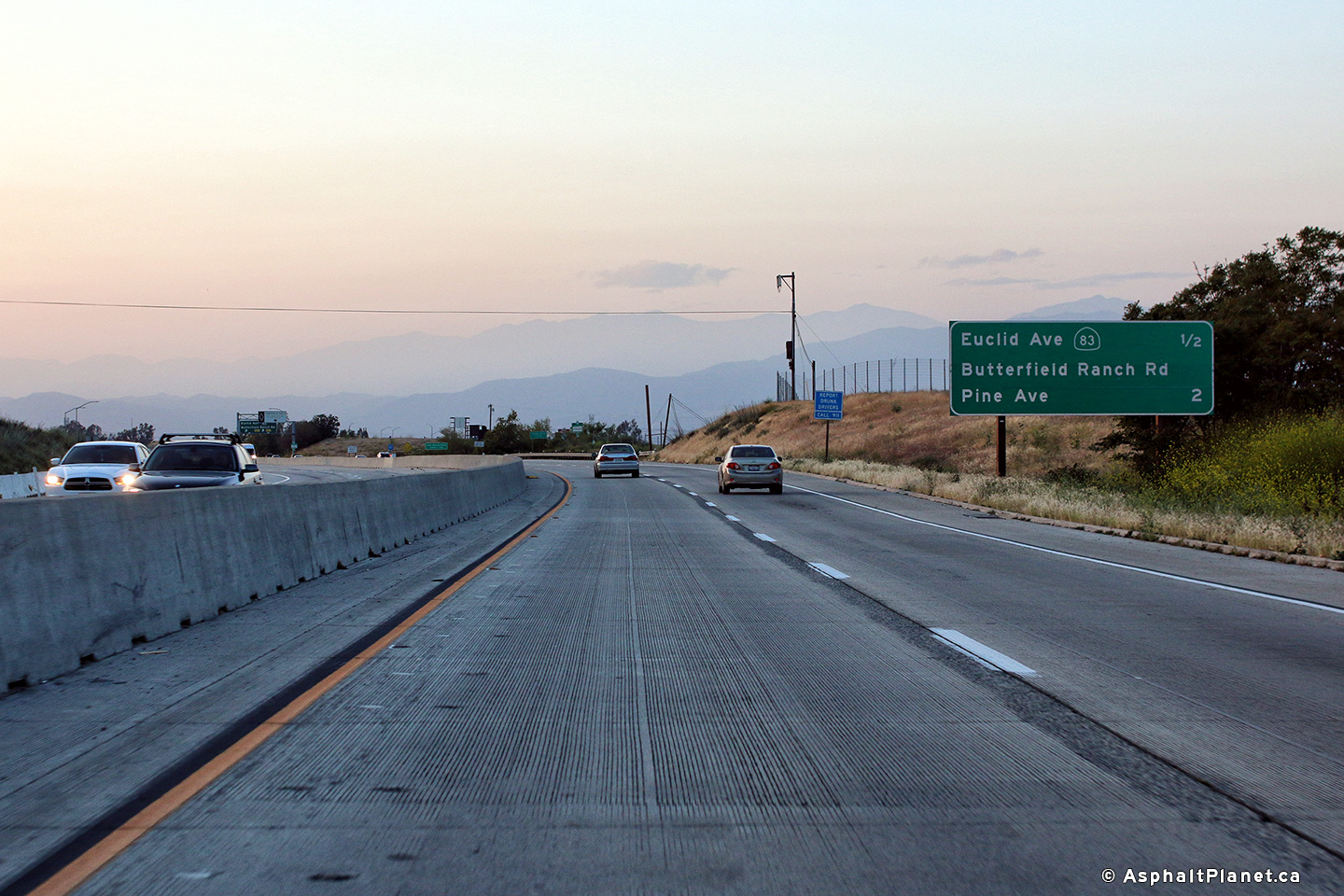
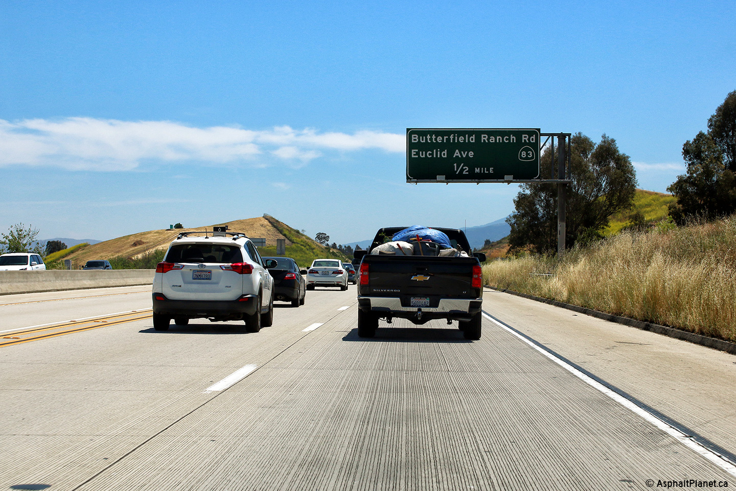
|
San Bernardino County |
Northbound interchange sequence signage approaching the State Route 83 interchange. |
 |
||
|
Date: 4/11/2017 |
High-res: (1440x960) (2400x1600) |
|||
|
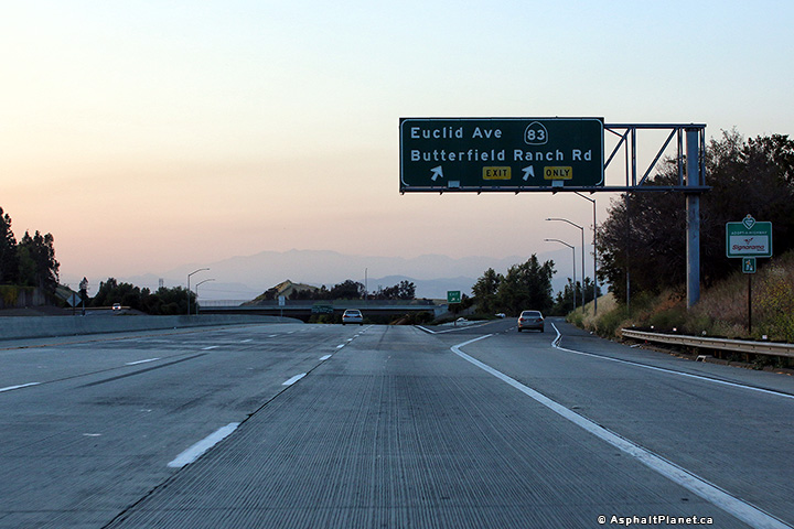
San Bernardino County |
View looking northerly at the northbound off-ramp to State Route 83. |
 |
||
|
Date: 4/11/2017 |
High-res: (1440x960) (2400x1600) |
|||
|
San Bernardino County |
View looking northerly at the northbound off-ramp to State Route 83. |
 |
||
|
Date: 4/13/2016 |
High-res: (1440x960) (2400x1600) |
|||
|
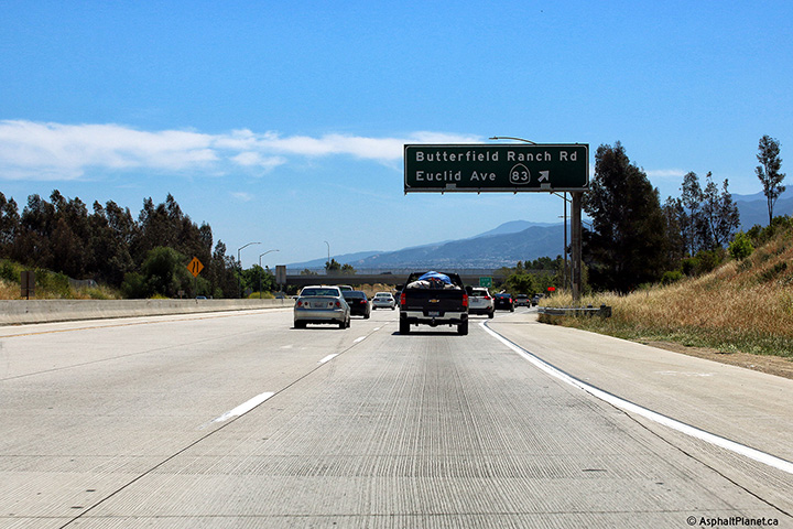
San Bernardino County |
Signage at the southbound off-ramp to State Route 83. |
 |
||
|
Date: 4/16/2017 |
High-res: (1440x960) (2400x1600) | |||
|
San Bernardino County |
Signage at the southbound off-ramp to State Route 83. |
 |
||
|
Date: 4/16/2017 |
High-res: (1440x960) (2400x1600) | |||
|
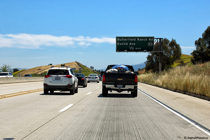
San Bernardino County |
Southbound advanced signage for the off-ramp to State Route 83. |
 |
||
|
Date: 4/16/2017 |
High-res: (1440x960) (2400x1600) | |||
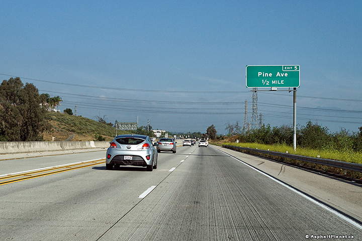
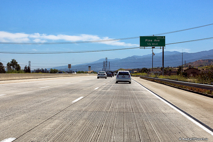
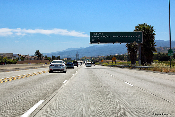
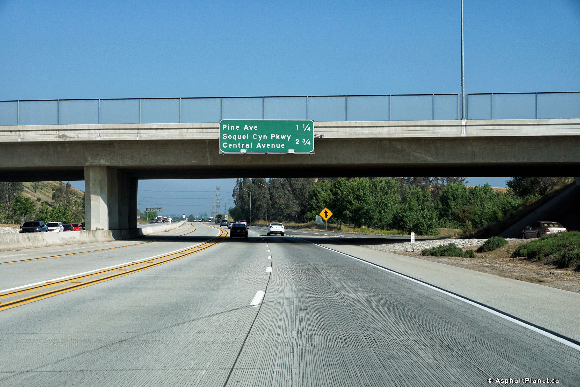
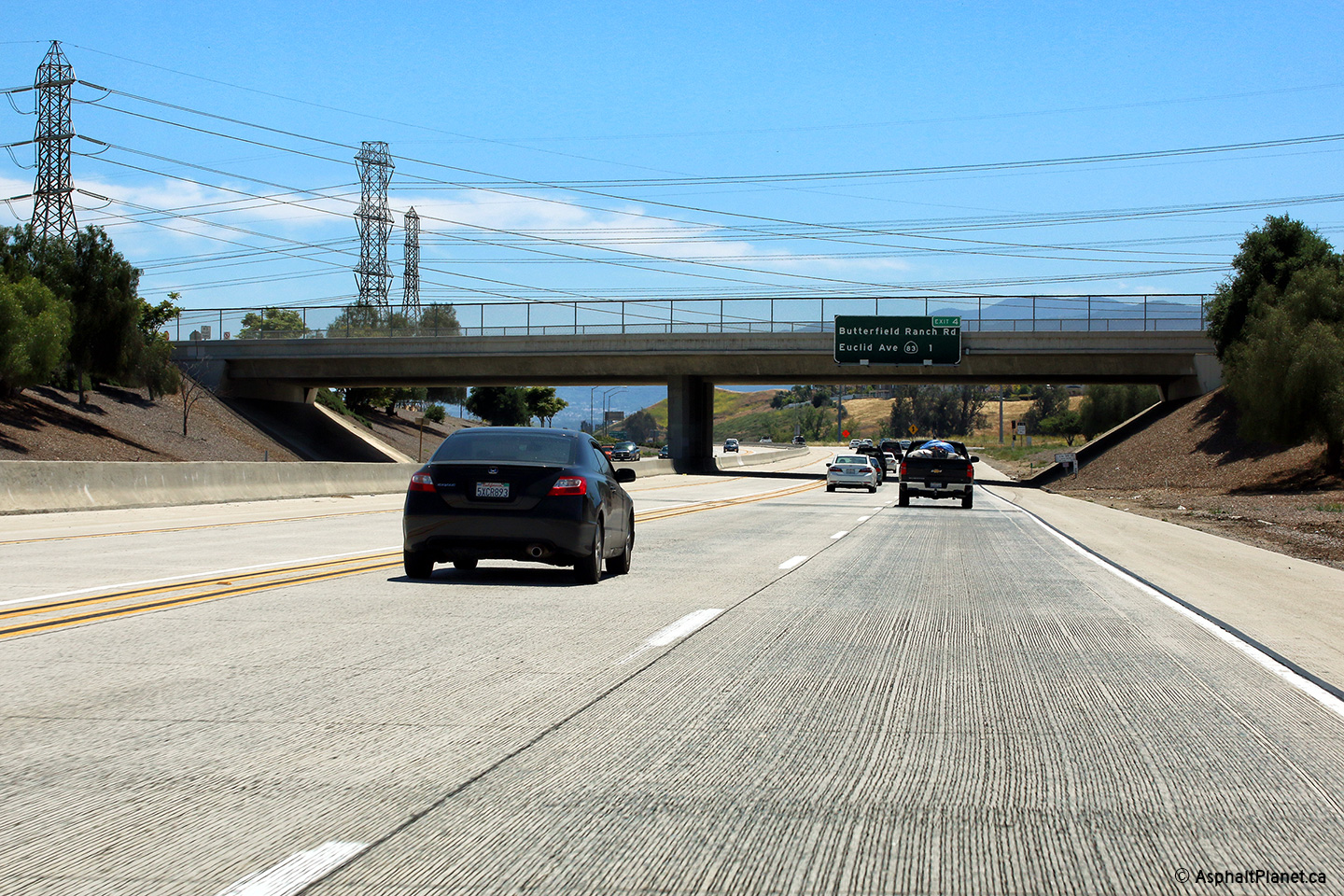
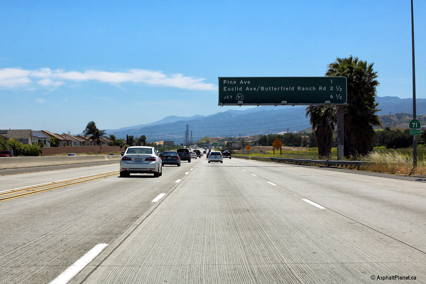
|
San Bernardino County |
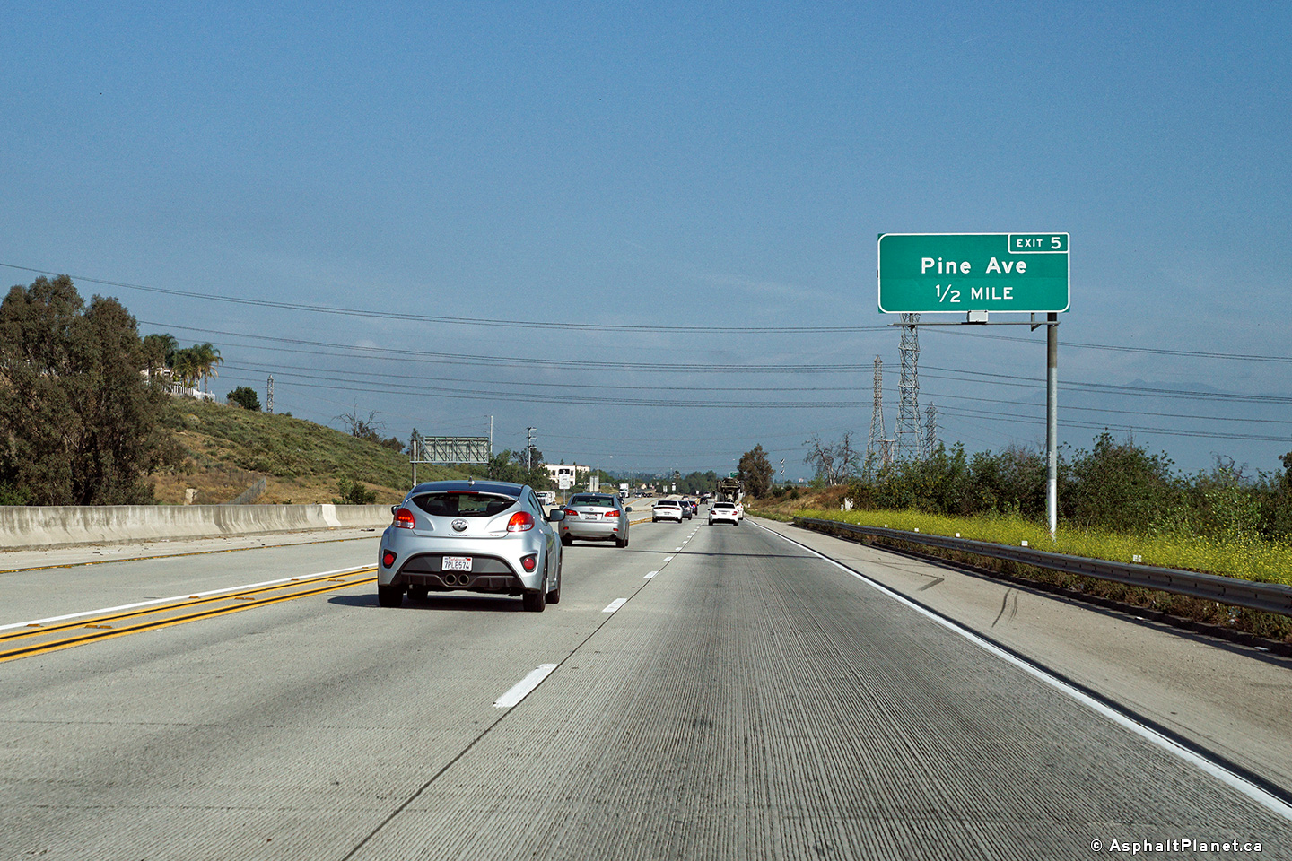
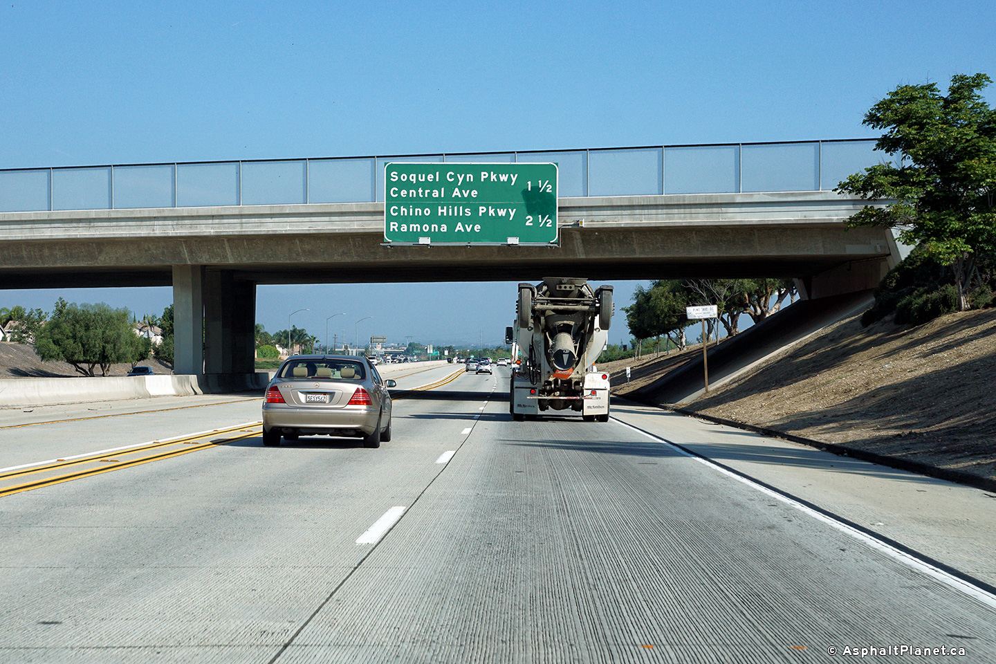
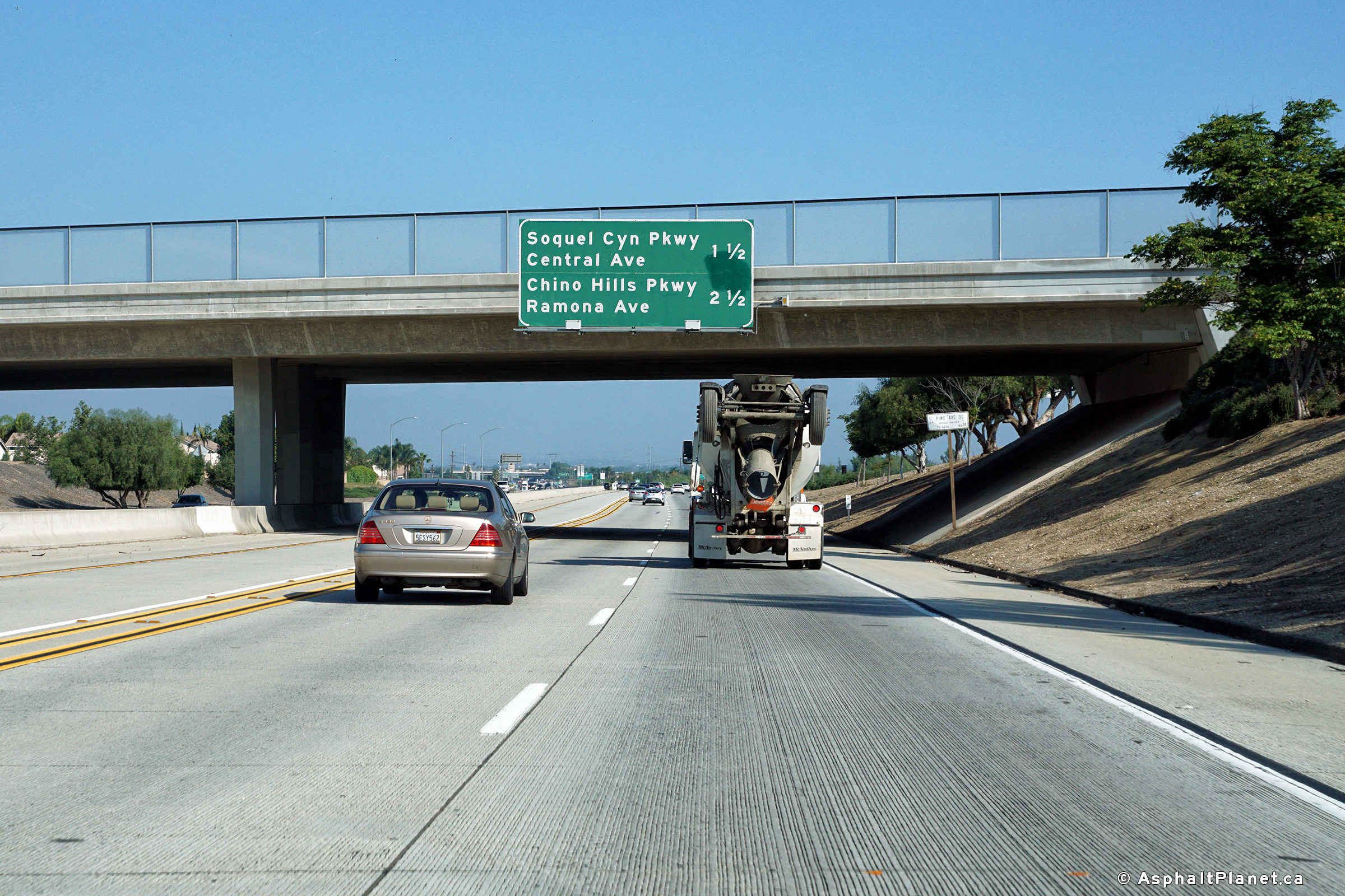
Northbound advanced signage for the Pine Avenue interchange. |
 |
||
|
Date: 4/13/2016 |
High-res: (1440x960) (2400x1600) |
|||
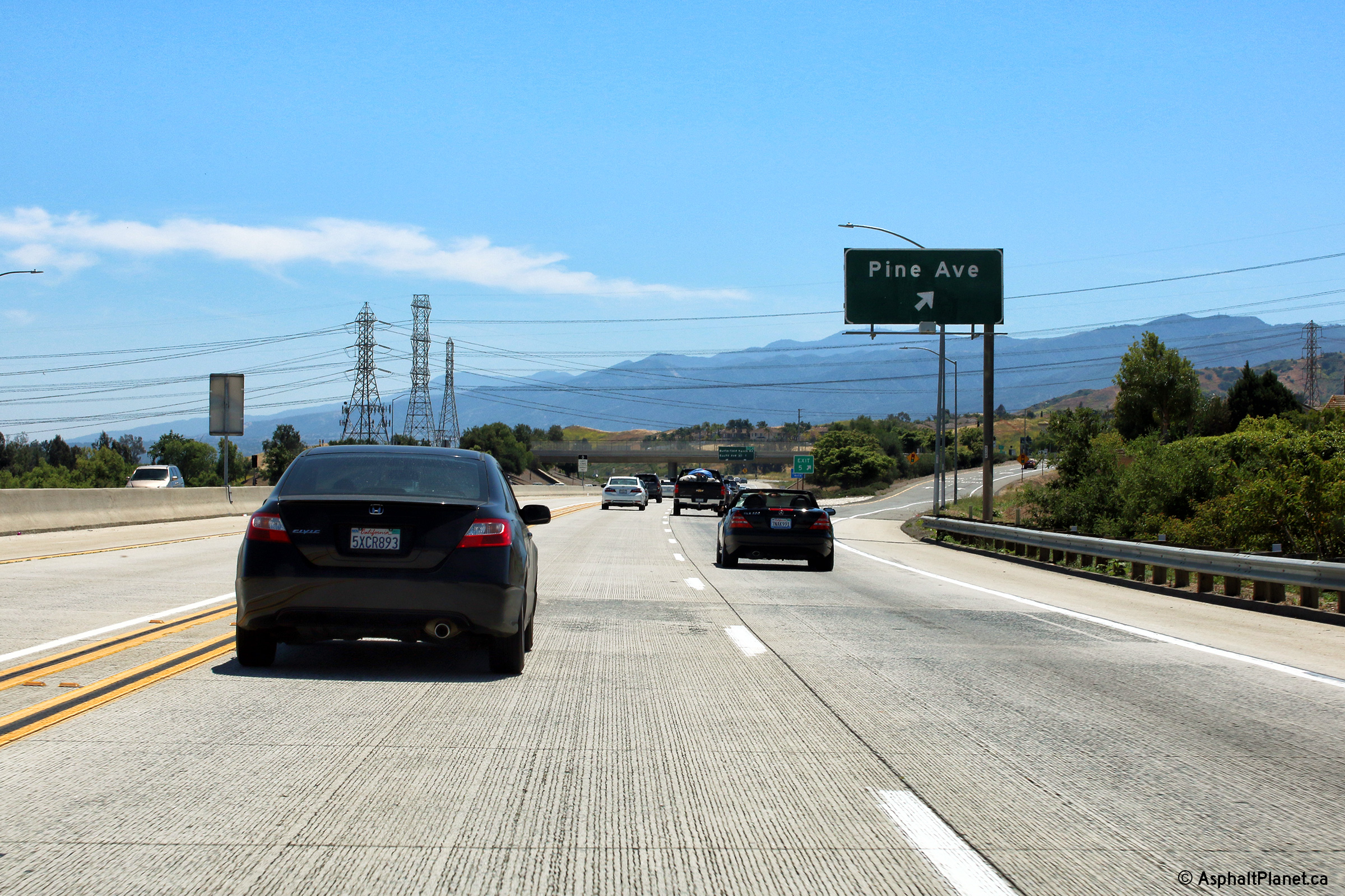
|
San Bernardino County |
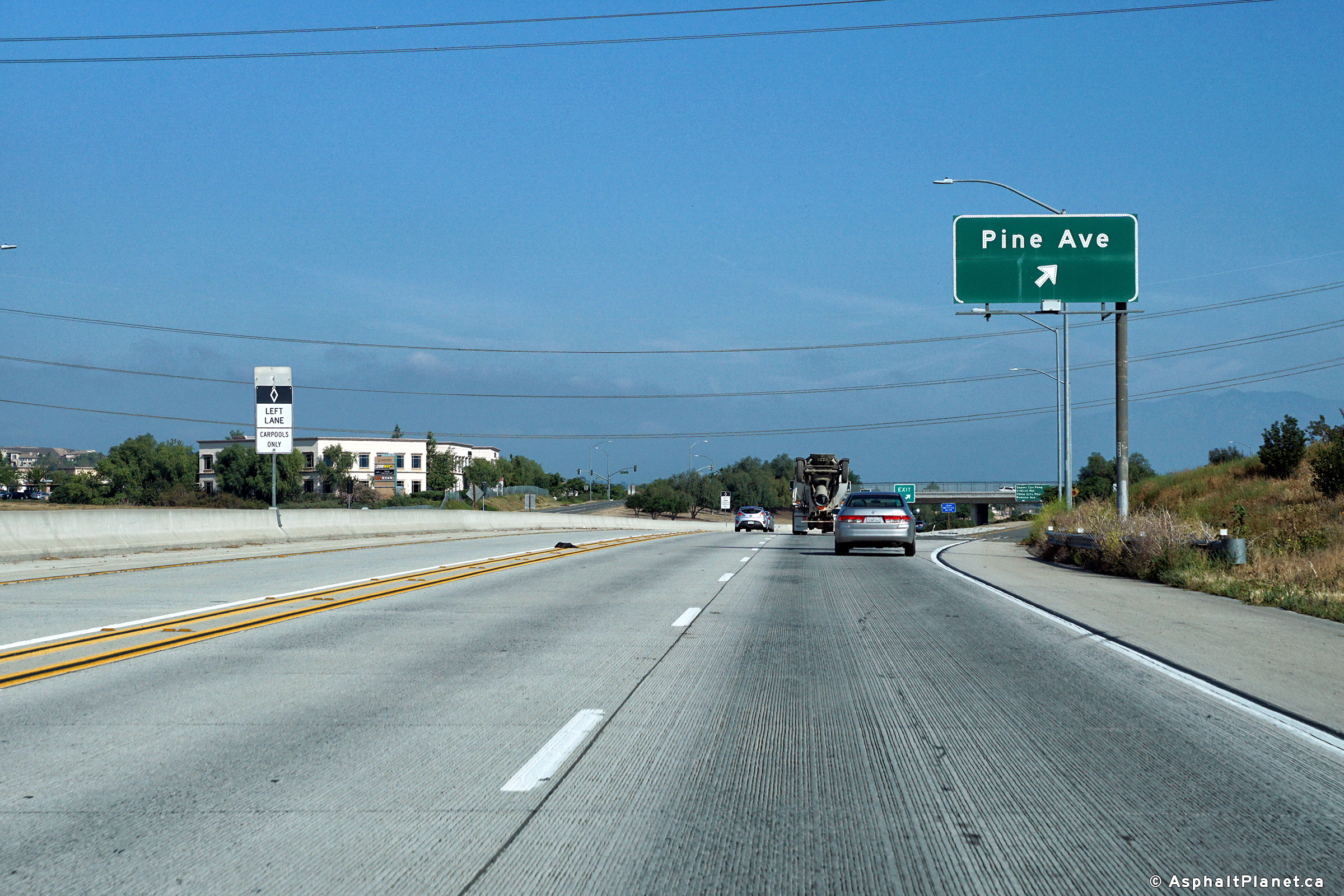
Northerly view at the northbound off-ramp to Pine Avenue. |
 |
||
|
Date: 4/13/2016 |
High-res: (1440x960) (2400x1600) |
|||
|
San Bernardino County |
Northbound view looking northerly through the Pine Avenue interchange. |
 |
||
|
Date: 4/13/2016 |
High-res: (1440x960) (2400x1600) |
|||
|
San Bernardino County |
An interchange sequence sign has been affixed to the Pine Avenue overpass. |
 |
||
|
Date: 4/16/2017 |
High-res: (1440x960) (2400x1600) | |||
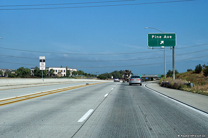
|
San Bernardino County |
View looking southerly at the off-ramp to Pine Avenue. |
 |
||
|
Date: 4/16/2017 |
High-res: (1440x960) (2400x1600) | |||
|
San Bernardino County |
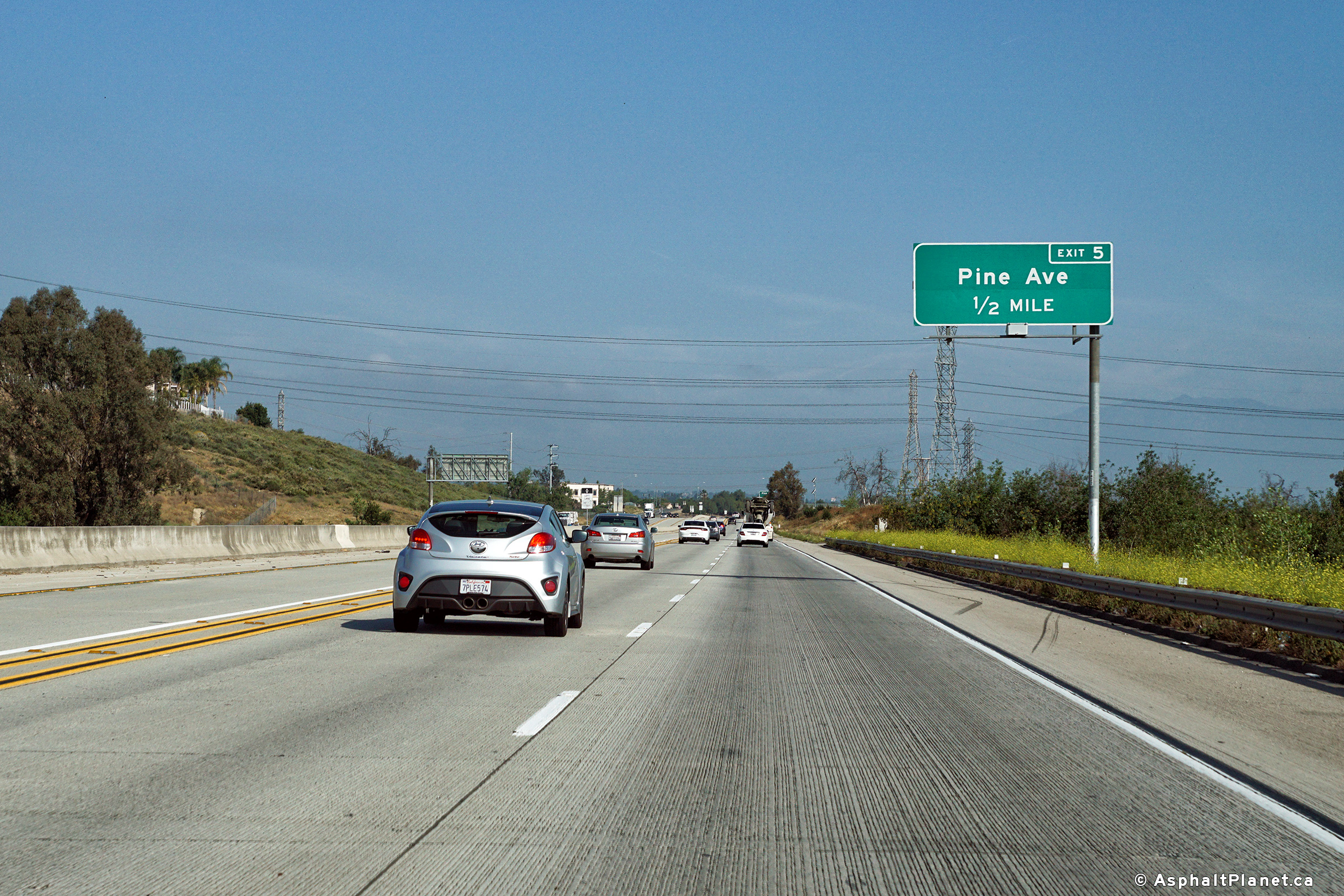
Southbound advanced signage for the Pine Avenue interchange. |
 |
||
|
Date: 4/16/2017 |
High-res: (1440x960) (2400x1600) | |||
|
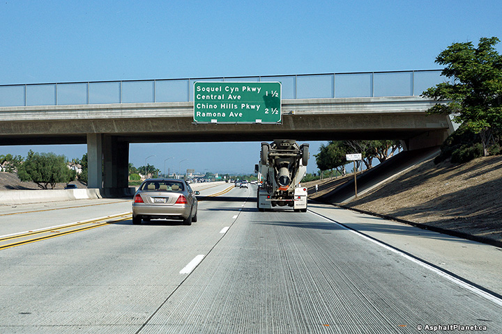
San Bernardino County |
Southbound interchange sequence signage approaching the Pine Avenue interchange. |
 |
||
|
Date: 4/16/2017 |
High-res: (1440x960) (2400x1600) | |||
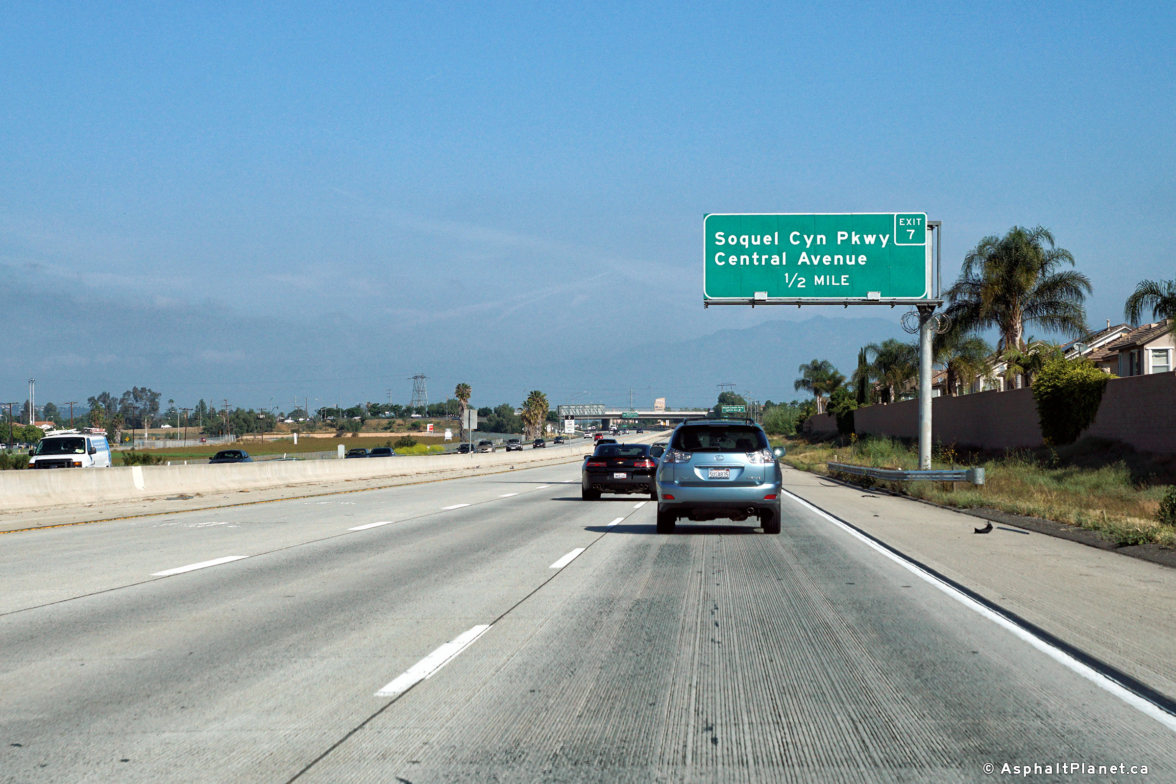
|
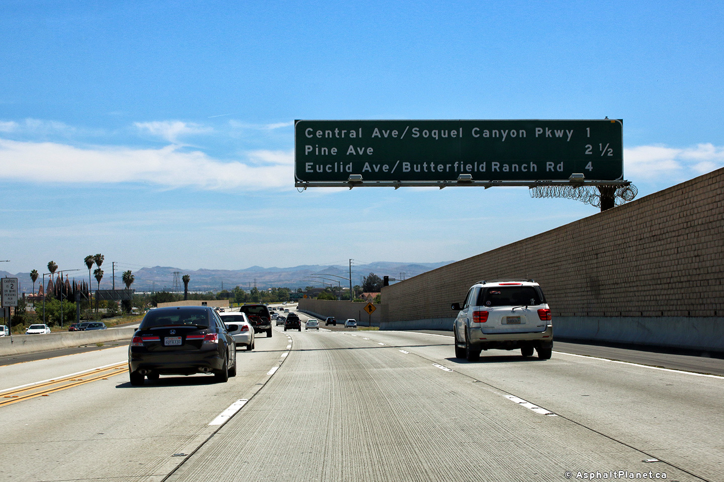
San Bernardino County |
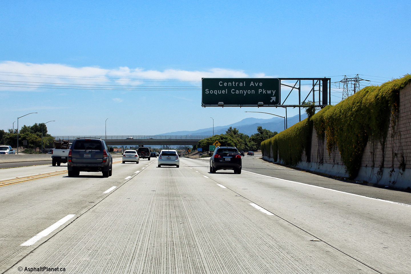
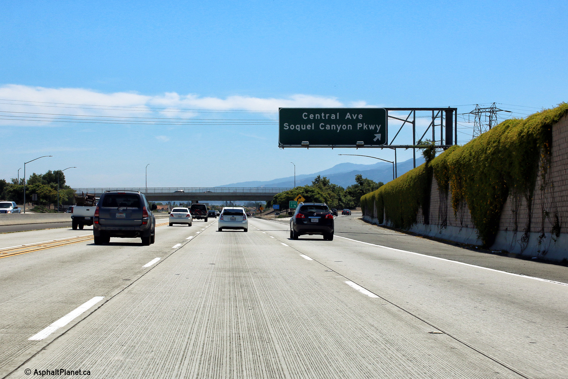
Northbound advanced signage for the Central Avenue interchange. |
 |
||
|
Date: 4/13/2016 |
High-res: (1440x960) (2400x1600) |
|||
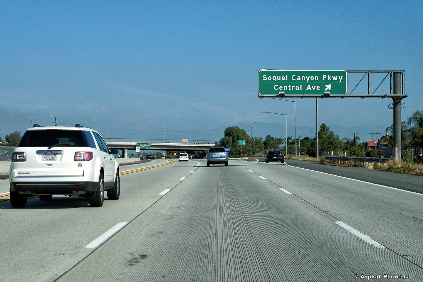
|
San Bernardino County |
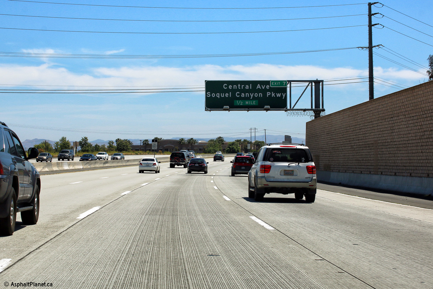
Northbound signage at the off-ramp to the Central Avenue interchange. |
 |
||
|
Date: 4/13/2016 |
High-res: (1440x960) (2400x1600) |
|||
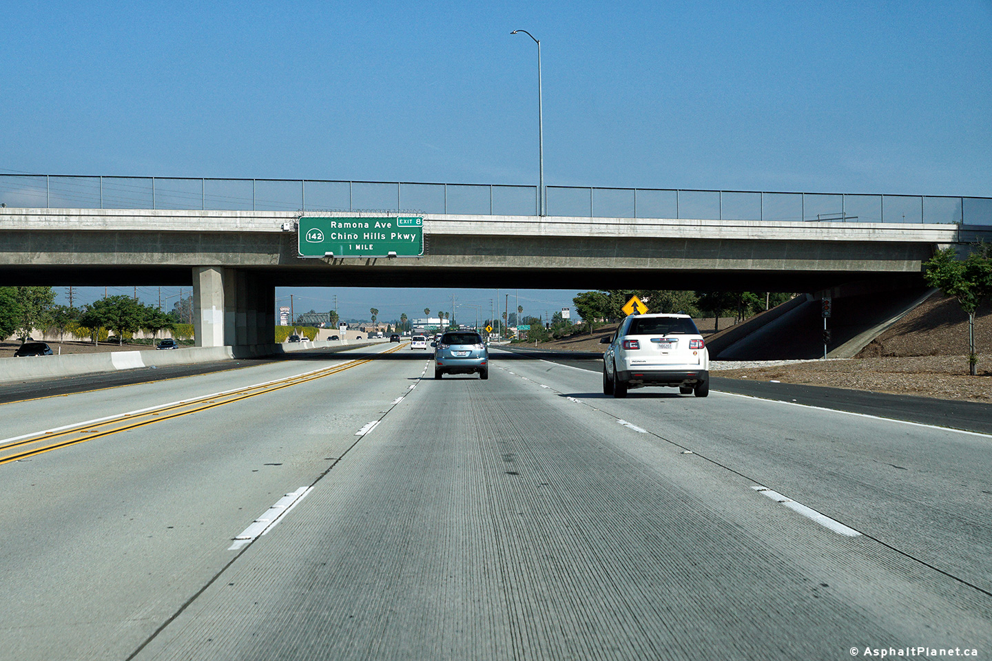
|
San Bernardino County |
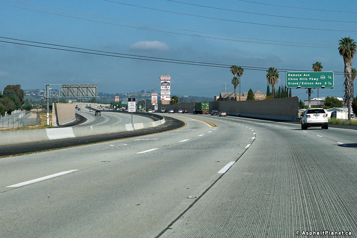
A pre-advanced sign for the Route 142 interchange has been affixed the Central Avenue overpass. |
 |
||
|
Date: 4/13/2016 |
High-res: (1440x960) (2400x1600) |
|||
|
San Bernardino County |
Signage at the southbound off-ramp to Central Avenue. |
 |
||
|
Date: 4/16/2017 |
High-res: (1440x960) (2400x1600) | |||
|
San Bernardino County |
Southbound signage in advance of the Central Avenue interchange. |
 |
||
|
Date: 4/16/2017 |
High-res: (1440x960) (2400x1600) | |||
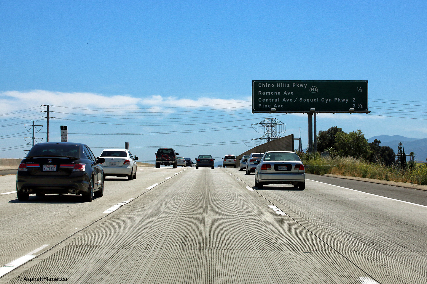
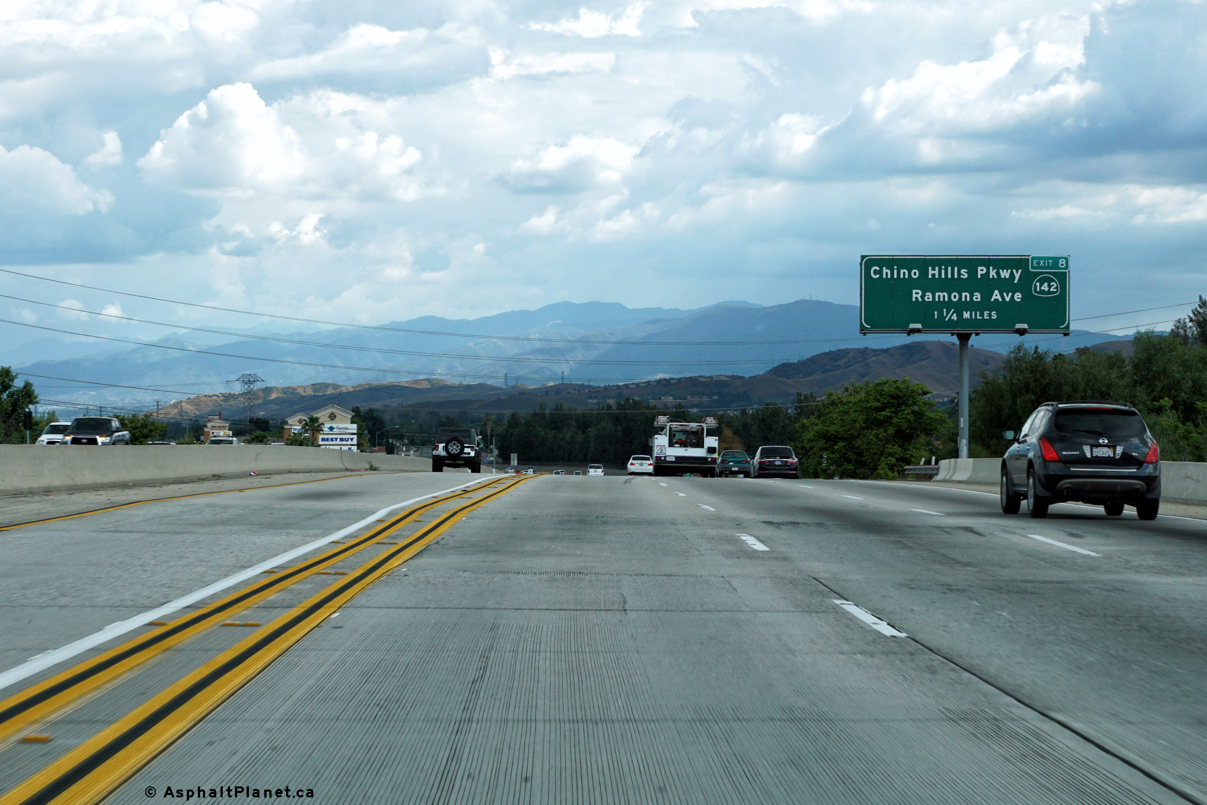
|
San Bernardino County |
Northbound interchange sequence signage in advance of the State Route 142 interchange. |
 |
||
|
Date: 4/13/2016 |
High-res: (1440x960) (2400x1600) |
|||
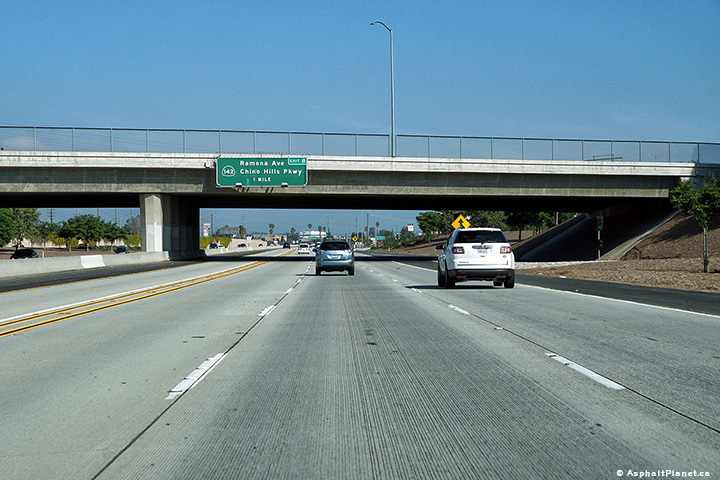
|
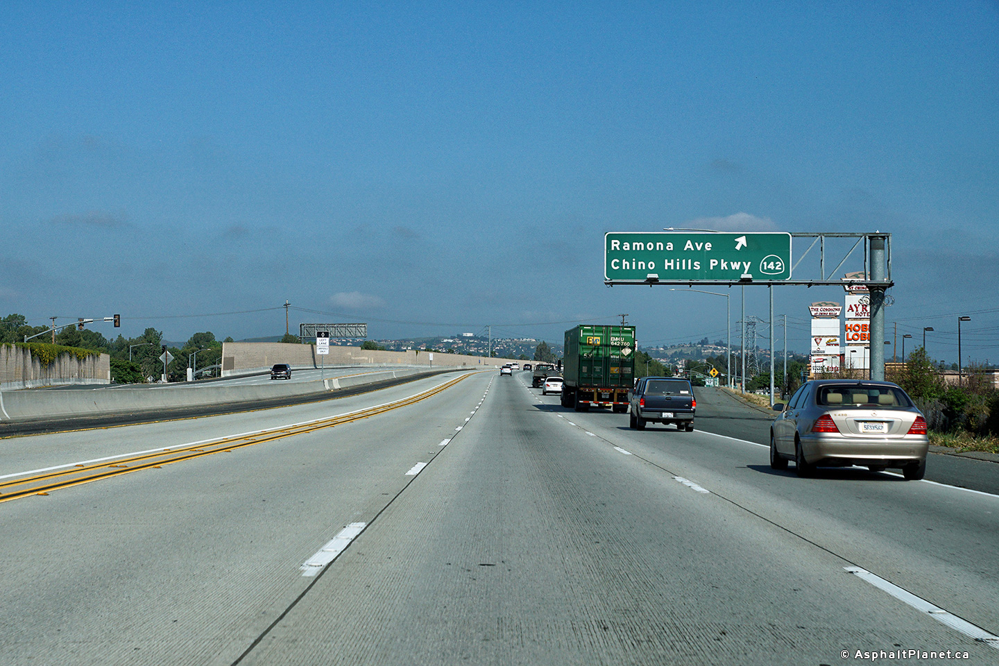
San Bernardino County |
Signage at the northbound off-ramp to State Route 142. |
 |
||
|
Date: 4/13/2016 |
High-res: (1440x960) (2400x1600) |
|||
|
San Bernardino County |
Signage at the northbound off-ramp to State Route 142. |
 |
||
|
Date: 4/13/2016 |
High-res: (1440x960) (2400x1600) |
|||
|
San Bernardino County |
Southbound interchange sequence signage located just south of the State Route 142 interchange. |
 |
||
|
Date: 4/16/2017 |
High-res: (1440x960) (2400x1600) | |||
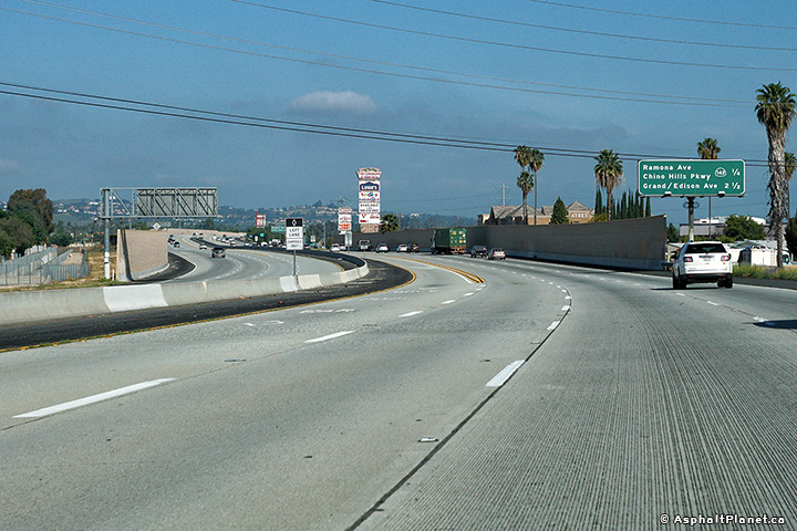
|
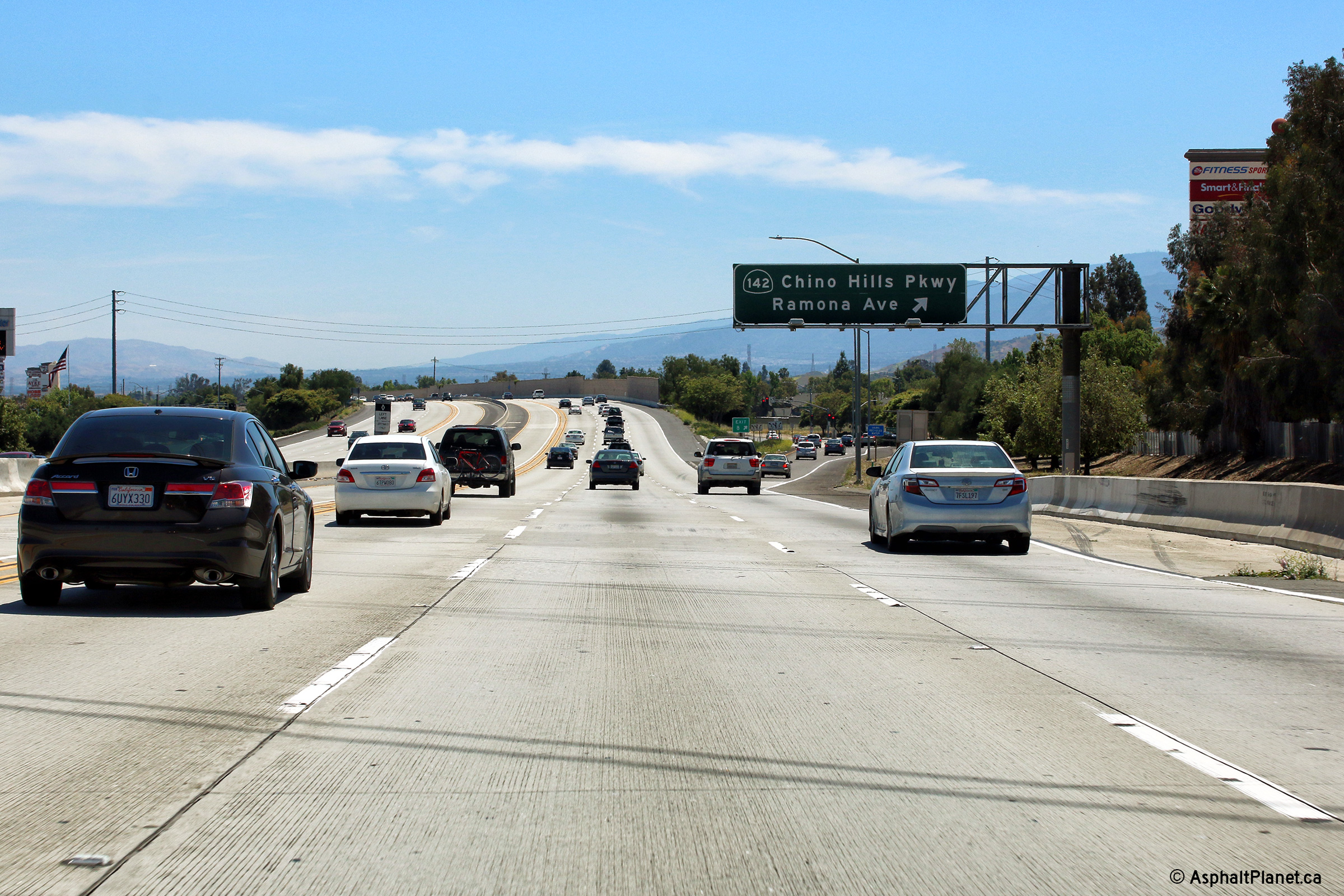
San Bernardino County |
Southbound signage at the off-ramp to State Route 142. |
 |
||
|
Date: 4/16/2017 |
High-res: (1440x960) (2400x1600) | |||
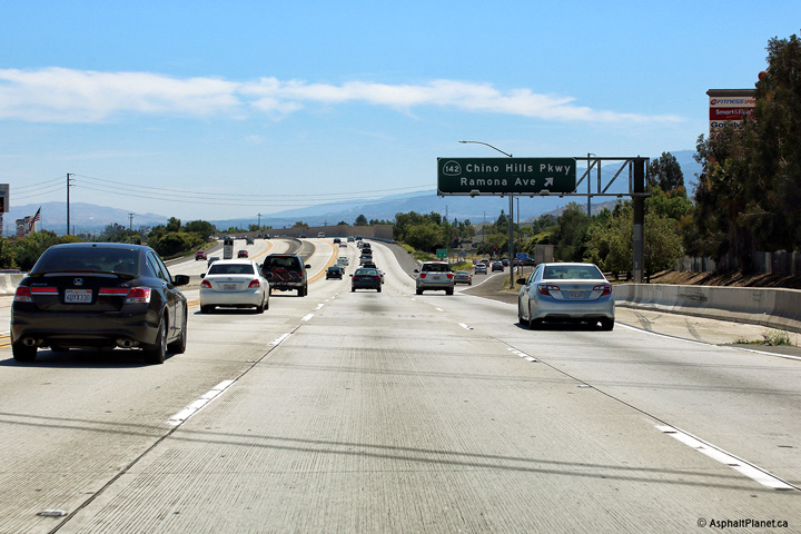
|
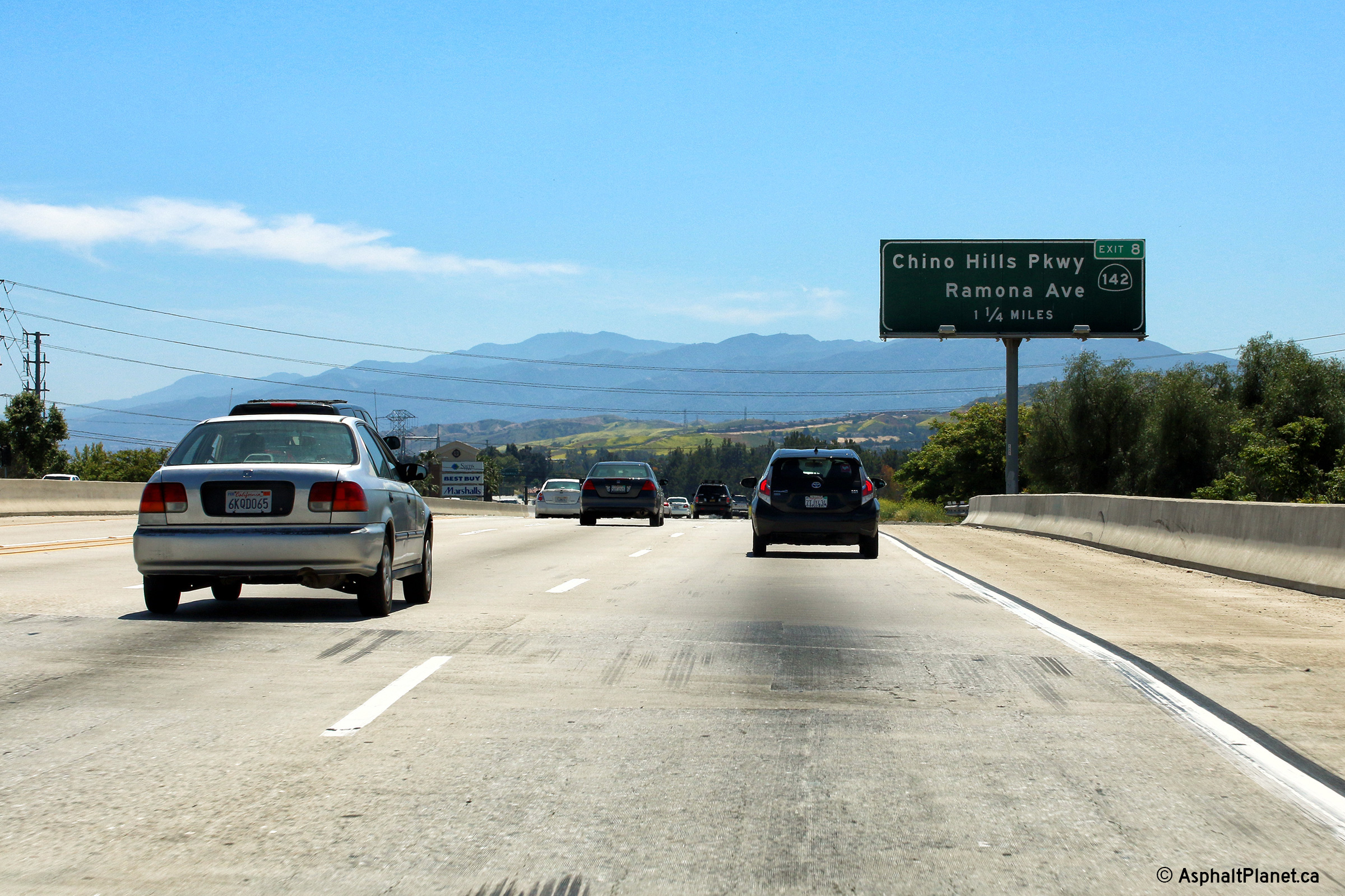
San Bernardino County |
Interchange sequence signage facing southbound motorists approaching the State Route 142 interchange. |
 |
||
|
Date: 4/16/2017 |
High-res: (1440x960) (2400x1600) | |||
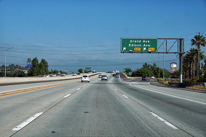
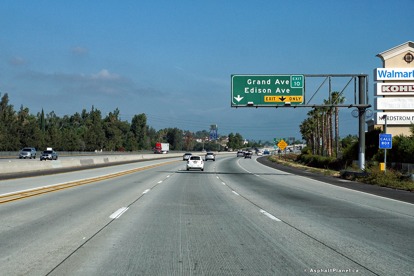
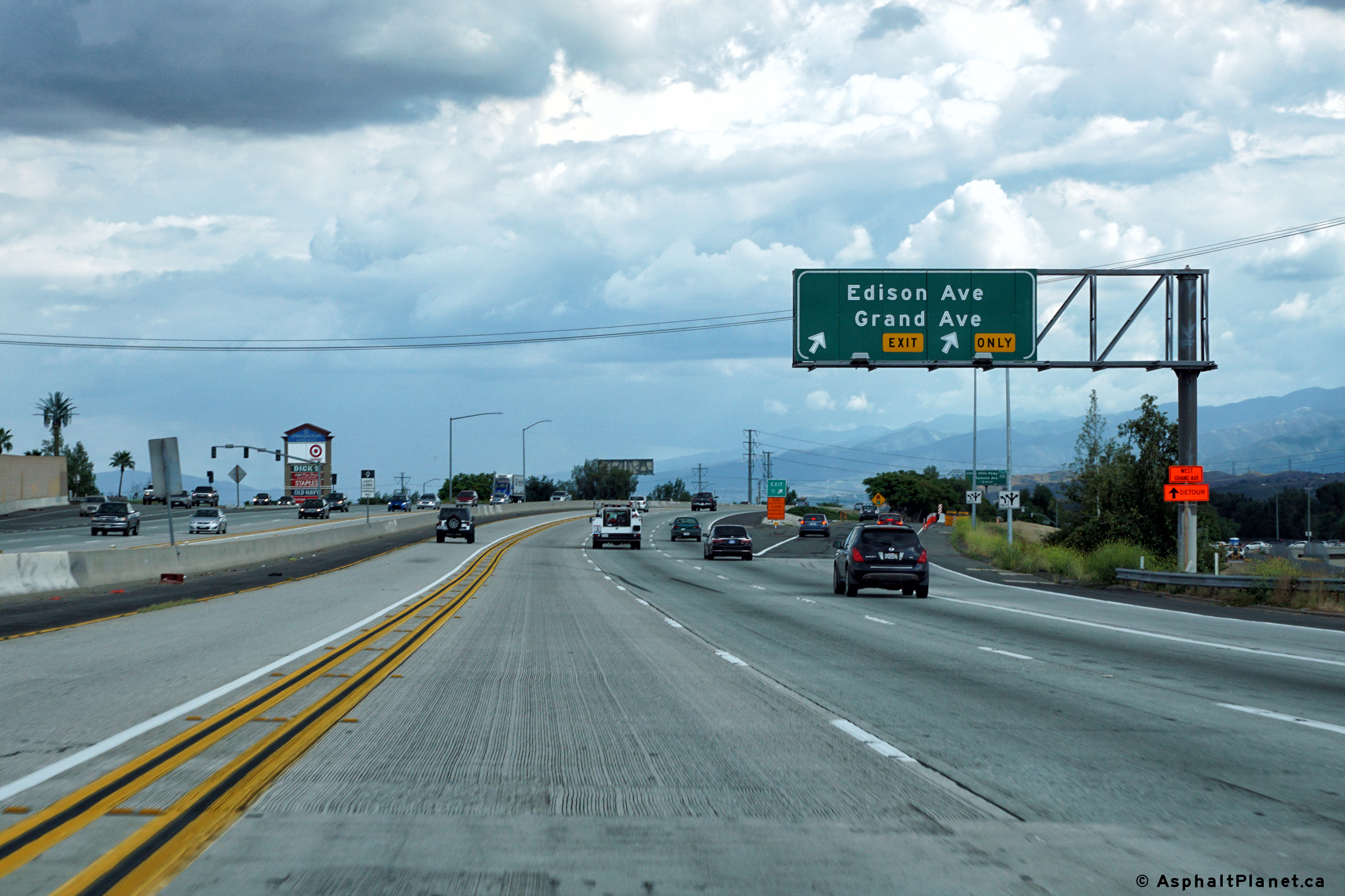
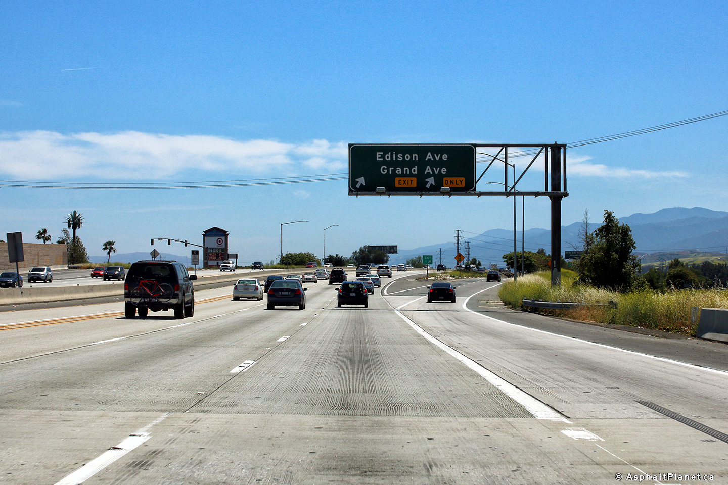
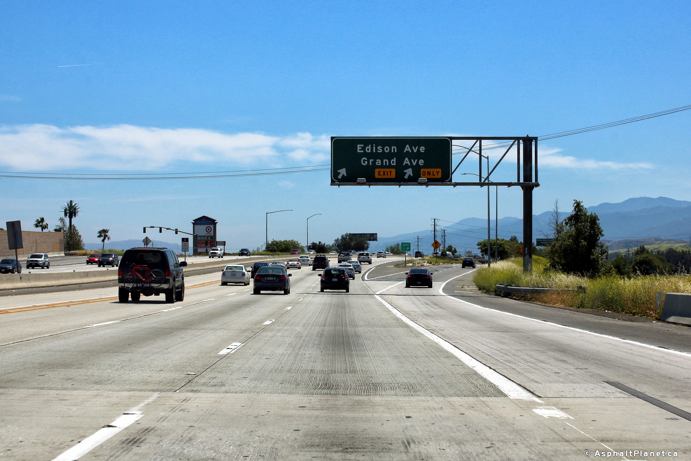
|
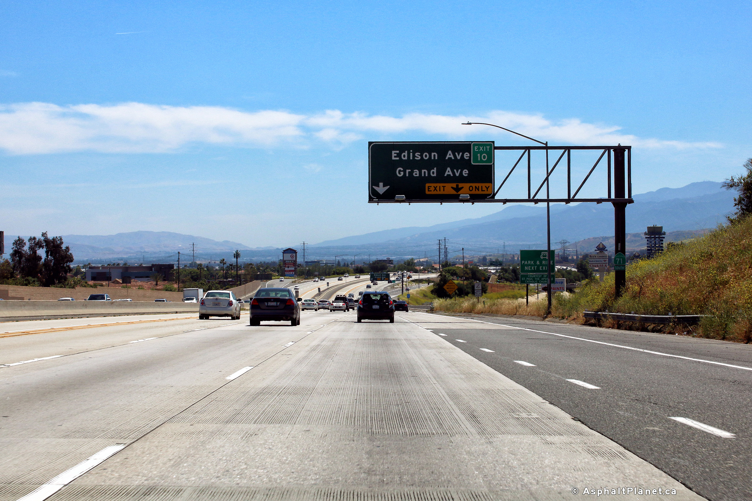
San Bernardino County |
Northbound signage in advance of the Grand Avenue interchange. |
 |
||
|
Date: 4/13/2016 |
High-res: (1440x960) (2400x1600) |
|||
|
San Bernardino County |
Northbound off-ramp to the Grand Avenue interchange. |
 |
||
|
Date: 4/13/2016 |
High-res: (1440x960) (2400x1600) |
|||
|
San Bernardino County |
Interchange sequence signage situated within the footprint of the Grand Avenue interchange. |
 |
||
|
Date: 4/13/2016 |
High-res: (1440x960) (2400x1600) |
|||
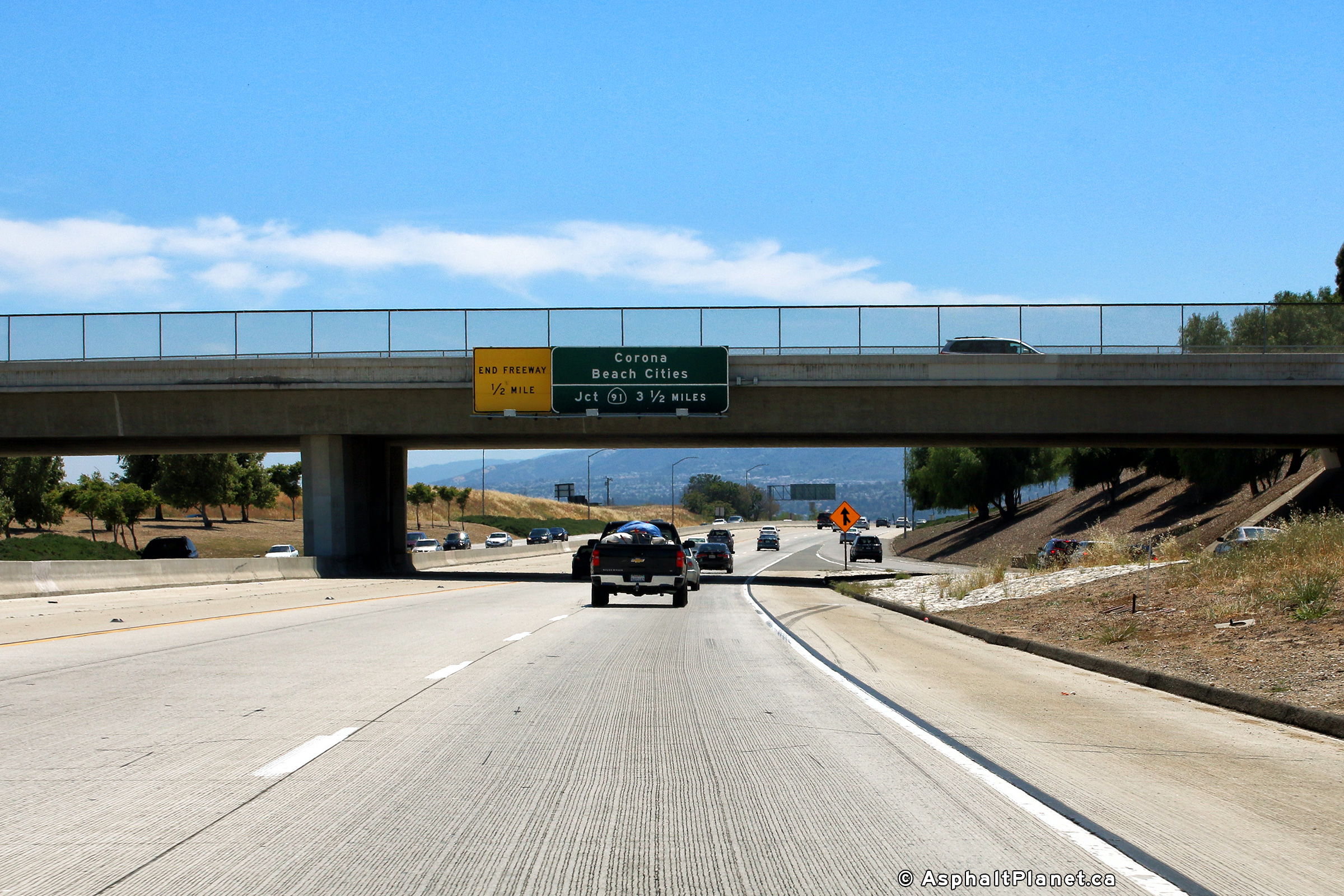
|
San Bernardino County |
Southbound advanced signage for the Route 142 interchange. Click here for an additional photo taken during April, 2006. |
 |
||
|
Date: 4/16/2017 |
High-res: (1440x960) (2400x1600) | |||
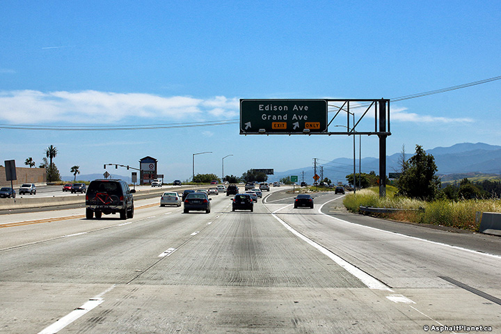
|
San Bernardino County |
Southbound view at the exit to Grand Avenue. Click here for an additional photo taken during April, 2006. |
 |
||
|
Date: 4/16/2017 |
High-res: (1440x960) (2400x1600) | |||
|
San Bernardino County |
The incoming on-ramp from Chino Avenue quickly departs at the Grand Avenue interchange. |
 |
||
|
Date: 4/16/2017 |
High-res: (1440x960) (2400x1600) | |||
|
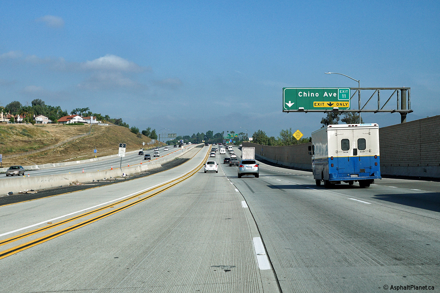
San Bernardino County |
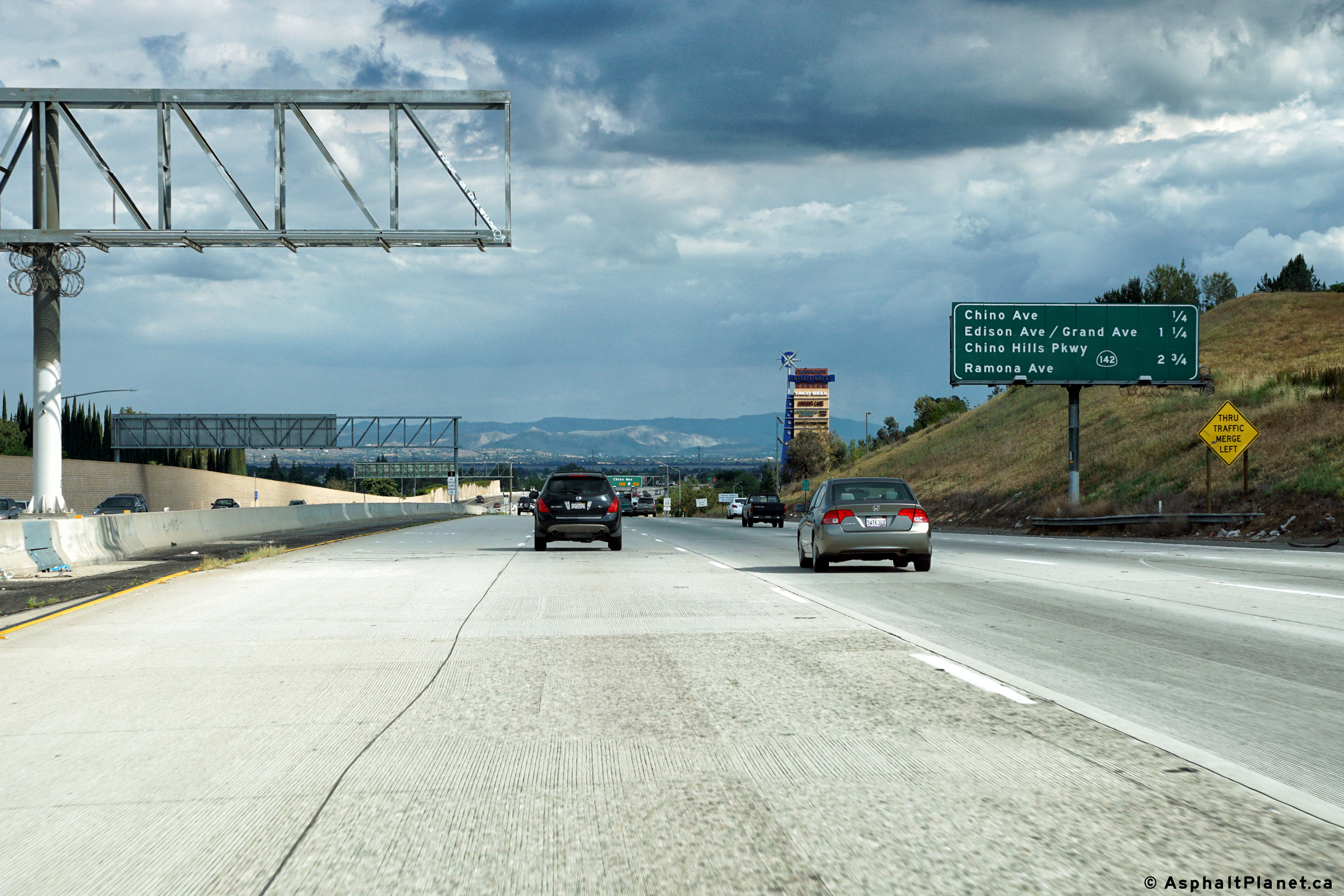
Northbound advanced signage for the Chino Avenue interchange. |
 |
||
|
Date: 4/13/2016 |
High-res: (1440x960) (2400x1600) |
|||
|
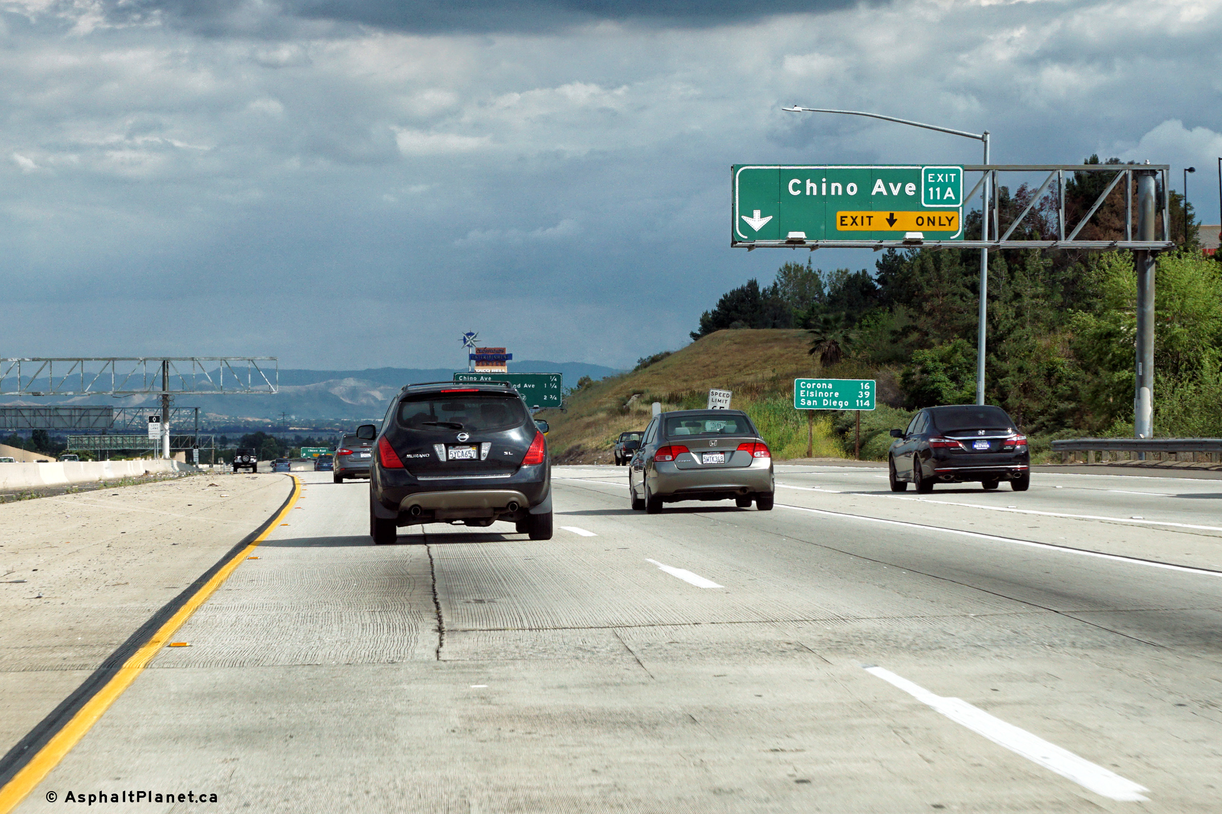
San Bernardino County |
Northbound signage at the off-ramp to Chino Avenue. |
 |
||
|
Date: 4/13/2016 |
High-res: (1440x960) (2400x1600) |
|||
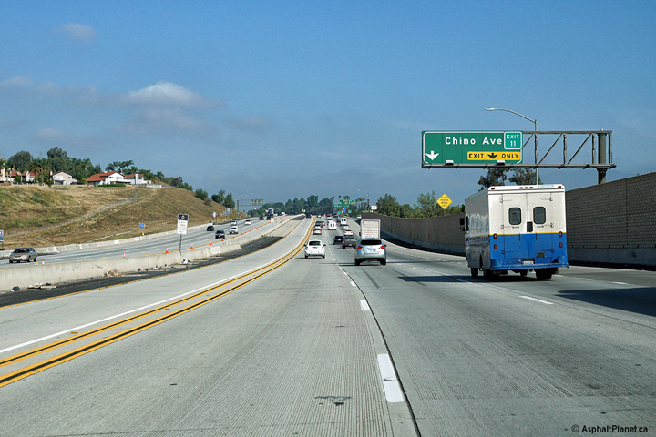
|
San Bernardino County |
Interchange sequence signage located within the Chino Avenue interchange. |
 |
||
|
Date: 4/13/2016 |
High-res: (1440x960) (2400x1600) |
|||
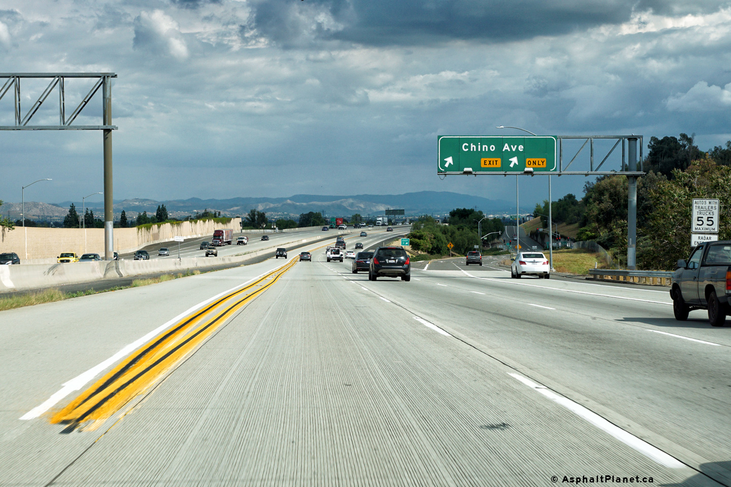
|
San Bernardino County |
Northbound signage at the off-ramp to Chino Avenue. |
 |
||
|
Date: 4/11/2016 |
High-res: (1440x960) (2400x1600) | |||
|
San Bernardino County |
Interchange sequence signage located upstream of the Chino Avenue intercahnge. |
 |
||
|
Date: 4/11/2016 |
High-res: (1440x960) (2400x1600) | |||
|
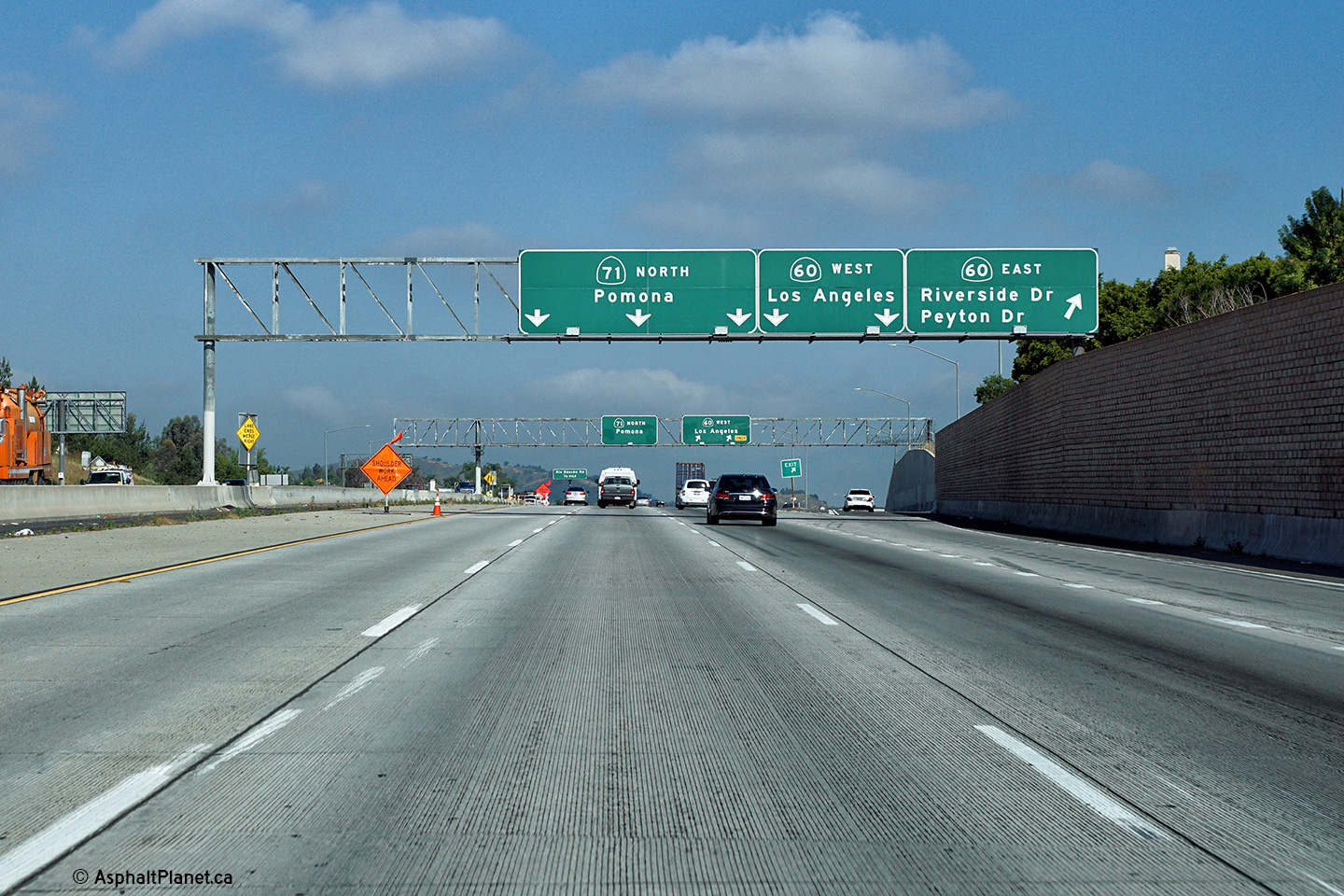
San Bernardino County |
Advanced lane assignment signage for the Chino Avenue signage as the on-ramp from SR-60 joins the SR-71 Freeway. |
 |
||
|
Date: 4/11/2016 |
High-res: (1440x960) (2400x1600) | |||
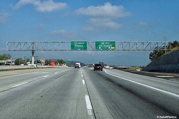
|
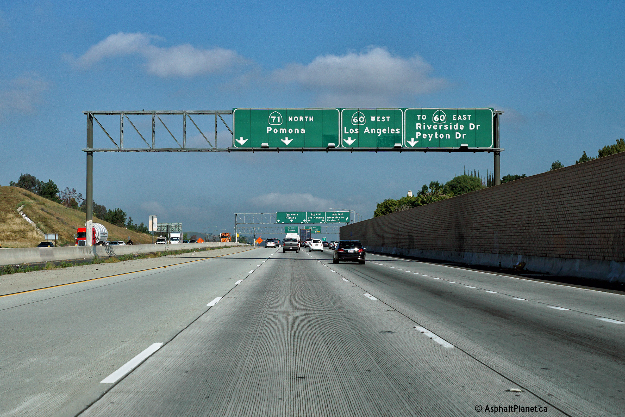
San Bernardino County |
Northbound lane assignment signage in advance of the SR-60 interchange. |
 |
||
|
Date: 4/13/2016 |
High-res: (1440x960) (2400x1600) |
|||
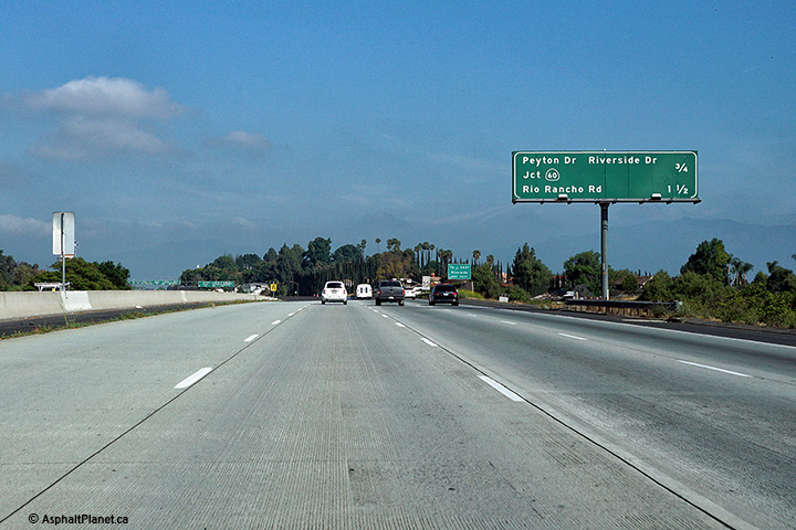
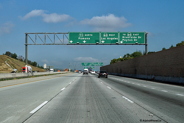
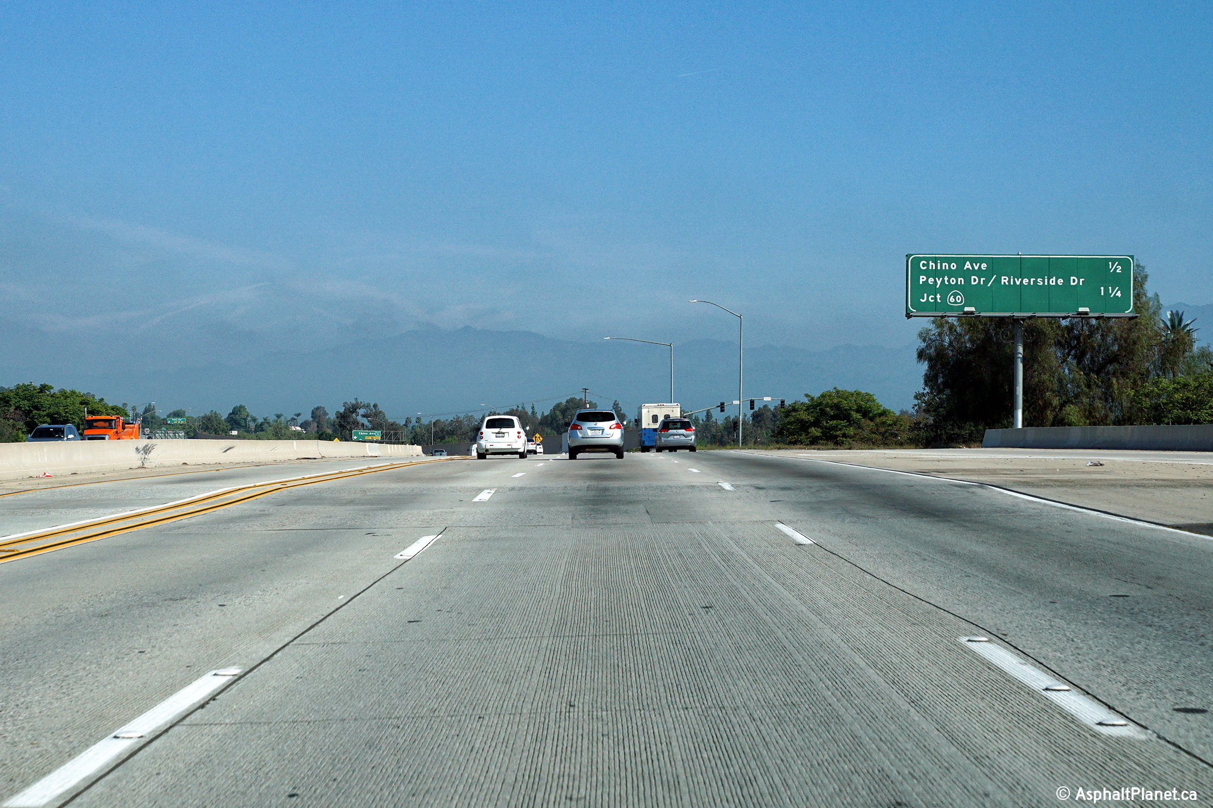
|
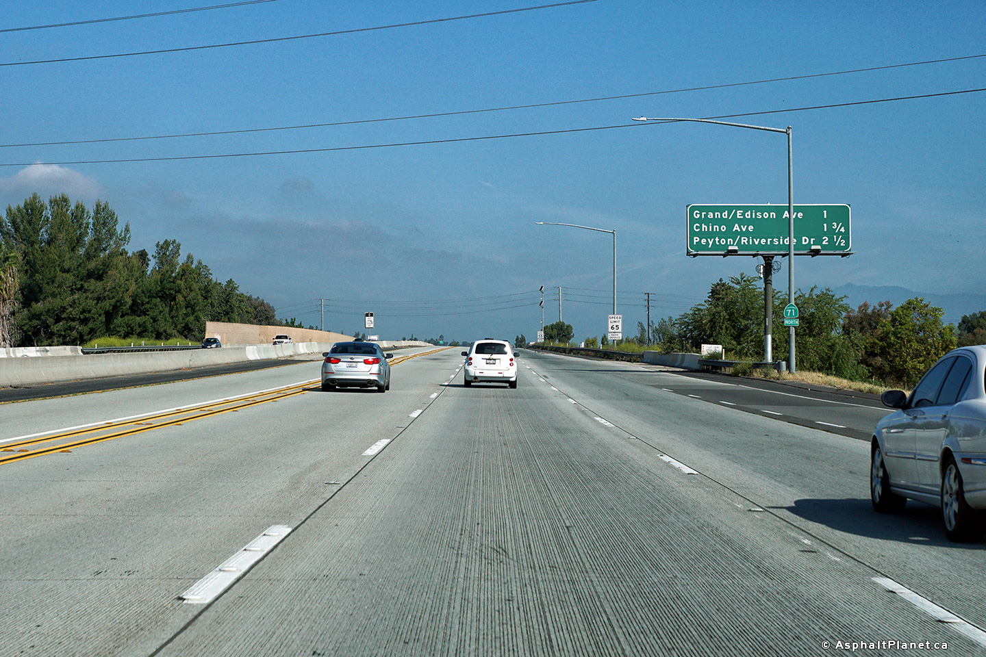
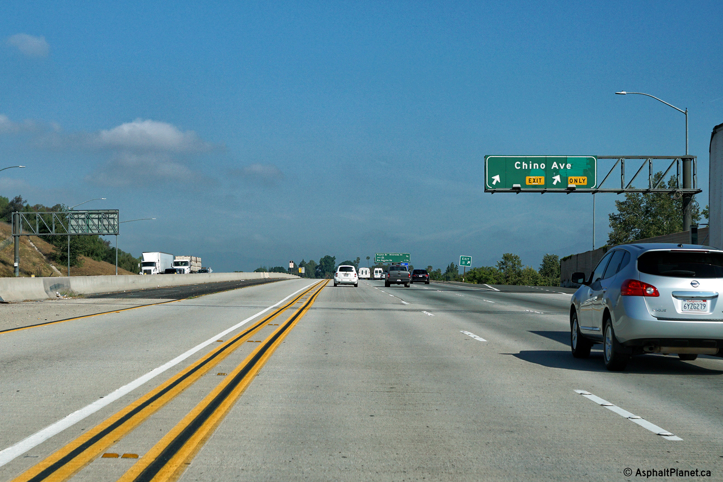
San Bernardino County |
Signage at the off-ramp to Peyton Drive and Riverside Drive. SR-60 is accessible from this off-ramp via surface streets. |
 |
||
|
Date: 4/13/2016 |
High-res: (1440x960) (2400x1600) |
|||
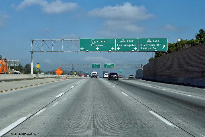
|
San Bernardino County |
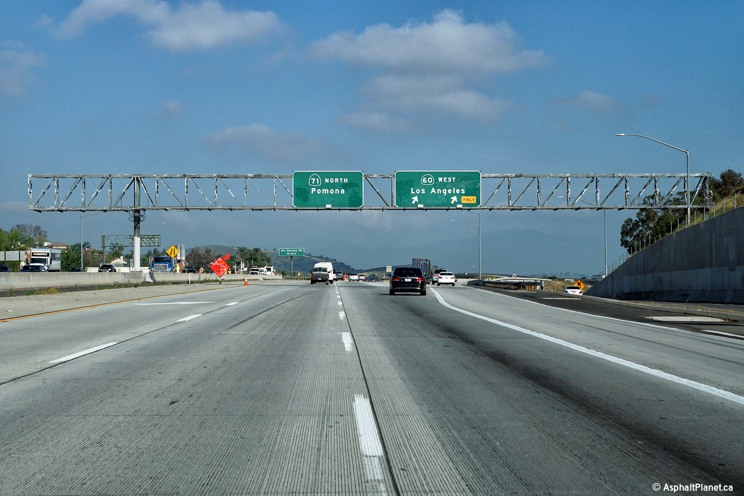
Northbound signage at the off-ramp to SR-60 West. This is a direct freeway to freeway connector. |
 |
||
|
Date: 4/13/2016 |
High-res: (1440x960) (2400x1600) |
|||
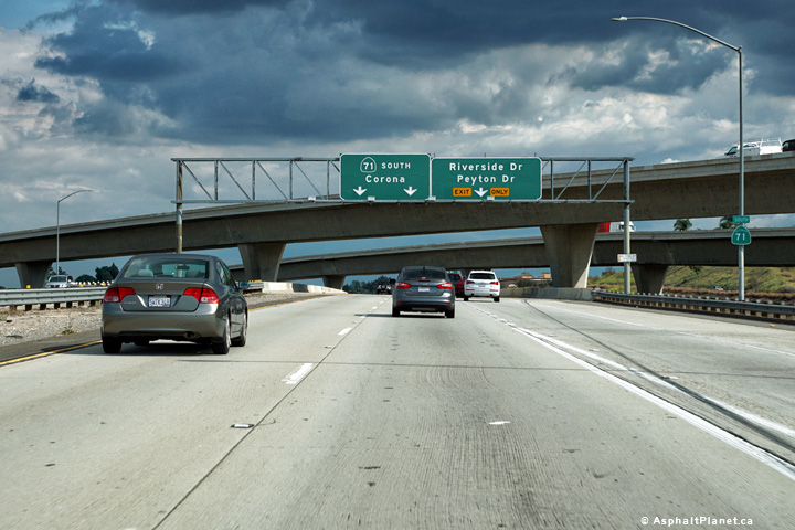
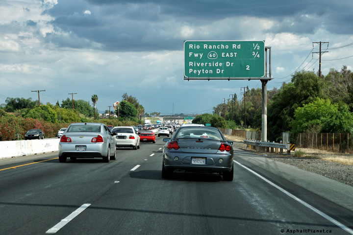
|
San Bernardino County |
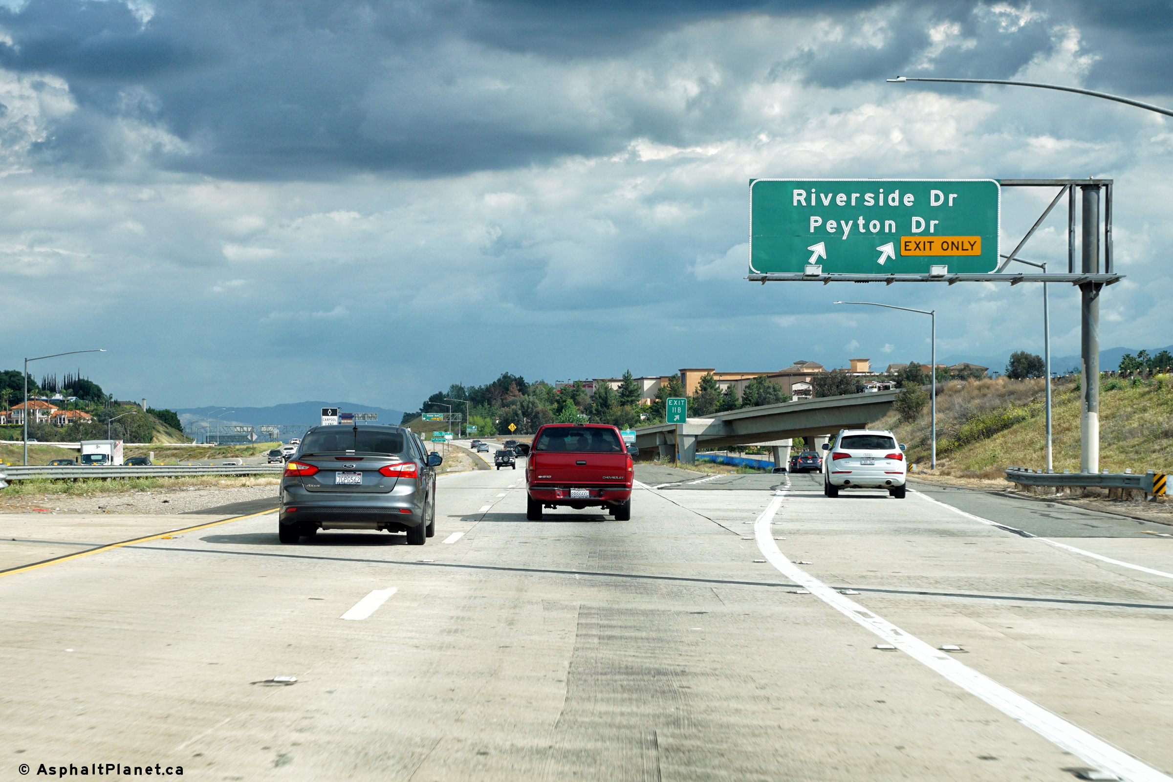
Signage at the northbound off-ramp to Riverside Drive and Peyton Drive. This off-ramp passes beneath the incoming on-ramp from SR-60. |
 |
||
|
Date: 4/11/2016 |
High-res: (1440x960) (2400x1600) | |||
| SR-60 is an important east-west freeway that stretches through much of the Los Angeles Metro Area. Click here for SR-60 Images. | ||||
|
San Bernardino County |
Southbound advanced signage approaching the Interstate 8 interchange. |
 |
||
|
Date: 4/11/2016 |
High-res: (1440x960) (2400x1600) | |||
|
San Bernardino County |
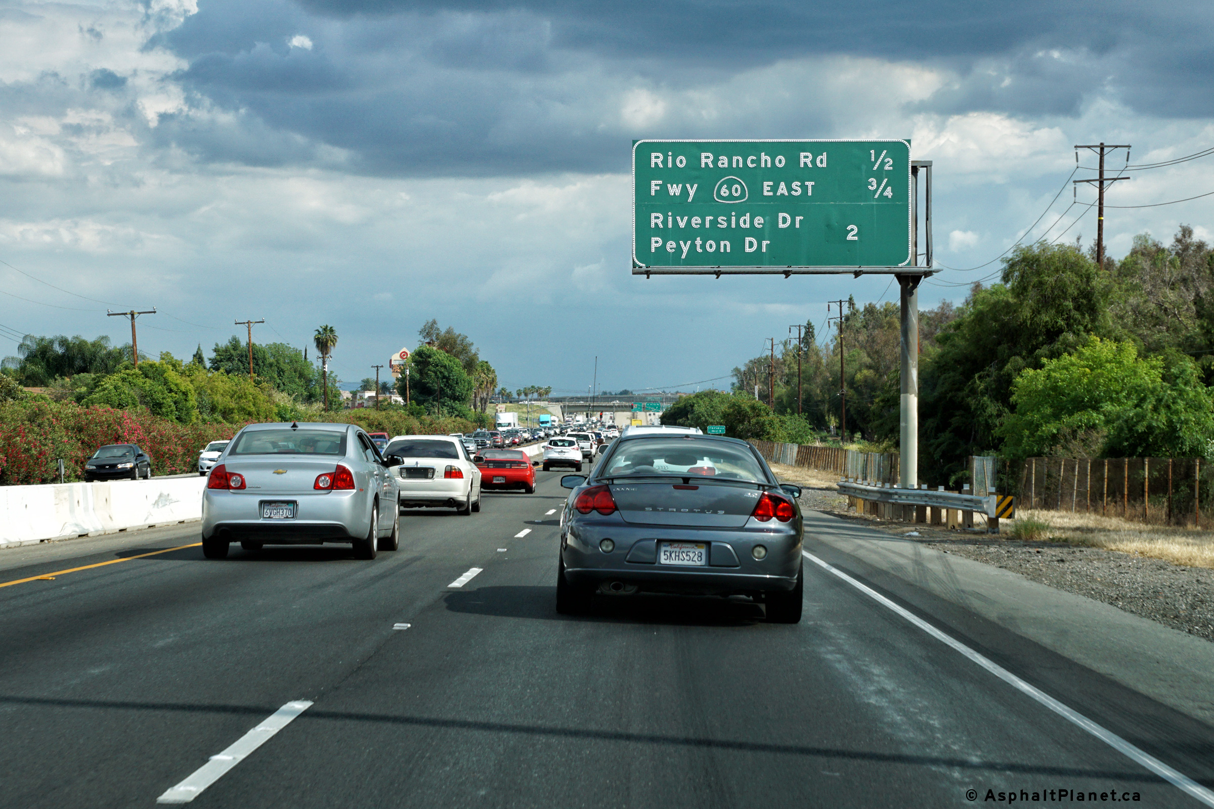
Southbound advanced signage approaching the Peyton Drive and Riverside Drive off-ramp. |
 |
||
|
Date: 4/11/2016 |
High-res: (1440x960) (2400x1600) | |||
|
San Bernardino County |
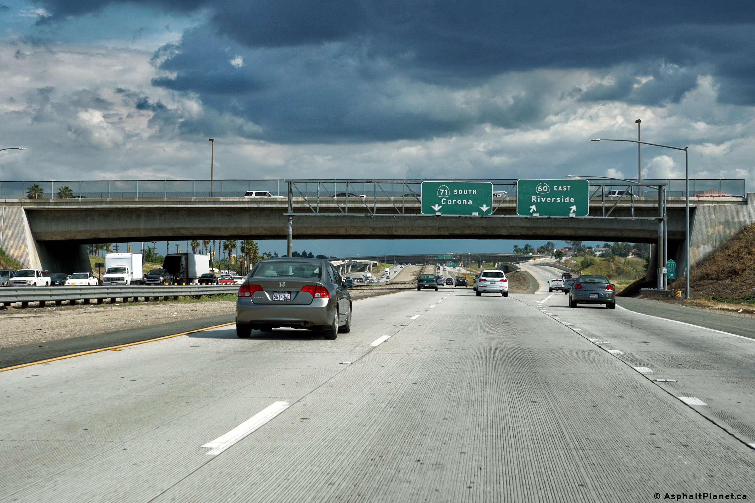
Signage at the off-ramp to SR-60 East from the southbound SR-71 carriageway. |
 |
||
|
Date: 4/11/2016 |
High-res: (1440x960) (2400x1600) | |||
|
San Bernardino County |
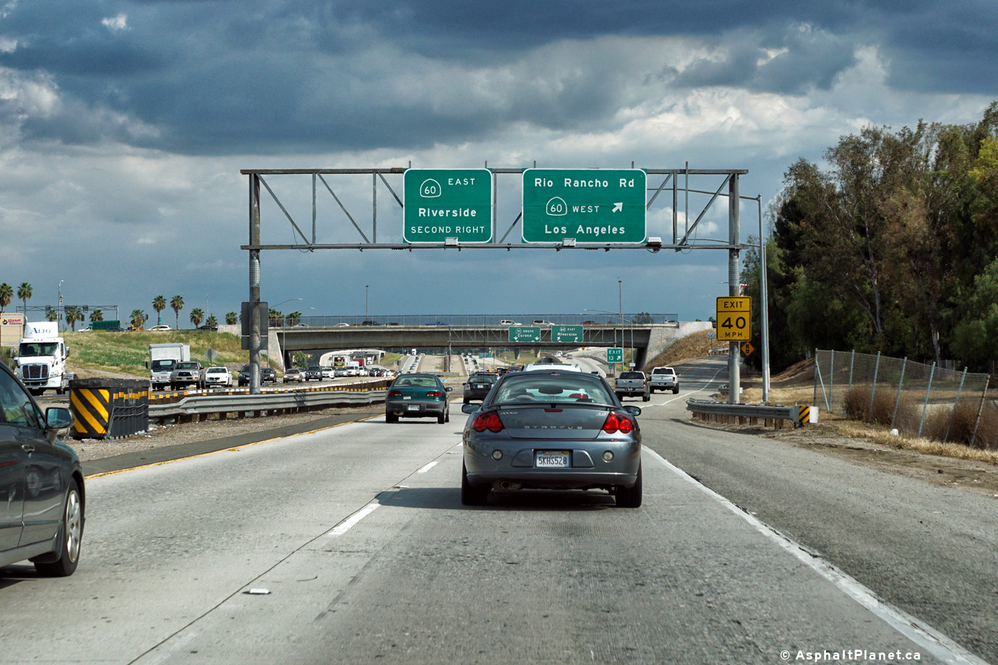
Signage at the southbound off-ramp to Rio Rancho Road. The westbound lanes of SR-60 are accessible from Rio Rancho Road. |
 |
||
|
Date: 4/11/2016 |
High-res: (1440x960) (2400x1600) | |||
| Interstate 10 is the southern-most Trans-Continental interstate in the US. Click here for I-10 Images. | ||||
<- CA-70
CA Highways
CA-72 ->
AsphaltPlanet.ca
© 2010-17 AsphaltPlanet.ca.
Scott@asphaltplanet.ca
Page Created: June 22, 2017
Last Updated: June 22, 2017.