AsphaltPlanet.ca > OntHighways >
Highway 559 > Images
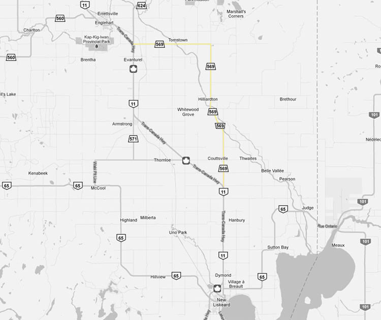
Secondary Highway 569 - Images
Photos shown in this table are arranged from South to North:
|
Proper Municipality Name |
Photo Description |
Photo |
|
|
Pictures taken from driver's perspective appear offset from centre-line pictures: |
North- |
South- |
|
|
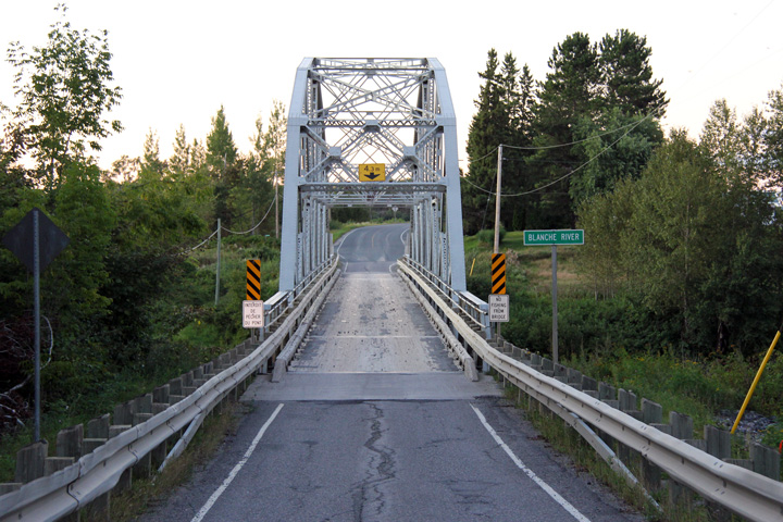
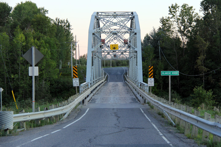
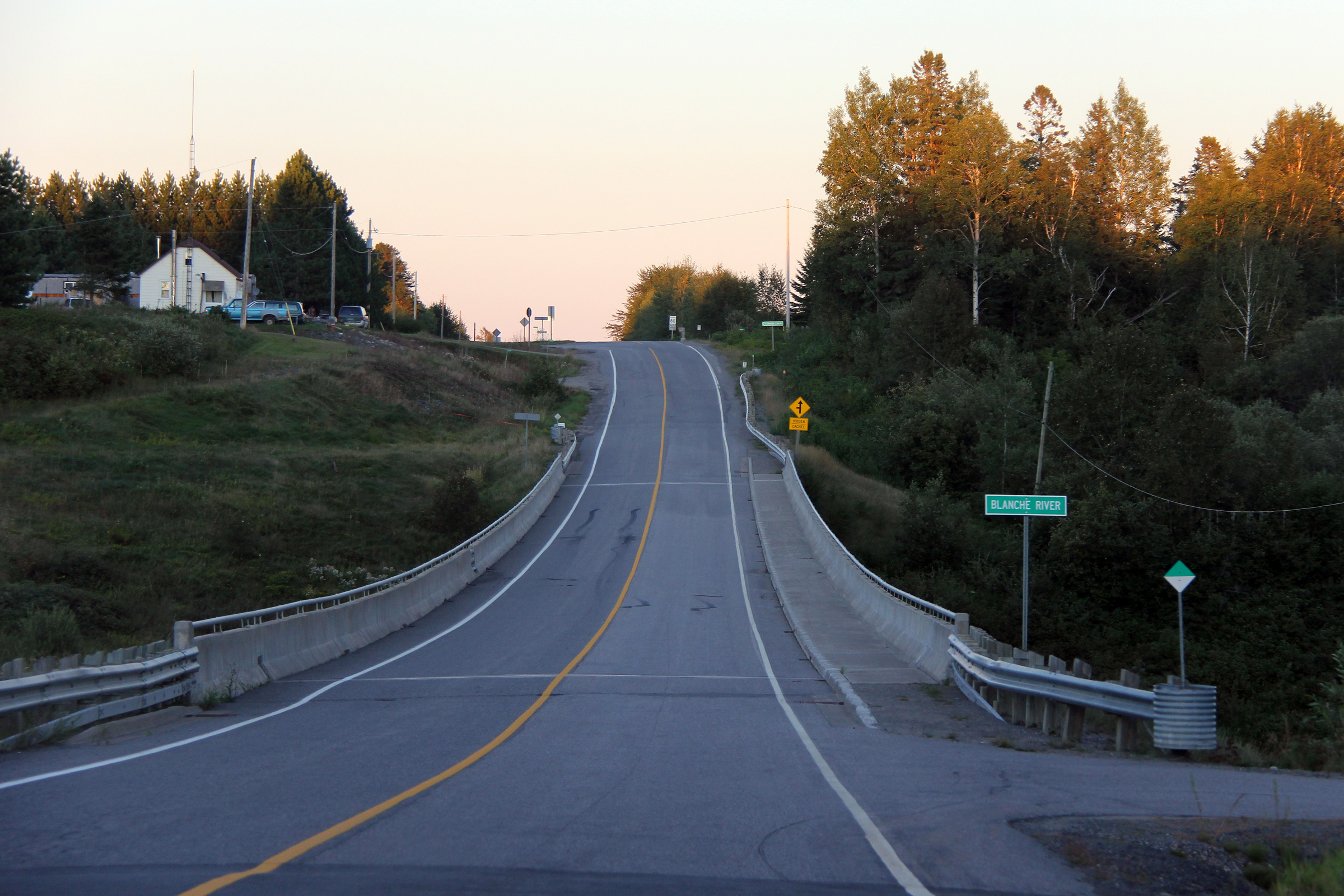
Township of Hilliard District of Timiskaming |
This view looks south as Highway 569 crosses overtop of the single lane
Blanche River bridge. Photo taken: August 27th, 2011. |
 |
|
|
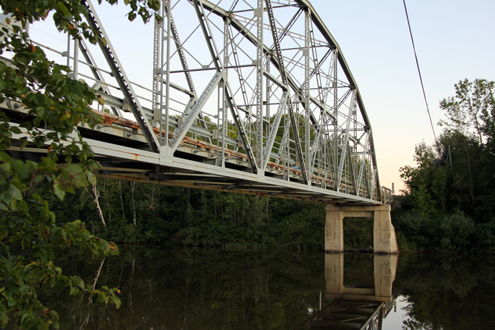
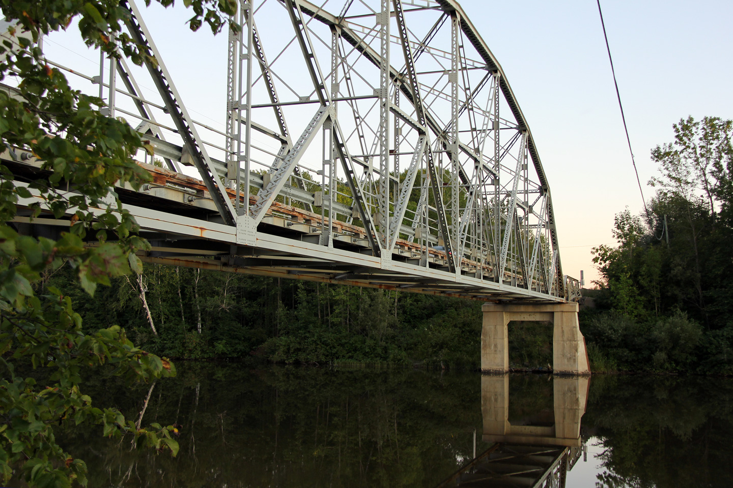
Township of Hilliard District of Timiskaming |
This is the eastern facade of the Blanche River bridge. Photo taken: August 27th, 2011. |
 |
|
|
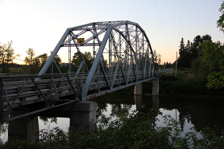
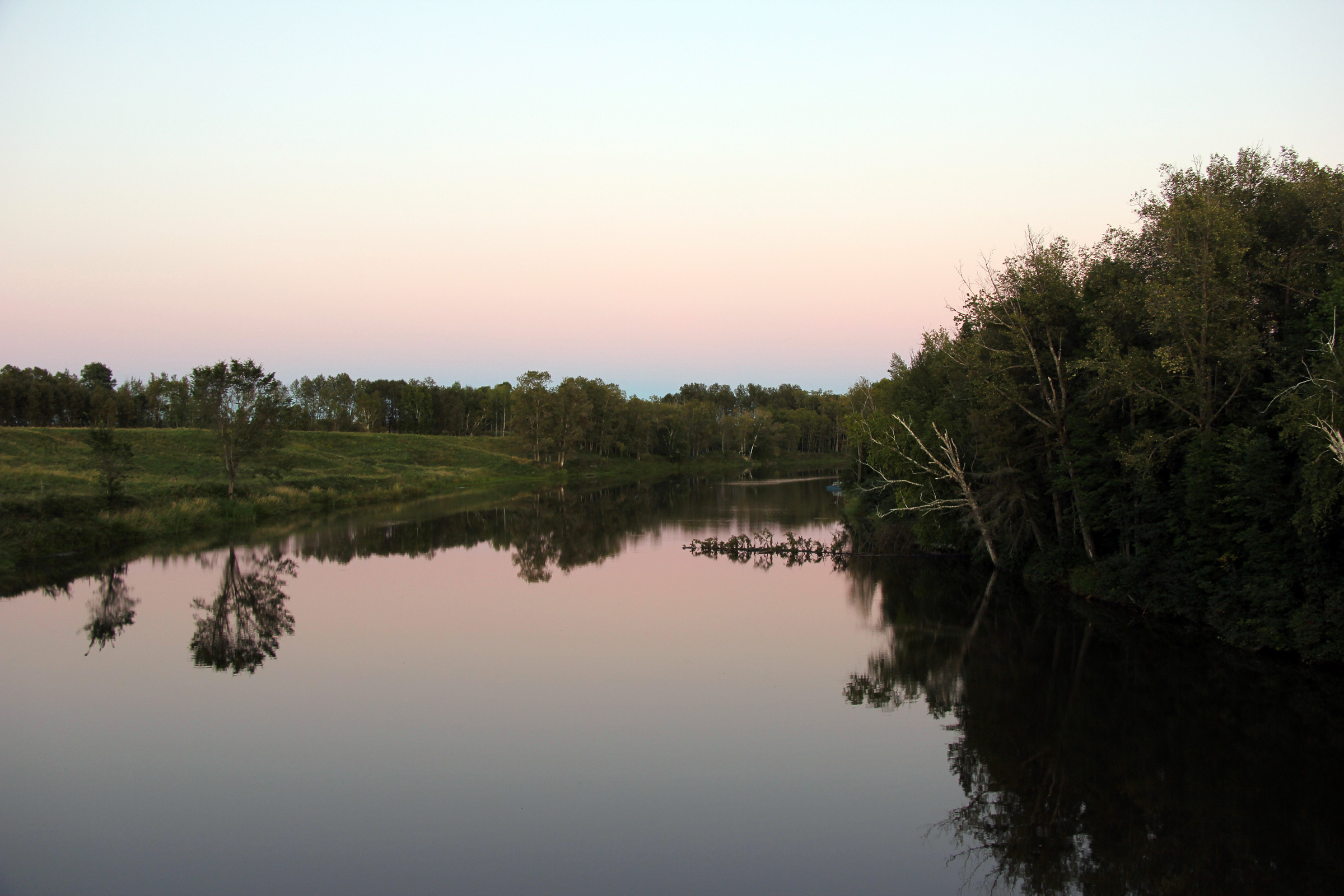
Township of Hilliard District of Timiskaming |
View looking downstream along the Blanche River as night begins to fall over
Hilliard Township. Photo taken: August 27th, 2011. |
 |
|
|
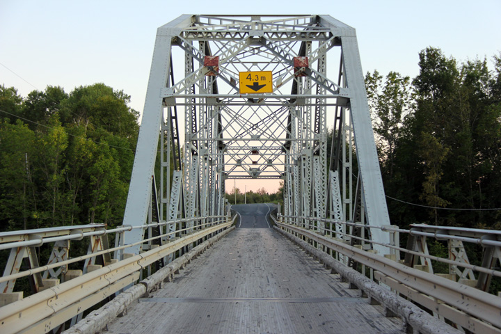
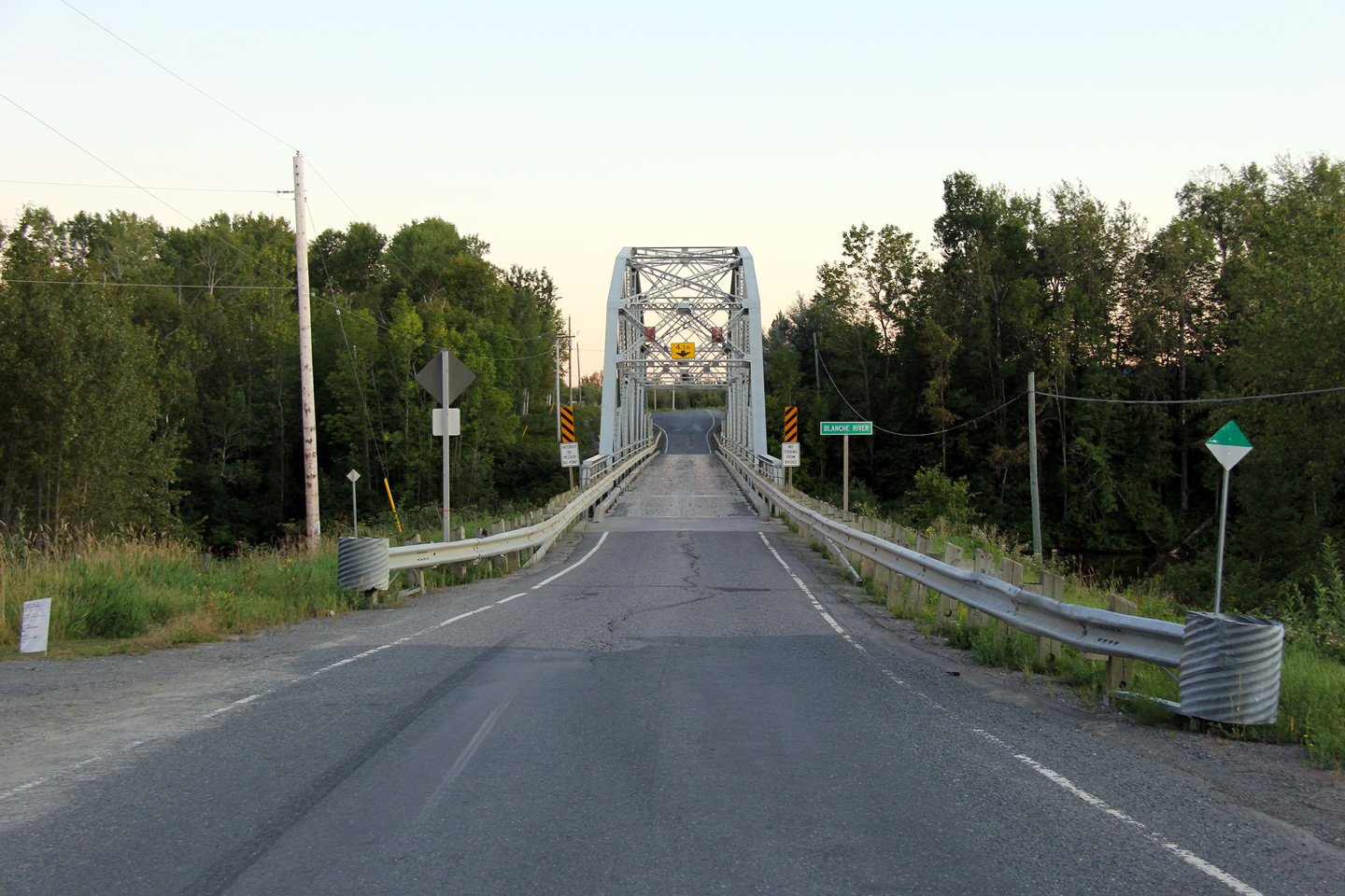
Township of Hilliard District of Timiskaming |
This view looks northerly across the wooden decked Blanch River bridge. Photo taken: August 27th, 2011. |
 |
|
|
Township of Hilliard District of Timiskaming |
This is the western side of the Blanche River bridge -- looking south. Photo taken: August 27th, 2011. |
 |
|
|
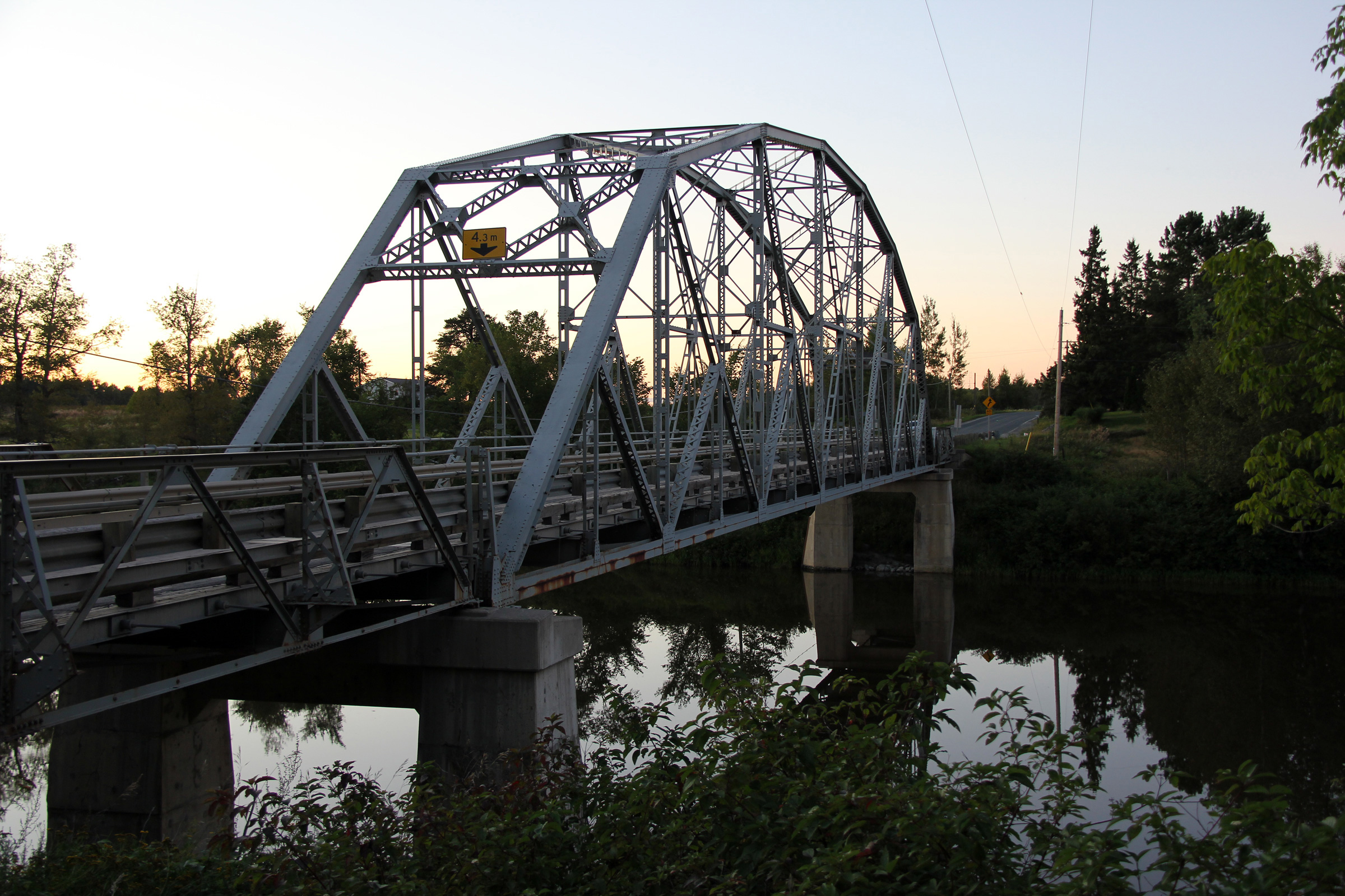
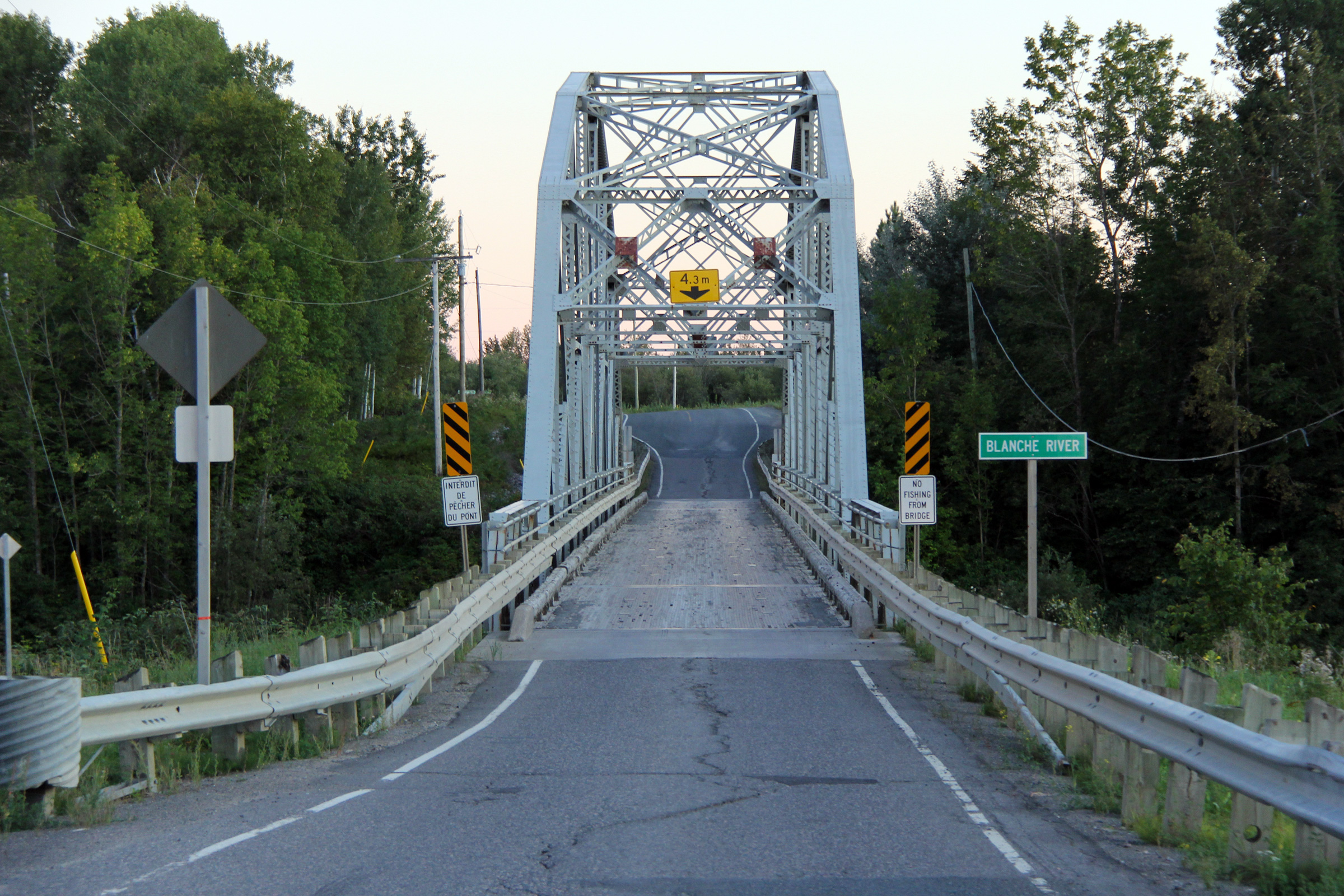
Township of Hilliard District of Timiskaming |
Two views looking southerly across the Blanche River bridge on Highway 569.
This elegant single lane truss bridge likely pre-dates Highway 569's
assumption into the highway network. In fact, there is a similar single
lane through truss bridge located a few short kilometres downstream on the
Greenwood Bridge Road. Photo taken: August 27th, 2011. |
 (720x480) (1440x960) (2400x1600)
|
|
|
Township of Evanturel District of Timiskaming |
Easterly view as Highway 569 passes over the north Blanche River bridge in
Tomstown. Photo taken: August 27th, 2011. |
 |
|
|
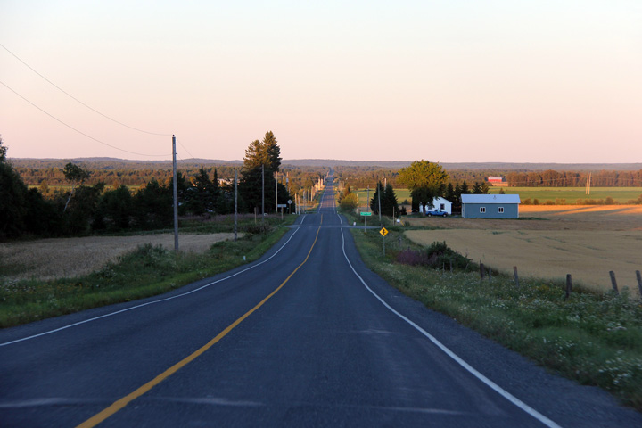
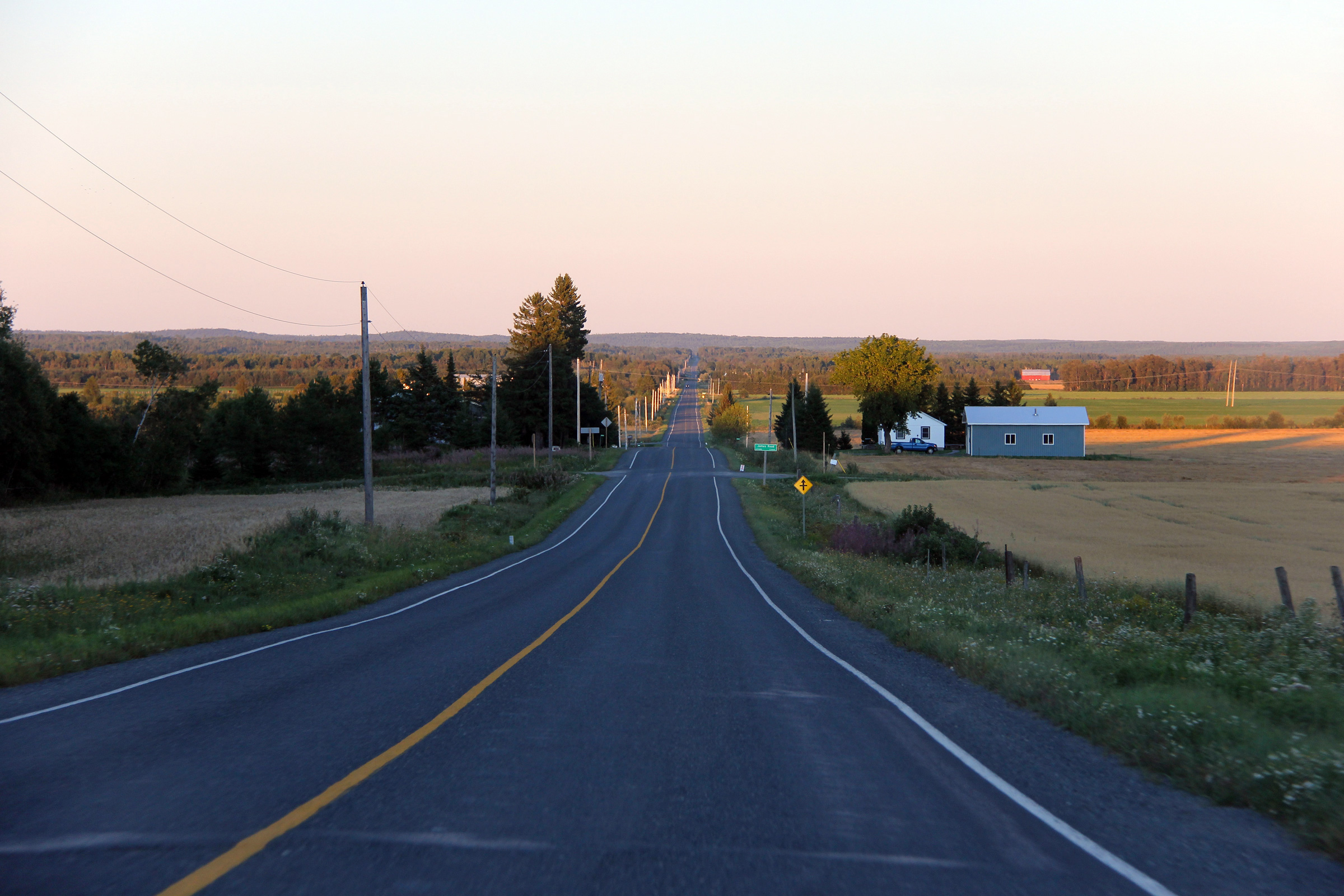
Township of Evanturel District of Timiskaming |
View looking easterly from just east of the ONR crossing as the last light
of the day stretches its long shadows over rural Evanturel Township. Photo taken: August 27th, 2011. |
 |
|
| Highway 569 ends at Highway 11. Click here for Highway 11 images. | |||
<- Highway 568 Images Back to Highway 569 Highway 570 Images ->
Copyright (c) 2004-2012, Scott Steeves (Webmaster) scott@asphaltplanet.ca