Secondary Highway
637 - www.OntHighways.com
Highway 637 is a long and desolate
highway that leads westerly from Highway 69 to Killarney. Highway 637 is
the only route connecting both the small community of Killarney and Killarney
Provincial Park to the rest of the provincial highway network. No part of
Highway 637 was affected during the downloading spree of the late 1990s.
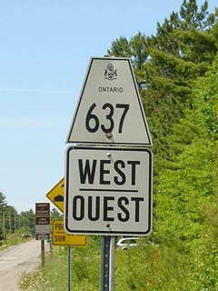
Secondary Highway 637 Shield.
|
|
Western Terminus:
Killarney Eastern Terminus:
Junction Highway 69 south of Estaire.
Length: 67.1 km
Multiplexes: None
Freeway: No
AADT (2002):
420, for the entire length of Highway 637
Road Info: Highway 637 is paved
for its entire length, however, much of this pavement surface has become
quite rough, and is only in fair condition. Traffic volumes are very
light along Highway 637, and the road passes through a very remote area of
Central Ontario. |
Communities and Intersections along and Highway 637 from West to East:
|
Proper
Municipality Name |
Community Name |
Distance |
Intersecting
Road |
| Municipality of Killarney |
Killarney |
0 km / 67.1 km |
----- |
| District of Sudbury |
----- |
67.1 km / 0 km |
King's Highway 69 |
|
Highway 607 Ends |
<-
Highway 636
www.OntHighways.com -
Home
Highway 638 ->
Copyright (c) 2004-2013, Scott Steeves (Webmaster)
scott@asphaltplanet.ca
Page last updated: May 27th, 2005
Page created: May 27th, 2005