Secondary Highway
600 - www.OntHighways.com
Highway 600 forms one of the
important secondary routes in the District of Rainy River. Highway 600
starts in the community of Rainy River, heading north-south in direction.
At River Road, approximately 15 km north of Rainy River, Highway 600 abruptly
turns east, becoming an east-west highway all the way to Highway 600's eastern
terminus at Highway 71. Interestingly, a small portion of Highway 600 was
once part of the King's Highway network. Before Highway 70 (now 71) was realigned in the
early-1950s, the section of highway from Black Hawk easterly to the route's
eastern terminus was part of Highway 70. In 1997/98 Highway 600 was
shortened by 500m as the section within Rainy River was formerly decommissioned.
It is, however, very likely that Highway 600 is still fully signed and locally known as Highway
600 through Rainy River to this date.
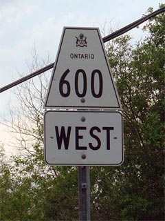
Secondary Highway 600 Shield
|
|
Western Terminus:
500m north of Highway 11 at the
north Limits of the community of Rainy River.
Eastern Terminus:
Junction Highway 71 & 615 in the District of Rainy River.
Length: 87.7 km.
Multiplexes: None
Orientation: East-West
Regions Served: Rainy River District
AADT (2002):
Highest: 350, from Rainy River northerly to River Road;
Lowest: 120 from River Road easterly to Highway 621.
Road Info:
Highway 600 is a lightly traveled secondary highway through Rainy River
District. The western half of the highway is hard surfaced, while the
eastern portion is graveled. Settlement is almost non-existent along
Highway 600. The posted speed limit is 80km/h. |
Communities and Intersections along and Highway 600 from West to East:
|
Proper
Municipality Name |
Community Name |
Distance |
Intersecting
Road |
|
The Southern (Western) 500m of
Highway 600 was transferred to Rainey River in the late 1990s. In all
likelihood, the road is still signed and known as Highway 600. |
| Town of Rainy River |
Rainy River |
0 km / 87.7 km |
King's Highway 11
(Atwood Road) |
| Rainy River - Atwood Boundary |
Rainey River North Limits |
0.5 km / 87.2 km |
----- |
| Township of Atwood |
----- |
15.6 km / 72.1 km |
River Road |
| District of Rainy River |
----- |
38.3 km / 49.4 km |
Secondary Highway 621 |
| District of Rainy River |
----- |
45.2 km / 24.3 km |
Secondary Highway 619 |
|
At Highway 617: EB: Turn
Left Towards Black Hawk. WB: turn Right towards Bergland |
| District of Rainy River |
North Branch |
63.4 km / 24.3 km |
Secondary Highway 617 |
| Rainy River District - Chapple Boundary |
Dearlock |
--- |
(Pine River Road) |
| Township of Chapple |
----- |
--- |
(Roen Road) |
| Township of Chapple |
----- |
--- |
(Teeple Road) |
|
At Barwick Road: EB: Turn
Left away from Barwick Road. WB: Turn Right towards North Branch |
| Township of Chapple |
Black Hawk |
--- |
(Barwick Road |
| Township of Chapple |
----- |
87.7 km / 0 km |
King's Highway 71 &
Secondary Highway 615 |
|
Highway 600 Ends |
<- Highway 599
www.OntHighways.com - Home
Highway 601 ->
Copyright (c) 2004-2007, Scott Steeves (Webmaster)
webmaster@onthighways.com
Page last updated: May 30th, 2008
Page created: April 23rd, 2005