Secondary
Highway 587 - www.OntHighways.com
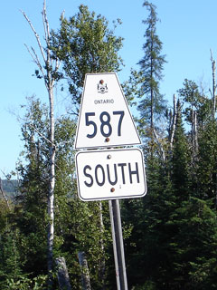
Highway 587 takes travelers south
from the Trans-Canada Highway through Pass Lake into Sleeping Giant Provincial
Park.
Secondary Highway 587 Shield
|
|
Southern Terminus:
Silver Islet
Northern Terminus: Junction Highway 11/17 northeast of Thunder
Bay
Length: 41.4km
Multiplexes: None
Orientation: North-South
Regions
Served: Thunder Bay District
AADT (2004):
Highest: 680, from Highway 11/17 southerly for 14.1km;
Lowest: 270, the remainder of Highway 587.
Road Info: Not available |
Communities and Intersections along and Highway 587 from South to North:
|
Proper
Municipality Name |
Community Name |
Distance |
Intersecting
Road |
| District of Thunder Bay |
Silver Islet |
0km / 41.1km |
----- |
| District of Thunder Bay |
----- |
33.5km / 7.9km |
Lake Marie Louise Park Entrance |
| District of Thunder Bay |
----- |
41.1km / 0km |
King's Highway 11/17 |
|
Highway 587 ENDS |
<- Highway 586
www.OntHighways.com - Home
Highway 588 ->
Copyright (c) 2004-2007, Scott Steeves (Webmaster)
webmaster@onthighways.com
Page last updated: May 31st, 2008
Page created: May 31st, 2008