Secondary
Highway 522 - www.OntHighways.com
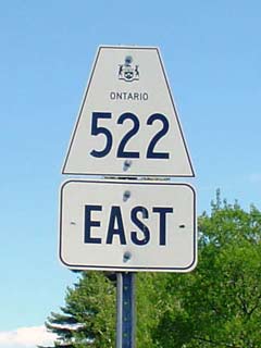
Highway 522 is an east-west
route running from Highway 69 near Georgian Bay to Highway 11 just south of Trout Creek.
Highway 522 is the major connection for several small Central Ontario centres
including
the communities of Arnstien and Port Loring. Interestingly, Highway 522 was
lengthened in 2002 as the highway assumed part of Highway 11's former routing
through Trout Creek, when Highway 11 was realigned onto the Trout Creek Bypass.
Also notable about Highway 522 is that the route is technically discontinuous through Trout
Creek as 500m from the former junction of Highway 11 was formerly decommissioned in 1998. Despite this legal discontinuity, Highway
522 is continuously signed through Trout Creek.
Secondary Highway 522 Shield
|
|
Western Terminus: Junction Highway 69 in
the hamlet of Cranberry Eastern Terminus: Junction Highway 11 at the south end of the small
community of Trout Creek
Length:
Current: 109.3km
Multiplexes: None
Orientation: East-West
Regions Served: Parry Sound District
AADT (2002):
Highest: 990, from Commanda Creek to Highway 11 south of Trout Creek;
Lowest:
410, from the Grundy Lake Provincial Park Etrance to East Road & North Road
in Loring.
Road Info: Not available. |
Communities and Intersections along and Highway 522 from West to East:
|
Proper
Municipality Name |
Community Name |
Distance |
Intersecting
Road |
| District of Parry Sound |
Cranberry |
0km / 109.3km |
King's Highway 69 |
| District of Parry Sound |
Pakesley |
--- |
----- |
| District of Parry Sound |
----- |
19.2km / 90.1km |
Lost Channel Road |
| District of Parry Sound |
Ess Narrows Landing |
27.9km / 82.3km |
----- |
| District of Parry Sound |
Fleming's Landing |
--- |
----- |
|
In Loring: EB: Turn Right towards Port Loring.
WB: Turn Left towards Highway 69. |
| District of Parry Sound |
Loring |
47.8km / 61.5km |
North Road & East Road |
| District of Parry Sound |
Port Loring |
--- |
----- |
| District of Parry Sound |
Arnstein |
--- |
----- |
| District of Parry Sound |
Golden Valley |
--- |
----- |
| District of Parry Sound |
----- |
68.3km / 41.1km |
Little River Road |
| District of Parry Sound |
Bear Valley |
--- |
----- |
| District of Parry Sound |
Farleys Corners |
80.4km / 29.4km |
Secondary Highway 524 |
| Township of Nipissing |
Commanda |
--- |
----- |
| Municipality of Powasson |
(Former) Trout Creek West
Limits |
105.1km / 4.2km |
----- |
| Municipality of Powasson |
Trout Creek |
106.7km / 2.6km |
Secondary Highway 522B (Formerly Highway 11) |
|
At Highway 522B: EB: Turn Right towards
Highway 11 South. SB: Turn Left towards Port Loring |
| Municipality of Powasson |
(Former) Trout Creek South
Limits |
107.7km / 1.6km |
----- |
| Municipality of Powasson |
----- |
109.3km / 0km |
King's
Highway 11 |
|
Highway 522 ENDS |
<- Highway 520
www.OntHighways.com - Home
Highway 522B ->
Copyright (c) 2004-2007, Scott Steeves (Webmaster)
webmaster@onthighways.com
Page last updated: April 4th, 2006
Page created: July 17th, 2004