AsphaltPlanet.ca > OntHighways >
Highway 61 > Images
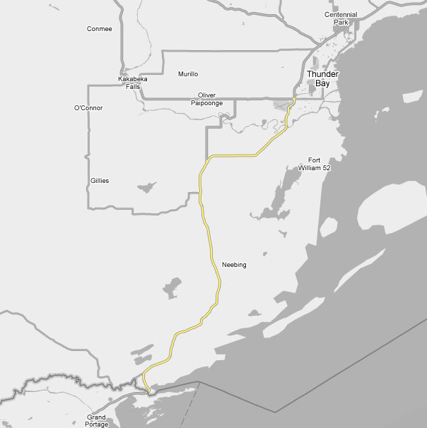
King's Highway 61 - Images
Photos shown in this table are arranged from South to North:
|
Proper Municipality Name |
Photo Description |
Photo |
||
|
Pictures taken from driver's perspective appear offset from centre-line pictures: |
North- |
South- |
||
|
Site visitors can continue southerly towards Duluth via Minnesota Route 61. Click here for Route 61 images. |
||||
|
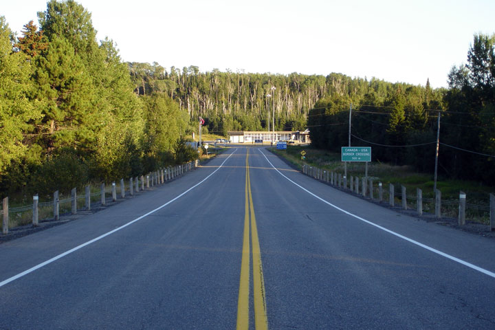
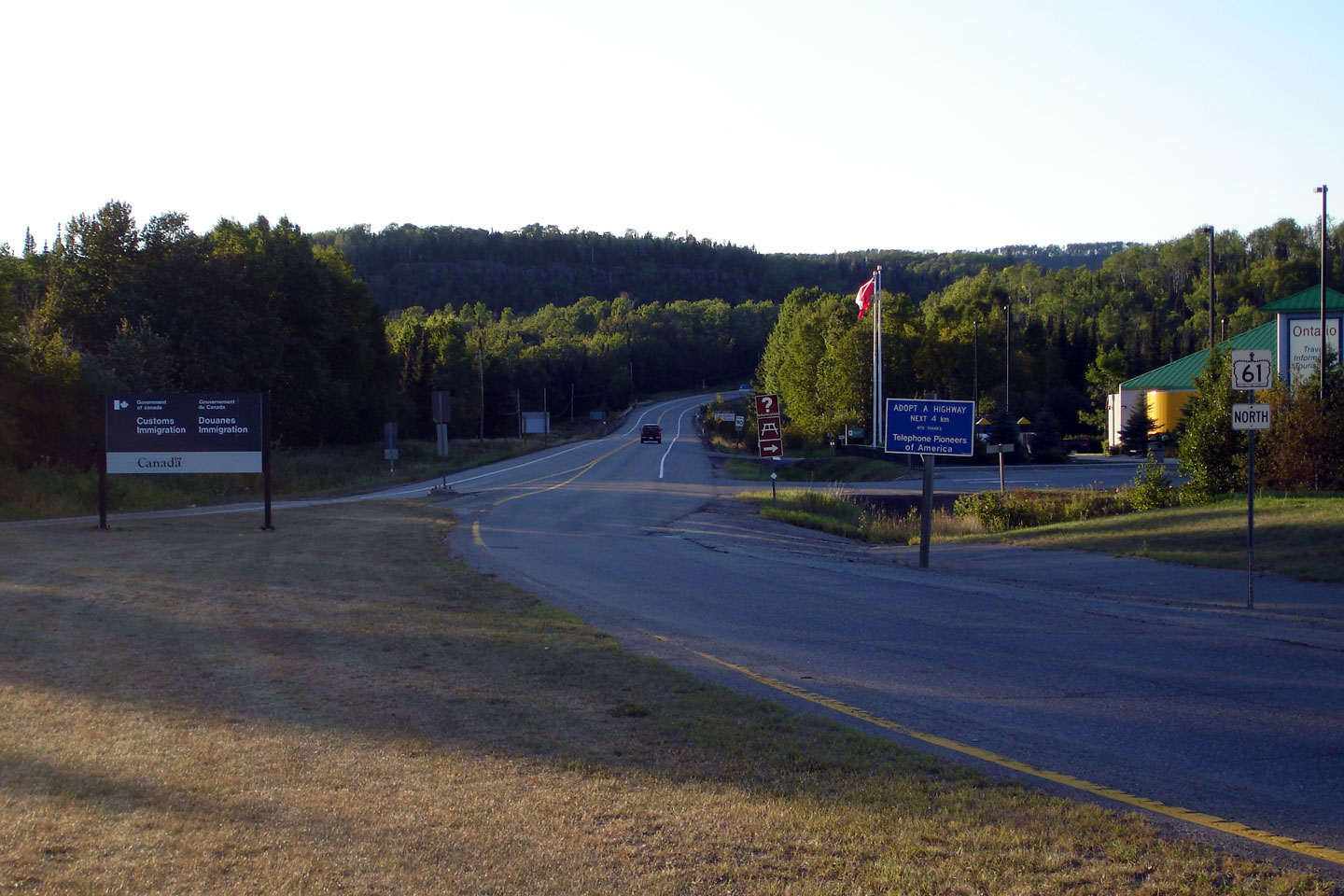
District of Thunder Bay |
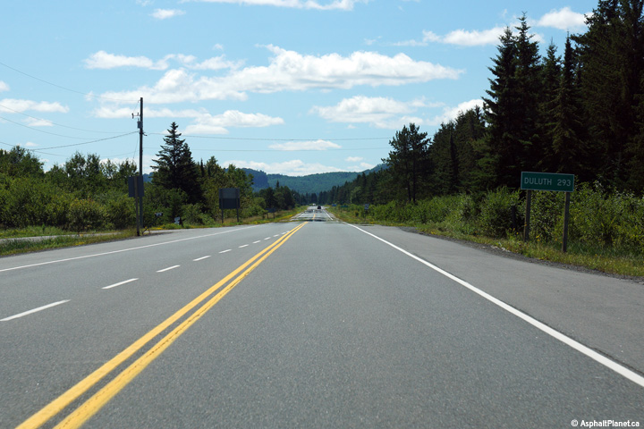
Northerly view along Highway 61 from the US customs facility. There
are no settlements along Highway 61 between the US Border and Thunder Bay. |
|||
|
District of Thunder Bay |
Southerly view along Highway 61 approaching the US customs facility. |
|||
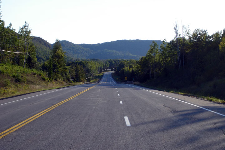
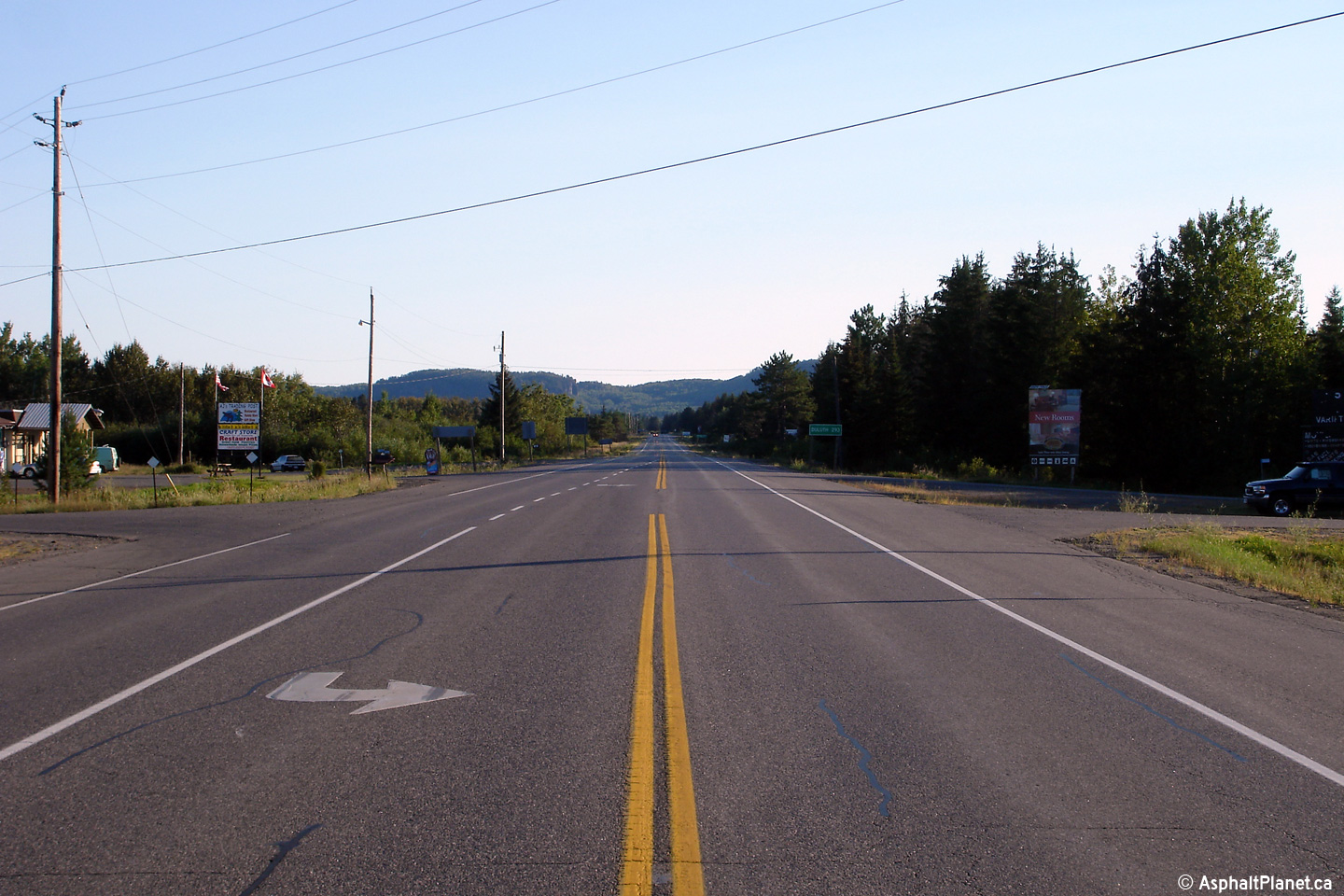
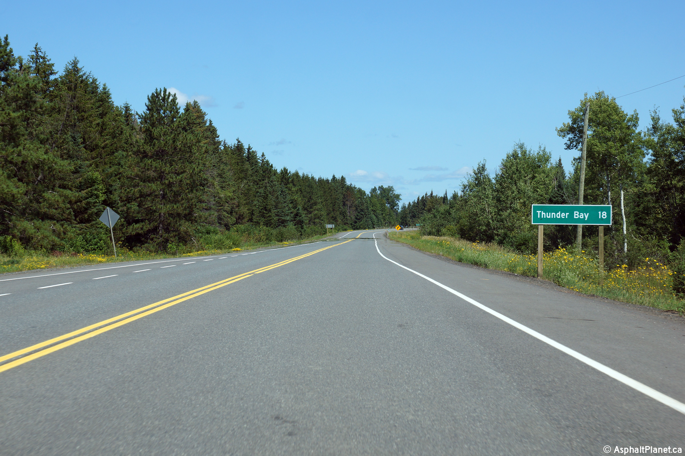
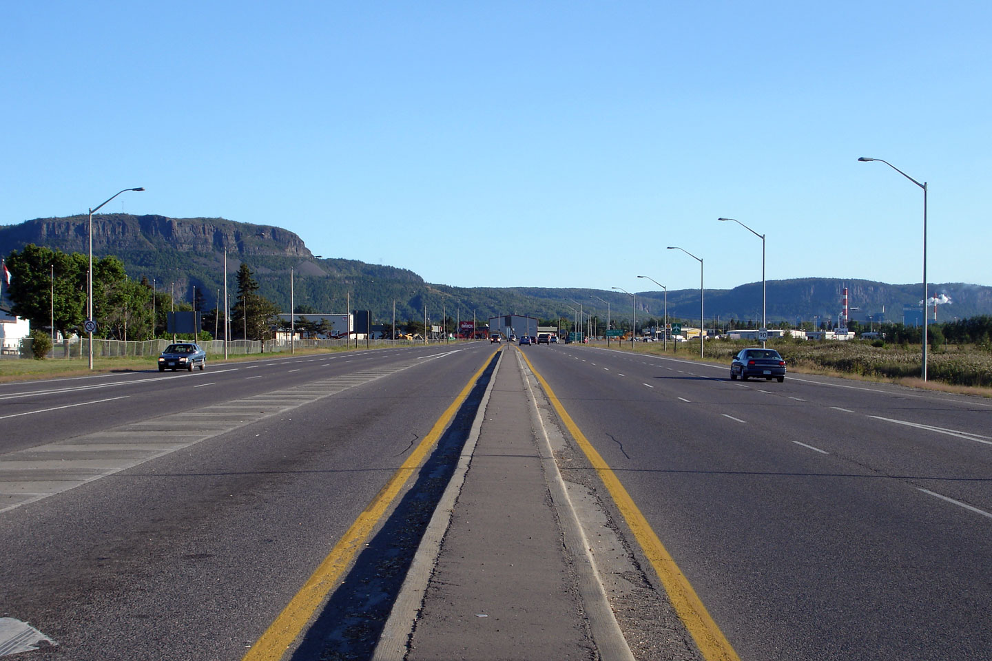
| District of Thunder Bay |
This view looks southerly some 20km north of the US border. While
Highway 61 is an important highway, it is not particularly busy. Photo taken: August 30th, 2006. |
 |
||
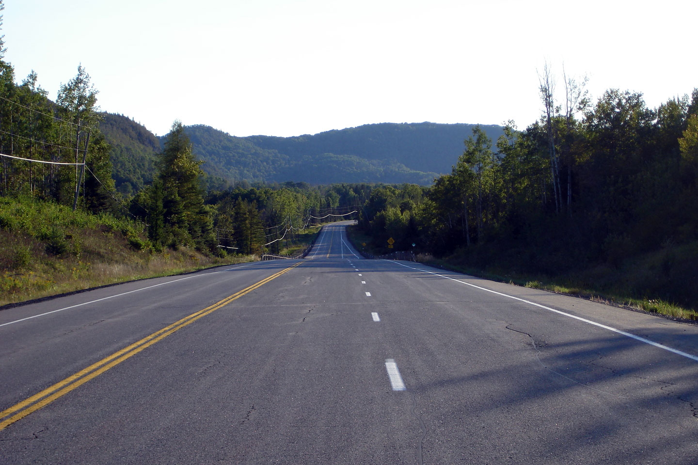
| District of Thunder Bay |
The treed hills of Northwestern Ontario dwarf Highway 61. This photo
is taken some 25km north of the US border. Photo taken: August 30th, 2006. |
 |
||
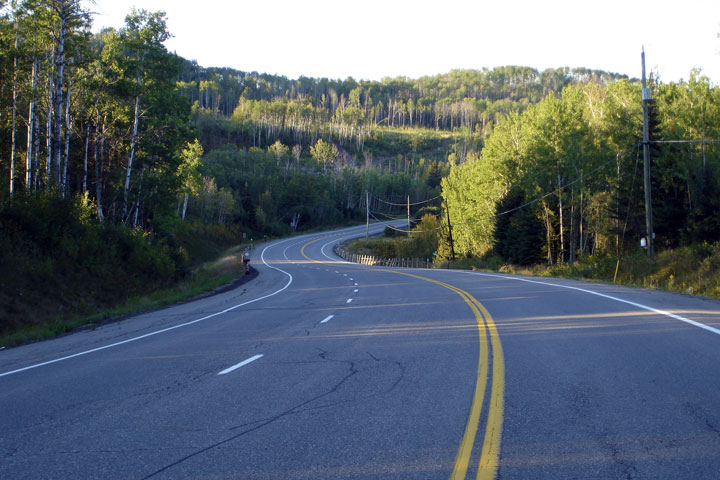
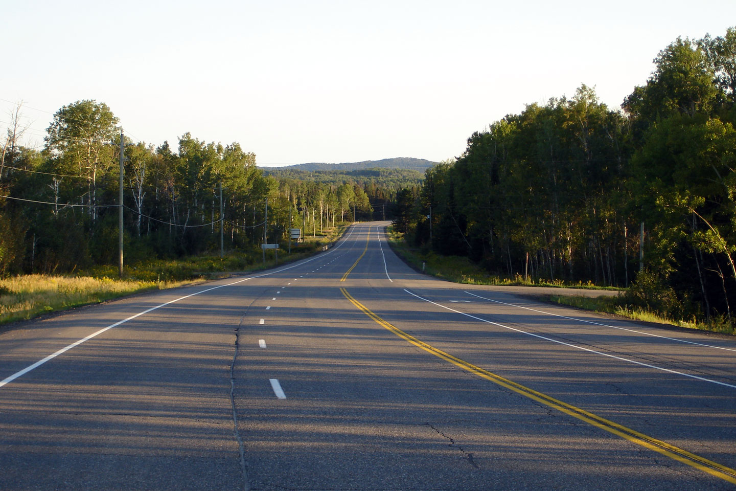
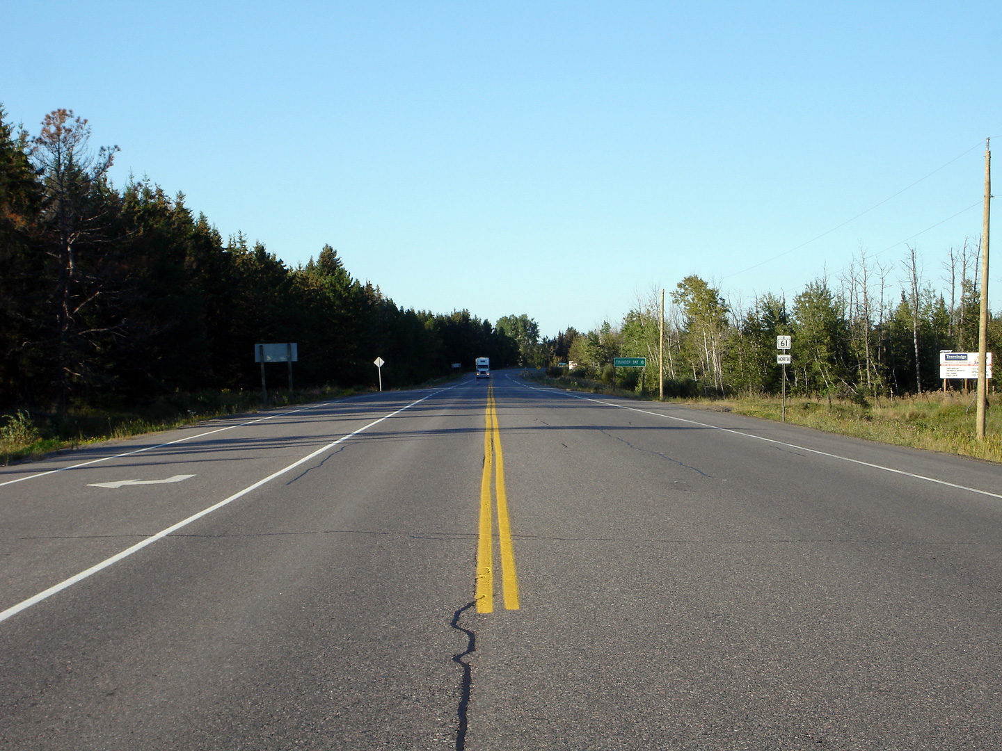
| District of Thunder Bay |
Northerly view some 25 km north of the US border. Considering the
light traffic volumes, Highway 61 is very well constructed, with numerous
passing lanes. Photo taken: August 30th, 2006. |
 |
||
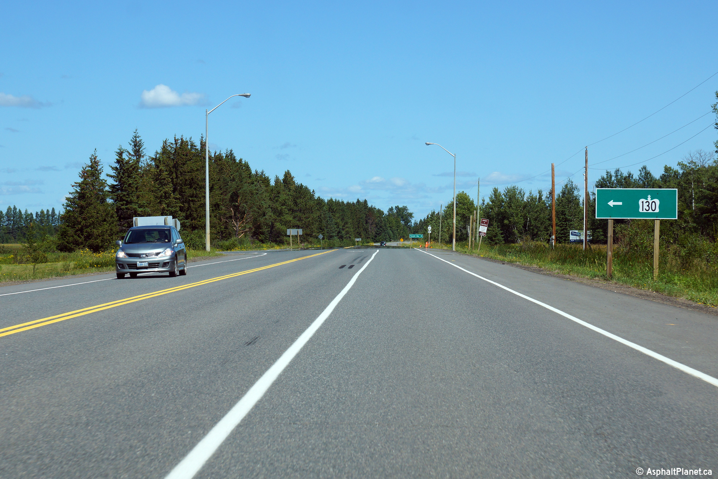
| Municipality of Oliver & Paipoonge District of Thunder Bay |
View looking south along Highway 61 from the Highway 130 junction.
South of Highway 130, Highway 61 begins to pass through more rugged terrain
as the valley the highway follows begins to narrow considerably. Click
here for a similar photo taken at this location, taken in 2006. Photo taken: August 13th, 2014. |
 (720x480) (1440x960) (2400x1600) |
||
| Municipality of Oliver & Paipoonge District of Thunder Bay |
View looking north towards the Highway 130 intersection. Click
here for a similar photo taken at this location, taken in 2006. Photo taken: August 13th, 2014. |
 (720x480) (1440x960) (2400x1600) |
||
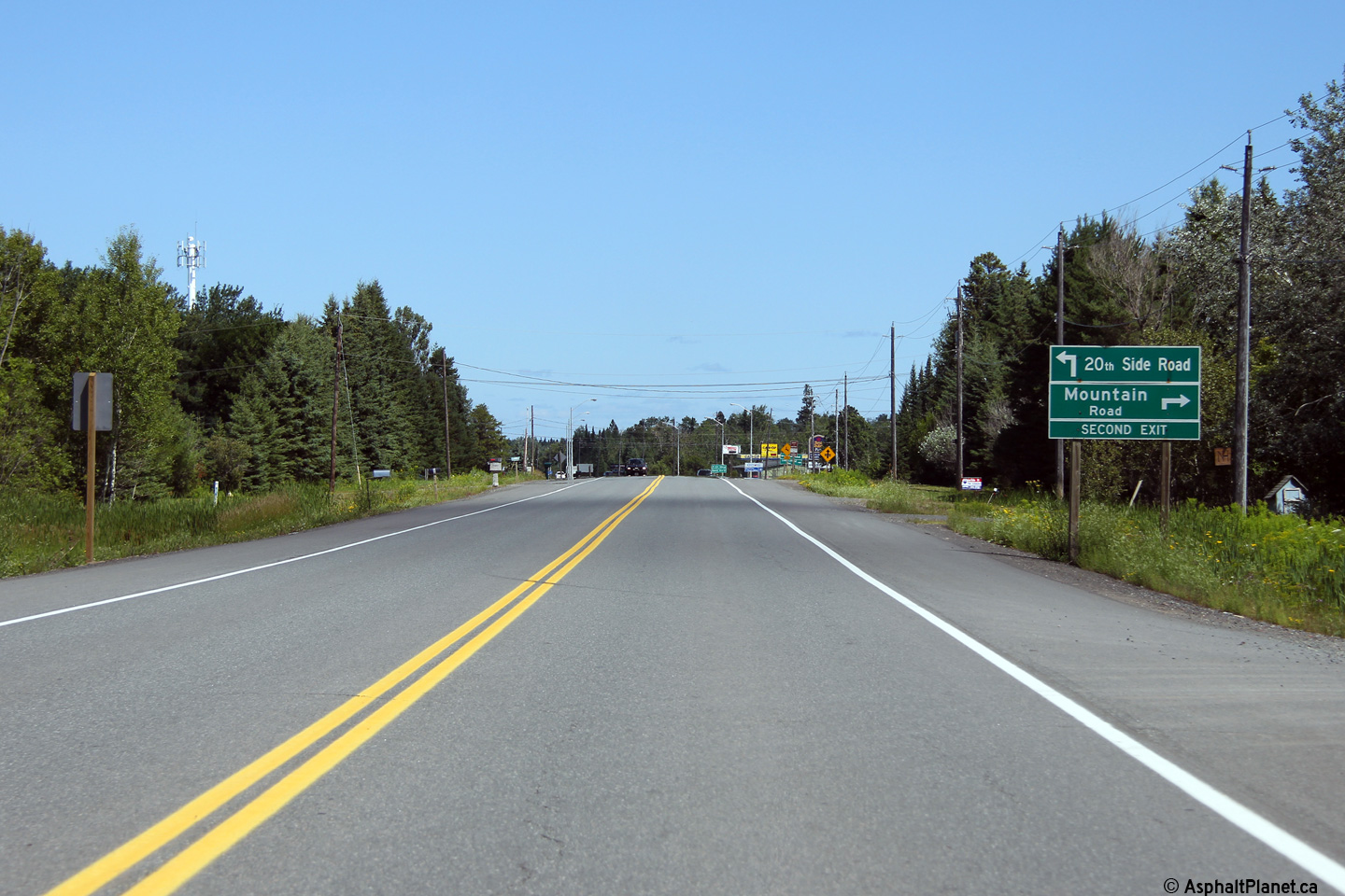
| Municipality of Oliver & Paipoonge District of Thunder Bay |
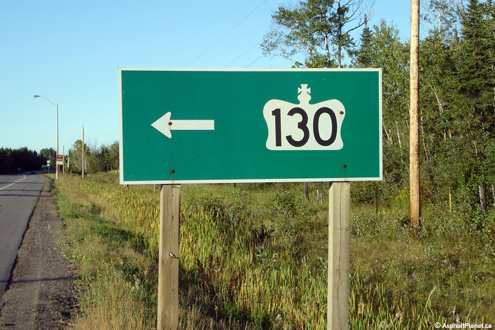
Green signage along Highway 61 denoting the intersection for northbound
vehicles. Photo taken: August 13th, 2014. |
 (720x480) (720x480)(1440x960) |
||
| Municipality of Oliver & Paipoonge District of Thunder Bay |
Looking north along Highway 61 from the Highway 130 intersection. Just
north of
Highway 130, Highway 61 curves easterly and runs parallel to Highway
11/17 for a
short distance before once again turning north and heading for Thunder Bay.
Click here for a similar photo taken at this location, taken in 2006. Picture taken: August 13th, 2014. |
 (720x480) (1440x960) (2400x1600) |
||
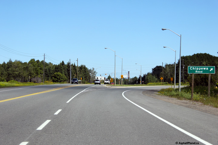
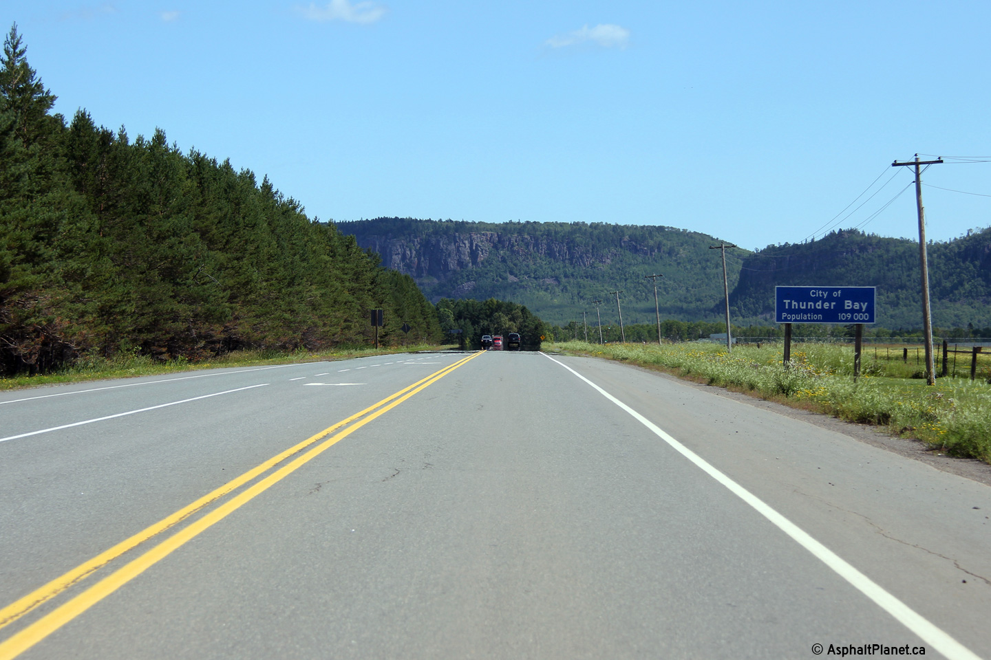
| City of Thunder Bay |
Signage welcoming northbound motorists into Thunder Bay just beyond the
Little Norway Road intersection. Photo taken: August 13th, 2014. |
 (720x480) (1440x960) (2400x1600) |
||
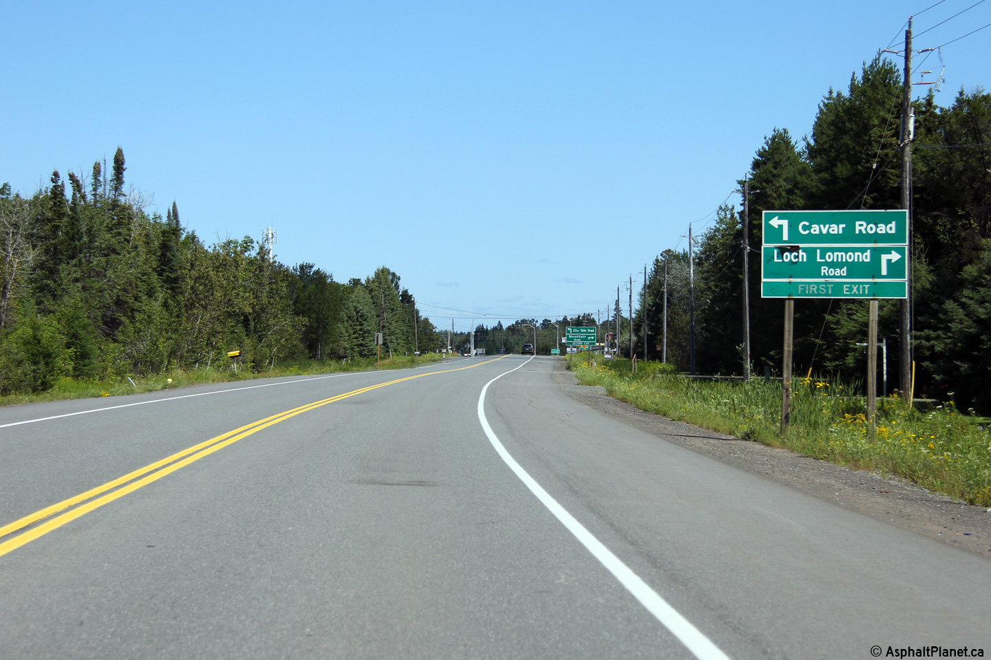
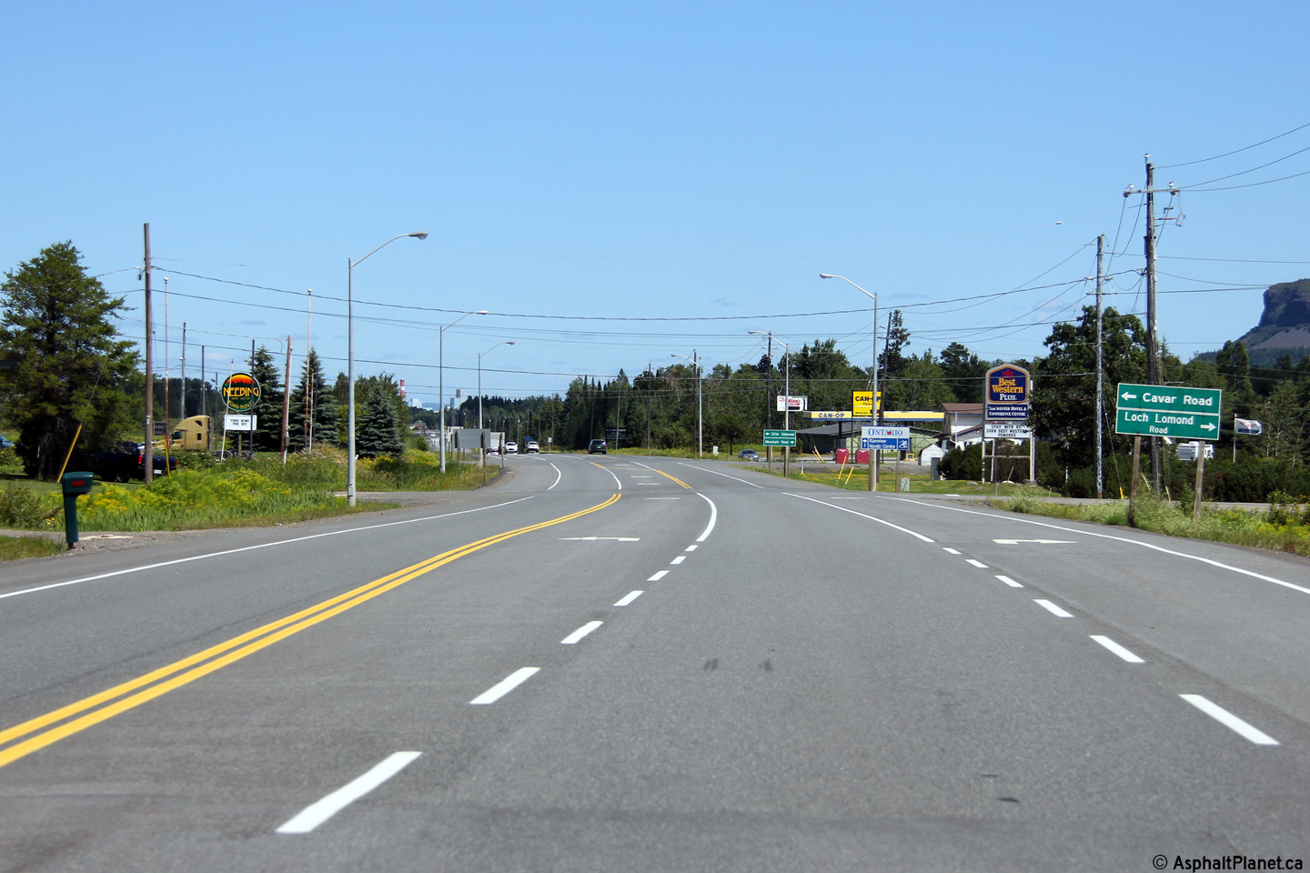
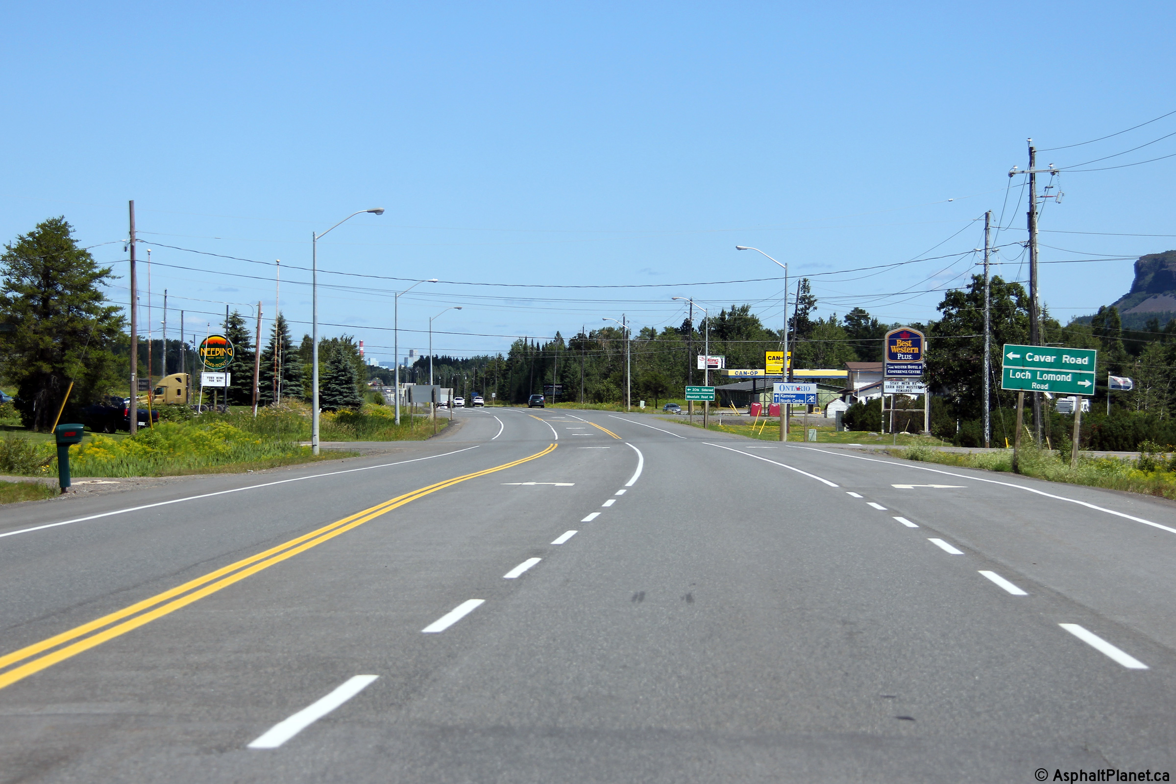
| City of Thunder Bay |
Advanced signage approaching the Loch Lomond Road intersection. Two
closely spaced intersections in the vicinity of Loch Lomond Road
intersection have necessitated some unique intersection signage. Photos taken: August 13th, 2014. |
 (720x480) (1440x960) (2400x1600)  (720x480) (1440x960) (2400x1600) |
||
| City of Thunder Bay |
View looking northerly approaching the Loch Lomond Road intersection. Photo taken: August 13th, 2014. |
 (720x480) (1440x960) (2400x1600) |
||
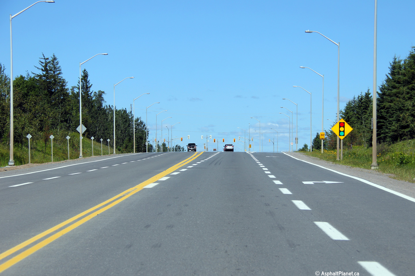
| City of Thunder Bay |
Northerly view approaching the Highway 61B intersection. Photo taken: August 13th, 2014. |
 (720x480) (1440x960) (2400x1600) |
||
| City of Thunder Bay |
View looking northerly along Highway 61 approaching the Kaministiquia River
Bridge. Photo taken: August 13th, 2014. |
 (720x480) (1440x960) (2400x1600) |
||
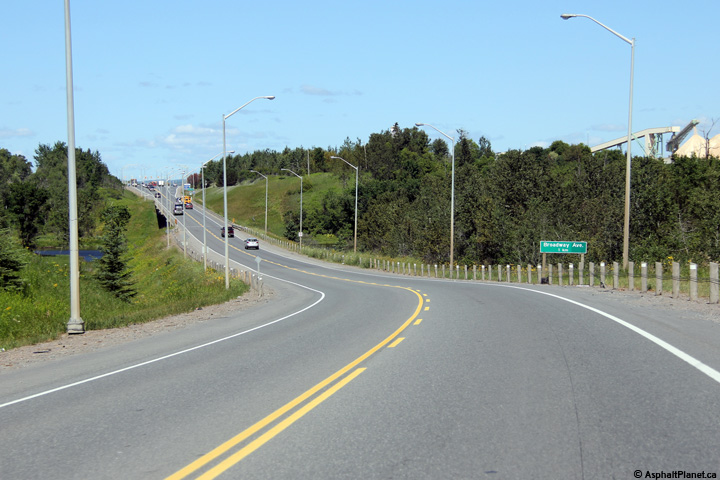
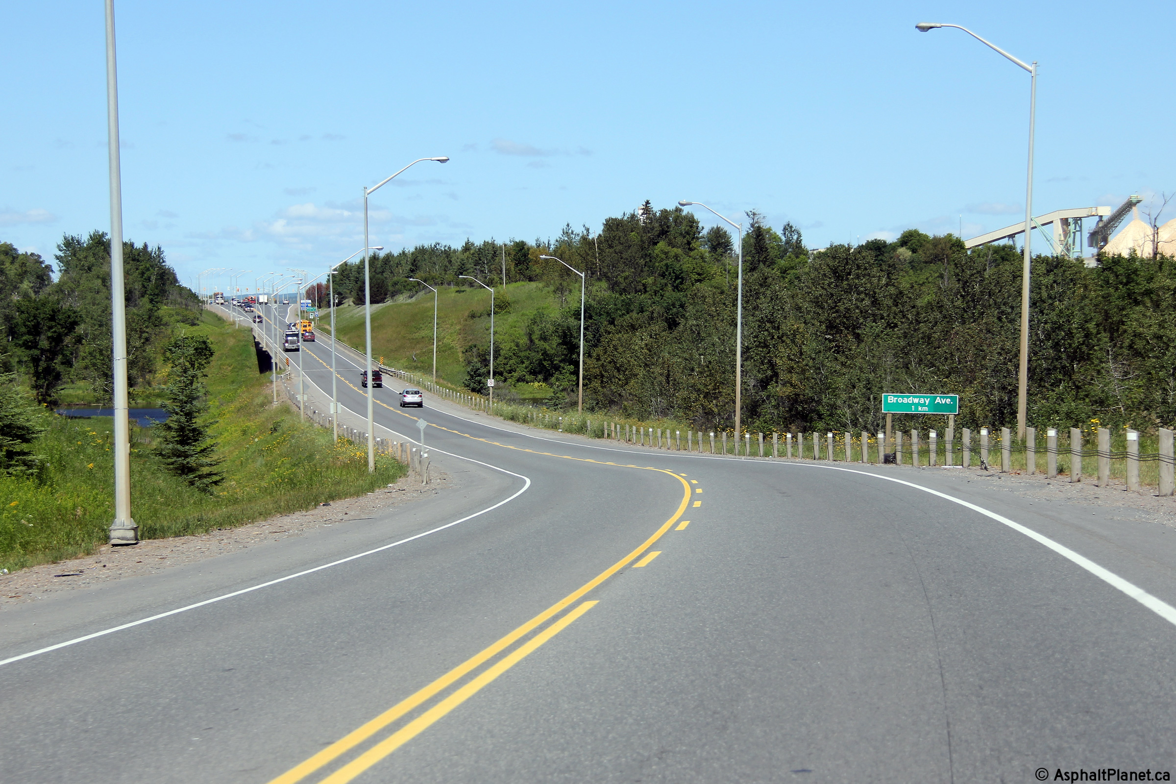
| City of Thunder Bay |
Two views as Highway 61 approaching the Broadway Street intersection north
of the Kaministiquia River Bridge Photos taken: August 13th, 2014. |
 (720x480) (1440x960) (2400x1600) 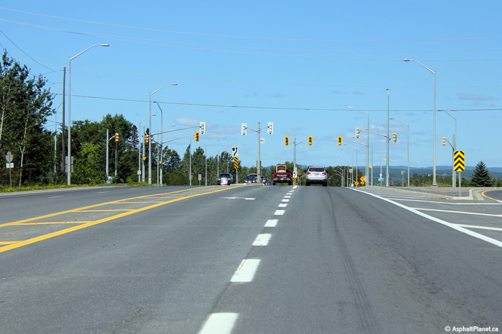 (720x480) (1440x960) (2400x1600) |
||
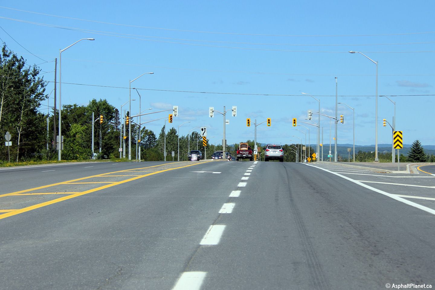
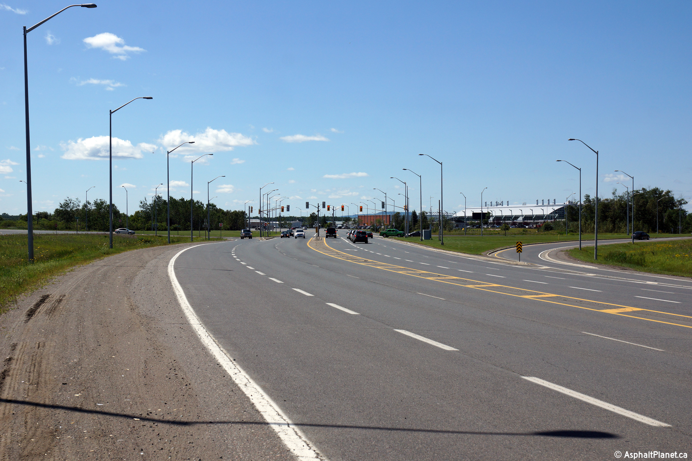
| City of Thunder Bay |
Two views looking northerly along Highway 61 approaching the Neebing Avenue
intersection. Photos taken: August 13th, 2014. |
 (720x480) (1440x960) (2400x1600)  (720x480) (1440x960) (2400x1600) |
||
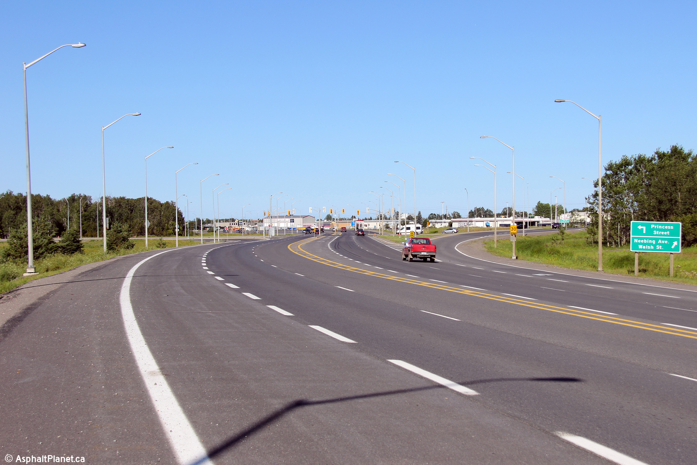
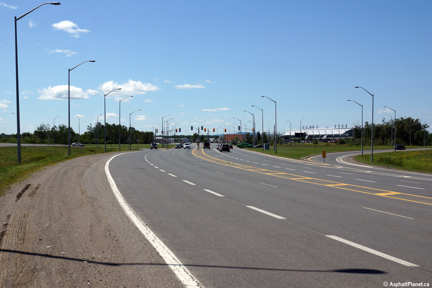
| City of Thunder Bay |
This view looks southerly approaching the Neebing Avenue intersection.
The terminal building for Thunder Bay International Airport is visible to
the right (west) of the highway in this photo. Photo taken: August 13th, 2014. |
 (720x480) (1440x960) (2400x1600) |
||
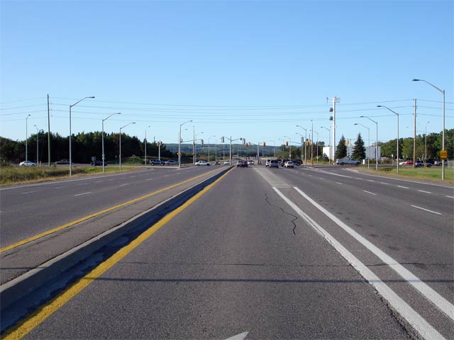
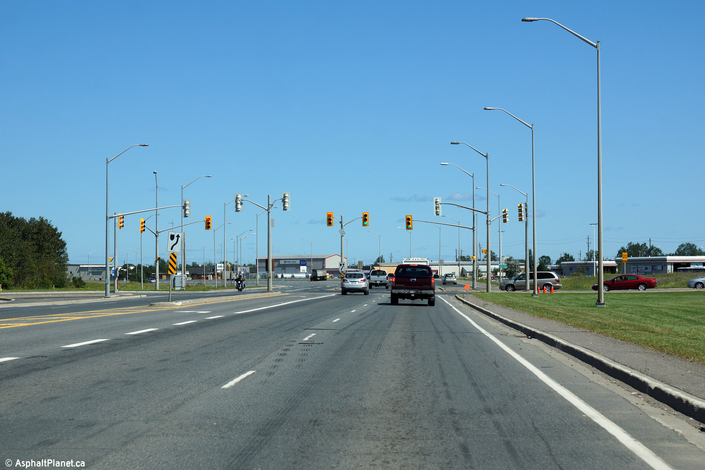
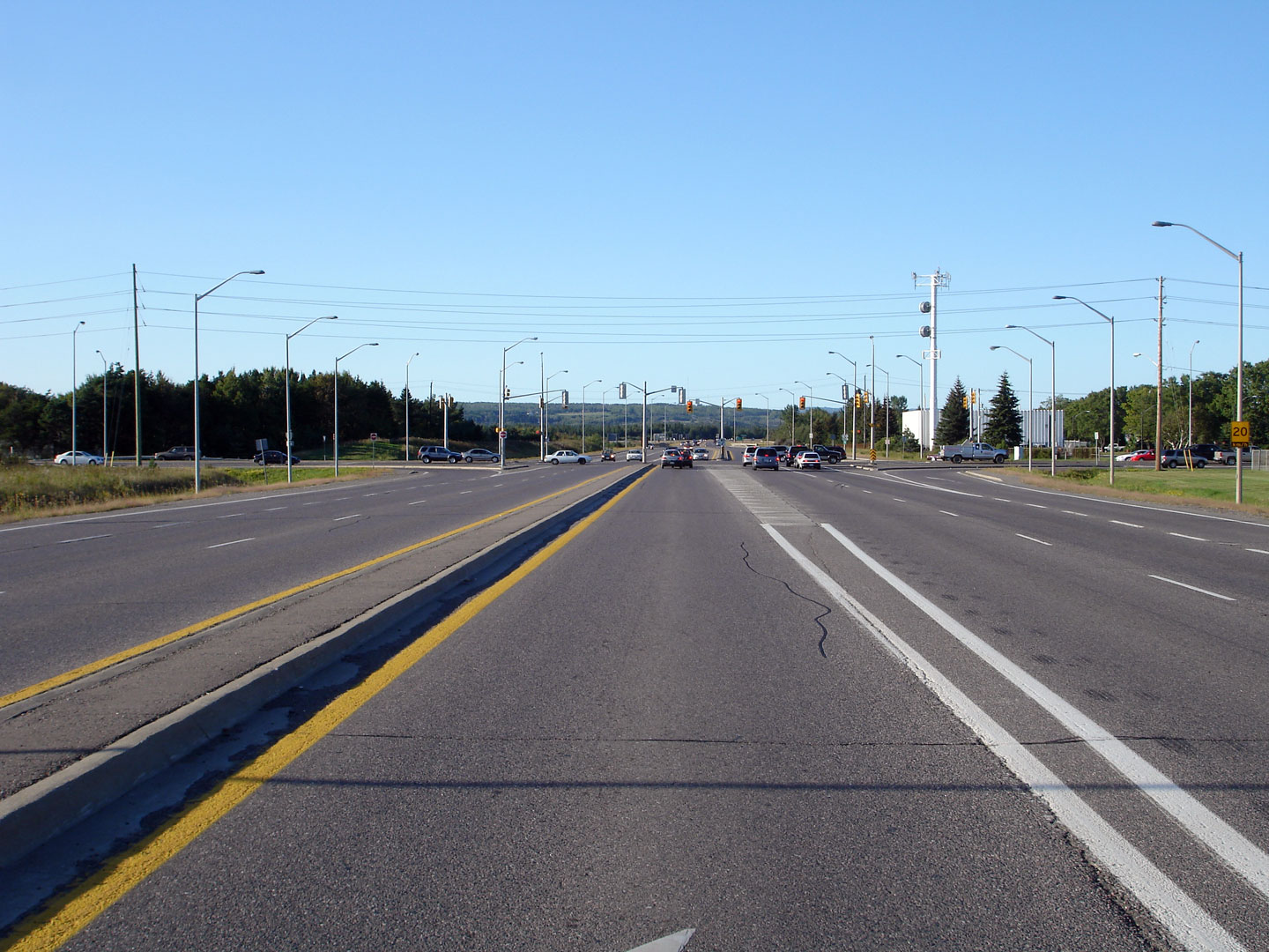
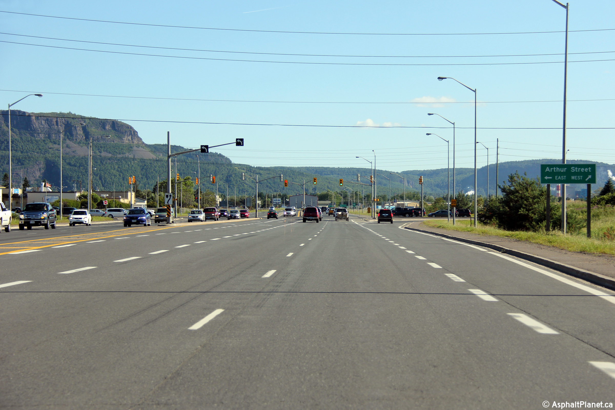
| City of Thunder Bay |
View looking north along the Thunder Bay expressway towards the Arthur
Street intersection. Notice the left turn lane for Arthur Street is
separated from the mainline lanes with concrete ripple strip median.
While once common on multi-lane highways, concrete ripple strips have fallen
out of favour with MTO highway designers. Photo taken: August 30th, 2006. |
 |
||
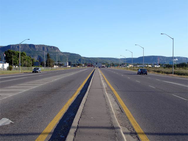
| City of Thunder Bay |
View looking south along Highway 61 from the Arthur Street (former Highway 11/17)
intersection. Photo taken: August 30th, 2006. |
 |
||
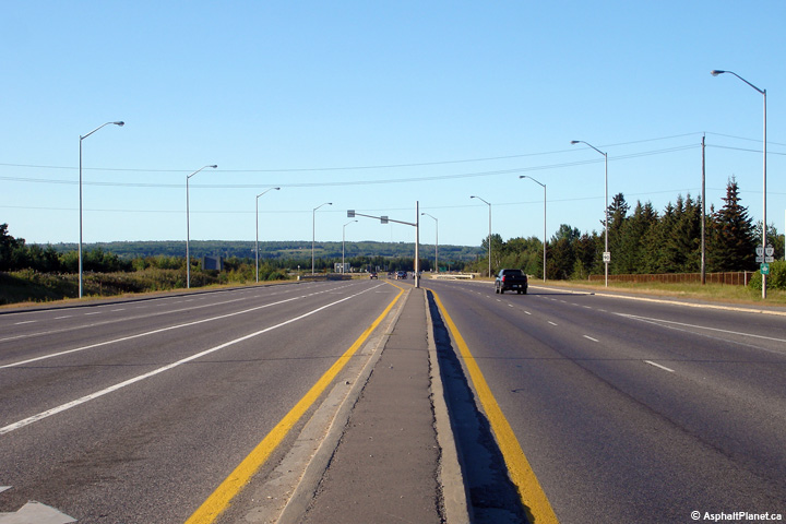
| City of Thunder Bay |
View looking northerly along the Thunder Bay Expressway from just
north of the Arthur Street
intersection. Notice the dual-left turning lanes for traffic turning
eastbound on Arthur Street. The Arthur Street intersection is the busiest
on the Thunder Bay Expressway. This portion of the Highway 61 was
still part of Highway 11/17 when this photo was taken. Photo taken: August 30th, 2006. |
 (720x480) (1440x960) |
||
| City of Thunder Bay |
Former southbound signage along the Thunder Bay Expressway approaching the
Arthur Street intersection. Before the Shabqua Highway opened in 2006,
Highway 11/17 followed Arthur Street west out of Thunder Bay. Highway
11/17 was rerouted onto the Shabaqua Highway after 2006, which saw Highway
61's alignment extended several kilometers to the north. Photo taken: July 3rd, 2004. |
|
||
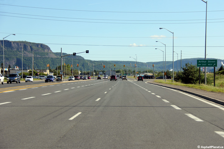
| City of Thunder Bay |
This view looks southerly approaching the Arthur Street intersection.
Before the completion of the Shabaqua Highway, Highway 11/17 followed Arthur
Street westerly out of Thunder Bay. Photo taken: August 13th, 2014. |
 (720x480) (1440x960) (2400x1600) |
||
| City of Thunder Bay |
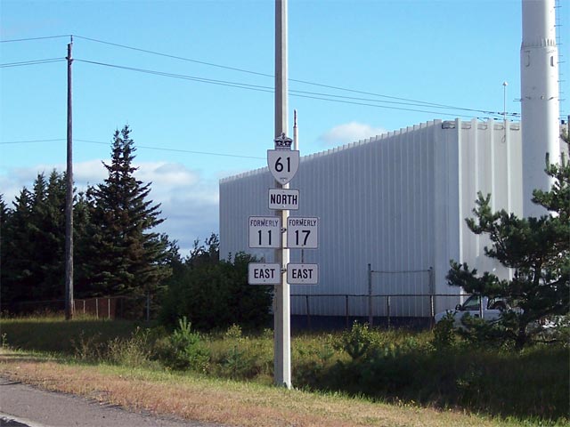
Newly erected (August 17th, 2007) formerly signage along the Thunder Bay
Expressway just north of Arthur Street. Highway 61 was extended north
of Arthur Street to the Harbour Expressway on August 17th, 2007 when Highway
11/17
was rerouted onto the newly constructed Shabaqua Expressway. Picture courtesy: Greg Fox. Taken: August 17th, 2007. |
 |
||
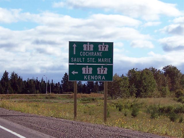
| City of Thunder Bay |
First advanced sigh for the Harbour Expressway and Highway
11/17
junction along Highway 61. Highway 61 ends at this junction, however
there is no ends assembly present. Picture courtesy: Greg Fox. Taken: August 17th, 2007. |
 |
||
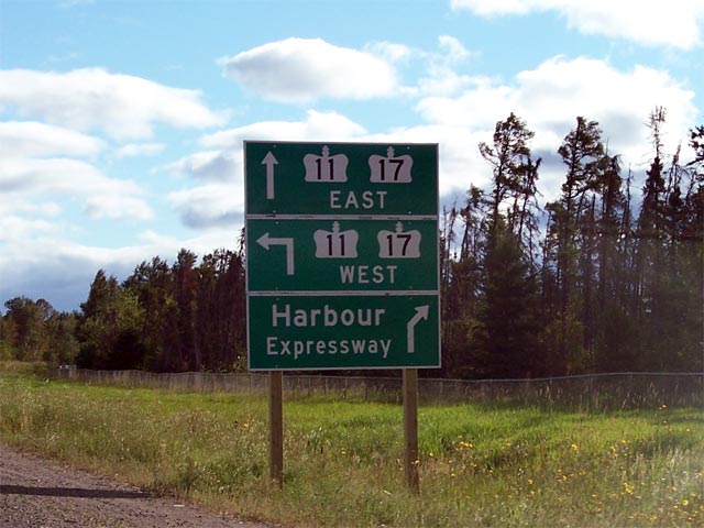
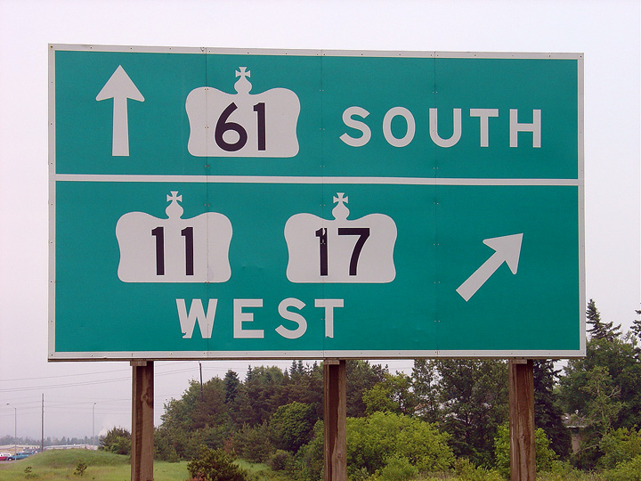
| City of Thunder Bay |
Signage denoting the Highway
11/17
junction at the Harbour Expressway. Notice the lack of cardinal
directions on this signage. Picture courtesy: Greg Fox. Taken: August 17th, 2007. |
|
||
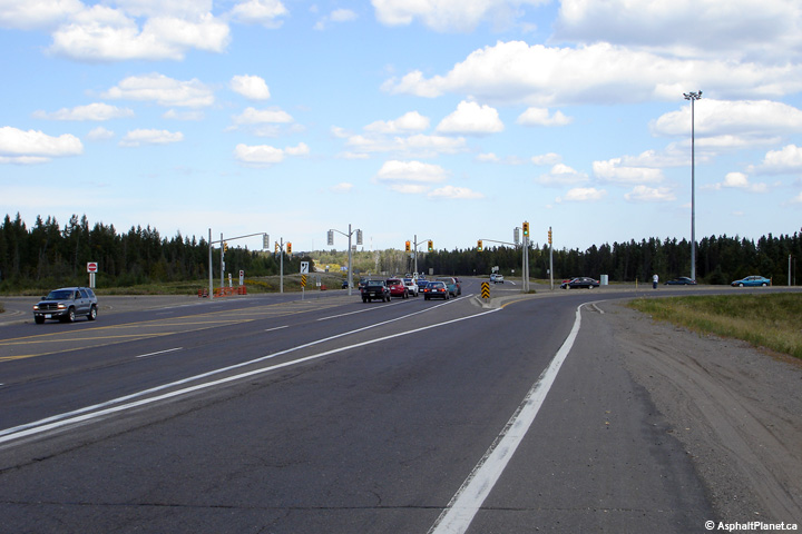
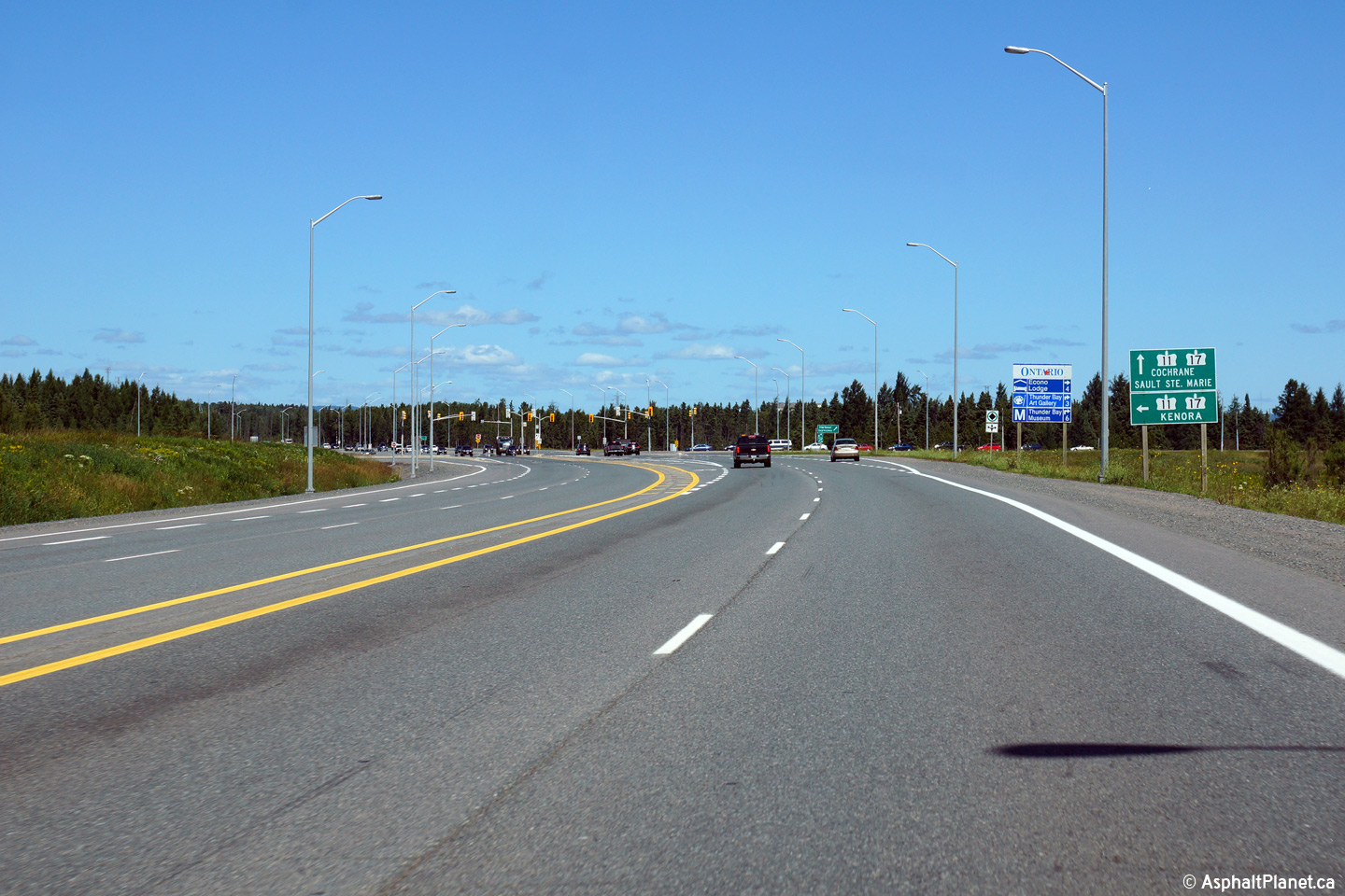
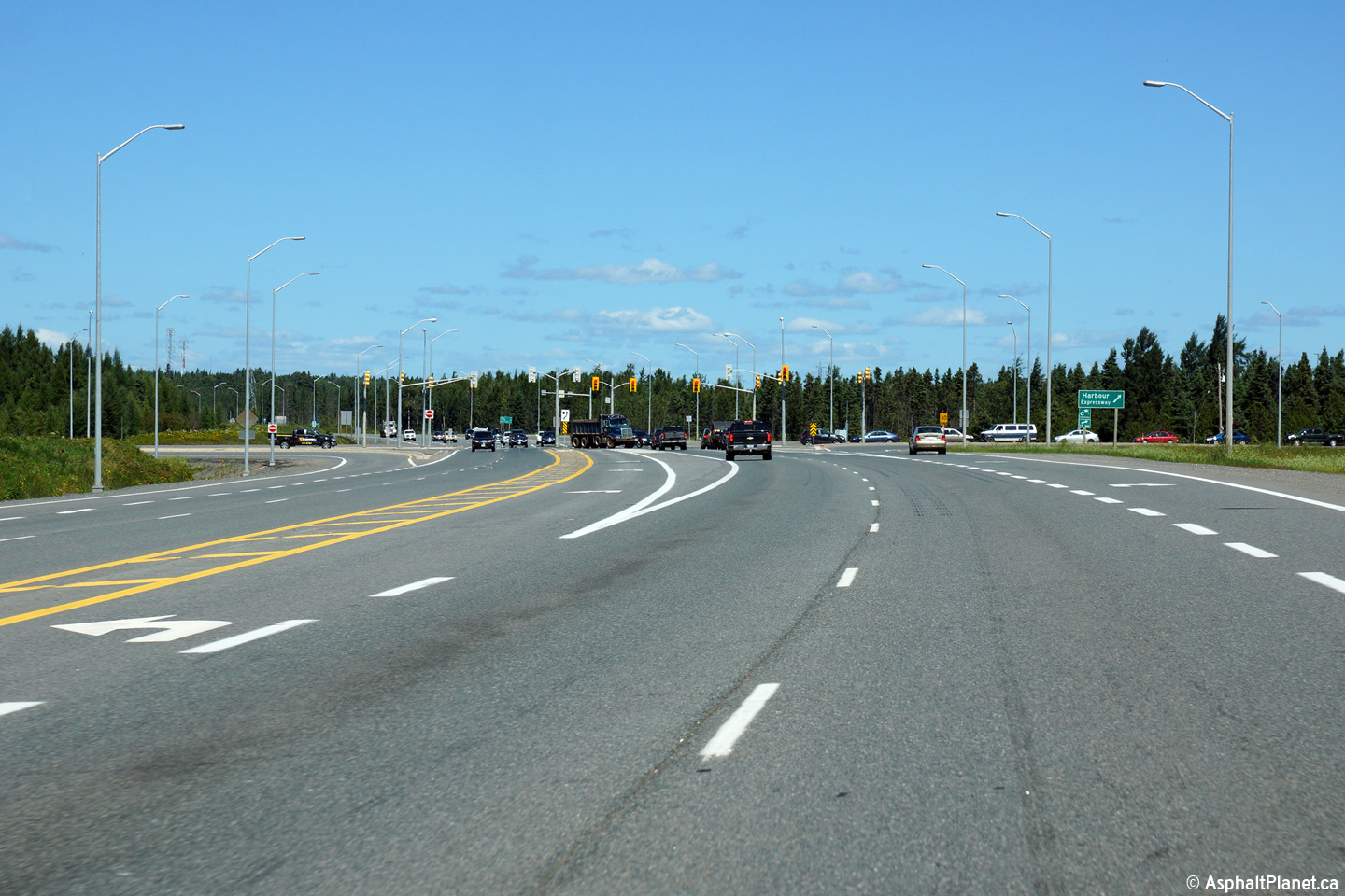
| City of Thunder Bay |
Views looking northerly along the Thunder Bay Expressway towards the
Highway 11/17 and Harbour Expressway intersection. The Harbour Expressway
was built jointly by the MTO and the Cities of the Port Arthur and Fort
William and was originally designated as Highway 131. The upper photo
shows the intersection prior to the completion of the Shabaqua Highway,
while the lower photos show the current and wider configuration. Upper photo taken: September 4th, 2006. Lower photos taken: August 13th, 2014. |
 (720x480) (1440x960) (2400x1600) 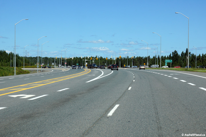 (720x480) (1440x960) (2400x1600) |
||
|
Highway 61 ends at Highway 11/17, the Trans-Canada Highway. Click here for Highway 11 West and East Images, and here for Highway 17 West and East Images. |
||||
<- Highway 60 Images Back to Highway 61 Highway 62 Images ->
Copyright (c) 2004-2015, Scott Steeves (Webmaster) scott@asphaltplanet.ca
