|
Proper Municipality Name |
Photo Description |
Photo |
|
Pictures taken
from driver's perspective appear offset from centre-line pictures: |
East-
Bound |
West-
bound |
|
Continued from
Thunder Bay to Pass Lake
Images |
|
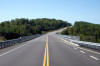
Township of Shuniah District of Thunder Bay |
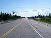
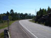
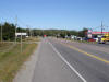
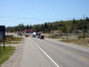
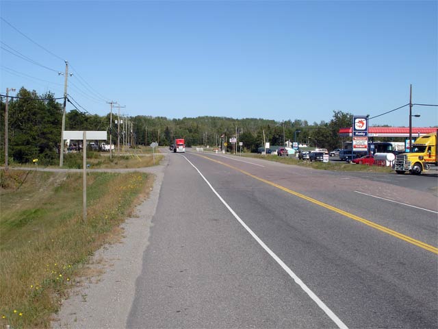
View looking westerly along Highway 11/17towards
the Highway 587 junction. Because of the high volume of traffic at
this intersection, there are several large truck stops in the area.
Picture taken: August 30th, 2006. Size: 40kb. |
 |
|
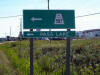
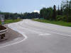
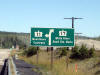
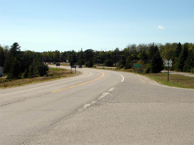
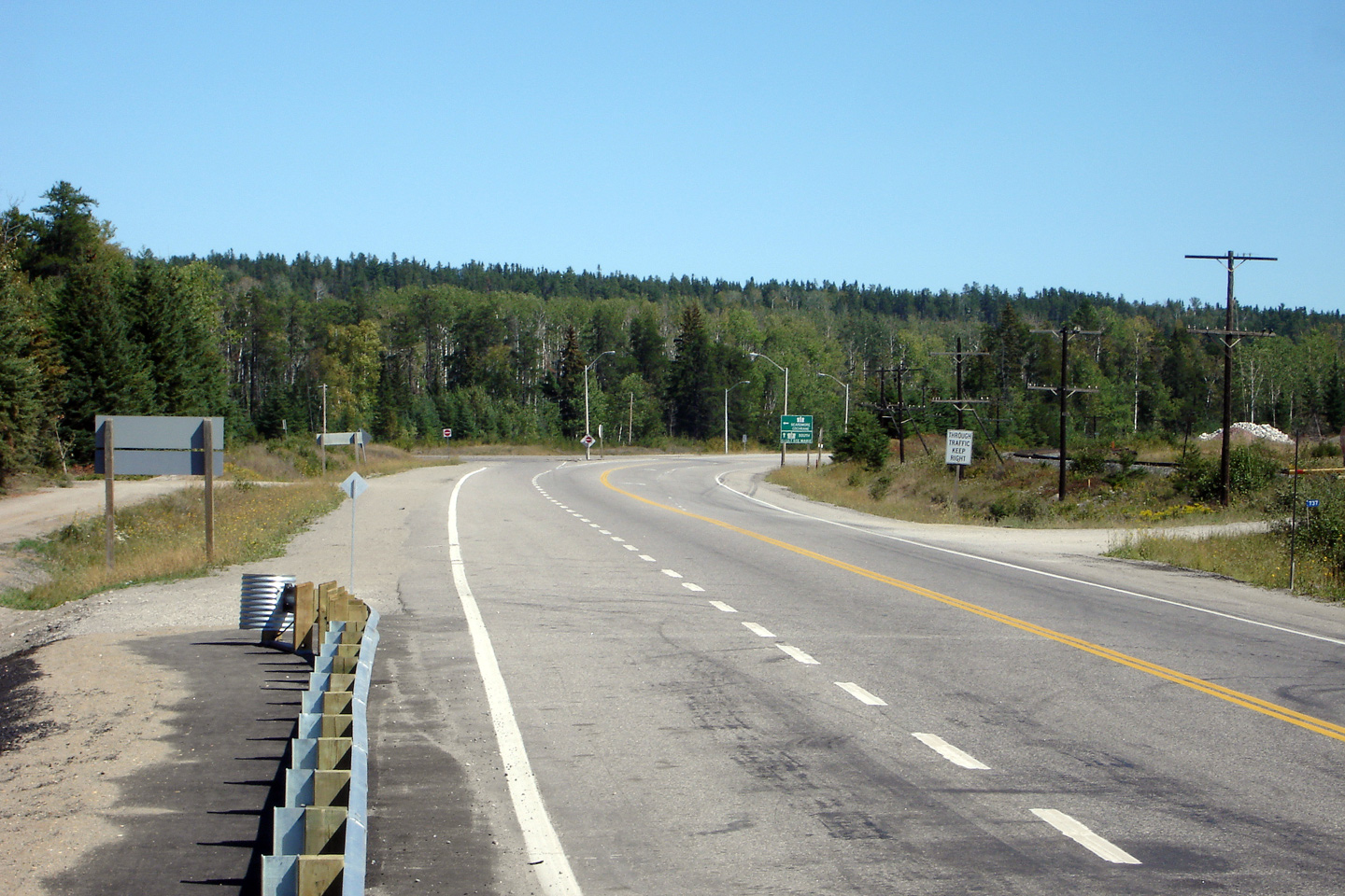
Township of Shuniah District of Thunder Bay |
Signage directing westbound motorists towards Secondary Highway 587.
Highway 587 leads south from Highway 11/17 to Pass Lake and towards Sibley
(Sleeping Giant) Provincial park. Click here for Highway 587 images
(Coming Soon!).
Picture size: 40kb. |
 |
|
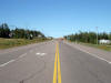
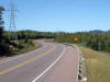
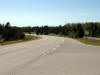
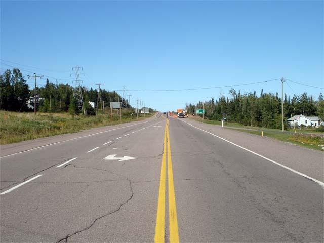
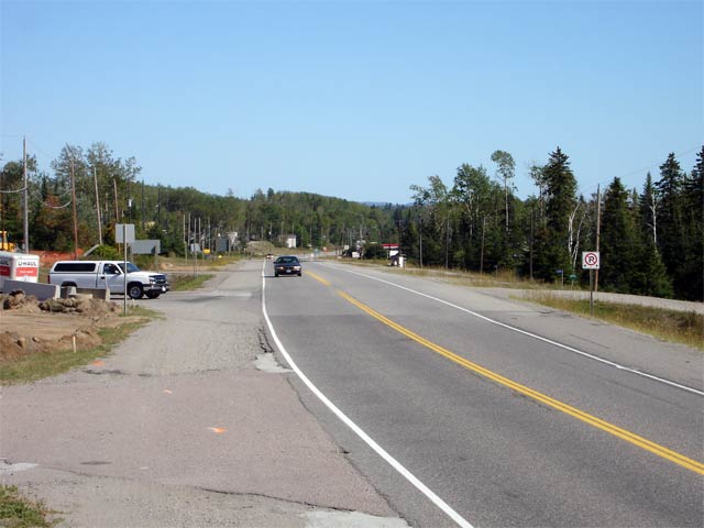
Township of Shuniah District of Thunder Bay |
Looking easterly from the Highway 587 junction along Highway 11/17.
Notice the two lane detour in the distance. This stretch of Highway 11/17
is being reconstructed during 2006/07 and the vertical alignment over this
small hill will be revised and improved.
Picture taken: August 30th, 2006. Size: 30kb. |
 |
|
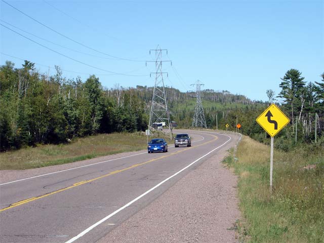
District of Thunder Bay |
View looking easterly along Highway 11/17
from roughly 13km east of the Pass Lake junction. Here the road curves
to avoid a small body of water and a large outcropping of rock. Picture
taken: August 30th, 2006. Size: 45kb. |
 |
|
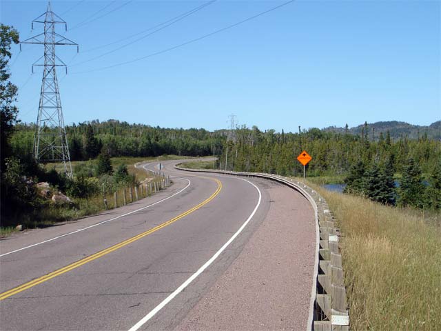
District of Thunder Bay |
View looking westerly at the same curve. Notice the close proximity of
the rock cut to the highway, reducing the westbound sight distance.
Picture taken: August 30th, 2006. Size: 45kb. |
 |
|
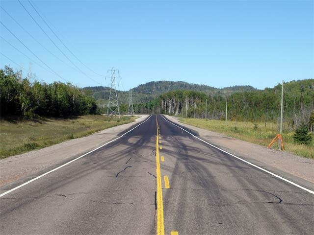
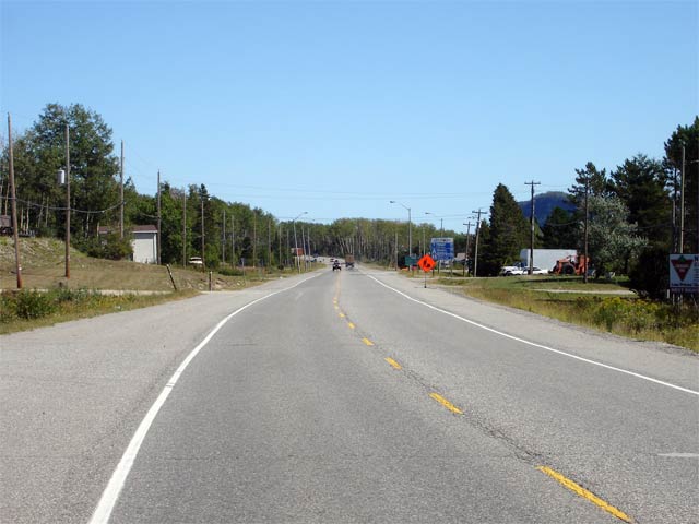
District of Thunder Bay |
Looking east along Highway 11/17 further
east along the same curve. Picture taken: August 30th, 2006. Size:
40kb. |
 |
|
District of Thunder Bay |
Looking once again easterly from about 1km east of the previous reversing
curve. This shot shows the western limit of a portion of highway that
was reconstructed in 2005/2006. Notice the wider shoulders and
improved design standards of the reconstructed stretch of highway.
Click here for high resolution image (205kb).
Picture taken: August 30th, 2006. Size: 40kb. |
 |
|
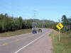
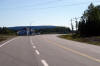
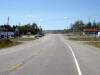
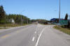
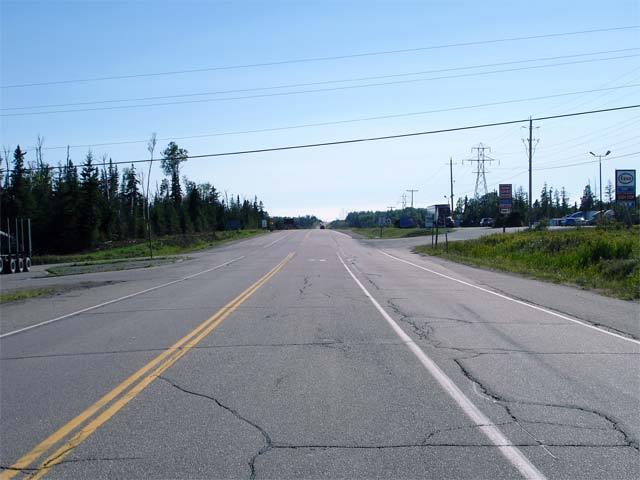
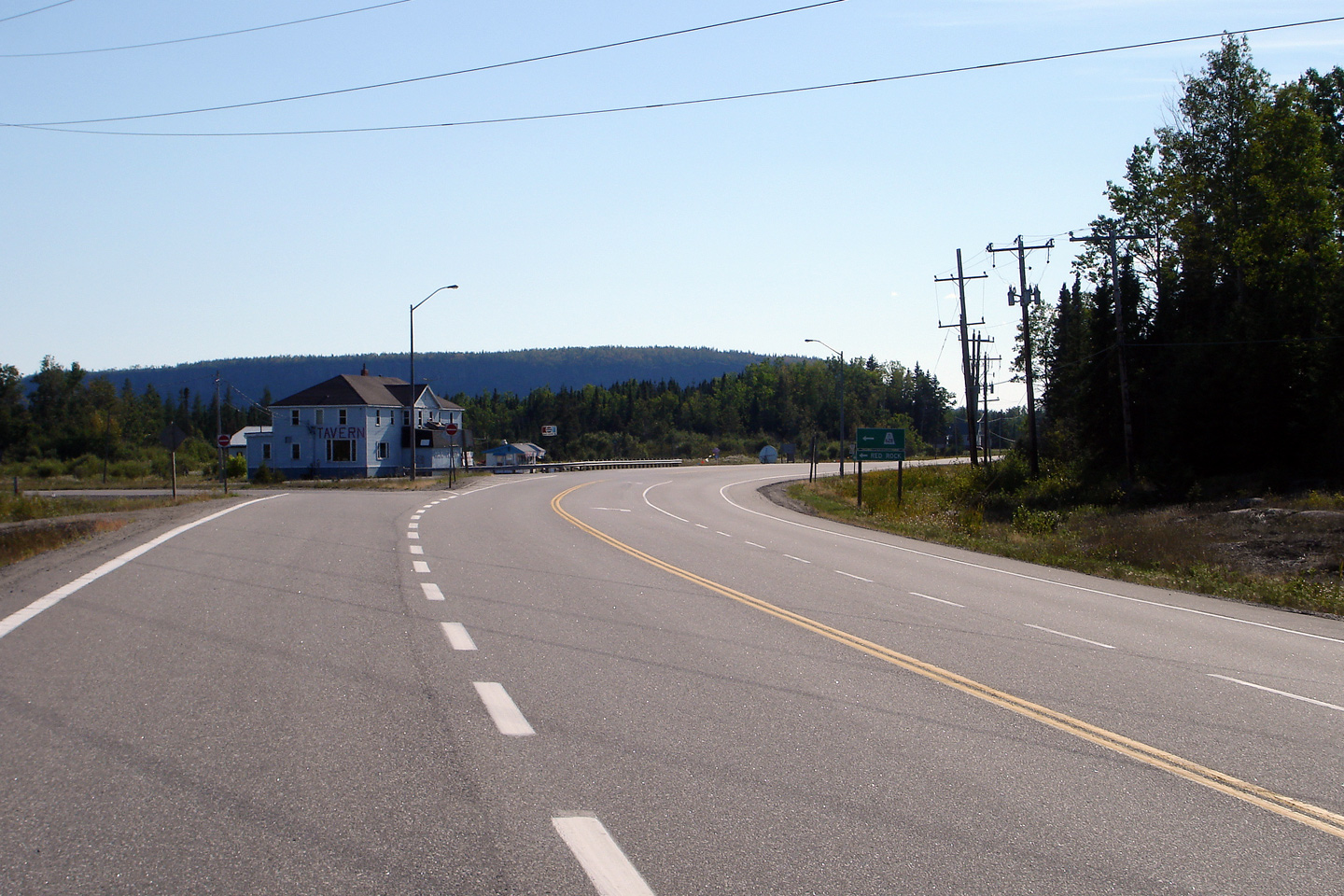
Township of Red Rock District of Thunder Bay |
Looking westerly towards Thunder Bay from the Highway 628 junction on
Highway 11/17. Picture taken: July 13th, 2004. Size: 55kb. |
 |
|
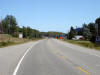
Township of Red Rock District of Thunder Bay |
Westerly view towards the Highway 628 junction.
Picture taken: September 4th, 2006. |
Low-res
High-res |
|
Township of Red Rock District of Thunder Bay |
View looking east along Highway 11/17 from the Highway 628 junction
Picture taken: September 4th, 2006. |

Low-res
High-res |
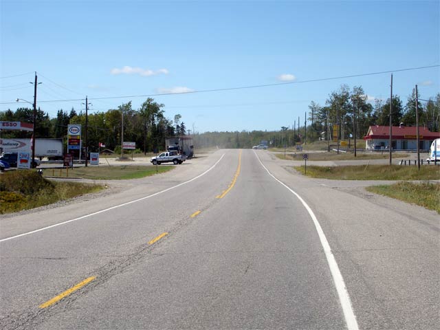
| Township of Nipigon District of
Thunder Bay |
Looking west along Highway 11/17 from roughly 800m west of Highway 585.
Picture taken: August 30th, 2006. Size: |
 |
| Township of Nipigon District of
Thunder Bay |
View looking easterly towards Nipigon from roughly 800m west of the Highway
585 junction. The roadside development that litters Highway
11/17 throughout Nipigon begins off at
roughly this point and continues as far easterly as First Street.
Picture taken: August 30th, 2006. Size: 45kb. |
 |
| Township of Nipigon District of
Thunder Bay |
View looking westerly from the Highway 585 junction at Nipigon.
Highway 585 is a relatively short highway that leads northerly from Nipigon
paralleling the Nipigon River to Pine Portage near the southern shores of
Lake Nipigon.
Picture taken: August 30th, 2006. Size: 45kb. |
 |
| Township of Nipigon District of
Thunder Bay |
View looking easterly towards the central part of Nipigon from the Highway
585 junction. Picture taken: August 30th, 2006. Size: 40kb. |
 |
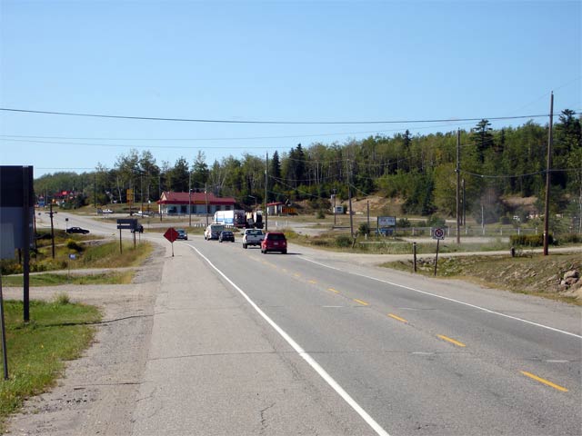
| Township of Nipigon District of
Thunder Bay |
Looking westerly towards the Highway 585 junction in Nipigon from roughly
halfway between the Highway 585 and First Street intersections. Picture
taken: August 30th, 2006. Size: 45kb. |
 |
| Township of Nipigon District of
Thunder Bay |
This time looking easterly from the same location as the previous picture.
Despite the amount of roadside development that has been allowed along
Highway 11/17 through Nipigon, Highway
11/17 has never been upgraded from
its rural standard.
Picture taken: August 30th, 2006. Size: 45kb. |
 |
| Township of Nipigon District of
Thunder Bay |
View looking westerly from the First Street intersection in Nipigon.
Picture taken: August 30th, 2006. Size: 45kb. |
 |
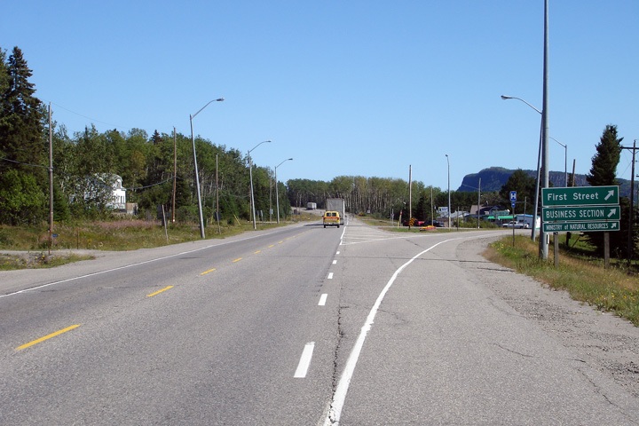
| Township of Nipigon District of
Thunder Bay |
View looking easterly along Highway 11/17 towards the First Street
intersection in Nipigon. Before the Nipigon By-pass was completed in
the 1970s Highway 11/17 followed First
Street and Railway Street into the heart of Nipigon.
Picture taken: August 30th, 2006. Size: 45kb. |
Low-res
High-res |
| Township of Nipigon District of
Thunder Bay |
Looking westerly towards the Railway Street intersection at the eastern end
of Nipigon. A westbound passing lane extends easterly along much of
the Nipigon By-pass starting from Railway Street. Picture taken: August
30th, 2006. Size: 45kb. |
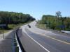 |
| Township of Nipigon District of
Thunder Bay |
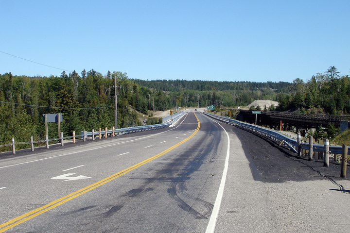
Looking east along Highway 11/17 towards the
Nipigon River bridge. This structure was rehabilitated during the 2006
construction season and was constructed in the mid 1970s. Picture taken:
August 30th, 2006. Size: 50kb. |
Low-res
High-res |
| Township of Nipigon District of
Thunder Bay |
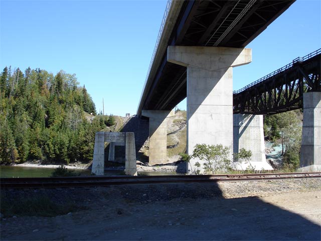
Looking westerly across the high-level Nipigon River structure. The
current high-level bridge is substantially higher then the original Nipigon
River bridge. Click here for a photo showing the original bridge's
piers compared to the current structure.
Picture taken: August 30th, 2006. Size: 40kb. |
Low-res
High-res |
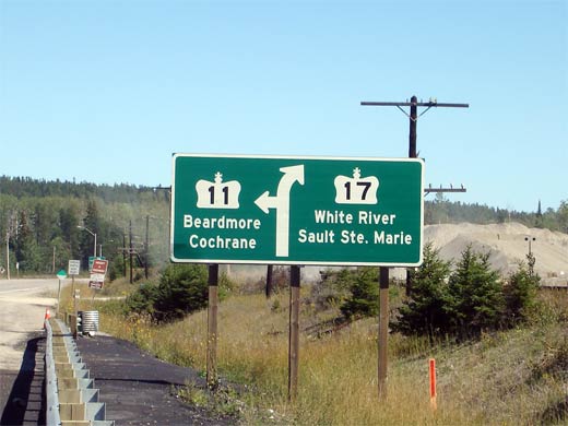
| Township of Nipigon District of
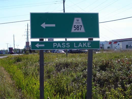
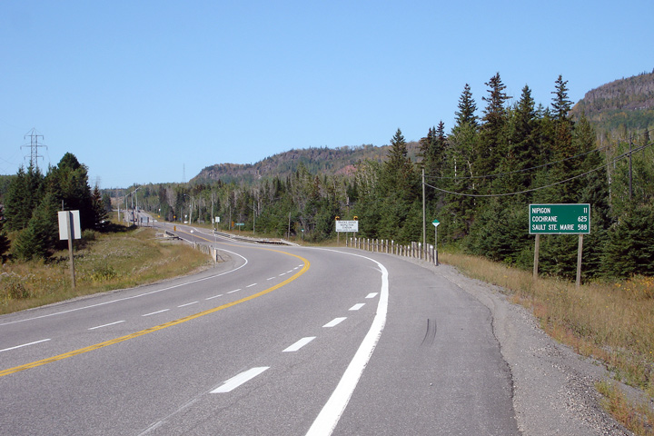
Thunder Bay |
Green signage denoting the Nipigon and eastern Highway
11/17 junction. Past this junction
Highway 11 heads northerly following the
Nipigon River to Beardmore before turning east towards Kapuskasing and
Cochrane. Highway 17 continues to follow the north shore of Lake
Superior heading towards Sault Ste Marie.
Picture size: 35kb. |
 |
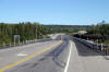
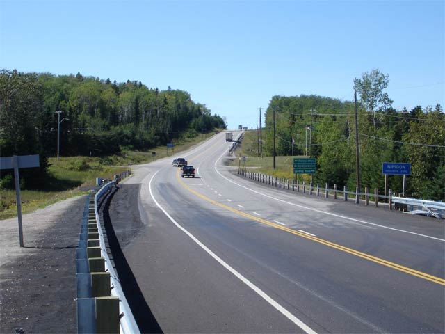
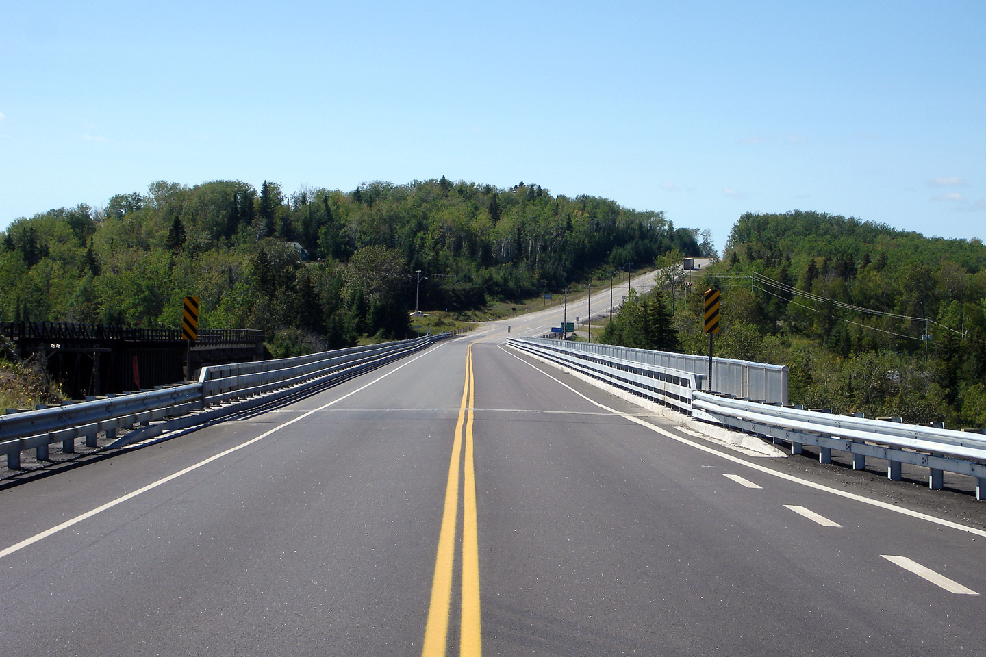
| Township of Nipigon District of
Thunder Bay |
View looking east along Highway 11/17 at the
Nipigon junction. This junction is located immediately east of the
Nipigon River. Picture taken: August 30th, 2006. Size: 50kb. |

Low-res
High-res |
|
Continues easterly on
Nipigon to
Schreiber Images |


