AsphaltPlanet.ca > OntHighways >
Highway 125 > Images
King's Highway 125 - Images
Photos shown in this table are arranged from South to North:
|
Proper Municipality Name |
Photo Description |
Photo |
|
|
Pictures taken from driver's perspective appear offset from centre-line pictures: |
North- |
South- |
|
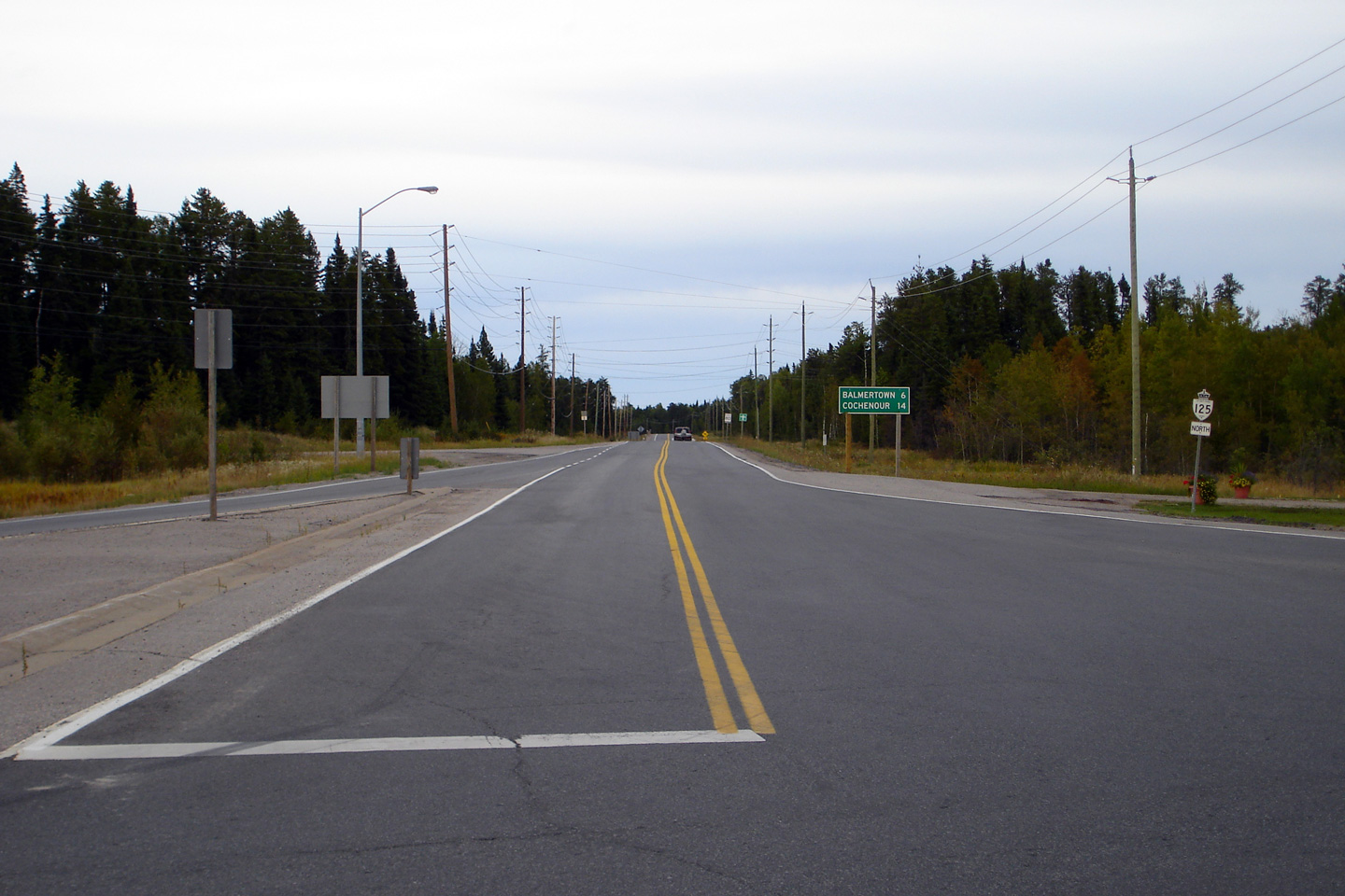
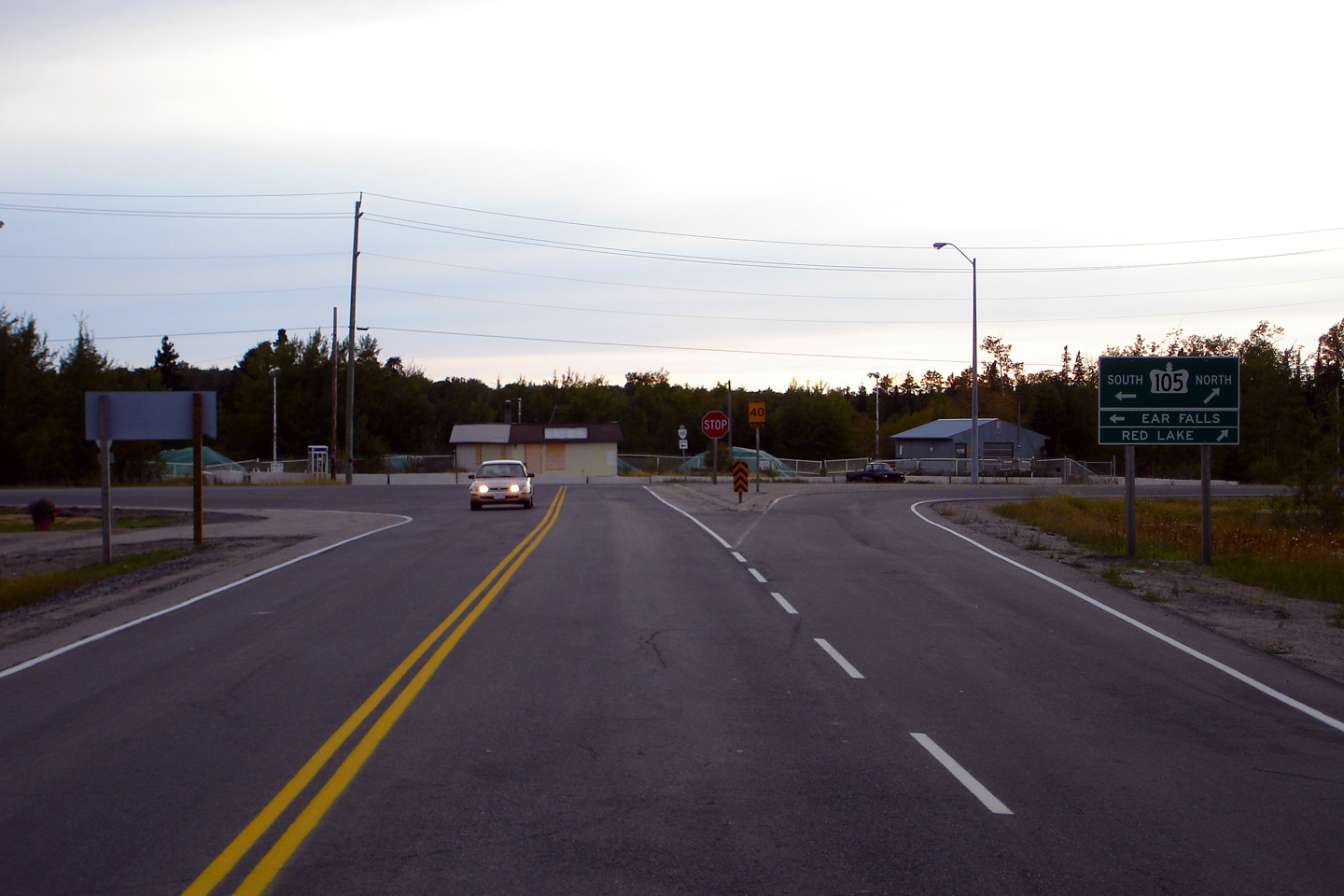
| Town of Red Lake District of Kenora |
Northerly view from the Highway 105 junction
along Highway 125. Photo taken: September 1st, 2006. |
 (720x480) (1440x960) |
|
| Town of Red Lake District of Kenora |
Southerly view approaching the southern terminus
of Ontario's northern-most King's Highway. Photo taken: September 1st, 2006. |
 (720x480) (1440x960) |
|
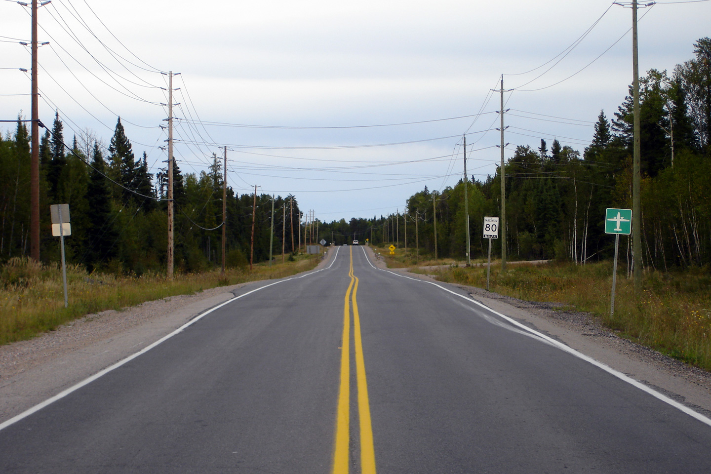
| Town of Red Lake District of Kenora |
Another northerly view, this time taken from
about 100m north of the Highway 105 junction. Photo taken: September 1st, 2006. |
 (720x480) (1440x960) |
|
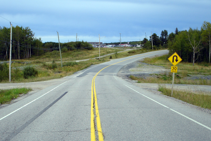
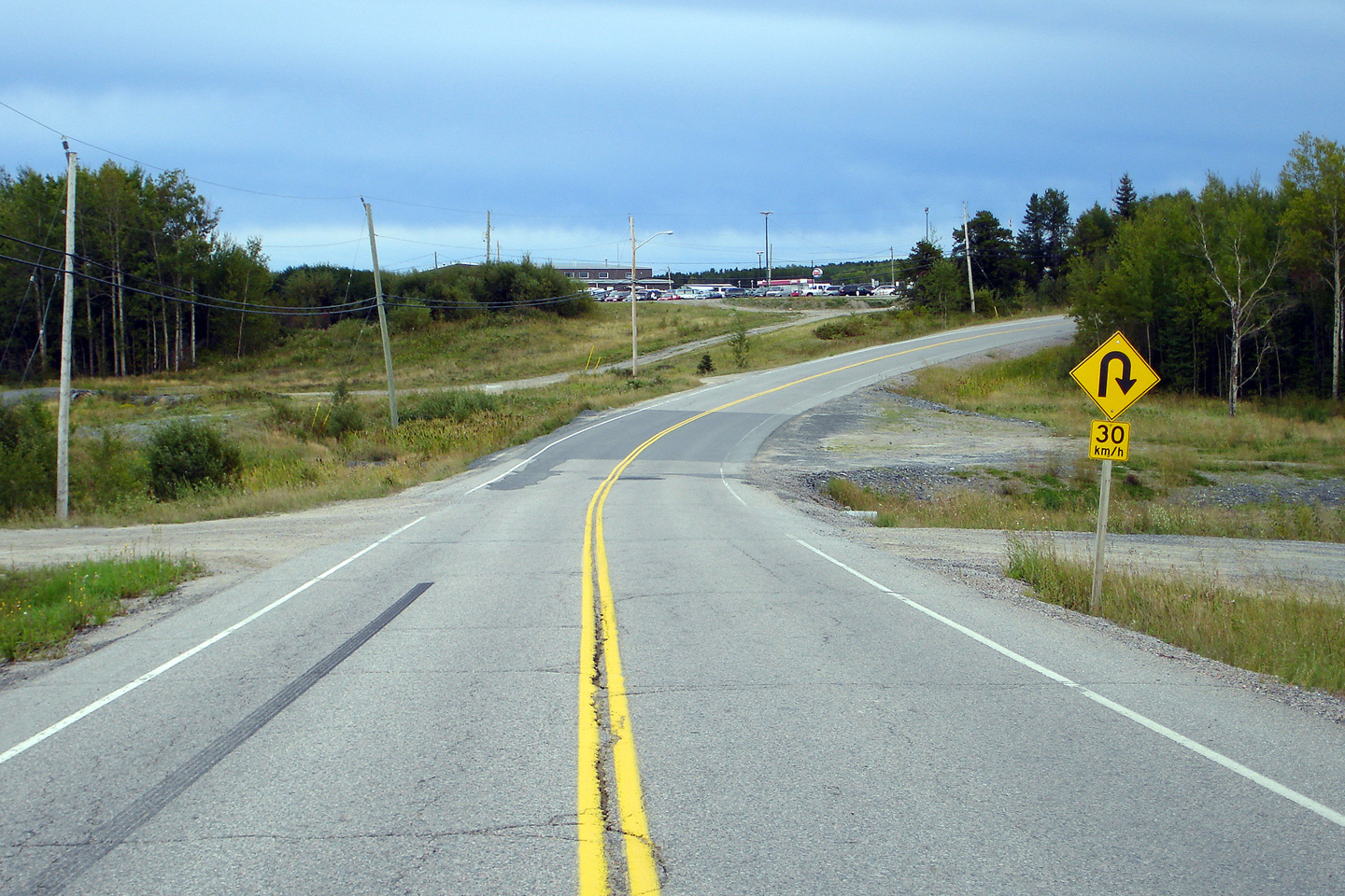
| Town of Red Lake District of Kenora |
Highway 125 arcs around Red Lake Airport's
runway between Balmertown and Cochenour -- hence the 30km/h advisory speed
around the curve. This view looks southerly. Photo taken: September 1st, 2006. |
 (720x480) (1440x960) |
|
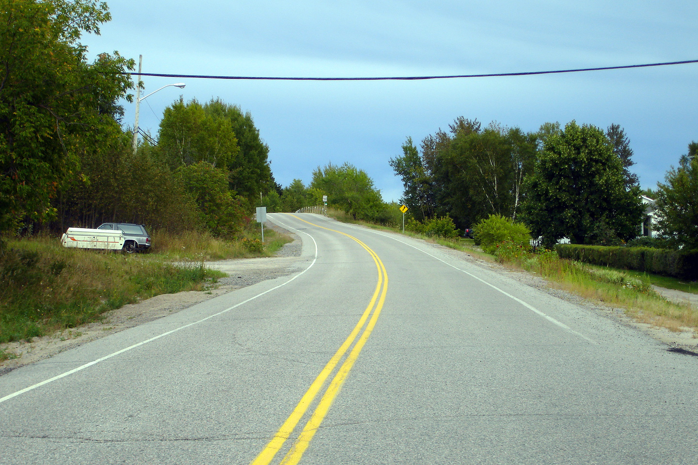
| Town of Red Lake District of Kenora |
Southerly view from just south of Red Lake at
Cochenour. Photo taken: September 1st, 2006. |
 (720x480) (1440x960) |
|
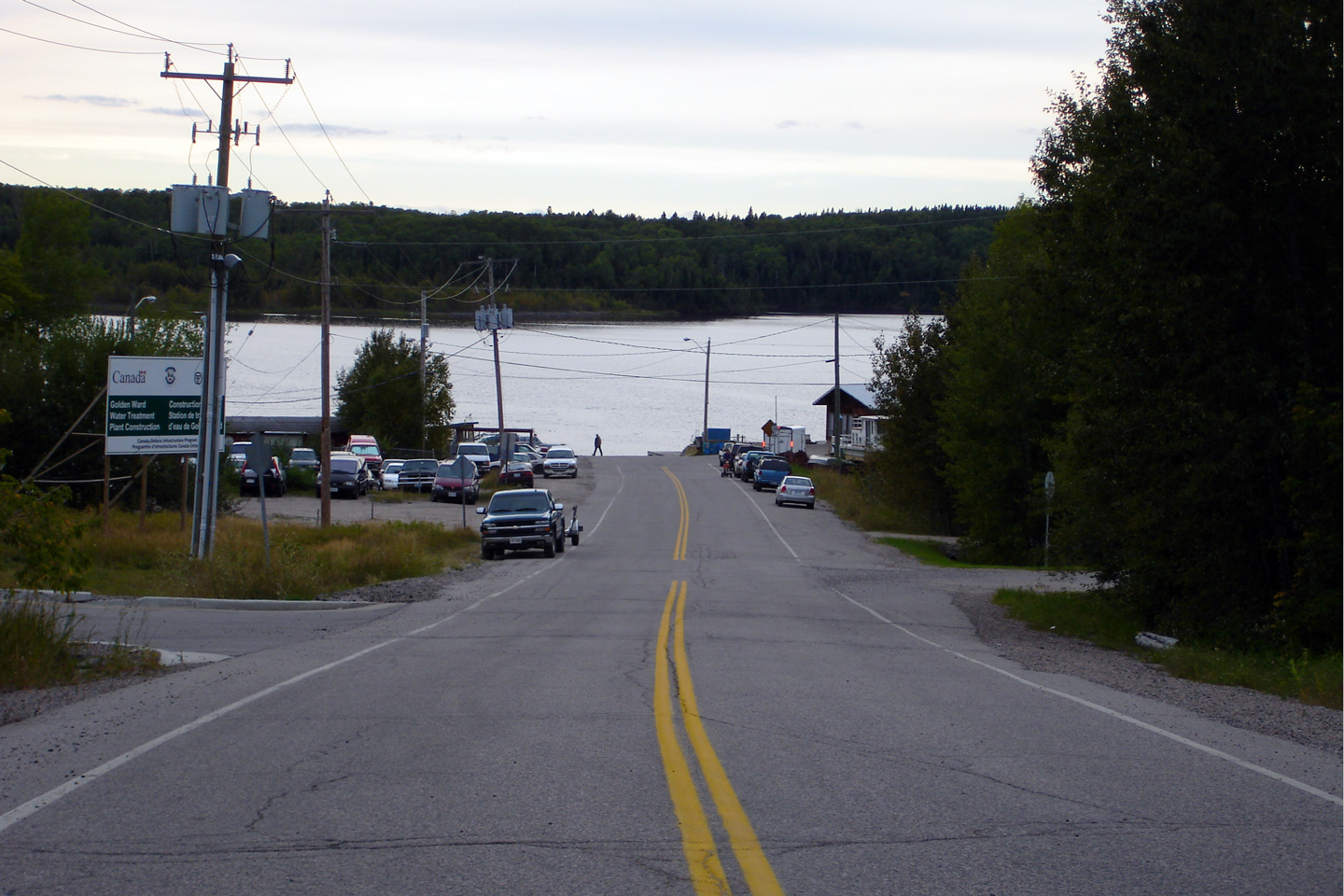
| Town of Red Lake District of Kenora |
Highway 125 ends at the southern bank of Red
Lake at Cochenour. This is the northern-most point of the King's
Highway network. Only one highway (secondary Highway 599) progresses
further north into the Ontario wilderness than Highway 125. Photo taken: September 1st, 2006. |
 (720x480) (1440x960) |
|
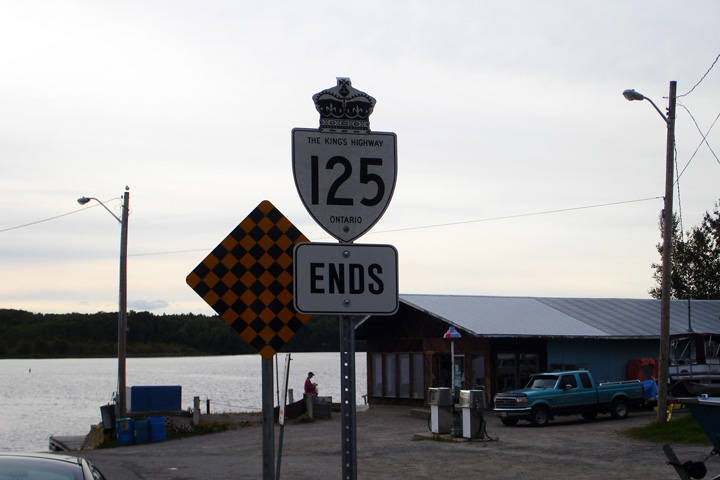
| Town of Red Lake District of Kenora |
The Highway 125 ends sign sits at the northern
end of the highway at Red Lake. Photo taken: September 1st, 2006. |
 (1440x960) |
|
<- Highway 124 Images Back to Highway 125 Highway 126 Images ->
Copyright (c) 2004-2012, Scott Steeves (Webmaster) scott@asphaltplanet.ca