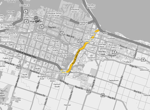
AsphaltPlanet.ca > OntHighways > Hamilton > Red Hill Valley Parkway
Red Hill Valley Parkway Images
Photos shown in this table are arranged from South to North:
|
Proper Municipality Name |
Photo Description |
Photo |
|
|
Pictures taken from driver's perspective appear offset from centre-line pictures: |
North- |
South- |
|
|
The Red Hill Valley Parkway designation ends just past the Dartnall Road interchange, the freeway continues across Hamilton Mountain as the Linc. Click here for Linc images. |
|||
|
The Red Hill Valley Parkway was opened to traffic on November 17th, 2007. For photos of the highway taken during its construction, click here. |
|||
|
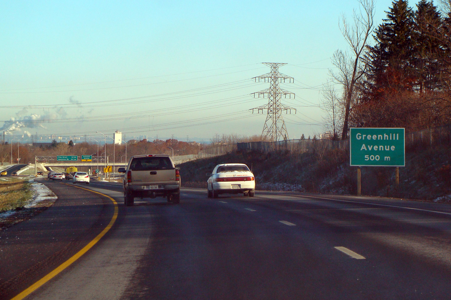
City of Hamilton |
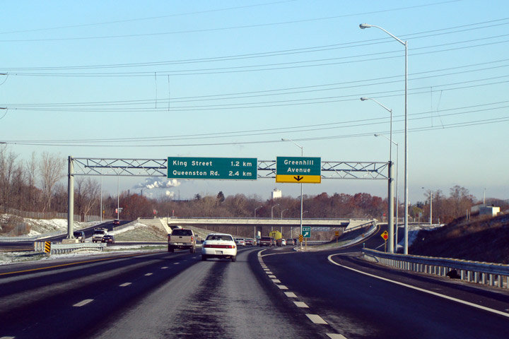
Advanced warning sign for Greenhill Avenue northbound
along the Parkway. |
||
|
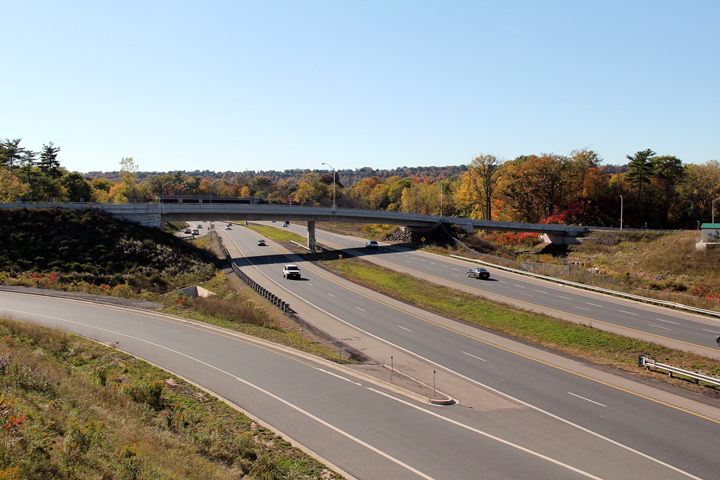
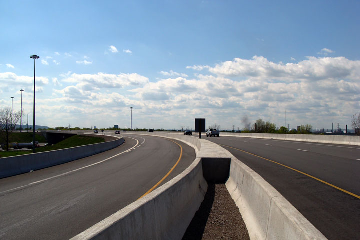
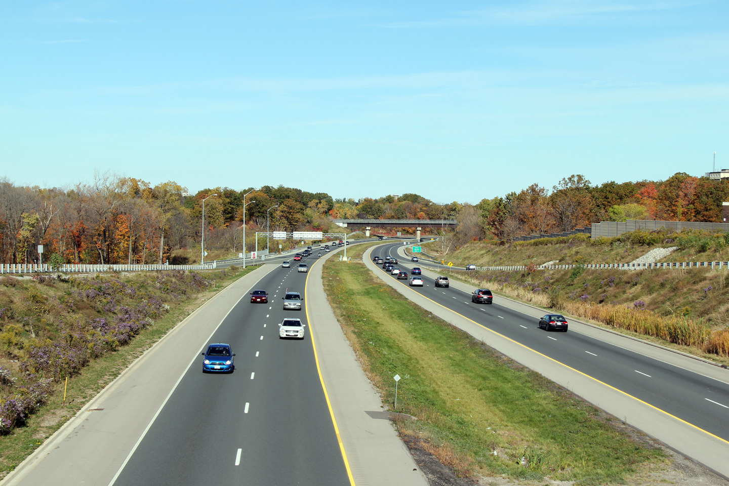
City of Hamilton |
The Red Hill Valley Parkway looking north down the hill at the Greenhill
Avenue interchange. Greenhill Avenue is the lower city's equivalent to
Fennel Avenue. |
||
|
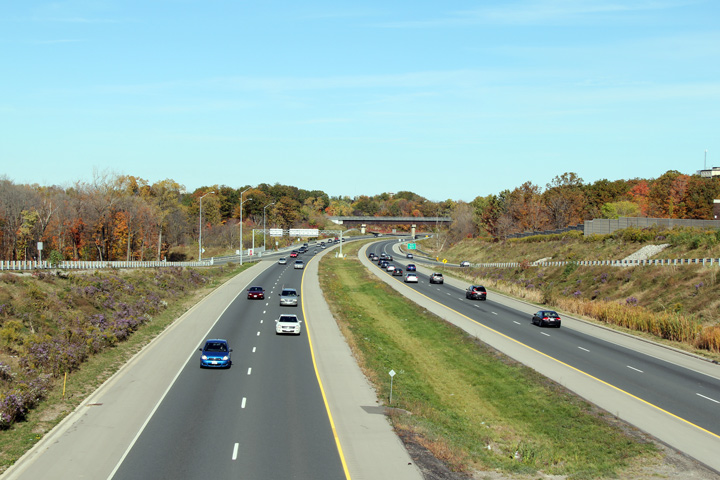
City of Hamilton |
View looking southerly from the Greenhill Avenue overpass towards Mud Street interchange.
Photo taken: October 16th, 2010. |
||
|
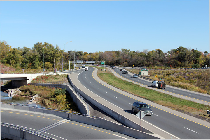
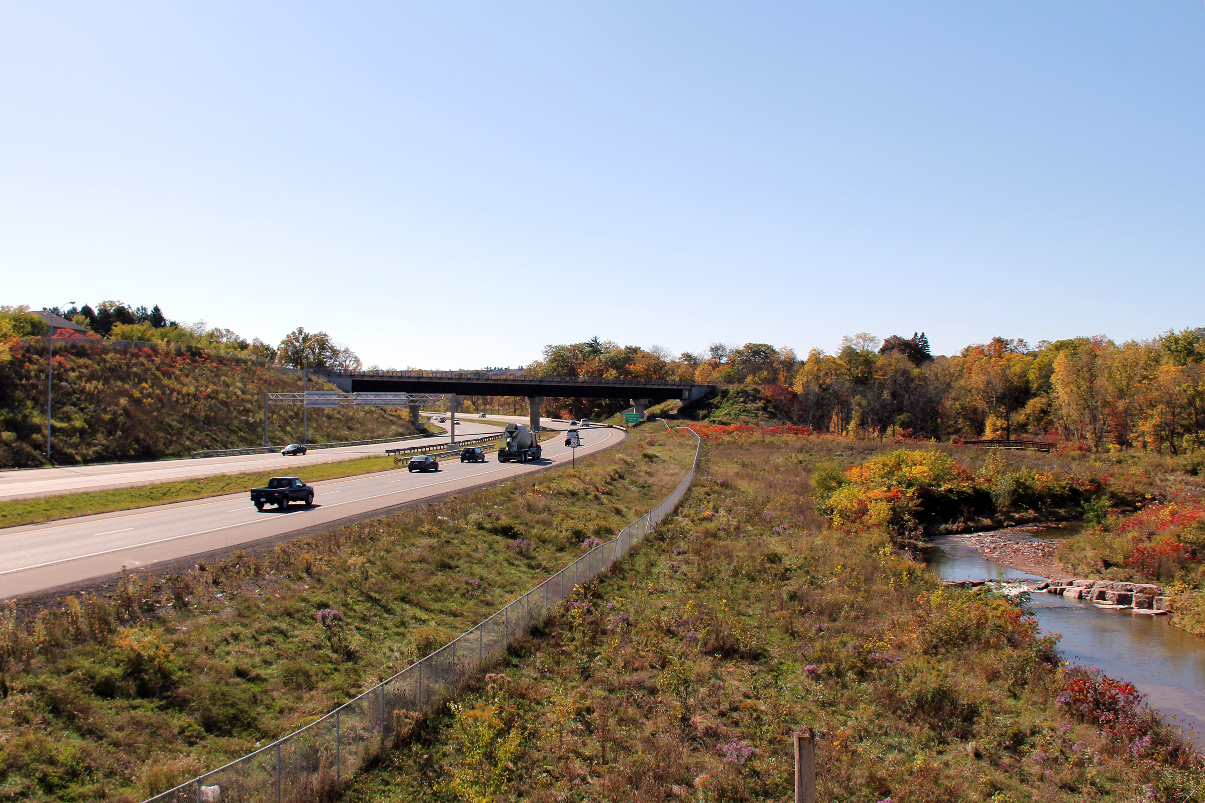
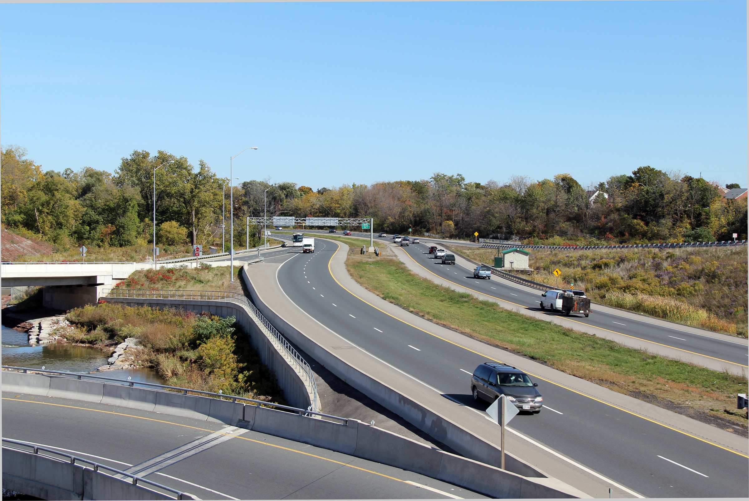
City of Hamilton |
Southerly view from the Greenhill Avenue overpass towards the CP Rail overpass.
Photo taken: October 16th, 2010. |
 (720x480) (1440x960) (2400x1600) |
|
|
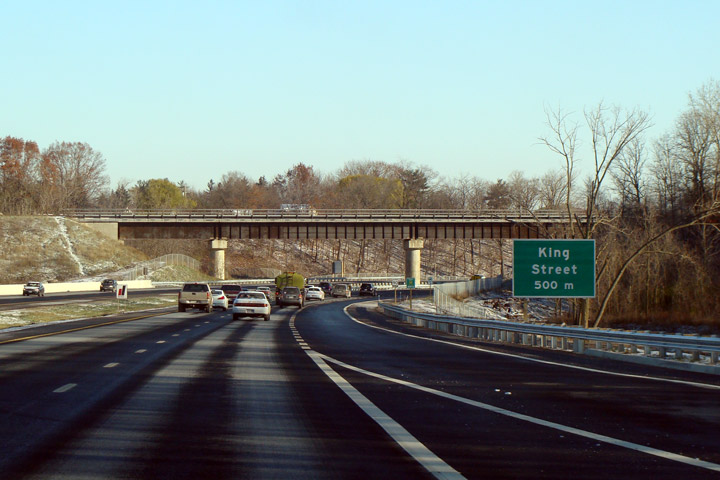
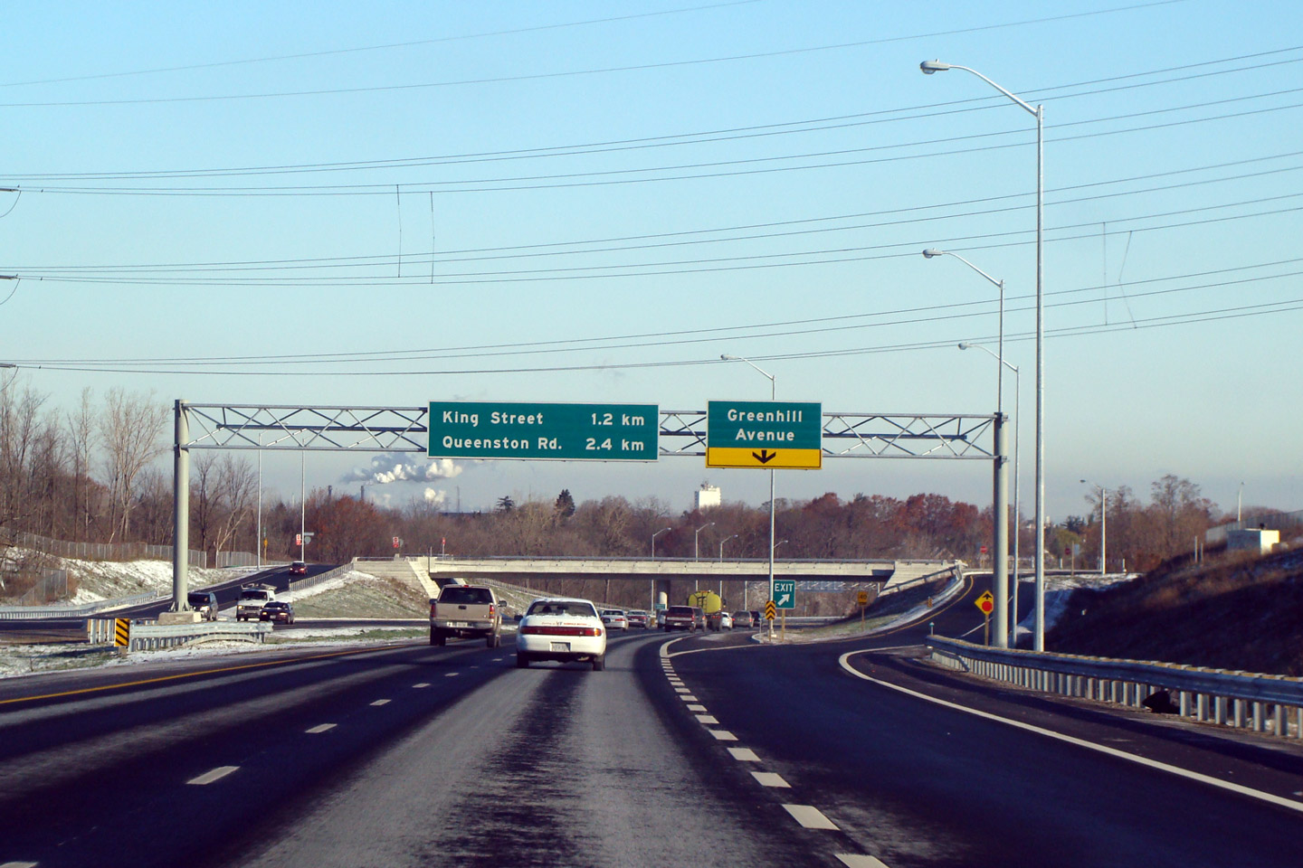
City of Hamilton |
Northbound signage in advance of King Street. |
||
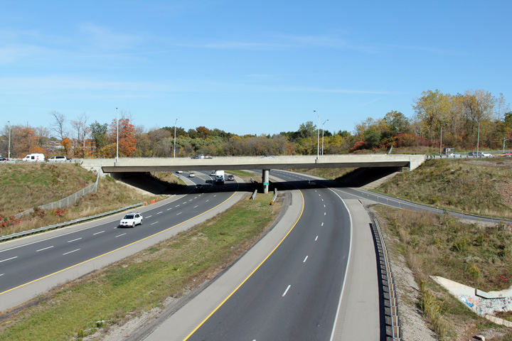
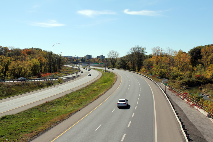
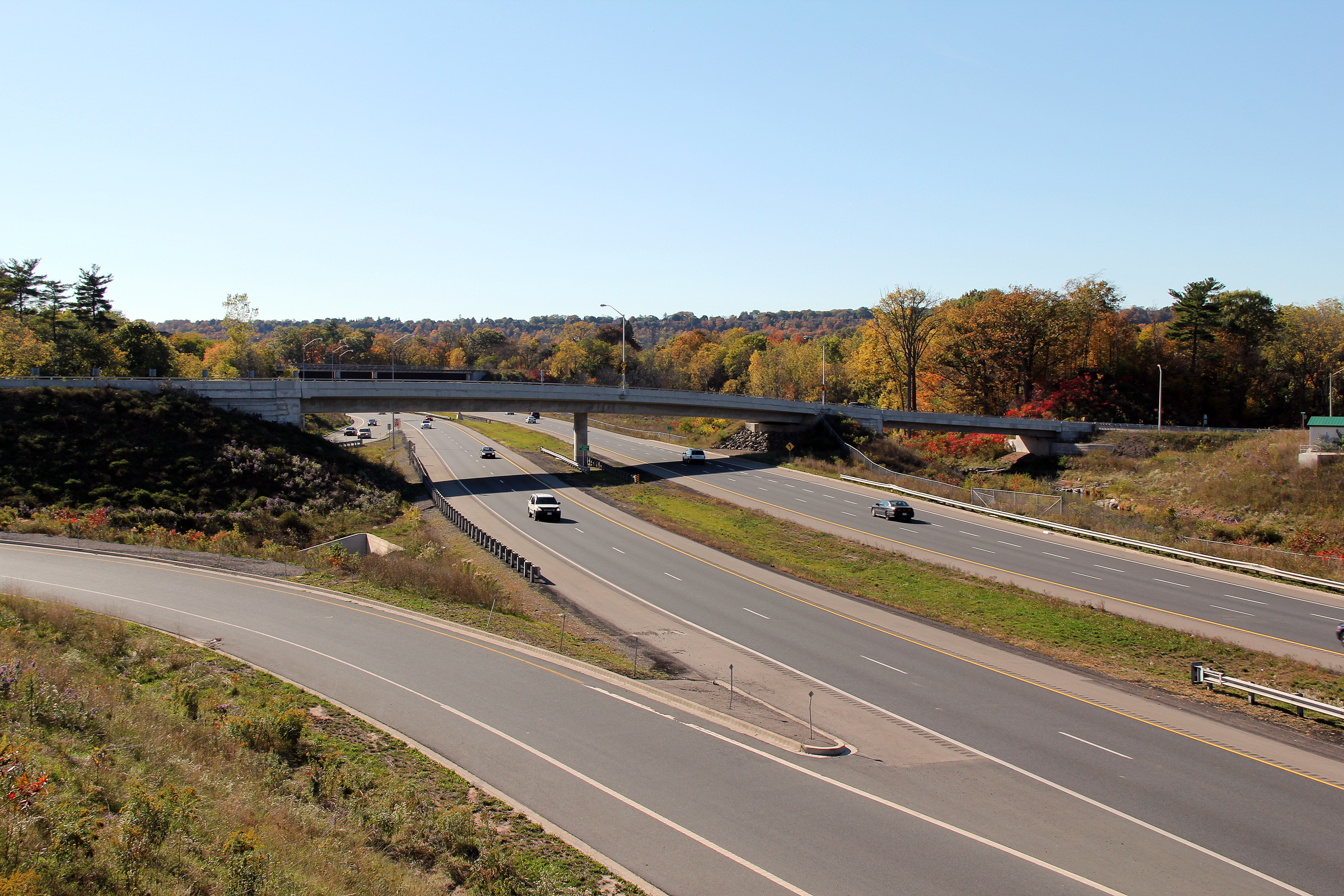
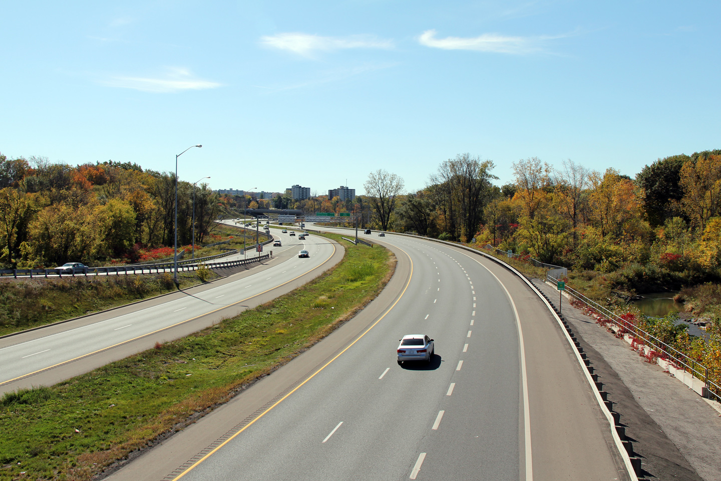
| City of Hamilton |
This view looks southerly along the Red Hill Valley Parkway from the Mount
Albion Road overpass Photo taken: October 16th, 2010. |
 (720x480) (1440x960) (2400x1600) |
|
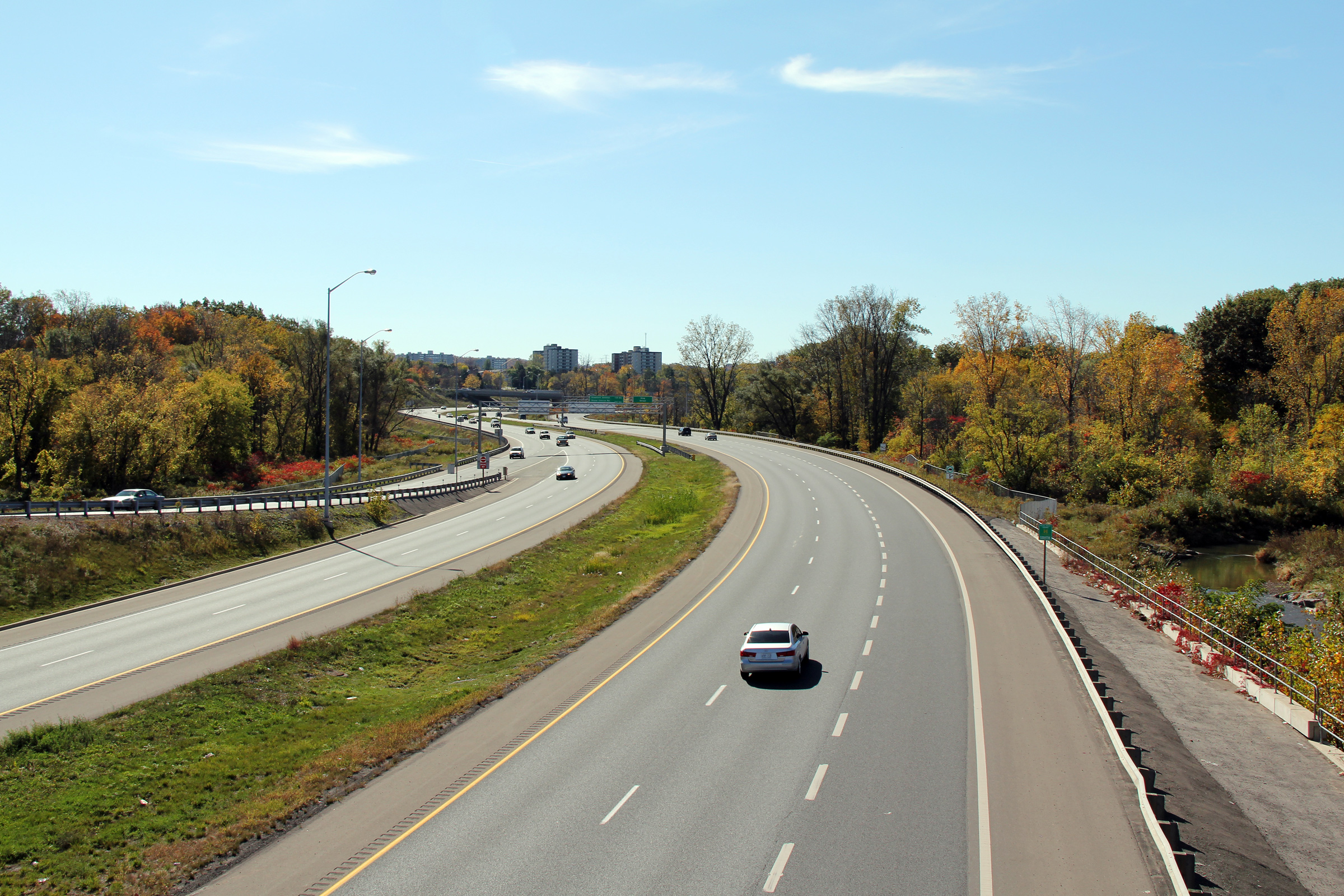
| City of Hamilton |
Northerly view towards King Street from the Mount Albion Road overpass. Photo taken: October 16th, 2010. |
 (720x480) (1440x960) (2400x1600) |
|
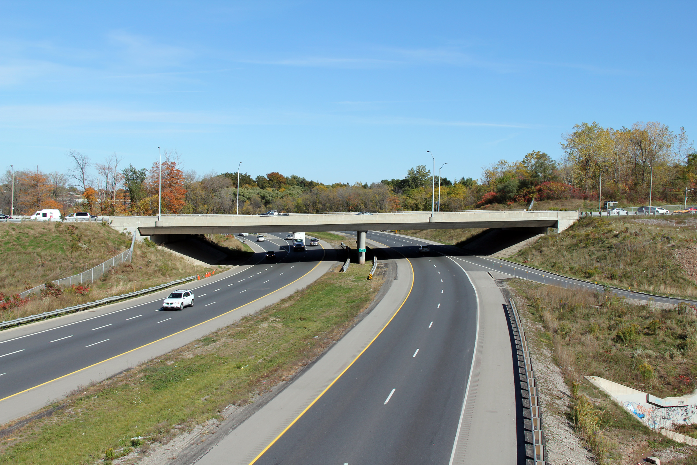
| City of Hamilton |
View towards Mount Albion Road, looking south from King Street. Photo taken: October 16th, 2010. |
 (720x480) (1440x960) (2400x1600) |
|
| City of Hamilton |
Northerly view from the King Street overpass. The southbound ramps to and
from King Street from the parkway cross over the Red Hill Creek. Photo taken: October 16th, 2010. |
 (720x480) (1440x960) (2400x1600) |
|
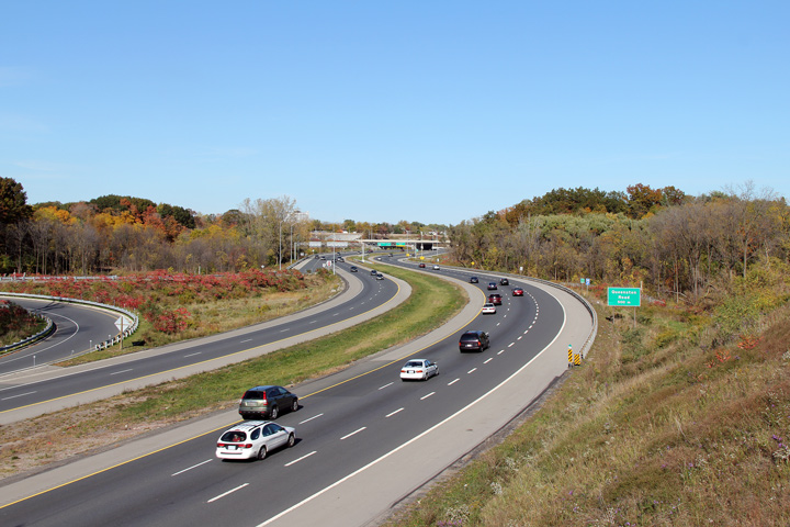
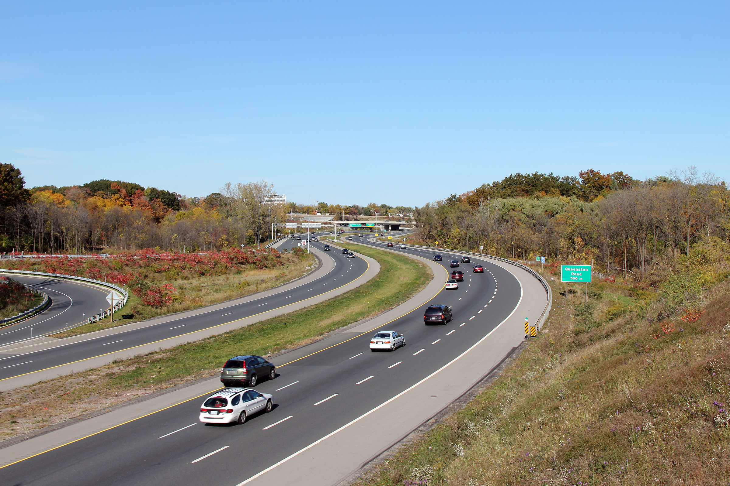
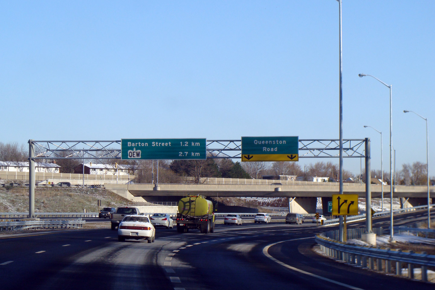
| City of Hamilton |
Northerly view from Queenston Road towards the King Street interchange. Photo taken: October 16th, 2010. |
 |
|
|
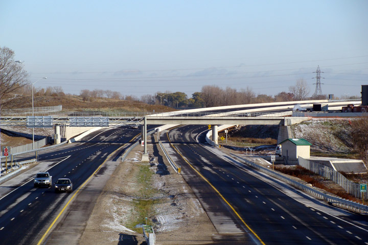
City of Hamilton |
Looking south from Queenston Road overpass. It's amazing the Parkway was not constructed with some sort of barrier median, particularly around some of the sharper curves.
Photo taken: October 16th, 2010. |
||
|
City of Hamilton |
Overhead signage at the Queenston Road interchange.
The Queenston Road overpass was constructed in the early 1990s as part of
the construction of the Linc. The Red Hill and Linc were originally to
be constructed as one continuous freeway, until the Rae government pulled
funding amid environmental concerns. |
||
|
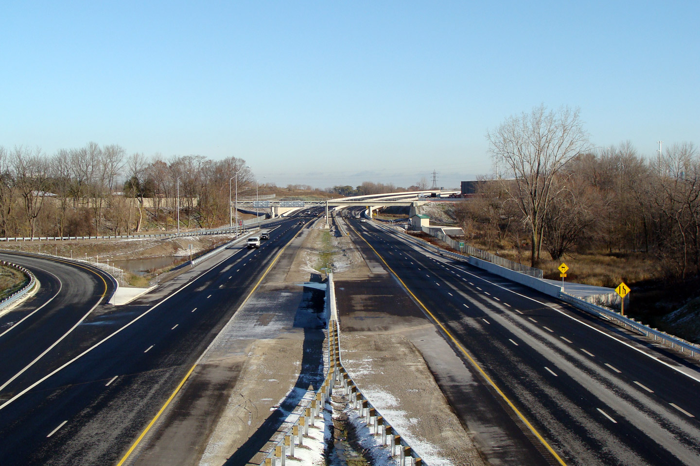
City of Hamilton |
Southerly view of the Red Hill Valley Parkway from the Barton Street
overpass. In a lot of ways, the Red Hill Valley Parkway is Hamilton's
attempt at Toronto's Don Valley Parkway. |
|
|
|
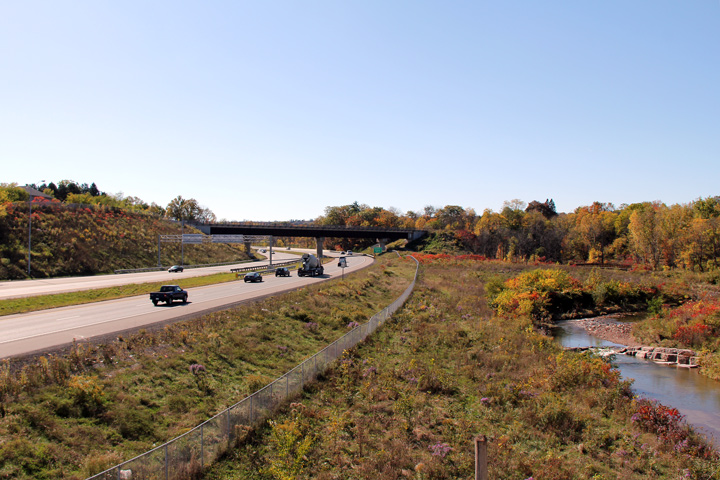
City of Hamilton |
Northerly view from Barton Street towards the CN Railway overpass.
Note how low the highway elevation is compared to the water elevation on the
nearby Red Hill Creek. The railway, and nearby expressway were tight
design constraints that likely required designers to place the highway
within the Red Hill Creek flood line. |
|
|
|
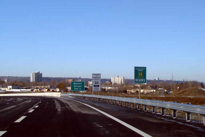
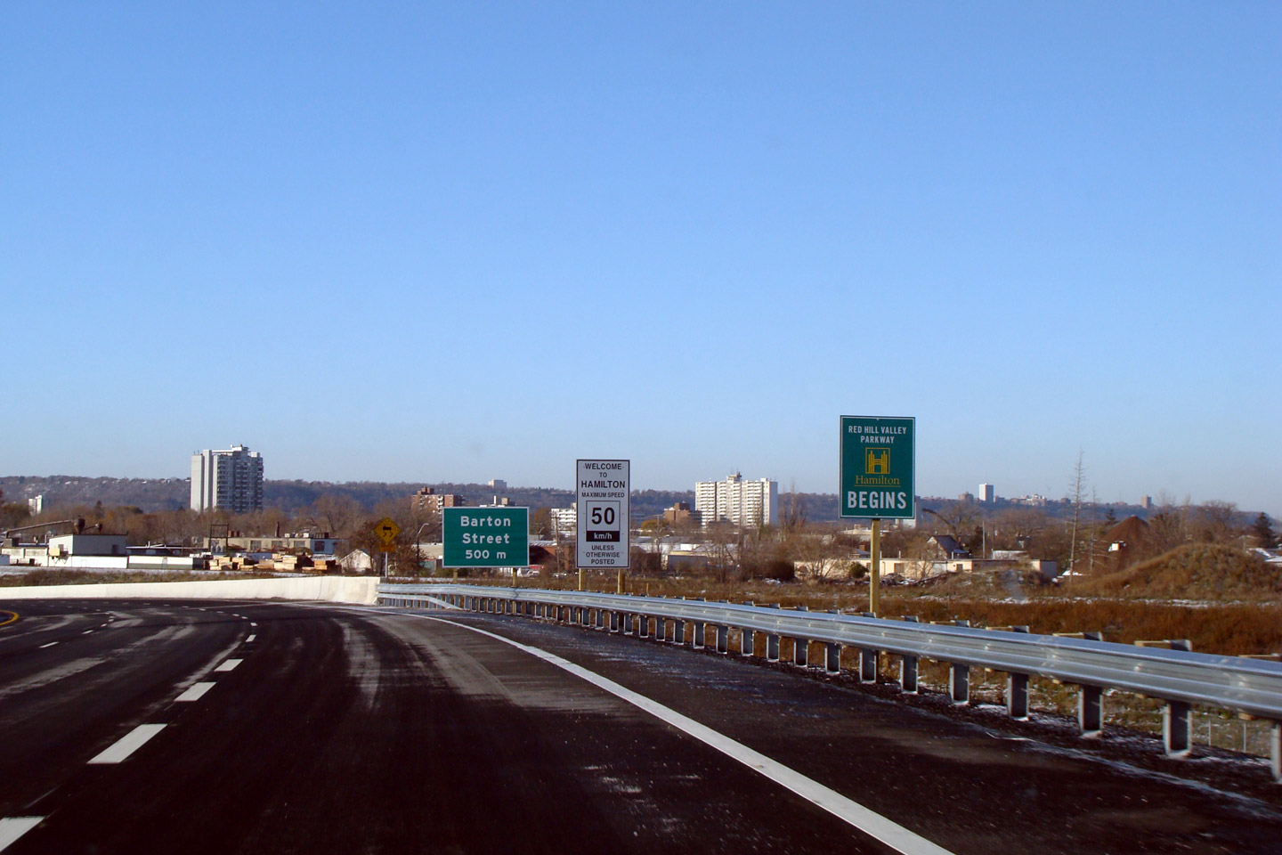
City of Hamilton |
Southbound signage marking the start of the Red Hill Valley Parkway.
The northern most section of the Red Hill Valley Parkway was constructed by
the MTO. |
||
|
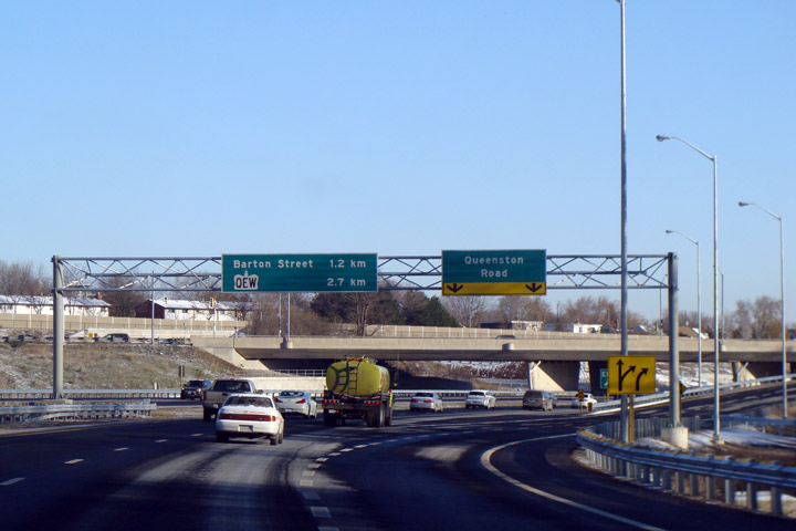
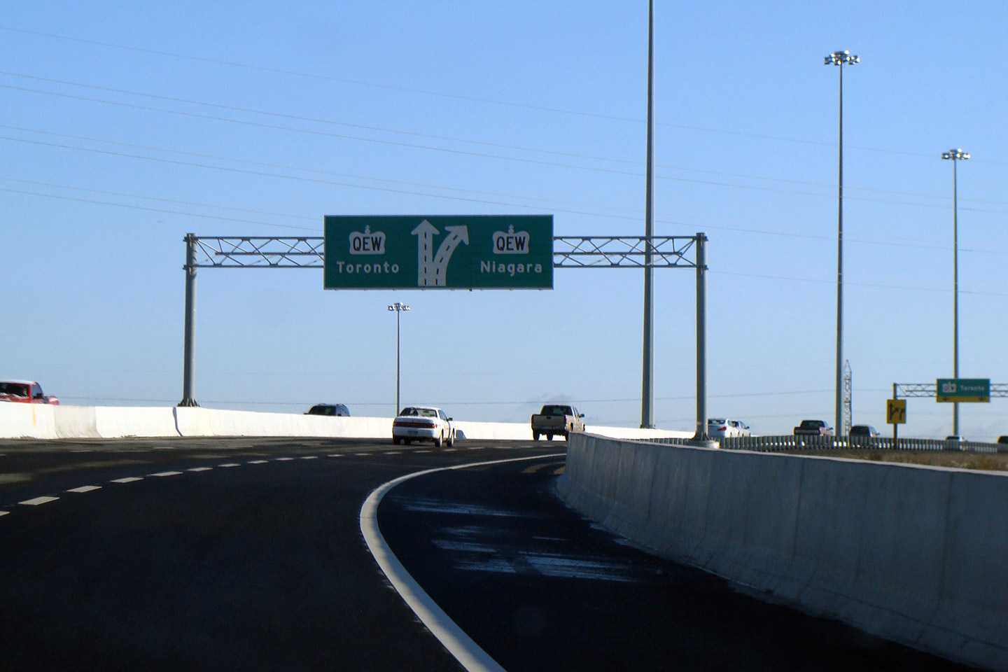
City of Hamilton |
Diagram signage in advance of the QEW interchange. |
||
|
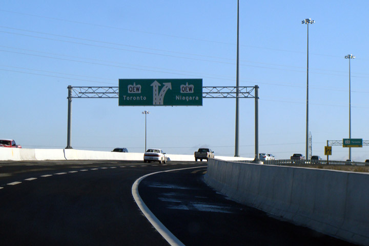
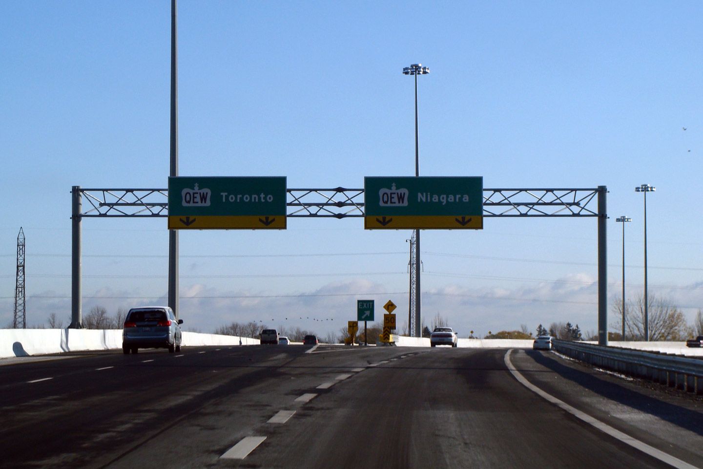
City of Hamilton |
Green signage at the Queen Elizabeth Way split from the Red Hill Valley
Parkway. The ramp to QEW Niagara is deceptively tight. I am
surprised ramp speed signage wasn't affixed to the overhead signage. |
||
|
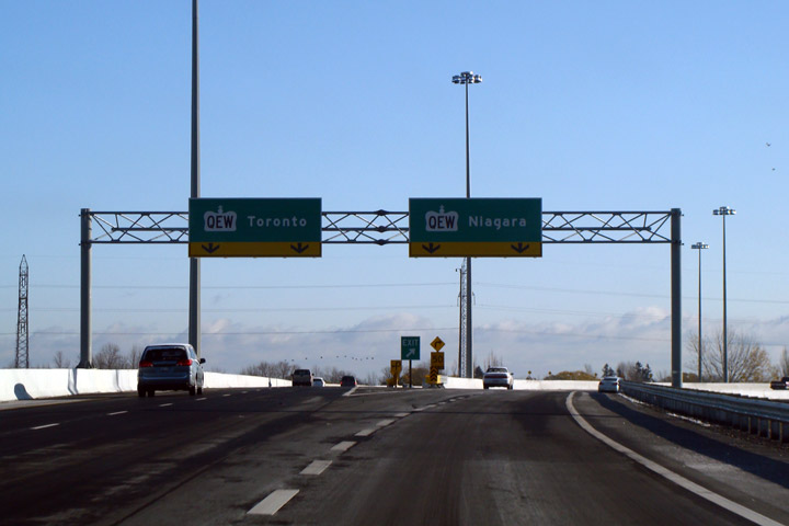
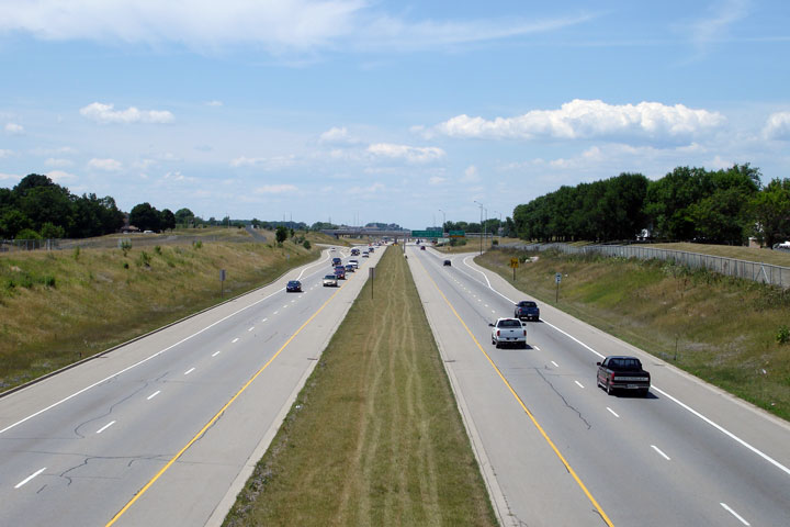
City of Hamilton |
View looking southerly along the Parkway from the median of the highway at the QEW interchange.
Photo taken: July 22nd, 2007. |
|
|
|
The Red Hill Valley Parkway ends at a trumpet interchange with the Queen Elizabeth Way. Click here for QEW images. |
|||
<- Lincoln M. Alexander Parkway Images Images Index
Copyright (c) 2004-2012, Scott Steeves (Webmaster) scott@asphaltplanet.ca


 (720x480)
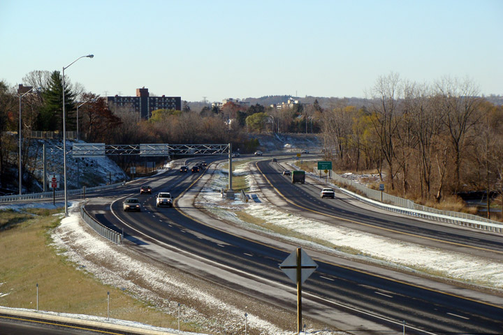
