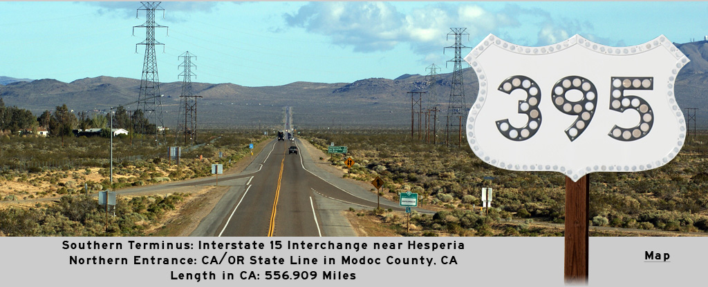
AsphaltPlanet.ca > California > US Route 395
Pictures on this
page are arranged in order from south to north. US-395 North photos are
left-aligned in the last column, while US-395 South photos are right-aligned.
Center-line pictures are centered within the last column.
|
Location |
Description |
Photo |
||
|
North- |
South- |
|||
| State Route 58 is a long highway that runs east-west from San Louis Obispo to Barstow. Click here for State Route 58 Images | ||||
|
San Bernardino County |
Southbound junction signage at the State Route 58 intersection at Kramer Junction. |
 |
||
|
Date: 4/05/2010 |
High-res: (1440x960) |
|||
|
San Bernardino County |
Northerly view along US-395 from just north of the State Route 58 intersection at Kramer Junction. |
 |
||
|
Date: 4/05/2010 |
High-res: (1440x960) (2400x1600) | |||
|
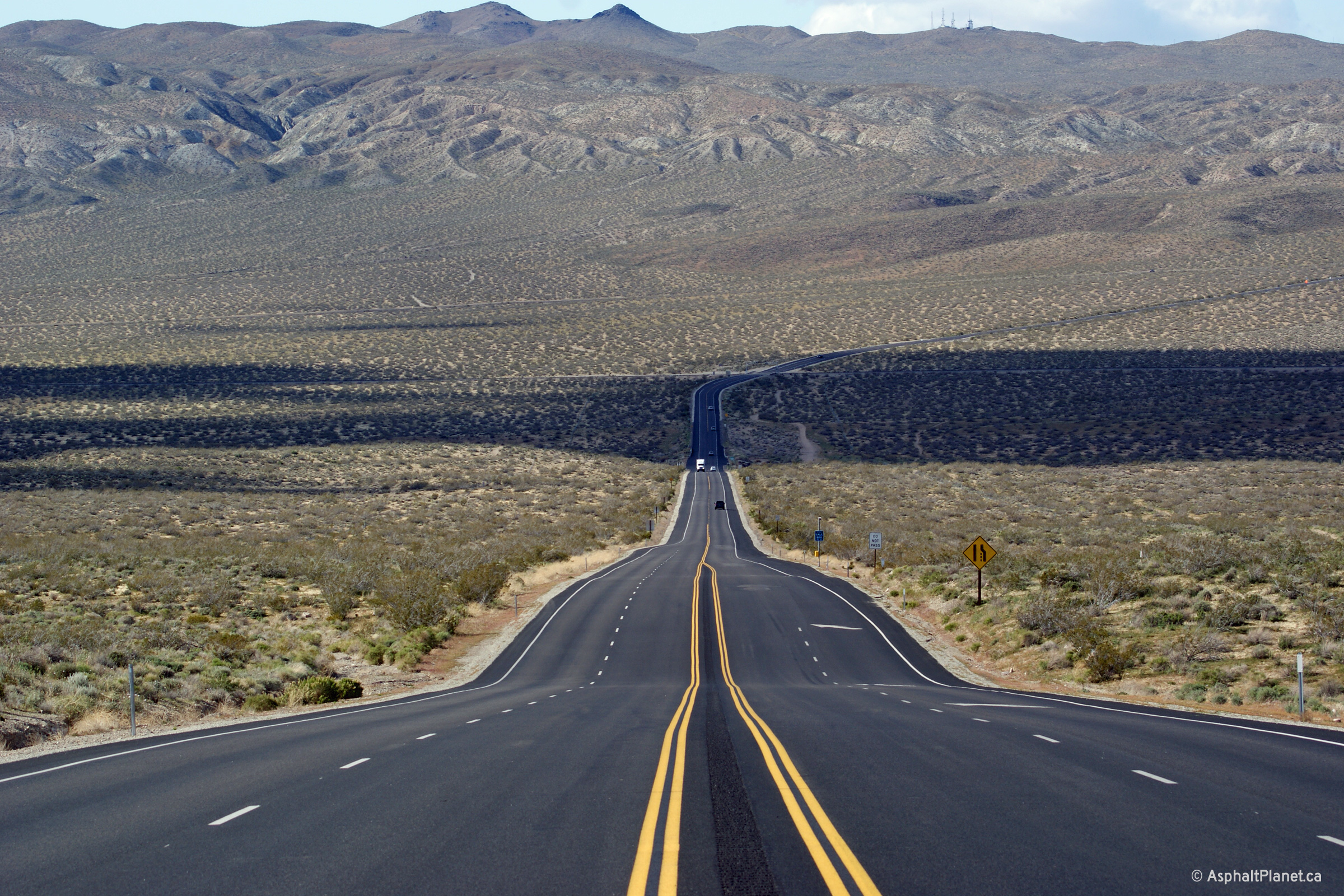
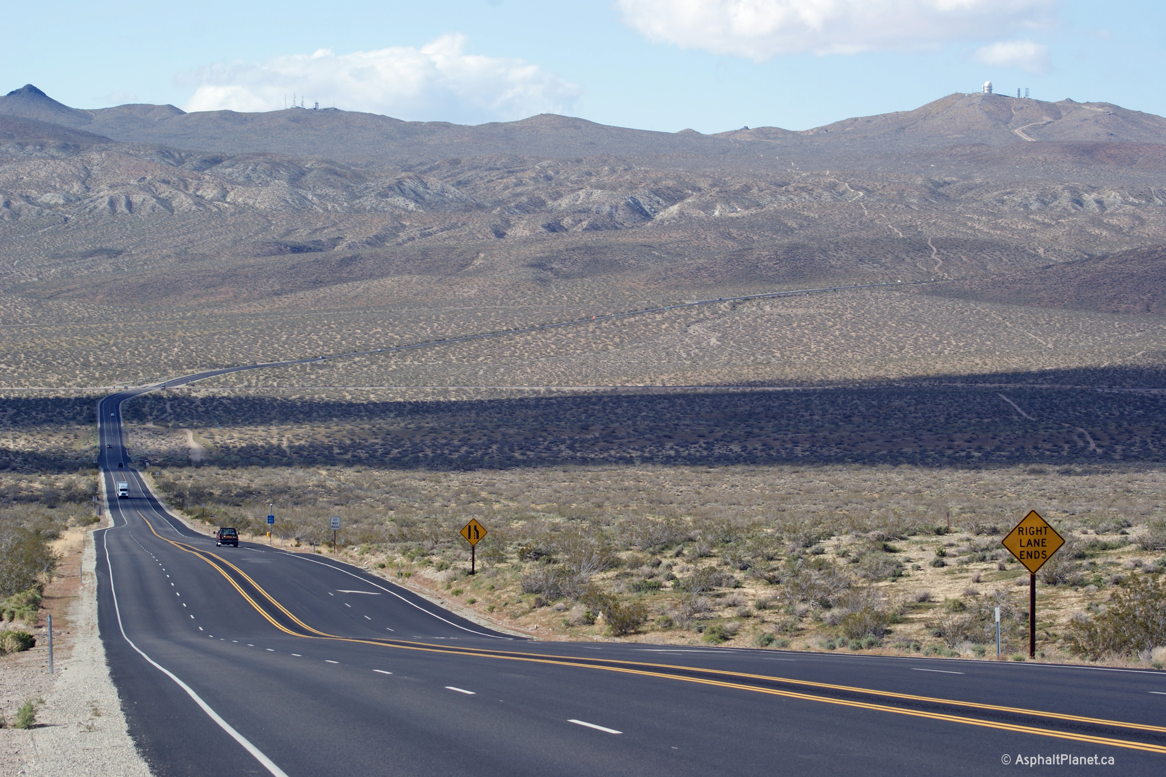
Kern County |
Two views looking northerly as US-395 descends into the wide Fremont Valley about 3 miles north of the Kern County Line. |
 |
||
| High-res: (1440x960) (2400x1600) | ||||
 |
||||
|
Date: 4/05/2010 |
High-res: (1440x960) (2400x1600) | |||
|
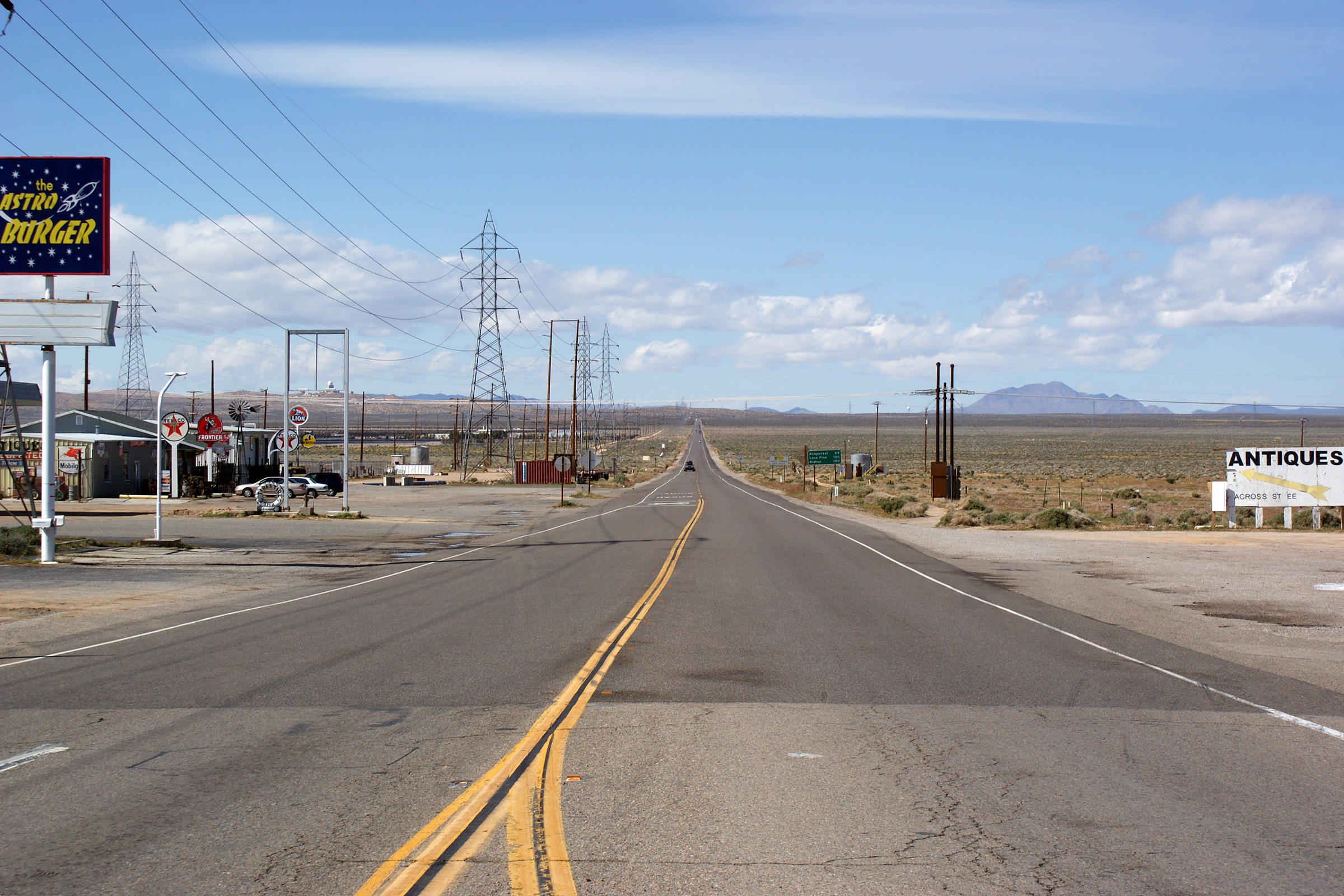
Kern County |
Southerly view towards Kramer Junction as US-395 descends into a wide valley south of Ridgecrest. |
 |
||
|
Date: 4/05/2010 |
High-res: (1440x960) (2400x1600) | |||
|
Kern County |
Distance sign northerly along US-395 just south of Ridgecrest. |
 |
||
|
Date: 4/05/2010 |
High-res: (1440x960) | |||
|
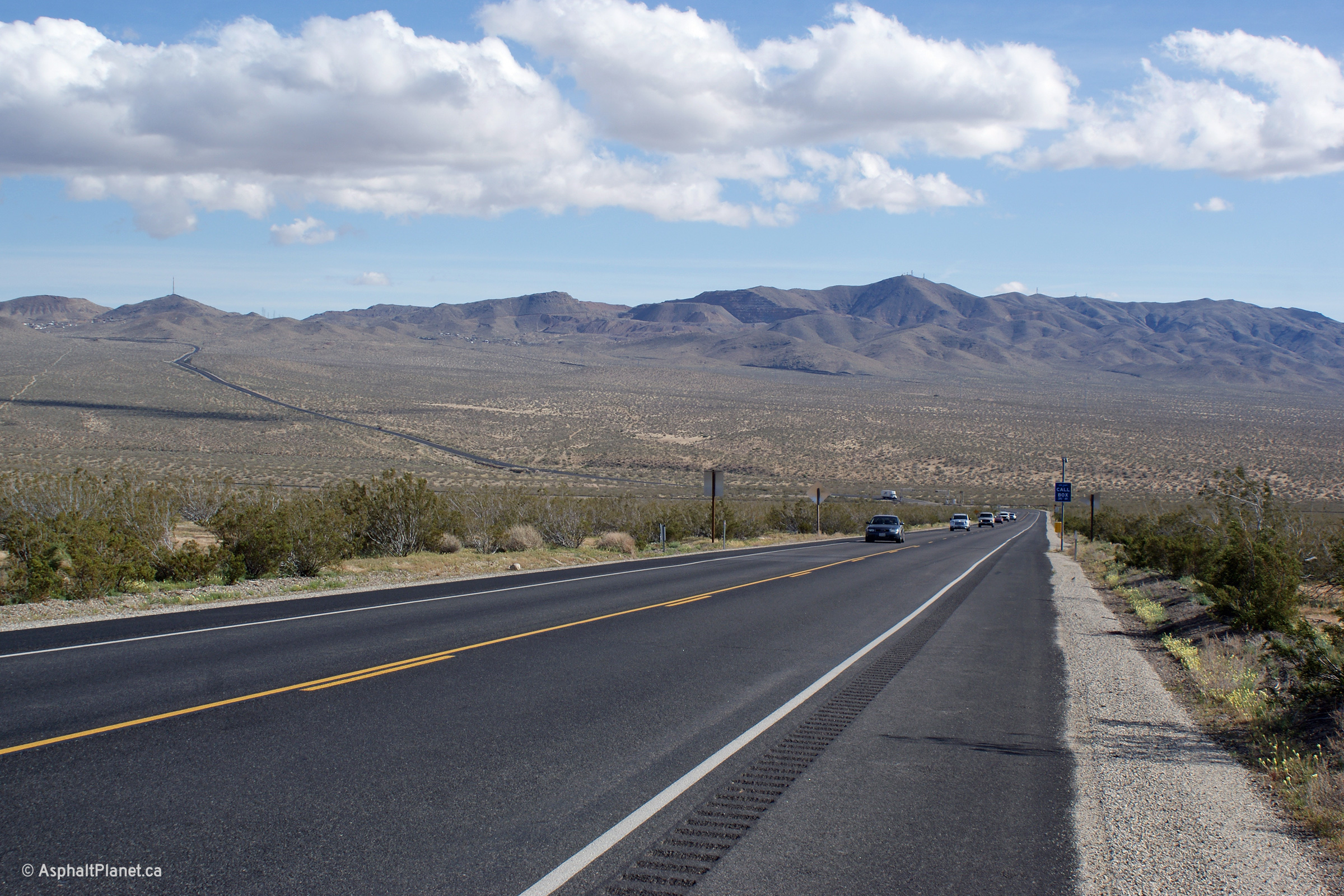
Kern County |
This view looks northerly approaching the Highway 14 interchange along US-395. North of the Highway 14 interchange, US-395 is a divided highway. |
 |
||
|
Date: 4/05/2010 |
High-res: (1440x960) (2400x1600) | |||
| State Route 14 follows the former alignment of US-6 southerly towards I-5 north of Los Angeles. Click here for State Route 14 Images. | ||||
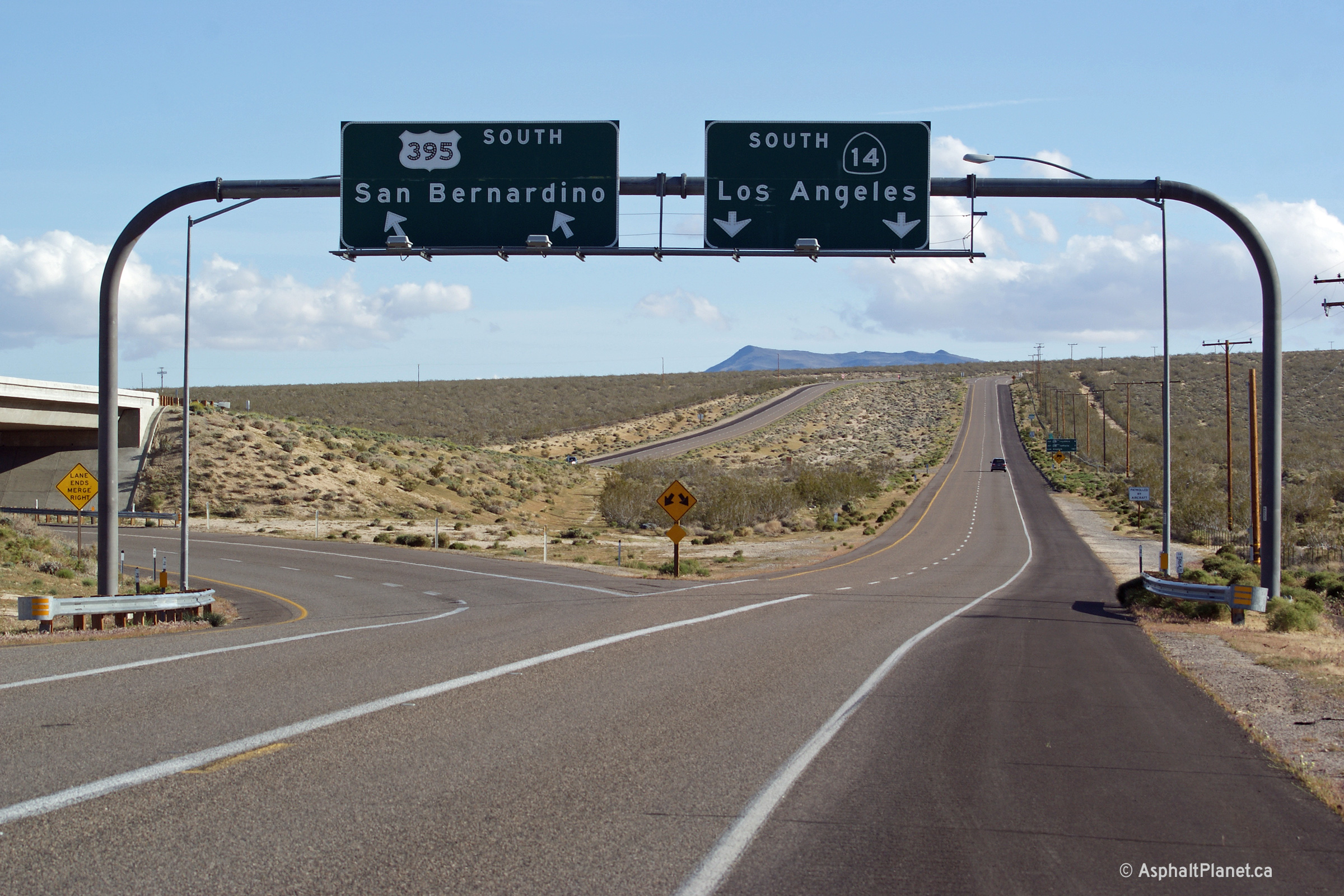
|
Kern County |
Southerly view approaching the Highway 14 interchange. US-395 veers to the southeast beyond this interchange for San Bernardino, while Highway 14 (formerly designated as US-6) continues southwesterly bound for Los Angeles. |
 |
||
|
Date: 4/05/2010 |
High-res: (1440x960) (2400x1600) | |||
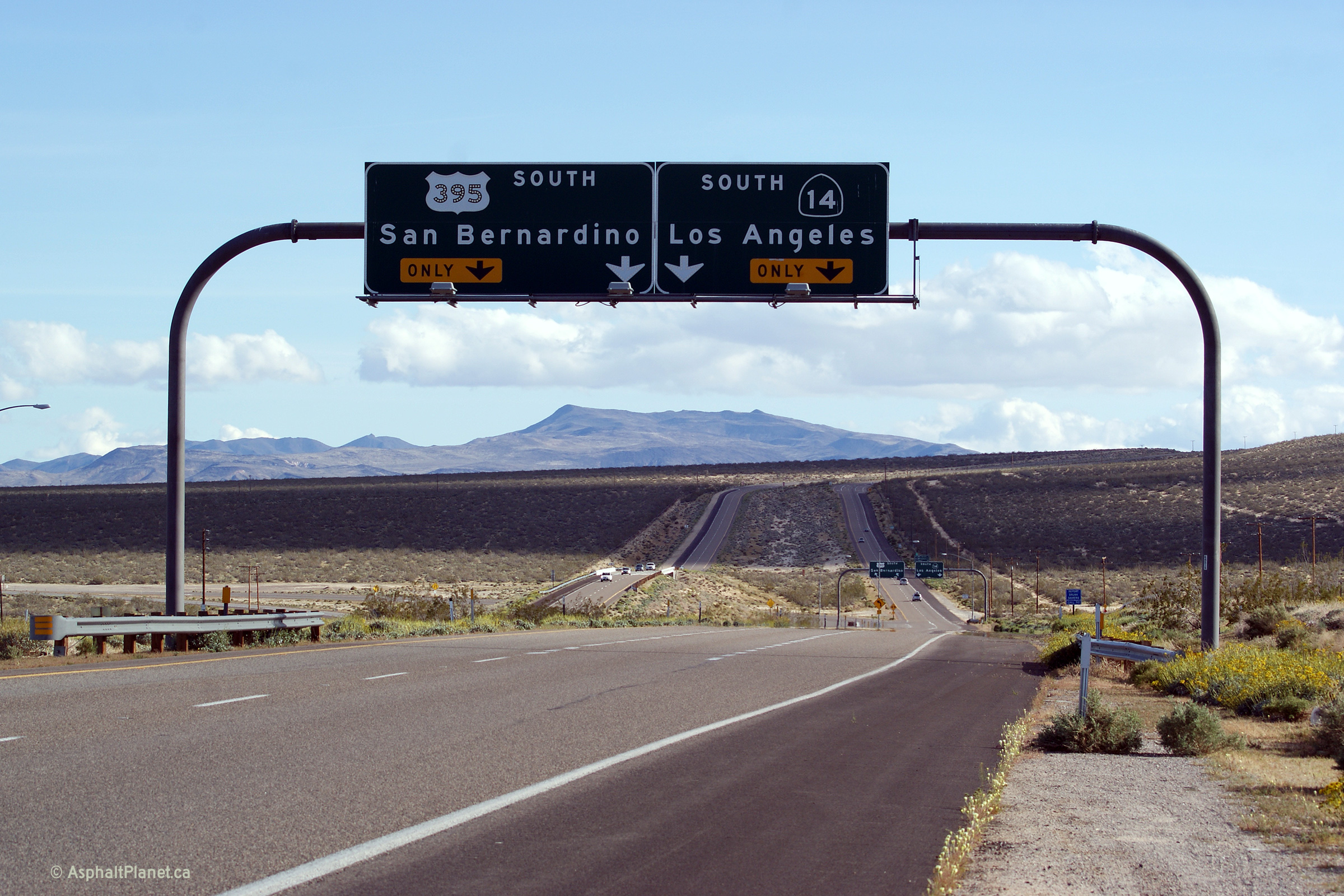
|
Kern County |
Button-copy advanced signage for the Highway 14 interchange. |
 |
||
|
Date: 4/05/2010 |
High-res: (1440x960) (2400x1600) | |||
|
Kern County |
Button copy distance signage along US-395 north of Highway 14. |
 |
||
|
Date: 4/05/2010 |
High-res: (1440x960) |
|||
<- US-101
CA Highways
CA-1 ->
AsphaltPlanet.ca
© 2010-14 AsphaltPlanet.ca.
AsphaltPlanet@asphaltplanet.ca
Page Created: September 15, 2014.
Last Updated: September 15, 2014.