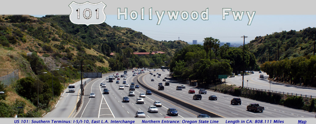
AsphaltPlanet.ca > California > US Route 101
Pictures on this page are arranged in order from west to east. US-101 North photos are left-aligned in the last column, while US-101South photos are right-aligned. Center-line pictures are centered within the last column.
|
Location |
Description |
Photo |
||
|
North- |
South- |
|||
| Highway 110 is the Pasadena and Harbor Freeway through Los Angeles. Click here California Highway 110 Images. | ||||
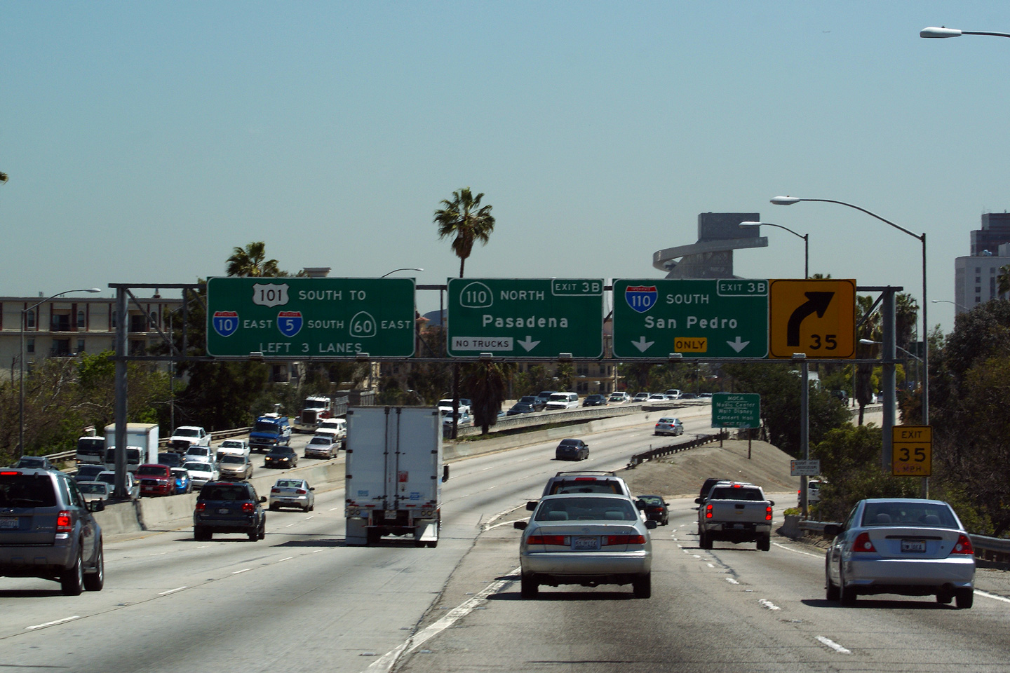
|
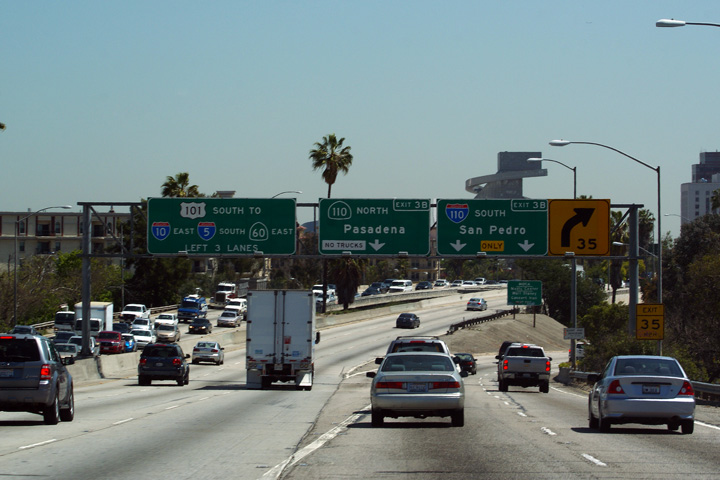
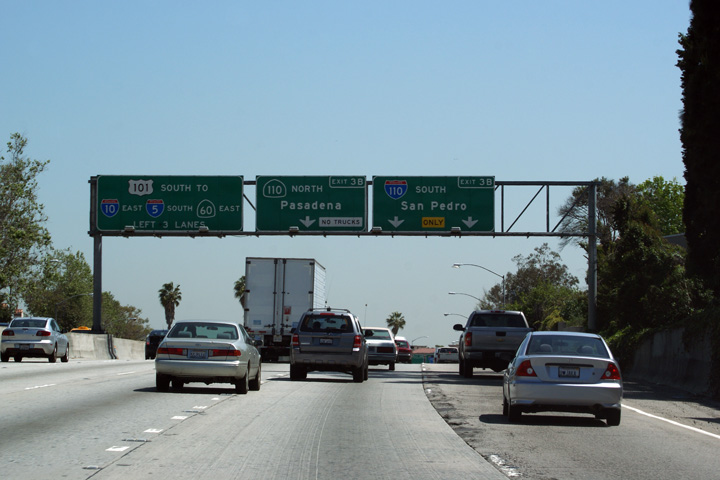
Los Angeles County |
Guide signage for the four-level interchange. At this interchange, US-101 continues southerly becoming the Santa Ana Freeway, while Highway 110 progresses both north and south of US-101 as the Pasadena and Harbor Freeway, respectively. |
 |
||
|
Date: 4/06/2010 |
High-res: (1440x960) | |||
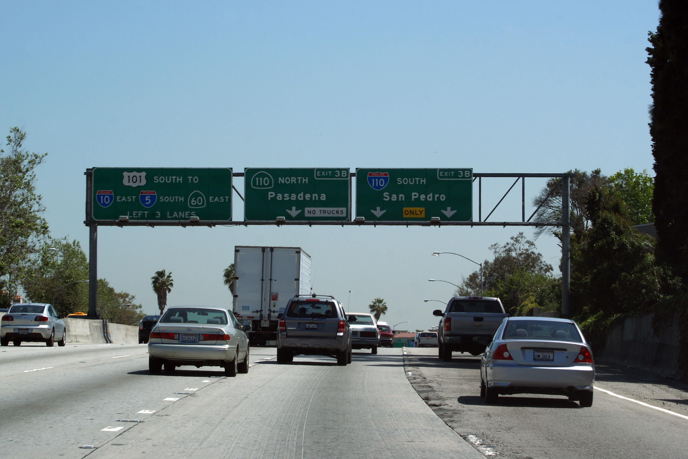
|
Los Angeles County |
Advanced lane assignment signage for the four-level interchange between US-101 and Highway 110. |
 |
||
|
Date: 4/06/2010 |
High-res: (1440x960) (2400x1600) | |||
|
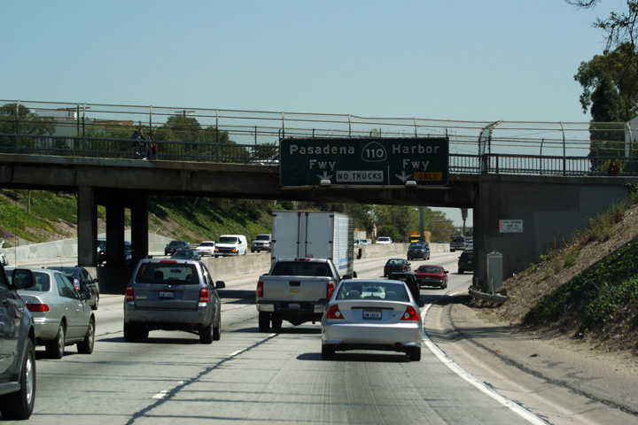
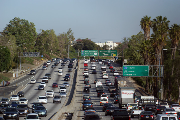
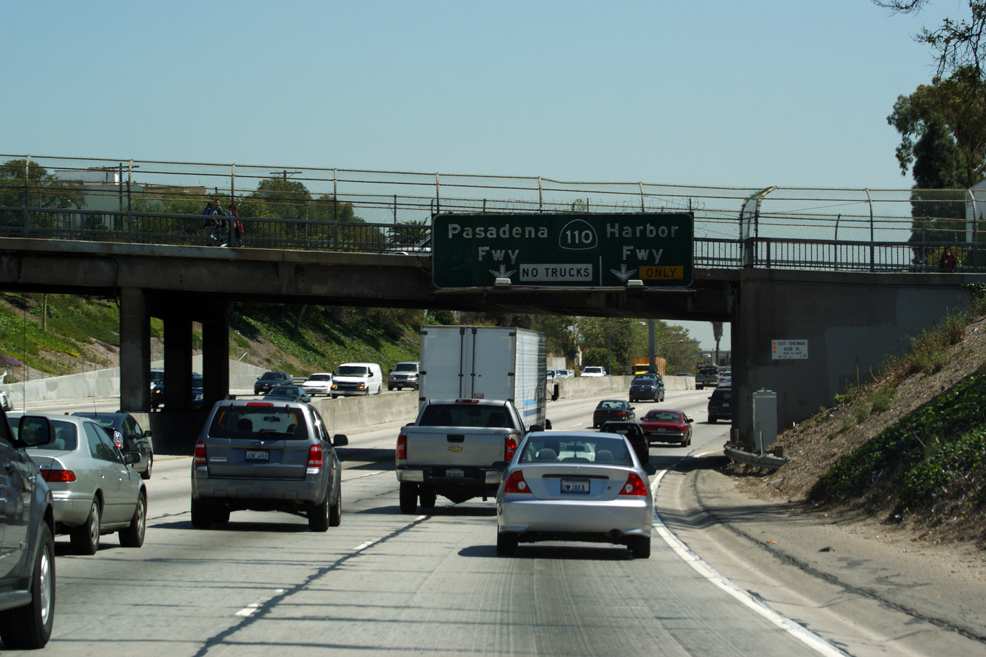
Los Angeles County |
Overhead lane assignment signage for the Highway 110 interchange affixed to the East Edgeware Road overpass. |
 |
||
|
Date: 4/06/2010 |
High-res: (1440x960) (2400x1600) | |||
|
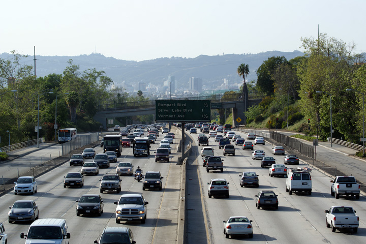
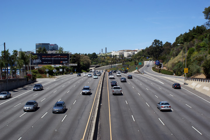
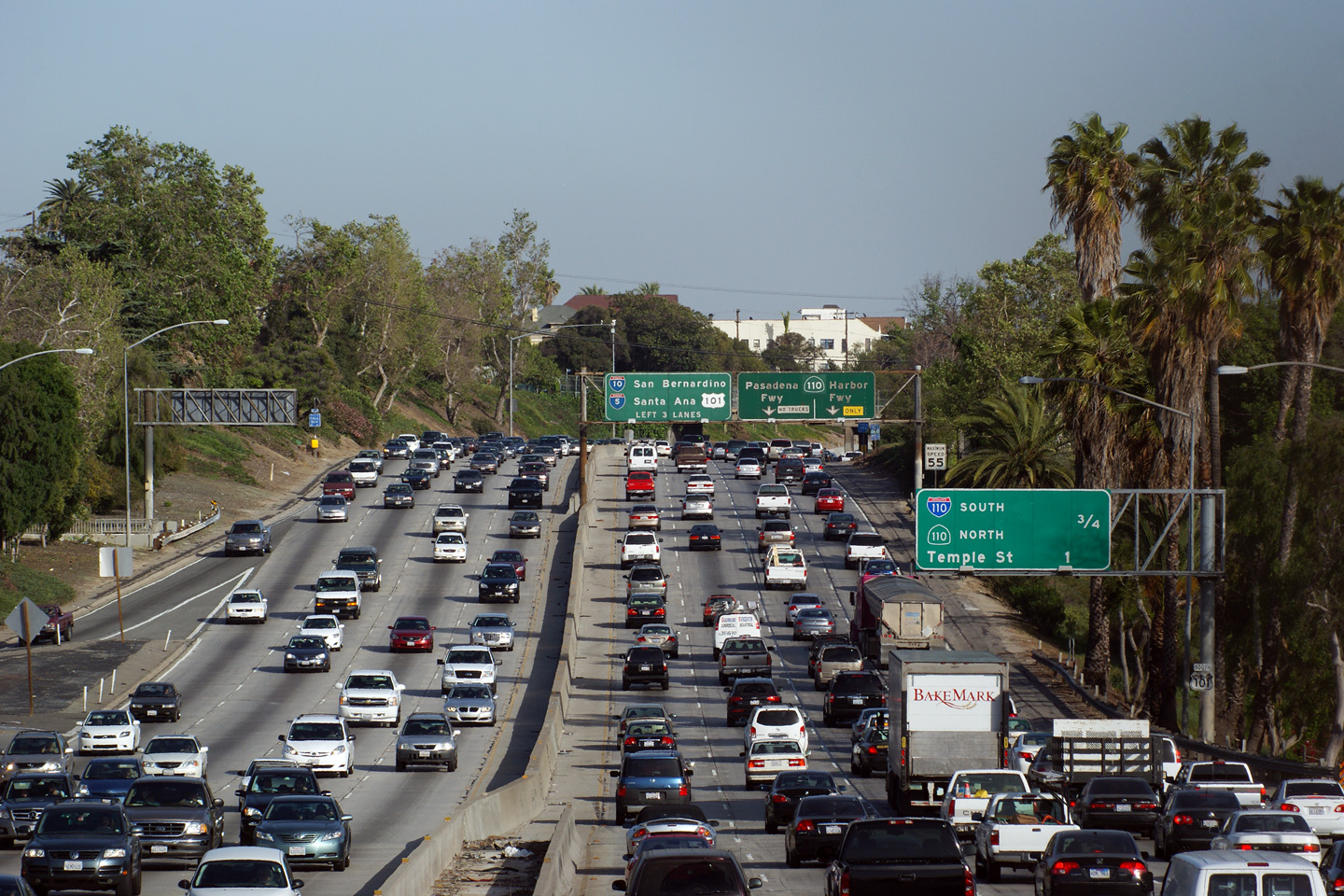
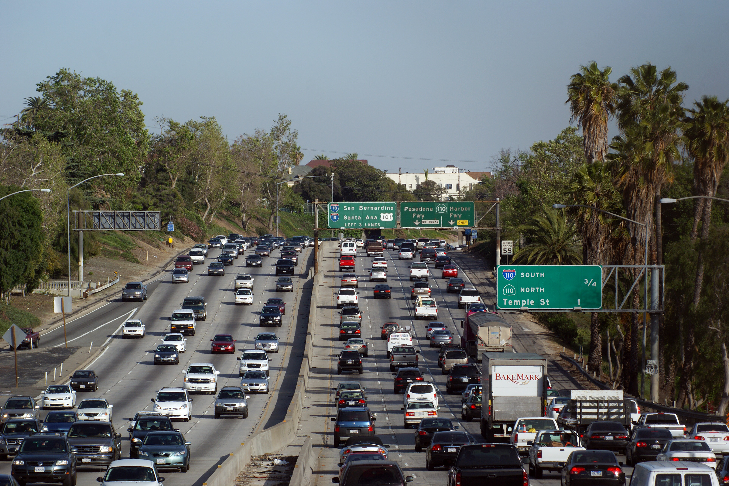
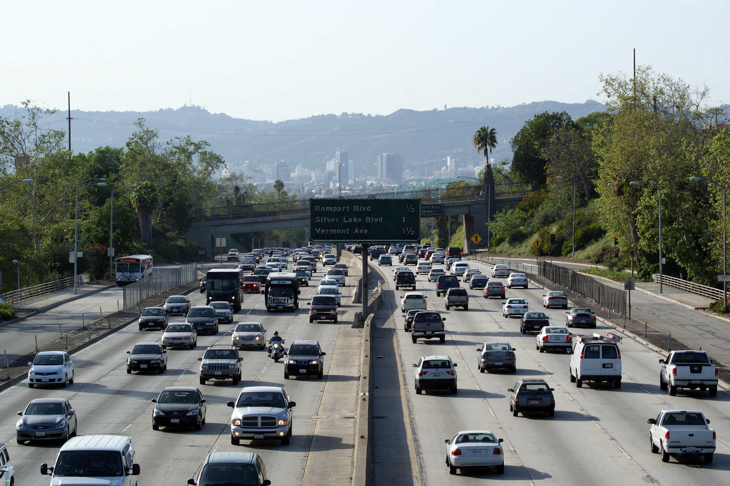
Los Angeles County |
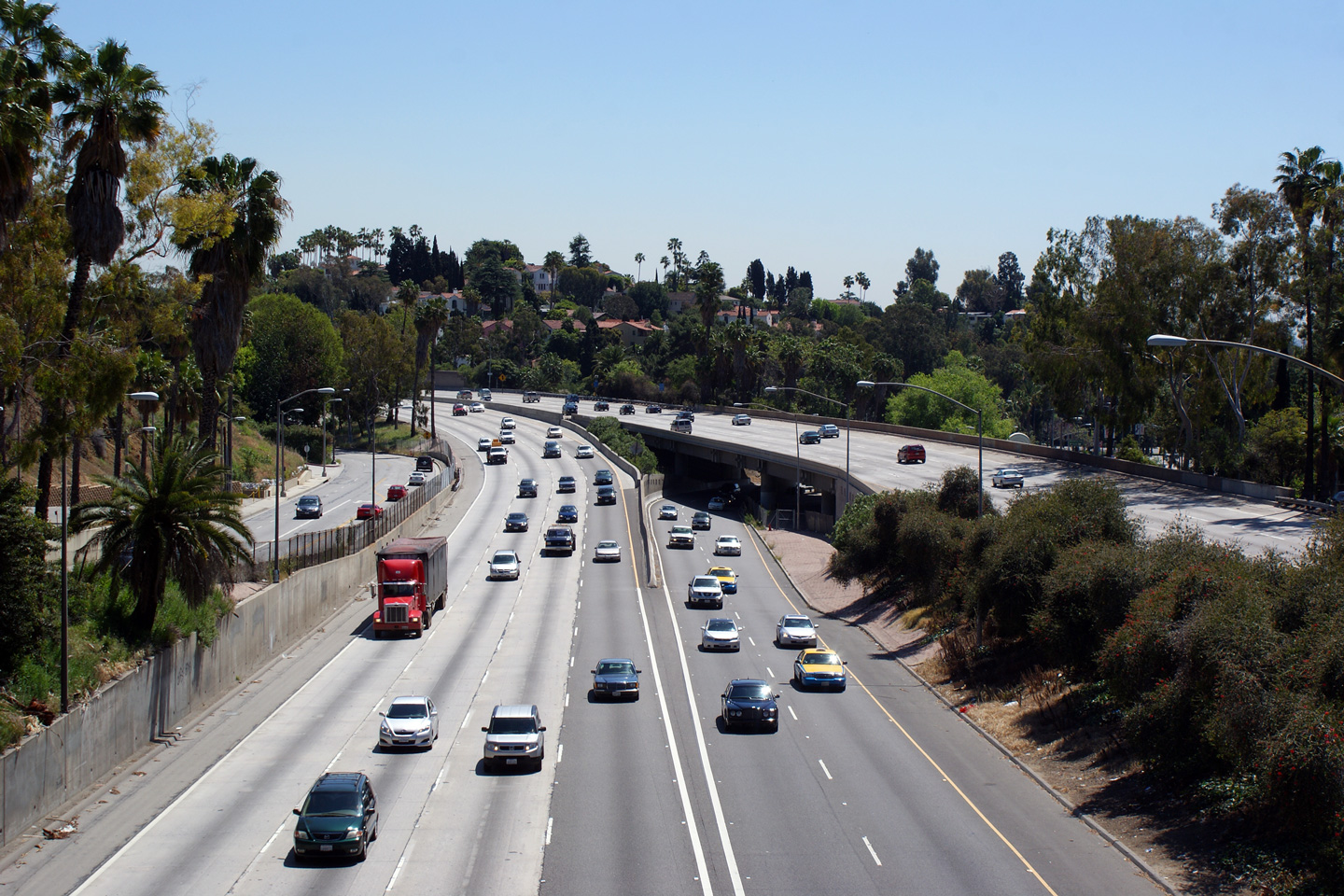
Southbound view along the Hollywood Freeway at rush hour from the Belmont Avenue pedestrian overpass. |
 |
||
|
Date: 3/26/2010 |
High-res: (1440x960) (2400x1600) |
|||
|
Los Angeles County |
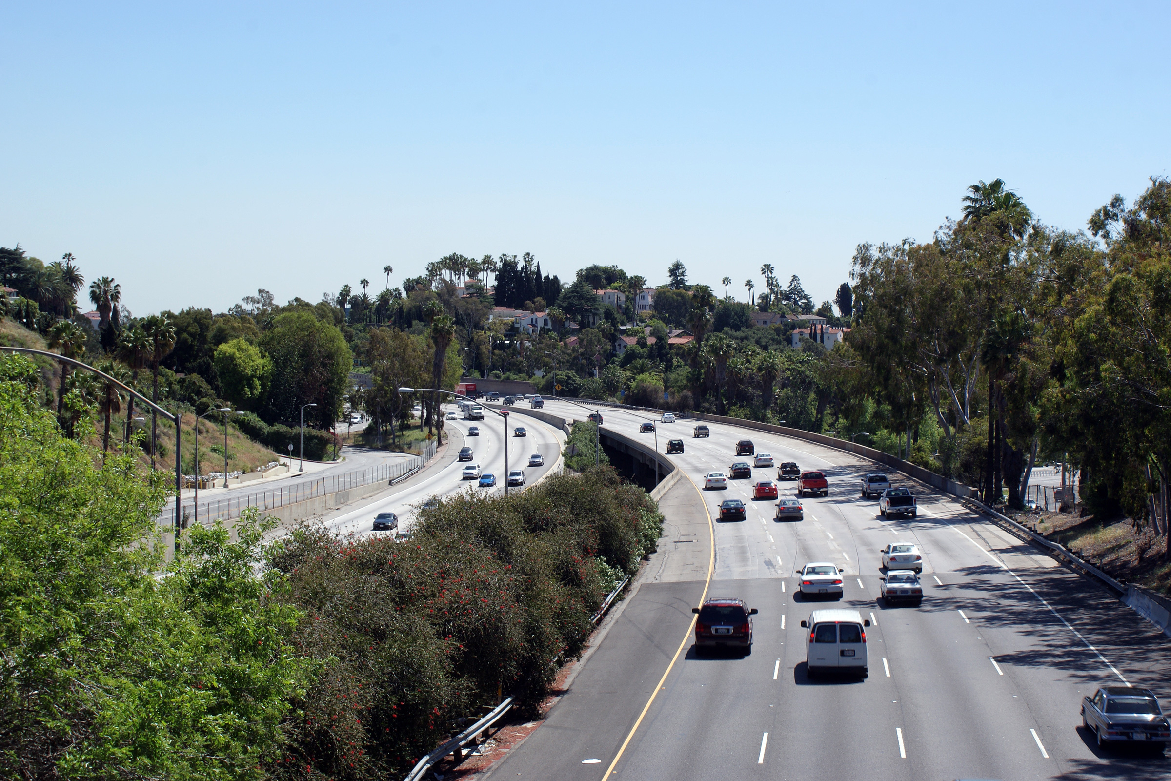
Southerly view along the Hollywood Freeway from Bonnie Brae Street. |
 |
||
|
Date: 3/26/2010 |
High-res: (1440x960) (2400x1600) |
|||
|
Los Angeles County |
Northerly view along Highway 101 from the Bonnie Brae Street overpass. The Hollywood skyline is visible in the distance. |
 |
||
|
Date: 3/26/2010 |
High-res: (1440x960) (2400x1600) |
|||
| Highway 2 continues east of the Hollywood Freeway along Alvarado Street before becoming the Glendale Freeway. Click here for Highway 2 Images. | ||||
|
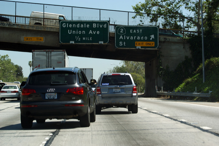
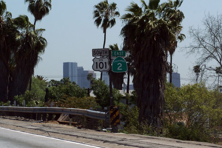
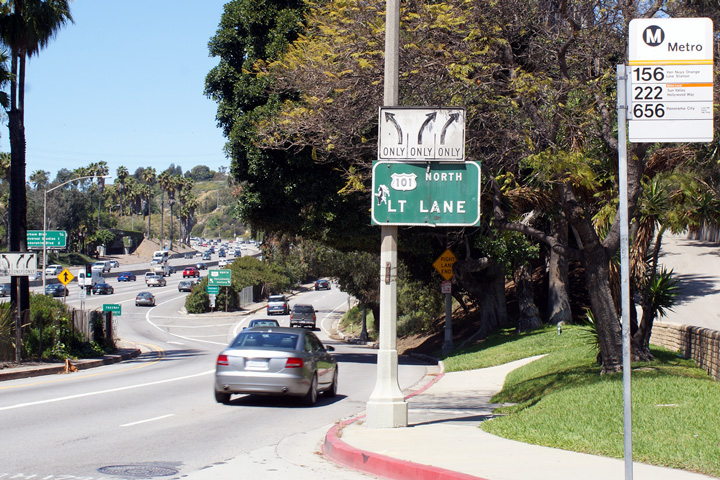
Los Angeles County |
Overhead signage for the ramp to Highway 2 North. |
 |
||
|
Date: 4/06/2010 |
High-res: (1440x960) | |||
|
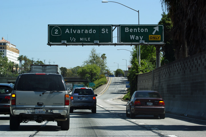
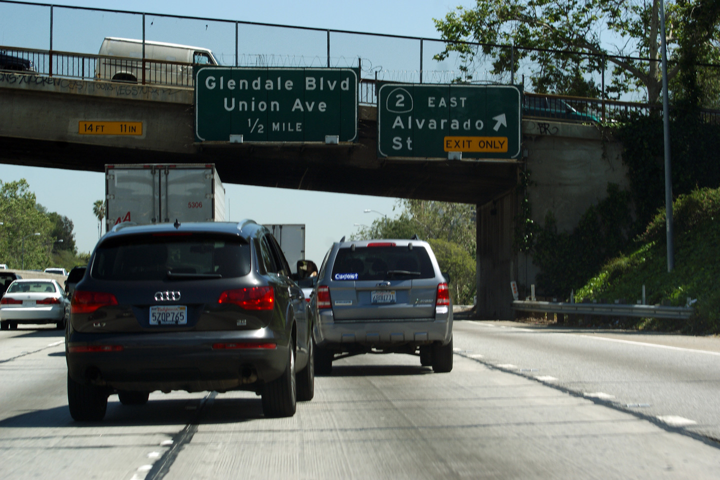
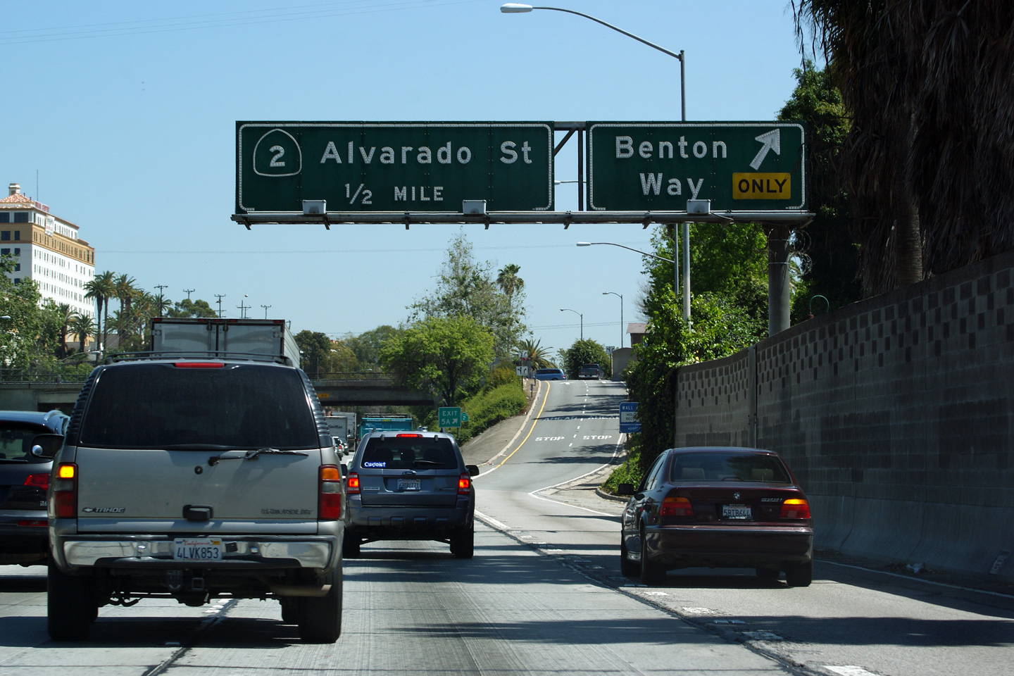
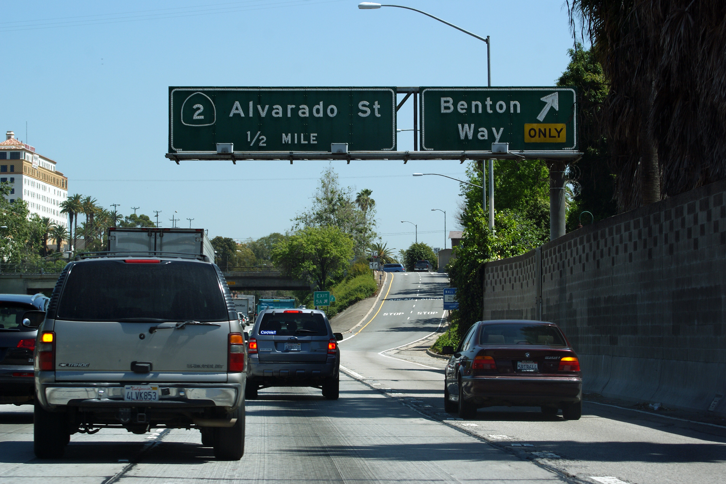
Los Angeles County |
Overhead signage assembly taken in heavy traffic at the exit to Benton Way. |
 |
||
|
Date: 4/06/2010 |
High-res: (1440x960) (2400x1600) | |||
|
Los Angeles County |
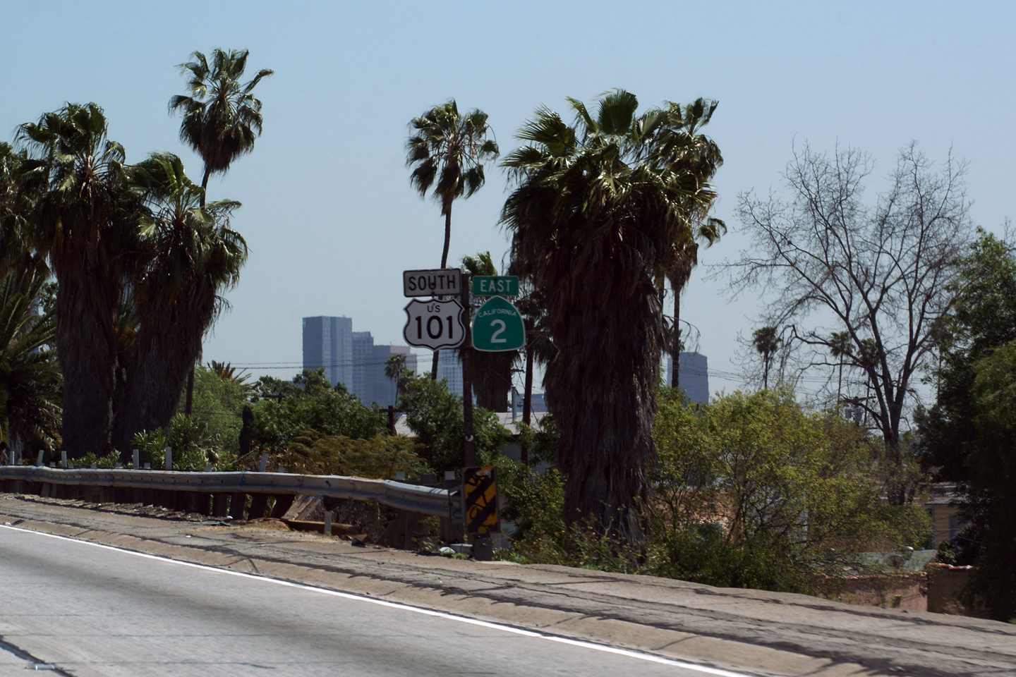
Southbound signage assembly denoting the US-101/CA-2 multiplex along the Hollywood Freeway. |
 |
||
|
Date: 4/06/2010 |
High-res: (1440x960) | |||
|
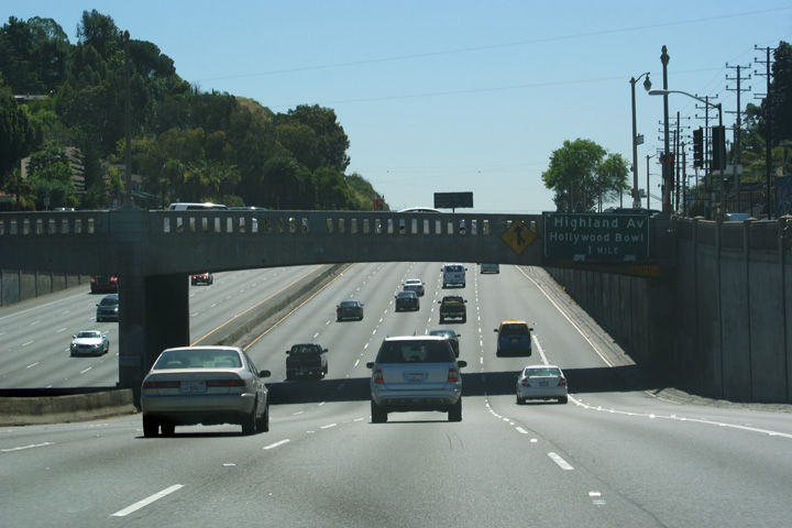
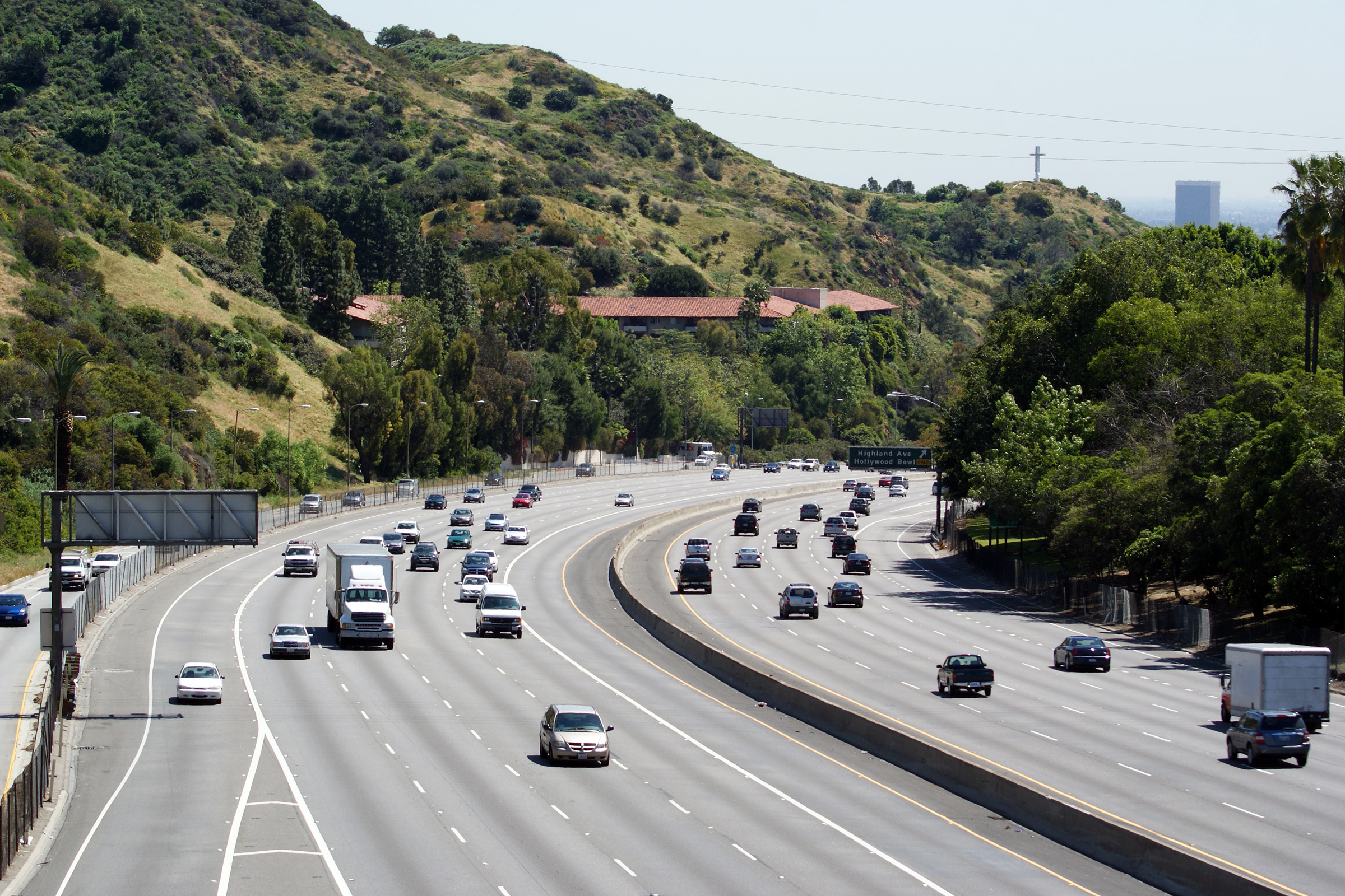
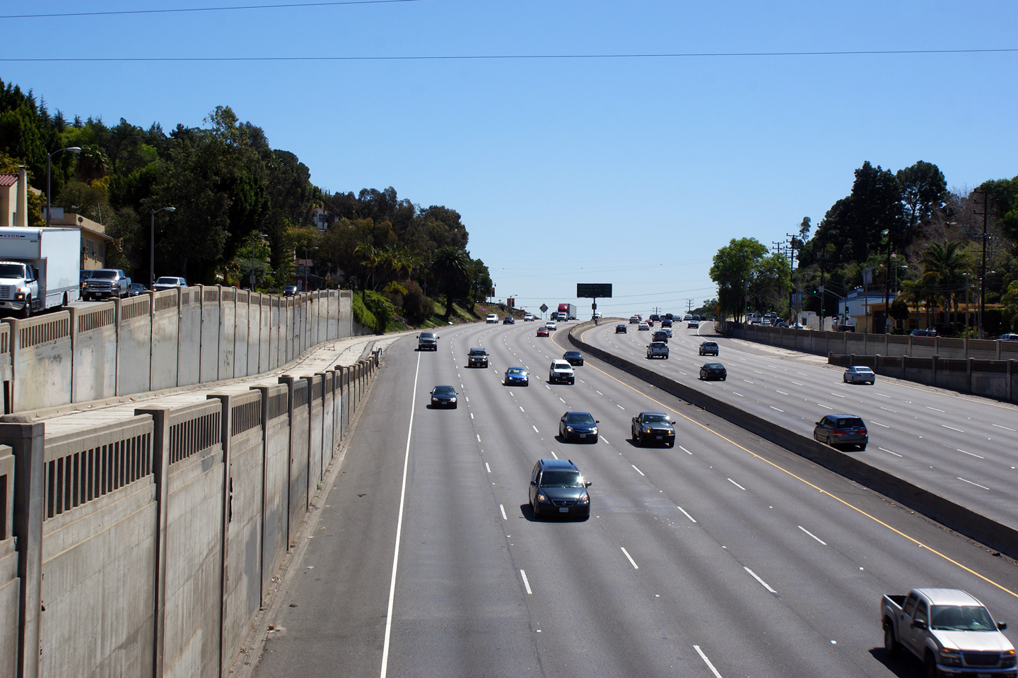
Los Angeles County |
Two views looking southerly from the Pilgrimage Bridge overpass in the vicinity of the Highland Avenue interchange. |
 |
||
|
High-res: (1440x960) (2400x1600) |
||||
 |
||||
|
Date: 4/06/2010 |
High-res: (1440x960) (2400x1600) |
|||
|
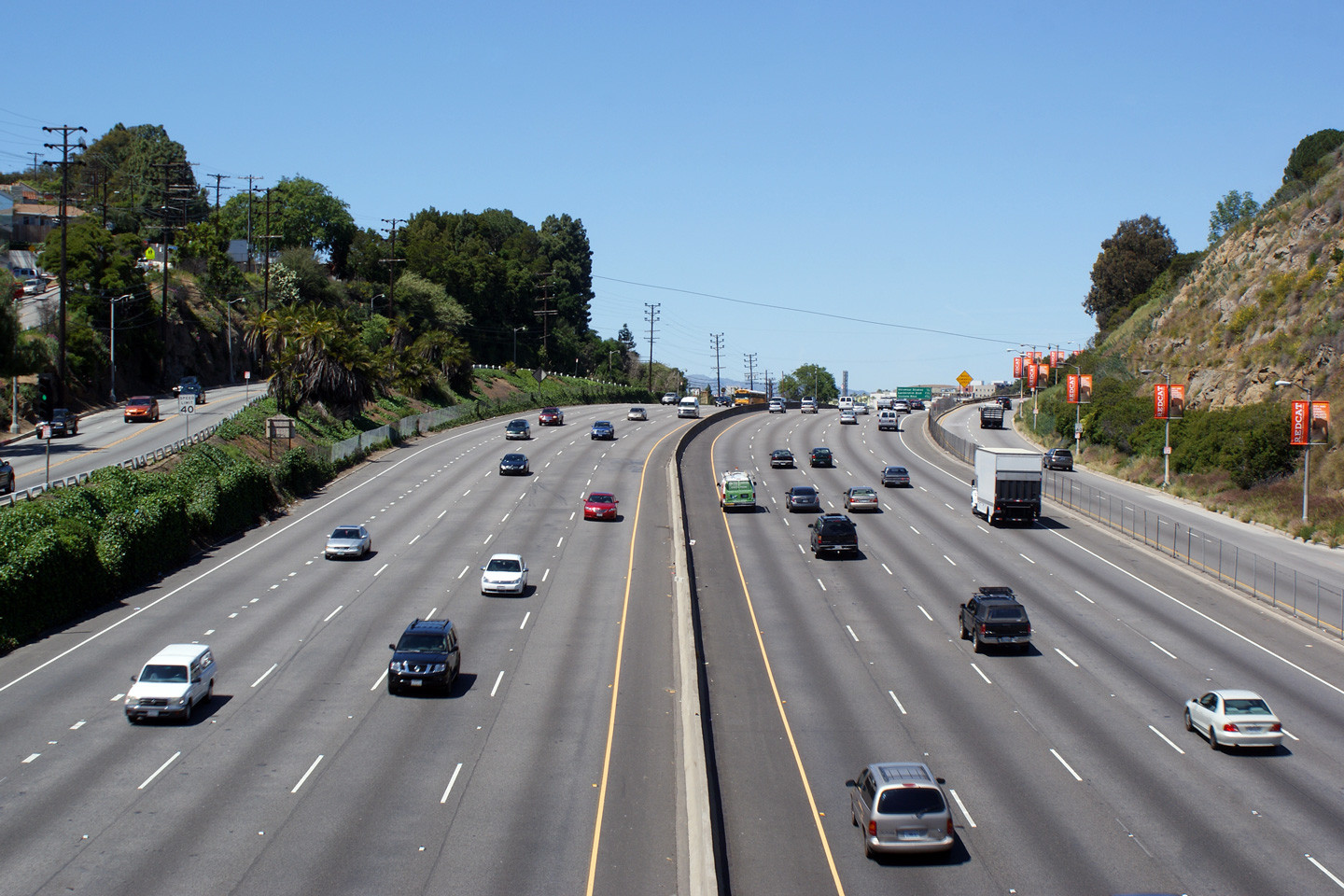
Los Angeles County |
Northerly view along the Hollywood Freeway from the Pilgrimage Bridge overpass. North of this photo, the Hollywood Freeway carries US Highway 101 overtop of the Santa Monica Mountains via the Cahuenga Pass. |
 |
||
|
Date: 4/06/2010 |
High-res: (1440x960) (2400x1600) |
|||
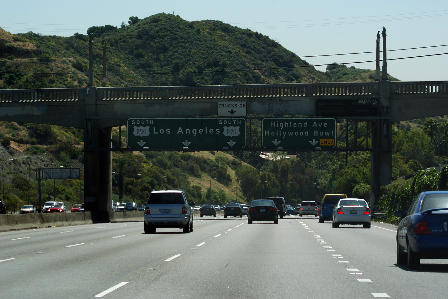
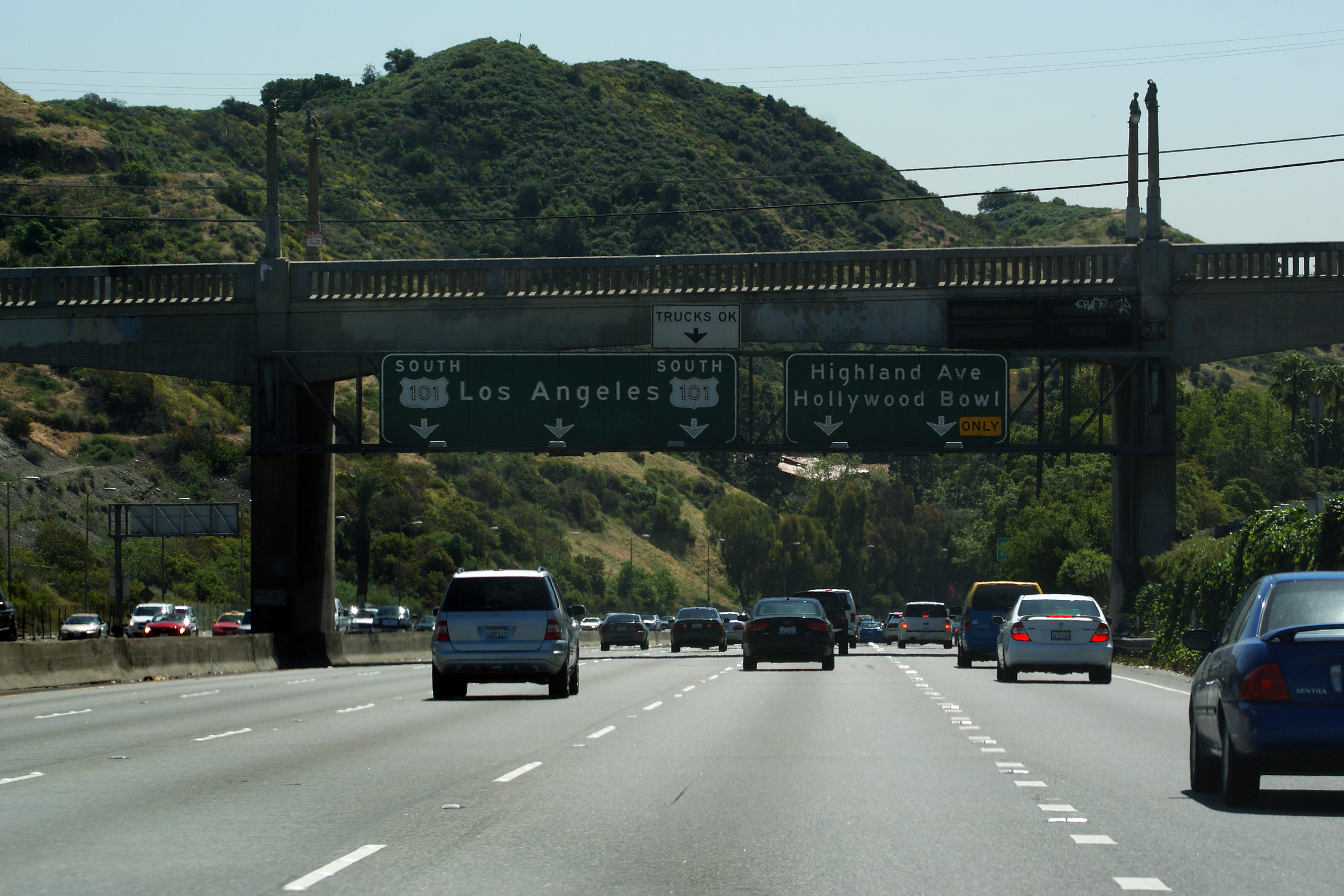
|
Los Angeles County |
A series of road signs that direct traffic onto US-101 in Los Angeles. |
 |
||
|
High-res: (1440x960) |
||||
 |
||||
|
High-res: (1440x960) |
||||
 |
||||
|
Date: 4/06/2010 |
High-res: (1440x960) |
|||
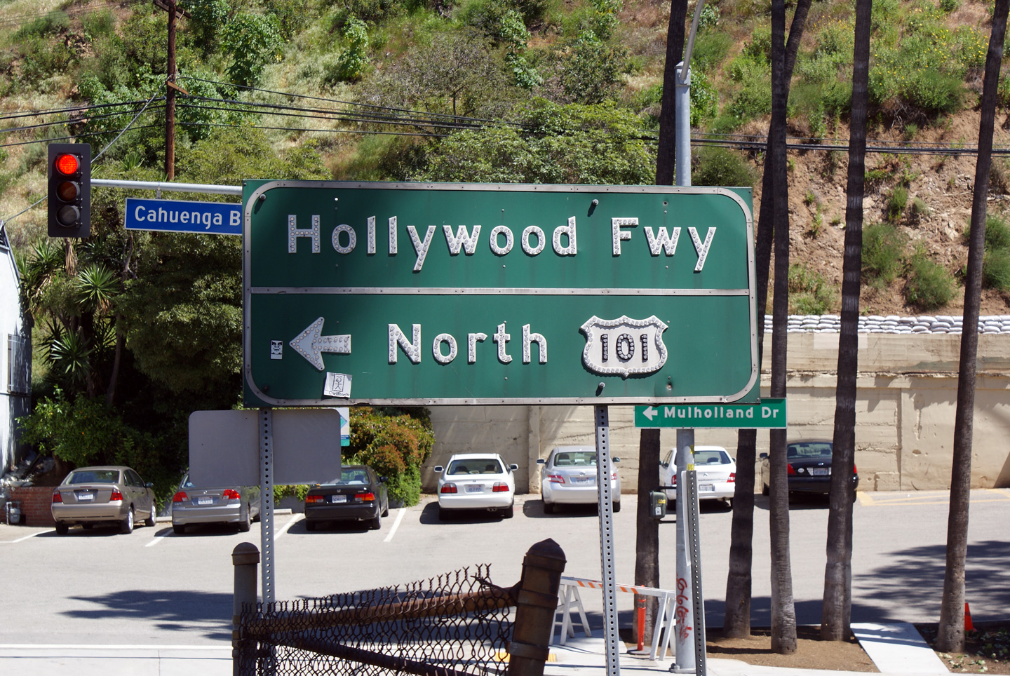
|
Los Angeles County |
Northerly view along the Hollywood Freeway approaching the Mulholland Drive overpass. |
 |
||
|
Date: 4/06/2010 |
High-res: (1440x960) (2400x1600) |
|||
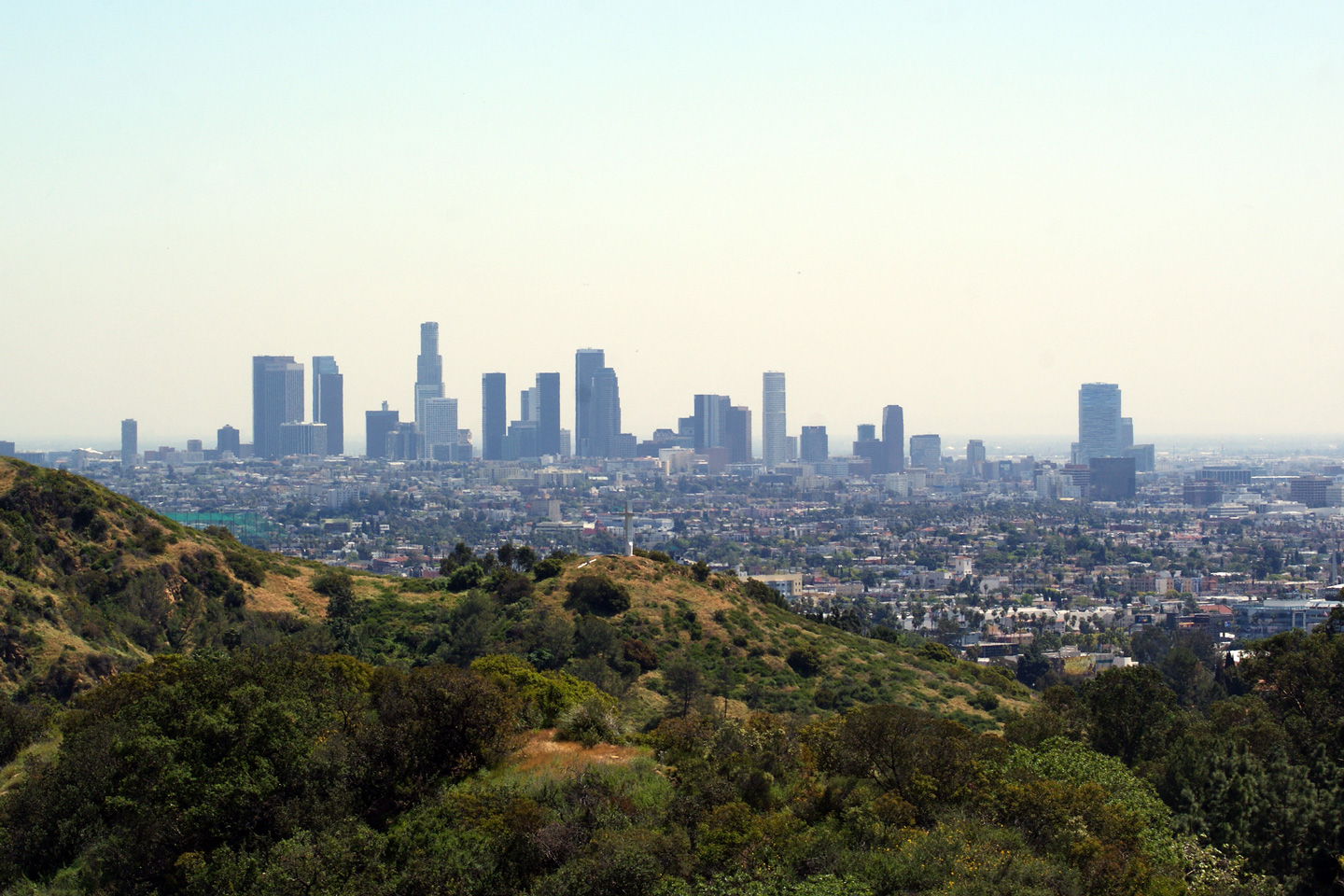
|
Los Angeles County |
View of the iconic Los Angeles skyline as seen from Mulholland Drive just west of the Hollywood Freeway. The L.A. skyline isn't nearly as impressive without a backdrop of snow capped mountains. |
 |
||
|
Date: 4/06/2010 |
High-res: (1440x960) (2400x1600) |
|||
|
Los Angeles County |
Southerly view of Cahuenga Pass from the Mulholland Drive overpass in Las Angeles.. |
 |
||
|
Date: 4/06/2010 |
High-res: (1440x960) (2400x1600) |
|||
|
Los Angeles County |
This view looks northerly from the Mulholland Drive overpass as US Highway 101 crests overtop of Cahuenga Pass. Cahunenga Pass has a peak elevation of 745 feet. |
 |
||
|
Date: 4/06/2010 |
High-res: (1440x960) (2400x1600) |
|||
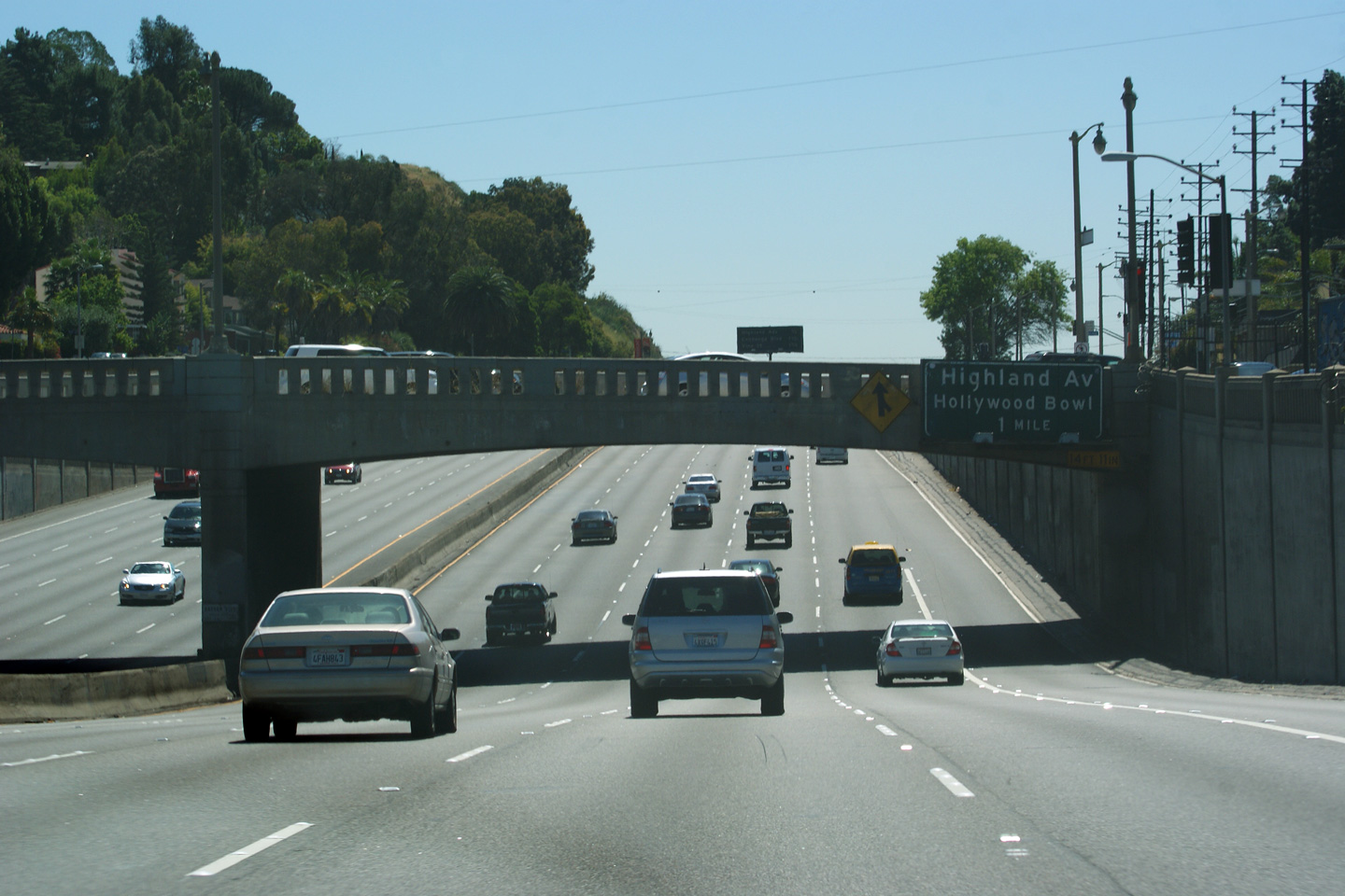
|
Los Angeles County |
Advanced signage for the exit to Highland Boulevard Guide affixed to the Mulholland Drive overpass. |
 |
||
|
Date: 4/06/2010 |
High-res: (1440x960) (2400x1600) | |||
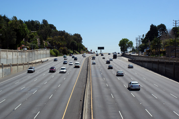
|
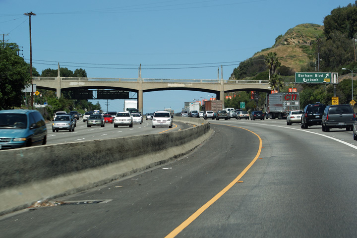
Los Angeles County |
After cresting overtop of Cahuenga Pass, Highway 101 passes underneath of Barham Boulevard. The Hollywood Freeway was originally constructed with an electric trolley line running through the median of the highway, hence the exceedingly wide overpass for a 1940s constructed freeway. |
 |
||
|
Date: 4/06/2010 |
High-res: (1440x960) (2400x1600) |
|||
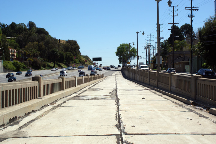
|
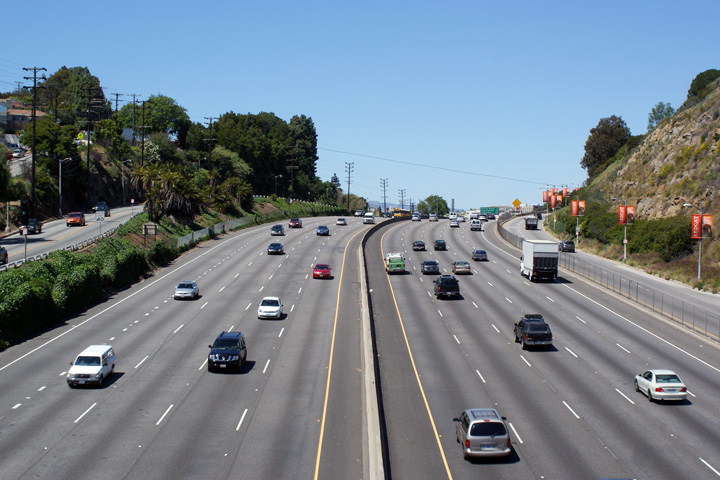
Los Angeles County |
A series of views looking southerly from the Barham Boulevard overpass. A partial diamond interchange formerly existed at this location. The Cahuenga Pass segment of the Hollywood Freeway is one of the oldest freeways in California, having opened to traffic in 1940. Because of the freeway's history, interesting vestiges into the past are visible along the route, such as this abandoned interchange at Barham Boulevard. |
 |
||
|
High-res: (1440x960) (2400x1600) |
||||
 |
||||
|
High-res: (1440x960) (2400x1600) |
||||
 |
||||
|
Date: 4/06/2010 |
High-res: (1440x960) (2400x1600) |
|||
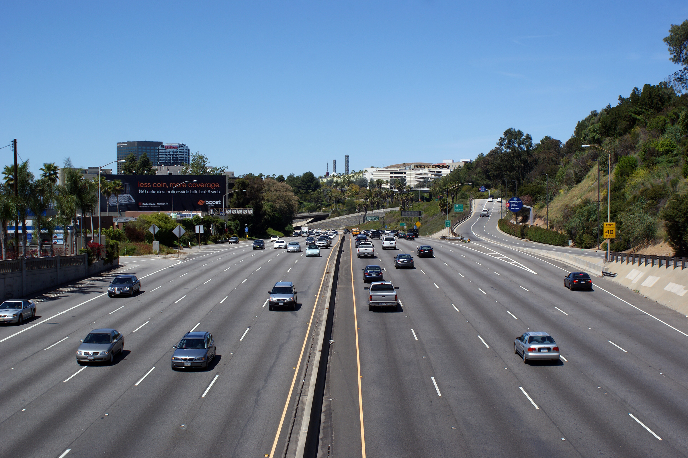
|
Los Angeles County |
This view looks northerly from the Barham Boulevard overpass towards Universal City along the Hollywood Freeway. |
 |
||
|
Date: 4/06/2010 |
High-res: (1440x960) (2400x1600) |
|||
|
Los Angeles County |
Advanced signage for the ramp to Highland Boulevard affixed to the Barham Boulevard overpass. |
 |
||
|
Date: 4/06/2010 |
High-res: (1440x960) (2400x1600) |
|||
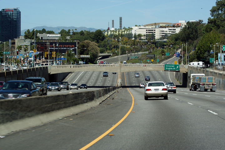
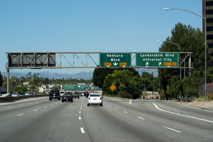
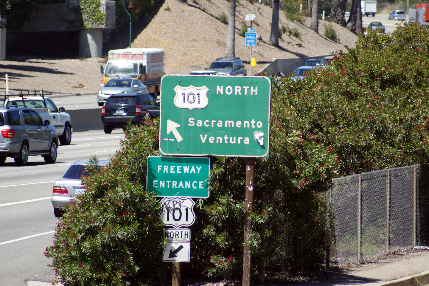
|
Los Angeles County |
Overhead signage at the exit to Lankershim Boulevard. |
 |
||
|
Date: 4/06/2010 |
High-res: (1440x960) (2400x1600) |
|||
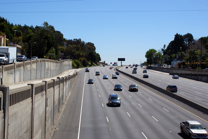
|
Los Angeles County |
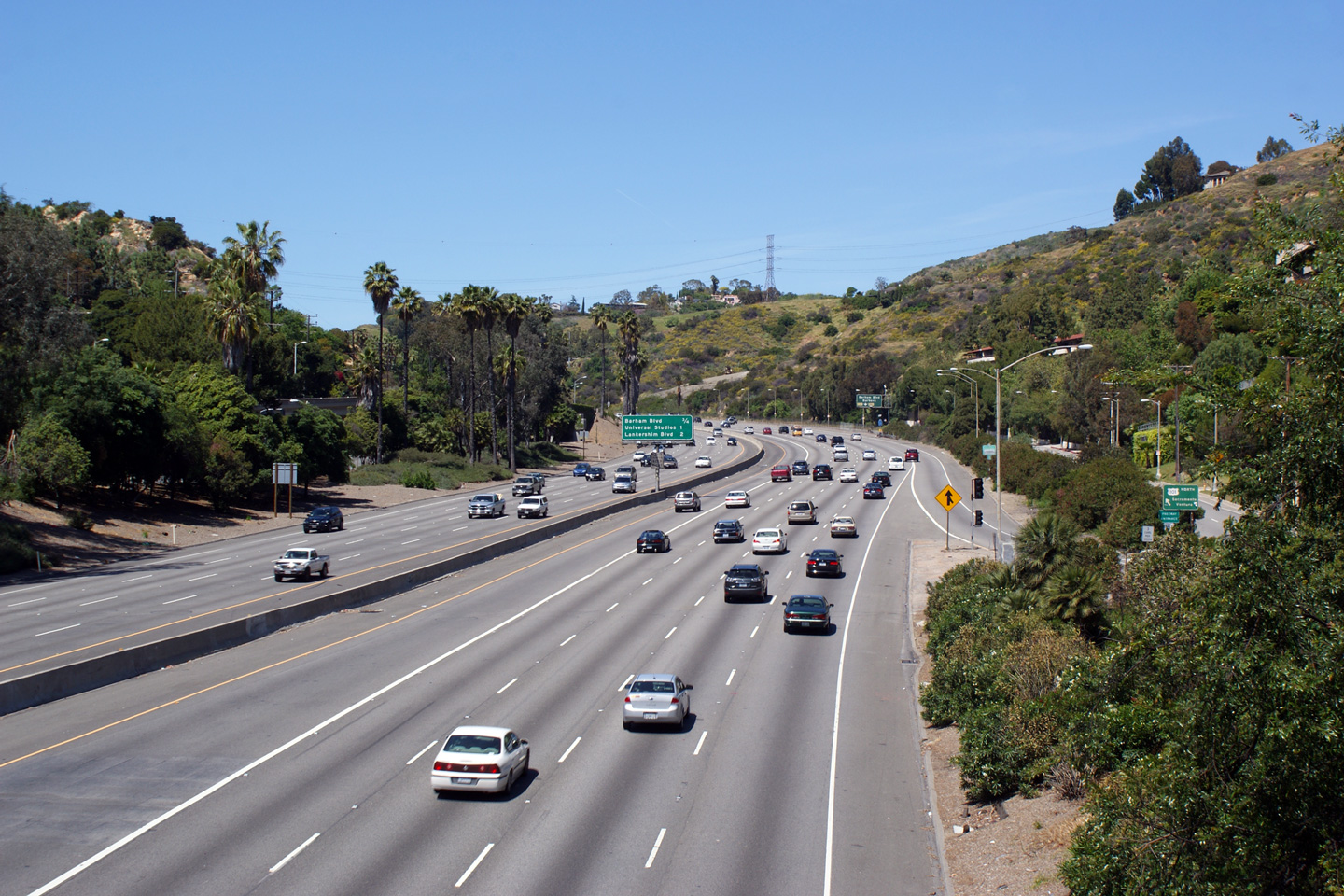
Northerly view along the Hollywood Freeway at the north-bound off-ramp to Ventura Boulevard. |
 |
||
|
Date: 4/06/2010 |
High-res: (1440x960) (2400x1600) |
|||
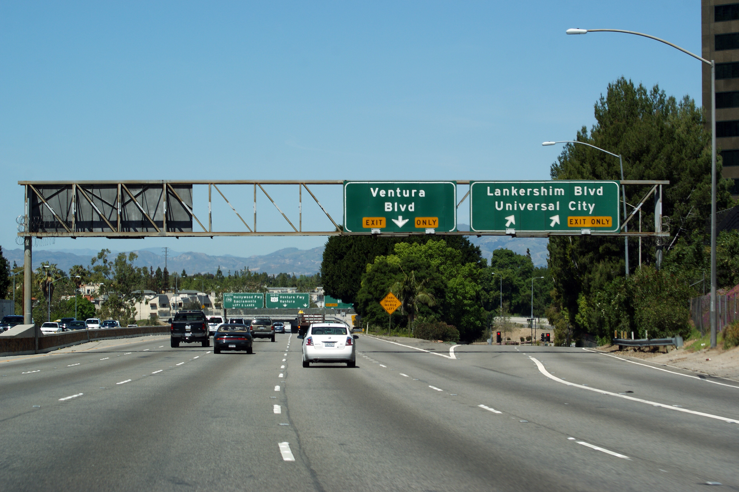
|
Los Angeles County |
Advanced lane assignment signage for the Ventura Freeway interchange. |
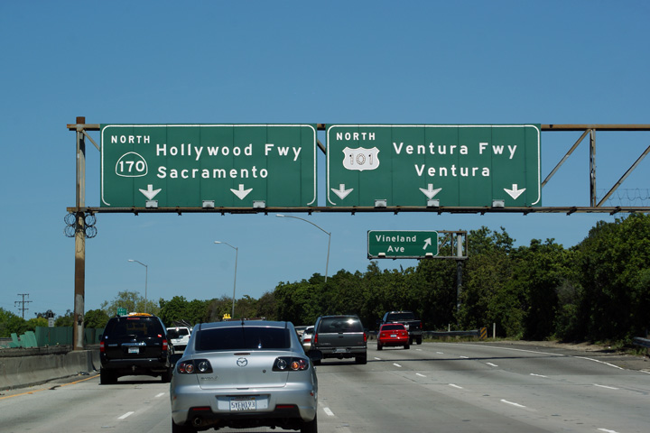 |
||
|
Date: 4/06/2010 |
High-res: (1440x960) (2400x1600) |
|||
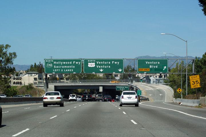
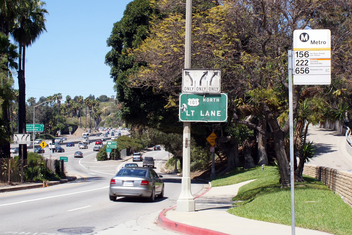
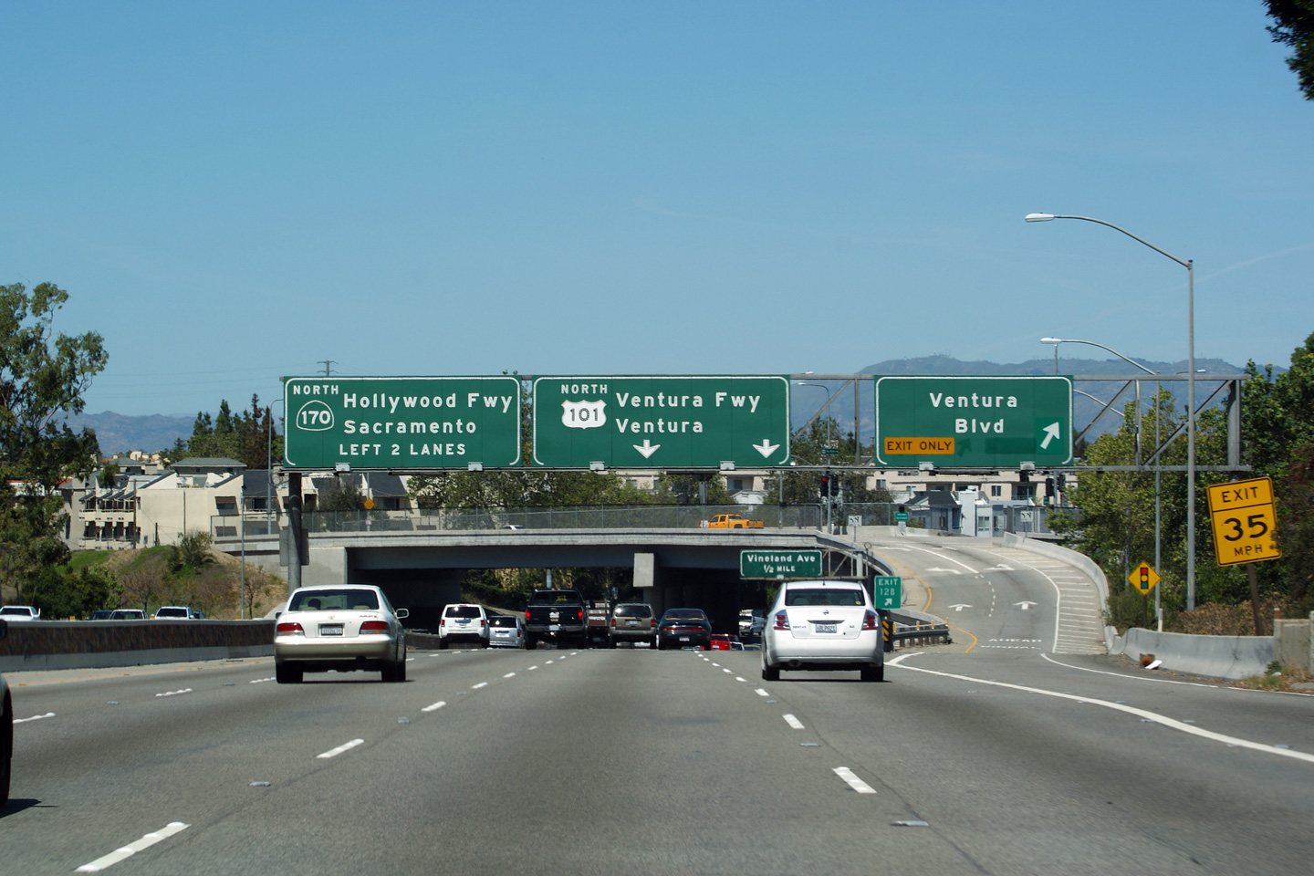
|
Los Angeles County |
Overhead signage directing through traffic to use the right three lanes of the Hollywood Freeway in order to continue northerly along US-101. US-101 departs the Hollywood Freeway for the Ventura Freeway at the upcoming Bruce T. Hinman Memorial Interchange. |
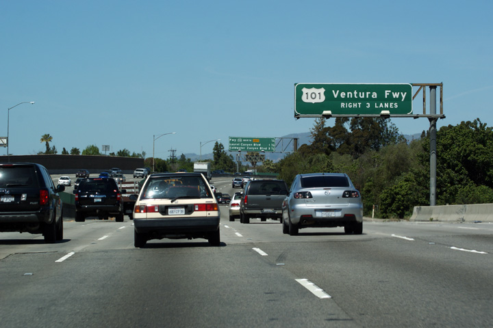 |
||
|
Date: 4/06/2010 |
High-res: (1440x960) (2400x1600) | |||
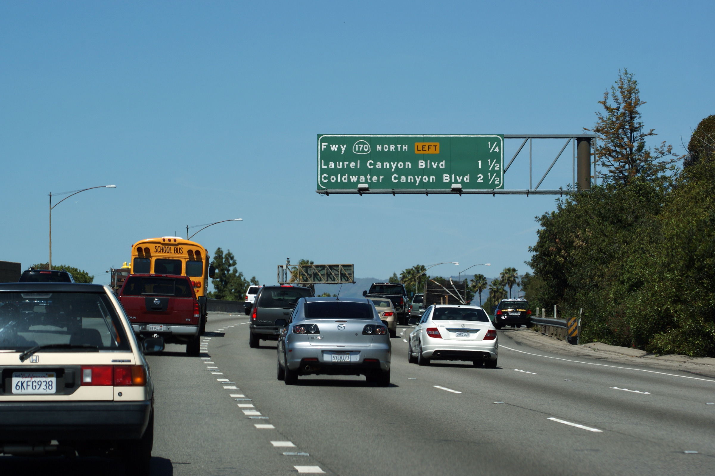
|
Los Angeles County |
Interchange sequence sign along US-101 North in advance of the Bruce T. Hinman Interchange with Highways 170 and 134. While the Hollywood Freeway moniker continues northerly as California Highway 170, US-101 departs the Hollywood Freeway alignment to become the western leg of the Ventura Freeway. This interchange sequence sign reflects the next exits along US-101 despite its change in alignment. |
 |
||
|
Date: 4/06/2010 |
High-res: (1440x960) (2400x1600) | |||
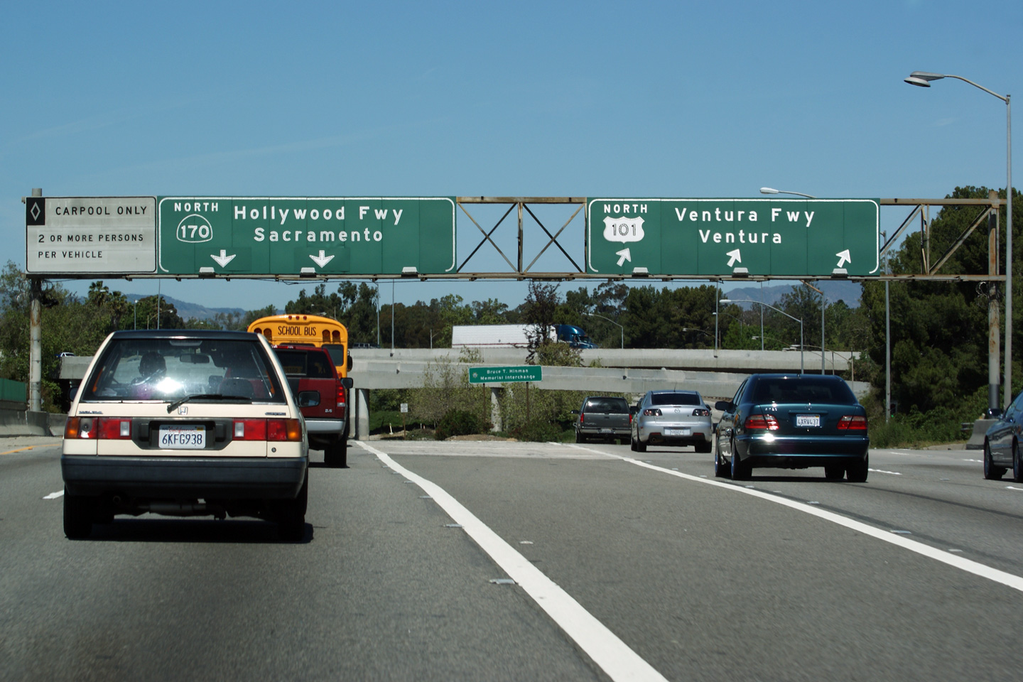
|
Los Angeles County |
Overhead signage at the northbound split between the Hollywood Freeway (now Highway 170) and the Ventura Freeway (now US Highway 101). |
 |
||
|
Date: 4/06/2010 |
High-res: (1440x960) (2400x1600) |
|||
| The Hollywood Freeway continues northerly bound for Interstate 5 as Highway 170. Click here for Highway 170 Images. | ||||
<- US-97
CA Highways
US-395 ->
AsphaltPlanet.ca
© 2010 AsphaltPlanet.ca.
AsphaltPlanet@asphaltplanet.ca
Page Created: February 13, 2012.
Last Updated: February 13, 2012.