
AsphaltPlanet.ca > California > Interstate 680
Pictures on this
page are arranged in order from south to north. I-805 North photos are
left-aligned in the last column, while I-805 South photos are right-aligned.
Center-line pictures are centered within the last column.
|
Location |
Description |
Photo |
||
|
North- |
South- |
|||
|
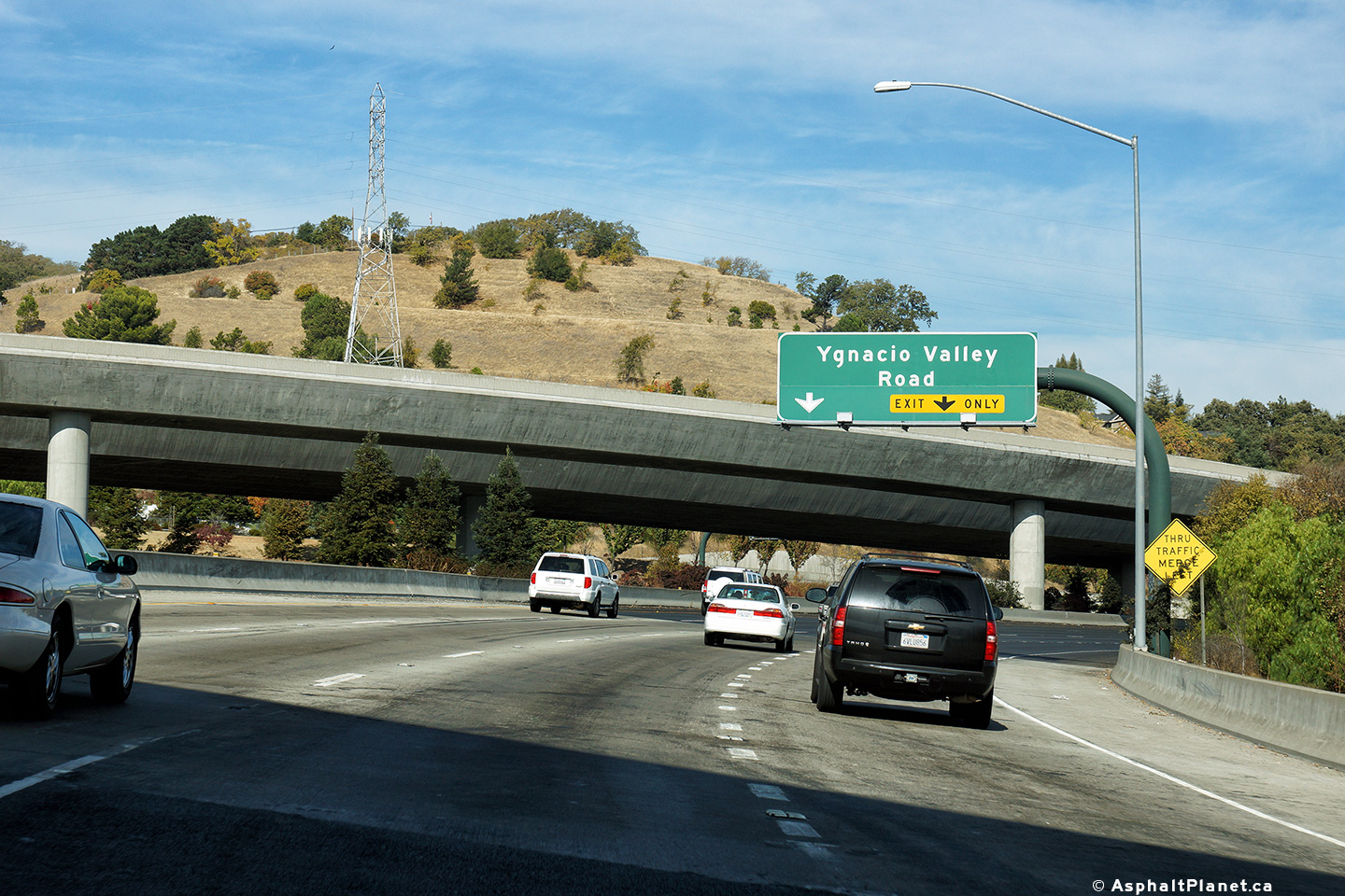
Contra Costa County |
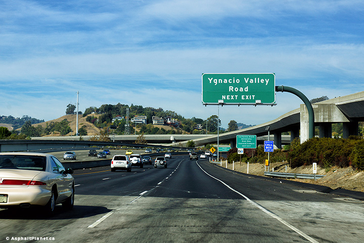
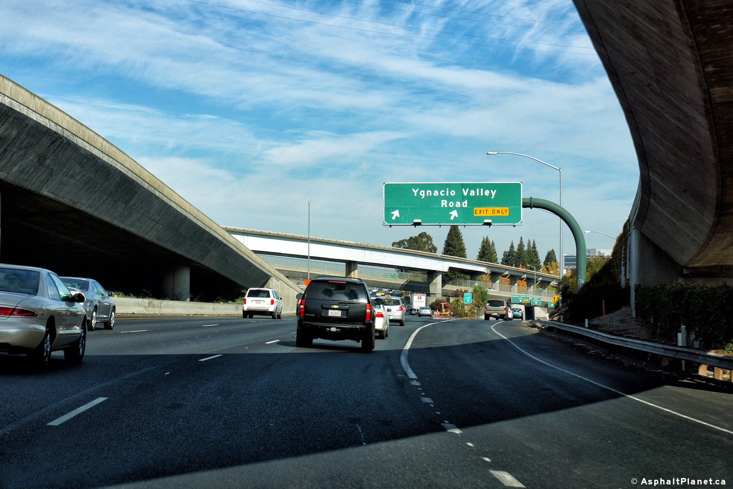
Northbound advanced signage for the Ygnacio Valley Road interchange. The ramps between I-680 and CA-24 can be seen towering over the freeway in this photograph. |
 |
||
|
Date: 10/31/2013 |
High-res: (1440x960) (2400x1600) |
|||
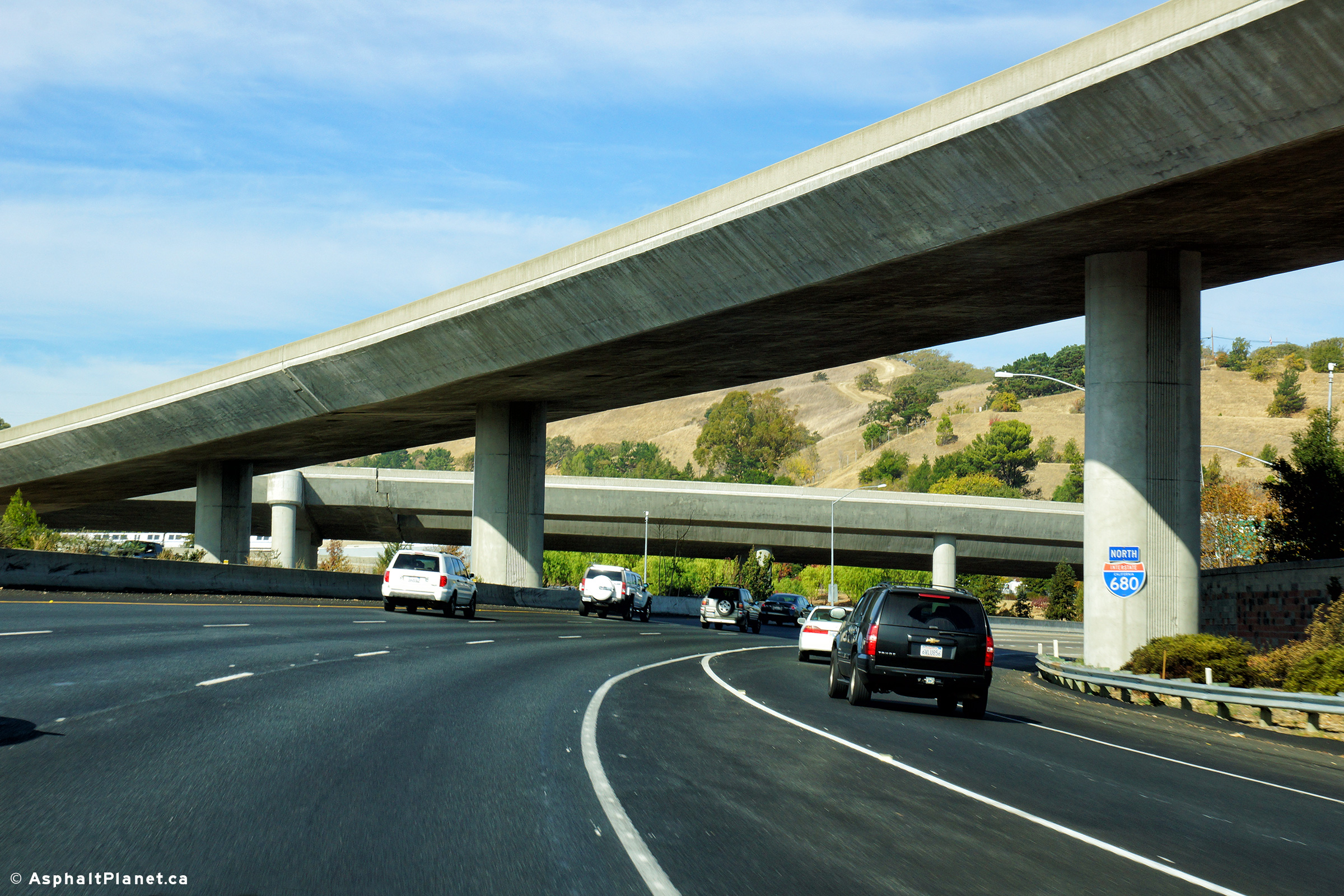
|
Contra Costa County |
View looking northerly as I-680 passes beneath the CA-24 interchange ramps. |
 |
||
|
Date: 10/31/2013 |
High-res: (1440x960) (2400x1600) |
|||
|
Contra Costa County |
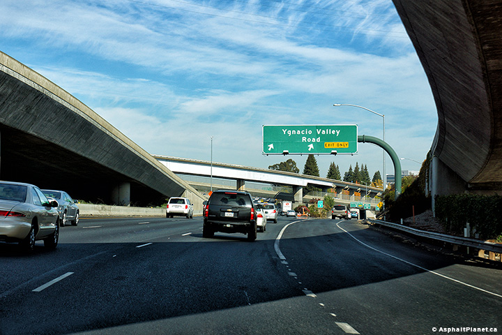
Northbound advanced signage for the Ygnacio Valley Road interchange. |
 |
||
|
Date: 10/31/2013 |
High-res: (1440x960) (2400x1600) |
|||
|
Contra Costa County |
Northerly view along I-680 at the off-ramp to Ygnacio Valley Road. The ramps from CA-24 are joining the freeway in this photo. |
 |
||
|
Date: 10/31/2013 |
High-res: (1440x960) (2400x1600) |
|||
|
Contra Costa County |
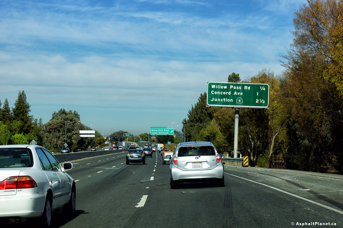
Northbound interchange sequence signage located just beyond the CA-242 interchange. |
 |
||
|
Date: 30/31/2013 |
High-res: (1440x960) (2400x1600) | |||
|
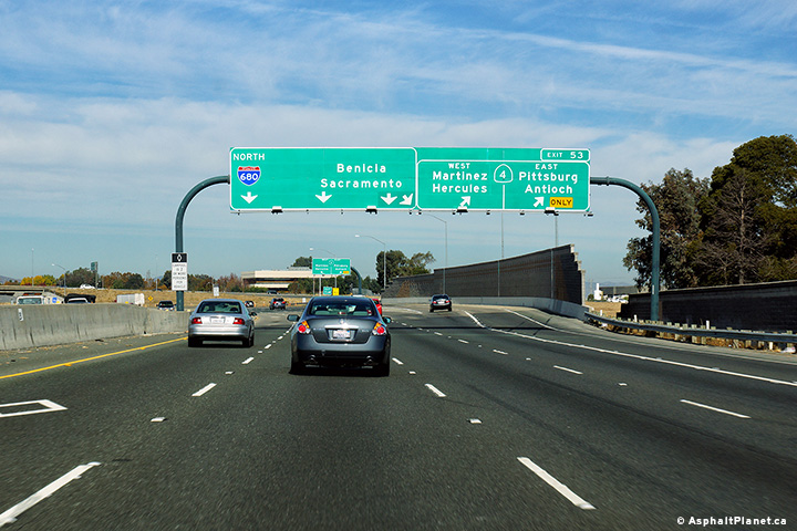
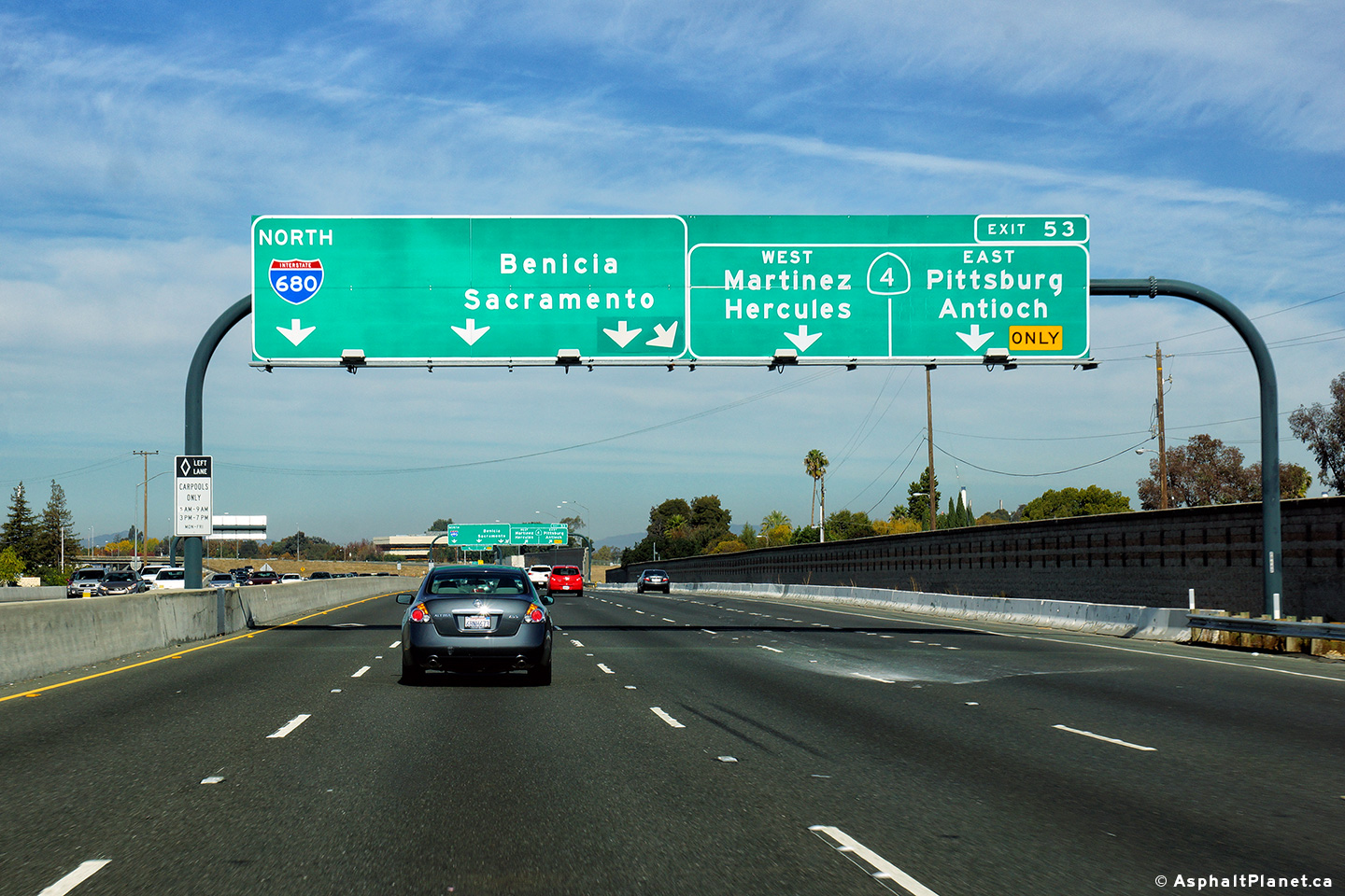
Contra Costa County |
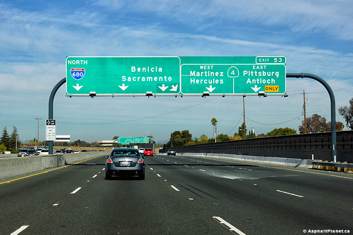
Northbound interchange sequence signage approaching the CA-4 interchange. |
 |
||
|
Date: 30/31/2013 |
High-res: (1440x960) (2400x1600) |
|||
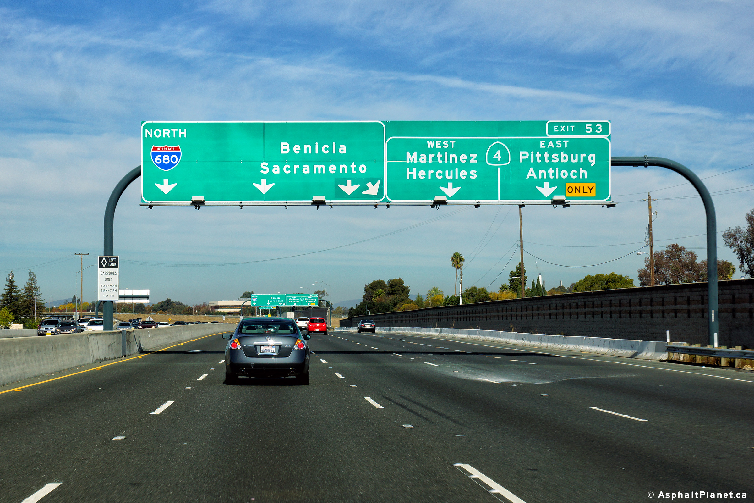
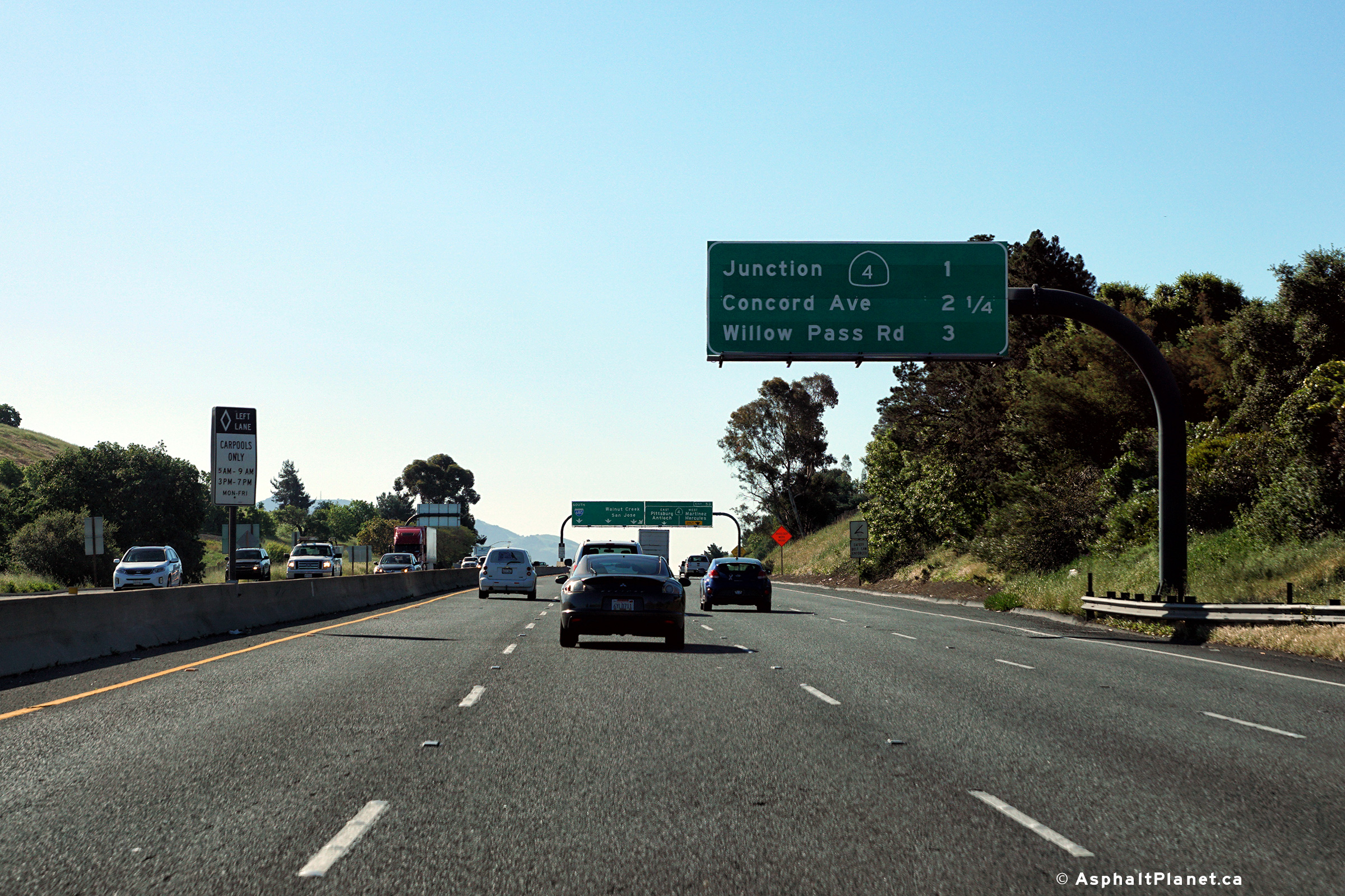
|
Contra Costa County |
Northbound advanced lane assignment signage approaching the CA-4 interchange. |
 |
||
|
Date: 30/31/2013 |
High-res: (1440x960) (2400x1600) |
|||
|
Contra Costa County |
Signage at the northbound off-ramp to CA-4. |
 |
||
|
Date: 30/31/2013 |
High-res: (1440x960) (2400x1600) |
|||
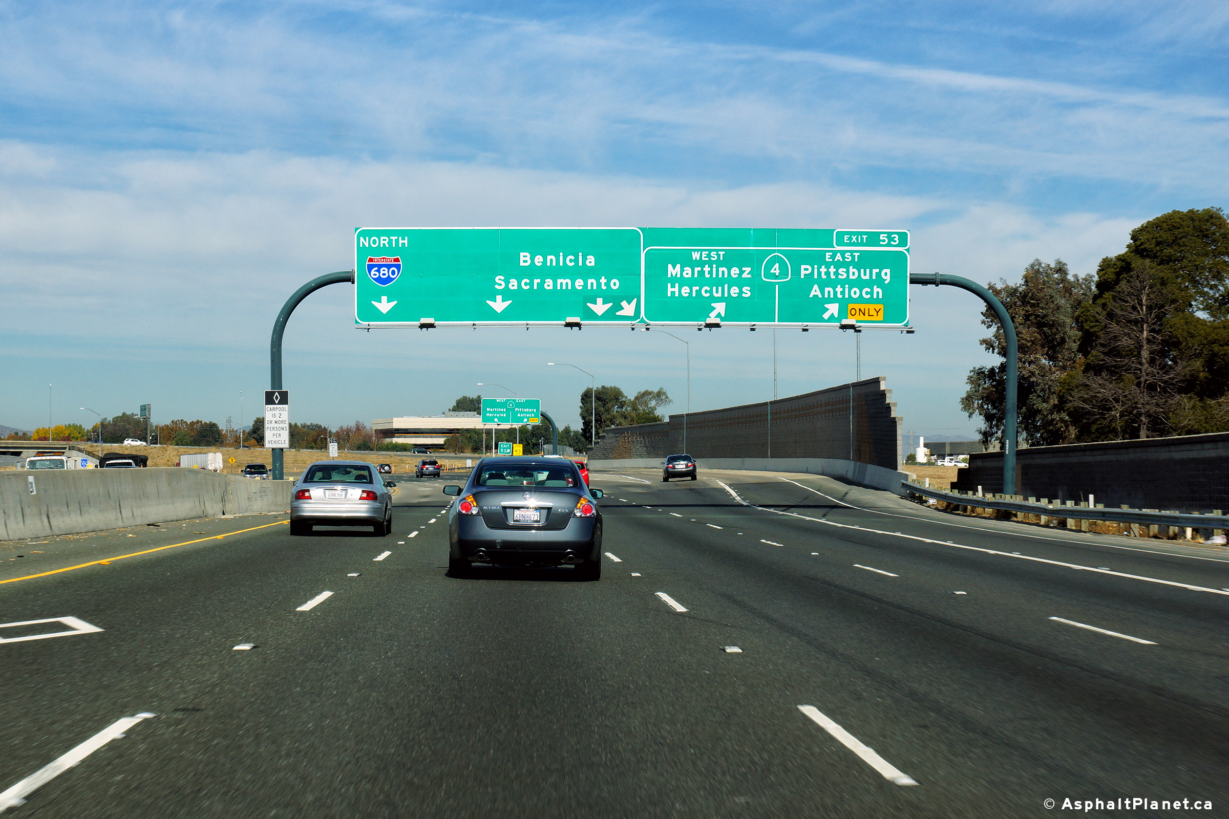
|
Contra Costa County |
Signage as I-680 passes through the CA-4 cloverleaf interchange. |
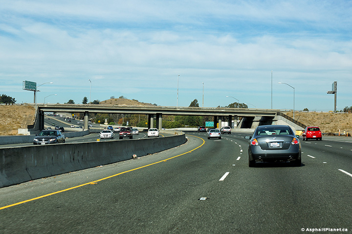 |
||
|
Date: 30/31/2013 |
High-res: (1440x960) (2400x1600) |
|||
| SR-4 is an east-west highway that runs easterly through Contra Costa County (and beyond) from Interstate 80. Click here for SR-4 Images. | ||||
|
Contra Costa County |
Southbound signage for the off-ramp to CA-4. |
 |
||
|
Date: 30/31/2013 |
High-res: (1440x960) (2400x1600) | |||
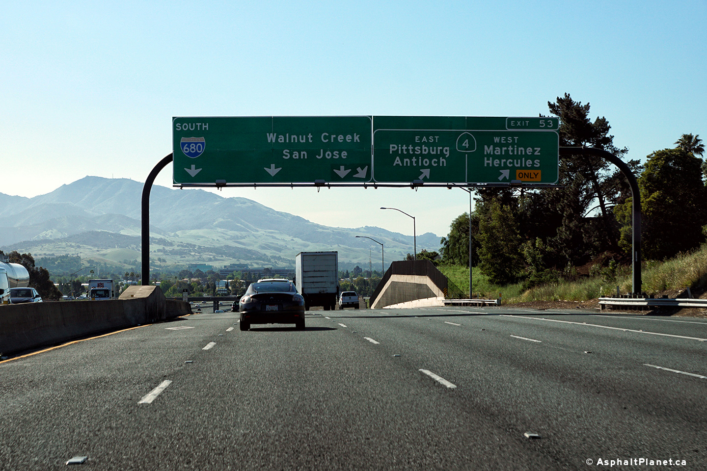
|
Contra Costa County |
Southbound advanced signage for the CA-4 interchange. |
 |
||
|
Date: 30/31/2013 |
High-res: (1440x960) (2400x1600) | |||
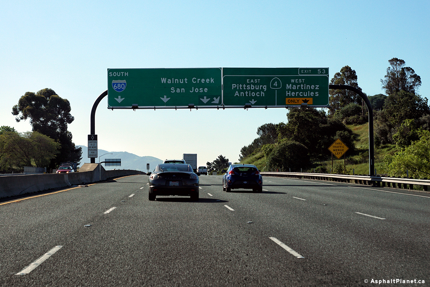
|
Contra Costa County |
Interchange sequence signage facing southbound traffic approaching the CA-4 interchange. |
 |
||
|
Date: 30/31/2013 |
High-res: (1440x960) (2400x1600) | |||
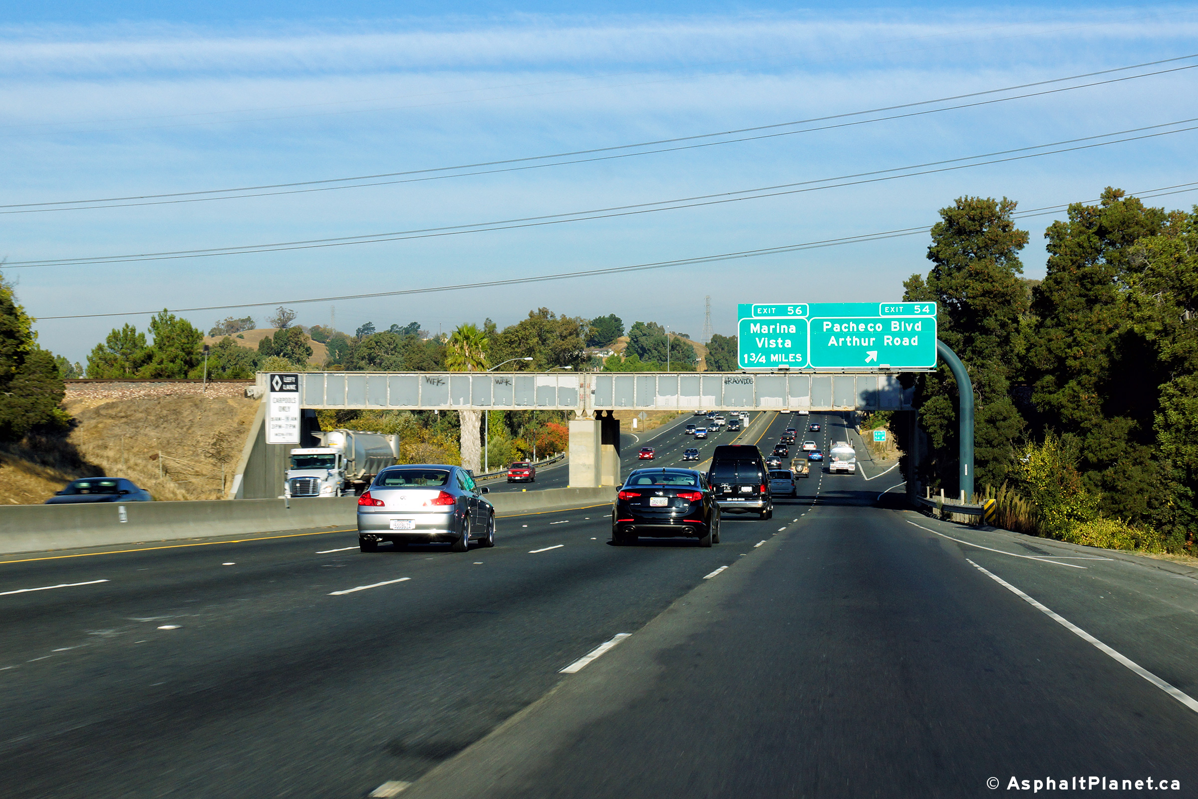
|
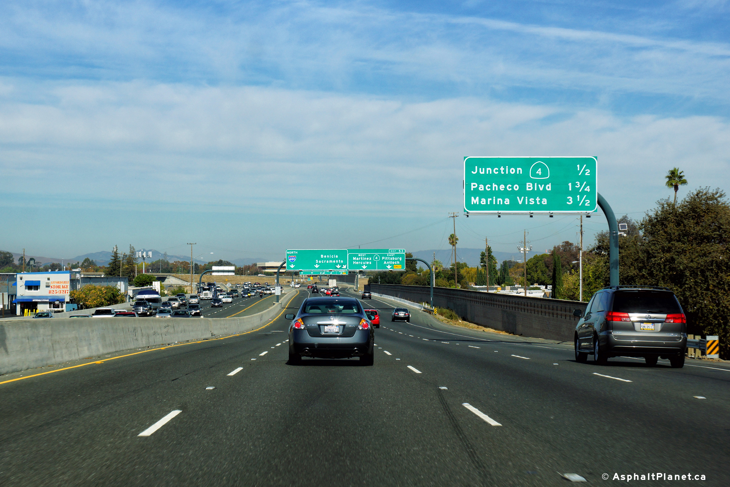
Contra Costa County |
Northbound signage at the off-ramp to Pacheco Boulevard and Arthur Road. |
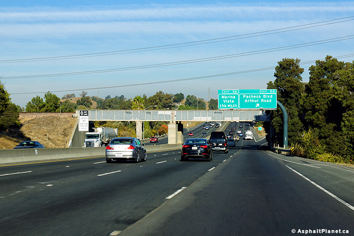 |
||
|
Date: 30/31/2013 |
High-res: (1440x960) (2400x1600) |
|||
|
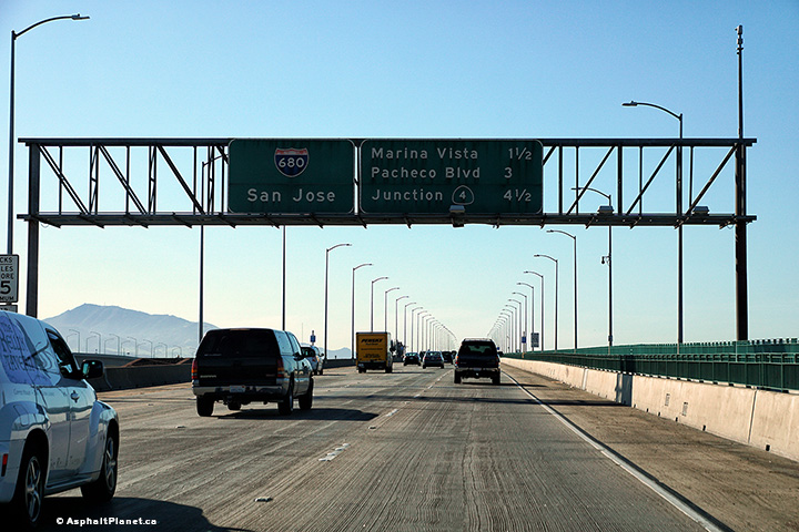
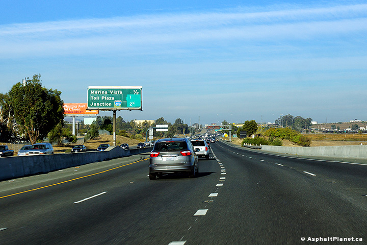
Contra Costa County |
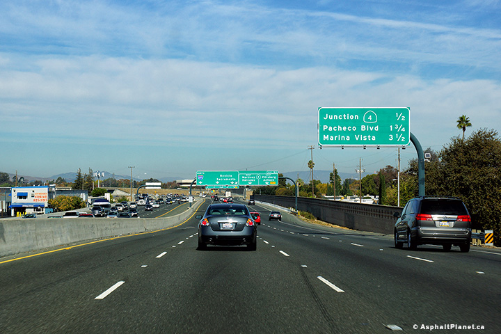
Northbound interchange sequence signage in advance of the Marina Vista Road interchange. |
|
||
|
Date: 3/26/2010 |
High-res: (1440x960) (2400x1600) |
|||
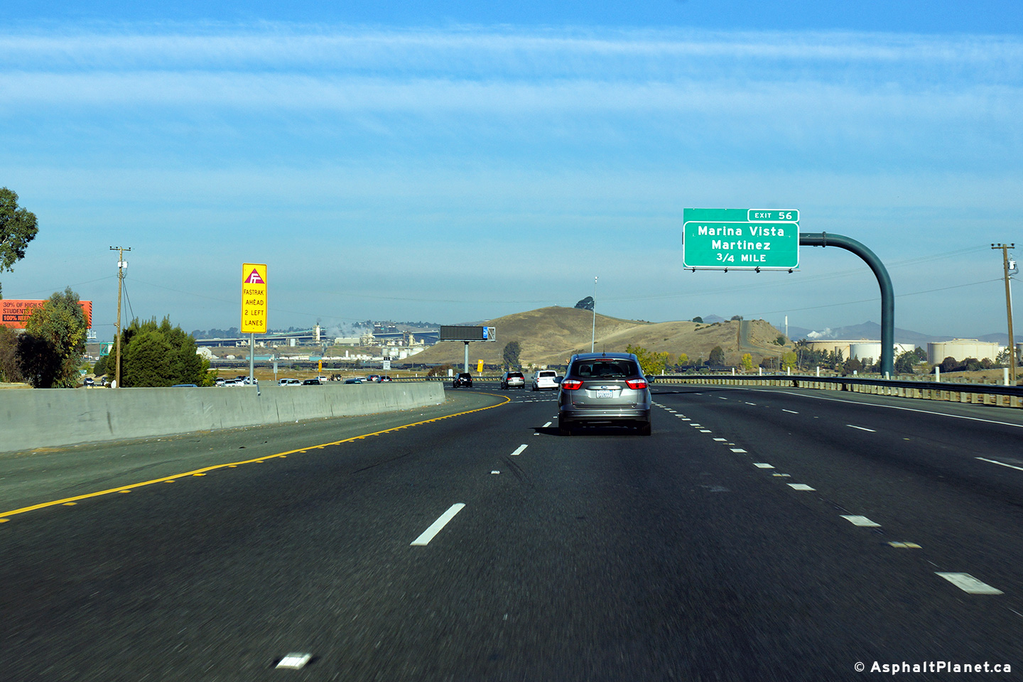
|
Contra Costa County |
Northbound advanced signage for the exit to Marina Vista and Martinez. |
 |
||
|
Date: 30/31/2013 |
High-res: (1440x960) (2400x1600) | |||
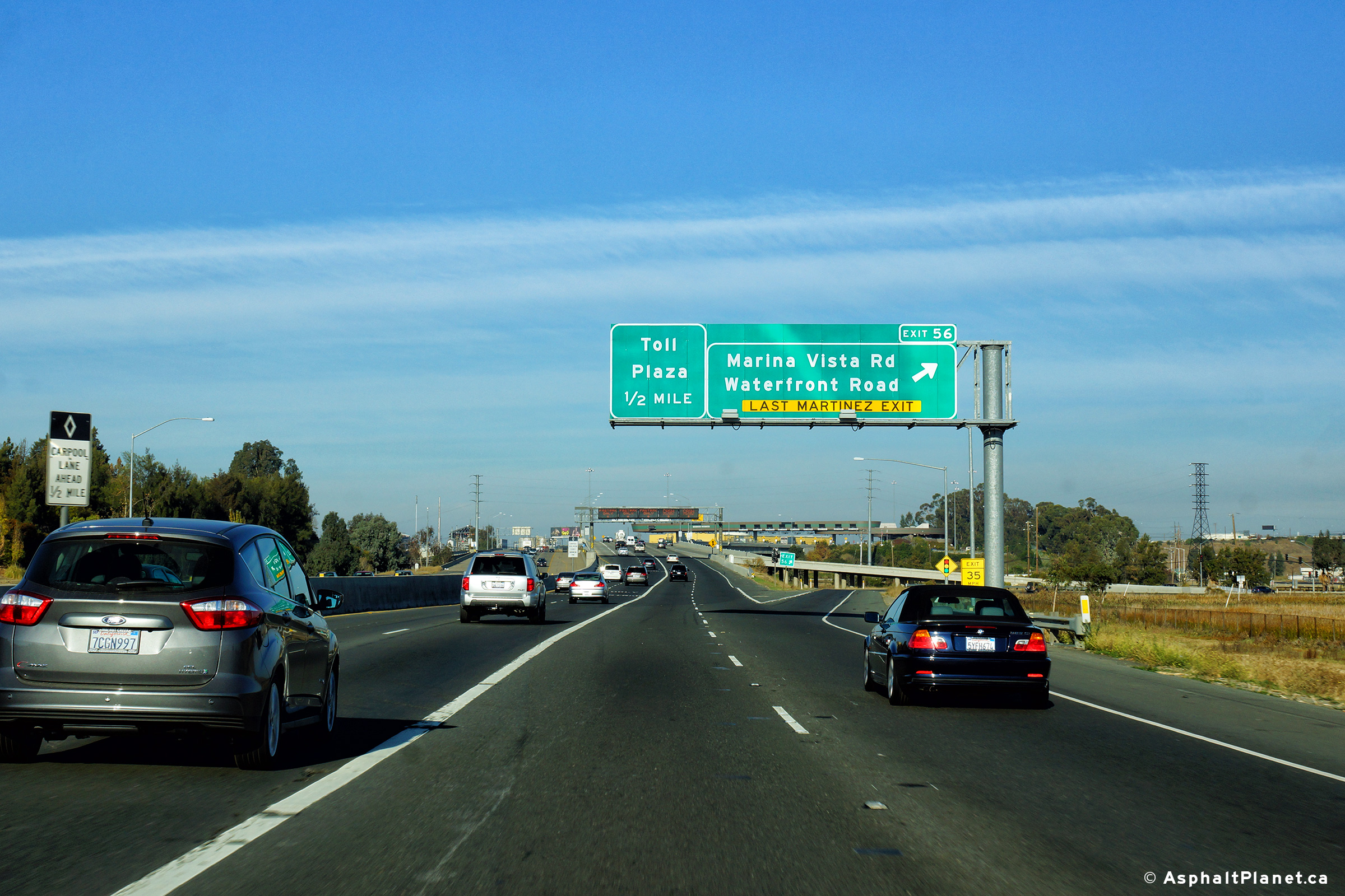
|
Contra Costa County |
Northbound signage at the off-ramp to Marina Vista Road. |
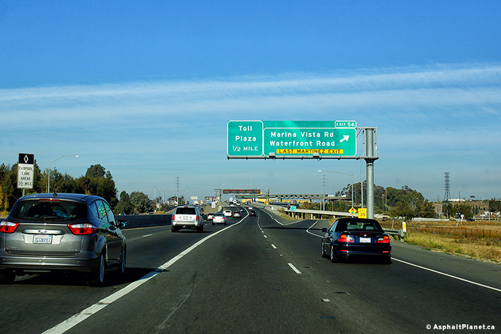 |
||
|
Date: 3/26/2010 |
High-res: (1440x960) (2400x1600) |
|||
|
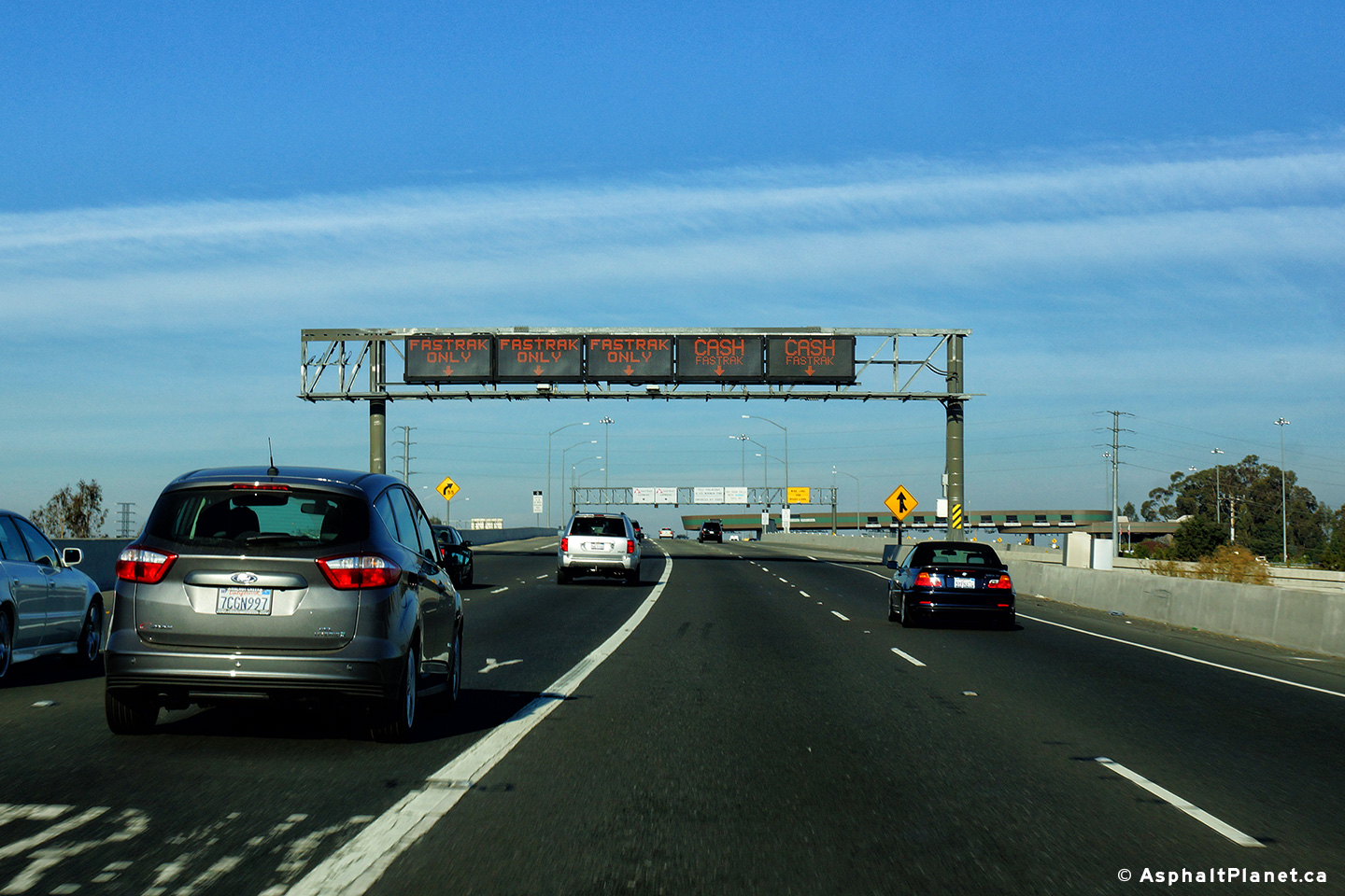
Contra Costa County |
Overhead signage advising traffic of the lane configuration of the upcoming toll booth. |
 |
||
|
Date: 30/31/2013 |
High-res: (1440x960) (2400x1600) | |||
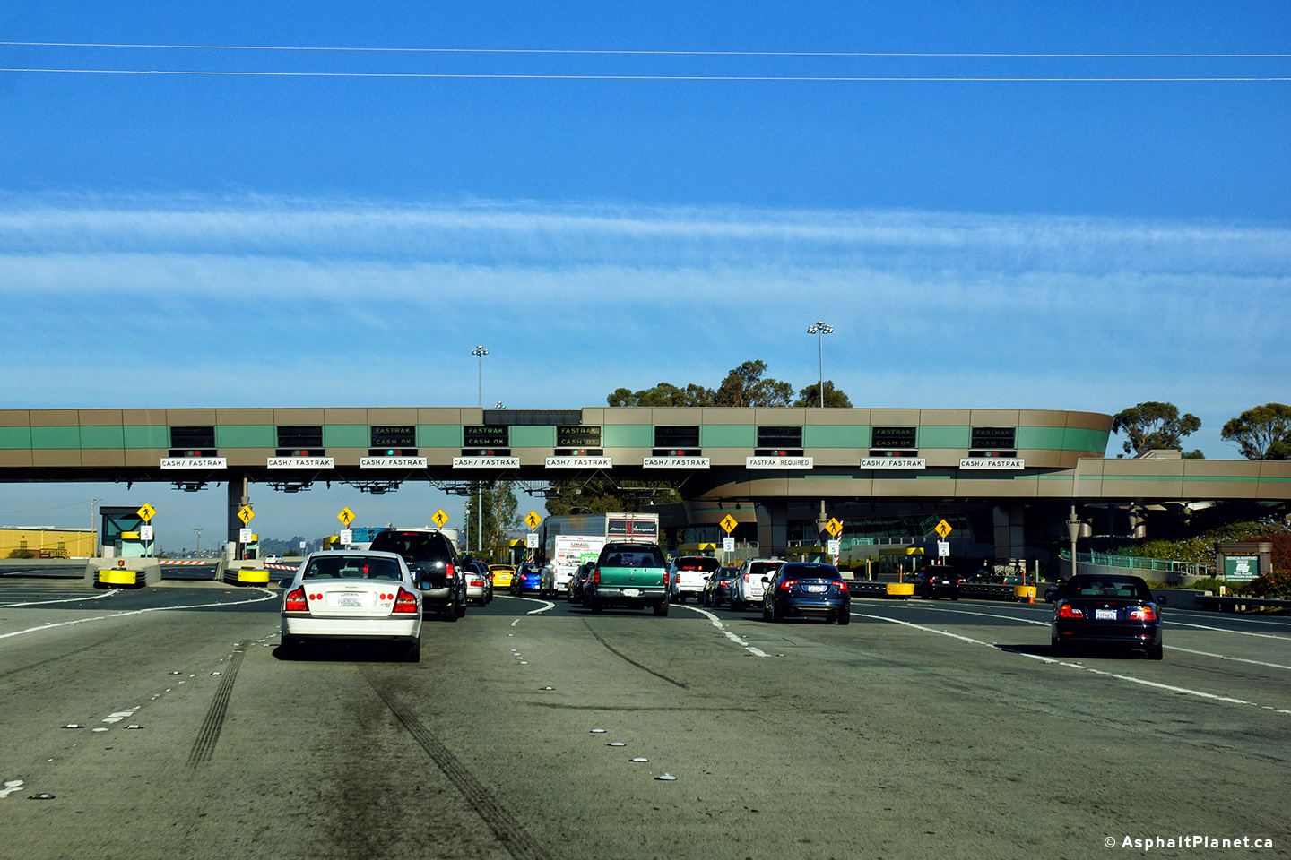
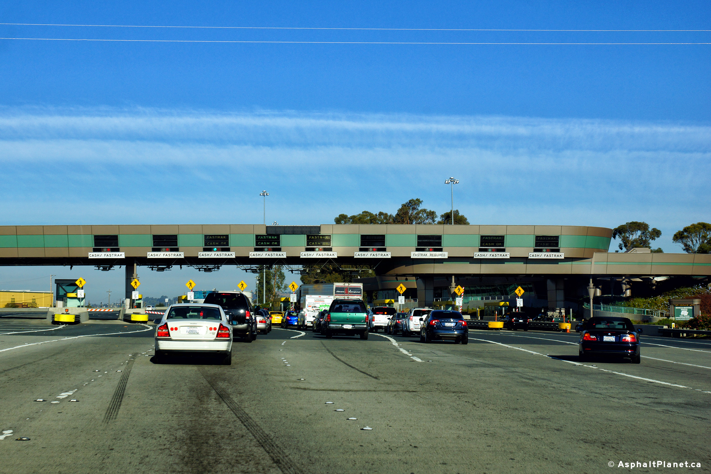
|
Contra Costa County |
Northbound toll plaza for the Benicia-Martinez Bridge. Tolls are only collected in the northbound direction on this bridge. |
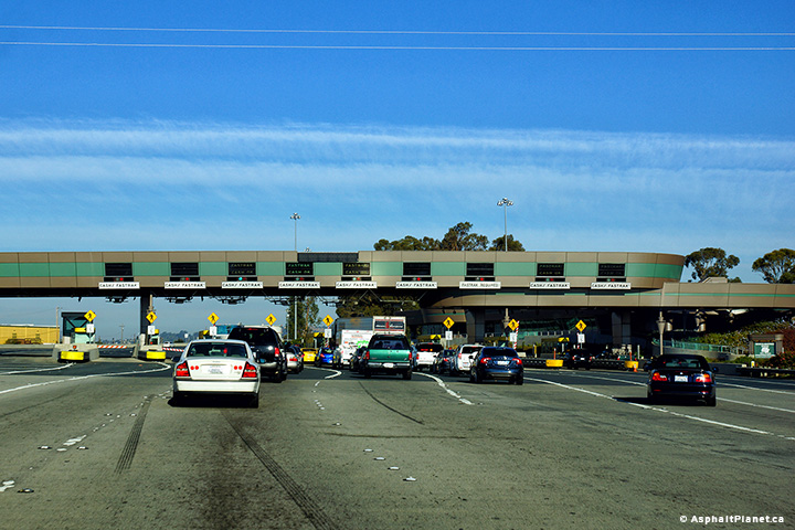 |
||
|
Date: 3/26/2010 |
High-res: (1440x960) (2400x1600) |
|||
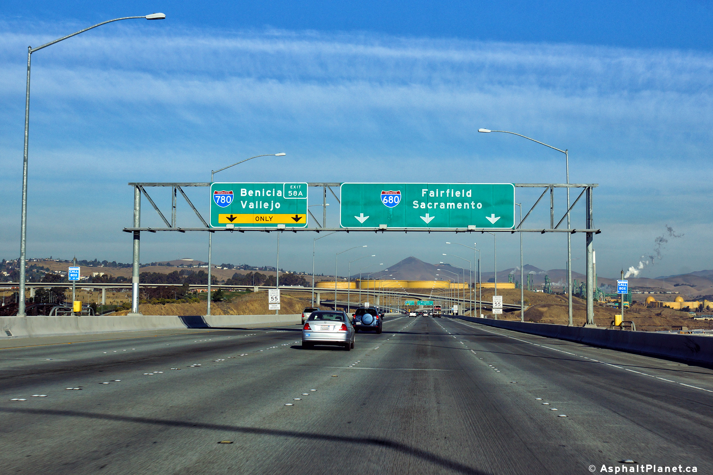
|
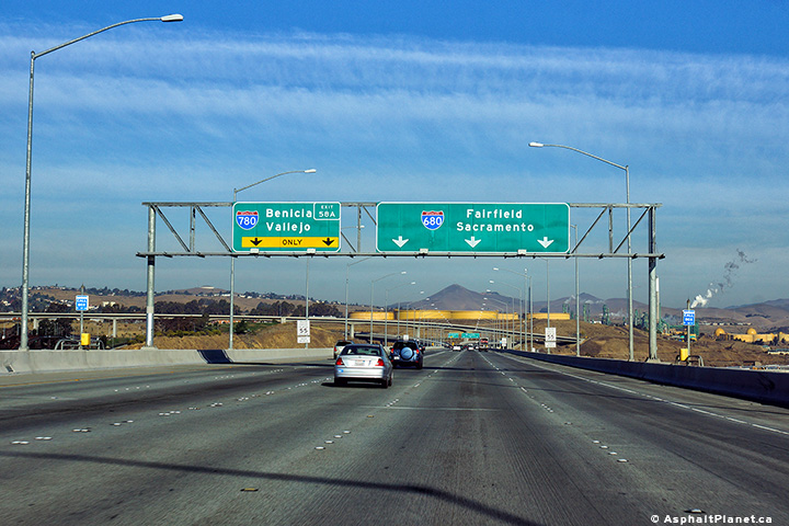
Contra Costa County |
Northbound advanced signage for the I-780 interchange. |
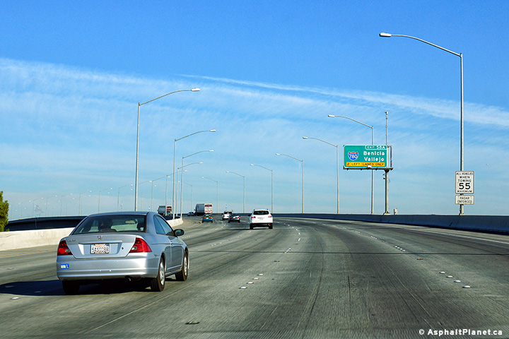 |
||
|
Date: 30/31/2013 |
High-res: (1440x960) (2400x1600) | |||
| Solano County |
Southbound signage along I-680 located just south of the I-780 interchange. |
 |
||
|
Date: 30/31/2013 |
High-res: (1440x960) (2400x1600) | |||
| Solano County |
Northbound signage approaching the I-780 interchange. The large fly-over ramp that links the eastbound lanes of I-780 to the northbound lanes of I-680 can be seen beyond the signage. |
 |
||
|
Date: 30/31/2013 |
High-res: (1440x960) (2400x1600) | |||
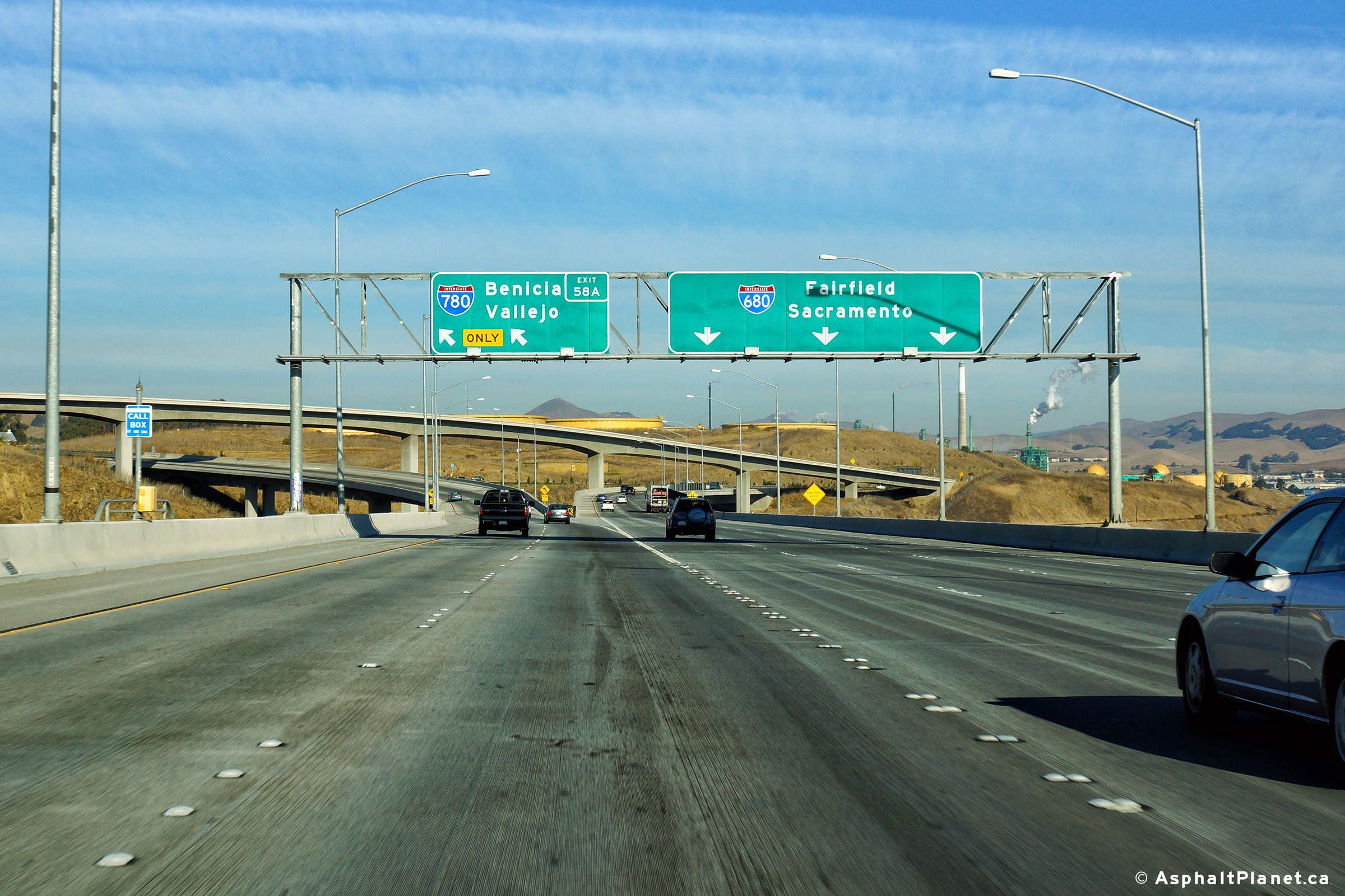
| Solano County |
Northbound signage at the Interstate 780 interchange. |
 |
||
|
Date: 30/31/2013 |
High-res: (1440x960) (2400x1600) | |||
<- I-605
CA Highways
I-705 ->
AsphaltPlanet.ca
© 2010-17 AsphaltPlanet.ca.
AsphaltPlanet@asphaltplanet.ca
Page Created: November 19, 2013.
Last Updated: November 19, 2013.